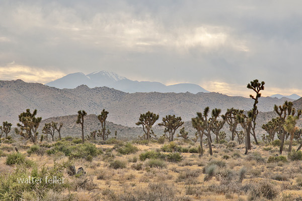
Johann George Ecker led a group of German and Swiss immigrants who settled in the Antelope Valley in 1886, founding a small colony they called Palmenthal—named for the nearby Joshua trees, which they mistook for palms. These settlers sought to establish a self-sufficient farming community on the high desert plain. Drawing from their European roots, they introduced cooperative labor, community organization, and dry-farming methods suited to the arid conditions. Early crops included barley, wheat, and fruit orchards, with irrigation ditches dug by hand to capture scarce water. Despite their determination, drought and isolation made survival difficult, and by the early 1890s, many settlers left. Still, their legacy endured in the renamed settlement of Palmdale, marking the valley’s first organized agricultural community.
Palmenthal was the original German-Swiss settlement that became Palmdale, California. Founded in 1886 by Johann George Ecker and a group of immigrant families from Germany and Switzerland, the colony was located near present-day 20th Street East and Avenue Q. The settlers named it Palmenthal, or “Palm Valley,” after mistaking the native Joshua trees for palms.
They arrived with hopes of building a cooperative farming community, bringing European agricultural practices and traditions with them. Using dry-farming methods, they planted barley, wheat, and fruit orchards, and attempted small-scale irrigation projects to make the desert productive. The settlers built simple homes, a school, and community facilities, establishing the first structured settlement in the Antelope Valley.
Life in Palmenthal was harsh. Repeated droughts, crop failures, and the isolation of the high desert took their toll. Within a few years, many families abandoned the colony, some moving closer to the Southern Pacific Railroad line near Harold, where water and transport were more reliable. By the early 1890s, Palmenthal was largely deserted, but its spirit persisted in the nearby settlement that would evolve into modern Palmdale.
The story of Palmenthal represents the first organized effort to colonize and cultivate the Antelope Valley—an experiment in community and endurance that laid the groundwork for future growth in the region.
Timeline
1886 – Johann George Ecker and a group of German and Swiss immigrants establish the settlement of Palmenthal in the Antelope Valley, naming it for the Joshua trees they mistake for palms.
1887 – The settlers begin dry farming and plant wheat, barley, and fruit orchards. A small schoolhouse and community hall are built.
1888 – Severe drought conditions make farming difficult. Wells yield limited water, forcing the settlers to haul water from distant springs.
1889 – Some families leave the settlement due to crop failures and the isolation of the high desert.
1890 – Remaining settlers attempt to improve irrigation by digging ditches and small reservoirs, but lack of rainfall continues to hinder success.
1891 – The Southern Pacific Railroad establishes a station several miles west, prompting some settlers to relocate closer to the line for better access to supplies and transport.
1892 – Palmenthal is largely abandoned. The remaining residents consolidate around the new rail siding area that becomes known as Palmdale.
1893 – The name Palmdale replaces Palmenthal, marking the transition from the failed colony to the town that would endure.
Colonel Albert G. Boyd’s influence on aviation in the Antelope Valley during the 1940s was profound and lasting.
Born in 1906, Boyd joined the Army Air Corps in the 1920s and developed a reputation as both a skilled pilot and a meticulous engineer. When he took command of Muroc Army Air Field in 1945, the base was still a relatively primitive outpost in the Mojave Desert, used primarily for gunnery and bombing practice during World War II. Boyd recognized the potential of the area’s wide, dry lakebeds and clear weather for testing experimental aircraft.
Under his direction, Muroc was reorganized into a formal testing and research facility. Boyd introduced structured engineering methods to flight testing—demanding that pilots follow precise test protocols, record accurate data, and collaborate directly with engineers. This disciplined approach replaced the earlier, more informal trial-and-error methods that had dominated aviation testing.
He personally flew and supervised tests of many of the era’s most advanced aircraft, including the P-80 Shooting Star (the first operational U.S. jet fighter), the XP-84 Thunderjet, and the XP-86 Sabre. Boyd also selected and mentored test pilots who would go on to fame, including Chuck Yeager, who broke the sound barrier in 1947 in the Bell X-1—an event made possible by Boyd’s groundwork in developing a safe, scientific test environment.
By 1949, Muroc had been renamed Edwards Air Force Base, and Boyd became its first commander under the newly formed U.S. Air Force. His influence extended to the creation of the Air Force Test Pilot School, which formalized the training of test pilots and engineers.
Boyd’s leadership established the Antelope Valley as the epicenter of experimental flight, directly shaping America’s Cold War aerospace industry. His legacy earned him induction into the National Aviation Hall of Fame in 1984 and enduring recognition as the “Father of Modern Flight Testing.”
Pearl L. (Allan) Lockheed’s story ties neatly into the larger evolution of aviation in Southern California and the Antelope Valley’s rise as an aerospace center. Here’s a fuller picture of that 1930s connection:
Allan Haines Loughead, who later respelled his name as “Lockheed” to simplify pronunciation, co-founded the original Lockheed Aircraft Company with his brother Malcolm in 1916 in Santa Barbara. Their first successful aircraft, the Model G seaplane, led to several innovative designs before the company went dormant in the 1920s due to financial hardship. In 1926, investor Fred Keeler and engineer Jack Northrop revived the brand as the Lockheed Aircraft Corporation in Hollywood, and by the early 1930s its headquarters had moved to Burbank.
During this period, Lockheed’s engineers were testing high-performance designs that demanded broad, open airfields far from populated areas. The Antelope Valley—with its dry climate, smooth alkali flats, and absence of air traffic—offered perfect conditions. Company pilots, mechanics, and test crews used open tracts near Lancaster and Muroc Dry Lake for proving flights, performance trials, and long-distance endurance runs. Aircraft such as the Lockheed Vega, made famous by pilots like Wiley Post and Amelia Earhart, were occasionally tested in these desert settings to assess handling and engine reliability under extreme heat and dust conditions.
These early desert test flights did more than validate aircraft—they demonstrated the region’s unmatched utility for flight experimentation. Word of the valley’s favorable flying conditions spread quickly through the Southern California aviation community, influencing later government and industry decisions. By the late 1930s, Muroc Dry Lake had been adopted by the Army Air Corps as a training and test site, the foundation of what became Edwards Air Force Base. Lockheed’s early desert work thus helped pave the way—both literally and figuratively—for the Antelope Valley’s transformation into America’s aerospace heartland.
Would you like me to include a short timeline of Lockheed’s Antelope Valley involvement leading up to World War II?
Timeline – Pearl L. (Allan) Lockheed and the Antelope Valley
1916 – Allan and Malcolm Loughead establish the Loughead Aircraft Manufacturing Company in Santa Barbara. They produce innovative seaplanes but struggle financially after World War I.
1926 – The Lockheed Aircraft Corporation is formed in Hollywood by a group of investors who revive the Loughead name and employ engineer Jack Northrop. The company quickly earns a reputation for strong, streamlined aircraft.
1927 – The first Lockheed Vega is built in a small shop in Hollywood. Designed for speed and endurance, it became one of the most successful aircraft of its time.
Late 1920s – Test flights begin taking advantage of Southern California’s wide, dry basins. Open areas north of Los Angeles, including the Antelope Valley, are occasionally used for long-range testing due to their flat terrain and low population density.
1930 – Lockheed relocates to Burbank, expanding production of the Vega, Air Express, and Orion aircraft. Pilots testing these aircraft frequently utilize the high desert for performance runs and navigation trials.
Early 1930s – As aircraft speeds increase and test safety becomes a growing concern, engineers and pilots continue to explore isolated desert fields near Lancaster and Muroc Dry Lake for proving flights. These flights help identify the area’s potential for larger-scale aviation operations.
Mid-1930s – Lockheed’s reputation for precision engineering attracts both private and government attention. The Antelope Valley becomes recognized within aviation circles as an ideal environment for high-speed, high-altitude testing.
1937 – The U.S. Army Air Corps begins using Muroc Dry Lake for training and gunnery practice, laying the foundation for what will become Muroc Army Air Field in 1938. Lockheed’s earlier presence in the area helps establish its suitability for military and industrial testing.
By the end of the 1930s, Lockheed was producing advanced aircraft such as the Model 14 Super Electra, and the Antelope Valley’s airfields were becoming integral to regional aerospace testing. These developments mark the beginning of the desert’s long association with flight research, innovation, and the aerospace industry that would define it in the decades to come.
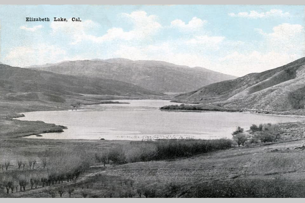
Francisco “Chico” Lopez was an early Californio rancher whose name became attached to what is now Elizabeth Lake, once widely known as La Laguna de Chico Lopez.
He was part of the Lopez family that held long-standing land and grazing rights in the western Antelope Valley during the Mexican and early American periods of California. The Lopez holdings were associated with the Rancho San Francisco grant, centered near present-day Newhall. Still, their herds often ranged north and west into the Sierra Pelona and Antelope Valley foothills.
By the 1840s, Chico Lopez was running sheep and cattle in the region surrounding the lake. Travelers and surveyors used his name to identify the landmark—“Chico Lopez’s Lake” or “La Laguna de Chico Lopez.” The lake served as a watering stop along the early trails crossing the San Andreas rift zone between Soledad Canyon and theAntelope Valley.
Later, as American settlers arrived in the 1860s and 1870s, the Lopez name persisted in maps and local speech until the site was renamed Elizabeth Lake. The renaming is attributed to surveyor Benjamin Davis Wilson (Don Benito Wilson), who supposedly named it for a relative or acquaintance during his expeditions through the area.
Though details of Chico Lopez’s later life are scarce, his legacy survives in the early place-name and in the transition from the Californio ranching era to the American homesteading period in the western Mojave frontier.
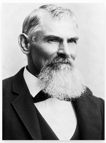
Born in 1825 in Bastard Township, Leeds County, Upper Canada (now Ontario). He was the son of Nathaniel and Jane Stoddard and brother to Sheldon, Albert, and Rufus. The family later converted to Mormonism and joined the westward migration.
Traveled with a Mormon emigrant company under Charles C. Rich from 1852 to 1853. Reached the Salt Lake Valley in Utah, then continued west into California by the mid-1850s, likely entering through Cajon Pass. Settled in the San Bernardino area with other early pioneers.
Moved into the Mojave region during the late 1850s or early 1860s. Established or drilled the Stoddard Well, which became a vital water source for travelers. Helped develop the Stoddard Wells Road, an important freight and emigrant route between Victorville and Barstow. Supported freighting operations and ranching efforts in the Victor Valley. Worked closely with his brother Sheldon, who was also active in transportation and settlement.
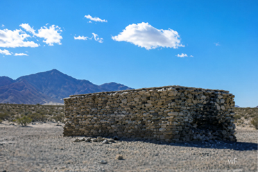
Stoddard’s well tank.
Stoddard Wells became a lasting geographic landmark and stop along desert routes. The road provided improved access for mining, settlement, and commerce. His work reflected the hands-on pioneer ethic of building essential infrastructure in difficult terrain. Remembered locally as one of the Stoddard brothers, among the earliest trailblazers of the Mojave Desert.
Remained in Southern California into the late 19th century. Died in 1914. His name endures through landmarks like Stoddard Wells, which commemorate his role in opening the Mojave to travel and settlement.
Arvin’s story illustrates the shift from Mormon settlement to broader regional development across Southern California. His contributions supported the growing network of trails, roads, and water sources that enabled travel across the desert. He stands as an example of the practical, industrious pioneers who built the foundation for future desert communities.
Sheldon Stoddard Early pioneer and Mormon settler who helped establish routes, wells, and communities along the Mojave River during California’s frontier expansion.
Upper Mojave River Trail Historic travel corridor following the upper Mojave River, connecting early settlements, ranches, and stage stops between Cajon Pass and Barstow.
Stoddard Wells Road Historic wagon route branching from the Mojave River Trail, used by settlers and freighters linking San Bernardino with desert mining districts.
Stoddard Well A vital water source established by the Stoddard brothers and later maintained by Heronymous Hartman, serving travelers and stockmen crossing the high desert.
Pioneers Early settlers who braved the Mojave frontier, building wells, trails, and communities that shaped the foundation of inland Southern California.
San Bernardino Regional center and supply hub for Mormon settlers and desert pioneers, serving as a gateway to the Mojave and points east during westward expansion.
Fish Ponds Artificial ponds along the Mojave River near Stoddard Wells provide food and water resources for ranchers and travelers in the arid landscape.
Mormon Crossing (Lane’s) Historic Mojave River ford near present-day Victorville, used by Mormon pioneers and freighters traveling between San Bernardino and Salt Lake City.
Mojave River An intermittent desert river flowing underground much of its course, sustaining life, travel, and settlement along California’s inland frontier.
The “frontier ethos” refers to the cultural attitude and moral outlook shaped by life on a frontier—where civilization meets wilderness, and individuals must rely on toughness, ingenuity, and self-reliance to survive and prosper. It’s both a historical mindset and a national myth, most famously tied to the American West.
Here’s a breakdown of its key traits and origins:
Self-reliance and independence On the frontier, people couldn’t depend on distant authorities or established systems. They had to make their own shelter, find their own food, and solve their own problems. This bred a strong belief in individual responsibility and personal liberty.
Ingenuity and practicality Frontier conditions required resourcefulness. Settlers and pioneers learned to adapt, invent, and repurpose what they had—traits that became central to the American ideal of innovation and “Yankee know-how.”
Courage and endurance The frontier demanded physical and moral toughness. People faced isolation, harsh climates, and conflict, all of which became symbols of endurance and determination.
Optimism and expansionism The frontier ethos was also fueled by the belief that progress and opportunity lay just beyond the horizon. This optimism became tied to Manifest Destiny—the conviction that expansion westward was both inevitable and righteous.
Community and cooperation Despite the focus on rugged individualism, survival often depended on cooperation. Settlers banded together to build towns, schools, and churches, reflecting a balance between independence and mutual reliance.
Moral and religious undertones Many saw the frontier as a proving ground for moral virtue and divine purpose. Hard work, thrift, and faith were often viewed as evidence of good character and divine favor.
Historian Frederick Jackson Turner famously argued in his 1893 “Frontier Thesis” that this ethos defined the American character itself—shaping values of democracy, equality (within limits), and restless ambition. Even after the physical frontier closed, the “frontier spirit” lingered as a national ideal—expressed in space exploration, technology, and the belief that challenges can be overcome through grit and creativity.
Lingenfelter’s Steamboats on the Colorado River, 1852–1916 provides an implicit social and economic history of every settlement that grew—or faded—along the river’s banks. The book’s narrative threads the growth of these river communities directly to the rise and fall of steamboat commerce.
Yuma and Arizona City
Origins: Fort Yuma (established 1850) was the main reason steamboats came to the river at all. Its chronic supply shortages prompted the launch of the Uncle Sam in 1852—the first river steamer.
Growth: Johnson’s General Jesup and later steamers transformed the isolated post into a trade hub. Yuma Indians, Cocopahs, and early merchants (Louis Jaeger, George Hooper, Mrs. Bowman “the Great Western”) were central to its development.
Outcome: Arizona City (later Yuma) became the permanent entrepot for the Arizona interior, surviving floods that wiped out rival settlements (Jaeger City and Colorado City) in 1862.
Steamboat impact: Yuma existed because of river transport—its food, freight, mail, and even building materials came upriver. The steamboat wharf and wood yards formed its economic heart until the Southern Pacific Railroad bridge was completed in 1877.
Fort Mohave and the Mojave Valley
Military anchor: Established in 1859 after Lt. Col. Hoffman’s expedition. Johnson’s General Jesup and Colorado carried the troops and artillery upriver.
Settlement influence: The fort’s constant freight and troop movements supported a network of wood-cutters, ferrymen, and small traders. Mohave and Chemehuevi Indians interacted with the garrison, at first through hostility, later trade.
Mining connection: Steamboats supplied nearby mining districts such as Eldorado Canyon, which developed into a key upriver port. Freight was landed directly from San Francisco via Johnson’s line, showing how the steamboat system enabled northern Arizona’s first mineral exploitation.
Ehrenberg (originally Mineral City)
Origins: Founded in the 1860s as a wood yard and landing above La Paz.
Growth: When gold was discovered at La Paz (1862), Johnson’s boats (Cocopah, Gila) ran regular trips, and the landing evolved into Mineral City—later renamed Ehrenberg.
Economic role: It became the principal upriver port for western Arizona mining. Merchants, assay offices, and stage connections tied it to Prescott and Wickenburg.
Decline: As river levels shifted and the railroad advanced toward Needles, Ehrenberg’s role diminished; by the 1890s, it had reverted to a small ferry and freight stop.
La Paz
Discovery and boom: Founded after the 1862 placer rush at Laguna de la Paz, fifty miles above Yuma.
Steamboat role: Johnson’s Cocopah and Colorado II made it a thriving port for a few years; millions in gold dust and supplies moved through its landing.
Community effects: Temporary but intense—stores, saloons, and a post office sprang up almost overnight. The town declined after the placers gave out, though it remained a shipping point for freighting routes into central Arizona.
Callville and Eldorado Canyon
Callville: Established in 1864 by Mormons under Anson Call as the uppermost navigable landing on the Colorado. Johnson’s Mojave II and the Gila reached it with supplies for Mormon colonies.
Eldorado Canyon: The river link to Nevada’s silver mines. Steamers delivered ore machinery and carried bullion out. Lower Camp and Hardyville (later Bullhead City) also grew as logistical points for these mines.
Outcome: The decline of mining and the development of railroads at Needles ended their importance, but their brief steamboat era left physical and place-name legacies.
Hardyville, Needles, and the Mojave Crossing
Hardyville: Founded by William Hardy in the 1860s near Fort Mohave as a landing and ferry for freight into northern Arizona and served by Johnson’s and later Polhamus’s boats (Gila, Mohave II).
Needles: Grew later from the same corridor once the railroad bridged the river. For a time, both rail and steamboat freight were interdependent—boats ferried heavy goods to and from the rail terminus.
Cultural tie: These settlements owed their early survival to the steamboat’s ability to deliver goods to otherwise inaccessible desert outposts.
Mexican Delta Settlements
Robinson’s Landing and Port Isabel: Transfer points where sea-going schooners met the river steamers. These landings, although primitive, were the logistical lifeline between San Francisco and Arizona before the rail era.
Cocopah and Yuma labor: River tribes provided the essential wood-cutting and loading labor at these lower landings. The steamboat economy reshaped indigenous life, drawing them into the wage economy.
Later decline: When the Imperial Canal and Laguna Dam diverted the river (1905–1909), most of these delta landings were abandoned or submerged.
Imperial Valley and the Lower Colorado (20th century)
Engineering phase: The Searchlight and St. Vallier were used by the California Development Company and the Reclamation Service to ferry materials during the Imperial Valley flood and Laguna Dam projects (1905–1909).
New communities: Mexicali, Calexico, and Imperial grew directly from these river engineering efforts—the last chapter of the steamboat’s social influence.
Summary of Broader Community Ties
Military Supply: Forts Yuma and Mohave created permanent river commerce.
Civic Formation: Yuma, Ehrenberg, and Hardyville evolved from wharves and woodyards into lasting towns.
Cross-Cultural Exchange: Cocopah, Yuma, and Mohave tribes were drawn into trade and labor systems, profoundly altering their economies.
Transition and Legacy: As railroads and dams replaced steamers, most of these towns either adapted (Yuma, Needles) or faded (La Paz, Callville).
In essence, the steamboats were the architects of civilization along the Colorado River. Every settlement from the Gulf to Callville began as a landing, woodyard, or ferry point tied to the fleets of Johnson, Polhamus, and their successors. When the engines fell silent in 1916, the towns they had spawned remained—the permanent human footprint of the river’s steamboat age.
Timeline of Steamboats and River Communities along the Colorado River, 1539–1916 (based on Richard E. Lingenfelter, Steamboats on the Colorado River, 1852–1916, University of Arizona Press, 1978)
1539 Francisco de Ulloa becomes the first European to sight the mouth of the Colorado River while exploring the Gulf of California for Spain.
1540 Hernando de Alarcón sails into the river delta, establishing it as a navigable waterway in Spanish maps.
1781 Mission San Pedro y San Pablo de Bicuñer is founded near the river and soon destroyed in native uprisings; Spanish efforts to settle the lower Colorado end.
1849 California Gold Rush brings heavy overland migration; Dr. Lincoln establishes a ferry at Yuma Crossing to serve travelers heading to the gold fields.
In 1850, Fort Yuma was founded to protect emigrants; supplies were freighted overland at ruinous cost.
In 1850, Lt. George H. Derby attempted to deliver supplies by sea aboard the schooner Invincible but failed due to Hardy’s erroneous map of the Colorado estuary.
In 1852, Captain James Turnbull launched the Uncle Sam, the first steamboat on the Colorado River, assembled near the mouth. She reaches Fort Yuma in December but later sinks.
In 1853, George A. Johnson, Ben Hartshorne, and Captain Alfred Wilcox established a freight company and began regular steam navigation with the General Jesup in January 1854.
1854 General Jesup proves commercial success; Fort Yuma and nearby settlements (Yuma Crossing, Jaeger’s Ferry) grow rapidly.
1855–1856 Additional woodyards established along the lower river; Johnson expands his business.
In 1857, Lt. Joseph C. Ives is assigned to explore the river’s head of navigation with the steamer Explorer.
In 1858, Ives launches the Explorer and ascends the river to Black Canyon; George Johnson’s General Jesup reaches nearly the same point earlier, demonstrating practical navigation to Pyramid Canyon.
In 1859, Fort Mohave was established at Beale’s Crossing; Johnson’s Colorado and Cocopah transport troops and supplies upriver. The Mohaves subdued after brief hostilities.
1859 Cocopah launched, the largest and most powerful stern-wheeler on the river to date; it began freight runs between the Gulf and upriver forts.
1860 Steamers in regular service to both Fort Yuma and Fort Mohave; landings and wood-yards form the nuclei of new settlements.
1861 Johnny Moss discovers silver in Eldorado Canyon; the first mining boom supported by river transport begins.
1862 Great Colorado River gold rush; La Paz and Mineral City (later Ehrenberg) were established as upriver mining and freight centers. Yuma (Arizona City) grows rapidly.
1863 Arizona Territory created; steamboats supply frontier posts, mines, and settlements along the river corridor.
In 1864, Mormon colonists founded Callville as the uppermost navigable port on the river; Mohave I and Gila reached it with freight and supplies.
1864–1865 Floods destroy Jaeger City and Colorado City; Arizona City (Yuma) survives and becomes the dominant port.
1866 Hardyville (later Bullhead City) founded as river landing and ferry opposite Fort Mohave.
1867–1870 Johnson’s fleet expanded with Cocopah II, Mohave II, Gila, and Colorado II; regular commercial runs between Gulf and Hardyville.
1870s Ehrenberg (formerly Mineral City) and La Paz prosper as supply depots for mining districts. Yuma thrives as regional capital and customs point.
1877 Southern Pacific Railroad reaches Yuma; rail begins to replace river freight to Fort Yuma and interior Arizona.
1880s Decline of Johnson’s monopoly; smaller independent boats like Searchlight and St. Vallier begin service for construction and local trade. Needles develops as rail terminal at Mojave Crossing.
1890s Limited steamboat service continues for miners and settlers between Yuma and Needles; smaller upper-river craft like Undine and Comet work in Green and Glen Canyons.
1905 Catastrophic flooding of the Imperial Valley (Salton Sink) creates major river diversion works. Steamboats carry rock, equipment, and workers to repair the break.
1907–1909 Construction of Laguna Dam; dredges Alpha, Beta, and Delta assist in engineering works. River settlements (Mexicali, Calexico, Imperial) expand.
1910–1916 Final years of commercial operation; the Searchlight and St. Vallier continue limited freight and survey work.
1916 Steamboat era ends; the last operational vessel, Searchlight, retires. The Colorado’s navigation frontier gives way to railroads and irrigation infrastructure.
Summary: The river towns—Yuma, La Paz, Ehrenberg, Hardyville, Callville, and others—each owe their existence to this 64-year steamboat epoch. The boats linked mining, military, and agricultural settlements from the Gulf of California to southern Nevada, and their decline marked the end of the Colorado River as an open commercial highway.
Connectivity along the Colorado River, 1852–1916 (based on Richard E. Lingenfelter’s Steamboats on the Colorado River, 1852–1916, University of Arizona Press, 1978)
The Colorado River functioned as a living transportation spine for the American Southwest. From the Gulf of California to the mouth of the Virgin River, its steamboat era linked ports, mines, forts, and settlements into a single continuous system of movement and exchange. The following summarizes how this connectivity developed—its physical, economic, and cultural dimensions.
1. The River as Transportation Artery
Before railroads, the Colorado was the only practical route through an otherwise impassable desert frontier. Steamboats transformed it from a natural barrier into a corridor of movement:
Vertical Integration: Cargoes from San Francisco and Mexican ports entered at the Gulf of California and were transferred at Robinson’s Landing or Port Isabel to shallow-draft river steamers.
Main Route: Steamers ran 600 miles upriver from the estuary to the head of navigation at Callville, with landings every 25–40 miles at woodyards and supply camps.
Branch Distribution: From these landings, mule and wagon roads carried freight to mining camps—La Paz, Wickenburg, Prescott, Eldorado Canyon, and beyond.
The river linked Pacific maritime trade directly to Arizona’s interior economy, reducing freight costs from $500 a ton (overland) to $75 or less.
2. Economic Connectivity: The Steamboat Network
Each segment of the river supported distinct but interlocking economies:
Lower River (Gulf to Yuma):
Served by General Jesup, Colorado I–II, and Cocopah boats.
Functioned as the supply chain for Fort Yuma, Arizona City, and Cocopah/Yuma tribal labor networks.
Exports: military supplies outbound; imports: grain, hides, and ore from upriver.
Middle River (Yuma to Fort Mohave):
Connected through Gila, Mohave, Cocopah II.
Supported ranching, freighting, and mining from La Paz, Ehrenberg, and Mineral City.
Fort Mohave provided stability and demand; nearby Hardyville became the main transfer point to the northern interior.
Upper River (Fort Mohave to Callville):
Connected through seasonal navigation, reaching Eldorado Canyon and Callville, linking Mormon settlements and Nevada mines.
Steamboats supplied machinery, food, and mail to isolated canyons and hauled bullion downstream.
These tiers formed an interdependent flow of goods and people—San Francisco → Gulf → Yuma → La Paz → Hardyville → Callville—binding together three territories: California, Arizona, and Nevada.
3. Military and Strategic Connectivity
Fort Yuma (1850) and Fort Mohave (1859): Anchored U.S. authority in the region.
Steamboats like the Jesup and Colorado carried troops, cannon, and supplies upriver, allowing rapid response to uprisings.
The river served as a military highway, tying remote garrisons into the national supply chain without the need for overland caravans.
4. Cultural and Indigenous Connectivity
The steamboat economy drew Cocopah, Yuma, Mohave, and Chemehuevi peoples into wage labor as woodcutters, ferrymen, and pilots.
Traditional seasonal migration routes became part of the logistical system for fuel supply—woodyards spaced every 30 miles were typically operated by natives.
Cultural exchange was double-edged: it increased trade and communication, but also displacement and dependency.
5. Intermodal and Regional Connectivity
Overland Links: Freight from landings connected to desert wagon roads—the Ehrenberg–Prescott route, Hardyville–Cerbat road, and Callville–St. George trail.
Rail Integration: The arrival of the Southern Pacific Railroad at Yuma (1877) and the Atlantic and Pacific line at Needles (1883) converted the river into a feeder route.
Steamboats ferried rail cargoes across unfinished bridges.
Yuma and Needles became multimodal junctions, the first in the desert Southwest.
Engineering Connectivity: During the early 1900s, steamboats carried dredge parts, rock, and machinery for the Imperial Canal and Laguna Dam, linking the river’s navigation legacy to the birth of modern irrigation infrastructure.
6. Communication and Settlement Network
Mail and Passenger Routes: Regular boat schedules carried mail and travelers between Yuma, Ehrenberg, and Hardyville—functioning as the desert’s postal road.
Towns and Ferries: Settlements emerged at every refueling stop: Jaeger’s Ferry, Pedrick’s Landing, Ogden’s, Gridiron, Port Famine, Mineral City, Ehrenberg, Hardyville, Callville.
Urban Continuity: The steamboat corridor produced a “string of pearls” settlement pattern—each landing spaced by distance of a single day’s travel.
7. Decline and Legacy
Railroads, motorboats, and dams broke the linear chain of river-based transport.
After 1905, the river was more a site of engineering than navigation.
Yet Yuma, Needles, and Mexicali owe their placement and early prosperity to this 19th-century river connectivity.
Even in decline, the steamboat system laid the geographic framework for later highways, irrigation canals, and border cities.
Summary
From 1852 to 1916, the Colorado River connected the American frontier in a single functional system—military, economic, and human.
The lower river tied the desert to the Pacific.
The middle River opened Arizona’s mines and ranches.
The upper river linked the Mormon, Nevada, and Utah frontiers.
Steamboats were not just transport—they were the connective tissue binding a thousand miles of desert into one coherent region. When they vanished, their routes became the blueprint for roads, railways, and settlements that still follow the river’s course today.
Big Bear, California, began as Yuhaaviatam homeland, later drawing gold seekers, ranchers, and dam builders. From Holcomb Valley’s 1860 rush to a four-season resort, its story blends natural beauty, resource ingenuity, and mountain tradition.
Prehistory • The Big Bear Valley has been inhabited for thousands of years by the Yuhaaviatam (Serrano) people, who live in seasonal villages and call the area “Yuhaaviat,” meaning “Pine Place.”
1845 • Benjamin Davis Wilson leads a posse into the San Bernardino Mountains in pursuit of raiders. The group encounters numerous grizzly bears and kills several, naming the area “Big Bear Valley.”
1850s • Early trappers and cattlemen moved through the San Bernardino Mountains. The valley remains largely remote and unsettled.
1860 • William F. “Bill” Holcomb discovers gold in Holcomb Valley, triggering a rush that brings hundreds of miners and creates mining camps such as Belleville, Union Town, and Clapboard Town.
1861–1862 • The Holcomb Valley boom peaks; San Bernardino County’s population surges. Belleville nearly becomes the county seat but loses to San Bernardino by two votes.
1863–1865 • Decline of the first gold boom as surface gold plays out. Miners leave, and the valley returns to quiet ranching and logging activity.
1870s • Elias J. “Lucky” Baldwin acquires mining claims around Baldwin Lake and forms the Gold Mountain Mining Company. A second wave of mining begins, centered on the Baldwin Mine.
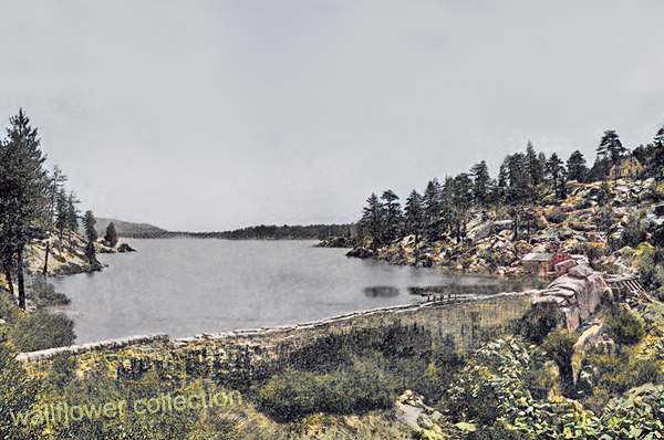
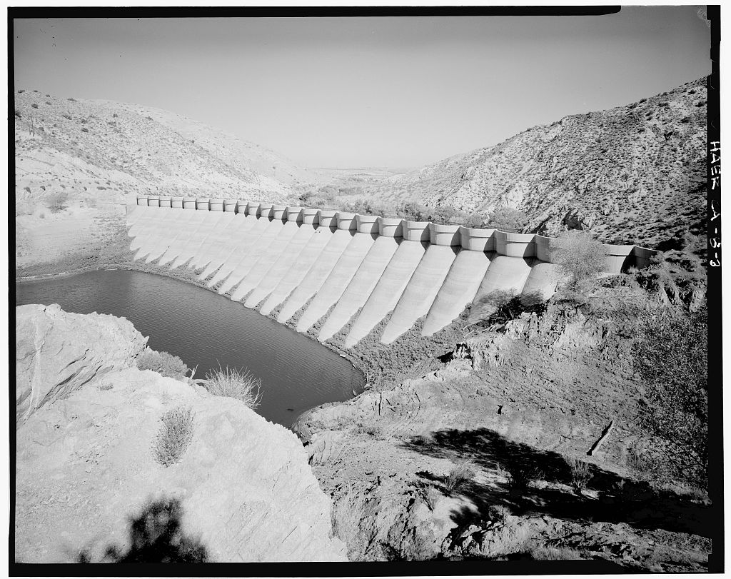
1884 • Frank Elwood Brown, a Redlands citrus grower, constructs the first Bear Valley Dam, a single-arch granite structure. The reservoir created by this dam was named Big Bear Lake.
1890s • Big Bear’s role shifts from mining to recreation. Hunters, anglers, and early tourists begin to visit the mountain lake area. Lodges and cabins start to appear.
1903 • Lower-valley growers formed the Bear Valley Mutual Water Company to manage the reservoir and water rights.
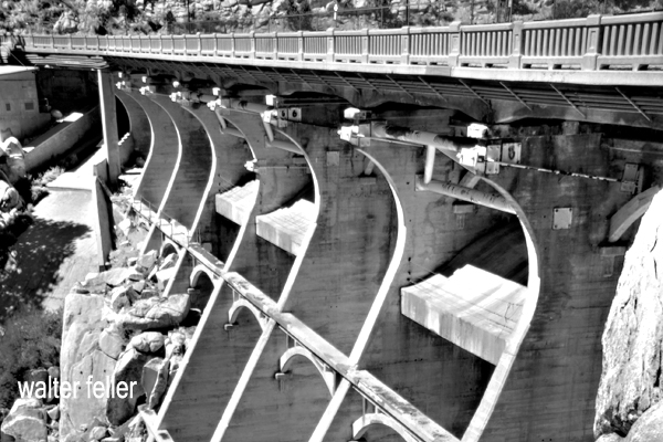
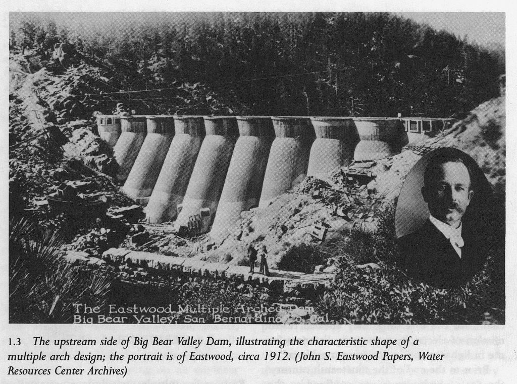
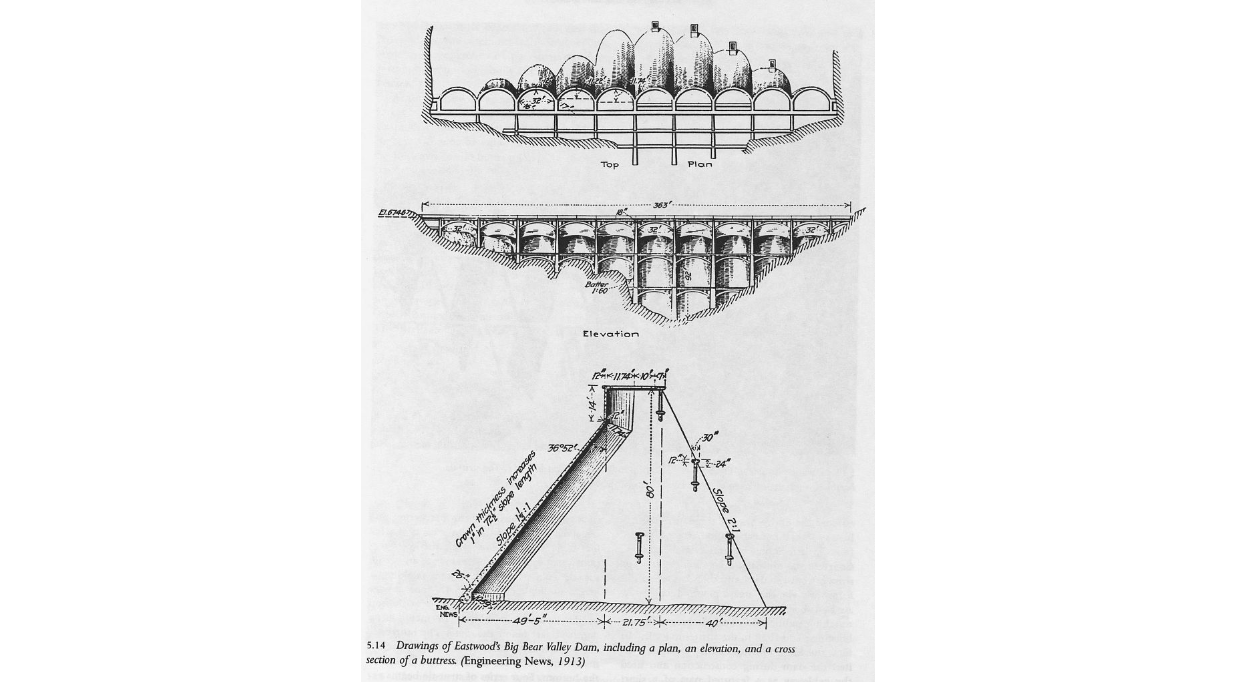
1910–1912 • A new multiple-arch dam, designed by John S. Eastwood, replaces Brown’s dam, raising the lake level by about 20 feet and greatly expanding its capacity.
1920s • Roads improve, and the automobile brings increased tourism. The town of Pineknot develops on the lake’s south shore with lodges, stores, and resorts.
1930s • Winter recreation grows. Early ski runs are cut, and lodges cater to both summer and winter visitors. • 1938 – Pineknot officially changes its name to Big Bear Lake.
1940s • Big Bear becomes a year-round resort. During World War II, mountain roads were used for military transport training, but the area remained largely a recreation destination.
1950s • Big Bear Alpine Zoo opens as a rehabilitation center for injured wildlife (1959). • Ski development accelerates with lifts at Snow Summit.
1960s • Tourism and second-home construction expand rapidly. • The Big Bear Valley Historical Society was founded in 1967.
1970s • The community continues to grow, balancing tourism with environmental concerns.
1980 • The City of Big Bear Lake was incorporated on November 28.
1980s • Alpine Slide at Magic Mountain opens (1983). • Ongoing improvements in highways and infrastructure make Big Bear a popular four-season resort.
1990s • Big Bear becomes known for altitude training by professional athletes, including world-class boxers.
2000s–Present • Tourism, recreation, and environmental stewardship define the region. • The old 1884 dam remains a historical landmark, sometimes visible during low water levels. • Big Bear preserves its mountain-resort heritage while serving as a gateway to the San Bernardino National Forest.
Big Bear and the Digital Desert are closely related through geography, ecology, history, and human development. The Digital Desert’s broader Mojave focus naturally overlaps with Big Bear’s transitional mountain-desert setting in several key ways:
Geographic Connection Big Bear sits at the top of the Santa Ana River watershed, where mountain snowmelt begins the river’s underground journey to Southern California hills and valleys.
Ecological Transition Zone The region bridges montane and desert biomes. Pinyon-juniper woodlands, chaparral, and Joshua tree habitats meet higher-elevation conifer forests. This gradation provides examples of how altitude, temperature, and moisture shape plant and animal communities—central themes within the Digital Desert’s ecological framework.
Historical Ties Figures like William Holcomb and Lucky Baldwin tie Big Bear’s mining story to other desert mineral ventures, including Holcomb Valley’s influence on later Mojave mining booms. Trails from Big Bear connected to routes leading toward Lucerne Valley, Johnson Valley, and beyond—pathways that also appear throughout Mojave Desert exploration and settlement history.
Water and Infrastructure The Bear Valley dams (1884 and 1912) represent early Southern California water engineering that parallels other Digital Desert themes such as aqueducts, irrigation systems, and the transformation of desert hydrology. Big Bear’s water storage directly supported the agricultural valleys below, tying mountain runoff to desert life.
Cultural and Recreational Link Both Big Bear and the Mojave represent frontier landscapes turned into recreation destinations. The same pioneer spirit that shaped desert communities like Apple Valley or Hesperia carried over into Big Bear’s tourism development—cabins, roads, and storytelling built around rugged independence and mountain allure.
Interpretive Relationship Within the Digital Desert framework, Big Bear serves as a high-elevation counterpart—a living case study for water origins, ecological transition, and cultural continuity. It connects the snow-fed headwaters to the dry basins below, showing the mountain-desert system as one continuous, interdependent landscape.
Ecological Description
Big Bear Valley lies high in the San Bernardino Mountains, about 6,700 to 7,000 feet above sea level, forming a broad mountain basin surrounded by rugged granite peaks and forested ridges. The valley stretches roughly east–west, framed by Butler Peak and Delamar Mountain to the north, and Sugarloaf Mountain, Gold Mountain, and the San Gorgonio massif to the south and east.
The valley floor is relatively flat, a remnant of ancient glacial and erosional processes, with Big Bear Lake occupying its central depression. Originally a meadowed valley with creeks and marshes, it became a permanent lake after the Bear Valley Dams were built. The soils are derived from decomposed granite, supporting open forests and meadows interspersed with boulder-strewn slopes.
Ponderosa pine, Jeffrey pine, white fir, and incense cedar dominate the higher slopes. At the same time, black oak, manzanita, and chaparral fill the lower edges in sheltered meadows and along streams, willows and alders grow, creating rare wetland habitats for species such as the mountain yellow-legged frog and bald eagle.
The climate is alpine-mediterranean—cold, snowy winters and warm, dry summers—marked by dramatic seasonal shifts. Snowmelt feeds Big Bear Creek and Baldwin Lake, the latter a seasonal alkali flat on the eastern edge of the valley.
Ecologically, Big Bear Valley forms the upper boundary of the Mojave Desert drainage system. It captures mountain precipitation that ultimately seeps underground toward Lucerne and the Mojave River basin, linking the high forest to the desert below.
Timeline References
Big Bear Valley Historical Museum. “History of Big Bear Valley.” Big Bear Valley Historical Society, Big Bear City, CA.
BigBear.com. “Dam: The Creation of Big Bear Lake.” Big Bear Visitors Bureau.
BigBearCabins.com. “About Big Bear: A History.” Big Bear Cabins Travel Guide.
BigBearVacations.com. “A History of Big Bear.” Big Bear Vacations Blog.
San Bernardino County Museum Archives. “Mining and Settlement in the San Bernardino Mountains.”
Eastwood, John S. “The Multiple-Arch Dam of Bear Valley.” Engineering Record, 1912.
U.S. Forest Service. “San Bernardino National Forest: Ecological Subsections and Watershed Overview.”
Bear Valley Mutual Water Company. “Early Development and Water Rights History.”
Langenheim, Jean H., and P. H. Osman. “Vegetation and Ecology of the San Bernardino Mountains.” University of California Publications in Botany, 1959.
California Department of Fish and Wildlife. “Baldwin Lake Ecological Reserve Management Plan.”
San Bernardino Valley Water District. “Hydrologic History of the Bear Valley and Mojave River System.”
Wikipedia contributors. “Big Bear Lake, California.” Wikipedia, The Free Encyclopedia.
Wikipedia contributors. “Big Bear Valley Historical Museum.” Wikipedia, The Free Encyclopedia.
Brown, F. E. “The First Bear Valley Dam and the Redlands Water System.” Redlands Historical Society Papers, 1884–1905.
U.S. Geological Survey. “Geology and Hydrology of the Big Bear Lake Region, San Bernardino County, California.” Professional Paper Series.
All right, here’s the whole story. No jargon, no technical formatting, just the history of how Lauren Wright and Bennie Troxel shaped our understanding of Death Valley, Tecopa, and the southern Mojave region.
Eagle Mountain
Lauren Wright and Bennie Troxel spent their lives in the desert. Starting in the early 1950s, they mapped the roughest country in Death Valley and beyond. What others called chaos, they patiently untangled, rock by rock. Over the years they became two of the most trusted voices in Basin and Range geology, known for their steady field habits, clean maps, and deep respect for what the land itself could tell them.
They began in Death Valley, working through the twisted terrain east of Badwater and Furnace Creek. There, scattered fault blocks looked like a puzzle someone had shaken apart. Wright and Troxel figured out that this “Amargosa Chaos” wasn’t random at all. It was the result of the crust stretching and tearing at low angles, lifting old rocks and dropping young ones. Their maps from the 1960s and 70s showed that the Valley wasn’t just a crack in the earth, but part of a much larger system in which the crust itself was thinning.
They studied the Furnace Creek and Death Valley fault zones and showed that the sideways, or strike-slip, motion wasn’t as massive as some believed. The land was moving both sideways and downward — sliding, stretching, and rotating all at once. Their careful work stopped wild speculation and grounded future studies in what could actually be seen in the rocks.
Later, when the field began to recognize “detachment faults” — those broad, low-angle breaks deep in the crust — Wright and Troxel were already there. They had mapped them years before anyone had a name for them. Their diagrams of tilted mountain blocks, uplifted footwalls, and sinking basins became the foundation for how geologists now picture the Basin and Range province.
Their influence spread southward, into the Tecopa and Shoshone area. Tecopa Basin, once thought of as just a dried-up lake, became under their framework a living tectonic basin — a place still moving, still changing. The basin sits between the Resting Spring Range on the east and the Nopah Range on the west, both tilted blocks bounded by faults. Wright and Troxel’s regional mapping explained how those ranges rose and the basin sank, all part of the same crustal stretching that shaped Death Valley.
The Resting Spring Range, they showed, is a footwall block lifted on a west-dipping detachment fault. That fault likely channels the hot water that feeds Tecopa’s springs. Across the basin, the Nopah Range tilts the other way, dropping the valley floor between them. The lake beds and alluvial fans that fill the basin record every stage of that movement. Their approach — always linking sediments, structure, and landscape — became the standard way of reading desert basins.
Following their line of thought south, the fault belt continues through Sperry Wash to the Kingston Range. There the crust was pulled so thin that deep rocks rose to the surface. Later researchers would prove the Kingston Range to be a metamorphic core complex, but it was Wright and Troxel’s earlier insight into Death Valley’s structure that pointed the way. They showed that the same forces that opened Death Valley also lifted the Kingston Range and dropped the Tecopa Basin between them.
At the southern edge of this chain lies the Avawatz Mountains, a natural hinge between the stretching Basin and Range and the sliding Mojave block. Wright and Troxel understood this as the turning point — where extension gives way to sideways shear. The Garlock Fault lies just to the south, a great east-west fracture that shifts motion from one style to another. They were among the first to argue that these systems are connected, not separate. The Garlock doesn’t stop Death Valley; it redirects it.
South of the Avawatz, the story continues through Soda and Silver Lakes, the broad dry basins near Baker. These, too, line up along the same fault trend. The Mojave River, flowing northward from the mountains through Barstow, traces that same old scar in the crust. The river’s course isn’t random — it follows a tectonic path carved long before any water ran through it. Every terrace, canyon, and dry lake along its route echoes the same pattern Wright and Troxel mapped farther north.
By the time the river reaches Afton Canyon and the dry sinks of Cronese and Soda Lake, it’s running through the tail end of their structural corridor. The ground here still moves, slowly and quietly, along the Lenwood, Lockhart, and Helendale faults. These smaller strands pick up the motion of the Garlock and pass it westward toward the San Andreas. The Mojave River flows right through the middle of it all — a living reminder of how deep-seated tectonics shape even the surface flow of water.
Wright and Troxel’s gift was not just their data but their way of seeing. They treated the desert as a single, connected organism — every basin, every fault, every dry lake part of the same long rhythm of motion. Where others saw disjointed ranges, they saw a story of continuous transformation, stretching from Furnace Creek to Barstow and beyond.
Their maps still hang in field camps and classrooms, and the Geological Society of America’s Wright–Troxel Award continues to support students studying these same basins. The accuracy of modern GPS and seismic work has only confirmed what they drew by hand half a century ago.
In the end, their legacy is both scientific and human. They showed that patient fieldwork, careful observation, and respect for the land can turn confusion into clarity. Thanks to them, the Mojave and Death Valley are no longer a tangle of broken hills but a single, coherent landscape — one long story written in the language of stone.
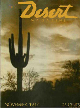
Title: Desert Magazine Date: November 1937 Publisher: Randall Henderson and J. Wilson McKenney, El Centro, California Price: 25 cents per copy | $2.50 per year subscription Significance: First issue — the magazine’s debut and statement of purpose.
1. The Desert, God’s Garden of Peace – Poem by Nellie N. Coffman A reverent poem from Palm Springs hotelier Nellie Coffman portraying the desert as a sacred retreat. She depicts the desert as “God’s Garden of Peace,” a place of quiet renewal and divine beauty for those seeking rest from worldly struggles.
2. There Are Two Deserts (Editorial) – Randall Henderson and J. Wilson McKenney The opening editorial contrasts two conceptions of the desert: one as a hostile wasteland, the other as a living, inspirational landscape. It introduces Desert Magazine as a “friendly, personal” publication meant to unite desert residents, celebrate desert culture, and counter public misconceptions about arid lands.
3. No. 1 Adventurer of the Desert – Don Admiral A natural-history essay about the creosote bush (Larrea divaricata), praised as the desert’s most enduring plant. Admiral explains its adaptive spacing, medicinal uses, and role in Native and pioneer life. The article begins a planned series on characteristic desert plants.
4. The Desert Under a Microscope – J. Wilson McKenney Profile of Dr. Forrest Shreve, director of the Carnegie Institution’s Desert Laboratory on Tumamoc Hill near Tucson. McKenney visits the lab and describes its studies of desert botany, seed germination, and adaptation. The article humanizes science through Shreve’s humor and dedication.
5. He Helps Keep the Chuckawalla Desert Dry – Randall Henderson A lively sketch of “Desert Steve” Ragsdale, founder of Desert Center, California. Ragsdale’s blend of humor, perseverance, and entrepreneurial grit illustrates the spirit of early highway pioneers who built services across remote desert routes.
6. “Bold Emory” – J. Wilson McKenney Historical narrative on Lt. William Hemsley Emory, U.S. Army engineer and diarist of the 1846–47 expedition from Fort Leavenworth to San Diego. McKenney recounts Emory’s mapping, scientific precision, and role in documenting the Southwest during the Mexican-American War.
7. Looking Down from Nevada’s 12,000-Foot Oasis – Randall Henderson Travel account of a Fourth-of-July climb to Charleston Peak near Las Vegas. Henderson describes alpine meadows, sweeping desert views, and the need to preserve the mountain from automobile intrusion. The essay balances adventure with conservationist sentiment.
8. Navajo Shepherdess (Photograph) – William M. Pennington A noted photograph accompanied by commentary on “dependence” among sheep, shepherdess, and the desert environment. The piece reflects ecological interconnection and was later hailed as one of Pennington’s finest desert images.
9. The Feel of the Desert – John Stewart MacClary Profile of photographer William M. Pennington. MacClary recounts Pennington’s early career in Durango, Colorado, his work among Hopi and Navajo peoples, and his patient, respectful method of photographing Native subjects. The essay introduces Pennington as Desert Magazine’s signature visual artist.
10. Lost Tree in a Lonely Land – Lillian Bos Ross Story of the rediscovery of the Elephant Tree (Bursera microphylla) in the Borrego Desert by Dr. E. M. Harvey and Don Admiral. Ross recounts her own trek to find the tree, blending field exploration with the drama of desert endurance and discovery.
11. Luck — Plus Brains – Jonathan Bart Feature on Kenneth Holmes, a young mining engineer who, with Ed Nicholson, developed a successful gold operation in Imperial County. The story emphasizes education, method, and perseverance as modern counterparts to old-time prospector “luck.”
12. For This Army — 8000 Grubbing Hoes – Larry D. Wolman Report on construction of the All-American Canal near the Colorado River. It profiles equipment operators and explains how the project will irrigate over a million acres, linking human labor to desert transformation.
13. Who Knows the Story of This Arizona Landmark? – Prize Contest Reader contest inviting submissions to solve a historical mystery surrounding an unnamed Arizona landmark. This establishes an interactive feature for readers and desert historians.
14. Sez Hardrock Shorty – Lon Garrison Humorous fictional sketch introducing “Hardrock Shorty,” a recurring character who would appear for years as the desert’s wisecracking prospector-philosopher.
15. Sandstone Home – Architecture feature A short illustrated piece on desert homebuilding, promoting use of local sandstone materials suited to arid conditions.
16. The Prospector – Jeff Worth Poetic meditation on the solitary life and spirit of the desert prospector, closing the issue with a note of rugged individualism and introspection.
Departments and Columns
Calendar of Desert Events: lists 1937–38 hunting seasons, fiestas, and regional gatherings across Arizona, California, and New Mexico.
Prize Photograph Contest: invites reader submissions of desert photography.
Books and Comment: brief reviews of southwestern literature.
Here and There on the Desert: short news notes and observations.
Just Between You and Me: closing column by the editor with informal remarks.
Summary Character
The debut issue defines the desert not as empty land but as a landscape of endurance, beauty, and individuality. Its mix of science, poetry, and portraiture frames the desert as both natural wonder and human community. The publication’s editorial tone is idealistic yet practical—part field guide, part cultural journal—and it laid the groundwork for the magazine’s long-running influence across the Southwest.
The story of Willie Boy is one of the most haunting and complex episodes in the history of the California desert. It begins in the early autumn of 1909, when a young Chemehuevi-Paiute man named Willie Boy falls deeply in love with Carlota, the daughter of a respected tribal elder. Their romance, set in the desert landscapes around Banning and Twentynine Palms, was as ill-fated as any tragic ballad of the Old West, and it ended in bloodshed, loss, and a manhunt that became part of American legend.
Willie Boy was about twenty-eight years old, a Chemehuevi from the Southern Paiute people, raised near the Colorado River but often working for white ranchers in the San Gorgonio Pass area. He was a quiet man, by most accounts, known for his skill as a runner and his ability as a capable worker. Carlota was sixteen, the daughter of William and Maria Mike, who lived with their people at the Oasis of Mara, now part of Joshua Tree National Park. Their families knew each other, but Chemehuevi tradition forbade marriage between cousins, which made the match impossible in the eyes of her father.
When Willie Boy and Carlota ran off together, they defied both cultural law and parental authority. They were brought back once, but they met again later that year when the Mike family traveled to Banning for the fall fruit harvest. The reunion of the two lovers set the final tragedy in motion. One evening in late September 1909, Willie Boy went to the Mike family’s camp near the Gilman Ranch to ask for Carlota’s hand. Her father, a strong-willed and traditional man, refused him flatly. Some say the older man reached for a gun, others that Willie Boy had brought one and lost his nerve. There was a struggle, a shot, and when the dust settled, William Mike lay dead. Whether the shooting was deliberate or accidental has never been settled.
Knowing that the white authorities would come for him, Willie Boy fled into the desert with Carlota. They rode and walked across the dry country east of Banning, following faint trails and water holes that only local people knew. When Maria Mike discovered her husband’s body at dawn, she reported the killing to the sheriff. Within hours, a posse had formed, led by Riverside County Sheriff Frank Wilson and his deputy Ben de Crevecoeur. With them were a handful of local ranchers and two Native trackers, John Hyde and Segundo Chino.
The chase that followed quickly became a national story. Newspapers painted Willie Boy as a savage outlaw, “a drunken Piute renegade” who had killed in a jealous rage and carried off a helpless girl. The language was raw, racist, and designed to sell papers. Reporters wrote that the “bloodthirsty Indian” might even threaten President Taft, who happened to be visiting Riverside that week. This hysteria turned a local tragedy into a full-blown legend.
Meanwhile, Willie Boy and Carlota pressed deeper into the Mojave. They moved mostly at night, hiding by day in the arroyos and canyons. Willie Boy’s endurance was remarkable; he could travel fifty miles across rough ground in a day. But they were running low on food and water, and the posse was relentless.
At some point during the pursuit, Carlota was killed. Her body was found later, shot through the back. Early newspaper reports said Willie Boy had murdered her so she would not slow him down. That version fit the outlaw story perfectly, but later investigations suggest otherwise. The coroner’s report showed she was shot from long range, likely by a posse member who mistook her for Willie Boy. She was wearing his coat at the time. Decades later, oral histories from the Chemehuevi confirmed that this is what their elders always believed: that the white men killed Carlota by mistake, then blamed her lover to save face.
After Carlota’s death, the posse pressed on. The final confrontation came at Ruby Mountain, near what is now Landers. Willie Boy took a defensive position among the rocks. As the posse approached, he opened fire, deliberately aiming for their horses rather than their riders. One deputy, Charlie Reche, was wounded in the arm. The standoff lasted all day until the lawmen pulled back to tend to the injured. At sunset, they heard a single gunshot from the mountain. They assumed Willie Boy had turned the gun on himself. When they returned a few days later, they found a badly decomposed body lying near a rifle and declared the manhunt over. They burned the remains on the spot rather than carrying them out of the desert.
That cremation left no evidence. No one could later prove that the body was Willie Boy’s, and none of the posse’s surviving photographs show a face that can be identified. This gap opened the door to one of the enduring mysteries of the story. Among the Chemehuevi, Paiute, and Cahuilla people, the belief persisted that Willie Boy escaped. They said he traveled north through the desert and eventually settled with relatives near Pahrump, Nevada, living quietly until tuberculosis took him years later. Segundo Chino, one of the trackers on the posse who later married Maria Mike, is said to have admitted that the posse never actually caught Willie Boy.
The events deeply shook the Chemehuevi community. They left their traditional home at the Oasis of Mara, afraid that William Mike’s restless spirit might bring misfortune. For many years, they refused to speak of the tragedy. In that silence, white writers filled the void. The newspapers portrayed Willie Boy as a villain and the manhunt as a piece of frontier nostalgia.
Half a century later, journalist Harry Lawton rediscovered the tale. Working from old newspaper clippings and interviews with surviving posse members, he published Willie Boy: A Desert Manhunt in 1960. His book treated the story as both history and myth, but it still leaned toward the posse’s version. The novel won awards and inspired the 1969 film Tell Them Willie Boy Is Here, directed by Abraham Polonsky and starring Robert Blake and Robert Redford. The film gave the story a tragic, modern edge and questioned some of the old assumptions, but it also cemented certain inaccuracies in popular memory.
In the 1990s, historians James Sandos and Larry Burgess revisited the story in The Hunt for Willie Boy: Indian-Hating and Popular Culture. They demonstrated how racism and sensationalism influenced the original reports and concluded that many of the most colorful details were fabricated. They agreed that Carlota was almost certainly killed by the posse, not by Willie Boy, but they accepted that he probably died on Ruby Mountain.
A generation later, Native historian Clifford Trafzer went further. Drawing on oral histories from Chemehuevi and Cahuilla elders, he argued that the man the posse burned was not Willie Boy at all. In the stories told by his people, Willie Boy survived the chase, lived for years among the Paiute in Nevada, and died quietly of illness. Trafzer’s work reframed the legend as a Native tragedy rather than a Western adventure.
For the Chemehuevi and other desert people, the story of Willie Boy and Carlota is more than a love story gone wrong. It represents the collision of two worlds: traditional tribal law and the laws of the new American order. It marks the loss of a way of life and the pain of a community forced into silence.
Today, the tale continues to echo across the desert. Artists and filmmakers have attempted to retell the story from the Native perspective. In 2016, Cahuilla artist Lewis de Soto created an installation in Twentynine Palms called Carlota, giving voice to the young woman whose story had long been overshadowed. In 2022, Jason Momoa produced The Last Manhunt, a film made in collaboration with the Chemehuevi that depicts the event as the tribe remembers it.
Whether Willie Boy died on Ruby Mountain or escaped into the Nevada desert may never be known. What is certain is that his story reveals how quickly truth can be twisted by fear and prejudice, and how long it can take for those who were silenced to be heard again.
The Willie Boy saga began as a local tragedy, became a legend through the press, and has endured as a window into the uneasy meeting of cultures in the desert. It reminds us that history is not fixed in stone, but lives in the voices of those who tell it, and that sometimes the best we can do is listen to all of them.
In the early 1850s, long wagon trains of Mormon pioneers crept down from the high desert into the mouth of Cajon Pass, hoping to reach the fertile San Bernardino Valley beyond. They soon found themselves at a natural choke point – a narrow ravine called Coyote Canyon, now known as Crowder Canyon – where sheer rock walls and a jumbled creek bed made passage nearly impossible. The first wagons through had to be disassembled: wheels removed and rolled by hand, cargo shifted onto a mule’s back, and wagon beds dragged piece by piece over the worst boulders. Early travelers remembered this grueling process, and the Mormon settlers who followed in 1851 likely endured the same ordeal to get their covered wagons through the upper Cajon Pass.
But adversity often sparks ingenuity. Not long after, some enterprising pioneers scouted a detour a few miles to the west of the treacherous canyon. There, a high spine of land offered a way around the worst narrows. This route ran along a slender ridge – a true hogback that rose above the canyon – and though it added a few extra miles, it spared travelers from having to lug their wagons through Coyote Canyon’s rock-strewn gauntlet. The Mormon colonists heading to Southern California in those years eagerly embraced this alternate path. In fact, by the early 1850s, they had established a wagon trail atop that ridge, which would later be known as the Mormon Hogback in honor of the many Latter-day Saint families who had blazed it.
In 1850, a veteran freighter named William T. B. Sanford took it upon himself to hack a rough wagon road along this western Cajon route. Sanford’s road departed the old Spanish Trail near present-day Victorville, climbed onto the flanks of Baldy Mesa, and then edged down through the West Cajon Valley, eventually descending toward a cluster of towering sandstone outcrops. Those pale rocks marked a kind of gateway at the foot of the hogback trail. They would later be known as the Mormon Rocks – named for the Mormon pioneers who camped beneath them after braving the ridge and finally emerging into the open Cajon wash.
Traveling the Mormon Hogback was still a heart-pounding adventure. The ridge was narrow and the drop-offs unforgiving; in places, the trail was scarcely wider than a wagon itself. The ascent to the summit was so steep that teams often had to “double up,” hitching multiple teams of oxen or mules to a single wagon. One contemporary account describes wagons needing as many as 32 mules in harness to tug a heavy load up the incline. On the way back down, drivers would lock their wagon wheels and skid the first several yards, the wooden rims dragging like sleds to slow the descent. The air filled with the shouts of teamsters and the groan of brake chains as each wagon inched along the hogback’s crest. It was perilous, yes, but for a time, this high road was the only practical way for settlers and supply wagons to get through Cajon Pass intact.
Despite these dangers, the ridge route quickly became the preferred wagon road. Sanford and others made further upgrades over the years. In 1855, workers even cut into the mountainside to create a new alignment about a mile and a half west of the original track. This was known as the Sanford Cutoff, which bypassed the most challenging section of the hogback. The grades were gentler than before, though still outrageously steep – some stretches tilted at a 30% incline, straining both beast and brake. Nevertheless, from the mid-1850s up until 1861, virtually every wagon train bound to or from Southern California chose to tackle the Mormon Hogback via Sanford’s route rather than risk the old rocky canyon. For the Mormon settlers in particular, this ridge road was a vital lifeline, allowing them to bring wagons loaded with families, lumber, and provisions into their new settlements without having to unload and reassemble everything at Cajon Pass.
The reign of the Mormon Hogback came to an end in the 1860s. In 1861, a local pioneer named John Brown Sr. partnered with two associates to finally tame the original canyon route itself. Capitalizing on a surge of travelers during a nearby gold rush, Brown’s company widened and improved the old trail through Crowder (Coyote) Canyon, smoothing out the worst boulders and drop-offs. They built a proper wagon road right through Cajon Pass’s eastern narrows and set up toll gates to collect fees from anyone using this new shortcut. Travelers gladly paid a few dollars rather than face the old hogback or haul their wagons apart again. With the opening of John Brown’s toll road – shorter and far less harrowing – the Mormon Hogback’s importance swiftly faded. The new turnpike through the canyon became the main gateway between the desert and the coast. Before long, even stagecoaches and mail wagons were rumbling through Crowder Canyon instead of teetering along the ridge.
Although the wagon ruts along the Mormon Hogback have long since faded into the brush, its legacy remains etched in the landscape and lore of Cajon Pass. The very name “Mormon Rocks” for those sandstone sentinels is a reminder of the emigrants who passed that way in the 1850s. Modern highways and railroads now carry traffic through Cajon Pass, roughly tracing the corridors that pioneers like the Mormons and John Brown once opened up. In fact, the historic Mormon wagon trail itself wound through the same valley of curious rock formations that visitors see today. Next time you drive north from San Bernardino and glimpse the weathered cliffs and crags of Cajon Pass, imagine a line of canvas-topped wagons winding down a dusty mountain ridge. That was the Mormon Hogback – a vital, if temporary, wagon road born of necessity and determination, now a nearly forgotten chapter of the westward migration to Southern California.
You could think of the Mojave Desert as a grand Broadway production—ancient, dramatic, and full of subtle choreography that has played out for millions of years.
The stage is the geology: immense backdrops of folded mountains, tilted strata, and fault lines painted by time. Volcanic cones serve as spotlight towers, alluvial fans sweep like curtains drawn across the basin floor, and the Mojave River cuts a wandering path like a traveling stagehand moving props between acts.
The set is built from plants, rocks, and the occasional weathered structure. Joshua trees rise like eccentric stage pieces, each with its own pose under the lights. Creosote bushes fill in the ensemble—reliable, understated performers who know every cue. Abandoned mining cabins, ghost towns, and derelict rail ties serve as the props and scenery from earlier acts, remnants left between scenes of prosperity and decline.
The lighting crew is the sun, directing each scene with precision—blinding spotlights at noon, warm amber tones at dusk, and moonlit silver rehearsals after dark. The wind adds the soundtrack, whispering through canyons or howling like a restless audience.
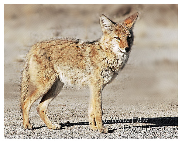
The actors? Coyotes, bighorn sheep, and lizards—all improvising within a script written by climate and time. Even the rain, when it shows up, steals the scene with a brief but powerful soliloquy, transforming everything for one fleeting act before bowing out again for months, sometimes years.
Every performance is different, but the play never closes. The Mojave’s production runs continuously, with geology always holding center stage and life finding its cues wherever it can.
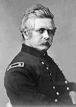
General Edward O. C. Ord has a small but interesting connection to the Mojave.
Ord was a career officer who fought in the Mexican-American War, against Native tribes in California, and later became a Union general in the Civil War. Before his rise to prominence, though, he spent time in California during the 1840s and 1850s. After arriving in Monterey in 1847, Ord worked on some of the earliest surveys of California.
That position put him in charge of military affairs in California and Nevada, where he directed troop deployments in and around the Mojave to protect settlers and suppress conflicts with Native peoples. His work overlapped with the surveying of wagon roads, trails, and the need to establish military posts to protect emigrants, mail lines, and freight routes. Fort Tejon, established in 1854, and later Camp Cady along the Mojave River (1860s), were part of that broader mission. While Ord himself did not leave a long record of direct operations in the Mojave, his service in California helped shape the Army’s early presence in the desert region.
In 1863, during the Civil War, Ord briefly commanded the Department of the Pacific, headquartered in San Francisco. That position placed him in broad command of military affairs in California and Nevada, and he oversaw troop deployments in and around the Mojave, where soldiers guarded settlers and suppressed conflicts with Native peoples.
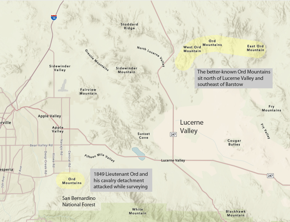
There are actually two distinct mountain ranges in Southern California that bear the name Ord Mountains, and the duplication stems from historical, cartographic, and military associations.
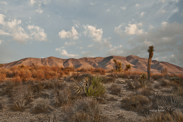
The better-known Ord Mountains sit north of Lucerne Valley and southeast of Barstow, between the Stoddard Wells area and Johnson Valley. These were named for General Edward O. C. Ord, a Civil War officer who had earlier surveyed parts of California in the late 1840s. His name was applied to several places in the state, and this Mojave range was one of them.
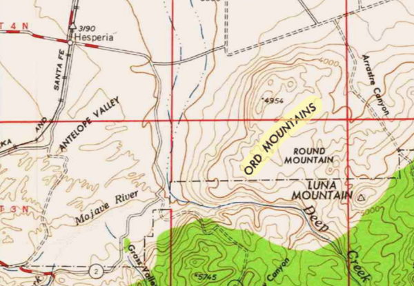
A second, lesser-known Ord Mountains name shows up southwest of Lucerne Valley, closer to Hesperia and Apple Valley. This separate range appears to have been named after an incident in 1849, when Lieutenant Ord and his cavalry detachment were attacked while surveying in that area. Contemporary reports described the soldiers being “surrounded and mauled” by Native Americans. Later mapmakers and local usage extended Ord’s name to those hills as well, even though they are distinct from the main Ord Mountains to the north.
So, while General Ord is not a “Mojave figure” in the sense of someone like Kit Carson, Edward Beale, or later officers tied directly to desert posts, his career intersected with the Mojave at points when the U.S. Army was extending its influence, building forts, and securing travel routes across the desert.
1604 – Juan de Onate meets the Mohave while seeking a route to the Southern Sea. 1772 – Deserting soldiers from San Diego Mission cross along the north foot of the San Gabriel Mountains; Capt. Pedro Fages pursues. 1776 (March) – Father Francisco Garces travels west along the Mojave River, passing the future Camp Cady site, bound for San Gabriel Mission. 1776 – Spanish explorers pass through what is now southern Nevada. 1810 (May 20) – Padre Francisco Dumetz names the San Bernardino Valley for St. Bernardine of Siena; Politana asistencia established. 1812 – Earthquakes damage Alta California missions; Serrano destroy the Politana chapel. 1819 – Fr. Joaquin Pasqual Nuez with Gabriel Moraga leads punitive expedition; Moraga camps at future Camp Cady. 1826 – Jedediah Smith crosses from the Colorado River to San Bernardino via the Mojave. 1827 – Smith attacked by Mohave on return; ten men killed. Ewing Young’s trappers trouble Mohave villages. 1829 – Rafael Rivera scouts Las Vegas Valley; Antonio Armijo leads caravan to California via Mojave River and Cajon Pass. San Bernardino asistencia rebuilt. Ewing Young and Kit Carson use the trail and camping sites. 1830 (Jan 28) – Armijo’s caravan descends Mojave River to Cajon Pass, fixing the first regular Old Spanish Trail. 1831 – William Wolfskill and George Yount travel the trail. 1832–1834 – Trade expands; missions suffer livestock thefts; caravans increase. 1837 – William Pope and Isaac Slover enter via the North Branch. 1838 – Lorenzo Trujillo and others settle near San Bernardino. 1839–1841 – New Mexican settlers arrive in California; John Rowland and William Workman lead immigrant parties. 1842 – Agua Mansa and Politana communities form. 1843 – Rancho Muscupiabe granted to Michael White (Miguel Blanco). 1844 – Fremont and Kit Carson cross Mojave; Carson and Godey avenge Resting Springs massacre. 1845 – Benjamin Wilson leads posse into San Bernardino Mountains, names Big Bear Valley. 1846 (May 13) – Mexican-American War begins; Californios defeat Kearny at San Pasqual in December. 1847 (Jan 13) – Capitulation of Cahuenga ends fighting in California. 1848 (Jan 24) – Gold discovered at Sutter’s Mill. 1848 (Feb 2) – Treaty of Guadalupe Hidalgo; U.S. acquires California. 1848 – Salt Spring, first recorded gold discovery in San Bernardino County. 1849 – Lost 49ers cross Death Valley. Capt. Jefferson Hunt leads Mormon Battalion members across the Mojave Road. 1850 – California becomes a state. Early gold reported in San Bernardino Mountains. 1851 (June 11) – Mormon colonists arrive in San Bernardino; Hunt brings first Mormon immigrant train. Hunt begins mail service from Mojave River base, lasting three years. 1852 – Mormon lumber road built toward Crestline. 1853 – Lt. Williamson surveys Mojave River; San Bernardino County petitioned. 1854 – Fort Tejon established. 1855 – First gold at Big Bear; Oasis of Mara noted. Mormon missionaries establish Las Vegas fort. 1857 (Jan 9) – Fort Tejon earthquake; San Bernardino disincorporated. Edward F. Beale notes Camp Cady site. 1858 (Jan) – Beale, Mercer, and 45 dragoons march toward the Colorado, passing site of future Camp Cady. Butterfield Overland stages begin service. 1859 (Jan) – Companies B and K, First Dragoons, scout Mojave River. Sept 29, dragoons return to Fort Tejon. Oct 21, Capt. Hancock sends wagon train of supplies via Mojave Road. Oct 29, J. Winston establishes depot at future Camp Cady. 1859 – Bodie, California, discovered by Wakeman S. Bodey. 1860 (Feb 11) – Lt. Col. B. L. Beall sends dragoons from Tejon in search of Indians. (Mar 31) Los Angeles Star calls for military post. (Apr 14) Maj. James Carleton establishes Camp Cady, named for Col. Albemarle Cady. (Apr–Jul) Patrols build redoubts at Soda and Bitter Springs; Carleton recalled to Tejon. 1860 – Coso discovered by Dr. E. Darwin French. Tecopa and Cerro Gordo ores found. 1861 (Jan 29) – Supply train sent to Fort Mojave via Camp Cady. (Apr) Civil War begins. 1861 – White Mountain City established; mining begins in New York Mountains; Sage Land District discovered. 1862 (Jan–Feb) – Floods damage Mojave roads. (Apr 14) Lt. Nathaniel Pierce and detachment briefly garrison Camp Cady. 1862 – Cerro Gordo worked by Mexican miners; Turtle Mountains, Whipple Mountains, and Copper Basin mined. 1863 – Camp not permanently garrisoned; visited by Federal troops. 1863 – Freeman District organized; Irataba copper district formed; Rock Spring silver discovered. 1864 (Jul–Sep) – Capt. John Cremony and Company B, 2nd California Cavalry, patrol Mojave Road from Cady to Rock Springs. 1864 – El Paso Mining District active. 1865 (Apr 23) – Official establishment date of Camp Cady. Rotations of California Infantry and Cavalry serve. Pvt. Somerindyke dies by accident; Elliot Coues visits in November. 1865 – Cerro Gordo revived by Coso miners; Tecopa developed; Bullion Mine in Ivanpah discovered. 1866 (Jan) – Capt. Benjamin West commended for building work. (Jul 29) Skirmish near Mojave kills several soldiers. 1866 – Anthony Mill Ruins noted. 1867 (Feb–Aug) – Lt. Manuel Eyre commands Camp Cady; Indian fights at Marl Springs and Pahute Springs. Store at camp burned; Eyre dismissed in 1866. 1868 (Oct 6) – Old site abandoned; new Camp Cady built half a mile west with permanent adobe buildings. 1868 – Clark Mountain copper discovery. 1870 (Oct 19) – Gen. Stoneman designates Camp Cady a military reservation. 1870 – Darwin rediscovered; Avawatz area named. 1871 (Mar) – Camp Cady abandoned; property turned over to local stockmen. 1871 – Chloride Cliff ore discovered. 1872 – Oro Grande/Silver Mountain district organized. 1873 – Old Woman Mountains discovery; Twentynine Palms finds; Panamint boom. 1874 – Darwin silver-lead bodies located. 1874–76 – Southern Pacific completes Tehachapi Loop, connecting San Francisco to Los Angeles. 1875 – Savahia Peak, Exchequer, Waterman, and Riggs mines discovered. 1876 – Ord and Fry Mountains claims located; Lookout district silver-lead discovered. 1877 – Wildrose kilns operate; Beveridge district mined. 1879 – George G. Lee dies, linked to Calico discovery. 1880 – Providence Bonanza King silver discovered; Nantan mine located. 1881 – SP builds Mojave to Calico Station. Harmony Borax Works founded; Calico camp grows; Alvord Mine consolidated. 1882–83 – SP extends track to Needles. 1882 – Providence Mountains gold-iron ores. 1883 – Atlantic & Pacific builds to Kingman; Carson & Colorado reaches Keeler. Needles Reduction Works opens; Ballarat’s Panamint Valley Mine located. 1883 (Aug 21) – Machinery for Alvord Mill delivered to Camp Cady. 1884 – A&P crosses Colorado River and acquires SP line Waterman Junction to Needles. Kramer siding established. 1884 (Jul 5) – President Arthur declares Camp Cady useless for military purposes. 1888 – Paradise Mine discovered. 1890 – Vanderbilt gold discovered by Bob Black. 1893 – Nevada Southern links Goffs to Manvel/Barnwell. Lost Horse Mine established in Joshua Tree region. 1895 – California Eastern begins service. 1897 – Stone Hammer and Orange Blossom mines discovered. 1898 – Randsburg Railway opens. Bagdad-Chase gold discovered; Copper City and Goldstone developed. 1899 – Rosalie post office moved from Ivanpah. 1900 – Coolgardie placers found. 1902 – Ludlow & Southern and Barnwell & Searchlight railroads built. Halloran Spring mines recorded. 1903 – Keane Wonder Mine discovered. 1904 – Tonopah & Tidewater Railroad opens. Rhyolite, Nevada founded. 1905 – San Pedro, Los Angeles & Salt Lake Railroad completed; Tonopah & Goldfield Railroad opens. Inyo Mine developed; Leadfield begins; turquoise discovered at Halloran Spring. 1906 – Las Vegas & Tonopah Railroad built. Skidoo founded; Goldbend and Death Valley Mine discovered. Albert Johnson and Walter Scott make first trip to Death Valley. 1906–1922 – Johnson and Scotty visit Death Valley intermittently. 1907 – Bullfrog Goldfield connects Nevada camps. Garvanza Mine; Hart boomtown founded; Gold Belt discovered. 1908–10 – Arizona & California line links Cadiz, Rice, and Parker. 1908 – Gold Valley discovery. 1909 – Gypsite discovered at Koehn Dry Lake. 1910 – Slocum and Opal camps founded. 1911 – Silver Lake talc mines opened; Saltdale noted. 1912 – Southern Pacific builds Jawbone Branch to Owens Valley. 1913 – Trona Railway opens. Clipper Mountains discovery. 1915–16 – California Southern (II) built between Rice and Ripley. Crutts mining camp appears. 1915–1917 – Johnson acquires ranches in Grapevine Canyon, names them Death Valley Ranch. 1921 – Johnson plans permanent structures. Eichbaum opens Towne Pass toll road. 1922 – Johnson hires Frederick Kropf as superintendent. 1922–1924 – Garage, main house, cookhouse built. 1924–1925 – Stables, chicken coop, workshop built. 1925 – Matt Roy Thompson hired. 1925–1926 – Commissary constructed. 1926–1931 – Architect MacNeilledge designs Spanish-style complex, replaced by de Dubovay in 1931. 1927 – U.S. Borax opens Furnace Creek Inn. 1929 – Dewey Kruckeberg landscapes Death Valley Ranch. 1930 – Hoover withdraws land for study; Johnson learns surveys flawed. Eichbaum completes road to Grapevine Canyon. Tourist traffic increases. 1930–1931 – Daily visitors range from 40 to 100 during construction. 1931 – Johnson halts construction over title issues. 1933 (Feb 11) – Hoover proclaims Death Valley National Monument. Johnsons move to Hollywood, visit monthly. 1934 – Johnson opens informal public tours; Burton Frasher postcards produced. 1935 (Aug 22) – Roosevelt allows Johnson to repurchase Grapevine Canyon land. 1936–1937 – Formal tours begin, $1 admission. Bessie Johnson manages. 1937 (Nov 17) – Johnson receives land patent. 1938 (Mar) – Flood washes away last traces of Camp Cady. 1941 (Oct) – Bessie Johnson publishes 10,000 castle guidebooks. 1942–1945 – WWII rationing reduces castle visitation. 1943 (Apr 22) – Bessie Johnson dies in auto accident on Towne Pass. 1946 – Johnson creates the Gospel Foundation. 1947 (May 19) – Johnson wills property to Gospel Foundation. 1948 (Jan 7) – Johnson dies; Foundation continues operating castle as “museum-hotel.” 1970 (Jul) – NPS purchases Grapevine ranches and castle for $850,000; furnishings donated. 1970–1973 – National Parks Concessions administers castle tours and upkeep. 1973 – NPS assumes full responsibility for Scotty’s Castle.
A long time ago, house finches lived only in the western United States and Mexico. They were small, cheerful birds. The males wore bright red feathers, while the females blended in with soft browns. People loved hearing their songs in backyards and towns.
In the 1940s, some sellers decided to trap these birds and bring them east. They thought people in New York would buy them as pets if they gave them a fancy name. So, they called them “Hollywood finches,” as if the birds were little movie stars from California.
At first, people did buy them. However, a new law soon made it illegal to sell wild birds. The sellers didn’t want to get in trouble, so they opened the cages and let the finches go free in the East.
The birds didn’t just survive—they thrived. They built nests on porches and rooftops, sang their songs in city parks, and raised families. Over time, they spread across the East and eventually met up with their western cousins. Today, house finches live almost everywhere in the United States.
So the next time you hear a happy chirp in your neighborhood, remember: that little bird might be the great-great-grandchild of one of those “Hollywood finches” who escaped their cages and made a brand-new life.
They’re called house finches because they like to live near people and their homes.
Unlike some shy birds that stay deep in the forest, house finches are very comfortable around neighborhoods. They often build their nests on porches, in hanging flowerpots, or in the nooks and crannies of houses and buildings. People would see them perched on rooftops or windowsills, singing their cheerful songs, and so the name “house finch” stuck.
So the name really means “a finch that likes living around houses.”
Lizards in the desert have some clever ways of finding homes. They don’t live in houses like people do, but they find spots that keep them safe from the hot sun and from hungry animals. Many lizards dig little burrows in the sand or dirt where it’s cooler. Others hide under rocks, inside cracks, or even in bushes.
Mojave fringe-toed lizard
During the hottest part of the day, they often stay hidden in these safe spots. When it’s cooler in the morning or evening, they come out to run around, eat bugs, or warm up by lying on sunny rocks.
So, a desert lizard’s “house” could be a hole in the ground, a shady bush, or even a crack in a boulder—it’s wherever they can stay safe and comfortable.
Raising cattle in the Mojave National Preserve comes with unique challenges and a long history. The area has been home to cattle ranching since the late 19th century, with ranchers taking advantage of the sparse but hardy desert vegetation and natural springs.
Historical Perspective
Cattle ranching in the Mojave Preserve dates back to the late 1800s, with ranchers establishing homesteads and using the land for grazing. Ranches like Rock Spring Ranch, Valley View Ranch, and the OX Ranch were some of the key operations. Water was always the limiting factor, so early ranchers developed wells, windmills, and water troughs to sustain their herds.
During the 20th century, ranching continued despite the harsh environment. The Bureau of Land Management (BLM) and later the National Park Service (NPS) managed grazing leases. Still, conflicts arose over land use, conservation, and the impact of cattle on fragile desert ecosystems.
Modern Challenges
After the creation of the Mojave National Preserve in 1994, the National Park Service began phasing out cattle ranching through voluntary buyouts of grazing rights. Some ranchers chose to sell, while others held on under special agreements. Today, very few cattle operations remain in the preserve, and grazing is largely restricted.
Key challenges include:
Water Scarcity: Natural springs and wells are limited, making it difficult to maintain large herds.
Harsh Climate: Extreme temperatures and unpredictable rainfall mean cattle must be resilient to drought conditions.
Regulatory Restrictions: The National Park Service enforces conservation policies, restricting new grazing leases and limiting herd sizes.
Predation and Disease: Coyotes and mountain lions pose risks to cattle, and disease can spread in remote conditions with limited veterinary care.
Legacy and Conservation
Tehachapi beef – Selected for character
Though large-scale ranching has faded chiefly, remnants of the cattle industry remain in the form of historic ranch sites, windmills, and abandoned corrals scattered throughout the preserve. Some former ranching areas have become part of conservation efforts to restore native plant life and protect desert ecosystems.
Ranching played a significant role in shaping the human history of the Mojave, but in many areas, the land is slowly returning to a more natural state.
Trona: The Mineral and the Lake That Made It Famous
When people hear the word “Trona,” they might think first of the tiny desert town in California’s Searles Valley. But long before there was a town, there was a mineral—trona itself—and long before that, there was a great Ice Age lake that left behind an astonishing chemical treasure chest. This is the story of the mineral, the lake, and the wider desert world it belongs to.
The Mineral Trona Trona is a sodium carbonate mineral with the chemical formula Na3(CO3)(HCO3)·2H2O. At first glance, it doesn’t look impressive—grayish, sometimes yellowish, dull and earthy in texture. You can scratch it with a fingernail, since it ranks only 2.5 on the Mohs scale. But appearances deceive. Trona is the raw material that fuels the soda ash industry, and soda ash in turn is essential for making glass, detergents, paper, and countless industrial products.
Trona forms in dry, alkaline lakes where evaporation pulls water away and leaves dissolved salts behind. In crystal form, it can be fibrous, granular, or massive, and it’s often found alongside related salts like nahcolite, gaylussite, and halite. It belongs to the evaporite family—minerals that crystallize in the desert sun as lakes vanish.
Trona’s Desert Cousins To understand trona, you have to meet its “cousins.” Borax, another evaporite mineral, forms in highly alkaline, boron-rich lakes. Borax is white and powdery, long known for its role in glassmaking and cleaning products, and it gained fame during the “20 Mule Team” borax days of Death Valley. Hanksite, a rare mineral found almost exclusively in Searles Lake, is more exotic. With its strange mix of carbonate, sulfate, and chloride, it grows in large hexagonal crystals prized by collectors. Thenardite, a sodium sulfate, appears later in the drying sequence, often after trona has already crystallized. And halite—plain rock salt—is the final curtain call in the evaporation process, forming thick beds of common salt.
Together, these minerals tell the chemical story of ancient lakes. Each one signals a different stage in the drying cycle: carbonates like trona first, then borates, then sulfates, then chlorides, with rare mixes like hanksite reserved for the most concentrated brines.
The Evaporation Sequence Picture a great lake in the desert slowly drying under the sun. As water disappears, minerals crystallize out in a sequence. First come the carbonates—trona and nahcolite—as the lake becomes alkaline. If boron is present, borax forms next. With more evaporation, sodium sulfate minerals like thenardite precipitate. Finally, halite—rock salt—deposits in massive beds, and in the last brine stages, unusual combinations like hanksite grow. It’s nature’s chemistry experiment written on the desert floor.
Searles Lake: A Desert Laboratory Searles Lake in the Mojave Desert is one of the best examples of this process. During the Ice Age, between 30,000 and 12,000 years ago, Searles Lake was a deep freshwater body. Fed by the Mojave River, it was part of a chain of lakes stretching across the desert. When the climate dried, Searles Lake shrank and minerals built up, cycle after cycle, until its bed became one of the richest evaporite deposits on earth.
Today, companies mine Searles Lake for trona, borax, soda ash, sodium sulfate, and halite. They use solution-mining, pumping brines from beneath the playa into evaporation ponds, then refining the salts. The nearby town of Trona, California, owes its name and existence to this mineral wealth. Each October, the community hosts “Gem-O-Rama,” when collectors from around the world flock to dig crystals of hanksite, borax, and halite fresh from the brines.
The Mojave River Lake Chain
Searles Lake didn’t exist in isolation. It was one link in a chain of Ice Age lakes connected by the Mojave River. The river began in the San Bernardino Mountains, flowed through the Victor Valley, and filled Lake Manix near Barstow. When Lake Manix spilled north through Afton Canyon, water reached Soda and Silver Lakes, forming Lake Mojave. In the wettest periods, Lake Mojave overflowed into Searles Lake. From there, water sometimes spilled farther into Panamint Valley, filling Panamint Lake. In the very wettest times, the chain reached all the way to Death Valley, where Lake Manly stretched 80 miles long and hundreds of feet deep.
This chain acted like a conveyor belt for water and minerals. Each basin concentrated dissolved salts, but Searles Lake, being closed and rarely flushed, became a perfect trap. That is why its sediments are so rich in trona and other evaporites.
From Ice Age to Industry When the Ice Age ended, about 12,000 years ago, the climate warmed, and the Mojave River carried far less water. Searles Lake dried into a playa, but its mineral layers remained. By the 1800s, prospectors discovered borax there. In 1873, John and Dennis Searles began mining borax with mule teams, one of the earliest borax operations in California. By the early 1900s, large-scale industrial mining was underway, and the town of Trona was established to house workers. Throughout the 20th century, operations expanded with new methods, and today the lake continues to support a thriving industry and a small desert community.
A Legacy Written in Salt Searles Lake is more than a dry playa; it is a book of climate history, a record of ancient rivers, and a living source of industrial minerals. The mineral trona, dull to look at but essential to modern life, is both its namesake and its most important product. In the larger story of the desert, Searles Lake shows how geology, chemistry, and human enterprise meet in one stark basin. From Ice Age waters to the shelves of today’s stores, trona’s journey is a desert tale written in crystal layers.
Out in the desert, most folks listen for the rattle-rattle warning of a rattlesnake. But did you know many other snakes are sharing the sand and rocks?
One day, a little Gopher Snake slithered by a farmer’s field. “Don’t worry,” it said, “I don’t bite like a rattler. I eat the mice sneaking into your grain.” And with that, it slipped into a hole and came out with a squeaking snack.
“Eeep, eeep, eep,” the vulnerable little mouse cried as it was manipulated headfirst into the snake’s mouth. Its cries muffled as the swallowing began. I have heard it said that going with the nap of the fur aids more efficient digestion.
A shiny Kingsnake stretched out in the sun. “Guess what I like to eat?” it grinned. “Other snakes—even rattlesnakes! Their venom doesn’t bother me one bit.” The rattler kept its distance.
Old Kingsnake had plenty of holes in his head and along his body to prove that he was immune to the rattlesnake bites.
Meanwhile, a Coachwhip zipped across the desert floor, faster than a kid on a bike, chasing lizards like a ribbon in the wind. And deep in the rocks, a Rosy Boa curled up, soft and calm, looking more like a coiled rope than a wild snake.
Every snake has its place, and while rattlesnakes warn with a rattle, the others work quietly to keep the desert in balance. So remember: not all snakes are scary—some are helpers too.
Out in the desert, you might see a lizard on a rock doing tiny push-ups. It looks funny, but for lizards it is very serious.
One reason is to warn other lizards: “This is my spot—stay away!” The push-ups are like flexing muscles, showing strength without actually fighting. If another male sees it, he knows the rock is already claimed.
Another reason is to attract attention. When a female lizard comes around, the male does even more push-ups, faster and stronger. Sometimes he flashes bright colors on his throat or belly while he moves. It is his way of saying, “Look how tough and healthy I am. Don’t you want to pick me?”
And there is a bonus reason: on cool desert mornings, push-ups help a lizard wake up and get his blood moving, almost like warm-up exercises before the day begins.
So those little desert push-ups are not just exercise. They are lizard language—part warning, part love song, and part morning workout.
The Mojave Desert is the central thread, but the archive is more than just a storehouse of facts about the land. It’s a layered record, part historical survey, part natural history guide, and part personal journal. The archive contains thousands of entries, ranging from carefully produced histories of ghost towns to quick, almost casual notes about desert wildflowers. It also includes the memory of conversations, some technical, some reflective, all contributing to a living body of knowledge.
The current archive carries these notes forward. They do not simply add new entries; they revisit and renew older ones. When you ask about Scotty’s Castle, it’s not only a summary of a landmark in Death Valley but also a chance to look again at Walter Scott’s fabricated gold mine, his staged shootout at Wingate Pass, and the way his friendship with Albert Johnson turned into one of the strangest desert partnerships. That reflects the way your archive works: history is never sealed off, but constantly connected to other stories. Scotty’s fake mine ties to mining history, con men, railroad investors, and the enduring myths of the desert.
Other chats anchor themselves in place. Marl Springs, for example, appears not just as a dot along the Mojave Road but as a critical water source, garrisoned by soldiers in 1867 and attacked in the same year. The description in your archive emphasizes its clay-like soil and its dependable, if limited, water supply. The chat adds motion to that entry by pulling the soldiers into view, by describing how isolated Marl Springs was from Soda Springs to the west, and by noting how wildlife still depend on its water. Here, the archive preserves detail, while the conversation reanimates it.
Afton Canyon is another recurring subject. The archive refers to it as the Grand Canyon of the Mojave, formed approximately 15,000 years ago when Lake Manix drained catastrophically. The chats bring it alive with more than geology. They highlight the Mojave River flowing above ground, the slot canyons and caves, the risks of flash floods, and the chance to hike and watch wildlife. The personal tone slips in here: Afton is not just an entry on a map; it is a place walked, seen, and photographed. This blend of technical and personal is one of the hallmarks of your work.
Rainbow Basin provides another good example. In the archive, it is a geologic site featuring badlands and folded rock, as well as paleontological finds and fragile soils. In conversation, it becomes a vivid picture of color bands, rattlesnakes, and the eerie feel of hiking through formations shaped by time and water. The description is simplified for younger readers when needed, but the detail remains. It is both a science lesson and a story about walking through the basin yourself.
The archive also gives weight to local communities and their histories. Cajon Pass, for instance, is not simply a route. It is a crossroads layered with stories: Rancho Muscupiabe, Mormon pioneers, the Santa Fe and Southern Pacific railroads, the old wagon roads, the geology of Lost Lake and Blue Cut. Chats about Cajon Pass often focus on its function as a gateway, a place where history, geology, and transportation come together. They show how the archive not only stores information but also draws connections, creating a network of meaning.
The same goes for Old Woman Springs. The archive notes its name, given by surveyors who saw Indian women there. It records Albert Swarthout’s ranching operation, the cattle drives through Rattlesnake Canyon, and the later disputes with J. Dale Gentry. In chat, the place becomes more than history. It becomes a story of how ranching shaped the Mojave, how land ownership shifted, and how the desert landscape still carries those traces.
Other places appear again and again, sometimes as historical notes, sometimes as subjects for simplified explanations. Shea’s Castle in the Antelope Valley, built by Richard Shea in hopes of curing his wife’s illness, ruined by the stock market crash, later a film set. Hotel Beale in Kingman is tied to Andy Devine, the actor whose name became linked to Route 66. Oasis of Mara in Twentynine Palms is a site of Native planting, early settlement, and eventual park development. Each of these places carries weight in the archive, but they come alive in conversation, as the details are retold, refined, and made accessible.
Ecology is just as present as history. Pinyon pines and junipers, Fremont cottonwoods, brittlebush, desert sunflowers, bees sleeping in flowers, and ‘horny toads’ explained to children — all of these details show how the archive ranges across subjects. A glossary entry on igneous rocks can sit beside a playful description of bees tucked into golden blossoms for the night. A technical note on pinyon-juniper woodland succession can be followed by a casual story about antelope ground squirrels darting through camp. These shifts in tone are part of the richness of the record.
The archive also holds larger arcs. The history of Owens Valley runs through it: the water conflicts with Los Angeles, the aqueduct, the treaties with Native peoples, the battles fought during the Owens Valley Indian War. Panamint City and Greenwater appear as examples of boom and bust, with detailed accounts of stagecoach robbers, Nevada senators, mining camps, and the short-lived hopes of investors. The Tonopah and Tidewater Railroad, Remi Nadeau’s freight road, and the Atlantic and Pacific’s push across the Mojave all weave together into the bigger story of transportation. These arcs show how your archive is not just about single places but about the way places link into broader regional histories.
The present chats extend these arcs. A question about Owenyo might focus on its railroad history, but in doing so, it links back into Owens Valley and forward into the decline of rail in the desert. A question about Llano del Rio touches both the socialist dreams of Job Harriman and the modern ruin that still draws visitors. Each chat is both a piece in itself and a way of extending the larger web.
Throughout, there is an awareness of presentation. The archive is not simply a private notebook. It is shaped to be shared: titles, descriptions, metadata, glossaries, indexes. Chats often focus on how best to present this material to readers, whether as timelines, simplified summaries, or relational indexes. The act of shaping the material for public use is part of the archive itself.
The combination of archive and chat also reflects a deeper concern: preservation. The desert is full of forgotten places, and people who once told their stories are no longer around. By recording these histories, revisiting them, and reshaping them for new audiences, the archive resists that loss. The chats show the urgency of this work, as you reflect on volunteers thinning out, museums struggling, and the need to keep the desert’s stories alive.
The archive is a landscape in itself. Its mesas are the long, detailed histories. Its washes are the short, playful notes. Its valleys are the connections between subjects. The chats are the weather moving across that landscape, stirring it, reshaping it, sometimes eroding, sometimes depositing. Over time, the whole thing grows richer, more interconnected, more alive.
This is why the archive and chats cannot be separated. The archive preserves. The chats enliven. Together they form a record of both the desert and of the act of remembering. The Mojave is the subject, but the deeper theme is persistence: the persistence of asking, recording, and shaping knowledge into something that lasts.
The Hotel Beale opened in 1899 in Kingman, Arizona, after an earlier wooden inn on the site burned down. For a growing railroad town on the edge of the desert, the Beale was a symbol of permanence: solid brick walls, rooms for travelers, and a touch of style on Front Street.
In 1906, Tom Devine, an Irish immigrant and businessman, bought the hotel. He expanded and remodeled it about a decade later, turning it into the finest lodging in Kingman. Travelers arriving by train or, later, by automobile along the developing Route 66 found the Beale a natural stop. It was a place where deals were made, stories were traded, and the town’s social life often centered.
Tom’s son, Andy Devine, grew up right there in the hotel. Born in 1905, Andy spent his childhood surrounded by railroad workers, cowboys, ranchers, and wanderers who drifted through Kingman. Living in that atmosphere of tall tales and wide-open West likely planted the seeds for his later career. Andy eventually headed west to Hollywood, where he became a beloved actor. With his trademark raspy voice and big-hearted, comic presence, he starred in hundreds of films, often as the sidekick in Westerns with John Wayne and Roy Rogers. He also became a fixture on radio and television, hosting shows that made him a household name. Despite his fame, Andy’s roots in Kingman were never forgotten. Locals proudly remembered him as the boy from the Beale.
For decades, the hotel thrived. It welcomed railroad passengers, Route 66 travelers, and even celebrities. But when Interstate 40 bypassed downtown Kingman, business declined. Modern motels popped up along the new highway, leaving the old Beale behind. The once-grand building eventually closed its doors and slipped into disrepair.
Today, the Hotel Beale stands boarded up and weathered, a tarnished landmark on Route 66. Yet it still carries the weight of history: the vision of Tom Devine, the laughter of guests who passed through, and the childhood of Andy Devine, who carried the spirit of Kingman all the way to Hollywood. Restoration groups and investors have shown interest in reviving it, seeing not just a crumbling building but a chance to honor both the town’s history and its most famous son.
The Hotel Beale’s story is one of boom, bust, and memory. It rose with the railroad, declined with the highway, and lives on in the legend of Andy Devine.
Lithic scatters These are the sites you see on the ground: clusters or spreads of stone fragments left behind from stone toolmaking. A lithic scatter could include flakes, cores, broken tools, or other debris. It is the visible archaeological footprint of tool production or use.
Debitage This is the waste material created when someone was shaping stone into tools. Think of the wood shavings on the floor after whittling. Debitage includes flakes, chips, and fragments that were not intended to be used as finished tools. Archaeologists study debitage to determine what kind of tools were being made, the techniques used, and sometimes even who was doing the knapping.
Flakes These are specific pieces of stone struck off from a larger stone (a core) during toolmaking. Some flakes are just waste (part of debitage), but others can be shaped further into tools themselves (like scrapers or blades). So, flakes can be both by-products and usable tools, depending on how they were treated afterward.
To put it together: A lithic scatter is the overall archaeological site, which contains debitage (waste pieces) and sometimes flakes (which may be either waste or turned into tools).
In the Mojave Desert, the bright yellow desert gold flowers open wide in the sunshine. They look like little suns shining across the sand. Bees love to visit, buzzing from one bloom to the next, sipping sweet nectar and rolling in golden pollen.
As the sun sinks low, the flowers start to close their petals. It’s bedtime for desert gold. But sometimes, a bee is still inside. When the petals fold shut, the bee is tucked in—safe and snug in a soft bed of pollen. The flower becomes a tiny motel room just for bees.
On windy nights, the motel isn’t always calm. The flower sways and shakes, tossing the bee about like a boat on stormy water. That’s what makes it “wild” life. But even if it gets bumpy, the bee is better off inside than out in the cold desert night.
Bees are hard workers with a wonderful work ethic. They don’t even leave the job when it’s time to rest. They sleep right at work, in golden beds of pollen. And when the morning sun warms the desert and the flowers open again, the bees are already up and ready—buzzing off to do their important work all over again.
In the early 1990s, Rancho Lucerne was introduced as an ambitious master-planned development for Lucerne Valley. The proposal covered nearly 1,400 acres and envisioned 4,257 homes, a 27-hole golf course, and commercial amenities. A Draft Environmental Impact Report was released in 1993, and early grading even took place near the high school. To its backers, Rancho Lucerne promised to transform the valley from a quiet agricultural community into a suburban center.
But the project unraveled almost as quickly as it appeared. The financier behind Rancho Lucerne was charged with embezzlement, money dried up, and by 2001 the plan was abandoned. What remained was a scar of disrupted desert soil, a reminder of what might have been.
At first glance, this collapse may have seemed like a failed opportunity for growth. In reality, it became a turning point that preserved Lucerne Valley’s traditional identity. Without Rancho Lucerne, the valley avoided the massive shift toward suburban sprawl. Instead, it stayed closer to its roots—scattered ranch homes, small farms, alfalfa fields, and open desert stretching to the horizon. Growth continued on a modest, individual scale, with new homes built one lot at a time rather than through sweeping developments.
The deeper reason for resistance lay in water. Lucerne Valley relies on its underground aquifer, a fragile supply that has always been stretched between farms, families, and the desert ecosystem. A project of Rancho Lucerne’s scale—thousands of houses and a golf course—would have drawn heavily from this source. For many locals, that alone made the project unsustainable. By failing, Rancho Lucerne spared the valley from a major new demand on its water, leaving space for the slower pace of development that better fits the desert.
Even today, when the project resurfaces in planning discussions, conservation groups such as the Morongo Basin Conservation Association push back, citing water, wastewater, air quality, traffic, cultural resources, and environmental justice. The mood of the community leans strongly against large-scale development. Rancho Lucerne has become a kind of cautionary tale: a reminder that the valley’s future is best secured by honoring its agricultural heritage and protecting its limited resources.
Looking back, the unbuilt project didn’t just fade into history—it helped define the community’s values. By collapsing, Rancho Lucerne reinforced the belief that Lucerne Valley’s strength lies not in suburban expansion but in its rural heart, where water, land, and tradition are treated as treasures too rare to gamble away.
Them dreams ain’t broken. They is just done playin’
There’s an old motel squatting beside the highway, its sign missing letters so it only spells half a word. Rows of doors face the road, all painted the same tired color, their numbers faded and flaking. The pool out back is nothing but cracked plaster and tumbleweeds. Travelers glance at it now and mutter, “broken dreams.”
But for a time, this place was buzzing. Neon glowed red and blue against the desert night, a beacon for weary drivers. Families pulled in with dust on their bumpers, kids tumbling out of cars and racing to the pool. Truckers parked out front, stretching stiff legs before grabbing a room. The ice machine clattered, the soda machine hummed, and radios crackled through thin walls. Each door held a story—honeymooners, salesmen, wanderers chasing the horizon.
The motel didn’t die because dreams collapsed. It faded when the road shifted, when chains offered cheaper beds closer to the freeway, when travel changed shape. The neon flickered out one night, the owner sold off the furniture, and the desert began to sift sand across the parking lot.
Now it sits in silence, a hollow frame where laughter once echoed. If you stand there at dusk, when the sky goes purple and the wind rattles the broken sign, you can almost hear the faint splash of kids in the pool, the muffled slam of a screen door, the hum of neon calling strangers in from the dark. Not broken dreams. Just the afterglow of a place that served its purpose and then stepped aside.
Dunes Motel
The Dunes Motel on Route 66 near Lenwood, California, was built in the late 1940s or 1950s. It had four buildings, each with four rooms (16 total), centered around a swimming pool designed to create a desert oasis feel. Located about 2.5 miles west of Lenwood at 23135 National Trails Highway, it catered to travelers during the heyday of Route 66.
Over time, with the arrival of Interstate 15 pulling traffic away, the motel declined. Today, it stands abandoned, with boarded windows, graffiti, and remnants like its old sign and pool still visible. Some recall it functioning more like an apartment complex in its later years, and it has even acquired a reputation for being haunted.
Lenwood itself once hosted several motels, cafes, and even a drive-in theater, but like the Dunes, most faded after the freeways bypassed Route 66.
Soledad Mountain rises just south of the Mojave, its rocky slopes bearing the stories of over a century of mining. Gold was first found here in 1894, when prospectors chased the Queen Esther and other veins. Early tunnels, stamp mills, and mercury pans yielded approximately five million dollars’ worth of gold and silver before activity slowed by 1914.
The Great Depression brought the mountain back to life. In 1933, George Holmes struck the Silver Queen vein, drawing in investors from South Africa. By 1935, the Golden Queen Mining Company had built a modern underground operation. From 1935 to 1942, the mine was the largest producer in southern California’s desert, until a federal wartime order shut down all gold mining.
After the war, the mountain quieted. The mill was dismantled, and with gold fixed at $35 an ounce, few miners could make a living. That changed in the 1980s, when new heap-leach technology made lower-grade ores profitable. Golden Queen Mining, a Canadian firm, consolidated the claims, drilled thousands of feet, and by 2016 reopened Soledad as a modern open-pit, heap-leach mine.
Geologically, Soledad Mountain is a volcanic dome complex of rhyolite and latite. These brittle rocks fractured to host dozens of quartz veins. The deposit is a low-sulfidation epithermal system, rich not just in gold but also silver—often five ounces of silver for every ounce of gold.
Today, lined leach pads, water monitoring, and wildlife protections stand where old shafts and tailings once scarred the land. The mine has produced over 340,000 ounces of gold and 3.5 million ounces of silver since 2016. Now owned by Andean Precious Metals, Soledad is one of California’s last working gold mines, carrying forward a desert legacy that began 130 years ago.
References
Mindat.org. Soledad Mountain (Golden Queen Mine), Mojave-Rosamond District, Kern County, California, USA. Mineral locality database. Accessed August 2025. https://www.mindat.org/loc-80502.html
Standard Hill sits just south of Mojave, California. Today, it appears to be just another rocky desert butte, but for more than a century, people were convinced it was a golden hill.
It started in 1894 when George Bowers, a lone prospector, stumbled across gold in the rocks. His first load of ore was worth $1,600, a substantial sum back then. Word spread fast. Soon, miners were sinking shafts into veins with colorful names, such as Yellow Rover, Exposed Treasure, and Desert Queen.
By 1901, the place wasn’t just a scatter of claims anymore. A big 20-stamp mill and a cyanide plant were built to crush and process the rock. What had been a lonely hill was suddenly alive with pounding stamps, the smell of chemicals, and the clatter of wagons hauling ore. A little company camp, called “Gold Town,” even grew at the base of the hill to house workers and families.
Mining boomed off and on for decades. Companies came and went—the Mojave Consolidated, Standard Mining and Milling, and later Standard Hill Mines Company. Each tried to pull wealth from the hill. In the 1930s, during the Great Depression, the district came roaring back to life. Miners chased the gold veins hundreds of feet down, working day and night until World War II shut them down by government order.
All told, Standard Hill yielded approximately $3.5 million worth of gold and silver in the past, primarily from the first three prominent veins. That’s roughly 170,000 ounces of gold, much of it in the form of bright yellow metal mixed with silver. People who worked in the mines said that some ore was so rich it sparkled in the sunlight.
The rock itself tells part of the story. Standard Hill is made of ancient granite capped with younger volcanic rock. When hot fluids moved through cracks in these rocks long ago, they left behind quartz veins stuffed with gold and silver. Miners followed these veins like treasure maps, finding pockets of ore several feet thick.
The hill wasn’t done yet. In the late 1980s, modern companies returned with bulldozers and leach pads, excavating four small open pits. They mined for just a few years before prices fell and the operation shut down again in the early 1990s.
Today, Standard Hill is quiet. You can still see old mine shafts, scattered ruins of the mill, and the scars of the modern pits. It’s a reminder of how one small desert hill fueled dreams of riches, supported little communities, and became part of California’s long gold-mining story.
Desert Fever: An Overview of Mining in the California Desert (Mojave Desert Mining History, Standard Hill section)
California Division of Mines and Geology, Mineral Resources of Kern County (1957; later summaries of Mojave-Rosamond District production and geology)
Mindat.org – Standard Hill Group (Mojave Mining District, Kern County, CA) – mindat.org/loc-219385.html
Elephant Butte – Standard Hill Group, Mojave Mining District, Kern County, California (technical geology report, academia.edu)
The Diggings – Standard Hill Mine (historical mining claim and production records) – thediggings.com/mines/28338
California Journal of Mines and Geology, 1930s–1940s issues (district reports with production figures and ore descriptions)
USGS Bulletins on Mojave District mineral deposits (notably reports describing epithermal systems of Soledad Mountain, Standard Hill, and Tropico Hill)
Indigenous Mojave and desert tribes lived in the region for thousands of years, traveling along the Mojave River and ancient trade routes.
1840s–1860s
Travelers along the Old Spanish Trail and Mormon Road camped at spots near Barstow such as Grapevines and Fish Ponds.
1860–1871: Camp Cady, east of Barstow, served as a U.S. Army post protecting travelers along the Mojave Road.
1860s–1880s
Silver mining boomed in nearby Calico and Daggett.
Settlement first appeared under names Fishpond and Waterman Junction (named for Robert Waterman, a silver mine owner).
1880s
1882–1884: Southern Pacific Railroad built to Daggett, later taken over by the Atchison, Topeka & Santa Fe Railway.
1886: Town officially named Barstow after William Barstow Strong, ATSF president. Became a major railway division point.
Early 1900s
1911: Casa del Desierto (Harvey House) opened, providing elegant lodging and meals to rail passengers.
1925: On July 4, the business district was moved about a quarter mile to align better with the highway and railroad.
Route 66 and World War II
1920s–1940s: Barstow thrived as a stop on Route 66.
1942: Marine Corps Logistics Base established, supporting military logistics during World War II.
Postwar era
1958: Goldstone Deep Space Communications Complex established nearby as part of NASA’s Deep Space Network.
1960: Barstow Community College founded.
Preservation and modern history
1975: Casa del Desierto listed on the National Register of Historic Places.
1976: Designated as a California Historical Landmark.
1990s: Harvey House restored after earthquake damage, repurposed to house the Route 66 Mother Road Museum, Western America Railroad Museum, and serve as an Amtrak station. (2025)
Andrew Jackson “Jack” Longstreet (circa 1834–1928) earned renown as “the Last of the Desert Frontiersmen” — a man of fierce independence and rugged frontier grit, whose life still echoes across Nevada’s wild backcountry.
Jack Longstreet was one of those desert characters who seemed pulled straight from a dime novel, only he was real — and larger than life. Born around 1834, probably in Tennessee, he carried a shadowy past that folks whispered about. Some said he’d been mixed up in rustling back east, and when his gang was caught, the others swung from a rope while Longstreet got off with the loss of an ear. He grew his hair long to hide it, and the scar just added to the air of danger around him.
By the 1880s, he had drifted into Nevada, a land of raw opportunity and rough justice. He was everything the frontier demanded: a prospector, gambler, rancher, stagecoach shotgun rider, saloonkeeper, and, by some accounts, even a Pony Express rider. He married a Southern Paiute woman named Fannie, learned her language, and earned a reputation as a man who stood up for Native rights. He could be tough, but he was fair — a quality that made him respected by some and feared by others.
In 1895, Longstreet built a stone cabin beside a spring in the lonely Ash Meadows of the Amargosa Valley. The place was remote enough to suit him, with water for his livestock and a wide view of anyone coming his way. That cabin, now restored in the Ash Meadows National Wildlife Refuge, still stands as a quiet witness to his life on the edge of civilization.
Ash Meadows Wildlife Refuge
He later moved north into the Monitor Range, setting up the Red Rock Ranch near Belmont. His final years were quieter, but not without drama. In 1928, an accidental gunshot led to a stroke that ended his life at the age of about 94. He was buried in Belmont Cemetery, with Fannie joining him four years later.
Longstreet lived by his own rules in a Nevada that was still wild. His life was part outlaw tale, part survival story — the kind of man who could gamble in a saloon one night, dig a waterhole the next, and disappear into the hills without a trace. Even today, his name carries the weight of desert legend.
Timeline
1834 – Born, likely in Tennessee. Mid-1800s – Rumored involvement in rustling; loses an ear as punishment. 1880 – Arrives in Nevada Territory; works as prospector, gambler, rancher, saloonkeeper, stagecoach shotgun rider. 1882 – Operates a saloon and drug store in Sylvania, Nevada. Late 1880s – Homesteads near Moapa Indian Reservation; involved in a fatal shooting, later acquitted as self-defense. 1890s – Marries Southern Paiute woman, Fannie; becomes known for supporting Native rights. 1895 – Builds stone cabin at Ash Meadows, Amargosa Valley; ranches and develops spring site. Early 1900s – Leaves Ash Meadows for Monitor Range; establishes Red Rock Ranch near Belmont. 1928 – Accidentally shoots himself; suffers stroke and dies in Tonopah at about 94 years old. 1932 – Fannie Longstreet dies; buried beside Jack in Belmont Cemetery.
Back in late 1998, Jerry Freeman, an amateur historian with a passion for Death Valley’s old 49er trails, came out of the Panamint Mountains claiming he had found something straight out of a gold rush daydream. Hidden deep inside a cave, he said, was a wooden trunk left behind by the lost ’49ers who famously struggled across Death Valley in 1849.
AP photo – Clay Campbell
The box was a curiosity in itself — weathered wood, iron hinges, smelling of dust and old paper. Inside was a jumble of “treasures”: gold and silver coins (most tarnished, some shiny), a hymnal, a flintlock pistol, a pair of baby shoes worn soft with age, ceramic bowls, and even a letter dated January 2, 1850, supposedly written by a pioneer named William Robinson. The letter told a story of hardship and faith as the writer prepared to leave the desert behind. To Freeman, it was the smoking gun of history — proof that the Jayhawker survivors had stashed some of their belongings before moving on.
When he brought the chest to Death Valley National Park headquarters in early 1999, there was real excitement. Newspapers ran breathless headlines about a half-million-dollar find. Historians daydreamed about finally holding personal effects from the very people who gave Death Valley its name.
But almost as quickly, the doubts started trickling in. Some of the coins didn’t match the time period. The word “grubstake” appeared in the letter — a term that historians said wasn’t common until years later. And some items looked suspiciously… fresh. One ceramic bowl still had a price sticker.
Park officials brought in experts from the Smithsonian and the Western Archaeological and Conservation Center. That’s when the story unraveled fast. They found modern polymer glue holding parts together. The tintype photos used a process that wasn’t invented until after 1856. A “Made in Germany” stamp on one bowl could only have existed after World War I. Even the leather on the baby shoes was still soft, which shouldn’t have been possible after 150 years in Death Valley heat.
By the end of January 1999, the Park Service went public: it was a hoax. Not one item in the chest could be proven authentic to the Gold Rush era.
Freeman stood his ground, saying he’d always believe the chest was genuine, maybe “salted” with a few newer items by someone else. But for most historians, the romance was gone. What had looked like a once-in-a-lifetime discovery turned out to be another desert tall tale — one that fooled people just long enough to make them want to believe it.
Origins and Early Life Moe is a chimpanzee with an extraordinary life story that began in Africa and soon intertwined with a California family. In 1967, St. James Davis – then a merchant seaman – encountered an infant chimp in Tanzania whose mother had been killed by poachers. Davis rescued the baby chimp and brought him to the United States with the help of missionaries. He and his wife LaDonna, who were unable to have children of their own due to LaDonna’s health, decided to adopt the chimpanzee and name him Moe. The Davises raised Moe in their West Covina, California home just as one might raise a human child. He wore clothes, was toilet-trained, took showers, and even slept in a bed. Family life for Moe included simple pleasures like enjoying chocolate milk and watching television with his adoptive parents. From his infancy, Moe bonded strongly with the Davises, becoming the center of their family life for decades.
Relationship with His Owners St. James and LaDonna Davis considered Moe their son in every sense. They referred to themselves as “Moe’s dad and mom,” and treated the chimpanzee as a pampered, if unconventional, member of the family. “That was the word they used to describe him, and that was how they treated him,” a story noted, portraying Moe as a “hairy, rambunctious child” in the Davis household. They taught Moe how to wear clothing, use utensils at the dinner table, and even communicate through simple sign language. In an oft-cited anecdote, Moe participated in the Davises’ wedding ceremony – LaDonna described him as a combination of flower girl and best man – emphasizing just how integrated he was in their personal lives. Over the years, countless family photos showed Moe snuggling with the couple or even lounging in bed with them. The deep emotional bond was mutual: the Davises doted on Moe, and he in turn was docile and affectionate with them, knowing them as his family. LaDonna once tearfully explained that Moe was “like the son she never had,” underscoring the profound connection between the chimp and his human caregivers.
Media Presence and Fame Prior to 2008 The City of West Covina awarded Moe an “Honorary Citizen” certificate in 1971, reflecting his local celebrity status. From the 1970s onward, Moe became something of a local celebrity in Southern California. In fact, a 1971 legal battle over Moe’s residency in West Covina turned into a public spectacle that Moe ultimately “won” – a judge ruled the city could not evict him, remarking in court that “he doesn’t have the traits of a wild animal, and is, in fact, somewhat better behaved than some people.” Following this victory, West Covina presented Moe with an official Honorary Citizen certificate, symbolically recognizing him as one of their own. Moe went on to make numerous public appearances that endeared him to the community. In the 1970s, he was often seen in parades and at civic events – at one point even ceremonially receiving the “keys to the city” of West Covina. Friends wrote a biographical book, Moe, documenting these years, including photographs of the chimpanzee engaging in human-like pastimes. Moe was pictured driving a speedboat and even sitting behind the wheel of a sports car, grinning as if he were out for a joyride. He reportedly “sold” Girl Scout cookies to help local troops and delighted crowds by performing ribbon-cuttings at events. Thanks to such exploits, Moe became a media darling. Local newspapers and TV stations featured stories on “Moe the chimp” over the years – sometimes portraying the charming, well-behaved ape as a model primate, and other times covering the more troublesome incidents that came later. By the early 2000s, Moe’s name was familiar to many in the Los Angeles area, as his saga of domestic life, celebrity cameos, and subsequent controversies played out in headlines.
Housing and Care Arrangements (Jungle Exotics in Devore) Moe’s living arrangements changed several times over his life, especially after authorities determined he could no longer reside in a suburban home. In 1999, following two incidents in which Moe bit a police officer’s hand and later a visitor’s fingertip (after she reached into his enclosure with red-painted nails), West Covina authorities forcibly removed Moe from the Davis home for violating the city’s wild animal ordinance. This marked the end of Moe’s idyllic life in the house and the beginning of his life in sanctioned facilities. His first stop was the Wildlife WayStation, a noted animal sanctuary in the Angeles National Forest, where he stayed for a few years. In 2003, when that sanctuary ran into licensing problems, Moe was transferred to a nonprofit facility called Animal Haven Ranch near Bakersfield, California. It was at Animal Haven Ranch that a notorious incident occurred in 2005: as St. James and LaDonna visited Moe to celebrate his 39th birthday with a cake and treats, two other younger chimpanzees escaped their cage and brutally attacked the Davises. (Moe himself did not partake in the attack and remained in his enclosure, reportedly looking on in shock.) This horrific event left St. James gravely injured and LaDonna also hurt, and it underscored the potential dangers of captive primates. Animal Haven Ranch closed to the public after the attack, and Moe’s presence there became a legal liability. In the aftermath, Moe had to be moved yet again for his own safety and care. By 2007, Moe found a new home at Jungle Exotics, a private compound in Devore, California. Jungle Exotics is a licensed facility that provides animals – from tigers and lions to reptiles and dogs – for film and television productions. Unlike a sanctuary, it’s essentially a training and boarding compound for working animals. Moe was not used in any show business work; he was kept as a permanent boarder, and the owners built him a large, comfortable enclosure complete with toys, blankets, and even a “lookout tower” platform where he could watch trains go by in the distance. By all accounts, Moe adjusted well and was “a happy camper” at Jungle Exotics, enjoying the fresh air and roomy cage after years in smaller quarters. However, this arrangement would later prove controversial. The co-owner of Jungle Exotics, a trainer named Sid Yost (operating under the business name “Amazing Animal Productions”), had been sued in 2005 for animal cruelty amid accusations that he beat and abused chimpanzees used in Hollywood shows. Yost settled that lawsuit in 2006 by agreeing to send all his chimps to accredited sanctuaries and to bar himself from working with great apes ever again. Yet here was Moe – a chimpanzee – living on Yost’s property in 2007–2008. The Animal Legal Defense Fund later pointed out that Moe’s very presence at Jungle Exotics violated the 2006 legal settlement and raised alarms about the adequacy of Moe’s care. (In fact, ALDF representatives said they had no idea Moe was at Jungle Exotics until news broke of his escape.) Despite these red flags, for a time Moe appeared to thrive in the Devore facility under the day-to-day care of trainers there. Jungle Exotics was Moe’s fourth home since leaving West Covina, and tragically, it would also be the last place he was seen.
The 2008 Escape Moe’s tranquil stay at Jungle Exotics came to an abrupt end in late June 2008. On Friday, June 27, 2008, the 42-year-old chimpanzee somehow escaped from his enclosure at the facility. The exact circumstances of Moe’s breakout remain a bit mysterious. The owners of Jungle Exotics were baffled as to how Moe managed to defeat his cage’s security – one co-owner noted that the steel enclosure “should have been able to hold a gorilla,” yet Moe had the strength or smarts to pry it open or break the welds. One theory was that Moe, who had always been clever with his hands, unlatched or bent a portion of the cage and simply walked out. Another suggestion was that a recent wildfire in the area might have agitated or frightened Moe, prompting him to make a bold escape into the unfamiliar wilderness. What is known is that on that Friday afternoon, after getting free, Moe wandered calmly from the Jungle Exotics compound onto a neighboring property. He ambled into a house that was undergoing remodeling, startling a group of construction workers inside. Reports indicate Moe may have approached the workers in a non-aggressive manner – one witness thought the chimp held out his hand as if expecting a treat or handshake, and there was even a rumor that a worker offered Moe a sandwich. Before anyone could contain him, however, Moe slipped away again. He hopped a fence and headed off into the vast brushy expanse of the San Bernardino National Forest, which borders the Devore area to the north. By the time animal caretakers arrived on scene, Moe had vanished into the wild. The initial escape occurred in a mountainous, heavily wooded zone, making it immediately difficult to track the chimp’s movements. Moe, who had lived his entire life in human care, was suddenly loose in an environment full of real dangers (rattlesnakes, mountain lions, and other wildlife) and devoid of the easy food sources he was used to. It was a race against time to find him.
Search Efforts After the Escape The search for Moe in the summer of 2008 was intense and emotionally charged. As soon as his disappearance was discovered, the Davises and their friends mobilized a private search party to comb the foothills where Moe was last seen. St. James Davis, still partially recovering from the 2005 mauling, even ventured out (in a wheelchair) to direct search efforts, demonstrating the couple’s devotion to their chimp despite the physical hardship. They quickly hired a helicopter to fly low over the forest, hoping the noise of the chopper might flush Moe out of hiding or spur him to reveal himself. Searchers on foot used four-wheel-drive vehicles to navigate the rugged terrain and broadcasted recorded chimp calls through loudspeakers in an attempt to lure or communicate with Moe. They also brought in bloodhounds to sniff for any trace of the chimpanzee’s trail. The San Bernardino County Animal Control authorities were on standby with tranquilizer dart guns, but they treated Moe’s escape as a mostly private matter – since Moe was not deemed an immediate public threat, officials did not mount a massive manhunt, instead offering support and a hotline for sightings. Despite these efforts, finding a single chimp in 240 square miles of forest proved exceedingly difficult. No confirmed sightings of Moe came in the first days or even weeks after his escape. The Davises pleaded with the public to help if they spotted Moe – asking anyone who saw the chimp to call authorities but not to approach him, for fear that Moe could be frightened or harmed by strangers. Numerous tips did trickle in: search teams followed up on reports of “big, hairy” creatures in the woods, only to determine those tracks belonged to bears, stray dogs, or even a mule. In one bizarre incident, someone reported seeing “a man in a monkey suit” running in traffic near a mountain road, which sent deputies scrambling, but that too turned out to be a false alarm or prank. A few tantalizing clues suggested Moe might still be roaming nearby – locals noted a couple of outdoor water faucets mysteriously left turned on, and a few chickens went missing from a rural property, raising hopes that Moe was stealthily raiding yards for water and food. However, none of these clues could be definitively linked to the chimp. After several exhaustive weeks, the search gradually wound down with no sign of Moe. Sadly, as of 2008, Moe had not been found and remains missing to this day. His disappearance became an unsolved mystery, leaving the Davises heartbroken and the public wondering whether Moe could possibly survive long-term in the wild.
Public and Legal Responses and Controversies Moe’s saga over the decades sparked significant public debate and several legal battles, highlighting controversies over exotic animal ownership. Early on, many in the community regarded Moe with affection – as evidenced by West Covina’s granting of honorary citizenship to the chimp – but city officials also grappled with the risks of keeping a chimpanzee in a residential neighborhood. In 1971, when West Covina first tried to enforce its ban on wild animals by removing Moe, the Davises fought back in court and won an unusual reprieve. The judge’s conclusion that Moe did not behave like a wild beast effectively gave the family legal cover to keep him at that time. This case, with Gloria Allred as the Davises’ attorney, received media attention and set a precedent (at least temporarily) that a well-behaved chimp could be treated akin to a household pet. However, as Moe grew older and larger, and after incidents in the late 1990s demonstrated the potential danger (two people were bitten, albeit in provoked situations), public sentiment shifted toward caution. In 1999 West Covina authorities invoked a zero-tolerance stance on the city’s wild animal ordinance, removing Moe for public safety reasons despite the Davises’ objections. The couple’s subsequent legal efforts – including a civil rights lawsuit – led to a 2002 settlement: West Covina agreed to pay them $100,000 and assist in purchasing a house in Baldwin Park (a neighboring city with looser animal regulations) so the family might reunite with Moe legally. In principle, this suggested a compromise to allow Moe back into a home setting outside West Covina. Yet bureaucratic delays and the aftermath of the 2005 mauling incident derailed that plan. By 2005, even some former supporters of Moe’s homecoming questioned the wisdom of keeping a strong adult chimp in a domestic environment, no matter how gentle he seemed. After the 2005 attack (in which Moe himself was blameless but humans were grievously hurt), the controversy over exotic pet primates intensified. The incident became a cautionary tale in news reports about the unpredictability of chimpanzees and the dangers they can pose as they reach maturity. St. James and LaDonna Davis, despite their trauma, remained steadfast in their love for Moe – in 2006 they even put up a sign on their lawn reading “Free Moe,” signaling their continued desire to bring him home. They pressed West Covina to honor the earlier agreement. A judge eventually ruled in 2007 that the city had breached its obligations and ordered West Covina to pay the Davises a further $32,000 and contribute $300 per month toward Moe’s care, since the promised Baldwin Park arrangement never materialized. This legal victory was bittersweet; by then Moe was living at Jungle Exotics under the Davises’ frequent supervision, and the couple’s priority was simply his well-being. Moe’s 2008 escape brought another wave of public response. There was both sympathy for the Davises – a sense of empathy for “parents” desperate to find their missing family member – and renewed criticism of the practice of keeping chimpanzees in captivity outside accredited zoos or sanctuaries. Animal welfare organizations seized on Moe’s disappearance as evidence that stricter oversight was needed. Notably, the Animal Legal Defense Fund called attention to the circumstances of Moe’s care at Jungle Exotics, arguing that Sid Yost should never have had a chimp in his custody at all due to his prior legal ban. ALDF suggested that Moe’s escape (and possible grim fate in the wild) was a tragic result of substandard caretaking and regulatory slip-ups. The case fueled discussion about tightening laws on exotic animal trainers and private ownership. Indeed, California law already prohibits keeping primates like chimpanzees without special permits, and Moe’s story became an example cited in support of these regulations. Ultimately, Moe the chimpanzee’s life reflects the complexities of human relationships with exotic animals. He was at once a beloved member of a human family and a wild creature subject to instincts and strength that humans sometimes underestimated. Public and legal responses to Moe’s situation evolved from indulgence and fascination in the early years to concern and strict oversight in later years. The controversies surrounding Moe – from city council meetings and courtroom showdowns to animal-rights investigations – have had a lasting impact. They have raised awareness about the responsibilities and risks of keeping great apes in captivity, and have prompted ongoing conversations about how we balance compassion for animals with public safety. Moe’s disappearance in 2008 left unanswered questions, but his legacy endures in the legal precedents and cautionary lessons that arose from his remarkable journey.
Luther A. Ingersoll was a journalist, editor, and historian active in Southern California in the late 19th and early 20th centuries. He is best known for compiling and publishing Ingersoll’s Century Annals of San Bernardino County, 1769–1904, a substantial local history volume released in 1904. This book is a detailed chronicle of San Bernardino County, California, combining early exploration, settlement, economic development, and biographical sketches of prominent citizens.
Here are a few key points about Luther A. Ingersoll:
Background: Not much is readily available about his early life, but he appears to have had a background in journalism and was active in publishing and historical writing.
Editor and Publisher: He worked in various editorial capacities and likely contributed to or edited newspapers in California. His writing style shows familiarity with both narrative history and biographical journalism.
Century Annals (1904): This was his best-known work and a common reference source for researchers studying early San Bernardino County. The book includes:
Explorations and Spanish mission history.
Rancho and pioneer development.
Biographical sketches (often based on submitted family or self-authored accounts).
Civic and institutional growth, including railroads, mining, and agriculture.
Methodology: Ingersoll’s work reflected the historiographical style of his time—often celebratory, biographically focused, and boosterish. Still, it captured primary recollections and early records that might otherwise have been lost.
Legacy: Despite some historical inaccuracies or omissions, Century Annals remains one of the foundational regional histories for San Bernardino County and is still cited in local historical studies.
Photo Title:George A.F.B., 12-22-2013 Photographer: Walter Feller
1. Composition:
The curve of the sidewalk pulls the viewer’s eye naturally from the foreground toward the background, which is effective in creating depth and leading lines.
The tree in the mid-ground serves as a visual anchor, offering a natural focal point in an otherwise rigid environment.
The buildings form a flat horizon, which complements the minimalist and desolate tone of the scene.
2. Lighting and Tone:
The subdued, desaturated palette supports the theme of abandonment and decay. There’s a washed-out, almost ghostly feel that mirrors the forgotten nature of the place.
Lighting is soft and diffused, likely from overcast skies or a low winter sun. That lends a cold, lifeless mood—appropriate for the subject matter.
3. Subject and Message:
The photograph tells a quiet but heavy story—of abandonment, former purpose, and time’s erosion. It’s a subtle documentation of what was once a vibrant part of military infrastructure, now fallen into silence.
Including the date and location in the image enhances its documentary value and turns the image into an archival piece.
4. Technical Observations:
Sharpness is well-controlled; textures in the concrete, tree bark, and dried ground are detailed but not exaggerated.
Some may critique the almost HDR-like softness in tonal contrast, but in this case, it enhances the surreal stillness.
The slight tilt of the camera horizon (if unintentional) could be distracting, but it also contributes a sense of unease.
5. Suggestions (if improvement were desired):
Cropping a sliver off the bottom might help rebalance the frame if you want to lessen sidewalk dominance and bring the focus more toward the buildings.
A version with slightly boosted contrast or selective color treatment (e.g., leaving the tree full desaturated while warming the sky subtly) could offer an alternative mood without losing the melancholy.
Overall Impression: A quietly powerful photograph. It captures the stark beauty of abandonment with compositional clarity and emotional restraint. The image feels frozen in time—appropriate for a forgotten base in the middle of the Mojave. It’s not loud, but it lingers.
—it’s Tamarix aphylla (athel tamarisk), which only reproduces by cloning, not seed. While it isn’t spreading like Tamarix ramosissima or chinensis, which have taken over waterways in the West, all types of tamarisk share one thing: they use proportionately large amounts of water. So even the non-invasive ones have an impact, especially in desert regions where water is life.
Here’s a list of the most common tamarisk (or saltcedar/athel) species found in the American Southwest, especially the Mojave Desert, with notes on whether they are considered invasive and whether they are heavy water users:
Tamarix ramosissima (Saltcedar)
Invasive: Yes
Water-sucking: Yes
Notes: One of the most aggressive species, spreads by seed and root. Known for choking out native vegetation and monopolizing riparian zones.
Tamarix chinensis (Chinese tamarisk)
Invasive: Yes
Water-sucking: Yes
Notes: Often hybridizes with T. ramosissima. Together, they dominate many desert waterways and floodplains.
Tamarix parviflora (Smallflower tamarisk)
Invasive: Yes
Water-sucking: Yes
Notes: Less common but still invasive, particularly in California. Can handle salty soils and crowds out native plants.
Tamarix gallica (French tamarisk)
Invasive: Occasionally
Water-sucking: Yes
Notes: Less aggressive in arid environments than others but still considered problematic in some regions.
Tamarix aphylla (Athel tamarisk or Athel tree)
Invasive: No (not generally considered invasive in the U.S.)
Water-sucking: Yes
Notes: Grows as a large tree, does not spread by seed in North America, but it still consumes a lot of water. Introduced intentionally as a shade and windbreak tree.
Summary:
Invasiveness: Most tamarisk species are invasive, especially T. ramosissima, chinensis, and their hybrids.
Water Use: All tamarisks are thirsty. Even T. aphylla, though not invasive, draws significant water—making them ecologically impactful in arid regions like the Mojave.
Tamarix aphylla (Athel tamarisk or Athel tree) https://en.wikipedia.org/wiki/Tamarix_aphylla
Feature
Tamarix aphylla (Athel)
Invasive Tamarisk (ramosissima/chinensis)
Growth Form
Large tree
Shrub or small tree
Height
30–50 feet
6–20 feet
Trunk
Single main trunk
Multiple stems
Leaves
Scale-like, dull grey-green
Fine, feathery, bright green
Leaf Spacing
Widely spaced
Dense along twigs
Flowers
Sparse, rarely seen
Showy pink/white spikes
Blooming Season
Rarely blooms in U.S.
Late spring to summer
Seed Production
None (no viable seed in U.S.)
Profuse—spreads aggressively
Branch Color
Brown to grey
Reddish to purplish, especially new growth
Water Use
High
High
Spread Potential
Low (clonal only)
Very high (seed and roots)
Typical Location
Homesteads, roadsides, farms
Riverbanks, washes, natural springs
Tamarix ramosissima Photo 32999308, (c) larry-heronema, some rights reserved (CC BY-NC) https://www.inaturalist.org/photos/32999308
When people think of Big Bear Lake or Littlerock Reservoir, they usually picture pine-covered hills or quiet desert canyons. But beneath those scenic views lie stories of bold ideas, early 20th-century innovation, and one man who didn’t mind going against the grain: John S. Eastwood.
Original Big Bear Dam – 1885 (colorized)
Eastwood wasn’t interested in building dams the way everyone else did. While most engineers were busy stacking massive concrete walls straight across rivers, he had something different in mind: a system of thin, curved arches that transferred pressure into solid rock abutments. It was lighter, cheaper, and—in his view—smarter.
In Big Bear, the original dam dated back to 1884. It was built by Frank Elwood Brown, a man with a vision to turn the dry, chaparral-covered inland valleys into citrus groves. His dam was modest and practical for its time, but growing demand soon outpaced its capacity. By 1910, the Bear Valley Mutual Water Company called on Eastwood to design something new. What he gave them in 1912 was a graceful structure of eleven concrete arches—his signature multiple-arch style. It raised the lake level and helped feed the thirst of the San Bernardino Valley below. A bridge was added in 1924, making the dam a true link between the north and south shores and turning it into a local landmark.
Meanwhile, about 60 miles west as the crow flies, the Littlerock Dam rose in a very different landscape—dry, wide-open desert edged by the San Gabriel Mountains. Built between 1922 and 1924, the dam had a job to do: tame seasonal flooding and store water for nearby farms and growing communities in the Antelope Valley. Again, Eastwood’s multiple-arch design was chosen. At the time of its completion, Littlerock Dam was the tallest structure of its kind in the world. It stood not just as a practical solution but also as a quiet sign of faith in human ingenuity—a way to harness nature without bulldozing over it.
Over the years, both dams have been modified to meet modern standards. Littlerock was reinforced in the 1990s, its delicate arches now hidden beneath a face of roller-compacted concrete. Some of Eastwood’s original elegance was lost, but the structure still holds firm. Big Bear’s dam remains more visibly true to his vision, standing quietly beside the lake like a relic from a time when ambition was poured in concrete.
Littlerock Reservoir
John S. Eastwood may not be a household name, but his work left a lasting mark on California’s landscape. His dams in Big Bear and Littlerock weren’t just about holding back water—they were about pushing engineering forward. More than a century later, their presence still shapes the way people live, work, and play in the Mojave and San Bernardino Mountains.
Eastwood wasn’t interested in building dams the way everyone else did. While most engineers were busy stacking massive walls of concrete straight across rivers, he had something different in mind: a system of thin, curved concrete arches that would transfer pressure into solid rock abutments. It was lighter, cheaper, and—in his view—smarter.
How House Finches ended up in New York is yet another quirky little chapter in bird history—and it all starts with a bit of rule-bending in the pet trade.
In the 1930s and early 1940s, House Finches were native only to the western United States and parts of Mexico. At that time, they were not present on the East Coast. But their pretty colors and sweet songs made them attractive to bird lovers. So, pet shop owners began capturing them in the Southwest and shipping them to pet stores in the East, especially around New York City.
Here’s the catch: under the Migratory Bird Treaty Act, it was illegal to sell native wild birds as pets. But sellers didn’t want to stop, so they tried to work around the law by giving the birds a fancy new name—“Hollywood Finches”—to make them sound exotic and non-native.
That didn’t fool everyone. Enforcement started tightening up when the government caught wind of the illegal trade. In 1940, pet shop owners in New York panicked and did something unexpected—they released their captive finches into the wild to avoid getting caught.
And that’s when things got interesting.
The released birds survived, adapted, and started breeding. They found New York’s parks, gardens, and backyards suitable places to raise families. Within a few years, they had spread throughout the Northeast and expanded rapidly across the eastern half of North America.
So now, thanks to an accidental release tied to illegal pet sales, House Finches are one of the most widespread songbirds in North America. It’s a classic case of unintended consequences—but one that ended with a success story (for the birds, anyway).
A natural thread of wildlife presence woven in, showing how desert creatures went about their lives while miners, homesteaders, and road-trippers came and went:
Ivanpah Valley: Mining, Settlement, and the Story of the Mojave
Nestled in the northeastern part of San Bernardino County, the Ivanpah Valley tells a story of shifting sands, silver dreams, and the rugged endurance of those who dared to live in one of the harshest corners of the American West. This desert basin, with its sweeping alluvial fans and ancient hills, bears the marks of both geologic forces and human ambition. From the first mining camps to homesteaders and the rise of Route 66, Ivanpah is a quiet but enduring witness to the broader saga of the Mojave Desert, a place of allure and mystery that has captivated generations.
The valley lies 2,600 and 4,500 feet above sea level and is part of Major Land Resource Area (MLRA) 30g. Its surface comprises fluvial, lacustrine, and wind-blown sands laid down during the Quaternary period, while occasional outcrops of rugged Precambrian rock poke through the sediment. Gently sloping alluvial fans define the terrain, while basin floors and dry lake beds, known as playas, stretch toward the horizon. Rain is rare—only about 4 to 7 inches fall yearly—yet the soil and climate support hardy desert plant communities like creosote bush, Joshua tree, saltbush, and greasewood, depending on moisture and soil type.
Amidst all this change and activity, the local wildlife continued its existence with a quiet resilience. Wagons rattled over gravel trails, and miners pounded away at rock walls. Yet, desert tortoises quietly roamed the flats, burrowing down into the cool earth to escape the heat. Coyotes trotted unseen along arroyos, pausing now and then to listen. Jackrabbits darted through greasewood and shadows, while red-tailed hawks circled high above the empty mining camps. For the creatures of the desert, life pulsed to an older rhythm, indifferent to boom or bust, a testament to the enduring resilience of the natural world.
Into this arid but mineral-rich land came waves of miners in the 19th century, drawn by tales of hidden veins and easy fortunes. In 1860, the first productive mine in the Mojave—called “Christmas Gift”—opened in Death Valley, setting off a flurry of activity across the desert. Borax, known as “the white gold of the desert,” was soon discovered and began to be mined profitably. By the 1870s, the Clark Mountain Mining District was established, and with it the town of Ivanpah, at that time the only sizable American settlement in the eastern Mojave.
The Bullion Mine, located on the north end of the Ivanpah Mountains, began production in the 1860s. Its rich silver ore was shipped down the Colorado River and on to Swansea, Wales. In 1879, the mine was producing steadily—about five tons every three days—and wagons driven by Jesse Taylor hauled the ore out across the desert. That same year, the mine superintendent, James Boyd, made headlines by replacing an Indian laborer who earned 75 cents a day with a teenage boy, advertised in the San Bernardino Weekly Times, who would work for $30 a month and board–this was frontier economics at its most practical.
The mine changed hands over the years, and in 1909, it was leased by George Bergman of Eldorado Canyon, backed by a $50,000 bond. With multiple shafts and a depth of 250 feet, the Bullion Mine produced ore containing lead, copper, and silver into the 1910s but has seen no significant production since.
Other mines in the Ivanpah Mountains also flourished, if only briefly. The Standard Mine, discovered in 1904 on the west side of the range, operated from 1906 to 1910 and again during World War I. It was nearly 700,000 pounds of copper and 20,000 ounces of silver. By 1908, a small company town had sprung up around it, with bunkhouses, a store, and an assay office.
The Kewanee Mine, discovered around 1901, was especially busy between 1907 and 1911, employing fifty men and operating its mill.
The Morning Star Mine, just west of the Kewanee, saw its most active years between 1927 and 1939, and by the 1970s, it was still being worked in search of the estimated 100,000 ounces of gold beneath its claims.
A particularly curious chapter comes from the Kokoweef Caves, where, in the 1920s, a miner named E.P. Dorr claimed to have discovered an underground river of gold. The tale has since become the stuff of legend, with some continuing to search for treasure in the shadows of the Carbonate and New Trail copper mines nearby.
While miners chased fortune beneath the ground, another wave of settlers sought a different treasure—land. In 1910, homesteaders arrived under federal land programs, usually staking claims on 160-acre parcels. Many came to the Lanfair Valley and surrounding regions, hoping to make a go of desert farming. The rains of the early 1910s encouraged them—fields sprouted crops, and the dry air drew veterans of World War I suffering from the effects of mustard gas.
But the good years were short-lived. When the rains failed, wells dried up or never reached water. Homesteaders found themselves hauling water across miles of open land. Tensions over water rights flared between settlers and ranchers. Gradually, families gave up. They left behind lonely cabins, wind-worn and silent, scattered across the desert.
And still, the lizards sunned themselves on warm rocks. Desert bighorn sheep lined the mountain ridges, standing like statues in the morning light. After a lucky rain in the springtime, wildflowers painted the valley in yellow and purple while hummingbirds zipped among the blooms—untroubled by claims or county lines.
In the 1920s, the iconic Route 66 was born. Built to connect the Midwest to California, it followed old wagon trails and pioneer routes. It symbolized freedom and opportunity—nicknamed “The Mother Road” and “Main Street of America.” It inspired books, songs, and even a TV show. Its significance in shaping the American landscape and culture is undeniable, evoking a sense of nostalgia and appreciation in those who traverse its historic path.
Then came the Great Depression in the 1930s. Struggling families from the Dust Bowl followed Route 66 west, hoping to grow their food and escape the failing economy. After World War II, traffic along Route 66 surged. Though the road was narrow and dangerous in spots, it remained vital—until the 1950s, when new interstate highways like I-15 and I-40 began to bypass the small desert towns. The last section of Route 66 was officially decommissioned in 1985. But its memory lives on. Starting in 1995, “Historic Route 66” signs began appearing in all eight states the route once crossed. Today, travelers trace its path through the Mojave, chasing a piece of American history.
The Ivanpah Valley and its surroundings may seem quiet today, but the landscape still whispers the stories of boomtowns and busted dreams, sunburned miners and hopeful homesteaders, and dust-choked cars rolling west on Route 66. It is a land shaped by wind, stone, and determination—where people once came looking for gold and found, if not riches, a chapter in the great American tale. And through it all, the desert’s original residents—the coyotes, quail, snakes, and tortoises—have never left, carrying on as they always have, desert-born and desert-bound.