Mohave tui Chub: The Last Native Fish of the Mojave River

Mohave tui ChubPhoto – Joe Ferreia, California Fish & Wildlife

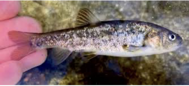
The Mohave tui chub (Siphateles bicolor mohavensis), formerly Gila bicolor mohavensis, is the only fish native to California’s Mojave River. It once lived throughout the river–inhabiting deep pools, sloughs, marshes, and backwaters from the Forks of the Mojave near the San Bernardino Mountains to Soda Lake near Baker. Now, it survives only in a few isolated refuges, making it one of the rarest native fishes in the American Southwest.

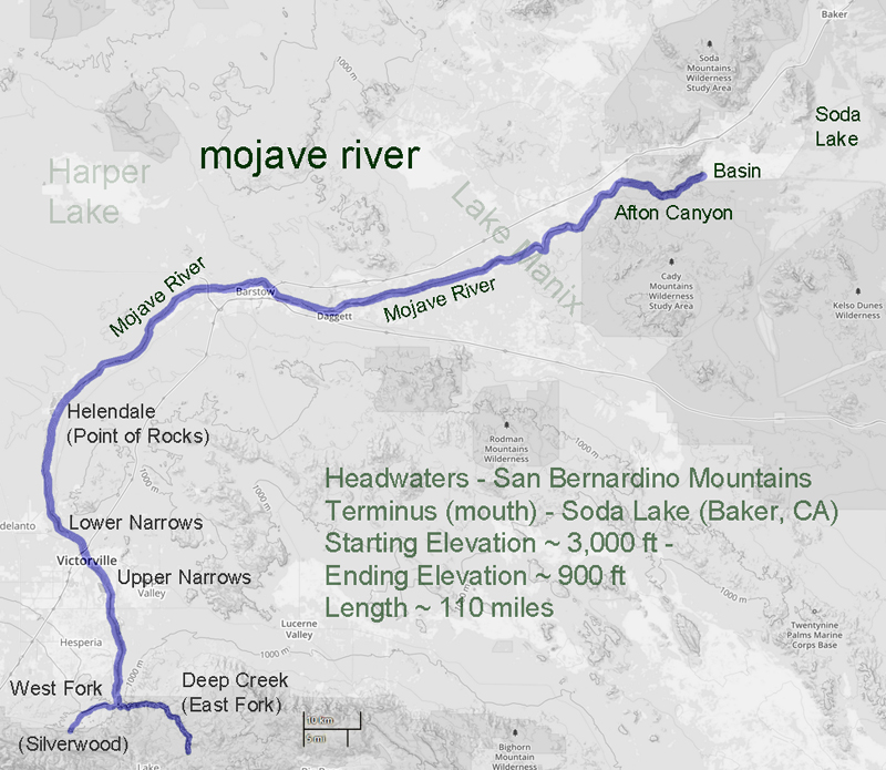
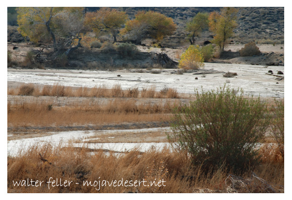
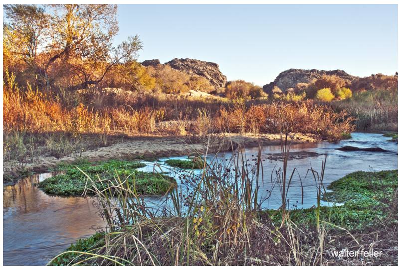
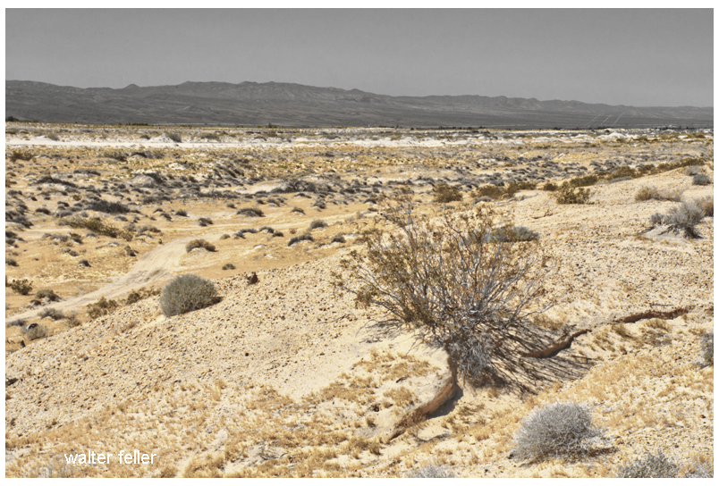
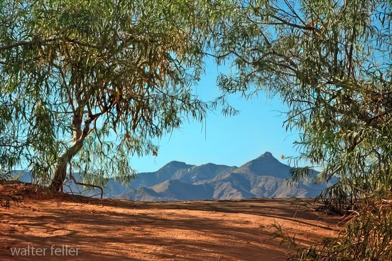
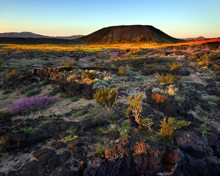
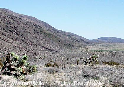
The Mojave River is unlike most North American rivers. It courses about 100 miles from the San Bernardino Mountains into the Mojave Desert, with most of its water underground. Surface flows occur only where bedrock forces groundwater to the surface, or when storms cause runoff. Despite being intermittent, the river once supported a rich aquatic ecosystem, including the Mohave tui chub.

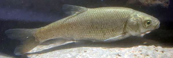
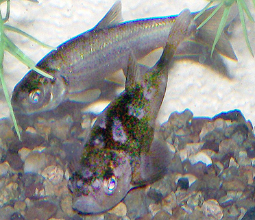
The fish is a chunky, large-scaled minnow with a small terminal mouth, olive-brown to brassy back, and silver-white belly. Adults are usually 4 to 6 inches long; some reach 9 inches. Mohave tui chub feed on insect larvae, algae, and organic debris. Spawning runs from February to October, when females deposit thousands of adhesive eggs on aquatic plants.

For thousands of years, the species did well in the Mojave River basin. Its decline began in the early twentieth century as dams, groundwater pumping, and water diversions altered the river’s flow. Yet, habitat modification alone did not cause its disappearance.

Arroyo chub (Gila orcutti) – Hank Baker

Around 1930, arroyo chub (Gila orcutti), native to coastal Southern California streams, were introduced into reservoirs in the San Bernardino Mountains. Likely released by trout anglers or accidentally during fish stocking, they spread throughout the Mojave River after major floods in March 1938.

Unlike many introduced species that compete with native wildlife, the arroyo chub threatened the Mohave tui chub by interbreeding with it. Studies by Carl Hubbs and Robert Miller documented extensive hybridization and backcrossing. Over time, the native fish was absorbed into the introduced population. By the 1960s, pure Mohave tui chubs had disappeared from the Mojave River, and by 1970, the species was effectively extirpated from its native habitat.

Lake Tuendae

Fortunately, a small population survived in isolated ponds at Soda Springs near the lower end of the watershed. These fish formed the foundation for all subsequent recovery efforts.

Authorities immediately recognized the species’ precarious status. The Mohave tui chub was listed as endangered under federal law in 1970, and the State of California followed in 1971. California also designated it as a Fully Protected species. In 1984, the U.S. Fish and Wildlife Service completed a recovery plan to prevent extinction and to establish secure refuge populations.

Today, genetically pure Mohave tui chubs survive in only a few places: Lake Tuendae at Zzyzx, Camp Cady Wildlife Area, MC Spring, and the Lark Seep system at China Lake. The China Lake population is regarded as the most secure. Since the mid-1990s, annual surveys there have estimated the number of fish in thousands. Water quality monitoring, invasive species control, habitat management, and vegetation removal help maintain suitable conditions.

Modern genetic studies have greatly improved the understanding of the species. Yongjiu Chen, Steve Parmenter, and Bernie May used microsatellite DNA analysis to examine surviving populations and compare them with fish from the Mojave River. Their results confirmed that refuge populations remain genetically pure Mohave tui chubs, while fish occupying the Mojave River today are pure arroyo chubs.

Mohave tui Chub – Arroyo Chub – photo Walter Feller

The study revealed key differences among populations. Lake Tuendae and China Lake have high genetic diversity and are genetically similar. Camp Cady has lower diversity because it was founded by only 10 fish. MC Spring shows the lowest diversity, likely due to long isolation and genetic change. The researchers recommended boosting gene flow among populations and creating new ones from the most diverse sites.

While the Mohave tui chub survived, the Mojave River itself continued to change. By 2002, at least twenty-two non-native fish species had entered the watershed. Introduced species dominated fish communities in the middle and lower Mojave River. Researchers documented six exotic species in their study reaches and found evidence of continued hybridization among non-native fishes. In some locations, other introduced species displaced even the arroyo chub.

Many scientists concluded restoration of Mohave tui chub to its historic range would be very difficult. The river’s ecology has been fundamentally changed by invasive species, water development, habitat modification, and altered hydrology. While some reintroductions might be possible within controlled settings, restoring the species throughout the Mojave River now appears unlikely.

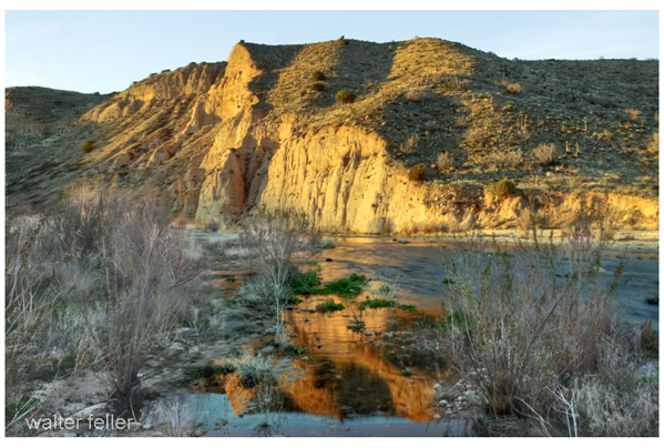
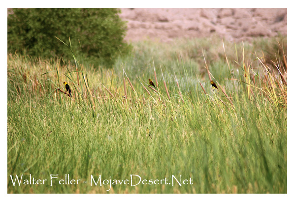
Despite these challenges, important habitat remains. One example is the Transition Zone of the Mojave River, where perennial surface water supports a fifteen-mile corridor of cottonwood and willow forest. Conservation measures have protected portions of this habitat, including the 1,647-acre Palisades Ranch. The property contains approximately 3.5 miles of Mojave River frontage and hundreds of acres of riparian forest, supporting a remarkable diversity of wildlife.

Species benefiting from the protection of the river corridor include the southwestern willow flycatcher, least Bell’s vireo, western yellow-billed cuckoo, Mojave River vole, southwestern pond turtle, arroyo toad, desert tortoise, Mohave ground squirrel, burrowing owl, and Mohave shoulderband snail. The area also contains habitat that could support Mohave tui chub if biological and hydrological obstacles are overcome.

The story of the Mohave tui chub is both a conservation success and a cautionary narrative. The species disappeared from the river where it evolved, not primarily because of direct predation or habitat destruction, but because it was replaced by genetic introgression from an introduced relative. Yet biologists, land managers, and conservation agencies worked together to save the fish from extinction.

Now, the Mohave tui chub is a living remnant of the earliest Mojave River ecosystem. Its survival depends on protected refuges, careful genetic management, and protection of remaining river stretches. As the only fish native to the Mojave River basin, it is a key symbol of the desert’s natural heritage.

Mohave tui Chub

Sensitive Fish Species

Lake Tuendae

Mojave River

Curtis Howe Springer and the Complicated Story of Zzyzx

Curtis Howe Springer and the Complicated Story of Zzyzx

Curtis Howe Springer was a radio preacher, health-product salesman, resort promoter, and one of the Mojave Desert’s most unusual characters. He was neither simply a generous desert visionary nor merely a confidence man. He built a functioning community, provided work and shelter, attracted visitors, and helped Baker’s economy. He also used credentials he had not earned, advertised products with unsupported medical claims, and operated a large resort on federal land he did not own.

Springer arrived at Soda Springs in 1944 with Helen Springer. He filed mining claims covering about 12,800 acres and renamed the place Zzyzx, which he promoted as “the last word in health.” From a collection of tents and old ruins, the Springers developed a resort with guest rooms, a dining hall, a chapel, mineral baths, a swimming pool, radio facilities, workshops, gardens, animal pens, and an airstrip.

Much of this was real. Zzyzx wasn’t simply a name on a brochure. People lived, worked, ate, worshiped, and vacationed there for nearly 30 years. The federal court later described four guest buildings containing 59 units, a dining room and kitchen, an administration building, a chapel, mineral baths, electrical equipment, and numerous other structures.

Work and Economic Benefits

Springer’s operation created work at Zzyzx and generated business in nearby Baker. Workers mixed and packaged health foods, printed literature, prepared radio recordings, filled orders, handled correspondence, maintained buildings, cooked meals, cared for animals, and mailed products.

Some workers were recruited from Los Angeles’ Skid Row. They were offered food, shelter, a small wage, and a place away from alcohol in exchange for construction and maintenance work. This labor helped Springer build the resort at relatively low cost, but it also provided men with few alternatives, a temporary home, and useful work.

Zzyzx also affected Baker. Visitors sometimes stayed in Baker motels while waiting to enter the resort. Springer’s enormous volume of packages, promotional literature, donations, and correspondence helped raise the Baker post office to first-class status. The federal court record specifically confirms that foods, printed materials, and radio recordings were packaged and prepared for mailing at Zzyzx.

However, Springer did not cause Baker’s first post office to be established. Postal records show that the office began under the name Silver Lake on March 27, 1907. It was renamed Baker in February 1933, eleven years before Springer arrived. His business greatly increased its workload, but it did not create the first post office.

Was Springer Rich?

Springer appears to have become wealthy during Zzyzx’s most successful years. The National Park Service describes him as a millionaire. His radio broadcasts reached hundreds of stations, while listeners sent donations and ordered teas, food supplements, books, and other products. The National Park Service states that he shipped more than four million packages during his years at Zzyzx.

One witness later recalled that Springer paid a $2,500 court fine immediately, treating it like a minor expense. This suggests that he had considerable available money.

His exact personal wealth is still unknown. No dependable financial statement or estate accounting has been found. Some of his apparent wealth was represented by buildings and improvements at Zzyzx. Those improvements stood on federal land, and Springer never obtained legal title to the property. He could control the operation while he occupied it, but he did not own a desert estate that he could legally sell.

The Ownership Problem

Springer held unpatented mining claims. Such claims allowed legitimate mineral exploration and mining, along with activities reasonably connected to mining. They did not automatically transfer ownership of the land.

The United States remained the legal owner. Springer’s hotel, health resort, food-packaging operation, radio studio, pools, airstrip, residential buildings, and religious activities went far beyond ordinary mining.

Springer made several attempts to obtain a stronger legal right to the property. He filed desert-land applications in 1951, public-recreation applications in 1957 and 1958, and another non-mineral application in 1966. These applications were rejected, dismissed, or denied. Despite those decisions, he continued operating Zzyzx.

In 1970, a federal district court restricted the property to mining-related uses. A 1971 injunction prohibited Springer from operating the resort, renting rooms, packaging food, preparing mail, recording broadcasts, maintaining pools, or inviting people to live there for purposes unrelated to mining. The Ninth Circuit Court of Appeals upheld that injunction.

The legal record, therefore, leaves little doubt about ownership: Springer and his organizations built and operated Zzyzx, but the United States owned the land.

Was Springer Selling Land?

There is evidence that Springer marked off residential lots and allowed major donors to build homes on them. Some historical accounts describe this as offering or selling parcels to supporters.

The wording requires care. Springer could promise someone a place to live or accept a donation in exchange for the use of a lot, but he could not convey valid ownership because he did not own the land. No deed from Springer could transfer federal property.

It is therefore safest to say that Springer allocated or offered homesites to donors as if he controlled the property. Whether every arrangement was described as a direct sale is less certain. What is certain is that donors could not receive a valid title from him.

Would Nonprofit Status Have Helped?

Nonprofit status would not have solved Springer’s central problems. In fact, organizations connected with Zzyzx already included the Dr. Curtis Howe Springer Foundation and the Zzyzx Community Church. Both were named in the federal land case.

A properly managed nonprofit could have accepted donations, operated a retreat, and possibly applied for an authorized lease or public-purpose agreement. It still would have needed federal approval to occupy the land. It would also have been required to follow food, drug, advertising, tax, and charitable organization laws.

Calling the resort a church, foundation, charity, or nonprofit could not transform a mining claim into ownership. It also could not legalize false medical advertising or the unauthorized distribution of public land.

A nonprofit might have helped only if Springer had reorganized the operation, stopped making unsupported health claims, kept proper financial records, and obtained a valid federal lease. The government had already rejected several of his applications, so nonprofit status alone would not have guaranteed that result.

Why Springer Went to Prison

Springer was not imprisoned merely for being eccentric, practicing natural health, or building a resort in the desert. The strongest court evidence concerns false advertising and misbranded foods.

The Ninth Circuit record states that he had been convicted on 18 counts of false advertising involving supposed remedies for hemorrhoids, heart disease, nervous conditions, thyroid problems, and goiter. It also records violations of California food-misbranding laws.

Springer was fined and sentenced to 60 days in jail. After appeals, he reportedly served 49 days. His imprisonment should be distinguished from the land dispute. The land case was primarily a federal civil action for an injunction, damages, ejectment, and eviction. His false advertising and food law convictions provided the criminal penalties.

Thus, two legal problems came together:

  1. Springer used federal mining-claim land for a resort, residence, manufacturing, and mail-order business.
  2. He advertised health products with claims that authorities and courts found false or misleading.

The first problem cost him Zzyzx. The second resulted in penalties and imprisonment.

Did the Rehabilitation Program Work?

Some men probably benefited from their time at Zzyzx, although their progress was never formally documented. Springer offered homeless and struggling men food, shelter, work, routine, and an alcohol-free environment. The National Park Service has concluded that these conditions certainly helped some visitors.

Springer later claimed that Zzyzx had helped rehabilitate 4,000 destitute men. That figure came from Springer himself. No known records follow these men after they left, nor do they show how many remained sober, found permanent employment, reunited with families, or established stable homes.

Zzyzx was not a licensed rehabilitation center with trained counselors, medical supervision, case records, or long-term follow-up. Nevertheless, temporary shelter and meaningful work can still help people. The fair conclusion is that Springer probably helped some individuals, but his claim of 4,000 successful rehabilitations cannot be verified.

Eviction and Final Years

After years of court proceedings, federal authorities removed Springer and his followers from Zzyzx in 1974. The government did not recognize his ownership claims, and Springer could not take the property with him or sell it as his estate.

In 1976, the Bureau of Land Management permitted the California State University system to use the site. Zzyzx became the Desert Studies Center, where students and researchers continue to study Mojave Desert biology, geology, hydrology, and history.

Springer and Helen moved to Las Vegas after the eviction and his short imprisonment. He remained there for the rest of his life. Curtis Howe Springer died in Las Vegas on August 19, 1985, at age 88. Available sources do not identify the particular residence or hospital where he died.

A Balanced Judgment

Springer’s story resists a simple conclusion. He was a persuasive promoter who made unsupported medical claims and used public land far beyond the limits of his mining claims. He accepted money and donations while presenting himself as a doctor and minister, even though he lacked recognized qualifications. His legal troubles were based on substantial evidence, not simply disagreement with unconventional medicine.

At the same time, he built a real desert community. Zzyzx provided jobs, meals, shelter, inexpensive vacations, religious fellowship, and temporary stability. His mail-order business supported packaging and mailing work and brought measurable business to Baker. Some people remembered him with sincere thanks.

His good works did not give him ownership of federal land, and nonprofit status would not have erased the legal violations. Likewise, his unlawful conduct does not mean that nobody benefited from Zzyzx. Both parts belong in history.

Sources

United States v. Springer, Ninth Circuit Court of Appeals

Mojave National Preserve Administrative History

National Park Service: Zzyzx

Los Angeles Times: Zzyzx and Curtis Howe Springer

California Post Office Records

SFGATE: The History of Zzyzx Road

Zzyzx

Table Mountain Observatory (TMO)

Table Mountain Observatory (TMO) is part of NASA JPL’s Table Mountain Facility, located above Wrightwood in the San Gabriel Mountains. The 37-acre site is situated at an elevation of 7,300 feet and overlooks the Mojave Desert, approximately 60 miles northeast of JPL’s Pasadena campus. Its high elevation, mountain setting, and distance from Los Angeles air pollution make it a prime location for astronomical and atmospheric research.

TMO – 1998 – pilot, Willy Williams

Building on this foundation, the site’s scientific history goes back further than most people think. The Smithsonian Institution started the observatory in 1926 to study solar radiation. In the late 1950s, JPL began using it to test solar panels for space vehicles and took over the U.S. Forest Service lease in 1962. That same year, JPL built TM-1, set up a 16-inch telescope, and saw its first light on August 1, 1962.

Beyond its original astronomical purpose, TMO’s primary focus is scientific research. In addition to astronomy, the Table Mountain Facility enables solar testing, spacecraft calibration, atmospheric lidar, and ozone and water vapor measurements. JPL’s lidar group values the site’s remote location, high altitude, favorable climate, and dark skies, which support research on stratospheric ozone, temperature, aerosols, tropospheric ozone, and water vapor.

In terms of significant equipment, a key modern telescope at TMO is Pomona College’s 1-meter (40-inch) telescope, which is shared with JPL. It has CCD imaging, filter wheels, polarimetry, near-infrared tools, and advanced adaptive optics. Built from 1982 to 1985, it got new optics in the 1990s and is now used for both student and research observations.

From a broader perspective, and from the viewpoint of someone in the Mojave or Wrightwood, Table Mountain Observatory stands out as a dedicated scientific station where the San Gabriel Mountains meet the desert sky. While places like Cajon Pass, Big Pines, and Angeles Crest are known for recreation, TMO’s main purpose is to support scientific research in the area.

Table Mountain – 1998 – Ultralight pilot, George Chabot

Further reading: JPL Table Mountain Facility history, JPL Table Mountain lidar site, NDACC Table Mountain Facility station page, and Pomona College’s Table Mountain Observatory page.

Wrightwood, CA

Angeles National Forest

Cajon Pass

Big Pines

Mojave River: A Lifeline in the Desert

Mojave River at Lanes Crossing

Introduction:

The Mojave River, a hidden gem in the arid landscapes of California, serves as a vital lifeline in the Mojave Desert. This remarkable river spans approximately 110 miles and offers a diverse ecosystem, historical significance, and recreational opportunities for nature enthusiasts and history buffs.

Geography and Formation:

The Mojave River originates in the San Bernardino Mountains and meanders through the Mojave Desert, eventually dissipating into Soda Lake. Its path encompasses various landscapes, including rugged canyons, barren deserts, and lush riparian habitats. The river’s formation can be traced back thousands of years ago when geological processes and the ever-changing climate of the region shaped its course.

Ecological Importance:

Despite the harsh Mojave Desert conditions, the Mojave River sustains a surprising array of flora and fauna. The river’s riparian zones provide an ideal habitat for a variety of plant species, such as willows, cottonwoods, and mesquite trees. These lush areas attract diverse wildlife, including birds, reptiles, and mammals, seeking refuge in this desert oasis.

Historical Significance:

The Mojave River holds a significant place in the history of California. Native American tribes, such as the Mojave, Serrano, and Chemehuevi, once relied on the river’s resources for sustenance and survival. European explorers, including Spanish missionaries and fur trappers, ventured along its banks, leaving behind a legacy of cultural exchange and exploration.

Moreover, during the mid-1800s, the Mojave River played a crucial role in the development of the Old Spanish Trail and the Mojave Road. These historic trade routes linked the Spanish colonies of California with the eastern United States, facilitating trade and migration.

Recreational Opportunities:

For outdoor enthusiasts, the Mojave River offers a plethora of recreational activities. Hiking trails, such as the Mojave Riverwalk Trail, provide opportunities for exploration, allowing visitors to immerse themselves in desert scenery. Camping facilities and picnic areas along the river’s banks provide the most idyllic setting for a peaceful getaway amidst nature’s tranquility.

Conservation Efforts:

Recognizing the importance of preserving this vibrant ecosystem, numerous conservation organizations and government agencies have worked to protect and restore the Mojave River. These initiatives focus on sustaining river water quality and preserving riparian habitats.

Conclusion:

The Mojave River stands as a testament to the resilience of nature in the face of adversity. Its meandering path through the Mojave Desert provides a lifeline for both wildlife and humans, offering a sanctuary amidst the arid landscapes. Whether you are a nature lover, history enthusiast, or adventure seeker, the Mojave River is a destination that promises a unique and memorable experience. So, embark on a journey to this desert oasis, and let the Mojave River captivate you with its beauty and allure.

Mojave River

Riparian Habitats

Arroyo Toad

Will Flaxington – USFWS

The arroyo toad is a small, stocky toad of sandy washes, shallow streams, and open riparian terraces. It is not a general desert toad. It depends on a very particular kind of stream: low-gradient water, sandy or fine-gravel bars, shallow pools, and nearby upland soils soft enough for burrowing. The young develop in quiet, shallow water, while adults spend much of the dry season underground.

In the Mojave region, the arroyo toad belongs to the old drainage system of the San Gabriel and San Bernardino mountains rather than the open desert floor. The U.S. Fish and Wildlife Service recognizes a Desert Recovery Unit in northeastern Los Angeles County and southwestern San Bernardino County.

Breeding usually occurs from winter into summer when shallow pools are available. Eggs hatch quickly, tadpoles develop in slow water, and young toads remain near drying pools before moving into nearby sandy uplands. During hot, dry months, toads estivate in burrows, emerging in response to moisture or disturbance.

The arroyo toad remains federally endangered. Its main problems are loss and fragmentation of stream habitat, dams and water diversions, altered flows, non-native predators such as bullfrogs and crayfish, drought, wildfire, and climate change.

Simple description:

The arroyo toad is a rare, federally endangered toad found along sandy, shallow streams in parts of central and southern California and northern Baja California. It needs both water and sand: quiet pools for breeding and soft upland soils for burrowing during the dry season. In the desert region, it is tied to mountain-fed washes and riparian corridors, not open dry flats.

Notes & Additional Reading

The arroyo toad, Anaxyrus californicus, was federally listed as endangered on December 16, 1994. U.S. Fish and Wildlife Service describes it as a species of shallow, slow-moving stream and riparian habitat with nearby sandy or fine-gravel uplands, and lists threats including non-native predators, disease, water withdrawals, urban and agricultural development, pollution, drought, and climate change.

For desert-region wording, be careful. The species is mainly tied to coastal and mountain drainages of central and southern California and northwestern Baja California, but it also occurs in some desert-associated drainages, including the Mojave River. The San Diego Natural History Museum atlas specifically notes “more prominent desert drainages, such as the Mojave River.”

For accuracy on old desert records, use Ervin, Beaman, and Fisher. They found that four reported Sonoran Desert populations from Riverside, San Diego, and Imperial counties were erroneous, which is important when discussing the arroyo toad’s desert range.

For current conservation and population discussion, use Hitchcock et al. The 2017-2020 range-wide surveys found arroyo toads at 61 of 88 surveyed historical sites and in 20 of 25 historically occupied watersheds, but no detections occurred at nearly one-third of surveyed sites. The paper also emphasizes drought, invasive aquatic species, altered flows, and other human effects as major management concerns.

For upland habitat, stream terraces, and management, use Gallegos et al. Their radio-telemetry study found that adult toads used open, sandy flats with sparse vegetation and remained on stream terraces during and after breeding; they also warned that assuming toads are absent from floodplain habitat outside the breeding season may leave them vulnerable to disturbance.

Additional reading:

U.S. Fish and Wildlife Service. “Arroyo Toad (Anaxyrus californicus).” Best general source for status, description, habitat, life cycle, range, threats, and recovery context.

U.S. Fish and Wildlife Service. “Arroyo Toad (Anaxyrus californicus) 5-Year Review.” Best source for the current federal review status and conservation assessment.

Hitchcock, C. J., et al. 2022. “Range-wide persistence of the endangered arroyo toad (Anaxyrus californicus) for 20+ years following a prolonged drought.” Ecology and Evolution. Best recent scientific paper for persistence, drought, and broad survey results.

Gallegos, E., L. M. Lyren, R. E. Lovich, M. J. Mitrovich, and R. N. Fisher. 2011. “Habitat use and movement of the endangered Arroyo Toad (Anaxyrus californicus) in coastal southern California.” Journal of Herpetology. Best paper for adult movement, stream terraces, upland use, and management timing.

Ervin, E. L., K. R. Beaman, and R. N. Fisher. 2013. “Correction of locality records for the endangered arroyo toad (Anaxyrus californicus) from the desert region of southern California.” Bulletin of the Southern California Academy of Sciences. Best paper for correcting desert-location errors.

California Department of Fish and Wildlife / UC Davis. California Amphibian and Reptile Species of Special Concern. Useful state-level conservation reference; the CDFW page includes the arroyo toad species account under its amphibian and reptile Species of Special Concern publication.

San Diego Natural History Museum. “Anaxyrus californicus — Arroyo Toad.” Good field-guide style source for identification, range notes, conservation status, and the Mojave River mention.

San Bernardino Mountains

San Gabriel Mountains

Mojave River

Riparian Habitat

Solitude

Experiencing solitude differs from just being alone. Being alone means having no one else present, while solitude is freedom from being watched, measured, interrupted, explained, or directed.

This is why it isn’t solitude if someone tells you so. When another names it, your experience transforms into performance. You’re no longer simply alone; you’re seen as alone, and that changes everything. True solitude can’t be certified; it has no witness.

Solitude arrives when the mind stops looking over its shoulder—no audience to impress, answer, or defend against. At first, it feels empty, but then honest. The usual noise from others fades, as well as the quiet inside you grows.

Because of this inward journey, solitude must be discovered, not assigned. Someone might point you to a trail, canyon, road, or quiet room, but can’t give you the experience. You must arrive inwardly and stay until silence feels present, not absent.

It is important to note that solitude is not loneliness, even though the two may seem alike at first. Loneliness longs for company; solitude accepts aloneness. Loneliness feels like exclusion; solitude feels like being reunited with yourself. Solitude is a private settlement between a person and the world.

In true solitude, the land does not explain itself. The wind does not ask to be understood. The stones, brush, sky, and distance do not perform for you. They simply exist. And if you remain still enough, you begin to exist in the same plain way. No announcement. No approval. No lesson forced upon you.

Once found, solitude is easier to visit. At first, it’s distant—a place with no road. You may mistake it for loneliness, boredom, or emptiness. But after that first encounter, you recognize the path back. You know what to set aside: noise, explaining, the need to be seen, and the habit of answering others. Then solitude is no longer a strange country; it becomes a place you can return to.

With practice, in solitude, you can sit still until the restlessness passes. At first, the mind seeks noise: a task, a voice, a screen, a reason to leave. Stay past that. Solitude works once the urge to be distracted fades.

In this space, you can walk without regarding it as exercise. Notice the ground, wind, tracks, shadows, slope, distance, heat, cold, bird calls, creosote, and how light changes on the rock. Let the place be, without turning it into a lesson.

During this attention, think honestly—not dramatically, not in circles. Ask simple questions: What burdens aren’t mine? What do I defend? What do I believe with no pressure? What matters without an audience?

Afterward, write a few plain sentences. Just field notes of the mind: I noticed. I remembered. I avoided it. I felt calmer when. No need to explain.

If writing settles your thoughts, read something steady: nature writing, scripture, philosophy, desert history, a field guide, or a map. Old books help because they don’t shout; they wait.

For example, I have read books in solitude. Land of Little Rain by Mary Hunter Austin is one. As time went on, I made photographs to illustrate her chapters. That kind of reading does not finish with the last page. It carries you back into the land itself. The words teach you how to look, and the camera becomes a quiet way of answering what the book first taught you to notice.

Study one plant, rock, wash, bird, or old road cut. Solitude pairs well with attention; the deeper you look at one thing, the less you crave many things.

Pray, meditate, or be silent. The name matters less than the act. The point is to stop performing and listen inwardly.

Above all, stop explaining yourself. That is solitude’s rarest gift: no defense, no audience, no argument. Quiet enough to be real again.

That is the value of being alone: it does not flatter or define you. It gives you space to find out.

Mojave Rodents: Squirrels, Rats, and Mice

Mojave Rodents: Squirrels, Rats, and Mice

The Mojave Desert is home to many small rodents, including squirrels, rats, and mice. At first glance, they may seem alike, but each group has its own habits and place in the desert.

Antelope Squirrel

Squirrels are often the easiest to see because many are active during the day. White-tailed antelope squirrels, California ground squirrels, and Mojave ground squirrels may be seen running across open ground, sitting upright, or watching from near a burrow. Their alert behavior helps them survive in a land of hawks, snakes, coyotes, and foxes.

PackratRoger Barbour photo – USFWS

Rats and mice are more often active at night. Kangaroo rats are well-adapted to desert life, with long hind legs for hopping and cheek pouches for carrying seeds. Woodrats may build large stick nests under cactus, shrubs, or rocks. Mice are usually smaller, quicker, and harder to notice. Pocket mice, deer mice, and grasshopper mice often stay hidden in burrows, brush, or rocky cover.

Pocket mouse

All of these animals are rodents. They have front teeth that keep growing, and many feed on seeds, plants, insects, or a mix of foods. Though small, they are an important part of the Mojave ecosystem. They move seeds, loosen soil, and provide food for owls, snakes, bobcats, kit foxes, and other desert predators.

Squirrels are the daytime watchers. Kangaroo rats are the night jumpers. Mice are the hidden seed gatherers. Together, they help keep the desert alive.

Why I Like Geology

Soda Lake – Mojave National Preserve

I like geology because it transforms how I see the desert. Geology explains why the land looks the way it does, why water follows certain paths, why mountains rise, or basins sink, and why springs appear. It shows how natural forces shape human choices: trails, roads, mines, railroads, and settlements emerge from the land’s history. Geology turns the desert from empty space into a record that can be read.

To many people, the desert looks still and silent. They see rocks, dry washes, cliffs, playas, distant mountains, and open ground. However, geology reveals that the desert is not still at all. It is the result of movement, pressure, heat, erosion, faulting, volcanism, uplift, and time. Every ridge, canyon, lava flow, terrace, wash, spring, and fault scarp has a reason for being there. While the land may not speak plainly, it leaves evidence.

Jumbo Rock – Joshua Tree National Park

That is one reason geology appeals to me. It is based on visible proof. A geologist can look at a cliff face, a broken hillside, a tilted layer of rock, a dry lakebed, or a mine dump and begin to understand what happened. The evidence may be old, weathered, scattered, or partly hidden, but it is still there. Geology rewards careful observation. It asks a person to slow down, look closely, compare patterns, and respect what the land is showing.

For about nine years, I wandered and explored the desert simply by going out there. I moved from one point of interest to another, mostly staying to myself. Instead of following a formal course or guided route, I learned by looking, walking, comparing places, and remembering what I had seen. A canyon led to a spring. A spring led to a wash. A wash led to a road. A road led to a mine, a pass, a dry lake, or a faulted hillside. Over time, the separate places began to connect, further deepening my understanding.

Amboy Crater

That kind of wandering gave the desert time to teach me. I was not trying to master it all at once. Some places made sense right away. Others stayed confusing until I saw another place that explained them. Over time, the desert became less like a collection of isolated sites and more like one connected landscape.

Lake Manly – Death Valley

In making these connections, I began to see that geology and history both seek to explain the past, but in different ways. History asks who came through a place, what they did, what they called it, and what they left behind. Geology, in contrast, asks deeper questions: Why is this pass here? Why did the river cut through at this place? Why did the lake disappear? Why was ore found in this mountain and not another? Why did a spring appear along one route and not another? Ultimately, human history depends on the shape and structure of the earth beneath it.

Blue Cut Fault – Joshua Tree National Park

This is especially true in the Mojave Desert. The Mojave is a land of corridors, barriers, basins, mountains, playas, springs, faults, and washes. People did not move across a blank map. They followed water, passes, dry lake margins, river channels, and openings between ranges. Trails, wagon roads, railroads, highways, mining camps, and towns were all influenced by geology. To understand the Mojave well, a person has to understand the ground.

Geology also explains why the desert can feel so old. Human history may reach back a few hundred or a few thousand years, but geology reaches into deep time. It deals with ancient seas, vanished lakes, old volcanoes, buried rivers, moving faults, and mountains worn down and raised again. It reminds us that the land existed long before us and will remain long after us. That perspective gives the desert dignity.

I admire geologists because they know how to read the earth without needing it to speak plainly. They can stand before a canyon wall, a fault zone, a lava field, or a dry lake and see more than scenery. They see time, force, sequence, and evidence. They understand that the land is not random. It has structure. It has a history. It has a record, even when that record is difficult to read.

I also admire the dedication and discipline geology requires. It is not casual work. It takes field study, maps, measurements, samples, notes, old reports, and comparison. A geologist must be willing to walk rough ground, endure heat and distance, and keep looking when the answer is not obvious. The earth does not reveal its story all at once. Understanding comes one observation at a time.

That kind of work requires humility. A good geologist cannot force the land to fit an easy explanation. The evidence has to lead. If the rocks say one thing and the theory says another, the theory must change. That respect for facts is one of the strongest parts of geology. It is disciplined curiosity. It combines imagination with restraint.

The Desert Studies Center at Zzyzx belongs in this story because it represents desert study put into practice. With this focus shifting from theory to place, it is a center where students, teachers, and researchers can go into the Mojave itself and learn directly from the land. Set near Soda Dry Lake, at the end of the Mojave River system, it stands in one of the best natural classrooms in the desert.

That setting matters. Around Zzyzx are dry lake beds, springs, salt flats, rocky slopes, volcanic features, desert plants, old shorelines, and evidence of water, heat, faulting, erosion, and long-term change. A person studying there is not learning geology only as an abstract subject. He is standing inside the evidence.

The Desert Studies Center also shows why geology requires discipline. Field science is not guessing from a distance. It means walking the ground, taking notes, checking maps, and comparing what is seen with what has been written. That is the kind of work I admire. It takes order and respect for facts.

In that sense, Zzyzx is more than a place on the map. It serves as a bridge between curiosity and discipline, and as a living example of how the Mojave Desert continues to be studied and interpreted. The Desert Studies Center turns admiration for geology into practical learning. Connecting students and researchers directly with the land shows that the desert itself remains the best teacher.

Geologists also help preserve meaning in places that might otherwise be overlooked. A dry wash is not just a wash. A playa is not just a flat place. A fault is not just a crack. A mine is not just a hole in the ground. Building on this, each one belongs to a larger story. Geology connects small details to big forces. It turns scattered features into a pattern.

That is why geology makes the desert understandable. Instead of seeing emptiness, geology reveals the bones and memory of the landscape. The Mojave is not barren, but layered with evidence of violence, patience, age, movement, and history. Geology’s explanation brings order and beauty to the surface, grounded in the evidence it preserves.

I like geology because it deepens every desert visit. Once you begin to see the land geologically, ordinary places become more interesting. A roadcut becomes a lesson. A wash becomes a process. A spring becomes a clue. A mountain front becomes evidence of movement. A dry lake becomes the trace of a vanished world.

Most of all, I like geology because it sharpens attention and deepens understanding. Geology rewards patience, discipline, and respect for the past. It reminds us that the earth has a story older than our own, and the Mojave Desert, far from being empty, vividly displays that story. With geology, the desert becomes readable and meaningful.

The Crust

At first glance, desert ground appears bare, dry, and lifeless. A visitor notices only gravel, sand, rock, and scattered shrubs. Yet in many parts of the Mojave Desert, the soil’s surface is alive. A thin, dark, uneven layer often forms between plants and rocks. This is a biological soil crust, sometimes called cryptobiotic soil crust. It is one of the desert’s quietest, most important natural systems.

A biological soil crust is composed of tiny living organisms, such as bacteria, algae, fungi, lichens, and mosses. These organisms grow together at the soil surface, binding loose particles into a protective skin. In dry weather, the crust may look dull, gray, black, or almost invisible. After rain, it can darken and swell, showing that it is not dead ground at all, but a living cover adapted to long drought and sudden moisture.

This crust holds the desert in place. Mojave soils are loose and easily moved by wind, water, feet, tires, and hooves. When healthy, biological crust stabilizes the surface and reduces erosion. It slows soil movement during storms and protects small seeds. In some places, it captures nutrients for desert plants. Though only a fraction of an inch thick, it has a much larger influence than its size suggests.

The crust is fragile. A single footprint breaks decades of growth. Tire tracks cut through, leaving scars for years. The slow-changing desert means even small damage lasts a long time. Trails matter. Stay on marked paths—not just for neatness or regulation, but to protect the living ground most people never notice.

Lichens are part of this desert story. They grow on soil, boulders, cliffs, and rocks. A lichen is not a single plant, but a partnership, usually between a fungus and algae or cyanobacteria. This partnership lets lichens survive where others cannot. On desert rocks, lichens appear as green, orange, yellow, gray, or black patches. They grow slowly, weather rock, and add color and texture to the stone country.

In places like Joshua Tree National Park, the links between rock, lichen, soil, and people become clear. Climbers seek granite formations; hikers move across the open ground. The same rocks that invite touch may also shelter lichens developed over the years. Spaces that seem empty may contain biological crust. The desert invites exploration, but rewards care.

Erosion is natural in the Mojave Desert. Wind, water, heat, cold, and gravity shape the land. Flash floods carve washes. Wind lifts dust. Expanding and contracting rock fractures over time. But when the protective surface erodes too quickly, erosion worsens. Biological soil crusts shield the desert from loss. When crushed, the soil moves easily, and the surface loses stability.

The Bajada Nature Trail and Ripley Desert Woodland reveal hidden life. On these walks, small dark spots on the ground are often biological crust. To an untrained eye, they look like dirt or stains, but they are part of a unique ecosystem. Nearby mistletoe, juniper, and palo verde show how life adapts to dryness. Some plants shelter animals. Some provide food. Desert mistletoe lives as a parasite. These details show the desert is not empty. It is layered.

Understanding biological soil crust changes how you see the Mojave. The empty space between shrubs matters. The dark patch beside a trail and the lichen on a boulder record nature’s history. The desert floor is not just a surface to cross. It is a living boundary between earth and air.

The old habit of looking closely serves us best. Walk slowly and observe. Stay on durable surfaces—such as rock, sand, or gravel—when possible. Never cut switchbacks; always use established paths. Keep vehicles on established roads. Check the ground before stepping off the trail. These simple acts protect organisms that cannot move or recover quickly.

The Mojave Desert demands patience from those who wish to understand it. Its life is not always loud, green, or obvious. Sometimes it is a thin crust, a lichen on stone, or a dark patch alive after rain. Biological soil crust reminds us that the desert’s strength lies in small things. Even the ground itself may be alive.

BIOTIC – Mojave Desert Glossary
https://mojavedesert.net/glossary/biotic.html
Defines biotic as the living part of the desert environment, including plants, animals, lichens, microbes, and soil organisms.

LICHENS – Mojave Desert Glossary
https://mojavedesert.net/glossary/lichens.html
Explains lichens as slow-growing partnerships of organisms found on desert rocks, soil, and tufa surfaces.

Rock Climbing at Joshua Tree – Digital-Desert
https://digital-desert.com/joshua-tree-national-park/climbing.html
Describes Joshua Tree’s famous rock formations and their long appeal to climbers and desert visitors.

EROSION – Mojave Desert Glossary
https://mojavedesert.net/glossary/erosion.html
Defines erosion and explains how wind, water, and gravity wear away and move desert soil and rock.

Soil Crust: Nature’s Living Ground Cover
https://mojavedesert.net/glossary/biological-soil-crusts.html
Introduces biological soil crust as a fragile living layer that protects and stabilizes desert soil.

Desert Magic – Cryptobiotic Soil Crust
https://digital-desert.com/bajada-trail/12.html
Shows cryptobiotic soil crust along the Bajada Nature Trail and explains why it should not be stepped on.

Desert’s Small but Mighty Ecosystem
https://digital-desert.com/ripley-desert-woodland/10.html
Describes small patches of cryptobiotic soil crust in the Ripley Desert Woodland and their role in desert life.

Biological Soil Crust – Mojave Desert Plants
https://mojavedesert.net/plants/biological-soil-crusts/
Explains biological soil crust as a thin living cover of organisms that helps hold desert soil together.

Juniper Fence Posts – Desert Uses and Wildlife Shelter
https://digital-desert.com/ripley-desert-woodland/11.html
Connects juniper wood, early desert use, wildlife shelter, burrows, and wood rat nests.

Night of Vultures

Once dusk approaches, vulture activity shifts noticeably. During the day, vultures ride thermals, travel, and search for carrion. While the sun drops lower, the warm rising air begins to weaken. The birds often stop traveling far and begin moving toward a regular night roost.

Just before sunset, vultures may circle near the roost in loose groups. This circling can look like they are gathering over something dead, but that is not always the case. In the evening, they often use the last lift of the day, sorting themselves into the roost and waiting for a safe place to settle. One bird may arrive, then several more. They may circle, drift, perch, shift position, and lift off again before finally settling.

A roost may be in tall trees, cliffs, utility towers, old buildings, or other high open places. Vultures prefer places where they can see around them. In the morning, they launch easily. Roosting together provides some protection against danger. It may also help them keep track of where other vultures go to feed.

After dark, vultures are mostly quiet and inactive. They do not hunt at night. Their eyesight is good, but they need sunlight and warm air to soar. Without thermals, they conserve energy by perching. They may shift, preen, or shuffle along a branch, but mostly they rest at night.

Animals die at night. Their carcasses, if not swallowed whole, may be hastily shredded, abandoned, and left to rot as a meal for the buzzards or other scavengers.

Near sunrise, the roost stirs. Vultures stretch, preen, and spread their wings. Sunning in the morning is among their most noticeable behaviors. A vulture standing with open wings is usually warming after the cool nighttime, drying dew, and preparing for flight.

They usually wait for the sun to warm the ground and create rising air. When thermals form, vultures leave, circling upward and spreading out. The roost empties, and the search begins again.

The Scavengers

Fifty-seven buzzards, one on each of fifty-seven fence posts at the rancho El Tejon, on a mirage-breeding September morning, sat solemnly while the white tilted travelers’ vans lumbered down the Canada de los Uvas. After three hours they had only clapped their wings, or exchanged posts. The season’s end in the vast dim valley of the San Joaquin is palpitatingly hot, and the air breathes like cotton wool. Through it all the buzzards sit on the fences and low hummocks, with wings spread fanwise for air. There is no end to them, and they smell to heaven. Their heads droop, and all their communication is a rare, horrid croak.

Mary Hunter-Austin – Land of Little Rain