USGS, NPS & BLM use of Ai

All three use AI, though mostly as a tool to process large amounts of scientific or operational data—not as a substitute for professional judgment.

AgencyDocumented uses
USGSMachine learning for terrain and landscape mapping, contaminant and harmful-algal-bloom monitoring, streamflow estimates in ungaged rivers, Landsat telemetry and anomaly analysis, and searching or synthesizing scientific publications. USGS overview
National Park ServiceIdentifying birds from sound recordings, processing wildlife-camera and drone imagery, modeling visitor use, and limited interpretive/archival work such as clearly labeled machine-colorized historic photographs. NPS BirdNET example
BLMMost visibly, AI-assisted camera networks that flag smoke and new ignitions, helping dispatchers respond more quickly to wildfire. BLM Nevada fire-camera example

Because USGS, NPS, and BLM are all within the Department of the Interior, they operate under Interior-wide AI policy. The Department says AI must be used responsibly and securely, with risk management and human oversight. Interior AI program

USGS is especially clear on scientific use: generative AI tools must be approved, and any AI contribution to a scientific product must be documented, checked for accuracy, and meet standards for reproducibility and scientific integrity. USGS AI-use requirements

The important distinction is this: using AI to help find a bird call, detect smoke, classify satellite pixels, or search thousands of studies is not the same as allowing AI to determine a land-use decision, publish unverified history, or replace a biologist, historian, ranger, or public review process.

Freedom to Walk Alone

“I might have become a millionaire, but I chose to become a tramp.”
John Muir, Son of the Wilderness

Throughout my career, I have declined opportunities that asked too much in return. I chose freedom: the freedom to follow my own interests, do my own work, and live by my own judgment.

I would rather walk alone than go along to get along. Conformity may bring approval, but it can demand silence, compromise, and the surrender of one’s own mind. I would rather keep my direction.

This pattern has returned in cycles. Eventually, the demands, expectations, and betrayals make it clear that the cycle is to be broken. The answer is to begin again, to walk away. That is not defeat. It is making room for quiet, honest work, and a life no longer arranged around the approval of others.

There is comedy in people who make whatever I do about them. If I create, compete, or promote what I believe in, they use it to excuse their own failures and inadequacies. That is their story, not mine.

My actions and motivations are my own. I am positive about what I produce, how I compete, and what I promote. I do good work, stand by it, and keep moving forward on my own feet.

That may not be the richest life by ordinary measures, but it is mine.

Crooks Avenue, Barstow, CA

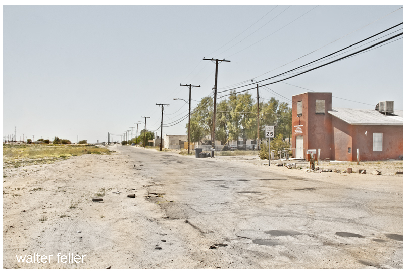
Crooks Avenue lies northwest of the Casa del Desierto, in the narrow district between the railroad yard, North First Avenue, and the Mojave River. Though small, it belongs to an important part of Barstow’s history: the working ground around the depot.

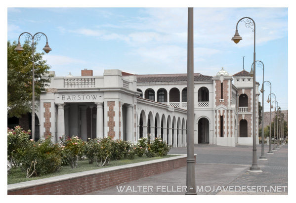
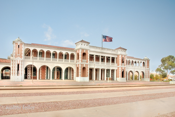
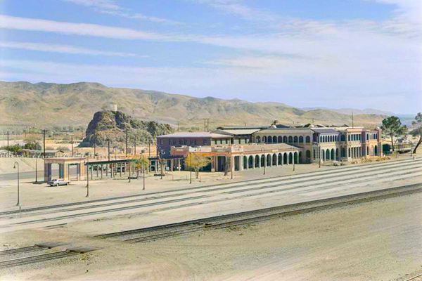
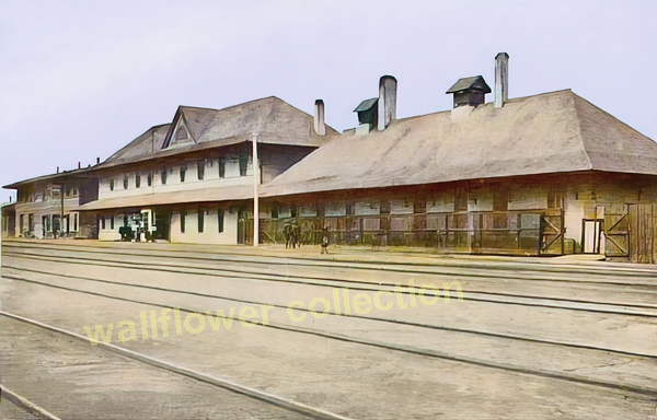
The Casa del Desierto opened in 1911 as a Santa Fe depot and Harvey House. For many years, it served railroad passengers, workers, residents, and desert travelers. The first depot-hotel project included a recreation and lodging building for railroad employees. At the same time, the railroad realigned and raised its tracks, changing the grade and shape of the surrounding ground.

Crooks Avenue developed beside this railroad center rather than on Barstow’s principal commercial street. Main Street, to the south, carried the highway traffic that became Route 66. Crooks Avenue remained a local street, close to the depot, rail yard, and Mojave River, with modest homes, rental buildings, and open lots.

Its surviving buildings reflect gradual mid-twentieth-century development as Barstow continued to serve railroad families, highway travelers, and military traffic, and to support the growing desert region. The street’s character was practical rather than formal, formed by its position at the edge of the rail yard and riverbed.

Crooks Avenue is not Route 66, nor was it one of Barstow’s early commercial thoroughfares. Its value lies in what it reveals about ordinary Barstow: the side streets behind the landmark depot, where railroad work, housing, traffic, and the desert landscape converge.

Route 66

NOTR

Casa Del Desierto

Barstow

Mojave River

Calico Comes to Life (1881-1882)

When the Silver King Mine was discovered on April 6, 1881, there was no town at Calico. The colorful mountain overlooking Wall Street Canyon was already known by name, but only a handful of prospectors occupied the district.

Even by Independence Day, July 4, 1881, the future townsite contained no buildings. Wall Street Canyon had only a single cabin, with just two known residents in the district. Within days, Sam James began developing the Silver King Mine. After Sheriff John C. King leased the property and assays confirmed exceptionally rich ore worth $100 to $2,000 per ton, word spread rapidly across Southern California.

By late summer, prospectors arrived almost daily. One newspaper reported that claim notices and monuments covered nearly every promising outcrop. Prospecting parties were spreading in every direction across the surrounding mountains, limited only by the amount of water they could carry.

A business district soon appeared beneath the mines on a narrow mesa below Wall Street Canyon. The first establishments included three stores, a hay yard, and an assay office. Ten miners worked the Silver King Mine for $4 per day. Town lots were already being sold. Mrs. Hieronymous Hartman, the first woman to settle permanently in the camp, opened a boarding house. It quickly became the community’s social center. As one correspondent humorously observed, “Wall Street booming. No banks yet.”

Despite several promising discoveries during the autumn and winter of 1881, Calico remained a rough mining camp waiting for investment capital. Residents joked they were “waiting like Micawber for something to turn up.” Entertainment was scarce. The appearance of a mountain lion became a major event, prompting an organized hunt. As Christmas approached, Mrs. Hartman organized a holiday dinner. The menu was expected to consist mainly of beans and bacon because neither turkeys nor chickens were available.

Communication with the outside world remained unreliable. Mail arrived only sporadically, carried by stage from San Bernardino. Reflecting ongoing isolation, stage driver Aaron Harrison even offered to carry letters personally on his weekly trips. Local residents referred to San Bernardino and Los Angeles simply as “the inside,” emphasizing how isolated Calico remained.

Winter brought severe storms. High winds and heavy snowfall blocked roads across the desert, but mining continued. The Burning Moscow Mine employed seven or eight men. New buildings were under construction. The camp soon boasted a blacksmith shop, several stores, a barber’s assay office, boarding and lodging houses, and even a shooting gallery. The miners at Silver King had built themselves comfortable quarters overlooking the camp.

By early 1882, newspapers were confident that the excitement surrounding Calico would continue. Employment at the Silver King Mine increased to ten men, and the growing number of miners’ candles being shipped from San Bernardino suggested extensive underground development. Sheriff John C. King frequently visited San Bernardino carrying pockets full of rich silver specimens, while other investors proudly displayed high-grade ore from the district.

Yet Calico’s greatest challenge was isolation. The Southern Pacific Railroad pushed eastward across the Mojave Desert, but Calico still lacked a post office. Mail traveled hundreds of unnecessary miles through Rogers Station and Ivanpah before reaching the camp, even though the mail route passed only a few miles from town. Residents complained that letters, “worn out traveling back and forth in sight of camp,” often arrived a month late.

Transportation costs also slowed development. Freight from San Bernardino costs $25 per ton. The desert offered little timber, little game, almost no farmland, and scarce fuel. Creosote bushes and Mojave River cottonwoods provided only limited firewood. The river itself ran so low that one observer joked it produced only “steam.” Veteran miner S. D. Blade remarked bluntly that little could survive on the plains without hauling in supplies—”except land turtles, lizards, or an occasional jackrabbit.”

Despite these hardships, Calico continued to grow. The combination of extraordinarily rich silver ore and determined miners overcame the obstacles of distance, weather, and supply shortages, laying the foundation for what would become California’s greatest silver-mining town. Thus, Calico’s persistence amid adversity marked the beginning of its remarkable story.

The Early Harvey House and Casa del Desierto

Before the Casa del Desierto, Barstow featured a wooden railroad depot, restaurant, and hotel serving Santa Fe passengers. Authoritative historical accounts generally date this earlier complex to 1885. Later, Fred Harvey operated the railroad’s hotel and dining facilities at Barstow, preparing the foundation for the site’s future development.

A turning point occurred in 1908: a fire destroyed the wooden depot-hotel. By then, Barstow had grown to be more than just a stop; as an important railroad division point, it needed more than another temporary replacement. The Santa Fe Railway responded by commissioning a much larger and more permanent structure.

In 1911, builders opened the Casa del Desierto, combining a railroad station, a Harvey House restaurant, a hotel, and a community gathering place. The reinforced construction, broad arcades, towers, tile roofs, and thick walls sharply departed from the wooden building it replaced.

While the above sequence is well documented, several local histories report additional depot fires and reconstructions preceding the construction of the Casa del Desierto. Although this account appears plausible, no one has yet verified the chronology using primary-source documentation.

Made Sense

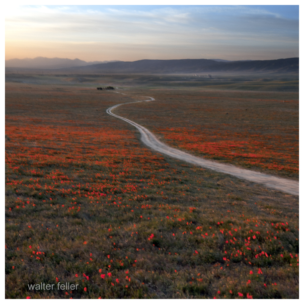
Beautiful memories of beautiful moments — I was there the day the valley floor was being painted. Each brushstroke was evenly pulled across the plain as the sun rose and the day grew warm. The colors covered everything with life. There were bugs and brightly detailed butterflies and the creatures that eat them. There were the diminutive blue and pink fairies that made it all worth living for, and meek mice, humble hares (although no one seems to remember one in particular), rats underground, and birds that flew higher than could be seen, and then there were the birds that flew in between.

Rats. Rats were everywhere–typically.

Ver (Latin)- very, new, truth, life, forward . . .
‘verdant’ meaning green and growing and ‘veritas’ or truth.

24 Consider the ravens: They do not sow or reap, they have no storeroom or barn, yet God feeds them. And how much more valuable you are than birds! 25 Who of you by worrying can add a single hour to your life? 26 Since you cannot do this very little thing, why do you worry about the rest?
— luke 12:24-26

Regional and Local Knowledge

Regional and local knowledge are not competitors—they are nested and interdependent.

To better understand this relationship, think of it as a hierarchy.

Local knowledge answers questions such as:

  • Who lived here?
  • Where was the spring?
  • Which road did they use?
  • What did people call this place?

In essence, local knowledge is intimate, detailed, and place-specific.

For example, someone in Lucerne Valley might know:

  • which ranch occupied a particular parcel,
  • where an old school stood,
  • How Rabbit Springs changed over time,
  • who built a specific road,
  • or where grinding slicks are found.

That knowledge may never have been published.

Regional knowledge asks a different question:

“How does Lucerne Valley fit into the Mojave Desert?”

It connects the local story to larger patterns.

For example:

Lucerne Valley was not simply a farming community.

Regional knowledge recognizes that it was:

  • part of the traditional homeland of the Serrano and Vanyume,
  • connected to the San Bernardino Mountains through seasonal travel,
  • influenced by nearby mining districts,
  • shaped by the Mojave River watershed,
  • linked to Cajon Pass and later highways,
  • affected by regional groundwater use,
  • and economically tied to Victor Valley and beyond.

Ultimately, the regional perspective explains why Lucerne Valley developed as it did.

Importantly, the relationship between local and regional knowledge works in both directions.

Local knowledge builds regional knowledge.

Imagine a thousand communities, springs, mines, ranches, and canyons.

Each contributes a piece of the puzzle.

Individual site       ↓Local history       ↓Community history       ↓Regional history       ↓Understanding the Mojave Desert

At the same time, regional knowledge also strengthens local knowledge.

Suppose someone finds an old wagon road near Newberry Springs.

A local historian can describe the road.

A regional historian may recognize it as:

  • part of the Mojave Road,
  • a branch of the Old Spanish Trail,
  • a military supply route,
  • a mining freight road,
  • or an early automobile route.

Without the regional context, the road is just an old road.

With the regional context, it becomes part of a much larger story.

This is why regional historians often act as connectors. They recognize that events separated by hundreds of miles are actually related.

For example:

  • A discovery in Holcomb Valley affects freight traffic through Cajon Pass.
  • That increases travel through Victor Valley.
  • This leads to the creation of new stations along the Mojave River.
  • This eventually influences settlement at Barstow.
  • Which changes transportation across the entire desert.

A local historian may document one link.

A regional historian explains the chain.

I think this is where your work naturally fits.

For instance, you’ve written local histories of places like Hesperia, Lucerne Valley, Newberry Springs, Ridgecrest, and Summit Valley. Yet your websites consistently connect those places to broader themes: Indigenous travel networks, the Mojave River, geology, mining booms, transportation corridors, military history, ecology, and settlement.

You’re not replacing local history; rather, you’re integrating it into the larger history of the Mojave Desert.

A useful way to express the relationship is:

Local knowledge tells us what makes a place unique. Regional knowledge explains why that place matters.

Neither is complete alone. Local knowledge gives detail; regional knowledge gives context. Together, they create a fuller understanding of the place and its larger landscape.

necessary gaps between the two

That’s an insightful question. There are necessary gaps between local and regional knowledge. If there weren’t, the two would simply be the same thing at different scales.

Those gaps are actually where much of the work of a regional historian takes place.

Some examples:

1. Scale

A local historian can know nearly everything about one town or valley.

A regional historian cannot know every detail of every community. Instead, they identify the details that matter beyond the local setting.

For example, a Lucerne Valley historian may know every schoolteacher, store owner, and election. A regional historian asks, “How did Lucerne Valley contribute to the development of the Mojave Desert?”

Some local details remain local—and that’s appropriate.

2. Perspective

Local knowledge often looks inward.

Regional knowledge looks outward.

Local:

“This spring supplied our community.”

Regional:

“This spring was one stop in a chain of water sources connecting the Colorado River to the San Gabriel Mountains.”

Both are true, but they answer different questions.

3. Completeness

No regional work can contain every local story.

If it tried, it would become an encyclopedia measured in hundreds of volumes.

Instead, regional knowledge abstracts.

It asks:

  • What is representative?
  • What changed the region?
  • What illustrates larger processes?

Many local details remain intentionally omitted because they do not change the regional picture.

4. Expertise

Local historians often possess knowledge unavailable anywhere else.

Regional historians rely upon them.

Conversely, local historians sometimes don’t see how their own community fits into larger patterns.

The relationship is complementary.

5. Interpretation

This is perhaps the largest gap.

Facts alone don’t create regional knowledge.

Someone must recognize relationships.

For example:

A local historian writes:

  • wagon road
  • spring
  • ranch
  • mining camp

A regional historian recognizes:

  • transportation corridor
  • watershed
  • settlement pattern
  • economic network

The same facts become a different understanding.


For your own work, I think there is another gap.

You often bridge disciplines.

A page about a canyon isn’t only about the canyon.

It’s also about:

  • its geology,
  • Native use,
  • exploration,
  • mining,
  • wildlife,
  • transportation,
  • photography,
  • and modern recreation.

That interdisciplinary connection is difficult to produce because few people work across all of those fields.


I sometimes think of it this way:

Facts   ↓Local knowledge   ↓Regional knowledge   ↓Regional understanding

Most people stop at facts.

Many historians stop at local knowledge.

Fewer people synthesize regional knowledge.

The rarest step is regional understanding—recognizing the forces that have shaped an entire landscape over centuries.

That’s where the enduring value of a regional reference lies. It doesn’t just preserve information; it helps readers see patterns that are invisible when viewed in isolation.