Dendrites

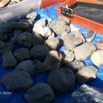
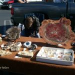
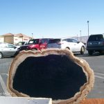
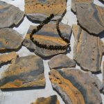
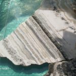
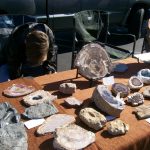
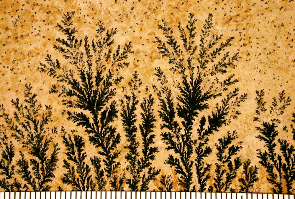
Dendrite fossils are not actual fossils but mineral formations that display branching, tree-like patterns on rock surfaces. These patterns are called “dendrites,” derived from the Greek word dendron, meaning “tree.” Due to their resemblance to ferns, mosses, or algae, they are often mistaken for fossilized plants.

Formation of Dendritic Patterns

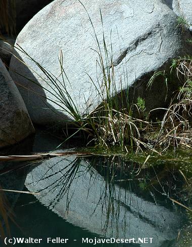
  • Mineral Deposition: Dendritic patterns form when mineral-rich water percolates through cracks and fissures in rocks. As the water evaporates, minerals like manganese and iron oxides precipitate out of the solution.
  • Crystallization Process: These minerals crystallize in branching patterns along the rock’s surface or within its layers, creating intricate designs that mimic organic structures.
  • Environment: Such formations commonly occur in sedimentary rocks like limestone, sandstone, and shale, where groundwater movement is prevalent.

Distinguishing Features

  • Inorganic Origin: Unlike true fossils, dendrites do not result from the preservation of organic material. They are entirely inorganic, formed solely by mineral processes.
  • Lack of Cellular Structure: Under magnification, dendrites lack the cellular details that characterize fossilized plant material.
  • Surface Patterns: Dendritic formations are typically two-dimensional patterns on rock surfaces, whereas fossils often have three-dimensional structures.

Common Misconceptions

  • Mistaken Identity: The visual similarity to plant life leads many to incorrectly identify dendrites as fossilized flora.
  • Educational Importance: Understanding dendrites helps in learning how to differentiate between mineral formations and actual fossils, which is crucial in fields like paleontology and geology.

Significance in Geology and Collecting

  • Scientific Interest: Dendrites provide insights into mineral deposition processes and the geological history of the area where they are found.
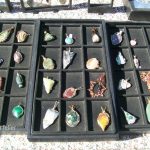
  • Aesthetic Value: Their intricate and visually appealing patterns make dendritic rocks popular among collectors and are often used in jewelry and decorative items.

Examples and Notable Locations

  • Solnhofen Limestone, Germany: Known for fine-grained limestone that often displays dendritic patterns, sometimes mistaken for fossilized plants.
  • Utah and New Mexico, USA: Regions where dendritic manganese oxides are commonly found on sandstone surfaces.
  • Chiastolite Stones: A variety of andalusite that shows cross-shaped (cruciform) patterns due to carbonaceous impurities, sometimes confused with dendritic patterns.

Conclusion

While dendritic patterns, or “dendrite fossils,” captivate the imagination with their lifelike appearances, they are mineralogical phenomena rather than remnants of ancient life. Recognizing the difference between these mineral formations and true fossils enhances our understanding of geological processes and helps prevent misinterpretations in both amateur and professional studies.


References

  • Mineralogy and Geology Texts: For detailed explanations of mineral formation processes.
  • Field Guides on Fossil Identification: To learn how to distinguish between fossils and mineral patterns.
  • Geological Surveys: For information on regions where dendritic formations are prevalent.
Cinnabar & Mercury

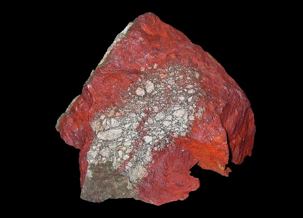
Mercury is a naturally occurring element that is found in the Earth’s crust, and it is extracted from cinnabar ore. The process of obtaining mercury from cinnabar involves several steps:

By H. Zell – Own work, CC BY-SA 3.0,
Cinnabar. (2024, April 11). In Wikipedia. https://en.wikipedia.org/wiki/Cinnabar
  1. Mining: Mercury is primarily obtained from cinnabar ore, which contains mercury sulfide (HgS). The cinnabar ore is mined from deposits found in the Earth.
  2. Crushing and Grinding: The mined cinnabar ore is crushed and ground to liberate the mercury sulfide from the surrounding rock.
  3. Roasting: The crushed ore is then heated in a furnace to a temperature of about 500 to 600 degrees Celsius (932 to 1112 degrees Fahrenheit) in the presence of oxygen. This process, called roasting, causes the mercury sulfide to decompose into mercury vapor and sulfur dioxide gas: HgS+O2โ†’Hg+SO2
  4. Condensation: The mercury vapor is then cooled and condensed into liquid mercury. This is typically done by passing the vapor through a series of condensers where it cools and changes back into a liquid state.
  5. Purification: The liquid mercury is collected and further purified to remove impurities. This can be done through distillation, where the mercury is heated to vaporize it again and then condensed to obtain pure mercury.

The resulting liquid mercury is then stored in flasks or containers and used for various industrial and scientific applications.

By Bionerd – Own work, CC BY 3.0,
Mercury (element). (2024, May 16). In Wikipedia. https://en.wikipedia.org/wiki/Mercury_(element)

Cinnabar (mercury sulfide, HgS) is toxic. The primary concern with cinnabar is its mercury content. Here are some key points about its toxicity:
  1. Mercury Content: Cinnabar contains mercury, which is a highly toxic element. Mercury can exist in several forms, each with different levels of toxicity and ways of causing harm. The toxicity primarily depends on the form and the route of exposure.
  2. Inhalation Hazards: When cinnabar is heated or processed, it can release mercury vapor. Mercury vapor inhalation is particularly dangerous as it can cause severe neurological and systemic health problems.
  3. Skin Contact and Ingestion: While elemental mercury is less easily absorbed through the skin, compounds like mercury sulfide in cinnabar can be harmful if ingested or if particles are inhaled. Chronic exposure can lead to mercury poisoning, which can affect the kidneys, nervous system, and other organs.
  4. Chronic Exposure: Long-term exposure to mercury, even in small amounts, can lead to mercury poisoning, with symptoms including tremors, memory problems, mood swings, and cognitive impairment.
  5. Environmental Impact: Mercury from cinnabar mining and processing can also contaminate the environment, leading to bioaccumulation in the food chain and affecting wildlife and human health.
Due to these risks, handling cinnabar and processing mercury require strict safety protocols to protect workers and the environment. Proper ventilation, protective equipment, and environmental controls are essential to minimize exposure and prevent mercury poisoning.
Cinnabar

https://mojavedesert.net/desert-fever/waterman.html

https://mojavedesert.net/mining-history/chloride-cliff/page-07.html

https://mojavedesert.net/desert-fever/coso.html

Mercury

https://digital-desert.com/gold-mining/stamp-mill.html

https://mojavedesert.net/glossary/amalgam.html

https://mojavedesert.net/mining-history/chloride-cliff/page-07.html

Littering, Dumping, Vandalism & Theft in the Mojave.

How do we prevent it?

Addressing littering, illegal dumping, vandalism, and theft in natural areas like the Mojave Desert requires a multifaceted approach, considering prevention and remediation. Here are some strategies that can be employed:

Education and Awareness

  1. Public Education Campaigns: Educating the public about the ecological, cultural, and historical significance of the Mojave Desert can foster a sense of stewardship. Campaigns can highlight the negative impacts of littering, dumping, vandalism, and theft.
  2. School Programs: Integrating environmental education into school curriculums can instill values of conservation and respect for nature in young people.

Enforcement and Regulation

  1. Increased Surveillance: Deploying more rangers or utilizing surveillance technology in high-risk areas can deter potential offenders.
  2. Stricter Penalties: Implementing harsher penalties for violations can serve as a deterrent. This could include higher fines, community service in environmental cleanup, and legal action for more serious offenses.
  3. Quick Response to Incidents: Rapid response to reports of dumping, vandalism, or theft can help catch perpetrators and serve as a deterrent to others.

Community Engagement and Participation

  1. Volunteer Cleanup Events: Organizing community cleanups can address existing litter and dumping and foster a sense of community ownership and responsibility.
  2. Adopt-a-Spot Programs: Encouraging individuals, families, or groups to “adopt” areas of the desert for regular monitoring and maintenance can help maintain cleanliness and report issues quickly.

Infrastructure and Accessibility

  1. Better Waste Management Facilities: Providing accessible and convenient disposal options near the Mojave area can reduce the likelihood of illegal dumping.
  2. Improved Signage: Clear, informative signage about rules, regulations, and the importance of preservation can serve as both an educational tool and a deterrent.
Technology and Innovation

  1. Mobile Apps: Developing and promoting mobile apps that allow visitors to report litter, dumping, vandalism, or theft in real-time can aid in quick responses and create a database of problem areas.
  2. Social Media: Utilizing social media platforms to share information, organize cleanup events, and foster a digital community of stewards can enhance engagement and awareness.

Partnerships

  1. Collaboration with Local Businesses: Engaging local businesses in sponsorship opportunities for cleanup events or educational programs can enhance resources and community involvement.
  2. Partnerships with Environmental Organizations: Working with NGOs and environmental groups can bring expertise, volunteers, and additional resources for conservation efforts.

Solving these issues in the Mojave Desert requires persistent efforts across multiple fronts. It’s about creating and nurturing a culture of respect and care for the environment, backed by effective enforcement and community involvement.

Mountain High East

Wrightwood Ski Resorts

Holiday Hill Ski Resort, located in the San Gabriel Mountains near Wrightwood, California, has a significant place in Southern California’s skiing history. While less known today, Holiday Hill played an important role in the region’s winter sports scene. Here’s a brief overview of its history:

  1. Early Beginnings: Holiday Hill Ski Resort started in the mid-20th century. It was part of the burgeoning ski industry in Southern California, which capitalized on the region’s mountainous terrain and winter snowfall.
  2. Location and Accessibility: Situated near the town of Wrightwood, Holiday Hill was easily accessible to the growing population of Southern California, especially those in the Los Angeles area. This accessibility contributed to its popularity as a ski destination.
  3. Facilities and Attractions: The resort offered skiing and snowboarding opportunities, with various slopes catering to different skill levels. It was known for its family-friendly atmosphere and was a popular choice for beginners and intermediate skiers.
  4. Transition and Development: Over the years, Holiday Hill underwent several changes, including ownership transitions and developments in its infrastructure. These changes were part of the broader evolution of the ski industry in Southern California.
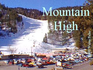
  5. Integration into Mountain High: Eventually, Holiday Hill became part of the larger Mountain High resort. This integration was a significant step in consolidating the ski areas in the Wrightwood region. The once Holiday Hill area is now part of the expanded Mountain High complex, specifically the East Resort.
  6. Legacy and Modern Era: Today, the legacy of Holiday Hill lives on as part of Mountain High. The East Resort of Mountain High, which encompasses the former Holiday Hill area, continues to offer skiing and snowboarding, emphasizing varied terrain and scenic views.
  7. Cultural Impact: Holiday Hill contributed to the growth of the skiing culture in Southern California. It played a role in introducing many Southern Californians to winter sports and helped establish the region as a destination for skiing and snowboarding.

In summary, Holiday Hill Ski Resort was a key player in developing the skiing industry in Southern California. Its integration into Mountain High Resort has allowed its legacy to continue, contributing to the region’s rich history of winter sports.

Ghost Stories & Legends

With its vast and rugged landscape, the Mojave Desert is steeped in legends and ghost stories passed down through generations. Here are some of the most famous ones:

  1. The Lost Ship of the Desert: One of the most enduring legends is that of a Spanish galleon laden with pearls and gold, which is said to have been stranded in the desert centuries ago. Over the years, many have searched for this lost ship, but it remains a tantalizing mystery, possibly just a mirage or a tale spun from the heat and isolation of the desert.
  2. The Ghosts of Calico: Once a thriving silver mining town, Calico is now a ghost town and tourist attraction. Visitors and employees have reported numerous ghost sightings, including that of a playful little girl, miners still panning for silver, and mysterious floating orbs.
  3. The Yucca Man: Similar to Bigfoot, the Yucca Man is a legendary creature said to roam the Mojave. Described as very tall and covered in hair, campers and hikers have reported this elusive being, though evidence of its existence is purely anecdotal.
  4. The Haunted Joshua Tree: The Joshua Tree National Park, part of the Mojave Desert, is home to many myths. One such story involves a specific Joshua tree said to be haunted by the spirit of a man who was hanged from its branches. Some claim to have seen his ghost wandering near the tree at night.
  5. The Cursed Gold of Pegleg Smith: This legend revolves around Thomas “Pegleg” Smith, a mountain man who allegedly discovered a huge black-coated gold nugget in the Mojave. He never found it again, and many treasure hunters have tried and failed to locate Pegleg’s lost gold, leading to speculations of a curse.
  6. The Char Man of San Bernardino: A lesser-known but chilling tale is that of the Char Man, a ghostly figure said to have been a fire victim. He is reputed to haunt the outskirts of San Bernardino, frightening unwary travelers with his burned and disfigured appearance.

These stories, whether based on fact or fiction, add a rich layer of mystery and intrigue to the Mojave Desert. They reflect the human fascination with the unknown and the allure of a beautiful and forbidding landscape.

Ghost Stories,Legends,Mojave Desert Myths,Haunted Places,Desert Ghosts,Paranormal Activity,Folklore,Desert Legends,Supernatural Tales,Haunted Sites,Mojave Mysteries,Historical Legends,Ghost Towns,Desert Spirits,Spooky Stories,Desert Lore

Covered Wagon (prairie schooner)

/wagons/

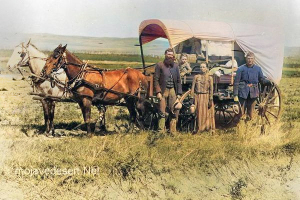
Covered wagons significantly impacted the United States’ westward expansion during the 18th and 19th centuries. These wagons, often called “prairie schooners,” were designed to transport goods and settlers across the North American continent.

Family & covered wagon (prairie schooner)

Key features and uses of covered wagons included:

  1. Design: Covered wagons typically had a wooden frame with a canvas cover. This cover protected the contents from weather elements like rain and sun. The wagon bed was usually made of wood and was about four feet wide by ten feet long.
  2. Cover: The cover was made of canvas or similar durable cloth, stretched over hooped frames, providing shelter and goods for the occupants.
  3. Wheels: The wheels were often large and designed to handle rough terrain. The front wheels were usually smaller than the rear wheels, allowing easier turning.
  4. Draft Animals: Oxen, mules, or horses were commonly used to pull these wagons. Oxen were preferred for their strength and endurance, especially over long distances.
  5. Role in Expansion: Covered wagons were essential for westward migration in the U.S. They carried settlers’ belongings, including tools, food, and sometimes even passengers. These wagons were a vital part of the movement to settle the American West and were commonly seen on trails like the Oregon Trail, the Santa Fe Trail, and the California Trail.
  6. Living Quarters: The covered wagon was a temporary home for many settlers traveling west. Families would cook, eat, sleep, and spend much of their time in or around the wagon during their journey.
  7. Historical Significance: The image of a covered wagon crossing the plains has become an iconic symbol of American frontier life, representing the pioneer spirit, exploration, and the challenges of frontier life.

The use of covered wagons declined with the advent of railroads, which offered a faster and more efficient means of transporting goods and people across the country. However, their legacy remains an integral part of American history and folklore.

Bodie -v- Mojave Ghost Towns

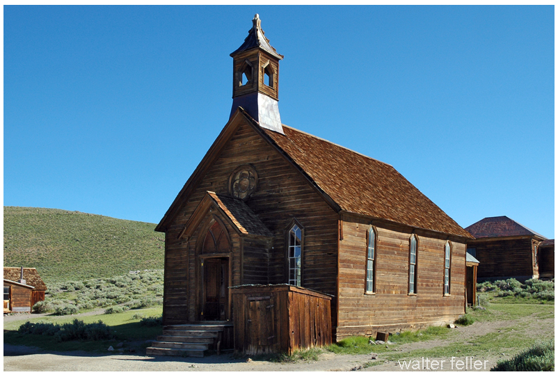
Bodie and Mojave Desert ghost towns are examples of abandoned settlements in the Western United States. Still, they are located in different regions and have distinct historical and geographical contexts.

Bodie
Cima

Here’s how Bodie ghost town compares to Mojave Desert ghost towns

  1. Location:
    • Bodie Ghost Town is located in eastern California, near the Nevada border, in the Bodie Hills of the Sierra Nevada Mountains. It is not part of the Mojave Desert.
    • Mojave Desert ghost towns, on the other hand, are scattered throughout the Mojave Desert region, which covers parts of California, Nevada, Utah, and Arizona. These ghost towns are found in a desert landscape, whereas Bodie is in a mountainous area.
  2. Historical Significance:
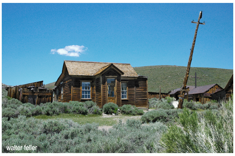
    • Bodie Ghost Town was once a bustling mining town during the late 19th century. It boomed during the Gold Rush but declined when the mines became depleted. It is known for its remarkably well-preserved buildings and artifacts, making it a popular tourist attraction and a State Historic Park.
    • The Mojave Desert ghost towns have diverse histories related to mining or other industries. These towns experienced growth and decline due to factors like mining, railroads, or changes in economic activity in the region.
  3. Geography and Climate:
    • Bodie’s location in the Sierra Nevada Mountains has a colder, alpine climate with snowy winters. It is not in a desert like the Mojave Desert ghost towns, which have hot, arid desert climates.
  4. Preservation:
    • Bodie Ghost Town is notable for its excellent preservation, with many buildings and artifacts remaining intact. It provides a unique glimpse into the past due to its relatively isolated location and the efforts to protect and maintain it.
    • Mojave Desert ghost towns vary in their levels of preservation. Some may have deteriorated significantly, while others may have been partially restored or maintained for historical and tourist purposes.

In summary, while Bodie Ghost Town and Mojave Desert ghost towns share the common theme of being abandoned settlements in the American West, they differ in their locations, historical backgrounds, climates, and levels of preservation. Each ghost town has its unique story and charm, showcasing the diversity of the history and landscapes of the Western United States.

Similarities

While Bodie Ghost Town and Mojave Desert ghost towns differ, they also share similarities due to their historical significance as abandoned settlements in the American West.

Bodie
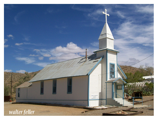
Santa Barbara Church – Randsburg

Here are some commonalities between them:

  1. Mining History: Both Bodie Ghost Town and many Mojave Desert ghost towns have roots in mining activities. They were often established to support nearby mining operations for gold, silver, copper, or other valuable minerals.
  2. Boom and Bust Cycles: Both ghost towns experienced periods of rapid growth and prosperity (boom) followed by economic decline and abandonment (bust) as the mining or other industries became less profitable or were exhausted.
  3. Historic Architecture: Both Bodie and the Mojave Desert ghost towns feature historic buildings and structures that reflect the architectural styles of the late 19th and early 20th centuries. These buildings offer insights into the daily lives of the people who once inhabited these towns.
  4. Tourism and Preservation: Many ghost towns, including Bodie, have been preserved and turned into tourist attractions or historic sites. Visitors can explore the well-preserved or partially restored buildings and artifacts, providing a glimpse into the past.
  5. Cultural Significance: These ghost towns hold cultural significance, representing a particular era in American history when mining and westward expansion were prominent. They serve as reminders of the challenges and opportunities that shaped the American West.
  6. Isolation: Bodie Ghost Town and many Mojave Desert ghost towns are often located in remote or isolated areas. This isolation contributed to their decline and abandonment as access to resources and services became more challenging.
  7. Natural Surroundings: While Bodie is mountainous, some Mojave Desert ghost towns are in arid desert landscapes. Both types of locations offer unique natural surroundings that add to the appeal of these historical sites.
  8. Photogenic and Cinematic Appeal: Bodie and Mojave Desert ghost towns have been popular settings for photography and film productions. Their well-preserved or picturesque appearances have made them attractive for creative projects.
  9. Historical Documentation: Researchers and historians have documented the histories of both Bodie and Mojave Desert ghost towns, helping preserve the stories and heritage of these places.

In summary, Bodie Ghost Town and Mojave Desert ghost towns share several similarities in their historical origins, economic activities, architectural heritage, cultural significance, and appeal as tourist destinations. However, it’s important to recognize that each ghost town has unique characteristics and history that make it special.

Considering the Gentrification of the Mojave Desert

Gentrification is a complex and multifaceted process that typically involves the transformation of a neighborhood or community due to an influx of wealthier residents and increased property development. While gentrification is commonly associated with urban areas, how it might manifest in desert regions is worth considering.

Barstow, California

In the context of desert areas like the Mojave Desert, some factors may contribute to changes in local communities:

  1. Tourism Development: Deserts are often attractive to tourists seeking unique landscapes and experiences. Developing tourist infrastructure, such as upscale resorts, could change the local economy and demographics.
  2. Environmental Conservation and Luxury Living: Some desert areas may become appealing to those seeking a more secluded or environmentally conscious lifestyle. This could lead to the development of upscale residences, potentially displacing existing communities.
  3. Renewable Energy Projects: The Mojave Desert, particularly, has seen increased interest in renewable energy projects like solar farms. This can bring economic development but may also change the local population dynamics.
  4. Artistic and Cultural Appeal: Artists and individuals attracted to the tranquility and unique landscapes of the desert may contribute to gentrification by establishing art communities or cultural hubs.

It’s crucial to note that the impact of gentrification can vary based on the specific characteristics of each desert region and the policies in place to address community concerns. Local governments and community organizations play a crucial role in shaping development patterns and mitigating the potential negative effects of gentrification, such as displacement of long-term residents and cultural erosion.

Wikiup (Shelter)

https://mojavedesert.net/archaeology/

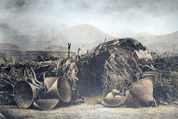
Mono Paiute wickiup – Edward Curtis 1900 (colorized)

A “wikiup” in the context of Native American culture typically refers to a traditional type of shelter or dwelling. It is a simple, dome-shaped structure constructed using a framework of branches or saplings. The frame is often covered with various materials, such as brush, reeds, grass, or sometimes animal hides. Various indigenous peoples in North America commonly used these shelters.

The design of wikiups varied among different tribes, reflecting the local environment and available resources. They were relatively easy to construct and could be adapted to different climates. Nomadic or semi-nomadic groups often used Wikiups as temporary or seasonal shelters.

It’s important to note that the term “wikiup” might be spelled or pronounced differently in various indigenous languages, and the specific features of these shelters could vary based on cultural and regional differences.

Trigger

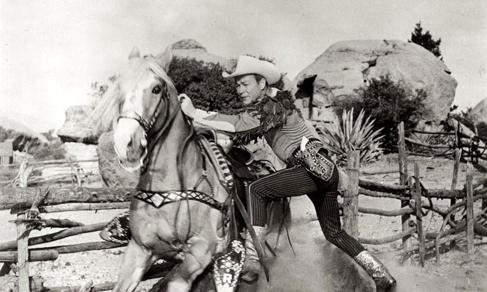
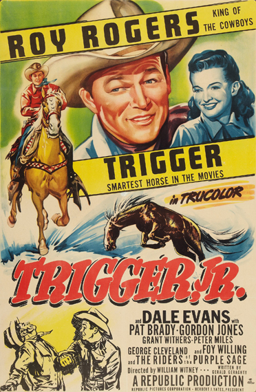
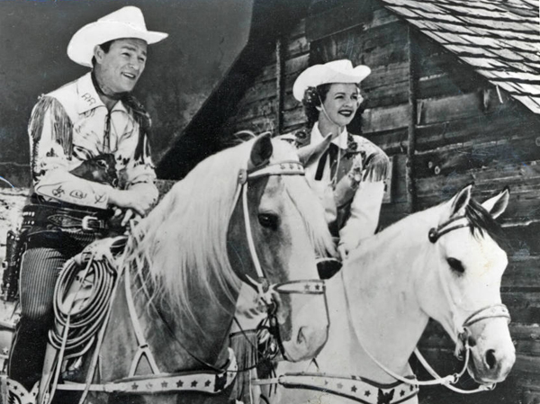
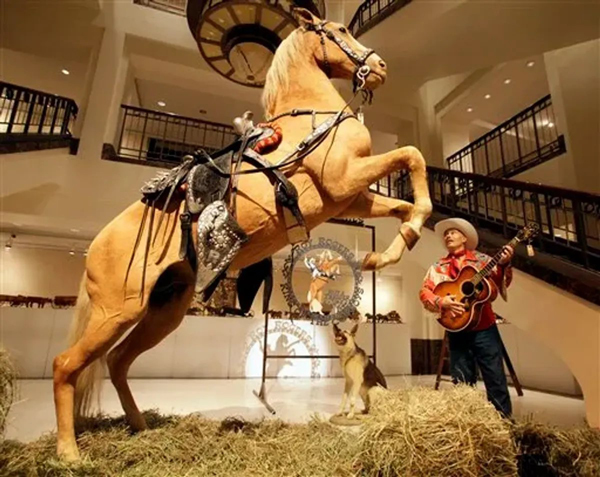
Trigger was the famous horse ridden by Roy Rogers, the iconic American cowboy actor and singer. Trigger was a golden palomino known for his intelligence, versatility, and striking appearance. He became one of the most well-known and beloved horses in the history of Hollywood.

Trigger was a Palomino horse that became famous as the faithful companion of Roy Rogers, a popular American cowboy actor and singer. Trigger was born in 1932 and originally named Golden Cloud. Roy Rogers first encountered the horse in the 1938 movie “The Adventures of Robin Hood,” where Olivia de Havilland rode him.

Impressed by the horse’s beauty and abilities, Rogers eventually acquired him. The horse was then renamed Trigger, and he became one of the most famous horses in Hollywood history. Trigger appeared in many of Roy Rogers’ films and television shows, showcasing his remarkable intelligence and performing various tricks on command.

Trigger appeared in many of Roy Rogers’ films and television shows, becoming a true partner to Rogers in his on-screen adventures. The horse was trained to perform a variety of tricks and stunts, showcasing both Trigger’s abilities and the strong bond between him and Rogers.

Trigger became a beloved icon, often called “The Smartest Horse in the Movies.” After Trigger died in 1965, Rogers arranged for the horse to be taxidermied. The preserved Trigger was displayed at the Roy Rogers and Dale Evans Museum in California. Later, the museum closed, and in 2010, Trigger was sold at auction for nearly $266,000. The buyer, a cable television network, intended to use the preserved horse in a planned Roy Rogers exhibit.

Trigger’s legacy lives on in fans’ memories and the numerous films and television shows where he played a prominent role alongside Roy Rogers.

Shea’s Castle

/antelope-valley/

“Shea Desert Castle Sold,โ€ Los Angeles Times, 25 Mar 1935 (colorized)

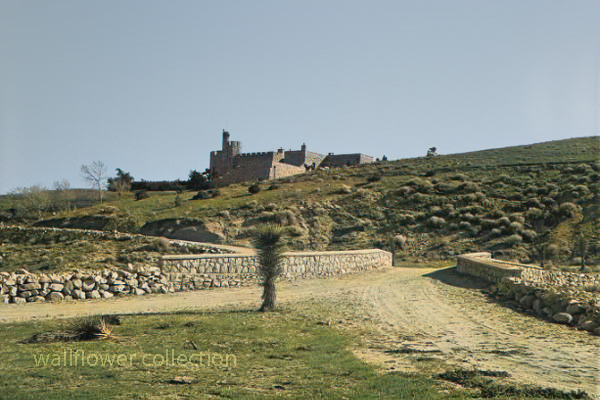
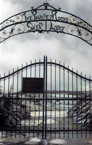
Richard Peter Shea built Shea’s Castle in 1924, also known as Sky Castle or Castle Ranch.

1929’s stock market crash bankrupted Shea. Shea’s wife died, the bank took over the castle, and Shea committed suicide.

Over the years, the property has changed hands and been used as a filming location.

Trigger, Roy Rogers’ horse, was trained on the property.

It is now a private residence.

The massive granite structure, built by R. P. Shea, was sold to three Beverly Hills women in 1935. The “castle” boasts many unique design elements that remain untouched after the purchase.
This photograph appears with the article, โ€œShea Desert Castle Sold,โ€ Los Angeles Times, 25 Mar 1935: 19.CAPTIONText from negative sleeve: Shaeโ€™s [sic] Castle nitrates

Handwritten on negative: Shaeโ€™s [sic] Castle 3-16-35
Text from newspaper caption: โ€œDream Homeโ€ in Mojave Desert Passes Into New Hands; A massive granite structure in the Mojave Desert, built ten years ago as a โ€œdream homeโ€ of R. P. Shea, yesterday, passed into the hands of new owners. So incongruous is its setting that many believe they are beholding a mirage when they see the $175,000 castle.

Peggy Sue’s 50s Diner

/yermo-ca/

Peggy Sue's Diner, Yermo, Route 66, nostalgia, 1950s

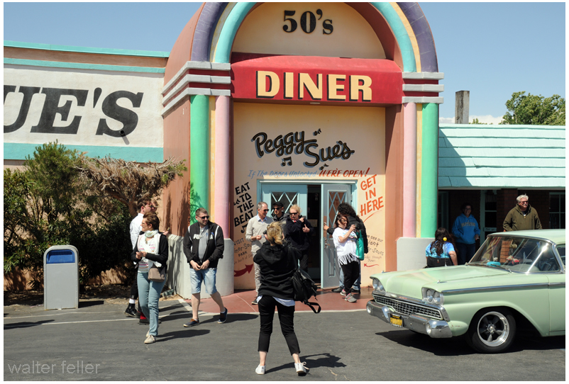
Peggy Sue’s 50s Diner is a well-known retro-themed diner in Yermo, California. It’s designed to resemble a classic 1950s diner, with vintage decor, neon lights, and a nostalgic atmosphere.

The diner typically offers classic American diner fare, such as burgers, shakes, fries, and other comfort food items. Additionally, Peggy Sue’s may have themed events or activities to enhance the 1950s experience for visitors.

Desert Rat 10 Commendents [sic]

DESERT RAT TEN COMMENDENTS   [sic]
BY THE EDITOR (from Harry Oliverโ€™s Desert Rat Scrapbook)

I

Thou shalt love the DESERT, but not lose patience with those who say itโ€™s bleak and ornery (even when the wind is blowing).

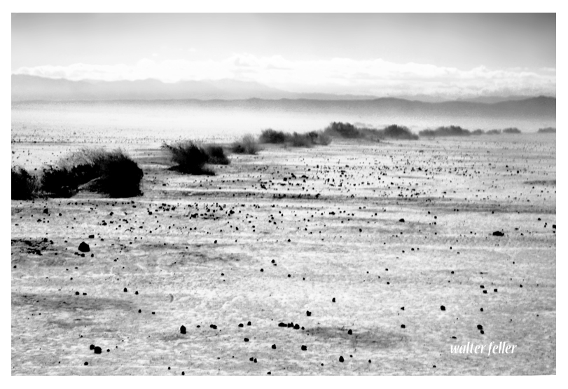
Coyote Lake wind storm
Even when the wind is blowing ..
II

Thou shalt speak of the DESERT with great reverence, and lie about it with great showmanship, adding zest to Tall Tales and Legends.

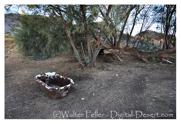
Bath tub in desert.
Adding zest โ€ฆ
III

Thou shalt not admit other DESERTS have more color than the one on which you have staked your claim.

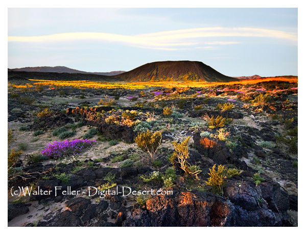
Amboy Crater
IV

Thou shalt on the Sabbath look to the Mountain Peaks soโ€™s to know better your whereabouts, soโ€™s you can help others to know the DESERT, dotting on the map the places where you have camped.

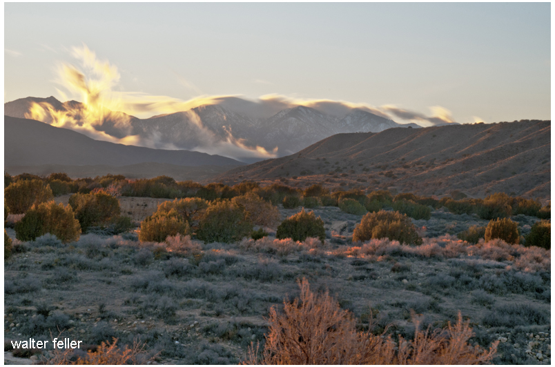
Summit Valley, Hesperia
โ€ฆ on the Sabbath look to the Mountain Peaks โ€ฆ
V

Honor the Pioneers, Explorers and the Desert Rats who found and marked the water holes . . . they tell you about the next water hole and try to help you.

VI

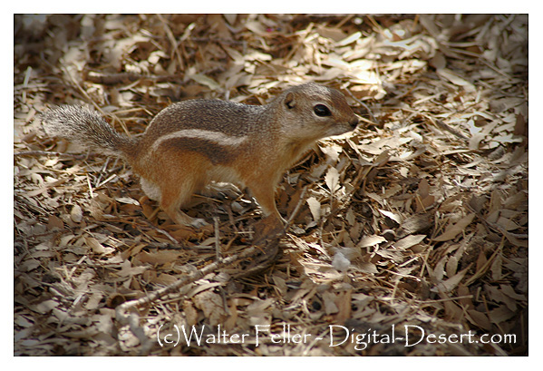
Thou shalt not shoot the Antelope-Chipmunk, Kangaroo Rat or other harmless Desert friends. (Keep your shot for a snake.)

white-tailed antelope squirrel
Donโ€™t shoot these.
VII

Thou shalt not adulterate the water holes nor leave the campsite messed up. Be sure to take 10 gallons of water with you. Donโ€™t have to ask the other fellow on the road for a quart, but be able to help the tenderfoot by giving him some water.

10 gallons of water ought to do it.
VIII

Thou shalt not steal (from the prospectorโ€™s shack), nor forget to fill the wood box and water pail.

Burro Schmidt Cabin, El Paso Mountains
Donโ€™t be an asshole and mess up or steal stuff from some guyโ€™s cabin.
IX

Thou shalt not bear false witness against thy neighbor; you know the mining laws; you know the whereabouts of his monuments.

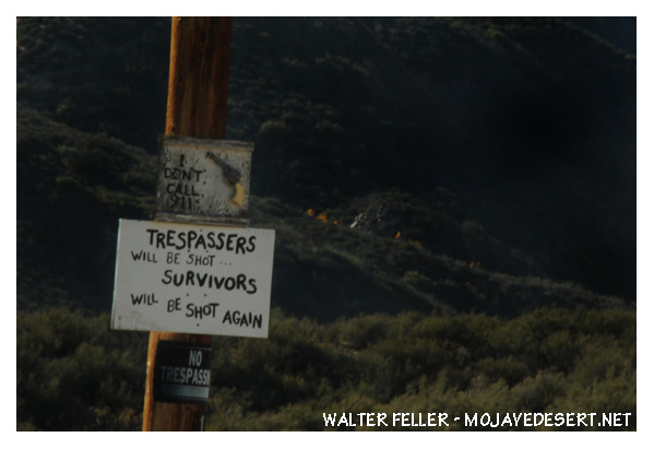
no tresspassing sign
Sign of the times.
X

Thou shalt not covet thy neighborโ€™s sleeping bag, his gun, nor the contents of his canteen.

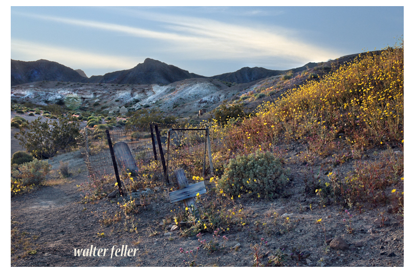
Shoshone Cemetery
Ultimately

~ The End ~

Getting Used to the Wind

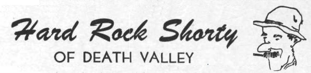
Death Valley was having one of its periodic wind storms when the tourists drove up in front of Inferno store to have their gas tank filled.

Hard Rock Shorty was seated on the bench under the lean-to porch with his hat pulled down to his ears to keep it from blowing away.

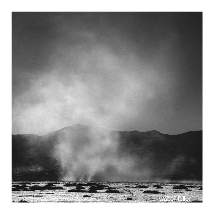
Desert wind storm
Desert wind storm

โ€œHave many of these wind storms?โ€ one of the dudes asked.

โ€œShucks, man, this ainโ€™t no wind storm. Jest a little breeze like we have nearly every day. You have to go up in Windy Pass in the Panamints to find out what a real wind is like.

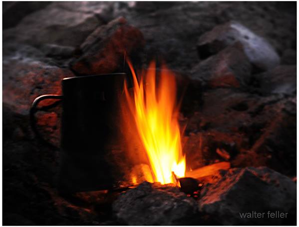
โ€œThree-four years ago I wuz up there doinโ€™ some prospectinโ€™. Got together a little pile oโ€™ wood anโ€™ finally got the coffee to boilinโ€™. Then I set it on a rock to cool while I fried the eggs.

โ€œAbout that time one of them blasts oโ€™ wind come along and blowed the fire right out from under the fryinโ€™ pan. Blowed โ€˜er away all in one heap so I kept after it tryinโ€™ to keep that fryinโ€™ pan over the fire to git my supper cooked.

โ€œI usually like my eggs over easy, but by the time 1 got one side done I wuz all tired out so I let โ€˜er go at that. Had to walk four miles back to the coffee pot.โ€

from; Desert Magazine โ€“ December 1953

Shortyโ€™s Grubstake

Shorty Harris in Ballarat

Once I asked Shorty Harris how he obtained his grubstakes. โ€œGrubstakes,โ€ he answered, โ€œlike gold, are where you find them. Once I was broke in Pioche, Nev., and couldnโ€™t find a grubstake anywhere. Somebody told me that a woman on a ranch a few miles out wanted a man for a few daysโ€™ work. I hoofed it out under a broiling sun, but when I got there, the lady said she had no job. I reckon she saw my disappointment and when her cat came up and began to mew, she told me the cat had an even dozen kittens and she would give me a dollar if I would take โ€™em down the road and kill โ€™em.

โ€œโ€˜Itโ€™s a deal,โ€™ I said. She got โ€™em in a sack and I started back to town. I intended to lug โ€™em a few miles away and turn โ€™em loose because I havenโ€™t got the heart to kill anything.

โ€œA dozen kittens makes quite a load and I had to sit down pretty often to rest. A fellow in a two-horse wagon came along and offered me a ride. I picked up the sack and climbed in.

โ€œโ€˜Cats, eh?โ€™ the fellow said. โ€˜They ought to bring a good price. I was in Colorado once. Rats and mice were taking the town. I had a cat.  She would have a litter every three months. I had no trouble selling them cats for ten dollars apiece. Beat a gold mine.โ€™

Prospector with grubstake essentials

โ€œThere were plenty rats in Pioche and that sack of kittens went like hotcakes. One fellow didnโ€™t have any money and offered me a goat. I knew a fellow who wanted a goat. He lived on the same lot as I did. His name was Pete Swain.

โ€œPete was all lit up when I offered him the goat for fifty dollars. He peeled the money off his roll and took the goat into his shack. A few days later Pete came to his door and called me over and shoved a fifty-dollar note into my hands. โ€˜I just wanted you to see what that goatโ€™s doing,โ€™ he said.

โ€œI looked inside. The goat was pulling the cork out of a bottle of liquor with his teeth.

โ€œโ€˜That goatโ€™s drunk as a boiled owl,โ€™ Pete said. โ€˜If I ever needed any proof that thereโ€™s something in this idea of the transmigration of souls, that goat gives it. Heโ€™s Jimmy, my old sidekick, who, I figgered, was dead and buried.โ€™

โ€œโ€˜Now listen,โ€™ I said. โ€˜Do you mean to tell me you actually believe that goat is your old pal, whom you drank with and played with and saw buried with your own eyes, right up there on the hill?โ€™

โ€œโ€˜Exactly,โ€™ Pete shouted, and he peeled off another fifty and gave it to me. So, you see, a grubstake, like gold, is where you find it.โ€


from:

Loafing Along Death Valley Trails
A Personal Narrative of People and Places
Author: William Caruthers

 Shorty Harris

Coyote Killers

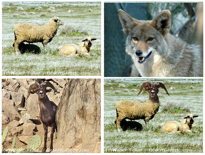
Bill Frakes was a gentleman from Argentina who brought sheep out to his claim at the oldย Camp Cadyย along theย Mojave River. As soon as he got there, it seemed he had sheep problems. They kept dying. They kept dying because the sheep had coyote problems. The coyotes had issues because they always seemed hungry, and the sheep were so tasty.

Bill Frakes noticed the coyotes rarely messed with the localย bighorn sheep. The bighorn would kick the hell out of the coyotes and cause them moreย coyoteย problems than the meal was worthโ€“like broken bones, punctured lungs, and death and stuffโ€ฆ

Bill Frakes had an idea on how to solve everyoneโ€™s problemsโ€“to interbreed the bighorn with the domestic sheep. He would make coyote killers, and Bill Frakes would be on Easy Street raising flocks and flocks of bad-ass sheep.

The details of what happened next are left in the gray fog of best-forgotten history, but there were rumors that several unfortunate and disturbing creatures were tied to a shed, and at night strange animal-like crying and sobbing could be heard.

Bill Frakesโ€™ plan failed miserably with a possible exception; up there in the hills, a hybrid ram is said to have escaped; too ugly to die, too ugly to let itself be seen, the King Mutant Ramโ€™s wailing and moaning can be heard to these very modern times in the mysterious night winds of theย Afton Canyonย highlands . . .

The End

Fiction inspired by a true event as described in โ€œDaggett, Life in a Mojave Frontier Town,โ€ by Dix Van Dyke โ€“ Edited by Peter Wild.

Hula Ville

Route 66 – Victorville, CA

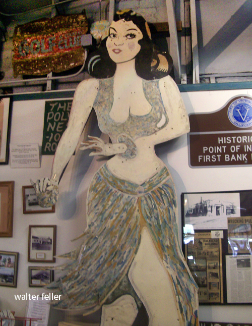
After retiring as a ‘carny,’ or carnival worker at the Venice Pier and Santa Monica Pier, Miles Mahan (1896-1997) began building Hula Ville in 1955.

Wine- and beer-bottle tree sculptures adorned Joshua trees and wooden posts. Desert sandblasted wood signs held poetry and prose; dolls, award statues, and other found objects were displayed outside. A homemade miniature golf course bordered by half-buried bottles was included in his residence, as well as a pickup truck camper and a pickup truck camper without a truck. There was no charge, and donations were accepted.

Mahan also erected a large dancing hula girl sign at the entrance, a business discard he rescued and repurposed. The crude hand-lettered sign beneath her read: “People travel through the state, how little will they know her fate, for the traveler who’ll ever be the wiser, the Supervisors saved her life.” Busses traveling to Las Vegas from Los Angeles would stop, and Miles would entertain them by dancing on his little wooden stage, and they would leave tips. Even in his eighties, he was still able to dance. As much as he enjoyed guessing people’s weights at carnivals, he enjoyed watching Hesperia grow into a city. His poetry and books mention the many people he met along the way, with whom he loved talking about real estate. Whiskey Pete and Scotty from Death Valley were his friends, and Miles was quite a storyteller. These were all true stories. He appeared on the Johnny Carson Show as Johnny invited him back due to his outspoken personality 2 or 3 times. They would send a limo to pick him up and return him.

In 1995 Miles Mahan moved to a convalescent home and died on April 15, 1997. In September 1997, Hula Ville was demolished.

Jackrabbit Homesteads

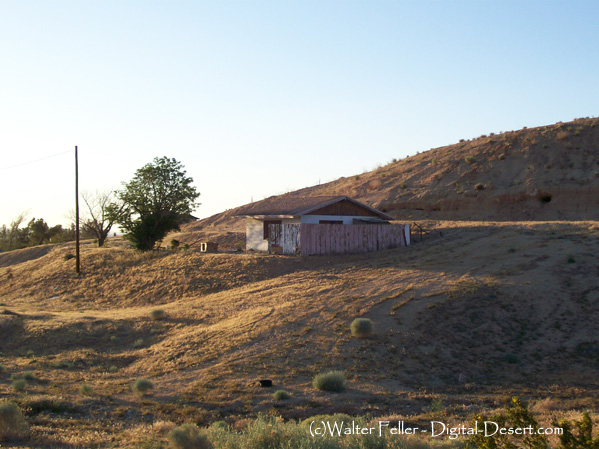
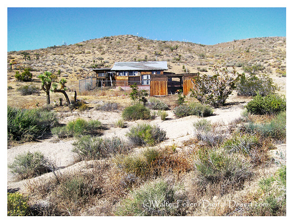
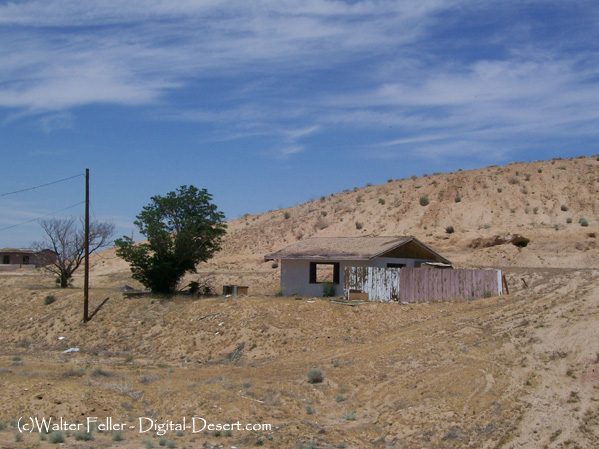
Jackrabbit Homesteads, a unique phenomenon in the American Southwest, hold a significant place in the region’s history and culture. These small, rustic cabins were built on public lands in the mid-20th century. They offered settlers the opportunity to claim a piece of the desert and forge their own paths. We will explore the intriguing story behind these homesteads and their enduring legacy.

The establishment of Jackrabbit Homesteads dates back to the passage of the Small Tract Act of 1938, which aimed to encourage settlement on federal lands. Under this act, individuals could claim up to five acres of land and build a dwelling upon it. Many of these homesteads were constructed between the 1950s and 1970s, attracting individuals seeking a simpler, off-grid lifestyle or a weekend getaway from the hustle and bustle of city life.

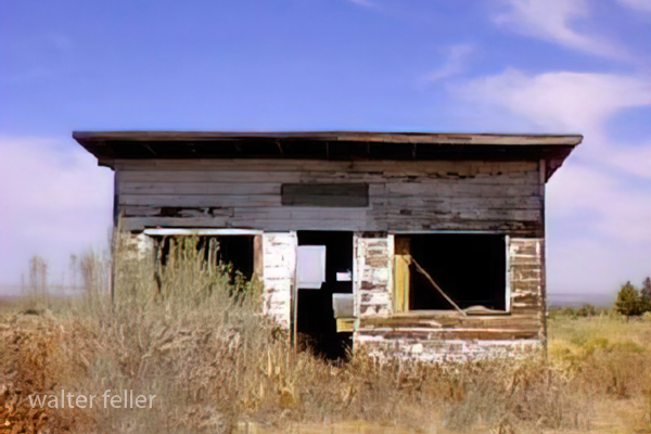
Jackrabbit Homesteads were typically modest, one-room cabins constructed from inexpensive materials such as concrete blocks or plywood. These structures were often sparsely furnished, reflecting the self-sufficient nature of the homesteaders who built them. Although lacking in modern amenities, these homesteads provided a sense of freedom and a connection to the surrounding natural landscape.

Living on a Jackrabbit Homestead required resourcefulness and willingness to adapt to harsh desert conditions. Homesteaders relied on rainwater catchment systems and solar power; many grew their own food or raised livestock. The simplicity of this lifestyle allowed individuals to reconnect with nature and find solace in the vast desert.

While Jackrabbit Homesteads have passed, their legacy lives on. Many homesteads have been abandoned or repurposed today as reminders of a bygone era. Some have even been transformed into art installations or preserved as historical landmarks. The National Park Service has recognized the cultural significance of Jackrabbit Homesteads and is working to preserve and document these unique structures.

For those intrigued by the allure of Jackrabbit Homesteads, there are opportunities to explore and experience these historic sites. For instance, Joshua Tree National Park in California is home to several preserved homesteads that offer a glimpse into the past. Visitors can wander through these time capsules, imagining the lives of the individuals who once called these cabins home.

Jackrabbit Homesteads are a testament to the human spirit of resilience and the desire for independence. Scattered across the desert landscape, these modest dwellings tell a story of determination and self-sufficiency. While the era of homesteading may have faded, the legacy of Jackrabbit Homesteads continues to captivate and inspire those who appreciate the allure of a simpler way of life.

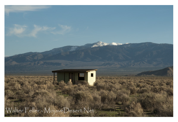
(c) Walter Feller

Indifference of the Desert: Gateway to Eternity

The desert, a vast expanse of arid land, holds an enigmatic allure that has captivated explorers, writers, and artists for centuries. In its barrenness lies a certain indifference, an apathy that transcends the human realm. It is a world of endless silence, where life struggles to survive, and time appears to stand still. This place, looking into the indifferent nature of the desert, exploring its striking beauty, unforgiving climate, and ability to evoke a sense of insignificance in the face of its vastness.

The desert’s indifference is paradoxically intertwined with its mesmerizing beauty. Stretching as far as the eye can see, the landscape is dominated by sand dunes, rocky outcrops, and expansive plains. The desert’s neutral color palette, comprising earthy tones of beige, ochre, and rust, creates a harmonious symphony of hues. Its vastness and emptiness instill a sense of awe as if gazing upon an infinite canvas that has been left untouched by human hands.

The desert’s indifference is most apparent in its extreme climate. The desert’s temperatures fluctuate dramatically from scorching heat during the day to bone-chilling cold at night. The barrenness of the landscape exacerbates these conditions, as there are no obstacles to provide shade or shelter. Survival in such an environment requires adaptation and resilience, as even the hardiest of creatures struggle to endure the harshness of the desert’s indifference.

In the desert, time seems to lose its relevance. The shifting sands, sculpted by the wind, erase any trace of human presence, leaving behind a blank canvas for nature to paint anew. The desert’s indifference to the passage of time can be both humbling and disorienting. It serves as a reminder of the transience of human existence, as the footprints we leave behind are quickly swallowed by the relentless sands, making us feel insignificant in the face of eternity.

While the desert’s indifference may seem daunting, it offers valuable lessons for those who are willing to listen. It teaches us to embrace solitude and find solace in our own company. It encourages us to adapt and persevere in the face of adversity. It reminds us of the impermanence of life and the importance of cherishing the present moment. The desert’s indifference serves as a gentle yet profound reminder of our place in the grand tapestry of the universe.

The indifference of the desert is a captivating paradox. Its silent beauty, harsh climate, and timeless sands evoke a sense of insignificance in the face of its vastness. Yet, within its indifference lies wisdom and resilience. The desert beckons us to embrace solitude, adapt to change, and appreciate the fleeting nature of existence. Let us heed its call and find solace in the indifference of the desert, for within its silence lies a profound understanding of the human condition.

(c)Walter Feller

The Pessimist’s Perspective on the Victor Valley

Introduction:

The Victor Valley, located in Southern California, is often hailed as a vibrant and promising region. Its picturesque landscapes, growing economy, and close proximity to major cities make it an attractive destination for many. However, in this blog post, we will explore a different viewpoint – that of a pessimist. By examining the potential drawbacks and challenges faced by the region, we aim to offer a contrasting perspective on the Victor Valley.

1. Economic Challenges:

Despite its apparent economic growth, the Victor Valley faces several challenges that a pessimist would highlight. The region heavily relies on a few industries, such as agriculture and tourism, which leaves it vulnerable to fluctuations in these sectors. Furthermore, the lack of diversification in the job market can lead to higher unemployment rates during economic downturns, leaving many residents struggling to make ends meet.

2. Infrastructure and Public Services:

From a pessimist’s viewpoint, the Victor Valley’s infrastructure and public services are not without their shortcomings. The area’s rapid population growth has strained the existing road networks, leading to congestion and longer commuting times. Additionally, public transportation options are limited, making it difficult for residents without private vehicles to navigate the region. Moreover, the availability and quality of essential services, such as healthcare and education, may not meet the demands of the growing population.

3. Environmental Concerns:

The pessimist’s perspective also sheds light on the environmental challenges faced by the Victor Valley. As the region continues to develop, it risks encroaching upon natural habitats and disrupting local ecosystems. The demand for water, in particular, poses a significant concern, as the Victor Valley is located in a semi-arid region with limited water resources. Excessive groundwater extraction and inadequate water management practices could have long-term consequences for the region’s sustainability.

4. Limited Cultural and Recreational Options:

Contrary to the popular perception of the Victor Valley as a vibrant cultural hub, a pessimist might argue that the region lacks diverse cultural and recreational opportunities. The area’s limited investment in arts, entertainment, and recreational facilities may leave residents with fewer options for leisure and personal growth. As a result, the Victor Valley may struggle to attract and retain young professionals and families seeking a well-rounded lifestyle.

Conclusion:

While the Victor Valley undoubtedly offers many benefits and opportunities, it is essential to consider the pessimist’s viewpoint to gain a well-rounded understanding of the region. By acknowledging the economic challenges, infrastructure limitations, environmental concerns, and cultural and recreational limitations, we can foster a more comprehensive dialogue about the future of the Victor Valley. It is through such discussions that we can work towards addressing these issues and ensuring a more balanced and sustainable future for the region and its residents.

Controlling Local History: The Practice of Marginalization and Banning People

Introduction:

Local history shapes community identity and collective memory. It preserves the stories, events, and heritage that shape the present. However, in some cases, the practice of controlling local history and banning people from it has raised concerns. This blog post explores the implications of such practices and their potential consequences for communities.

1. The Power Dynamics of Controlling Local History:

Controlling local history involves the selective interpretation and presentation of historical narratives, often influenced by those in power. Controlling the narrative can emphasize certain perspectives or events while suppressing others, resulting in a skewed understanding of the past. This power dynamic can lead to the exclusion and erasure of marginalized voices and communities.

2. Banning People from Local History:

Banning individuals from participating in local history recording, sharing, or access restricts collective memory and perpetuates exclusion. This exclusion can occur for a variety of reasons, such as political dissent, social status, or cultural differences. However, by denying individuals the right to contribute to, learn from, and engage with local history, a community risks losing valuable insights and perspectives.

3. Implications for Communities:

When individuals are banned from local history, the community as a whole suffers. The diversity of experiences and perspectives is diminished, resulting in a narrow understanding of the past. This can lead to a distorted sense of identity and an inability to learn from past mistakes or appreciate the contributions of all community members. Furthermore, the practice of banning people from local history can perpetuate social divisions and hinder unity and cohesion.

4. Promoting Inclusive Local History:

To ensure a more inclusive and accurate representation of local history, it is crucial to adopt practices that encourage participation from all members of the community. This can be achieved through initiatives such as oral history projects, community-led documentation, and the establishment of inclusive historical archives. Communities can create a more comprehensive and nuanced understanding of their shared past by actively involving diverse voices.

5. The Importance of Dialogue and Understanding:

Rather than banning individuals from local history, fostering open dialogue and understanding can lead to a more inclusive and comprehensive narrative. Communities can work toward reconciliation and healing by creating spaces for conversations, sharing different perspectives, and acknowledging history’s complexities. This approach allows for a more accurate reflection of the past, embracing diversity and promoting a sense of belonging for all community members.

Conclusion:

Controlling local history and banning people from it has far-reaching consequences for communities. It perpetuates power imbalances, excludes marginalized voices, and limits collective memory. Instead of resorting to such practices. Communities should strive for inclusivity, open dialogue, and the active participation of all individuals in shaping and preserving local history. Doing so can create a more accurate, diverse, and enriching understanding of the past, ensuring a more inclusive and united future.

Walter Feller – 8/2023

The Waning Character of the Victor Valley: A Reflection on Change

Introduction:

The Victor Valley, once known for its vibrant character and idyllic charm, has witnessed a gradual decline in its unique essence over the years. Let us examine the factors contributing to the waning character of the Victor Valley and reflect upon the changes that have shaped its present state.

The Historical Significance:

The Victor Valley has a rich history, deeply rooted in the California Gold Rush and the railroad system development. These historical events played a pivotal role in shaping the valley’s character, attracting settlers, prospectors, and entrepreneurs seeking opportunities. The region blossomed with small communities, bustling industries, and a strong sense of community.

Urbanization and Economic Shifts:

Over time, the Victor Valley has undergone significant urbanization and economic shifts, which have profoundly impacted its character. With the expansion of cities and towns, vast open spaces have been replaced by commercial developments and residential neighborhoods. This rapid growth has led to a loss of natural beauty and a decline in historical landmark preservation.

Furthermore, economic changes have influenced the character of the Victor Valley. The decline of traditional industries, such as agriculture and mining, has resulted in a shift towards a service-based economy. While this has brought economic stability and employment opportunities, it has also contributed to a loss of the valley’s unique identity as small businesses struggle to compete with larger corporate chains.

Cultural Shifts and Loss of Community Spirit:

Another significant factor contributing to the waning character of the Victor Valley is the cultural shifts experienced by its residents. As the valley has become more diverse, the sense of community and shared values that once defined its character has diminished. People are now more connected virtually than physically, and the traditional community spirit has given way to individualism and isolation.

The Impact of Modernization:

The advent of modern technology and social media has further eroded the character of the Victor Valley. The constant connectivity and virtual interactions have replaced face-to-face communication, making it harder for residents to connect and engage with each other. The valley’s unique charm, once fostered by personal connections and local events, now struggles to compete with the allure of the digital age.

Preserving the Victor Valley’s Character:

Despite Victor Valley’s challenges, there is hope for preserving its character. Community-driven initiatives, historical preservation efforts, and a renewed focus on local businesses can help restore the valley’s identity. By embracing sustainable development practices and promoting cultural events celebrating the valley’s heritage, residents and local authorities can work together to attempt to revive the character that once defined the Victor Valley.

Conclusion:

The waning character of Victor Valley reminds us of the ever-changing nature of our society. The forces of urbanization, economic shifts, cultural changes, and technological advancements have left an indelible mark on the valley’s identity.

The Hog Drive to Daggett

TRUE STORIES – TOLD INCORRECTLY – A DESERT TRADITION

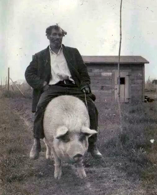
A totally unrelated photo of Leslie Kirchner riding his pig reminds me of the legend of the Daggett Pig Drive.

There were too many pigs, and it would have been too expensive to have them hauled to market, yet the little girl’s family needed the money to live in a hotel in Long Beach or someplace like that. The decision was made to drive the hogs to the railroad depot in Daggett as an old-fashioned cattle drive to Abilene. Betty was excited.

There were hogs and pigs as far as the eye could see, being guided by drovers experienced not with driving pigs but with small cattle. One-eyed Ben, the old man, said, “Driving pigs is just like driving tiny cows, except they don’t have horns, which is good because pigs are angry.” The hogs snorted, grunted, and squealed as they hurried down the dusty road. The trick, however, was to keep them from running and losing all their weight.

Little Betty cried when her father told her pigs were classified into ‘lard’ or ‘bacon.’ That meant the dreams of her two favorite pigs, Willis and Tina, wouldn’t be getting a pig wedding and then having a pig family together. Their future looked dark. “Lard or bacon?” thought Betty.

“Cheer up, Betty,” her father told her. “Have a stick of gum.”

And she did, and she stopped crying and went to live in a hotel in or near Long Beach.

The End

Fiction inspired by a true event as described in “Daggett, Life in a Mojave Frontier Town,” by Dix Van Dyke – Edited by Peter Wild.

Protecting the Mojave in 1974

Los Angeles Herald Examiner Photo Collection
Howell, E. Bruce – 1974

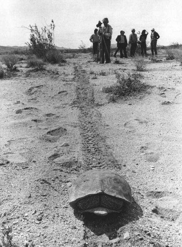
Photograph caption dated April 3, 1974 reads, “Shy desert tortoise curls up inside his shell on top of a groove left in desert sand by motorcycle on the Stoddard Valley off-road vehicle racing area of Barstow. Already legally protected as an endangered species, environmentalists and scientists say the threat is heightened along with other desert life by off-road vehicle activities.”

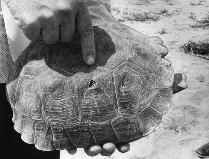
Photograph caption dated April 3, 1974 reads, “Environmentalist group that recently toured the Mojave Desert to show evidence of damage done by indiscriminate use of off-road vehicle say they believe holes on this live desert tortoise shell were caused by bullets.”

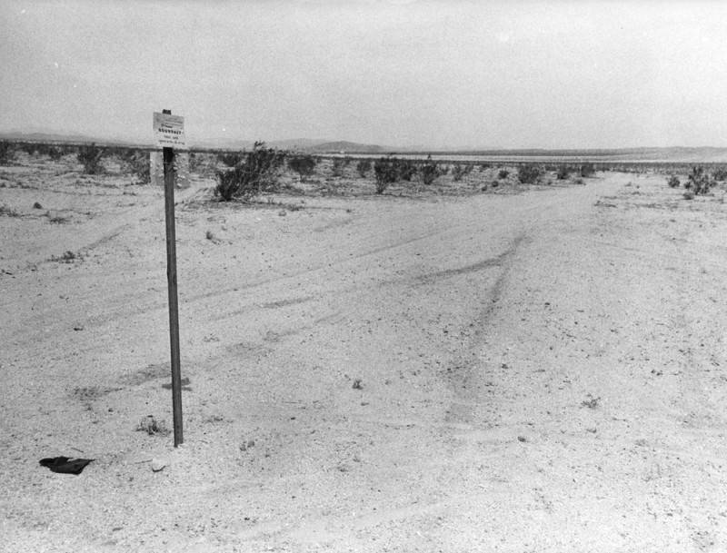
Photograph caption dated April 3, 1974 reads, “Tiny marker planted in Mojave Desert at Stoddard Valley, marks U.S. Bureau of Land Management boundary separating approved off-road vehicle race course from a restricted area. Heavy tire tracks on both sides of marker indicate that such markers are virtually ignored, except by desert visitors with guns, who have riddled them with bullets.”

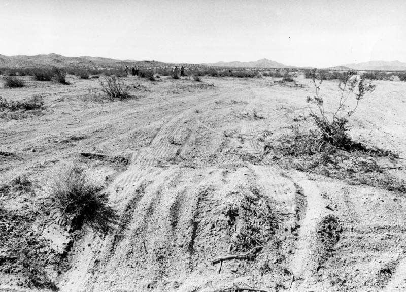
Photograph caption dated April 3, 1974 reads, “Stoddard Valley on Mojave Desert near Barstow, despite its vast openness is a continuous maze of off-road vehicle tire tracks. Federal plan for managing off-road vehicle use on desert has left it open for off-road vehicle races and closed other areas. But environmentalists and scientists say regulations for restricted areas are too vague and open to this kind of damage.”

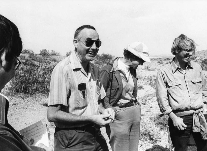
Photograph caption dated April 3, 1974 reads, “These people seek to defend the vast Mojave Desert from a federal program that regulates off-road vehicles. They claim regulations are vague, unenforceable, and could open the desert to extensive off-road vehicle damage. From left are UC Riverside professors Bill Mayhew, zoology; Sylvia Broadbent, anthropology; and Richard E. Gutting, Jr., attorney for Environmental Defense Fund.”

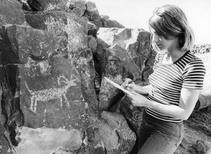
Photograph caption dated April 3, 1974 reads, “Judith Winder, staffer for Environmental Defense Fund, sketches petroglyph of longhorn sheep from rock in Inscription Canyon.”

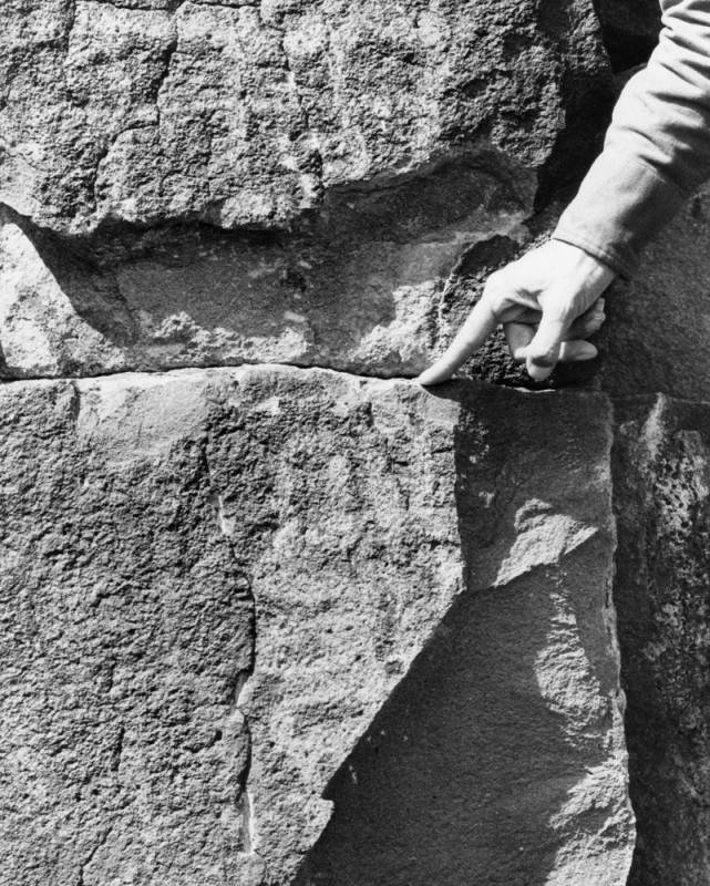
Photograph caption dated April 3, 1974 reads, “Hand of UC Riverside anthropology professor, Sylvia Broadbent, points out recent chisel mark at bottom of a chipped out section of volcanic rock which had an ancient Indian carving on it. Such damage to antiquities, which is widespread in the Mojave Desert is illegal. This damage was in Inscription Canyon near Barstow.”

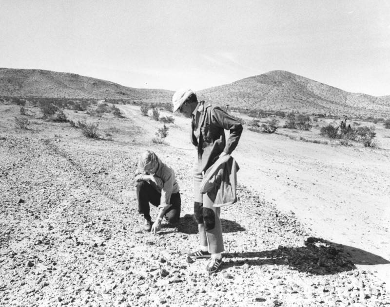
Photograph caption dated April 3, 1974 reads, “Richard E. Gutting, Jr., kneeling, attorney for Environmental Defense Fund, and UC Riverside anthropology professor Sylvia Broadbent, examine off-road vehicle dislocation of ‘desert pavement,’ a dark, rocky covering on desert floor which takes thousands of years to form but is important to the natural balance of desert life. Light swath was made by off-road vehicle race.”

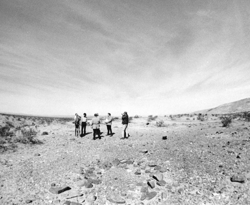
Photograph caption dated April 3, 1974 reads, “Off-road vehicle race course touring party gathers at scene of ancient Indian sleeping circle (foreground), a circular formation of larger rocks in midst of small ones, which anthropologists say were foundations for shelters built by prehistoric Indians. All such sites, they assert, should be protected.”

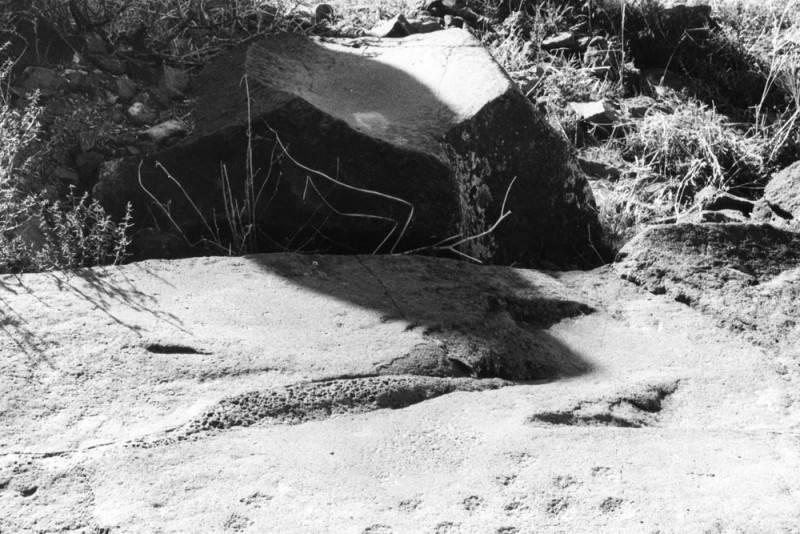
Photograph caption dated April 3, 1974 reads, “Not just ordinary boulders, these, according to Dr. Sylvia Broadbent, UC Riverside anthropology professor, who said there is no question that the slightly concave rock in the upper half of photo was worn that way by ancient Indians grinding grain and marks on the surface of the rock in the lower photo were also made by the same Indians.”

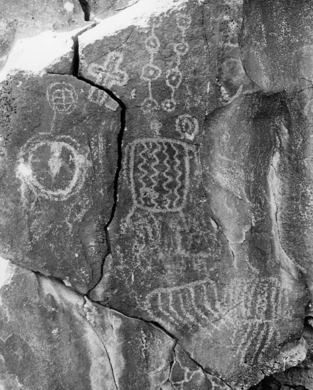
Photograph caption dated April 3, 1974 reads, “Petroglyphs, ancient Indian rock art, abound on the walls of Inscription Canyon near Barstow. Archaeologists look upon them as valuable keys to unlocking the secrets of prehistoric peoples who inhabited the vast Mojave Desert, but complain they are being destroyed by desert visitors at an alarming rate.”

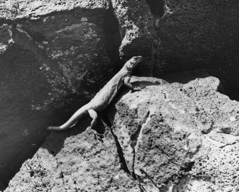
Photograph caption dated April 3, 1974 reads, “He calls the Mojave Desert ‘home.’ Desert lizard suns itself on dark, porous volcanic rock in Inscription Canyon. Same rocks are covered with ancient Indian petroglyphs, and rock art carvings, indicating the canyon may have been where Indians trapped and captured longhorn sheep and other desert game. The entire canyon is falling victim to vandals and souvenir hunters.”


The Legend of ‘Three-fingered’ Bob

A Mystery of the Mojave – Men on the Mesa:

‘Three-fingered’ Bob lay dying on the saloon floor in the mud and the blood and the beer. He was an old man for his time–34 years old to be exact. Quite old for a varmint and bank robber like him up here on the mesa.

They called him ‘Three-fingered’ Bob because, of course, his name was Bob. He liked that. He was playing cards one night and lost a bet. He lost his finger to a dull knife for a marker on his debt. Six days later he paid his debt and his finger was returned to him, but it was too late to reattach. Bob didn’t learn his lesson.

The next week he lost a finger on the other hand–another bet he couldn’t cover. He paid his gambling debt sooner this time, after only one day–but it was too late to sew the finger back on.

Within days it happened once more. Bob was now down to two fingers remaining on one hand and three on the other. Three fingers, on the one hand, wasn’t why they called him ‘Three-fingered’ Bob. He was called ‘Three-fingered’ Bob because he kept his three dried-up fingers in a little bag tied to his belt.

I never did find out what happened to ‘Three-fingered’ Bob, why he was dying, and why the mud and the blood and the beer were all over the floor. Because by the time I finished telling you his story he died and the coroner came and took his corpse away.

“What did kill ‘Three-fingered Bob?” you may ask. This, no one knows that I know of. In fact, we may never know as this is, . . . A Mystery of the Mojave ~

Photo Edits/Updates 12/2021

Afton Canyon

Ivanpah Dry Lake

Red Mountain

Red Mountain

Bell Mountain, Apple Valley, Ca.

Digital-Desert.com/MojaveDesert.Net — Corporate Campus

Summit Valley, Hesperia, Ca.

Inyo Mine, Echo Canyon, Death Valley

Furnace Creek Wash, Death Valley

Badwater Spring, Death Valley

We all need a place to watch the world spin . . .
Needles Eye, Echo Canyon, Death Valley

Furnace Creek, Death Valley National Park

Devil’s Playground, Soda Lake, Mojave National Preserve

Joshua Tree National Park

Providence Mountains, Mojave National Preserve

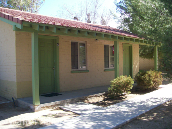
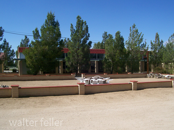
Sunrise Bungalow, Mojave Preserve

Soda Lake, Pacific Coast Soda Company 

Winterkind, Inspiration Point, San Gabriel National Monument

San Bernardino National Forest – 2/2010

Marl Springs, Mojave National Preserve, Mojave Road

Marl Spring, Mojave National Preserve

Last Chance Spring, Last Chance Canyon, El Paso Mountains, Cudahy ghost town, Lost 49ers

Last Chance Spring – 2010

Lava Field, Amboy Crater – 2008

Bell Mountain Summit, Apple Valley, Ca. – 1/2004

Saratoga Springs, Death Valley National Park

Bell Mountain, Apple Valley, Victor Valley, Ca. – 2011

Mojave Preserve – NPS

LIST OF ILLUSTRATIONS –


Mojave Administrative History; NPS – Eric Nystrom

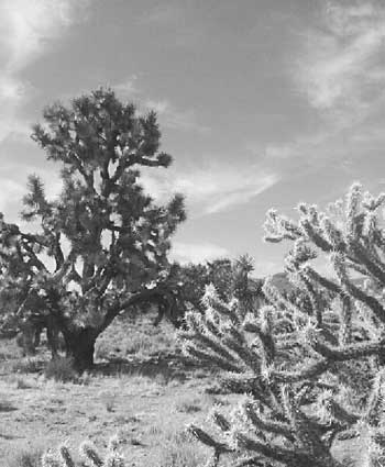
Illustration 1 – Joshua tree and buckhorn cholla

Illustration 2 – Prehistoric petroglyphs at Indian Well

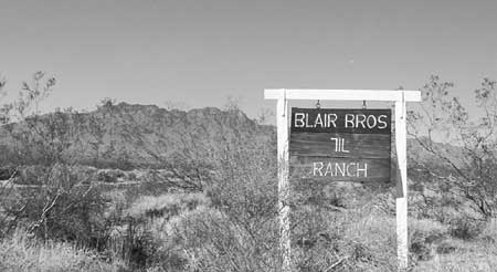
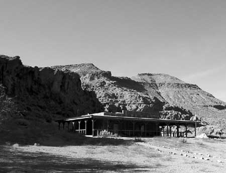
Illustration 3 – The 7IL Ranch

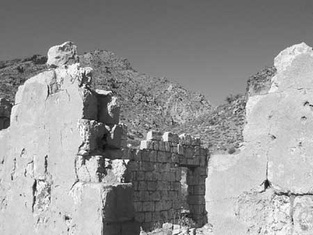
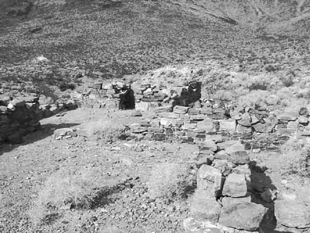
Illustration 4 – Stone walls of 1880s-era Providence

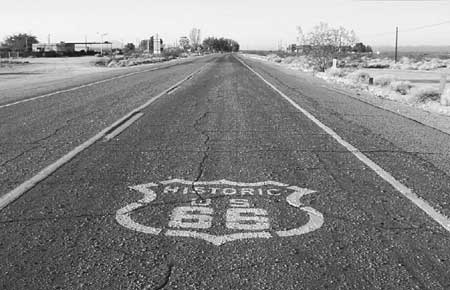
Illustration 5 – U.S. Highway 66, Essex, California

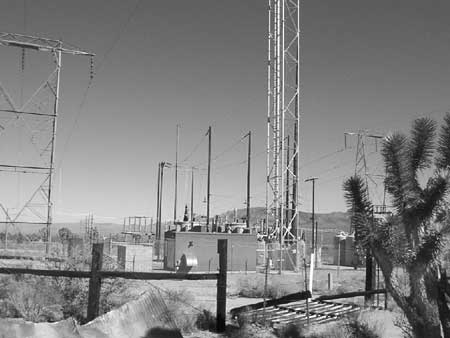
Illustration 6 – High-tension power wires and associated infrastructure

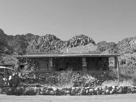
Illustration 7 – Visitor’s center for Providence Mountains State Recreation Area

Illustration 8 – Zzyzx

Illustration 9 – Four-wheel drive vehicles traveling the Mojave Road

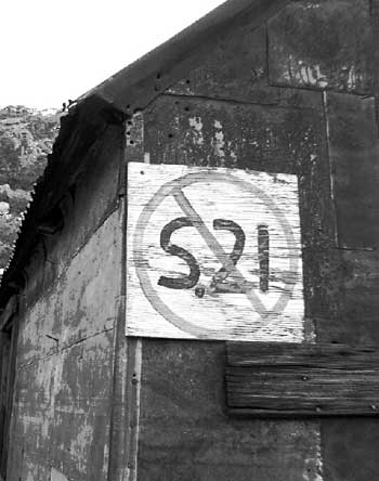
Illustration 10 – Painted sign opposing S.21

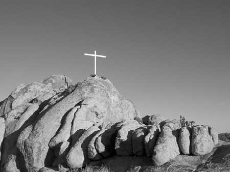
Illustration 11 – Cross on Sunrise Rock

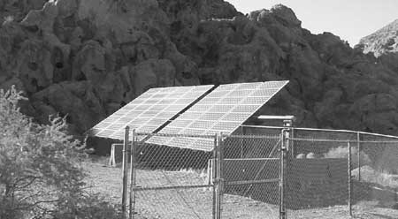
Illustration 12 – Solar panels at Hole-in-the-Wall

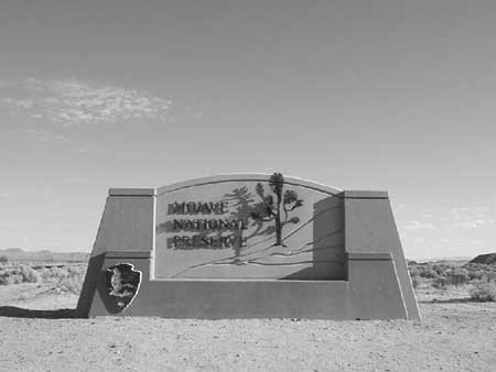
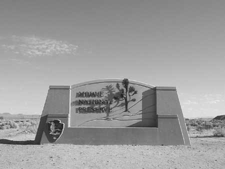
Illustration 13 – Mojave National Preserve entrance monument

Illustration 14 – Official logo of Mojave National Preserve

Illustration 15 – Buildings at the New Trail Mine

Illustration 16 – Graffiti on Kelbaker Road

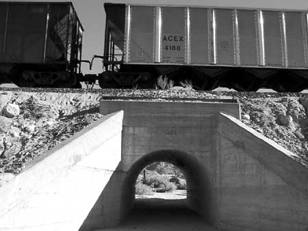
Illustration 17 – The Union Pacific Railroad

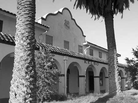
Illustration 18 – Kelso Depot

Illustration 19 – NPS visitors’ center at Hole-in-the-Wall

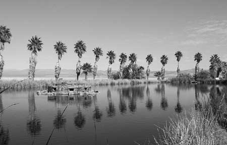
Illustration 20 – Lake Tuendae at Zzyzx

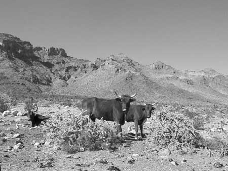
Illustration 21 – Desert cattle

Illustration 22 – Rock walls of the military outpost at Piute Creek

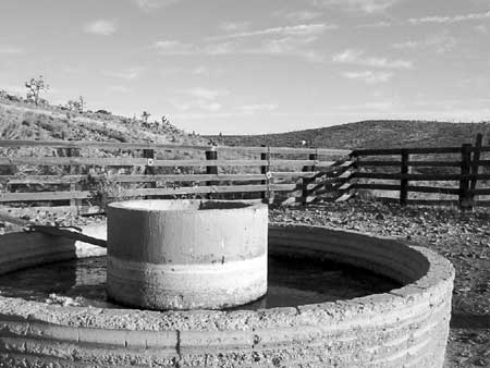
Illustration 23 – The Rock Springs Land & Cattle Company trough and corral

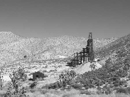
Illustration 24 – Headframe of the Evening Star Mine

Illustration 25 – Morning Star Mine

—

Chaotic Heart

This red thing
This arrhythmic thing
This beating heart
Pounding and pounding, pounding
Torn from the chest and held high
in infrangible grasp
in wild eccentricity
Uncontrolled
Sacrifice
unbalanced
This beating heart
erratically pulsing wave after wave of deep, red light
& silver, dull gray, ungreen
under these painted skies
Pounding, pounding, and pounding
in wild eccentricity
This Chaotic Heart
This arrhythmic thing
This red thing


Missing Pet

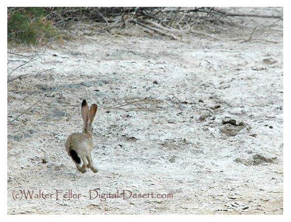
Mike, the pet jackrabbit, is missing!

This is a photo of Mike bolting out of the brush after some rustling around in there and getting part of his ear bitten off and eaten or something. Mike was last seen near Salt Springs hopping across the desert in the epitome of fear and the adrenaline rush of flight.

Mike, was the family’s favorite lagomorph. They would see him during their desert travels all over the place hopping out of a bush or across their path when they least expected.

After a fruitless 3 minute search for Mike, the family left to check-in at their hotel.

“Coming out of the parking area there was a clunk noise like we hit something,” one of the children stated.

“Mom started to say something, but dad said for her to shut up,” the kid continued.

—

There is no reward. Only closure for the kids.

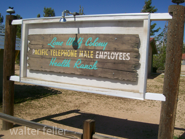
Lone Wolf Colony

Health Ranch – Apple Valley, Ca.

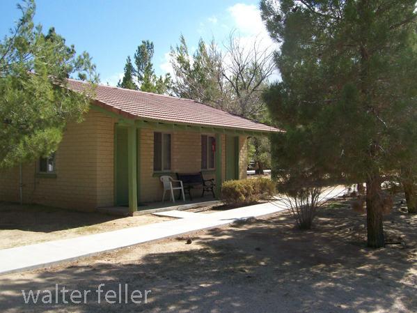
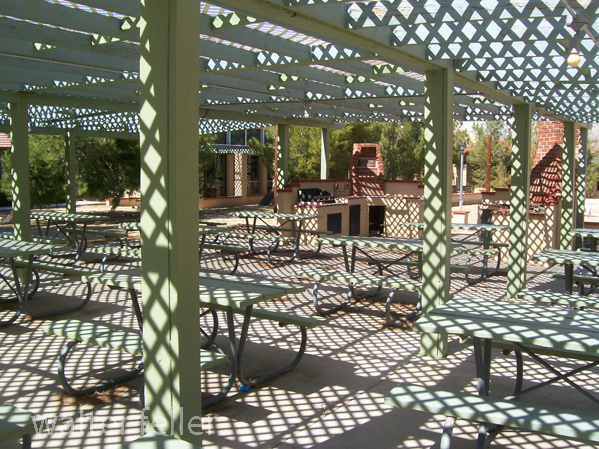
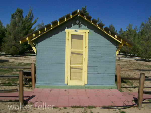
Lone Wolf Colony is a Historical Landmark in the Town of Apple Valley, California.

Over 15 million people were killed during World War I (1914-1918), and a countless number of people were injured. The use of poison gas as a weapon caused many of these deaths and injuries. Suffering from the effects of poison gas during some returning Pacific Telephone and Telegraph employees were unable to obtain hospitalization or other care. The Southern California Telephone Company in Los Angeles began working to provide care and lodging for these recuperating veterans. By 1924 the Lone Wolf Colony was established.

Last Season

The season of the long shadows is over. Shadows clinging to the trunks of awkward trees, cactus, brush, and the base of rocks, stretched in desperation fearing their silent annihilation in the encroaching dark.

The new season brings foreshortened versions of silhouettes from the south. They emerge from the base of the mountains and then rapidly down the bajadas and canyons and arroyos, as it were. The day is quickly painted over in unsunlight and deep twilight while a cold nether rolls across the bristly plain.

The little rat people may look out of their little rat homes before retreating into their little rat holes to do whatever it is that little rat people do there.

The cutest little adorable cottontail bunny hippity-hops cautiously down the little bunny trail to have a little bunny snack. Or to die. Little bunnies generally do not usually live any longer than the moment they learn what a coyote is.

Alas! At the smother of darkness, the coyote has completed his transformation from a lazy begging dog to a starving psychotic murderer.

—

Carreta

American Automobile Assoc. photo

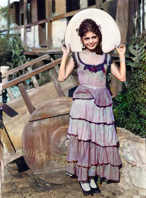
The pretty senorita is standing next to a carreta, a two-wheeled cart pulled by mules to haul freight in early Spanish and Mexican California. The carreta could be built quickly and inexpensively. Four-wheeled wagons in Southern California were a rarity if there were any at all until the first ones rolled in through the Cajon Pass in 1849 driven by Mormon pioneers.

Archive