Trigger

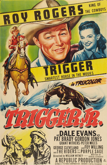
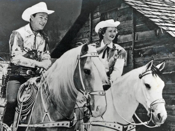
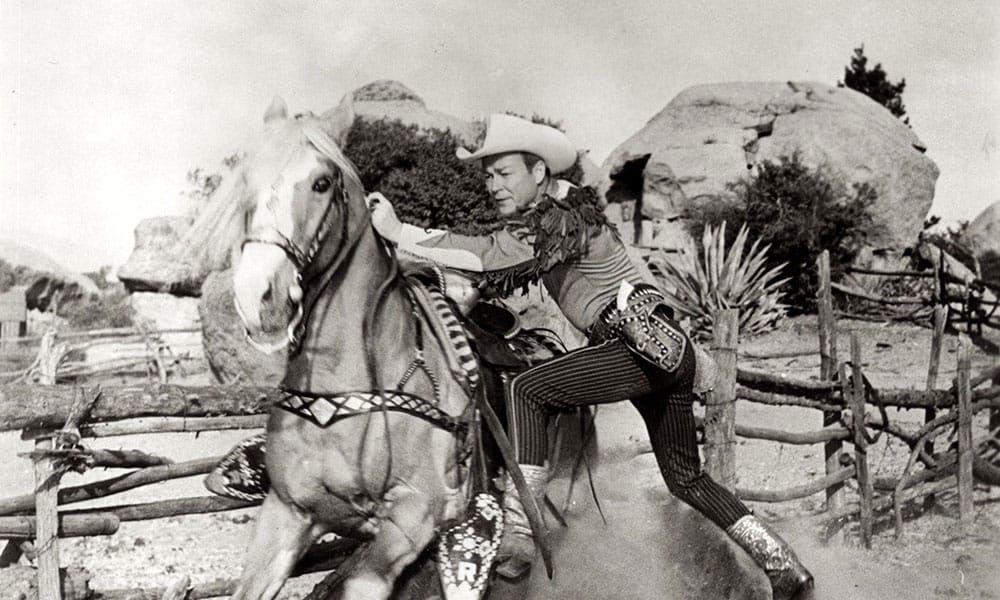
Trigger was the famous horse ridden by Roy Rogers, the iconic American cowboy actor and singer. Trigger was a golden palomino known for his intelligence, versatility, and striking appearance. He became one of the most well-known and beloved horses in the history of Hollywood.

Trigger was a Palomino horse that became famous as the faithful companion of Roy Rogers, a popular American cowboy actor and singer. Trigger was born in 1932 and originally named Golden Cloud. Roy Rogers first encountered the horse in the 1938 movie “The Adventures of Robin Hood,” where Olivia de Havilland rode him.

Impressed by the horse’s beauty and abilities, Rogers eventually acquired him. The horse was then renamed Trigger, and he became one of the most famous horses in Hollywood history. Trigger appeared in many of Roy Rogers’ films and television shows, showcasing his remarkable intelligence and performing various tricks on command.

Trigger appeared in many of Roy Rogers’ films and television shows, becoming a true partner to Rogers in his on-screen adventures. The horse was trained to perform a variety of tricks and stunts, showcasing both Trigger’s abilities and the strong bond between him and Rogers.

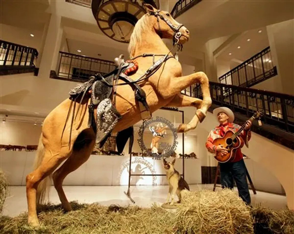
Trigger became a beloved icon, often called “The Smartest Horse in the Movies.” After Trigger died in 1965, Rogers arranged for the horse to be taxidermied. The preserved Trigger was displayed at the Roy Rogers and Dale Evans Museum in California. Later, the museum closed, and in 2010, Trigger was sold at auction for nearly $266,000. The buyer, a cable television network, intended to use the preserved horse in a planned Roy Rogers exhibit.

Trigger’s legacy lives on in fans’ memories and the numerous films and television shows where he played a prominent role alongside Roy Rogers.

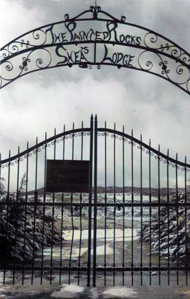
Shea’s Castle

/antelope-valley/

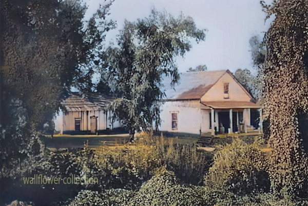
“Shea Desert Castle Sold,” Los Angeles Times, 25 Mar 1935 (colorized)

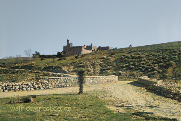
Richard Peter Shea built Shea’s Castle in 1924, also known as Sky Castle or Castle Ranch.

1929’s stock market crash bankrupted Shea. Shea’s wife died, the bank took over the castle, and Shea committed suicide.

Over the years, the property has changed hands and been used as a filming location.

Trigger, Roy Rogers’ horse, was trained on the property.

It is now a private residence.

The massive granite structure, built by R. P. Shea, was sold to three Beverly Hills women in 1935. The “castle” boasts many unique design elements that remain untouched after the purchase.
This photograph appears with the article, “Shea Desert Castle Sold,” Los Angeles Times, 25 Mar 1935: 19.CAPTIONText from negative sleeve: Shae’s [sic] Castle nitrates

Handwritten on negative: Shae’s [sic] Castle 3-16-35
Text from newspaper caption: “Dream Home” in Mojave Desert Passes Into New Hands; A massive granite structure in the Mojave Desert, built ten years ago as a “dream home” of R. P. Shea, yesterday, passed into the hands of new owners. So incongruous is its setting that many believe they are beholding a mirage when they see the $175,000 castle.

The Man who was Hanged Twice

by Myrtle Nyles – November 1964 – Desert Magazine

Skidoo came to life because of fog. When Harry Ramsey and a man called One-eye Thompson lost their way on a road leading to the new boom camp of Harrisburg, they stopped to rest near a log lying against an outcropping of rock. When the fog lifted, the rock turned out to be gold. This was back in 1905. In deciding upon a name for the town that sprung up, a numerologist associated a popular expression of the day, 23-Skidoo, with the fact that a Rhyolite man named Bob Montgomery had successfully piped water from Telescope Peak 23 miles away and suggested the name Skidoo. So it became.

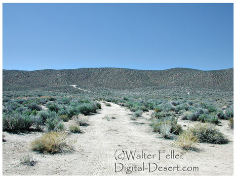
Downtown Skidoo. Death Valley National Park

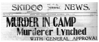
Old-timers say the camp produced over a million dollars worth of gold ore between its discovery and its demise some 20 years later. Skidoo’s chief claim to fame, however, was not its riches. Rather, it was an infamous lynching of a scoundrel named Joe Simpson in 1908.

On a tour to the ghost town of Skidoo in 1962, we were privileged to be accompanied by an 87-year-old gentleman named George Cook. The interesting thing about Mr. Cook was that it was he who pulled on the rope at the lynching. His participation had only recently been divulged to a few intimate friends—after all others involved had passed on to their rewards, or whatever.

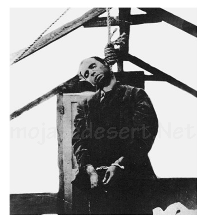
Joe "Hooch" Simpson
Joe “Hooch” Simpson

“Joe Simpson,” Mr. Cook told us, ‘was a would-be villain who had killed a man at Keeler after shooting-up Jack Gun’s Saloon in Independence the preceding year. He’d somehow gotten off and drifted to Skidoo where he became a partner with Fred Oakes in the Gold Seal Saloon. Across the street was Jim Arnold’s Skidoo Trading Company.

“Arnold was a friendly, well-liked man and had always been on good terms with Simpson, but Simpson became drunk and abusive one April morning and decided to hold up a bank situated in part of Arnold’s Skidoo Trading Company. Apprehended, his gun was taken away and hidden by the deputy sheriff, but a little later Simpson found his weapon and returned to the store to shoot Jim Arnold. He then turned on two other men who had come to the rescue, but his aim was poor and both escaped. Eventually, Simpson was overpowered and placed under guard in the deputy sheriff’s cabin. Unfortunately,” Mr. Cook lamented, “the popular Jim Arnold died that night.”

Skidoo went wild with indignation. After Arnold’s funeral, which the entire camp attended, a group went to the improvised jail, led the prisoner out at the end of a rope, and hanged him to the nearest telephone pole. When Sheriff Nailor from Independence arrived, after a hazardous trip over rough roads via Tonopah and Rhyolite, he made the now famous statement, “It’s the best thing that ever happened to Inyo County; it saved us $25,000!”

But this wasn’t the end. Several spectators had forgotten their cameras and wanted pictures of the hanging. So, Joe Simpson’s body was obligingly strung up again, this time from the ridgepole of the tent where he was “laid out.” News of this gruesome encore spread and the lynching won everlasting fame. In his private narrative of the event, George Cook added a factor never before related: “Joe was dead before we got the rope around his neck; he died of a heart attack (from fright) and was already gone when dragged to the telephone pole scaffold.”

It was also he, George Cook confessed, who assisted Dr. MacDonald in removing the head from Simpson’s corpse. The doctor, it seems, had once performed an operation on Simpson s nose and wanted to make a further medical study of the case. Going at night, they performed the severance at the lonely prospect hole where Simpson’s body had been tossed. (No one in Skidoo would give him a decent burial, so great was the indignation at his senseless crime). The skull was exhibited for a period in a showcase at Wildrose, but later disappeared.

The remainder of the skeleton resisted oblivion, however. Years later when George Cook returned to Skidoo to work in the mill, an agitated prospector appeared one day to report a headless skeleton of a man who’d evidently been murdered. Because Cook was the only old-timer around at the time, he was consulted. Indeed a crime had been committed sometime, he agreed, but of the details, he had conveniently forgotten.

Last year George Cook passed away. Small in stature, religious, mild-tempered, and given to writing sentimental verse, he was the antithesis of our Western idea of a vigilante. The role forced upon him by his acute anger over the murder of a friend bothered this good man to the end of his days. His belief that Simpson did not expire at his hand appeared to be a real comfort. And, perhaps he was right. We cannot disagree, for George Cook was there.

Much interesting history is connected with the now-defunct Skidoo. Following its early boom, the town was deserted for a period, then, under new management, the mine and mill reopened during the 1930s and a period of production occurred. The old wild days never returned, however, and its fame as a mining camp still rests upon the lynching incident —to which we add, “Joe Simpson did not die because of a rope and a telephone pole. He died of a heart attack!”

by Myrtle Nyles – November 1964 – Desert Magazine

Editor’s Note: This is but one version of this story, and it is worth saying that it has generated many other versions and stories through its telling.

History of Skidoo

In January 1906 two wandering prospectors, John Ramsey and John (One-Eye) Thompson were headed towards the new gold strike at Harrisburg. Along the way a blinding fog came in and the two camped near Emigrant Spring for fear of getting lost. … More …

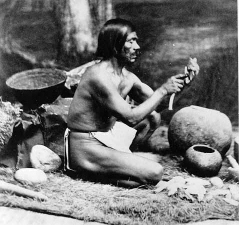
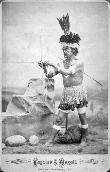
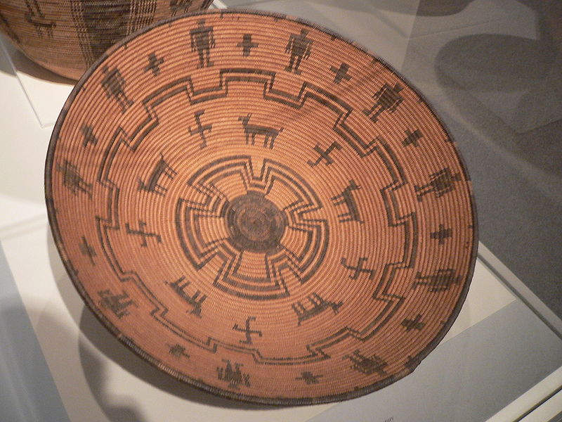
Chumash Indians

The Chumash are a Native American people who historically inhabited the coastal and inland regions of California, particularly the Central and Southern California coastal areas. Their traditional territory includes areas from the Santa Barbara Channel to Malibu. The Chumash are considered part of the Hokan language family.

The Chumash people are known for their complex social organization, advanced maritime technology, and well-developed basketry and rock art. They were skilled fishermen, hunters, and gatherers, relying on the rich marine resources of the Pacific Ocean as well as the diverse plant and animal life in their environment.

The Chumash were organized into chiefdoms, each with its leader, and they lived in villages with plank-built houses. Their society had a sophisticated economic and political structure and traded with neighboring tribes.

With the arrival of Spanish explorers in the 18th century, the Chumash were profoundly affected by European colonization. Spanish missions were established in Chumash territory, leading to changes in their way of life, the introduction of new diseases, and the disruption of their social structures.

Today, Chumash people continue to maintain and revitalize their cultural traditions. Ongoing efforts are to preserve Chumash languages, arts, and traditional knowledge. Some Chumash individuals and communities are also involved in cultural and educational initiatives, including managing tribal museums and interpretive centers that showcase Chumash history and heritage.

The Chumash are recognized as a sovereign tribal nation, and contemporary issues include discussions about tribal governance, land rights, and the broader acknowledgment of indigenous rights in the United States.

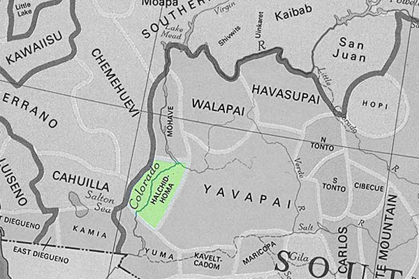
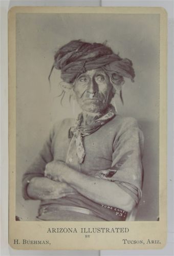
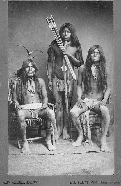
Halchidhoma Indians

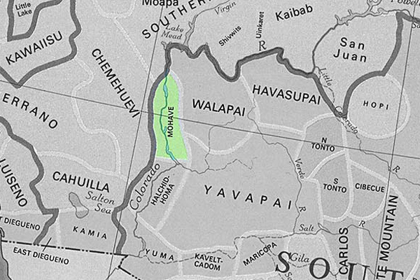
The Halchidhoma (also spelled Halchidoma or Haltchidhoma) was a Native American tribe historically inhabiting the southwestern United States. They were part of the Yuman language-speaking people and lived in the lower Colorado River region, particularly in what is now Arizona and California. The Halchidhoma were closely related to other Yuman-speaking groups, such as the Mojave, Quechan, and Cocopah.

The Halchidhoma people were known for adapting to the desert environment and were skilled at fishing, hunting, and gathering resources in the arid landscape. They utilized the Colorado River for sustenance, catching fish, and utilizing plants for food, medicine, and other purposes.

However, the Halchidhoma tribe faced significant challenges with the arrival of European colonizers and the subsequent westward expansion of the United States. The disruption caused by the influx of settlers, diseases, and conflicts with other Native American groups and European colonists contributed to the decline of the Halchidhoma population.

Over time, the Halchidhoma people faced displacement, and their distinct tribal identity gradually faded. Today, the Halchidhoma are considered one of the many Native American groups whose historical presence has diminished, and their cultural heritage is often studied through archaeological and historical records.

It’s important to note that the history of Native American tribes is complex, and various factors, including interactions with European settlers, government policies, and environmental changes, have shaped their experiences.

Mojave Indians

/mojave-indians/

/blog/?p=3633

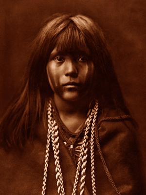
The Mojave are Native American people who traditionally inhabited the Mojave Desert, which spans parts of California, Arizona, Nevada, and Utah in the United States. The Mojave people are part of the larger Yuman language family.

The Mojave are known for their adaptation to the harsh desert environment and their traditional lifestyle as hunter-gatherers. They relied on the diverse resources of the desert, including native plants, seeds, and the hunting of small game. The Colorado River, which flows through their territory, played a significant role in their lives.

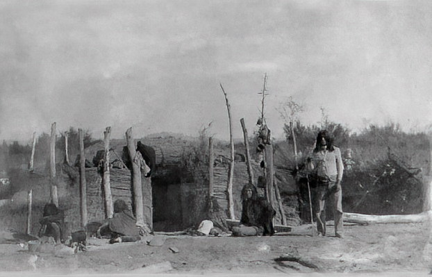
Historically, the Mojave people lived in small family groups and had a strong sense of community. They built dome-shaped houses known as “kish,” their social organization included tribal leaders and spiritual figures.

With European settlers’ arrival and the United States’s expansion in the 19th century, the Mojave, like many other Native American groups, faced significant challenges. European diseases, conflicts over land, and changes in their traditional way of life profoundly affected their population and culture.

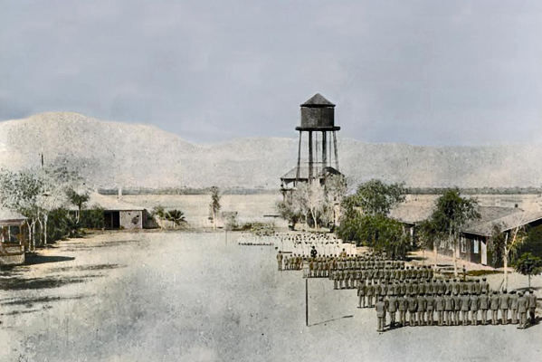
Today, the Mojave people continue to maintain their cultural traditions and have a presence on the Fort Mojave Indian Reservation, which spans parts of California, Arizona, and Nevada. Efforts are underway to preserve the Mojave language, arts, and traditional knowledge. Additionally, like other Native American groups, the Mojave is engaged in discussions about tribal sovereignty, land rights, and broader issues related to recognizing indigenous rights.

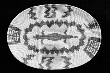
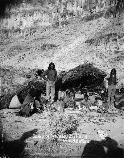
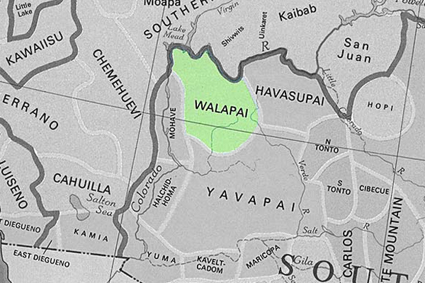
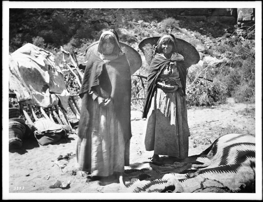
Hualapai Indians

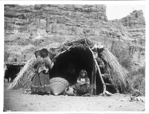
The Hualapai, also spelled Walapai, are a Native American people who traditionally lived in the western part of the United States, primarily in the Hualapai Indian Reservation in northwestern Arizona. They are part of the larger Yuman language family.

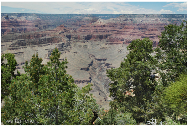
The Hualapai people are known for their strong connection to the Grand Canyon, as a significant portion of their reservation includes parts of the Grand Canyon and the Colorado River. The term “Hualapai” translates to “People of the Tall Pines” in their language, reflecting the importance of the pine forests in their traditional territory.

Historically, the Hualapai were hunter-gatherers, relying on the resources of their diverse environment, including the Grand Canyon, plateaus, and mountainous regions. They hunted game, gathered plants, and engaged in cultural practices that reflected their close relationship with the land.

With the arrival of European settlers and the expansion of the United States, the Hualapai faced challenges such as the loss of traditional lands, conflicts over resources, and changes in their way of life. In the late 19th century, the Hualapai Reservation was established, providing a designated area for the tribe.

Today, the Hualapai people continue to preserve their cultural heritage. The Hualapai Reservation is a popular destination for tourists interested in experiencing the Grand Canyon from the perspective of the Hualapai people. The Hualapai Tribe is also known for managing the Grand Canyon Skywalk, a glass bridge that extends over the Grand Canyon.

Efforts are ongoing to maintain and revitalize the Hualapai language, arts, and traditional knowledge. Like many other Native American groups, the Hualapai are actively engaged in issues related to tribal sovereignty, land rights, and the broader recognition of indigenous rights.

Havasupai Indians

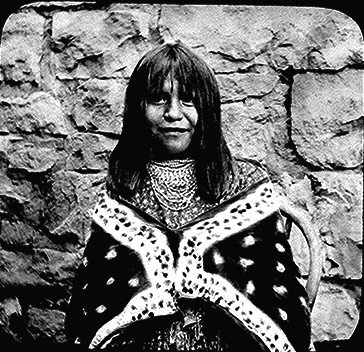
The Havasupai, or Havasu ‘Baaja, are a Native American people who have traditionally lived in the Grand Canyon region of Arizona, particularly in Havasu Canyon. “Havasupai” means “people of the blue-green water,” which reflects the turquoise color of the Havasu Creek that flows through their ancestral lands.

Havasupai’s history and culture include their deep connection to the Grand Canyon, reliance on the area’s natural resources, and their traditional practices as hunter-gatherers. Havasupai people historically hunted game, gathered plants, and engaged in trade with neighboring tribes.

In 1882, the U.S. government established the Havasupai Indian Reservation, which encompasses about 188,077 acres and includes the Havasu Canyon. The reservation is situated within the larger Grand Canyon National Park.

Some notable features of Havasupai land are the Havasu Falls, Mooney Falls, and other waterfalls along Havasu Creek. These natural wonders, known for their striking blue-green waters, attract visitors worldwide.

The Havasupai people maintain cultural traditions, including traditional ceremonies, crafts, and storytelling. The Havasupai language is also preserved within the community.

Tourism plays a significant role in the Havasupai economy, as visitors are allowed to experience the beauty of Havasu Canyon, including its waterfalls and hiking trails. However, the community also faces challenges in maintaining the delicate balance between tourism and preserving cultural and natural resources.

Like other Native American groups, the Havasupai are actively engaged in issues related to tribal sovereignty, land rights, and the broader recognition of indigenous rights.

Cocopah Indians

The Cocopah, or Cocopah Tribe, are a Native American people who traditionally lived along the lower Colorado River in the southwestern United States and northern Mexico. Their homeland includes areas in Arizona and California, as well as the Baja California region of Mexico. The Cocopah are part of the larger Yuman language family.

Historically, the key aspects of Cocopah culture included fishing, hunting, and gathering in the desert and riverine environments. They were skilled in constructing traditional houses called “káak” or “mat káak” made from arrowweed and brush. The Cocopah people have a rich cultural heritage, including traditional songs, dances, and ceremonies.

With the arrival of European settlers, the Cocopah, like many other Native American groups, faced challenges such as changes in their way of life, conflicts, and the loss of traditional lands. The Cocopah Reservation, established in the United States, is located near Somerton in southwestern Arizona.

Today, the Cocopah Tribe is engaged in cultural preservation efforts, including revitalizing the Cocopah language, traditional arts, and ceremonies. The tribe is also involved in economic development initiatives, education, and healthcare programs to benefit its community members.

The Cocopah people maintain a connection to their ancestral lands and the Colorado River, an important aspect of their cultural identity. Issues related to tribal sovereignty, water rights, and the broader recognition of indigenous rights are significant considerations for the Cocopah Tribe.

Quechan Indians

The Quechan also spelled Kwtsaan or Kwtsan, are a Native American people who traditionally inhabited the lower Colorado River Valley, including parts of present-day Arizona and California. The Quechan are part of the larger Yuman language family.

The Quechan people have a rich cultural heritage, including traditional ceremonies, dances, and crafts. They historically relied on the resources of the region, such as fish from the Colorado River, wild plants, and small game.

One of the well-known groups within the Quechan people is the Fort Yuma Quechan Tribe, which is based on the Fort Yuma Indian Reservation. The Fort Yuma Indian Reservation is near the present-day city of Yuma, Arizona, along the Colorado River. The Quechan people have a long history in the region, and their reservation is an important center for preserving and promoting their cultural traditions.

With the arrival of European settlers and the establishment of the United States, the Quechan, like many Native American groups, faced challenges such as the loss of traditional lands, conflicts, and changes in their way of life. However, they have persisted in maintaining their cultural identity and practices.

Today, the Quechan Tribe is actively involved in issues related to tribal sovereignty, land rights, and the broader recognition of indigenous rights. The Fort Yuma Quechan Tribe engages in various cultural and educational initiatives to preserve and revitalize their language, arts, and traditions, ensuring their heritage is passed on to future generations.

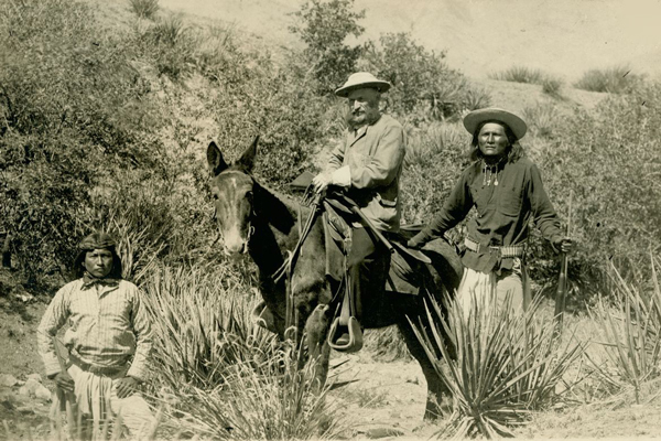
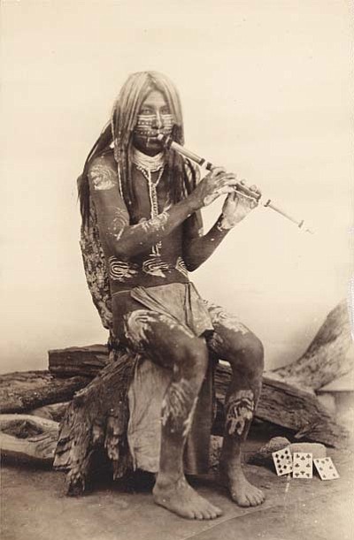
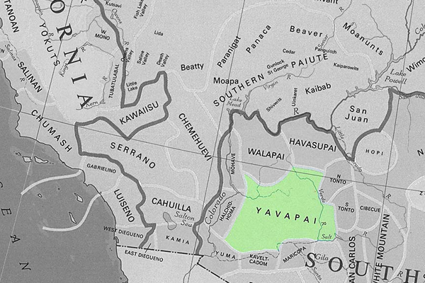
Yavapai Indians

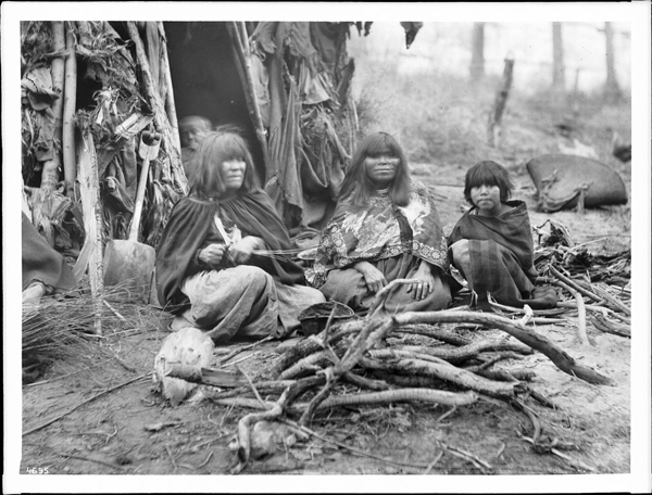
The Yavapai are a Native American people who traditionally inhabited Arizona’s central and western regions in the southwestern United States. Their name is derived from the Yavapai word “Enyaeva,” meaning “people of the sun.” The Yavapai are closely related to the Havasupai, Hualapai, and Apache peoples and share linguistic and cultural ties.

Historically, the Yavapai were semi-nomadic, engaging in hunting, gathering, and some agriculture. They hunted game, gathered plants and seeds, and cultivated crops in the riparian areas along rivers.

With European settlers’ arrival and the United States’ westward expansion, the Yavapai, like many other Native American groups, faced significant challenges. They experienced conflicts with European settlers and the loss of their traditional lands.

The Yavapai people were forcibly removed from their ancestral lands and faced forced marches and resettlements in the late 19th century. This period was marked by hardship and suffering, and many Yavapai people were relocated to the San Carlos Apache Reservation.

Today, the Yavapai-Apache Nation is a federally recognized tribe that represents the descendants of the Yavapai and Apache people. The Yavapai-Apache Nation has reservations near Camp Verde and Clarkdale in Arizona. The tribe is actively involved in cultural preservation, education, and economic development initiatives to ensure the continuation of their heritage.

Efforts are made to revitalize the Yavapai language, traditional arts, and cultural practices. Like many Native American groups, the Yavapai-Apache Nation engages in discussions related to tribal sovereignty, land rights, and the broader recognition of indigenous rights.

Earthquakes

San Juan Capistrano (Wrightwood) 

December 8, 1812 | M7.5

This midmorning earthquake occurred on December 8, 1812, with an estimated magnitude of 7.5 (Mw). The location is uncertain but probably on the San Andreas fault near Wrightwood in San Bernardino County.

This quake is remembered, and named after, its death toll: forty Native Americans attending mass at San Juan Capistrano were killed when the church collapsed due to the mortar in the walls failing. Records from this time are poor, but it is likely that there was also damage at Mission San Gabriel and in San Diego.

1857 Fort Tejon Earthquake

The Fort Tejon earthquake occurred on January 9, 1857, and is one of the largest historical earthquakes in California. It had an estimated magnitude of 7.9 and was associated with the southern segment of the San Andreas Fault

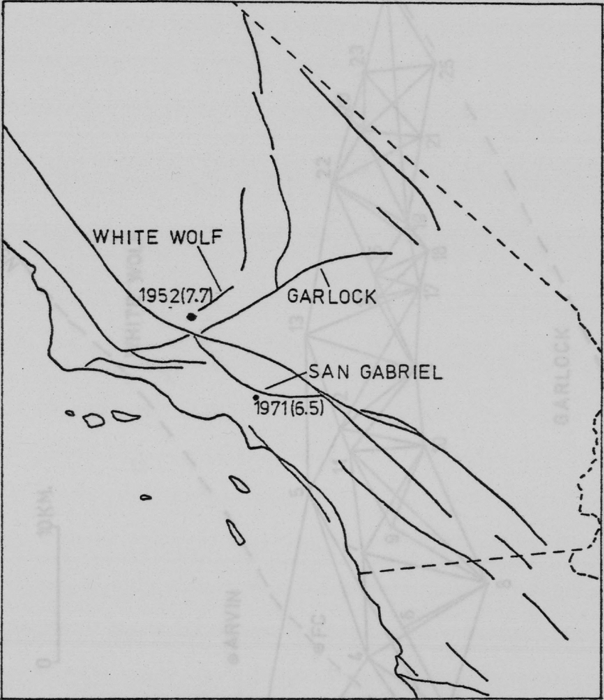
1952 Kern County Earthquake

The 1952 Kern County earthquake occurred in southern California on July 21, 1952. This earthquake had an estimated magnitude of 7.3, making it one of the most powerful earthquakes in California’s history. The epicenter was near the White Wolf Fault in the southern Sierra Nevada mountain range.

1872 Owens Valley Earthquake

The 1872 Owens Valley earthquake was a significant seismic event on March 26, 1872, in Owens Valley, California, USA. The earthquake is estimated to have had a magnitude of 7.4 to 7.9, making it one of the largest historical earthquakes in California.

Cajon Pass 

July 22, 1899 | M5.7

On July 22, 1899, a magnitude 5.7 (ML) earthquake occurred about 15 miles northwest of San Bernardino. People reported feeling this quake in much of Southern California. No deaths were reported, but the number of injuries is uncertain.

The earthquake caused landslides that blocked the Lytle Creek Canyon road and the road through Cajon Pass. It also caused some damage to buildings in San Bernardino, Highland and Patton. Minor damage was also reported in Redlands, Pomona, Riverside, Pasadena and Los Angeles.

Manix

April 10, 1947 | M6.5

On April 10, 1947, a magnitude 6.5 (Mw) earthquake occurred about 25 miles east of Barstow. Because of its remote location, it didn’t cause a lot of damage. However, there were reports of cracked floors and walls, a few collapsed structures, and heavy objects being moved.

This quake was notable because it was the largest earthquake at that time—and the first to cause surface rupture (about three miles of rupture)—in the Mojave Block tectonic region.

Big Bear Earthquake

TYPE OF FAULTING: left-lateral strike-slip
TIME: June 28, 1992 / 8:05:30 am PDT
LOCATION: 34° 12′ N, 116° 49.6′ W 8 km (5 miles) SE of Big Bear Lake 40 km (25 miles) east of San Bernardino
MAGNITUDE: MSS.4

DEPTH: 5 km

While technically an “aftershock” of the Landers earthquake (indeed, the largest aftershock), the Big Bear earthquake occurred over 40 km west of the Landers rupture, on a fault with a different orientation and sense of slip than those involved in the main shock — an orientation and slip which could be considered “conjugate” to the faults which slipped in the Landers rupture.

The Big Bear earthquake rupture did not break the surface; in fact, no surface trace of a fault with the proper orientation has been found in the area. However, the earthquake produced its own set of aftershocks, and from these, we know the fault geometry — left-lateral slip on a northeast-trending fault.

Following the Landers mainshock by three hours (it occurred while TV news coverage of the Landers earthquake was being broadcast live from Caltech), the Big Bear earthquake caused a substantial amount of damage in the Big Bear area, but fortunately claimed no lives. Landslides triggered by the jolt blocked roads in the San Bernardino Mountains, however, aggravating the clean-up and rebuilding process.

1952 Kern County Earthquake

The 1952 Kern County earthquake occurred on July 21, 1952, in southern California. This earthquake had an estimated magnitude of 7.3, making it one of the most powerful earthquakes in California’s history. The epicenter was near the White Wolf Fault in the southern Sierra Nevada mountain range.

Key points about the 1952 Kern County earthquake:

  1. Magnitude and Intensity: The earthquake was 7.3 and is considered a major event. It caused strong shaking in the affected areas.
  2. Location: The epicenter was near Arvin in Kern County, California.
  3. Damage: The earthquake caused significant damage in several communities, including Bakersfield, Tehachapi, and Arvin. Many buildings were damaged, and some were destroyed. Infrastructure, such as roads and bridges, also suffered.
  4. Casualties: The earthquake resulted in 12 fatalities and numerous injuries. The loss of life and property damage were considerable.
  5. Aftershocks: Like many major earthquakes, the 1952 Kern County earthquake was followed by a series of aftershocks, some of which were strong enough to cause additional damage.
  6. Effects on Oil Fields: The earthquake had notable effects on oil fields in the region. The shaking caused ground rupture and surface faulting, impacting oil extraction operations.
  7. Response and Study: The earthquake prompted increased interest and research in engineering and seismology. Lessons learned from the event contributed to advancements in earthquake-resistant building design and seismic hazard assessment.

The 1952 Kern County earthquake was a significant event in the history of seismic activity in California, and it played a role in shaping earthquake preparedness and research efforts in the region.

History of Shoshone, California

Shoshone is a small unincorporated community located in the southeastern part of Inyo County, California, USA. The history of Shoshone is closely tied to the development of the surrounding region, characterized by its desert landscape and proximity to Death Valley.

  1. Native American Presence: Before European settlers arrived, the area around Shoshone was inhabited by various Native American groups, including the Shoshone people, from whom the town takes its name. The Shoshone were a group of indigenous people who traditionally lived in the Great Basin and surrounding areas.
  2. Exploration and Settlement: In the late 19th century, the California desert attracted prospectors and settlers seeking opportunities. In 1880, George Lane discovered a spring in the area, which led to the establishment of Shoshone as a water stop for the Tonopah and Tidewater Railroad in the early 1900s. This made Shoshone an essential point for transportation and commerce.
  3. Mining and Agriculture: The nearby Dublin Gulch and Funeral Mountains attracted miners seeking gold and other minerals. Mining activities contributed to the growth of Shoshone. Additionally, agriculture, particularly the farming of date palms, became important in the region due to the presence of water from natural springs.
  4. Amargosa Opera House: Marta Becket, a dancer and artist, arrived in Shoshone in the 1960s. She renovated and reopened the Amargosa Opera House in nearby Death Valley Junction, which became a cultural hub for the area. The opera house is known for its unique murals and performances.
  5. Tourism and Recreation: Over the years, Shoshone has become a gateway for tourists exploring Death Valley National Park and the surrounding desert landscapes. The town offers services and amenities for visitors, including accommodations, restaurants, and the Shoshone Museum, which showcases the area’s history.
  6. Environmental and Conservation Issues: The region faces water scarcity and environmental conservation challenges. The delicate desert ecosystem requires careful management, and organizations work to balance development with the preservation of natural resources.

Today, Shoshone remains a small community focusing on tourism and outdoor recreation. Its history reflects the broader patterns of development and economic activities that have shaped the desert regions of California. Visitors to Shoshone can explore its historical sites, enjoy the unique desert landscape, and learn about the area’s rich cultural and natural heritage.

Charles Brown at Greenwater

From “Loafing Along Death Valley Trails” by William Caruthers

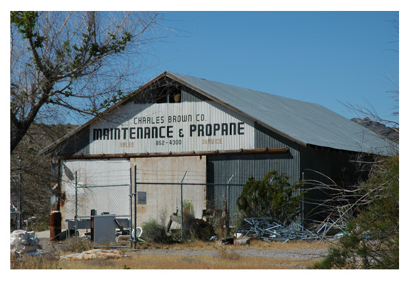
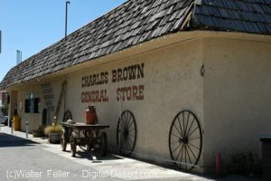
Charles Brown General Store - Shoshone, Ca.
Charles Brown General Store – Shoshone, Ca.

The story of Charles Brown and the Shoshone store begins in Greenwater. In the transient hordes of people that poured into that town, there was one who had not come for quick, easy money. On his own, since he was 11 when he had gone to work in a Georgia mine, he only wanted a job. And he got it. In the excited, loose-talking mob, he was conspicuous because he was silent, calm, and unhurried.

There were no law enforcement officers in Greenwater.  The jail was 150 miles away. Every day was a field day for the toughs in the town. Better citizens decided to do something about it. They petitioned George Naylor, Inyo County Sheriff at Independence, to appoint or send a deputy to keep some semblance of order.

Naylor sent over a badge and a note that said, “Pin it on some husky youngster, who is unmarried and unafraid, and tell him to shoot first.”

The Citizens’ Committee met. ” I know a fellow who answers that description,”  one of them said. ” Steady sort. Built like a panther. Comes from Georgia. Kind slow motion in till he is ready to spring. Name is Brown.”

The badge was pinned on Charles Brown.

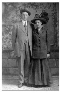
Charles & Stella Brown

Greenwater was a port of call for Death Valley Slim, a character of the Western deserts, who normally was a happy-go-lucky likable fellow. Periodically Slim would fill himself with desert “likker”,  his belt with six guns and terrorized the town.

Shortly after Brown assumed the duties of his office, Slim sent word to the deputy that he was on his way to that place for a little frolic. ” Tell him, ”  he coached

Shortly after Brown assumed the duties of his office, Slim sent word to the deputy that he was on his way to that place for a little frolic. ” Tell him, ”  he coached the messenger, “Sheriffs rile me and he better take a vacation.”

After notifying the merchants and residents, who promptly barricaded themselves indoors, the officer found shelter for himself in Beatty, Nevada.

So Slim only saw empty streets and barge shutters upon arrival.  Since there was nothing to shoot at, he headed through Dead Mead Canyon for Greenwater.  their he found the main street crowded to his liking and the saloons jammed. He made for the nearest, ordered a drink and, whipping out his gun, began to pop the bottles on the shelves. At first blast, patrons made a break for the exits. At the second, the doors and windows were smashed and when Slim holstered his gun, the place was a wreck.

Messengers were sent for Brown, who was at his cabin a mile away. Brown’s stuck a pistol in his pocket and went down. He found Slim in Waddell’s saloon, the town’s smartest.  their Slim had refused to let the patrons leave with the bartenders cowed, the patrons cornered, Slim was amusing himself by shooting alternately at chandeliers, the feet of customers, and the plump breasts of the nude lady featured in the painting behind the bar.  following Brown at a safe distance, was half of the population, keyed for the massacre.

Brown walked in and said “Hello Slim”. ” Fellows tell me you  are hogging all the fun. Better let me have that  gun, hadn’t you?” “Like hell,” Slim sneered, ” I’ll let you have it right through the guts.”

As he raised his gun for the kill, the panther sprung  and the battle was on.  they fought one over the bar room –  standing up, laying down, rolling over –  first one, then the other on top. Tables toppled, chairs crashed. For half an hour they battled savagely, finally rolling against the bar –  both mauled and bloody. There, with his strong vice-like legs wrapped around Slim’s and in arm of steel gripping net and shoulder, Brown slipped irons over the bad man’s wrist. ” Get up,”  Brown ordered as he stood aside, breathing hard.


Greenwater, Ca. ghost town site, Death Valley National Park

Slim rose, leaned against the bar. There was fight still in him and seeing a bottle in front of him, he had seized it with manacled hands, started to lift it.

” Slim,”  Brown said calmly , ” if you lift that bottle, you’ll never lift another.”

The bad boy instinctively knew the look that foretells death and Slim’s fingers fell from the  bottle.

Greenwater had no jail. Brown took him to his own cabin. Leaving the manacles on the prisoner, he took off his shoes and locked  him in a closet.  no man, drunk or sober, he reflected, would tackle barefoot the gravel street littered with thousands of broken liquor bottles.  He went to bed.

He left a bloodstained trail, but at 2 AM he found Slim in a blacksmith shop, having the handcuffs removed. Brown retrieved his shoes and on the return trip, Slim went barefoot. After hog tying the prisoner, Brown chained  him to the bed and went to sleep.

Thereafter, the bad boys scratched Greenwater off their calling list.

Slim attained fame with  Pancho Villa down in Mexico,  became a good citizen and later went east.

-~

A History of American Indians in California:1880-1904


In the 1880s, there was increased public awareness of the problems California Indians were confronting. While the problems were rarely analyzed, many people helped to improve the quality of life for Indians. There was an effort to improve the education of Indians through schools, and to provide them with land to better their economic conditions so that Indians could become full citizens of the United States of America.

In the early 1880s, Helen Hunt Jackson wrote A Century of Dishonor and sent a copy of her book to each United States congressman. She was then appointed to a commission to examine the condition of Indians in Southern California. Her visits resulted in The Report on the Condition and Needs of the Mission Indians of California, by special agents Helen Jackson and Abbot Kinney. The report summarized the problems and concerns of Southern California Indians; many of the conditions outlined in the report, however, were applicable to all California Indians. The report noted that Indians had been continually displaced from their land. She also noted that while many Indians had taken “immoral” paths, others had chosen the responsibilities of herding animals and raising crops. In her report, she also noted that the United States government had done little to right the wrongs of the past. While Jackson did not solve all the problems of Southern California Indians, her work did bring their concerns to the attention of the American public and Congress.

One recurring concern was the lack of education and training necessary for survival in American society. The government, as well as Jackson, saw education as a way of assimilating Indians into the mainstream of United States society. Reports from the Secretary of the Interior and the Bureau of Indian Affairs at that time expressed the goals of the government in relation to the educational process. In 1908, one report stated, “the rooms held three or four each and it was arranged that no two tribes were placed in the same room. This not only helped in the acquirement of English, but broke up tribal and race clannishness, a most important victory in getting Indians toward real citizens.” (Spicer, 1969:235) An earlier report stated, “I can see no reason why a strong government like ours should not govern and control them [Indians] and compel each one to settle down and stay in one place, his own homestead, wear the white man’s clothing, labor for his own support, and send his children to school.” (Spicer, 1969:236) Other people had even stronger ideas. For instance, George Ellis, in his book, The Red Man and the White Man in North America, wrote, “The Indian must be made to feel he is in the grasp of a superior.” (Ellis 1882:572) In opposition to this view, the Indian Rights Association was formed in 1882. This Indian advocate group would play a powerful role in formulating Indian policy in upcoming years.

While the approaches differed, all agreed that education was necessary. “In California, three types of educational programs were established for native peoples. The first was the Federal Government reservation day school. The second type was the boarding school, fashioned after Carlisle. And finally, the nearby public school that allowed Indians to attend began a slow, though steady, increase in popularity among policy makers.” (Heizer, 1978:115) While the public schools seemed the best alternative, most Indians did not have the right to attend these schools until the 1920s.

In 1881, an elementary school system for Indians was established in California. However, the Indians soon recognized that the schools were a threat to their culture, as well as to the tribe as a political unit. “As a result, considerable resistance to the schools developed. Native peoples destroyed the day school at Potrero in 1888, and burned the school at Tule River in 1890. At Pachanga, a Luiseno named Venturo Molido, burned the school and assassinated the school teacher in 1895.” (Heizer, 1978:115) Much of the destruction and violence could have been avoided if the school system and the government had recognized the great importance the Indians placed on being able to maintain their cultural beliefs. In 1891, school attendance was made mandatory. But while attendance was mandatory, there were still Indian children who did not attend.

In 1901, the first Indian hospital in California was established at Sherman Institute in Riverside. Sherman later became a boarding school for Indian children. While hospitals and other facilities improved conditions for California Indians, most Indians were still without homes.

During this period, another major focus was on the acquisition of land for Indians. Probably the most interesting example of the way land was acquired is evidenced by the Yokayo Pomo in 1881: “After collecting nearly $1,000 from their people, the head man selected a 120-acre site near the Russian River and made the down payment. The Yokayo groups prospered; they paid the entire balance owed on their land, and even saved enough to purchase farm machinery shortly thereafter.” (Heizer, 1978:118)

A major tool the government used in trying to assimilate Indians during this time was the General Allotment Act of 1887, also known as the Dawes Act, which appeared to be generally advantageous to Indians. However, the major intent of the act was to break down the role of tribal government. The act itself provided that each Indian living on a reservation would receive a 160-acre allotment of land per family unit, and each single man would receive 80 acres if the reservation had enough land. If there was not enough land, other provisions were made. Indians not residing on a reservation would be entitled to settle on any surveyed or unsurveyed government lands not appropriated. The lands allotted would be held in trust for 25 years by the Bureau of Indian Affairs. If all other provisions of the act were met, that is, if the Indians made use of the lands for agriculture and became self-sufficient, then the land would become the property of the individual. “Native people understood full well the implications of allotment and offered considerable resistance. Nevertheless, the Bureau of Indian Affairs began ordering allotments of various sizes at Rincon, Morongo, and Pala Reservations in 1893. . . . The next year, allotments were begun at Round Valley Reservation. By the turn of the century, 1,614 individual allotments were made among eight reservations in the state.” (Heizer, 1978:117)

Long before the passage of the Dawes Act, people recognized that problems would occur from its implementation. In 1881, Senator Henry Moore Teller of Colorado spoke in opposition to an earlier form of the Allotment Act. Senator Teller concluded, “If I stand alone in the Senate, I want to put upon the record my prophecy in this matter, that when 30 or 40 years shall have passed and these Indians shall have parted with their title, they will curse the hand that was raised professedly in their defense to secure this kind of legislation, and if the people who are clamoring for it understood Indian character and Indian laws, and Indian morals, and Indian religion, they would not be here clamoring for this at all.” (Spicer, 1969:234) The senator would soon be proven correct.

Other Indians, such as the Cupenos from Warner Springs, chose to fight for their lands in the courts. With the assistance of the Indian Rights Association, they began a suit to stop their eviction from their home at the Warner Ranch. In 1888, they won a favorable decision which temporarily stopped their eviction. However, the case was appealed to the United States Supreme Court, and in 1903, the Cupenos were evicted from their home.

Still, other Indians chose to purchase land that was once theirs and reside on it. However, not every transaction was fair. In 1904, the San Francisco Chronicle reported that Indians who bought land from Whites were being dispossessed by the heirs of the granters, who gave no valid titles. “The Northern California Indian Association reported that about 10,000 Indians lived on land to which whites hold title. They were subject to eviction ‘at any time.’ The Indians are recognized for what they are not, usually competent to compete with white men in economic struggle. . . . Congress should buy lands for Indians in locations where they now are and allot them small farms in severalty. . . . It is also asked that their status as to citizenship be satisfactorily established. This petition is now before congress. It should be granted for justice and honesty. . . .” (San Francisco Chronicle, 1904).

The struggle for homes would continue.

https://www.nps.gov/parkhistory/online_books/5views/5views1d.htm

Malki Museum

A History of American Indians in California:HISTORIC SITES


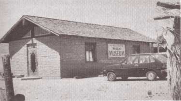
Malki Museum
Riverside County

The Malki Museum is located on the Morongo Indian Reservation on Fields Road near the town of Banning, California. It is constructed of adobe bricks, and is approximately 30′ x 50′ x 12′ in size. Display cases house cultural objects made by Indians from the surrounding area, while the museum grounds include several brush arbors and a botanical garden. Both the museum and its grounds are well attended.

The Malki Museum was constructed in 1965 by the Cahuilla Indians and serves to preserve and enhance Cahuilla Indian lifeways. Its cultural exhibits relate the story of the Cahuillas from the pre-contact period to the present. Malki was also the first home for a publishing company, the Ballena Press, which has expanded its services to include ethnographic and ethnohistoric information and analysis of southwestern tribes.

The Malki Museum was the first Indian controlled and operated museum in California. As such, it is an important example to other Indian groups who are interested in preserving their material culture through a museum. Although the idea of an Indian Museum operated by Indian people seems like an obvious and natural development, it should be remembered that it takes dedicated people to actually accomplish such a task. Malki is a living example of an Indian people’s ability to adapt to the fast-changing circumstances that surround their cultural heritage. It will serve future generations by providing them with a glimpse into the rich and beautiful history of the Cahuilla people.

https://www.nps.gov/parkhistory/online_books/5views/5views1h46.htm

Tejon Indian Reservation

A History of American Indians in California: HISTORIC SITES


Tejon Indian Reservation
Kern County

In the early 1800s, Indians in the interior of California began to feel the effects of trappers and explorers. By mid-century, coastal Indians who moved inland following the breakup of the missions also suffered under the influx of miners and settlers. When the federal government sent Indian agents to write treaties with California Indians, Agent George W. Barbour negotiated the treaties with both interior and coastal Indians in the southern San Joaquin Valley. In return for the promise of goods, annuities, and land, the Indians vacated much of their home land.

In February of 1852, President Millard Fillmore submitted 18 California Indian treaties to the United States Congress for ratification, but the California delegation objected, complaining that the treaties provided too much good land for the Indians. Congress failed to ratify the treaties but did make some provisions for California Indians.

Edward F. Beale was appointed Superintendent of Indian Affairs for California in April 1852. Upon arrival in September, Beale toured the state to determine the status of California Indians. He reported in February 1853 that “our laws and policy with respect to Indians have been neglected or violated. . . . [The Indians] are driven from their homes and deprived of their hunting-grounds and fishing-waters at the discretion of the whites. . . .” Beale requested $500,000 for military reservations where both soldiers and Indians would reside.

Beale hired H. B. Edwards to start farming operations at Tejon and the San Joaquin River. On March 2, 1853, Congress appropriated $250,000 for five reservations, not to exceed 25,000 acres each, to be located on public lands, with good land, wood, and water. In September, Beale expanded the Tejon Farm into the first California reservation.

To gain support for his efforts, Beale named the reservation after Senator William Sebastian, Chairman of the Indian Affairs Committee. The Sebastian Indian Reservation, more commonly known as Tejon Indian Reservation, was located in the southern end of the San Joaquin Valley, “between Tejon Vaquero Headquarters and Canada de las Uvas. . . .” (Latta, 1977:736)

Tejon was located on a Mexican land grant rather than on public land, but Beale argued that no public lands were available and that the unoccupied grant could be purchased if necessary. Beale’s primary reason for choosing Tejon was the presence of mission-trained Indians with agricultural skills, more likely to succeed on a reservation.

Despite substantial opposition, Beale continued to gather Indians and move them to Tejon. In early 1854, he reported 2,500 Indians at Tejon and 2,650 acres under cultivation. Beale’s arguments for a reservation of 75,000 acres failed, and in July 1854, he was replaced by Thomas J. Henley.

When Henley took charge, he noted only 800 Indians, with fewer than 350 present at one time, and only 1,500 acres under cultivation, indicating that numbers of Indians and amount of acreage under cultivation had been inflated. Most of the crops failed that year because of drought. Henley started the Tule River Farm to supplement the reservation’s food, but the Indians still had to gather native foods and the government had to bring in more supplies in order to feed the reservation population. Throughout the reservation’s existence, drought, insects, and crop disease undermined the attempts at farming.

In November of 1856, the reservation was reduced to 25,000 acres. That year, 700 Indians were reported residing on the reservation and 700 acres were under cultivation. By 1859, Henley had been replaced.

In addition to crop failure, the reservation faced loss of the land when the land grant claim was upheld in court. Settlers also encroached on the unsurveyed and unfenced land, allowing cattle and sheep to eat reservation crops. During the 1863 drought year, all the crops were lost except for 30 tons of hay.

Meanwhile, former agent Edward F. Beale had purchased five contiguous ranchos in the Tejon area, including the reservation land, and was raising 100,000 sheep. In 1863, he offered to lease 12,000 acres to the government for a dollar an acre, but withdrew the offer when he found that the government planned to move Owens River Indians there. He noted that he had made the offer only because Indians already on the reservation were his friends.

Jose Pacheco, a Tejon leader, wrote to General Wright on April 16, 1864, “I should not have troubled you with this letter, Dear General, did I not think the agents here had wronged us. You and our great father at Washington do not know how bad we fare, or you would give us food or let us go back to our lands where we can get plenty of fish and game. I do not think we get the provisions intended for us by our Great Father; the agents keep it from us, and sell it to make themselves rich, while we and our children are very poor and hungry and naked.” (Sacramento Union, April 28, 1964)

The reservation was ordered closed in June 1864, and on July 11, Austin Wiley wrote, “I have the honor to inform you that all the Indians on the Tejon Farm and in the vicinity of Fort Tejon, some two hundred in number, have been removed from there to the Tule River farm.” Wiley noted that there was no food for the Indians at Tejon.

Shortly thereafter, D. N. Cooley, Commissioner of Indian Affairs, summarized the reasons for the reservation’s failure: “The lack of legal title to the land severely restrained investment in construction and development, leaving the reserve and the Indians on it in a state of constant uncertainty. The ideal of converting Indians from food gathering to settled agriculture was never realized.”

(Note: Unless otherwise specified, all above quotes are from government reports as cited in California Department of Parks and Recreation reference document No. 169, “Tejon Indian Reservation.”)

https://www.nps.gov/parkhistory/online_books/5views/5views1h92.htm

Fort Tejon Road


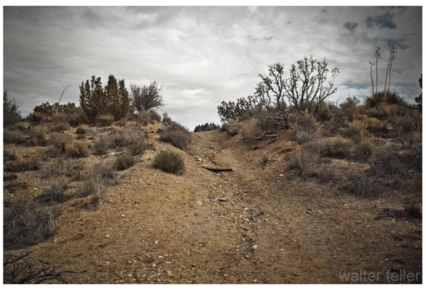
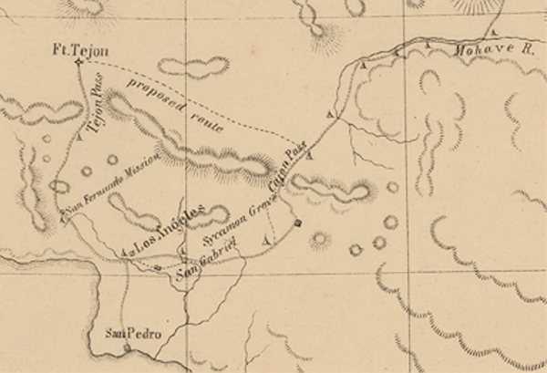
Fort Tejon Road refers to a historic route in California that leads to Fort Tejon State Historic Park. Fort Tejon was established in 1854 and served as a military outpost during the turbulent times of the 19th century, addressing issues related to the Gold Rush and conflicts with Native American tribes.

The fort is located in the Grapevine Canyon, part of the Tehachapi Mountains in Kern County. The Fort Tejon Road provides access to the park and passes through scenic landscapes. The area is known for its historical significance and is a popular destination for those interested in California’s history.

1855

Visitors to Fort Tejon State Historic Park can explore the well-preserved buildings, learn about the fort’s history through exhibits, and participate in various events and demonstrations. The park is managed by the California Department of Parks and Recreation and serves as a reminder of the state’s military and cultural history during the mid-19th century.

Desert Studies Center – Zzyzx

/zzyzx/

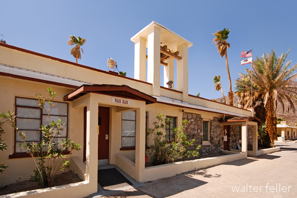
Main Building – Desert Studies Center

Zzyzx, pronounced “zy-zicks,” is a unique and intriguing place in the Mojave Desert of Southern California, USA. Specifically, it is home to the Desert Studies Center, operated by the California State University (CSU) system. The center serves as a field station for research and education focused on the desert ecosystem.

Here are some key points about Zzyzx and the Desert Studies Center:

  1. Location: Zzyzx is approximately 100 miles northeast of Los Angeles, near Baker, California. The Desert Studies Center is part of the larger California State University system and is used for academic and research purposes.
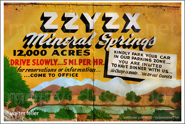
  2. History: The name “Zzyzx” was given to the area by Curtis Howe Springer, a self-proclaimed medical doctor and radio evangelist who established the Zzyzx Mineral Springs and Health Spa in the 1940s. The name was created to be the last word in English, and Springer intended to use it for marketing purposes. However, in 1974, the Bureau of Land Management (BLM) reclaimed the land, which became the site of the Desert Studies Center.
  3. Desert Studies Center: A research and educational facility jointly operated by the California State University system. It provides a base for researchers, students, and educators interested in studying the unique ecology and geology of the Mojave Desert. The center offers facilities for field courses, workshops, and research projects related to desert studies.
  4. Facilities: The Desert Studies Center has dormitories, classrooms, laboratories, and other amenities to support researchers and students. It serves as a hub for scientific exploration and learning about the challenges and adaptations of life in desert environments.
  5. Research: Researchers at the Desert Studies Center focus on various topics, including desert ecology, geology, climate, and biodiversity. The unique characteristics of the Mojave Desert make it an ideal location for studying desert ecosystems and understanding how plants, animals, and microorganisms have adapted to this arid environment.

Visitors to the Desert Studies Center can explore the surrounding Mojave Desert, learn about its flora and fauna, and gain insights into the challenges and opportunities presented by desert ecosystems. It’s a valuable resource for those interested in environmental science, ecology, and desert studies.

Lake Tuendae

/blog/curtis-howe-springer-and-the-complicated-story-of-zzyzx/

Paleontology

PALEONTOLOGY – Mojave Desert – Glossary of Terms and Definitions

mojavedesert.net › glossary › paleontology

The study of fossils and their relation to geologic time. … Paleontology Miocene fossils have been found in the cliffs of Red Rock Canyon. Scientists continue …

Mojave Desert Paleontology

The study of fossils and their relation to geologic time.

Paleontology in Red Rock Canyon

Wrightwood, Ca. Mountain Hardware Wrightwood, Ca. Canyon Cartography · DesertLink. Links to Desert Museums, Grizzly Cafe Family Dining …

Geology of the Mojave River

digital-desert.com › mojave-river › geology

The river flows below the surface for much of its length and only intermittently at the surface. The Mojave River, an arid desert lifeline, supplies water and …

Fossils, Rocks, and Time: Fossils and Rocks

digital-desert.com › paleontology › fossils-rocks

Geology : Paleontology. FOSSILS AND ROCKS. To tell the age of most layered rocks, scientists study the fossils these rocks contain. Fossils provide important …

Red Rock Canyon California State Park

digital-desert.com › red-rock-canyon

Red Rock Canyon State Park, Mojave California, Mojave Desert.

Fossils, Rocks, and Time: The Relative Time Scale

digital-desert.com › paleontology › relative

Geology : Paleontology. THE RELATIVE TIME SCALE. Long before geologists had the means to recognize and express time in numbers of years before the present …

Fossils, Rocks, and Time: The Numeric Time Scale

digital-desert.com › paleontology › numeric

Geologic time scale showing both relative and numeric ages. Ages in millions of years are approximate. Nineteenth-century geologists and paleontologists …

Fossils, Rocks, and Time: Fossil Succession

digital-desert.com › paleontology › succession

Geology : Paleontology. FOSSIL SUCCESSION. Three concepts are important in the study and use of fossils: (1) Fossils represent the remains of once-living …

Fossils, Rocks, and Time: Putting Events in Order

digital-desert.com › paleontology › order

Geology : Paleontology. PUTTING EVENTS IN ORDER. Scientists who study the past try to put events in their proper order. When we discuss events that happened …

Fossils, Rocks, and Time: Table of Contents

digital-desert.com › paleontology › index-frt

Geology : Paleontology. FOSSILS, ROCKS, AND TIME. INTRODUCTION. We study our Earth for many reasons: to find water to drink or oil to run our cars or coal …

FOSSIL – Mojave Desert – Glossary of Terms and Definitions

mojavedesert.net › glossary › fossil

The Fossil Canyon Loop Road is an interesting route for vehicle touring. … Mojave Desert Paleontology The study of fossils and their relation to geologic …

Fossils, Rocks, and Time: Rocks and Layers

digital-desert.com › paleontology › rocks-layers

Geology : Paleontology. ROCKS AND LAYERS. We study Earth’s history by studying the record of past events that is preserved in the rocks. The layers of the …

Mojave Desert – Scavenger

mojavedesert.net › glossary › scavenger

Paleontologists are … Raven – Desert Wildlife. Raven – Raven Also see > Bird: Omnivore : Scavenger: Predator: Diurnal Mammals – Predators Mountain Lion · …

Mojave Desert Geology

digital-desert.com › geology

Paleontology. The scientific study of prehistoric plants and animals in their geologic context. Alluvial material in dry wash. Dry Lake – Playa Desert Varnish …

Red Rock Canyon – Mojave California

digital-desert.com › red-rock-canyon › introduction

Located in the southern El Paso Mountains, these colorful cliffs with their stark beauty and unique features have attracted hikers, geologists, paleontologists, …

Cajon Pass Geology

digital-desert.com › cajon-pass › geology

Pliocene and Pleistocene evolution of the Mojave River, and associated tectonic development of the Transverse Ranges and Mojave Desert, based on borehole …

Dr. Joan S. Schneider

mojavedesert.net › people › schneider-joan

Mojave Desert History > Names in History. Dr. Joan S. Schneider. Photo of Dr Joan Schneider at Joshua Tree National Park Joan S. Schneider, Ph.D.

ANTIQUITIES – Mojave Desert – Glossary of Terms and Definitions

mojavedesert.net › glossary › antiquities

ANTIQUITIES – A general term for archaeological or paleontological resources which are at least 100 years of age and which tangibly represent or have the …

Lake Mead

digital-desert.com › lake-mead

Three of America’s four desert ecosystems–the Mojave, the Great Basin, and the Sonoran Deserts–meet in Lake Mead NRA. As a result, this seemingly barren area …

References – Mojave Preserve – California Mojave Desert

digital-desert.com › mojave-preserve › geology

Hewitt, D.F., 1956, Geology and mineral resources of the Ivanpah quadrangle, California and Nevada: U.S. Geological Survey Professional Paper 275, 172 p.

The Grand Canyon

digital-desert.com › grand-canyon

Grand Canyon National Park, a World Heritage Site, encompasses 1,218,375 acres and lies on the Colorado Plateau in northwestern Arizona. The land is semi-arid …

RELATIVE DATING – Mojave Desert – Glossary of Terms and …

mojavedesert.net › glossary › relative-dating

RELATIVE DATING – A method of dating rock layers by their relationships or proximity to each other. Both archaeologists and paleontologists use relative dating.

Elizabeth Campbell

mojavedesert.net › people › campbell-elizabeth

Elizabeth Campbell. Photo of Elizabeth Campbell, Mojave Desert archeologist. NPS photo – colorized. Elizabeth Warder Crozer was born in August of 1893 into a …

Grand Canyon natural environments

digital-desert.com › grand-canyon › natural

Near the Colorado River, riparian vegetation and sandy beaches prevail. Just above the river corridor a desert scrub community exists complete with a wide …

Kokoweef Caves

mojavedesert.net › desert-fever › kokoweef

Kokoweef and the mysterious river of gold in the Mojave Desert.

Cajon Pass Heritage

digital-desert.com › cajon-pass › cajon-fs-heritage

Heritage resources in the Cajon Pass region of the Mojave Desert.

Mojave Desert – Glossary of Terms and Definitions

mojavedesert.net › glossary

Mojave Desert Glossary. The following definitions may be helpful. In most instances, they may not be specific to, or, all-inclusive of, the Mojave Desert.

Kokoweef

digital-desert.com › kokoweef

If there were what may be trillions of dollars in gold lying at the bottom of an ‘unrediscovered’ river running from the Great Basin under the Mojave Desert to …

Rainbow Basin

digital-desert.com › rainbow-basin

Land ownership status can be found on the “Cuddeback Lake” Desert Access Guide. These BLM maps can be purchased from any California Desert District BLM …
1872 Owens Valley Earthquake

/owens-valley/

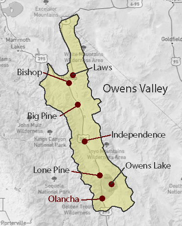
The 1872 Owens Valley earthquake was a significant seismic event on March 26, 1872, in Owens Valley, California, USA. The earthquake is estimated to have had a magnitude of 7.4 to 7.9, making it one of the largest historical earthquakes in California.

Some key points about the 1872 Owens Valley earthquake:

  1. Location: The earthquake’s epicenter was near Lone Pine in Owens Valley, in eastern California, near the eastern Sierra Nevada mountain range.
  2. Effects: The earthquake caused extensive damage in the Owens Valley region. The town of Lone Pine suffered the most severe damage, with many buildings collapsing. In addition to the structural damage, the earthquake triggered ground ruptures, creating surface faulting along the eastern Sierra Nevada.
  3. Surface Rupture: The earthquake is notable for the significant surface rupture that occurred along the Owens Valley fault. This rupture extended for about 30 miles (48 kilometers) and displaced the ground horizontally by as much as 15 feet (4.5 meters). This surface rupture remains visible today as a scar on the landscape.
  4. Aftershocks: Numerous aftershocks followed the mainshock, continuing for several months. These aftershocks contributed to ongoing damage and hampered recovery efforts.
  5. Impact on the Landscape: The earthquake caused changes to the landscape, including the formation of new fault scarps and the uplifting of land along the eastern Sierra Nevada. These changes are still studied by geologists today.
  6. Historical Significance: The 1872 Owens Valley earthquake is historically significant in the study of seismic activity in California. It provided valuable data for understanding the behavior of faults and the effects of large earthquakes on the landscape.

It’s worth noting that the Owens Valley region remains seismically active, and scientists continue studying the area to understand future earthquakes’ potential better. The 1872 event serves as a reminder of the seismic hazards associated with the complex fault systems in California.

Lone Pine

Owens Valley

Eastern Sierra Nevada

Mormon Rocks

/mormon-rocks/

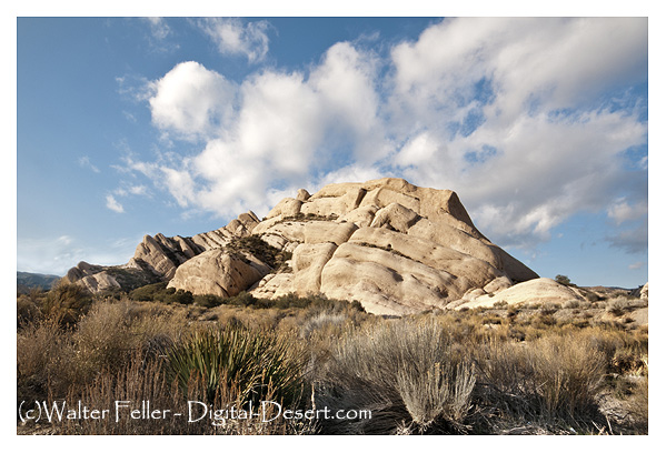
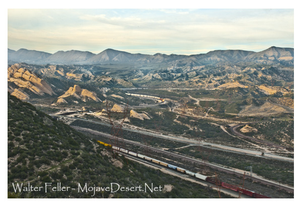
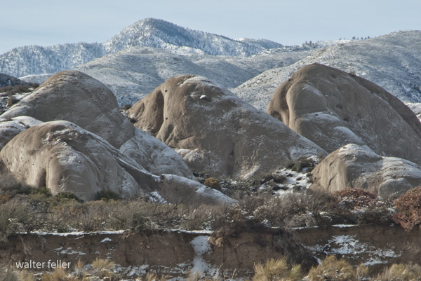
The Mormon Rocks, also known as the Rock Candy Mountains, are a series of distinctive sandstone outcrops in the Cajon Pass, a mountain pass in the San Bernardino Mountains of Southern California. The Cajon Pass is a critical transportation corridor connecting the Los Angeles Basin with the Mojave Desert and beyond.

Here are some key points about Mormon Rocks and their significance:

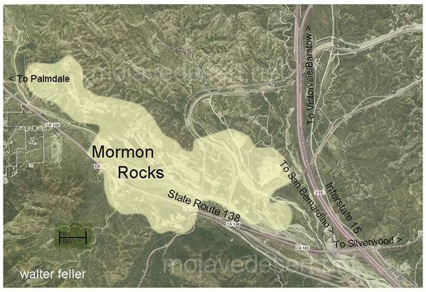
  1. Location: The Mormon Rocks are within the Cajon Pass, traversed by Interstate 15 and several major railroad lines. The rocks are easily visible from the highway, making them a notable geological feature.
  2. Geological Formation: The rocks are sedimentary sandstone and formed through tectonic and erosional processes over millions of years. The distinctive red and white banded appearance is due to iron oxide (hematite) and other minerals.
  3. Cultural Significance: The Mormon Rocks have cultural and historical significance. The area is named after a group of Mormon pioneers who passed through the Cajon Pass in the mid-19th century during their westward migration. The rocks are a prominent landmark in the pass and have been featured in various forms of media.
  4. Recreational Opportunities: The area around Mormon Rocks provides outdoor activities and recreation opportunities. There are trails and viewpoints where visitors can appreciate the geological formations and enjoy scenic views of the surrounding landscape.
  5. Conservation: The Mormon Rocks are part of the San Bernardino National Forest, and efforts are made to preserve and protect the natural and cultural resources in the area.
  6. Railroad Transportation: The Cajon Pass is a crucial route for road and rail traffic. The presence of the rocks adds to the landscape’s visual appeal and has made the pass a notable location for train enthusiasts who enjoy watching trains navigate the steep grades of the pass.

Whether you are interested in geology, history, or simply enjoying scenic landscapes, the Mormon Rocks in the Cajon Pass offer a unique and visually striking destination. If you plan to visit, be sure to follow any posted regulations and respect the natural environment.

Tejon Ranch

/beale-adobe/

The Tejon Ranch, located in California, has a rich and varied history that spans centuries.

Tejon Ranch Headquarters

Here is an overview of its history:

  1. Native American Presence: The area around Tejon Ranch was originally inhabited by Native American communities, including the Kitanemuk people. These indigenous groups had a deep connection with the land, relying on its resources for their sustenance.
  2. Spanish Era: With the arrival of Spanish explorers and missionaries in the 18th century, the Tejon Ranch area became part of the vast landholdings of the Spanish missions and the California missions system. The land was used for cattle ranching and agriculture to support the missions.
  3. Mexican Land Grants: Following Mexico’s independence from Spain in 1821, the Mexican government began granting large tracts of land, including the Tejon Ranch, to private individuals. The Rancho El Tejon was granted to José Antonio Aguirre in 1843.
  4. Gold Rush and Transition: The California Gold Rush of 1848-1855 brought significant changes to the region. The influx of people seeking gold and the economic and political shifts associated with the U.S.-Mexican War led to the end of Mexican land grants. 1852, the U.S. government affirmed the land grant, and Benjamin and James Roberts acquired the Rancho El Tejon.
  5. Ranching and Agriculture: The Tejon Ranch became a center for ranching and agriculture. Cattle ranching, farming, and other activities flourished on the vast expanse of land. The ranch was crucial in supplying beef and other products to growing communities in Southern California.
  6. Treaty of Fort Tejon: In 1854, the U.S. government negotiated the Treaty of Fort Tejon with various Native American tribes, including the Kitanemuk. However, the treaty was not fully implemented, leading to conflicts and struggles for the indigenous people.
  7. Railroad Development: The Southern Pacific Railroad played a significant role in developing the Tejon Ranch. In the late 19th century, the railroad bypassed the Tehachapi Mountains, where the ranch is located, favoring a route through the nearby Tehachapi Pass. This decision affected the economic growth of the Tejon Ranch region.
  8. 20th Century and Beyond: The Tejon Ranch underwent various ownership and land use changes. In the 20th century, it evolved into a diversified operation involving agriculture, ranching, and commercial activities. The Tejon Ranch Company, established in the early 1900s, was key in managing and developing the property.

Today, the Tejon Ranch remains one of the largest privately-owned ranches in California, known for its conservation efforts, including partnerships with environmental organizations to preserve significant portions of the land as open space. The ranch’s history reflects the broader historical and cultural shifts in California, from indigenous habitation to Spanish colonization, Mexican land grants, and the economic transformations of the 19th and 20th centuries.

E.F. Beale and the Tejon Ranch

Edward Fitzgerald Beale, often referred to as E.F. Beale, played a significant role in the history of the Tejon Ranch.

Tejon Ranch – La Liebre Rancho

Here’s an overview of his connection to the ranch:

  1. Military Career: E.F. Beale was born in 1822 and had a distinguished military career. He served as a lieutenant in the U.S. Navy and later became Superintendent of Indian Affairs in California and Nevada.
  2. Surveyor and Explorer: In the 1850s, Beale was appointed by the U.S. government to survey and explore a wagon road along the 35th parallel from Fort Defiance in Arizona to the Colorado River. This expedition, known as the Beale Wagon Road, aimed to improve transportation and communication between the East and the newly acquired territories in the West.
  3. Tejon Ranch and the Wagon Road: The Beale Wagon Road passed through the Tejon Ranch, linking Fort Tejon to the Colorado River. Beale recognized the strategic importance of the Tejon Pass for transportation routes and recommended it as a route for the railroad.
  4. Land Acquisition: In 1861, Beale purchased the Rancho El Tejon, which included the Tejon Ranch. He acquired the property from the prominent rancher General Edward Beale Tracy. E.F. Beale engaged in various agricultural and ranching activities on the land.
  5. Conservation and Agriculture: Beale was not only interested in ranching but also in conservation. He introduced various agricultural improvements to the ranch, including cultivating wheat and vineyards. Beale also advocated for land conservation and recognized the need to protect natural resources.
  6. Tejon Ranch Company: In the early 20th century, the Tejon Ranch changed ownership and management. The Tejon Ranch Company was established in 1936, and E.F. Beale’s descendants were involved in the company’s operations.
  7. Legacy: E.F. Beale’s legacy is intertwined with the history of the Tejon Ranch. His contributions to the development of transportation routes, his role in the acquisition of the ranch, and his efforts in both ranching and conservation have left a lasting impact on the region.
Tejon Ranch winter quarters

Today, the Tejon Ranch remains a significant property in California, known for its historical, cultural, and environmental importance. The Tejon Ranch Company continues to manage the property, balancing agricultural activities with conservation initiatives and partnerships to preserve large portions of the land as open space.

A Yucca Moth and its Yucca

https://mojavedesert.net/plants/

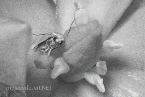
The relationship between a yucca moth and a yucca plant is a classic example of mutualism, a symbiotic relationship where both species benefit. Yucca moths and yucca plants have coevolved over millions of years, and their interaction is highly specialized.

  1. Pollination:
    • Yucca Moths: Female yucca moths play a crucial role in pollination. They are equipped with specialized mouthparts called maxillae, which they use to collect and carry pollen. The female moth visits the flowers of the yucca plant to lay her eggs.
    • Yucca Plants: Yucca plants rely on yucca moths for pollination. The female moth collects pollen from one yucca flower and then deposits it on the stigma of another flower while laying her eggs. This ensures cross-pollination, facilitating genetic diversity in the yucca plant population.
  2. Egg-Laying and Larval Development:
    • Yucca Moths: The female moth deposits her eggs inside the ovaries of the yucca flowers. She uses specialized structures called ovipositors, which also transfer the pollen. The eggs hatch into larvae.
    • Yucca Plants: The yucca plant provides a place for the yucca moth to lay eggs, and the developing larvae feed on some of the developing seeds within the yucca fruit. The yucca plant sacrifices a small portion of its seeds to nourish the larvae.
  3. Specificity and Coevolution:
    • The relationship between yucca moths and yucca plants is highly specific. Each species of yucca plant is typically associated with a specific species of yucca moth.
    • This specificity has arisen through coevolution, where the traits of each species have adapted to complement the other. Yucca moths have evolved to be efficient pollinators of yucca plants, while yucca plants have developed features that attract and support yucca moths.
  4. Obligate Mutualism:
    • The relationship is often considered an obligate mutualism, meaning each species depends on the other for reproduction. Yucca moths rely on yucca plants for a place to lay their eggs, and yucca plants rely on yucca moths for effective pollination.
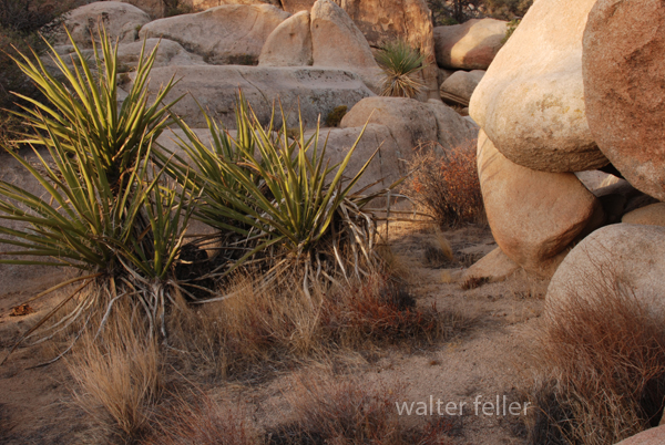
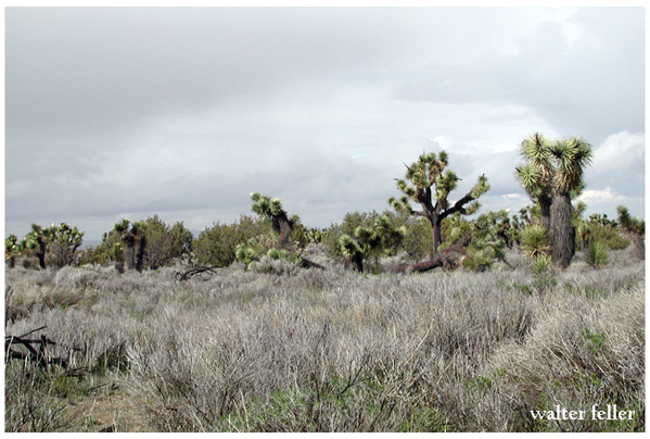
Yucca schidigera

This intricate relationship between yucca moths and yucca plants highlights the fascinating ways organisms can evolve together, developing mutual dependencies crucial for their survival and reproduction.

Yucca brevifolia

Saline Valley Salt Tram

/saline-valley/salt-tram/

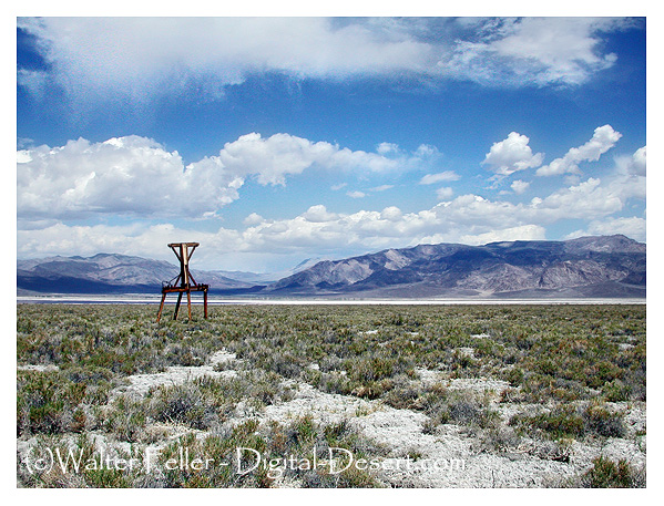
Photo of tramway tower in Saline Valley

The Saline Valley Salt Tram, also known as the Saline Valley Tramway, is a historic tramway system used to transport salt from the Saline Valley in California, USA. The Saline Valley is located within the Death Valley National Park.

The tramway was constructed in the early 20th century to facilitate the transportation of salt from the salt flats in the Saline Valley to the Owens Valley. The system consisted of cables and tramcars that carried salt over the Inyo Mountains. The salt was then transported to market via the Owens Valley.

The operation of the Saline Valley Salt Tram ceased in the mid-20th century, and the tramway itself has since fallen into disuse and disrepair. The remnants of the tramway, including some of the infrastructure and cables, can still be found in the Saline Valley. The area attracts historians, hikers, and those interested in exploring the remnants of historical infrastructure.

Ghost Towns & Sites in the Mojave Desert

/ghost-towns/

The Mojave Desert in the southwestern United States is home to several ghost towns and abandoned sites that reflect the region’s history of mining, ranching, and other activities.

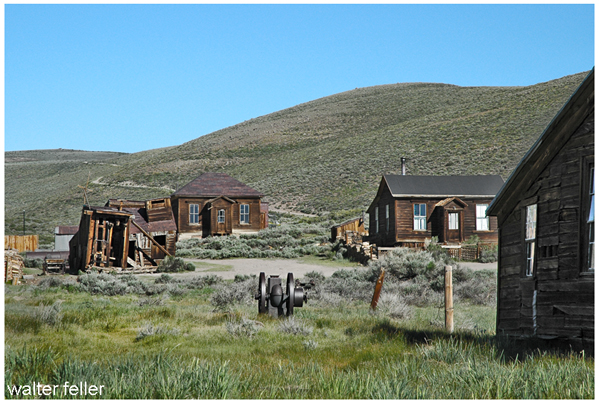
Bodie Ghost Town

Here are some notable examples:

  1. Calico Ghost Town:
    • Located near Barstow, California, Calico is one of the most famous ghost towns in the Mojave Desert. It was a silver mining town in the 1880s and 1890s. Today, Calico is a county park and tourist attraction with preserved buildings and mining equipment.
  2. Rhyolite:
    • Near Death Valley in Nevada, Rhyolite was a bustling gold mining town in the early 20th century. It had a population of several thousand people at its peak. The town had schools, banks, and even an opera house. However, it declined rapidly, and now visitors can explore the ruins of its former glory.
  3. Ballarat:
    • In California near the Panamint Mountains, Ballarat was a supply town for the nearby mines in the early 20th century. It is known for its association with the infamous outlaw Charles Manson, who briefly stayed in the area.
  4. Bodie:
    • Although technically not in the Mojave Desert (in the Eastern Sierra region), Bodie is worth mentioning. This well-preserved ghost town was a gold mining boomtown in the late 19th century. It’s now a state park; visitors can explore the abandoned buildings and artifacts.
  5. Panamint City:
    • Nestled in the Panamint Range of California, Panamint City was a silver mining town that thrived in the late 19th century. The town’s remote location contributed to its decline and was abandoned by the early 20th century. The site is accessible by hiking, and some structures remain.
  6. Cima:
    • Cima is a small ghost town in the Mojave National Preserve in California. It was a mining and railroad town in the early 20th century. While most of the buildings are gone, the area still has some remnants of its past.
  7. Ivanpah:
    • Ivanpah, located in California, was a mining town that saw activity in the late 19th and early 20th centuries. Today, only a few structures remain, including stamp mill ruins.
Building in Cima ghost town in Mojave Preserve
Cima Ghost Town

Exploring these ghost towns and abandoned sites provides a fascinating glimpse into the history of the Mojave Desert and the people who once inhabited these remote areas. Keep in mind that some of these sites may be on private land or protected areas, so it’s essential to respect any restrictions and regulations in place.

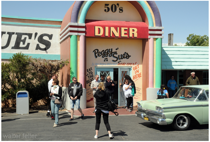
Peggy Sue’s 50s Diner

/yermo-ca/

Peggy Sue's Diner, Yermo, Route 66, nostalgia, 1950s

Peggy Sue’s 50s Diner is a well-known retro-themed diner in Yermo, California. It’s designed to resemble a classic 1950s diner, with vintage decor, neon lights, and a nostalgic atmosphere.

The diner typically offers classic American diner fare, such as burgers, shakes, fries, and other comfort food items. Additionally, Peggy Sue’s may have themed events or activities to enhance the 1950s experience for visitors.

Mojave Desert Experiences

The Mojave Desert, located in the southwestern United States, is a vast and captivating landscape known for its unique geological features and diverse ecosystems. Here are some activities you can enjoy in the Mojave Desert:

  1. Joshua Tree National Park:
    • Hiking: Explore the numerous hiking trails, such as the popular trails to Hidden Valley, Barker Dam, and Ryan Mountain.
    • Rock Climbing: Joshua Tree is renowned for its granite rock formations, making it a world-class destination for rock climbers of all skill levels.
    • Stargazing: The park is a designated International Dark Sky Park, offering excellent stargazing opportunities.
  2. Mojave National Preserve:
    • Kelso Dunes: Hike to the top of these iconic dunes for panoramic views of the desert landscape.
    • Hole-in-the-Wall: Explore the unique volcanic rock formations and hike through the scenic canyons of Hole-in-the-Wall.
  3. Off-Highway:
    • Mojave Road: Embark on the historic Mojave Road, a 140-mile trail that takes you through the heart of the Mojave Desert. It’s a popular route for off-road enthusiasts.
  4. Red Rock Canyon State Park:
    • Scenic Drive: Enjoy a scenic drive through the park, with opportunities for short hikes to view the striking red rock formations.
    • Wildflower Viewing: The park comes alive in the spring with vibrant wildflowers, offering a colorful display.
  5. Death Valley National Park:
    • Badwater Basin: Visit the lowest point in North America and explore the unique salt flats.
    • Artist’s Palette: Drive through this colorful area known for its mineral-stained hills.
    • Zabriskie Point: Enjoy panoramic views of the badlands and eroded rock formations.
  6. Ghost Towns:
    • Calico Ghost Town: Explore this well-preserved ghost town that was once a bustling silver mining community.
    • Randsburg: Visit another historic mining town known for its quirky atmosphere and vintage charm.
  7. Mojave Air and Space Port:
    • Aerospace Museum: Discover the history of aviation and space exploration at the Mojave Air and Space Port, home to innovative aerospace projects.
  8. Bird Watching:
    • The Mojave Desert is home to a variety of bird species. Bring binoculars and explore areas like the Amargosa River and nearby wetlands for birdwatching opportunities.
  9. Photography:
    • Capture the unique landscapes, rock formations, and vibrant sunsets the Mojave Desert offers. Joshua Tree’s unique Joshua trees and the play of light and shadow make for excellent photographic opportunities.
  10. Camping:
    • Enjoy camping under the desert stars at designated campgrounds in Joshua Tree National Park, Mojave National Preserve, and Death Valley National Park.

Remember to check weather conditions, carry plenty of water, and follow Leave No Trace principles when exploring the Mojave Desert. Always be aware of the desert’s extreme temperatures and take necessary precautions for a safe and enjoyable experience.

Desert Rockhounding

Desert rockhounding is a popular recreational activity that involves searching for, collecting, and identifying rocks, minerals, gemstones, and fossils in arid regions. Deserts often have unique geological formations and a diverse range of minerals, making them interesting and rewarding for rockhounding enthusiasts. Here are some tips for desert rockhounding:

  1. Research the Area: Before heading out, research the desert area you plan to explore. Learn about the geology, rock formations, and the types of minerals or gemstones commonly found in that region. Geological maps and online resources can be valuable tools.
  2. Check Regulations: Be aware of any regulations or restrictions in the area you plan to visit. Some areas may have rules about collecting rocks, and respecting these regulations is important to preserve the environment.
  3. Safety First: Deserts can be challenging environments with extreme temperatures. Wear appropriate clothing, including a hat, sunscreen, and sturdy footwear. Carry plenty of water and be mindful of your surroundings to ensure a safe and enjoyable rockhounding experience.
  4. Use the Right Tools: Bring the necessary rock-hounding tools, such as rock hammers, chisels, safety glasses, gloves, and a backpack to carry your finds. A field guide to rocks and minerals can help you identify your discoveries.
  5. Explore Washes and Dry Creek Beds: Water action in desert washes can concentrate rocks and minerals, making these areas fruitful for rockhounding. Explore dry creek beds, washes, and areas where water has flowed in the past.
  6. Look for Indicator Minerals: Certain minerals may indicate the presence of valuable gemstones or other interesting specimens. Learn to recognize indicator minerals and follow their trail to potential collecting sites.
  7. Be Respectful: Leave no trace and practice ethical rockhounding. Avoid damaging plants, disturb the environment as little as possible, and fill in any holes you may dig. Remember that some areas may be protected, and it’s important to respect these conservation efforts.
  8. Join Rockhounding Clubs: Consider joining local rockhounding clubs or groups. These organizations often have experienced members who can share knowledge about the best collecting sites and provide guidance on responsible rockhounding practices.
  9. Time Your Visit: The best time for desert rockhounding is during the cooler months, as summer temperatures can be extremely high. Early morning and late afternoon are generally more comfortable and offer better lighting for observing and collecting.
  10. Learn to Identify Rocks: Familiarize yourself with the characteristics of rocks and minerals commonly found in the desert. Understanding the properties, colors, and formations of different specimens will enhance your rockhounding experience.

Always be aware of your impact on the environment and prioritize conservation while enjoying the excitement of discovering rocks and minerals in the desert.

Rockhound

Desert Photography

Desert photography offers unique challenges and opportunities due to arid regions’ distinctive landscapes and lighting conditions. Whether you’re capturing vast dunes, rocky terrains, or desert flora and fauna, here are some tips to enhance your desert photography:

West Fork, Mojave River
  1. Golden Hours: The soft, warm light during the golden hours (shortly after sunrise and before sunset) can add a magical touch to your desert photos. Shadows are longer, and the colors become more vibrant, creating a pleasing atmosphere.
  2. Contrast and Textures: Deserts often feature striking contrasts between sand, rocks, and the sky. Emphasize these contrasts in your compositions to create visually appealing images. Pay attention to the textures of the sand or rocky surfaces.
  3. Silhouettes: Use the strong sunlight to create silhouettes of desert features. This technique can be particularly effective when the sky has captivating colors during sunrise or sunset.
  4. Wide Angle for Landscapes: A wide-angle lens is great for capturing the vastness of desert landscapes. It lets you include expansive skies, sweeping dunes, or rocky formations in your frame.
  5. Macro Photography: Explore the smaller details of the desert environment with macro photography. Capture close-up shots of desert flowers, reptiles, or insects to showcase the intricacies of life in arid regions.
  6. Use a Polarizing Filter: A polarizing filter can help reduce glare from the sun on sand or rocks and enhance the colors of the sky. It’s particularly useful when photographing in midday sunlight.
  7. Capture the Night Sky: Deserts often have low light pollution, making them ideal for astrophotography. Consider capturing the night sky, stars, and celestial objects. Use a sturdy tripod and a wide aperture for long exposure shots.
  8. Add a Point of Interest: To give your photos a focal point, include an interesting subject such as a lone tree, a rock formation, or even a person in the vast desert landscape. This helps create a sense of scale and adds visual interest.
  9. Protect Your Gear: Deserts can be harsh with blowing sand and intense sunlight. Keep your camera and lenses protected when not in use, and consider using lens hoods or lens caps to prevent sand from damaging your equipment.
  10. Mind the Temperature: Be mindful of the temperature, especially in hot desert environments. Carry sufficient water, protect yourself from the sun, and take breaks to avoid heat-related issues.
Death Valley, Mesquite Dunes

Remember that each desert is unique, so take the time to explore and discover the specific features that make the desert you photograph special. Experiment with different compositions, lighting conditions, and perspectives to create captivating desert images.

Railfanning

mojavedesert.Net/railroads

Railfanning refers to the hobby or activity of watching, photographing, and sometimes documenting trains and railroads. Railfans, or rail enthusiasts, engage in railfanning for various reasons, including a fascination with trains, locomotives, and rail infrastructure, as well as an interest in the history and operations of railroads.

Railfanning activities can include:

  1. Spotting Trains: Railfans often visit train stations, rail yards, and scenic locations along rail lines to observe and photograph trains as they pass by.
  2. Photography and Videography: Railfans use cameras and video equipment to capture images and footage of trains. Some focus on capturing the unique designs of locomotives, while others may document rare or historic trains.
  3. Collecting Memorabilia: Railfans often collect items related to trains, such as timetables, tickets, and other memorabilia. Some may also collect model trains.
  4. Tracking Train Movements: With modern technology, railfans can use websites, apps, and radio scanners to track the movements of trains in real time. This allows them to plan their railfanning activities and capture specific trains.
  5. Engaging in Online Communities: Many railfans connect through online forums, social media groups, and websites dedicated to railfanning. They share their experiences, photos, and information about train sightings.
  6. Visiting Railroad Museums: Railfans may also enjoy visiting museums dedicated to preserving and showcasing the history of railroads. These museums often have static displays of historic locomotives and rolling stock.
  7. Documenting Railroad History: Some railfans are also historians who document the history of railroads in their region. They may research and compile information about past and present rail lines, companies, and infrastructure.

Railfanning is a diverse hobby with enthusiasts of all ages. The appeal of trains and railroads can range from an appreciation of engineering and technology to a nostalgic connection with the past. It’s a hobby that allows individuals to combine their love of transportation, history, and photography while enjoying the sights and sounds of trains in action.

Petroglyphs, Pictographs, and Geoglyphs in the Mojave Desert

/petroglyphs/

The Mojave Desert, located in the southwestern United States, is rich in cultural and historical significance, with evidence of human habitation dating back thousands of years. Petroglyphs, pictographs, and geoglyphs are among the archaeological features found in the Mojave Desert, offering glimpses into the region’s past.

Here’s a brief overview of each:

  1. Petroglyphs:
    • Petroglyphs are rock engravings created by carving or pecking into the surface of a rock.
    • They are often found on exposed rock surfaces, such as canyon walls or large boulders.
    • Petroglyphs in the Mojave Desert can depict various symbols, animals, human figures, and abstract designs.
    • Native American communities made these carvings as a form of communication, storytelling, or spiritual expression.
  2. Pictographs:
    • Pictographs are rock art created by applying pigments to the surface of rocks. These pigments are usually composed of natural materials like plant extracts or mineral pigments.
    • Pictographs are found on rock shelters, caves, and cliff faces, often in areas with some protection from the elements.
    • Like petroglyphs, pictographs in the Mojave Desert can represent various subjects, including humans, animals, and symbolic patterns.
    • The pictograph colors can include red, black, white, and yellow, with red being a common choice.
  3. Geoglyphs:
    • Geoglyphs are large designs or motifs created on the ground’s surface, often by arranging stones or altering the landscape’s natural features.
    • While geoglyphs are more commonly associated with other regions like the Nazca Lines in Peru, there are examples of geoglyphs in the Mojave Desert as well.
    • The Blythe Intaglios, located in the lower Colorado River valley near Blythe, California, is a notable example of geoglyphs in the Mojave Desert. These large human and animal figures were created by scraping away dark rocks to reveal the lighter soil beneath.

Preservation of these cultural artifacts is crucial, and many sites are protected to prevent vandalism and degradation. Researchers and archaeologists work to study and document these features, shedding light on the history and practices of the indigenous peoples who lived in the Mojave Desert. It is important visitors respect and avoid disturbing these archaeological sites to ensure their preservation for future generations.

Geography of the Antelope Valley

/antelope-valley/geography.html

The Antelope Valley is a region located in northern Los Angeles County and southeastern Kern County in the state of California.

Here are some key geographical features and aspects of the Antelope Valley:

  1. Location:
    • Counties: The Antelope Valley spans Los Angeles County to the south and Kern County to the north.
  2. Topography:
    • Desert Landscape: The Antelope Valley is part of the Mojave Desert, characterized by a high desert landscape with arid conditions.
    • Valley and Basin: The region is named after the pronghorn antelope that used to roam the area. It is a valley and basin surrounded by mountain ranges, including the San Gabriel Mountains to the south and the Tehachapi Mountains to the northwest.
  3. Cities and Communities:
    • Palmdale: One of the major cities in the Antelope Valley, located in Los Angeles County.
    • Lancaster: Another significant city in the region in Los Angeles County.
    • Quartz Hill: A community within the Antelope Valley, known for its agricultural history.
    • Rosamond: A community in Kern County, east of Lancaster, known for its aerospace industry.
  4. Climate:
    • High Desert Climate: The Antelope Valley experiences a high desert climate with hot summers and cool winters.
    • Low Precipitation: The region receives relatively low annual precipitation, and water scarcity is a concern.
  5. Agriculture:
    • Historical Agriculture: The Antelope Valley has a history of agriculture, especially in areas like Quartz Hill. However, water availability has posed challenges for sustained agricultural practices.
  6. Edwards Air Force Base:
    • Military Presence: The Antelope Valley is home to Edwards Air Force Base, a major aerospace and flight test facility.
  7. Transportation:
    • Highways: Major highways, including State Route 14 (Antelope Valley Freeway), connect the Antelope Valley to the rest of Southern California.
  8. Natural Attractions:
    • Poppy Reserve: The Antelope Valley California Poppy Reserve is a notable natural attraction, drawing visitors during the spring when wildflowers, including poppies, bloom.
  9. Economic Activities:
    • Aerospace Industry: The aerospace industry, including Edwards Air Force Base and related activities, plays a significant role in the economy of the Antelope Valley.
  10. Challenges:
    • Water Scarcity: Like many desert regions, water scarcity is a challenge in the Antelope Valley, and sustainable water management is crucial for the area’s development.

Understanding the geography of the Antelope Valley involves recognizing its desert setting, mountainous surroundings, urban centers, and economic activities.

/antelope-valley/

Mormon Battalion

https://mojavedesert.net/military/fort-irwin-04.html

Mormon Battalion, flag

The Mormon Battalion was a United States Army volunteer unit composed primarily of Latter-day Saint (Mormon) men. It was formed during the Mexican-American War in 1846. The battalion played a significant role in the western expansion of the United States and the development of the American West.

Here are some key points about the Mormon Battalion:

  1. Formation: The Mormon Battalion was officially organized on July 16, 1846, in Council Bluffs, Iowa. The Mormon pioneers, led by Brigham Young, had been forced to leave their homes in Nauvoo, Illinois, and were headed west to the Salt Lake Valley.
  2. Purpose: The battalion was created to support the U.S. war effort in the Mexican-American War (1846–1848). The U.S. government, in need of troops to secure the territory acquired in the Southwest, allowed the Mormons to form their unit.
  3. Service: The Mormon Battalion marched over 2,000 miles from Council Bluffs to San Diego, California, through harsh and challenging conditions. They were mustered out of service in July 1847.
  4. Contribution to Western Expansion: The journey of the Mormon Battalion played a role in opening up a southern wagon route to California and exploring potential routes for future transportation and communication lines.
  5. Legacy: The legacy of the Mormon Battalion is still remembered today. Many battalion members settled in California after their service, and their contributions are commemorated in various historical sites and monuments. The battalion is also remembered as a unique episode in American military history and the history of the Church of Jesus Christ of Latter-day Saints.

The Mormon Battalion’s journey was a remarkable chapter in the American West’s history and the United States’s expansion during the 19th century.

Old Crump

In 1849, a wagon train bound for California split up, with many members opting for a supposed shortcut to the goldfields. The shortcut did not work out, and these intrepid wanderers found themselves stranded, lock, stock, barrel, and four children on the floor of a place called ‘Death Valley.’

Bennett’s Long Camp

Over a month of hardship and waiting had passed while two heroic young men walked to find a way out and return with supplies to bring this band of Lost 49ers to safety. This they did, returning with food, a white horse, and a one-eyed mule. Sadly enough, the white horse had to be abandoned in a dry fall in the Panamint Mountains.

With these heroes returning, they could make their escape. The children were weak, tired, and sick and would not make the trip if they had to walk, so the pioneers sewed several shirts together, making saddlebags to carry them in.

The children were uncomfortable and sick. They cried, but ‘Crump,’ the ox selected to bear this burden, seemed to sense the importance of carrying its cargo as gently as possible, never missing a step, stumbling, or even making a sudden, jarring move.

This ordeal, beginning late in 1849 and finishing up early in 1850, became a distant memory to the party members.

Years later, a much older William Manly, one of the two heroes who saved the emigrants (John Rogers being the other), was walking down a road in the Central Valley. He noticed that over in a shady pasture, there was a fat ox relishing the long, tender blades of grass. Strangely enough, the ox looked vaguely familiar. Sure enough, it was Old Crump, warm and gentle as ever.

Ox in pasture of green grass
Retired beast of burden – NPS photo

Back in 1850, when things settled after their hardship-fraught journey and arrival at their destination, the owner of the ox retired the creature as a reward for its distinguished service, and Crump never worked another day in his life.

Chapter XI – Death Valley in 49
Wm. Lewis Manly

Draft Oxen

Draft oxen are domesticated cattle trained to work as draft animals, primarily for agricultural purposes. They have been used for centuries in many parts of the world to pull plows, wagons, and other heavy loads. Oxen are typically castrated male cattle, and they are trained to respond to commands from their handlers.

NPS photo of oxen - ox tream
Oxen – NPS photo

Here are some key characteristics and advantages of using draft oxen:

  1. Strength: Oxen are strong animals, capable of pulling heavy loads, plowing fields, and performing other tasks requiring significant physical strength. They are often used for tilling soil and other agricultural activities.
  2. Endurance: Oxen are known for their endurance. They can work long hours, making them suitable for tasks requiring sustained effort, such as plowing large fields or pulling heavy loads over extended distances.
  3. Steadiness and Reliability: Oxen is generally known for its steady and reliable work. They are patient animals and can handle repetitive tasks at a consistent pace.
  4. Adaptability: Oxen are well-adapted to various climates and terrains. They can work in different conditions and are particularly useful in areas where mechanized equipment may not be practical or accessible.
  5. Low Maintenance: Oxen are often considered low-maintenance animals compared to some other draft animals. They can graze on pasture, and their dietary requirements are relatively simple. They also have sturdy hooves, which reduces the need for frequent hoof care.
  6. Draught Power: Oxen have been historically crucial for providing draught power in agriculture. They were widely used before the advent of mechanized farming equipment and are still used in some regions where traditional farming methods persist.
  7. Manure Production: Aside from their work capabilities, oxen also produce manure, which can be used as crop fertilizer. This contributes to the sustainability of agricultural practices.

While draft oxen have been widely used historically, the prevalence of mechanized agriculture has led to a decline in their use in many developed countries. However, in certain regions and for specific purposes, draft oxen continue to be valued for their strength, reliability, and suitability for sustainable and traditional farming practices. Training and working with oxen require skill and patience, as they respond well to positive reinforcement and consistent handling.

Draft Mules

Draft mules are hybrid animals created by mating a male donkey (jack) with a female horse (mare). The resulting offspring is known as a mule, and when specifically bred for heavy work, it is referred to as a draft mule. Draft mules are known for their strength, endurance, and intelligence, making them valuable partners in agricultural and heavy-duty tasks.

Here are some key characteristics and advantages of draft mules:

  1. Strength: Draft mules are robust, inheriting the strength of their horse and donkey parents. They are capable of pulling heavy loads and performing strenuous tasks.
  2. Endurance: Mules, in general, are known for their endurance. They can work long hours without tiring quickly, making them well-suited for demanding tasks in agriculture and transportation.
  3. Intelligence: Mules are considered intelligent animals, often possessing a combination of the best traits from both donkeys and horses. They are known for their problem-solving abilities and adaptability.
  4. Sure-footedness: Mules tend to be sure-footed, making them well-suited for navigating challenging terrains. This quality is particularly advantageous in agricultural settings or uneven landscapes.
  5. Economical: Draft mules are often considered more economical than some other draft animals. They typically have lower maintenance costs than some purebred draft horses and are known for being hardy and requiring less veterinary care.
  6. Longevity: Mules are known for their longevity. They often live longer than horses and can remain active and productive for many years.
  7. Versatility: Draft mules can be used for various tasks, including plowing fields, pulling wagons, logging, and other heavy agricultural work. Their adaptability makes them valuable in a range of settings.

Despite their many advantages, it’s essential to note that mules, like all animals, require proper care and training. Additionally, because mules are hybrids, they are usually sterile and cannot reproduce, unlike their horse and donkey parents.

Wild Burros

/wildlife/wild-burro.html

Wild burros, also known as wild donkeys, can be found in various desert regions around the world. In North America, one notable population of wild burros resides in the deserts of the southwestern United States, particularly in states like Arizona, California, Nevada, and Utah. These burros are descendants of domesticated animals brought to the region by early European settlers and prospectors.

Here are some key points about wild burros in the desert:

  1. Origins: Wild burros in the American Southwest are often descendants of animals brought by Spanish explorers and settlers in the 1500s. Over the centuries, these domesticated animals escaped or were released, adapting to the arid desert environment.
  2. Adaptations: Wild burros have evolved to thrive in harsh desert conditions. They are well-adapted to arid environments, with efficient water retention capabilities and the ability to consume a variety of desert vegetation.
  3. Habitat: Wild burros are typically found in semi-arid and arid regions, where water sources may be scarce. Deserts provide them with open spaces, rocky terrain, and sparse vegetation that suits their browsing and grazing habits.
  4. Behavior: Wild burros are social animals and often form small herds led by a jack, a dominant male. They have a hierarchical social structure and communicate through vocalizations and body language.
  5. Conservation Concerns: While wild burros have adapted well to desert life, their populations sometimes face challenges. Overgrazing, competition for limited water sources, and conflicts with human activities can impact their well-being. As a result, ongoing efforts are to manage and conserve wild burro populations in some areas.
  6. Management and Control: In some regions, wild burro populations are managed to prevent overgrazing and habitat degradation. This may involve relocation, adoption programs, or fertility control measures to balance the burro population and the available resources.
  7. Tourism and Observation: Wild burros in the desert can be a point of interest for tourists and nature enthusiasts. Observing these animals in their natural habitat can be a unique experience. Still, visitors need to respect their space and adhere to any regulations in place for their protection.

Understanding the ecology and behavior of wild burros is crucial for their conservation and coexistence with human activities in desert environments. Conservation efforts aim to balance preserving these iconic animals and maintaining the health of the ecosystems they inhabit.

El Burro

Oatman, Arizona

Fort Tejon Earthquake 1857

/fort-tejon/

The Fort Tejon earthquake occurred on January 9, 1857, and is one of the largest historical earthquakes in California. It had an estimated magnitude of 7.9 and was associated with the southern segment of the San Andreas Fault. Here are some key details about the Fort Tejon earthquake:

  1. Date and Time:
    • The earthquake struck on January 9, 1857.
  2. Location:
    • The epicenter was near Fort Tejon in Kern County, California.
  3. Magnitude:
    • The earthquake is estimated to have had a magnitude of 7.9.
  4. San Andreas Fault:
    • The earthquake was associated with the southern segment of the San Andreas Fault.
  5. Damage:
    • The region affected by the earthquake was sparsely populated, which helped reduce casualties.
    • Significant damage occurred to buildings, infrastructure, and landscapes.
    • The earthquake caused surface rupture along the fault, creating a noticeable surface offset.
  6. Aftershocks:
    • A series of aftershocks followed the main event, further contributing to the seismic activity in the region.
  7. Impact on Landscape:
    • The earthquake caused visible changes in the landscape, with the ground surface breaking along the fault line.
  8. Historical Significance:
    • The Fort Tejon earthquake is significant in understanding the seismic history of California.
    • It provided valuable information about the behavior of the San Andreas Fault and the potential for large earthquakes in the region.

It’s worth noting that the Fort Tejon earthquake occurred when the population in the affected area was relatively low, which helped mitigate the impact on human lives. The earthquake remains an important event in studying California’s seismic activity and understanding earthquake hazards in the region.