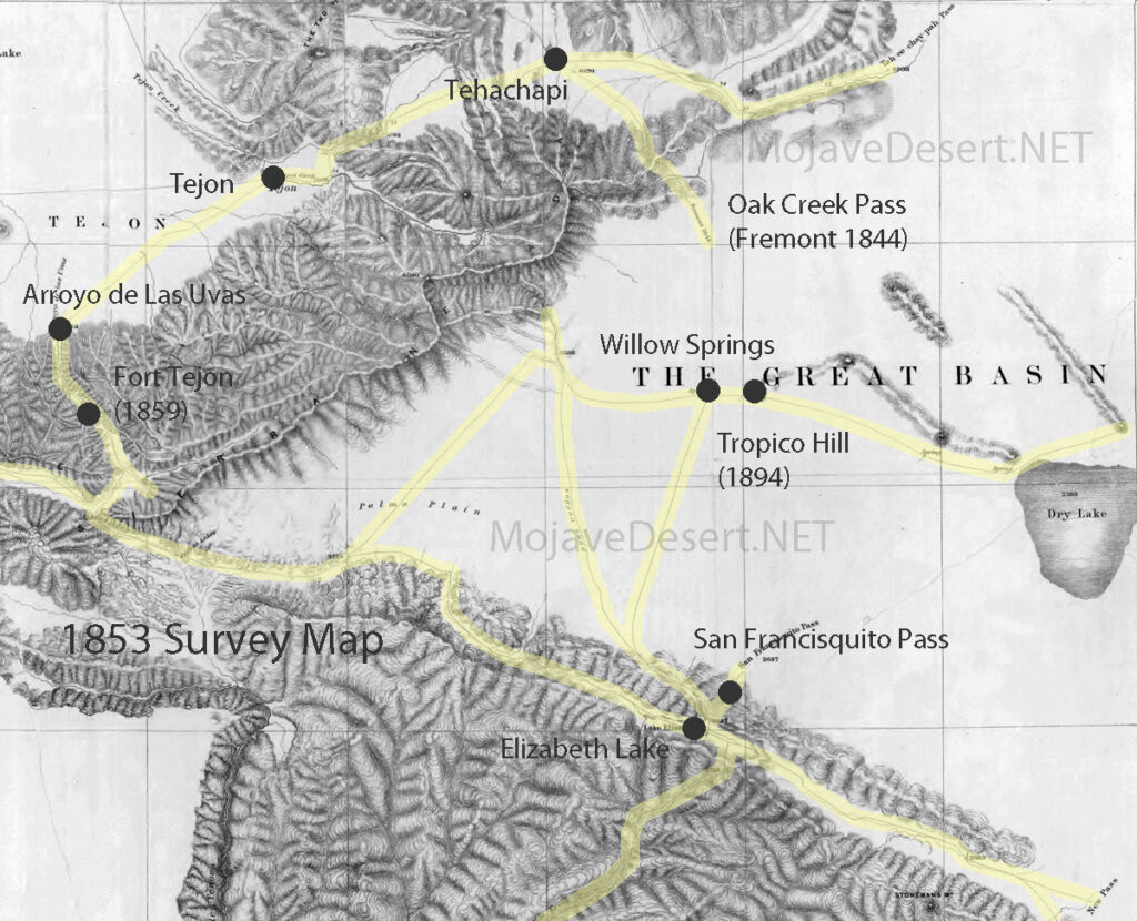
The indigenous peoples of the Mojave Desert, such as the Mojave, Chemehuevi, Serrano, and others, developed the first trails through the desert based on a deep understanding of the natural environment, honed over generations of living in this challenging landscape. These trails were not found by accident but were carefully established routes facilitating travel, trade, and access to resources within the desert and between different ecological zones. Here are some key methods and considerations that these indigenous peoples likely used to establish the trails:
Water Sources: Finding and remembering the locations of reliable water sources was crucial for survival in the desert. Trails often connected springs, rivers, and waterholes that could sustain travelers through the arid landscape.
Landmarks: Natural landmarks such as mountains, rock formations, and distinctive vegetation would have served as navigation aids, helping to guide the way and mark progress along the trails.
Seasonal Variations: Understanding the seasonal changes in the desert, including variations in water availability and the movement of game animals, would have influenced the timing and direction of travel on these trails.
Trade and Social Networks: Trails facilitated trade and communication between indigenous groups. They were designed to connect communities and trading posts, enabling the exchange of goods, ideas, and cultural practices.
Observation and Oral Tradition: Knowledge of the landscape and its best routes would have been passed down through generations, with each generation refining and adding to this knowledge base. This oral tradition ensured that valuable information about navigating the desert was retained and shared within communities.
Adaptation to the Environment: Trails would have been adjusted and modified over time in response to environmental changes, such as the shifting of water sources or the growth of new obstacles. This adaptive approach ensured that the trails remained viable over long periods.
These trails, established through intimate knowledge of the desert environment, would later be used by European explorers, settlers, and others as they moved through the Mojave Desert. The legacy of these indigenous trail-making practices is a testament to the ingenuity and resilience of the desert’s original inhabitants.
OpenAI. (2024). ChatGPT (4) [Large language model]. https://chat.openai.com
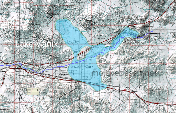
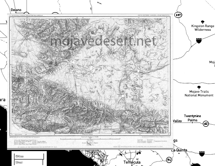
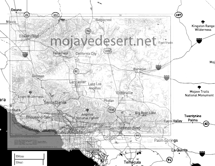
Lake Manix is an ancient lake in what is now the Mojave Desert of California, USA. It was part of the ancient Mojave River system, which flowed through the area during periods of the Pleistocene epoch when the climate was wetter than it is today. The presence of this lake is a testament to the dramatically different environmental conditions that prevailed in the region thousands of years ago.
Lake Manix
In its ancient course, the Mojave River fed into Lake Manix, creating a significant water body supporting diverse flora and fauna. This ancient river system was vital for migrating and sustaining animals and possibly early human populations. Over time, Lake Manix eventually dried as the climate became warmer, and the Mojave River’s flow diminished significantly. The remnants of this ancient river system can still be traced in the modern landscape of the Mojave Desert, with the Mojave River now flowing intermittently and largely underground.
Archaeological and geological evidence from the Lake Manix area provides valuable insights into the climatic changes that have occurred over millennia in the Mojave Desert. Studies of sediment deposits, fossil records, and other geological features around the former lake site help scientists reconstruct the paleoenvironmental conditions, offering clues about water availability, vegetation types, and the animals that once inhabited the region.
The transition from a wetter, lake-dominant landscape to the arid desert environment of today highlights the dynamic nature of Earth’s climate and ecosystems. Understanding the history of Lake Manix and the ancient Mojave River system contributes to our knowledge of past climatic shifts. It helps inform current and future conservation efforts in desert ecosystems.
Coyote Arm of Lake Manix
The Coyote arm of Lake Manix refers to a specific portion or segment of ancient Lake Manix, which existed during the Pleistocene epoch in what is now the Mojave Desert of California. This area is particularly interesting to geologists and archaeologists because it provides evidence of the extent of the lake and the environmental conditions that prevailed in the region.
Lake Manix covered a large area and had multiple “arms” or extensions, with the Coyote arm being one of them. These arms were parts of the lake that extended into different valleys or low-lying areas, filled by the ancient Mojave River and its tributaries. The existence of these arms indicates that the lake’s water levels and boundaries changed over time, influenced by climatic fluctuations, precipitation patterns, and river flow dynamics.
Studying the Coyote arm and other parts of Lake Manix helps scientists reconstruct the paleohydrology of the region. By examining sediment layers, fossil remains, and other geological features, researchers can infer past water levels, the timing of lake expansion and contraction, and the habitats around the lake. This information is crucial for understanding how ancient ecosystems responded to climate change and how they supported early human populations and other species.
Evidence from the Coyote arm and similar areas around the former Lake Manix also contributes to our understanding of the broader paleoclimatic patterns in North America. Such studies are part of a larger effort to piece together the history of Earth’s climate and how it has shaped the development of landscapes and ecosystems over geological time scales.
Troy Lake arm of Lake Manix
The Troy Lake arm of Lake Manix represents another significant segment of the ancient Lake Manix, which was a part of the extensive Pleistocene-age lake system in the Mojave Desert, California. Like the Coyote arm, the Troy Lake arm was one of the various extensions or branches of Lake Manix, fed by the ancient Mojave River and its tributaries during a time when the climate was considerably wetter than it is today.
The presence of the Troy Lake arm and other arms like the Coyote arm indicate the region’s complex hydrology and varied topography during the Pleistocene. These arms were essentially the lake’s extensions into surrounding valleys, creating diverse habitats for various plant and animal life. These lake arms’ fluctuating boundaries and water levels, driven by climatic variations, offer valuable insights into past environmental conditions.
Researchers study the Troy Lake arm and focus on sediment deposits, fossilized remains, and other geological indicators to understand the lake’s hydrology, such as water depth, extent, and changes over time. These studies contribute to a broader understanding of how ancient lake systems like Lake Manix responded to glacial and interglacial cycles, influencing precipitation patterns, temperature, and, ultimately, the region’s hydrography.
The research on the Troy Lake arm, alongside other parts of Lake Manix, is crucial for reconstructing past climates and ecosystems. It helps in understanding the challenges faced by early human settlers and the strategies they employed for survival. Moreover, it provides context for current environmental changes and aids in predicting future climatic shifts, especially in desert regions like the Mojave, which are sensitive indicators of broader environmental transformations.
Afton Canyon
/afton-canyon/
Afton Canyon, often called the “Grand Canyon of the Mojave,” is a striking geological feature in California’s Mojave Desert. It is renowned for its dramatic landscape, including steep canyon walls, rare desert waterways, and various wildlife. The formation of Afton Canyon is closely tied to the history of Lake Manix and the ancient Mojave River system.
During the Pleistocene epoch, when Lake Manix existed, it was a significant water body fed by the Mojave River, which carried meltwater from glaciers in the mountains to the north. Over time, the climate became drier, and the lake levels fluctuated. Eventually, Lake Manix breached its natural dam, leading to a catastrophic water outflow. This event was a pivotal moment in the formation of Afton Canyon.
The breach of Lake Manix’s dam caused a massive release of water that carved through the landscape, creating Afton Canyon. Rapid erosion cut deeply into the sediment and rock, forming the canyon’s distinctive steep walls. The force of the water was so powerful that it removed vast amounts of material, shaping the canyon into its present form.
Today, Afton Canyon remains one of the few places in the Mojave Desert where the Mojave River flows above ground, offering a rare glimpse into the water’s erosive power that shaped the landscape. The canyon’s formation is a testament to the dynamic geological processes that have occurred over millennia, driven by climatic shifts and water movement.
The role of Lake Manix in forming Afton Canyon highlights the interconnectedness of geological features within the Mojave Desert. It illustrates how ancient lakes, rivers, and climatic conditions have sculpted the region’s unique landscapes. Afton Canyon’s creation is a prime example of how water, even in arid environments, can be a powerful change agent, carving through the earth to create spectacular natural features.
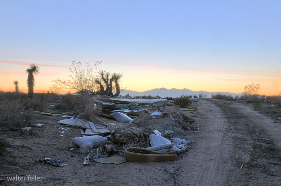
Addressing littering, illegal dumping, vandalism, and theft in natural areas like the Mojave Desert requires a multifaceted approach, considering prevention and remediation. Here are some strategies that can be employed:
Education and Awareness
Public Education Campaigns: Educating the public about the ecological, cultural, and historical significance of the Mojave Desert can foster a sense of stewardship. Campaigns can highlight the negative impacts of littering, dumping, vandalism, and theft.
School Programs: Integrating environmental education into school curriculums can instill values of conservation and respect for nature in young people.
Enforcement and Regulation
Increased Surveillance: Deploying more rangers or utilizing surveillance technology in high-risk areas can deter potential offenders.
Stricter Penalties: Implementing harsher penalties for violations can serve as a deterrent. This could include higher fines, community service in environmental cleanup, and legal action for more serious offenses.
Quick Response to Incidents: Rapid response to reports of dumping, vandalism, or theft can help catch perpetrators and serve as a deterrent to others.
Community Engagement and Participation
Volunteer Cleanup Events: Organizing community cleanups can address existing litter and dumping and foster a sense of community ownership and responsibility.
Adopt-a-Spot Programs: Encouraging individuals, families, or groups to “adopt” areas of the desert for regular monitoring and maintenance can help maintain cleanliness and report issues quickly.
Infrastructure and Accessibility
Better Waste Management Facilities: Providing accessible and convenient disposal options near the Mojave area can reduce the likelihood of illegal dumping.
Improved Signage: Clear, informative signage about rules, regulations, and the importance of preservation can serve as both an educational tool and a deterrent.
Technology and Innovation
Mobile Apps: Developing and promoting mobile apps that allow visitors to report litter, dumping, vandalism, or theft in real-time can aid in quick responses and create a database of problem areas.
Social Media: Utilizing social media platforms to share information, organize cleanup events, and foster a digital community of stewards can enhance engagement and awareness.
Partnerships
Collaboration with Local Businesses: Engaging local businesses in sponsorship opportunities for cleanup events or educational programs can enhance resources and community involvement.
Partnerships with Environmental Organizations: Working with NGOs and environmental groups can bring expertise, volunteers, and additional resources for conservation efforts.
Solving these issues in the Mojave Desert requires persistent efforts across multiple fronts. It’s about creating and nurturing a culture of respect and care for the environment, backed by effective enforcement and community involvement.
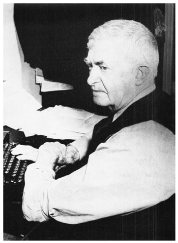
“The Story of Inyo” by W.A. Chalfant is a comprehensive history of Inyo County, California, first published in 1922. W.A. Chalfant (1865-1943) was a newspaperman and historian who spent much of his life in the Eastern Sierra region of California. His work is considered one of the seminal histories of this part of California, detailing the early exploration, settlement, and development of Inyo County.
The book covers a wide range of topics, including the area’s indigenous peoples, the impact of European settlement, mining, and economic development, and the natural history and geography of the region. Chalfant’s writing is noted for its detailed research, engaging narrative style, and commitment to telling the stories of the Native American inhabitants and the settlers who came to the area.
Inyo County is a region of great diversity and contrast, home to some of the highest and lowest points in the contiguous United States, including Mount Whitney and Death Valley. This geographic and environmental diversity is reflected in the stories Chalfant tells, from tales of survival and adaptation in harsh landscapes to the boom and bust of mining towns and the ongoing challenges and conflicts over land and water use.
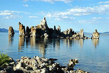
Mono Lake
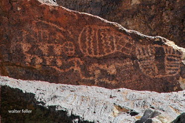
Petroglyphs
“The Story of Inyo” remains an essential resource for historians, geographers, and anyone interested in the American West, offering insights into the complex history of human and environmental interaction in this unique part of California.
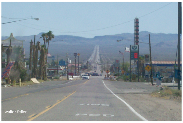
The Baker Grade is a renowned and challenging stretch of the Interstate 15 (I-15) freeway in the Mojave Desert near Baker, California. This freeway segment is characterized by its steep incline and decline over a long distance, presenting a significant test for vehicles, especially during the extreme temperatures in this desert region. The I-15 is a critical highway connecting Southern California, Los Angeles, and San Diego, as well as Las Vegas, Nevada. Further, it extends towards Salt Lake City, Utah, making the Baker Grade a crucial passage for travelers and freight transport.
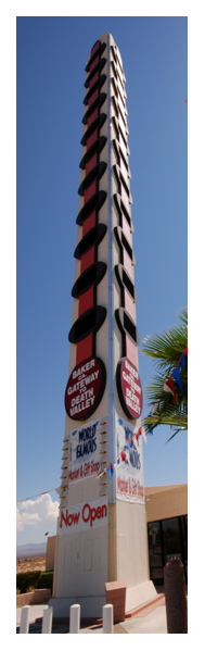
Baker, the small town near this stretch of the I-15, is often cited as the “Gateway to Death Valley,” serving as a critical rest and supply stop for those en route to Death Valley National Park and other destinations in the Mojave Desert. The town is famous for the World’s Tallest Thermometer, a 134-foot tall structure designed to commemorate the highest temperature recorded in Death Valley (134°F in 1913) and symbolize the region’s extreme heat.
The Baker Grade’s significance goes beyond its physical challenge; it is a testament to the engineering and planning required to maintain such a vital artery through one of the most inhospitable terrains in the United States. Travelers navigating this section are advised to ensure their vehicle’s cooling system is in optimal condition, to carry plenty of water, and to be prepared for the possibility of extreme weather conditions, which can range from scorching heat to sudden cold in the winter months.
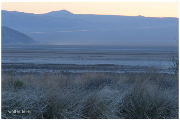
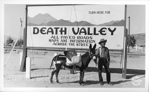
State Highway 127 to Death Valley
Moreover, the Mojave Desert’s stark, austere beauty offers a unique backdrop for this portion of the I-15. It makes the journey through the Baker Grade memorable for its scenic vistas and physical demands. Despite the challenges it presents, the Baker Grade is an essential component of the southwestern U.S. transportation network, facilitating commerce and travel between California and Nevada.
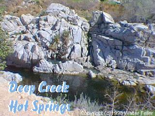
Deep Creek Hot Springs, located near Apple Valley in the Mojave Desert of Southern California, is a popular natural attraction within the San Bernardino National Forest. These hot springs are renowned for their scenic beauty and the therapeutic benefits of the mineral-rich waters. The area around Deep Creek Hot Springs offers a variety of outdoor activities, including hiking, swimming, and wildlife viewing.
Access to Deep Creek Hot Springs is primarily through hiking trails, the most common being the Bradford Ridge Path from the high desert side and the Pacific Crest Trail from the Lake Arrowhead side. The hike to the hot springs is known for its rugged terrain, offering a moderate to challenging trek depending on the path chosen and the hiker’s experience level.
The hot springs themselves are situated along Deep Creek, a tributary of the Mojave River. The area features several pools with varying temperatures, allowing visitors to choose their preferred level of warmth. The surrounding environment is a mix of desert and riparian zones, home to various plant and animal species.
It’s important to note that visiting Deep Creek Hot Springs requires adherence to local regulations and respect for the natural environment. The area is managed by the U.S. Forest Service, which may impose restrictions to protect the habitat and ensure the safety and enjoyment of all visitors. Additionally, due to its remote location and the necessity of hiking to reach the hot springs, visitors should be well-prepared with adequate water, food, and safety gear.
Cartago Landing holds a significant place in the history of the Owens Valley and Eastern Sierra region of California, particularly during the era when Owens Lake was a fully watered body. Cartago Landing served as a crucial point for transporting and shipping goods before the lake’s desiccation due to water diversion to Los Angeles via the Los Angeles Aqueduct in the early 20th century.
Pre-Aqueduct Era:
Economic Hub: Cartago Landing, situated on the shores of Owens Lake, was an important economic hub in the late 19th and early 20th centuries. The lake provided a natural route for transporting goods, making Cartago a vital location for loading and unloading cargo to be distributed throughout the Owens Valley and beyond.
Steamship Operations: The use of steamships on Owens Lake facilitated the movement of silver ore from mines in the area, particularly from Cerro Gordo, to Cartago Landing. From there, the ore was transported to processing facilities or railheads for further distribution. This mode of transportation was critical for the mining industry, which was a significant economic driver in the region during that period.
Environmental and Economic Impact: The construction of the Los Angeles Aqueduct, which began in 1908 and was completed in 1913, profoundly impacted Owens Lake and Cartago Landing. The diversion of water to Los Angeles led to the drying up of Owens Lake, rendering the lakebed a source of dust pollution and significantly altering the ecological and economic landscape of the region.
Loss of Waterway: Cartago Landing and its role as a transportation and economic hub ceased with the lake’s desiccation. The area transformed from a vibrant community centered around the lake’s resources to one grappling with the environmental and health impacts of dust storms from the dry lakebed.
Modern Efforts and Legacy:
Environmental Restoration: In recent decades, efforts have been made to mitigate the dust pollution from the dried lakebed, including partial rewatering projects and establishing ground cover to stabilize the soil. These efforts are part of broader environmental restoration initiatives in the Owens Valley.
Historical Recognition: The history of Cartago Landing, along with the broader story of Owens Lake and the impact of water diversion, remains an important chapter in California’s environmental history. It serves as a reminder of the complex interplay between natural resource management, urban development, and environmental stewardship.
The transition of Cartago Landing from a bustling port to a reminder of ecological change underscores the profound impact human actions can have on the environment. It highlights the ongoing challenges of balancing water needs, environmental health, and community well-being in the arid West.
The transition from horse-drawn vehicles to automobiles in the Mojave Desert, much like in other parts of the United States and the world, marked a significant shift in transportation, lifestyle, and economic activities. This changeover happened primarily in the early 20th century, driven by the broader adoption of the automobile as a more efficient and reliable means of transportation. Here are several key aspects of this transition:
1. Impact on Transportation
Speed and Efficiency: Automobiles offered much faster and more reliable transportation than horse-drawn vehicles. This efficiency was crucial in the vast and challenging terrain of the Mojave Desert, where distances between towns and water sources can be significant.
Infrastructure Development: The rise of automobiles necessitated the development of roads suitable for vehicle traffic. In the Mojave Desert, this meant creating and improving roads that could withstand the harsh desert conditions.
2. Economic Changes
Decline of Traditional Industries: The demand for services related to horse-drawn transportation, such as blacksmiths and farriers, saw a decline as automobiles became more prevalent.
New Opportunities: At the same time, new economic opportunities arose, including those related to automobile maintenance, fuel stations, and roadside accommodations for travelers.
3. Social and Cultural Impact
Accessibility: Automobiles made the Mojave Desert more accessible for residents and tourists. This accessibility profoundly impacted the social fabric and cultural exchanges within the region.
Lifestyle Changes: The ease of travel allowed for greater mobility, changing where people lived, worked, and how they spent their leisure time.
4. Environmental Considerations
Impact on the Landscape: Road construction and increased vehicle traffic had environmental impacts on the desert landscape, affecting native plant and animal species.
Resource Consumption: Automobiles also changed resource consumption, including increased demand for petroleum and water for cooling engines, which must be considered in the desert’s scarce water supply context.
5. Historical Context
Early Adoption and Challenges: The adoption of automobiles in remote areas like the Mojave Desert came with challenges, including limited access to fuel and mechanical services. Early automobiles were not as reliable as they are today, and breakdowns in the desert could be life-threatening.
Route 66 and Other Roads: The construction of Route 66, which passes through the Mojave Desert, was a significant factor in the desert’s automotive history. It facilitated increased travel and commerce, symbolizing the American West’s automotive transition.
This transition was part of the broader technological and societal shifts occurring in the early 20th century, reflecting the changing American landscape and the Mojave Desert’s unique challenges and opportunities.
The transition from early road and highway networks to the modern Interstate Highway System represents a monumental shift in transportation infrastructure, significantly impacting economic development, urban planning, and daily life across the United States. This evolution can be traced from the early 20th century to the mid-1950s when the Interstate Highway System began to take shape under President Dwight D. Eisenhower’s administration.
Early Road and Highway Networks
Prior to the Interstate Highway System, the United States relied on a patchwork of roadways that included everything from unpaved rural roads to paved urban streets and early state highways. The early 1900s saw the rise of the automobile, quickly outpaced existing roads’ capacity and condition, leading to calls for a national road network. Initiatives like the Lincoln Highway (established in 1913 as one of the first transcontinental highways) and the U.S. Numbered Highway System (established in 1926) marked significant early efforts to create a more organized and navigable network of national roads. However, these roads varied greatly in quality and were often insufficient for the rapidly increasing number of motor vehicles.
The Push for a National System
The idea of an interstate highway system gained momentum in the 1930s and 1940s, driven by the need for national defense, improved road safety, and economic development. The Federal-Aid Highway Act of 1944 first proposed the creation of a “National System of Interstate Highways,” but it did not provide funding to build the highways.
The Interstate Highway System
The modern Interstate Highway System officially began with the Federal-Aid Highway Act of 1956, which was championed by President Dwight D. Eisenhower. Eisenhower had been influenced by his experiences in World War II and his appreciation of the German autobahn network. He saw the strategic value of a national highway system for defense purposes and the potential benefits for economic growth and efficiency.
The 1956 act authorized the construction of a 41,000-mile (later expanded) network of interstate highways across the nation. It introduced a new funding mechanism through a Highway Trust Fund, which collected revenue from a federal fuel tax and allocated funds to the states to cover 90 percent of the construction costs, with states responsible for the remaining 10 percent.
Impact and Expansion
The Interstate Highway System revolutionized travel, commerce, and urban development in the United States:
Economic Growth: It facilitated the efficient movement of goods and services, contributing to economic growth and the expansion of the national economy.
Suburban Expansion: The system enabled greater suburban growth, as people could easily commute longer distances by car.
National Connectivity: It connected major cities and regions with reliable, high-speed roadways, making long-distance travel and shipping faster and more predictable.
Urban Development: The construction of interstate highways through urban centers had mixed effects, including facilitating urban sprawl and, in some cases, contributing to the decline of inner cities.
Ongoing Challenges and Evolution
While the Interstate Highway System has been a cornerstone of American infrastructure, its development has not been without challenges, including environmental concerns, the displacement of communities, and the maintenance of an aging network. Today, there is ongoing discussion about how to modernize the system, address its environmental impact, and ensure its sustainability for future generations.
The transition from early road networks to the modern Interstate Highway System reflects a significant evolution in how people and goods move across the United States, with lasting impacts on the country’s social, economic, and physical landscape.
The transition from wagon roads to toll roads and early paved highways represents a significant evolution in transportation infrastructure, reflecting changes in technology, economics, and societal needs. This transition occurred over several centuries, with notable developments taking place from the 18th century onwards.
Wagon Roads
Wagon roads were the primary means of overland transportation for centuries. These roads were often simple, dirt paths that followed the natural landscape. They were suitable for wagons, horses, and foot traffic but were prone to becoming impassable in poor weather conditions. Wagon roads connected rural areas with towns and cities, facilitating trade, migration, and communication. However, their maintenance was minimal, and they did not allow for efficient or speedy travel over long distances.
Toll Roads
The concept of toll roads, or turnpikes, emerged as a response to the need for better-maintained and more reliable roads. Private investors or companies typically built toll roads. In return, they were granted the right to charge travelers a fee, or toll, to use the road. This revenue was used to fund construction, maintenance, and improvement of the road. The toll road system began in the late 17th and early 18th centuries, first in Europe and later in North America.
Toll roads represented an early form of public-private partnership in infrastructure development. They facilitated more reliable and efficient transportation of goods and people, contributing to economic growth. The roads were constructed more thoughtfully, with attention to gradients, drainage, and surfacing to make them passable in all weathers.
Early Paved Highways
The advent of the automobile in the late 19th and early 20th centuries necessitated a new wave of road development. Early paved highways were designed to accommodate motor vehicles, offering smoother, more durable surfaces than the earlier dirt and gravel roads.
The transition to paved highways involved significant technological and engineering advances. Materials like concrete and asphalt became the standard for road construction, providing durability and facilitating higher speeds. The early 20th century saw the development of national highway systems, with governments taking a more active role in funding and overseeing road construction and maintenance.
The Federal Aid Road Act of 1916 in the United States marked a pivotal moment in this transition, signaling the federal government’s commitment to improving road infrastructure. This act was followed by further legislation and investment, leading to the construction of extensive highway networks across the country and around the world.
Impact
The transition from wagon roads to toll roads and early paved highways had a profound impact on society. It facilitated economic growth by improving the efficiency of transportation and trade. It also changed the way people lived and worked, enabling faster travel over longer distances and contributing to the growth of suburbs and the mobility of the population.
This evolution of road infrastructure reflects broader trends in technological innovation, economic development, and societal change. It laid the groundwork for the modern transportation systems that are essential to contemporary life.
OpenAI. (2024). ChatGPT (4) [Large language model]. https://chat.openai.com
The transition from wagon roads to steamboats and railroads marks a pivotal era in transportation history, characterized by dramatic improvements in speed, capacity, and reliability. This period, primarily occurring during the 18th and 19th centuries, was driven by technological innovation and the industrial revolution, leading to significant social, economic, and geographical changes.
Wagon Roads
Characteristics: Wagon roads were an improvement over footpaths and wagon trails, often constructed with more durable materials and designed to support the heavy loads of freight wagons and stagecoaches. Despite these improvements, travel over land was still slow, expensive, and limited by weather and the physical condition of the roads.
Limitations: The major limitations of wagon roads included their vulnerability to weather conditions, limited capacity for freight and passengers, and the physical toll on animals and vehicles. These limitations underscored the need for more efficient means of transportation over longer distances.
Steamboats
Advent of Steam Power: The introduction of steam power in the late 18th and early 19th centuries revolutionized water transportation. Steamboats could travel upstream and against the wind, making river travel more reliable and opening up inland waterways that were previously difficult to navigate.
Impact: Steamboats significantly reduced transportation costs and time, especially in the United States, where the extensive river systems became highways for the movement of goods and people. They facilitated the agricultural and industrial expansion into the interior regions, connecting these areas with domestic and international markets.
Railroads
Technological Innovation: The development of the steam locomotive in the early 19th century introduced a new era in land transportation. Railroads could carry larger loads over longer distances at faster speeds than wagons, regardless of weather conditions.
Expansion: The rapid expansion of the railroad network in the mid to late 19th century transformed economies and societies. Railroads made it feasible to connect distant cities and ports, greatly enhancing the movement of goods and people. They played a crucial role in the industrialization process, enabling the efficient distribution of raw materials and manufactured goods.
Social and Economic Impact: Railroads had a profound impact on almost every aspect of society. They facilitated westward expansion in the United States, contributed to the growth of new cities, and were instrumental in the development of national markets. Railroads also accelerated the pace of industrialization, requiring and enabling the mass production of steel and other materials.
Conclusion
The transition from wagon roads to steamboats and railroads was a transformative period in transportation history. It was characterized by significant advancements in technology and infrastructure, leading to unprecedented changes in how goods and people moved across landscapes and waterways. This era laid the foundation for the modern transportation systems we rely on today, significantly shrinking the perceived size of the world and increasing the connectivity between different regions and cultures.
The transition from mule caravan trade routes to wagon roads in the Mojave Desert exemplifies a key phase in developing transportation infrastructure in arid regions of the American West. A combination of technological advancements, economic demands, and the adaptation of transportation methods to the challenging desert environment drove this evolution. Here’s an overview of this transformation:
Mule Caravan Trade Routes
Initial Use: Mule caravans were a primary mode of trade transportation in the Mojave Desert, especially before the mid-19th century. These caravans were essential for moving goods, people, and information across vast and difficult terrains where water and resources were scarce.
Advantages: Mules are highly resilient and adapted to arid conditions, making them ideal for navigating the harsh desert landscape. They could carry significant loads long distances, relying on minimal water and forage.
Transition to Wagon Roads
Economic and Social Drivers
Mining and Settlement: The discovery of gold, silver, and other valuable minerals in and around the Mojave Desert during the 19th century led to an influx of settlers and miners. This mining boom created a demand for more efficient transportation methods to move larger quantities of goods and equipment.
Agricultural Development: As agricultural activities in the region expanded, there was a need to transport produce to markets, further necessitating improved transportation infrastructure.
Technological Improvements
Wagon Technology: Advances in wagon design and construction allowed for larger loads and more durable vehicles that could withstand the rigors of desert travel. The development of the “prairie schooner” and other wagon types made it possible to carry supplies and equipment needed for mining and settlement.
Road Construction: The construction of wagon roads involved clearing paths, improving natural surfaces, and occasionally creating more permanent infrastructures such as bridges over washes and gullies. These roads followed existing trails where possible but were often widened and modified to accommodate wagon traffic.
Impact of the Transition
Trade and Communication: Wagon roads improved trade and communication within the Mojave Desert and surrounding regions. They enabled the more efficient movement of goods, contributing to the area’s economic development.
Settlement Patterns: The establishment of wagon roads facilitated the growth of settlements and the expansion of mining operations, as they provided a lifeline for communities in the desert.
Environmental Changes: The construction and use of wagon roads also had environmental impacts, including changes to the landscape and local ecosystems. Over time, these roads would pave the way for further developments, including railroads and highways.
Conclusion
The transition from mule caravan trade routes to wagon roads in the Mojave Desert was a critical development in the region’s history, reflecting broader trends in the American West. This transformation was driven by economic opportunities, such as mining and agriculture, and was enabled by technological advancements in transportation. The development of wagon roads marked a significant step in the integration of the Mojave Desert into the regional and national economy, setting the stage for future transportation innovations and the continued development of the American Southwest.
OpenAI. (2024). ChatGPT (4) [Large language model]. https://chat.openai.com
The transition from footpaths to mule trails marks an important phase in the evolution of human transportation networks, reflecting changes in societal needs, technological advancements, and the domestication of animals for labor and transport. This transition is characterized by the adaptation and enhancement of existing paths to accommodate animal pack trains, primarily mules, which could carry heavier loads than humans and travel longer distances more efficiently. Here’s an overview of this transformation:
Footpaths
Initial Use: Footpaths were primarily pedestrian pathways that connected early human settlements, water sources, hunting grounds, and other essential locations. They were narrow, following the natural contours of the landscape, and were often the result of many years of foot traffic compacting the soil.
Characteristics: These paths were generally suitable only for walking or for pack animals that could navigate narrow, uneven terrains, such as goats or small horses. The paths were maintained minimally by the communities they served, cleared of obstacles but not significantly modified or paved.
Transition to Mule Trails
Domestication and Use of Mules: The domestication of mules (a hybrid of a male donkey and a female horse) played a pivotal role in this transition. Mules combine the strength, endurance, and surefootedness of their parents, making them particularly suited for carrying loads over difficult terrains. Their ability to carry significant weight and traverse challenging paths made them invaluable for expanding trade and transportation.
Modification of Footpaths: To accommodate mules and their loads, footpaths had to be widened and sometimes reinforced. This meant clearing more vegetation, smoothing out steep or irregular sections, and sometimes reinforcing the path with stones or wood to make it more durable and less prone to erosion.
Infrastructure Development: Along these mule trails, infrastructure such as rest stops, water points, and in some cases, stabling facilities began to appear. These developments were especially common on routes that became major trade or pilgrimage paths, reflecting the increased traffic and the need for services catering to both the animals and their handlers.
Impact of the Transition
Economic and Social Expansion: The transformation of footpaths into mule trails facilitated trade and communication between distant regions. Mule trains could carry goods such as minerals, agricultural products, and manufactured items across mountains, deserts, and other challenging terrains, linking remote areas with major trade centers.
Cultural Exchange: As mule trails increased access to previously isolated regions, they also became conduits for cultural exchange, spreading ideas, religions, languages, and technologies.
Environmental and Landscape Changes: The expansion of mule trails had environmental impacts, including changes in landscape to accommodate these paths and the associated infrastructure. In some regions, this led to deforestation, soil erosion, and habitat disruption.
Conclusion
The transition from footpaths to mule trails illustrates a significant development in human mobility and economic activity, enabled by the domestication of animals and improvements in transportation infrastructure. This evolution from simple pedestrian paths to more complex transportation networks facilitated not only the exchange of goods but also ideas and cultures, playing a crucial role in the development of human societies. The legacy of these mule trails can still be seen today in some of the ancient trade routes and paths that have been preserved or adapted for modern use.
The transition from game trails to footpaths represents a fundamental shift in human mobility and landscape interaction, reflecting broader evolutionary changes in human societies. This transition is deeply intertwined with the development of human cultures, technologies, and the increasing impact of humans on the natural environment. Here’s an exploration of this transition:
Game Trails
Natural Origins: Game trails are created by the repeated movements of animals across the landscape. These paths are formed naturally as animals travel in search of food, water, shelter, or during migration. They typically follow the contours of the land, taking the path of least resistance to conserve energy.
Human Utilization: Early humans and their predecessors would have initially used these natural pathways for similar reasons as the animals did: to find food, water, and navigate through the landscape more efficiently. Following game trails would have also been a strategy for hunting, as these paths often led to areas frequented by game animals.
Transition to Footpaths
Early Human Modification: As humans began to establish more permanent settlements and engage in agricultural practices, the need for more defined and reliable pathways became evident. People started to modify and extend existing game trails to suit their specific needs, such as connecting settlements, fields, water sources, and areas of religious or social significance.
Development of Footpaths: These modifications involved clearing vegetation, removing obstacles, and marking paths more clearly. Over time, what began as simple trails widened and became more established through repeated use, evolving into footpaths that were intentionally maintained by human communities.
Cultural and Social Significance: Footpaths also began to hold cultural and social significance, connecting not just physical locations but also linking people, communities, and cultural sites. They became conduits for trade, communication, and cultural exchange, reflecting the social organization and technological capabilities of a society.
Factors Influencing the Transition
Technological Advances: The development of tools for clearing paths and constructing more durable walking surfaces (e.g., wooden walkways, stone pavements) facilitated this transition. Such technologies made travel easier and more accessible, encouraging the further development of footpaths.
Societal Changes: The shift from nomadic to sedentary lifestyles, the development of agriculture, and the rise of cities and trade networks all contributed to the transformation of game trails into more sophisticated footpaths and, eventually, into roads and highways.
Environmental Impact: This transition also reflects the growing impact of humans on the environment. As societies grew, so did their influence on the landscape, transforming natural paths into human-made infrastructure that catered to their evolving needs.
Conclusion
The transition from game trails to footpaths is emblematic of human ingenuity and adaptability, marking the beginning of a long history of environmental modification for transportation. This process was not uniform across all human societies but evolved in diverse ways depending on local environmental conditions, technological advancements, and societal needs. The development of footpaths from game trails is a key milestone in the history of human mobility, laying the groundwork for the complex network of roads and pathways that facilitate movement today.
The Providence Mountains are a mountain range located in the eastern Mojave Desert of San Bernardino County, California, within the Mojave National Preserve. This range is known for its striking geological features, rich biodiversity, and historical significance. One of the highlights of the Providence Mountains is the Mitchell Caverns, part of the Providence Mountains State Recreation Area, which showcases fascinating limestone caves with various natural formations such as stalactites, stalagmites, and other speleothems.
Eastern face of Providence Mountains
Geologically, the Providence Mountains are part of the greater Basin and Range Province, characterized by their rugged, linear ranges and intervening valleys. They offer diverse habitats, from desert scrub at lower elevations to pinyon-juniper woodlands at higher altitudes, supporting a wide array of wildlife and plant species.
The area has a rich history, from Native American use to European exploration and mining in the 19th and 20th centuries. Indigenous peoples traversed the mountains and surrounding areas for thousands of years, and more recently, they were mined for silver, iron, and other minerals during the boom periods of the American West.
The Mojave National Preserve, where the Providence Mountains are located, provides opportunities for outdoor activities such as hiking, camping, wildlife viewing, and exploring the scenic beauty of the desert landscape. The preserve’s conservation and restoration efforts help protect this unique area’s natural and cultural resources for future generations.
Providence Mountains (Gold-Iron) The gold mines in the Providence Mountains that were first worked lay south of Foshay Pass, and were discovered as early as …
In the Trojan mining district of the Providence Mountains are located the properties of the Bonanza King Development Company of Los Angeles. This property …
Providence Mountains – Lanfair Valley · Lithology and Stratigraphy. The uplands in this subsection are mainly Mesozoic granitic, Tertiary volcanic, Paleozoic …
For the period of the 1850s the records of mining activities on the Mojave Desert are very scant, as the prospectors were few and the work was on a minor scale.
Along the steep slopes of the Providence Mountains, south of the Clark Mining District, parties of prospects from Ivanpah found extremely rich silver ore …
Note how little relief exists on this alluvial fan surface on the eastern flank of the Providence Mountains. Close-up view of a desert pavement. A close-up …
Located in southern California, the desert area is a land of mountain ranges, sand dunes, great mesas and extinct volcanoes. Mojave contains several diverse …
Located in the heart of the Providence Mountains State Recreation Area at an elevation of 4,300 feet are the Mitchell Caverns. … Mojave Geomorphic Province
The Chemehuevi territory lay off the lower Colorado River north and west toward Death Valley and west to about the Providence Mountains. A less populated …
Rock cabin. Living at the caverns was to be Jack and Ida’s second honeymoon. “Two Lovers Shipwrecked on a Deserted Island.” They would live in the desert …
The Mojave Desert comprises the southwestern quadrant of the Basin and Range physiographic province, a vast region dominated by rugged mountain ranges and …
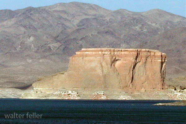
Temple Bar, located on the Arizona side of Lake Mead, has a rich history intertwined with the development and management of the Colorado River and the creation of Lake Mead itself. Lake Mead is a man-made reservoir formed by the Colorado River damming with the completion of the Hoover Dam in 1936. This dam was a monumental engineering project of its time, aimed at controlling floods, providing irrigation water, and generating hydroelectric power for the southwestern United States.
The Temple
The name “Temple Bar” predates Lake Mead and is believed to have been named after a rock formation in the area resembling a temple. As Lake Mead filled, Temple Bar became an important recreational area. It is one of the many sites around Lake Mead that offers access to the water for boating, fishing, and other water sports, along with facilities for camping and lodging.
Before Lake Mead flooded the area, the region was home to indigenous peoples who left behind petroglyphs and other archaeological sites for thousands of years. With the arrival of European settlers, the area saw various uses, including as part of trade routes, mining operations, and later, as recreational sites once the dam was completed.
The creation of Lake Mead and facilities like Temple Bar marked a significant change in how the American Southwest dealt with water, turning the arid region into a place where large-scale agriculture and urban centers could develop, thanks to the availability of controlled water resources. Over the decades, Lake Mead has become not just a utilitarian body of water but also a major recreational destination, drawing visitors worldwide.
Environmental changes and challenges have also affected Lake Mead and Temple Bar. Water levels in the lake have fluctuated significantly in recent years due to ongoing drought conditions, impacting the area’s ecology and the human activities that depend on the lake. These changes have spurred efforts to manage water resources more sustainably and to balance the needs of urban development, agriculture, and the natural environment in the Colorado River Basin.
The history of Temple Bar, like much of the region around Lake Mead, is a testament to human ingenuity and adaptation in the face of harsh environmental conditions. It reflects broader themes in American and environmental history, including the impact of human activities on natural landscapes and the ongoing challenges of managing water resources in the West.
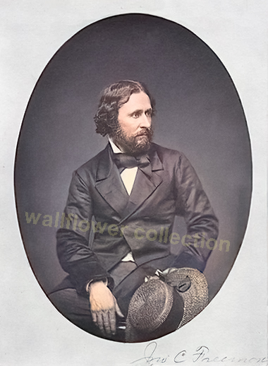
So, this story takes place north of the Mojave. However, it is still relevant to John C Fremont’s 1843-44 survey expedition of the Mojave Desert and how he lost a cannon.
“Fremont’s Lost Cannon” refers to a historical incident involving John C. Frémont, an American explorer, military officer, and politician. During one of his expeditions in the 19th century, specifically the third expedition (1845-1846) aimed at mapping and exploring the Western United States, John C. Frémont brought along a cannon for defense purposes. This expedition was crucial in the context of the U.S. expansion westward, including the period of the Mexican-American War.
The story goes that while traversing challenging terrains, including the Rocky Mountains and the Sierra Nevada, Frémont’s party faced significant difficulties. The terrain and conditions were so harsh that the expedition had to abandon the cannon in the snow to save themselves and their other supplies. This occurred as they attempted to cross the Sierra Nevada during the winter, which was an extraordinarily difficult and risky endeavor then.
The exact location where the cannon was abandoned has been a subject of speculation and interest among historians and treasure hunters. Some attempts have been made to find the lost cannon, but as far as public records indicate, it remains lost to history. The story of Fremont’s lost cannon is often cited as an example of the challenges faced by early explorers of the American West and the lengths to which they went in their efforts to map the continent and secure it for future American settlement.
–
John C. Frémont, known for his exploration and mapping of the American West, did not explicitly have permission from the U.S. government to take a cannon on his expeditions. His expeditions, particularly the one in 1845-1846 leading into the beginning of the Mexican-American War, were officially for the purpose of mapping and exploration. However, the political and military context of the time suggests that his actions were not entirely outside the interests of the U.S. government.
Frémont was a lieutenant in the U.S. Army, and his expeditions were funded and supported by the government, specifically by the Corps of Topographical Engineers. The third expedition, which is often associated with the story of the lost cannon, was aimed at mapping the Oregon Trail and further exploring the Great Basin and California, which were not yet part of the United States but were of significant interest due to the manifest destiny ideology and tensions with Mexico.
Although there might not have been explicit permission for using a cannon, the military nature of his role and the implicit support of expansionist elements within the U.S. government suggests that his actions, including arming his expedition, aligned with broader U.S. interests in the region. Using a cannon could be considered a precautionary measure for defense against potential threats, considering the hostile territories they were exploring and the uncertain political situation with Mexico at the time.
Frémont’s expeditions, especially the third one, played a significant role in the U.S. expansion westward, contributing to the outbreak of the Mexican-American War and the eventual annexation of California and other territories to the United States. The ambiguity around permission for the cannon reflects the complex mix of exploration, military reconnaissance, and political maneuvering characteristic of U.S. westward expansion during that period.
–
Jessie Benton Frémont, the wife of John C. Frémont, played a significant role in her husband’s expeditions, including the suggestion to take a cannon on his third expedition. Jessie was supportive of her husband’s ventures and actively involved in planning and advocating for his work. She was the daughter of Senator Thomas Hart Benton of Missouri, a prominent advocate of westward expansion, which likely influenced her interest and involvement in her husband’s exploratory missions.
Jessie Benton Frémont was known to be a strong and intelligent woman who understood the political and military implications of her husband’s expeditions. Her suggestion to take a cannon along on the expedition can be seen as a strategic move, understanding the potential for conflict and the need for protection in the uncharted territories they were to explore. The cannon symbolized both a means of defense and a statement of American power and intent in the face of foreign claims to the territories of the West, especially with tensions rising between the United States and Mexico over territories such as California.
Her involvement went beyond mere suggestions; Jessie was instrumental in editing and preparing Frémont’s reports and writings for publication, helping to shape the narrative of his expeditions and the image of the American West in the minds of the U.S. public and policymakers. These reports played a significant role in drumming up support for westward expansion and contributed to the mythology of the American frontier.
Jessie Benton Frémont’s suggestion to take a cannon underscores her understanding of the complexities of the expedition, not only in terms of exploration but also in the context of national ambition and security.
The Loggerhead Shrike, scientifically known as Lanius ludovicianus, is a fascinating and unique bird species, notable for its predatory habits despite its small size. It belongs to the shrike family, which is known for its members’ unusual behavior of impaling their prey on thorns, twigs, or barbed wire. This distinctive behavior has earned them the nickname “butcher birds.”
Characteristics
Size and Appearance: The Loggerhead Shrike is a medium-sized bird measuring about 8 to 9 inches long. It has a distinctive black mask that extends across its eyes and forehead, a grey back, and a white underbelly. Its wings are black with white patches, and it has a relatively large head compared to its body size, which is where its name “loggerhead” comes from.
Diet: This bird is carnivorous, feeding on various prey, including insects, small mammals, birds, and reptiles. It lacks the strong talons of raptors, so it uses its hooked beak to kill and manipulate its prey.
Habitat: Loggerhead Shrikes are found across North America, particularly in open habitats such as grasslands, farmlands, and desert edges. They require environments with suitable perches for hunting and dense vegetation or other structures for impaling their prey.
Reproduction: They are monogamous birds that nest in trees or shrubs. The female typically lays 4 to 8 eggs, which both parents help to incubate. After hatching, the young are fed by both parents until they are ready to fledge.
Conservation Status
The Loggerhead Shrike is considered a species of conservation concern in many parts of its range due to habitat loss, pesticide use, and collisions with vehicles. Efforts are being made to monitor populations and conserve their habitats to help stabilize and increase their numbers.
Despite their fierce hunting habits, these birds play an important role in their ecosystems by controlling insect and small vertebrate populations. Understanding and conserving the Loggerhead Shrike and its habitat is vital for maintaining the balance of ecosystems where these unique birds live.
OpenAI. (2024). ChatGPT (4) [Large language model]. https://chat.openai.com
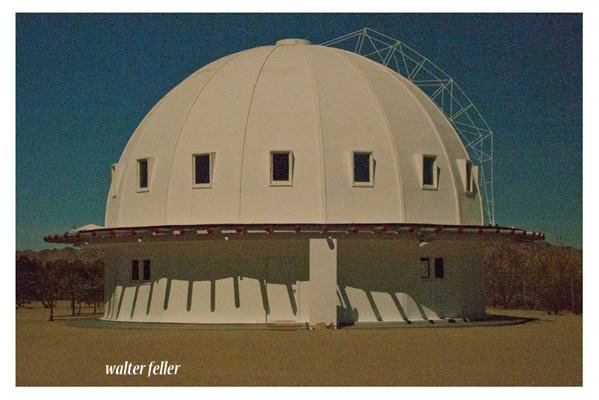
The Integratron is a unique and historic structure located in Landers, California, near Joshua Tree National Park. Designed by George Van Tassel, who was an aeronautical engineer, ufologist, and contactee, the Integratron is a 38-foot high, 55-foot diameter, all-wooden dome that was constructed without the use of nails to ensure a perfect acoustical environment. Van Tassel claimed that the Integratron was capable of rejuvenation, anti-gravity, and time travel and that its design was inspired by Moses’ Tabernacle and the work of Nikola Tesla. The building sits on a powerful geomagnetic vortex in the Mojave Desert, adding to its mystical appeal. Today, the Integratron is known for its “Sound Bath” experiences, offering visitors deep relaxation, rejuvenation, and introspection through the use of sound waves generated within the structure’s acoustically perfect dome
Indian Cove is a popular area within Joshua Tree National Park, known for its stunning rock formations, unique desert landscapes, and accessibility for camping and rock climbing. Located in the Mojave Desert of California, this area offers a different experience than the park’s main parts due to its unique geology and vegetation. Indian Cove is characterized by its towering rock walls, which make it a favorite spot for climbers of various skill levels.
The campground at Indian Cove is nestled among the massive boulders, providing a scenic backdrop for campers. It’s one of the few campgrounds in Joshua Tree National Park that can be reserved in advance, making it a convenient option for visitors planning their trip. The area also features several hiking trails, ranging from easy walks to more challenging hikes, allowing visitors to explore the desert landscape and wildlife.
Indian Cove is accessed from a road different from the main park entrances, located off Highway 62, which makes it somewhat separate from the rest of Joshua Tree National Park. This separation adds to its secluded and exclusive feel, although it is still part of the park and subject to the same rules and regulations.
Visitors to Indian Cove can enjoy the natural beauty and outdoor activities and the opportunity to experience the quiet and solitude of the desert. Nighttime brings clear, starry skies, making it an excellent location for stargazing.
To visit Indian Cove, it’s important to check the latest information on Joshua Tree National Park’s official website or contact the park directly for current conditions, campground availability, and any specific requirements or restrictions that may be in place.
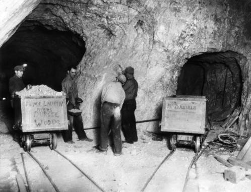
Denver Public Library Special Collections, [call number]
Title
Silver Queen Mine Mojave Calif.
Date
1934 December 4
Summary
Miners, including Andrew Holmes, inspect a piece of ore in a tunnel of the Silver Queen Mine (a gold mine) near Mojave, California. Two mine cars that read: “R. L. McLaurin Myers Durkee Woods” and “M. Daniels” are nearby.
Title hand-written on back of print. Type-written label attached to back of print reads: “Associated Press Photo” and contains historical information. R7100614761
Corrections and Suggestions
If you have a question or a correction regarding this resource, please contact us at history@denverlibrary.org
Like in many desert environments, natural erosion in the Mojave Desert is a process influenced by a combination of factors, including wind, water, temperature fluctuations, and biological activity. These forces work together to shape the landscape over time, contributing to the unique features characteristic of the desert. Here’s an overview of how these factors contribute to natural erosion in the Mojave Desert:
Wind Erosion: Wind is a significant agent of erosion in the Mojave Desert. Strong winds can pick up and transport sand and smaller particles in a process known as deflation, leaving behind larger rocks and creating features such as sand dunes and yardangs (streamlined rock formations carved by wind-blown sand). Wind erosion can also polish and shape rocks and landforms through a sand-blasting effect.
Water Erosion: Although the Mojave Desert is known for its arid climate, it does experience occasional heavy rains and flash floods, especially during thunderstorms. These sudden downpours can rapidly erode the landscape, carving out gullies and washes and shaping canyons and valleys. Water erosion is particularly effective because the dry, compacted soil and sparse vegetation offer little resistance to the force of running water.
Temperature Fluctuations: The Mojave Desert experiences extreme temperature variations between day and night, contributing to mechanical weathering, which breaks down rocks without chemical change. This occurs as minerals in the rocks expand and contract at different rates due to the temperature changes, leading to the formation of cracks and ultimately causing the rocks to break apart. Over time, this process further breaks down rock materials that can be more easily eroded by wind and water.
Biological Activity: The activity of organisms, including plants, animals, and microorganisms, can also contribute to erosion in the Mojave Desert. For example, the roots of plants can grow into cracks in rocks, eventually prying them apart. Burrowing animals can move soil and rock, exposing new surfaces to erosion. Microbial and fungal activity can also chemically weather rock surfaces, making them more susceptible to erosion.
Chemical Erosion: Although less visible, chemical weathering plays a role in shaping the Mojave Desert landscape. This involves the breakdown of rocks through chemical reactions, such as the dissolution of minerals by water. This process can be particularly evident in areas with saline soils and water sources, forming unique mineral deposits and features.
These natural erosion processes are slow and occur over long periods, gradually sculpting the desert’s landscape into its current form. The interaction of these factors creates a dynamic environment where landforms are continuously shaped and reshaped, contributing to the diverse and striking landscapes found in the Mojave Desert.
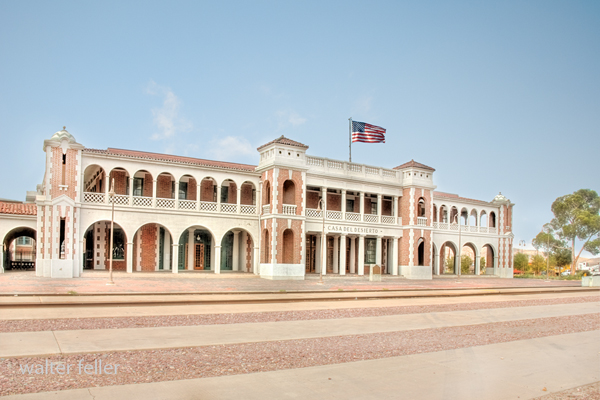
History of Casa del Desierto, Harvey House, Barstow, California
Casa del Desierto
The Casa del Desierto in Barstow, California, is a significant landmark with a rich history, symbolizing the Harvey Houses’ bygone era. In partnership with the Santa Fe Railway, Fred Harvey established a chain of Harvey Houses along the railroad in the late 19th and early 20th centuries. These establishments provided high-quality food and lodging to travelers, revolutionizing railway dining and accommodation in the United States.
The Casa del Desierto, meaning “House of the Desert,” was built in 1911 and is one of the finest examples of the Harvey House establishments. Designed in the Spanish Colonial Revival style, it reflects the architectural elegance and grandeur intended to attract and serve passengers of the Santa Fe Railway. This particular Harvey House played a crucial role in the development of the American Southwest by providing a luxurious stopover for travelers traversing the vast and arid Mojave Desert.
Throughout its operational years, the Casa del Desierto served as a restaurant and hotel and housed the Barstow railroad depot, a Harvey Company retail store, and a telegraph office. It was a vital part of the community and a hub of activity, embodying the spirit of hospitality and the cultural exchange between the East and West.
However, with the decline of railway travel and the rise of automobile transportation, the demand for Harvey House services diminished. The Casa del Desierto closed its doors in the late 20th century and fell into disrepair. Recognizing its historical and architectural significance, efforts were made to preserve and restore the building.
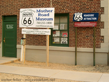
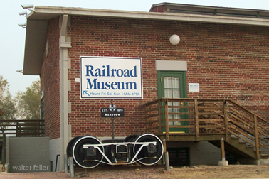
Today, the Casa del Desierto has been repurposed and houses the Barstow Area Chamber of Commerce, the Western America Railroad Museum, and the Route 66 “Mother Road” Museum. It stands as a testament to the vision of Fred Harvey and the importance of the Harvey Houses in American history. It is listed on the National Register of Historic Places, ensuring its preservation for future generations to appreciate the legacy of the Harvey Houses and their impact on travel and culture in the American Southwest.
A high desert community NW of San Bernardino. The area was known as Sheep Creek in the early 1900s ) and when the AFPO was filed on 2 May 1916, the name “Renfroe” was requested, allegedly to the surprise of natives who crossed it off the application and substituted Phelan. Phelan was for former San Francisco mayor James Phelan, and again, the locals claimed the name was “foisted” off on them against their wishes by the P.O.D. At any rate, the name was given the P.O. and remains the community name. Before the P.O. was established, mail was delivered from Victorville 3 times a week for five years by Isaac McAllister, who had homesteaded in 1915.
Postmaster Ruth McDaniel states the office had four different locations in and around the small town since 1916 and is presently located in a mall at 4184 Phelan Rd. It has over-flowed its building and has a permanent trailer for retail sales in front of the facility. The office has ten employees making 4,000 deliveries to an estimated patronage of 10,000.
From Postal History of San Bernardino County by Lewis Garrett
The name “Twentynine Palms,” referring to the city in California, indeed lacks a hyphen, which might seem unusual given the norm in English to hyphenate compound numbers from twenty-one through ninety-nine. The reason for this absence of a hyphen in “Twentynine Palms” is more historical and conventional than grammatical.
Oasis of Mara (colorized vintage photo)
The city’s name comes from the original designation of the area by the Oasis of Mara, where it was noted by early settlers or possibly by surveyors that there were twenty-nine palm trees at the site. This naming convention stuck, and the specific styling of “Twentynine” without a hyphen became the city’s official name. Over time, this styling was retained in official documents, signage, and local usage, making it the standard spelling.
In-place names, especially hyphens, can vary widely and are often dictated by tradition or local preference rather than strict grammatical rules. Once a name is established and recognized in official records, it tends to remain unchanged to preserve historical consistency and identity. This is why “Twentynine Palms” remains without a hyphen, reflecting its unique history and how it was originally named.
Randsburg, often called a “living ghost town,” is a unique and fascinating study in architectural resilience, adapting to both the harsh desert environment and the boom-and-bust cycles characteristic of mining towns. In the high desert of California, Randsburg’s architectural style reflects its history as a late 19th-century gold mining town that has managed to retain a small population even as its mining operations have largely ceased.
The architectural significance of Randsburg lies not just in the individual structures but in the town’s overall ability to maintain its historical character while adapting to modern needs. It serves as a case study in preserving historical architecture in challenging environments and economic conditions.
Randsburg’s architecture tells the story of its past, from the optimism of the gold rush era to the perseverance required to survive once the initial boom faded. The town’s ability to attract tourists and maintain a sense of community amidst its historic buildings is a testament to the enduring appeal of architectural heritage.
Randsburg’s architecture offers valuable insights into the life and times of a mining town that has weathered the ups and downs of fortune. Its buildings, both preserved and decaying, provide a tangible connection to the past. At the same time, the town’s ongoing adaptation speaks to the resilience of its community and the enduring relevance of its architectural legacy. Randsburg stands as a living ghost town where architecture plays a crucial role in keeping its history alive.
Elmer Long’s Bottle Tree Ranch is a unique outdoor art gallery on the historic Route 66 in Helendale, California. This folk art installation is a fascinating example of American roadside culture and creativity. Elmer Long began creating his Bottle Tree Ranch in the early 2000s, using bottles collected from his childhood adventures in the desert with his father. The ranch features hundreds of metal trees adorned with thousands of glass bottles and various found objects and antiques, creating a colorful and whimsical landscape.
Visitors to the Bottle Tree Ranch can wander through the forest of bottle trees, each clinking and clattering in the wind, creating a serene yet eerie musical symphony. The installation is not just a display of recycled art; it’s a personal history and homage to the spirit of exploration and beauty in discarded items. Each tree and item on the ranch tells a story, making it a poignant stop on the journey along Route 66.
Elmer Long’s Bottle Tree Ranch is a testament to the artist’s creativity and dedication to transforming everyday objects into something magical. It’s a must-see for travelers interested in folk art, Americana, and the history of Route 66. The ranch provides a unique photo opportunity and a chance to experience one of the most iconic and imaginative roadside attractions in the United States.
The “Boy in the Box” incident occurred in 1969 at Solar Ranch near Vidal, California. This case involved a six-year-old boy named Anthony Saul Gibbons, who was found sitting inside a six-foot by six-foot box with a chain padlocked to his left leg and attached to a heavy metal plate. This incident was connected to the Solar Lodge of the Ordo Templi Orientis, a magical organization established in 1965 in California. The lodge owned several businesses in Vidal, including a gas station with a cafe, motel, bar, house, and grocery store.
The case became infamous when it was revealed that the boy was mistreated by members of the lodge, leading to charges of child endangerment. It was alleged that the boy had been chained inside the box for 56 days; however, it was later clarified that he was only in the box for 10 hours. To avoid prosecution, several officers of the lodge fled California.