PALEONTOLOGY – Mojave Desert – Glossary of Terms and Definitions
mojavedesert.net › glossary › paleontology
The study of fossils and their relation to geologic time. … Paleontology Miocene fossils have been found in the cliffs of Red Rock Canyon. Scientists continue …
Mojave Desert Paleontology
The study of fossils and their relation to geologic time.
Paleontology in Red Rock Canyon
Wrightwood, Ca. Mountain Hardware Wrightwood, Ca. Canyon Cartography · DesertLink. Links to Desert Museums, Grizzly Cafe Family Dining …
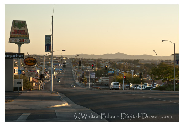
Geology of the Mojave River
digital-desert.com › mojave-river › geology
The river flows below the surface for much of its length and only intermittently at the surface. The Mojave River, an arid desert lifeline, supplies water and …
Fossils, Rocks, and Time: Fossils and Rocks
digital-desert.com › paleontology › fossils-rocks
Geology : Paleontology. FOSSILS AND ROCKS. To tell the age of most layered rocks, scientists study the fossils these rocks contain. Fossils provide important …
Red Rock Canyon California State Park
digital-desert.com › red-rock-canyon
Red Rock Canyon State Park, Mojave California, Mojave Desert.
Fossils, Rocks, and Time: The Relative Time Scale
digital-desert.com › paleontology › relative
Geology : Paleontology. THE RELATIVE TIME SCALE. Long before geologists had the means to recognize and express time in numbers of years before the present …
Fossils, Rocks, and Time: The Numeric Time Scale
digital-desert.com › paleontology › numeric
Geologic time scale showing both relative and numeric ages. Ages in millions of years are approximate. Nineteenth-century geologists and paleontologists …
Fossils, Rocks, and Time: Fossil Succession
digital-desert.com › paleontology › succession
Geology : Paleontology. FOSSIL SUCCESSION. Three concepts are important in the study and use of fossils: (1) Fossils represent the remains of once-living …
Fossils, Rocks, and Time: Putting Events in Order
digital-desert.com › paleontology › order
Geology : Paleontology. PUTTING EVENTS IN ORDER. Scientists who study the past try to put events in their proper order. When we discuss events that happened …
Fossils, Rocks, and Time: Table of Contents
digital-desert.com › paleontology › index-frt
Geology : Paleontology. FOSSILS, ROCKS, AND TIME. INTRODUCTION. We study our Earth for many reasons: to find water to drink or oil to run our cars or coal …
FOSSIL – Mojave Desert – Glossary of Terms and Definitions
mojavedesert.net › glossary › fossil
The Fossil Canyon Loop Road is an interesting route for vehicle touring. … Mojave Desert Paleontology The study of fossils and their relation to geologic …
Fossils, Rocks, and Time: Rocks and Layers
digital-desert.com › paleontology › rocks-layers
Geology : Paleontology. ROCKS AND LAYERS. We study Earth’s history by studying the record of past events that is preserved in the rocks. The layers of the …
Mojave Desert – Scavenger
mojavedesert.net › glossary › scavenger
Paleontologists are … Raven – Desert Wildlife. Raven – Raven Also see > Bird: Omnivore : Scavenger: Predator: Diurnal Mammals – Predators Mountain Lion · …
Mojave Desert Geology
digital-desert.com › geology
Paleontology. The scientific study of prehistoric plants and animals in their geologic context. Alluvial material in dry wash. Dry Lake – Playa Desert Varnish …
Red Rock Canyon – Mojave California
digital-desert.com › red-rock-canyon › introduction
Located in the southern El Paso Mountains, these colorful cliffs with their stark beauty and unique features have attracted hikers, geologists, paleontologists, …
Cajon Pass Geology
digital-desert.com › cajon-pass › geology
Pliocene and Pleistocene evolution of the Mojave River, and associated tectonic development of the Transverse Ranges and Mojave Desert, based on borehole …
Dr. Joan S. Schneider
mojavedesert.net › people › schneider-joan
Mojave Desert History > Names in History. Dr. Joan S. Schneider. Photo of Dr Joan Schneider at Joshua Tree National Park Joan S. Schneider, Ph.D.
ANTIQUITIES – Mojave Desert – Glossary of Terms and Definitions
mojavedesert.net › glossary › antiquities
ANTIQUITIES – A general term for archaeological or paleontological resources which are at least 100 years of age and which tangibly represent or have the …
Lake Mead
digital-desert.com › lake-mead
Three of America’s four desert ecosystems–the Mojave, the Great Basin, and the Sonoran Deserts–meet in Lake Mead NRA. As a result, this seemingly barren area …
References – Mojave Preserve – California Mojave Desert
digital-desert.com › mojave-preserve › geology
Hewitt, D.F., 1956, Geology and mineral resources of the Ivanpah quadrangle, California and Nevada: U.S. Geological Survey Professional Paper 275, 172 p.
The Grand Canyon
digital-desert.com › grand-canyon
Grand Canyon National Park, a World Heritage Site, encompasses 1,218,375 acres and lies on the Colorado Plateau in northwestern Arizona. The land is semi-arid …
RELATIVE DATING – Mojave Desert – Glossary of Terms and …
mojavedesert.net › glossary › relative-dating
RELATIVE DATING – A method of dating rock layers by their relationships or proximity to each other. Both archaeologists and paleontologists use relative dating.
Elizabeth Campbell
mojavedesert.net › people › campbell-elizabeth
Elizabeth Campbell. Photo of Elizabeth Campbell, Mojave Desert archeologist. NPS photo – colorized. Elizabeth Warder Crozer was born in August of 1893 into a …
Grand Canyon natural environments
digital-desert.com › grand-canyon › natural
Near the Colorado River, riparian vegetation and sandy beaches prevail. Just above the river corridor a desert scrub community exists complete with a wide …
Kokoweef Caves
mojavedesert.net › desert-fever › kokoweef
Kokoweef and the mysterious river of gold in the Mojave Desert.
Cajon Pass Heritage
digital-desert.com › cajon-pass › cajon-fs-heritage
Heritage resources in the Cajon Pass region of the Mojave Desert.
Mojave Desert – Glossary of Terms and Definitions
mojavedesert.net › glossary
Mojave Desert Glossary. The following definitions may be helpful. In most instances, they may not be specific to, or, all-inclusive of, the Mojave Desert.
Kokoweef
digital-desert.com › kokoweef
If there were what may be trillions of dollars in gold lying at the bottom of an ‘unrediscovered’ river running from the Great Basin under the Mojave Desert to …
Rainbow Basin
digital-desert.com › rainbow-basin
Land ownership status can be found on the “Cuddeback Lake” Desert Access Guide. These BLM maps can be purchased from any California Desert District BLM …