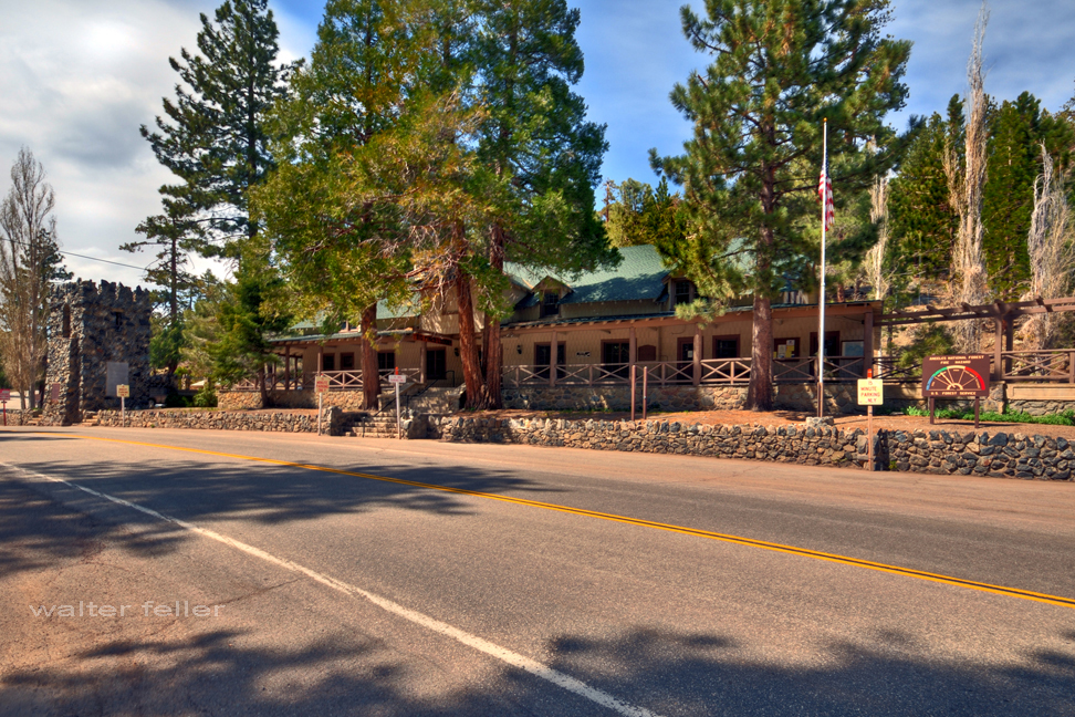
Swarthout Lodge, located in the Big Pines Recreation Area of the Angeles National Forest, has a rich history tied to developing recreational facilities in Southern California. Here’s a detailed overview of its history:
Early Beginnings
1924: The Los Angeles County Board of Supervisors established the Big Pines Recreation Area as a mountain resort to promote public recreation. This was part of a broader effort to make the natural beauty of the San Gabriel Mountains accessible to the public.
Initial Development: The area quickly became popular for winter sports and summer activities. Facilities such as lodges, cabins, and a ski jump were constructed to accommodate visitors.
Swarthout Lodge
Construction: Swarthout Lodge was one of the central buildings in the Big Pines Recreation Area. Named after H. L. Swarthout, the lodge served as a visitor hub.
Architecture: The lodge was designed in a rustic style typical of mountain resorts of the era. Its focus was on blending into the natural surroundings while providing essential amenities for guests.
Role in Recreation
Winter Sports: The lodge played a significant role in promoting winter sports, particularly skiing. Big Pines became a premier destination for Southern Californians seeking snow sports, and Swarthout Lodge was at the heart of this activity.
Summer Activities: During the summer, the lodge served as a base for hiking, fishing, and other outdoor activities. Its location in the Angeles National Forest provided easy access to numerous trails and scenic spots.
Decline and Changes
Mid-20th Century: As recreational trends changed and other mountain resorts developed, the popularity of Big Pines and Swarthout Lodge began to decline. Additionally, natural disasters like fires and floods affected the area, leading to periods of reconstruction and change.
Transition: Over the years, the lodge’s management and use evolved. Parts of the original facilities were repurposed or fell into disrepair, reflecting broader changes in public recreation and forest management policies.
Legacy and Current Status
Preservation Efforts: In recent years, efforts have been made to preserve and restore historic structures within the Big Pines Recreation Area, including Swarthout Lodge. These efforts aim to maintain the historical significance and promote the area’s rich heritage.
Modern Use: Today, the Big Pines Recreation Area offers recreational opportunities, although the focus has shifted to more sustainable and environmentally conscious practices. Swarthout Lodge’s history remains a testament to the early efforts to make natural landscapes accessible for public enjoyment.
With its historical significance and role in the development of outdoor recreation in Southern California, Swarthout Lodge remains an important part of the heritage and history of the Angeles National Forest.
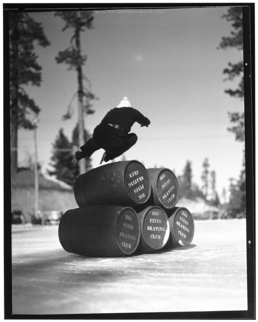
Photograph of ice skate jumping at Big Pines Recreation Camp, 1929. Five barrels labeled “Big Pines Skating Club” are stacked on their sides on the ice at the center. A skater in dark clothing and a lightly-colored hat is mid-jump over the barrels. Tall evergreen trees stand in the background.;
“In 1923, Los Angeles County established a major recreational facility at Big Pines, an all-year resort that included winter and summer sports. Big Pines Recreation Camp (elevation 6,862 feet) had cabins, a dining room, a fountain, and a store. Many buildings still stand (notably one of the two stone towers that once supported a pedestrian overpass across Highway 2, west of Wrightwood). Now administered by the U.S. Forest Service, Big Pines is a popular recreation area encompassing three ski resorts, several campgrounds, and Jackson Lake.”
Title: Ice skate jumping at Big Pines Recreation Camp, 1929 Date: 1929 Collection: California Historical Society Collection, 1860-1960 Owning Institution: California Historical Society Source: Calisphere Date of access: May 19 2024 16:16 Permalink: https://calisphere.org/item/82e13683baac344604588a7655825d43/
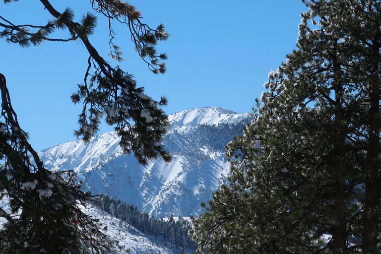
9,399′ high Mt. Baden-Powell’s massif dominates the southwest skyline from Table Mountain.
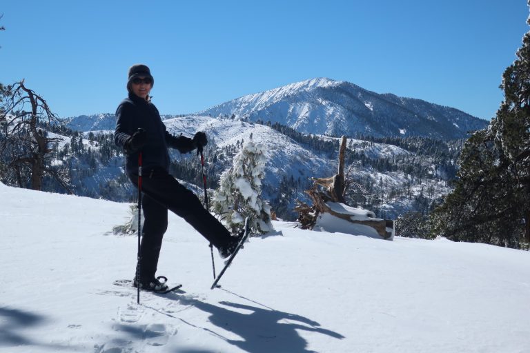
Joanie and I got out for a great afternoon of snowshoeing up on Wrightwood’s Table Mountain about a week and a half ago. Since then, more storms have dropped even more of the precious powder on our local mountains. Whether you like to cross-country ski or snowshoe, it’s a fantastic time to be out amongst our high country peaks, canyons and forests!
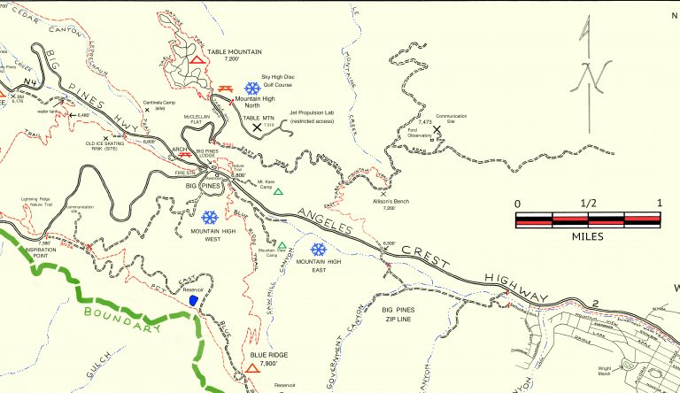
Inset of the Trails of Wrightwood – Big Pines map. The area we went snowshoeing is depicted as Table Mountain (with campground symbol) at an elevation of 7,200′. The west end of Wrightwood appears in the lower right corner of image.
Table Mountain is 7,516′ high and super easy to get to from Wrightwood. Just drive. You’re only looking at four miles from our village center. Make sure to turn off to the right on Table Mountain Road when you arrive at the three way split in the roads at Big Pines. Table Mountain Campground is where we did our snowshoeing on a quiet Friday, where we seemed to have the place to ourselves. The wind had sculpted the snow into pristine dunes along the gently sloping ridge top that the extensive campground straddles.
Joanie seems to almost float atop the powder on the sunny slopes of Table Mountain!
All the campsites were, of course, hidden under the snowy mantle, with just the picnic tabletops presenting themselves as a bit of a depth gauge. Most of the time, snow depth was around 24″ and in places well over three feet. The windward sides of the mammoth white fir and Ponderosas were coated in sparkling icicles that fell like shards of glass in the wind gusts that came out of the southwest. Mt. Baden-Powell kept constant watch over us from across the great gulf of the East Fork of the San Gabriel River. The Mojave Desert off to the north was a mosaic of tans, yellow sands and the right-angled patchwork of green winter crops scattered here and there. It looked and felt warmer down there. And high up on Table Mountain, that day was to be one of cobalt blue skies, bright white snows, wind and evergreens.
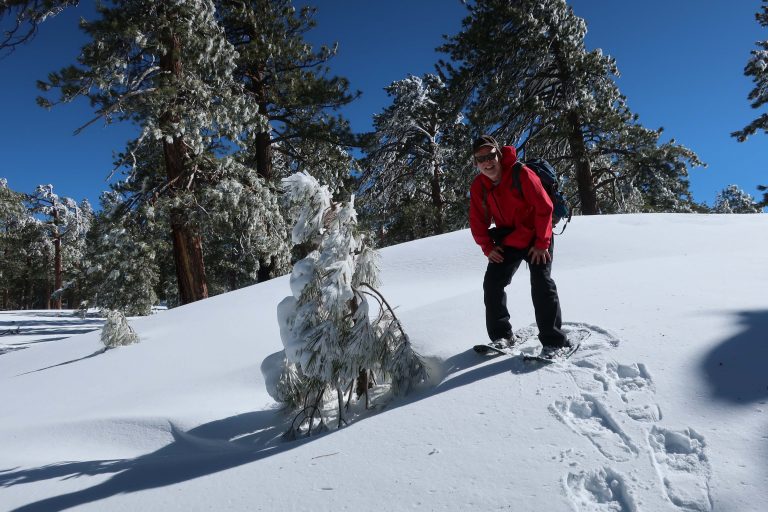
A small wind-bent snowy pine and Chris have a little visit amongst Table Mountain’s frozen forest.
Distance and elevation gain / loss: Approximately one mile (one way) with 400′ of elevation gain.
Follow the gated dirt road that runs atop levee on north side of Heath Creek stream bed.
Hike begins on Thrush Rd, just east of the tee intersection with Victorville St. Walk up the dirt road just west of Heath Creek bridge. There’s a silver-colored pipe gate just a short distance above Thrush.
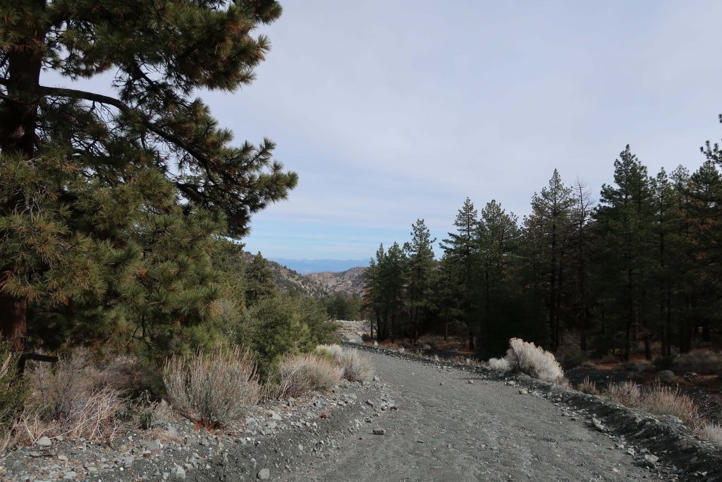
Looking toward the desert on the levee road. This spot is about half-way between the lower and upper pipe gates.
One of the major canyons dropping into Wrightwood’s Swarthout Valley is Heath Creek. It’s the canyon that begins as the large, conspicuous slide on Wright Mountain’s north side. The slide, dropping straight down from the summit is especially prominent from downtown Wrightwood. If you’re outside the post office or Mountain Hardware and looking southward, there’s a really good view of the slide, with Wright Mountain’s pine covered summit just to the left of it (elev. 8,505′). The canyon is named after Harry Heath who homesteaded the east end of the Swarthout Valley, near present day Pacific Crest Estates, back in 1886. Back then, Heath Ranch (circa 1900-1919) had a dairy, as well as boasting an orchard of apple and pear trees irrigated with water conveyed from a stream intake in the watercourse that today bears his name.
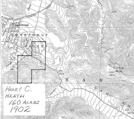
Outline of the former Heath Ranch. Purchased from Sumner Wright in 1902, Harry Heath received his deed for the land in 1910. You can see that some of Heath’s most suitable ranch land was in the area now known as Pacific Crest Estates. Oddly, his 160 acres do not extend to the watershed that bears his name. Map image courtesy of Wrightwood Historical Society.
Pat Krig, a long-time Wrightwood pioneer and historian, wrote down some notes about the Heath Ranch which she visited on horseback as a young girl. The Wrightwood Historical Society generously provided me a copy of her notes from 2006 which portrays what little is known of Harry Heath’s ranch. Unfortunately, there were no photos of either Heath or his ranch. One paragraph in Pat’s reminiscences that in particular stood out to me, was this: “A few of the gnarled apple trees still stand, bearing fruit and bringing memories of hot apple pies for tired travelers, and offers of a pitcher of fresh milk, thick cream for coffee, and butter to spread on warm, fragrant bread then slathered with pumpkin butter.” Pat wrote this back in 2006. Sadly, Pat passed away just this last year, taking with her memories of an earlier time in the mountains that we can only faintly imagine.
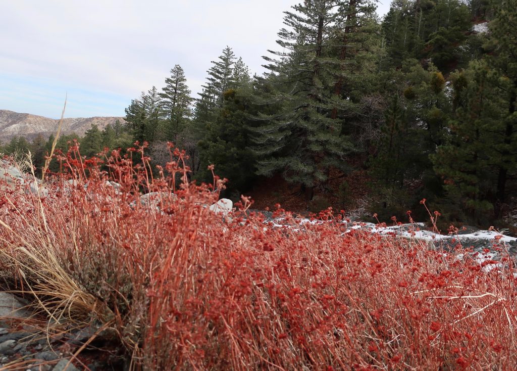
Last year’s dried flower stalks still draw your attention to clumps of buckwheat growing along Heath Creek.
Pearl Comfort Fisher, who wrote “The Mountaineers” back in 1972, provides a brief glimpse into a cowboy’s visit to the Heath Ranch back in 1907. The cowboy was Harvey Cheesman, hired to round up stray cattle from the nearby Lovejoy Springs Ranch. “So it happened that as I came over the divide from Lone Pine Canyon one cold February late afternoon I found the ranch or homestead of Harry Heath at the head of Sheep Creek. Upon knocking at the door I was met by a lady with a small baby in her arms. It was Mrs. Heath. She said, “‘My, am I glad to see some one. A mountain lion has been prowling around here for three nights and my husband is away working, and I am afraid the lion will get some of our pigs and chickens. “No lion showed up that night and I had to go on my way the next day.”
Today, it’s hard to imagine Wrightwood as wild and isolated as it must have been 112 years ago. The upper half of this hike will give you a taste of a quieter more forested Swarthout Valley.
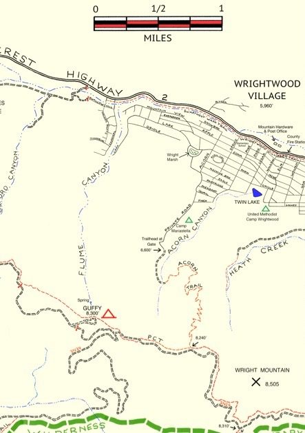
Here’s a small section of the Wrightwood – Big Pines map depicting part of Heath Creek. Access this hike by taking the dirt road that departs south, climbing upslope from Thrush Rd. between Victorville Street and Heath Creek Rd.
This walk is a great one if you just have a little time, say less than an hour and you’d like to get some hill climbing in, too. You’re walking on a flood control levee road. The beginning of your trip is a bit exposed to the sun and completely devoid of trees, much of the landscape down in the wash to your left has a sterile, bleak look due to constant grading from county bulldozers. Not that great at first. . . Hang in there, the bleakness soon ends. Your route soon encounters black oaks, Jeffrey and Ponderosa pines on both sides of the levee road. An enticing flat makes its’ presence across the stream on your left. On your right is a gentle, expansive alluvial slope covered in a healthy pine forest. Mostly private, undeveloped land, this terrain gives you a sense of what Wrightwood must have been like in the 19th century. On a warm day, the air is fragrant with pine and amazingly quiet, save the occasional song bird or acorn woodpecker tapping high above the forest floor.
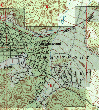
Trailhead for the Heath Creek hike is where Thrush crosses Heath Canyon. Thrush is the straight, east-west trending road just above (north) the “n” in Canyon. Notice that this U.S.G.S. topographic map section still shows Lone Pine Canyon Road crossing Heath Canyon, as it once did prior to the 1969 flood.
After a mile, you’ll encounter another silver painted pipe gate. This is your turnaround point. If you have the time, continue further up along the road to a set of four wooden benches set in a square configuration. Walk on past this gathering area, bearing left and staying with the canyon bottom. Follow a deeply eroded trace of a former jeep road. Essentially now a trail, continue on up the canyon for another 400′ feet of elevation to the trail’s end on a rocky berm above the stream bed. You will also see a little frame structure made from lashed together cedar trunks and limbs.
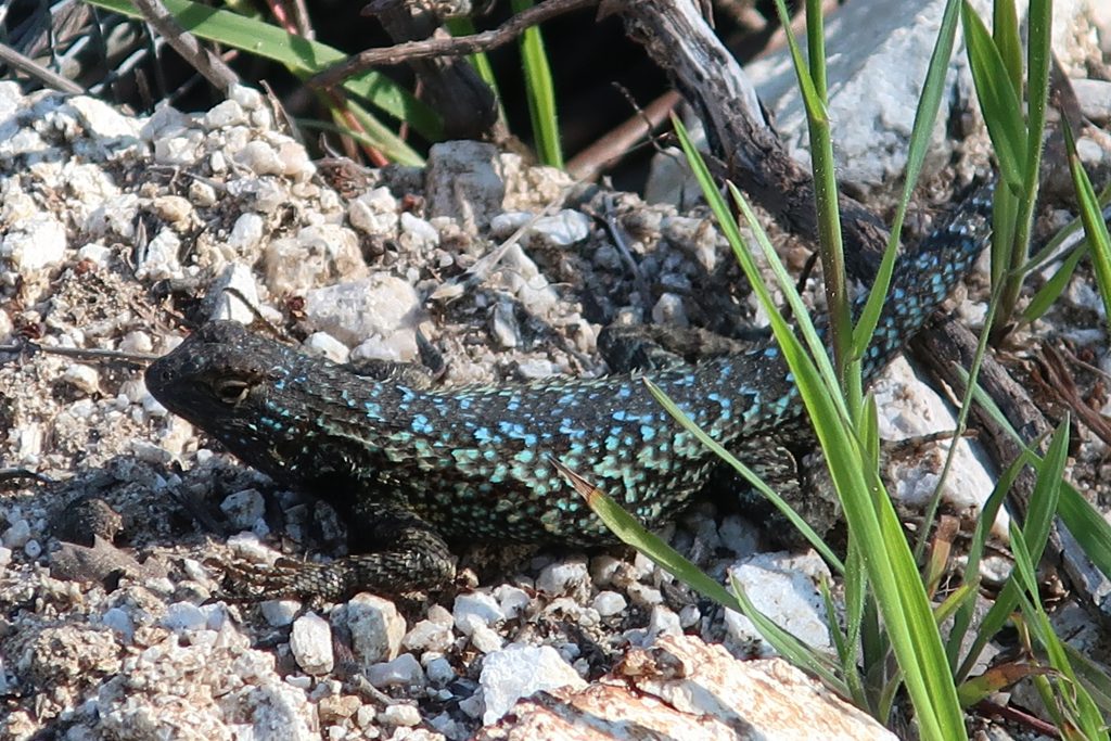
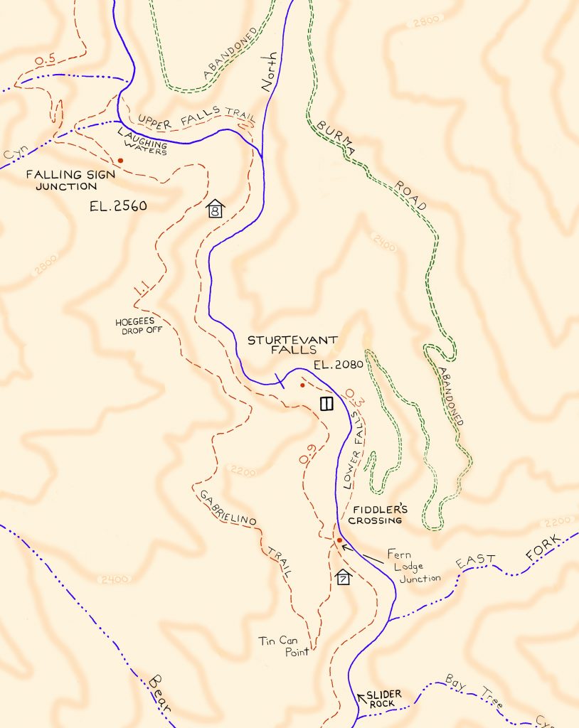
This turquoise colored fence lizard (Sceloporus occidentalis) was seen out in the warmth of early Spring at Tin Can Point. Tin Can Point is just up from Fern Lodge Junction on the Gabrielino Trail. It’s the first switchback you’d encounter after the trail passes through the canyon live oak forest and then enters the chaparral, just a few minutes up from the trail junction.
A beautiful fence lizard basks in the gentle warmth of early Spring at Tin Can Point. See inset of the Chantry Flat – Mt. Wilson Trails map, below, to see where this point is. As of this writing, a cold wet pacific storm is dropping nearly six days of chilly rain and snow in much of the San Gabriel mountains. Big Santa Anita Canyon dam has received over 5 1/2″ of rain in the last week. Something I just learned recently about these Western Fence lizards is that their populations have the effect of reducing the incidence of Lyme’s disease in the ticks that live in the chaparral, such as found covering much of the slopes of the Big Santa Anita Canyon! Apparently, a protein in the lizard’s blood kills the bacterium in the tick’s gut, which is good news for hikers and even their dogs during the spring and autumn months.
Like most reptiles, Western Fence lizards hibernate, at least for a little while each winter throughout their habitats which are wide-spread throughout California. As for food, these lizards eat spiders and various insects such as mosquitos, beetles and grasshoppers. The females lay several small clutches of eggs (3-17) in the spring, the young emerging in the summer.
Detail of Gabrielino Trail section, Chantry Flat – Mt. Wilson Trails map.
On your next hike out from Chantry Flats, watch for for lizards flitting about on the trails and sunning themselves on the myriad stretches of rock. As for the various types of reptiles to be found in the Big Santa Anita, Western Fence lizards are abundant and deserve a place in the sun!
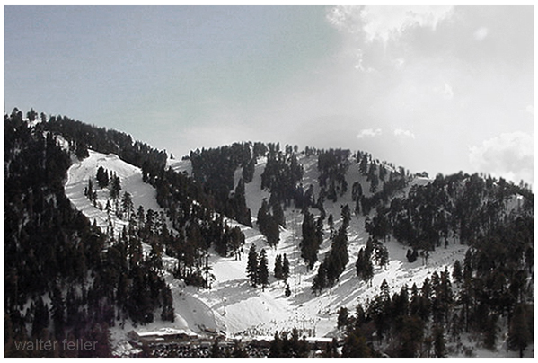
The Blue Ridge Ski Resort in Wrightwood, California, is a historical part of the region’s skiing heritage. However, it’s important to clarify that Blue Ridge Ski Resort is the former name of what is now known as the West Resort of Mountain High.
Early Beginnings: Blue Ridge Ski Resort was among the earliest ski areas developed in the San Gabriel Mountains. Its origins trace back to the 1930s and 1940s when the potential for winter sports in the Wrightwood area was first realized.
Development and Growth: The resort grew in popularity through the mid-20th century. The development of ski lifts and other infrastructure helped establish Blue Ridge as a notable destination for Southern California skiers.
Transition to Mountain High: Blue Ridge Ski Resort evolved and expanded over time. It eventually became part of what is known today as Mountain High. This transition involved a change in name and significant upgrades in facilities and services. The West Resort of Mountain High, the direct successor of the original Blue Ridge Ski Resort, retains much of the historical charm and ski culture from its early days.
Terrain and Features: The area that was once Blue Ridge and is now Mountain High West Resort is known for its varied terrain, catering to skiers and snowboarders of different skill levels. It features a mix of beginner, intermediate, and advanced runs.
Modernization and Improvements: After becoming part of Mountain High, the former Blue Ridge Ski Resort saw substantial improvements, including the installation of more modern and efficient lifts, enhanced snowmaking capabilities, and the development of terrain parks.
Cultural Impact: The history of Blue Ridge Ski Resort is deeply intertwined with the development of skiing culture in Southern California. It was crucial in introducing and popularizing winter sports to a region more commonly associated with beaches and sunshine.
Legacy: Today, while the name Blue Ridge Ski Resort has faded into history, its legacy continues through the West Resort of Mountain High. It remains a testament to the early days of skiing in Southern California and the region’s growth in the sport.
This brief history highlights the transformation of Blue Ridge Ski Resort from its early days to its modern incarnation as part of Mountain High, underscoring its significance in the development of skiing in Southern California.
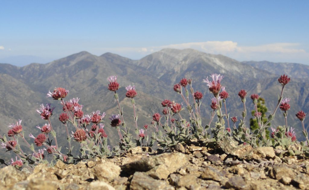
Mt. Baldy and Dawson Peak as seen from the PCT. This view is looking across upper Lytle Creek and still some miles below East Blue Ridge.
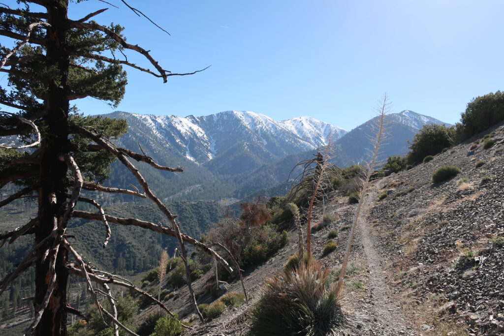
Vincent Gap trailhead is once, again, open to vehicles coming in through Wrightwood. Highway 2 continues to be gated to any driving west of the trailhead. If you’re looking to hike up to Mt. Baden Powell or drop down into the East Fork, all this is possible now and through the summer and autumn months.
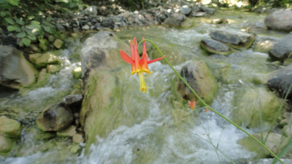
Looking out across the East Fork of the San Gabriel River to Pine Mountain, Dawson Peak and Mt. Baldy. This view is from a spur ridge just below summit of Mt. Baden-Powell. A native Columbine graces the East Fork just downstream from Mine Gulch Campsite .