Willow Springs Raceway: A Storied Legacy in Motorsports

Willow Springs Raceway

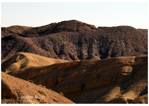
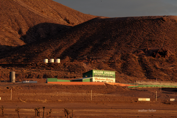
Willow Springs Raceway, also known as Willow Springs International Motorsports Park, stands as a storied institution in the world of motorsports. Located in Rosamond, California, this iconic racing facility has been a cornerstone of American racing since its inception in 1953. Known affectionately as “The Fastest Road in the West,” Willow Springs boasts a rich history, diverse tracks, and a reputation for challenging and exhilarating racing.

A Storied History

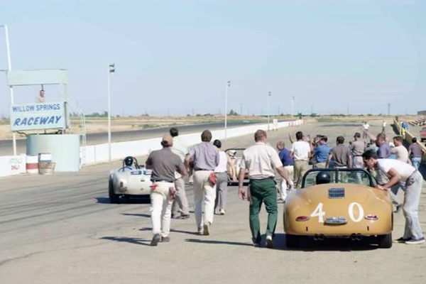
Founded by a group of racing enthusiasts led by Bill Huth, Willow Springs Raceway opened its doors in November 1953 with its inaugural race, quickly establishing itself as a premier racing destination. Over the decades, the track grew in popularity and prestige, attracting top racers and becoming a hub for automotive testing and media production.

Famous Figures and Vehicles

Willow Springs Raceway has a storied legacy and has been home to many iconic drivers and vehicles. I’m impressed by the list of notable names who have raced there, including Mario Andretti, Ken Miles, Carroll Shelby, and even James Dean. Steve McQueen was also a frequent visitor.

As for the cars and motorcycles, the list is just as impressive. The Shelby Cobra, Ford GT40, Porsche 911, and Ferrari 250 GTO are all iconic names in the automotive world, and Willow Springs Raceway has hosted them all. And then there are the motorcycles, like the Yamaha YZR500, Honda RC30, and Ducati 916.

Willow Springs has also hosted famous riders like Kenny Roberts, Wayne Rainey, and Nicky Hayden. The track has been a part of many famous moments in racing, and it continues to offer a challenging and exhilarating experience for drivers and spectators alike.

Diverse and Challenging Tracks

Willow Springs Raceway is a storied institution in the world of motorsports, known for its high-speed straights and challenging corners. The main track, Big Willow, is ideal for those who enjoy an adrenaline rush. But Willow Springs Raceway is home to several tracks, each catering to different types of racing and experience levels.

Streets of Willow is a smaller, technical course, while Horse Thief Mile is favored by drifting enthusiasts and time attack events. The Willow Springs Kart Track is perfect for those who want to test their skills in a competitive environment. Whether you’re looking for speed or technique, Willow Springs Raceway has a track to suit your needs.

Endurance Racing and Top Races

One of the most significant events in the track’s history is the Willow Springs 24-Hour Endurance Race. This grueling event tests both the durability of vehicles and the stamina of drivers, attracting a diverse field of competitors from professional teams to amateur racers. While not held annually, endurance races remain a highlight, showcasing the track’s versatility and challenge.

Other top races include SCCA national races, NASA events, and the Willow Springs Motorcycle Club (WSMC) races. The track has also hosted the Toyota Pro/Celebrity Race and various vintage racing events, adding to its reputation as a premier motorsports venue.

Accidents and Safety

Willow Springs Raceway has experienced its fair share of accidents over the years. Other incidents have occurred during private track days and club racing events. Despite these challenges, the raceway has continually made safety improvements. These include enhanced barriers, runoff areas, and emergency response protocols to ensure a safe environment for all participants.

Conclusion

Willow Springs stands as a testament to the enduring appeal and excitement of motorsports. It has a rich history and diverse tracks, and it continues to attract top racers, automotive enthusiasts, and fans from around the world. With its challenging racing environment and diverse and thrilling experience for drivers and spectators alike, it’s no wonder that Willow Springs remains a beloved and iconic racing facility. It’s a great place to learn how to race, test your skills, and watch professionals.

Stage Stops & Relay Stations

Stagecoach relay stations and accommodations were vital for the stagecoach travel system, especially during the 18th and 19th centuries. These stations were strategically located along stagecoach routes to ensure efficient travel and the well-being of passengers, horses, and drivers.

Relay Stations

Relay stations, also known as “staging posts” or “stage stops,” were positioned every 10 to 20 miles along the route. Their primary purpose was to provide fresh horses for the stagecoach, as they would be exhausted after traveling long distances. At these stations, tired horses were replaced with rested ones, ensuring the stagecoach could maintain a steady pace without long delays.

Key features of relay stations included:

  • Stables: For housing and caring for horses.
  • Feed and Water: Ample supplies of food and water for the horses.
  • Blacksmith Services: For shoeing horses and making necessary repairs to the stagecoach.
  • Shelter: Basic accommodations for passengers if they need a brief rest.

Accommodations

Beyond just relay stations, more substantial accommodations were often provided at larger intervals or significant points along the route. These accommodations varied widely, ranging from simple inns to more elaborate hotels, depending on the route’s location and prominence.

Key features of stagecoach accommodations included:

  • Sleeping Quarters: Rooms for passengers to rest overnight, often shared with other travelers.
  • Dining Facilities: Meals were provided, typically hearty and designed to sustain travelers for the next leg of their journey.
  • Lounge Areas: Common rooms where passengers could relax, socialize, and recover from the journey.
  • Washrooms: Basic facilities for washing up, although these were often quite rudimentary by modern standards.
  • Repair Services: Facilities to fix any damage to the stagecoach or passenger belongings.

The Experience

Traveling by stagecoach was often uncomfortable and tiring. Roads could be rough, and the constant need to change horses meant frequent stops. However, relay stations and accommodations provided necessary breaks and a chance for passengers to stretch their legs, eat, and rest. These stops were crucial for the safety and efficiency of the stagecoach system, making long-distance travel more manageable during this era.

Despite the hardships, stagecoach travel was an essential part of life, enabling communication, commerce, and transportation across vast distances before the advent of the railroad and the automobile.

Overview of Desert Stagecoach Lines Before Railroads

Before railroads revolutionized transportation, stagecoaches were a critical means of public transport across the desert regions. Here are some key stage lines and their operations:

  1. Goldfield Stage (1905): This stage provided transportation services in the Goldfield area.
  2. Applewhite’s Stage: This stage used a three-bench buggy to transport miners from Calico to town for business and lodging.
  3. Arizona Overland Mail (1866-1868): Initially, it was a weekly mail service from Camp Drum to Prescott, Arizona, which later became twice-weekly. It overcame significant challenges, including Indian troubles.
  4. Barnwell to Death Valley Route: A daily stage route from Barnwell to Manse, Nevada, that remained crucial for travelers and miners even after the completion of the Salt Lake Railroad.
  5. Barnwell to Searchlight Stage Line: Operated until 1906 when the Barnwell & Searchlight Railroad commenced.
  6. Black Canyon Stage Station: A stop for the Panamint Transportation Company along the Black Canyon route.
  7. Brooklyn Well: A stage stop on the Dale to Amboy route, providing necessary water and rest.
  8. Butterfield Overland Stage Company (1858-1860): A major mail route running from Missouri to California, passing through the Mojave Desert.
  9. Calico Stage Line (1): Operated between Daggett and Calico from 1885 to 1887 using a six-horse Concord Coach.
  10. Calico Stage Line (2): Provided twice-daily trips between Calico and Daggett with improved coaches and horses.
  11. California Southern Stage Line: Connected Calico with Barstow and San Bernardino.
  12. Cottonwood Stage Station: A notable station that was raided in 1875 by Cleovaro Chavez’s gang.
  13. Crackerjack Auto Transit Company (1907): Introduced auto-stage services between Silver Lake and Crackerjack.
  14. Daggett & Skidoo Stage Line: Operated through Black Canyon.
  15. Dale to Amboy Stage Line (1903-1916): Known as the Buckboard Stage, this line included lunch in its $5 fare.
  16. Death Valley Chug Line (1907): An auto-stage operated by “Alkali Bill” Brong, transporting passengers around Death Valley.
  17. Domingo Stage & Freight (1887): Ran from Providence to Fenner, primarily hauling ore.
  18. Goldstone-Los Angeles Auto Stage: Provided bi-weekly trips between Los Angeles and Goldstone.
  19. Harrison’s Calico Express Line (1882): Connected San Bernardino with Calico, taking a day and a half each way.
  20. Huntington Stage: The first public transport service between San Bernardino and Calico.
  21. Livingstone & Cahill Stage Line: Operated between Barstow, Daggett, and Calico.
  22. Mecham’s Panamint Stage (1874): Charged $30 for a one-way trip from San Bernardino to Panamint.
  23. Nipton & Searchlight Stage Line (1910): Transported passengers and freight between Searchlight and the railroad at Nipton.
  24. Orange Blossom Mining & Milling Company Stage Line (1908): Served the Orange Blossom mines and camp.
  25. Panamint Transportation Company (1873-1874): Ran from San Bernardino to Panamint City, a challenging and critical route for the time.
  26. Perew Auto Stage (1905): An innovative auto-stage line from Manvel to Searchlight.
  27. Pioneer Stage (1890s): Charged $2 for a 5-mile trip from Manvel into Vanderbilt.

These stagecoach lines were essential in connecting remote areas and facilitating commerce, mail delivery, and passenger transport before the widespread advent of railroads. They navigated rough terrain, faced threats from bandits, and dealt with challenging weather conditions to keep the region connected.

Horse Stealing in the American West: A Complex Saga of Survival, Conflict, and Lawlessness

In the mid-19th century, the American West was a land of vast open spaces, sparse settlements, and a constant struggle for survival. Among the various challenges faced by settlers, Native Americans, and other inhabitants of the region, horse stealing emerged as a significant and often dangerous activity. This essay explores the multifaceted nature of horse stealing, its impact on different communities, and the notable figures involved in these activities, focusing on the Mojave Desert and surrounding areas.

Historical Context and Importance of Horses

Horses were introduced to North America by Spanish explorers in the 16th century and quickly became integral to the way of life for many Native American tribes. By the 19th century, horses were indispensable for transportation, labor, hunting, and warfare. For settlers and ranchers, horses were crucial assets, representing significant economic value and practical utility.

The California Gold Rush of the late 1840s brought settlers to the region, intensifying resource competition and escalating conflicts between different groups. Horses’ value made them prime targets for theft, and horse stealing became a widespread problem, contributing to the lawlessness and violence that characterized much of the frontier.

Techniques and Tactics of Horse Stealing

Horse stealing requires a combination of skill, knowledge, and audacity. Thieves often operated in bands, using well-planned tactics to carry out their raids. These tactics included:

  1. Night Raids: Most horse thefts occurred at night when thieves took advantage of the darkness to avoid detection and increase their chances of a successful escape.
  2. Remote Trails: Thieves used remote trails and difficult terrain to evade pursuers. Their knowledge of the landscape was a significant advantage, allowing them to move swiftly and remain hidden.
  3. Speed and Surprise: The element of surprise was crucial. Thieves would strike quickly, gather as many horses as possible, and leave before the victims could organize a response.
  4. Dispersal and Fencing: Stolen horses were often dispersed among various locations or quickly sold to fences, making it difficult for the rightful owners to recover them.

Notable Figures in Horse Stealing

Several prominent figures became infamous for their involvement in horse stealing. Their stories highlight the complexities and contradictions of frontier life.

Walkara: The Ute Leader

Walkara, also known as Chief Walker, was a Ute leader born around 1808. He became one of the most feared and respected figures in the Great Basin and Mojave Desert regions due to his prowess in horse stealing. Leading numerous raids from Utah into California, Walkara amassed thousands of horses. His knowledge of the terrain and guerrilla tactics made him a formidable opponent. Despite his reputation as a horse thief, Walkara was also a shrewd leader and negotiator, embodying the dual roles of protector and predator standard among Native American leaders of the time.

Jim Beckwourth: The Adventurous Frontiersman

James P. Beckwourth, a mixed-race mountain man, fur trader, and explorer, was born into slavery in 1798 and gained his freedom to become one of the most colorful figures of the American frontier. While primarily known for his role as a trader and guide, Beckwourth’s interactions with various Native American tribes, including the Crow, often placed him amid horse raiding activities. His involvement in horse stealing adds another layer to his multifaceted legacy, reflecting the blurred lines between legitimate trade and outlaw activities on the frontier.

Peg-leg Smith: The Notorious Thief

Thomas L. “Peg-leg” Smith, born in 1801, was notorious for horse-stealing raids across the Southwest. Known for his wooden leg, Smith conducted large-scale raids on Mexican ranchos, stealing hundreds of horses and driving them north to American markets. His daring exploits and cunning escapes made him a legendary figure in Western folklore, contributing to the mythos of the Wild West. Smith’s activities disrupted the economies of the regions he targeted and highlighted the challenges of maintaining law and order in the frontier.

The Case of Indian Joaquin

Indian Joaquin, also known as Joaquin Valenzuela, was another significant figure in horse stealing. His band of outlaws, including the Mojave Desert, was active in California and was known for their bold raids. In 1845, Governor Pio Pico sent Benjamin Davis Wilson to lead an expedition against these horse thieves. Wilson’s mission culminated in a confrontation where he shot and killed Indian Joaquin. This event marked a significant moment in the struggle between settlers and Native American bands, illustrating the harsh measures taken to protect property and assert dominance in the region.

Responses to Horse Stealing

The persistent threat of horse stealing led to various responses from both military and civilian authorities:

  1. Military Patrols: Increased military presence and patrols aimed to protect settlements and ranchos from raids. Forts and outposts were established strategically to serve as bases for these operations.
  2. Vigilance Committees: Settlers often formed vigilance committees to protect their property and pursue horse thieves. These groups operated outside formal legal structures, using extrajudicial methods to capture and punish suspected thieves.
  3. Negotiations and Treaties: In some cases, attempts were made to negotiate with raiding groups to establish peace and trade agreements. However, these efforts were often temporary and depended on the shifting dynamics of power and resources.

Impact and Legacy

The impact of horse stealing in the American West was profound, influencing economic stability, social dynamics, and cultural interactions. The legacy of horse stealing includes:

  1. Economic Disruption: The theft of horses had significant economic implications, disrupting transportation, labor, and trade. For many settlers, losing horses meant a critical setback in establishing livelihoods in the harsh frontier environment.
  2. Cultural Tensions: Horse stealing exacerbated tensions between different cultural groups, including Native Americans, Mexican landowners, and American settlers. These tensions often led to violent confrontations and shaped the broader patterns of conflict in the region.
  3. Folklore and Mythology: The exploits of horse thieves and the responses to their activities became part of the folklore of the American West. Stories of daring raids, cunning escapes, and brutal reprisals contributed to the mythos of the Wild West, reflecting the complexities of frontier life.
  4. Law and Order: The persistent threat of horse stealing highlighted the challenges of maintaining law and order in the rapidly expanding frontier. Responses to this threat, including military actions and vigilance committees, underscored the often violent efforts to establish security and protect property.

Conclusion

Horse stealing in the American West, particularly in the Mojave Desert and surrounding regions, was a complex phenomenon that significantly shaped the frontier’s history and culture. The activities of Walkara, Jim Beckwourth, Peg-leg Smith, and Indian Joaquin illustrate the multifaceted nature of horse stealing, reflecting broader themes of survival, resistance, and adaptation in a rapidly changing landscape.

The responses to horse stealing, from military patrols to vigilance committees, highlight the ongoing struggle to establish order and protect property in a region marked by turmoil and conflict. The legacy of horse stealing, with its economic, social, and cultural impacts, continues to be a fascinating and integral part of the history of the American West. Through the stories of these notorious figures and the broader patterns of conflict and adaptation, we gain valuable insights into the dynamic and often chaotic nature of 19th-century frontier life.

Historic Fort Mojave: A Pillar of Frontier Defense

Introduction

Historic Fort Mojave, located along the Colorado River in Arizona, is a landmark of significant historical and cultural importance. Established in 1859 by the United States Army, the fort served multiple roles, from protecting settlers and travelers to acting as a military stronghold during the turbulent times of the Indian Wars and the American Civil War. The fort’s history reflects the broader narrative of westward expansion, conflict, and cultural change in 19th-century America.

Establishment and Strategic Importance

Fort Mojave was strategically situated on the east bank of the Colorado River, near present-day Fort Mojave in Mohave County, Arizona. Its creation was primarily driven by the need to safeguard settlers and travelers navigating the perilous Mojave Road, a crucial route connecting the east and west coasts. The fort’s location was pivotal, offering a military advantage in a region where control over territory was contested by various Native American tribes, particularly the Mojave tribe.

The fort’s initial garrison faced daunting challenges, including harsh desert conditions, extreme temperatures, and limited water resources. Despite these adversities, Fort Mojave emerged as a critical outpost in the United States’ efforts to secure its expanding frontiers. During the Indian Wars, the fort played a key role in military operations aimed at pacifying and relocating Native American tribes, a mission fraught with conflict and complexity.

Role During the Civil War

During the American Civil War, Fort Mojave’s strategic value increased. It served as a vital supply depot and base for Union forces operating in the Southwest. The fort’s presence ensured Union control over a vast and remote region, deterring Confederate incursions and maintaining supply lines crucial for the war effort. This period marked the fort’s peak in military significance, as it became a hub of logistical and operational activity in a largely unsettled frontier.

Garrison Life and Economic Impact

Life at Fort Mojave for soldiers and their families was a mix of military routine and adaptation to the harsh desert environment. Daily activities included drills, patrols, and maintaining the fort’s infrastructure. The soldiers’ resilience in extreme conditions is a testament to their determination and discipline. The fort also acted as a catalyst for local economic development. The influx of soldiers and associated personnel brought economic activity to the area, fostering the growth of nearby settlements and creating a foundation for future community development.

Decline and Post-Military Use

As the Indian Wars subsided and the American frontier became more settled, Fort Mojave’s military importance waned. By 1890, the fort was officially abandoned by the military. However, its legacy continued as the site found new life in various civilian roles. Notably, it was repurposed as a reservation school for Native American children, symbolizing a shift from conflict to education and cultural integration.

Establishing the Fort Mojave Indian Reservation further ensured the preservation of the site’s historical and cultural significance. The reservation, which spans Arizona, Nevada, and California, has become a vibrant community engaged in agriculture, gaming, and tourism. Efforts to preserve and interpret the history of Fort Mojave include historical markers and exhibits, which provide educational opportunities for visitors and honor the fort’s complex past.

Cultural and Historical Significance

Fort Mojave is a significant cultural heritage site for the Mojave tribe and other Native American communities. It embodies a period of dramatic transition, reflecting the broader themes of westward expansion, military strategy, and cultural interaction in American history. The fort’s preservation efforts underscore the importance of remembering and understanding this chapter of the American frontier.

Conclusion

Historic Fort Mojave is more than a relic of military history; it is a symbol of the enduring legacy of the American West. From its establishment as a frontier defense outpost to its role in the lives of Native American communities, Fort Mojave offers a window into the complex and often contentious history of the 19th-century American frontier. Its story is a testament to resilience, adaptation, and the enduring significance of cultural heritage in shaping our understanding of the past.

Historic Journey: The Road to Panamint

Introduction

Nestled within the rugged landscapes of Eastern California, the Panamint Valley is home to a historical artery that has played a pivotal role in developing the American West—the road to Panamint. Originally trodden by Native Americans and later transformed by the ambitions of silver miners, this route not only facilitated economic booms but also bore witness to the ebbs and flows of fortune. The road to Panamint is a testament to the region’s mining era, epitomizing the broader transportation infrastructure development crucial for westward expansion.

Historical Background

The Panamint Valley, framed by the arid peaks of the Panamint Range, was first utilized by the Shoshone Native Americans, who traversed these harsh landscapes following seasonal migration patterns and trade routes. The discovery of silver in 1872 marked a turning point for the valley. News of silver attracted droves of prospectors, catalyzing the establishment of mining camps and the nascent stages of the road. This road would soon become the lifeline for a burgeoning settlement, later known as Panamint City.

Development of the Road

The transformation from a series of Native trails to a fully functional road was propelled by the mining industry’s explosive growth. As prospectors and entrepreneurs flooded the area, the demand for a reliable transportation route skyrocketed. The road to Panamint was quickly carved out of the valley’s rugged terrain, facilitating the movement of people and ore. During the mid-1870s, Panamint City blossomed into a boomtown, with the road being crucial for transporting silver ore to markets beyond the valley. However, as the mines depleted and profits dwindled, the road witnessed the departure of those who had come seeking fortune, leaving behind ghost towns and tales of a fleeting era.

Significance in Regional History

Beyond its economic contributions, the road to Panamint played a significant role in shaping the regional history of Eastern California. It facilitated the integration of remote areas into the state’s broader economic and cultural fabric. Moreover, it was a stage for several historical events, including conflicts between Native Americans and settlers and among competing mining companies. The road connected Panamint with the outside world and helped establish transportation routes that would later support the growth of other regional industries and settlements.

Preservation and Legacy

Today, the road to Panamint is a shadow of its former self, yet it remains an integral part of the cultural heritage of the American West. Efforts have been undertaken to preserve its historical significance, recognizing the road as a physical pathway and a historical document inscribed upon the landscape. It is featured in historical tours, providing insights into the challenges and triumphs of those who once traveled its length in pursuit of silver and survival. The preservation of this road allows contemporary visitors and historians alike to traverse the same paths miners once did, offering a tangible connection to the past.

Conclusion

The road to Panamint encapsulates the spirit of an era driven by the quest for precious metals and the relentless push toward the West. Its historical importance remains a key narrative in understanding how transportation helped shape the economic and cultural landscapes of the American West. As we reflect on its legacy, the road to Panamint continues to offer valuable lessons on resilience and the transient nature of human endeavors.

https://mojavedesert.net/history/pioneer/part-time-prospector-16.html

/post-office-spring/

https://mojavedesert.net/desert-fever/panamint.html

https://digital-desert.com/panamint-city

Sierra Highway

/road-trail/

Looking north on the Sierra Highway from Mojave, Ca.

The Sierra Highway is a road in Southern California, United States, with a rich history. Here’s an overview:

  1. Early Beginnings: The history of the Sierra Highway can be traced back to the early 20th century. It was initially part of the state highway system established in 1910 under the State Route 4 designation. This route was part of the Midland Trail, a transcontinental route established in the early days of automobile travel.
  2. Ridge Route Connection: In the 1910s, the Sierra Highway was connected to the Ridge Route, a significant engineering achievement that connected Los Angeles to the San Joaquin Valley. This connection made the Sierra Highway a vital link in Southern California’s road network.
  3. U.S. Route 6: In 1937, the Sierra Highway became part of U.S. Route 6, a transcontinental highway that at one point stretched from Provincetown, Massachusetts, to Long Beach, California. This made it one of the longest highways in the United States.
  4. Changes and Decline in Importance: Completing the Interstate Highway System, particularly Interstate 5, led to a decline in the importance of the Sierra Highway as a major through route. Much of its role was supplanted by these newer, faster roadways.
  5. Modern Era: The Sierra Highway still exists today, but it functions more as a local road than a major thoroughfare. It passes through or near towns such as Santa Clarita, Palmdale, and Mojave, and it offers a scenic alternative to the faster interstate highways.
  6. Cultural Significance: Beyond its practical use, the Sierra Highway holds a place in California’s cultural and historical landscape. It represents an era of early automotive travel, the state’s infrastructure development, and Southern California’s growth.

The Sierra Highway, like many historic roads, tells a story of technological progress, changing transportation needs, and the development of communities along its path.

/historic-roads/

/historic-roads/el-camino-sierra/

/road-trail/highway-14.html

Braided Trails

Braided wagon trails become braided due to a variety of factors, primarily stemming from the behavior of the travelers and the physical environment they traverse. Here’s an overview of how this process occurs:

  1. Multiple Path Creation: Initially, a wagon trail starts as a single path. As more wagons follow the same route, the trail becomes more pronounced. However, when a part of the trail becomes difficult to traverse due to obstacles, mud, steep inclines, or other challenges, travelers may start to create alternate paths to bypass these difficult sections.
  2. Environmental Conditions: Factors like weather conditions (heavy rains creating mud, snow, etc.), natural obstacles (fallen trees, rockslides), or changes in the landscape (river course changes, growth of vegetation) can render parts of the original trail less passable. Wagon drivers then seek easier or safer routes, leading to the creation of parallel tracks.
  3. Heavy Use and Erosion: With heavy use, the main trail can become deeply rutted and eroded, making it increasingly difficult for wagons to pass. This encourages travelers to forge new paths alongside the original one. Over time, with many wagons choosing different routes to avoid these ruts, a braided pattern of multiple trails emerges.
  4. Avoidance of Conflict or Danger: Sometimes, the creation of braided trails is also influenced by the travelers’ desire to avoid conflict with other groups or dangerous wildlife. This could lead to detours that contribute to the braiding.
  5. Search for Resources: In some cases, particularly during long journeys, wagons might veer off the main path in search of resources like water, grazing land for livestock, or better camping spots, which further contributes to the braiding of trails.
  6. Lack of Central Coordination: In many historical contexts, there was no central authority planning or maintaining these trails, so they evolved organically based on the immediate needs and decisions of the travelers.

This phenomenon was particularly notable in the era of westward expansion in the United States, where many trails, like portions of the Oregon Trail or the Santa Fe Trail, exhibited this braiding due to the heavy traffic of wagons over decades, all facing various environmental and practical challenges.

Covered Wagon (prairie schooner)

/wagons/

Covered wagons significantly impacted the United States’ westward expansion during the 18th and 19th centuries. These wagons, often called “prairie schooners,” were designed to transport goods and settlers across the North American continent.

Family & covered wagon (prairie schooner)

Key features and uses of covered wagons included:

  1. Design: Covered wagons typically had a wooden frame with a canvas cover. This cover protected the contents from weather elements like rain and sun. The wagon bed was usually made of wood and was about four feet wide by ten feet long.
  2. Cover: The cover was made of canvas or similar durable cloth, stretched over hooped frames, providing shelter and goods for the occupants.
  3. Wheels: The wheels were often large and designed to handle rough terrain. The front wheels were usually smaller than the rear wheels, allowing easier turning.
  4. Draft Animals: Oxen, mules, or horses were commonly used to pull these wagons. Oxen were preferred for their strength and endurance, especially over long distances.
  5. Role in Expansion: Covered wagons were essential for westward migration in the U.S. They carried settlers’ belongings, including tools, food, and sometimes even passengers. These wagons were a vital part of the movement to settle the American West and were commonly seen on trails like the Oregon Trail, the Santa Fe Trail, and the California Trail.
  6. Living Quarters: The covered wagon was a temporary home for many settlers traveling west. Families would cook, eat, sleep, and spend much of their time in or around the wagon during their journey.
  7. Historical Significance: The image of a covered wagon crossing the plains has become an iconic symbol of American frontier life, representing the pioneer spirit, exploration, and the challenges of frontier life.

The use of covered wagons declined with the advent of railroads, which offered a faster and more efficient means of transporting goods and people across the country. However, their legacy remains an integral part of American history and folklore.

U.S. Highway 395

U.S. 395

U.S. Highway 395, often simply referred to as Highway 395, is a north-south highway that runs through the western part of the country. It spans approximately 1,300 miles (2,092 kilometers) from southern California to the border of Washington and Canada.

Part of this highway passes through the Mojave Desert in California. The Mojave Desert is known for its arid landscape, unique geological features, and desert flora and fauna. Highway 395 offers travelers the opportunity to experience the beauty and solitude of the Mojave Desert while providing access to various points of interest along the way.

Here are some key points about U.S. Highway 395:

  1. Route: U.S. 395 starts in Southern California and travels north through California, Nevada, Oregon, and Washington before reaching the Canadian border near Laurier, Washington. It roughly follows the eastern side of the Sierra Nevada mountain range.
  2. Scenic Route: Highway 395 is renowned for its scenic beauty and passes through a diverse range of landscapes, including deserts, mountain ranges, valleys, and forests. It offers breathtaking views of the Sierra Nevada Mountains, Mono Lake, and the Eastern Sierra.
  3. Recreation: The highway provides access to numerous outdoor recreational opportunities, including hiking, skiing, fishing, camping, and boating in the various natural areas it traverses.
  4. Historical Sites: U.S. 395 also passes by several historical sites and attractions, such as the Manzanar National Historic Site (a former Japanese internment camp during World War II), the Eastern California Museum, and various mining and pioneer heritage sites.

Some notable places and attractions along U.S. Highway 395 in the Mojave Desert region include:

  1. Red Rock Canyon State Park: Located near Ridgecrest, this park features stunning red rock formations and hiking trails.
  2. Alabama Hills: Famous for its distinctive rock formations and used as a filming location for many Western movies.
  3. Manzanar National Historic Site: This site was once a Japanese internment camp during World War II and now serves as a reminder of this important period in American history.
  4. Death Valley National Park: While not directly on Highway 395, it’s a short drive to this famous national park known for its extreme heat, Badwater Basin, and unique desert landscapes.
  5. Lone Pine: A charming town with access to the Eastern Sierra, Mount Whitney, and the Eastern Sierra Visitor Center.
  6. Bishop: A larger town along the highway known for outdoor recreation, including fishing, hiking, and rock climbing.
  7. Mono Lake is a unique and ancient saline lake near Lee Vining with striking tufa towers.

Travelers along U.S. Highway 395 can experience the stark beauty of the Mojave Desert, explore its geological wonders, and access various outdoor recreational opportunities. It’s a popular route for road trips and exploration of California’s eastern Sierra region.

Overall, U.S. Highway 395 is a significant transportation corridor in the western United States, known for its stunning scenery, recreational opportunities, and historical significance. It offers travelers a chance to explore diverse landscapes and experience the beauty of the American West.

Midland Trail

Sierra Highway

The Stoddard Boys

Of all the brother acts operating in and around San Bernardino County during the Mormon period, Few accomplished more for the ultimate benefit of the area than the Stoddard boys, Arvin and Sheldon.

Neither cut an imposing figure. Arvin, the quiet one, was only 5’5″ tall and weighed 135 pounds soaking wet, while Sheldon wasn’t much larger.  But what they lacked in height, they more than made up in spirit.

Arvin, however,   had an imposing ally in his wife Caroline. She was 6 feet tall and weighed well over 200 pounds —  a formidable Amazon and an extremely vocal one too. One is tempted to ask if she carried him across the threshold on their wedding night.

She became Arvin’s mouthpiece and  did not hesitate to make her opinions known, particularly when the chips were down. As their grandson, R. Jackson Stoddard  wrote in the March 1970 issue of the LA Westerners Branding Iron, “For although she followed the will of her husband, in many cases the will of her husband was truly only a reflection of her own wants and desires.”

Stoddard Mountain

Today, a stretch of the Mojave Desert between Victorville and Daggett is blanketed with sites bearing the Stoddard’s names. They include the Stoddard Mountains, Stoddard Hills, Stoddard gulch, Stoddard Valley, Stoddard Well and Stoddard Wells Road —  all  directly attributable  to Arvin’s work in the area during the 1850s and 60s.

Flag of the Mormon Battailion (note spelling)

There were four Stoddard Brothers at the beginning; Rufus, Albert, Arvin and Sheldon, who were all born in Canada. When their father died in 1838, mother Jane gathered them all up and crossed the United States border, first to Ohio in then to Warsaw, Illinois, where she became hooked on the Mormon religion. When the church made it’s great trek to Salt Lake City in 1847, she and her boys were in the initial contingent.

Rufus was the first of the boys to reach California, arriving in San Diego as a member of the Mormon Battalion. After his group was disbanded in Los Angeles, he remained in the area for almost a year before he rejoining his family at Salt Lake City in 1849.

Sheldon was the next to go. Leaving Salt Lake in 1848, along with  30 other men found for the placer diggings near hang town, they traveled as far as Mountain Meadows with a larger company who hired Capt. Jefferson Hunt to guide them to Los Angeles over the Old Spanish Trail.

At the Meadows they left Hunt’s party and turned west to take what they thought was a shortcut to the gold fields and for the next 17 days blindly followed a false trail without a guide, compass or map to go by.

On the 18th day, hopelessly lost in facing death without water their lives were spared when a sudden rain squall drenched the area.   As Sheldon later wrote, “We caught the water by spreading out our rubber blankets on the ground and drank it with a spoon.”

They then turned east on the Muddy River, followed at South until they fortunately encountered Capt. Hunt’s company again and accompanied it up the Mojave River, through Cajon Pass and down to the Chino Ranch.

Crowder Canyon – Old Spanish Trail

Tragically enough, on the same trip another group of would-be minors left Hunt’s command at Provo, Utah, insisting they also knew a shorter route to the gold fields, only to blunder into Death Valley, where five died before the survivors made it to Los Angeles.

Death Valley

From Chino the party went on to Mariposa, where they broke up to mine, while Stoddard ran a trading post in nearby Carson Valley  for a few months before returning to Salt Lake with a herd of horses and mules.

in March 1851 Sheldon married Jane Hunt, daughter of Capt. Hunt, and the following month they accompanied the first group of Mormon colonizers to the San Bernardino Valley, making temporary camp at Sycamore Grove.

After the Mormons purchased the San Bernardino Rancho that September, and moved down into the valley, Sheldon built the first  log cabin in the settlement on First Street,, west of I Street. His cabin was later moved to and made part of the Westside of this stockade constructed on the present courthouse site as protection against hostile Indians.

For the next 14 years Sheldon Stoddard was engaged in freighting and carrying mail between San Bernardino and Salt Lake City, crossing the Mojave 24 times in all. In 1865 he made one trip to Nevada in Montana with a mule team which covered  over 1300 miles, and took six months to complete.

Arvin Stoddard and his wife also came to San Bernardino with the first Mormon train and lived in the stockade for three years before receiving an urgent message from Mormon leader Brigham Young, authorizing him to investigate a gold strike in the Calico Hills to see if he could ” obtain as much gold as possible to help finance the founding and furtherance of the faith,”  keeping only enough to live on during the venture.

Calico Hills

Arvin and Caroline,  ardent church devotees, packed their wagon and with their poor young children in tow, headed for the hills without hesitation.

Mojave River at Afton Canyon

But before looking for gold, Arvin searched for water to raise crops to feed his family and stock and to flush through sluice boxes used to separate flakes of gold from the desert sand.

One of his more successful wells, known as Stoddard Well, is still flowing today and besides furnishing the family with ample water, also provided an impetus for others to break out a new road on almost a straight line from Lane’s Crossing,  near today’s Oro Grande, to Fish Ponds Station between present-day Barstow and Daggett, thereby saving many miles compared with the old route, which followed the westward band of the Mojave River.

Although it took him almost 8 years of prospecting, Arvin finally struck a rich claim and extracted a sum that Caroline estimated at  $60,000   before calling it quits and lighting out for Salt Lake City to hand to Brigham Young.

But before they reach the Mormon Temple, they were held up by Indians and robbed of all their hard-earned loot, except for a few thousand dollars hidden in Caroline’s underwear.

As her grandson related, “The Indians were neither red nor brown.  they were more white than any Indian she (Caroline)  had ever seen.”  Caroline deduced they were renegade Mormons, acting on behalf of the church, and although her suspicions were never resolved, her once benevolent attitude toward the Mormon hierarchy changed overnight and led to her eventual break with the church.

In 1869 the Arvin Stoddards move to Milford, Utah, where they build a hotel called, naturally, “The  Stoddard House,”  where they lived until Caroline died in 1904.

Sheldon Stoddard remained in San Bernardino for the rest of his life, Rev. and honored by all who knew him for his contributions to the county and state.

Blue Cut – Cajon Pass

After serving as president of the pioneer society, he spent his final years surrounded by old friends like John Brown and Billy Holcomb. They camped and fished together in their mountain retreats and dedicated monuments to the pioneers in Cajon Pass.  he was active up to the day of his death in 1919 at the age of 89.

From:

Heritage Tales 1988
by Fred Holladay
published by the City of San Bernardino Historical and Pioneer Society