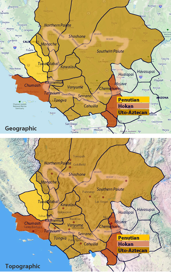
Tribal Generations

Before the arrival of the Spanish and other Europeans, a Native American tribe might separate into two (or more) for several reasons, all tied to natural social, environmental, and political dynamics:

  1. Territorial Expansion – As a tribe grew in population, they might need more space to hunt, gather, or farm. A portion of the group might move to a new area, eventually developing their own identity and leadership.
  2. Resource Availability – If a hunting or fishing ground became overused, or if a drought affected a key water source, some members of the tribe might migrate elsewhere, forming a new but related group.
  3. Disagreements Over Leadership – Tribal leadership was often based on consensus, but disagreements could arise. If a faction preferred a different leader or way of governance, they might break away and establish their own group.
  4. Cultural or Spiritual Differences – A group within the tribe might develop distinct beliefs, ceremonies, or practices, leading to a natural separation over time.
  5. Trade and Alliances – Interaction with neighboring tribes could lead to new connections, intermarriage, or even the adoption of different customs, creating a distinct offshoot of the original tribe.
  6. Conflict or Internal Struggles – Disputes over hunting grounds, resources, or social issues could lead a faction to break away to avoid ongoing conflict.
  7. Seasonal or Nomadic Patterns – Some groups might split due to differing seasonal migration routes, with each eventually forming its own traditions and leadership.

Many tribes we recognize today likely formed through gradual separations like these, rather than sudden or dramatic splits. Over time, they developed distinct dialects, customs, and identities while still often maintaining shared ancestry and connections.

Indian Trails in the Mojave Desert

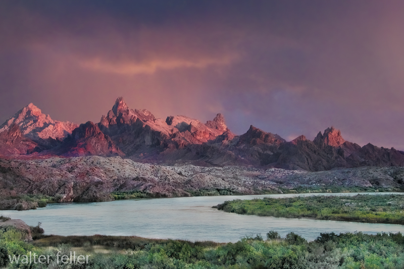
The Mojave Desert, an expansive arid region spanning southeastern California and parts of Nevada, Arizona, and Utah, is more than just a vast, desolate landscape. It is a land imbued with a rich cultural history, much of which is etched into the ancient Indian trails that crisscross its terrain. These trails are a deep connection to the land possessed by the indigenous peoples who once called this desert home.

Historical Significance

.

The Indian trails of the Mojave Desert were primarily created and used by Native American tribes such as the Mojave, Chemehuevi, and Southern Paiute. These tribes utilized the trails for various purposes, including trade, communication, and seasonal migration. The network of trails facilitated the exchange of goods like pottery, shells, foodstuffs, and obsidian, linking the Mojave Desert with coastal and inland regions. This trade network was integral to the economy and culture of the tribes, allowing for the spread of ideas, technologies, and cultural practices.

The trails were not merely utilitarian. They often held spiritual and cultural significance, following natural landmarks and water sources. Sacred sites, ceremonial grounds, and essential gathering places were often along these trails. This cultural layer adds depth to understanding these pathways, illustrating how they were interwoven with the people’s social and spiritual lives.

The Old Spanish Trail

One of the most notable trails is the Old Spanish Trail, which later became a significant route for Spanish explorers and settlers in the 18th and 19th centuries. Blazed initially by Native Americans, this trail stretched from Santa Fe, New Mexico, to Los Angeles, California. The Spanish utilized these established paths to connect their colonial holdings, facilitating trade and the movement of people and goods. The trail highlights the continuity of use by various cultures over centuries, transforming from an indigenous trade route to a significant conduit of colonial expansion.

The Old Spanish Trail was a challenging route, traversing some of the harshest landscapes in North America. Its use by both Native Americans and later Spanish settlers underscores the adaptability and resourcefulness required to navigate the Mojave Desert.

Adaptation to the Desert Environment

The Indian trails of the Mojave Desert showcase the adaptive strategies of Native Americans to the harsh desert environment. The tribes identified and utilized natural springs and seasonal water sources, ensuring safe passage across the expansive and often unforgiving terrain. These water sources were crucial, as they provided the necessary hydration points along the trails. Knowledge of these water sources was passed down through generations, often guarded closely as essential survival information.

The trails frequently ran along the base of mountain ranges and through passes, providing more accessible routes than the open desert. These paths took advantage of the natural topography to offer shade, easier walking conditions, and strategic viewpoints. The trails also connected various ecological zones, allowing the tribes to exploit various resources, from desert plants to mountain game.

Cultural Legacy

Today, the Indian trails of the Mojave Desert are an integral part of the region’s cultural heritage. Many of these trails are preserved and studied by archaeologists and historians, offering insights into the historical movements and lifestyles of the indigenous populations. Modern-day hikers, historians, and cultural enthusiasts retrace these paths, gaining a deeper understanding of the rich history and enduring legacy of the Native American tribes who first navigated the vast Mojave Desert.

Preservation efforts are crucial in maintaining these historic routes. Many trails are threatened by modern development, off-road vehicle use, and natural erosion. Organizations dedicated to preserving Native American heritage work tirelessly to document and protect these trails, ensuring they remain a living testament to the ingenuity and resilience of the desert’s original inhabitants.

Contemporary Relevance

In recent years, interest has been resurgent in these ancient trails. Educational programs, guided tours, and cultural heritage projects aim to bring the stories of these paths to a broader audience. Indigenous groups also play a vital role in these efforts, sharing their knowledge and perspectives to preserve and respect the trails as sacred cultural sites.

The trails also offer lessons in sustainable living and environmental stewardship. The indigenous peoples of the Mojave Desert thrived in a harsh environment through a deep understanding of the land and its resources. Their trails remind us of the importance of living in harmony with nature, an increasingly relevant lesson today.

Conclusion

The Indian trails of the Mojave Desert are more than just paths across the sand; they are the veins of a rich cultural heritage, connecting the past with the present. They tell stories of trade, migration, survival, and spiritual journeying etched into the desert’s landscape. As we explore and preserve these trails, we honor the legacy of the Native American tribes that first navigated the Mojave Desert, ensuring that their stories and knowledge continue to inspire and educate future generations.

The Historical and Ecological Significance of Summit Valley and Its Surroundings

Summit Valley: A Historical Overview

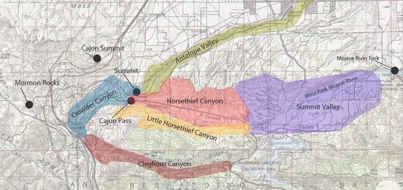
Summit Valley is a region rich in history and natural beauty in Southern California. Nestled between the Mojave Desert and the Southern California Mountains, it lies east of the Cajon Pass. Hesperia borders it to the north and the San Bernardino National Forest to the south. This valley, traversed by the West Fork of the Mojave River, holds significant historical and ecological importance.

Key Historical Figures and Events

1776: Fr. Francisco Garcés

Francisco Garcés, a Spanish Franciscan missionary and explorer, traveled through Summit Valley in 1776 as part of his extensive travels across the American Southwest. Garcés played a crucial role in establishing early routes and missions in the region, and his detailed diaries provide valuable insights into the landscape and indigenous peoples.

1826: Jedediah Smith

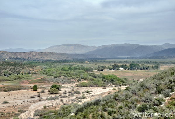
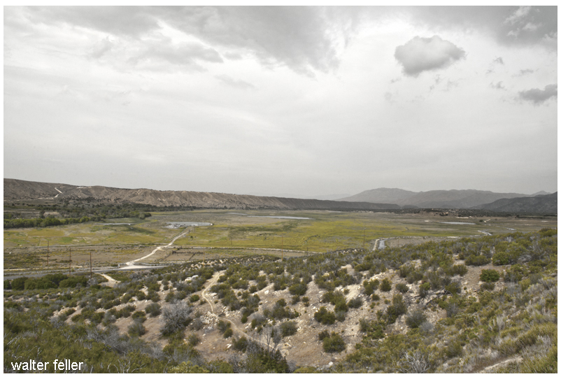
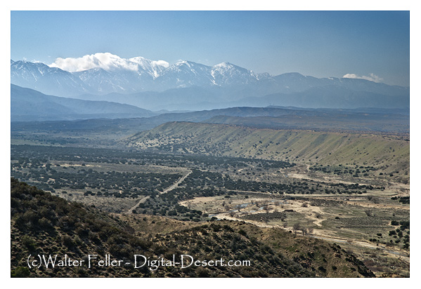
Looking west across the valley

Jedediah Smith, a renowned American frontiersman, trapper, and explorer, led an expedition through Summit Valley in 1826. This marked one of the earliest American explorations of the region, significantly contributing to the mapping and understanding of the Western United States.

1840: Chaguanoso Raid

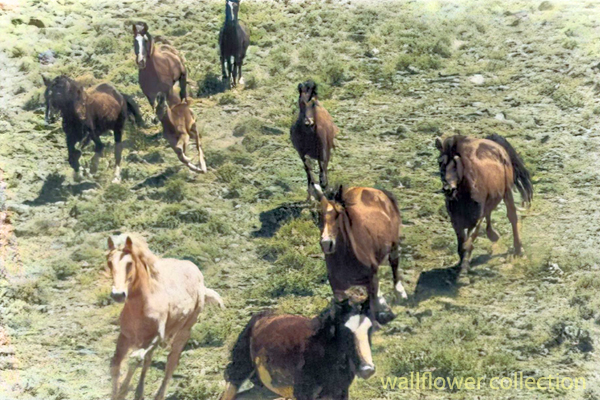
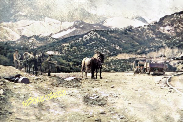
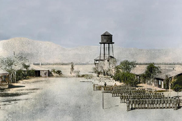
Raiders would run the horses to death if they had to–the stakes were high. (BLM photo colorized)

The Chaguanoso raid was the largest stock theft in California’s history. On May 14, 1840, Juan Perez, the administrator of Mission San Gabriel, reported the theft of mares by Chaguanoso raiders. Tiburcio Tapia, a prominent Californian businessman and alcalde of Los Angeles, directed the pursuit of the robbers who crossed the Mojave Desert. Despite the efforts of men like Ygnacio Palomares and José Antonio Carrillo, the raiders largely escaped.

A possible site of Campo de la Puente (Camp on the bridge)

Early 1840s: Michael White (Miguel Blanco)

In the early 1840s, Michael White (Miguel Blanco) confronted horse thieves led by Chief Coyote in Crowder Canyon. White’s successful defense of his cattle, culminating in the killing of Chief Coyote, marked a significant moment in the region’s history and highlighted the persistent threat of banditry.

Settlement and Development

1866: Summit Valley Massacre

Massacre site

On March 25, 1866, Edwin Parrish, Nephi Bemis, and Pratt Whiteside, young cowboys employed at Las Flores Ranch, were ambushed and killed by Piute Indians near Las Flores Ranch. This violent episode highlighted the ongoing tensions between settlers and native populations.

Late 1800s: Las Flores Ranch

In the late 1800s, cattle driven from Arizona were pastured on Summit Valley’s green grass and running water and fattened before being sent to market in San Bernardino. Despite the challenges from wildlife and hostile natives, the ranch became central to the regional economy.

1884-1885: Railroad Construction

The construction of the Southern California Railroad in 1884-1885, following the old Spanish Trail route, was a significant development. Summit, located about six miles west of the Bircham Ranch, became a crucial station for shipping supplies. Despite unsuccessful oil explorations, the area continued to develop.

Early 1900s: Agricultural Growth

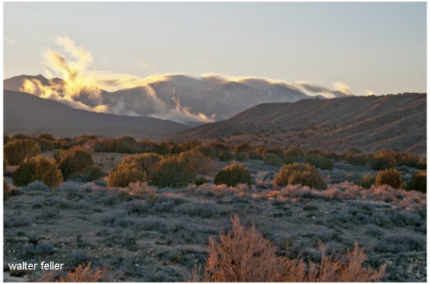
Looking northeast from the mouth of Cedar Springs Canyon

Summit Valley’s fertile lands and plentiful water made it an attractive location for cattle ranching. Early settlers capitalized on these resources, establishing large ranches that became central to the valley’s economy. Over time, the introduction of railroads and improved transportation infrastructure facilitated the growth of agriculture and livestock trade, further cementing the valley’s role as a key agricultural hub.

1924: Modern Infrastructure

Looking east into Horsethief Canyon on SR 138 – November 2015

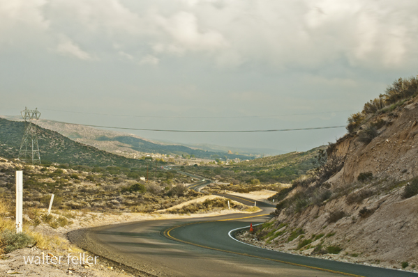
By the early 20th century, the region had developed a network of roads and railroads, with State Route 138 emerging as a critical transportation corridor. This infrastructure supported the valley’s continued growth and integration into the broader Southern California economy while preserving its historical legacy and natural beauty.

Ecological and Recreational Importance

Biodiversity and Conservation

Summit Valley has diverse habitats, from montane forests and riparian zones to grasslands and desert ecosystems. These habitats support a variety of wildlife, including many species of birds, mammals, and plants. Conservation efforts in the valley focus on protecting these natural resources, managing invasive species, and ensuring the region’s ecological health.

Silverwood Lake and Recreational Activities

Cedar Springs Dam

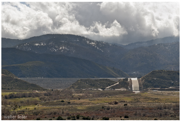
The creation of Silverwood Lake as part of the California State Water Project has significantly enhanced the recreational opportunities in Summit Valley. The lake offers boating, fishing, hiking, and camping activities, attracting regional visitors. The Pacific Crest Trail, which passes through the valley, provides additional opportunities for outdoor enthusiasts to explore the area’s natural beauty.

Cedar Springs, CA

Downtown Cedar Springs, CA.

Cedar Springs was a small community in the San Bernardino Mountains, submerged by the creation of Silverwood Lake in 1971. Before the lake’s construction, Cedar Springs was known for its natural beauty, with lush cedar forests and clear springs that attracted visitors and residents alike. While the community was lost, the lake’s creation transformed the area into a major recreational destination.

Conclusion

Summit Valley’s rich history, from early exploration by figures like Francisco Garcés and Jedediah Smith to significant events like the Chaguanoso raid and Summit Valley massacre, paints a vivid picture of a region that has played a crucial role in Southern California’s story. From the challenges faced by early settlers to its modern-day significance as a recreational and ecological haven, Summit Valley remains a testament to the dynamic interplay between human activity and the natural world.

The Whipple 35th Parallel Railroad Survey: Mohave Indians

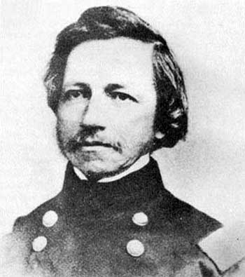
The Whipple 35th Parallel Railroad Survey, led by Lieutenant Amiel Weeks Whipple in 1853, was a pivotal expedition to explore a potential transcontinental railroad route along the 35th parallel from Fort Smith, Arkansas, to Los Angeles, California. Commissioned by Secretary of War Jefferson Davis, the survey aimed to assess the feasibility of the railroad, gather scientific data, and document interactions with Native American tribes, significantly contributing to the understanding and development of the American West.

Excerpt from – Harper’s New Monthly Magazine
The Tribes of the Thirty-Fifth Parallel

September 1858
VOL. XVII.–No. 100

Mohaves

Leaving the beautiful valley of the Chemehuevis, we presently find our friends among the shrewd, sprightly, and hospitable Mojaves. On the 25th of February, they were honored by a visit of ceremony from a pompous old chief of the Mojaves, who presented credentials from Major Heintzelman.–The Major wrote that the bearer, Captain Francisco, had visited Fort Yuma, with a party of warriors, while on an expedition against the Cocopas, and that he had professed friendship; but Americans were advised not to trust him.

The parade and ceremony with which the visit was set off were not, in this instance, altogether vain and idle, for without them that august personage, Captain Francisco, might easily have been mistaken for the veriest[sic] beggar of his tribe. He was old, shriveled, ugly, and naked-but for a strip of dirty cloth suspended by a cord from his loins and an old black hat, band-less and torn, drawn down to his eyes. But his credentials were satisfactory, and he was received with all the honors and installed in a stately manner on a blanket. The object of the expedition was explained to him, and he cordially promised aid and comfort. A few trinkets, some tobacco, and red blankets cut into narrow strips were then presented for distribution among the warriors. The chief would accept nothing for himself, so the council was dissolved. The Mojave chiefs look upon foreign gifts in a national light and accept them only in the name of the people.

Savedra counted six hundred Indians in camp, of whom probably half had brought bags of meal or baskets of corn for sale. The market was opened, and all were crowding, eager to be the first at the stand, amidst shouts, laughter, and a confusion of tongues-English, Spanish, and Indian.

When the trading was concluded, the Mojave people sauntered about the camp in picturesque and merry groups, making the air ring with peals of laughter. Some of the young men selected a level spot, forty paces in length, for a play-ground, and amused themselves with their favorite game of hoop-and-poles. The hoop is six inches in diameter, and made of elastic cord; the poles are straight, and about fifteen feet in length. Rolling the hoop from one end of the course toward the other, two of the players chase it half-way, and at the same time throw their poles. He who succeeds in piercing the hoop wins the game.

Target-firing and archery were then practiced–the exploring party using rifles and Colt’s pistols, and the Indians shooting arrows.

The fire-arms were triumphant; and at last an old Mojave, mortified at the discomfiture of his people, ran in a pet and tore down the target. Notwithstanding the unity of language, the family resemblance, and amity between the Cuchans and Mojaves, a jealousy, similar to that observed among Pimas and Maricopas, continually disturbs their friendship. A squaw detected her little son in the act of concealing a trinket that he fancied. She snatched the bauble from him with a blow and a taunt, saying, “Oh, you Cuchan!” Some one inquired if he belonged to that tribe. “Oh no,” she replied ” he is a Mojave, but behaves like a Cuchan, whose trade is stealing !” Nevertheless, the Cuchans are welcomed by the Mojaves wherever they go.

These Indians are probably in as wild a state of nature as any tribe on American territory.

They have not had sufficient intercourse with any civilized people to acquire a knowledge of their language or their vices. It was said that no white party had ever before passed through their country without encountering hostility.

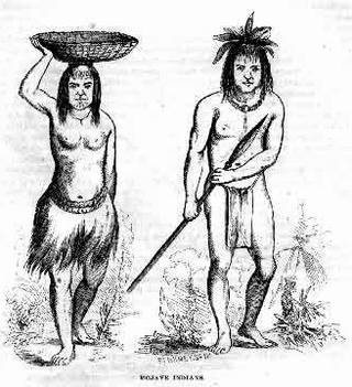
Nevertheless they appear intelligent, and to have naturally amiable dispositions. The men are tall, erect, and well-proportioned; their features inclined to European regularity; their eyes large, shaded by long lashes, and surrounded by circles of blue pigment, that add to their apparent size. The apron, or breech-cloth, for men, and a short petticoat, made of strips of the inner bark of cotton-wood, for women, are the only articles of dress deemed indispensable; but many of the females have long robes, or cloaks, of fur. The young girls wear heads.

When married, their chins are tattooed with vertical blue lines, and they wear a necklace with a single sea-shell in front, curiously wrought.

Those shells are very ancient, and esteemed of great value.

From time to time they rode into the camp, mounted on spirited horses; their bodies and limbs painted and oiled, so as to present the appearance of highly-polished mahogany. The dandies paint their faces perfectly black. Warriors add a streak of red across the forehead nose, and chin. Their ornaments consist of leathern bracelets, adorned with bright buttons, and worn on the left arm; a kind of tunic, made of buckskin fringe, hanging from the shoulders; beautiful eagles’ feathers, called “sormeh”–sometimes white, sometimes of a crimson tint-tied to a lock of hair, and floating from the top of the head; and, finally, strings of wampum, made of circular pieces of shell, with holes in the centre, by which they are strung, often to the length of several yards, and worn in coils about the neck.

These shell beads, which they call “pook,” are their substitute for money, and the wealth of an individual is estimated by the “pook” cash he possesses. Among the Cuchans, in 1852, a foot of “pook” was equal in value to a horse; and divisions to that amount are made by the insertion of blue stones, such as by Coronado and Alargon were called “turkoises,” [turquoise] and are now found among ancient Indian ruins.

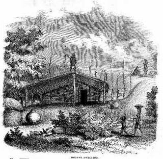
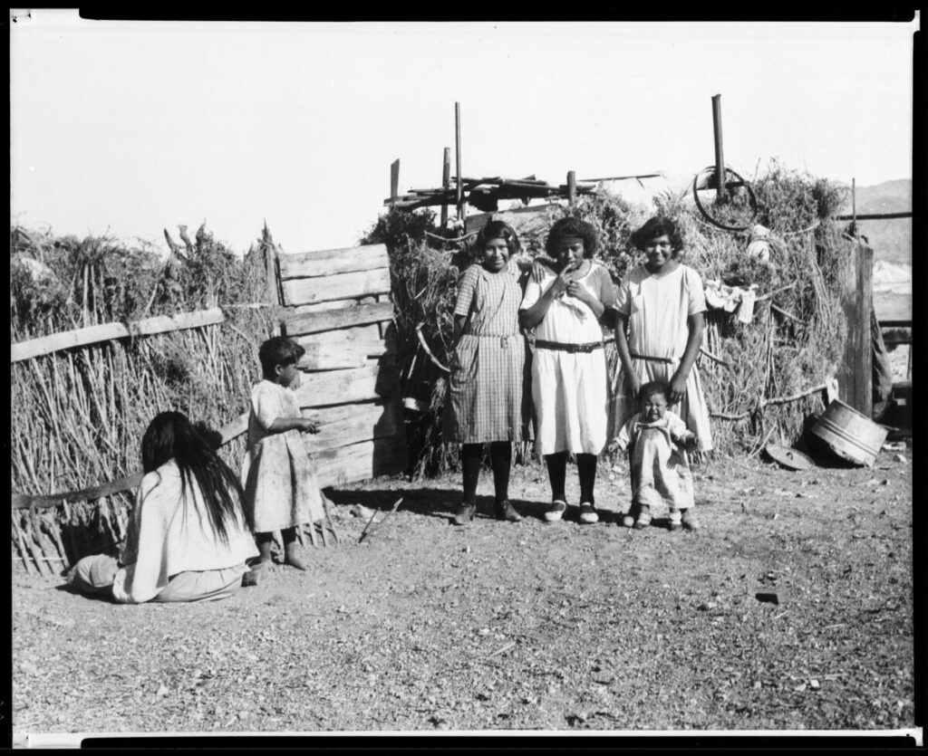
The Mojave rancherias are surrounded by granaries filled with corn, mesquite beans, and tortillas. The houses are constructed with an eye to durability and warmth. They are built upon sandy soil, and are thirty or forty feet square; the sides, about two feet thick, of wicker-work and straw; the roofs matched, covered with earth, and supported by a dozen cottonwood posts. Along the interior walls are ranged large earthen pots, filled with stores of corn, beans, and flour, for daily use. In front is a wide shed, a sort of piazza, nearly as large as the house itself. Here they find shelter from rain and sun. Within, around a small fire in the centre, they sleep. But their favorite resort seems to be the roof, where could usually be counted from twenty to thirty persons, all apparently at home. Near the houses were a great number of cylindrical structures, with conical roofs, quite skillfully made of osiers; these were the granaries, alluded to above, for their surplus stores of corn and mesquite.

As the explorers passed these rancherias, the women and children watched them from the house-tops; and the young men, for the moment, suspended their sport with hoop and poles. At first only a few of the villagers seemed inclined to follow them, but at length their little train swelled to an army a mile in length.

On the 27th of February, being favored with a clear and calm morning, they hastened to take advantage of it to cross the river; but the rapid current and the long ropes upset their ” gondola” in mid-stream. The Mojaves, who are capital swimmers, plunged in and helped them save their property. Many had brought rafts to the spot, anticipating the disaster. These were of simple construction, being merely bundles of rushes placed side by side, and securely bound together with osiers.

But they were light and manageable, and their crews plied them with considerable dexterity.

It was night when finally the great work was accomplished-the Colorado crossed, and the camp pitched on the right bank.

Our friends had now quite exhausted their stock in trade in gifts, although large quantities of grain were yet in camp for sale. When told that their white brothers were too poor to buy, the Indians expressed no disappointment, but strolled from fire to fire, laughing, joking, curious but not meddlesome, trying, with a notable faculty of imitation, to learn the white man’s language, and to teach their own.

As long as our explorers were among them, these Mojaves were gay and happy, talking vicariously, singing, laughing. Confiding in the good intentions and kindness of the strangers, they laid aside for the time their race’s studious reserve. Tawny forms glided from one camp-fire to another, or reclined around the blaze, their bright eyes and pearly teeth glistening with animation and delight. They displayed a new phase of Indian character, bestowing an insight into the domestic amusements which are probably popular at their own firesides: mingling among the soldiers and Mexicans, they engaged them in games and puzzles with strings, and some of their inventions in this line were quite curious.

No doubt these simple people were really pleased with the first dawning light of civilization.

They feel the want of comfortable clothing, and appreciate some of the advantages of trade. There is no doubt that, before many years pass away, a great change will have taken place in their country. The advancing tide of emigration will sweep over it, and, unless the strong arm of Government protects them, the Mojaves will be driven to the mountains or exterminated.

When the exploring party wore about to leave, the chiefs came with an interpreter, to say that a national council had been held, in which they had approved of the plan for opening a great road through the Mojave country. They knew that on the trail usually followed by the Pai’ Utes toward California the springs were scanty, and insufficient for the train; that thus the mules might perish on the road, and the expedition fail. Therefore they had selected a good man, who knew the country well, and would send him to guide their white brothers by another route, where an abundance of water and grass would be found. They wished their white brothers to report favorably of their conduct to the Great Chief at Washington, in order that he might send many more of his people to pass that way, and bring clothing and utensils to exchange for the produce of their fields.

Desiring to learn something of their notions regarding the Deity, death, and a future existence, Lieutenant Whipple led an intelligent Mojave to speak upon these subjects. One stooped and drew in the sand a circle, which he said was to represent the former casa, or dwelling-place of Mat-e-vil, Creator of Earth (which was a woman) and Heaven. After speaking for some time with impressive, and yet almost unintelligible, earnestness regarding the traditions of that bright era of their race which all Indians delight in calling to remembrance, he referred again to the circle, and suiting the action to the word, added:

“This grand habitation was destroyed, the nations were dispersed, and Mat-e-vil took his departure, going eastward over the great waters. 110 promised, however, to return to his people and dwell with them forever; and the time of his coming they believe to be near at hand.”

The narrator then became enthusiastic in the anticipation of that event, which is expected to realize the Indian’s hopes of a paradise on earth. Much that he said was incomprehensible. The principal idea suggested was the identity of their Deliverer, coming from the east, with the Montezuma of the Pueblo Indians, or perhaps the Messiah of Israel; and yet the name of Montezuma seemed utterly unknown to this Indian guide. His ideas of a future existence appeared somewhat vague and undefined. The Mojaves, he said, were accustomed to burn the bodies of the dead; but they believe that an undying soul arises from the ashes of the deceased, and takes its flight, over the mountains and waters, eastward to the happy spirit-land.

Loroux says, that he has been told by a priest of California that the Colorado Indians were Aztecs, driven from Mexico at the time of the conquest of Cortez. He thinks the circle represents their ancient city, and the water spoken of refers to the surrounding lakes. This idea derives some plausibility from the fact, mentioned by Alargon, that, in his memorable expedition up the Colorado River in 1540, he met with tribes that spoke the same language as his Indian interpreters, who accompanied him from the City of Mexico, or Culiacan.


The Mojave People

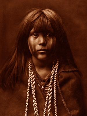
The Mojave Indians are a Native American tribe indigenous to the southwestern United States, primarily in the Mojave Desert region, which spans parts of California, Nevada, Arizona, and Utah. They have a rich ethnography and ethnohistory characterized by their unique cultural practices, social organization, and historical interactions with European settlers.

Here are some key aspects of the Mojave Indians’ ethnography and ethnohistory:

  1. Language and Culture: The Mojave people traditionally spoke the Mojave language, part of the Yuman language family. Their culture was closely tied to the natural environment of the Mojave Desert, and they had a deep knowledge of desert plants and animals. They practiced farming along the Colorado River and engaged in hunting and gathering.
  2. Social Organization: The Mojave society was organized into clans, and their social structure was matrilineal, meaning descent and inheritance were traced through the mother’s line. Clan membership played a significant role in their social and kinship systems.
  3. Religion and Spirituality: Mojave religious beliefs were centered around a complex system of spirits and deities associated with the natural world. The Colorado River played a significant role in their spiritual beliefs, and ceremonies often revolved around it. The Mojave Creation Story is an important part of their religious narrative.
  4. Contact with European Settlers: Like many Native American tribes, the Mojave people experienced significant changes with the arrival of European settlers. In the 19th century, they encountered Spanish explorers, Mexican settlers, and American pioneers. These encounters led to conflicts and changes in their way of life.
  5. Fort Mojave Reservation: In the 19th century, the Mojave people were relocated to the Fort Mojave Indian Reservation, which is located near Needles, California. The reservation is still home to many Mojave tribal members today.
  6. Contemporary Mojave: Today, the Mojave people continue to preserve and celebrate their cultural heritage. They have cultural centers and organizations that work to maintain their traditions, languages, and arts. The tribe also engages in economic development and land management on their reservation.

The ethnography and ethnohistory of the Mojave Indians provide valuable insights into the history and culture of this indigenous group in the American Southwest. Researchers and historians continue to study and document their traditions to preserve their cultural heritage for future generations.

Wikiup (Shelter)

https://mojavedesert.net/archaeology/

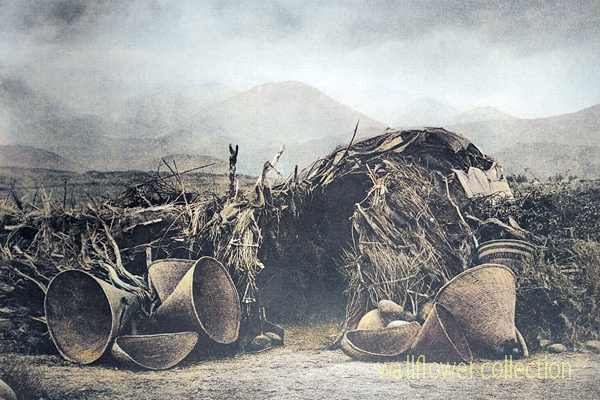
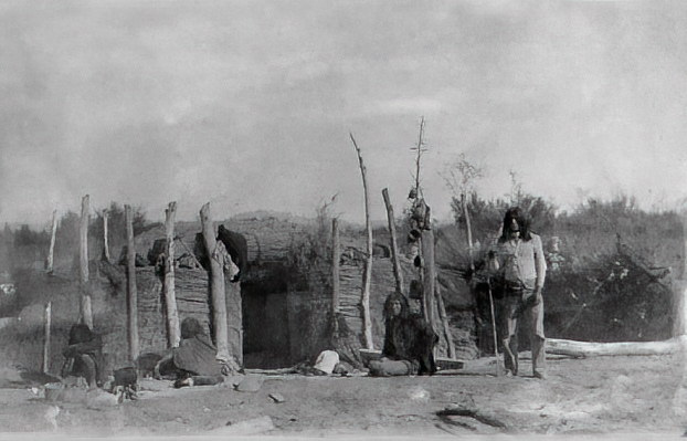
Mono Paiute wickiup – Edward Curtis 1900 (colorized)

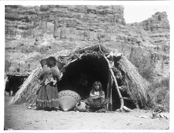
A “wikiup” in the context of Native American culture typically refers to a traditional type of shelter or dwelling. It is a simple, dome-shaped structure constructed using a framework of branches or saplings. The frame is often covered with various materials, such as brush, reeds, grass, or sometimes animal hides. Various indigenous peoples in North America commonly used these shelters.

The design of wikiups varied among different tribes, reflecting the local environment and available resources. They were relatively easy to construct and could be adapted to different climates. Nomadic or semi-nomadic groups often used Wikiups as temporary or seasonal shelters.

It’s important to note that the term “wikiup” might be spelled or pronounced differently in various indigenous languages, and the specific features of these shelters could vary based on cultural and regional differences.

Chumash Indians

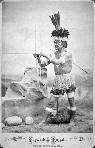
The Chumash are a Native American people who historically inhabited the coastal and inland regions of California, particularly the Central and Southern California coastal areas. Their traditional territory includes areas from the Santa Barbara Channel to Malibu. The Chumash are considered part of the Hokan language family.

The Chumash people are known for their complex social organization, advanced maritime technology, and well-developed basketry and rock art. They were skilled fishermen, hunters, and gatherers, relying on the rich marine resources of the Pacific Ocean as well as the diverse plant and animal life in their environment.

The Chumash were organized into chiefdoms, each with its leader, and they lived in villages with plank-built houses. Their society had a sophisticated economic and political structure and traded with neighboring tribes.

With the arrival of Spanish explorers in the 18th century, the Chumash were profoundly affected by European colonization. Spanish missions were established in Chumash territory, leading to changes in their way of life, the introduction of new diseases, and the disruption of their social structures.

Today, Chumash people continue to maintain and revitalize their cultural traditions. Ongoing efforts are to preserve Chumash languages, arts, and traditional knowledge. Some Chumash individuals and communities are also involved in cultural and educational initiatives, including managing tribal museums and interpretive centers that showcase Chumash history and heritage.

The Chumash are recognized as a sovereign tribal nation, and contemporary issues include discussions about tribal governance, land rights, and the broader acknowledgment of indigenous rights in the United States.

Halchidhoma Indians

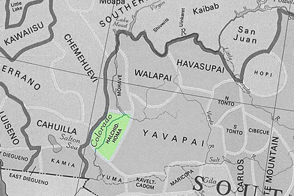
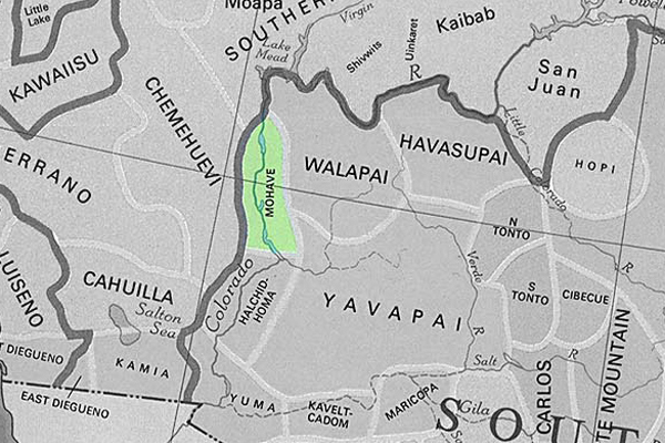
The Halchidhoma (also spelled Halchidoma or Haltchidhoma) was a Native American tribe historically inhabiting the southwestern United States. They were part of the Yuman language-speaking people and lived in the lower Colorado River region, particularly in what is now Arizona and California. The Halchidhoma were closely related to other Yuman-speaking groups, such as the Mojave, Quechan, and Cocopah.

The Halchidhoma people were known for adapting to the desert environment and were skilled at fishing, hunting, and gathering resources in the arid landscape. They utilized the Colorado River for sustenance, catching fish, and utilizing plants for food, medicine, and other purposes.

However, the Halchidhoma tribe faced significant challenges with the arrival of European colonizers and the subsequent westward expansion of the United States. The disruption caused by the influx of settlers, diseases, and conflicts with other Native American groups and European colonists contributed to the decline of the Halchidhoma population.

Over time, the Halchidhoma people faced displacement, and their distinct tribal identity gradually faded. Today, the Halchidhoma are considered one of the many Native American groups whose historical presence has diminished, and their cultural heritage is often studied through archaeological and historical records.

It’s important to note that the history of Native American tribes is complex, and various factors, including interactions with European settlers, government policies, and environmental changes, have shaped their experiences.

Mojave Indians

/mojave-indians/

/blog/?p=3633

The Mojave are Native American people who traditionally inhabited the Mojave Desert, which spans parts of California, Arizona, Nevada, and Utah in the United States. The Mojave people are part of the larger Yuman language family.

The Mojave are known for their adaptation to the harsh desert environment and their traditional lifestyle as hunter-gatherers. They relied on the diverse resources of the desert, including native plants, seeds, and the hunting of small game. The Colorado River, which flows through their territory, played a significant role in their lives.

Historically, the Mojave people lived in small family groups and had a strong sense of community. They built dome-shaped houses known as “kish,” their social organization included tribal leaders and spiritual figures.

With European settlers’ arrival and the United States’s expansion in the 19th century, the Mojave, like many other Native American groups, faced significant challenges. European diseases, conflicts over land, and changes in their traditional way of life profoundly affected their population and culture.

Today, the Mojave people continue to maintain their cultural traditions and have a presence on the Fort Mojave Indian Reservation, which spans parts of California, Arizona, and Nevada. Efforts are underway to preserve the Mojave language, arts, and traditional knowledge. Additionally, like other Native American groups, the Mojave is engaged in discussions about tribal sovereignty, land rights, and broader issues related to recognizing indigenous rights.

Hualapai Indians

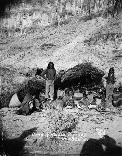
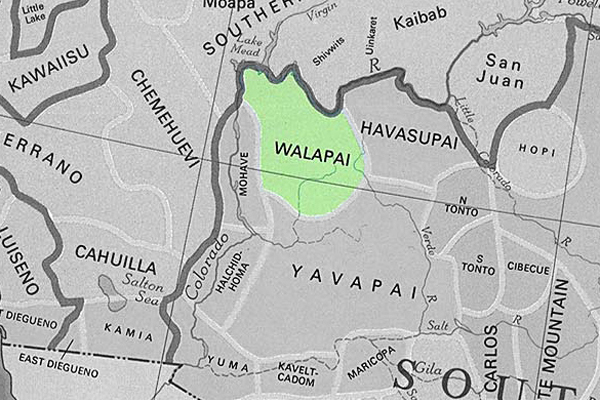
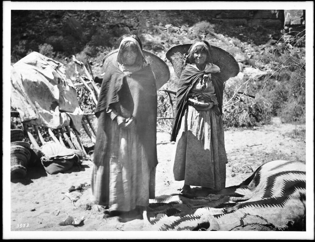
The Hualapai, also spelled Walapai, are a Native American people who traditionally lived in the western part of the United States, primarily in the Hualapai Indian Reservation in northwestern Arizona. They are part of the larger Yuman language family.

The Hualapai people are known for their strong connection to the Grand Canyon, as a significant portion of their reservation includes parts of the Grand Canyon and the Colorado River. The term “Hualapai” translates to “People of the Tall Pines” in their language, reflecting the importance of the pine forests in their traditional territory.

Historically, the Hualapai were hunter-gatherers, relying on the resources of their diverse environment, including the Grand Canyon, plateaus, and mountainous regions. They hunted game, gathered plants, and engaged in cultural practices that reflected their close relationship with the land.

With the arrival of European settlers and the expansion of the United States, the Hualapai faced challenges such as the loss of traditional lands, conflicts over resources, and changes in their way of life. In the late 19th century, the Hualapai Reservation was established, providing a designated area for the tribe.

Today, the Hualapai people continue to preserve their cultural heritage. The Hualapai Reservation is a popular destination for tourists interested in experiencing the Grand Canyon from the perspective of the Hualapai people. The Hualapai Tribe is also known for managing the Grand Canyon Skywalk, a glass bridge that extends over the Grand Canyon.

Efforts are ongoing to maintain and revitalize the Hualapai language, arts, and traditional knowledge. Like many other Native American groups, the Hualapai are actively engaged in issues related to tribal sovereignty, land rights, and the broader recognition of indigenous rights.

Havasupai Indians

The Havasupai, or Havasu ‘Baaja, are a Native American people who have traditionally lived in the Grand Canyon region of Arizona, particularly in Havasu Canyon. “Havasupai” means “people of the blue-green water,” which reflects the turquoise color of the Havasu Creek that flows through their ancestral lands.

Havasupai’s history and culture include their deep connection to the Grand Canyon, reliance on the area’s natural resources, and their traditional practices as hunter-gatherers. Havasupai people historically hunted game, gathered plants, and engaged in trade with neighboring tribes.

In 1882, the U.S. government established the Havasupai Indian Reservation, which encompasses about 188,077 acres and includes the Havasu Canyon. The reservation is situated within the larger Grand Canyon National Park.

Some notable features of Havasupai land are the Havasu Falls, Mooney Falls, and other waterfalls along Havasu Creek. These natural wonders, known for their striking blue-green waters, attract visitors worldwide.

The Havasupai people maintain cultural traditions, including traditional ceremonies, crafts, and storytelling. The Havasupai language is also preserved within the community.

Tourism plays a significant role in the Havasupai economy, as visitors are allowed to experience the beauty of Havasu Canyon, including its waterfalls and hiking trails. However, the community also faces challenges in maintaining the delicate balance between tourism and preserving cultural and natural resources.

Like other Native American groups, the Havasupai are actively engaged in issues related to tribal sovereignty, land rights, and the broader recognition of indigenous rights.

Cocopah Indians

The Cocopah, or Cocopah Tribe, are a Native American people who traditionally lived along the lower Colorado River in the southwestern United States and northern Mexico. Their homeland includes areas in Arizona and California, as well as the Baja California region of Mexico. The Cocopah are part of the larger Yuman language family.

Historically, the key aspects of Cocopah culture included fishing, hunting, and gathering in the desert and riverine environments. They were skilled in constructing traditional houses called “káak” or “mat káak” made from arrowweed and brush. The Cocopah people have a rich cultural heritage, including traditional songs, dances, and ceremonies.

With the arrival of European settlers, the Cocopah, like many other Native American groups, faced challenges such as changes in their way of life, conflicts, and the loss of traditional lands. The Cocopah Reservation, established in the United States, is located near Somerton in southwestern Arizona.

Today, the Cocopah Tribe is engaged in cultural preservation efforts, including revitalizing the Cocopah language, traditional arts, and ceremonies. The tribe is also involved in economic development initiatives, education, and healthcare programs to benefit its community members.

The Cocopah people maintain a connection to their ancestral lands and the Colorado River, an important aspect of their cultural identity. Issues related to tribal sovereignty, water rights, and the broader recognition of indigenous rights are significant considerations for the Cocopah Tribe.

Quechan Indians

The Quechan also spelled Kwtsaan or Kwtsan, are a Native American people who traditionally inhabited the lower Colorado River Valley, including parts of present-day Arizona and California. The Quechan are part of the larger Yuman language family.

The Quechan people have a rich cultural heritage, including traditional ceremonies, dances, and crafts. They historically relied on the resources of the region, such as fish from the Colorado River, wild plants, and small game.

One of the well-known groups within the Quechan people is the Fort Yuma Quechan Tribe, which is based on the Fort Yuma Indian Reservation. The Fort Yuma Indian Reservation is near the present-day city of Yuma, Arizona, along the Colorado River. The Quechan people have a long history in the region, and their reservation is an important center for preserving and promoting their cultural traditions.

With the arrival of European settlers and the establishment of the United States, the Quechan, like many Native American groups, faced challenges such as the loss of traditional lands, conflicts, and changes in their way of life. However, they have persisted in maintaining their cultural identity and practices.

Today, the Quechan Tribe is actively involved in issues related to tribal sovereignty, land rights, and the broader recognition of indigenous rights. The Fort Yuma Quechan Tribe engages in various cultural and educational initiatives to preserve and revitalize their language, arts, and traditions, ensuring their heritage is passed on to future generations.

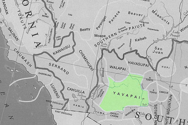
Yavapai Indians

The Yavapai are a Native American people who traditionally inhabited Arizona’s central and western regions in the southwestern United States. Their name is derived from the Yavapai word “Enyaeva,” meaning “people of the sun.” The Yavapai are closely related to the Havasupai, Hualapai, and Apache peoples and share linguistic and cultural ties.

Historically, the Yavapai were semi-nomadic, engaging in hunting, gathering, and some agriculture. They hunted game, gathered plants and seeds, and cultivated crops in the riparian areas along rivers.

With European settlers’ arrival and the United States’ westward expansion, the Yavapai, like many other Native American groups, faced significant challenges. They experienced conflicts with European settlers and the loss of their traditional lands.

The Yavapai people were forcibly removed from their ancestral lands and faced forced marches and resettlements in the late 19th century. This period was marked by hardship and suffering, and many Yavapai people were relocated to the San Carlos Apache Reservation.

Today, the Yavapai-Apache Nation is a federally recognized tribe that represents the descendants of the Yavapai and Apache people. The Yavapai-Apache Nation has reservations near Camp Verde and Clarkdale in Arizona. The tribe is actively involved in cultural preservation, education, and economic development initiatives to ensure the continuation of their heritage.

Efforts are made to revitalize the Yavapai language, traditional arts, and cultural practices. Like many Native American groups, the Yavapai-Apache Nation engages in discussions related to tribal sovereignty, land rights, and the broader recognition of indigenous rights.

A History of American Indians in California:1880-1904


In the 1880s, there was increased public awareness of the problems California Indians were confronting. While the problems were rarely analyzed, many people helped to improve the quality of life for Indians. There was an effort to improve the education of Indians through schools, and to provide them with land to better their economic conditions so that Indians could become full citizens of the United States of America.

In the early 1880s, Helen Hunt Jackson wrote A Century of Dishonor and sent a copy of her book to each United States congressman. She was then appointed to a commission to examine the condition of Indians in Southern California. Her visits resulted in The Report on the Condition and Needs of the Mission Indians of California, by special agents Helen Jackson and Abbot Kinney. The report summarized the problems and concerns of Southern California Indians; many of the conditions outlined in the report, however, were applicable to all California Indians. The report noted that Indians had been continually displaced from their land. She also noted that while many Indians had taken “immoral” paths, others had chosen the responsibilities of herding animals and raising crops. In her report, she also noted that the United States government had done little to right the wrongs of the past. While Jackson did not solve all the problems of Southern California Indians, her work did bring their concerns to the attention of the American public and Congress.

One recurring concern was the lack of education and training necessary for survival in American society. The government, as well as Jackson, saw education as a way of assimilating Indians into the mainstream of United States society. Reports from the Secretary of the Interior and the Bureau of Indian Affairs at that time expressed the goals of the government in relation to the educational process. In 1908, one report stated, “the rooms held three or four each and it was arranged that no two tribes were placed in the same room. This not only helped in the acquirement of English, but broke up tribal and race clannishness, a most important victory in getting Indians toward real citizens.” (Spicer, 1969:235) An earlier report stated, “I can see no reason why a strong government like ours should not govern and control them [Indians] and compel each one to settle down and stay in one place, his own homestead, wear the white man’s clothing, labor for his own support, and send his children to school.” (Spicer, 1969:236) Other people had even stronger ideas. For instance, George Ellis, in his book, The Red Man and the White Man in North America, wrote, “The Indian must be made to feel he is in the grasp of a superior.” (Ellis 1882:572) In opposition to this view, the Indian Rights Association was formed in 1882. This Indian advocate group would play a powerful role in formulating Indian policy in upcoming years.

While the approaches differed, all agreed that education was necessary. “In California, three types of educational programs were established for native peoples. The first was the Federal Government reservation day school. The second type was the boarding school, fashioned after Carlisle. And finally, the nearby public school that allowed Indians to attend began a slow, though steady, increase in popularity among policy makers.” (Heizer, 1978:115) While the public schools seemed the best alternative, most Indians did not have the right to attend these schools until the 1920s.

In 1881, an elementary school system for Indians was established in California. However, the Indians soon recognized that the schools were a threat to their culture, as well as to the tribe as a political unit. “As a result, considerable resistance to the schools developed. Native peoples destroyed the day school at Potrero in 1888, and burned the school at Tule River in 1890. At Pachanga, a Luiseno named Venturo Molido, burned the school and assassinated the school teacher in 1895.” (Heizer, 1978:115) Much of the destruction and violence could have been avoided if the school system and the government had recognized the great importance the Indians placed on being able to maintain their cultural beliefs. In 1891, school attendance was made mandatory. But while attendance was mandatory, there were still Indian children who did not attend.

In 1901, the first Indian hospital in California was established at Sherman Institute in Riverside. Sherman later became a boarding school for Indian children. While hospitals and other facilities improved conditions for California Indians, most Indians were still without homes.

During this period, another major focus was on the acquisition of land for Indians. Probably the most interesting example of the way land was acquired is evidenced by the Yokayo Pomo in 1881: “After collecting nearly $1,000 from their people, the head man selected a 120-acre site near the Russian River and made the down payment. The Yokayo groups prospered; they paid the entire balance owed on their land, and even saved enough to purchase farm machinery shortly thereafter.” (Heizer, 1978:118)

A major tool the government used in trying to assimilate Indians during this time was the General Allotment Act of 1887, also known as the Dawes Act, which appeared to be generally advantageous to Indians. However, the major intent of the act was to break down the role of tribal government. The act itself provided that each Indian living on a reservation would receive a 160-acre allotment of land per family unit, and each single man would receive 80 acres if the reservation had enough land. If there was not enough land, other provisions were made. Indians not residing on a reservation would be entitled to settle on any surveyed or unsurveyed government lands not appropriated. The lands allotted would be held in trust for 25 years by the Bureau of Indian Affairs. If all other provisions of the act were met, that is, if the Indians made use of the lands for agriculture and became self-sufficient, then the land would become the property of the individual. “Native people understood full well the implications of allotment and offered considerable resistance. Nevertheless, the Bureau of Indian Affairs began ordering allotments of various sizes at Rincon, Morongo, and Pala Reservations in 1893. . . . The next year, allotments were begun at Round Valley Reservation. By the turn of the century, 1,614 individual allotments were made among eight reservations in the state.” (Heizer, 1978:117)

Long before the passage of the Dawes Act, people recognized that problems would occur from its implementation. In 1881, Senator Henry Moore Teller of Colorado spoke in opposition to an earlier form of the Allotment Act. Senator Teller concluded, “If I stand alone in the Senate, I want to put upon the record my prophecy in this matter, that when 30 or 40 years shall have passed and these Indians shall have parted with their title, they will curse the hand that was raised professedly in their defense to secure this kind of legislation, and if the people who are clamoring for it understood Indian character and Indian laws, and Indian morals, and Indian religion, they would not be here clamoring for this at all.” (Spicer, 1969:234) The senator would soon be proven correct.

Other Indians, such as the Cupenos from Warner Springs, chose to fight for their lands in the courts. With the assistance of the Indian Rights Association, they began a suit to stop their eviction from their home at the Warner Ranch. In 1888, they won a favorable decision which temporarily stopped their eviction. However, the case was appealed to the United States Supreme Court, and in 1903, the Cupenos were evicted from their home.

Still, other Indians chose to purchase land that was once theirs and reside on it. However, not every transaction was fair. In 1904, the San Francisco Chronicle reported that Indians who bought land from Whites were being dispossessed by the heirs of the granters, who gave no valid titles. “The Northern California Indian Association reported that about 10,000 Indians lived on land to which whites hold title. They were subject to eviction ‘at any time.’ The Indians are recognized for what they are not, usually competent to compete with white men in economic struggle. . . . Congress should buy lands for Indians in locations where they now are and allot them small farms in severalty. . . . It is also asked that their status as to citizenship be satisfactorily established. This petition is now before congress. It should be granted for justice and honesty. . . .” (San Francisco Chronicle, 1904).

The struggle for homes would continue.

https://www.nps.gov/parkhistory/online_books/5views/5views1d.htm

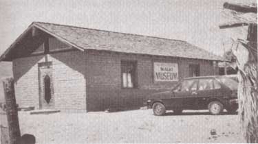
Malki Museum

A History of American Indians in California:HISTORIC SITES


Malki Museum
Riverside County

The Malki Museum is located on the Morongo Indian Reservation on Fields Road near the town of Banning, California. It is constructed of adobe bricks, and is approximately 30′ x 50′ x 12′ in size. Display cases house cultural objects made by Indians from the surrounding area, while the museum grounds include several brush arbors and a botanical garden. Both the museum and its grounds are well attended.

The Malki Museum was constructed in 1965 by the Cahuilla Indians and serves to preserve and enhance Cahuilla Indian lifeways. Its cultural exhibits relate the story of the Cahuillas from the pre-contact period to the present. Malki was also the first home for a publishing company, the Ballena Press, which has expanded its services to include ethnographic and ethnohistoric information and analysis of southwestern tribes.

The Malki Museum was the first Indian controlled and operated museum in California. As such, it is an important example to other Indian groups who are interested in preserving their material culture through a museum. Although the idea of an Indian Museum operated by Indian people seems like an obvious and natural development, it should be remembered that it takes dedicated people to actually accomplish such a task. Malki is a living example of an Indian people’s ability to adapt to the fast-changing circumstances that surround their cultural heritage. It will serve future generations by providing them with a glimpse into the rich and beautiful history of the Cahuilla people.

https://www.nps.gov/parkhistory/online_books/5views/5views1h46.htm

Tejon Indian Reservation

A History of American Indians in California: HISTORIC SITES


Tejon Indian Reservation
Kern County

In the early 1800s, Indians in the interior of California began to feel the effects of trappers and explorers. By mid-century, coastal Indians who moved inland following the breakup of the missions also suffered under the influx of miners and settlers. When the federal government sent Indian agents to write treaties with California Indians, Agent George W. Barbour negotiated the treaties with both interior and coastal Indians in the southern San Joaquin Valley. In return for the promise of goods, annuities, and land, the Indians vacated much of their home land.

In February of 1852, President Millard Fillmore submitted 18 California Indian treaties to the United States Congress for ratification, but the California delegation objected, complaining that the treaties provided too much good land for the Indians. Congress failed to ratify the treaties but did make some provisions for California Indians.

Edward F. Beale was appointed Superintendent of Indian Affairs for California in April 1852. Upon arrival in September, Beale toured the state to determine the status of California Indians. He reported in February 1853 that “our laws and policy with respect to Indians have been neglected or violated. . . . [The Indians] are driven from their homes and deprived of their hunting-grounds and fishing-waters at the discretion of the whites. . . .” Beale requested $500,000 for military reservations where both soldiers and Indians would reside.

Beale hired H. B. Edwards to start farming operations at Tejon and the San Joaquin River. On March 2, 1853, Congress appropriated $250,000 for five reservations, not to exceed 25,000 acres each, to be located on public lands, with good land, wood, and water. In September, Beale expanded the Tejon Farm into the first California reservation.

To gain support for his efforts, Beale named the reservation after Senator William Sebastian, Chairman of the Indian Affairs Committee. The Sebastian Indian Reservation, more commonly known as Tejon Indian Reservation, was located in the southern end of the San Joaquin Valley, “between Tejon Vaquero Headquarters and Canada de las Uvas. . . .” (Latta, 1977:736)

Tejon was located on a Mexican land grant rather than on public land, but Beale argued that no public lands were available and that the unoccupied grant could be purchased if necessary. Beale’s primary reason for choosing Tejon was the presence of mission-trained Indians with agricultural skills, more likely to succeed on a reservation.

Despite substantial opposition, Beale continued to gather Indians and move them to Tejon. In early 1854, he reported 2,500 Indians at Tejon and 2,650 acres under cultivation. Beale’s arguments for a reservation of 75,000 acres failed, and in July 1854, he was replaced by Thomas J. Henley.

When Henley took charge, he noted only 800 Indians, with fewer than 350 present at one time, and only 1,500 acres under cultivation, indicating that numbers of Indians and amount of acreage under cultivation had been inflated. Most of the crops failed that year because of drought. Henley started the Tule River Farm to supplement the reservation’s food, but the Indians still had to gather native foods and the government had to bring in more supplies in order to feed the reservation population. Throughout the reservation’s existence, drought, insects, and crop disease undermined the attempts at farming.

In November of 1856, the reservation was reduced to 25,000 acres. That year, 700 Indians were reported residing on the reservation and 700 acres were under cultivation. By 1859, Henley had been replaced.

In addition to crop failure, the reservation faced loss of the land when the land grant claim was upheld in court. Settlers also encroached on the unsurveyed and unfenced land, allowing cattle and sheep to eat reservation crops. During the 1863 drought year, all the crops were lost except for 30 tons of hay.

Meanwhile, former agent Edward F. Beale had purchased five contiguous ranchos in the Tejon area, including the reservation land, and was raising 100,000 sheep. In 1863, he offered to lease 12,000 acres to the government for a dollar an acre, but withdrew the offer when he found that the government planned to move Owens River Indians there. He noted that he had made the offer only because Indians already on the reservation were his friends.

Jose Pacheco, a Tejon leader, wrote to General Wright on April 16, 1864, “I should not have troubled you with this letter, Dear General, did I not think the agents here had wronged us. You and our great father at Washington do not know how bad we fare, or you would give us food or let us go back to our lands where we can get plenty of fish and game. I do not think we get the provisions intended for us by our Great Father; the agents keep it from us, and sell it to make themselves rich, while we and our children are very poor and hungry and naked.” (Sacramento Union, April 28, 1964)

The reservation was ordered closed in June 1864, and on July 11, Austin Wiley wrote, “I have the honor to inform you that all the Indians on the Tejon Farm and in the vicinity of Fort Tejon, some two hundred in number, have been removed from there to the Tule River farm.” Wiley noted that there was no food for the Indians at Tejon.

Shortly thereafter, D. N. Cooley, Commissioner of Indian Affairs, summarized the reasons for the reservation’s failure: “The lack of legal title to the land severely restrained investment in construction and development, leaving the reserve and the Indians on it in a state of constant uncertainty. The ideal of converting Indians from food gathering to settled agriculture was never realized.”

(Note: Unless otherwise specified, all above quotes are from government reports as cited in California Department of Parks and Recreation reference document No. 169, “Tejon Indian Reservation.”)

https://www.nps.gov/parkhistory/online_books/5views/5views1h92.htm

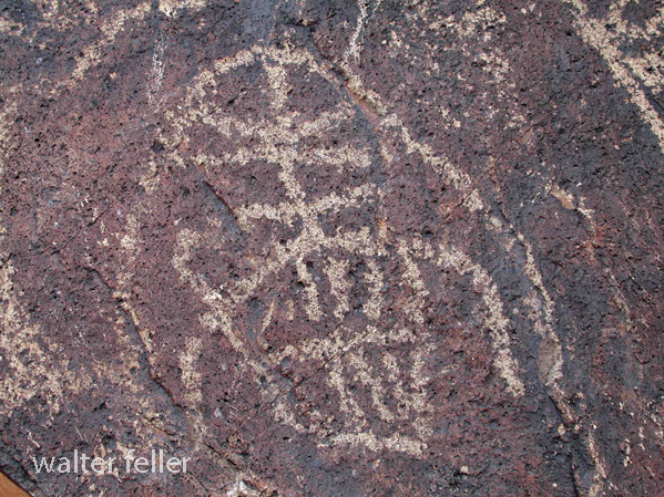
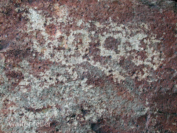
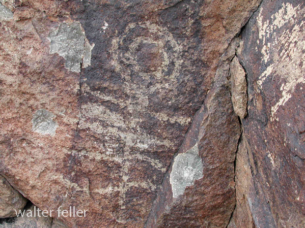
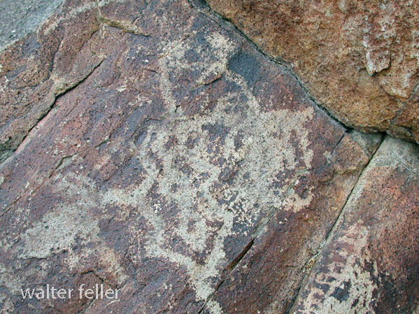
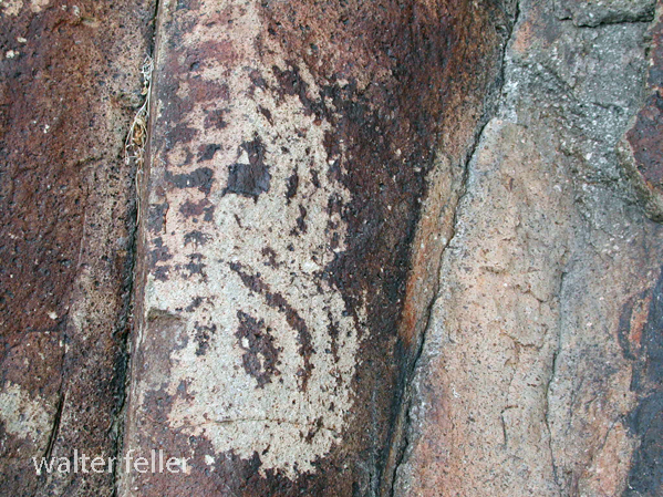
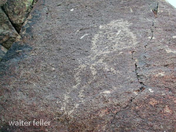
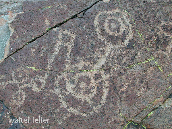
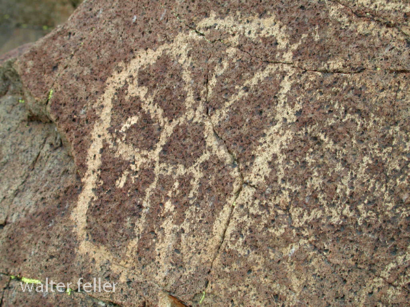
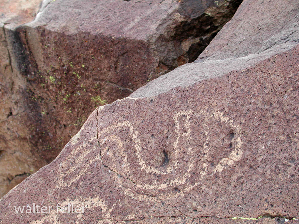
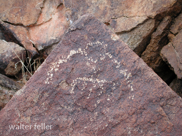
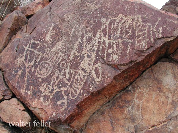
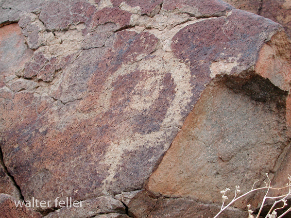
Petroglyphs, Pictographs, and Geoglyphs in the Mojave Desert

/petroglyphs/

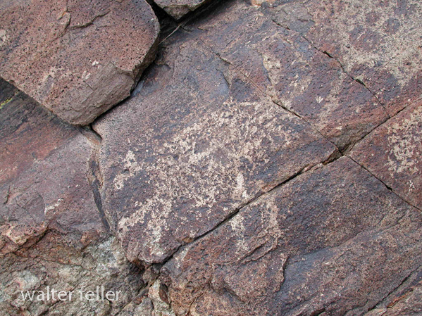
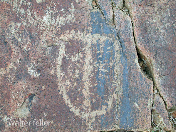
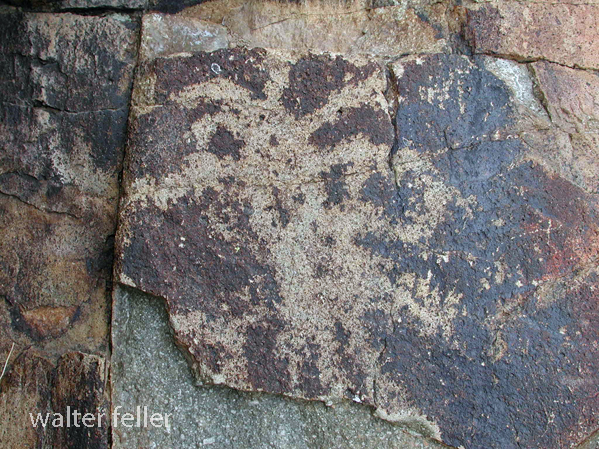
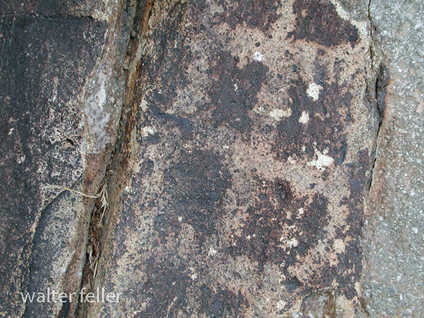
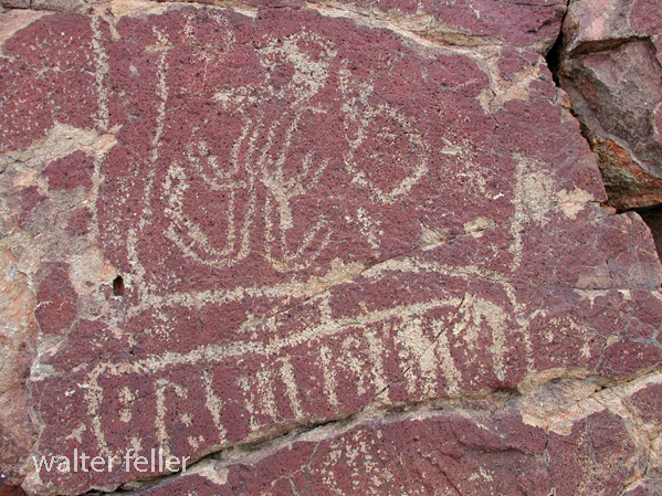
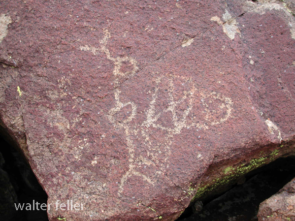
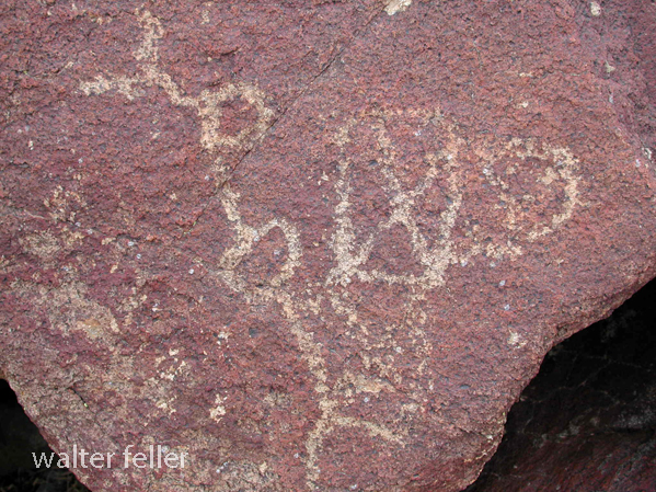
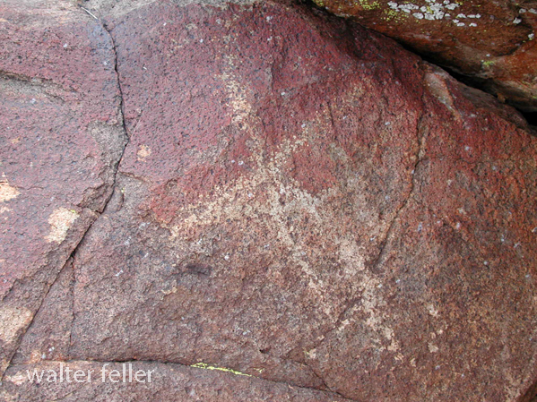
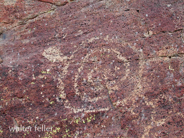
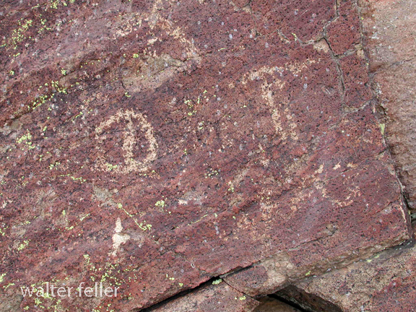
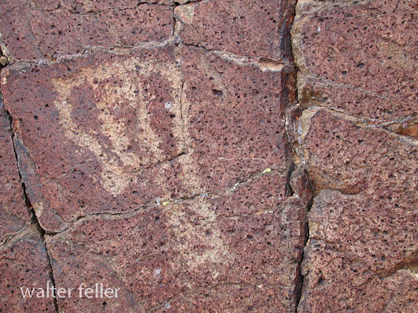
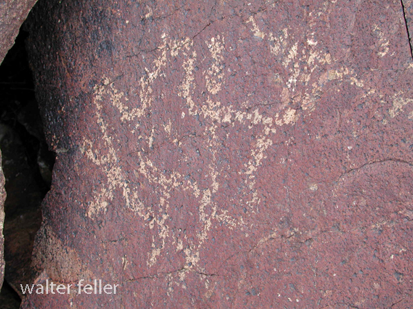
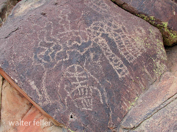
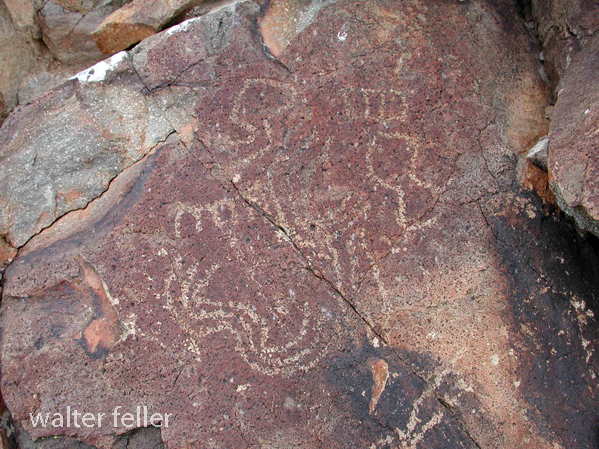
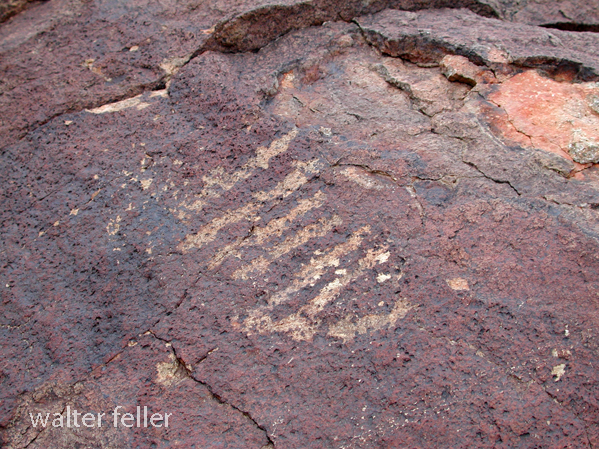
The Mojave Desert, located in the southwestern United States, is rich in cultural and historical significance, with evidence of human habitation dating back thousands of years. Petroglyphs, pictographs, and geoglyphs are among the archaeological features found in the Mojave Desert, offering glimpses into the region’s past.

Here’s a brief overview of each:

  1. Petroglyphs:
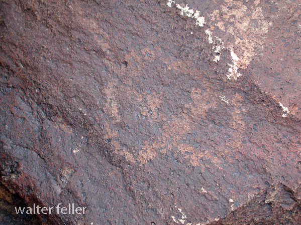
    • Petroglyphs are rock engravings created by carving or pecking into the surface of a rock.
    • They are often found on exposed rock surfaces, such as canyon walls or large boulders.
    • Petroglyphs in the Mojave Desert can depict various symbols, animals, human figures, and abstract designs.
    • Native American communities made these carvings as a form of communication, storytelling, or spiritual expression.
  2. Pictographs:
    • Pictographs are rock art created by applying pigments to the surface of rocks. These pigments are usually composed of natural materials like plant extracts or mineral pigments.
    • Pictographs are found on rock shelters, caves, and cliff faces, often in areas with some protection from the elements.
    • Like petroglyphs, pictographs in the Mojave Desert can represent various subjects, including humans, animals, and symbolic patterns.
    • The pictograph colors can include red, black, white, and yellow, with red being a common choice.
  3. Geoglyphs:
    • Geoglyphs are large designs or motifs created on the ground’s surface, often by arranging stones or altering the landscape’s natural features.
    • While geoglyphs are more commonly associated with other regions like the Nazca Lines in Peru, there are examples of geoglyphs in the Mojave Desert as well.
    • The Blythe Intaglios, located in the lower Colorado River valley near Blythe, California, is a notable example of geoglyphs in the Mojave Desert. These large human and animal figures were created by scraping away dark rocks to reveal the lighter soil beneath.

Preservation of these cultural artifacts is crucial, and many sites are protected to prevent vandalism and degradation. Researchers and archaeologists work to study and document these features, shedding light on the history and practices of the indigenous peoples who lived in the Mojave Desert. It is important visitors respect and avoid disturbing these archaeological sites to ensure their preservation for future generations.

Serrano Indians

https://mojavedesert.net/serrano-indians/

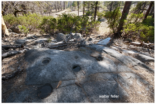
Communal grinding stone in San Bernardino Mountains

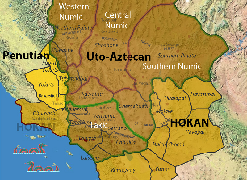
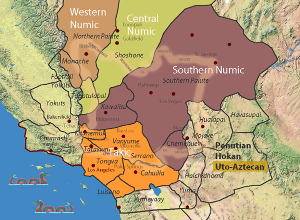
The Serrano are a Native American people who historically resided in the San Bernardino Mountains and the surrounding areas of Southern California, including the Mojave Desert. They are part of the larger Serrano branch of the Uto-Aztecan language family. (also see Vanyume)

Here are some key points about the Serrano Indians:

  1. Language: The Serrano people traditionally spoke the Serrano language, a member of the Takic subgroup of the Uto-Aztecan language family. Like many Native American languages, the Serrano language is endangered, and there are limited fluent speakers today.
  2. Lifestyle and Subsistence: The Serrano were traditionally hunter-gatherers, relying on the region’s rich natural resources. They hunted game, gathered plants, and engaged in fishing. Acorns were a significant food source, and the Serrano developed various methods for processing and preparing acorns for consumption.
  3. Houses and Shelters: The Serrano traditionally lived in dome-shaped structures known as kish, which were constructed from a framework of willow branches covered with brush and reeds. These structures were well-suited to the climate of the region.
  4. Cultural Practices: The Serrano had a rich cultural and spiritual life, with ceremonies, rituals, and traditions that were closely tied to their environment. They believed in a variety of supernatural beings and spirits.
  5. Contact with Europeans: European contact with the Serrano people began with the arrival of Spanish explorers and missionaries in the late 18th century. Like many Native American groups, the Serrano experienced significant disruptions to their way of life due to the introduction of new diseases, cultural changes, and the influence of European settlers.
  6. Reservation: In the mid-19th century, as Euro-American settlers expanded into Southern California, the Serrano people faced displacement from their traditional lands. In the 20th century, some members of the Serrano Nation settled on the San Manuel Indian Reservation near Highland, California.
  7. Contemporary Issues: Today, the Serrano people, like many Native American communities, face challenges related to economic development, healthcare, education, and cultural preservation. Efforts have been made to revitalize cultural practices and traditions.

It’s important to note that the history and experiences of Native American tribes are diverse, and individual tribes have unique cultures, histories, and contemporary challenges.

Mojave Indians

https://mojavedesert.net/mojave-indians/

/blog/?p=4048

The Mojave people, also known as the Mohave or Mojave Indians, are a Native American group indigenous to the Colorado River basin, which spans parts of present-day California, Arizona, Nevada, and Utah.

Here are some key aspects of the Mojave Indians:

  1. Geography: The traditional homeland of the Mojave people includes the Mojave Desert and the Colorado River basin. They are closely associated with the Mojave Desert, a harsh and arid region with extreme temperatures.
  2. Language: The Mojave people traditionally spoke the Mojave language, part of the Yuman language family. Like many Native American languages, Mojave is endangered, with relatively few fluent speakers remaining today.
  3. Lifestyle and Subsistence: The Mojave were traditionally semi-nomadic people, adapting their lifestyle to the challenges of the desert environment. They engaged in hunting, gathering, and fishing along the Colorado River. The mesquite tree in the region was a crucial food source, providing beans ground into flour.
  4. Houses and Shelters: The Mojave traditionally lived in dome-shaped homes made from brush and other natural materials. These structures were called “káa nyava” or “a nyava.” In addition to these homes, temporary shelters were constructed during travels.
  5. Contact with Europeans: Like many Native American tribes, the Mojave encountered European explorers, missionaries, and settlers. Spanish missionaries established missions in the region in the 18th century. Europeans’ arrival significantly impacted Mojave society, introducing new technologies, trade goods, and diseases.
  6. Steamboats and Trade: In the 19th century, the Colorado River became an important transportation route for steamboats, facilitating trade. The Mojave people traded with non-Native groups, exchanging goods such as mesquite products, pottery, and woven items.
  7. Fort Mojave Reservation: The Fort Mojave Reservation was established in 1880 along the Colorado River, encompassing parts of Arizona, California, and Nevada. It is the home of the Fort Mojave Indian Tribe, which includes Mojave, Chemehuevi, and Navajo people.
  8. Contemporary Challenges: Like many Native American communities, the Mojave faces contemporary challenges, including issues related to economic development, healthcare, education, and cultural preservation. Efforts have been made to revitalize cultural practices and promote the community’s well-being.

As with any Native American group, it is important to recognize the diversity and uniqueness of Mojave culture and history. Individual experiences and traditions within the tribe can vary.

Chemehuevi Indians

The Chemehuevi are a Native American tribe that primarily resides in the southwestern United States, particularly in the states of California, Arizona, and Nevada. The name “Chemehuevi” is derived from their Mojave name, which means “those who play with fish.” They are closely related to the Southern Paiute people and have historical and cultural ties to other indigenous groups in the region.

Key points about the Chemehuevi Indians include:

  1. Location: Traditionally, the Chemehuevi inhabited the areas around the eastern shores of the Salton Sea in California, the Colorado River, and parts of Arizona and Nevada.
  2. Language: The Chemehuevi people speak the Chemehuevi language, which is part of the Numic branch of the Uto-Aztecan language family. However, today, only a few individuals still speak their native language fluently.
  3. Subsistence: Historically, the Chemehuevi were skilled hunters and gatherers. They relied on hunting game, fishing, and gathering wild plants for their sustenance. The availability of the resources in the arid region influenced their nomadic lifestyle.
  4. Contact with Europeans: Like many Native American tribes, the Chemehuevi encountered European explorers and settlers, including Spanish missionaries and later American pioneers. These interactions significantly impacted their way of life, introducing new technologies and diseases and disrupting traditional practices.
  5. Reservation: The Chemehuevi Reservation was established in the 1860s along the Colorado River. The Chemehuevi Reservation is located near Havasu Lake, California. This area is the primary home for the tribe today.
  6. Contemporary Issues: Like many Native American communities, the Chemehuevi face various challenges, including issues related to cultural preservation, economic development, healthcare, and education. The tribe has made efforts to preserve and revitalize their cultural heritage.

It’s important to note that the history and experiences of Native American tribes are diverse, and individual tribes have unique cultures, histories, and contemporary challenges.

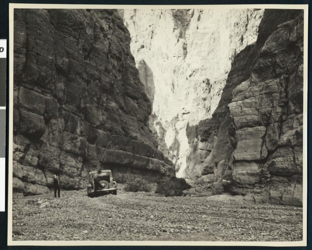
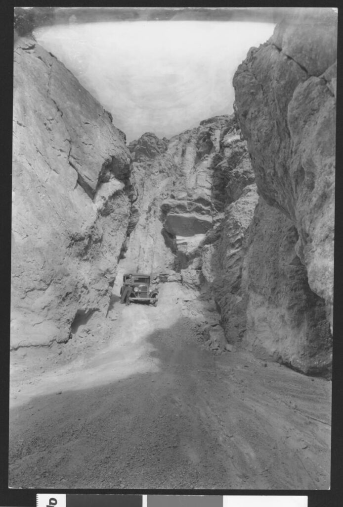
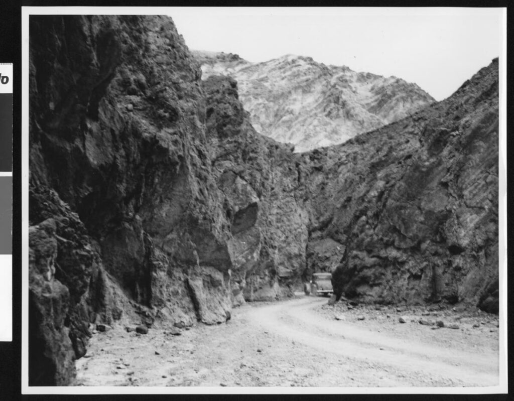
Death Valley Vintage Photos

C.C. Pierce

The Worst of It

In warm weather —and it is hardly ever cold in their tropic valley —the men wear only a breech-clout, and the women a single garment generally made of flaming bandannas bought in the piece. They dress their long hair in curious ropes, and plaster the scalp with mud, tattoo the chin in wild patterns, and have no ornaments save fichus, which they make with great skill from tiny glass beads.

They have been practicing cremation from time immemorial, and were just having a funeral near East Bridge. The corpse, dressed in its best, was stretched on top of a huge pile of dry old ties from the railroad, and the chief mourner touched a torch to the heap of dry brush at the bottom. As the flames sprang aloft and hissed and roared, the mourners stood in a gloomy ring, chanting a wild refrain ; and as the savage fire and savage song went on, they threw upon the pyre from time to time all the earthly possessions of the deceased, and one by one their own garments and ornaments.

Passing the strange, jagged spires of peaks, which are called the Needles because two of them have natural eyelets, —though these are visible only from the canon, and not from the railroad, —I crossed the 1300-foot drawbridge, now abandoned for a fine new cantilever, a dozen miles below, and stood upon the there forbidding soil of California. A night at the rather pretty little railroad town of Needles, and I started off again into the grim Mojave Desert. It was the beginning of two hundred miles whose sufferings far outweighed all that had gone before . . .

A TRAMP
ACROSS THE CONTINENT
BY CHARLES F. LUMMIS

Indian Mouse

Nevada History: XXVII
SOME NEVADA TRAGEDIES
From James G. Scrugham, Nevada: The Narrative of the Conquest of a Frontier Land (1935), vol. I

The Story of Mouse

One of the wildest frontier lands left in the United States is embraced in the southern tip of the State of Nevada, between the confluence of the Virgin and Colorado rivers and the site of the great Boulder dam project construction.

Bonelli Landing – Lake Mead

Some thirty-five years ago (123 years in 2023), this area was the scene of one of the most remarkable man hunts ever taking place within the state’s confines. This thrilling drama’s chief actors were eight: three Pahute Indians and five white men.

The leading character was an Indian named “Mouse” by his fellow tribesmen, of his habit of hiding out in the brush and his sly and silent movements. Although of a retiring and surly disposition, he was a good worker and possessed a crafty and intelligent mind.

The next character in importance and interest was one “Red Eye,” the most skilled Indian tracker of his tribe. He derived his name from bloodshot flecks which were always visible in the whites of his eyes, and was well-liked by the white men on account of his loyalty and industry as a ranch hand.

The third Indian character was a fierce old Indian woman who proved to be the Nemesis of the story, stirred to heroic action by the theft of a large and much-prized cabbage from her garden.

Daniel Bonelli – Huntington Library

Of the white actors, the most important was Daniel Bonelli, a famous pioneer settler of the early days. He conducted a hay and vegetable ranch near the junction of the Virgin and Colorado Rivers. Also, he operated a ferry over the latter stream connecting with the main trail south through Arizona. He employed a large number of white men and Indians to assist in his livestock, farming, and ferrying enterprises, among whom was a strong, fearless cowpuncher named George Sherwood, who later appears prominently in the story.

Other white men who figured notably in the tragedy were two young prospectors, Davis and Stearns, who were searching for placer gold on the bars of the Colorado River. These men were accompanied by an elderly prospector k, Majorreenowalt, whose chief function was to serve as camp tender.

The story begins at Bonelli’s ranch on the Colorado River. The place was then on the main line of travel between Oregon, Idaho, Utah, and the rich mining camps of Pioche and Delamar on the north to points in Arizona, Mexico, and elsewhere in the south. A continual stream of travelers passed, many of whom were fugitives from justice-seeking oblivion in distant, isolated places.

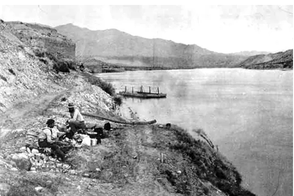
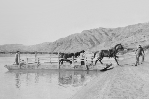
Bonelli’s Ferry

Others were nomads seeking the warmth of southern climes in winter and the coolness of the highlands of the north in the summer. In addition to revenues derived from his voyage over the Colorado and sale of hay and supplies to passersby, Bonelli also made extensive trade in meat and produce with the flourishing mining camps at El Dorado Canyon, Chloride, Gold Basin, and a score of other places.

In the operation of his ranch, Bonelli employed several Indian hands, including Mouse and Red Eye.

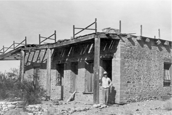
The Bonelli Home in Rioville (Bonelli Landing)

On a spring evening in 1896, when the story begins, the Indian Mouse somehow secured a quantity of whisky that he drank. Under the alcoholic stimulant, his naturally vicious disposition had no restraint, and Mouse started a promiscuous shooting at the other Indians in the camp. They fled to the main ranch and informed Bonelli that Mouse was on a killing rampage, and their lives had only been saved by the bad aim of the drunken aggressor.

Bonelli and some of his ranch hands then went to the Indian camp and disarmed the crazed Mouse, locking him in an adobe outhouse for the night. The next morning the Indian had become sober and appeared entirely docile. However, Bonelli, knowing the disposition of Mouse, gave him his discharge and ferried him over to the Arizona side; after returning to the man, his gun and ammunition were taken away the previous evening.

From Bonelli’s Ferry, the Indian went to a mining camp called White Hills and worked a few days cutting Joshua trees for fuel. Becoming tired of the labor, he stole a horse and set out for one of his old haunts at Indian Springs, some eighty miles away at the foot of the Charleston Mountains.

Mouse attempted to cross the Colorado River back to Nevada at a point opposite the old trail up the Las Vegas Wash, evidently intending to obtain food supplies at the Las Vegas ranch en route to his destination.

Just before he reached the Nevada shore, his horse became so deeply mired in the quicksands that he could not be extricated. Mouse was compelled to leave the struggling animal, and he made his way up the river toward a prospector’s camp, which he sighted on the Arizona shore. This camp was occupied at the time by the three men mentioned above, Davis, Stearns, and Major Greenowalt, who were prospecting for placer gold in the river bars. They had a small boat which they used for the purpose and accommodatingly crossed the river to meet the Indian when he signaled to them.

After being fed by the prospectors, who were obviously tenderfeet in the country, the crafty Mouse aroused their interest by relating the story of a fictitious ledge of gold-bearing quartz, which he claimed to have discovered in an almost inaccessible canyon, some ten miles back from the camp.

Early the following day, accompanied by Davis and Stearns, the Indian started for the scene of the alleged find, Greenowalt remaining at the river location. Davis and Stearns were never again seen alive.

The next morning the scene of the story shifts back to the Bonelli ranch, some twenty miles further up the river from the prospectors’ camp.

Among the horses on the place were two handsome gray geldings, half-brothers five and six years old, which Bonelli had bought from a band of well-bred horses being driven from northern Nevada to the Arizona market. These animals were the best in the place, but one was a much better saddle horse than the other, owing to a more tractable disposition.

During the time Mouse worked on the ranch, he was familiar with the horses and their characteristics. On the morning in question, when the ranch hands went into the fields to harness the stock, the best gray horse was found to be missing. This caused no particular excitement until it was found that his bridle was also gone.

Speedily circling the fields in search of tracks, the buckaroos discovered where the lost horse had been led out toward the Virgin River by a man wearing leather boots, who mounted at the bank before plunging into the stream. A hasty inspection of the shorelines revealed no place where the rider could have come out from the river. A general alarm was sounded, and all hands set out to find the trail of the thief. After a couple of hours’ delay, the outcoming tracks were finally located on the opposite side, more than a half mile above where the stolen animal had entered the water. The extraordinary effort made to throw pursuers off the track indicated that the horse stealer was a person of some skill and experience who had gained a probable ten or twelve-hour start on possible pursuers. However, Bonelli acted promptly. He armed two of his best riders with Winchester rifles and instructed them to stay with the trail until they recovered the horse or killed the thief.

The pursuing posse followed the tracks up the sandy shores of the Rio Virgin until they reached the Bitter Springs Wash, the drainage channel for a great range of territory to the west of the Virgin.

At the head of this wash are springs of bitter waters that will support life, although hardly palatable enough for human consumption. Here the crafty Mouse, for he was the thief, left the bottom of the wash where trailing was easy and took to the dolomitic limestone banks where vegetation and the soft ground were scanty, and no imprints were made. However, the very hardness of the ground defeated the purpose of the Indian thief. The rough limestone caused the horse’s hoofs to bleed, leaving a plain track for the pursuers to follow.

All through the long afternoon and in the moonlit evening, the Bonelli buckaroos followed the trail. About ten o’clock at night, while going over a steep declivity covered with loose lime shale, one of the horses missed his footing and started both riders and their steeds to slide into the precipitous gulch below. When the descent was stopped, both horsemen were so exhausted from the efforts of the day that they dismounted and unsaddled their animals, leaving their bridles on.

Both men wrapped themselves in their saddle blankets and took turns sleeping through the remainder of the night. On the following morning, they were up at the first peep of dawn, ready to resume the trail. However, it was found that the horse who had missed his footing was so badly bruised and cut that he could hardly walk, and the trailers decided to go back to the Bonelli ranch for reinforcements.

On arriving home early in the afternoon and reporting their adventures, the master of the ranch immediately detailed George Sherwood, his ranch foreman, and Red Eye, the skilled Indian tracker, to follow the thief to the end. From the information available, Sherwood and Red Eye decided that the horse thief was heading for the Las Vegas ranch, seventy-five miles away, as that was the nearest food and water available.

Pushing their horses to the utmost, the trailers arrived at their destination the second evening after leaving the Bonelli ranch. Then it was found that the Indian Mouse had arrived the night before on foot, wearing leather boots, with a story of having killed his crippled horse in the Muddy range at a point near where the first pair of pursuers had lost the bloody trail the day before.

It then became obvious that Mouse was the thief and that the lost horse was dead; otherwise, he would have been brought in for water. As further evidence of the guilt of the Indian, he had silently slipped away in the night soon after the ranchmen fed him, and his tracks indicated that he had made directly for the rugged fastnesses of the Charleston Mountains, some thirty miles away.

A successful pursuit was impossible, so after two days’ rest, Sherwood and Red Eye started on their return to the Bonelli place to inform their employer of the identity of the criminal. Arriving at the foot of the Las Vegas Wash, where Mouse had lost his first stolen horse in the quicksands of the Colorado River a few days before, Sherwood and his companion saw a flock of buzzards circling around and eating the remains of the animal, which projected from the quicksand.

As night was approaching, they rode up the river to a point opposite the prospectors’ camp.

Here Major Greenowalt rowed over and informed them that his partners had left five days before with an Indian named Mouse, who was to show them the location of a rich gold ledge. The Major was greatly disturbed by the protracted absence of his companions, as they had only carried food and water for a one-day trip.

On hearing the Major’s story, both Sherwood and Red Eye became apprehensive that the surly Mouse, with whom they were well acquainted, had added murder to his crime of horse theft.

The next morning they rode back to the home ranch and reported their information and suspicions to Mr. Bonelli.

The aroused ranch owner immediately organized a posse that went down the river to seek the missing men. Again the indomitable Red Eye took up the trail over rough and hard ground.

After two days of tedious tracking, Red Eye finally led the posse to the foot of a steep declivity where the mutilated bodies of Davis and Stearns were discovered. The boots had been removed from the feet of Stearns, accounting for the boot tracks made by Mouse when he had stolen the gray gelding at the Bonelli ranch.

Reconstructing the tragedy, Mouse appeared to have taken the lead until he enticed the two prospectors to the lonely place where the bodies were found. There he suddenly turned and vented his blood lust against the white race by shooting both Davis and Stearns.

The bodies of the unfortunate gold seekers were carried down to the river, then transported 100 miles in skiffs to Needles, California, from whence the remains were shipped back to relatives in the East.

With his dastardly acts fully revealed, Mouse became a hunted outcast, to be killed on sight. Even his tribal compatriots were in terror of him and sought his extermination as a crazed killer.

Mouse Tank – Valley of Fire

For two years, the murderer remained at large, living on seeds, nuts, and rodents and making an occasional raid on a prospectors camp for flour, bacon, and beans. There was found evidence of where Mouse had killed a wild mustang at a water hole and made jerky of the meat.

Finally, there came an end to this bold and much-feared outlaw. In the course of his wanderings, he came to a mountain overlooking a narrow valley where some of his fellow tribesmen had a little truck garden by a water hole. He descended in the night and stole some corn and cabbage to assuage his hunger.

This act led to his undoing. The cabbage belonged to an astute old squaw, who picked up the trail and followed it enough to identify it as belonging to Mouse from certain peculiarities of gait with which she was familiar.

Returning to the camp, the old squaw set up a hue and cry, which brought about the speedy organization of a well-armed posse to endeavor to capture the murderer. Red Eye, the tracker, led the hot pursuit. Day and night continued the chase through the flaming red sandstones of the Valley of Fire, then up the Meadow Valley Wash to Cave Springs and back again toward the Muddy River.

Bonelli had relays of men to provide food and water for the pursuers, as he was determined that the miscreant should not again escape.

The track was lost and found, then lost and found again. Mouse used every concealment art, but the tireless Red Eye never gave up the trail.

After nearly two weeks of hide and seek, the posse cornered Mouse early one morning at a lonely water hole on a gypsum flat near the Muddy River. Here the outlaw made his last stand.

Cursing and screaming, Mouse exchanged shot for shot with his pursuers. However, his pistols were no match for the high-powered rifles of the posse. The savage murderer finally fell, with his body literally riddled with bullets. Thus was avenged the deaths of Davis and Stearns, and the whole countryside felt relief from the sinister shadow of the Indian Mouse.

END

January 2022 Edits

Canada Geese at Saratoga Springs, Death Valley National Park

Owl Canyon

Owl Canyon

Owl Canyon

Apple Valley, Ca.

Ambient Sunrise

Coxcomb Mountains

Apple Valley – Joshua Tree Forest

Zzyzx – Desert Studies Center

Techatticup Mine – Eldorado Canyon, Nelson, Nevada – 3/2015

Nelson, Nevada – 3/2015

Lucerne Dry Lake

Tomorrow’s Sunrise

Wild Places – Cougar Buttes

The high country is different than the low country. The high country is higher and of course the low country, lower.

Petroglyphs – February 2011

Coso Obsidian

Emerging Efforts to Define the Coso Obsidian Economic Exchange System in the Rose, Fremont and Antelope Valleys of the Western Mojave Desert, California
By Mark R. Faull, California State Parks (Ret.)
Proceedings of the Society for California Archaeology, Volume 19, 2006, pp 159-167

Archaeological investigations in and about Red Rock Canyon State Park in Kern County’s El Paso Mountains have unveiled a series of lithic procurement sites, the nature of which is primarily designed to support other off-site prehistoric communities. The rise and fall of these support sites coincide with the peak production of Coso obsidian. The nearest contemporary community for postulated interaction would likely represent the Koehn Lake village complex (CA-KER-875). A reexamination of the Sutton model developed for Koehn Lake, along with other sites in the region, leads to a new interpretation of local complexity, connectivity, and interdependence potentially aligned with the Coso economic system, whereby major villages potentially served in an interlinked fashion to facilitate the widespread dispersal of the valuable Coso volcanic glass.

The ambitious goal of this inquiry is to initiate the concept of the interconnectedness of site function within a portion of the western Mojave Desert when viewing a series of regional prehistoric sites that are contemporaneous to the peak period of Coso obsidian quarrying and distribution. The ensuing discussion of the Coso Obsidian Economic Exchange System rests mostly upon a reexamination of the works conducted by others, whereby I hope to stimulate new perspectives of thought and approach.

For purposes of definition, references to the Coso Obsidian Economic Exchange System are equivalent to the “Coso Hot Springs Exchange System” of Ericson (1981:119-122) and Hughes and True (1985:326, 334), as well as the “Sugarloaf production and exchange system” of Allen (1986:10). In addition, Allen (1986:1) referred to the Coso trade as an “egalitarian economic system.” Discussing more general California obsidian trade, Bouey and Basgall (1984:135) referred to “areas of economic articulation.” Such areas provide cultural connections and ties that are worthy of investigation.

The examination of the possible cooperation of communities holds certain potentials for elucidating the interlinked, complex relationships and possible interdependent functions of a suite of archaeological complexes, which in this instance stretched from the southeastern Sierra through the Antelope Valley in California’s western Mojave Desert. Such research also holds promise for identifying era- specific archaeological complexes within a regional framework or perspective.

The ensuing discussion focuses primarily upon the Late Gypsum/ Newberry through the Rose Spring/Haiwee periods of peak Coso obsidian production and distribution, which potentially interconnect the Rose, China Lake, Fremont, and Antelope valleys of the western Mojave. Per the work of Gilreath and Hildebrandt (1997) and many others, this period of pronounced economic and cultural florescence has been shown to have met its demise with the close of the Rose Spring/Haiwee period, perhaps associated in some fashion with the series of progressive droughts now referred to as the Medieval Climatic Anomaly (see Stine 1994 and others).

THE EL PASO MOUNTAIN QUARRIES AND THE KOEHN LAKE SITE

For 20 years, my place of employment within this region was Red Rock Canyon State Park, a landscape that beckons travelers to pause from their journeys amidst spires and cathedrals of stone. These canyonlands never fail to astonish — yielding unending discoveries in the realms of the biotic, the paleontological, and the archaeological. Pursuant to a large expansion of the park in 1994, State Park staff began documenting extensive prehistoric chert and chalcedony quarries (Faull 2000; Faull and Sampson 2004; Sampson 2003).

These extensive quarries and secondary reduction sites display temporal affinity with the rise and fall of the Coso obsidian quarries and economic system (Faull and Sampson 2004). These sites were purely supportive of other off-site communities or activities, and were not self-sufficient. Thus it became apparent that the quarries were connected within a larger regional cultural system. But who quarried the stone, and where was its destination? The closest contemporaneous community would be the primarily Rose Spring-era village complex at nearby Koehn Dry Lake to the south.

The Koehn Lake village (KER-875) was excavated by Dr. Mark Sutton and has become one of the premier cornerstones of Dr. Sutton’s proposed western Mojave Desert model (Sutton 1986, 1988a, 1990, 1991, 1996; Sutton and Everson 1992; Sutton and Hansen 1986). Thanks are due to Dr. Sutton for his effort to refine Mojave Desert archaeology by proposing testable models of the prehistoric past.

Sutton noted that the primarily Rose Spring-era Koehn Lake village site rests principally above a shoreline associated with ancient Koehn Dry Lake (Sutton 1986:8, 1988a, 1990, 1991, 1996; Sutton and Hansen 1986:3-7). The village abuts aeolian dunes once crested by a sizeable mesquite community (Sutton 1986:2, 7, 1990:3), now decimated by agricultural drawdown of the local water table (Pampeyan et al. 1988). During excavations, Sutton encountered a collapsed circular, semi-subterranean juniper structure, as well as frequent juniper remains (Sutton 1990:3, 1991:179; Sutton and Hansen 1986:2). In addition, Sutton later excavated a prehistoric juniper structure found at the Honda Test Track site (KER-2211) located 3 km west of the Koehn Lake village (Sutton 1990:5, 1991:139,180). As Sutton (1991:179) noted, the closest modern juniper communities lie 15 to 30 km distant in the southern Sierra Nevada.

The discovery of the ancient Koehn Lake shoreline combined with the juniper frequency on-site underscores Sutton’s postulated Western Mojave model, whereby he proposes a mesic regime sufficient to support a lake stand and to lower the juniper community to the shoreline of ancient Koehn Lake (Sutton 1991:179, 1996:238, 243; Sutton and Everson 1992:62; Sutton and Hansen 1986). Such a model bears certain attractive features, which help to explain the local cultural florescence of the late Gypsum through middle Rose Spring periods. In addition, Sutton proposes that the desiccation of the lake stand at 1000 B.P. led to the eventual abandonment of the Koehn Lake site (Sutton 1991:178181, 1996:232; Sutton and Everson 1992:62-63).

PROXY DATA AND KOEHN DRY LAKE

To date, no paleoenvironmental studies have been conducted upon Koehn Lake proper to confirm or deny the model. Therefore, proxy data must suffice for analysis. To the north, Searles Lake near Trona does bear evidence of a shallow, highly saline, fluctuating Holocene lake stand (Smith 1979:95, 96, 109). Two-thirds of the way up through a Holocene mud overburden, a radiocarbon date of 3520 B.P. has been documented (Stuiver and Smith 1979:69, 73). This lake stand appears associated with the known pluvials of roughly 4000 and 2000 B.P. (see Smith 1979:109, Figure 41). The upper deposits at present cannot yet be correlated to match the postulated Rose Spring era Koehn lake stand.

Farther to the north, Stine (1995:9) has concluded “that Owens Lake was exceptionally low, and perhaps non-existent during extended portions of the Haiwee [Rose Spring] time.” Stine (1995:4, 9) cites the work of McGuire (1994) who documented archaeological remains at INY-3541, which range in age from roughly A.D. 135 to 933 and reside on a moderately low beach line of Owens Lake. This beach line lies at 1,093.2 m, roughly 3.4 m below the historical high stand of Owens Lake (Stine 1995:9). The data from McGuire (1994), as well as from Stine (1995), do appear convincing that a lower-than-normal, rather than higher-than-normal, stand for Owens Lake existed during much of the late Gypsum and Rose Spring periods, contrasting with the postulated model for Koehn Dry Lake.

At present, the closest correlative pattern to that proposed for Koehn Lake appears to be distantly removed at Lower Pahranagat Lake northeast of Las Vegas, Nevada. At this location a pattern of summer- shifted rainfall apparently produced and maintained a shallow lake during the Rose Spring era, where previous to and following this period marsh habitat had predominated (Wigand and Rhode 2002:341).

More direct proxy data appear available to analyze the postulated down-slope shift of the juniper community into the vicinity of Koehn Lake. In nearby Red Rock Canyon four archaeological sites have now been excavated which bear in part strata of either Gypsum or more commonly Rose Spring era assemblages: KER-147 (Robinson 1981), KER-246 (Harvey and Gardner 2003), KER-250 (McGuire et al. 1982), and KER-5043 (Gardner 1998). Despite their presence up-slope and up- canyon from Koehn Lake, no juniper remains have been discovered at these sites. Gardner (1998:123, 139) specifically notes such an absence in her thesis, which investigated portions of the Sutton model.

Elsewhere, Peter Wigand (2003), working at the Airport Playa site to the north in the Coso Mountains, reports pursuant to both packrat midden and pollen studies a continuity of plant communities over the past 2,600 years. While ratios of plant species vary within the composition, the community members themselves remain constant (Wigand 2003). Rhode and Lancaster (1996:17-24), working south of Koehn Lake at Edwards Air Force Base, report an identical situation involving fluctuating species ratios but consistency of plant communities status over the last 5,600 years. To the east of Koehn Lake, research at Fort Irwin confirms an identical scenario of general plant community consistency during the later Holocene over the last 3,500 years (Basgall and Hall 1992:5; Koehler and Anderson 1993).

In the absence of proxy data supporting a dramatic down-slope shift in the juniper community, perhaps other scenarios might account for the presence of juniper at Koehn Lake; the most logical counter- conclusion being that invested energy transported juniper to the site. Why would a community invest such an effort to establish outposts at both Koehn Lake and at KER-2211, 3 km to the west? What other qualities about these sites would motivate such an effort? Expending such extreme energy speaks to some form of strategic importance for the location of these communities.

THE POTENTIAL COSO OBSIDIAN TRADE CORRIDOR(S)

Following Gilreath and Hildebrandt’s (1997) seminal work on the Coso Volcanic Field — and the earlier documentation of Coso obsidian distribution by other regional researchers (Ericson 1981; Ericson and Glascock 2004:780-781, 783, Figure 1; Ericson and Singer 1971; Ericson et al. 1989; Hughes and True 1985; Koerper et al. 1986; Meighan 1978), insufficient attention has been expended examining the logical inter- connective footprint of the Coso Economic Exchange System, which delivered high-quality obsidian to much of the southern California coast.

Numerous researchers have hinted at or suggested that a connective trade corridor, possibly involving Coso obsidian, functioned within the western Mojave through the Antelope Valley (Ericson and Meighan 1984:147; Koerper et al. 1986:57; Robinson 1977; Sutton 1980:221, 1981:124, 1988a:76-78, 1988b:25, 1989:109; Warren 1988:4647). Along these lines, Sutton (1989:101, 107-109) has discussed the Mojave Desert patterning of Coso obsidian in a post-A.D. 1000, Late Period or Protohistoric temporal context. The focus of this inquiry mostly predates that context.

Other possible Coso trade corridors might involve the southern San Joaquin Valley, although few targeted studies have yet occurred. This potential inter-connective economic corridor warrants further investigation in tandem with the Mojave Desert economic system.

Perhaps in a larger context the presence of the Koehn Lake village could be viewed as integral or sustaining to the economic system of Coso obsidian exchange through the western Mojave Desert. As such, let us briefly examine the regional pattern of village establishment within a potential Coso context.

THE ESTABLISHMENT OF DESERT VILLAGES

The earliest dated village within the Antelope Valley is that of Lovejoy Springs (LAN-192). At this site, a group inhumation dated at 2720 B.P. included a Coso obsidian Elko point and one youth draped in over 3,000 beads (Love 1992, 1996:106; Sutton 1988a:52; Toney 1968:810). Thus, the inception of village establishment within the Antelope Valley already displays connection between the coast, trade in beads, and Coso obsidian from the north.

Looking elsewhere in the Antelope Valley, a second significant village complex west of Rosamond (KER-303) has yielded an excavated residential structure (probably made of juniper) dated to 2370 B.P. and 2140 B.P., subtended by nearly 1 m of midden (Sutton 1988a:39-40, 62; Sutton and Robinson 1982). Elsewhere at the site, a radiocarbon date of 2200 B.P. was obtained from a charcoal sample at a depth of 2.5 m (Sutton 1988a:39). Coso obsidian is known from the site, and burials at the site, which currently lack sufficient temporal constraints, do display copious unanalyzed shell beads (Sutton 1988a:42, 43, 56).

Changing focus to the extreme northern vicinities of the potential Coso System, the village establishment at Rose Spring (INY-372) appears to be roughly marked by a youth inhumation from Locus 1, which can be roughly dated at between 2400 to 2500 B.P. (Lanning 1963:243, 268, 281; Yohe 1992:146). This youth inhumation possesses 1,000 Haliotis ring beads along with an obsidian Elko corner-notched point (Lanning 1963:243, 260-261, 263, 320). At Locus 3 the base of the rich occupational midden has been radiocarbon dated at 2240 B.P. (Yohe 1992:94). At Locus 1 a similar date of 2200 B.P. was recovered from the 152-163 cm level of Trench 1 (Yohe 1992:140, Table 5), near the base of the rich midden defining Lanning’s (1963:242) original Stratum 2.

Again, possible village establishment appears to coincide with connectivity to the coast in terms of exchange or trade in shell beads and ornaments. Are the occurrences noted coincidental, or could village establishment contain an element of connectivity to trade? Future targeted investigations appear warranted.

Could village placement be strategic to controlling the trade in Coso obsidian? Sutton has previously illustrated how trade might have linked certain early villages in the Antelope and Fremont valleys as potential “gateway communities” developed in response to trade, as per the Hirth (1978) model, while sometimes identifying obsidian as the trade product (Sutton 1981:124, 1988a:77-78, 1988b:24, 25). Many of these villages, located near reliable water, could easily serve as strategic trade partners for Coso obsidian exchange. These Antelope Valley villages remain well positioned to serve another potential intermediate link in Coso distribution near Castaic Lake, LAN-324, where obsidian lithic artifacts and bifaces were present (Ericson 1981:Appendix 2, personal communication 2004; Ericson and Glascock 2004:781; Ericson and Singer 1971).

Farther south, trade through the Cajon Pass remains less clearly defined. The strategic presence of the culturally distinct village of Oro Grande (SBR-72) above Cajon Pass (see Warren and Crabtree 1986:191), with its near-absence of obsidian and Rose Spring points in the latter Rose Spring era (Rector et al. 1983:35, 37, 47), would appear to discourage hypotheses involving Coso trade. However, the presence of shell beads at Oro Grande (Rector et al. 1983:68-87) bespeaks a coastal connection and the presence of modest quantities of Coso obsidian in Crowder Canyon, SBR-113, SBR-421, and SBR-713, near Cajon Pass (Basgall and True 1985:5.16-5.18, 7.10; Bouey 1985:J2; de Barros 1997:5-93; White 1973:Table 4) may complicate this scenario, unless Coso obsidian moved inland from the coast similar to the scenario suggested for San Diego County (Hughes and True 1985:333). In addition, minor amounts of Coso obsidian have also been documented for the early to mid Gypsum period Siphon Site (SBR-6580) in the Summit Valley 14 km east of Crowder Canyon (Sutton et al. 1993:53).

To the north, with additional Eastern Sierra sources of obsidian as potential competitors, one could view the early establishment of the Rose Spring village as strategically positioned or situated to assist with the control of access and trade through the southern Owens and Rose valleys. The later establishment of two large Rose Spring/Haiwee era villages north of the Rose Spring proper, at INY-3806/H on the western shore of Owens Lake at the confluence of Cottonwood Creek and at INY3812 in the north end of the Rose Valley (Delacorte 1994:5-6; Delacorte and McGuire 1993:178, 252), combined with the establishment of the Coso Junction Ranch village (INY-2284) southwest of the Rose Spring site (Allen 1986; Gumerman 1985; Whitley et al. 1988), could potentially further strengthen control over access through time. In addition, a third sizable Rose Spring period occupation at INY-1428, also located west of Owens Lake, adds even greater presence during this critical temporal period (Gilreath and Holanda 2000:121).

Returning to the Koehn Lake village, with a calibrated radiocarbon date suggesting establishment around 1700 B.P. (Sutton 1996:235, 238), perhaps part of this site’s invested energy involved the strategic value of further controlling trade and access from realms to the south.

INCREASING CULTURAL SPECIALIZATION

Lithic Specialization

The discussed florescence of Coso quarrying during the late Gypsum and Rose Spring periods can also be viewed as a period of increasing cultural specialization (cf. Ericson 1984). Shifting from a perspective of potential specialized village establishment, examination of specialized quarry sites can follow. Gilreath and Hildebrandt (1997:178-179) have documented the increasing specialization of quarry selection within the Coso Volcanic Field during the Gypsum/Newberry and Rose Spring/Haiwee periods (see also Whitley et al. 1988:5), as well as the use of secondary bifacial reduction sites (see also Allen 1986:35).

The cryptocrystalline quarries of Red Rock Canyon State Park display a similar evolved focus and association with secondary reduction loci (Faull and Sampson 2004). Add to this the Antelope Valley rhyolite quarries (Glennan 1970, 1971; Sutton 1982) and a greater regional picture of the quarry complex emerges.

Within the localized El Paso Mountain to Fremont Valley region 94 percent of the recovered Rose Spring projectile points are fashioned from Coso obsidian. This ratio of preferred material use tends to contrast sharply with other eras within the local assemblage. However, despite this observed preference for obsidian point production during the Rose Spring period, the Red Rock cryptocrystalline quarries expand in tandem with the Coso model, indicating a reduced but specialized spectrum of use for cryptocrystalline materials within the tool kit of the El Paso to Fremont Valley segment of the Coso Economic System. In- depth analyses of local sites, such as the Koehn Lake village to the south and the Freeman Spring site (KER-6106) to the north, may offer greater insights into this more restricted, specialized use of cryptocrystalline rock within the Rose Spring tool kit.

The introduction of the bow and arrow during the period of Coso obsidian florescence has generated much debate as to the impact of such technology on both large mammal populations and lithic technology trajectories (Allen 1986; Ericson 1982; Grant et al. 1968:58; Yohe 1992, 1998; Yohe and Sutton 2000). Focusing first upon lithic technology trajectories, secondary bifacial reduction of tradable obsidian and other overlapping products of the Coso trade system could account in part for the difficulty researchers have experienced in discerning the introduction of the bow and arrow within lithic artifact assemblages.

In addition, some Antelope Valley researchers assert that local lithic trajectories suggest that Rose Spring points may have been traded into the valley as completed products (Earle 2004:12; see also the lack of debitage in Sutton 1988a:76). On the margins of the Fremont Valley at KER-1998, Sutton and Everson (1992:57) note that obsidian appeared mostly as small-sized pressure flakes, suggesting that obsidian “was being brought to the site as artifacts in generally completed form.” Examining sites, such as Coso Junction Ranch and others, for the possible specialized production of tradable points might be another line of valuable inquiry (see the Phase B change in the ratio of biface thinning versus secondary reduction reported by Allen 1986:32-33, 37, 40; see also Gilreath and Hildebrandt 1997:168).

Intensified Food Specialization

Whether or not the introduction of the bow and arrow decimated large mammal populations within this region, the archaeological record for this segment of the western Mojave is unequivocal about the intensification of focused food resources. The Rose Spring/Haiwee era witnessed both an expansion of pinyon processing (Bettinger 1975, 1976, 1980, 1989; Garfinkel and Cook 1979, 1980) and an accelerated fetish with the consumption of lagomorphs and a series of small animals (Delacorte 1994:8-10; Yohe and Sutton 2000:5), particularly hares.

Lepus procurement sees the establishment of massive specialized collection and processing sites, such as those at Freeman Spring near Walker Pass (Williams 2004), and at the Bickel site in the El Paso Mountains, KER-250 (McGuire et al. 1982). Intensive Lepus processing is known from the village sites of Rose Spring, Koehn Lake, and KER2211 (Sutton 1990:5, 1991:180; Yohe 1994; Yohe and Goodman 1991; Yohe and Sutton 2000:3). Gumerman (1985:28) documented that rabbit processing intensified during the progression of the Rose Spring period at the Coso Junction Ranch site (see also Whitley et al. 1988:6, 8). Kranz (1963:288) stated for the Rose Spring site that it was “tempting to conclude that rabbit brains were eaten, including the relatively soft cranial bones.” Ethnographically, rabbit brains have been reported as a delicacy (Christenson 1990:368). However, it should be noted that at the Bickel site in the El Paso Mountains, Lepus heads and certain parts of the extremities were removed from lagomorphs before apparent transportation off-site to the place or point of actual consumption or use (Basgall 1982:137-138).

A suite of other small mammals and other animals were also widely to locally exploited by Rose Spring era populations (cf. Delacorte 1994 and others). Broadening the perspective, the Anasazi of the Southwest reportedly display a similar intensified utilization of small game, particularly lagomorphs and mice, before their profound decline, around the peak of the Medieval Climatic Anomaly (Diamond 2005:150). Perhaps a scenario somewhat similar to the Anasazi occurred in portions of the western Mojave — where initial success and population expansion possibly became increasingly difficult to support or sustain, in light of potential over-predation or increasing resource failure associated with progressing drought and aridity (cf. Ericson and Meighan 1984:150; Whitley et al. 1988:8; Yohe and Sutton 2000:1, 4).

A REGIONALIZED PERSPECTIVE

In conclusion, from north to south, village establishment within the discussed corridor of the western Mojave Desert appears to initiate with relative concurrence during the Gypsum period, with each site displaying connectivity to both coastal and Coso resources. Over time, a series of late Gypsum through Rose Spring period, potentially interdependent sites appear to arise, possibly aligned to support the fruition of the Coso Obsidian Economic Exchange System.

By approximately 1100 B.P., the Antelope Valley is well positioned to participate in the emergence of the new trade system with the Southwest, which transitions into the Late Prehistoric or Marana period (Davis 1961:4, Map 1; Heizer 1946:191; Sample 1950:4-5; Warren and Crabtree 1986:193). The Antelope Valley displays village continuity across the Medieval Climatic Anomaly and the terminal Rose Spring (Campbell 2004:8, personal communication 2005; David D. Earle, personal communication 2004; see also the data of Robinson 1977; Sutton 1988a), which marks the demise of the long-standing Coso Economic System farther to the north.

By contrast, the Fremont, China Lake, and Rose valleys to the north experience the dramatic cessation of major quarrying at Coso and the resultant disseminating trade system (Ericson and Meighan 1984:149; Gilreath and Hildebrandt 1997:iii, 179, 183; Hughes and True 1985:333, 334; Meighan 1978:160; Koerper et al. 1986:53). In tandem, the major quarrying and secondary reduction loci located within Red Rock Canyon State Park in the El Paso Mountains cease to function (Faull and Sampson 2004). Village abandonment occurs at a suite of sites, which includes the Koehn Lake village (Sutton 1990, 1991, 1996), the Coso Junction Ranch village (Allen 1986:2-3; Gumerman 1985; Sutton 1996:239; Whitley et al. 1988:5, 8; see also Yohe and Sutton 2000:3), the INY-1428 occupation site (Gilreath and Holanda 2000), the INY-3806/H village, and the INY-3812 village (Delacorte 1994; Delacorte and McGuire 1993). A significant decrease in activity is simultaneously recorded for the Rose Spring site (Lanning 1963; Whitley et al. 1988:5; Yohe 1992). Finally, the large, highly specialized rabbit procurement sites at Freeman Spring (Williams 2004) and at the Bickel site (McGuire et al. 1982) similarly demise.

In short, the system of villages and associated specialized sites, which apparently rise in concordance with the observed expansion of the Coso quarrying complex, appear to display a concurrence in their temporal cessation. In the absence of cooperative trade and possibly in light of prolonged, intensifying drought combined with local over- predation, the discussed desert-based villages of the northwest Mojave Desert appear to dissolve, never to be reassembled in the Fremont through Rose Valleys in any similar fashion.

CONCLUDING REMARKS

It is not asserted with certainty that the Coso Obsidian Economic Exchange System involved precisely all the elements contended herein. Rather, this working hypothesis and its associated observations are intended to elevate a new dialogue to incite inquisition into the possible interrelationship and function of sites stretching along a known western Mojave Desert trade corridor.

If significant interconnectedness existed in the form of a regionalized trade economy, “optimal foraging theories” and “resource intensification models” will not adequately define past realities unless they account for such specialized energies. Likewise, models that attempt to define the change in lithic technologies or trajectories will likely suffer similar frustrations unless the overlapping complexities of regional trade production are factored into the analysis. I hope that this dialogue will prove productive towards a new linkage of regional prehistoric archaeology in the western Mojave Desert of California.
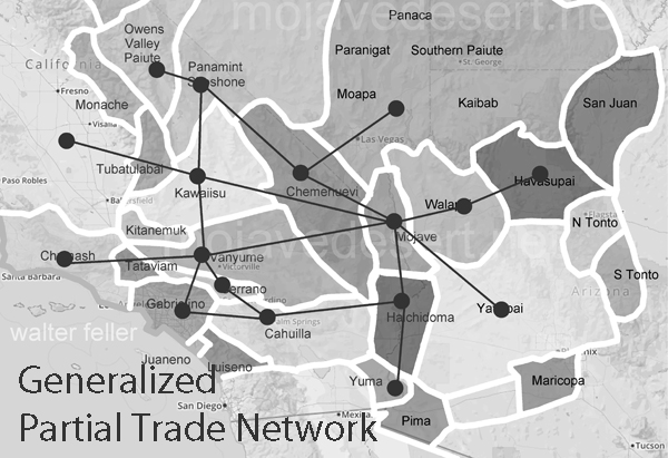
Kwanami

The dream world was as important to the Mojave People as was the physical world. It was from this dream state instruction was given that would guide them to their destiny.
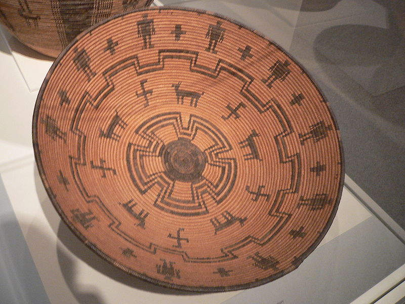
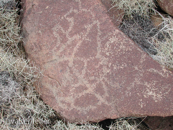
The Mojave Warrior was as brutal and violent in battle as his enemy. Even more so, not only because of strength and endurance but because those who had bad dreams; dreams of death and misfortune, were left behind in the villages with the women so as not to bring a curse to the war.

Among the small and dangerous bands were mixed the Kwanami.  They were the elite warrior captains.  The Kwanami were said to have dreamed of war and the death of their opponents in the womb before their birth.  Their dreams would be of ripping lion and bear creatures apart with bare hands and emerging from the dust victorious and unscathed.

The Kwanami lived apart from the rest of the Mohave People, in the south of the valley where Mastamho, the God-son, fought with the serpent under the three peaks.  It was here they would fast and meditate on the death of their opponents and the art of warfare.

These men who were stoic and impervious to heat, cold, hunger, and pain, would practice with their war bows and clubs in order to be the most effective in ministering death to their foes.