Mojave Desert History:

Who Is in Charge?

No single government, tribe, agency, or company controls the Mojave Desert. That is the first rule for understanding its history. The Mojave is not one jurisdiction. It is an area with many overlapping authorities. It is older than the borders now drawn. It is still managed piece by piece: by federal land agencies, tribal nations, state governments, county supervisors, city councils, military commands, water districts, railroads, utilities, conservation laws, mining claims, private property, and custom.

Before American maps and agencies, Native peoples held authority over the region. Their homelands, trails, springs, food-gathering areas, trade routes, and river crossings shaped the land. This was not “ownership” in the later courthouse sense; instead, it meant use, memory, obligation, defense, kinship, and sacred geography. The Mojave people controlled key parts of the Colorado River. Paiute, Chemehuevi, Serrano, Cahuilla, Kawaiisu, Timbisha Shoshone, and others were tied to desert and mountain margins. Authority followed water, trails, seasonal movement, and social ties.

Spanish and Mexican authority followed, coming lightly and unevenly. The Mojave was crossed, described, feared, and sometimes claimed. It was not closely governed. Missions, ranchos, military parties, and traders affected the edges and corridors more than the interior. The desert was difficult to occupy in the usual colonial way. Water was scarce. Distances were great. Native people still controlled much of the practical geography.

After the United States took California and the Southwest, authority became more formal but not necessarily more complete. Surveyors, soldiers, miners, freighters, railroad companies, and county officials imposed new systems of control. Military posts guarded roads and river crossings. Mining districts drafted local rules before the full government arrived. Stage and wagon roads made certain corridors important. Counties claimed jurisdiction, but their reach was often thin.

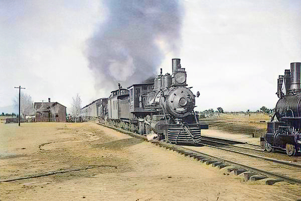
The arrival of the railroad changed the balance of power. The Atlantic and Pacific Railroad, later tied to the Santa Fe system, crossed the Mojave. Authority gathered around depots, water stops, sidings, land grants, and townsites. Places like Daggett, Barstow, Needles, Kelso, and Mojave developed. Transportation created order in a land that had previously resisted centralized control. The railroad did not govern the whole desert. However, it controlled movement, freight, settlement patterns, and economic opportunity.

Mining created another layer. Silver, gold, borax, copper, iron, salt, and other minerals brought camps, claims, mills, roads, and speculation. In many districts, authority came from miners’ meetings, claim notices, local custom, and whoever could pay for extraction and hauling. Over time, state and federal law provided the legal framework. On the ground, the desert was ruled by remoteness, money, water, and endurance.

Homesteading added another layer to authority. The government encouraged settlement through land laws. Much of the Mojave, however, was marginal for farming. Some settlers proved up claims. Some built cabins. Some failed. Some left behind the jackrabbit homestead landscape. Authority here was paper-based: legal descriptions, patents, assessment rolls, roads, school districts, and county maps. But the land itself often had the final word.

In the 20th century, the federal government became the main land authority. National parks, military bases, grazing districts, wildlife refuges, reclamation projects, and later BLM management made much of the Mojave public land. World War II and the Cold War expanded the military presence. Fort Irwin, China Lake, Edwards Air Force Base, Marine Corps bases, and training ranges made the desert a national defense site.

At the same time, water and power authorities became decisive. As a result, projects like the Hoover Dam, the Colorado River system, aqueducts, transmission lines, pipelines, and later solar and wind initiatives connected the Mojave to cities across the Southwest. In this phase, the desert was governed by both land ownership and infrastructure.

Later, the conservation era changed the question of authority again. Laws and designations like the 1964 Wilderness Act, the 1976 Federal Land Policy and Management Act, the California Desert Conservation Area, and the 1994 California Desert Protection Act redefined much of the Mojave as habitat, wilderness, cultural landscape, and public trust. Groups such as the National Park Service, BLM, Fish and Wildlife, state agencies, county governments, tribes, miners, ranchers, off-road users, utilities, conservation groups, and local residents all joined the debate.

Today, much of the California desert is managed by the Bureau of Land Management. Other major areas are under the National Park Service, such as Mojave National Preserve, Joshua Tree National Park, and Death Valley National Park. The military is also a major landholder and decision-maker. Tribal authority is increasingly recognized through consultation, co-stewardship, and co-management, though this is not always done equally or adequately. Counties regulate land use in private and unincorporated areas. Cities govern their own townsites. Water districts, utilities, mining companies, conservation groups, and private owners all hold some authority.

Also, who is in charge?

The best answer is: it depends on where you are, what resource is at issue, and what kind of authority you mean. A ranger can control a campground. A county may control the zoning. A sheriff can enforce local law. The BLM can manage grazing, recreation, mining access, or conservation on public land. The Park Service may regulate activity within a preserve or park. A tribe may exercise cultural, historical, legal, and, sometimes, land-management authority. The military can close an entire landscape. A water district can decide the fate of an aquifer. A railway or utility may control a corridor. A private owner may hold title to a desert square surrounded by public land.

That is the Mojave’s pattern: not centralized command, but layered jurisdiction. The desert has always been negotiated valley by valley, spring by spring, road by road. Its history is people trying to cross it, use it, protect it, extract from it, defend it, name it, and claim it—but never mastering it. Whoever controlled water, movement, maps, law, minerals, military access, or infrastructure controlled part of the desert. But no one controlled it all. The Mojave is best seen not as a single chain of command, but as a contest between landform, use, law, memory, and power.
The Stolen

The association between Thomas Long (Pegleg) Smith and Walkara in Cajon Pass centers on the great horse raids of the 1830s-1840s along the Old Spanish Trail.

Walkara, sometimes called Wakara or Chief Walker, led large mounted raiding parties from present-day Utah into Southern California. These expeditions targeted Californio ranchos and mission herds, especially around San Luis Obispo, San Gabriel, and inland Southern California. The stolen horses were then driven eastward through the Mojave Desert and across Cajon Pass toward Utah and New Mexico.

Pegleg Smith was one of several Anglo mountain men tied to this trade network. Contemporary and later sources repeatedly connect him with Walkara’s operations, though historians debate whether he directly participated in raids or mainly acted as trader, guide, and broker. James Beckwourth and Old Bill Williams are usually mentioned alongside him.

Cajon Pass mattered because it was the principal gateway between the Los Angeles basin and the Mojave Desert. Large bands of stolen horses moved through the pass on their way east. Some traditions claim thousands of horses crossed there during Walkara’s biggest expeditions.

The raids became so notorious that local geographic names in and around Cajon Pass were later linked to them. Horsethief Canyon and Little Horsethief Canyon are traditionally associated with Walkara’s raiders and their escape routes into the desert.

An important detail often missed is that this was not random outlawry in the modern sense. The horse trade formed part of a large transregional economy running along the Old Spanish Trail. California horses had enormous value in the Rockies and Great Basin. Walkara built a disciplined mounted raiding system, while men like Pegleg Smith connected Native raiding networks with Anglo and Mexican trading systems.

By the mid-1840s, Californio authorities and local militia figures such as Benjamin Davis Wilson pursued these raiding bands through Cajon Pass and into the Mojave, though with limited success.

Victor Valley Timeline

Combined timelines of Victorville, Hesperia & Apple Valley, CA.


Pre-1800s: Indigenous Presence and Trade

  • The Serrano and Vanyume tribes lived along the Mojave River, relying on the river’s intermittent flow for food and trade.
  • Trails used by these tribes would later become parts of the Mojave Road, Old Spanish Trail, and Salt Lake Road.

1850s–1870s: Pioneer Waystations and Early Ranching

  • 1858Aaron G. Lane establishes Lane’s Crossing on the Mojave River (present-day Oro Grande/Victorville area), offering rest and resupply to travelers heading west.
  • Lane is considered the first permanent American settler along the Mojave River.
  • Summit Valley, near present-day Hesperia, sees increased grazing by early ranchers.
  • The Summit Valley Massacre (1866): A conflict between settlers and Native groups over livestock thefts and land disputes—an often overlooked but significant local tragedy.

1880s: Railroads and Town Foundations

  • 1885: The California Southern Railroad, part of the Atchison, Topeka and Santa Fe system, reaches the High Desert.
  • A telegraph and railroad station named Victor is established, later renamed Victorville in 1901 to avoid confusion with Victor, Colorado.
  • Jacob Nash Victor, the railroad manager, is the town’s namesake.
  • The Hesperia Land and Water Company, led by James G. Howland, promotes Hesperia. It lays out plans for an agricultural colony and resort town, though irrigation plans fall short.

1900s–1930s: Modest Growth and Agriculture

  • Hesperia experiments with vineyards, orchards, and dairy farms, but water shortages and harsh conditions hinder success.
  • Victorville grows as a railroad shipping center and stopover for travelers crossing the desert.
  • The Victor Elementary School District is formed in 1906.
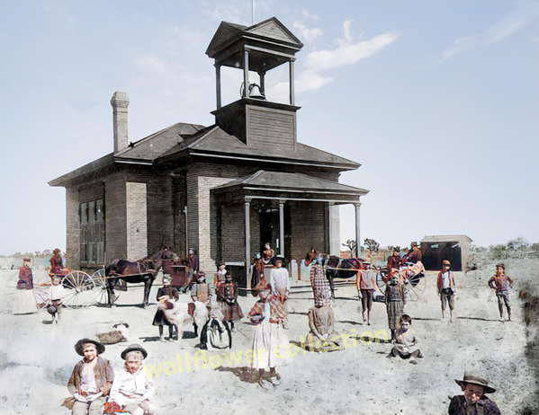
  • Early buildings still visible include the Hesperia Schoolhouse (Main St. and C Ave.).

1940s: War Changes Everything

  • 1941Victorville Army Airfield (later George Air Force Base) is established on the western edge of Victorville.
  • The base brings thousands of military personnel, rapid infrastructure growth, and federal investment.
  • Apple Valley remains mostly desert ranchland, but interest grows due to its mild climate and open space.

1948–1950s: Apple Valley Booms

  • 1948Apple Valley Inn opens, built by Newt Bass and Bud Westlund to attract investors and wealthy land buyers.
  • Stars like Bob HopeMarilyn MonroeJohn Wayne, and President Eisenhower stayed at the inn.
  • Murray’s Dude Ranch (founded earlier, 1920s–30s): One of the few Black-owned resorts in the country. It hosted African American guests during segregation and was used in Black-cast Western films.
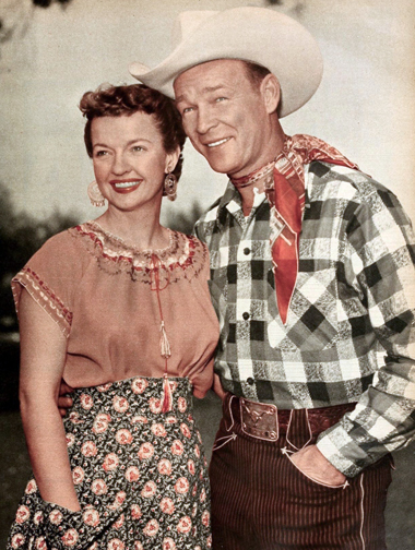
  • Roy Rogers and Dale Evans purchase a ranch in Apple Valley and become its most notable residents, eventually opening Roy Rogers’ Apple Valley Inn.

1950s–1960s: Expansion and Identity

  • Hesperia Inn and the Hesperia Golf & Country Club try to rekindle resort dreams. Jack Dempsey, the former boxing champion, lends his name to a museum at the inn.
  • Victorville grows with new housing and infrastructure to support the military population.
  • Route 66 runs right through Old Town Victorville, lined with diners, motels, and neon signs.

1970s–1980s: Steady Growth and Cultural Legacy

  • Apple Valley becomes a desirable retirement destination, marketing itself as a “Better Way of Life.”
  • Civic leaders like Bud Westlund and Newton Bass help shape the town’s modern layout and community services.
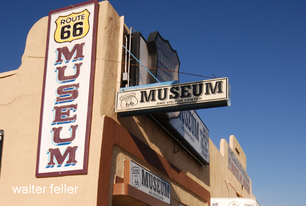
  • The California Route 66 Museum opens in Victorville in a former café, preserving the highway’s local legacy.

1992–2000s: Transformation and Reinvention

  • 1992George Air Force Base closes under federal military restructuring, dealing a blow to Victorville’s economy.
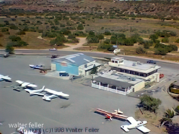
  • The base is repurposed into Southern California Logistics Airport (SCLA), an international freight and aerospace hub.
  • Apple Valley, Hesperia, and Victorville begin to urbanize, growing into commuter towns for the Inland Empire and the Los Angeles area.

2000s–Present: Modern Challenges and Historic Preservation

  • Victor Valley College, founded in 1961, continues to serve the region.
  • Old Town Victorville Revitalization Project aims to preserve the historic downtown.
  • Apple Valley promotes its Western heritage through the Happy Trails Highway and events honoring Roy Rogers and Dale Evans.
  • Hesperia Lake ParkSilverwood Lake, and local trails draw new visitors and recreation seekers.

Indian Trails in the Mojave Desert

The Mojave Desert, an expansive arid region spanning southeastern California and parts of Nevada, Arizona, and Utah, is more than just a vast, desolate landscape. It is a land imbued with a rich cultural history, much of which is etched into the ancient Indian trails that crisscross its terrain. These trails are a deep connection to the land possessed by the indigenous peoples who once called this desert home.

Historical Significance

.

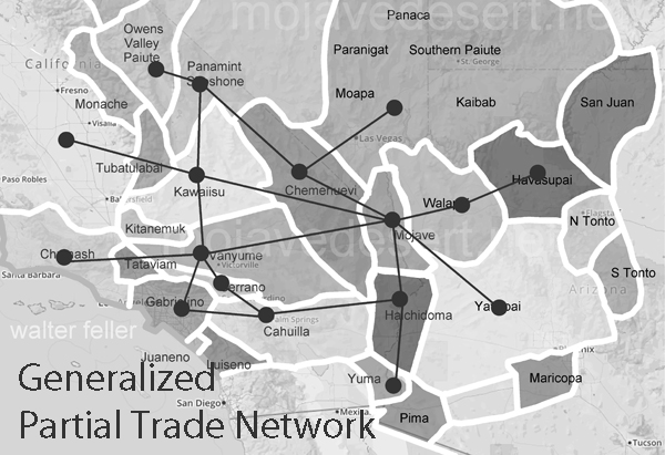
The Indian trails of the Mojave Desert were primarily created and used by Native American tribes such as the Mojave, Chemehuevi, and Southern Paiute. These tribes utilized the trails for various purposes, including trade, communication, and seasonal migration. The network of trails facilitated the exchange of goods like pottery, shells, foodstuffs, and obsidian, linking the Mojave Desert with coastal and inland regions. This trade network was integral to the economy and culture of the tribes, allowing for the spread of ideas, technologies, and cultural practices.

The trails were not merely utilitarian. They often held spiritual and cultural significance, following natural landmarks and water sources. Sacred sites, ceremonial grounds, and essential gathering places were often along these trails. This cultural layer adds depth to understanding these pathways, illustrating how they were interwoven with the people’s social and spiritual lives.

The Old Spanish Trail

One of the most notable trails is the Old Spanish Trail, which later became a significant route for Spanish explorers and settlers in the 18th and 19th centuries. Blazed initially by Native Americans, this trail stretched from Santa Fe, New Mexico, to Los Angeles, California. The Spanish utilized these established paths to connect their colonial holdings, facilitating trade and the movement of people and goods. The trail highlights the continuity of use by various cultures over centuries, transforming from an indigenous trade route to a significant conduit of colonial expansion.

The Old Spanish Trail was a challenging route, traversing some of the harshest landscapes in North America. Its use by both Native Americans and later Spanish settlers underscores the adaptability and resourcefulness required to navigate the Mojave Desert.

Adaptation to the Desert Environment

The Indian trails of the Mojave Desert showcase the adaptive strategies of Native Americans to the harsh desert environment. The tribes identified and utilized natural springs and seasonal water sources, ensuring safe passage across the expansive and often unforgiving terrain. These water sources were crucial, as they provided the necessary hydration points along the trails. Knowledge of these water sources was passed down through generations, often guarded closely as essential survival information.

The trails frequently ran along the base of mountain ranges and through passes, providing more accessible routes than the open desert. These paths took advantage of the natural topography to offer shade, easier walking conditions, and strategic viewpoints. The trails also connected various ecological zones, allowing the tribes to exploit various resources, from desert plants to mountain game.

Cultural Legacy

Today, the Indian trails of the Mojave Desert are an integral part of the region’s cultural heritage. Many of these trails are preserved and studied by archaeologists and historians, offering insights into the historical movements and lifestyles of the indigenous populations. Modern-day hikers, historians, and cultural enthusiasts retrace these paths, gaining a deeper understanding of the rich history and enduring legacy of the Native American tribes who first navigated the vast Mojave Desert.

Preservation efforts are crucial in maintaining these historic routes. Many trails are threatened by modern development, off-road vehicle use, and natural erosion. Organizations dedicated to preserving Native American heritage work tirelessly to document and protect these trails, ensuring they remain a living testament to the ingenuity and resilience of the desert’s original inhabitants.

Contemporary Relevance

In recent years, interest has been resurgent in these ancient trails. Educational programs, guided tours, and cultural heritage projects aim to bring the stories of these paths to a broader audience. Indigenous groups also play a vital role in these efforts, sharing their knowledge and perspectives to preserve and respect the trails as sacred cultural sites.

The trails also offer lessons in sustainable living and environmental stewardship. The indigenous peoples of the Mojave Desert thrived in a harsh environment through a deep understanding of the land and its resources. Their trails remind us of the importance of living in harmony with nature, an increasingly relevant lesson today.

Conclusion

The Indian trails of the Mojave Desert are more than just paths across the sand; they are the veins of a rich cultural heritage, connecting the past with the present. They tell stories of trade, migration, survival, and spiritual journeying etched into the desert’s landscape. As we explore and preserve these trails, we honor the legacy of the Native American tribes that first navigated the Mojave Desert, ensuring that their stories and knowledge continue to inspire and educate future generations.

Mojave Desert Human (Historical) Geography

Mojave Desert Geography

A long interaction history between people and the challenging desert environment marks the human (historical) geography of the Mojave Desert. Here are key aspects of the human history and settlement patterns in the Mojave Desert:

  1. Indigenous Peoples:
    • Before European contact, various indigenous groups inhabited the Mojave Desert, including the Mojave, Chemehuevi, and Serrano peoples.
    • These groups adapted to the arid environment, relying on hunting, gathering, and seasonal migrations to exploit available resources.
  2. Spanish Exploration and Missionaries:
    • Spanish explorers and missionaries, including Francisco Garces and Juan Bautista de Anza, ventured into the Mojave Desert in the 18th century.
    • These explorers sought routes to link Spanish missions in California and establish trade connections.
  3. Old Spanish Trail:
    • The Old Spanish Trail, a trade route connecting Santa Fe, New Mexico, to California, passed through the Mojave Desert in the early 19th century.
    • This trail facilitated the exchange of goods and cultural interactions between Spanish settlers and indigenous groups.
  4. American Pioneers and Westward Expansion:
    • During the 19th century, American pioneers and settlers ventured into the Mojave Desert as part of westward expansion.
    • The discovery of gold and other minerals in the region, such as the Calico Mountains, led to mining booms and the establishment of mining towns.
  5. 19th Century Military:
  6. Railroads and Transportation:
    • The construction of railroads, such as the Southern Pacific Railroad, was crucial in connecting the Mojave Desert to the broader transportation network.
    • Railroad towns, including Barstow, developed as important transportation hubs.
  7. Mining and Boomtowns:
    • Mining activities, particularly for silver and borax, flourished in the late 19th and early 20th centuries.
    • Boomtowns like Calico, once a significant silver mining town, experienced periods of rapid growth and decline.
  8. Military Presence:
    • The Mojave Desert has been home to various military installations, including Edwards Air Force Base and the Naval Air Weapons Station China Lake.
    • These installations have played roles in aviation testing, research, and training.
  9. Route 66:
    • The historic Route 66, a major U.S. highway, passed through the Mojave Desert during the mid-20th century, bringing increased traffic, commerce, and tourism to the region.
  10. National Parks and Conservation Efforts:
    • Establishing national parks and preserves, such as Joshua Tree National Park and the Mojave National Preserve, reflects efforts to conserve the desert’s unique ecosystems and landscapes.
  11. Modern Urbanization and Recreation:
    • Urban areas on the periphery of the Mojave Desert, such as Las Vegas, have experienced rapid growth.
    • The desert attracts tourists and outdoor enthusiasts interested in hiking, rock climbing, and stargazing.

Understanding the human history of the Mojave Desert involves recognizing the diverse ways different groups have interacted with the desert environment over time, from indigenous peoples adapting to the harsh conditions to the various waves of exploration, settlement, and economic activities that have shaped the region.