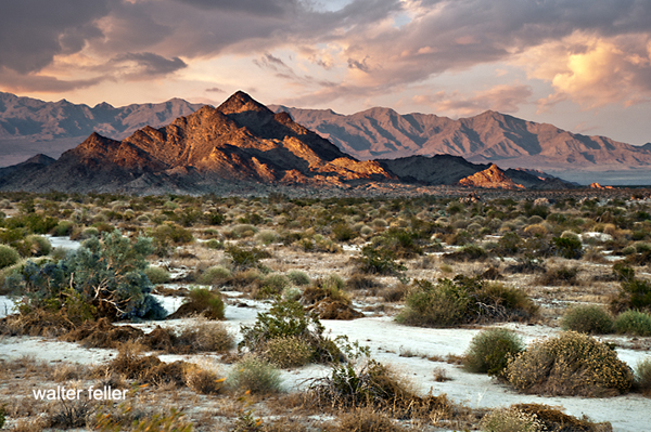
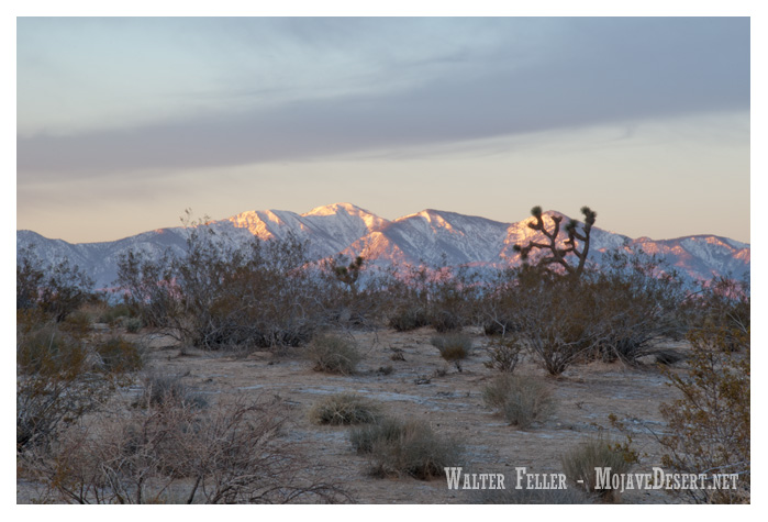
The Mojave River, a hidden gem in the arid landscapes of California, serves as a vital lifeline in the Mojave Desert. This remarkable river spans approximately 110 miles and offers a diverse ecosystem, historical significance, and recreational opportunities for nature enthusiasts and history buffs.
Geography and Formation:
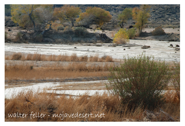
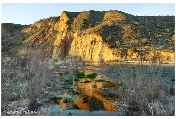
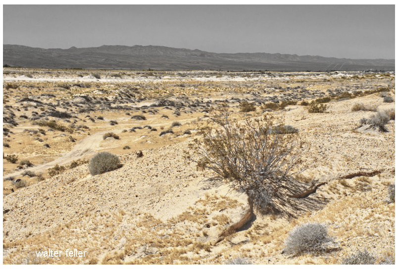
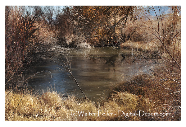
The Mojave River originates in the San Bernardino Mountains and meanders through the Mojave Desert, eventually dissipating into Soda Lake. Its path encompasses various landscapes, including rugged canyons, barren deserts, and lush riparian habitats. The river’s formation can be traced back thousands of years ago when geological processes and the ever-changing climate of the region shaped its course.
Ecological Importance:
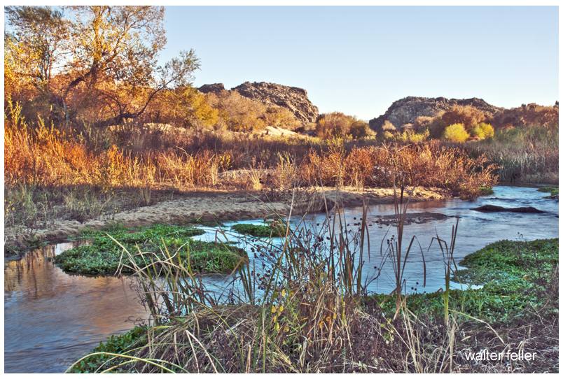
Despite the harsh Mojave Desert conditions, the Mojave River sustains a surprising array of flora and fauna. The river’s riparian zones provide an ideal habitat for a variety of plant species, such as willows, cottonwoods, and mesquite trees. These lush areas attract diverse wildlife, including birds, reptiles, and mammals, seeking refuge in this desert oasis.
Historical Significance:
The Mojave River holds a significant place in the history of California. Native American tribes, such as the Mojave, Serrano, and Chemehuevi, once relied on the river’s resources for sustenance and survival. European explorers, including Spanish missionaries and fur trappers, ventured along its banks, leaving behind a legacy of cultural exchange and exploration.
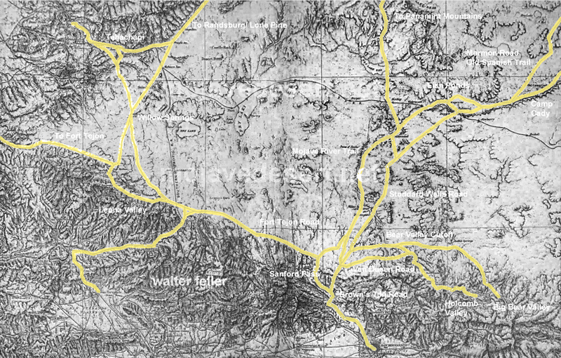
Moreover, during the mid-1800s, the Mojave River played a crucial role in the development of the Old Spanish Trail and the Mojave Road. These historic trade routes linked the Spanish colonies of California with the eastern United States, facilitating trade and migration.
Recreational Opportunities:
For outdoor enthusiasts, the Mojave River offers a plethora of recreational activities. Hiking trails, such as the Mojave Riverwalk Trail, provide opportunities for exploration, allowing visitors to immerse themselves in desert scenery. Camping facilities and picnic areas along the river’s banks provide the most idyllic setting for a peaceful getaway amidst nature’s tranquility.
Conservation Efforts:
Recognizing the importance of preserving this vibrant ecosystem, numerous conservation organizations and government agencies have worked to protect and restore the Mojave River. These initiatives focus on sustaining river water quality and preserving riparian habitats.
Conclusion:
The Mojave River stands as a testament to the resilience of nature in the face of adversity. Its meandering path through the Mojave Desert provides a lifeline for both wildlife and humans, offering a sanctuary amidst the arid landscapes. Whether you are a nature lover, history enthusiast, or adventure seeker, the Mojave River is a destination that promises a unique and memorable experience. So, embark on a journey to this desert oasis, and let the Mojave River captivate you with its beauty and allure.
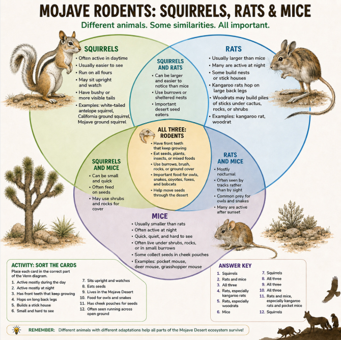
The Mojave Desert is home to many small rodents, including squirrels, rats, and mice. At first glance, they may seem alike, but each group has its own habits and place in the desert.
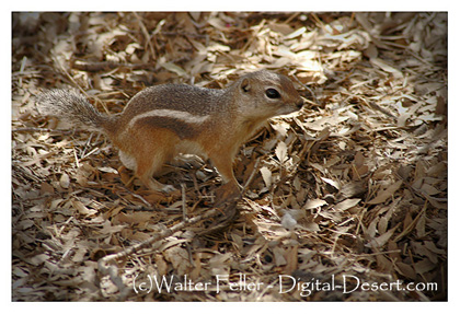
Antelope Squirrel
Squirrels are often the easiest to see because many are active during the day. White-tailed antelope squirrels, California ground squirrels, and Mojave ground squirrels may be seen running across open ground, sitting upright, or watching from near a burrow. Their alert behavior helps them survive in a land of hawks, snakes, coyotes, and foxes.
Packrat – Roger Barbour photo – USFWS
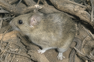
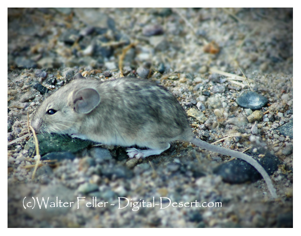
Rats and mice are more often active at night. Kangaroo rats are well-adapted to desert life, with long hind legs for hopping and cheek pouches for carrying seeds. Woodrats may build large stick nests under cactus, shrubs, or rocks. Mice are usually smaller, quicker, and harder to notice. Pocket mice, deer mice, and grasshopper mice often stay hidden in burrows, brush, or rocky cover.
Pocket mouse
All of these animals are rodents. They have front teeth that keep growing, and many feed on seeds, plants, insects, or a mix of foods. Though small, they are an important part of the Mojave ecosystem. They move seeds, loosen soil, and provide food for owls, snakes, bobcats, kit foxes, and other desert predators.
Squirrels are the daytime watchers. Kangaroo rats are the night jumpers. Mice are the hidden seed gatherers. Together, they help keep the desert alive.
Transmogrification, though it carries a slightly literary, almost mythic tone, suggests not just change but a deep and strange transformation into something fundamentally different.
For much of its recorded history, the Mojave Desert was primarily understood as a physical region. Its identity arose from terrain and climate. Dense or permanent human occupation played little role. Early travelers, surveyors, geologists, and writers described it using the language of the landform. They noted broad basins, isolated mountain ranges, dry lakes, volcanic fields, alluvial fans, dunes, washes, and the intermittent course of the Mojave River. The desert was seen as a geographical system. Uplift, erosion, aridity, and distance formed it. Its boundaries were often indistinct. The Mojave was not yet a tightly organized human landscape. It was seen as open country, with character shaped by the land’s form.
In that earlier conception, geography imposed limits upon people. Travel followed springs, canyon mouths, and natural passes through the mountains. Camps and settlements clustered where water permitted survival. Roads bent around lava flows, crossed playas, or traced older Indigenous routes refined over generations of movement through the desert. Human activity existed within conditions dictated by climate and terrain. The desert remained the dominant force, and people adapted themselves to it.
Even with these earliest permanent intrusions, the long-standing dynamic between people and landscape was not immediately overturned. Mining camps rose and disappeared as ore deposits and water supplies fluctuated. Wagon roads faded when springs failed. Small railroad towns appeared abruptly but often remained fragile in the face of the scale and hostility of the surrounding landscape. Much of the Mojave still retained the appearance of a place shaped principally by geology rather than by civilization.
Over time, a shift occurred: the Mojave, once defined by natural systems, increasingly came to be structured around human needs. The first key shift came with railroads, which established artificial centers in previously insignificant locations—places that had mattered only as crossings or water stops. Afterward, elements like highways, aqueducts, transmission corridors, military reservations, utility infrastructure, suburban expansion, recreational development, industrial agriculture along the margins, and large-scale energy production continued this trend. These forces did not simply occupy the desert; they actively reorganized it.
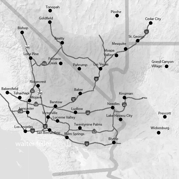
A modern map of the Mojave clearly reveals this shift: vast military boundaries now dominate entire valleys and mountain ranges. Meanwhile, interstate highways create strong directional corridors across what were once diffuse travel landscapes. Utility-scale solar developments, visible for miles, convert open basins into industrial energy fields. Transmission towers march across dry lakes and bajadas. Off-road recreation networks carve repeating tracks into fragile terrain. Finally, conservation areas and national preserves add another layer of organization by establishing access restrictions, managing habitats, providing tourism infrastructure, and developing preservation policies.
Increasingly, the Mojave is understood less through watersheds and landforms than through jurisdiction and use. One valley becomes associated with military training, another with renewable energy, others with recreation, habitat protection, logistics, or suburban expansion. This shift is reflected in the language used to describe the desert. Whereas earlier generations emphasized playas, volcanic mesas, spring systems, or mountain passes, modern discussions focus on renewable energy zones, conservation plans, transportation corridors, protected acreage, groundwater management, housing pressure, and recreational access.
Yet the older desert has not disappeared beneath these overlays. The geology remains the controlling framework beneath every human system. Basin-and-range topography still governs drainage and movement. Mountain ranges still create rain shadows and isolate valleys. Heat still limits settlement density. Water scarcity still defines possibility. Dry lakes still gather runoff after storms, just as they did centuries ago. In many places, the desert resists permanent transformation. Every generation is reminded that the underlying landscape remains older and more powerful than any system laid upon it.
Building on these evolving layers of meaning, what has changed most is not simply the Mojave’s physical appearance but its significance. The desert has shifted in its conceptual role: initially perceived as a natural form, then as a landscape of use, and now increasingly as a landscape of negotiation.
The central question is no longer merely “What is the Mojave?” but “What is the Mojave for?” Different groups now approach the same landscape with competing visions: energy developers see open basins suitable for solar fields and transmission infrastructure; conservationists see fragile ecosystems, migration corridors, and biological continuity; tribes see ancestral homelands, sacred sites, and cultural memory in the terrain itself. The military sees strategic training space, defined by isolation and open airspace, while residents see communities and livelihoods. Recreationists seek freedom, mobility, solitude, and escape, while cities beyond the desert offer land, water, transportation routes, and energy supplies.
As these pressures intensify, nearly every part of the Mojave acquires overlapping claims—emptiness itself becomes contestable. Open land is no longer simply open; instead, it becomes designated, managed, leased, protected, restricted, industrialized, or defended. Consequently, the future Mojave is likely to be shaped not by a single activity, but by tensions among many competing systems, all operating simultaneously across the same terrain.
In this evolving context, the Mojave is entering a third historical phase. Initially, it was defined by its physical landforms. Next, human activities and uses became the defining factors. Now, the Mojave’s identity may increasingly depend on negotiations and conflicts over its meaning, access, and purpose.
The old desert will still remain beneath these arguments. The playas will still whiten under summer heat. Winds will still sweep across creosote flats. Mountain ranges will still rise abruptly from broad basins at dusk. Seasonal floods will still cut across washes after sudden storms. The geological skeleton of the Mojave will endure. However, as human systems become more extensive and entangled, the experience and interpretation of the desert will continue to change.
The future Mojave will be governed as a layered landscape. No single authority will determine its fate: federal agencies will control vast public lands; counties will regulate roads, zoning, and development pressure; tribes will press claims rooted in sovereignty, memory, and sacred geography; energy and mining companies will seek permits, leases, and corridors; conservation groups will defend habitat and species; recreationists will demand access; and residents will argue for the right to live within the desert, not just be managed from outside. In light of these overlapping interests, governance will become less about drawing boundaries and more about arbitrating between claims. The desert will be administered through plans, lawsuits, permits, consultations, closures, leases, and exceptions. Its future will not be decided all at once; instead, it will be determined valley by valley, corridor by corridor, and project by project.
The Mojave functions as both an ancient physical landscape and a modern human one. While it is no longer shaped solely by tectonics, erosion, and climate, it is no longer defined solely by railroads, highways, military reservations, and energy development. Increasingly, the desert is formed by negotiations over how such a landscape should exist. Thus, what once was defined by its form is now shaped by the competing meanings people assign to it.
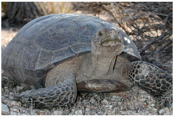
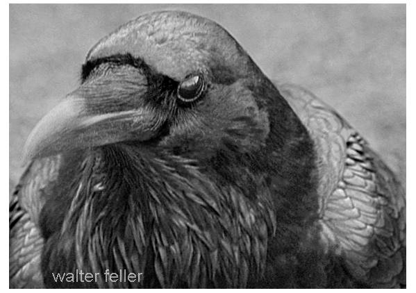
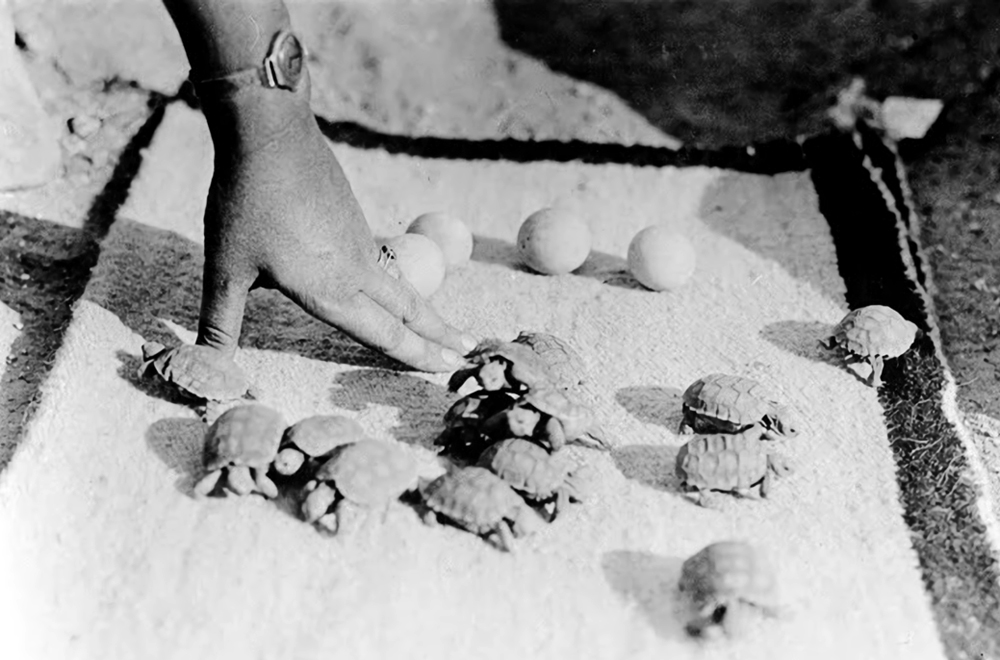
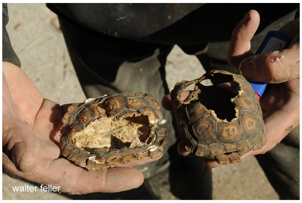
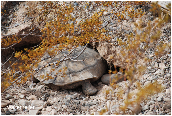
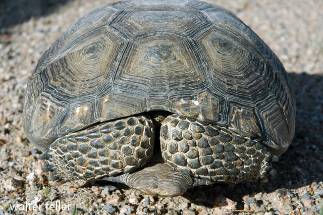
Common ravens are now among the most important predators of young desert tortoises in the Mojave Desert. Adult tortoises are generally protected by their heavy shells, but hatchlings and juveniles are small, soft-shelled, and vulnerable. Ravens can flip them over, peck through the shell, and kill them quickly. Over the last century, this predation pressure has increased substantially, not because ravens are foreign to the desert, but because human activity has allowed their populations to expand far beyond historic levels.
Historically, ravens lived in the Mojave in relatively low numbers, limited by scarce food, water, and nesting sites. Modern development altered those limits. Landfills, dumpsters, roadkill, artificial water sources, agricultural areas, campgrounds, transmission towers, utility poles, and roadside structures now provide reliable support for large raven populations across the desert. Biologists often describe these as “subsidized” ravens: native predators whose numbers are unnaturally amplified by human infrastructure.
Young tortoises are especially vulnerable during their first years of life, before the shell fully hardens. In some heavily developed areas, raven predation has removed large numbers of juveniles before they can reach adulthood. Because desert tortoises mature slowly and reproduce cautiously, sustained losses of hatchlings can have serious long-term effects on local populations.
Conservation efforts, therefore, focus not only on tortoises themselves but on the broader human landscape that supports elevated raven numbers. Securing trash, reducing open dumpsters, cleaning up roadkill, limiting artificial water sources, and modifying utility poles or towers to discourage nesting and perching are all important measures. In open desert terrain, tall structures provide ravens with excellent lookout points from which to search for young tortoises.
Additional protections are sometimes used in sensitive areas. Wildlife agencies may place protective cages over burrows or release sites, restore shrub cover that conceals juvenile tortoises, or use “head-start” programs in which hatchlings are raised in captivity until their shells harden and become more resistant to predators. Some agencies also conduct direct raven management through nest removal, egg oiling, or, in limited cases, lethal control under federal permits. However, most researchers agree that predator removal alone cannot solve the problem if the artificial food and infrastructure supporting high raven populations remain in place.
For this reason, the raven-tortoise conflict is often understood not simply as a natural predator-prey relationship, but as a broader ecological imbalance created by modern desert development.
Brine flies at Mono Lake are one of those old, workmanlike desert stories where something humble ends up being essential.
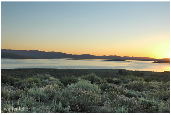
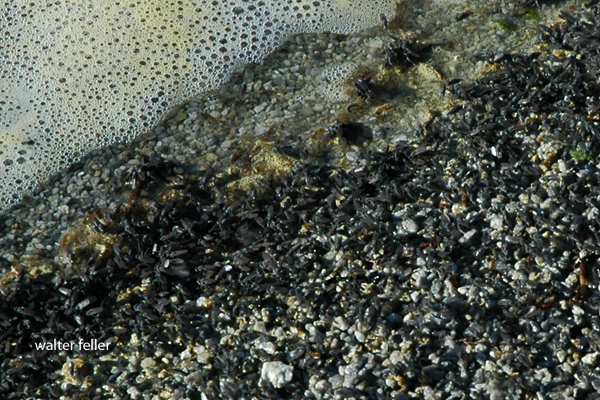
Mono Lake is extremely salty and alkaline, so almost nothing can live there. Brine flies (Ephydra hians) are the big exception. They spend most of their lives as larvae and pupae underwater, grazing on algae that coat the lake bottom and tufa formations. When they emerge as adults, they form the dark, moving bands you see along the shoreline and rocks.
Their trick is simple but effective. Adult flies have dense hairs and a waxy coating that traps air around their bodies, allowing them to walk underwater to lay eggs and feed without drowning. It looks strange, but it works, and it has worked for a very long time.
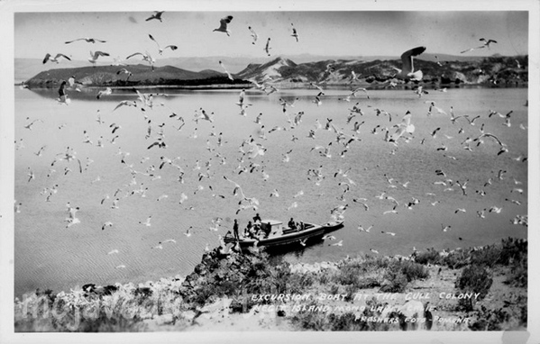
Ecologically, brine flies are the backbone of Mono Lake. They convert algae into protein, and in doing so, they feed millions of migratory birds. Eared grebes, phalaropes, gulls, and others depend on the flies during migration, sometimes doubling their body weight before moving on. If the flies disappeared, Mono Lake would be nearly silent.
Culturally, they mattered too. The Kutzadikaa Paiute, often called the Mono Lake Paiute, harvested brine fly pupae, dried them, and traded them as a high-protein food. Early Euro-American settlers mostly saw the flies as a nuisance, but the Paiute understood precisely what they were worth.
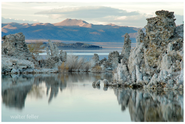
Today, brine flies are also an indicator species. When lake levels drop, and salinity rises too far, fly populations suffer. Keeping Mono Lake at a sustainable level is not just about scenery or tufa towers; it is about preserving this old, tightly balanced system that has been working more or less the same way since long before modern water diversions arrived.
The Mojave Desert is the central thread, but the archive is more than just a storehouse of facts about the land. It’s a layered record, part historical survey, part natural history guide, and part personal journal. The archive contains thousands of entries, ranging from carefully produced histories of ghost towns to quick, almost casual notes about desert wildflowers. It also includes the memory of conversations, some technical, some reflective, all contributing to a living body of knowledge.
The current archive carries these notes forward. They do not simply add new entries; they revisit and renew older ones. When you ask about Scotty’s Castle, it’s not only a summary of a landmark in Death Valley but also a chance to look again at Walter Scott’s fabricated gold mine, his staged shootout at Wingate Pass, and the way his friendship with Albert Johnson turned into one of the strangest desert partnerships. That reflects the way your archive works: history is never sealed off, but constantly connected to other stories. Scotty’s fake mine ties to mining history, con men, railroad investors, and the enduring myths of the desert.
Other chats anchor themselves in place. Marl Springs, for example, appears not just as a dot along the Mojave Road but as a critical water source, garrisoned by soldiers in 1867 and attacked in the same year. The description in your archive emphasizes its clay-like soil and its dependable, if limited, water supply. The chat adds motion to that entry by pulling the soldiers into view, by describing how isolated Marl Springs was from Soda Springs to the west, and by noting how wildlife still depend on its water. Here, the archive preserves detail, while the conversation reanimates it.
Afton Canyon is another recurring subject. The archive refers to it as the Grand Canyon of the Mojave, formed approximately 15,000 years ago when Lake Manix drained catastrophically. The chats bring it alive with more than geology. They highlight the Mojave River flowing above ground, the slot canyons and caves, the risks of flash floods, and the chance to hike and watch wildlife. The personal tone slips in here: Afton is not just an entry on a map; it is a place walked, seen, and photographed. This blend of technical and personal is one of the hallmarks of your work.
Rainbow Basin provides another good example. In the archive, it is a geologic site featuring badlands and folded rock, as well as paleontological finds and fragile soils. In conversation, it becomes a vivid picture of color bands, rattlesnakes, and the eerie feel of hiking through formations shaped by time and water. The description is simplified for younger readers when needed, but the detail remains. It is both a science lesson and a story about walking through the basin yourself.
The archive also gives weight to local communities and their histories. Cajon Pass, for instance, is not simply a route. It is a crossroads layered with stories: Rancho Muscupiabe, Mormon pioneers, the Santa Fe and Southern Pacific railroads, the old wagon roads, the geology of Lost Lake and Blue Cut. Chats about Cajon Pass often focus on its function as a gateway, a place where history, geology, and transportation come together. They show how the archive not only stores information but also draws connections, creating a network of meaning.
The same goes for Old Woman Springs. The archive notes its name, given by surveyors who saw Indian women there. It records Albert Swarthout’s ranching operation, the cattle drives through Rattlesnake Canyon, and the later disputes with J. Dale Gentry. In chat, the place becomes more than history. It becomes a story of how ranching shaped the Mojave, how land ownership shifted, and how the desert landscape still carries those traces.
Other places appear again and again, sometimes as historical notes, sometimes as subjects for simplified explanations. Shea’s Castle in the Antelope Valley, built by Richard Shea in hopes of curing his wife’s illness, ruined by the stock market crash, later a film set. Hotel Beale in Kingman is tied to Andy Devine, the actor whose name became linked to Route 66. Oasis of Mara in Twentynine Palms is a site of Native planting, early settlement, and eventual park development. Each of these places carries weight in the archive, but they come alive in conversation, as the details are retold, refined, and made accessible.
Ecology is just as present as history. Pinyon pines and junipers, Fremont cottonwoods, brittlebush, desert sunflowers, bees sleeping in flowers, and ‘horny toads’ explained to children — all of these details show how the archive ranges across subjects. A glossary entry on igneous rocks can sit beside a playful description of bees tucked into golden blossoms for the night. A technical note on pinyon-juniper woodland succession can be followed by a casual story about antelope ground squirrels darting through camp. These shifts in tone are part of the richness of the record.
The archive also holds larger arcs. The history of Owens Valley runs through it: the water conflicts with Los Angeles, the aqueduct, the treaties with Native peoples, the battles fought during the Owens Valley Indian War. Panamint City and Greenwater appear as examples of boom and bust, with detailed accounts of stagecoach robbers, Nevada senators, mining camps, and the short-lived hopes of investors. The Tonopah and Tidewater Railroad, Remi Nadeau’s freight road, and the Atlantic and Pacific’s push across the Mojave all weave together into the bigger story of transportation. These arcs show how your archive is not just about single places but about the way places link into broader regional histories.
The present chats extend these arcs. A question about Owenyo might focus on its railroad history, but in doing so, it links back into Owens Valley and forward into the decline of rail in the desert. A question about Llano del Rio touches both the socialist dreams of Job Harriman and the modern ruin that still draws visitors. Each chat is both a piece in itself and a way of extending the larger web.
Throughout, there is an awareness of presentation. The archive is not simply a private notebook. It is shaped to be shared: titles, descriptions, metadata, glossaries, indexes. Chats often focus on how best to present this material to readers, whether as timelines, simplified summaries, or relational indexes. The act of shaping the material for public use is part of the archive itself.
The combination of archive and chat also reflects a deeper concern: preservation. The desert is full of forgotten places, and people who once told their stories are no longer around. By recording these histories, revisiting them, and reshaping them for new audiences, the archive resists that loss. The chats show the urgency of this work, as you reflect on volunteers thinning out, museums struggling, and the need to keep the desert’s stories alive.
The archive is a landscape in itself. Its mesas are the long, detailed histories. Its washes are the short, playful notes. Its valleys are the connections between subjects. The chats are the weather moving across that landscape, stirring it, reshaping it, sometimes eroding, sometimes depositing. Over time, the whole thing grows richer, more interconnected, more alive.
This is why the archive and chats cannot be separated. The archive preserves. The chats enliven. Together they form a record of both the desert and of the act of remembering. The Mojave is the subject, but the deeper theme is persistence: the persistence of asking, recording, and shaping knowledge into something that lasts.
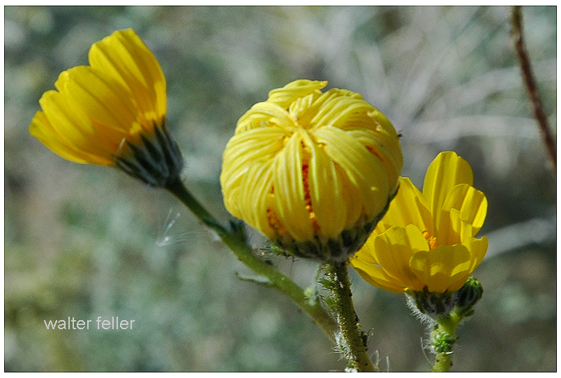
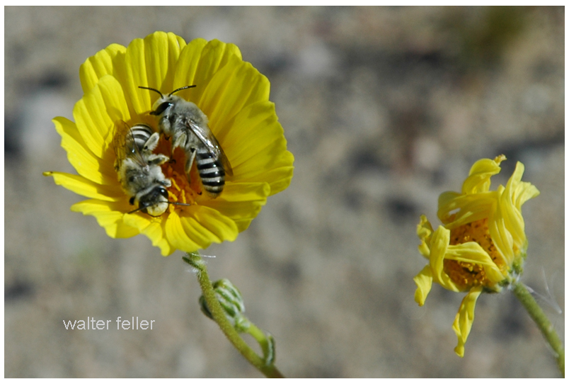
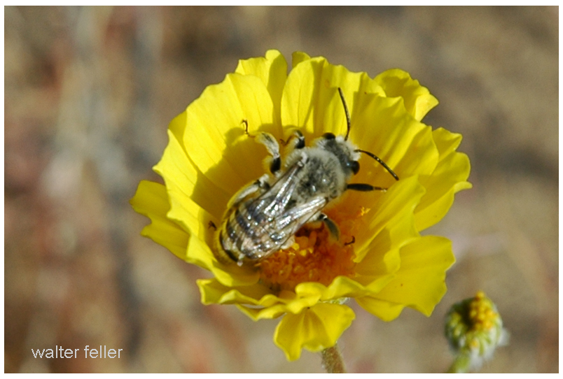
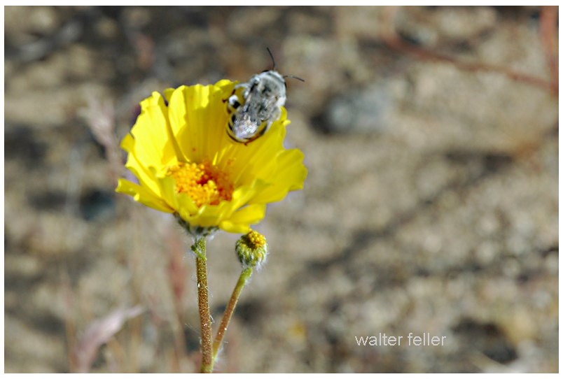
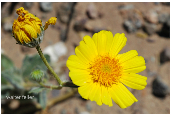
In the Mojave Desert, the bright yellow desert gold flowers open wide in the sunshine. They look like little suns shining across the sand. Bees love to visit, buzzing from one bloom to the next, sipping sweet nectar and rolling in golden pollen.
As the sun sinks low, the flowers start to close their petals. It’s bedtime for desert gold. But sometimes, a bee is still inside. When the petals fold shut, the bee is tucked in—safe and snug in a soft bed of pollen. The flower becomes a tiny motel room just for bees.
On windy nights, the motel isn’t always calm. The flower sways and shakes, tossing the bee about like a boat on stormy water. That’s what makes it “wild” life. But even if it gets bumpy, the bee is better off inside than out in the cold desert night.
Bees are hard workers with a wonderful work ethic. They don’t even leave the job when it’s time to rest. They sleep right at work, in golden beds of pollen. And when the morning sun warms the desert and the flowers open again, the bees are already up and ready—buzzing off to do their important work all over again.
The digital-desert.com and mojavedesert.net sites share the same subject matter and similar structure, dealing with the Mojave Desert and surrounding regions. Both of them provide learning materials, exploration tools, and information on history.
Here are the main parts that make up both sites:
1. Natural History Geology: Rock formations, fissures in the earth (such as the San Andreas Fault), volcanic activity, and desert patterns. Lake systems (e.g., former Lake Manix and dry lakes such as Soda Lake).
Ecology: Plants and animals that live in desert environments include Joshua trees, creosote bushes, desert tortoises, and bighorn sheep. Habitats include sand dunes, salt flats, canyons, and oases. Climate: Desert weather patterns include very hot temperatures, seasonal rain, and wind events.
2. Human History Native American Culture: Tribes such as the Mojave, Chemehuevi, Serrano and Paiute. Rock art, traditions, and trade routes such as the Old Mojave Trail. Explorers and Pioneers: Tales of explorers like Jedediah Smith, Kit Carson, and Father Garces. Principal routes: Mojave Road, Spanish Trail, and Butterfield Overland Mail. Mining History: Gold, silver, and borax mining expand rapidly. Specific mining towns and operations are Calico, Rhyolite, and Boron. Historic Places and Ghost Towns: Places like Kelso Depot, Ballarat, and Pioneer Town. Old abandoned buildings, stage stops, and rail history.
3. Geography and Exploration Areas and Landmarks: Joshua Tree National Park Death Valley Mojave National Preserve and Rainbow Basin. Special shapes such as the Devil’s Punchbowl, Afton Canyon, and sand hills. Streets and Roads: Route 66, Old Mojave Road, and gorgeous roads. Hiking and driving routes with maps and information. Interactive Maps: Topographic and historical maps depicting routes of exploration and other localities.
4. Cultural Characteristics Towns and Communities: Tales of desert towns such as Barstow, Victorville, Littlerock, and Needles. Key Players: The area called Death Valley housed early settlers and miners, even famous dudes like Roy Rogers. Art and Folklore: Desert-themed art installations, legends (e.g., ghost stories, lost mines) and folklore.
5. Learning and Information Photos and Pictures: Large photo galleries of desert landscapes, animals and abandoned places. Field Guides: Resources for identifying plants and animals. History Timelines: A summary of geological, prehistoric, and modern historical events. Resource Links: References to books, museums and archives for further research.
6. Fun Guides Camping and Hiking: Lists of campgrounds, remote places, and summaries of hiking trails. Driving Tours: Ideas for a nice road trip with important places to see. Safety and Preparation: Tips for desert exploration, including hydration, navigation, and safety around wildlife.
While digital-desert.com focuses on exploration and natural beauty through detailed guides and maps, mojavedesert.net often has a more structured historical narrative and cultural focus. Both sites are resources for desert enthusiasts, historians, and educators.
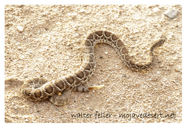
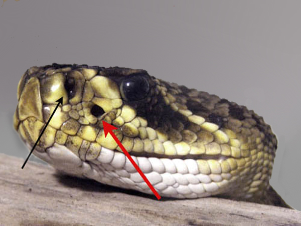
Infrared detection in Mojave Desert rattlesnakes (Crotalus scutulatus) represents a highly specialized adaptation that enhances their ability to locate and capture prey in their arid environment. Like other pit vipers, these rattlesnakes have heat-sensitive pit organs between their eyes and nostrils. These organs can detect infrared radiation, corresponding to the thermal emissions from warm-blooded animals.
Black arrows to nostrils – Red arrows to pit organs.
The pit organs detect minute temperature differences, potentially as small as 0.001°C. This enables the rattlesnakes to effectively “visualize” the thermal signatures of their prey, even in the absence of visible light. This capability is particularly advantageous in the Mojave Desert, where nocturnal temperature drops can contrast the cooler ambient environment and the warmer bodies of potential prey.
The precision of this infrared detection system allows for highly accurate strikes, even when prey is partially concealed by vegetation or other environmental features. This adaptation is crucial for survival in the desert ecosystem, where prey availability may be limited, necessitating efficient and effective hunting strategies.
The Mojave Desert, an expansive arid region spanning southeastern California and parts of Nevada, Arizona, and Utah, is more than just a vast, desolate landscape. It is a land imbued with a rich cultural history, much of which is etched into the ancient Indian trails that crisscross its terrain. These trails are a deep connection to the land possessed by the indigenous peoples who once called this desert home.
Historical Significance
.
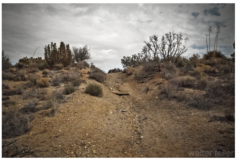
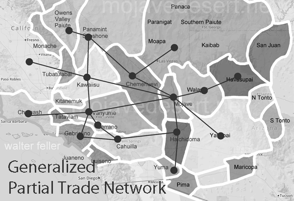
The Indian trails of the Mojave Desert were primarily created and used by Native American tribes such as the Mojave, Chemehuevi, and Southern Paiute. These tribes utilized the trails for various purposes, including trade, communication, and seasonal migration. The network of trails facilitated the exchange of goods like pottery, shells, foodstuffs, and obsidian, linking the Mojave Desert with coastal and inland regions. This trade network was integral to the economy and culture of the tribes, allowing for the spread of ideas, technologies, and cultural practices.
The trails were not merely utilitarian. They often held spiritual and cultural significance, following natural landmarks and water sources. Sacred sites, ceremonial grounds, and essential gathering places were often along these trails. This cultural layer adds depth to understanding these pathways, illustrating how they were interwoven with the people’s social and spiritual lives.
The Old Spanish Trail
One of the most notable trails is the Old Spanish Trail, which later became a significant route for Spanish explorers and settlers in the 18th and 19th centuries. Blazed initially by Native Americans, this trail stretched from Santa Fe, New Mexico, to Los Angeles, California. The Spanish utilized these established paths to connect their colonial holdings, facilitating trade and the movement of people and goods. The trail highlights the continuity of use by various cultures over centuries, transforming from an indigenous trade route to a significant conduit of colonial expansion.
The Old Spanish Trail was a challenging route, traversing some of the harshest landscapes in North America. Its use by both Native Americans and later Spanish settlers underscores the adaptability and resourcefulness required to navigate the Mojave Desert.
Adaptation to the Desert Environment
The Indian trails of the Mojave Desert showcase the adaptive strategies of Native Americans to the harsh desert environment. The tribes identified and utilized natural springs and seasonal water sources, ensuring safe passage across the expansive and often unforgiving terrain. These water sources were crucial, as they provided the necessary hydration points along the trails. Knowledge of these water sources was passed down through generations, often guarded closely as essential survival information.
The trails frequently ran along the base of mountain ranges and through passes, providing more accessible routes than the open desert. These paths took advantage of the natural topography to offer shade, easier walking conditions, and strategic viewpoints. The trails also connected various ecological zones, allowing the tribes to exploit various resources, from desert plants to mountain game.
Cultural Legacy
Today, the Indian trails of the Mojave Desert are an integral part of the region’s cultural heritage. Many of these trails are preserved and studied by archaeologists and historians, offering insights into the historical movements and lifestyles of the indigenous populations. Modern-day hikers, historians, and cultural enthusiasts retrace these paths, gaining a deeper understanding of the rich history and enduring legacy of the Native American tribes who first navigated the vast Mojave Desert.
Preservation efforts are crucial in maintaining these historic routes. Many trails are threatened by modern development, off-road vehicle use, and natural erosion. Organizations dedicated to preserving Native American heritage work tirelessly to document and protect these trails, ensuring they remain a living testament to the ingenuity and resilience of the desert’s original inhabitants.
Contemporary Relevance
In recent years, interest has been resurgent in these ancient trails. Educational programs, guided tours, and cultural heritage projects aim to bring the stories of these paths to a broader audience. Indigenous groups also play a vital role in these efforts, sharing their knowledge and perspectives to preserve and respect the trails as sacred cultural sites.
The trails also offer lessons in sustainable living and environmental stewardship. The indigenous peoples of the Mojave Desert thrived in a harsh environment through a deep understanding of the land and its resources. Their trails remind us of the importance of living in harmony with nature, an increasingly relevant lesson today.
Conclusion
The Indian trails of the Mojave Desert are more than just paths across the sand; they are the veins of a rich cultural heritage, connecting the past with the present. They tell stories of trade, migration, survival, and spiritual journeying etched into the desert’s landscape. As we explore and preserve these trails, we honor the legacy of the Native American tribes that first navigated the Mojave Desert, ensuring that their stories and knowledge continue to inspire and educate future generations.
A long interaction history between people and the challenging desert environment marks the human (historical) geography of the Mojave Desert. Here are key aspects of the human history and settlement patterns in the Mojave Desert:
The construction of railroads, such as the Southern Pacific Railroad, was crucial in connecting the Mojave Desert to the broader transportation network.
Railroad towns, including Barstow, developed as important transportation hubs.
The historic Route 66, a major U.S. highway, passed through the Mojave Desert during the mid-20th century, bringing increased traffic, commerce, and tourism to the region.
Establishing national parks and preserves, such as Joshua Tree National Park and the Mojave National Preserve, reflects efforts to conserve the desert’s unique ecosystems and landscapes.
Modern Urbanization and Recreation:
Urban areas on the periphery of the Mojave Desert, such as Las Vegas, have experienced rapid growth.
The desert attracts tourists and outdoor enthusiasts interested in hiking, rock climbing, and stargazing.
Understanding the human history of the Mojave Desert involves recognizing the diverse ways different groups have interacted with the desert environment over time, from indigenous peoples adapting to the harsh conditions to the various waves of exploration, settlement, and economic activities that have shaped the region.
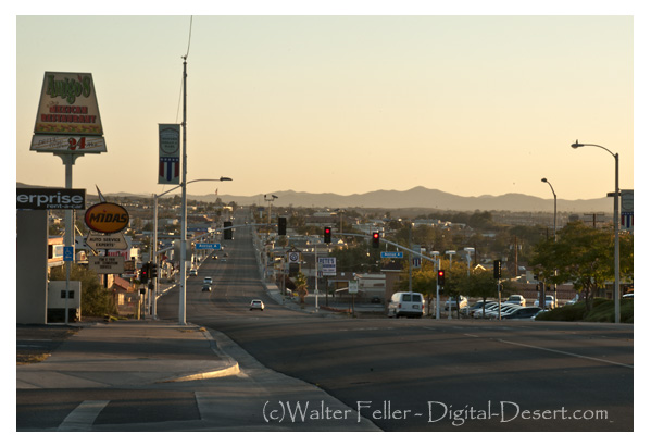
Barstow Area. Barstow lies in the intersection of the three largest ecosubsections in the Mojave Desert; High Desert Plains & Hills (322Ag), Mojave Valley – …
Barstow 1890. Barstow is situated at the junction of the California Southern and the A. &. P. Railway, eighty-two miles from San Bernardino and twelve miles …
3) Go west on the State Route 58 through Boron, Mojave or California City and up to Tehachapi and over the Southern Sierra. 4) Go east to Barstow. There is food …
Mojave Desert Indians – Map. Vanyume Indians. The Vanyume or Beñemé, as Father Garces called them, lived beyond and along much of the length of the Mojave …
Casa del Desierto – Harvey House. Barstow Harvey House and train station photo – Casa del Desierto Casa del Desierto: The Spanish for “House of the Desert” In …
Nov 4, 2023 … Today, it remains an essential point of access and commerce for those traveling through the Mojave Desert in Southern California. Post Views: 12.
Goldstone Ghost Town. More of a site than a ghost town, there are only a few scattered foundations and some rubble to be found. The area is now home to NASA’s …
The Barstow yards are used jointly by the Santa Fe and Union Pacific and handily very considerable volume of the transcontinental traffic. Hence the railroad …
The desert food chain is a complex system involving various organisms interacting for energy and survival. Despite the harsh conditions of deserts, life has adapted to these environments, and a delicate balance exists within the food chain. Here is a simplified overview of the desert food chain:
Seeds → kangaroo rat → rattlesnake → hawk Wildflowers → grasshopper → lizard → roadrunner Grasses and wildflowers → desert tortoise → raven (primarily eggs and young tortoises) Shrubs → jackrabbit → coyote
Producers:
Plants and Cacti: Deserts have specialized plants adapted to conserve water and thrive in arid conditions. Examples include cacti, succulents, and drought-resistant shrubs. These plants are primary producers, converting sunlight into energy through photosynthesis.
Primary Consumers:
Herbivores: Insects, rodents, and small mammals feed on desert plants. Examples include grasshoppers, mice, and rabbits. These organisms are primary consumers that obtain their energy by consuming plants.
Secondary Consumers:
Carnivores: Predators in the desert feed on herbivores. Examples include snakes, lizards, and birds of prey. Some mammals like foxes and coyotes also fall into this category, preying on smaller animals for sustenance.
Tertiary Consumers:
Top Predators: Larger predators at the top of the desert food chain prey on herbivores and smaller carnivores. Examples include large birds of prey like eagles and apex predators like some species of bobcats and mountain lions.
Scavengers:
Scavengers: These organisms feed on the remains of dead animals. Scavengers play a crucial role in nutrient recycling in the desert ecosystem. Vultures are an example of scavengers.
Decomposers:
Microorganisms: Decomposers decompose organic matter, such as dead plants and animals, into simpler nutrients the soil can absorb. Bacteria and fungi are essential decomposers in the desert ecosystem.
Throughout this food chain, energy is transferred from one trophic level to the next, with each level being dependent on the level below for its energy source. Water is a limiting factor in deserts, and many organisms have adapted various mechanisms to conserve water or extract it efficiently from their food sources. The delicate balance of the desert food chain is essential for the survival of its inhabitants in these harsh environments.
California is home to high and low deserts, characterized by distinct features, climates, and elevations. The primary differences between California’s high and low deserts include elevation, temperature, and vegetation.
Low Desert
High Desert
Elevation:
High Desert: The high desert refers to areas at higher elevations, typically between 2,000 and 4,000 feet above sea level. Examples of high desert regions in California include the Mojave Desert. Cities like Lancaster and Palmdale are located in the high desert region.
Low Desert: The low desert, on the other hand, is found at lower elevations, often below 2,000 feet. The Colorado Desert, part of the larger Sonoran Desert, is an example of a low desert in California. Cities like Palm Springs and Indio are located in the low desert region.
Temperature:
High Desert: High deserts generally experience greater temperature fluctuations between day and night. Summers can be hot, with daytime temperatures exceeding 100°F (37.8°C), while winters can be cool, with nighttime temperatures dropping significantly.
Low Desert: Low deserts tend to have higher average temperatures, especially during the summer. Daytime temperatures in the low desert areas can often surpass 100°F (37.8°C), and the winters are milder compared to the high deserts.
Vegetation:
High Desert: Vegetation in the high desert is adapted to the arid conditions and includes hardy shrubs, grasses, and some cold-resistant plants. Joshua trees are a characteristic plant of the Mojave Desert.
Low Desert: The low desert is known for its unique plant life, including various species of cacti and succulents. The iconic saguaro cactus is commonly found in the lower elevations of the Sonoran Desert.
Geography:
High Desert: The high desert often features rocky terrain and vast expanses of open land and is characterized by a mix of mountains, plateaus, and valleys.
Low Desert: The low desert may have more sandy and flat terrain, including areas with salt flats. Rugged mountains may also punctuate the landscape.
It’s important to note that these are generalizations, and there can be variations within each desert region. The specific characteristics can also vary depending on the exact location within California.