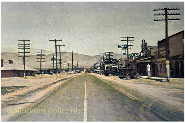
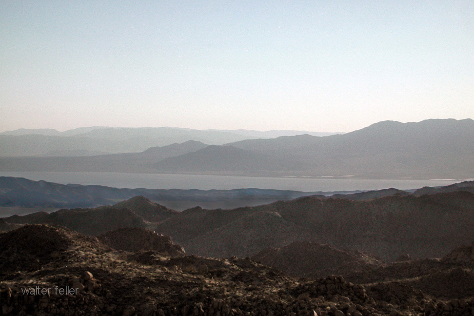
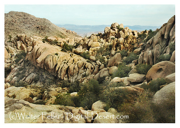
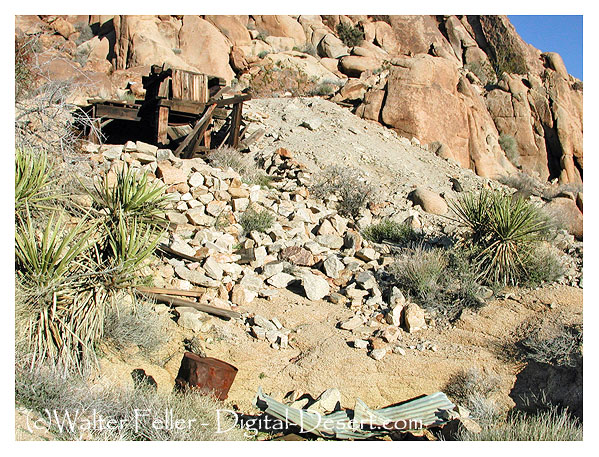
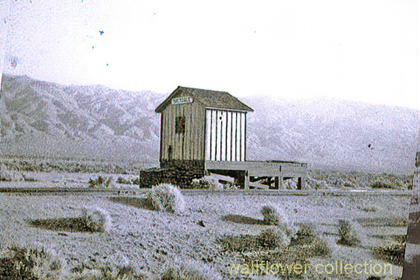
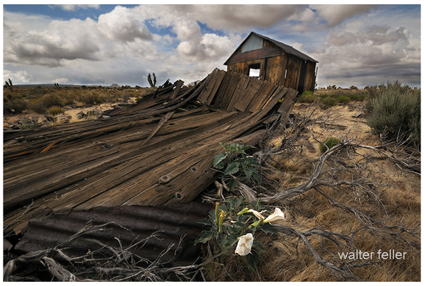
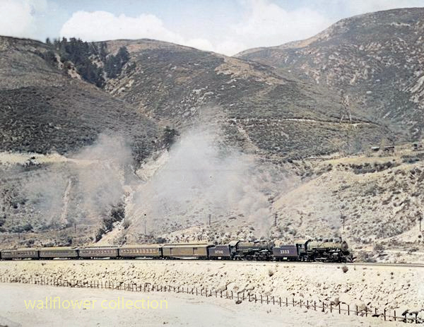
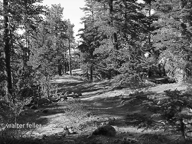
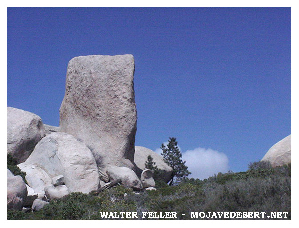
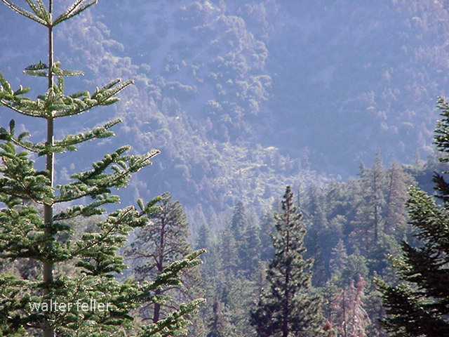
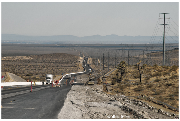
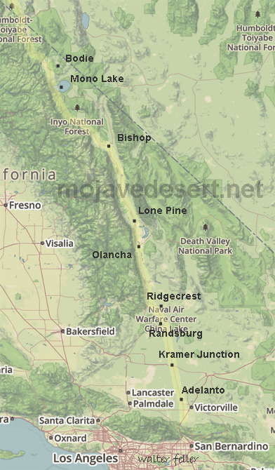
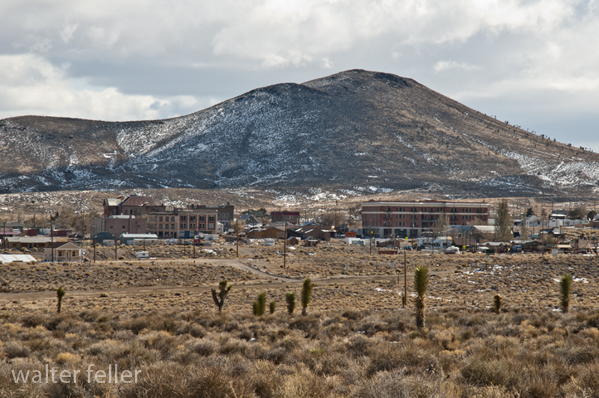
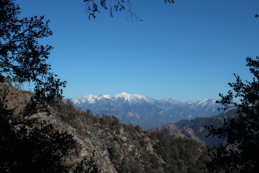
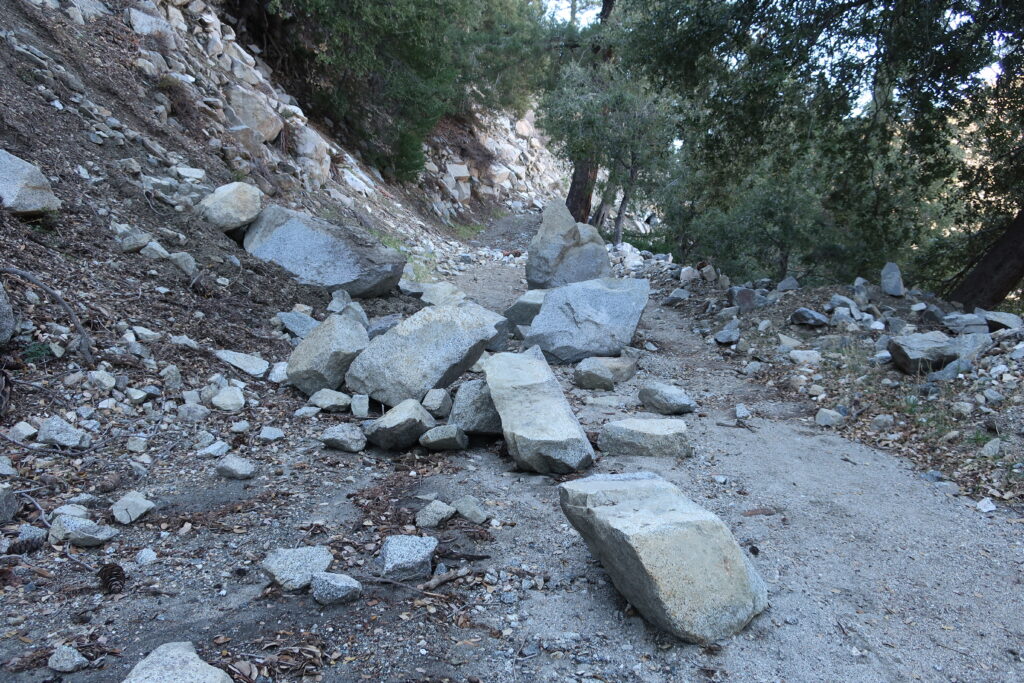
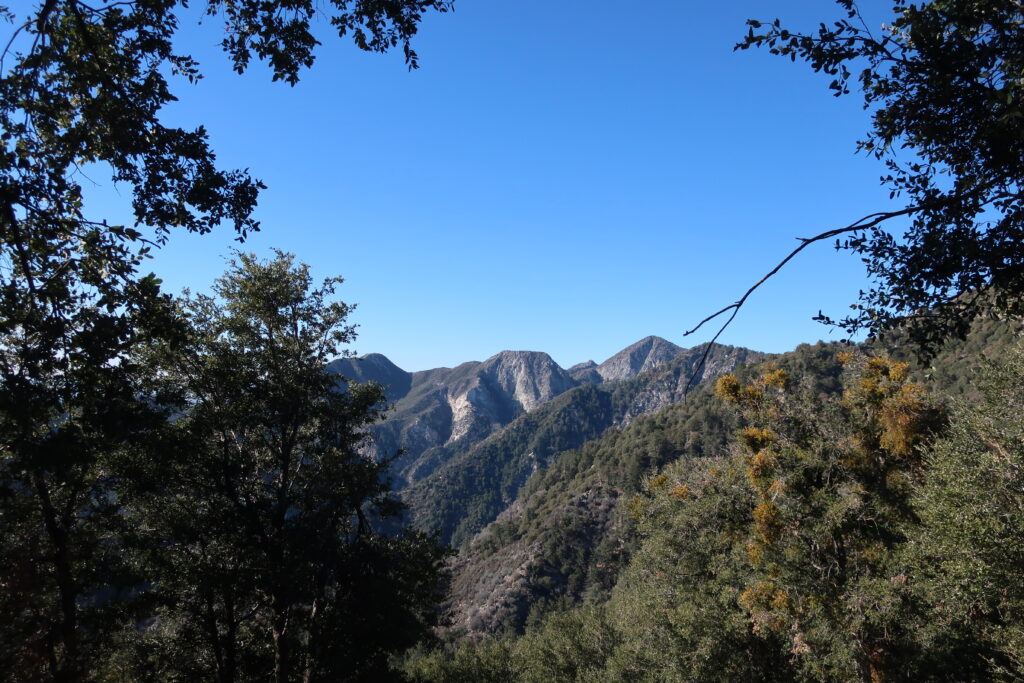
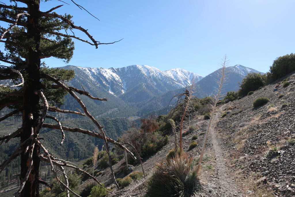
Looking north on the Sierra Highway from Mojave, Ca.
The Sierra Highway is a road in Southern California, United States, with a rich history. Here’s an overview:
Early Beginnings: The history of the Sierra Highway can be traced back to the early 20th century. It was initially part of the state highway system established in 1910 under the State Route 4 designation. This route was part of the Midland Trail, a transcontinental route established in the early days of automobile travel.
Ridge Route Connection: In the 1910s, the Sierra Highway was connected to the Ridge Route, a significant engineering achievement that connected Los Angeles to the San Joaquin Valley. This connection made the Sierra Highway a vital link in Southern California’s road network.
U.S. Route 6: In 1937, the Sierra Highway became part of U.S. Route 6, a transcontinental highway that at one point stretched from Provincetown, Massachusetts, to Long Beach, California. This made it one of the longest highways in the United States.
Changes and Decline in Importance: Completing the Interstate Highway System, particularly Interstate 5, led to a decline in the importance of the Sierra Highway as a major through route. Much of its role was supplanted by these newer, faster roadways.
Modern Era: The Sierra Highway still exists today, but it functions more as a local road than a major thoroughfare. It passes through or near towns such as Santa Clarita, Palmdale, and Mojave, and it offers a scenic alternative to the faster interstate highways.
Cultural Significance: Beyond its practical use, the Sierra Highway holds a place in California’s cultural and historical landscape. It represents an era of early automotive travel, the state’s infrastructure development, and Southern California’s growth.
The Sierra Highway, like many historic roads, tells a story of technological progress, changing transportation needs, and the development of communities along its path.
Braided wagon trails become braided due to a variety of factors, primarily stemming from the behavior of the travelers and the physical environment they traverse. Here’s an overview of how this process occurs:
Multiple Path Creation: Initially, a wagon trail starts as a single path. As more wagons follow the same route, the trail becomes more pronounced. However, when a part of the trail becomes difficult to traverse due to obstacles, mud, steep inclines, or other challenges, travelers may start to create alternate paths to bypass these difficult sections.
Environmental Conditions: Factors like weather conditions (heavy rains creating mud, snow, etc.), natural obstacles (fallen trees, rockslides), or changes in the landscape (river course changes, growth of vegetation) can render parts of the original trail less passable. Wagon drivers then seek easier or safer routes, leading to the creation of parallel tracks.
Heavy Use and Erosion: With heavy use, the main trail can become deeply rutted and eroded, making it increasingly difficult for wagons to pass. This encourages travelers to forge new paths alongside the original one. Over time, with many wagons choosing different routes to avoid these ruts, a braided pattern of multiple trails emerges.
Avoidance of Conflict or Danger: Sometimes, the creation of braided trails is also influenced by the travelers’ desire to avoid conflict with other groups or dangerous wildlife. This could lead to detours that contribute to the braiding.
Search for Resources: In some cases, particularly during long journeys, wagons might veer off the main path in search of resources like water, grazing land for livestock, or better camping spots, which further contributes to the braiding of trails.
Lack of Central Coordination: In many historical contexts, there was no central authority planning or maintaining these trails, so they evolved organically based on the immediate needs and decisions of the travelers.
This phenomenon was particularly notable in the era of westward expansion in the United States, where many trails, like portions of the Oregon Trail or the Santa Fe Trail, exhibited this braiding due to the heavy traffic of wagons over decades, all facing various environmental and practical challenges.
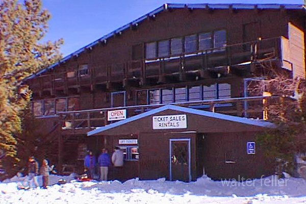
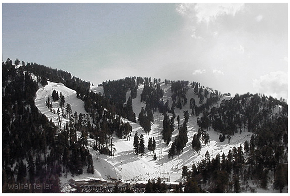
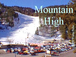
Mountain High North, previously known as Ski Sunrise, is part of the Mountain High Resort in Wrightwood, California. This area of the resort has its own unique characteristics and offerings. Here’s an overview:
Ski Sunrise – 1996
Mountain High North, previously known as Ski Sunrise, is part of the Mountain High Resort in Wrightwood, California. This area of the resort has its own unique characteristics and offerings. Here’s an overview:
Location and Terrain: Mountain High North is located in the San Gabriel Mountains near Wrightwood. The terrain at Mountain High North is generally known for being more beginner and family-friendly compared to the other areas of Mountain High. It’s an excellent place for those new to skiing or snowboarding.
Integration and Development: Mountain High North was integrated into Mountain High Resort following the acquisition of the Ski Sunrise area. This integration expanded the overall capacity and variety of terrain offered by Mountain High, making it one of the largest ski resorts in Southern California.
Facilities and Services: Mountain High North typically offers various services, including ski and snowboard lessons, equipment rentals, and food and beverage options. The facilities are designed to cater to families and beginners, focusing on creating a welcoming and accessible environment.
Snow Play and Tubing: One of the unique features of Mountain High North is its emphasis on snow play and tubing. This makes it a popular destination for skiers and snowboarders, and those looking to enjoy the snow in other ways.
Operating Schedule: Mountain High North sometimes has a different operating schedule than the West and East resorts, often opening later in the season and closing earlier. This is due to its specific focus and the varying snow conditions across the different areas of Mountain High.
Events and Activities: Mountain High North hosts various events and activities throughout the season aimed at families and beginners. These can include special holiday events, beginner workshops, and family-friendly competitions.
Contribution to Mountain High: The addition of the North resort has allowed Mountain High to offer a more diverse range of experiences to visitors. It complements the more advanced and diverse terrain in the West and East resorts, making the combined Mountain High Resort appealing to a wider range of winter sports enthusiasts.
Mountain High North, with its focus on beginner-friendly slopes, snow play, and tubing, plays a crucial role in the overall appeal of Mountain High Resort. It caters to a segment of visitors looking for a more relaxed, family-oriented snow experience in the proximity of Los Angeles.
The Blue Ridge Ski Resort in Wrightwood, California, is a historical part of the region’s skiing heritage. However, it’s important to clarify that Blue Ridge Ski Resort is the former name of what is now known as the West Resort of Mountain High.
Early Beginnings: Blue Ridge Ski Resort was among the earliest ski areas developed in the San Gabriel Mountains. Its origins trace back to the 1930s and 1940s when the potential for winter sports in the Wrightwood area was first realized.
Development and Growth: The resort grew in popularity through the mid-20th century. The development of ski lifts and other infrastructure helped establish Blue Ridge as a notable destination for Southern California skiers.
Transition to Mountain High: Blue Ridge Ski Resort evolved and expanded over time. It eventually became part of what is known today as Mountain High. This transition involved a change in name and significant upgrades in facilities and services. The West Resort of Mountain High, the direct successor of the original Blue Ridge Ski Resort, retains much of the historical charm and ski culture from its early days.
Terrain and Features: The area that was once Blue Ridge and is now Mountain High West Resort is known for its varied terrain, catering to skiers and snowboarders of different skill levels. It features a mix of beginner, intermediate, and advanced runs.
Modernization and Improvements: After becoming part of Mountain High, the former Blue Ridge Ski Resort saw substantial improvements, including the installation of more modern and efficient lifts, enhanced snowmaking capabilities, and the development of terrain parks.
Cultural Impact: The history of Blue Ridge Ski Resort is deeply intertwined with the development of skiing culture in Southern California. It was crucial in introducing and popularizing winter sports to a region more commonly associated with beaches and sunshine.
Legacy: Today, while the name Blue Ridge Ski Resort has faded into history, its legacy continues through the West Resort of Mountain High. It remains a testament to the early days of skiing in Southern California and the region’s growth in the sport.
This brief history highlights the transformation of Blue Ridge Ski Resort from its early days to its modern incarnation as part of Mountain High, underscoring its significance in the development of skiing in Southern California.
Holiday Hill Ski Resort, located in the San Gabriel Mountains near Wrightwood, California, has a significant place in Southern California’s skiing history. While less known today, Holiday Hill played an important role in the region’s winter sports scene. Here’s a brief overview of its history:
Early Beginnings: Holiday Hill Ski Resort started in the mid-20th century. It was part of the burgeoning ski industry in Southern California, which capitalized on the region’s mountainous terrain and winter snowfall.
Location and Accessibility: Situated near the town of Wrightwood, Holiday Hill was easily accessible to the growing population of Southern California, especially those in the Los Angeles area. This accessibility contributed to its popularity as a ski destination.
Facilities and Attractions: The resort offered skiing and snowboarding opportunities, with various slopes catering to different skill levels. It was known for its family-friendly atmosphere and was a popular choice for beginners and intermediate skiers.
Transition and Development: Over the years, Holiday Hill underwent several changes, including ownership transitions and developments in its infrastructure. These changes were part of the broader evolution of the ski industry in Southern California.
Integration into Mountain High: Eventually, Holiday Hill became part of the larger Mountain High resort. This integration was a significant step in consolidating the ski areas in the Wrightwood region. The once Holiday Hill area is now part of the expanded Mountain High complex, specifically the East Resort.
Legacy and Modern Era: Today, the legacy of Holiday Hill lives on as part of Mountain High. The East Resort of Mountain High, which encompasses the former Holiday Hill area, continues to offer skiing and snowboarding, emphasizing varied terrain and scenic views.
Cultural Impact: Holiday Hill contributed to the growth of the skiing culture in Southern California. It played a role in introducing many Southern Californians to winter sports and helped establish the region as a destination for skiing and snowboarding.
In summary, Holiday Hill Ski Resort was a key player in developing the skiing industry in Southern California. Its integration into Mountain High Resort has allowed its legacy to continue, contributing to the region’s rich history of winter sports.
Ancient Lake Cahuilla, or Lake LeConte, was a prehistoric lake in California and northern Mexico. This lake was significantly larger than the current Salton Sea in the same region. It existed in the Salton Basin, a low-lying area of the Colorado Desert.
Salton Sea
The formation of Lake Cahuilla was due to the Colorado River changing its course at various times in history. The river flowed into the Salton Basin, creating a large freshwater lake. The size and existence of the lake fluctuated over centuries, depending on the river’s course and the climate.
Lake Cahuilla was significant in several ways:
Ecological Impact: As a large freshwater lake, it supported a diverse ecosystem and was an important habitat for various species.
Human History: The lake significantly influenced the indigenous peoples of the region. Tribes such as the Cahuilla, Quechan, Mohave, and others lived around its shores and relied on its resources for survival. The lake’s presence and subsequent disappearance influenced their cultural narratives and settlement patterns.
Geological Interest: The rise and fall of Lake Cahuilla have been of interest to geologists and other scientists in understanding the region’s geological history and the behavior of the Colorado River.
Archaeological Significance: The areas that were once under the lake have been rich in archaeological findings, providing insights into the life of the indigenous peoples who lived there.
Influence on Modern Issues: The history of Lake Cahuilla has been studied in the context of understanding modern issues related to the Salton Sea, such as environmental and water management challenges.
The remnants of Lake Cahuilla, like beach ridges and other geological features, are still visible in the landscape, providing a glimpse into this prehistoric body of water’s vastness and significance.
Timeline for Lake Cahuilla
The timeline of Lake Cahuilla’s existence spans several thousand years, with filling and drying periods corresponding to changes in the course of the Colorado River and regional climate conditions. Here’s a general overview of its timeline:
Early Formation (Prehistoric Times): The formation of Lake Cahuilla dates back to prehistoric times. It is believed to have formed and disappeared multiple times over several thousand years. The exact dates of these cycles are subject to ongoing research and interpretation.
Evidence of Multiple Cycles (Several Thousand Years Ago): Geological and archaeological evidence suggests that Lake Cahuilla filled and dried up multiple times. These cycles were driven by the Colorado River’s changing course, alternating between flowing into the Gulf of California and the Salton Basin.
Last High Stand (About 1300-1600 AD): One of Lake Cahuilla’s most recent and well-documented high stands occurred between 1300 and 1600 AD. This period is particularly interesting to archaeologists and historians as it coincides with the flourishing of indigenous cultures in the region.
Final Drying (Around 1600 AD): The lake is believed to have dried up completely around 1600 AD, following the Colorado River reverting its course away from the Salton Basin and back towards the Gulf of California. The desert environment of the Salton Sea area as we know it today began to take shape after this event.
Modern Times (20th Century Onwards): The current Salton Sea was created in the early 20th century due to accidental flooding from the Colorado River in part of ancient Lake Cahuilla’s basin. This event is unrelated to the natural cycles that created and dried up Lake Cahuilla but occurs in the same geographic region.
The timeline of Lake Cahuilla is a subject of ongoing scientific study, with new research continually refining our understanding of its history and the factors that influenced its formation and disappearance.
Mines in Joshua Tree National Park are remnants of the region’s rich mining history. During the late 19th and early 20th centuries, the area now Joshua Tree National Park saw a mining boom. Prospectors were drawn to this part of the California desert by the promise of gold, silver, copper, and other valuable minerals.
History of Mining in the Area: The mining era in the region began in the 1800s and continued into the early 1900s. Miners established several small mines throughout the area, extracting various minerals. The most sought-after were gold and silver, but there were also operations for copper and other minerals.
Impact on the Landscape: The mining activities left a significant mark on the landscape. You can find old mine shafts, ruins of miner’s cabins, and remnants of mining equipment scattered throughout the park. These historical artifacts provide a glimpse into the harsh conditions miners faced.
Preservation and Safety: Many of these mines are now part of the cultural heritage protected within Joshua Tree National Park. However, they can be dangerous, with unstable shafts and toxic substances. Visitors are generally advised to admire them safely and not enter mine shafts or tunnels.
Popular Mines to Visit: Some of the more well-known mines in the park include the Lost Horse Mine, one of the area’s most productive gold mines, and the Desert Queen Mine. These mines and others are accessible via hiking trails and are popular spots for visitors interested in the area’s history.
Educational and Recreational Opportunities: The park offers educational programs about the area’s mining history, and many visitors enjoy hiking to these historical sites to learn about the past.
Conservation Efforts: The National Park Service works to preserve these historical sites while ensuring visitors’ safety and the natural environment’s protection.
Thus, Joshua Tree National Park is a natural reserve and a historical archive of the American West’s mining era.
The Mastodon Mine in Joshua Tree National Park has history dates back to the early 20th century. In southeastern California, Joshua Tree National Park is renowned for its stunning desert landscapes, unique vegetation, and geological features.
Mastodon Mine
The Mastodon Mine was primarily a gold mine, reflecting the broader gold mining activity of the California Gold Rush era. However, it occurred later than the initial rush of 1849. Mining in this region was fueled by the discovery of gold and the potential for profitable mining operations.
The mine was established in the early 1900s. The Mastodon Mine was not one of the region’s largest or most productive mines during its operational years. Still, it was significant enough to draw workers and contribute to the local mining history. The miners would have used traditional hard-rock mining techniques to extract gold from the quartz veins in the area.
Over the years, the mine changed hands and eventually ceased operations. Like many abandoned mines, it was left with remnants of its mining past, including shafts, tunnels, and debris. These remnants are historical artifacts, providing insight into the mining techniques and life during that period.
In 1994, the area encompassing the Mastodon Mine became part of Joshua Tree National Park, established to protect the region’s unique desert ecosystem and cultural heritage. The National Park Service manages the site, balancing preserving historical resources with protecting the natural environment.
Today, the Mastodon Mine is a point of interest for Joshua Tree National Park visitors. It offers a glimpse into the area’s mining history, with trails leading to the mine site and interpretive signs providing information about its history and impact on the region.
As with many historical sites, the information about the Mastodon Mine is based on historical records, archaeological evidence, and ongoing research. The National Park Service and historians continue to study such sites to understand the region’s past better.
Koehn Lake and the nearby ghost town of Saltdale have a rich history intertwined with the salt industry in California. Koehn Lake, situated in the Fremont Valley of the Mojave Desert in eastern Kern County, California, is a dry and seasonally endorheic lake, occasionally becoming a closed basin without outflow. The lake is approximately 5 miles long and 3 miles wide at its widest point.
Saltdale, founded in 1915, owes its origins to the salt harvesting operations from Koehn Dry Lake. The town had a post office operating from 1916 to 1950. The history of salt production in the area began in earnest in 1914 with the operations of the Consolidated Salt Company. This was further expanded with the involvement of the Fremont Salt Company from 1919 to 1927, which also utilized solar evaporation of surface brine for salt production.
The salt industry in this region has undergone several changes in ownership and production methods over the years. In the early 20th century, salt production fluctuated considerably, largely dependent on rainfall and storm runoff to supply water for brine formation. Modern techniques involve pumping brine from wells and channeling it to ponds for evaporation, a process that takes about four months to form approximately 6 inches of salt.
Saltdale, during its peak, had a diverse community, including managers, skilled workers, and their families, as well as common laborers, often Latino Catholics. The town had facilities like a company store, a post office, a school, and a service station. Saltdale’s school, under the guidance of notable teachers, played a significant role in community life, including efforts towards “Americanization” by encouraging English language use and cultural integration.
However, Saltdale faced challenges due to its remote location and the fluctuations in the salt industry. The town experienced isolation, difficulties in accessing law enforcement and medical care, and was impacted by the economic conditions of the time, including the Great Depression.
The decline of Saltdale was marked by the eventual abandonment of the town by the 1970s. The salt operations also evolved, with less need for manpower due to modernization. Today, Saltdale stands as a ghost town, with the remnants of its past slowly eroding away in the salty landscape.
Koehn Lake, apart from its salt mining history, has also been used for various other purposes. At its northern end, there are evaporation ponds from the salt mining operation, and the rail siding at the former townsite of Saltdale has been used for offloading explosives. The area around the lake has also been used for testing by the Reaction Research Society and for a desert test track by Honda Motors. In 2014, it was notably the area where Virgin Galactic’s experimental spaceship disintegrated.
The history of Koehn Lake and Saltdale provides a unique glimpse into the industrial and community life of early 20th-century California, highlighting the challenges and adaptations of a community built around a natural resource.
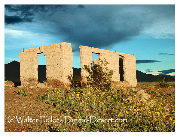
Ashford Mill in Death Valley, located in California, has a fascinating history that dates back to the early 20th century. It was named after the Ashford brothers, who were prospectors in the area.
Ashford Mill – Death Valley National Park
Discovery of Gold: The story of Ashford Mill begins with the discovery of gold in the Black Mountains of Death Valley. In 1907, two brothers, Harold and Erwin Ashford, staked claims in a canyon known as Golden Canyon.
Operation of the Mill: The Ashford brothers lacked the experience and resources to develop the mine, so they leased it to a businessman, B.W. McCausland. McCausland recognized the need for a mill to process ore and built the Ashford Mill in 1914. The mill was constructed to process gold ore from the Golden Treasure Mine, located about five miles away in the Black Mountains.
Technological Features: The mill was a typical representation of the ore-processing technology of its time. It included structures for crushing, mixing with chemicals, and separating gold from the ore.
Short-Lived Success: Despite the investment in the mill and the initial enthusiasm, the operation was short-lived. The ore from the Golden Treasure Mine was of lower quality than expected, making the operation unprofitable.
Abandonment: By 1915, just a year after its construction, the mill was abandoned as the dreams of profitable gold mining faded. The harsh conditions of Death Valley and the lack of substantial gold findings made it impractical to continue.
Today: The ruins of Ashford Mill stand as a reminder of the brief gold rush in Death Valley. The site is preserved within Death Valley National Park. Visitors can see the remnants of the mill’s foundation and some of the walls, offering a glimpse into the early mining history of the region.
The history of Ashford Mill is a typical example of the boom-and-bust cycle that characterized many mining ventures in the American West during the late 19th and early 20th centuries. It reflects the optimism, hardships, and eventual disappointment those seeking fortune face in this harsh and unforgiving landscape.
With its vast and rugged landscape, the Mojave Desert is steeped in legends and ghost stories passed down through generations. Here are some of the most famous ones:
The Lost Ship of the Desert: One of the most enduring legends is that of a Spanish galleon laden with pearls and gold, which is said to have been stranded in the desert centuries ago. Over the years, many have searched for this lost ship, but it remains a tantalizing mystery, possibly just a mirage or a tale spun from the heat and isolation of the desert.
The Ghosts of Calico: Once a thriving silver mining town, Calico is now a ghost town and tourist attraction. Visitors and employees have reported numerous ghost sightings, including that of a playful little girl, miners still panning for silver, and mysterious floating orbs.
The Yucca Man: Similar to Bigfoot, the Yucca Man is a legendary creature said to roam the Mojave. Described as very tall and covered in hair, campers and hikers have reported this elusive being, though evidence of its existence is purely anecdotal.
The Haunted Joshua Tree: The Joshua Tree National Park, part of the Mojave Desert, is home to many myths. One such story involves a specific Joshua tree said to be haunted by the spirit of a man who was hanged from its branches. Some claim to have seen his ghost wandering near the tree at night.
The Cursed Gold of Pegleg Smith: This legend revolves around Thomas “Pegleg” Smith, a mountain man who allegedly discovered a huge black-coated gold nugget in the Mojave. He never found it again, and many treasure hunters have tried and failed to locate Pegleg’s lost gold, leading to speculations of a curse.
The Char Man of San Bernardino: A lesser-known but chilling tale is that of the Char Man, a ghostly figure said to have been a fire victim. He is reputed to haunt the outskirts of San Bernardino, frightening unwary travelers with his burned and disfigured appearance.
These stories, whether based on fact or fiction, add a rich layer of mystery and intrigue to the Mojave Desert. They reflect the human fascination with the unknown and the allure of a beautiful and forbidding landscape.
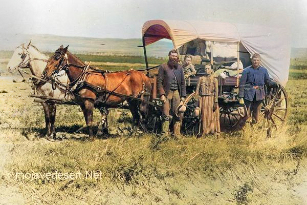
Covered wagons significantly impacted the United States’ westward expansion during the 18th and 19th centuries. These wagons, often called “prairie schooners,” were designed to transport goods and settlers across the North American continent.
Family & covered wagon (prairie schooner)
Key features and uses of covered wagons included:
Design: Covered wagons typically had a wooden frame with a canvas cover. This cover protected the contents from weather elements like rain and sun. The wagon bed was usually made of wood and was about four feet wide by ten feet long.
Cover: The cover was made of canvas or similar durable cloth, stretched over hooped frames, providing shelter and goods for the occupants.
Wheels: The wheels were often large and designed to handle rough terrain. The front wheels were usually smaller than the rear wheels, allowing easier turning.
Draft Animals: Oxen, mules, or horses were commonly used to pull these wagons. Oxen were preferred for their strength and endurance, especially over long distances.
Role in Expansion: Covered wagons were essential for westward migration in the U.S. They carried settlers’ belongings, including tools, food, and sometimes even passengers. These wagons were a vital part of the movement to settle the American West and were commonly seen on trails like the Oregon Trail, the Santa Fe Trail, and the California Trail.
Living Quarters: The covered wagon was a temporary home for many settlers traveling west. Families would cook, eat, sleep, and spend much of their time in or around the wagon during their journey.
Historical Significance: The image of a covered wagon crossing the plains has become an iconic symbol of American frontier life, representing the pioneer spirit, exploration, and the challenges of frontier life.
The use of covered wagons declined with the advent of railroads, which offered a faster and more efficient means of transporting goods and people across the country. However, their legacy remains an integral part of American history and folklore.
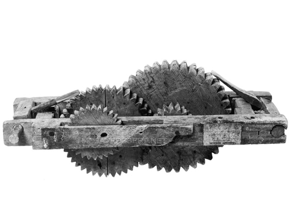
An odometer was an instrument used by American pioneers, particularly during the westward expansion in the 19th century, to measure the distance traveled. These devices were vital for journeys along routes like the Old Spanish Trail, as they helped travelers gauge their progress, estimate their arrival times, and manage their resources more effectively.
Wagon odometer – Courtesy LDS Church
The basic principle of the odometer dates back to ancient times, with variations used by the Romans and Chinese. However, the version used on covered wagons was adapted to the needs of the pioneers. It typically involved a mechanism that counted the revolutions of a wagon wheel. Since the wheel’s circumference was known, each revolution corresponded to a specific distance traveled. This count was then converted into miles or another distance unit and displayed.
This simple but effective device was crucial for pioneers who had to navigate vast, often unmarked territories. Knowing how far they had traveled, they could make informed decisions about when to rest, resupply, or seek shelter, especially as they faced the weather, terrain, and other uncertainties of frontier travel.
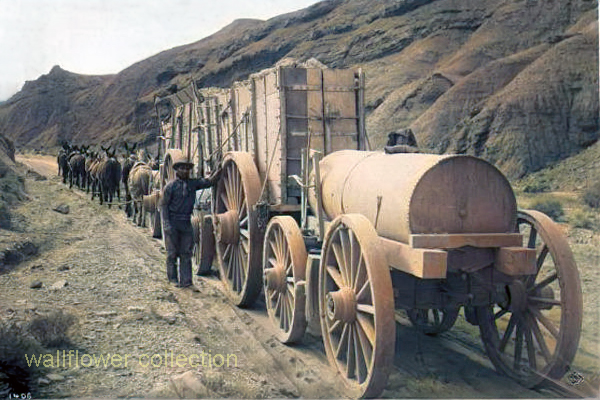
The 20-mule team borax ore wagons used in the late 1800s to transport borax from the mines in Death Valley, California, were quite large and had specific dimensions.
Here are the approximate dimensions for a typical 20-mule team borax ore wagon:
Length: Approximately 30 feet (9 meters)
Width: About 8 feet (2.4 meters)
Height: Around 7 feet (2.1 meters)
Weight: These wagons weighed approximately 7 tons when fully loaded with borax ore.
These massive wagons required a team of 18 mules and two horses to pull them across the harsh desert terrain. They were an iconic part of the borax mining industry in the late 19th century and were crucial in transporting borax to the nearest railroad for distribution.
Two large ore wagons were used to transport the borax ore from the mines in Death Valley to the nearest railroad for shipment. They were massive and could carry a significant amount of borax.
One water tank wagon: There was a specialized tank wagon in addition to the two ore wagons. This wagon carried water for the mules and horses that pulled the wagons. The desert environment of Death Valley was harsh, and providing water for the animals was crucial to their survival during the long and arduous journey.
So, the 20-mule team borax wagons actually consisted of 18 mules and 2 horses pulling two ore wagons and one water tank wagon. These wagons became an iconic symbol of the borax mining industry in the late 19th century.
The Mojave Indians are a Native American tribe indigenous to the southwestern United States, primarily in the Mojave Desert region, which spans parts of California, Nevada, Arizona, and Utah. They have a rich ethnography and ethnohistory characterized by their unique cultural practices, social organization, and historical interactions with European settlers.
Here are some key aspects of the Mojave Indians’ ethnography and ethnohistory:
Language and Culture: The Mojave people traditionally spoke the Mojave language, part of the Yuman language family. Their culture was closely tied to the natural environment of the Mojave Desert, and they had a deep knowledge of desert plants and animals. They practiced farming along the Colorado River and engaged in hunting and gathering.
Social Organization: The Mojave society was organized into clans, and their social structure was matrilineal, meaning descent and inheritance were traced through the mother’s line. Clan membership played a significant role in their social and kinship systems.
Religion and Spirituality: Mojave religious beliefs were centered around a complex system of spirits and deities associated with the natural world. The Colorado River played a significant role in their spiritual beliefs, and ceremonies often revolved around it. The Mojave Creation Story is an important part of their religious narrative.
Contact with European Settlers: Like many Native American tribes, the Mojave people experienced significant changes with the arrival of European settlers. In the 19th century, they encountered Spanish explorers, Mexican settlers, and American pioneers. These encounters led to conflicts and changes in their way of life.
Fort Mojave Reservation: In the 19th century, the Mojave people were relocated to the Fort Mojave Indian Reservation, which is located near Needles, California. The reservation is still home to many Mojave tribal members today.
Contemporary Mojave: Today, the Mojave people continue to preserve and celebrate their cultural heritage. They have cultural centers and organizations that work to maintain their traditions, languages, and arts. The tribe also engages in economic development and land management on their reservation.
The ethnography and ethnohistory of the Mojave Indians provide valuable insights into the history and culture of this indigenous group in the American Southwest. Researchers and historians continue to study and document their traditions to preserve their cultural heritage for future generations.
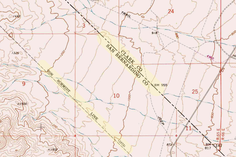
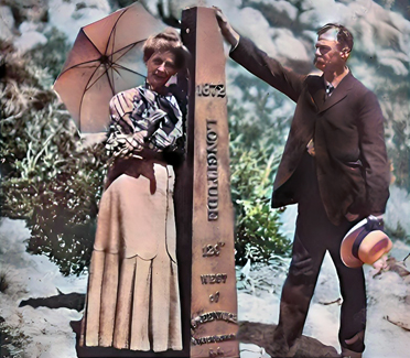
The Von Schmidt boundary, or the Schmidt Line, refers to a historical boundary line in California. It was surveyed and established by Alexey von Schmidt, a Russian engineer, in the 1860s. The purpose of the Von Schmidt boundary was to delineate the border between California and Nevada during a time when there was confusion and disputes over the exact location of the state boundary.
Von Schmidt’s survey helped clarify the boundary and resolve conflicts between California and Nevada. His efforts included placing markers and monuments along the boundary line to make it clear and permanent. The boundary he established still exists today and is the official border between the two states.
The Von Schmidt boundary is of historical significance and has been preserved as a reminder of the surveying and boundary disputes of the past. It is located in the eastern part of California near the Nevada border.
Why was the initial boundary incorrect?
The initial boundary between California and Nevada was incorrect and subject to disputes for several reasons:
Lack of Accurate Surveys: In the early years of California’s statehood and during the Gold Rush era in the mid-19th century, limited resources and technology were available for accurate land surveys. As a result, the initial surveys and boundary markers were not precise.
Rush for Mineral Resources: The discovery of gold and other valuable minerals in the region led to a rapid influx of settlers and miners. This rush created a need for clear land boundaries and property rights. However, the focus was often on extracting resources rather than conducting precise surveys.
Overlapping Claims: Different parties, including miners, settlers, and land speculators, had conflicting claims to land in the region. These overlapping claims added to the confusion regarding the exact location of the state boundary.
Political Disputes: California became a state in 1850, and shortly thereafter, disputes arose over its eastern boundary. Nevada was not established as a separate territory until 1861. Political disagreements and conflicting interpretations of earlier treaties and agreements existed during this period.
Multiple Surveys: Various individuals and surveyors attempted to establish the boundary, but their surveys often differed. This further complicated matters.
Given these factors, there was much uncertainty and disagreement regarding the California-Nevada boundary in the early years. It was only through the efforts of surveyors like Alexey von Schmidt and subsequent legal and political resolutions that the boundary was eventually clarified and accepted. Von Schmidt’s survey work played a crucial role in resolving these disputes and establishing a more accurate boundary line.
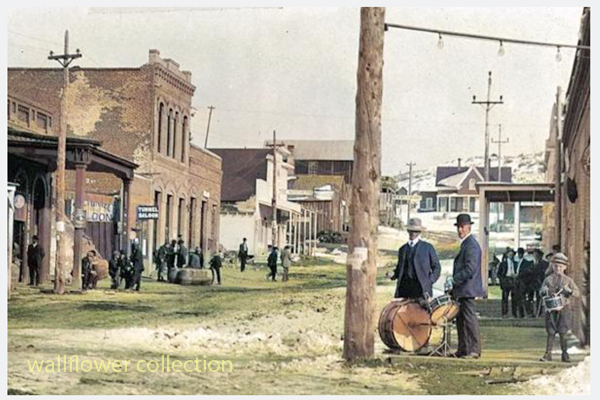
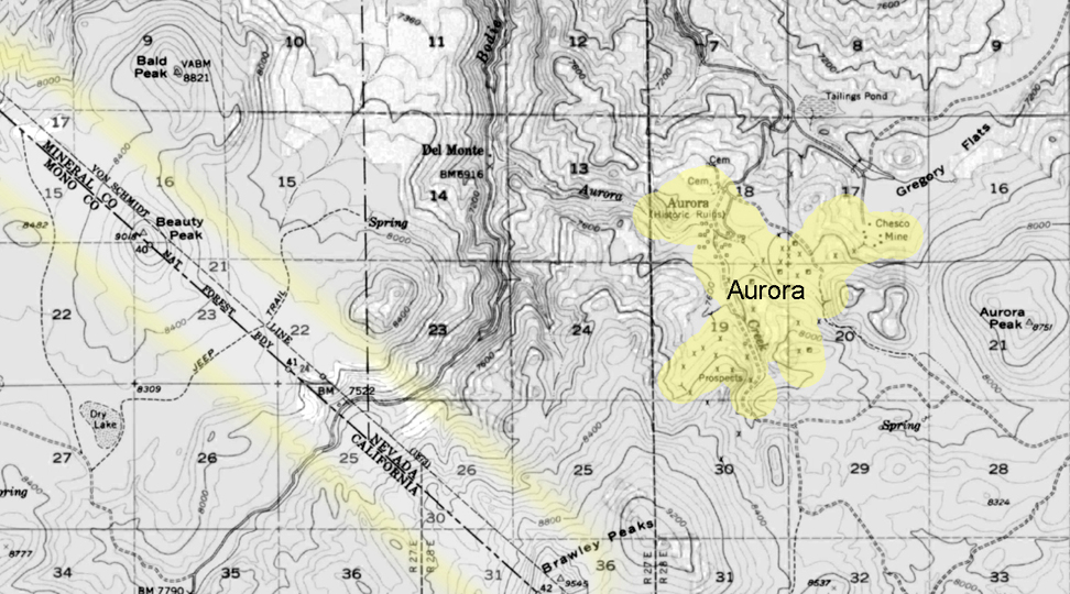
Aurora
Aurora, Nevada 1910
The town of Aurora, Nevada, experienced a move due in part to the boundary disputes between California and Nevada. Aurora was originally founded in the 1860s during the Nevada Silver Rush. At its founding, the exact location of the California-Nevada border was still uncertain and subject to disputes.
Aurora moved to make sure it was in Nevada.
As a result of the boundary disputes and the fact that Aurora’s initial location was close to the border, there were concerns about which state’s jurisdiction the town fell under. Aurora’s residents and businesses moved the town slightly to the east, further into Nevada’s territory, to avoid potential legal and tax issues. This move ensured that Aurora would be firmly within the boundaries of Nevada when the border dispute was eventually resolved.
The relocation of Aurora was a strategic decision made to secure the town’s status as part of Nevada rather than California, given the uncertainties and conflicts related to the state boundary at the time. This move allowed Aurora to thrive as a mining town in Nevada without the legal complications associated with straddling the border.
Is everybody happy?
It’s difficult to determine whether “everybody” is happy, as people’s feelings and satisfaction with their circumstances can vary widely. Happiness is subjective and depends on individual experiences, perspectives, and circumstances.
In the context of the town of Aurora’s relocation due to boundary disputes, it’s possible that the decision to move was made to address specific legal and jurisdictional concerns at the time. The move may have been necessary for the town’s continued growth and prosperity. However, whether every resident or stakeholder was happy with the decision would depend on their perspectives and interests.
In any community or population, there will be a range of opinions and emotions regarding significant decisions like a town’s relocation. Some may have been happy with the move because it resolved legal uncertainties, while others may have been less pleased due to the disruption and changes associated with relocation.
To determine the current happiness or satisfaction of people in a specific context, it would be necessary to conduct surveys or interviews to gather their perspectives and opinions.
The history of the Tecopa and Shoshone area in California is closely tied to the region’s Native American heritage and the later development spurred by mining and tourism. Here’s a brief overview of the history of this area:
Native American Presence: Before European and American settlement, the Tecopa and Shoshone region was inhabited by Native American tribes, including the Southern Paiute people. They had a rich cultural history and lived harmoniously with the desert environment.
Mining Era: In the late 19th century, mining activities brought settlers to the area. Tecopa was named after a Paiute leader and became a mining town. Various minerals, including borax, were mined in the region. Mining operations attracted people looking for economic opportunities.
Shoshone’s Beginnings: Shoshone, known as Metberry Springs, developed as a railroad station and water stop along the Tonopah and Tidewater Railroad in the early 20th century. The name was later changed to Shoshone.
Water Resources: The presence of natural springs in the Shoshone area, including the famous Shoshone Springs, played a crucial role in attracting settlers and supporting mining and agricultural activities in the arid desert environment.
Borax and Tourism: Borax mining was a significant industry in the area, and the famous Twenty Mule Team wagons transported borax from the region to the market. The Harmony Borax Works, located nearby, was a key mining operation. Additionally, the unique desert landscapes and proximity to Death Valley National Park began to draw tourists.
Modern-Day Shoshone and Tecopa: Today, Shoshone and Tecopa are small communities that rely on tourism, agriculture, and the natural springs for their economy. They serve as gateways to Death Valley National Park, attracting visitors interested in exploring the desert’s unique beauty, geology, and history.
Cultural and Historical Preservation: Efforts have been made to preserve the historical and cultural heritage of the Tecopa and Shoshone area. The Shoshone Museum, for example, provides insights into the region’s history.
Overall, the history of Tecopa and Shoshone, CA, reflects the area’s development from its Native American roots through mining and the growth of tourism, all while showcasing the rugged beauty of the Mojave Desert and its natural resources.
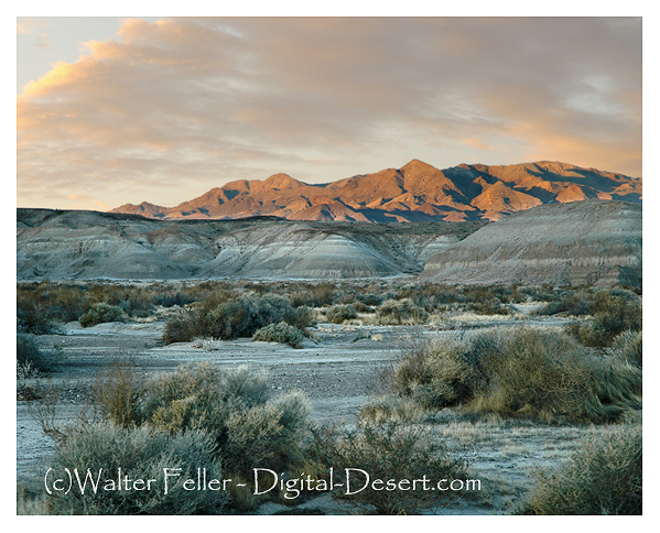
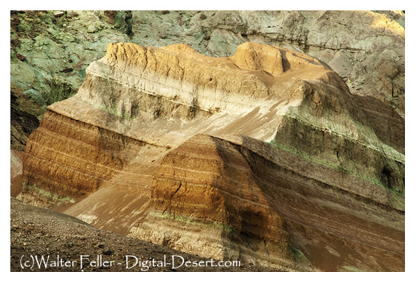
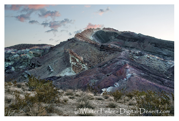
Rainbow Basin is a geological formation in the Mojave Desert of California. It is known for its unique and colorful rock formations, which provide valuable insights into the region’s geological history. Here are some key aspects of the geology of Rainbow Basin:
Sedimentary Rocks: Rainbow Basin primarily comprises sedimentary rocks accumulated over millions of years. These rocks include sandstones, shales, and mudstones. The different layers of sedimentary rocks represent different periods of geological history.
Fossilized Marine Life: Within the sedimentary rocks of Rainbow Basin, fossils of marine life from the Miocene epoch (approximately 15-20 million years ago) have been found. These fossils include shells, bones, and other remnants of ancient sea creatures. This suggests that a shallow sea once covered the area.
Faulting and Uplift: The geology of Rainbow Basin has been influenced by tectonic forces. The region is situated near the intersection of several fault lines, including the Garlock Fault. These fault movements have caused the uplift of the rocks, exposing them to erosion and creating the unique landscape seen today.
Erosion and Weathering: Over time, erosion and weathering have shaped the colorful rock formations in Rainbow Basin. These processes have created intricate patterns and exposed layers of colored sediments, giving the area its name.
Geological Time Scale: The rocks at Rainbow Basin span a significant portion of the geological time scale, providing geologists with valuable information about the changing environments and life forms that existed in the area millions of years ago.
Geological Tours: Rainbow Basin is a popular destination for geological enthusiasts and tourists interested in its unique geology. There are guided tours and interpretive exhibits that provide insights into the geological history of the area.
Rainbow Basin, Barstow, Ca.
In summary, Rainbow Basin is a geological wonder in the Mojave Desert, characterized by its sedimentary rocks, fossils, faulting, erosion, and vibrant colors. It offers a glimpse into the geological history of California and the forces that have shaped its landscape over millions of years.
Barstow, California, has a rich history related to railroads. Here is an overview of the railroad history in Barstow:
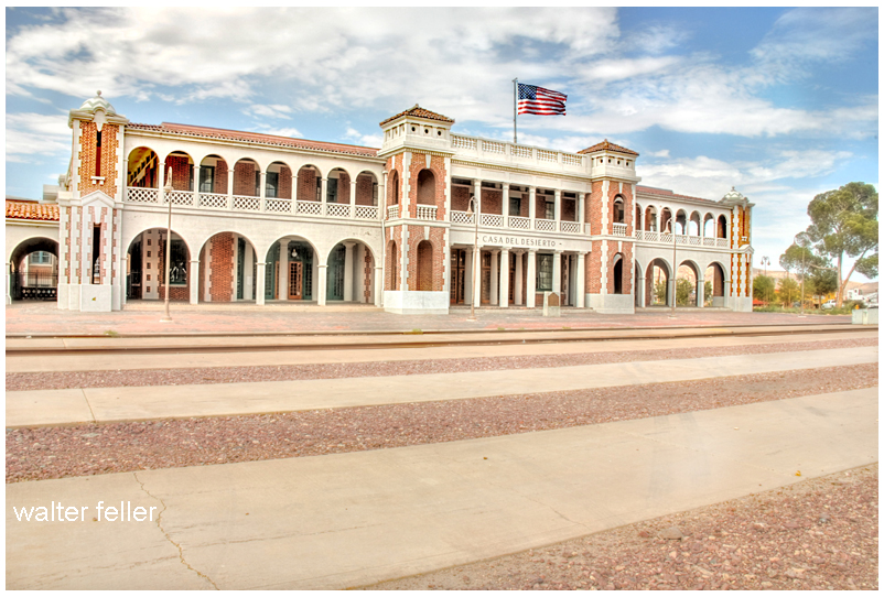
Harvey House – Casa Del Desierto
Early Railroad Development: Barstow’s history as a railroad town dates back to the late 19th century when the Atchison, Topeka, and Santa Fe Railway (AT&SF) and the Southern Pacific Railroad (SP) played significant roles in its development. The AT&SF arrived in Barstow in 1883, and the SP followed shortly after.
Railroad Facilities: Barstow became a strategic location for both railroads due to its position as a junction point. It was a division point on the AT&SF line, meaning it had extensive locomotive maintenance and repair facilities. Additionally, it served as a crew change and refueling station.
Harvey House: The historic Casa del Desierto, also known as the Harvey House, was a prominent feature of the Barstow railroad history. It was a luxurious hotel and restaurant built by the Fred Harvey Company in 1911 to serve passengers traveling on the AT&SF railway. The Harvey House has been beautifully restored and now houses a museum.
Railroad Growth: Barstow continued growing as a railroad town over the years. It had a large rail yard, roundhouse, and various support facilities to handle the extensive railroad traffic passing through the area.
Importance as a Railroad Junction: Barstow’s strategic location made it a crucial junction for freight and passenger trains. It was a hub for transferring goods and passengers between different rail lines, making it a bustling activity center.
Modern Times: While the significance of railroads has declined in recent years, Barstow still maintains its historical ties to the railroad industry. The Barstow Rail Museum and the Harvey House Museum are popular attractions for visitors interested in learning about the town’s railroad history.
Barstow’s history as a railroad town is an integral part of its identity, and the legacy of the railroads can still be seen and appreciated in the town today.
The history of mining in the Barstow area is closely tied to the extraction of various minerals and resources that played a significant role in the development of Southern California. Here’s a more detailed look at the history of mining in the Barstow area:
Borax Mining: Borax mining was one of the earliest mining activities in the Barstow region. In the late 19th century, borax deposits, a valuable industrial mineral used in various applications, were discovered in the nearby Calico Mountains. The Pacific Coast Borax Company, owned by Francis Marion “Borax” Smith, was instrumental in developing borax mines in the area. This marked the beginning of significant mining operations in the region, with borax being a primary focus.
Calico Mining District: The Calico Mining District, which includes the town of Calico, was a major center of mining activity in the Barstow area. Silver and silver-lead ores were the primary resources mined in this district. At its peak in the late 1800s, Calico had a population of over 3,000 people and was a bustling mining town.
Calico Ghost Town: Calico, often referred to as Calico Ghost Town today, was once a thriving mining town. It featured numerous mines, including the Bismarck, Silver King, and Oriental Mines. Visitors to Calico can explore the well-preserved historic buildings, mines, and artifacts, gaining insight into the region’s mining history.
Railroad Transportation: The expansion of railroads played a crucial role in facilitating the transportation of mined materials from the Barstow area to other parts of California and beyond. The Atchison, Topeka, and Santa Fe Railway was a key transportation link for the mining industry, enabling the efficient movement of ores and minerals.
Variety of Minerals: While borax, silver, and silver-lead ores were among the most significant resources mined in the Barstow area, various other minerals were also extracted. These included gypsum, limestone, and barite. These minerals had industrial applications and were important for construction and manufacturing.
Decline of Mining: As the easily accessible mineral deposits were depleted, mining activities in the Barstow area began to decline. Many mines were abandoned, and mining communities saw a decrease in population. The shift in economic focus led to the decline of mining as a major industry in the region.
Today, the mining history of the Barstow area is preserved through places like Calico Ghost Town, museums, and historical sites. These serve as reminders of the pioneering spirit of early miners and the role mining played in shaping the history of Barstow and the surrounding region.
The Curse of Bodie is a legend that suggests the town of Bodie, particularly its well-preserved buildings and artifacts, is cursed. This legend is not uncommon in ghost towns and adds to the town’s mystique. Here are the key elements of the Curse of Bodie legend:
Taking Artifacts: According to the legend, the curse affects those who take artifacts, items, or souvenirs from Bodie Ghost Town without proper permission. This includes visitors who remove historical objects from the town as keepsakes.
Misfortune and Bad Luck: Those who are believed to have taken items from Bodie may experience a series of misfortunes and bad luck in their lives. The curse brings financial troubles, health problems, or other unfortunate circumstances to those who have taken something from the town.
Returning Stolen Items: Some versions of the legend suggest that the curse can be lifted or mitigated by returning the stolen item to Bodie. Restoring the item to its rightful place is believed to break the curse and avoid further misfortune.
Mail-Back Items: Over the years, there have been reports of people mailing stolen artifacts or items back to Bodie, accompanied by letters expressing remorse for taking them and hoping to undo the curse. These returned items are often referred to as “Ghost Town Mail.”
Warnings and Signs: Bodie’s visitor center and park rangers often display warnings and signs advising visitors not to take anything from the town, emphasizing the belief in the curse and the importance of preserving the site’s historical integrity.
Cultural Preservation: The legend of the curse serves as a reminder of the importance of preserving historical and cultural heritage. It encourages responsible tourism and respect for the historical significance of Bodie Ghost Town.
It’s important to note that the Curse of Bodie is part of the folklore and mystique surrounding the town, and there is no scientific evidence to confirm the existence of such a curse. Nevertheless, the legend has become a cultural phenomenon associated with Bodie, and many visitors are aware of it. As a result, most people who visit Bodie today respect its historical artifacts and refrain from taking items as souvenirs, contributing to the ongoing preservation of the site.
Bodie Ghost Town is not only known for its well-preserved historical buildings but also for its legends and stories that have contributed to its reputation as a haunted and mysterious place.
Here are some of the legends associated with Bodie:
The Curse of Bodie: One of the most famous legends surrounding Bodie is the supposed curse that befalls anyone who removes items or artifacts from the town. According to the legend, those who take something from Bodie will suffer bad luck until they return the item. As a result, many people who have taken souvenirs from the town have mailed them back, claiming misfortune.
The Ghosts of Bodie: Bodie is often considered one of the most haunted places in California. Visitors and park rangers have reported numerous ghostly sightings and unexplained phenomena. Some claim to have seen apparitions of former residents heard disembodied voices or witnessed strange lights in the windows of abandoned buildings.
The Jinxed Bodie Gold Nugget: Legend states that a large gold nugget was found in Bodie in the late 1800s. The nugget was said to be cursed, and those who possessed it met with misfortune or tragedy. Some believe the nugget was eventually returned to Bodie to lift the curse.
The Murder of Cain and Kenner: Two brothers, Cain and Kenner, were involved in a bitter dispute over a mining claim in Bodie. The feud escalated, leading to the murder of both brothers. It is said that their spirits still haunt the town, and some visitors claim to have heard the sound of gunshots echoing in the distance.
The Lady in White: A popular ghost story involves the “Lady in White,” who is said to roam the streets of Bodie at night. According to the legend, she appears as a woman in a white dress, often near the cemetery. Her identity and the circumstances of her death remain a mystery.
The Bodie Fire Curse: Bodie experienced several destructive fires during its history, including a massive blaze in 1932 that devastated much of the town. Some believe these fires resulted from a curse placed on the town due to its wild and lawless reputation during its heyday.
The Phantom Miner: There have been reports of a phantom miner wandering the hills around Bodie. This spectral figure is often described as a miner with a pickaxe and a lantern, continuing his work in the afterlife.
It’s important to note that these legends are part of the folklore and mystique surrounding Bodie Ghost Town. While they add to the town’s allure, they are not verified historical facts. Nonetheless, they contribute to the intrigue and mystique of Bodie, making it a captivating destination for those interested in history and the supernatural. Visitors can enjoy these stories while exploring the well-preserved remnants of the past in this iconic ghost town.
A day in Bodie Ghost Town provides visitors with a unique and immersive experience that offers a glimpse into the past and showcases the history, culture, and daily life of a late 19th-century mining town.
Here’s what a day in Bodie can show you:
Well-Preserved Buildings: Bodie is known for its remarkably well-preserved buildings. A walk through the town reveals a variety of structures, including homes, saloons, general stores, a church, a schoolhouse, and more. These buildings are frozen in time, filled with period-appropriate furnishings, tools, and artifacts, allowing visitors to see how people lived and worked in the late 1800s.
Historic Artifacts: Inside the buildings and throughout the town, you’ll find a wide range of historical artifacts, from old mining equipment to personal belongings of the town’s former residents. These items provide insight into the daily lives and occupations of Bodie’s inhabitants.
Authentic Atmosphere: Bodie Ghost Town has a unique atmosphere that transports visitors back in time. The unpaved streets, weathered wooden buildings, and the absence of modern amenities contribute to an authentic Old West ambiance.
Interpretive Displays: The Bodie State Historic Park often features interpretive displays and signs that provide historical context and information about the town’s history, its prominent figures, and its residents’ challenges.
Photography Opportunities: Bodie is a popular destination for photographers due to its picturesque buildings, dramatic landscapes, and the way natural elements have reclaimed some areas. The interplay of light and shadow on the historic structures creates stunning photo opportunities.
Ghost Town Lore: Visitors can learn about the legends and stories associated with Bodie, including its reputation for being a rough and lawless place during its heyday. The town’s history contains tales of mining accidents, shootouts, and colorful characters.
Spectacular Scenery: Bodie is surrounded by beautiful natural landscapes, with views of the Sierra Nevada Mountains in the background. Visitors can enjoy the region’s scenic beauty, including meadows and desert flora.
Visitor Center: Bodie has a visitor center where you can gather information about the town’s history, obtain maps, and watch introductory videos that provide background on the site. It’s a good starting point for your visit.
Guided Tours (seasonal): Bodie may offer guided tours led by knowledgeable park rangers or docents, depending on the time of year. These tours provide additional insights and stories about the town’s history.
Peaceful Serenity: Bodie is often described as a peaceful and serene place. The remote location, lack of crowds (compared to more famous tourist destinations), and the sense of isolation contribute to a tranquil and reflective experience.
Overall, a day in Bodie Ghost Town offers a fascinating journey into the past, providing a tangible connection to the lives of those who once called this historic mining town home. It’s a place where history comes alive, and visitors can appreciate the challenges and triumphs of the people who lived there during the late 1800s.
Bodie and Mojave Desert ghost towns are examples of abandoned settlements in the Western United States. Still, they are located in different regions and have distinct historical and geographical contexts.
Bodie
Cima
Here’s how Bodie ghost town compares to Mojave Desert ghost towns
Location:
Bodie Ghost Town is located in eastern California, near the Nevada border, in the Bodie Hills of the Sierra Nevada Mountains. It is not part of the Mojave Desert.
Mojave Desert ghost towns, on the other hand, are scattered throughout the Mojave Desert region, which covers parts of California, Nevada, Utah, and Arizona. These ghost towns are found in a desert landscape, whereas Bodie is in a mountainous area.
Historical Significance:
Bodie Ghost Town was once a bustling mining town during the late 19th century. It boomed during the Gold Rush but declined when the mines became depleted. It is known for its remarkably well-preserved buildings and artifacts, making it a popular tourist attraction and a State Historic Park.
The Mojave Desert ghost towns have diverse histories related to mining or other industries. These towns experienced growth and decline due to factors like mining, railroads, or changes in economic activity in the region.
Geography and Climate:
Bodie’s location in the Sierra Nevada Mountains has a colder, alpine climate with snowy winters. It is not in a desert like the Mojave Desert ghost towns, which have hot, arid desert climates.
Preservation:
Bodie Ghost Town is notable for its excellent preservation, with many buildings and artifacts remaining intact. It provides a unique glimpse into the past due to its relatively isolated location and the efforts to protect and maintain it.
Mojave Desert ghost towns vary in their levels of preservation. Some may have deteriorated significantly, while others may have been partially restored or maintained for historical and tourist purposes.
In summary, while Bodie Ghost Town and Mojave Desert ghost towns share the common theme of being abandoned settlements in the American West, they differ in their locations, historical backgrounds, climates, and levels of preservation. Each ghost town has its unique story and charm, showcasing the diversity of the history and landscapes of the Western United States.
Similarities
While Bodie Ghost Town and Mojave Desert ghost towns differ, they also share similarities due to their historical significance as abandoned settlements in the American West.
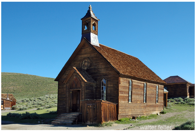
Bodie
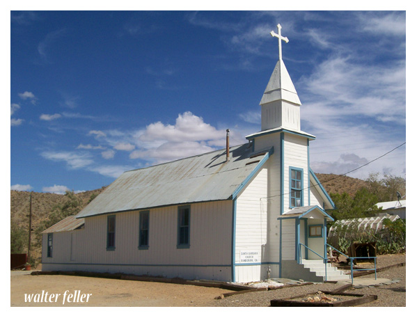
Santa Barbara Church – Randsburg
Here are some commonalities between them:
Mining History: Both Bodie Ghost Town and many Mojave Desert ghost towns have roots in mining activities. They were often established to support nearby mining operations for gold, silver, copper, or other valuable minerals.
Boom and Bust Cycles: Both ghost towns experienced periods of rapid growth and prosperity (boom) followed by economic decline and abandonment (bust) as the mining or other industries became less profitable or were exhausted.
Historic Architecture: Both Bodie and the Mojave Desert ghost towns feature historic buildings and structures that reflect the architectural styles of the late 19th and early 20th centuries. These buildings offer insights into the daily lives of the people who once inhabited these towns.
Tourism and Preservation: Many ghost towns, including Bodie, have been preserved and turned into tourist attractions or historic sites. Visitors can explore the well-preserved or partially restored buildings and artifacts, providing a glimpse into the past.
Cultural Significance: These ghost towns hold cultural significance, representing a particular era in American history when mining and westward expansion were prominent. They serve as reminders of the challenges and opportunities that shaped the American West.
Isolation: Bodie Ghost Town and many Mojave Desert ghost towns are often located in remote or isolated areas. This isolation contributed to their decline and abandonment as access to resources and services became more challenging.
Natural Surroundings: While Bodie is mountainous, some Mojave Desert ghost towns are in arid desert landscapes. Both types of locations offer unique natural surroundings that add to the appeal of these historical sites.
Photogenic and Cinematic Appeal: Bodie and Mojave Desert ghost towns have been popular settings for photography and film productions. Their well-preserved or picturesque appearances have made them attractive for creative projects.
Historical Documentation: Researchers and historians have documented the histories of both Bodie and Mojave Desert ghost towns, helping preserve the stories and heritage of these places.
In summary, Bodie Ghost Town and Mojave Desert ghost towns share several similarities in their historical origins, economic activities, architectural heritage, cultural significance, and appeal as tourist destinations. However, it’s important to recognize that each ghost town has unique characteristics and history that make it special.
The Cajon Pass is a significant mountain pass in Southern California, USA, and it has a rich history when it comes to railroads. It is a crucial transportation route for both freight and passenger trains.
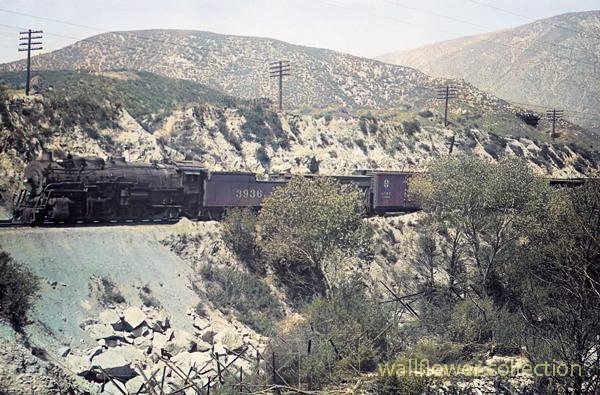
Courtesy Burlington Northern Santa Fe Railroad Blue Cut- 1941 (colorized)
Here’s some information about railroads in the Cajon Pass:
History: The history of railroads in the Cajon Pass dates back to the 19th century. The first railroad line through the pass was the California Southern Railroad, completed in the 1880s. It was later acquired by the Atchison, Topeka and Santa Fe Railway (ATSF).
Santa Fe Railway: The ATSF (Santa Fe) significantly developed the Cajon Pass as a major transportation route. They constructed numerous tracks, tunnels, and bridges to facilitate the passage of trains through the rugged terrain of the pass.
Union Pacific:Union Pacific (UP) also operates through the Cajon Pass. UP and BNSF (Burlington Northern Santa Fe) are two major freight railroads that use this pass for transporting goods between the West Coast and the rest of the United States.
Passenger Rail: Besides freight, passenger trains use the Cajon Pass. Amtrak’s Pacific Surfliner and Metrolink commuter trains provide passenger services in the region, connecting cities like Los Angeles and San Bernardino.
Cajon Pass Railfan Locations: The Cajon Pass is a popular spot for rail enthusiasts (railfans) to watch and photograph trains. There are various well-known locations, such as Sullivan’s Curve and the Hill 582 Overlook, where railfans gather to enjoy the sight of trains traversing the pass.
Modern Operations: The Cajon Pass remains a vital artery for transporting goods between Southern California and the rest of the country. Freight trains of various lengths and configurations, including long double-stack container trains, can frequently pass through the area.
Upgrades and Maintenance: Railroads invest in upgrading and maintaining the tracks and infrastructure in the Cajon Pass to ensure safe and efficient rail transportation.
Courtesy Burlington Northern Santa Fe Railroad – 1941 photo (colorized)
Please note that while this information provides an overview of railroads in the Cajon Pass. It’s always a good idea to check with local authorities or rail companies for the most up-to-date information on rail operations in the Cajon Pass.
Sorrow deepens in the evening then glides on tilted wings Between the twisted trees Above the trail through a woodland malice .
. And shadow after shadow drops from the moonlight pouring through the forest. The white moon and the burnt black shadows. Shoved into sadness . These terrible shadows, one after another Long wings slowly, gracefully beating Silent, save the wind. Silent and sad. .
Arrowhead Pinnacles is a popular rock climbing area in Southern California’s San Bernardino Mountains. It is known for its unique and challenging rock formations, making it a favorite destination for rock climbers and outdoor enthusiasts.
Here are some key details about Arrowhead Pinnacles:
Location: Arrowhead Pinnacles is situated within the San Bernardino National Forest, near the city of San Bernardino in San Bernardino County, California. It is approximately 80 miles east of Los Angeles.
Rock Formations: The area is characterized by a series of granite rock spires and pinnacles, which provide a wide range of climbing opportunities. The granite formations offer a variety of cracks, slabs, and faces for climbers of different skill levels.
Rock Climbing: Arrowhead Pinnacles is primarily known for its rock climbing opportunities. Climbers can find routes that vary in difficulty, from beginner-friendly routes to more advanced and challenging climbs. The granite rocks and scenic surroundings make it a popular destination for traditional and sports climbing.
Access: Access to Arrowhead Pinnacles typically requires a National Forest Adventure Pass for parking. The area is accessible via a short hike from the parking area to the climbing routes. Climbers should check for specific regulations and access updates from the San Bernardino National Forest or local climbing organizations.
Scenic Beauty: Besides rock climbing, Arrowhead Pinnacles offers stunning views of the surrounding San Bernardino Mountains and Lake Arrowhead. The area’s natural beauty attracts climbers, hikers, and nature enthusiasts.
Safety: Climbing at Arrowhead Pinnacles requires proper gear, including ropes, harnesses, helmets, and climbing shoes. Climbers should also be aware of the weather conditions and potential hazards associated with outdoor rock climbing.
As with any outdoor activity, it’s essential for climbers to prioritize safety and adhere to Leave No Trace principles to protect the natural environment. Before visiting Arrowhead Pinnacles, you should check with local climbing organizations or the San Bernardino National Forest for up-to-date information on access, routes, and any seasonal closures or restrictions.
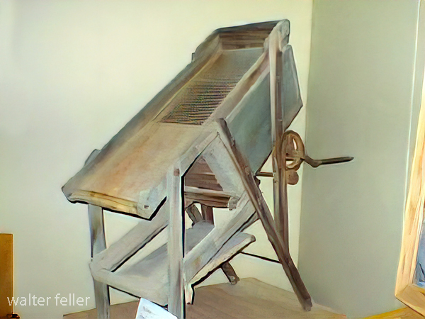
A drywasher for gold is a piece of equipment used in gold prospecting and mining. It is a device that uses air to separate gold particles from other materials, such as sand and gravel, without water. Here’s how it typically works:
Dry Material Feed: A drywasher is loaded with dry material from a gold-bearing area, such as soil or gravel, that may contain gold flakes or nuggets.
Vibrations: The dry washer has a vibrating mechanism that shakes the material, allowing the gold particles to settle downward due to their higher density.
Air Blower: An air blower blows air through the material. The airflow helps to separate the lighter materials (like sand and gravel) from the heavier gold particles. Gold is denser than most other materials in the mixture, so it settles at the bottom.
Collection Tray: At the bottom of the drywasher is a tray or riffles where the separated gold collects. Miners can then carefully remove the gold from this tray.
Repeat Process: The process is repeated until no more gold is collected, indicating that the gold-bearing material has been processed.
Drywashers are particularly useful in arid regions where water is scarce or where regulations restrict water use for mining activities. They are portable and relatively easy for small-scale prospecting and mining operations.
It’s important to note that using a drywasher for gold requires understanding gold prospecting techniques and knowing where to find gold-bearing material. Additionally, following local laws and regulations related to gold prospecting and mining activities is essential.
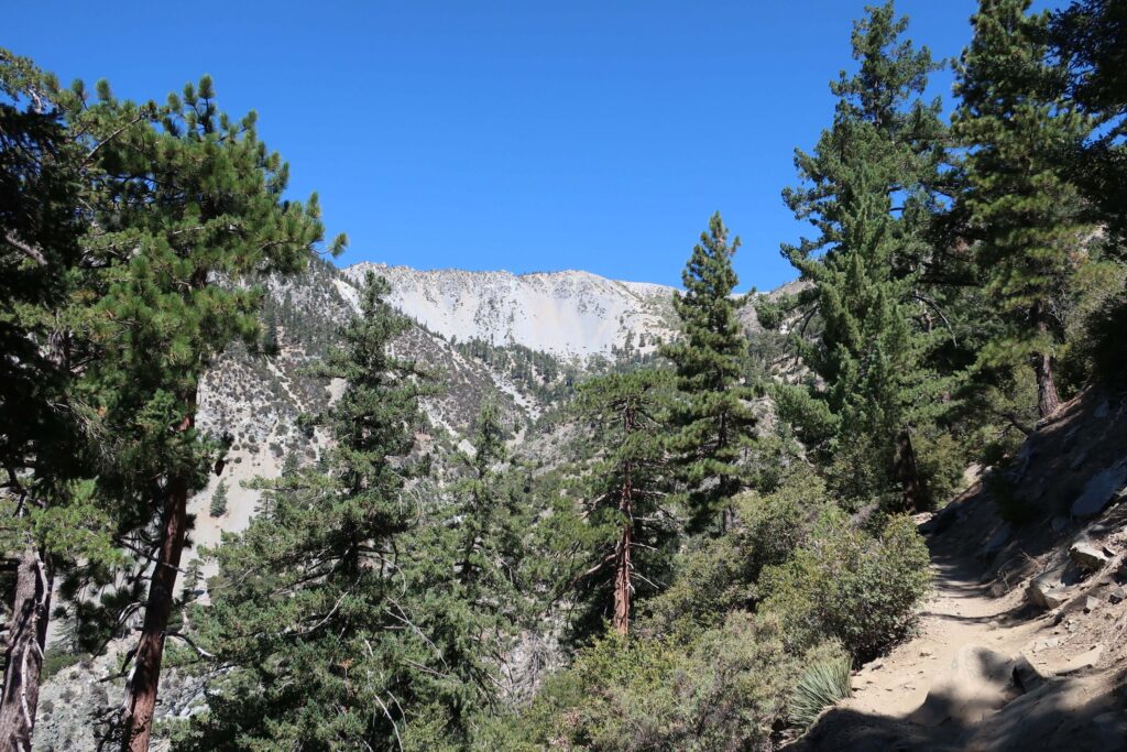
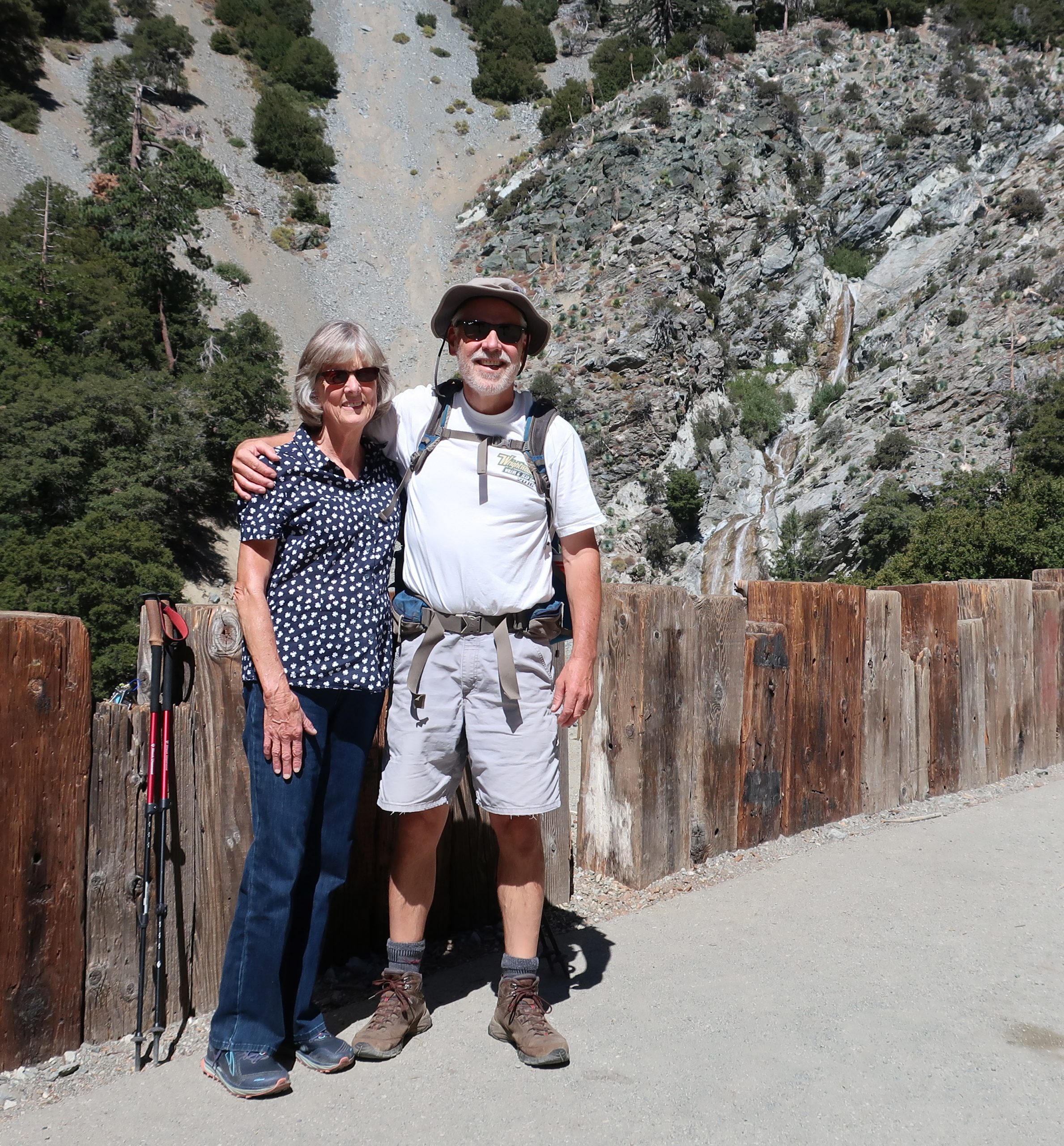
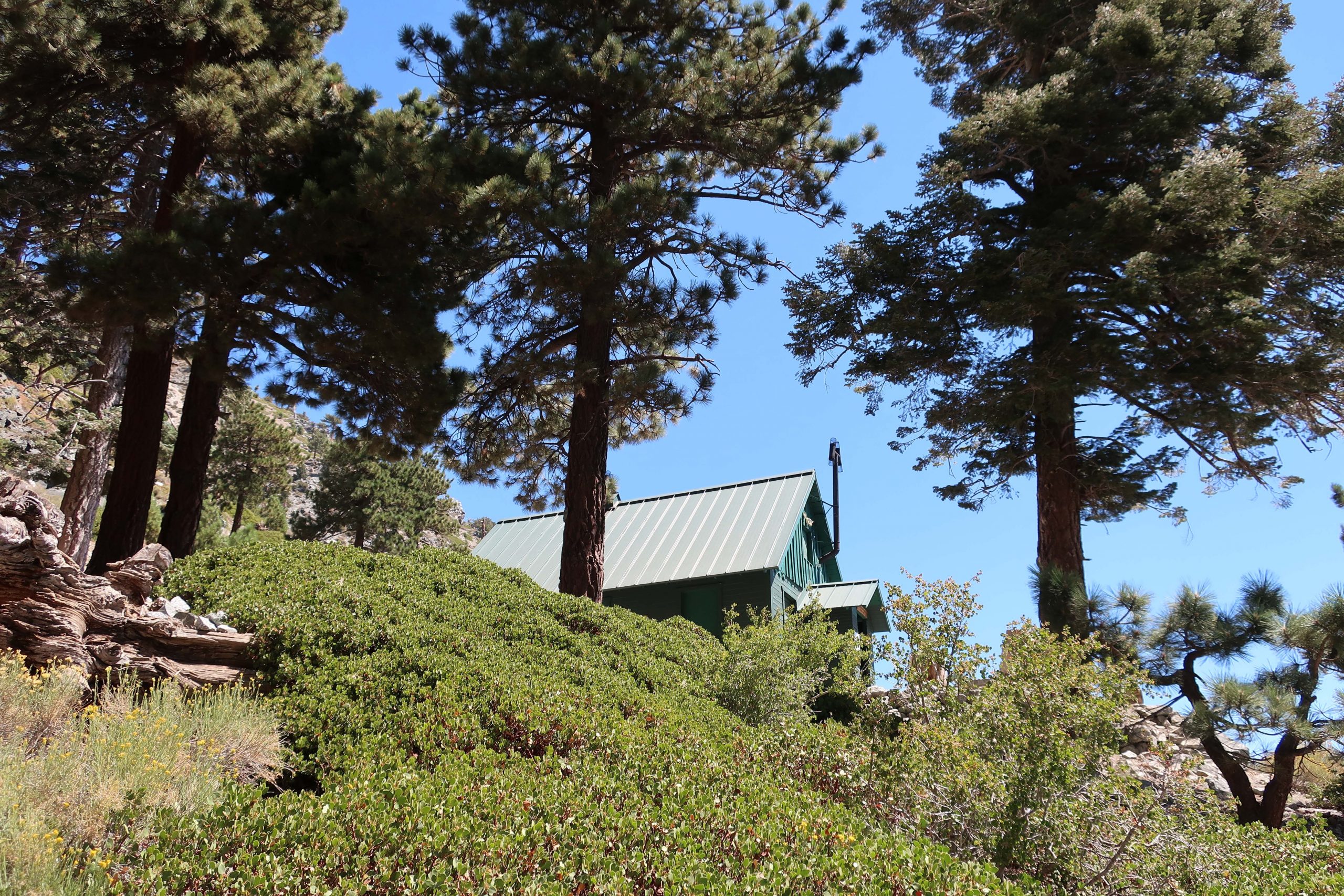
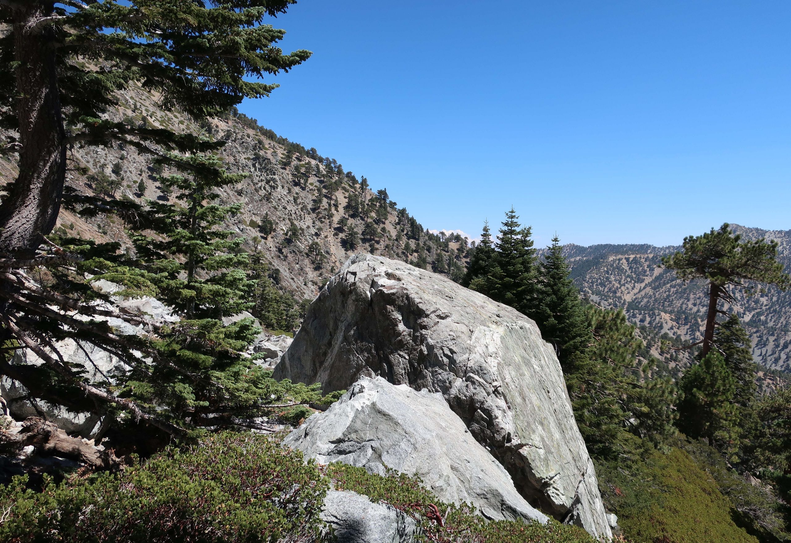
The Acorn Canyon Trail is a popular hiking trail in Wrightwood, California. It is part of the San Gabriel Mountains and offers a beautiful natural setting for outdoor enthusiasts. The trail is known for its scenic views.
View from the Acorn Trail
Trail conditions, accessibility, and regulations may change over time, so it’s a good idea to check with local authorities or websites dedicated to hiking in the area for the most up-to-date information before planning your visit. Additionally, be prepared with appropriate hiking gear and follow Leave No Trace principles to protect the environment while enjoying the trail.
Acorn Canyon is indeed a part of the Angeles National Forest in California. It’s a beautiful area for hiking and enjoying the outdoors. As with any outdoor activity, it’s important to be prepared and follow safety guidelines when exploring this area.
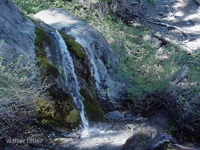
Acorn Falls
Here are some general tips:
Trail Information: Ensure you have up-to-date information about the Acorn Canyon Trail, including its length, difficulty level, and recent trail conditions or closures. This information is often found on the Angeles National Forest website or from local ranger stations.
Hiking Gear: Wear appropriate clothing and footwear for hiking. Don’t forget essentials like a hat, sunscreen, sunglasses, and plenty of water. Depending on the season, you may also want to carry insect repellent.
Trail Etiquette: Practice Leave No Trace principles by staying on designated trails, disposing of trash properly, and respecting wildlife. It’s also a good idea to yield the trail to others and be courteous to fellow hikers.
Safety: Let someone know your plans, including your expected return time. Carry a map and a fully charged cell phone, but be aware that cell phone reception may be limited in some parts of the forest.
Wildlife: Be aware of the potential for encounters with wildlife, including snakes. Stay on the lookout and keep a safe distance.
Weather: Check the weather forecast for the area before heading out. Weather conditions can change rapidly in mountainous areas, so be prepared for sudden temperature drops or rain.
Permits and Regulations: Depending on the specific trail and activities you plan to do, you may need permits or have to follow certain regulations. Check with the forest service or relevant authorities for necessary permits or rules.
Emergency Contacts: Have the contact information for local emergency services or the nearest ranger station in emergencies.
Safety should be a priority when enjoying the outdoors, especially in wilderness areas like the Angeles National Forest. Enjoy your hike in Acorn Canyon and take in the area’s natural beauty while staying safe and respecting the environment.
U.S. Highway 395, often simply referred to as Highway 395, is a north-south highway that runs through the western part of the country. It spans approximately 1,300 miles (2,092 kilometers) from southern California to the border of Washington and Canada.
Part of this highway passes through the Mojave Desert in California. The Mojave Desert is known for its arid landscape, unique geological features, and desert flora and fauna. Highway 395 offers travelers the opportunity to experience the beauty and solitude of the Mojave Desert while providing access to various points of interest along the way.
Here are some key points about U.S. Highway 395:
Route: U.S. 395 starts in Southern California and travels north through California, Nevada, Oregon, and Washington before reaching the Canadian border near Laurier, Washington. It roughly follows the eastern side of the Sierra Nevada mountain range.
Scenic Route: Highway 395 is renowned for its scenic beauty and passes through a diverse range of landscapes, including deserts, mountain ranges, valleys, and forests. It offers breathtaking views of the Sierra Nevada Mountains, Mono Lake, and the Eastern Sierra.
Recreation: The highway provides access to numerous outdoor recreational opportunities, including hiking, skiing, fishing, camping, and boating in the various natural areas it traverses.
Historical Sites: U.S. 395 also passes by several historical sites and attractions, such as the Manzanar National Historic Site (a former Japanese internment camp during World War II), the Eastern California Museum, and various mining and pioneer heritage sites.
Some notable places and attractions along U.S. Highway 395 in the Mojave Desert region include:
Red Rock Canyon State Park: Located near Ridgecrest, this park features stunning red rock formations and hiking trails.
Alabama Hills: Famous for its distinctive rock formations and used as a filming location for many Western movies.
Manzanar National Historic Site: This site was once a Japanese internment camp during World War II and now serves as a reminder of this important period in American history.
Death Valley National Park: While not directly on Highway 395, it’s a short drive to this famous national park known for its extreme heat, Badwater Basin, and unique desert landscapes.
Lone Pine: A charming town with access to the Eastern Sierra, Mount Whitney, and the Eastern Sierra Visitor Center.
Bishop: A larger town along the highway known for outdoor recreation, including fishing, hiking, and rock climbing.
Mono Lakeis a unique and ancient saline lake near Lee Vining with striking tufa towers.
Travelers along U.S. Highway 395 can experience the stark beauty of the Mojave Desert, explore its geological wonders, and access various outdoor recreational opportunities. It’s a popular route for road trips and exploration of California’s eastern Sierra region.
Overall, U.S. Highway 395 is a significant transportation corridor in the western United States, known for its stunning scenery, recreational opportunities, and historical significance. It offers travelers a chance to explore diverse landscapes and experience the beauty of the American West.
Goldfield, Nevada, is a small town in Esmeralda County, in the southwestern part of the state. It has a rich history, primarily centered around its boom and subsequent decline during the early 20th century.
Here’s a brief overview of the history of Goldfield:
Discovery of Gold: Goldfield’s history began in 1902 when prospector Tom Fisherman and his partner Harry Stimler discovered gold in the area. This discovery led to a rush of prospectors and miners to the region, hoping to strike it rich.
Boomtown: The town of Goldfield quickly grew as miners and entrepreneurs flocked to the area. By 1903, it had become a booming mining town with a rapidly growing population. Goldfield was known for its numerous mines, including the famous Combination Mine.
Infrastructure Development: During its peak, Goldfield saw significant development. The town had hotels, saloons, theaters, banks, and even an opera house. The Goldfield Hotel, constructed in 1907, was one of the most luxurious hotels in the state at the time.
Mining Industry: The mining industry was the lifeblood of Goldfield. The town produced significant gold, silver, copper, and other minerals. It became one of the largest gold-producing towns in Nevada.
Labor Strikes: Goldfield experienced labor strikes and tensions in the early 1900s as miners demanded better working conditions and wages. The labor disputes occasionally turned violent.
Decline: Despite its initial success, Goldfield’s fortunes began to decline in the late 1910s. The ore veins started to run out, and the town’s population dwindled. The decline accelerated during the Great Depression.
Modern Era: Today, Goldfield is a small, historic town with a much smaller population than its heyday. It is known for its preserved historic buildings, including the Goldfield Hotel, which is rumored to be haunted.
Tourism: In recent years, Goldfield has seen a revival of interest in its history and has attracted tourists interested in the town’s gold rush past.
Goldfield’s history is a classic example of the rise and fall of a mining boomtown in the American West. While it may not have the same prosperity it once enjoyed, its history and architecture continue to captivate those interested in the Old West and the mining industry.
Gold and silver ore milling and processing in the Mojave Desert refers to the historical practice of extracting and refining precious metals from ore deposits found in the Mojave Desert region of the southwestern United States, primarily during the late 19th and early 20th centuries.
Keeler smelter
This process involved several steps:
Mining: The first step was to locate and extract gold and silver ore from underground mines or open-pit operations in the desert. Miners would use various techniques to break up the rock and access the valuable minerals.
Crushing and Grinding: Once the ore was extracted, it was typically in large rocks or chunks. Miners would use crushers and mills to crush and grind the ore into smaller particles, making it easier to extract the precious metals.
Chemical Processing: After crushing and grinding, the ore was treated with chemicals, typically cyanide for gold and other reagents for silver, to separate the precious metals from the rest of the ore.
Smelting: In some cases, the ore was further processed through smelting. Smelting involves heating the ore to high temperatures to separate the metal from impurities. This step was often used for silver processing.
Refining: The final step was refining the extracted gold and silver to increase their purity. Various techniques were used to achieve this, including electrolysis and chemical processes.
Tailings: The waste material left after extracting and processing gold and silver ore, known as tailings, was often deposited in tailings piles or ponds near the processing facilities. These tailings could contain residual metals and chemicals, posing environmental concerns.
Historically, many towns and mining camps in the Mojave Desert were established to support these mining and processing operations. Some of these ghost towns remain reminders of the region’s mining history.
It’s important to note that the methods and environmental regulations for mining and ore processing have evolved significantly since the heyday of mining in the Mojave Desert. Modern mining and processing operations are subject to strict environmental regulations to mitigate the impact on the desert ecosystem and surrounding communities.
The Mojave Desert is known for its rich history of mining and the presence of ghost towns and abandoned mines. Here are some notable ghost towns, sites, and gold and silver mines in the Mojave Desert:
Calico Ghost Town: Located near Barstow, California, Calico is one of the most famous ghost towns in the Mojave Desert. It was a thriving silver mining town in the late 1800s but became abandoned when the silver market declined. Today, it’s a well-preserved tourist attraction.
Rhyolite, Nevada: Rhyolite was once a booming gold mining town in the early 1900s. It had over 5,000 people but was quickly abandoned when the mines played out. You can visit the remains of the town and see the famous “Bottle House” made of glass bottles.
Goldfield, Nevada: Goldfield was another prosperous gold mining town in Nevada. It had a peak population of around 20,000 people in the early 1900s. The Goldfield Hotel and several historic buildings still stand today.
Panamint City, California: This remote ghost town in Death Valley National Park was a silver mining town in the late 1800s. It’s accessible via a challenging hike and offers stunning views of the surrounding desert.
Cerro Gordo, California: Cerro Gordo is an old silver mining town still privately owned. It’s located in the Inyo Mountains and has a well-preserved ghost town, including a general store, bunkhouse, and other structures.
Mines in the Mojave Desert: The Mojave Desert is home to numerous gold and silver mines, many of which are abandoned. These mines contributed to the region’s mining history. Some notable mines include the Tonopah-Belmont Mine, the Desert Queen Mine, and the Goldstone Mine.
Remember that exploring abandoned mines can be dangerous due to unstable structures and the presence of toxic gases. It’s essential to exercise caution and, if needed, seek permission or guidance from local authorities or landowners when visiting these sites. Additionally, some ghost towns and mines may be on private property, so be respectful of any access restrictions.
The Old Spanish Trail had become increasingly used as a pack mule trail between New Mexico and California, and with this traffic came the opportunity for those to take advantage of the distance and desperate nature of the land.
Hundreds and sometimes even thousands of stolen horses from the ranchos would burst through Coyote Canyon beginning their ‘journey of death’ across the Mojave.
California horses were beautiful creatures, and the mules were taller and stronger than those in New Mexico and they were easy to steal. The rolling hills and plains presented clear paths to the Cajon where numerous hidden canyons and washes were available to slip into and prepare for the furious run across the desert. Horses would be stolen in herds from many different ranchos at once. Hundreds of horses, even thousands could be commandeered and driven by just a few experienced thieves.
Narrows, Crowder Cyn., Cajon Pass
Chief Walkara, ‘Hawk of the Mountains’ and the greatest horse thief in all of history along with his band of renegade Chaguanosos , and notables such as Jim Beckwourth and Pegleg Smith would work together in this illegal trade. During one raid they were said to have coordinated the theft of 3,000-5,000 horses, driving them to Fort Bridger to trade for more horses to run to New Mexico to trade again. Horses would fall from exhaustion every mile and the local bands of Paiute would feast on the remains.
The rich ranchos of southern California.
In 1843 Michael White was granted one league of land at the mouth of the Cajon Pass called Rancho Muscupiabe. At a point overlooking the trails leading into and away from the canyon he was expected to thwart the raiders and horse thieves that were plaguing the Southern California ranchos. In theory it was a good plan but in practice it did not work so well.
From the piedmont between Devil and Cable canyons, Miguel Blanco could keep an eye out for the horse thieves entering the Cajon.
He built his home of logs and earth and constructed corrals for his stock. However, the location between Cable and Devil Canyon only served as a closer and more convenient target for the Indian thieves. His family was with him, but after six weeks until it became too dangerous. He left after nine months without any livestock and in debt.
The Old Spanish Trail went down this slope to behind Miguel Blanco’s rough-hewn homestead. Indians would watch from this forest for Miguel to leave and they would slip down and steal everything that could be stolen.
Miguel sold his property, however, Miguel had misread the grant, letting the rancho go for much less than it was worth. The land described on the grant was roughly 5 times larger than Miguel thought. Blanco brought a suit but lost.
Muscupiabe Rancho
As the late 1840s and 1850s rolled by wagon roads were being developed in the canyon minimizing the effectiveness of the maze of box canyons being used to cover the escape of desperadoes on horseback. With California becoming a state frontiersmen such as Beckwourth and Peg Leg Smith would not steal from fellow Americans. Horse-thieving under U.S. law had become a crime where before it was just stealing horses from Mexicans. That was only serious if caught in the act. Americans would never extradite them. For the most part, that was the end of the horse stealing raids.
Mount Baldy as seen from the Baldy Bowl Trail. It’s a steep climb to the “Bowl”, let alone the summit. However, the alpine scenery and bright blue skies make it entirely worth it.
Hike Mount Baldy to Wrightwood via the North Backbone Trail. This trip takes you from south to north, traversing the San Gabriel mountains eastern high country. The terrain is high and dry, passing amongst wind bent pines, colorful outcroppings of rock, and views in all directions while taking you through stunning alpine scenery.
Total Distance = Approx. 12 miles one way
Initial Elevation Gain = 3,900′ the first 4 miles to Mt Baldy. Once on the North Backbone trail, which’ll take off northward at the 10,064′ summit, there is an initial 1,300′ of steep descent down to the first saddle. Next there’s 900′ of climb to Dawson Peak followed by 400′ of drop to the next saddle. Finally there’s a brief climb of 450′ to the gentle summit of Pine Mountain. Now and finally, there’s a good 1,400′ drop down to the last little saddle before climbing up a couple hundred yards to the end of the North Backbone trail. In another 1 1/2 miles of level trail walking you’ll reach the upper end of the Acorn Trail where there will be 1,600′ of drop into Wrightwood. Over the length of this hike your total Gain will be 5,250′ and the total DROP will be 4,700′.
Map to take: Tom Harrison’s “ANGELES High Country” map, 2018. Nothing against map apps, I just happen to really like having a physical map as well as bringing an orienteering compass, too.
Joanie and Chris just a short distance up San Antonio Canyon from Manker Flat Campground. That’s San Antonio Falls just off to the right of my shoulder.
This last Monday, my wife and I drove around to San Antonio Canyon above Upland, from our home in Wrightwood. I’d been thinking about hiking up Mt. Baldy from the U.S. Forest Service Manker Flat campground and had been kicking this idea around for about a week. As some days went by, got to thinking that it’d be really nice to just keep on hiking from Baldy’s summit to Wrightwood via the North Backbone trail. Easy, speasy.
All of this area, including the North Backbone trail, I had hiked years earlier, meaning in some cases, some decades ago… It all seemed so easy in my head and being that it was only going to be a day hike, there wouldn’t be a heavy pack to lug up and down the ridge tops. That’s it, a cinch! I’m now pushing 59 years and still hiking, yet there’s no denying that the hikes take a wee bit longer and the recovery the day after is longer . Yeah. Well, as things turned out, we got started a bit later than planned, meaning like almost 11:00 a.m. Nonetheless, it ended up being a great day to hike! My wife was going to drop me off at the Manker Flat trailhead and we’d meet up later in Wrightwood.
The Sierra Club’s “Ski Hut” was built back in the 1930’s. After a couple of really steep miles, the Baldy Bowl Trail passes just beneath this beautifully maintained cabin.
I’d wanted to show Joanie San Antonio Falls, which she’d never seen before, and peer down at some of the little cabins hidden along the little creek. This meant walking the gated fire road, which is unfortunately paved, up to its’ first switchback at the base of the falls. It can be sort of hot and exposed, like it was the day we went. Still it was worth seeing the Falls. We said our goodbyes out under the bright blue sky and off I climbed up the fire road which had now become dirt. It’d be some ten hours before we’d meet up, again, on the other side of the range in Wrightwood.
View looking toward Baldy Notch from Mt. Baldy Bowl. This photo was taken just minutes after passing by the Sierra Club Ski Hut.
The turn off for the Baldy Bowl trail came up quickly on my left. That’s where the work began. Two things that came to mind and became readily apparent in no time at all was: 1. How much steeper the trail was than I had remembered it and 2. Just how big Mt. Baldy really is, no matter which way you go up it. It’s really a tall, broad mountain, especially by Southern California standards. Throughout the climb, despite the frequent standing up rests to slow the heart down and catch my breath, it was absolutely beautiful looking out over rugged San Antonio canyon. The trail climbs quickly up through oaks, mountain mahogany, manzanita and of course, shading pines and white fir. Just before reaching the Baldy Bowl, named by early x-country skiers in the early 20th century, you pass under the Sierra Club’s ski hut. Available to overnight stays by reservation only, this place is meticulously maintained and obviously loved by the membership. No one was there that day and I just kept hiking along, grateful for the icy cold stream that lay just moments ahead. There are strips of meadow flowers hugging the stream banks both below and above the trail. Flowers and willows crowded together along the tumbling, silver thread of water. The section where the trail crosses through the bowl is a complex of boulders, many the size of small cabins. It’s slow going and requires taking your time to read the trail, watching for clues as to where to meander next. Constantly, there was this sense that I was in the Sierras, and yet, somehow this San Gabriel mountains scenery felt, looked and even had that scent of Sierra rock and pine. All too soon, the trail leaves the Bowl and begins to switchback up through Jeffrey and Ponderosa pines. Soon the lodgepole pines began to make their presence and so did someone else.
A solitary Big Horn sheep on the west side of the Baldy Bowl. This is a female or commonly known as a ewe. Often elusive, these creatures are able to easily scale the steepest and loosest of high country slopes.
It had been years since seeing a bighorn sheep. Like always, it was never my eyes that would detect these elusive creatures. The sound of a few pebbles breaking loose from the hillside caught my attention and there she was! A few minutes later, another ewe peered at me from behind a fallen tree. She and her lamb were grazing on about a 45 degree slope on the edge of the Bowl. A double gift for sure. Occasionally I’d stop at the end of a switchback and take in the changing view of the ridge line (Devil’s Backbone) coming in from Baldy Notch. By now I’d reached the broad ridge top defining the west side of Baldy Bowl, the immense scale of the smooth talus slope dropping steeply off the south side of the summit had become apparent. The trees, pretty much all lodgepole, were twisted and sculpted by the centuries of storms blowing in off the Pacific.
One of the trail signs at the summit of Mt. Baldy. There’s no lack of directional signage here, a good thing.
One thing that really caught my eye along the whole route were the really well made and maintained trail signs. Not only are there good directional signs along the way, there are even square steel posts with reflective tape on them, often giving you a good sense of where the trail would be should it be dark or there be a mantle of snow on the ground. This trail has really been well thought out. Another detail that became subtly apparent after some time was the lack of litter. My route was especially pristine and free of trash. There’s definitely a sense of stewardship going on up here. I hadn’t brought a watch, so never did determine just when I summited. That was purposeful and there was this wonderful relief at not having to know. Probably at least several hours had elapsed before making it to the top. There were probably no more than a dozen people sharing the trail up to the top that day. Really peaceful. Found a spot near the summit marker (elev. 10,064′) to sit down on my tired haunches, looking out to the north and down into the Fish Fork.
Here’s the monument marking the summit of one of the most popular peaks in Southern California.
While taking in the view, a fit 30 something man with a solid build and neatly cropped red beard approached, asking if he wasn’t spoiling my solitude. Of course not! Pull up a boulder and sit down. Pretty soon I learned where he’d been, as his IPA cracked open and quickly vanished. Sam had started out at the Heaton Flat trailhead way down in the East Fork before heading up to Iron Mountain, one of the most isolated and difficult peaks to reach. From there, he worked his way across West San Antonio Ridge to the summit of West Mt. Baldy. From here, he’d drop down to Manker Flat and find his hidden mountain bike and take that back to his car by pedaling over the Glendora Mountain Ridge Road! That’s the caliber of company you can sometimes run into on higher peaks… Soon I was off and heading down the North Backbone Trail toward Blue Ridge and Wrightwood beyond. Gotta tell you, taking trekking poles was one of my best moves of the day. The descent was extremely steep down to the first saddle north of Mt. Baldy. Spots where I definitely would have slipped just from fatigue, were pretty easily walked down with the aid of the poles. This is a trip where you’d be glad to have a set of them.
Here’s the view looking toward the North Backbone trail from Mt. Baldy’s summit. That’s Dawson Peak straight ahead, just off to the right of the steel sign. Pine Mountain is further out, on the left of photo. Hiking this ridge is the key to traversing the San Gabriels to Wrightwood.
The climb up to Dawson Peak went well. There’s lots of rabbitbrush along the way. The trail weaved in and out of the thick yellow blossoms, giving the late afternoon light a feeling of autumn. Mountain mahogany and twisted rock outcroppings kept things interesting as well. There was a great view down toward the Cajon Pass with commuters making their sluggish drive back toward the desert. A freight train could be seen climbing the serpentine railroad tracks as well, tiny in comparison to the arid landscape. All this activity was silent, visible, yes, yet no sound whatsoever. To my left, grand scenes of the Fish Fork and Mount Baden Powell, continued to dominate my senses. A refreshing and constant breeze out of the west kept me cooled down. Once on top of Dawson (elev. 9,575′), I signed the summit register and continued on down a gentle descent through sun – polished plates of schist. Talus, I suppose. Beautiful stuff that sounded like ceramic dinner plates clunking together under my boots at times. There were even these beautiful, hidden, forested and shaded flats just below the trail at times, spots that would make for a perfect campsite. Untouched. Just before reaching the saddle between Dawson and Pine Mountain, I saw the old and seemingly untrammeled Fish Fork Trail coming in from my left.
Trail junction for the seldom trod Dawson Peak Trail in the upper Fish Fork. This is the upper end of what appears on Tom Harrison’s Angeles High Country map as being the 4 1/2 mile route down to Fish Fork Campsite, probably one of the most remote places in the San Gabriels. The elevation at this spot is 9,200′.
There’s even an old graying wooden sign indicating the way down. I’ve always wanted to follow this trail which drops down to Fish Fork trail camp, probably one of the most isolated haunts in our range. That old feeling came back somewhat suddenly, mixed with wonder at how good things still are in the backcountry here. Pristine. And since it’s hard to get to, at least for me, nothing’s trashed. A constant truth throughout the ages. Thank God. Amen.
A section of the North Backbone trail, looking back toward Dawson Peak. The ridge line on the horizon, seen off to the right is part of the Mount Harwood / Mt. Baldy massif. This picturesque “flag” tree in the foreground is one of many found along these high country slopes and ridge tops, sculpted over the centuries from the high winds blowing in from Pacific winter storms.
Soon I was climbing yet, again. This time it was up to Pine Mountain (9,648′). Weaving amongst more pines and mountain mahogany, the sun continued to drop further and further down across the mountains, casting longer and longer shadows in the gentle wind. Up on top, the summit register of nested red cans was easily found in a cairn of rocks. The desire to linger here awhile longer was resisted by the nagging feeling to at least get to Blue Ridge and the Pacific Crest Trail (PCT) before it got dark. So, reluctantly, off I dragged my now tired self down a gentle slope amongst a thick forest of lodgepole pine. The deepening pools of shade penetrated the forest in a way that reminded me of being a little boy, maybe six or seven, running through the giant sequoias where our family used to camp every summer in a tent cabin. I missed people that I hadn’t thought about in awhile. They all came back for a bit and I reveled in this.
As the sun sunk lower and lower in the west, I made my way along the top of the ridge to the north of Pine Mountain, dropping toward Blue Ridge which is visible to the right.
After a short while, the ridge top timber all but left, becoming a sharp edged knife of rock, bathed in orange golden sunlight. Take your time here, Chris, something kept gently telling me. I was tired and starting to get sloppy, not quite so nimble as hours earlier. Eventually the ridge got easier and right before sun had set below the horizon, a beam of that gold light struck some dangling cones hanging from an ancient sugar pine. This hike kept getting more and more gorgeous, nostalgic in a way. In the graying light, I made a last little climb up to the dirt road (East Blue Ridge recreation road) to the northern terminus of the North Backbone Trail.
The gold light of early evening illuminates several sugar pine cones along the North Backbone trail. That’s the Mojave Desert in the background, while distant ranges still bask in the sunset.
I scurried up the slope behind the road, following a scratch trail that led to the PCT. Turning left (west) and continuing at a pretty fast clip, I arrived at a spot just to the west of the large slide above Wrightwood. The lights of homes were now twinkling in the early evening darkness. Time to get the flashlight out. I continued on in the dark, amongst and under the tall white fir and pines. Still no one around. Perfect. Here and there you could make out the silhouette of Pine Mountain to the south. A short time later was the turn-off for the Acorn Trail, which would descend about 1,600′ feet down into upper Wrightwood. Up here, it was possible to reach Joanie by radio, and yes, you guessed it…. Without a bit of shame, I took the ride back to our home in the little red Honda while Joanie told me about her day. Why the hell not? Who wants to walk on pavement I say to myself. That ride was heaven on earth. And so there you have it, it’s possible to walk across the highest point in the San Gabriels in a day! The next day my thighs felt entirely spent while walking on the little stone paths around our yard. And yet, looking back on it all, such as all good hikes, it was definitely worth it.
Mid-winter through spring is a good time to hike up to Mt. Wilson. Even as Chantry Flat in the Big Santa Anita Canyon continues to heal from the Bobcat Fire of 2020, don’t feel like there’s no good way up to Mt. Wilson. If you’ve never done it, hiking up the Old Mount Wilson Trail from the scenic Sierra Madre is not a bad way. The canyon you’ll travel through on your way up toward Manzanita Ridge is known as the Little Santa Anita Canyon. This is the original way up to “Wilson’s Peak,” named after Don Benito Wilson. The trail dates back to the 1860s.
A view of Mt. Baldy from Manzanita Ridge.
Manzanita Ridge, sections of it quite true to its’ name, makes up the watershed divide between Winter Creek (to the north) and Little Santa Anita Canyon on the south. Following the ridge line up toward the Old Mount Wilson Toll Road views out into the High Country of the San Gabriels abound. Once up on the Toll Road, you’ll continue to walk along refrigerator-sized boulders that have dropped off the near vertical slopes of Mt. Harvard.
Once you reach Martin’s Saddle, the site of a once popular trail resort of the late 19th Century, views out toward the west are to be had. You’re now contouring the slopes of Upper Eaton Canyon, a beautifully rugged wilderness in its own right. Looking out across the steep and deep tributary canyons, there is, from left to right, Mt. Lowe, Mt. Markham (flat-topped), and San Gabriel Peak. When the air is clear, this scene is spectacular.
Boulders accumulate on the Mt. Wilson Toll Road after winter storms.A view across Upper Eaton Canyon
Once up at the top, I found a picnic bench in the open-air pavilion and soaked in the sunlight for some time before heading back down. The Pacific reflected back at me like an amber platter just to the north of the Palos Verdes peninsula. What a beautiful place to be hiking. What a beautiful place to be alive.
Mt. Baldy and Dawson Peak are seen from the PCT. This view looks across upper Lytle Creek and some miles below East Blue Ridge.
Vincent Gap trailhead is once again open to vehicles coming in through Wrightwood. Highway 2 continues to be gated to any driving west of the trailhead. If you’re looking to hike up to Mt. Baden Powell or drop down into the East Fork, all this is possible now and through the summer and autumn months.
Looking out across the East Fork of the San Gabriel River to Pine Mountain, Dawson Peak, and Mt. Baldy. This view is from a spur ridge just below the summit of Mt. Baden-Powell. A native Columbine graces the East Fork just downstream from Mine Gulch Campsite.
In the summer of 1845, Benjamin D Wilson, who owned part of the interest in the Jurupa Rancho, the site of the present city of Riverside, led a troop of Calvary in search of cattle rustlers.
Setting out from San Bernardino Valley, he divided his command. Most of the men he sent throughCajon Pass, keeping only 22 Mexican troopers with him to follow a trail across the mountains. Two days later, Wilson and his men reached the lake, where they sighted scores of grizzly bears.
Most of the soldiers had been vaqueros. They formed in pairs and drew reatas, each pair attacking a bear. One looped a rope around the bear’s neck; his companion roped the same bear by a hind foot. Then, the men drew apart to stretch the rope taut and hold the bear a prisoner. They bagged and skinned eleven bears, stretched their hides, and continued across the mountains to join the rest of the command in the desert at Rancho Las Flores on the Mojave River.
Here, the reunited party engaged Indians in a fight, after which Wilson and his 22 vaquero-troopers returned home by the way of the lake. They again found the place overrun with bears, and the same 22 soldiers brought in eleven more bears– enough to give them a bear rug apiece as a trophy. Then, Wilson named Bear Lake to the little body of water.
Years later, the name was changed to Baldwin Lake. The name survives, however, in Big Bear Lake, which was created at the site of the Talmadge Ranch in 1884 when a dam was built to provide a constant water supply for the Redlands District.
– adapted from ~ Pioneer Tales of San Bernardino County – WPA – 1940.
The California grizzly bear (Ursus arctos californicus) is a subspecies of the brown bear that once inhabited various regions of California. Historically, grizzly bears were found throughout the state, from the coast to the mountains and valleys. They were an important part of California’s wildlife and played a role in the culture and folklore of indigenous peoples.
California grizzly bear (Ursus arctos californicus)
Unfortunately, due to habitat loss, hunting, and human conflicts, the California grizzly bear population declined significantly throughout the 19th century. The last known California grizzly bear in the wild was killed in 1922 in Tulare County. The species was declared extinct in 1924.
Efforts have been made to preserve the memory of the California grizzly bear, and it is often symbolically represented in the state’s flag and seal. The California grizzly bear is also the state animal, even though it no longer exists in the wild.
1846 – 1910
1911 – 1952
Today
There have been occasional discussions and proposals for reintroducing grizzly bears to certain parts of California, but these efforts are complex and face challenges related to habitat, human-wildlife conflicts, and public opinion. As of my last knowledge update in January 2022, there were no active reintroduction programs in place. Still, it’s advisable to check for the latest information, as conservation efforts and plans may evolve.
Benjamin Wilson leads a posse of 22 men into the San Bernardino Mountains to search for Indians who had been raiding ranches in . He discovers Big Bear Valley and gives it the name it has today. Up until 1845, Bear Valley was known to the local Serrano Indians as Yahaviat, which means “Pine Place”. – bb