Gentrification is a complex and multifaceted process that typically involves the transformation of a neighborhood or community due to an influx of wealthier residents and increased property development. While gentrification is commonly associated with urban areas, how it might manifest in desert regions is worth considering.
In the context of desert areas like the Mojave Desert, some factors may contribute to changes in local communities:
Tourism Development: Deserts are often attractive to tourists seeking unique landscapes and experiences. Developing tourist infrastructure, such as upscale resorts, could change the local economy and demographics.
Environmental Conservation and Luxury Living: Some desert areas may become appealing to those seeking a more secluded or environmentally conscious lifestyle. This could lead to the development of upscale residences, potentially displacing existing communities.
Renewable Energy Projects: The Mojave Desert, particularly, has seen increased interest in renewable energy projects like solar farms. This can bring economic development but may also change the local population dynamics.
Artistic and Cultural Appeal: Artists and individuals attracted to the tranquility and unique landscapes of the desert may contribute to gentrification by establishing art communities or cultural hubs.
It’s crucial to note that the impact of gentrification can vary based on the specific characteristics of each desert region and the policies in place to address community concerns. Local governments and community organizations play a crucial role in shaping development patterns and mitigating the potential negative effects of gentrification, such as displacement of long-term residents and cultural erosion.
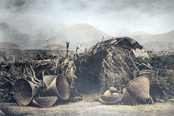
Mono Paiute wickiup – Edward Curtis 1900 (colorized)
A “wikiup” in the context of Native American culture typically refers to a traditional type of shelter or dwelling. It is a simple, dome-shaped structure constructed using a framework of branches or saplings. The frame is often covered with various materials, such as brush, reeds, grass, or sometimes animal hides. Various indigenous peoples in North America commonly used these shelters.
The design of wikiups varied among different tribes, reflecting the local environment and available resources. They were relatively easy to construct and could be adapted to different climates. Nomadic or semi-nomadic groups often used Wikiups as temporary or seasonal shelters.
It’s important to note that the term “wikiup” might be spelled or pronounced differently in various indigenous languages, and the specific features of these shelters could vary based on cultural and regional differences.
The most famous lost mine in the Death Valley area is the Lost Breyfogle. There are many versions of the legend, but all agree that somewhere in the bowels of those rugged mountains is a colossal mass of gold, which Jacob Breyfogle found and lost.
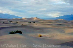
Mesquite Flats Sand Dunes – Death Valley
Jacob Breyfogle was a prospector who roamed the country around Pioche and Austin, Nevada, with infrequent excursions into theDeath Valleyarea. He traveled alone.
Indian George, Hungry Bill, and Panamint Tom saw Breyfogle several times in the country around Stovepipe Wells, but they could never trace him to his claim. When followed, George said, Breyfogle would step off the trail and completely disappear. Once George told me about trailing him into the Funeral Range. He pointed to the bare mountain. “Him there, me see. Pretty quick—” He paused, puckered his lips. “Whoop—no see.”
Breyfogle left a crude map of his course. All lost mines must have a map. Conspicuous on this map are the Death Valley Buttes which are landmarks. Because he was seen so much here, it was assumed that his operations were in the low foothills. I have seen a rough copy of this map made from the original in possession of “Wildrose” Frank Kennedy’s squaw, Lizzie.
Breyfogle presumably coming from his mine, was accosted near Stovepipe Wells by Panamint Tom, Hungry Bill, and a young buck related to them, known as Johnny. Hungry Bill, from habit, begged for food. Breyfogle refused, explaining that he had but a morsel and several hard days’ journey before him. On his burro he had a small sack of ore. When Breyfogle left, Hungry Bill said, “Him no good.”
Incited by Hungry Bill and possible loot, the Indians followed Breyfogle for three or four days across the range. Hungry Bill stopped en route, sent the younger Indians ahead. At Stump Springs east ofShoshone, Breyfogle was eating his dinner when the Indians sneaked out of the brush and scalped him, took what they wished of his possessions and left him for dead.
Ash Meadows Charlie, a chief of the Indians in that area confided to Herman Jones that he had witnessed this assault. This happened on the Yundt Ranch, or as it is better known, the Manse Ranch. Yundt and Aaron Winters accidentally came upon Breyfogle unconscious on the ground. The scalp wound was fly-blown. They had a mule team and light wagon and hurried to San Bernardinowith the wounded man. The ore, a chocolate quartz, was thrown into the wagon.
Resting Springs
“I saw some of it at Phi Lee’s home, theResting Spring Ranch,” Shorty Harris said. “It was the richest ore I ever saw. Fifty pounds yielded nearly $6000.”
Breyfogle recovered, but thereafter was regarded as slightly “off.” He returned to Austin, Nevada, and the story followed.
Wildrose (Frank) Kennedy, an experienced mining man obtained a copy of Breyfogle’s map and combed the country around the buttes in an effort to locate the mine. Kennedy had the aid of the Indians and was able to obtain, through his squaw Lizzie, such information as Indians had about the going and coming of the elusive Breyfogle.
“Some believe the ore came from around Daylight Springs,” Shorty said, “but old Lizzie’s map had no mark to indicate Daylight Springs. But it does show the buttes and the only buttes in Death Valley are those above Stovepipe Wells.
“Kennedy interested Henry E. Findley, an old time Colorado sheriff and Clarence Nyman, for years a prospector for Coleman andSmith(thePacific Borax Company). They induced Mat Cullen, a rich Salt Lake mining man, to leave his business and come out. They made three trips into the valley, looking for that gold. It’s there somewhere.”
Francis Marion “Borax” Smith
At Austin, Breyfogle was outfitted several times to relocate the property, but when he reached the lower elevation of the valley, he seemed to suffer some aberration which would end the trip. His last grubstaker was not so considerate. He told Breyfogle that if he didn’t find the mine promptly he’d make a sieve of him and was about to do it when a companion named Atchison intervened and saved his life. Shortly afterward, Breyfogle died from the old wound.
Indian George, repeating a story told him by Panamint Tom, once told me that Tom had traced Breyfogle to the mine and after Breyfogle’s death went back and secured some of the ore. Tom guarded his secret. He covered the opening with stone and leaving, walked backwards, obliterating his tracks with a greasewood brush. Later when Tom returned prepared to get the gold he found that a cloudburst had filled the canyon with boulders, gravel and silt, removing every landmark and Breyfogle’s mine was lost again.
“Some day maybe,” George said, “big rain come and wash um out.”
Among the freighters of the early days was John Delameter who believed the Breyfogle was in the lower Panamint. Delameter operated a 20 mule team freighting service between Daggett and points in both Death Valley and Panamint Valley. He told me that he found Breyfogle down in the road about twenty-eight miles south of Ballarat with a wound in his leg. Breyfogle had come into the Panamint from Pioche, Nevada, and said he had been attacked by Indians, his horses stolen, while working on his claim, which he located merely with a gesture toward the mountains.
Subsequently, Delameter made several vain efforts to locate the property, but like most lost mines, it continues to be lost. But it was good bait for a grubstake for years and served both the convincing liar and the honest prospector.
Nearly all old timers had a version of the Lost Breyfogle differing in details, but all agreed on the chocolate quartz and its richness.
That Breyfogle really lost a valuable mine, there can be little doubt, but since he is authentically traced from the northern end of Death Valley to the southern, and since the chocolate quartz is found in many places of that area, one who cares to look for it must cover a large territory.
“Gold Stone is the name of a new camp, thirty-five miles north of Barstow, where some phenomenal ore has been found. Quite a stampede followed the discovery.
The area is the site of the only commercial opal mine in the California Desert. Waterman. Five years before the famous silver discoveries at Calico, George G.
4 days ago … Post Views: 12. Goldstone, Barstow California, Mojave Desert. digital-desert.com › goldstone-ghost-town. Goldstone Ghost Town. More of a site …
Goldstone – Mojave Desert. Several people were involved in mining during this same time, including John Harper and Goodrich. 289. One of the most active …
Persistent rumors have it that gold … 1859: Bodie, California … by prospector Wakeman S. Bodey, who the town was named after. Bodey died in November making …
States: Primarily in California and Nevada, with smaller portions in Arizona and Utah. Extent: The Mojave Desert is part of the larger North American Desert and …
Some of the dry lake beds are Bicycle, Coyote, East Cronese, West Cronese, Goldstone, Langford Wells, Leach, Manix, Nelson, Pilot Knob Valley, Red Pass, and …
And now, with the operations of the Goldstone tracking station ushering the “space age” into the desert, the future holds promise far beyond the wildest dreams …
A long interaction history between people and the challenging desert environment marks the human (historical) geography of the Mojave Desert. Here are key aspects of the human history and settlement patterns in the Mojave Desert:
The construction of railroads, such as the Southern Pacific Railroad, was crucial in connecting the Mojave Desert to the broader transportation network.
Railroad towns, including Barstow, developed as important transportation hubs.
The historic Route 66, a major U.S. highway, passed through the Mojave Desert during the mid-20th century, bringing increased traffic, commerce, and tourism to the region.
Establishing national parks and preserves, such as Joshua Tree National Park and the Mojave National Preserve, reflects efforts to conserve the desert’s unique ecosystems and landscapes.
Modern Urbanization and Recreation:
Urban areas on the periphery of the Mojave Desert, such as Las Vegas, have experienced rapid growth.
The desert attracts tourists and outdoor enthusiasts interested in hiking, rock climbing, and stargazing.
Understanding the human history of the Mojave Desert involves recognizing the diverse ways different groups have interacted with the desert environment over time, from indigenous peoples adapting to the harsh conditions to the various waves of exploration, settlement, and economic activities that have shaped the region.
The Mojave Desert, situated in the southwestern United States, has a distinctive physical geography shaped by its unique combination of topography, climate, and ecosystems.
Here is an overview of the physical (regional) geography of the Mojave Desert:
Location:
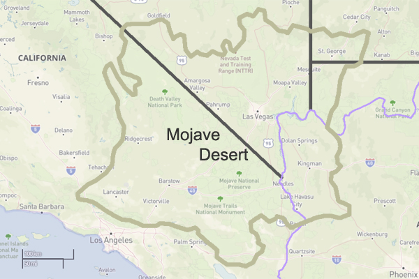
The Mojave Desert spans southeastern California, southern Nevada, southwestern Utah, and northwestern Arizona. It is one of the four major deserts in North America.
Size:
The Mojave Desert covers approximately 47,877 square miles (124,000 square kilometers).
Topography:
The Mojave Desert features a diverse topography with mountain ranges, valleys, and extensive desert plains.
Prominent mountain ranges include the Mojave, Providence, New York, and Clark Mountains.
The Mojave Desert has a cold climate characterized by hot summers and mild winters.
Summer temperatures often exceed 100°F (38°C), while winter temperatures can drop below freezing, especially at higher elevations.
Rainfall is generally low, with most precipitation occurring during the winter months. The desert experiences occasional flash floods during intense rainstorms.
Natural water sources are limited, and the Mojave River is one of the few perennial rivers in the region.
Springs and oasis areas, such as Ash Meadows in Nevada, provide critical water sources for both wildlife and human activities.
Human Impact:
Human activities in the Mojave Desert include mining, military training areas, and recreational activities.
Cities such as Las Vegas, Nevada, and Lancaster, California, are located on the periphery of the Mojave Desert.
Protected Areas:
The Mojave National Preserve, Joshua Tree National Park, and portions of Death Valley National Park are examples of protected areas within the Mojave Desert, preserving its unique ecosystems and landscapes.
Understanding the physical geography of the Mojave Desert involves recognizing its diverse landforms, climate extremes, and the adaptations of both flora and fauna to the arid conditions. Additionally, human activities and efforts to preserve the desert’s unique features contribute to the overall regional geography of the Mojave.
The Mojave Desert is a vast desert in the southwestern United States, primarily in southeastern California, southern Nevada, and parts of Arizona and Utah.
Here are some key geographical features and characteristics of the Mojave Desert:
Location:
States: Primarily in California and Nevada, with smaller portions in Arizona and Utah.
Extent: The Mojave Desert is part of the larger North American Desert and is the smallest of the four major deserts in the United States.
Size:
The Mojave Desert covers approximately 47,877 square miles (124,000 square kilometers).
Topography:
The desert’s topography is varied, featuring flat basins, rugged mountains, and expansive valleys.
Some prominent mountain ranges include the Providence, New York, and Clark Mountains.
Landforms:
Playas: Dry lake beds or playas are scattered throughout the desert.
Mesas and Buttes: Flat-topped plateaus and isolated hills dot the landscape.
Dunes: The Kelso Dunes and Eureka Dunes are extensive dune fields in the Mojave.
Climate:
The Mojave Desert has a typical cold desert climate with hot summers and mild winters.
Summer temperatures can exceed 100°F (38°C), while winter temperatures can drop below freezing, especially at higher elevations.
Rainfall is generally low, and the desert experiences occasional flash floods during intense rainstorms.
Vegetation:
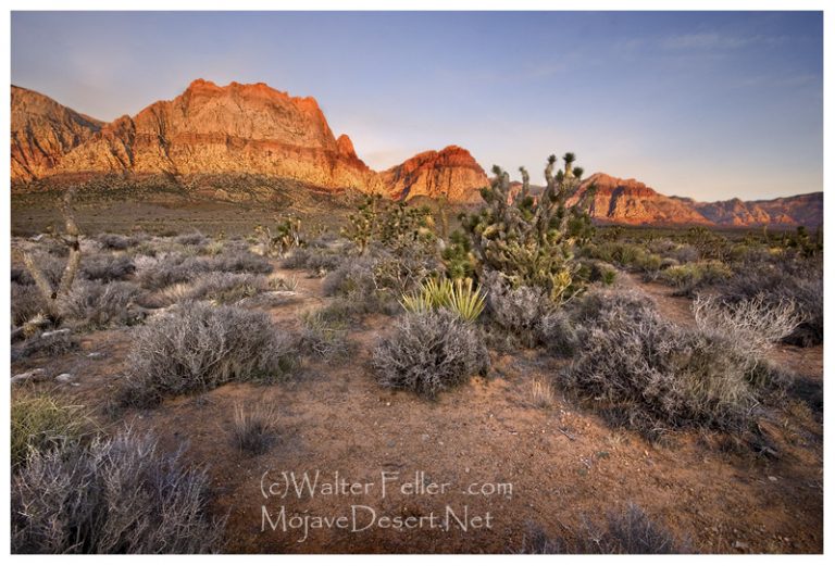
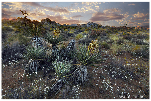
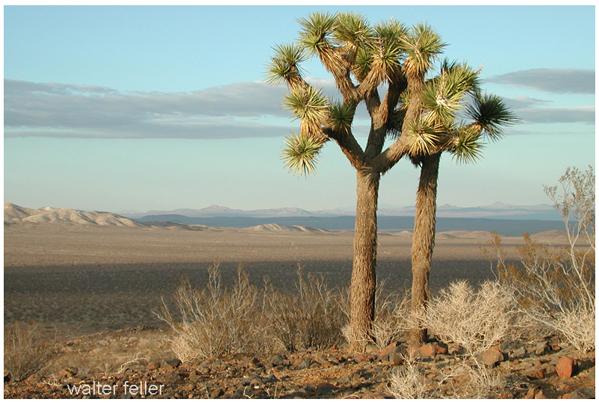
The desert is home to various plant species adapted to arid conditions, including Joshua trees, creosote bushes, yuccas, and cacti.
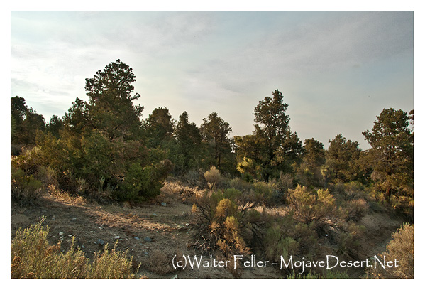
Higher elevations may support juniper and pinyon pine forests.
Understanding the geography of the Mojave Desert involves recognizing its diverse terrain, climate, and the various plant and animal species that have adapted to this challenging environment.
The Mojave Desert, located in the southwestern United States, is a unique and ecologically diverse ecosystem known for its extreme temperatures, arid conditions, and distinct plant and animal life. Various factors, including topography, climate, and human activities, influence the transitions within the Mojave Desert ecosystem.
Here are some key ecological transitions within the Mojave Desert:
Elevation Gradients:
The Mojave Desert exhibits significant elevation gradients, ranging from below sea level in Death Valley to higher elevations in mountainous regions such as the Spring Mountains and the Mojave National Preserve. These elevation changes lead to variations in temperature, precipitation, and vegetation types.
Flora and Fauna Shifts:
Plant and animal species are adapted to specific elevation ranges within the Mojave Desert. As you move from lower to higher elevations, you may encounter shifts in vegetation types, with desert shrubs giving way to pinyon-juniper woodlands and eventually to coniferous forests.
Water Availability:
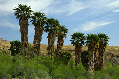
Water availability is a critical factor influencing ecological transitions in the Mojave Desert. Oasis ecosystems, supported by underground aquifers or natural springs, provide unique habitats in contrast to the surrounding arid landscapes. These oases can support a higher diversity of plant and animal life.
Playa Ecosystems:
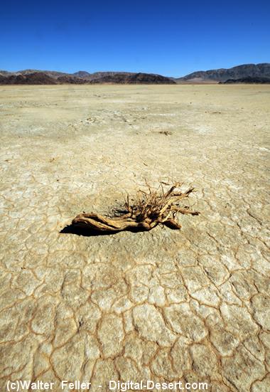
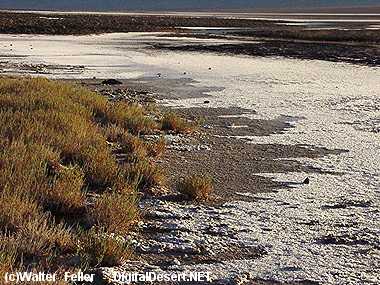
Playas, or dry lake beds, are common features in the Mojave Desert. During rainfall, playas can fill with water, creating temporary wetland habitats that support a burst of life, including migratory birds and amphibians. However, these ecosystems are highly dependent on unpredictable precipitation patterns.
Human Impact:
Human activities, such as urban development, agriculture, and infrastructure projects, have significantly altered the Mojave Desert landscape. Urban areas like Las Vegas and Los Angeles have expanded into the desert, leading to habitat fragmentation and loss. Human activities can disrupt natural ecological processes and contribute to invasive species encroachment.
Climate Change Effects:
The Mojave Desert is not immune to the impacts of climate change. Changes in temperature and precipitation patterns can affect the distribution of plant and animal species, alter vegetation composition, and influence the timing of biological events, such as flowering and migration.
Fire Ecology:
Fire is a natural ecological process in many ecosystems, including the Mojave Desert. Some plant species in the desert have adapted to fire, and periodic wildfires can shape vegetation patterns. However, altered fire regimes due to human activities or climate change can have complex effects on the ecosystem.
Spring MountainsDesert FrontIbex SpringEmerson Dry LakeHuman Impact – Victorville
Understanding these ecological transitions is crucial for effective conservation and management of the Mojave Desert. Conservation efforts need to consider the interconnectedness of various factors and address the challenges posed by human activities and climate change to maintain the health and biodiversity of this unique desert ecosystem.
Ecotones are transitional zones between different ecosystems, characterized by a mix of species from adjacent ecosystems and often exhibiting unique ecological dynamics. In the case of the Mojave Desert, there are several ecotones where the desert transitions into other ecosystems. Here are some notable ecotones in the Mojave Desert:
At higher elevations in the Mojave Desert, the vegetation transitions from typical desert scrub, dominated by creosote bush (Larrea tridentata), Joshua trees (Yucca brevifolia), and other drought-tolerant plants, to pinyon-juniper woodlands. Pinyon pine (Pinus monophylla) and juniper (Juniperus spp.) become more prevalent in these transitional areas.
In the mountainous regions surrounding the Mojave Desert, pinyon-juniper woodlands transition further into coniferous forests. Species such as ponderosa pine (Pinus ponderosa) and white fir (Abies concolor) become more dominant. This transition is often associated with increasing elevation and cooler temperatures.
Desert Washes and Riparian Zones:
Where desert washes, or arroyos, intersect with the Mojave Desert, there are ecotones characterized by riparian vegetation. These transitional zones may include cottonwood (Populus fremontii) and willow (Salix spp.) trees, providing habitat for different plant and animal species compared to the surrounding arid landscape.
Desert to Playa Ecosystems:
The transition from the desert to playa ecosystems, such as dry lake beds, represents another ecotone. Playas can support unique vegetation adapted to periodic flooding and provide a habitat for migratory birds during wet periods.
Urban-Wildland Interface:
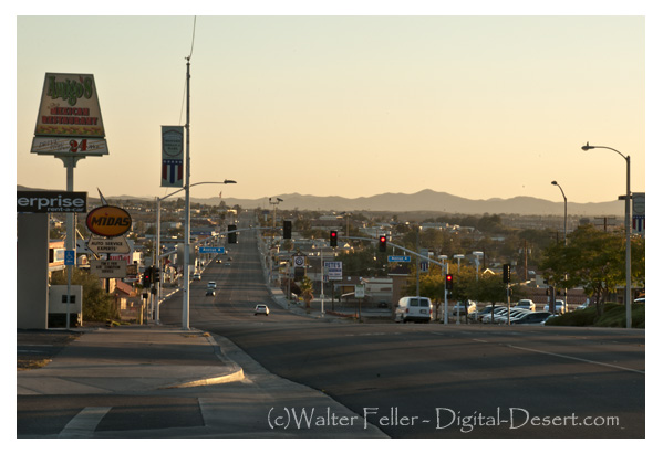
There is an ecotone known as the urban-wildland interface, where urban areas encroach upon the Mojave Desert. The interaction between human-dominated landscapes and the natural desert environment characterizes this transition zone. Human activities in these areas can have significant impacts on the desert ecosystem.
Mojave Desert to Great Basin Transition:
In the northern reaches of the Mojave Desert, there is a transition zone where the desert ecosystem merges with the Great Basin. This transition is marked by changes in vegetation and species composition influenced by elevation and precipitation.
Understanding and protecting these ecotones is crucial for preserving biodiversity and maintaining ecosystem resilience in the Mojave Desert. These transitional zones often support unique assemblages of plants and animals that are adapted to the specific conditions found at the boundaries between different ecosystems. Human activities, including urban development and climate change, can impact these ecotones, emphasizing the importance of conservation and sustainable management practices in the region.
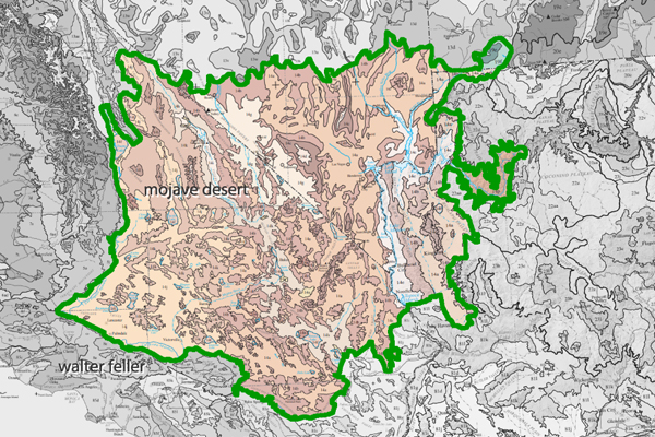
Ecozones, also known as ecological zones or ecoregions, are geographic areas with distinct ecological characteristics, including climate, vegetation, and animal life. In the case of the Mojave Desert, several ecozones can be identified, each with its unique set of features. These ecozones help to categorize and understand the diverse environments within the broader Mojave Desert region.
Here are some key Mojave Desert ecozones:
Lower Colorado River Valley:
This ecozone includes the area along the lower course of the Colorado River, extending into southeastern California. Riparian habitats, including marshes and wetlands, along the riverbanks characterize it. The presence of water allows for a higher diversity of plant and animal life compared to the more arid parts of the Mojave Desert.
Mojave Desert Basin and Range:
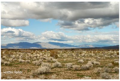
The Mojave Desert Basin and Range ecozone cover the central and southern parts of the Mojave Desert. It includes vast expanses of arid lands with characteristic desert scrub vegetation, dominated by creosote bush, Joshua trees, and various cacti. Basins and mountain ranges mark the terrain.
Mojave High Desert:
This ecozone encompasses higher elevations within the Mojave Desert, including areas with pinyon-juniper woodlands and coniferous forests. It is found in mountainous regions such as the Spring Mountains and the Mojave National Preserve. The Mojave High Desert exhibits cooler temperatures and a different plant and animal community compared to lower elevations.
Sonoran Desert Transition:
Along the Mojave Desert’s southern boundary is a transition zone into the Sonoran Desert. This ecozone exhibits characteristics of both deserts and supports a mix of plant species from both regions. A warmer and subtropical climate influences the Sonoran Desert Transition ecozone compared to the central Mojave.
Mojave Desert Playas:
Playas, or dry lake beds, are characteristic features of the Mojave Desert landscape. These flat, unvegetated areas are part of the Mojave Desert Playas ecozone. They are important for unique plant and animal communities adapted to the periodic flooding during rain events.
Mojave-Upland Desert Scrub:
This ecozone includes upland areas within the Mojave Desert, characterized by desert scrub vegetation. It represents the transitional zone between lower elevations and the Mojave High Desert, showcasing variations in plant composition and adaptations to different environmental conditions.
Understanding these ecozones is essential for the Mojave Desert’s conservation efforts and management strategies. Each ecozone has its ecological processes, biodiversity, and environmental challenges. Conservation initiatives should consider each ecozone’s specific characteristics to ensure the long-term health and sustainability of the Mojave Desert ecosystem.
The Mojave Desert, located in the southwestern United States, is a vast and enchanting landscape that has inspired various stories and myths. While it may not be traditionally associated with romantic tales, “Romance of the Mojave Desert” could be interpreted differently.
One aspect might refer to the rugged beauty and allure of the desert itself. The Mojave Desert is known for its unique and diverse ecosystems, featuring vast expanses of arid land, rocky canyons, and iconic Joshua trees. Many people find beauty in the solitude and harshness of the desert environment, and there’s a certain romance in appreciating the stark landscapes and breathtaking sunsets.
Another interpretation could be linked to the historical and cultural stories embedded in the Mojave Desert. Native American communities have inhabited the region for thousands of years, and their stories and traditions add a layer of richness to the area. Explorers, pioneers, and settlers have also left their mark on the Mojave, contributing to its fascinating history.
“Romance of the Mojave Desert” may be a book, poem, or piece of art that captures the spirit and essence of the desert romantically or imaginatively.
The Mojave Desert continues to captivate and inspire those drawn to its unique charm and mystique. Whether it’s the silence of the vast landscapes, the resilience of the flora and fauna, or the rich history that echoes through the canyons, the Mojave Desert holds a special place in the collective imagination.
Barstow Area. Barstow lies in the intersection of the three largest ecosubsections in the Mojave Desert; High Desert Plains & Hills (322Ag), Mojave Valley – …
Barstow 1890. Barstow is situated at the junction of the California Southern and the A. &. P. Railway, eighty-two miles from San Bernardino and twelve miles …
3) Go west on the State Route 58 through Boron, Mojave or California City and up to Tehachapi and over the Southern Sierra. 4) Go east to Barstow. There is food …
Mojave Desert Indians – Map. Vanyume Indians. The Vanyume or Beñemé, as Father Garces called them, lived beyond and along much of the length of the Mojave …
Casa del Desierto – Harvey House. Barstow Harvey House and train station photo – Casa del Desierto Casa del Desierto: The Spanish for “House of the Desert” In …
Nov 4, 2023 … Today, it remains an essential point of access and commerce for those traveling through the Mojave Desert in Southern California. Post Views: 12.
Goldstone Ghost Town. More of a site than a ghost town, there are only a few scattered foundations and some rubble to be found. The area is now home to NASA’s …
The Barstow yards are used jointly by the Santa Fe and Union Pacific and handily very considerable volume of the transcontinental traffic. Hence the railroad …
A desert microhabitat refers to a small-scale environment within a desert with unique characteristics and supporting specific life forms. Deserts are harsh ecosystems characterized by low precipitation levels and extreme temperatures. Despite these challenging conditions, various microhabitats exist within deserts, providing specialized plants and animals with niches to thrive. Here are some examples of desert microhabitats:
Shade of Rocks or Sand Dunes:
Some plants and animals find refuge in the shade provided by rocks or dunes, where temperatures are slightly lower.
Rock Crevices:
Gaps and crevices in rocks can offer protection from the sun and wind. Certain plant species may establish themselves in these microenvironments.
Dry Riverbeds (Washes):
Though dry for much of the year, riverbeds in deserts (washes) may have occasional water flow during rain events, attracting a variety of life adapted to sporadic water availability.
Salt Flats:
In some desert regions, there are vast salt flats where specific salt-tolerant plants and microorganisms can survive.
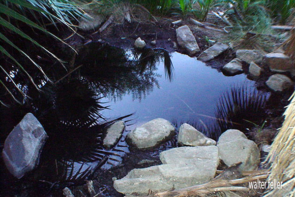
Oases:
Oases are areas with water sources, often surrounded by vegetation. They provide a vital microhabitat for a diversity of plant and animal species in an otherwise arid landscape.
Burrows and Nests:
Some desert animals create burrows or nests to escape extreme temperatures and predators. Examples include burrowing rodents, reptiles, and certain bird species.
Cryptobiosis in Microorganisms:
Certain microorganisms in deserts can enter a state of cryptobiosis, a dormant condition that allows them to survive extreme dryness until conditions become more favorable.
Surface Crusts:
Microbial crusts on the desert surface, composed of algae, fungi, and bacteria, play a crucial role in stabilizing soil and preventing erosion. They also contribute to nutrient cycling.
Camouflage Adaptations:
Both plants and animals in deserts often have adaptations for camouflage, helping them blend in with the surroundings and avoid predators.
Understanding and preserving these microhabitats is essential for the conservation of desert ecosystems. Even small-scale disturbances can significantly impact the delicate balance of life in these environments.
Desert Wash – Desert Habitats. Roadside water runoff can also create a microhabitat of its own. The sacred datura, also called jimson weed or thorn apple, …
Microhabitat · Indian Culture Ceremonialism · Wildflower Photo Guide · Joshua Tree National Park · List of Mojave Desert Shrubs * · Plants at Hoover Dam · Zion …
Unlike the sparse vegetation in most of the Mojave, plantlife in washes is lush and deep-rooted. Plants range from shrubs such as the catclaw acacia, cheesebush …
Oasis Visitor Center, Twentynine Palms. Skull Rock – .25 mile loop, Microhabitat – Cap Rock · A relict population – Hidden Valley · Disappearing soil – Arch …
mojavedesert.net › trees › pinus-monophylla › 2.00.html
The seed characteristics and the microhabitats in which seeds are placed are important in determining their fate after dispersal. … Singleleaf pinyon seedlings …
The ecotones between singleleaf pinyon woodlands and adjacent shrublands and grasslands provide favorable microhabitats for singleleaf pinyon seedling …
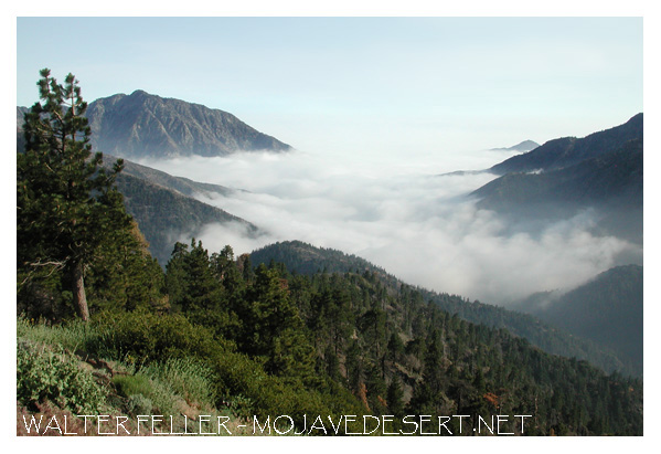
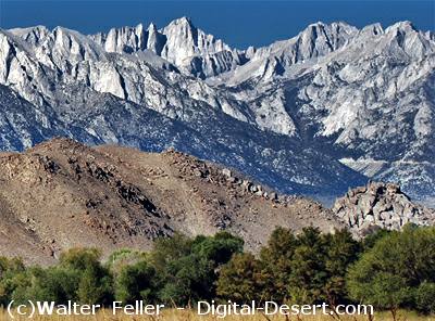
The Mojave Desert rain shadow is a meteorological phenomenon that occurs in the southwestern United States. A rain shadow is an area on the leeward side of a mountain or mountain range that receives significantly less precipitation than the windward side. In the case of the Mojave Desert, this rain shadow effect is primarily influenced by the Sierra Nevada mountain range.
The prevailing westerly winds carry moist air from the Pacific Ocean. As this air rises over the western slopes of the Sierra Nevada, it cools and condenses, leading to precipitation. By the time the air descends on the eastern side of the mountains, it has lost much of its moisture, creating a rain shadow effect.
The Mojave Desert, located east of the Sierra Nevada in California, experiences this rain shadow effect. The descending air on the eastern side of the mountains warms up, leading to a drier and warmer climate in the Mojave Desert compared to the western side of the Sierra Nevada.
As a result, the Mojave Desert is characterized by arid and semi-arid conditions, with lower annual precipitation than the Sierra Nevada’s western slopes. This rain shadow effect plays a significant role in shaping the climate and ecosystem of the region. The Mojave Desert is known for its unique flora and fauna adapted to the arid conditions influenced by the rain shadow effect.
Overview. View from shadow mountains near El Mirage The Mojave Desert exists in a rain shadow created by the Transverse Ranges and the Sierra Nevada Mountain …
For example, the California portion of the desert often receives as little as 3 cm of rain. The Mojave is considered a rain shadow desert because the …
The rain shadow effect is produced by the high mountains on the west, which block the movement of wet winter storms. Artesian Wells · Flash Floods · Intro:: …
… rain shadow” effect produced by the high mountains on the west, and 2) the … The Joshua trees serve as a rain gauge in those areas of the desert where no …
The rain shadow from the San Gabriel Mountains affects vegetation types and water availability in the Mojave Front Country Place. It is a transition zone …
The Transverse Ranges are a group of mountain ranges in Southern California, USA. They run east-west and are characterized by their unique orientation, perpendicular to the typical north-south alignment of most other mountain ranges in North America. The Transverse Ranges play a significant role in the geography and climate of Southern California.
San Gabriel Range
San Bernardino Range
The main Transverse Ranges include:
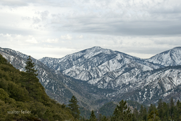
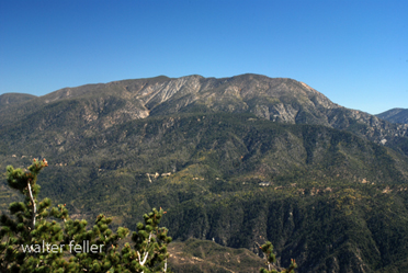
San Gabriel Mountains: Located northeast of Los Angeles, the San Gabriel Mountains are a prominent part of the Transverse Ranges. They contain several peaks over 10,000 feet, including Mount San Antonio (Mt. Baldy), the highest peak in the range.
San Bernardino Mountains: To the east of the San Gabriel Mountains, the San Bernardino Mountains are another subrange within the Transverse Ranges. They include prominent peaks such as San Gorgonio Mountain, the highest peak in Southern California.
Additional Transverse Ranges (not in project)
Santa Ynez Mountains: Situated to the northwest of Los Angeles, the Santa Ynez Mountains are part of the Transverse Ranges and run parallel to the coast. They contribute to the scenic backdrop of the Santa Barbara area.
Santa Susana Mountains: Located northwest of Los Angeles, the Santa Susana Mountains are a smaller subrange within the Transverse Ranges.
Topatopa Mountains: Situated north of Ventura, the Topatopa Mountains are part of the Transverse Ranges and are known for their distinctive east-west orientation.
The Transverse Ranges have a significant impact on the climate of Southern California. They act as a barrier to moist air coming from the Pacific Ocean, causing a rain shadow effect. This results in a drier climate on the leeward (eastern) side of the ranges, contributing to the arid conditions of the inland areas.