Response to Big Horn Mine Post

Interesting! Haven’t been there, but it’s been described as gold mineralization localized in one of the low-angle (thrust) fault zones that extend south from (and relieve compression from) the San Andreas Fault along the north side of the San Gabriels. That compressional environment extends from where it bends more westerly, north of the Coachella Valley, to where it resumes its more northwesterly course at the west end of the San Gabriels. Could you see any visible geological evidence of that? Envious that you got there!

Interesting! I have not been there, but I have heard it described as gold mineralization localized in one of the low-angle thrust fault zones that extend south from the San Andreas Fault along the north side of the San Gabriels. Those faults help accommodate the compression created where the San Andreas bends more westerly north of the Coachella Valley, before resuming its more northwesterly course near the west end of the San Gabriels.

Could you see any visible geologic evidence of that on the ground? Fault gouge, sheared rock, quartz veining, altered zones, breccia, or repeated/tilted beds would all be interesting. Envious that you got there!

elucidate

Here is a more elucidated version:

Interesting. I have not been there, but the description makes geological sense. The gold mineralization has been described as localized within one of the low-angle thrust or reverse-fault zones that extend southward from the San Andreas Fault along the north side of the San Gabriel Mountains.

That setting is important because this part of the San Andreas is not a simple, straight strike-slip boundary. North of the Coachella Valley, the fault bends into a more westerly trend. That bend creates transpression: strike-slip motion combined with compression. The crust has to shorten and thicken, and some of that strain is taken up by reverse and thrust faults along the northern San Gabriels. Farther west, near the west end of the range, the San Andreas resumes its more typical northwest trend.

In such a compressional fault environment, mineralization can become focused along zones of weakness. Fault planes, fractured rock, breccia zones, and sheared contacts can all act as pathways for hydrothermal fluids. If those fluids carried silica, sulfides, and metals, they could deposit quartz veins and gold where pressure, temperature, chemistry, or permeability changed.

So I would be curious whether there was visible evidence of the structure on the ground: sheared or crushed rock, fault gouge, breccia, slickensides, repeated rock units, tilted beds, iron staining, quartz veining, altered zones, or a distinct contact where one rock package has been pushed over another. Even if the gold itself was not visible, the structural setting might be.

Envious that you got there. That is exactly the kind of place where the landscape may tell a larger tectonic story if you know what to look for.

expand all

Interesting. I have not been there, but the description makes geologic sense, and it opens up a much larger story than just “gold in a fault zone.”

The gold mineralization has been described as localized within one of the low-angle thrust or reverse-fault zones that extend southward from the San Andreas Fault along the north side of the San Gabriel Mountains. That is an important detail. A low-angle fault zone is not just a crack in the rock; it is a broad zone of broken, sheared, crushed, and chemically altered rock where movement has taken place over time. In a compressional setting, one block of crust is being driven up and over another. Those zones can become major pathways for mineral-bearing fluids.

This part of the San Andreas is not a simple, straight, clean strike-slip fault. Farther south and east, the San Andreas trends northwest-southeast in the classic right-lateral fashion. But north of the Coachella Valley, the fault bends into a more westerly orientation. That bend matters enormously. When a right-lateral strike-slip fault bends the “wrong” way, the two sides do not simply slide past each other smoothly. They jam, shorten, and thicken the crust. Geologists call that transpression: a combination of lateral shear and compression.

That compressional zone extends along the northern front of the San Gabriel Mountains. The mountains themselves are partly a product of that tectonic crowding. The crust is squeezed, folded, broken, and shoved upward. Some of the strain stays on the main trace of the San Andreas, but much of it is transferred into adjacent reverse faults, thrust faults, oblique-slip faults, folds, and fractured belts. In other words, the San Andreas does not act alone. It produces a whole structural neighborhood.

The low-angle thrust zones extending south from the San Andreas are part of that neighborhood. They help accommodate shortening across the range front. In plain terms, the crust cannot slide smoothly through the bend, so it stacks, uplifts, and fractures. That creates the conditions in which fault-related mineralization can occur.

Gold mineralization in such a setting is usually not random. Hydrothermal fluids move through the most permeable pathways available. A fault zone provides exactly that: broken rock, fractures, crushed breccia, shear planes, and repeated openings caused by movement. Fluids rising through these pathways may carry silica, iron, sulfur, carbonate, and small amounts of precious metals. When conditions change–pressure drops, temperature changes, chemistry shifts, fluids mix, or the pathway narrows–minerals precipitate. Quartz veins, iron oxides, sulfides, clay alteration, and sometimes gold may form in and near the fault zone.

That is why I would be especially interested in what was visible on the ground. The gold itself might not be obvious, and in many cases it would not be visible at all. But the structural and alteration evidence might be. I would look for a zone of rock that appears more shattered, softened, stained, or disrupted than the surrounding material. Fault gouge would be one clue: clay-rich, powdery, crushed material produced by grinding along the fault. Fault breccia would be another: angular fragments of older rock cemented or packed together within the fault zone. Sheared rock, where minerals or rock fabrics are smeared out into streaks or bands, would also be significant.

Quartz veining would be especially interesting. In a mineralized fault zone, quartz may occur as thin stringers, irregular veinlets, thicker veins, or stockwork networks. The veins might be white, gray, rusty, milky, or iron-stained. Rusty red, brown, orange, or yellow staining can indicate oxidation of iron-bearing minerals such as pyrite. That does not prove gold, but it is often associated with hydrothermal alteration. Greenish, whitish, or clay-rich alteration halos around fractures could also be meaningful.

A true thrust relationship might show itself in larger structural ways. You might see one rock type lying structurally above another in a way that does not match normal stratigraphic order. There may be repeated units, abrupt contacts, crushed zones along the contact, or beds and foliations tilted at unexpected angles. In metamorphic or plutonic terrain, the evidence may be less like neat layered beds and more like zones of mylonite, cataclasite, breccia, altered granitic rock, or sheared gneiss.

Slickensides would be another prize: polished or striated fault surfaces showing the direction of movement. On a thrust or reverse fault, the lineations may suggest upward movement of one block over another, though in this region movement could be oblique because the San Andreas system combines strike-slip and compression. That obliquity is part of what makes the San Gabriel block so structurally interesting.

The broader tectonic setting is the key. From the San Gorgonio Pass / Coachella Valley region westward along the northern San Gabriels, the San Andreas enters a restraining-bend geometry. The motion between the Pacific and North American plates is still dominantly right-lateral, but the bend forces compression into the system. That compression is relieved through uplift of the San Bernardino and San Gabriel Mountains, thrusting along range-front and internal faults, folding of sedimentary basins, and distributed deformation away from the main fault.

At the west end of the San Gabriels, where the San Andreas resumes a more northwesterly course, the geometry changes again. The compressional intensity and structural style are not uniform along the entire belt. Some areas are dominated by uplift and thrusting; others by oblique-slip deformation, strike-slip transfer, folding, or basin development. That variability could help explain why mineralization is localized in one fault zone rather than spread evenly everywhere. The right combination of structure, permeability, host rock chemistry, fluid source, and timing has to occur.

So the place you mention may be interesting for two reasons at once. Locally, it may preserve a mineralized fault zone where gold-bearing fluids used a low-angle thrust structure as a conduit. Regionally, it may be a small exposure of the larger tectonic machinery that built and continues to deform the northern San Gabriel Mountains. The mine or prospect is the local expression; the restraining bend of the San Andreas is the regional engine.

What I would want to know from someone who had been there is whether the mineralization looked structurally controlled in the field. Was the quartz confined to a shear zone? Did the veins parallel the fault fabric, or cut across it? Was the country rock pervasively altered, or only fractured locally? Was there a visible low-angle contact? Did the workings follow a seam, a vein, a breccia body, or a crushed zone? Were there iron-stained ribs or resistant quartz ledges standing out from softer fault gouge? Were the dumps full of milky quartz, rusty quartz, altered granite, schist, or breccia?

Those details would help distinguish several possibilities. It could be gold in discrete quartz veins occupying fractures related to thrusting. It could be disseminated or veinlet-controlled mineralization in a broader altered shear zone. It could be mineralization along a contact between contrasting rock units. Or it could be older mineralization later caught up in San Andreas-related deformation. The field relationships would matter.

In a place like that, the visible clues are often subtle. A casual visitor might see only broken rock, brush, mine dumps, and a scar in the hillside. But a geologist would ask: why here? Why did the miners follow this exact line? Why is the rock crushed here and not there? Why does the staining follow a zone? Why do the veins have this orientation? Why does the ridge or drainage line up with the structure? Those questions are often more revealing than the mine opening itself.

That is why I said I would be envious. It sounds like the kind of locality where a small mining feature might sit directly on top of a much larger tectonic story: the San Andreas bend, compression along the northern San Gabriels, low-angle faulting, fractured rock, hydrothermal fluid movement, and localized gold deposition all intersecting in one place.

outline

I. Main point

The locality is interesting because the gold occurrence may not be isolated or random. It may be tied to a larger structural system associated with compression along the San Andreas Fault and the north side of the San Gabriel Mountains.

II. Regional tectonic setting

A. The San Andreas Fault is not straight in this region.

B. North of the Coachella Valley, the fault bends into a more westerly trend.

C. This bend creates a restraining-bend geometry.

D. In a right-lateral fault system, that geometry produces compression as well as lateral slip.

E. The resulting deformation is called transpression: strike-slip motion plus shortening.

III. Effect on the San Gabriel Mountains

A. The northern San Gabriels occupy part of this compressional zone.

B. The crust is shortened, thickened, fractured, and uplifted.

C. The mountains are partly a result of this tectonic crowding.

D. The San Andreas does not carry all the deformation by itself.

E. Strain is distributed into nearby structures, including:

  1. Reverse faults
  2. Thrust faults
  3. Oblique-slip faults
  4. Folds
  5. Shear zones
  6. Fractured belts

IV. Low-angle thrust faults

A. Some fault zones extend southward from the San Andreas along the north side of the San Gabriels.

B. These may be low-angle thrust or reverse-fault zones.

C. In such structures, one block of crust is pushed up and over another.

D. These faults help relieve or accommodate compression from the San Andreas restraining bend.

E. They form broad zones of crushed, sheared, fractured, and altered rock.

V. Relationship to gold mineralization

A. Gold mineralization may be localized within one of these low-angle fault zones.

B. Fault zones are natural conduits for hydrothermal fluids.

C. Mineral-bearing fluids can move through:

  1. Fractures
  2. Breccia zones
  3. Shear planes
  4. Crushed rock
  5. Reopened fault surfaces

D. Gold and associated minerals may precipitate where conditions change, including:

  1. Pressure drops
  2. Temperature changes
  3. Chemical shifts
  4. Fluid mixing
  5. Changes in permeability
  6. Narrowing or sealing of fluid pathways

VI. Possible mineral indicators

A. Visible gold may not be present.

B. More likely clues would include:

  1. Quartz veins
  2. Quartz stringers
  3. Stockwork veinlets
  4. Iron staining
  5. Rusty red, brown, orange, or yellow oxidation
  6. Sulfide remnants or boxwork textures
  7. Clay alteration
  8. Silicified rock
  9. Altered granitic, metamorphic, or sedimentary host rock

VII. Structural evidence to look for

A. Fault gouge: soft, clay-rich, crushed material along a fault.

B. Fault breccia: angular broken rock fragments in a fault zone.

C. Sheared rock: stretched, smeared, or foliated material produced by movement.

D. Slickensides: polished or striated fault surfaces showing movement direction.

E. Repeated rock units: the same unit appearing more than once because of thrusting.

F. Abrupt contacts: sudden boundaries between rock types.

G. Low-angle contacts: shallowly dipping fault surfaces.

H. Tilted or disrupted bedding or foliation.

I. Linear ridges, saddles, gullies, or drainage alignments following the fault zone.

VIII. Field questions for someone who visited

A. Was the mineralization clearly confined to a shear or fault zone?

B. Did the workings follow a vein, seam, breccia body, or crushed zone?

C. Was there a visible low-angle fault contact?

D. Were quartz veins parallel to the fault fabric, or did they cut across it?

E. Was there iron-stained quartz on the dump?

F. Was the country rock altered broadly or only along fractures?

G. Were there slickensides, gouge, breccia, or sheared rock?

H. Did the mine follow a structurally obvious line?

IX. Alternative interpretations

A. Gold may have formed directly in the thrust-related hydrothermal system.

B. Gold may occupy fractures caused by compression.

C. Gold may be related to an older mineralizing event later deformed by San Andreas-related faulting.

D. Gold may be localized along a contact between contrasting rock units.

E. Gold may occur in discrete veins rather than a broad mineralized fault zone.

X. Larger significance

A. The site may be a local mining feature.

B. It may also expose part of the broader tectonic machinery of Southern California.

C. The mineralization, faulting, uplift, and San Andreas restraining bend may all be connected.

D. The key question is whether visible field evidence supports that structural interpretation.

XI. Closing sentiment

A. The locality sounds worth seeing because it may combine mine history, structural geology, mineralization, and regional tectonics in one place.

B. The most interesting question to ask on the ground is: why did mineralization happen there, along that exact zone?

if I were to return to the site (Big Horn Mine, Angeles National Forest) what would be the top three pieces of evidence to look for?

I will ground this in the Big Horn Mine setting rather than speak only in generalities, and I will separate geologic clues from mine-safety/access issues.Thought for 15s

For Big Horn Mine specifically, I would make the top three targets these:

  1. The Vincent Thrust contact itself

The main thing to look for is not just “a vein,” but evidence that the mine sits in the Vincent Thrust zone. The published mine description places Big Horn along the trace of the Vincent Thrust, with mineralization in a northeast-striking, low-angle zone dipping roughly 15 to 30 degrees northwest. It also describes the thrust as the contact between upper-plate San Gabriel Gneiss and lower-plate Pelona Schist. That is your number-one field question: can you see the structural contact, or at least the contrast between the rocks on either side? USGS/MRDS summaries describe the gold as occurring in a structurally favorable position along the Vincent Thrust zone.

In practical terms, look for a low-angle, laterally persistent zone rather than a steep, narrow fissure. Look for a change from more massive gneissic or amphibolitic rock to more foliated schistose rock. The Pelona Schist near the mine is described as well-foliated, medium- to dark-gray or black schist; the host interval between thrust strands is described as dominated by crushed amphibolite, an important host for the gold mineralization.

  1. Crushed, sheared, gougy, or brecciated rock in the fault zone

The second thing to look for is mechanical damage: the ground preparation that made the rock permeable. The deposit description says favorable preparation included crushing and increased permeability within the Vincent Thrust zone, with impermeable gouge along upper and lower thrust surfaces helping confine the fluids. That is a very useful clue because it tells you the ore was not merely “near” a fault; it depended on the fault zone’s internal architecture.

On the ground, I would look for angular breccia fragments, crumbly clay-rich gouge, slick or polished shear surfaces, smeared foliations, shattered amphibolite, and zones where the rock changes from competent to rotten over a short distance. A mine dump may be as useful as an outcrop: pieces of crushed amphibolite, gneiss, schist, gouge, or veined breccia would tell you what the miners were actually following underground.

  1. Quartz-pyrite-gold and calcite-pyrite-gold veinlets, especially where they follow fractured rock

The third thing is the mineralization style. The USGS resource study summarizes the district’s gold as being associated with small amounts of sulfides and occurring in quartz in fracture zones. The Big Horn mine description is more specific: it describes quartz-pyrite-gold and calcite-pyrite-gold veinlets formed from hydrothermal fluids.

In the field, look for white to gray quartz veinlets, calcite veinlets, rusty iron staining after pyrite, boxwork textures where sulfides weathered out, and quartz or calcite concentrated along fractures rather than randomly distributed. The key observation is orientation: do the veinlets parallel the thrust fabric, occupy sheared fractures, or occur between strands of the fault zone? If the veins and alteration are confined to the crushed thrust interval, that supports the structural-control interpretation.

My field hierarchy would be: first find the structural zone, then the damaged rock, and then check whether quartz/calcite/sulfide alteration is localized within that damaged zone. That sequence would give you the strongest evidence that the gold mineralization is tied to the Vincent Thrust rather than merely occurring somewhere near an old mine.

One caution: observe from outside. Current hiking guidance warns against entering the mine and to be careful around old boards and metal; the route is also seasonal because CA-2 can close in winter.
Saying Something

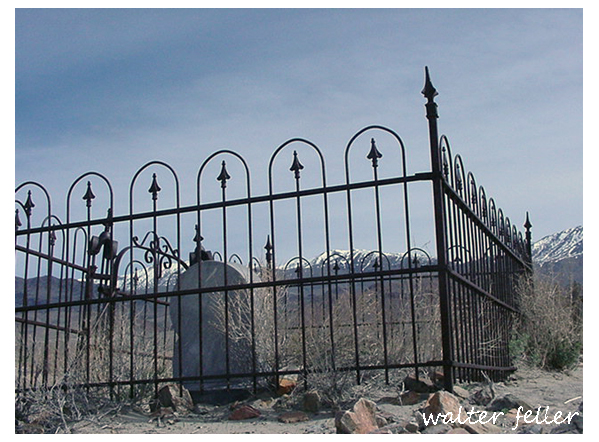
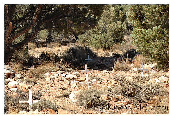
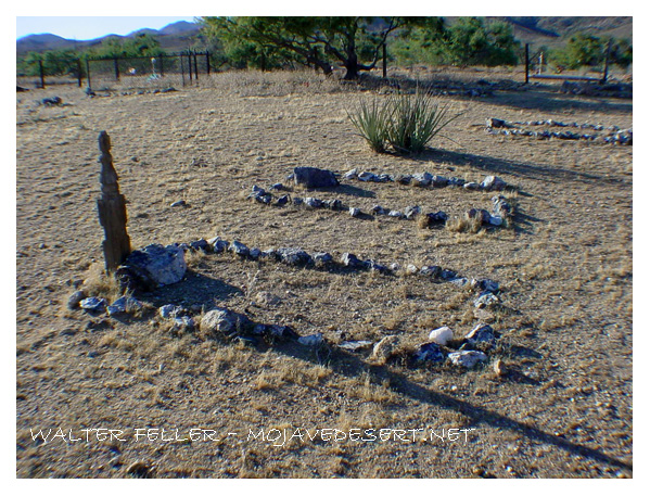
Beginning photographers are drawn to cemeteries because they offer strong subjects without needing access, models, money, or complicated logistics.

A cemetery gives a novice several useful things at once: quiet, stillness, interesting light, readable shapes, texture, inscriptions, age, symbolism, and emotion. The subject does not move, so the photographer can slow down and practice composition, focus, depth of field, close-ups, shadows, and framing. Headstones, fences, trees, paths, statues, flowers, flags, and weathered surfaces naturally create visual structure.

They also feel meaningful. A beginner often wants photographs to say something, not merely show something. Cemeteries come preloaded with themes: memory, loss, time, ancestry, mystery, abandonment, faith, and neglect. That can make the pictures feel more profound than the photographer’s technical skill can yet produce elsewhere.

There is also a long-standing romantic and gothic pull. Old cemeteries provide atmosphere: leaning stones, carved angels, iron gates, winter grass, late-afternoon light. They can look dramatic even when photographed simply.

But that is also the trap. Cemetery photography can become easy symbolism: a broken stone, a skull, an angel, a name, a sunset. The best work usually goes beyond mood. It notices evidence: who is buried there, how the graves are arranged, what materials were used, which names repeat, which markers are cared for, which are forgotten, and what the cemetery says about the community around it.

So beginners are drawn to cemeteries because cemeteries are accessible, patient, visually rich, emotionally charged, and historically layered. They make it easier to feel that a photograph has weight.

Mojave Desert History:

Who Is in Charge?

No single government, tribe, agency, or company controls the Mojave Desert. That is the first rule for understanding its history. The Mojave is not one jurisdiction. It is an area with many overlapping authorities. It is older than the borders now drawn. It is still managed piece by piece: by federal land agencies, tribal nations, state governments, county supervisors, city councils, military commands, water districts, railroads, utilities, conservation laws, mining claims, private property, and custom.

Before American maps and agencies, Native peoples held authority over the region. Their homelands, trails, springs, food-gathering areas, trade routes, and river crossings shaped the land. This was not “ownership” in the later courthouse sense; instead, it meant use, memory, obligation, defense, kinship, and sacred geography. The Mojave people controlled key parts of the Colorado River. Paiute, Chemehuevi, Serrano, Cahuilla, Kawaiisu, Timbisha Shoshone, and others were tied to desert and mountain margins. Authority followed water, trails, seasonal movement, and social ties.

Spanish and Mexican authority followed, coming lightly and unevenly. The Mojave was crossed, described, feared, and sometimes claimed. It was not closely governed. Missions, ranchos, military parties, and traders affected the edges and corridors more than the interior. The desert was difficult to occupy in the usual colonial way. Water was scarce. Distances were great. Native people still controlled much of the practical geography.

After the United States took California and the Southwest, authority became more formal but not necessarily more complete. Surveyors, soldiers, miners, freighters, railroad companies, and county officials imposed new systems of control. Military posts guarded roads and river crossings. Mining districts drafted local rules before the full government arrived. Stage and wagon roads made certain corridors important. Counties claimed jurisdiction, but their reach was often thin.

The arrival of the railroad changed the balance of power. The Atlantic and Pacific Railroad, later tied to the Santa Fe system, crossed the Mojave. Authority gathered around depots, water stops, sidings, land grants, and townsites. Places like Daggett, Barstow, Needles, Kelso, and Mojave developed. Transportation created order in a land that had previously resisted centralized control. The railroad did not govern the whole desert. However, it controlled movement, freight, settlement patterns, and economic opportunity.

Mining created another layer. Silver, gold, borax, copper, iron, salt, and other minerals brought camps, claims, mills, roads, and speculation. In many districts, authority came from miners’ meetings, claim notices, local custom, and whoever could pay for extraction and hauling. Over time, state and federal law provided the legal framework. On the ground, the desert was ruled by remoteness, money, water, and endurance.

Homesteading added another layer to authority. The government encouraged settlement through land laws. Much of the Mojave, however, was marginal for farming. Some settlers proved up claims. Some built cabins. Some failed. Some left behind the jackrabbit homestead landscape. Authority here was paper-based: legal descriptions, patents, assessment rolls, roads, school districts, and county maps. But the land itself often had the final word.

In the 20th century, the federal government became the main land authority. National parks, military bases, grazing districts, wildlife refuges, reclamation projects, and later BLM management made much of the Mojave public land. World War II and the Cold War expanded the military presence. Fort Irwin, China Lake, Edwards Air Force Base, Marine Corps bases, and training ranges made the desert a national defense site.

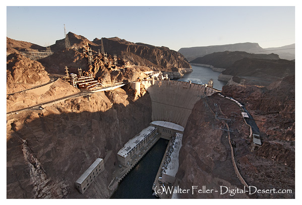
At the same time, water and power authorities became decisive. As a result, projects like the Hoover Dam, the Colorado River system, aqueducts, transmission lines, pipelines, and later solar and wind initiatives connected the Mojave to cities across the Southwest. In this phase, the desert was governed by both land ownership and infrastructure.

Later, the conservation era changed the question of authority again. Laws and designations like the 1964 Wilderness Act, the 1976 Federal Land Policy and Management Act, the California Desert Conservation Area, and the 1994 California Desert Protection Act redefined much of the Mojave as habitat, wilderness, cultural landscape, and public trust. Groups such as the National Park Service, BLM, Fish and Wildlife, state agencies, county governments, tribes, miners, ranchers, off-road users, utilities, conservation groups, and local residents all joined the debate.

Today, much of the California desert is managed by the Bureau of Land Management. Other major areas are under the National Park Service, such as Mojave National Preserve, Joshua Tree National Park, and Death Valley National Park. The military is also a major landholder and decision-maker. Tribal authority is increasingly recognized through consultation, co-stewardship, and co-management, though this is not always done equally or adequately. Counties regulate land use in private and unincorporated areas. Cities govern their own townsites. Water districts, utilities, mining companies, conservation groups, and private owners all hold some authority.

Also, who is in charge?

The best answer is: it depends on where you are, what resource is at issue, and what kind of authority you mean. A ranger can control a campground. A county may control the zoning. A sheriff can enforce local law. The BLM can manage grazing, recreation, mining access, or conservation on public land. The Park Service may regulate activity within a preserve or park. A tribe may exercise cultural, historical, legal, and, sometimes, land-management authority. The military can close an entire landscape. A water district can decide the fate of an aquifer. A railway or utility may control a corridor. A private owner may hold title to a desert square surrounded by public land.

That is the Mojave’s pattern: not centralized command, but layered jurisdiction. The desert has always been negotiated valley by valley, spring by spring, road by road. Its history is people trying to cross it, use it, protect it, extract from it, defend it, name it, and claim it—but never mastering it. Whoever controlled water, movement, maps, law, minerals, military access, or infrastructure controlled part of the desert. But no one controlled it all. The Mojave is best seen not as a single chain of command, but as a contest between landform, use, law, memory, and power.

Hoover Dam or Boulder Dam?

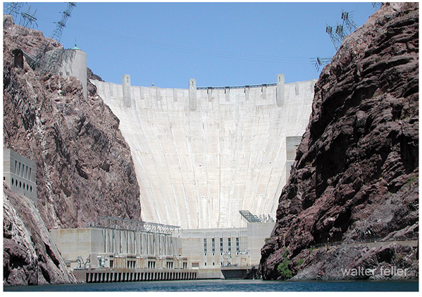
Hoover Dam and Boulder Dam refer to the same concrete structure that crosses the Colorado River between Nevada and Arizona. The distinction lies not in the dam, but in a story formed by planning, politics, and changing names.
Early proposals to control the Colorado River focused on Boulder Canyon, upstream of the eventual construction site. As a result, the project became widely known as Boulder Dam, a name that remained familiar even after engineers selected Black Canyon, with its stronger rock walls and narrower gorge, as the better location for such a massive dam.

In 1930, Secretary of the Interior Ray Lyman Wilbur announced that the project would be named Hoover Dam, in honor of President Herbert Hoover, who had supported Colorado River development and played a role in negotiations among the basin states. Construction began during his administration, but the dam soon became associated with the Great Depression and the political changes that followed.

When Franklin D. Roosevelt became president in 1933, his administration returned to the older name Boulder Dam, which government publications and public references often used for years. Roosevelt dedicated the dam in 1935, even as major construction was still underway. During this period, “Boulder Dam” was not merely a casual nickname; it was the official name favored by many people and agencies.

In 1947, Congress formally restored the name Hoover Dam, which has since been the official designation. Boulder Dam remains an older historical term.

The two names, therefore, mark different moments in American history: “Boulder Dam” belongs to the era of early planning, Depression-era construction, and New Deal usage, while “Hoover Dam” is the modern official name. Together, the names reflect not only a landmark of engineering but also the politics of memory in the American West.

https://digital-desert.com/hoover-dam/history.html

https://digital-desert.com/hoover-dam/name.html

The Guided Road South

The Salt Lake Route, the Mojave River, and the Safer Passage of 1849

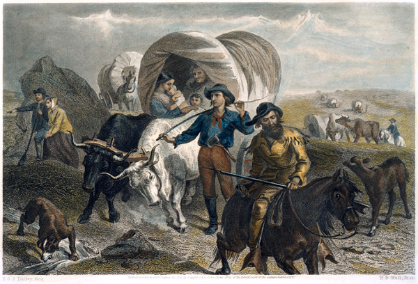
Emigrants crossing the plains / F.O.C. Darley, fecit ; H.B. Hall, Jr. sc.
L.O.C.
Emigrants crossing the plains / F.O.C. Darley, fecit ; H.B. Hall, Jr. sc.

Walter Van Dyke, a young Cleveland lawyer, joined the 1849 rush to California. Reaching Salt Lake too late to cross the Sierra safely, he turned south with a guided party under Captain Jefferson Hunt. His account records the successful Salt Lake-to-Los Angeles route via the Old Spanish Trail, Santa Clara, the Virgin River, Las Vegas, the Mojave River, and the Cajon Pass. It is valuable for showing the southern road that worked, not the Death Valley disaster.

The California Gold Rush is often remembered as a westward rush: across the plains, over the Sierra Nevada, or around the Horn and through Panama. These routes shaped the classic Forty-niner image: ox-team emigrant, sea passenger, red-shirted miner, speculator, and gold-seeker. Stewart Edward White divided the movement into three channels: the Cape Horn voyage, the overland road, and the Panama route. The overland road drew hardier emigrants, whose property was wagons, livestock, and farm equipment. White also highlighted the heavy price: cholera, failed animals, abandoned wagons, alkali deserts, and exhaustion from the Humboldt and Sierra crossings. The ordeal was a “trial by fire.” Reaching California, in the end, changed the emigrant.

Yet the overland story was a web of routes, decisions, delays, guides, mistakes, and improvisations. The best-known road led to the Humboldt and the Sierra. By 1849, however, lateness changed everything. Those late to Salt Lake faced a hard choice: attempt the Sierra and risk disaster, winter in Utah, or turn south toward Los Angeles on the Old Spanish Trail—a safer but longer route. At this juncture, Van Dyke’s “Overland to Los Angeles, by the Salt Lake Route in 1849” proves valuable, as his party avoided Death Valley by joining Captain Jefferson Hunt’s guided movement south and west toward the Mojave River and Cajon Pass.

Van Dyke started as an ordinary gold seeker. He was recently admitted to the bar in Cleveland. In spring 1849, he joined a company and left for California via Chicago, Iowa, Council Bluffs, the Platte, Fort Laramie, the Sweetwater, and Salt Lake City. His plain, late-life recollection preserves a useful chronology: leaving Chicago on June 6. Crossing the Mississippi on June 18. Leaving the Missouri on July 24. Reaching Salt Lake City on October 8. Then, waiting as the season closed, the Sierra route. Like many emigrants, they were late. However, unlike many, they accepted the consequences. The Donner disaster was a fresh warning that still shaped their choices.

In Salt Lake, Van Dyke’s party learned from Mormons returning from the mines that crossing the Sierra before winter was impossible. While they hesitated, the Pomeroy brothers, Missouri traders, prepared to take livestock and freight wagons to Southern California. Consequently, the emigrants joined them and hired Captain Jefferson Hunt as a guide. This decision put Van Dyke’s party on a different road from most Forty-niners, making their success reliant on guidance, water, forage, and discipline—not speed.

They left Salt Lake on 3 November 1849, heading south along the Wasatch. Near Utah Lake’s south end, they struck the Old Spanish Trail, which Van Dyke calls the northern route between Los Angeles and Santa Fe. This is important: the party did not create a new road, but entered an old corridor of travel, trade, and survival. They passed Spanish Fork, Sevier County, Mountain Meadows, Santa Clara, Virgin, Las Vegas, Mojave River, and Cajon Pass. The route was difficult but clear, with known camps, springs, river bottoms, and a familiar guide.

Van Dyke’s southern-route account should be read with the context provided by Will Bagley in Across the Plains, Mountains, and Deserts. Bagley’s bibliography demonstrates the scale of the overland documentary record: thousands of primary accounts, guidebooks, gazetteers, later wagon-travel sources, and secondary works. However, he warns that the California Trail’s southern route is less represented than the northern and central routes. This gap matters. Because of it, Bagley’s coverage is selective. He directs readers to Harlan Hague and Patricia Etter for more detail. This caution is important: Van Dyke is not just another emigrant reminiscence. For the Mojave and southern-route studies, he is a firsthand witness in a thin documentary field.

The contrast with White’s narrative is sharp. In his “Across the Plains” chapter, White spotlights catastrophic features: the Humboldt Sink, Sierra, broken wagons, dead animals, cholera graves, and emigrant trains collapsing under haste and poor preparation. Van Dyke’s account is different. There are hardships, hunger, snow, poor feed, and exhausted stock, but not disaster. The southern road remained challenging, not easy. The crucial distinction lay in route choice. By turning south, Van Dyke’s party exchanged the Sierra wall for a long desert road with intermittent water, warmer weather after Utah, and a descent through Cajon Pass into Southern California.

The Mojave River was the final desert threshold for Van Dyke’s party. Provisions nearly failed. About a dozen men went ahead for relief. They reached the Mojave River on the second day from the main camp, near present-day Barstow. They followed the Old Spanish Trail up the river to Cajon Pass. This short passage matters: it shows the Mojave River as the practical approach to Southern California. The river led emigrants to the pass and from the desert to the settlement.

The emotional climax is at Cajon Pass. Out of food and aided by moonlight, Van Dyke’s advance party went through the pass at night. They emerged in the valley around four o’clock on February 1. Van Dyke’s memory fixes on the contrast. The day before, they were in a harsh desert. Now, they walked through flowers and wild clover, with fragrant morning air. The passage is conventional–a classic arrival scene–, but its power lies in its geography.

Cajon Pass marked the divide between ordeal and relief.

At Cucamonga Rancho, the advance party found food, milk, and butter. A few days later, they reached Chino Ranch, linked to Colonel Isaac Williams, who had sent relief that season. Soon after, Van Dyke went to Los Angeles with a horse and guide, carrying letters and packages. The rest of the Cleveland party arrived with the train about a week later. The crossing took eight months. All arrived alive and healthy. Van Dyke knew this was rare. He had seen graves along the Platte and Black Hills and knew many had endured worse.

Van Dyke drew a larger lesson from their survival. That winter brought early rains and deep Sierra snow. No ordinary party could have crossed the Sierra. His group traveled from Salt Lake to Southern California with ox teams and heavy wagons, delayed primarily by weakened stock. He used this fact to argue that the Salt Lake-to-Los Angeles corridor was the natural railroad route to the Pacific—lighter grades, fewer snow sheds. This is retrospective route advocacy. However, it is grounded in their successful winter passage when the Sierra route was closed.

White frames what Van Dyke omits: the allure of the mines and San Francisco. White’s world rushes toward gold. It sorts into miners, merchants, teamsters, speculators, lawyers, gamblers, and citizens of a new commonwealth. The Gold Rush was a social furnace as well as a migration. Van Dyke confirms this from the south. In Los Angeles, he found a small Spanish pueblo with little business beyond stock raising. Even southern route emigrants kept moving north. The mines remained the magnet.

The three sources, therefore, work best together. Bagley supplies the research architecture: how to think about diaries, journals, recollections, reminiscences, guidebooks, and the uneven survival of trail records. White gives the broad synthetic frame. The Gold Rush was a migration, ordeal, social leveling, urban explosion, and civic improvisation. Van Dyke gives the local route witness. A Cleveland emigrant who reached Salt Lake too late. He turned south under guidance, followed the Old Spanish Trail, came by the Mojave River and Cajon Pass, and arrived safely in Los Angeles. Used together, these accounts show that the Forty-niner story was not simply a rush to California. It was a series of choices made under pressure. The right road, at the right season, could mean the difference between disaster and survival.

For Death Valley and Mojave work, that distinction is essential. The southern route is often remembered through the dramatic failure of the Death Valley parties. Van Dyke preserves the counterexample: the guided road that worked. His party suffered from hunger, snow, poor forage, and failing cattle. But it did not fall into catastrophe. It stayed with Hunt’s route. They kept to the Old Spanish Trail, used known water corridors, and entered Southern California through Cajon Pass. In that sense, Van Dyke’s account is not merely a reminiscence. It is evidence for the practical geography of survival in 1849.

The better historical question, then, is not simply why some Forty-niners suffered. All suffered in some measure. The sharper question is why some parties survived intact while others broke apart. Timing, leadership, route knowledge, livestock condition, water, forage, and the discipline to abandon the wrong ambition at the right moment–that made the difference. Van Dyke’s party wanted the gold fields. But at Salt Lake, they accepted winter’s terms.

The better historical question, then, is not simply why some Forty-niners suffered. All suffered in some measure. The sharper question is why some parties survived intact while others broke apart. Timing, leadership, route knowledge, livestock condition, water, forage, and the discipline to abandon the wrong ambition at the right moment—that made the difference. Van Dyke’s party wanted the gold fields. But at Salt Lake, they accepted winter’s terms. That decision sent them south, through the Mojave, and into Los Angeles alive.

References

Bagley, Will, ed. Across the Plains, Mountains, and Deserts: A Bibliography of the Oregon-California Trail, 1812-1912. Prepared for the National Park Service, National Trails Intermountain Region. Salt Lake City: Prairie Dog Press, 2015.

Van Dyke, Walter. “Overland to Los Angeles, by the Salt Lake Route in 1849.” Historical Society of Southern California.

White, Stewart Edward. The Forty-Niners: A Chronicle of the California Trail and El Dorado. New Haven: Yale University Press, 1918.

Early Historical References

Working source set:

Caballeria, History of San Bernardino Valley: From the Padres to the Pioneers, 1810-1851 – mission-era foundation, Guachama, Politana, San Bernardino naming, La Placita, Agua Mansa, and transition to Mormon settlement.

Ingersoll, Century Annals of San Bernardino County, 1769 to 1904 – detailed San Bernardino County annals, Mormon colony, county formation, pioneer memory, illustrations, local biographies, railroad/citrus/irrigation development, and the 1904 historical frame.

Brown and Boyd, History of San Bernardino and Riverside Counties, Vol. I – broader county synthesis, San Bernardino and Riverside institutional history, towns, agriculture, irrigation, transportation, mining, education, courts, and later regional development.

Master timeline using all three files:

1542 – Cabrillo reaches San Diego Bay, beginning the Spanish coastal frame that Caballeria uses as background for San Bernardino Valley history. Caballeria’s table of contents begins with Cabrillo and Viscaino, then moves to the missions and San Bernardino Valley proper.

1602-1603 – Viscaino surveys the California coast and reinforces the Spanish naming pattern that later appears inland in mission-era place names.

1769 – Spanish occupation of Alta California begins under the Portola-Serra expedition. Ingersoll’s title frame begins San Bernardino County history at 1769, while Brown/Boyd and Caballeria both treat the mission system as the institutional background for the valley.

1770 – Mission San Carlos Borromeo is founded at Monterey, after which the Spanish occupation of California was considered complete in the mission narrative.

1771 – Mission San Gabriel Arcangel is founded. This becomes the parent mission for the San Bernardino Valley activity. Caballeria’s structure moves from San Gabriel directly toward Politana and the valley mission outposts.

1774-1776 – The inland Anza route makes the San Bernardino Valley part of the practical travel corridor between the Colorado River, the San Gabriel, and coastal California.

1810 – Politana is established at or near Guachama as the first Christian settlement in the San Bernardino Valley. Ingersoll places “Mission Settlements in San Bernardino County,” “Politana,” and “San Bernardino Mission Station” in his Spanish-era chapter.

1812 – Earthquakes and Native resistance disrupt the first Politana settlement. This marks the first failure of the San Gabriel mission foothold in the valley.

1820s – Mission activity resumes in the San Bernardino Valley, leading to the establishment of the San Bernardino mission station, agriculture, stock raising, and zanja irrigation works.

1830s – Secularization breaks the mission system and shifts land, labor, water, buildings, and herds toward Mexican civil and rancho control. Caballeria treats secularization, abandonment, land titles, and Mexican grants as the hinge between mission and rancho history.

1842 – Rancho San Bernardino is granted to Antonio Maria Lugo and his sons. Ingersoll also notes that the Lugos offered lands near Politana to New Mexican colonists.

July 4, 1842 – Daniel Sexton raises the American flag in San Gorgonio Pass, an early symbolic American act before formal U.S. control.

1843 – Lorenzo Trujillo and others settle at Agua Mansa, according to Ingersoll’s annals.

1845 – A second party of colonists under Jose Tomas Salazar removes from La Politana and founds Agua Mansa. Caballeria says Agua Mansa means “gentle water,” names Ignacio Moya as the first alcalde, and says Louis Rubidoux later succeeded him.

1846 – The Battle of Chino occurred during the Mexican-American War. Ingersoll places it in the Mexican-era chapter alongside Rancho Santa Ana del Chino, the San Bernardino Grant, Indian troubles, and the rancho order.

April 12, 1847 – A detachment of the Mormon Battalion is sent to establish a military post at Cajon Pass.

April 1848 – A Mormon Battalion party passes through Cajon Pass with a wagon; Ingersoll calls it the first wagon to cross that route.

1849 – Gold Rush-era movement passes through the inland route, but Caballeria notes that the San Bernardino Valley itself remained distant from the earliest gold excitement, with Mexican settlers continuing their pastoral life.

June 11, 1851 – The first Mormon party reaches Cajon Pass.

September 1851 – The Mormons purchase the San Bernardino grant. This is the hinge from Mexican rancho occupation to organized American colonization.

1852 – The Old Fort is erected; the Mormons build a grist mill and a road up Twin Creek Canyon.

1851-1852 – The Little Church of Agua Mansa is built and dedicated to San Salvador; Caballeria says its parish records preserved marriages, births, and deaths.

April 26, 1853 – San Bernardino County is separated from Los Angeles County. The townsite of San Bernardino was laid out the same year, and the Mormon Council House was erected.

April 13, 1854 – The City of San Bernardino is incorporated. The first stage of service between San Bernardino and Los Angeles began the same year.

1855 – Volunteers under Captain Andrew Lytle enter the desert in pursuit of Native raiders, highlighting continued frontier insecurity after county formation.

1856 – Conflict grows between Mormons and Independents.

1857 – The Mormon recall begins, effectively closing the Mormon colony phase. Ingersoll’s contents treat “The Recall” as part of the Mormon-era chapter.

1858 – The first Union Sunday School and first May Day picnic are recorded; the Butterfield stage route is established. Ingersoll marks this as the start of the “Between Period–1858-1875.”

1859 – The Ainsworth-Gentry fight occurs, one of the best-known local violence episodes of the post-Mormon years. Brown/Boyd describe this period as one in which Mormon-Gentile tensions, mining-camp lawlessness, Native raiding, and Civil War sentiment converged.

1860 – Gold is discovered in Bear and Holcomb valleys; the San Bernardino Herald appears as the first newspaper in the county.

1861 – A toll road through Cajon Pass is established; Camp Carleton is established on the Santa Ana River; C. W. Piercey is killed in a duel near San Rafael.

January 22, 1862 – The great flood destroys Agua Mansa. Caballeria says rain continued for fifteen days and nights, the Santa Ana became a raging torrent, and the village was washed away except for the church and Cornelius Jensen’s house. Ingersoll summarizes the event as “Agua Mansa swept away.”

1862 – The first county educational convention is held, and the first orange grove, four acres, is set out at Old San Bernardino.

1862-1868 – Flood memory becomes part of the region’s historical identity. Brown/Boyd preserve Mrs. Crafts’ account of the 1861-62 rains, describing families fleeing to higher ground, adobe houses melting, and neighbors sheltering one another.

1875-1890 – Ingersoll’s “Progression” period: agriculture, horticulture, city growth, transportation, and the boom era reshape the county.

1880s – Citrus, irrigation, railroad development, and new towns transform San Bernardino County from a former mission-rancho-frontier district into a modern agricultural and town-building region.

1890s – County consolidation continues through public buildings, horticultural organizations, transportation networks, electric power, and institutional development.

1904-1905 – Ingersoll’s Century Annals of San Bernardino County, 1769 to 1904, is prepared as a permanent county history and biographical record; one biographical note says Ingersoll began gathering data in 1898 and published after delays.

1922 – Brown and Boyd’s History of San Bernardino and Riverside Counties offers a later retrospective synthesis, folding Caballeria and Ingersoll into a broader county- and regional-history.

The combined structure is:

Spanish and mission foundation, 1542-1830s: coastal discovery, San Gabriel, Politana, San Bernardino mission station, zanja, stock, and agriculture.

Mexican rancho and New Mexican settlement, 1830s-1851: secularization, Lugo grant, La Politana, La Placita, Agua Mansa, stock protection, and Battle of Chino.

Mormon colony and county formation, 1851-1857: purchase of Rancho San Bernardino, Old Fort, townsite, county separation, incorporation, roads, mills, and the Mormon recall.

Between periods, 1858-1875: post-Mormon instability, flooding, mining, lawlessness, Civil War tensions, schools, stages, and slow recovery.

Progression and boom, 1875-1890: railroad, irrigation, citrus, Redlands, Ontario, Chino, Highland, and speculative expansion.

Modern county memory, 1890-1922: public institutions, electric power, forest reserve, county division, horticulture, biography, and the writing of formal local history.

Transmogrification

Transmogrification, though it carries a slightly literary, almost mythic tone, suggests not just change but a deep and strange transformation into something fundamentally different.

For much of its recorded history, the Mojave Desert was primarily understood as a physical region. Its identity arose from terrain and climate. Dense or permanent human occupation played little role. Early travelers, surveyors, geologists, and writers described it using the language of the landform. They noted broad basins, isolated mountain ranges, dry lakes, volcanic fields, alluvial fans, dunes, washes, and the intermittent course of the Mojave River. The desert was seen as a geographical system. Uplift, erosion, aridity, and distance formed it. Its boundaries were often indistinct. The Mojave was not yet a tightly organized human landscape. It was seen as open country, with character shaped by the land’s form.

In that earlier conception, geography imposed limits upon people. Travel followed springs, canyon mouths, and natural passes through the mountains. Camps and settlements clustered where water permitted survival. Roads bent around lava flows, crossed playas, or traced older Indigenous routes refined over generations of movement through the desert. Human activity existed within conditions dictated by climate and terrain. The desert remained the dominant force, and people adapted themselves to it.

Even with these earliest permanent intrusions, the long-standing dynamic between people and landscape was not immediately overturned. Mining camps rose and disappeared as ore deposits and water supplies fluctuated. Wagon roads faded when springs failed. Small railroad towns appeared abruptly but often remained fragile in the face of the scale and hostility of the surrounding landscape. Much of the Mojave still retained the appearance of a place shaped principally by geology rather than by civilization.

Over time, a shift occurred: the Mojave, once defined by natural systems, increasingly came to be structured around human needs. The first key shift came with railroads, which established artificial centers in previously insignificant locations—places that had mattered only as crossings or water stops. Afterward, elements like highways, aqueducts, transmission corridors, military reservations, utility infrastructure, suburban expansion, recreational development, industrial agriculture along the margins, and large-scale energy production continued this trend. These forces did not simply occupy the desert; they actively reorganized it.

A modern map of the Mojave clearly reveals this shift: vast military boundaries now dominate entire valleys and mountain ranges. Meanwhile, interstate highways create strong directional corridors across what were once diffuse travel landscapes. Utility-scale solar developments, visible for miles, convert open basins into industrial energy fields. Transmission towers march across dry lakes and bajadas. Off-road recreation networks carve repeating tracks into fragile terrain. Finally, conservation areas and national preserves add another layer of organization by establishing access restrictions, managing habitats, providing tourism infrastructure, and developing preservation policies.

Increasingly, the Mojave is understood less through watersheds and landforms than through jurisdiction and use. One valley becomes associated with military training, another with renewable energy, others with recreation, habitat protection, logistics, or suburban expansion. This shift is reflected in the language used to describe the desert. Whereas earlier generations emphasized playas, volcanic mesas, spring systems, or mountain passes, modern discussions focus on renewable energy zones, conservation plans, transportation corridors, protected acreage, groundwater management, housing pressure, and recreational access.

Yet the older desert has not disappeared beneath these overlays. The geology remains the controlling framework beneath every human system. Basin-and-range topography still governs drainage and movement. Mountain ranges still create rain shadows and isolate valleys. Heat still limits settlement density. Water scarcity still defines possibility. Dry lakes still gather runoff after storms, just as they did centuries ago. In many places, the desert resists permanent transformation. Every generation is reminded that the underlying landscape remains older and more powerful than any system laid upon it.

Building on these evolving layers of meaning, what has changed most is not simply the Mojave’s physical appearance but its significance. The desert has shifted in its conceptual role: initially perceived as a natural form, then as a landscape of use, and now increasingly as a landscape of negotiation.

The central question is no longer merely “What is the Mojave?” but “What is the Mojave for?” Different groups now approach the same landscape with competing visions: energy developers see open basins suitable for solar fields and transmission infrastructure; conservationists see fragile ecosystems, migration corridors, and biological continuity; tribes see ancestral homelands, sacred sites, and cultural memory in the terrain itself. The military sees strategic training space, defined by isolation and open airspace, while residents see communities and livelihoods. Recreationists seek freedom, mobility, solitude, and escape, while cities beyond the desert offer land, water, transportation routes, and energy supplies.

As these pressures intensify, nearly every part of the Mojave acquires overlapping claims—emptiness itself becomes contestable. Open land is no longer simply open; instead, it becomes designated, managed, leased, protected, restricted, industrialized, or defended. Consequently, the future Mojave is likely to be shaped not by a single activity, but by tensions among many competing systems, all operating simultaneously across the same terrain.

In this evolving context, the Mojave is entering a third historical phase. Initially, it was defined by its physical landforms. Next, human activities and uses became the defining factors. Now, the Mojave’s identity may increasingly depend on negotiations and conflicts over its meaning, access, and purpose.

The old desert will still remain beneath these arguments. The playas will still whiten under summer heat. Winds will still sweep across creosote flats. Mountain ranges will still rise abruptly from broad basins at dusk. Seasonal floods will still cut across washes after sudden storms. The geological skeleton of the Mojave will endure. However, as human systems become more extensive and entangled, the experience and interpretation of the desert will continue to change.

The future Mojave will be governed as a layered landscape. No single authority will determine its fate: federal agencies will control vast public lands; counties will regulate roads, zoning, and development pressure; tribes will press claims rooted in sovereignty, memory, and sacred geography; energy and mining companies will seek permits, leases, and corridors; conservation groups will defend habitat and species; recreationists will demand access; and residents will argue for the right to live within the desert, not just be managed from outside. In light of these overlapping interests, governance will become less about drawing boundaries and more about arbitrating between claims. The desert will be administered through plans, lawsuits, permits, consultations, closures, leases, and exceptions. Its future will not be decided all at once; instead, it will be determined valley by valley, corridor by corridor, and project by project.

The Mojave functions as both an ancient physical landscape and a modern human one. While it is no longer shaped solely by tectonics, erosion, and climate, it is no longer defined solely by railroads, highways, military reservations, and energy development. Increasingly, the desert is formed by negotiations over how such a landscape should exist. Thus, what once was defined by its form is now shaped by the competing meanings people assign to it.

The Tortoise – Raven Problem

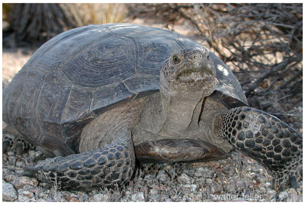
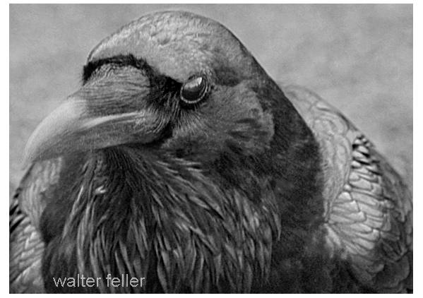
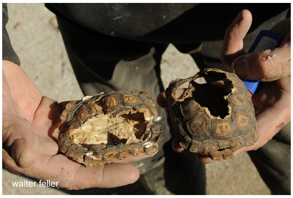
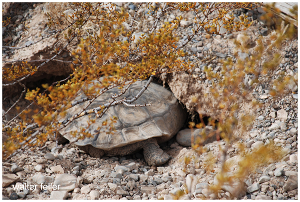
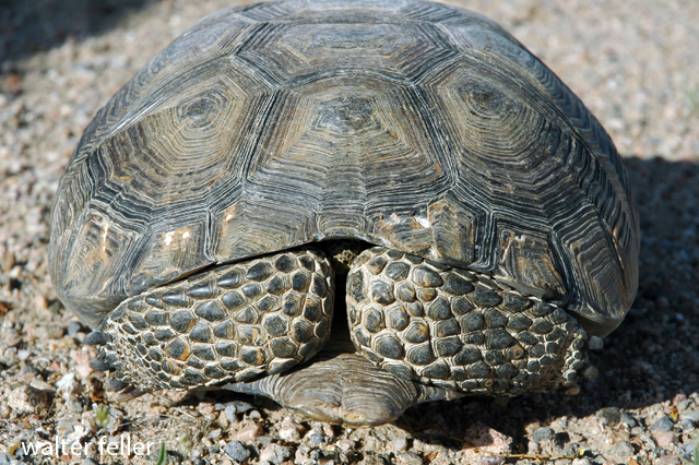
Common ravens are now among the most important predators of young desert tortoises in the Mojave Desert. Adult tortoises are generally protected by their heavy shells, but hatchlings and juveniles are small, soft-shelled, and vulnerable. Ravens can flip them over, peck through the shell, and kill them quickly. Over the last century, this predation pressure has increased substantially, not because ravens are foreign to the desert, but because human activity has allowed their populations to expand far beyond historic levels.

Historically, ravens lived in the Mojave in relatively low numbers, limited by scarce food, water, and nesting sites. Modern development altered those limits. Landfills, dumpsters, roadkill, artificial water sources, agricultural areas, campgrounds, transmission towers, utility poles, and roadside structures now provide reliable support for large raven populations across the desert. Biologists often describe these as “subsidized” ravens: native predators whose numbers are unnaturally amplified by human infrastructure.

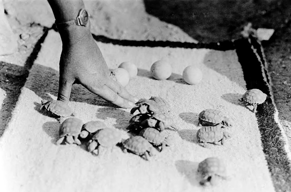
Young tortoises are especially vulnerable during their first years of life, before the shell fully hardens. In some heavily developed areas, raven predation has removed large numbers of juveniles before they can reach adulthood. Because desert tortoises mature slowly and reproduce cautiously, sustained losses of hatchlings can have serious long-term effects on local populations.

Conservation efforts, therefore, focus not only on tortoises themselves but on the broader human landscape that supports elevated raven numbers. Securing trash, reducing open dumpsters, cleaning up roadkill, limiting artificial water sources, and modifying utility poles or towers to discourage nesting and perching are all important measures. In open desert terrain, tall structures provide ravens with excellent lookout points from which to search for young tortoises.

Additional protections are sometimes used in sensitive areas. Wildlife agencies may place protective cages over burrows or release sites, restore shrub cover that conceals juvenile tortoises, or use “head-start” programs in which hatchlings are raised in captivity until their shells harden and become more resistant to predators. Some agencies also conduct direct raven management through nest removal, egg oiling, or, in limited cases, lethal control under federal permits. However, most researchers agree that predator removal alone cannot solve the problem if the artificial food and infrastructure supporting high raven populations remain in place.

For this reason, the raven-tortoise conflict is often understood not simply as a natural predator-prey relationship, but as a broader ecological imbalance created by modern desert development.

The Stolen

The association between Thomas Long (Pegleg) Smith and Walkara in Cajon Pass centers on the great horse raids of the 1830s-1840s along the Old Spanish Trail.

Walkara, sometimes called Wakara or Chief Walker, led large mounted raiding parties from present-day Utah into Southern California. These expeditions targeted Californio ranchos and mission herds, especially around San Luis Obispo, San Gabriel, and inland Southern California. The stolen horses were then driven eastward through the Mojave Desert and across Cajon Pass toward Utah and New Mexico.

Pegleg Smith was one of several Anglo mountain men tied to this trade network. Contemporary and later sources repeatedly connect him with Walkara’s operations, though historians debate whether he directly participated in raids or mainly acted as trader, guide, and broker. James Beckwourth and Old Bill Williams are usually mentioned alongside him.

Cajon Pass mattered because it was the principal gateway between the Los Angeles basin and the Mojave Desert. Large bands of stolen horses moved through the pass on their way east. Some traditions claim thousands of horses crossed there during Walkara’s biggest expeditions.

The raids became so notorious that local geographic names in and around Cajon Pass were later linked to them. Horsethief Canyon and Little Horsethief Canyon are traditionally associated with Walkara’s raiders and their escape routes into the desert.

An important detail often missed is that this was not random outlawry in the modern sense. The horse trade formed part of a large transregional economy running along the Old Spanish Trail. California horses had enormous value in the Rockies and Great Basin. Walkara built a disciplined mounted raiding system, while men like Pegleg Smith connected Native raiding networks with Anglo and Mexican trading systems.

By the mid-1840s, Californio authorities and local militia figures such as Benjamin Davis Wilson pursued these raiding bands through Cajon Pass and into the Mojave, though with limited success.

Snail’s Pace

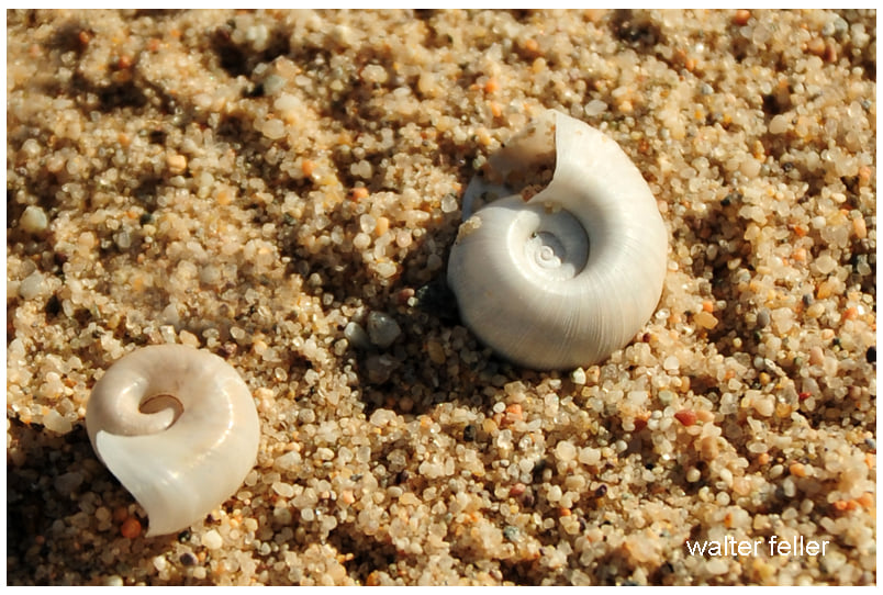
These appear to be desert land snail shells, probably from one of the small Mojave or Sonoran desert snail groups rather than marine shells. The thick, chalky white shell and tight spiral are typical adaptations for arid environments: the pale color reflects heat, while the heavy shell helps reduce water loss.

The shell on the right looks weathered and sun-bleached, likely long dead. In deserts, snail shells can persist for years because the dry climate slows decomposition. After seasonal rains, the living snails emerge briefly to feed and reproduce, then retreat underground or beneath rocks and seal themselves inside the shell with a thin membrane during drought.

The shape is especially reminiscent of desert hairy snails and allied southwestern taxa in the family Helminthoglyptidae, though exact identification from shells alone is difficult.

It is one of the quieter desert details people often overlook: tiny white shells scattered across washes and dunes, evidence that even the most arid country supports hidden cycles of dormancy and brief renewal.