Mojave Desert History:

Who Is in Charge?

No single government, tribe, agency, or company controls the Mojave Desert. That is the first rule for understanding its history. The Mojave is not one jurisdiction. It is an area with many overlapping authorities. It is older than the borders now drawn. It is still managed piece by piece: by federal land agencies, tribal nations, state governments, county supervisors, city councils, military commands, water districts, railroads, utilities, conservation laws, mining claims, private property, and custom.

Before American maps and agencies, Native peoples held authority over the region. Their homelands, trails, springs, food-gathering areas, trade routes, and river crossings shaped the land. This was not “ownership” in the later courthouse sense; instead, it meant use, memory, obligation, defense, kinship, and sacred geography. The Mojave people controlled key parts of the Colorado River. Paiute, Chemehuevi, Serrano, Cahuilla, Kawaiisu, Timbisha Shoshone, and others were tied to desert and mountain margins. Authority followed water, trails, seasonal movement, and social ties.

Spanish and Mexican authority followed, coming lightly and unevenly. The Mojave was crossed, described, feared, and sometimes claimed. It was not closely governed. Missions, ranchos, military parties, and traders affected the edges and corridors more than the interior. The desert was difficult to occupy in the usual colonial way. Water was scarce. Distances were great. Native people still controlled much of the practical geography.

After the United States took California and the Southwest, authority became more formal but not necessarily more complete. Surveyors, soldiers, miners, freighters, railroad companies, and county officials imposed new systems of control. Military posts guarded roads and river crossings. Mining districts drafted local rules before the full government arrived. Stage and wagon roads made certain corridors important. Counties claimed jurisdiction, but their reach was often thin.

The arrival of the railroad changed the balance of power. The Atlantic and Pacific Railroad, later tied to the Santa Fe system, crossed the Mojave. Authority gathered around depots, water stops, sidings, land grants, and townsites. Places like Daggett, Barstow, Needles, Kelso, and Mojave developed. Transportation created order in a land that had previously resisted centralized control. The railroad did not govern the whole desert. However, it controlled movement, freight, settlement patterns, and economic opportunity.

Mining created another layer. Silver, gold, borax, copper, iron, salt, and other minerals brought camps, claims, mills, roads, and speculation. In many districts, authority came from miners’ meetings, claim notices, local custom, and whoever could pay for extraction and hauling. Over time, state and federal law provided the legal framework. On the ground, the desert was ruled by remoteness, money, water, and endurance.

Homesteading added another layer to authority. The government encouraged settlement through land laws. Much of the Mojave, however, was marginal for farming. Some settlers proved up claims. Some built cabins. Some failed. Some left behind the jackrabbit homestead landscape. Authority here was paper-based: legal descriptions, patents, assessment rolls, roads, school districts, and county maps. But the land itself often had the final word.

In the 20th century, the federal government became the main land authority. National parks, military bases, grazing districts, wildlife refuges, reclamation projects, and later BLM management made much of the Mojave public land. World War II and the Cold War expanded the military presence. Fort Irwin, China Lake, Edwards Air Force Base, Marine Corps bases, and training ranges made the desert a national defense site.

At the same time, water and power authorities became decisive. As a result, projects like the Hoover Dam, the Colorado River system, aqueducts, transmission lines, pipelines, and later solar and wind initiatives connected the Mojave to cities across the Southwest. In this phase, the desert was governed by both land ownership and infrastructure.

Later, the conservation era changed the question of authority again. Laws and designations like the 1964 Wilderness Act, the 1976 Federal Land Policy and Management Act, the California Desert Conservation Area, and the 1994 California Desert Protection Act redefined much of the Mojave as habitat, wilderness, cultural landscape, and public trust. Groups such as the National Park Service, BLM, Fish and Wildlife, state agencies, county governments, tribes, miners, ranchers, off-road users, utilities, conservation groups, and local residents all joined the debate.

Today, much of the California desert is managed by the Bureau of Land Management. Other major areas are under the National Park Service, such as Mojave National Preserve, Joshua Tree National Park, and Death Valley National Park. The military is also a major landholder and decision-maker. Tribal authority is increasingly recognized through consultation, co-stewardship, and co-management, though this is not always done equally or adequately. Counties regulate land use in private and unincorporated areas. Cities govern their own townsites. Water districts, utilities, mining companies, conservation groups, and private owners all hold some authority.

Also, who is in charge?

The best answer is: it depends on where you are, what resource is at issue, and what kind of authority you mean. A ranger can control a campground. A county may control the zoning. A sheriff can enforce local law. The BLM can manage grazing, recreation, mining access, or conservation on public land. The Park Service may regulate activity within a preserve or park. A tribe may exercise cultural, historical, legal, and, sometimes, land-management authority. The military can close an entire landscape. A water district can decide the fate of an aquifer. A railway or utility may control a corridor. A private owner may hold title to a desert square surrounded by public land.

That is the Mojave’s pattern: not centralized command, but layered jurisdiction. The desert has always been negotiated valley by valley, spring by spring, road by road. Its history is people trying to cross it, use it, protect it, extract from it, defend it, name it, and claim it—but never mastering it. Whoever controlled water, movement, maps, law, minerals, military access, or infrastructure controlled part of the desert. But no one controlled it all. The Mojave is best seen not as a single chain of command, but as a contest between landform, use, law, memory, and power.
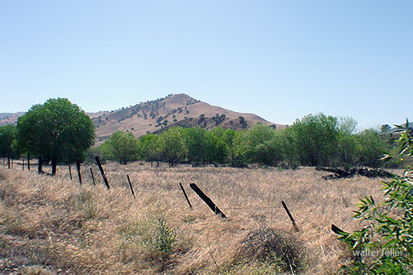
Kern County Timeline

History of Kern County, California (Wallace M. Morgan, 1914):


Pre-1850s

  • Native Yokuts and Serrano tribes inhabit the region, living along rivers and valleys, practicing hunting and gathering.
  • Lieutenant Edward F. Beale later establishes the Tejon Reservation to “civilize” and protect these groups.

1849

  • Naturalist John Audubon travels through the area, recording early observations of wildlife and the potential for settlement.

1851

  • First discovery of gold along the Kern River sparks a regional rush.
  • Miners arrive from southern and northern routes, establishing primitive camps.

1852–1854

  • Quartz mining begins at Keysville; the Keys and Mammoth Mines become notable operations.
  • The first quartz mill is hauled from San Francisco.
  • Mining towns like Whiskey Flat and Kernville emerge.
  • Discovery of the Keys Mine in 1854.

1857

  • California legislature passes a reclamation act for swamp and overflow lands.
  • Early settlers, including Colonel Thomas Baker, began reclaiming the Kern Delta.
  • A major flood reshapes portions of the lower Kern River lands.

1859

  • The site of modern Bakersfield is first identified.
  • Early cattlemen and settlers began to locate along the delta.

1860s

  • Havilah was founded as a mining center and later became the first county seat.
  • Immigrant roads and stage lines cross the valley.
  • Floods of 1867–68 create temporary lakes and swamps; drainage projects follow.
  • Early schools and cotton crops were established.
  • Outlaw Tiburcio Vasquez operates in the region; wild-horse catching is common.

1866–1870

  • Transition from placer mining to agriculture and stock raising.
  • Swamp land patents granted to Baker and others.
  • Ranching and sheep industries expand.

1868–1872

  • Kern County formally created from parts of Tulare and Los Angeles counties.
  • County seat at Havilah; first county officials elected.
  • Colonel Baker becomes prominent in reclamation and civic improvement.
  • 1872: Death of Colonel Thomas Baker, widely regarded as the founder of Bakersfield.

1873–1876

  • Bakersfield wins the county seat election (1874).
  • Town incorporated (1873) and disincorporated (1876).
  • Havilah declines; Bakersfield begins steady growth.
  • Early capitalists such as Livermore and Redington invest in local enterprises.

1877

  • Severe drought devastates the county’s cattle and farming interests.
  • Settlement expands in Tehachapi; first apple orchards planted.

1878–1885

  • Water rights disputes intensify between Haggin, Carr, Miller & Lux.
  • Major court cases begin over Kern River usage.
  • Construction of irrigation ditches and canal systems begins.
  • Early colonization efforts launched.

1880s

  • Tehachapi develops as a railroad and agricultural community.
  • Lynchings and outlaw conflicts occur during this rough period.
  • Bakersfield experiences a fire and rebuilding effort.
  • Introduction of electricity and other public utilities.

1890–1895

  • Mining resurgence: discovery of the Yellow Aster Mine at Randsburg.
  • Other desert mining districts (Amalie, Tungsten) discovered.
  • Bakersfield gains street railways and gas/electric utilities.
  • Great railway strike affects local commerce (1894).

1899

  • Discovery of oil near McKittrick and Sunset; first wells drilled.
  • Beginning of Kern County’s modern oil era.

1900–1905

  • Kern River oil field developed; Elwood brothers credited with major discovery.
  • Early pipelines and refineries built.
  • Bakersfield begins paving, civic expansion, and population growth.

1906–1910

  • Lakeview gusher (1910) becomes one of California’s largest oil strikes.
  • Consolidated Midway and North Midway fields expand.
  • Gushers flood markets; oil regulation and conservation efforts start.
  • Bakersfield experiences building boom; new roads and public buildings constructed.

1911–1913

  • Pump irrigation develops in valley towns like Wasco and McFarland.
  • Citrus and apple industries expand.
  • Bakersfield and Kern consolidate as one municipality.
  • Bonds issued for paved roads and infrastructure.
  • County churches, schools, and civic institutions flourish.

1914

  • Publication of Morgan’s History of Kern County marks the county’s transition from frontier to industrial modernity.
  • Bakersfield stands as the regional center of oil, agriculture, and commerce.

Kern County

Bear Valley

Historical Timeline

Big Bear, California, began as Yuhaaviatam homeland, later drawing gold seekers, ranchers, and dam builders. From Holcomb Valley’s 1860 rush to a four-season resort, its story blends natural beauty, resource ingenuity, and mountain tradition.

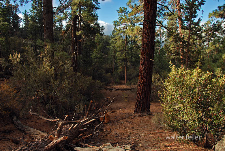
Bear Valley plants and trees

Prehistory
• The Big Bear Valley has been inhabited for thousands of years by the Yuhaaviatam (Serrano) people, who live in seasonal villages and call the area “Yuhaaviat,” meaning “Pine Place.”

1845
• Benjamin Davis Wilson leads a posse into the San Bernardino Mountains in pursuit of raiders. The group encounters numerous grizzly bears and kills several, naming the area “Big Bear Valley.”

1850s
• Early trappers and cattlemen moved through the San Bernardino Mountains. The valley remains largely remote and unsettled.

1860
• William F. “Bill” Holcomb discovers gold in Holcomb Valley, triggering a rush that brings hundreds of miners and creates mining camps such as Belleville, Union Town, and Clapboard Town.

1861–1862
• The Holcomb Valley boom peaks; San Bernardino County’s population surges. Belleville nearly becomes the county seat but loses to San Bernardino by two votes.

1863–1865
• Decline of the first gold boom as surface gold plays out. Miners leave, and the valley returns to quiet ranching and logging activity.

1870s
• Elias J. “Lucky” Baldwin acquires mining claims around Baldwin Lake and forms the Gold Mountain Mining Company. A second wave of mining begins, centered on the Baldwin Mine.

1884
• Frank Elwood Brown, a Redlands citrus grower, constructs the first Bear Valley Dam, a single-arch granite structure. The reservoir created by this dam was named Big Bear Lake.

1890s
• Big Bear’s role shifts from mining to recreation. Hunters, anglers, and early tourists begin to visit the mountain lake area. Lodges and cabins start to appear.

1903
• Lower-valley growers formed the Bear Valley Mutual Water Company to manage the reservoir and water rights.

1910–1912
• A new multiple-arch dam, designed by John S. Eastwood, replaces Brown’s dam, raising the lake level by about 20 feet and greatly expanding its capacity.

1920s
• Roads improve, and the automobile brings increased tourism. The town of Pineknot develops on the lake’s south shore with lodges, stores, and resorts.

1930s
• Winter recreation grows. Early ski runs are cut, and lodges cater to both summer and winter visitors.
• 1938 – Pineknot officially changes its name to Big Bear Lake.

1940s
• Big Bear becomes a year-round resort. During World War II, mountain roads were used for military transport training, but the area remained largely a recreation destination.

1950s
• Big Bear Alpine Zoo opens as a rehabilitation center for injured wildlife (1959).
• Ski development accelerates with lifts at Snow Summit.

1960s
• Tourism and second-home construction expand rapidly.
• The Big Bear Valley Historical Society was founded in 1967.

1970s
• The community continues to grow, balancing tourism with environmental concerns.

1980
• The City of Big Bear Lake was incorporated on November 28.

1980s
• Alpine Slide at Magic Mountain opens (1983).
• Ongoing improvements in highways and infrastructure make Big Bear a popular four-season resort.

1990s
• Big Bear becomes known for altitude training by professional athletes, including world-class boxers.

2000s–Present
• Tourism, recreation, and environmental stewardship define the region.
• The old 1884 dam remains a historical landmark, sometimes visible during low water levels.
• Big Bear preserves its mountain-resort heritage while serving as a gateway to the San Bernardino National Forest.

Big Bear and the Digital Desert are closely related through geography, ecology, history, and human development. The Digital Desert’s broader Mojave focus naturally overlaps with Big Bear’s transitional mountain-desert setting in several key ways:


Geographic Connection
Big Bear sits at the top of the Santa Ana River watershed, where mountain snowmelt begins the river’s underground journey to Southern California hills and valleys.


Ecological Transition Zone
The region bridges montane and desert biomes. Pinyon-juniper woodlands, chaparral, and Joshua tree habitats meet higher-elevation conifer forests. This gradation provides examples of how altitude, temperature, and moisture shape plant and animal communities—central themes within the Digital Desert’s ecological framework.


Historical Ties
Figures like William Holcomb and Lucky Baldwin tie Big Bear’s mining story to other desert mineral ventures, including Holcomb Valley’s influence on later Mojave mining booms. Trails from Big Bear connected to routes leading toward Lucerne Valley, Johnson Valley, and beyond—pathways that also appear throughout Mojave Desert exploration and settlement history.


Water and Infrastructure
The Bear Valley dams (1884 and 1912) represent early Southern California water engineering that parallels other Digital Desert themes such as aqueducts, irrigation systems, and the transformation of desert hydrology. Big Bear’s water storage directly supported the agricultural valleys below, tying mountain runoff to desert life.


Cultural and Recreational Link
Both Big Bear and the Mojave represent frontier landscapes turned into recreation destinations. The same pioneer spirit that shaped desert communities like Apple Valley or Hesperia carried over into Big Bear’s tourism development—cabins, roads, and storytelling built around rugged independence and mountain allure.


Interpretive Relationship
Within the Digital Desert framework, Big Bear serves as a high-elevation counterpart—a living case study for water origins, ecological transition, and cultural continuity. It connects the snow-fed headwaters to the dry basins below, showing the mountain-desert system as one continuous, interdependent landscape.

Ecological Description

Big Bear Valley lies high in the San Bernardino Mountains, about 6,700 to 7,000 feet above sea level, forming a broad mountain basin surrounded by rugged granite peaks and forested ridges. The valley stretches roughly east–west, framed by Butler Peak and Delamar Mountain to the north, and Sugarloaf Mountain, Gold Mountain, and the San Gorgonio massif to the south and east.

The valley floor is relatively flat, a remnant of ancient glacial and erosional processes, with Big Bear Lake occupying its central depression. Originally a meadowed valley with creeks and marshes, it became a permanent lake after the Bear Valley Dams were built. The soils are derived from decomposed granite, supporting open forests and meadows interspersed with boulder-strewn slopes.

Ponderosa pine, Jeffrey pine, white fir, and incense cedar dominate the higher slopes. At the same time, black oak, manzanita, and chaparral fill the lower edges in sheltered meadows and along streams, willows and alders grow, creating rare wetland habitats for species such as the mountain yellow-legged frog and bald eagle.

The climate is alpine-mediterranean—cold, snowy winters and warm, dry summers—marked by dramatic seasonal shifts. Snowmelt feeds Big Bear Creek and Baldwin Lake, the latter a seasonal alkali flat on the eastern edge of the valley.

Ecologically, Big Bear Valley forms the upper boundary of the Mojave Desert drainage system. It captures mountain precipitation that ultimately seeps underground toward Lucerne and the Mojave River basin, linking the high forest to the desert below.

Timeline References

  1. Big Bear Valley Historical Museum. “History of Big Bear Valley.” Big Bear Valley Historical Society, Big Bear City, CA.
  2. BigBear.com. “Dam: The Creation of Big Bear Lake.” Big Bear Visitors Bureau.
  3. BigBearCabins.com. “About Big Bear: A History.” Big Bear Cabins Travel Guide.
  4. BigBearVacations.com. “A History of Big Bear.” Big Bear Vacations Blog.
  5. San Bernardino County Museum Archives. “Mining and Settlement in the San Bernardino Mountains.”
  6. Eastwood, John S. “The Multiple-Arch Dam of Bear Valley.” Engineering Record, 1912.
  7. U.S. Forest Service. “San Bernardino National Forest: Ecological Subsections and Watershed Overview.”
  8. Bear Valley Mutual Water Company. “Early Development and Water Rights History.”
  9. Langenheim, Jean H., and P. H. Osman. “Vegetation and Ecology of the San Bernardino Mountains.” University of California Publications in Botany, 1959.
  10. California Department of Fish and Wildlife. “Baldwin Lake Ecological Reserve Management Plan.”
  11. San Bernardino Valley Water District. “Hydrologic History of the Bear Valley and Mojave River System.”
  12. Wikipedia contributors. “Big Bear Lake, California.” Wikipedia, The Free Encyclopedia.
  13. Wikipedia contributors. “Big Bear Valley Historical Museum.” Wikipedia, The Free Encyclopedia.
  14. Brown, F. E. “The First Bear Valley Dam and the Redlands Water System.” Redlands Historical Society Papers, 1884–1905.
  15. U.S. Geological Survey. “Geology and Hydrology of the Big Bear Lake Region, San Bernardino County, California.” Professional Paper Series.