Kern County
NO. 97 OAK CREEK PASS
- In 1776, Father Francisco Garcés used the Oak Creek Pass to return to the Mojave after exploring the San Joaquin Valley, as did Frémont in 1844-1845. Until the railroad was built through the Tehachapi Pass in 1876, Oak Creek Pass was the only route used through the Tehachapi Mountains. Location: On Willow Pass Rd, 4.6 mi S of Tehachapi Blvd, 74 mi SE of TehachapiNO. 99 WALKER'S PASS
- Discovered by Joseph R. Walker, American trailblazer, who left the San Joaquin Valley through this pass in 1834. This area was traversed by topographer Edward M. Kern, after whom the Kern River was named, while accompanying the Frémont expedition of 1845. After 1860 it became a mining freight route to Owens Valley. Location: At summit on State Hwy 178 (P.M. 79.8), 8.4 mi NW of Freeman Jct (State Hwy 14)NO. 129 FORT TEJÓN
- This military post was established by the United States Army on June 24, 1854, to suppress stock rustling and protect the Indians in the San Joaquin Valley. Camels for transportation were introduced here in 1858. As regimental headquarters of the First Dragoons, Fort Tejón was an important military, social, and political center - it was abandoned September 11, 1864. Location: Fort Tejón State Historic Park, on Lebec Rd, 2.8 mi N of LebecNO. 130 WILLOW SPRINGS
- Willow Springs was visited by Padre Garcés in 1776 while following the old Horse Thief Trail (later known as Joe Walker Trail) - Frémont stopped here in 1844, and the famished Jayhawk Party of 1850 found water here while struggling from Death Valley to Los Angeles. Still later, Willow Springs was a stage station of the Los Angeles-Havilah and Inyo Stage Lines. Location: From State Hwy 14, go 6.8 mi W on Rosamond Blvd, then N 0.7 mi on Tehachapi Willow Springs Rd, then 0.6 mi NW on Truman-Manly Rd, RosamondNO. 133 SEBASTIAN INDIAN RESERVATION
- The Sebastian or Tejón Indian Reservation (headquarters ten miles east of here) was established in 1853 by General Edward Fitzgerald Beale as one of several California reservations. The number of Indians quartered here varied from 500 to 2,000. General Beale acquired title to this area under Mexican land grant of 1843. In 1864 the U.S. government transferred the Indians to other reservations. Location: Grapevine, NE corner of Grapevine Rd and 'D' St, 70 mi S of MettlerNO. 457 INDIAN WELLS
- After five days' travel from the Argus Range, the Manly-Jayhawker parties of 1849 found their first water at this Indian waterhole on the Joseph R. Walker Trail of 1843. During the 1860s, this was the site of a stage and freight station for traffic between Los Angeles and the Coso and Cerro Gordo Mines. Location: Indian Wells Lodge, 4.9 mi N of Freeman Jct (Hwys 14 and 178) on Hwy 14 (P.M. 62.6)NO. 476 DESERT SPRING
- This spring was on an old Indian horse thief trail and later (1834) Joe Walker Trail. The famished Manly-Jayhawk Death Valley parties (1849-50) were revived here after coming from Indian Wells through Last Chance Canyon. This was also a station on the Nadeau Borax Freight Road. Location: SE corner Pappas Ranch, on Pappas Rd, then walk 1/4 mi W toward trees, 0.5 mi S of Valley Rd, 3.7 mi E of Cantil post officeNO. 508 TEHACHAPI LOOP
- From this spot may be seen a portion of the world-renowned Loop completed in 1876 under the direction of William Hood, Southern Pacific railroad engineer. In gaining elevation around the central hill of the Loop, a 4,000-foot train will cross 77 feet above its rear cars in the tunnel below. Location: On Old State Hwy, 3.2 mi E of Keene exit, 6.5 mi W of TehachapiNO. 643 OLD TOWN (TEHACHAPI)
- The oldest settlement in Tehachapi Valley, known as 'Old Town,' was established here during the 1860s. Long an important station on the road between Southern California and the San Joaquin Valley, the community began to decline when residents gradually moved to nearby Greenwich, later renamed Tehachapi, after completion of the Southern Pacific Railroad in 1876. Location: NE corner of Old Town Rd and Woodford-Tehachapi Rd, 1.3 mi N of State Hwy 202, 2.5 mi W of Tehachapi .NO. 652 20-MULE-TEAM BORAX TERMINUS
- Just west of this point was the Southern Pacific terminus for the 20-mule-team borax wagons that operated between Death Valley and Mojave from 1884 to 1889. The route ran from the Harmony Borax Mining Company works, later acquired by the Pacific Coast Borax Company, to the railroad loading dock in Mojave over 165 miles of mountain and desert trail. A round trip required 20 days. The ore wagons, which hauled a payload of 24 tons, were designed by J. W. S. Perry, Borax Company superintendent in Death Valley, and built in Mojave at a cost of $900 each. New borax discoveries near Barstow ended the Mojave shipments in 1889. Location: 16246 Sierra Hwy (Hwy 14), MojaveNO. 660 POINT ON THE JEDEDIAH SMITH TRAIL
- About February 1, 1827, Jedediah Strong Smith, first American to reach Mexican California overland, passed near this spot with his party of fur trappers. From San Gabriel Mission, the group was en route north to a land reported teeming with 'plenty of Beaver.' Smith and his men were trailblazers whose exploits soon led to the American conquest of California. Location: SE corner of Old Bena and Tower Line Rds, 3.6 mi E of EdisonNO. 671 SITE OF THE TOWN OF GARLOCK
- In 1896, Eugene Garlock constructed a stamp mill near this spot to crush gold ore from the Yellow Aster Mine on Rand Mountain. Known originally as Cow Wells by prospectors and freighters during the 1880s and early 1890s, the town of Garlock continued to thrive until 1898, when water was piped from here to Randsburg and the Kramer-Randsburg rail line was completed. Location: 74 mi W of State Hwy 395 on Garlock Rd, 13.4 mi NE of Cantil post officeNO. 741 BEALVILLE
- Edward Fitzgerald Beale, serving under Commodore Stockton in 1846, established his home here on Rancho le Libre in 1855. He also engaged in mining and became Superintendent of Indian Affairs for California and Nevada, and Minister to Vienna. Location: On Bealville Rd, 0.9 mi N of State Hwy 58, 1.3 mi S of CalienteNO. 757 CALIENTE
- Originally known as Allen's Camp after Gabriel Allen, who in the 1870s had a cabin and stock pasture near here, the settlement was named Caliente when railroad construction reached this point in April 1875. The town became a railroad terminal for about 16 months while a force of up to three thousand men, most of them Chinese, labored on the heavy railroad construction on the mountain. Location: 2.3 mi N of Hwy 58 on Bealville Rd, CalienteNO. 766 FREEMAN JUNCTION
- Explorer Joseph R. Walker passed this junction of Indian trails in 1834 after discovering nearby Walker Pass. After their escape from Death Valley, '49er parties split here to go west and south to the California gold fields. Here the bandit Tiburcio Vásquez preyed on stages and freighters traveling between the Kern River mines and Los Angeles and the mines of Bodie and the Panamints. Location: On State Hwy 178 (P.M. 88.0), 0.2 mi W of junction with State Hwy 14NO. 938 RAND MINING DISTRICT
- The Yellow Aster, or Rand, mine was discovered in April 1895 by Singleton, Burcham, and Mooers. The town of Randsburg quickly developed, followed by the supply town of Johannesburg in 1896. Both names were adopted from the profusion of minerals resembling those of the ranch mining district in South Africa. In 1907, Churchill discovered tungsten in Atolia, used in steel alloy during World War I. In June 1919, Williams and Nosser discovered the famous California Rand Silver Mine at Red Mountain. Location: Kern Co Desert Museum, Butte Ave, RandsburgNO. 1054 TOMO-KAHNI
- Winter Village in the Kawaiisu language, is a late prehistoric/protohistoric site affiliated with the Kawaiisu and is located in the southern Sierra Nevada Mountains near Tehachapi, California. A number of features have been recorded at the site, including food processing areas with bedrock mortars, milling slicks, rock art panels on boulders and within shelters or caves, and concentrated deposits of artifacts. Tomo-Kahni State Historic Park became a unit of California State Parks in 1993. Due to the extremely sensitive nature of the site, Tomo-Kahni is available to the public by tour only. Location: Tours meet at 310 S. Green Street at East E Street, Tehachapi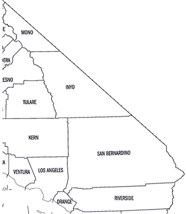
Kern County
Kern County, located in California, has played a significant role in the state's mining history, particularly during the gold rush and subsequent mineral mining booms. The discovery of gold in California in 1848 sparked the famous California Gold Rush, drawing thousands of prospectors and miners to the state, including to areas within what is now Kern County.Gold Rush Era
Although Kern County was established later, in 1866, the region experienced its own gold rush in the 1850s and 1860s. One of the most notable areas was the Kern River area, which became a significant site for gold mining. The first gold discovery in the Kern River area occurred in 1851, leading to a mini gold rush to the region. This discovery was part of the larger Southern California gold rush, which is less famous than the one in Northern California but was significant for the local communities.Silver and Other Minerals
Following the initial gold rush, Kern County also became a site for other types of mineral extraction, including silver. The discovery of silver in the late 19th century in areas such as Cerro Gordo led to another mining boom. Kern County's mineral wealth was not limited to precious metals alone; the county also became known for its deposits of borax, a mineral used in many household products.20th Century and Beyond
In the 20th century, Kern County transitioned from its early focus on gold and silver to becoming a significant player in the oil industry. The county sits on one of the largest oil-producing regions in the United States. However, its historical mining sites remain a testament to the county's rich history in the early days of California's development.Economic and Cultural Impact
The mining booms in Kern County contributed to the area's economic development, leading to the growth of towns and infrastructure. Mining, particularly gold mining, played a crucial role in attracting settlers and establishing the economic foundation of the region. Today, the legacy of the mining era can still be seen in Kern County's cultural heritage and historical sites, attracting tourists and history enthusiasts interested in the California Gold Rush and mining history.Conclusion
Kern County's place in the gold and mineral mining booms is a significant part of California's mining history. From the gold rush era to the silver and borax mining periods, the county has a rich heritage of exploration and extraction, contributing to both the local economy and the broader story of California's development.OpenAI. (2024). ChatGPT (4) [Large language model]. https://chat.openai.com
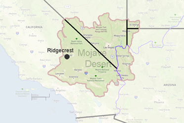 Ridgecrest, CA.