Mojave Desert History:

Who Is in Charge?

No single government, tribe, agency, or company controls the Mojave Desert. That is the first rule for understanding its history. The Mojave is not one jurisdiction. It is an area with many overlapping authorities. It is older than the borders now drawn. It is still managed piece by piece: by federal land agencies, tribal nations, state governments, county supervisors, city councils, military commands, water districts, railroads, utilities, conservation laws, mining claims, private property, and custom.

Before American maps and agencies, Native peoples held authority over the region. Their homelands, trails, springs, food-gathering areas, trade routes, and river crossings shaped the land. This was not “ownership” in the later courthouse sense; instead, it meant use, memory, obligation, defense, kinship, and sacred geography. The Mojave people controlled key parts of the Colorado River. Paiute, Chemehuevi, Serrano, Cahuilla, Kawaiisu, Timbisha Shoshone, and others were tied to desert and mountain margins. Authority followed water, trails, seasonal movement, and social ties.

Spanish and Mexican authority followed, coming lightly and unevenly. The Mojave was crossed, described, feared, and sometimes claimed. It was not closely governed. Missions, ranchos, military parties, and traders affected the edges and corridors more than the interior. The desert was difficult to occupy in the usual colonial way. Water was scarce. Distances were great. Native people still controlled much of the practical geography.

After the United States took California and the Southwest, authority became more formal but not necessarily more complete. Surveyors, soldiers, miners, freighters, railroad companies, and county officials imposed new systems of control. Military posts guarded roads and river crossings. Mining districts drafted local rules before the full government arrived. Stage and wagon roads made certain corridors important. Counties claimed jurisdiction, but their reach was often thin.

The arrival of the railroad changed the balance of power. The Atlantic and Pacific Railroad, later tied to the Santa Fe system, crossed the Mojave. Authority gathered around depots, water stops, sidings, land grants, and townsites. Places like Daggett, Barstow, Needles, Kelso, and Mojave developed. Transportation created order in a land that had previously resisted centralized control. The railroad did not govern the whole desert. However, it controlled movement, freight, settlement patterns, and economic opportunity.

Mining created another layer. Silver, gold, borax, copper, iron, salt, and other minerals brought camps, claims, mills, roads, and speculation. In many districts, authority came from miners’ meetings, claim notices, local custom, and whoever could pay for extraction and hauling. Over time, state and federal law provided the legal framework. On the ground, the desert was ruled by remoteness, money, water, and endurance.

Homesteading added another layer to authority. The government encouraged settlement through land laws. Much of the Mojave, however, was marginal for farming. Some settlers proved up claims. Some built cabins. Some failed. Some left behind the jackrabbit homestead landscape. Authority here was paper-based: legal descriptions, patents, assessment rolls, roads, school districts, and county maps. But the land itself often had the final word.

In the 20th century, the federal government became the main land authority. National parks, military bases, grazing districts, wildlife refuges, reclamation projects, and later BLM management made much of the Mojave public land. World War II and the Cold War expanded the military presence. Fort Irwin, China Lake, Edwards Air Force Base, Marine Corps bases, and training ranges made the desert a national defense site.

At the same time, water and power authorities became decisive. As a result, projects like the Hoover Dam, the Colorado River system, aqueducts, transmission lines, pipelines, and later solar and wind initiatives connected the Mojave to cities across the Southwest. In this phase, the desert was governed by both land ownership and infrastructure.

Later, the conservation era changed the question of authority again. Laws and designations like the 1964 Wilderness Act, the 1976 Federal Land Policy and Management Act, the California Desert Conservation Area, and the 1994 California Desert Protection Act redefined much of the Mojave as habitat, wilderness, cultural landscape, and public trust. Groups such as the National Park Service, BLM, Fish and Wildlife, state agencies, county governments, tribes, miners, ranchers, off-road users, utilities, conservation groups, and local residents all joined the debate.

Today, much of the California desert is managed by the Bureau of Land Management. Other major areas are under the National Park Service, such as Mojave National Preserve, Joshua Tree National Park, and Death Valley National Park. The military is also a major landholder and decision-maker. Tribal authority is increasingly recognized through consultation, co-stewardship, and co-management, though this is not always done equally or adequately. Counties regulate land use in private and unincorporated areas. Cities govern their own townsites. Water districts, utilities, mining companies, conservation groups, and private owners all hold some authority.

Also, who is in charge?

The best answer is: it depends on where you are, what resource is at issue, and what kind of authority you mean. A ranger can control a campground. A county may control the zoning. A sheriff can enforce local law. The BLM can manage grazing, recreation, mining access, or conservation on public land. The Park Service may regulate activity within a preserve or park. A tribe may exercise cultural, historical, legal, and, sometimes, land-management authority. The military can close an entire landscape. A water district can decide the fate of an aquifer. A railway or utility may control a corridor. A private owner may hold title to a desert square surrounded by public land.

That is the Mojave’s pattern: not centralized command, but layered jurisdiction. The desert has always been negotiated valley by valley, spring by spring, road by road. Its history is people trying to cross it, use it, protect it, extract from it, defend it, name it, and claim it—but never mastering it. Whoever controlled water, movement, maps, law, minerals, military access, or infrastructure controlled part of the desert. But no one controlled it all. The Mojave is best seen not as a single chain of command, but as a contest between landform, use, law, memory, and power.
Corridor Identification

A) The Mojave River spine (Colorado River → eastern Mojave springs → Mojave River corridor → Cajon Pass → San Bernardino/LA)

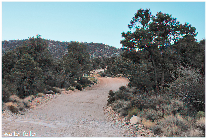
Mojave Indian Trail; Mojave River Trail; Mojave Road; Old Spanish Trail (where it drops into/uses Mojave River and related desert crossings); Beale’s Wagon Road (in its CA desert segment); Brown’s Toll Road (as the Cajon gateway upgrade); plus the generic “Wagon Roads” label when you’re talking about the 19th-century wagonable evolution of the same line.

The idea is simple: reliable water spacing and a workable pass dictated the alignment. The Mohave Trail conceptually underlies the later Mojave Road, and the NPS explicitly treats the Mojave Road through Mojave National Preserve as a branch of the Old Spanish National Historic Trail. Beale’s route description also ties his Mojave Desert segment to the Mojave Trail/Old Spanish Trail network, then notes the junction with the Mormon Road at the Mojave River. Brown’s Toll Road is best understood as “the Cajon Pass switch” that made the desert–coast connection more serviceable (toll/improvement era), not a whole new long-distance corridor by itself.

B) The LA ↔ Salt Lake “southern route” family (good-roads era branding laid over older travel)

Salt Lake Road; Old Spanish Trail (northern route pieces); Arrowhead Trails Highway; and again “Wagon Roads” as the pre-auto baseline.

This is the family that turns into the famous LA–Las Vegas–Salt Lake motor corridor in the auto-trails era. The BLM’s Arrowhead Trails Highway page is blunt about the lineage: the proposed/marketed auto route followed the late-19th-century “Old Mormon Road” and the earlier Old Spanish Trail. The Arrowhead Trail’s “association/branding layer” starts in 1916 (organized/incorporated that year) and is essentially a named-trail wrapper on that corridor.

C) “Good Roads” transcontinental overlays (names that often ride on top of existing roads, then feed into numbered highways)

National Old Trails; Midland Trail; Route 66 (as the numbered successor in the Southwest); and sometimes Arrowhead Trails Highway where it shares pavement with the NOTR in Southern California.

The key point: these aren’t necessarily new alignments end-to-end; they’re promotional/organizational systems that sign and improve what counties and states already had. FHWA and other summaries describe the National Old Trails Road Association as one of the early major named-trail movements (founded 1912). In the West, big stretches of the NOTR were later folded into US 66, which was established/commissioned in 1926 (signing followed). The Midland Trail is another early signed transcontinental auto trail (signed by 1913) that overlaps conceptually with the named-trails era rather than replacing everything on the ground.

D) The Sierra/Eastern Sierra north–south family (LA ↔ Mojave ↔ Owens Valley and beyond)

Sierra Highway / El Camino Sierra.

This one is its own long corridor family, and it intersects the desert east–west systems at junction towns rather than duplicating them. It’s commonly framed as an early 20th-century promoted route (established/advertised early, with later highway rebuilds) connecting Los Angeles into the Eastern Sierra.

E) The Tejon/Tehachapi gateway family (LA Basin ↔ San Joaquin Valley crossings)

Fort Tejon Road; Ridge Route.

Think “northbound exit from the LA Basin” rather than “Mojave crossing.” The Los Angeles–Fort Tejon Road is described as a successful wagon road solution over/near the Tehachapi barrier, completed in 1855. The Ridge Route is the early engineered state highway-era answer (opened 1915) that finally made that link paved and direct in the automobile age.

F) San Bernardino/San Gabriel mountain connectors (coast ↔ mountain communities, not trans-desert corridors)

Rim of the World Drive; Angeles Crest Scenic Drive (Angeles Crest Highway); Van Dusen Road.

These are “mountain access projects” more than “interregional desert crossings.” Rim of the World Drive is documented as opening in 1915 to connect San Bernardino with Big Bear through the range. Angeles Crest Highway construction begins in 1929 and the completed through-route opens much later (mid-20th century). Van Dusen Road sits here as an earlier wagon-road era Big Bear/Holcomb access line tied to the 1860–61 gold rush logistics (often described as a wagon road built in 1861).

G) Death Valley–Panamint access network (mining roads, toll-road tourism era, park-era backroads)

West Side Road (Death Valley); Road to Panamint; Eichbaum’s Toll Road (same as “Eichbaum Toll Road”).

This family is its own ecosystem: borax-era freight roads, mining camp supply lines, then purpose-built access to resorts/tourism. NPS frames the borax era as transport over “primitive roads” (1883–1889). The Eichbaum Toll Road is well-documented as a 1925–26 build from near Darwin to Stovepipe Wells (i.e., a deliberate west-side entry improvement). “Road to Panamint” is best treated as the umbrella for the Panamint Valley/Skidoo/Rhyolite road-pushing phase in the 1906–1907 window and its successors; NPS history material and HAER/other documentation talk explicitly about wagon-road development and the Rhyolite–Skidoo road beginning in 1906 and being in use by 1907. West Side Road is the park backroad line on the valley floor’s west side (modern status aside), squarely in the “Death Valley internal access” bucket.

Covered Wagon (prairie schooner)

/wagons/

Covered wagons significantly impacted the United States’ westward expansion during the 18th and 19th centuries. These wagons, often called “prairie schooners,” were designed to transport goods and settlers across the North American continent.

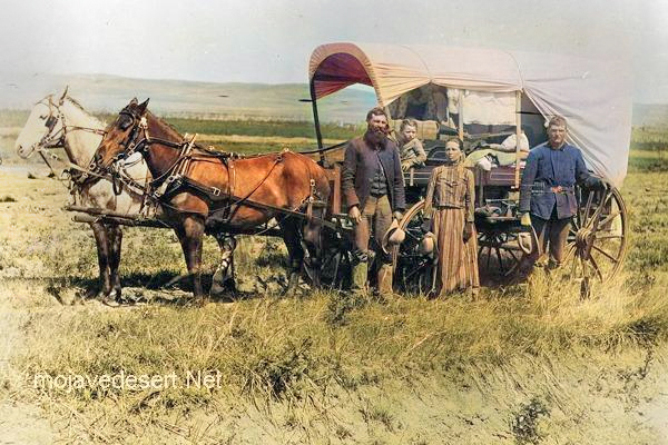
Family & covered wagon (prairie schooner)

Key features and uses of covered wagons included:

  1. Design: Covered wagons typically had a wooden frame with a canvas cover. This cover protected the contents from weather elements like rain and sun. The wagon bed was usually made of wood and was about four feet wide by ten feet long.
  2. Cover: The cover was made of canvas or similar durable cloth, stretched over hooped frames, providing shelter and goods for the occupants.
  3. Wheels: The wheels were often large and designed to handle rough terrain. The front wheels were usually smaller than the rear wheels, allowing easier turning.
  4. Draft Animals: Oxen, mules, or horses were commonly used to pull these wagons. Oxen were preferred for their strength and endurance, especially over long distances.
  5. Role in Expansion: Covered wagons were essential for westward migration in the U.S. They carried settlers’ belongings, including tools, food, and sometimes even passengers. These wagons were a vital part of the movement to settle the American West and were commonly seen on trails like the Oregon Trail, the Santa Fe Trail, and the California Trail.
  6. Living Quarters: The covered wagon was a temporary home for many settlers traveling west. Families would cook, eat, sleep, and spend much of their time in or around the wagon during their journey.
  7. Historical Significance: The image of a covered wagon crossing the plains has become an iconic symbol of American frontier life, representing the pioneer spirit, exploration, and the challenges of frontier life.

The use of covered wagons declined with the advent of railroads, which offered a faster and more efficient means of transporting goods and people across the country. However, their legacy remains an integral part of American history and folklore.