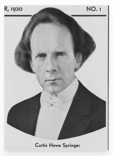
Curtis Howe Springer and the Complicated Story of Zzyzx
Curtis Howe Springer was a radio preacher, health-product salesman, resort promoter, and one of the Mojave Desert’s most unusual characters. He was neither simply a generous desert visionary nor merely a confidence man. He built a functioning community, provided work and shelter, attracted visitors, and helped Baker’s economy. He also used credentials he had not earned, advertised products with unsupported medical claims, and operated a large resort on federal land he did not own.
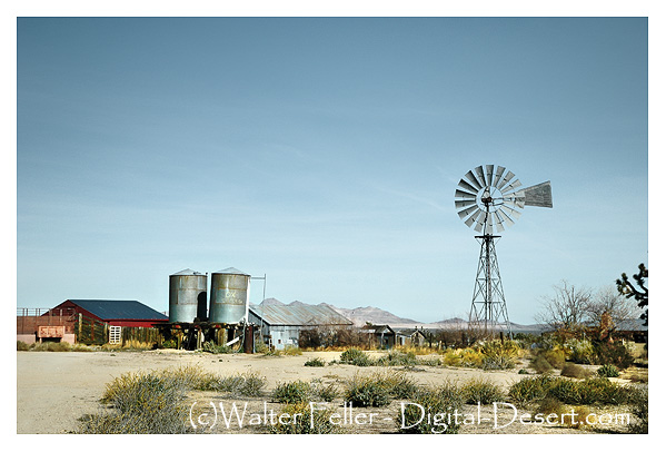
Springer arrived at Soda Springs in 1944 with Helen Springer. He filed mining claims covering about 12,800 acres and renamed the place Zzyzx, which he promoted as “the last word in health.” From a collection of tents and old ruins, the Springers developed a resort with guest rooms, a dining hall, a chapel, mineral baths, a swimming pool, radio facilities, workshops, gardens, animal pens, and an airstrip.
Much of this was real. Zzyzx wasn’t simply a name on a brochure. People lived, worked, ate, worshiped, and vacationed there for nearly 30 years. The federal court later described four guest buildings containing 59 units, a dining room and kitchen, an administration building, a chapel, mineral baths, electrical equipment, and numerous other structures.
Work and Economic Benefits
Springer’s operation created work at Zzyzx and generated business in nearby Baker. Workers mixed and packaged health foods, printed literature, prepared radio recordings, filled orders, handled correspondence, maintained buildings, cooked meals, cared for animals, and mailed products.
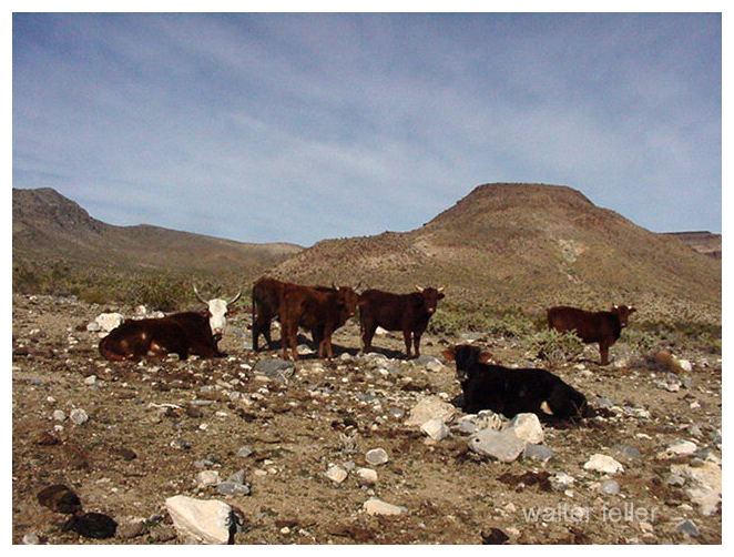
Some workers were recruited from Los Angeles’ Skid Row. They were offered food, shelter, a small wage, and a place away from alcohol in exchange for construction and maintenance work. This labor helped Springer build the resort at relatively low cost, but it also provided men with few alternatives, a temporary home, and useful work.
Zzyzx also affected Baker. Visitors sometimes stayed in Baker motels while waiting to enter the resort. Springer’s enormous volume of packages, promotional literature, donations, and correspondence helped raise the Baker post office to first-class status. The federal court record specifically confirms that foods, printed materials, and radio recordings were packaged and prepared for mailing at Zzyzx.
However, Springer did not cause Baker’s first post office to be established. Postal records show that the office began under the name Silver Lake on March 27, 1907. It was renamed Baker in February 1933, eleven years before Springer arrived. His business greatly increased its workload, but it did not create the first post office.
Was Springer Rich?
Springer appears to have become wealthy during Zzyzx’s most successful years. The National Park Service describes him as a millionaire. His radio broadcasts reached hundreds of stations, while listeners sent donations and ordered teas, food supplements, books, and other products. The National Park Service states that he shipped more than four million packages during his years at Zzyzx.
One witness later recalled that Springer paid a $2,500 court fine immediately, treating it like a minor expense. This suggests that he had considerable available money.
His exact personal wealth is still unknown. No dependable financial statement or estate accounting has been found. Some of his apparent wealth was represented by buildings and improvements at Zzyzx. Those improvements stood on federal land, and Springer never obtained legal title to the property. He could control the operation while he occupied it, but he did not own a desert estate that he could legally sell.
The Ownership Problem
Springer held unpatented mining claims. Such claims allowed legitimate mineral exploration and mining, along with activities reasonably connected to mining. They did not automatically transfer ownership of the land.
The United States remained the legal owner. Springer’s hotel, health resort, food-packaging operation, radio studio, pools, airstrip, residential buildings, and religious activities went far beyond ordinary mining.
Springer made several attempts to obtain a stronger legal right to the property. He filed desert-land applications in 1951, public-recreation applications in 1957 and 1958, and another non-mineral application in 1966. These applications were rejected, dismissed, or denied. Despite those decisions, he continued operating Zzyzx.
In 1970, a federal district court restricted the property to mining-related uses. A 1971 injunction prohibited Springer from operating the resort, renting rooms, packaging food, preparing mail, recording broadcasts, maintaining pools, or inviting people to live there for purposes unrelated to mining. The Ninth Circuit Court of Appeals upheld that injunction.
The legal record, therefore, leaves little doubt about ownership: Springer and his organizations built and operated Zzyzx, but the United States owned the land.
Was Springer Selling Land?
There is evidence that Springer marked off residential lots and allowed major donors to build homes on them. Some historical accounts describe this as offering or selling parcels to supporters.
The wording requires care. Springer could promise someone a place to live or accept a donation in exchange for the use of a lot, but he could not convey valid ownership because he did not own the land. No deed from Springer could transfer federal property.
It is therefore safest to say that Springer allocated or offered homesites to donors as if he controlled the property. Whether every arrangement was described as a direct sale is less certain. What is certain is that donors could not receive a valid title from him.
Would Nonprofit Status Have Helped?
Nonprofit status would not have solved Springer’s central problems. In fact, organizations connected with Zzyzx already included the Dr. Curtis Howe Springer Foundation and the Zzyzx Community Church. Both were named in the federal land case.
A properly managed nonprofit could have accepted donations, operated a retreat, and possibly applied for an authorized lease or public-purpose agreement. It still would have needed federal approval to occupy the land. It would also have been required to follow food, drug, advertising, tax, and charitable organization laws.
Calling the resort a church, foundation, charity, or nonprofit could not transform a mining claim into ownership. It also could not legalize false medical advertising or the unauthorized distribution of public land.
A nonprofit might have helped only if Springer had reorganized the operation, stopped making unsupported health claims, kept proper financial records, and obtained a valid federal lease. The government had already rejected several of his applications, so nonprofit status alone would not have guaranteed that result.
Why Springer Went to Prison
Springer was not imprisoned merely for being eccentric, practicing natural health, or building a resort in the desert. The strongest court evidence concerns false advertising and misbranded foods.
The Ninth Circuit record states that he had been convicted on 18 counts of false advertising involving supposed remedies for hemorrhoids, heart disease, nervous conditions, thyroid problems, and goiter. It also records violations of California food-misbranding laws.
Springer was fined and sentenced to 60 days in jail. After appeals, he reportedly served 49 days. His imprisonment should be distinguished from the land dispute. The land case was primarily a federal civil action for an injunction, damages, ejectment, and eviction. His false advertising and food law convictions provided the criminal penalties.
Thus, two legal problems came together:
- Springer used federal mining-claim land for a resort, residence, manufacturing, and mail-order business.
- He advertised health products with claims that authorities and courts found false or misleading.
The first problem cost him Zzyzx. The second resulted in penalties and imprisonment.
Did the Rehabilitation Program Work?
Some men probably benefited from their time at Zzyzx, although their progress was never formally documented. Springer offered homeless and struggling men food, shelter, work, routine, and an alcohol-free environment. The National Park Service has concluded that these conditions certainly helped some visitors.
Springer later claimed that Zzyzx had helped rehabilitate 4,000 destitute men. That figure came from Springer himself. No known records follow these men after they left, nor do they show how many remained sober, found permanent employment, reunited with families, or established stable homes.
Zzyzx was not a licensed rehabilitation center with trained counselors, medical supervision, case records, or long-term follow-up. Nevertheless, temporary shelter and meaningful work can still help people. The fair conclusion is that Springer probably helped some individuals, but his claim of 4,000 successful rehabilitations cannot be verified.
Eviction and Final Years
After years of court proceedings, federal authorities removed Springer and his followers from Zzyzx in 1974. The government did not recognize his ownership claims, and Springer could not take the property with him or sell it as his estate.
In 1976, the Bureau of Land Management permitted the California State University system to use the site. Zzyzx became the Desert Studies Center, where students and researchers continue to study Mojave Desert biology, geology, hydrology, and history.
Springer and Helen moved to Las Vegas after the eviction and his short imprisonment. He remained there for the rest of his life. Curtis Howe Springer died in Las Vegas on August 19, 1985, at age 88. Available sources do not identify the particular residence or hospital where he died.
A Balanced Judgment
Springer’s story resists a simple conclusion. He was a persuasive promoter who made unsupported medical claims and used public land far beyond the limits of his mining claims. He accepted money and donations while presenting himself as a doctor and minister, even though he lacked recognized qualifications. His legal troubles were based on substantial evidence, not simply disagreement with unconventional medicine.
At the same time, he built a real desert community. Zzyzx provided jobs, meals, shelter, inexpensive vacations, religious fellowship, and temporary stability. His mail-order business supported packaging and mailing work and brought measurable business to Baker. Some people remembered him with sincere thanks.
His good works did not give him ownership of federal land, and nonprofit status would not have erased the legal violations. Likewise, his unlawful conduct does not mean that nobody benefited from Zzyzx. Both parts belong in history.
Sources
United States v. Springer, Ninth Circuit Court of Appeals
Mojave National Preserve Administrative History
Los Angeles Times: Zzyzx and Curtis Howe Springer
California Post Office Records
SFGATE: The History of Zzyzx Road