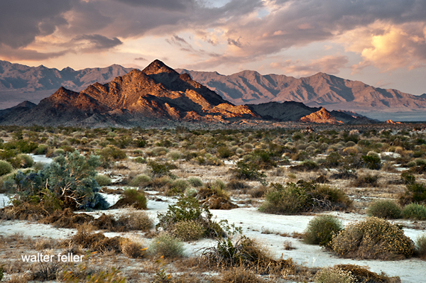
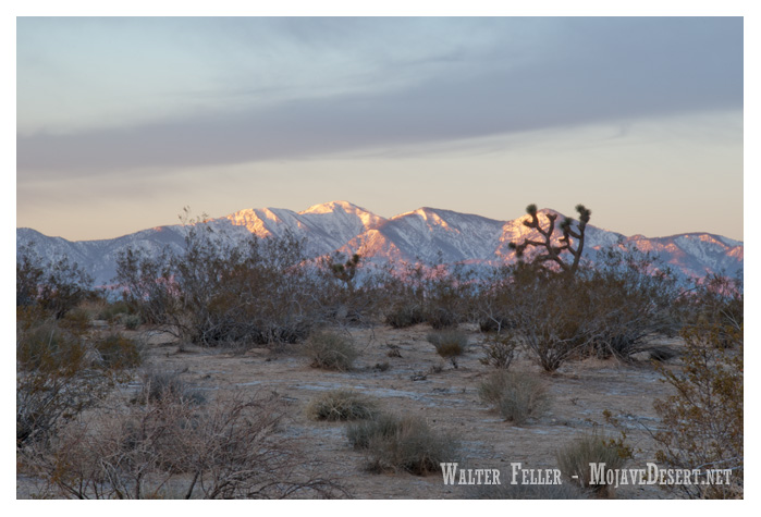
The Mojave River, a hidden gem in the arid landscapes of California, serves as a vital lifeline in the Mojave Desert. This remarkable river spans approximately 110 miles and offers a diverse ecosystem, historical significance, and recreational opportunities for nature enthusiasts and history buffs.
Geography and Formation:
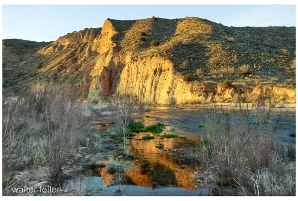
The Mojave River originates in the San Bernardino Mountains and meanders through the Mojave Desert, eventually dissipating into Soda Lake. Its path encompasses various landscapes, including rugged canyons, barren deserts, and lush riparian habitats. The river’s formation can be traced back thousands of years ago when geological processes and the ever-changing climate of the region shaped its course.
Ecological Importance:
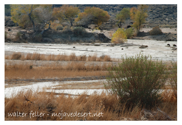
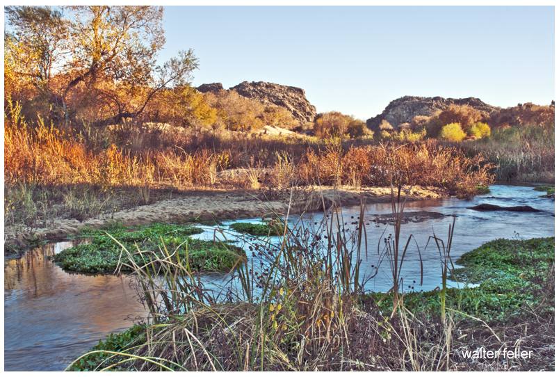
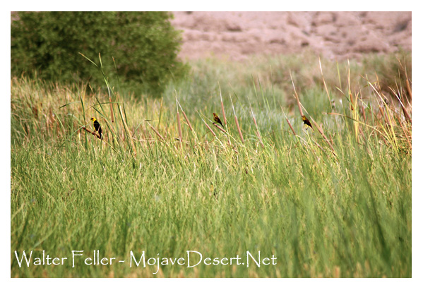
Despite the harsh Mojave Desert conditions, the Mojave River sustains a surprising array of flora and fauna. The river’s riparian zones provide an ideal habitat for a variety of plant species, such as willows, cottonwoods, and mesquite trees. These lush areas attract diverse wildlife, including birds, reptiles, and mammals, seeking refuge in this desert oasis.
Historical Significance:
The Mojave River holds a significant place in the history of California. Native American tribes, such as the Mojave, Serrano, and Chemehuevi, once relied on the river’s resources for sustenance and survival. European explorers, including Spanish missionaries and fur trappers, ventured along its banks, leaving behind a legacy of cultural exchange and exploration.
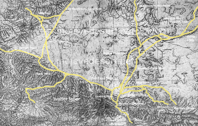
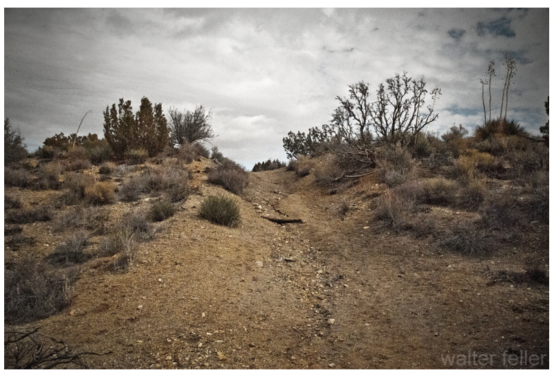
Moreover, during the mid-1800s, the Mojave River played a crucial role in the development of the Old Spanish Trail and the Mojave Road. These historic trade routes linked the Spanish colonies of California with the eastern United States, facilitating trade and migration.
Recreational Opportunities:
For outdoor enthusiasts, the Mojave River offers a plethora of recreational activities. Hiking trails, such as the Mojave Riverwalk Trail, provide opportunities for exploration, allowing visitors to immerse themselves in desert scenery. Camping facilities and picnic areas along the river’s banks provide the most idyllic setting for a peaceful getaway amidst nature’s tranquility.
Conservation Efforts:
Recognizing the importance of preserving this vibrant ecosystem, numerous conservation organizations and government agencies have worked to protect and restore the Mojave River. These initiatives focus on sustaining river water quality and preserving riparian habitats.
Conclusion:
The Mojave River stands as a testament to the resilience of nature in the face of adversity. Its meandering path through the Mojave Desert provides a lifeline for both wildlife and humans, offering a sanctuary amidst the arid landscapes. Whether you are a nature lover, history enthusiast, or adventure seeker, the Mojave River is a destination that promises a unique and memorable experience. So, embark on a journey to this desert oasis, and let the Mojave River captivate you with its beauty and allure.
Transmogrification, though it carries a slightly literary, almost mythic tone, suggests not just change but a deep and strange transformation into something fundamentally different.
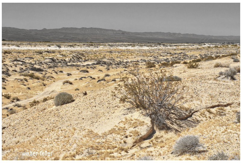
For much of its recorded history, the Mojave Desert was primarily understood as a physical region. Its identity arose from terrain and climate. Dense or permanent human occupation played little role. Early travelers, surveyors, geologists, and writers described it using the language of the landform. They noted broad basins, isolated mountain ranges, dry lakes, volcanic fields, alluvial fans, dunes, washes, and the intermittent course of the Mojave River. The desert was seen as a geographical system. Uplift, erosion, aridity, and distance formed it. Its boundaries were often indistinct. The Mojave was not yet a tightly organized human landscape. It was seen as open country, with character shaped by the land’s form.
In that earlier conception, geography imposed limits upon people. Travel followed springs, canyon mouths, and natural passes through the mountains. Camps and settlements clustered where water permitted survival. Roads bent around lava flows, crossed playas, or traced older Indigenous routes refined over generations of movement through the desert. Human activity existed within conditions dictated by climate and terrain. The desert remained the dominant force, and people adapted themselves to it.
Even with these earliest permanent intrusions, the long-standing dynamic between people and landscape was not immediately overturned. Mining camps rose and disappeared as ore deposits and water supplies fluctuated. Wagon roads faded when springs failed. Small railroad towns appeared abruptly but often remained fragile in the face of the scale and hostility of the surrounding landscape. Much of the Mojave still retained the appearance of a place shaped principally by geology rather than by civilization.
Over time, a shift occurred: the Mojave, once defined by natural systems, increasingly came to be structured around human needs. The first key shift came with railroads, which established artificial centers in previously insignificant locations—places that had mattered only as crossings or water stops. Afterward, elements like highways, aqueducts, transmission corridors, military reservations, utility infrastructure, suburban expansion, recreational development, industrial agriculture along the margins, and large-scale energy production continued this trend. These forces did not simply occupy the desert; they actively reorganized it.
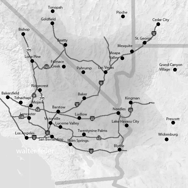
A modern map of the Mojave clearly reveals this shift: vast military boundaries now dominate entire valleys and mountain ranges. Meanwhile, interstate highways create strong directional corridors across what were once diffuse travel landscapes. Utility-scale solar developments, visible for miles, convert open basins into industrial energy fields. Transmission towers march across dry lakes and bajadas. Off-road recreation networks carve repeating tracks into fragile terrain. Finally, conservation areas and national preserves add another layer of organization by establishing access restrictions, managing habitats, providing tourism infrastructure, and developing preservation policies.
Increasingly, the Mojave is understood less through watersheds and landforms than through jurisdiction and use. One valley becomes associated with military training, another with renewable energy, others with recreation, habitat protection, logistics, or suburban expansion. This shift is reflected in the language used to describe the desert. Whereas earlier generations emphasized playas, volcanic mesas, spring systems, or mountain passes, modern discussions focus on renewable energy zones, conservation plans, transportation corridors, protected acreage, groundwater management, housing pressure, and recreational access.
Yet the older desert has not disappeared beneath these overlays. The geology remains the controlling framework beneath every human system. Basin-and-range topography still governs drainage and movement. Mountain ranges still create rain shadows and isolate valleys. Heat still limits settlement density. Water scarcity still defines possibility. Dry lakes still gather runoff after storms, just as they did centuries ago. In many places, the desert resists permanent transformation. Every generation is reminded that the underlying landscape remains older and more powerful than any system laid upon it.
Building on these evolving layers of meaning, what has changed most is not simply the Mojave’s physical appearance but its significance. The desert has shifted in its conceptual role: initially perceived as a natural form, then as a landscape of use, and now increasingly as a landscape of negotiation.
The central question is no longer merely “What is the Mojave?” but “What is the Mojave for?” Different groups now approach the same landscape with competing visions: energy developers see open basins suitable for solar fields and transmission infrastructure; conservationists see fragile ecosystems, migration corridors, and biological continuity; tribes see ancestral homelands, sacred sites, and cultural memory in the terrain itself. The military sees strategic training space, defined by isolation and open airspace, while residents see communities and livelihoods. Recreationists seek freedom, mobility, solitude, and escape, while cities beyond the desert offer land, water, transportation routes, and energy supplies.
As these pressures intensify, nearly every part of the Mojave acquires overlapping claims—emptiness itself becomes contestable. Open land is no longer simply open; instead, it becomes designated, managed, leased, protected, restricted, industrialized, or defended. Consequently, the future Mojave is likely to be shaped not by a single activity, but by tensions among many competing systems, all operating simultaneously across the same terrain.
In this evolving context, the Mojave is entering a third historical phase. Initially, it was defined by its physical landforms. Next, human activities and uses became the defining factors. Now, the Mojave’s identity may increasingly depend on negotiations and conflicts over its meaning, access, and purpose.
The old desert will still remain beneath these arguments. The playas will still whiten under summer heat. Winds will still sweep across creosote flats. Mountain ranges will still rise abruptly from broad basins at dusk. Seasonal floods will still cut across washes after sudden storms. The geological skeleton of the Mojave will endure. However, as human systems become more extensive and entangled, the experience and interpretation of the desert will continue to change.
The future Mojave will be governed as a layered landscape. No single authority will determine its fate: federal agencies will control vast public lands; counties will regulate roads, zoning, and development pressure; tribes will press claims rooted in sovereignty, memory, and sacred geography; energy and mining companies will seek permits, leases, and corridors; conservation groups will defend habitat and species; recreationists will demand access; and residents will argue for the right to live within the desert, not just be managed from outside. In light of these overlapping interests, governance will become less about drawing boundaries and more about arbitrating between claims. The desert will be administered through plans, lawsuits, permits, consultations, closures, leases, and exceptions. Its future will not be decided all at once; instead, it will be determined valley by valley, corridor by corridor, and project by project.
The Mojave functions as both an ancient physical landscape and a modern human one. While it is no longer shaped solely by tectonics, erosion, and climate, it is no longer defined solely by railroads, highways, military reservations, and energy development. Increasingly, the desert is formed by negotiations over how such a landscape should exist. Thus, what once was defined by its form is now shaped by the competing meanings people assign to it.
Introduction This synthetic history offers a short, integrated view of how a place or event may have developed over time. It draws on known facts, adds reasonable connections, and presents a straightforward narrative that helps the reader see the larger pattern behind the details.
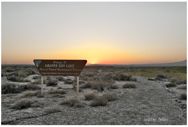
Harper Lake began as a shallow Pleistocene basin fed by the changing Mojave River system. As the climate shifted and Lake Manix drained, water reached the Harper basin only in rare pulses, leaving broad mudflats and signs of older shorelines. Early travelers used the dry lake as an open landmark between Barstow and the Fremont Valley. Ranchers later crossed it while moving stock between seasonal ranges. In the twentieth century, power lines, ranch roads, and the airfield at Lockhart marked its edges, but the basin itself stayed quiet. What began as an ancient lake became a wide, dependable reference point in the western Mojave.
Diagram version
Pleistocene Basin
(formed during wetter Mojave River phases)
          |
          v
Lake Manix Drainage
(water reaches basin in rare pulses)
          |
          v
Broad Mudflats
(old shorelines, dry lake surface)
          |
          v
Travel Landmark
(open guide between Barstow and Fremont Valley)
          |
          v
Ranch Use
(stock crossings, seasonal routes)
          |
          v
Modern Markers
(power lines, Lockhart airfield, access roads)
          |
          v
Present Basin
(dry, stable landmark in the western Mojave)
Essay Harper Lake is one of those quiet western Mojave basins that tells a long story without saying much. Its history begins in the late Pleistocene, when the Mojave River behaved differently, and water sometimes pushed farther west than it does today. After Lake Manix drained, the river wandered across its basin system in unpredictable pulses. During the wetter periods, some of that water reached the Harper basin, leaving layers of fine silt and clay, smoothing the floor, and marking low shoreline benches on the basin walls. These old lake margins still sit a few feet above the flats, showing where storms, climate, and river pathways once made a shallow lake in a place that is now dry most of the year.
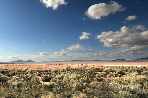
As the climate warmed and dried, Harper Lake shifted into a different role. Its connection to the Mojave River became rare and temporary. Water arrived only through heavy storms, brief pooling, or scattered sheetflow that vanished as fast as it came. By the Holocene, the basin had settled into the pattern we recognize today: a vast playa surrounded by creosote scrub, saltbush patches on the margins, and a wind-polished surface that reflects the sky when it is dry and mirrors it when it is briefly wet.
This kind of history fits perfectly with the synthetic examples we started building. In those early models, we traced how simple features in desert country begin as natural formations and slowly take on meaning as people start using them. Harper Lake followed that path. Long before written history, Native travelers crossed its edges as they moved between springs and gathering places. The lake itself offered little water, but its openness made it a dependable marker between the Mojave River corridor and the Fremont Valley routes.
When ranching spread into the region, the basin became part of seasonal stock drives. The flat surface offered a straight line across the land, and the margins gave access to scattered grazing after rare rains. Later, freighters and early motorists used the dry lake the same way: as a clear, recognizable point in a vast landscape where a person needed all the help they could get to stay oriented. The open horizon, the straight edges, and the bare floor served as practical signs that they were on the right course.
By the twentieth century, modern structures began to appear around the basin. Power lines crossed the margins. Utility roads threaded across the flats. The airfield at Lockhart took advantage of the open terrain. Yet even with these additions, Harper Lake retained its quiet identity. It stayed dry most years, it kept its old shorelines in place, and it remained a stable reference point for anyone who knew the western Mojave.
This is the same pattern our first synthetic histories described: a natural feature shaped by water and climate becomes a guide for travel, a minor stage in ranching and settlement, and finally a fixed part of the regional map. Harper Lake shows that a place does not need deep water or dramatic cliffs to play a long role in desert history. Sometimes a broad, silent basin does the work, carrying its past in its shape and offering direction to anyone crossing the land.
–
Synthetic history disclaimer This synthetic history blends facts with interpretive narrative to show how events, places, and processes may have unfolded. It is not a primary source and does not replace direct historical records, archaeological findings, or scientific studies. Details drawn from known evidence are kept as accurate as possible, while connecting material is written to provide continuity and context. Readers should treat this as an interpretive aid, not as a definitive account, and consult documented sources for precise dates, data, and citations. This is a learning engine rather than a teaching engine.
California is home to high and low deserts, characterized by distinct features, climates, and elevations. The primary differences between California’s high and low deserts include elevation, temperature, and vegetation.
Low Desert
High Desert
Elevation:
High Desert: The high desert refers to areas at higher elevations, typically between 2,000 and 4,000 feet above sea level. Examples of high desert regions in California include the Mojave Desert. Cities like Lancaster and Palmdale are located in the high desert region.
Low Desert: The low desert, on the other hand, is found at lower elevations, often below 2,000 feet. The Colorado Desert, part of the larger Sonoran Desert, is an example of a low desert in California. Cities like Palm Springs and Indio are located in the low desert region.
Temperature:
High Desert: High deserts generally experience greater temperature fluctuations between day and night. Summers can be hot, with daytime temperatures exceeding 100°F (37.8°C), while winters can be cool, with nighttime temperatures dropping significantly.
Low Desert: Low deserts tend to have higher average temperatures, especially during the summer. Daytime temperatures in the low desert areas can often surpass 100°F (37.8°C), and the winters are milder compared to the high deserts.
Vegetation:
High Desert: Vegetation in the high desert is adapted to the arid conditions and includes hardy shrubs, grasses, and some cold-resistant plants. Joshua trees are a characteristic plant of the Mojave Desert.
Low Desert: The low desert is known for its unique plant life, including various species of cacti and succulents. The iconic saguaro cactus is commonly found in the lower elevations of the Sonoran Desert.
Geography:
High Desert: The high desert often features rocky terrain and vast expanses of open land and is characterized by a mix of mountains, plateaus, and valleys.
Low Desert: The low desert may have more sandy and flat terrain, including areas with salt flats. Rugged mountains may also punctuate the landscape.
It’s important to note that these are generalizations, and there can be variations within each desert region. The specific characteristics can also vary depending on the exact location within California.