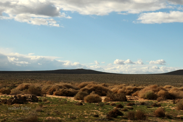
Subsection 322Ag
High Desert Plains and Hills

Hinkley, CA.
The High Desert Plains and Hills section is a distinct part of the western Mojave Desert, shaped by its geology, climate, and natural features. Here's a simplified breakdown of its main aspects:
Location
This area is bordered by several significant geographic and geological features:North/Northwest: Garlock Fault
Southwest: San Andreas Fault
Southeast: Mojave River
Northeast: Harper Valley Fault
It includes notable regions like Indian Wells Valley and has a hot, dry climate.
Geology and Soil
Rocks and Deposits: The area is rich in Mesozoic granitic rocks and Quaternary alluvial and lake deposits, with some sand dunes (eolian sand). You'll also find basalt flows in the Indian Wells Valley and smaller patches of older Precambrian and Miocene sedimentary rocks.Soils: The soils are mostly sandy and rocky, with names like Typic Torriorthents and Lithic Haplocambids. These well-drained soils support desert plants like creosote bushes and Joshua trees. Playas, or dry lake beds, have salty soils (Salids).
Landscape
Landforms: Think gently sloping pediments (rocky flatlands), alluvial fans (fan-shaped deposits of sediment), and flat basin floors with dry lakes like China Lake and El Mirage Lake. There are also occasional hills and mountains, such as Fremont Peak at 4,584 feet.Processes: Wind (eolian), water erosion, and sediment deposition shape the land.
Plants and Vegetation
The desert's plant life reflects its arid environment:Lowlands: Creosote bushes and Joshua trees dominate.
Higher Elevations: California junipers take over at around 3,000 feet.
Wet Areas: Saltgrass, greasewood, and iodine bush grow in salty or moist soils near playas and marshes.
Other notable plants include desert grasses (like big galleta) and shrubs (like shadscale and rubber rabbitbrush).
Climate
Rainfall: 4-10 inches per year, mostly as rain.Temperature: Annual average is 60-66F.
Freeze-Free Days: Around 250-275 days a year.
Water
Runoff: Water moves quickly off mountains and fans but slows in flat basins.Playas: Temporary ponds form after rare rains, but streams are dry most of the year.
Drainage: The region's basins don't drain to the ocean but keep water within closed systems.
In short, this region is a mix of rocky landscapes, sandy soils, sparse desert plants, and dry lakebeds, all shaped by the intense sun and occasional rains of the Mojave Desert.
< previous - Mojave Desert - next >
