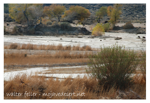
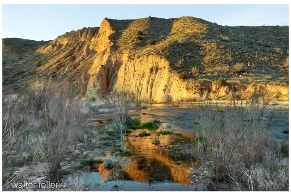
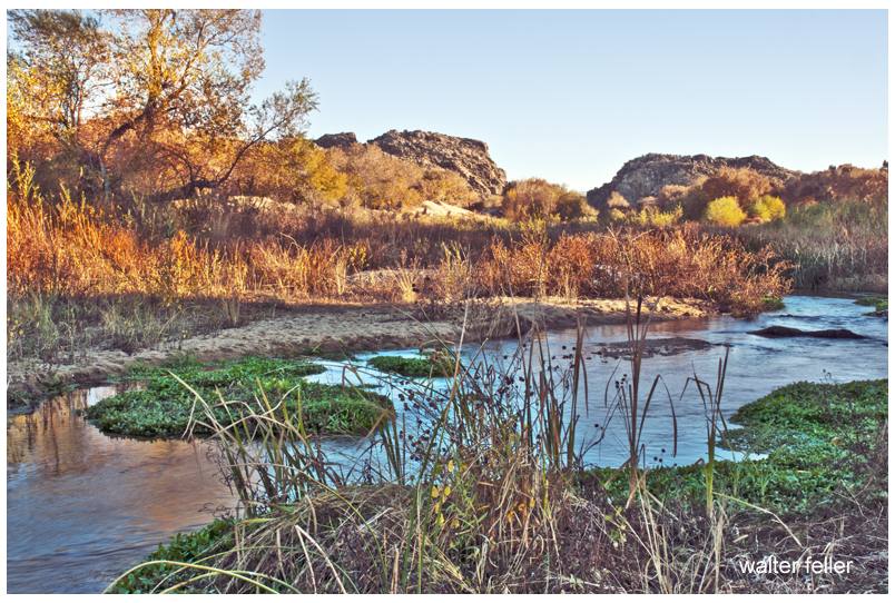
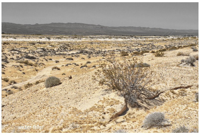
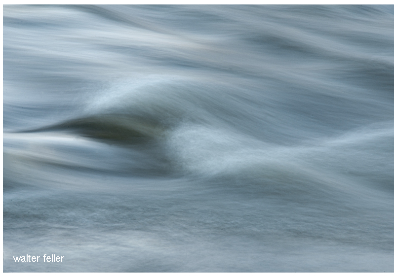
The Mojave River, a hidden gem in the arid landscapes of California, serves as a vital lifeline in the Mojave Desert. This remarkable river spans approximately 110 miles and offers a diverse ecosystem, historical significance, and recreational opportunities for nature enthusiasts and history buffs.
Geography and Formation:
The Mojave River originates in the San Bernardino Mountains and meanders through the Mojave Desert, eventually dissipating into Soda Lake. Its path encompasses various landscapes, including rugged canyons, barren deserts, and lush riparian habitats. The river’s formation can be traced back thousands of years ago when geological processes and the ever-changing climate of the region shaped its course.
Ecological Importance:
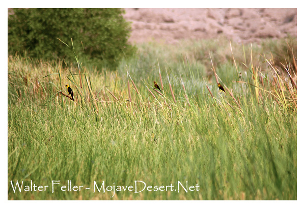
Despite the harsh Mojave Desert conditions, the Mojave River sustains a surprising array of flora and fauna. The river’s riparian zones provide an ideal habitat for a variety of plant species, such as willows, cottonwoods, and mesquite trees. These lush areas attract diverse wildlife, including birds, reptiles, and mammals, seeking refuge in this desert oasis.
Historical Significance:
The Mojave River holds a significant place in the history of California. Native American tribes, such as the Mojave, Serrano, and Chemehuevi, once relied on the river’s resources for sustenance and survival. European explorers, including Spanish missionaries and fur trappers, ventured along its banks, leaving behind a legacy of cultural exchange and exploration.
Moreover, during the mid-1800s, the Mojave River played a crucial role in the development of the Old Spanish Trail and the Mojave Road. These historic trade routes linked the Spanish colonies of California with the eastern United States, facilitating trade and migration.
Recreational Opportunities:
For outdoor enthusiasts, the Mojave River offers a plethora of recreational activities. Hiking trails, such as the Mojave Riverwalk Trail, provide opportunities for exploration, allowing visitors to immerse themselves in desert scenery. Camping facilities and picnic areas along the river’s banks provide the most idyllic setting for a peaceful getaway amidst nature’s tranquility.
Conservation Efforts:
Recognizing the importance of preserving this vibrant ecosystem, numerous conservation organizations and government agencies have worked to protect and restore the Mojave River. These initiatives focus on sustaining river water quality and preserving riparian habitats.
Conclusion:
The Mojave River stands as a testament to the resilience of nature in the face of adversity. Its meandering path through the Mojave Desert provides a lifeline for both wildlife and humans, offering a sanctuary amidst the arid landscapes. Whether you are a nature lover, history enthusiast, or adventure seeker, the Mojave River is a destination that promises a unique and memorable experience. So, embark on a journey to this desert oasis, and let the Mojave River captivate you with its beauty and allure.
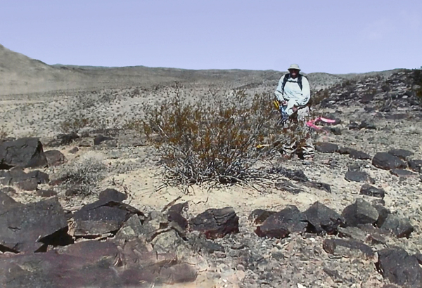
Juduth Reed, archaeologist – photo Russell Kaldenberg
A geoglyph is a ground design created by arranging or removing surface materials so the figure appears when viewed from above. In desert settings, this usually means placing or clearing pavement stones, exposing lighter soil, or scraping shallow lines that catch low-angle light. Mojave examples tend to occupy quiet, stable surfaces such as old lake margins, bajadas, ridgelines, and mesa tops. Their age is difficult to determine without stratified artifacts, and they usually appear in liminal settings that suggest signaling, marking, ceremony, or boundary use.
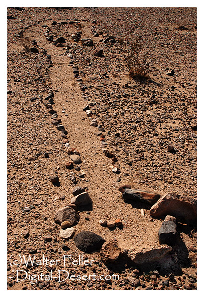
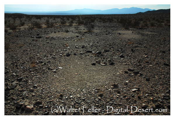
Mojave Desert geoglyphs are scattered and subtle, blending with the surface rather than dominating it. They are created by repositioning varnished stones or removing surface layers, forming sinuous lines, circles, meanders, keyhole forms, and occasionally serpentine figures. Most notable examples can be found in the eastern and central Mojave, where travel corridors, ancient water sources, and basin edges converge. Documented sites are located at Fort Irwin, along the Amargosa drainage, near the Lower Colorado River region, and within ancient lake basins such as Cronese, Soda, and Silver. These figures are commonly twenty to sixty feet long or wide. They are not dramatic from the ground; they reveal their form from oblique or aerial views. Many alignments appear to mark direction, vantage, or symbolic forms rooted in local cultural landscapes. Research is limited by erosion, restricted access to lands, and the scarcity of datable material.
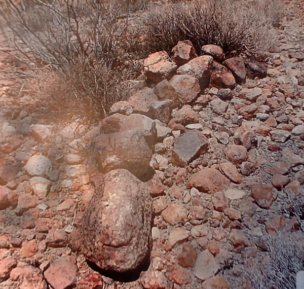
Geoglyphs at Fort Irwin became known only after archaeologists expanded survey work into newly added training lands. Earlier work on the site documented petroglyphs, pictographs, and small rock circles, but newer surveys revealed another category of rock art: broad surface alignments set directly into the desert pavement. These geoglyphs consist of fist-sized stones arranged into straight lines, curves, swirls, and branching patterns covering portions of pavement roughly a quarter of an acre in size. They sit so low and blend so closely in tone with the surrounding ground that they remain almost invisible until someone familiar with desert varnish and pavement structure points them out. Artifacts and oxidation patterns provide relative age clues, though no firm dates are given.
Archaeologists describe the Mojave landscape as highly readable, with scars, signals, and surface changes preserved by aridity. In this setting, rock alignments are found on stable pavements, old lake margins, and gentle rises where water once flowed across the ground. Fort Irwin sits within that framework: ancient lake basins, remnant shorelines, and corridors that once linked seasonal camps. Nearby lithic scatters suggest long-term movement associated with water, game, and travel. Interpretations of the geoglyphs remain limited. Some broken quartzite fragments hint at possible ceremonial use, but the exact meaning remains unknown. Cultural memory tied to such features has not survived, and researchers avoid overreaching beyond what the land itself reveals.
Photo by Russell Kaldenberg
Within the broader Goldstone basin sector of the installation, survey data also note a low ridge with surface materials arranged into a curving alignment that may represent a stylized serpent or directional form. Its placement on a quiet slope between pavement and basin edge fits a familiar Mojave pattern in which subtle figures mark routes, thresholds, or vantage points without leaving associated domestic remains. Features of this kind are typically visible only from an angled view, where dark varnished stones contrast with lighter soil. Because the land is part of an active training area, precise locations are protected, and access is restricted to guided visits. As with other prehistoric sites on the post, Fort Irwin treats these alignments as resources to be safeguarded.
Together, the abstract pavement figures and the additional curving alignment illustrate how ancient travelers marked the basin edges and crossings of the central Mojave. They show that even in a landscape that seems empty at first glance, the ground carries the record of movement, gathering, and intention shaped into the surface itself.
Core Bibliography: Mojave Geoglyphs and Rock Alignments
Allen, Mark W. 1991. Archaeological Investigations at Fort Irwin. Fort Irwin Cultural Resources Program.
Basgall, Mark E. 1993. Chronometric Studies in the Mojave Desert. Publications in California Prehistory 34.
Clewlow, C. William Jr. 1976. Prehistoric Trails of the Lake Mojave Region. UC Archaeological Research Facility Report 30.
Davis, Emma Lou. 1978. The Ancient Californians: Rancholabrean Hunters of the Mojave Desert. Ballena Press.
Fort Irwin Cultural Resources Program. Various Survey Reports and Inventory Summaries, 1980s to present.
Goldstone Deep Space Communications Complex. Cultural Resources Overview Studies, 1990s–2000s.
Heizer, Robert F., and Martin A. Baumhoff. 1962. Prehistoric Rock Art of Nevada and Eastern California. University of California Press.
Minor, Rick. 1987. Intaglios and Ground Figures of the American Southwest. American Rock Art Research Association.
Schaefer, Jerry. 1995. Cultural Resource Management Studies at Fort Irwin, California. ASM Affiliates.
U.S. Army, Fort Irwin Cultural Resources Program. Survey reports and site documentation for expanded training lands, various years.
Sutton, Mark Q., and Jill K. Gardner. Patterns of Mojave Desert Prehistory. Nevada State Museum Anthropological Papers, 1997.
Warren, Claude N., and Robert H. Crabtree. Prehistory of the Southwest and Great Basin. In Handbook of North American Indians, Vol. 11, Great Basin. Smithsonian Institution, 1986.
Draut, Amy E., et al. Late Pleistocene lake histories in the Mojave River and Amargosa Basin region. USGS Professional Papers and Open-File Reports, various years.
McCarthy, Daniel. Ground figures of the Mojave and Colorado Deserts. In Rock Art Papers, San Diego Museum of Man, various volumes.
GSA and USGS publications on desert pavement formation, varnish development, and surface stability relevant to geoglyph preservation.
California Department of Parks and Recreation. Archaeological surveys within the Mojave Desert region, assorted site records.
The digital-desert.com and mojavedesert.net sites share the same subject matter and similar structure, dealing with the Mojave Desert and surrounding regions. Both of them provide learning materials, exploration tools, and information on history.
Here are the main parts that make up both sites:
1. Natural History Geology: Rock formations, fissures in the earth (such as the San Andreas Fault), volcanic activity, and desert patterns. Lake systems (e.g., former Lake Manix and dry lakes such as Soda Lake).
Ecology: Plants and animals that live in desert environments include Joshua trees, creosote bushes, desert tortoises, and bighorn sheep. Habitats include sand dunes, salt flats, canyons, and oases. Climate: Desert weather patterns include very hot temperatures, seasonal rain, and wind events.
2. Human History Native American Culture: Tribes such as the Mojave, Chemehuevi, Serrano and Paiute. Rock art, traditions, and trade routes such as the Old Mojave Trail. Explorers and Pioneers: Tales of explorers like Jedediah Smith, Kit Carson, and Father Garces. Principal routes: Mojave Road, Spanish Trail, and Butterfield Overland Mail. Mining History: Gold, silver, and borax mining expand rapidly. Specific mining towns and operations are Calico, Rhyolite, and Boron. Historic Places and Ghost Towns: Places like Kelso Depot, Ballarat, and Pioneer Town. Old abandoned buildings, stage stops, and rail history.
3. Geography and Exploration Areas and Landmarks: Joshua Tree National Park Death Valley Mojave National Preserve and Rainbow Basin. Special shapes such as the Devil’s Punchbowl, Afton Canyon, and sand hills. Streets and Roads: Route 66, Old Mojave Road, and gorgeous roads. Hiking and driving routes with maps and information. Interactive Maps: Topographic and historical maps depicting routes of exploration and other localities.
4. Cultural Characteristics Towns and Communities: Tales of desert towns such as Barstow, Victorville, Littlerock, and Needles. Key Players: The area called Death Valley housed early settlers and miners, even famous dudes like Roy Rogers. Art and Folklore: Desert-themed art installations, legends (e.g., ghost stories, lost mines) and folklore.
5. Learning and Information Photos and Pictures: Large photo galleries of desert landscapes, animals and abandoned places. Field Guides: Resources for identifying plants and animals. History Timelines: A summary of geological, prehistoric, and modern historical events. Resource Links: References to books, museums and archives for further research.
6. Fun Guides Camping and Hiking: Lists of campgrounds, remote places, and summaries of hiking trails. Driving Tours: Ideas for a nice road trip with important places to see. Safety and Preparation: Tips for desert exploration, including hydration, navigation, and safety around wildlife.
While digital-desert.com focuses on exploration and natural beauty through detailed guides and maps, mojavedesert.net often has a more structured historical narrative and cultural focus. Both sites are resources for desert enthusiasts, historians, and educators.