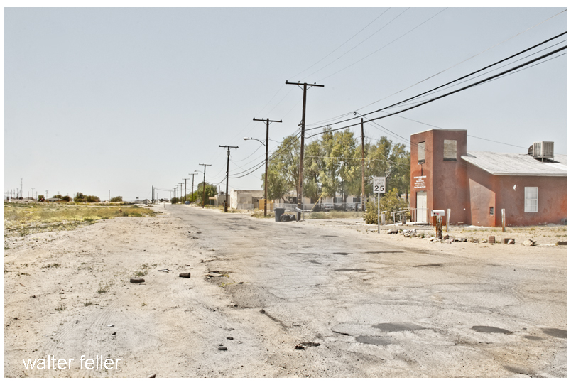
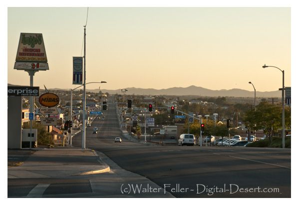
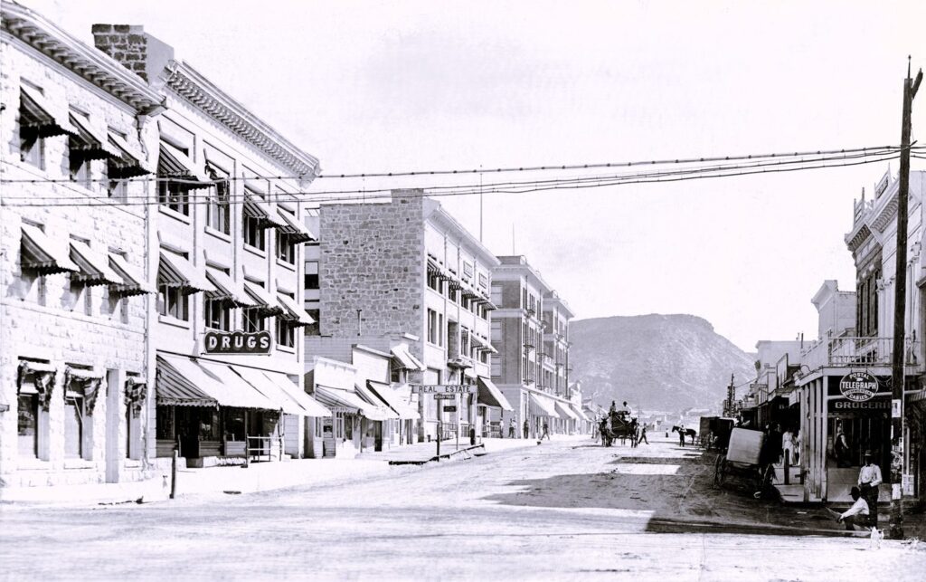
Crooks Avenue lies northwest of the Casa del Desierto, in the narrow district between the railroad yard, North First Avenue, and the Mojave River. Though small, it belongs to an important part of Barstow’s history: the working ground around the depot.
The Casa del Desierto opened in 1911 as a Santa Fe depot and Harvey House. For many years, it served railroad passengers, workers, residents, and desert travelers. The first depot-hotel project included a recreation and lodging building for railroad employees. At the same time, the railroad realigned and raised its tracks, changing the grade and shape of the surrounding ground.
Crooks Avenue developed beside this railroad center rather than on Barstow’s principal commercial street. Main Street, to the south, carried the highway traffic that became Route 66. Crooks Avenue remained a local street, close to the depot, rail yard, and Mojave River, with modest homes, rental buildings, and open lots.
Its surviving buildings reflect gradual mid-twentieth-century development as Barstow continued to serve railroad families, highway travelers, and military traffic, and to support the growing desert region. The street’s character was practical rather than formal, formed by its position at the edge of the rail yard and riverbed.
Crooks Avenue is not Route 66, nor was it one of Barstow’s early commercial thoroughfares. Its value lies in what it reveals about ordinary Barstow: the side streets behind the landmark depot, where railroad work, housing, traffic, and the desert landscape converge.
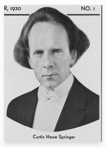
Curtis Howe Springer and the Complicated Story of Zzyzx
Curtis Howe Springer was a radio preacher, health-product salesman, resort promoter, and one of the Mojave Desert’s most unusual characters. He was neither simply a generous desert visionary nor merely a confidence man. He built a functioning community, provided work and shelter, attracted visitors, and helped Baker’s economy. He also used credentials he had not earned, advertised products with unsupported medical claims, and operated a large resort on federal land he did not own.
Springer arrived at Soda Springs in 1944 with Helen Springer. He filed mining claims covering about 12,800 acres and renamed the place Zzyzx, which he promoted as “the last word in health.” From a collection of tents and old ruins, the Springers developed a resort with guest rooms, a dining hall, a chapel, mineral baths, a swimming pool, radio facilities, workshops, gardens, animal pens, and an airstrip.
Much of this was real. Zzyzx wasn’t simply a name on a brochure. People lived, worked, ate, worshiped, and vacationed there for nearly 30 years. The federal court later described four guest buildings containing 59 units, a dining room and kitchen, an administration building, a chapel, mineral baths, electrical equipment, and numerous other structures.
Work and Economic Benefits
Springer’s operation created work at Zzyzx and generated business in nearby Baker. Workers mixed and packaged health foods, printed literature, prepared radio recordings, filled orders, handled correspondence, maintained buildings, cooked meals, cared for animals, and mailed products.
Some workers were recruited from Los Angeles’ Skid Row. They were offered food, shelter, a small wage, and a place away from alcohol in exchange for construction and maintenance work. This labor helped Springer build the resort at relatively low cost, but it also provided men with few alternatives, a temporary home, and useful work.
Zzyzx also affected Baker. Visitors sometimes stayed in Baker motels while waiting to enter the resort. Springer’s enormous volume of packages, promotional literature, donations, and correspondence helped raise the Baker post office to first-class status. The federal court record specifically confirms that foods, printed materials, and radio recordings were packaged and prepared for mailing at Zzyzx.
However, Springer did not cause Baker’s first post office to be established. Postal records show that the office began under the name Silver Lake on March 27, 1907. It was renamed Baker in February 1933, eleven years before Springer arrived. His business greatly increased its workload, but it did not create the first post office.
Was Springer Rich?
Springer appears to have become wealthy during Zzyzx’s most successful years. The National Park Service describes him as a millionaire. His radio broadcasts reached hundreds of stations, while listeners sent donations and ordered teas, food supplements, books, and other products. The National Park Service states that he shipped more than four million packages during his years at Zzyzx.
One witness later recalled that Springer paid a $2,500 court fine immediately, treating it like a minor expense. This suggests that he had considerable available money.
His exact personal wealth is still unknown. No dependable financial statement or estate accounting has been found. Some of his apparent wealth was represented by buildings and improvements at Zzyzx. Those improvements stood on federal land, and Springer never obtained legal title to the property. He could control the operation while he occupied it, but he did not own a desert estate that he could legally sell.
The Ownership Problem
Springer held unpatented mining claims. Such claims allowed legitimate mineral exploration and mining, along with activities reasonably connected to mining. They did not automatically transfer ownership of the land.
The United States remained the legal owner. Springer’s hotel, health resort, food-packaging operation, radio studio, pools, airstrip, residential buildings, and religious activities went far beyond ordinary mining.
Springer made several attempts to obtain a stronger legal right to the property. He filed desert-land applications in 1951, public-recreation applications in 1957 and 1958, and another non-mineral application in 1966. These applications were rejected, dismissed, or denied. Despite those decisions, he continued operating Zzyzx.
In 1970, a federal district court restricted the property to mining-related uses. A 1971 injunction prohibited Springer from operating the resort, renting rooms, packaging food, preparing mail, recording broadcasts, maintaining pools, or inviting people to live there for purposes unrelated to mining. The Ninth Circuit Court of Appeals upheld that injunction.
The legal record, therefore, leaves little doubt about ownership: Springer and his organizations built and operated Zzyzx, but the United States owned the land.
Was Springer Selling Land?
There is evidence that Springer marked off residential lots and allowed major donors to build homes on them. Some historical accounts describe this as offering or selling parcels to supporters.
The wording requires care. Springer could promise someone a place to live or accept a donation in exchange for the use of a lot, but he could not convey valid ownership because he did not own the land. No deed from Springer could transfer federal property.
It is therefore safest to say that Springer allocated or offered homesites to donors as if he controlled the property. Whether every arrangement was described as a direct sale is less certain. What is certain is that donors could not receive a valid title from him.
Would Nonprofit Status Have Helped?
Nonprofit status would not have solved Springer’s central problems. In fact, organizations connected with Zzyzx already included the Dr. Curtis Howe Springer Foundation and the Zzyzx Community Church. Both were named in the federal land case.
A properly managed nonprofit could have accepted donations, operated a retreat, and possibly applied for an authorized lease or public-purpose agreement. It still would have needed federal approval to occupy the land. It would also have been required to follow food, drug, advertising, tax, and charitable organization laws.
Calling the resort a church, foundation, charity, or nonprofit could not transform a mining claim into ownership. It also could not legalize false medical advertising or the unauthorized distribution of public land.
A nonprofit might have helped only if Springer had reorganized the operation, stopped making unsupported health claims, kept proper financial records, and obtained a valid federal lease. The government had already rejected several of his applications, so nonprofit status alone would not have guaranteed that result.
Why Springer Went to Prison
Springer was not imprisoned merely for being eccentric, practicing natural health, or building a resort in the desert. The strongest court evidence concerns false advertising and misbranded foods.
The Ninth Circuit record states that he had been convicted on 18 counts of false advertising involving supposed remedies for hemorrhoids, heart disease, nervous conditions, thyroid problems, and goiter. It also records violations of California food-misbranding laws.
Springer was fined and sentenced to 60 days in jail. After appeals, he reportedly served 49 days. His imprisonment should be distinguished from the land dispute. The land case was primarily a federal civil action for an injunction, damages, ejectment, and eviction. His false advertising and food law convictions provided the criminal penalties.
Thus, two legal problems came together:
Springer used federal mining-claim land for a resort, residence, manufacturing, and mail-order business.
He advertised health products with claims that authorities and courts found false or misleading.
The first problem cost him Zzyzx. The second resulted in penalties and imprisonment.
Did the Rehabilitation Program Work?
Some men probably benefited from their time at Zzyzx, although their progress was never formally documented. Springer offered homeless and struggling men food, shelter, work, routine, and an alcohol-free environment. The National Park Service has concluded that these conditions certainly helped some visitors.
Springer later claimed that Zzyzx had helped rehabilitate 4,000 destitute men. That figure came from Springer himself. No known records follow these men after they left, nor do they show how many remained sober, found permanent employment, reunited with families, or established stable homes.
Zzyzx was not a licensed rehabilitation center with trained counselors, medical supervision, case records, or long-term follow-up. Nevertheless, temporary shelter and meaningful work can still help people. The fair conclusion is that Springer probably helped some individuals, but his claim of 4,000 successful rehabilitations cannot be verified.
Eviction and Final Years
After years of court proceedings, federal authorities removed Springer and his followers from Zzyzx in 1974. The government did not recognize his ownership claims, and Springer could not take the property with him or sell it as his estate.
In 1976, the Bureau of Land Management permitted the California State University system to use the site. Zzyzx became the Desert Studies Center, where students and researchers continue to study Mojave Desert biology, geology, hydrology, and history.
Springer and Helen moved to Las Vegas after the eviction and his short imprisonment. He remained there for the rest of his life. Curtis Howe Springer died in Las Vegas on August 19, 1985, at age 88. Available sources do not identify the particular residence or hospital where he died.
A Balanced Judgment
Springer’s story resists a simple conclusion. He was a persuasive promoter who made unsupported medical claims and used public land far beyond the limits of his mining claims. He accepted money and donations while presenting himself as a doctor and minister, even though he lacked recognized qualifications. His legal troubles were based on substantial evidence, not simply disagreement with unconventional medicine.
At the same time, he built a real desert community. Zzyzx provided jobs, meals, shelter, inexpensive vacations, religious fellowship, and temporary stability. His mail-order business supported packaging and mailing work and brought measurable business to Baker. Some people remembered him with sincere thanks.
His good works did not give him ownership of federal land, and nonprofit status would not have erased the legal violations. Likewise, his unlawful conduct does not mean that nobody benefited from Zzyzx. Both parts belong in history.
Timeline of major violent events and notorious moments in Bodie, California’s wild history — a town so lawless it earned a reputation as one of the roughest mining camps in the West:
1876 – Bodie’s Boom Begins The Standard Mine strikes gold. Prospectors flood in, and Bodie transforms from a quiet camp into a booming town — and with it comes gambling, saloons, opium dens, and gunslingers.
1879 – Peak Population, Peak Violence Bodie hits its peak with around 7,000–10,000 residents. That year alone, it’s said there were 30+ murders, many tied to gambling disputes and drunken shootouts. The phrase “Bad Man from Bodie” enters widespread use.
1879 – Tom Treanor Kills a Man in a Saloon After a heated argument during a card game, Treanor guns down another miner in a crowded bar. He was arrested but later released after a murky trial. The town shrugs it off — just another night in Bodie.
1880 – Gunfight on Main Street A broad daylight gunfight erupts between rival gamblers. Two men are killed, and several bystanders are wounded. This kind of event is common enough that locals don’t even bother locking their doors — they’re used to chaos.
1881 – James Stuart Lynched by a Mob Caught robbing a stagecoach, Stuart is jailed in Bodie. That night, a group of vigilantes breaks in and hangs him from a telegraph pole. His body dangled for hours — a message to other would-be criminals.
1882 – Red Irwin Walks Free After Killing a Man “Red” Irwin shoots another gambler in the back during a dispute. Witnesses testify, but the case is dismissed on a technicality. Irwin boasts about it in saloons afterward, reinforcing Bodie’s anything-goes culture.
1883 – Deputy Sheriff Shot in Line of Duty Deputy John Kelly is killed while trying to break up a bar fight. His murder is never solved. By this point, even lawmen hesitate to enforce order in Bodie.
1884 – Town Begins to Decline Mines starts to dry up. Many “bad men” drift elsewhere. But Bodie’s violent legend is cemented, passed down through newspapers, dime novels, and the stories of old-timers.
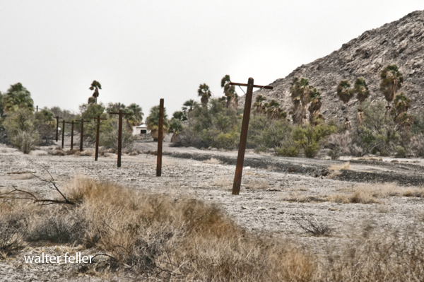
Telegraph poles along the side of the T&T RR roadbed.
Across the Mojave Desert, distance has always been the central challenge, fundamentally shaping the region’s social and economic development. Before the introduction of the telegraph and other forms of rapid communication, travelers, soldiers, and traders moved slowly between scattered springs, river crossings, and mountain passes. Messages traveled only as fast as the horses or wagons carrying them. In this landscape, information lagged behind events, leaving settlements, mining camps, and transportation routes isolated for days. This persistent isolation highlights the importance of the telegraph’s arrival. In this essay, I will examine how the emergence and spread of the telegraph transformed communication in the Mojave, tracing its gradual development, its integration into the transportation and mining infrastructure, and its broader role in connecting the region to the economic and administrative systems of the American West.
The telegraph’s arrival in the nineteenth century transformed communication in the Mojave. As wires were laid alongside railroads and travel routes, the region’s first network emerged—turning settlements and stations into nodes that instantly transported news, business, and personal messages across vast distances. In this way, the once-remote Mojave became part of a coordinated economic and transportation landscape.
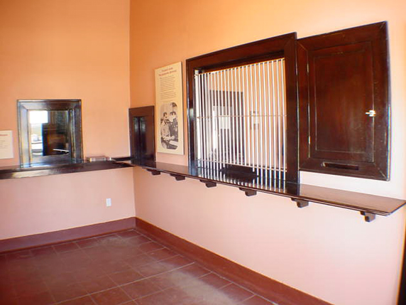
Telegraph room, Kelso Depot
The telegraph lines were more than a technological milestone—they turned the desert’s corridors into channels for movement and information, connecting towns from Needles to Barstow and Mojave as part of a regional network. To understand this transformation, note that the telegraph’s spread across the Mojave was not a single event but a gradual process spanning several decades. Initially, communication lines traced existing corridors: first, military roads in the mid-nineteenth century; then stage routes; and finally, most decisively, railroads beginning in the 1870s. With each advance, as the wire reached new parts of the Mojave, the effective distance shrank. Consequently, remote stations, mining camps, depots, and river crossings could now report conditions, request supplies, transmit orders, and relay market news in near real time.
Before the telegraph—throughout the early to mid-1800s—communication across the Mojave depended entirely on physical travel. Messages were moved by rider, wagon, stage, or military courier over routes such as the Mojave Road and the Salt Lake Road. Later in the century, they traveled along the wagon corridors tied to San Bernardino, Fort Mojave, and the Colorado River crossings. As a result, delay, uncertainty, and isolation were the norm. For example, a storm, a washout, a hostile encounter, or a shortage of animals could disrupt message delivery for days. In a region where water, distance, and timing mattered, that limitation was severe.
In 1861, the construction of the first transcontinental telegraph line marked a major turning point in American communications, but this initial line bypassed the Mojave. Only after the Civil War, as settlement, military use, mining, and rail transport expanded in the region during the late 1860s and 1870s, did the Mojave begin to develop its own telegraph lines. (Editors, 2009) In the desert Southwest, telegraph lines thrived where regular travel and economic support made maintenance feasible.
Against this backdrop, by the 1870s and 1880s, railroads became the main builders of telegraph infrastructure in the Mojave. As tracks crossed the desert, telegraph poles inevitably followed, since the railroad needed wire as much as rails. To dispatch trains efficiently over long single-track stretches, rapid communication between stations, sidings, yards, and division points became vital. In this way, telegraph offices at depots and section stations became the desert railroad’s nervous system, turning what was once open distance into a managed corridor.
This approach was exemplified by the Southern Pacific’s advance into the greater Mojave in the 1870s. Rail stations were not just stops for passengers and freight; they were communication nodes. A station agent might also serve as a telegraph operator, sending orders, reporting shipments, relaying delays, and linking local businesses to regional markets. Settlements with rail stops often gained telegraphic relevance as well.
The Mojave corridor’s transformation accelerated in 1883, when the Atlantic & Pacific Railroad—later controlled by Santa Fe—completed its line from Needles to Mojave. This milestone marked a decisive moment in regional communication (Atlantic and Pacific Railroad records, 1889-1893, n.d.). With the railroad came a continuous telegraph, linking Colorado River gateways, desert sidings, supply hubs, and western connections. As a result, towns such as Needles, Fenner, Cadiz, Ludlow, Barstow, and Mojave gained new significance—they became points in an interconnected network, not just locations on a map.
As a result of these shifts, Barstow’s later importance rested partly on this logic. As lines converged and railroad functions intensified, so did telegraph traffic. Train movements, freight, maintenance orders, livestock, mining output, and commercial messages all depended on the wire. Telegraphy made Barstow a control point, not just a stopover. The same applied, more modestly, to smaller stations, whose importance stemmed from siding capacity, water supply, or As the route developed into a major rail corridor after 1901, its telegraph infrastructure expanded, and places such as Daggett and the line toward Las Vegas became part of a communications spine linking Southern California with the Great Basin and the interior West (Guide to the San Pedro, Los Angeles & Salt Lake Railroad Company Records, 2024). In turn, the wire made the entire corridor legible to managers, dispatchers, and officials.
As rail and telegraph lines expanded, mining districts also benefited, though typically only indirectly at first. Mines needed access to a telegraph office, whether at their own camp, a nearby rail station, or a supply town—not a full regional grid. In the Mojave, camps often rose and fell too quickly for elaborate infrastructure, but more durable districts spread communication from the railheads. As one mining superintendent observed in an 1882 report, “With the wire to hand, news of strikes or shipments is sent in minutes, not weeks.” Telegraphy enabled ore buyers, investors, freighters, smelters, and operators to coordinate activities far faster than before. The telegraph was an economic multiplier; however, it did not create mineral wealth, but accelerated extraction and speculation.
Beyond its economic impact, the telegraph fundamentally reshaped the exercise of governance in the desert by enabling authorities to coordinate and intervene over long distances far more effectively than before. Sheriffs, military officers, railroad managers, and commercial entities gained the ability to transmit orders, directives, and requests for aid almost instantaneously, enabling more proactive, coordinated responses to emergencies and routine matters alike. The telegraph enabled the rapid management of crises such as accidents, conflicts, floods, labor disputes, supply shortages, and equipment failures. In a region where low population density and vast expanses had previously hindered centralized oversight and delayed administrative actions, the telegraph facilitated more timely decision-making and remote supervision. In effect, telegraphy became not just a technical advance but a core administrative instrument that altered patterns of authority and governance in the Mojave Desert. (Schwoch, n.d.)
Socially, the telegraph drew isolated desert communities into a broader world, fostering new cultural connections and a sense of participation in national affairs. Telegraph offices not only provided access to newspapers, commodity prices, railroad schedules, political news, and personal messages, but also exposed residents to broader currents of information and social change. The resulting increase in awareness allowed Mojave inhabitants to engage more actively with markets, politics, and news beyond their immediate environment. However, it is important to recognize that these benefits were not experienced equally by all residents. Some individuals and communities, particularly those unable to afford telegraph services or lacking easy access to the wire, may have found themselves left further behind as information and economic opportunities flowed to more connected settlements. Although expensive and specialized compared to mail, the telegraph’s symbolic value was enormous, representing technological progress and integration with modern society. (Schwoch, 2019) Nevertheless, while a desert station with a telegraph key was no longer truly remote, those without such infrastructure could remain marginalized—demonstrating that technological advancement could both connect and divide communities within the Mojave. In this sense, the telegraph’s integration sometimes reinforced social and economic disparities, complicating the narrative of universal connectedness and belonging to the broader American experience.
By the early twentieth century, telegraph service across the Mojave had become routine but remained crucial. It laid the groundwork for later advances like telephones and radio, proving that main corridors were channels of information as significant as the rails.
The development of the telegraph across the Mojave can be divided into three clearly defined stages. The first stage, prior to the 1860s, was characterized by a pre-wire desert that relied entirely on courier communication, with messages delivered by riders or wagons. The second stage, spanning the mid to late nineteenth century, marked a transition, as growing military, commercial, and transportation demands increased the need for more rapid communication, prompting the initial spread of telegraph lines along established routes. The third stage began in the 1870s and extended into the early 1900s, when the expansion of railroads led to the widespread installation of telegraph lines along the main transportation corridors of the desert, making telegraphic communication a standard feature of the Mojave (Axotl, 2025). While the telegraph did not conquer the Mojave by itself, its expansion demonstrated a new order: the desert was transformed from a space merely traversed into one constantly monitored, coordinated, and integrated.
By the early twentieth century, telegraph offices at railroad depots relayed train orders and freight movements, connecting desert settlements with distant cities and enabling coordination with markets and administrative centers beyond the desert.
Although later technologies—such as the telephone, radio, and digital communication—replaced the telegraph’s practical role, it is important to remember that the system it created marked a turning point in the region’s history. The telegraph bound the Mojave Desert into the economic and administrative framework of the American West and enabled information to travel as quickly as railroads carried people and goods.
Seen in this light, the telegraph poles that once lined the desert rail corridors represented far more than mere infrastructure. They signaled a profound transformation in the region’s social and economic fabric, marking the Mojave’s entry into the networks that shaped the modern American West.
Alongside the development of railroads and roads, the telegraph fundamentally redefined the meaning of distance and isolation in the desert. By enabling near-instantaneous communication, it not only connected settlements but also facilitated new forms of economic coordination, administrative oversight, and social engagement. Ultimately, the arrival of the telegraph was not simply a technological change: it reimagined the Mojave as part of a broader, interconnected world, demonstrating how technological innovations can reshape both the lived experience and future possibilities of even the most remote regions.
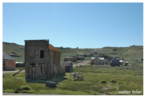
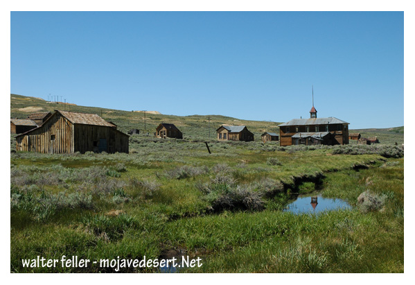
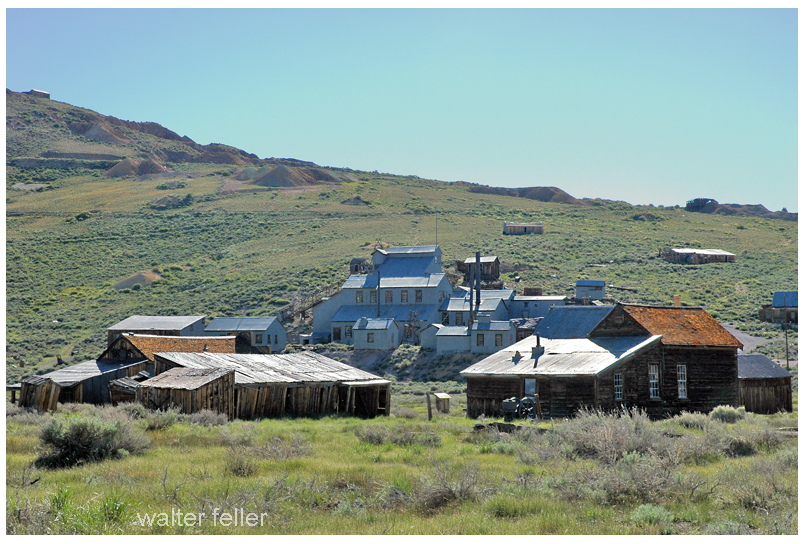
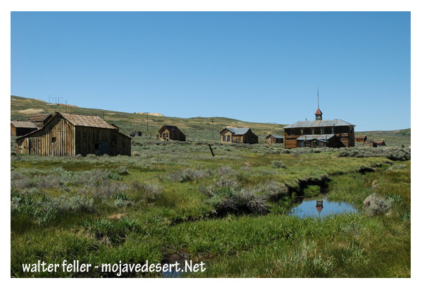
Bodie is often used as a model ghost town for the Mojave Desert region, even though it lies north of it, in the Sierra Nevada–Great Basin transition zone, because it embodies the same historical, environmental, and cultural forces that shaped Mojave ghost towns. In short, Bodie represents the type, even if not the place.
Here’s why:
1. Mining Boom and Bust Pattern Bodie’s rise and fall followed the same pattern as Mojave mining towns like Calico, Rhyolite, and Skidoo. A rich ore discovery in 1859 triggered a rush, creating a town of thousands almost overnight. When the mines declined in the 1880s and 1890s, the population vanished just as quickly. That boom-and-bust cycle defines the Mojave’s mining history as well.
2. Harsh, Isolated Environment Although Bodie sits at a higher elevation and experiences freezing winters rather than desert heat, it shares the same frontier isolation—extreme weather, scarce water, and rugged terrain. Like the Mojave, survival there depended on resourcefulness and imported supplies.
3. Architectural and Material Similarities The wood-frame, false-front buildings, stamp mills, and corrugated-iron roofs in Bodie are identical in style and function to those found in Mojave towns such as Ballarat or Randsburg. These towns employed similar construction methods and materials, which were hauled in by wagon or rail.
4. Cultural Reflection of the Mining West Bodie’s lawlessness, saloons, and transient population mirror the social life of Mojave towns. Newspapers, dance halls, and miners’ unions appeared rapidly, then disappeared when the ore played out.
5. Preservation and Interpretation Bodie is one of the best-preserved ghost towns in the American West—maintained in a state of “arrested decay.” Because of this, it serves as a tangible reference point for understanding less intact Mojave sites. It shows what Calico or Goldfield might have looked like before time and scavengers took their toll.
So, even though it’s geographically outside the Mojave Desert, Bodie stands as an ideal representative of the region’s mining-era ghost towns—capturing their architecture, atmosphere, and transient human story better than almost anywhere else.
Founded around 1869 at the foot of Clark Mountain, Old Ivanpah was one of San Bernardino County’s earliest and most promising silver camps. Prospectors from the Providence and Mescal districts discovered rich silver-lead ore in the nearby hills and organized the Ivanpah Mining District soon after. Within a few years, a small but thriving town developed to serve the mines. It included a general store, boardinghouses, assay office, blacksmith shop, and several saloons. Freight teams hauled ore south to San Bernardino and later to mills along the Mojave River.
The Beatrice and Lizzie Bullock mines were among the most productive, and for a time Ivanpah enjoyed a steady output of high-grade ore. Yet the district’s isolation and lack of a local mill proved costly. When richer or more accessible strikes appeared in neighboring regions—especially Providence and later Calico—miners drifted away. By the early 1880s, the old camp had nearly been abandoned, and activity had shifted southward to a rail-connected settlement, sometimes referred to as New Ivanpah, later known as Ivanpah Station.
By the twentieth century, only stone walls and a few graves remained to mark the site. Wind and time reclaimed the streets where wagons once rattled and miners swapped stories in the shade of Clark Mountain. The 1985 Desert Magazine article described Ivanpah as quiet, dignified, and enduring—one of the earliest desert towns to rise and fall before the railroad age had reached the Mojave. It remains a symbol of the first great wave of silver exploration in the eastern Mojave and the restless pursuit of ore that would shape the region’s history for decades.
References
Desert Magazine, February 1985, Vol. 49, No. 1, “Ghost Towns of San Bernardino County, Part I: ‘Old’ Ivanpah,” pp. 30–33.
Vredenburgh, Larry M., Shumway, Gary L., and Hartill, Russell D. Desert Fever: An Overview of Mining in the California Desert. California Bureau of Land Management, 1981.
Warren, Claude N., et al. Cultural Resources Overview of the Amargosa–Mojave Basin Planning Units. Bureau of Land Management, 1980.
Myrick, David F. Railroads of Nevada and Eastern California, Vol. I. Howell-North Books, 1962.
Lingenfelter, Richard E. Death Valley and the Amargosa: A Land of Illusion. University of California Press, 1986.
Lingenfelter, Richard E. The Hardrock Miners: A History of the Mining Labor Movement in the American West, 1863–1893. University of California Press, 1974.
San Bernardino County Museum Association. Mojave Desert Mining Camps and Ghost Towns. Redlands, CA, various editions.
San Bernardino County Archives, Mining District Records, Ivanpah District, 1869–1883.
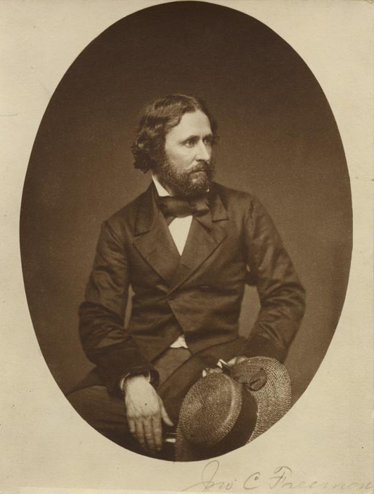
The relationship between John C. Fremont and his chief surveyor, Charles Preuss, was a mixture of professional interdependence and deep personal tension. Both men were indispensable to each other—Fremont as the ambitious public face and commanding officer, Preuss as the trained cartographer and topographic backbone of the expeditions—but their temperaments could hardly have been more different.
John C. Fremont
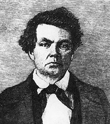
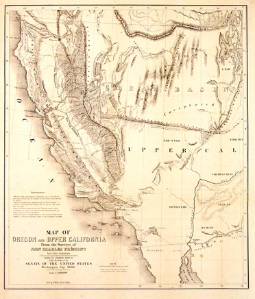
Preuss, a German-born topographer and mapmaker, brought a meticulous scientific discipline and European technical education to Fremont’s ventures. He was responsible for producing the maps that gave Fremont’s reports their authority, accuracy, and ultimate political impact. Fremont depended heavily on Preuss’s precision and methodical fieldwork—his astronomical observations, triangulations, and record-keeping were the foundation upon which Fremont’s reputation as “the Pathfinder” was built.
Charles Preuss
However, the relationship was far from harmonious. Preuss’s surviving diary-often dry, caustic, and skeptical—shows frequent frustration with Fremont’s impulsiveness and his flair for drama. A telling remark from his journal reads, “I feel better because of Fremont’s absence,” reflecting how strained the interpersonal atmosphere could become in the field expeditions of John Fr. Fremont, for his part, maintained formal respect for Preuss’s abilities but rarely mentioned him by name in official correspondence, reinforcing the imbalance between Fremont’s fame and Preuss’s quiet technical role.
Despite their tension, their collaboration was crucial to their success. Preuss translated Fremont’s raw exploration data into accurate maps that guided westward migration and railroad planning for decades. Fremont provided the narrative that captured public imagination, while Preuss provided the empirical skeletonthat made those narratives credible.
In short, theirs was a mutually dependent but uneasy partnership. This partnership combined Fremont’s ambition and charisma with Preuss’s scientific rigor, yielding one of the 19th century’s most influential bodies of cartographic and exploratory work.
“He names mountains and rivers as a poet writes verses, quickly and without measure.” — 1843, eastern Nevada
Barstow, California, from the 1870s through the present, with all key details preserved and arranged chronologically:
Barstow stands today at the center of the Mojave Desert’s long story of ranching, mining, railroads, and highways. Its history reflects the layered development of the Mojave River corridor, where water, transportation, and enterprise have drawn people across the desert for more than a century and a half.
In the years following the Civil War, the upper Mojave River region supported a few scattered cattle ranches and wagon stations. Before Barstow existed, the country between Oro Grande and Daggett was known for its open range and desert pastures. Herds were grazed along the Mojave River, using its shallow pools, seeps, and hand-dug wells. During the 1870s and 1880s, ranchers moved stock between the high country of the San Bernardino Mountains and the desert valleys, following trails that paralleled the river. Stations at places such as Lane’s Crossing and Fish Ponds served as watering points for stock and travelers. As the Santa Fe Railroad advanced across the desert, freight access to distant markets encouraged limited agriculture along the riverbanks. By the early 1900s, alfalfa, grain, and small orchards appeared in Victor Valley, and a few experimental plots extended downstream toward Barstow. The Arrowhead Reservoir and Power Company began purchasing riparian tracts between Victorville and Barstow to secure water rights, recognizing that the Mojave River would control the future of settlement. Though the arid climate limited cultivation, these early ranches and farms laid the foundation for the region’s first lasting economy before industry and highway travel arrived.
Barstow’s founding dates to the early 1880s, when the Atlantic & Pacific Railroad, later part of the Atchison, Topeka & Santa Fe system, pushed its line westward from Needles toward Mojave. In 1883, the mainline was completed across the desert, and a division point was established to centralize maintenance, crew changes, and fueling. This camp, called initially Waterman Junction, became the nucleus of Barstow. The town was renamed in 1884 for William Barstow Strong, president of the Santa Fe, and quickly became the railroad’s desert headquarters. Roundhouses, repair shops, and supply depots were built to serve the trains moving freight and passengers across the Mojave.
While Barstow developed as a railroad town, the nearby community of Daggett became the milling and shipping center for the Calico silver mines. The Calico district boomed in the early 1880s, with more than a hundred mines producing ore that was hauled to Daggett for reduction and shipment east. In 1898, a short branch line was built from Daggett to Calico to carry ore directly to the Santa Fe main line. This small spur improved mining transport but did not found Barstow; the town was already well established as a division headquarters long before. Barstow’s location on the main transcontinental line—roughly midway between San Bernardino and Needles—gave it strategic importance that would outlast the mining booms around it.
As the 1890s ended and silver prices dropped, mining declined, but the railroad presence ensured Barstow’s survival. The town expanded with railroad housing, stores, and services for workers and travelers. The Mojave River valley became a modest agricultural district, producing hay, fruit, and dairy products for local use. By 1910, Barstow had schools, churches, and small businesses serving both rail employees and the surrounding ranch country.
In 1911, the Fred Harvey Company constructed the Casa del Desierto, a grand Mission Revival depot and Harvey House that brought elegance and permanence to the desert town. The building served as a hotel, restaurant, and railroad office, offering travelers comfort along the route between Los Angeles and the Colorado River. It quickly became Barstow’s social center and symbol of progress. The Santa Fe expanded its shops, roundhouse, and yards, reinforcing the town’s position as a key maintenance and operating base.
At the same time, the automobile age arrived. The National Old Trails Highway followed the corridor of the railroad, and by the 1920s, U.S. Route 66 brought a steady stream of motorists through town. Gas stations, garages, and cafes appeared along the main street, which paralleled the railroad tracks. Barstow became a vital service stop for travelers crossing the Mojave Desert, bridging two eras of transportation—steam and motor—and transforming from a company town into a crossroads community.
The Great Depression slowed new growth, but Barstow endured. The flow of automobiles along Route 66 kept the economy alive, while the railroad continued to carry freight and passengers across the desert. By the late 1930s, the town’s main street was lined with motor courts, diners, and filling stations.
World War II brought another surge of activity. Barstow’s location on both the Santa Fe main line and Route 66 made it ideal for military supply and logistics. The Marine Corps established the Nebo Depot just west of town, handling ordnance and supplies for the Pacific war effort. Additional facilities at Daggett and Yermo supported troop movements and desert training exercises. Troop trains, fuel convoys, and war freight filled the region, and the population grew rapidly as railroad workers, servicemen, and civilian contractors arrived.
By the late 1940s, Barstow had become the true hub of the Mojave. Mining had faded, but rail, highway, and military operations kept the town busy. Route 66 was in its prime, bringing travelers east and west through a landscape alive with neon lights and the constant hum of engines. Barstow’s economy rested on three pillars: the Santa Fe Railroad, the Marine base, and the steady flow of cross-country traffic.
After the war, the new interstate system reshaped the desert. The Marine Corps Logistics Base at Nebo expanded during the 1950s, and the Yermo Annex was developed for vehicle storage and repair. Together, they became major employers for the region. Barstow’s population grew as families settled near the base, supported by trucking companies, service stations, and small industries. Route 66 reached its height during this period, and Barstow’s main street glittered with motels, diners, and bright neon signs welcoming motorists.
By the late 1960s, however, the new Interstate 15 and Interstate 40 began to bypass the older downtown route. Travel patterns shifted, and many classic roadside businesses declined. Still, the same geography that had favored Barstow from the start—its place at the meeting of routes—kept it alive. The Santa Fe Railroad remained one of the town’s largest employers, operating extensive classification yards. The Marine bases continued their vital supply missions, and long-haul trucking replaced some of the lost highway trade.
Through the 1970s, Barstow adapted to the new interstate era. Truck stops and logistics centers replaced many of the old motor courts. Route 66, though decommissioned later, remained a nostalgic symbol of the town’s mid-century heyday. The Casa del Desierto depot closed in 1973 when passenger rail service declined, but the building survived. Preservation efforts during the 1980s and 1990s restored it as a civic landmark housing the Western America Railroad Museum and the Route 66 Museum offices. The restored depot reopened to the public, honoring the legacy of the Harvey Girls and the long railroad heritage that gave the town its start.
Today, Barstow continues to serve as the crossroads of the Mojave Desert. It stands at the junction of Interstates 15 and 40, serving travelers, truckers, and freight moving between Southern California and the interior West. The BNSF Railway, successor to the Santa Fe, operates one of its largest freight classification yards in town, handling thousands of cars daily. The Marine Corps Logistics Base remains a major employer, linking Barstow to the modern defense and transportation economy.
Though much has changed, the pattern remains the same. The Mojave River still winds below the town, the rails still hum with freight, and the highways still carry travelers across the vast desert plain. Barstow’s story—from cattle ranching and mining to railroads and freeways—reflects the larger history of the Mojave itself: a land shaped by endurance, movement, and the constant meeting of past and present at the desert’s enduring crossroads.
Johann George Ecker led a group of German and Swiss immigrants who settled in the Antelope Valley in 1886, founding a small colony they called Palmenthal—named for the nearby Joshua trees, which they mistook for palms. These settlers sought to establish a self-sufficient farming community on the high desert plain. Drawing from their European roots, they introduced cooperative labor, community organization, and dry-farming methods suited to the arid conditions. Early crops included barley, wheat, and fruit orchards, with irrigation ditches dug by hand to capture scarce water. Despite their determination, drought and isolation made survival difficult, and by the early 1890s, many settlers left. Still, their legacy endured in the renamed settlement of Palmdale, marking the valley’s first organized agricultural community.
Palmenthal was the original German-Swiss settlement that became Palmdale, California. Founded in 1886 by Johann George Ecker and a group of immigrant families from Germany and Switzerland, the colony was located near present-day 20th Street East and Avenue Q. The settlers named it Palmenthal, or “Palm Valley,” after mistaking the native Joshua trees for palms.
They arrived with hopes of building a cooperative farming community, bringing European agricultural practices and traditions with them. Using dry-farming methods, they planted barley, wheat, and fruit orchards, and attempted small-scale irrigation projects to make the desert productive. The settlers built simple homes, a school, and community facilities, establishing the first structured settlement in the Antelope Valley.
Life in Palmenthal was harsh. Repeated droughts, crop failures, and the isolation of the high desert took their toll. Within a few years, many families abandoned the colony, some moving closer to the Southern Pacific Railroad line near Harold, where water and transport were more reliable. By the early 1890s, Palmenthal was largely deserted, but its spirit persisted in the nearby settlement that would evolve into modern Palmdale.
The story of Palmenthal represents the first organized effort to colonize and cultivate the Antelope Valley—an experiment in community and endurance that laid the groundwork for future growth in the region.
Timeline
1886 – Johann George Ecker and a group of German and Swiss immigrants establish the settlement of Palmenthal in the Antelope Valley, naming it for the Joshua trees they mistake for palms.
1887 – The settlers begin dry farming and plant wheat, barley, and fruit orchards. A small schoolhouse and community hall are built.
1888 – Severe drought conditions make farming difficult. Wells yield limited water, forcing the settlers to haul water from distant springs.
1889 – Some families leave the settlement due to crop failures and the isolation of the high desert.
1890 – Remaining settlers attempt to improve irrigation by digging ditches and small reservoirs, but lack of rainfall continues to hinder success.
1891 – The Southern Pacific Railroad establishes a station several miles west, prompting some settlers to relocate closer to the line for better access to supplies and transport.
1892 – Palmenthal is largely abandoned. The remaining residents consolidate around the new rail siding area that becomes known as Palmdale.
1893 – The name Palmdale replaces Palmenthal, marking the transition from the failed colony to the town that would endure.
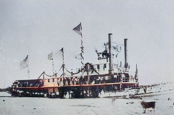
Lingenfelter’s Steamboats on the Colorado River, 1852–1916 provides an implicit social and economic history of every settlement that grew—or faded—along the river’s banks. The book’s narrative threads the growth of these river communities directly to the rise and fall of steamboat commerce.
Yuma and Arizona City
Origins: Fort Yuma (established 1850) was the main reason steamboats came to the river at all. Its chronic supply shortages prompted the launch of the Uncle Sam in 1852—the first river steamer.
Growth: Johnson’s General Jesup and later steamers transformed the isolated post into a trade hub. Yuma Indians, Cocopahs, and early merchants (Louis Jaeger, George Hooper, Mrs. Bowman “the Great Western”) were central to its development.
Outcome: Arizona City (later Yuma) became the permanent entrepot for the Arizona interior, surviving floods that wiped out rival settlements (Jaeger City and Colorado City) in 1862.
Steamboat impact: Yuma existed because of river transport—its food, freight, mail, and even building materials came upriver. The steamboat wharf and wood yards formed its economic heart until the Southern Pacific Railroad bridge was completed in 1877.
Fort Mohave and the Mojave Valley
Military anchor: Established in 1859 after Lt. Col. Hoffman’s expedition. Johnson’s General Jesup and Colorado carried the troops and artillery upriver.
Settlement influence: The fort’s constant freight and troop movements supported a network of wood-cutters, ferrymen, and small traders. Mohave and Chemehuevi Indians interacted with the garrison, at first through hostility, later trade.
Mining connection: Steamboats supplied nearby mining districts such as Eldorado Canyon, which developed into a key upriver port. Freight was landed directly from San Francisco via Johnson’s line, showing how the steamboat system enabled northern Arizona’s first mineral exploitation.
Ehrenberg (originally Mineral City)
Origins: Founded in the 1860s as a wood yard and landing above La Paz.
Growth: When gold was discovered at La Paz (1862), Johnson’s boats (Cocopah, Gila) ran regular trips, and the landing evolved into Mineral City—later renamed Ehrenberg.
Economic role: It became the principal upriver port for western Arizona mining. Merchants, assay offices, and stage connections tied it to Prescott and Wickenburg.
Decline: As river levels shifted and the railroad advanced toward Needles, Ehrenberg’s role diminished; by the 1890s, it had reverted to a small ferry and freight stop.
La Paz
Discovery and boom: Founded after the 1862 placer rush at Laguna de la Paz, fifty miles above Yuma.
Steamboat role: Johnson’s Cocopah and Colorado II made it a thriving port for a few years; millions in gold dust and supplies moved through its landing.
Community effects: Temporary but intense—stores, saloons, and a post office sprang up almost overnight. The town declined after the placers gave out, though it remained a shipping point for freighting routes into central Arizona.
Callville and Eldorado Canyon
Callville: Established in 1864 by Mormons under Anson Call as the uppermost navigable landing on the Colorado. Johnson’s Mojave II and the Gila reached it with supplies for Mormon colonies.
Eldorado Canyon: The river link to Nevada’s silver mines. Steamers delivered ore machinery and carried bullion out. Lower Camp and Hardyville (later Bullhead City) also grew as logistical points for these mines.
Outcome: The decline of mining and the development of railroads at Needles ended their importance, but their brief steamboat era left physical and place-name legacies.
Hardyville, Needles, and the Mojave Crossing
Hardyville: Founded by William Hardy in the 1860s near Fort Mohave as a landing and ferry for freight into northern Arizona and served by Johnson’s and later Polhamus’s boats (Gila, Mohave II).
Needles: Grew later from the same corridor once the railroad bridged the river. For a time, both rail and steamboat freight were interdependent—boats ferried heavy goods to and from the rail terminus.
Cultural tie: These settlements owed their early survival to the steamboat’s ability to deliver goods to otherwise inaccessible desert outposts.
Mexican Delta Settlements
Robinson’s Landing and Port Isabel: Transfer points where sea-going schooners met the river steamers. These landings, although primitive, were the logistical lifeline between San Francisco and Arizona before the rail era.
Cocopah and Yuma labor: River tribes provided the essential wood-cutting and loading labor at these lower landings. The steamboat economy reshaped indigenous life, drawing them into the wage economy.
Later decline: When the Imperial Canal and Laguna Dam diverted the river (1905–1909), most of these delta landings were abandoned or submerged.
Imperial Valley and the Lower Colorado (20th century)
Engineering phase: The Searchlight and St. Vallier were used by the California Development Company and the Reclamation Service to ferry materials during the Imperial Valley flood and Laguna Dam projects (1905–1909).
New communities: Mexicali, Calexico, and Imperial grew directly from these river engineering efforts—the last chapter of the steamboat’s social influence.
Summary of Broader Community Ties
Military Supply: Forts Yuma and Mohave created permanent river commerce.
Civic Formation: Yuma, Ehrenberg, and Hardyville evolved from wharves and woodyards into lasting towns.
Cross-Cultural Exchange: Cocopah, Yuma, and Mohave tribes were drawn into trade and labor systems, profoundly altering their economies.
Transition and Legacy: As railroads and dams replaced steamers, most of these towns either adapted (Yuma, Needles) or faded (La Paz, Callville).
In essence, the steamboats were the architects of civilization along the Colorado River. Every settlement from the Gulf to Callville began as a landing, woodyard, or ferry point tied to the fleets of Johnson, Polhamus, and their successors. When the engines fell silent in 1916, the towns they had spawned remained—the permanent human footprint of the river’s steamboat age.
Timeline of Steamboats and River Communities along the Colorado River, 1539–1916 (based on Richard E. Lingenfelter, Steamboats on the Colorado River, 1852–1916, University of Arizona Press, 1978)
1539 Francisco de Ulloa becomes the first European to sight the mouth of the Colorado River while exploring the Gulf of California for Spain.
1540 Hernando de Alarcón sails into the river delta, establishing it as a navigable waterway in Spanish maps.
1781 Mission San Pedro y San Pablo de Bicuñer is founded near the river and soon destroyed in native uprisings; Spanish efforts to settle the lower Colorado end.
1849 California Gold Rush brings heavy overland migration; Dr. Lincoln establishes a ferry at Yuma Crossing to serve travelers heading to the gold fields.
In 1850, Fort Yuma was founded to protect emigrants; supplies were freighted overland at ruinous cost.
In 1850, Lt. George H. Derby attempted to deliver supplies by sea aboard the schooner Invincible but failed due to Hardy’s erroneous map of the Colorado estuary.
In 1852, Captain James Turnbull launched the Uncle Sam, the first steamboat on the Colorado River, assembled near the mouth. She reaches Fort Yuma in December but later sinks.
In 1853, George A. Johnson, Ben Hartshorne, and Captain Alfred Wilcox established a freight company and began regular steam navigation with the General Jesup in January 1854.
1854 General Jesup proves commercial success; Fort Yuma and nearby settlements (Yuma Crossing, Jaeger’s Ferry) grow rapidly.
1855–1856 Additional woodyards established along the lower river; Johnson expands his business.
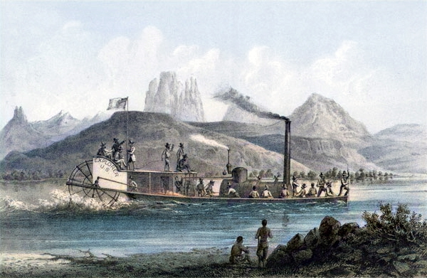
In 1857, Lt. Joseph C. Ives is assigned to explore the river’s head of navigation with the steamer Explorer.
In 1858, Ives launches the Explorer and ascends the river to Black Canyon; George Johnson’s General Jesup reaches nearly the same point earlier, demonstrating practical navigation to Pyramid Canyon.
In 1859, Fort Mohave was established at Beale’s Crossing; Johnson’s Colorado and Cocopah transport troops and supplies upriver. The Mohaves subdued after brief hostilities.
1859 Cocopah launched, the largest and most powerful stern-wheeler on the river to date; it began freight runs between the Gulf and upriver forts.
1860 Steamers in regular service to both Fort Yuma and Fort Mohave; landings and wood-yards form the nuclei of new settlements.
1861 Johnny Moss discovers silver in Eldorado Canyon; the first mining boom supported by river transport begins.
1862 Great Colorado River gold rush; La Paz and Mineral City (later Ehrenberg) were established as upriver mining and freight centers. Yuma (Arizona City) grows rapidly.
1863 Arizona Territory created; steamboats supply frontier posts, mines, and settlements along the river corridor.
In 1864, Mormon colonists founded Callville as the uppermost navigable port on the river; Mohave I and Gila reached it with freight and supplies.
1864–1865 Floods destroy Jaeger City and Colorado City; Arizona City (Yuma) survives and becomes the dominant port.
1866 Hardyville (later Bullhead City) founded as river landing and ferry opposite Fort Mohave.
1867–1870 Johnson’s fleet expanded with Cocopah II, Mohave II, Gila, and Colorado II; regular commercial runs between Gulf and Hardyville.
1870s Ehrenberg (formerly Mineral City) and La Paz prosper as supply depots for mining districts. Yuma thrives as regional capital and customs point.
1877 Southern Pacific Railroad reaches Yuma; rail begins to replace river freight to Fort Yuma and interior Arizona.
1880s Decline of Johnson’s monopoly; smaller independent boats like Searchlight and St. Vallier begin service for construction and local trade. Needles develops as rail terminal at Mojave Crossing.
1890s Limited steamboat service continues for miners and settlers between Yuma and Needles; smaller upper-river craft like Undine and Comet work in Green and Glen Canyons.
1905 Catastrophic flooding of the Imperial Valley (Salton Sink) creates major river diversion works. Steamboats carry rock, equipment, and workers to repair the break.
1907–1909 Construction of Laguna Dam; dredges Alpha, Beta, and Delta assist in engineering works. River settlements (Mexicali, Calexico, Imperial) expand.
1910–1916 Final years of commercial operation; the Searchlight and St. Vallier continue limited freight and survey work.
1916 Steamboat era ends; the last operational vessel, Searchlight, retires. The Colorado’s navigation frontier gives way to railroads and irrigation infrastructure.
Summary: The river towns—Yuma, La Paz, Ehrenberg, Hardyville, Callville, and others—each owe their existence to this 64-year steamboat epoch. The boats linked mining, military, and agricultural settlements from the Gulf of California to southern Nevada, and their decline marked the end of the Colorado River as an open commercial highway.
Connectivity along the Colorado River, 1852–1916 (based on Richard E. Lingenfelter’s Steamboats on the Colorado River, 1852–1916, University of Arizona Press, 1978)
The Colorado River functioned as a living transportation spine for the American Southwest. From the Gulf of California to the mouth of the Virgin River, its steamboat era linked ports, mines, forts, and settlements into a single continuous system of movement and exchange. The following summarizes how this connectivity developed—its physical, economic, and cultural dimensions.
1. The River as Transportation Artery
Before railroads, the Colorado was the only practical route through an otherwise impassable desert frontier. Steamboats transformed it from a natural barrier into a corridor of movement:
Vertical Integration: Cargoes from San Francisco and Mexican ports entered at the Gulf of California and were transferred at Robinson’s Landing or Port Isabel to shallow-draft river steamers.
Main Route: Steamers ran 600 miles upriver from the estuary to the head of navigation at Callville, with landings every 25–40 miles at woodyards and supply camps.
Branch Distribution: From these landings, mule and wagon roads carried freight to mining camps—La Paz, Wickenburg, Prescott, Eldorado Canyon, and beyond.
The river linked Pacific maritime trade directly to Arizona’s interior economy, reducing freight costs from $500 a ton (overland) to $75 or less.
2. Economic Connectivity: The Steamboat Network
Each segment of the river supported distinct but interlocking economies:
Lower River (Gulf to Yuma):
Served by General Jesup, Colorado I–II, and Cocopah boats.
Functioned as the supply chain for Fort Yuma, Arizona City, and Cocopah/Yuma tribal labor networks.
Exports: military supplies outbound; imports: grain, hides, and ore from upriver.
Middle River (Yuma to Fort Mohave):
Connected through Gila, Mohave, Cocopah II.
Supported ranching, freighting, and mining from La Paz, Ehrenberg, and Mineral City.
Fort Mohave provided stability and demand; nearby Hardyville became the main transfer point to the northern interior.
Upper River (Fort Mohave to Callville):
Connected through seasonal navigation, reaching Eldorado Canyon and Callville, linking Mormon settlements and Nevada mines.
Steamboats supplied machinery, food, and mail to isolated canyons and hauled bullion downstream.
These tiers formed an interdependent flow of goods and people—San Francisco → Gulf → Yuma → La Paz → Hardyville → Callville—binding together three territories: California, Arizona, and Nevada.
3. Military and Strategic Connectivity
Fort Yuma (1850) and Fort Mohave (1859): Anchored U.S. authority in the region.
Steamboats like the Jesup and Colorado carried troops, cannon, and supplies upriver, allowing rapid response to uprisings.
The river served as a military highway, tying remote garrisons into the national supply chain without the need for overland caravans.
4. Cultural and Indigenous Connectivity
The steamboat economy drew Cocopah, Yuma, Mohave, and Chemehuevi peoples into wage labor as woodcutters, ferrymen, and pilots.
Traditional seasonal migration routes became part of the logistical system for fuel supply—woodyards spaced every 30 miles were typically operated by natives.
Cultural exchange was double-edged: it increased trade and communication, but also displacement and dependency.
5. Intermodal and Regional Connectivity
Overland Links: Freight from landings connected to desert wagon roads—the Ehrenberg–Prescott route, Hardyville–Cerbat road, and Callville–St. George trail.
Rail Integration: The arrival of the Southern Pacific Railroad at Yuma (1877) and the Atlantic and Pacific line at Needles (1883) converted the river into a feeder route.
Steamboats ferried rail cargoes across unfinished bridges.
Yuma and Needles became multimodal junctions, the first in the desert Southwest.
Engineering Connectivity: During the early 1900s, steamboats carried dredge parts, rock, and machinery for the Imperial Canal and Laguna Dam, linking the river’s navigation legacy to the birth of modern irrigation infrastructure.
6. Communication and Settlement Network
Mail and Passenger Routes: Regular boat schedules carried mail and travelers between Yuma, Ehrenberg, and Hardyville—functioning as the desert’s postal road.
Towns and Ferries: Settlements emerged at every refueling stop: Jaeger’s Ferry, Pedrick’s Landing, Ogden’s, Gridiron, Port Famine, Mineral City, Ehrenberg, Hardyville, Callville.
Urban Continuity: The steamboat corridor produced a “string of pearls” settlement pattern—each landing spaced by distance of a single day’s travel.
7. Decline and Legacy
Railroads, motorboats, and dams broke the linear chain of river-based transport.
After 1905, the river was more a site of engineering than navigation.
Yet Yuma, Needles, and Mexicali owe their placement and early prosperity to this 19th-century river connectivity.
Even in decline, the steamboat system laid the geographic framework for later highways, irrigation canals, and border cities.
Summary
From 1852 to 1916, the Colorado River connected the American frontier in a single functional system—military, economic, and human.
The lower river tied the desert to the Pacific.
The middle River opened Arizona’s mines and ranches.
The upper river linked the Mormon, Nevada, and Utah frontiers.
Steamboats were not just transport—they were the connective tissue binding a thousand miles of desert into one coherent region. When they vanished, their routes became the blueprint for roads, railways, and settlements that still follow the river’s course today.
Big Bear, California, began as Yuhaaviatam homeland, later drawing gold seekers, ranchers, and dam builders. From Holcomb Valley’s 1860 rush to a four-season resort, its story blends natural beauty, resource ingenuity, and mountain tradition.
Prehistory • The Big Bear Valley has been inhabited for thousands of years by the Yuhaaviatam (Serrano) people, who live in seasonal villages and call the area “Yuhaaviat,” meaning “Pine Place.”
1845 • Benjamin Davis Wilson leads a posse into the San Bernardino Mountains in pursuit of raiders. The group encounters numerous grizzly bears and kills several, naming the area “Big Bear Valley.”
1850s • Early trappers and cattlemen moved through the San Bernardino Mountains. The valley remains largely remote and unsettled.
1860 • William F. “Bill” Holcomb discovers gold in Holcomb Valley, triggering a rush that brings hundreds of miners and creates mining camps such as Belleville, Union Town, and Clapboard Town.
1861–1862 • The Holcomb Valley boom peaks; San Bernardino County’s population surges. Belleville nearly becomes the county seat but loses to San Bernardino by two votes.
1863–1865 • Decline of the first gold boom as surface gold plays out. Miners leave, and the valley returns to quiet ranching and logging activity.
1870s • Elias J. “Lucky” Baldwin acquires mining claims around Baldwin Lake and forms the Gold Mountain Mining Company. A second wave of mining begins, centered on the Baldwin Mine.
1884 • Frank Elwood Brown, a Redlands citrus grower, constructs the first Bear Valley Dam, a single-arch granite structure. The reservoir created by this dam was named Big Bear Lake.
1890s • Big Bear’s role shifts from mining to recreation. Hunters, anglers, and early tourists begin to visit the mountain lake area. Lodges and cabins start to appear.
1903 • Lower-valley growers formed the Bear Valley Mutual Water Company to manage the reservoir and water rights.
1910–1912 • A new multiple-arch dam, designed by John S. Eastwood, replaces Brown’s dam, raising the lake level by about 20 feet and greatly expanding its capacity.
1920s • Roads improve, and the automobile brings increased tourism. The town of Pineknot develops on the lake’s south shore with lodges, stores, and resorts.
1930s • Winter recreation grows. Early ski runs are cut, and lodges cater to both summer and winter visitors. • 1938 – Pineknot officially changes its name to Big Bear Lake.
1940s • Big Bear becomes a year-round resort. During World War II, mountain roads were used for military transport training, but the area remained largely a recreation destination.
1950s • Big Bear Alpine Zoo opens as a rehabilitation center for injured wildlife (1959). • Ski development accelerates with lifts at Snow Summit.
1960s • Tourism and second-home construction expand rapidly. • The Big Bear Valley Historical Society was founded in 1967.
1970s • The community continues to grow, balancing tourism with environmental concerns.
1980 • The City of Big Bear Lake was incorporated on November 28.
1980s • Alpine Slide at Magic Mountain opens (1983). • Ongoing improvements in highways and infrastructure make Big Bear a popular four-season resort.
1990s • Big Bear becomes known for altitude training by professional athletes, including world-class boxers.
2000s–Present • Tourism, recreation, and environmental stewardship define the region. • The old 1884 dam remains a historical landmark, sometimes visible during low water levels. • Big Bear preserves its mountain-resort heritage while serving as a gateway to the San Bernardino National Forest.
Big Bear and the Digital Desert are closely related through geography, ecology, history, and human development. The Digital Desert’s broader Mojave focus naturally overlaps with Big Bear’s transitional mountain-desert setting in several key ways:
Geographic Connection Big Bear sits at the top of the Santa Ana River watershed, where mountain snowmelt begins the river’s underground journey to Southern California hills and valleys.
Ecological Transition Zone The region bridges montane and desert biomes. Pinyon-juniper woodlands, chaparral, and Joshua tree habitats meet higher-elevation conifer forests. This gradation provides examples of how altitude, temperature, and moisture shape plant and animal communities—central themes within the Digital Desert’s ecological framework.
Historical Ties Figures like William Holcomb and Lucky Baldwin tie Big Bear’s mining story to other desert mineral ventures, including Holcomb Valley’s influence on later Mojave mining booms. Trails from Big Bear connected to routes leading toward Lucerne Valley, Johnson Valley, and beyond—pathways that also appear throughout Mojave Desert exploration and settlement history.
Water and Infrastructure The Bear Valley dams (1884 and 1912) represent early Southern California water engineering that parallels other Digital Desert themes such as aqueducts, irrigation systems, and the transformation of desert hydrology. Big Bear’s water storage directly supported the agricultural valleys below, tying mountain runoff to desert life.
Cultural and Recreational Link Both Big Bear and the Mojave represent frontier landscapes turned into recreation destinations. The same pioneer spirit that shaped desert communities like Apple Valley or Hesperia carried over into Big Bear’s tourism development—cabins, roads, and storytelling built around rugged independence and mountain allure.
Interpretive Relationship Within the Digital Desert framework, Big Bear serves as a high-elevation counterpart—a living case study for water origins, ecological transition, and cultural continuity. It connects the snow-fed headwaters to the dry basins below, showing the mountain-desert system as one continuous, interdependent landscape.
Ecological Description
Big Bear Valley lies high in the San Bernardino Mountains, about 6,700 to 7,000 feet above sea level, forming a broad mountain basin surrounded by rugged granite peaks and forested ridges. The valley stretches roughly east–west, framed by Butler Peak and Delamar Mountain to the north, and Sugarloaf Mountain, Gold Mountain, and the San Gorgonio massif to the south and east.
The valley floor is relatively flat, a remnant of ancient glacial and erosional processes, with Big Bear Lake occupying its central depression. Originally a meadowed valley with creeks and marshes, it became a permanent lake after the Bear Valley Dams were built. The soils are derived from decomposed granite, supporting open forests and meadows interspersed with boulder-strewn slopes.
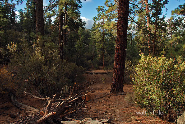
Ponderosa pine, Jeffrey pine, white fir, and incense cedar dominate the higher slopes. At the same time, black oak, manzanita, and chaparral fill the lower edges in sheltered meadows and along streams, willows and alders grow, creating rare wetland habitats for species such as the mountain yellow-legged frog and bald eagle.
The climate is alpine-mediterranean—cold, snowy winters and warm, dry summers—marked by dramatic seasonal shifts. Snowmelt feeds Big Bear Creek and Baldwin Lake, the latter a seasonal alkali flat on the eastern edge of the valley.
Ecologically, Big Bear Valley forms the upper boundary of the Mojave Desert drainage system. It captures mountain precipitation that ultimately seeps underground toward Lucerne and the Mojave River basin, linking the high forest to the desert below.
Timeline References
Big Bear Valley Historical Museum. “History of Big Bear Valley.” Big Bear Valley Historical Society, Big Bear City, CA.
BigBear.com. “Dam: The Creation of Big Bear Lake.” Big Bear Visitors Bureau.
BigBearCabins.com. “About Big Bear: A History.” Big Bear Cabins Travel Guide.
BigBearVacations.com. “A History of Big Bear.” Big Bear Vacations Blog.
San Bernardino County Museum Archives. “Mining and Settlement in the San Bernardino Mountains.”
Eastwood, John S. “The Multiple-Arch Dam of Bear Valley.” Engineering Record, 1912.
U.S. Forest Service. “San Bernardino National Forest: Ecological Subsections and Watershed Overview.”
Bear Valley Mutual Water Company. “Early Development and Water Rights History.”
Langenheim, Jean H., and P. H. Osman. “Vegetation and Ecology of the San Bernardino Mountains.” University of California Publications in Botany, 1959.
California Department of Fish and Wildlife. “Baldwin Lake Ecological Reserve Management Plan.”
San Bernardino Valley Water District. “Hydrologic History of the Bear Valley and Mojave River System.”
Wikipedia contributors. “Big Bear Lake, California.” Wikipedia, The Free Encyclopedia.
Wikipedia contributors. “Big Bear Valley Historical Museum.” Wikipedia, The Free Encyclopedia.
Brown, F. E. “The First Bear Valley Dam and the Redlands Water System.” Redlands Historical Society Papers, 1884–1905.
U.S. Geological Survey. “Geology and Hydrology of the Big Bear Lake Region, San Bernardino County, California.” Professional Paper Series.
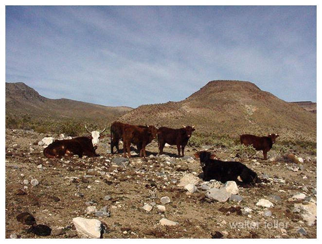
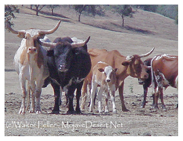
Raising cattle in the Mojave National Preserve comes with unique challenges and a long history. The area has been home to cattle ranching since the late 19th century, with ranchers taking advantage of the sparse but hardy desert vegetation and natural springs.
Historical Perspective
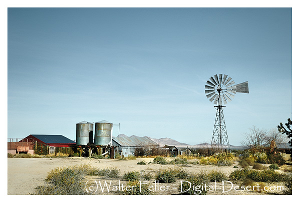
Cattle ranching in the Mojave Preserve dates back to the late 1800s, with ranchers establishing homesteads and using the land for grazing. Ranches like Rock Spring Ranch, Valley View Ranch, and the OX Ranch were some of the key operations. Water was always the limiting factor, so early ranchers developed wells, windmills, and water troughs to sustain their herds.
During the 20th century, ranching continued despite the harsh environment. The Bureau of Land Management (BLM) and later the National Park Service (NPS) managed grazing leases. Still, conflicts arose over land use, conservation, and the impact of cattle on fragile desert ecosystems.
Modern Challenges
After the creation of the Mojave National Preserve in 1994, the National Park Service began phasing out cattle ranching through voluntary buyouts of grazing rights. Some ranchers chose to sell, while others held on under special agreements. Today, very few cattle operations remain in the preserve, and grazing is largely restricted.
Key challenges include:
Water Scarcity: Natural springs and wells are limited, making it difficult to maintain large herds.
Harsh Climate: Extreme temperatures and unpredictable rainfall mean cattle must be resilient to drought conditions.
Regulatory Restrictions: The National Park Service enforces conservation policies, restricting new grazing leases and limiting herd sizes.
Predation and Disease: Coyotes and mountain lions pose risks to cattle, and disease can spread in remote conditions with limited veterinary care.
Legacy and Conservation
Tehachapi beef – Selected for character
Though large-scale ranching has faded chiefly, remnants of the cattle industry remain in the form of historic ranch sites, windmills, and abandoned corrals scattered throughout the preserve. Some former ranching areas have become part of conservation efforts to restore native plant life and protect desert ecosystems.
Ranching played a significant role in shaping the human history of the Mojave, but in many areas, the land is slowly returning to a more natural state.
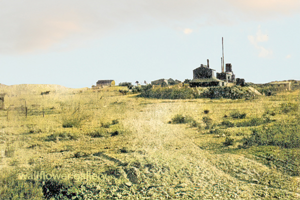
Standard Hill sits just south of Mojave, California. Today, it appears to be just another rocky desert butte, but for more than a century, people were convinced it was a golden hill.
It started in 1894 when George Bowers, a lone prospector, stumbled across gold in the rocks. His first load of ore was worth $1,600, a substantial sum back then. Word spread fast. Soon, miners were sinking shafts into veins with colorful names, such as Yellow Rover, Exposed Treasure, and Desert Queen.
By 1901, the place wasn’t just a scatter of claims anymore. A big 20-stamp mill and a cyanide plant were built to crush and process the rock. What had been a lonely hill was suddenly alive with pounding stamps, the smell of chemicals, and the clatter of wagons hauling ore. A little company camp, called “Gold Town,” even grew at the base of the hill to house workers and families.
Mining boomed off and on for decades. Companies came and went—the Mojave Consolidated, Standard Mining and Milling, and later Standard Hill Mines Company. Each tried to pull wealth from the hill. In the 1930s, during the Great Depression, the district came roaring back to life. Miners chased the gold veins hundreds of feet down, working day and night until World War II shut them down by government order.
All told, Standard Hill yielded approximately $3.5 million worth of gold and silver in the past, primarily from the first three prominent veins. That’s roughly 170,000 ounces of gold, much of it in the form of bright yellow metal mixed with silver. People who worked in the mines said that some ore was so rich it sparkled in the sunlight.
The rock itself tells part of the story. Standard Hill is made of ancient granite capped with younger volcanic rock. When hot fluids moved through cracks in these rocks long ago, they left behind quartz veins stuffed with gold and silver. Miners followed these veins like treasure maps, finding pockets of ore several feet thick.
The hill wasn’t done yet. In the late 1980s, modern companies returned with bulldozers and leach pads, excavating four small open pits. They mined for just a few years before prices fell and the operation shut down again in the early 1990s.
Today, Standard Hill is quiet. You can still see old mine shafts, scattered ruins of the mill, and the scars of the modern pits. It’s a reminder of how one small desert hill fueled dreams of riches, supported little communities, and became part of California’s long gold-mining story.
Desert Fever: An Overview of Mining in the California Desert (Mojave Desert Mining History, Standard Hill section)
California Division of Mines and Geology, Mineral Resources of Kern County (1957; later summaries of Mojave-Rosamond District production and geology)
Mindat.org – Standard Hill Group (Mojave Mining District, Kern County, CA) – mindat.org/loc-219385.html
Elephant Butte – Standard Hill Group, Mojave Mining District, Kern County, California (technical geology report, academia.edu)
The Diggings – Standard Hill Mine (historical mining claim and production records) – thediggings.com/mines/28338
California Journal of Mines and Geology, 1930s–1940s issues (district reports with production figures and ore descriptions)
USGS Bulletins on Mojave District mineral deposits (notably reports describing epithermal systems of Soledad Mountain, Standard Hill, and Tropico Hill)
Old, local histories offer several benefits, particularly for those interested in understanding their community, heritage, or region in depth. Here are some of the key advantages:
1. Preserving Cultural Heritage
Local histories capture the stories, traditions, and customs of a specific area, ensuring they aren’t lost to time. These records help preserve the unique identity of a community and can be a source of pride for residents.
2. Understanding Historical Context
They provide insight into how a community or region developed, from its earliest days to the present. This context can help explain why things are the way they are—like why a town was built in a particular spot or how its economy evolved.
3. Fostering Connection to Place
Local histories make people feel more connected to their surroundings. Learning about past residents, old landmarks, or forgotten events can create a deeper sense of belonging and appreciation for where you live.
4. Educational Value
These histories are invaluable resources for educators, researchers, and students. They offer specific examples of broader historical trends, such as migration, industrialization, or environmental changes, on a small, relatable scale.
5. Uncovering Hidden Stories
Local histories often highlight lesser-known stories or voices that might not appear in broader historical accounts—such as those of indigenous peoples, women, or minority groups who played crucial roles in shaping the area.
6. Inspiration for Creative Work
Writers, artists, and filmmakers often draw inspiration from local histories to create works that bring these stories to life. They can be a goldmine for unique characters, dramatic events, and compelling narratives.
7. Guiding Modern Decisions
Understanding a region’s past can inform present-day decisions about planning, conservation, and development. Knowing what worked (or didn’t) in the past helps guide future actions.
8. Building Community
Sharing stories from a local history can bring people together, whether through historical societies, reenactments, or simply reminiscing. It strengthens communal ties and fosters intergenerational dialogue.
9. Highlighting Change and Continuity
Local histories show what has changed over time and what has stayed the same. This perspective can be both humbling and inspiring, reminding people of their resilience, adaptability, and enduring values.
10. Personal Connections
If your ancestors lived in a region, exploring its history can help you learn more about their lives and experiences, making genealogy research richer and more meaningful.
In short, old, local histories help us better understand the roots of our communities, connect to the past, and navigate the future. They’re like a treasure chest of lessons, stories, and wisdom waiting to be rediscovered!
THE OVERLAND MAIL 1849-1869 Promoter of Settlement Precursor of Railroads by LE ROY R. HAFEN, PH.D . Historian, The Stale Historical and Natural History Society of Colorado
The first United States mail between California and Salt Lake City was established in 1851. This route was advertised January 27, 1851, and the thirty-seven bids received ranged from $20,000 for “horseback or two horse coach service,” to $200,000 per year for service with ” 135 pack animals with 45 men, divided into three parties.” One bid was for a four-horse coach with a guard of six men, at $135,000 per year. The lowest bid was accepted and a contract was made in April with Absalom Woodward and George Chorpenning for a monthly service at $14,000 per year; the trip each way was to be made in thirty days. No points were designated at which the route should touch, but it was to go “by the then traveled trail, considered about 910 miles long.”
Chorpenning and his men left Sacramento May 1, 1851, with the first mail. They had great difficulty in reaching Carson valley, having had to beat down the snow with wooden mauls to open a trail for their animals over the Sierras. For sixteen days and nights they struggled through and camped upon deep snow. Upon reaching Carson valley, Chorpenning staked off in the usual western manner, a quarter section of land and arranged to establish a mail station. The town of Genoa, Nevada, grew-up on this site. Chorpenning and several men continued eastward and reached Salt Lake City June 5th, having been delayed somewhat by snow in the Goose Creek mountains.
Throughout the summer, difficulties were experienced with the Indians; and Woodward, who left Sacramento with the November mail, was killed by them just west of Malad River in northern Utah. The December and January mails from Sacramento were forced to return on account of deep snow, but the February (1852) mail was pushed through by way of the Feather River Pass and reached Salt Lake City in sixty days. The carriers endured frightful sufferings; owing to the fact that their horses were frozen to death in the Goose Creek mountains, they had to go the last two hundred miles to Salt Lake City on foot. Permission was obtained from the special agent in San Francisco to send the March mail down the coast to San Pedro and thence by the Cajon Pass and the Mormon trail to Salt Lake City. During the summer of 1852 the service continued to be performed across northern Nevada by way of the Humboldt River; but as winter approached, arrangements were made with the mail agent at San Francisco to carry the Utah mail via Los Angeles during the winter months. The Carson valley post office was supplied monthly by a carrier on snow-shoes. Fred Bishop and Dritt were the first carriers and they were succeeded by George Pierce and John A. Thompson. The latter, “Snowshoe Thompson,” a Norwegian by birth, made himself famous in this section by his feats on snow-shoes during succeeding winters. The shoes used were ten feet long and of the Canadian pattern. He often took one hundred pounds upon the journey between Placerville and Carson, and made the trip in three days to Placerville and the return journey in two days.
With the interruption by bad weather of the mail service east of Salt Lake City, the mail was sent westward to San Pedro, where it was transmitted by steamer to the Atlantic seaboard. This increased the weight of Chorpenning mail from about one hundred pounds to about five hundred pounds. For this additional service Chorpenning made claim and in 1857 received payment on a pro rata basis.
The causes of the irregularity and interruption of the mail service to Utah had not been explained to the Postmaster-general by the Special Agent at San Francisco and so, upon the grounds of the derangement of the service, the Postmaster-general annulled the contract with Chorpenning, and made one with W. L. Blanchard of California. The new contractor was to receive $50,000 per year, and was to maintain a fortified post at Carson valley. Upon learning of this new arrangement in January, 1853, Chorpenning set out for Washington and, after setting forth his case before the new Postmaster-general, was reinstated. A verbal agreement was made that the compensation should be increased to $30,000 per year and permission was given to carry the mails via San Pedro during the winter months.
During the first three years (1851-4) the Utah-California mail was carried except in winter, by the old emigrant route. This route lay from Sacramento through Folsom, Placerville, along the old road through Strawberry and Hope valleys to Carson valley. From this point it led to the Humboldt, which stream was followed nearly to its source. Leaving the Humboldt the route led northeastward into southern Idaho in the vicinity of the Goose Creek mountains, and thence southeasterly around the north side of Great Salt Lake to Salt Lake City.
In the lettings of 1854, the Utah-California mail route was changed to run from Salt Lake City over the Mormon trail to San Diego. Chorpenning was again the successful bidder. The mail was to be carried monthly each way, through in twenty-eight days, for a compensation of $12,500 per year. Chorpenning thought it worthwhile to enter a low bid to ensure getting the contract since he expected that the service would probably be increased to a weekly schedule, the time per trip reduced, and the compensation increased.
The service began July 1, 1854, and was to continue for four years. The mail was carried on horseback or on pack mules. During that first summer, Indian difficulties arose and continued at intervals for months. The emigration fell off and expenses on the route increased. Similar difficulties had been encountered by the contractors east of the Rocky Mountains, who appealed to Congress and received increased remuneration by the act of March 3, 1855. Encouraged by their success with Congress, and inasmuch as his difficulties continued, Chorpenning went to Washington and presented his claims in June, 1856. Congress responded with an act for his relief March 3, 1857. It provided that the compensation be increased to $30,000 per year from July 1, 1853, to the termination of the contract in 1858; that the full contract pay be allowed during the suspension of the contract in the spring of 1853; and that the Postmaster-general make an additional allowance on a pro rata basis for the extra service performed prior to 1853. A total of $109,072.95 was allowed and paid under the provisions of this act.
During the four years of the duration of the contract (until July i, 1858), the mail was carried with fair regularity, and often in less than schedule time. The service was usually performed on horseback, but a wagon was used occasionally. The mail of December, 1857, was taken from Salt Lake City to Los Angeles by wagon in twenty-six days, while on horseback the trip often did not consume more than twenty days.
Wells Fargo and Company, Adams and Company, and other express companies maintained express service on the line during this period (1854-8). There was also much freighting and some emigrant travel over the road. The Mormon “State of Deseret” had included the whole of this route with its terminus upon the Pacific Coast. A colony was planted by these pioneers at San Bernardino in 1851 and considerable trade and intercourse was carried-on over this road.
The route was in general that of the present “Arrowhead Trail” automobile road. From Los Angeles the route led to San Bernardino, through Cajon Pass to the Mohave River, which was followed for fifty miles. From the Mohave River the route lay to the north to Bitter Springs, then turned eastward by Kingston Springs to Las Vegas, Nevada. From this famous resting station a dry stretch of sixty miles was crossed leading to the Muddy Creek. After crossing another “bench” the Virgin River was reached, and this stream was followed to Beaver Dams, Arizona. Leaving the Virgin River the road crossed the “slope” and over a little mountain range to the Santa Clara Creek, which stream was followed to the vicinity of the famous Mountain Meadows. From Mountain Meadows the route led to Cedar City and thence almost due north through the Mormon settlements of Parowan, Beaver, Fillmore, Nephi, Payson, Provo, and Lehi to Salt Lake City.”
Before the termination of the contract on this route the policy of extensive increases in the western mail lines was inaugurated, and partisans of the “Central Route” via Salt Lake City and across northern Nevada were demanding service upon that more direct route to San Francisco. Accordingly, in 1858 this Los Angeles to-Salt Lake City route was discontinued and the original route of 1851 was re-established and put upon an improved basis.
Pleistocene Era (circa 2.5 million years ago) The origins of Rogers Dry Lake, located in the Antelope Valley within the Mojave Desert, trace back to the Pleistocene Era, around 2.5 million years ago. As a pluvial lake, it boasts an incredibly flat, smooth, and hard surface, which can withstand pressures up to 250 psi. These unique geological characteristics made Rogers Dry Lake a natural choice for aviation and automotive speed trials. Covering approximately 65 square miles, the lakebed forms a rough figure eight and is known for its harsh climate, experiencing extreme temperatures, violent dust storms, and mesmerizing sunsets.
Early Settlement and Development
Pre-1876: Sparse Population and Railroad Expansion Before significant settlement, the area was primarily inhabited by occasional prospectors searching for mineral wealth. The Southern Pacific Railroad established a water stop near the lakebed in 1876. In 1882, the Santa Fe Railroad extended westward from Barstow toward Mojave, establishing another water stop at the edge of what was then called Rodriguez Dry Lake. By the early 1900s, the name “Rodriguez” had been anglicized to “Rogers.”
1910: The Corum Family and the Founding of Muroc In 1910, the Corum family settled at the lakebed, naming the area “Muroc” by reversing their last name after their original choice, “Corum,” was rejected due to its similarity to “Coram, California.” The Corum family established a general store and post office, attracting other homesteaders and helping to develop the area. Their efforts laid the foundation for what would become a significant site in both aviation and automotive history.
Early Racing Events
1920s: The Dawn of Speed Events Muroc Dry Lake became a prominent site for American Automobile Association (AAA) sanctioned speed events during the 1920s. The affordability and modifiability of the Model T made it the preferred vehicle for early hot rodders. Roadsters were favored among racers, but touring cars were also frequently raced. In May 1923, Joe Nikrent set a speed record of 108.24 miles per hour in a stripped-down Buick. The following year, Tommy Milton achieved 151.26 mph in a Miller-powered race car. In 1927, Frank Lockhart reached a speed of 171 miles per hour, further cementing Muroc’s reputation as a premier racing venue.
October 9, 1927: Southern California Champion Sweepstakes One of the most significant early racing events was the Southern California Champion Sweepstakes, held on October 9, 1927. Organized by Earl Mansell from Pasadena, California, the event featured five classes of competition:
Ford Roadsters: Open to any Ford roadster with or without fenders or windshields, requiring a hood and turtle deck.
Ford Coupes: Required fenders, hood, windshield, and doors.
Ford Touring Cars: Fenders and windshields were optional.
Special Flathead Race: Open to any body style with a flathead engine, offering refunded entry fees to winners of the previous events.
Championship Sweepstakes: Open to any roadster, coupe, or touring car, with the option to race without windshield or fenders.
Organized Racing and the SCTA
1931: The First Organized Speed Trials In 1931, one of the first known organized amateur speed trials took place at Muroc, sponsored by Gilmore Oil Company of Los Angeles and organized by George Wight, owner of Bell Auto Parts. Recognizing the need for coordinated rules and regulations, Wight invited hot rodders to an organizational meeting in East Los Angeles. Early rules categorized cars based on engine types, including Model T flatheads, Model T Rajos, Model T Frontenacs and Chevrolets, Model A flatheads, and Model A overhead valve conversions. Supercharged cars were not allowed to compete. The first organized meet was held on March 25, 1931, followed by another on April 19, 1931. Safety measures were implemented, such as a 40 mph speed limit for returning cars and penalties for jumping the start.
Formation of the Muroc Racing Association By the end of 1931, the Muroc Racing Association was formed, complete with officers and a race program. The association collected a one-dollar entry fee to cover expenses, and the Purdy Brothers developed an electrical timer to clock the cars’ speeds, further formalizing the events.
1932-1933: Changes in Classification In 1932, the trials continued under the same rules, but significant changes in car classification were introduced. Cars were now categorized as either stock-bodied or modified. Stock-bodied cars could have certain parts removed, while modified cars were significantly altered. Between the 1932 and 1933 seasons, classifications shifted to speed and body type, with new classes based on potential top speeds. This change aimed to ensure fairness and safety, with measures like painting speedometers with white shoe polish to prevent drivers from knowing their exact speed.
Military Establishment and World War II
September 1933: The Arrival of the Army In 1933, the United States Army arrived at Muroc, recognizing the lakebed’s potential as an airfield. The Muroc Bombing and Gunnery Range was established, and by 1937, the United States Army Air Corps set up Muroc Air Field for training and testing purposes.
World War II and the Establishment of Muroc Army Air Base During World War II, Muroc Army Air Base was activated, serving as a major training site for bomber crews and fighter pilots. The flat, hard surface of Rogers Dry Lake was ideal for aircraft testing, including early jet planes like the Bell XP-59A and the Lockheed XP-80. On October 1, 1942, the Bell XP-59A Airacomet, America’s first jet plane, made its first flight at Muroc. The base played a crucial role in the war effort, training crews and testing new aircraft.
Post-War Developments After the war, Muroc continued to be a central hub for aviation research and development. The Bell X-1, piloted by Capt. Charles E. “Chuck” Yeager, broke the sound barrier on October 14, 1947, marking a significant milestone in aviation history. The base was renamed Edwards Air Force Base in February 1948 in honor of Capt. Glen W. Edwards, who died in a test flight accident. By 1950, Edwards Air Force Base was officially dedicated and recognized as the U.S. Air Force Flight Test Center (AFFTC).
The Hot Rodding Era
Post-War Racing and El Mirage The end of World War II marked a transition from racing activities at Muroc to El Mirage, another dry lakebed south of the air base. While El Mirage was not as ideal as Muroc, it continued to host hot rodding events. The SCTA (Southern California Timing Association) organized several “reunion” races at Muroc in 1995, bringing together a generation of racers who had participated in early SCTA events. However, racing activities at Muroc were halted following the events of September 11, 2001, due to security concerns.
Legacy and Continued Significance
Aviation and Hot Rodding Heritage Muroc’s dual legacy as a pioneering site for both aviation and hot rodding remains significant. Edwards Air Force Base continues to be a premier flight testing center, contributing to numerous advancements in aerospace technology. Meanwhile, the early days of hot rodding at Muroc are fondly remembered by enthusiasts and are considered a foundational period in the history of American motorsports.
Current Status and Future Prospects While racing activities at Muroc have ceased, El Mirage remains an active site for hot rodding events. The SCTA continues to organize races, preserving the spirit and tradition of early speed trials. There is hope that, in the future, Muroc might once again host racing events, allowing the sands to echo with the sounds of high-speed automotive competition.
In conclusion, Muroc’s history is a testament to its unique geographical features and its adaptability, serving as a critical site for both military aviation and automotive racing. The integration of these diverse historical elements highlights Muroc’s significant contribution to American technological and cultural heritage.
The story of the aeronautics industry in Antelope Valley, California, is like a thrilling adventure packed with innovation, daring feats, and a community of passionate people pushing the boundaries of what’s possible.
The Early Days: A Desert Transformed
Dryden Flight Research Center and Edwards Air Force Base 1983. (Courtesy of NASA, NASA/Dryden Flight Research Center)
In the 1930s, Antelope Valley’s vast, quiet deserts started humming with activity as the Muroc Army Air Field, which would become Edwards Air Force Base, took root. The endless skies and isolated expanses were perfect for daring pilots to test new aircraft far from prying eyes.
World War II: A Boom of Innovation Fast forward to the 1940s, and the skies over the Antelope Valley were buzzing with the energy of World War II. The desert became a crucible for innovation, with pilots and engineers working tirelessly to develop and test new aircraft that would give the Allies an edge.
Breaking Barriers: The Jet Age Then came the post-war era and, with it, a leap into the unknown. In 1947, Chuck Yeager made history by breaking the sound barrier in the Bell X-1 at Edwards Air Force Base. Imagine the exhilaration of that moment—the roar of the jet, the shattering of records, and the sense of stepping into a new era of aviation.
The Space Race: Reaching for the Stars The 1960s brought the space race, and the Antelope Valley became a launchpad for dreams of space exploration. NASA’s Flight Research Center at Edwards AFB buzzed with activity. Engineers and astronauts worked side by side, testing the limits of humans and machines. The X-15 rocket plane, for instance, soared to the edge of space, paving the way for the Apollo missions.
Modern Marvels: From Stealth to Space The Antelope Valley continued to be a hotbed of innovation in the following decades. The 1980s and 1990s saw the development of stealth technology, leading to iconic aircraft like the B-2 Spirit bomber and the F-117 Nighthawk. Every test flight was a step into the unknown, with engineers and pilots working together to make the impossible possible.
The Commercial Space Age: New Horizons As we moved into the 21st century, the Mojave Air and Space Port became a playground for the new pioneers of space—the private companies aiming to make space travel accessible to all. Think of the excitement as companies like Virgin Galactic and SpaceX took bold steps towards commercial spaceflight, testing rockets and spacecraft in the very place where aviation history had been made for decades.
A Community of Innovators One thing remained constant throughout these eras: the spirit of the people in Antelope Valley. This community has been the heart and soul of aviation innovation, from the test pilots risking their lives to the engineers working late into the night to the local educators training the next generation of aerospace workers.
Milestones and Memories The Antelope Valley is more than just a location; it’s a living testament to human ingenuity and endurance. It’s where the sound barrier was broken, the Space Shuttle first touched down, and new frontiers in aviation and space continue to be explored.
The story of the aeronautics industry in the Antelope Valley celebrates human achievement. It’s a narrative filled with high-flying dreams, ground-breaking successes, and the persistent pursuit of the skies and beyond.
Aeronautics Industry in Antelope Valley, California
The Antelope Valley, located in northern Los Angeles County and the southeast portion of Kern County in California, is a significant hub for the aeronautics industry. This region is often referred to as the “Aerospace Valley” due to its rich history and ongoing contributions to aviation and space exploration. Here are some key highlights about the aeronautics industry in the Antelope Valley:
Edwards Air Force Base:
Edwards AFB is a major center for flight testing and research. It is home to the Air Force Test Center and the Air Force Test Pilot School.
Historically, it has been the site for testing experimental aircraft, including the X-1, in which Chuck Yeager broke the sound barrier, and the Space Shuttle, which landed here after its missions.
NASA’s Armstrong Flight Research Center:
Located within Edwards Air Force Base, this NASA center focuses on aeronautics research and testing advanced aircraft technologies.
Notable projects include the testing of unmanned aerial vehicles (UAVs) and new propulsion systems.
Mojave Air and Space Port:
The Mojave Air and Space Port is a civilian aerospace test center and home to several private aerospace companies.
Companies such as Virgin Galactic, Stratolaunch, and Masten Space Systems have conducted significant testing and development here.
Plant 42:
Air Force Plant 42 in Palmdale is another critical facility, serving as a production and testing site for major aerospace companies like Lockheed Martin, Northrop Grumman, and Boeing.
It is known for the assembly and modification of aircraft, including the B-2 Spirit and the F-35 Lightning II.
Aerospace Companies:
Several prominent aerospace companies have a significant presence in the Antelope Valley. Northrop Grumman, Lockheed Martin, and Boeing all conduct major regional operations.
These companies are involved in developing and testing cutting-edge technologies for military and civilian applications.
Historical Significance:
The region has a storied aviation history, from the early days of flight testing to the modern era of space exploration.
It has played a crucial role in developing many iconic aircraft and spacecraft.
Educational and Research Institutions:
Institutions like Antelope Valley College, California State University, and Bakersfield offer programs related to aerospace and engineering, supporting the industry with a skilled workforce.
The Antelope Valley continues to be a cornerstone of innovation and progress in the aeronautics industry, playing a pivotal role in advancing aerospace technology and exploration.
Aviation Leaders in the Valley
The Antelope Valley has been home to numerous aviation leaders who have significantly contributed to advancing aerospace technology. These pioneers and visionaries have left an indelible mark on the industry, driving innovation and inspiring future generations. Here are some notable aviation leaders from the Antelope Valley:
Chuck Yeager Accomplishment: First person to break the sound barrier. Contribution: On October 14, 1947, Yeager piloted the Bell X-1 at Edwards Air Force Base, achieving supersonic flight. His courage and skill made him an aviation legend and set the stage for future high-speed aircraft development.
Jack Northrop Accomplishment: Founder of Northrop Corporation. Contribution: Jack Northrop was a visionary engineer and designer known for his innovative aircraft designs, including the flying wing concept. His company played a crucial role in developing advanced military aircraft.
Kelly Johnson Accomplishment: Founder of the Lockheed Skunk Works. Contribution: Johnson was a brilliant aerospace engineer who designed iconic aircraft such as the U-2 spy plane, the SR-71 Blackbird, and the F-117 Nighthawk. His work at Skunk Works in Palmdale pushed the boundaries of stealth and reconnaissance technology.
Burt Rutan Accomplishment: Founder of Scaled Composites. Contribution: An innovative aerospace engineer, Rutan is known for designing SpaceShipOne, the first privately funded spacecraft to reach space. His work at the Mojave Air and Space Port has revolutionized the field of private space exploration.
George S. Patton Jr. Accomplishment: WWII General and namesake of Patton Aviation. Contribution: Although primarily known for his military leadership during World War II, Patton’s legacy extends to aviation through the Patton Aviation company, contributing to aviation training and services in the Antelope Valley.
Bill Dana Accomplishment: NASA test pilot and astronaut. Contribution: Dana was a key figure in testing the X-15 rocket plane, reaching the edge of space. His work helped bridge the gap between atmospheric flight and space travel, contributing significantly to the understanding of high-speed, high-altitude flight.
Frank Kendall Accomplishment: Assistant Secretary of the Air Force for Acquisition. Contribution: Kendall has played a vital role in developing and procuring advanced aerospace systems, ensuring the U.S. Air Force remains at the cutting edge of technology. His work has supported the Antelope Valley’s position as a leader in aerospace innovation.
Richard Branson Accomplishment: Founder of Virgin Galactic. Contribution: Branson’s company, Virgin Galactic, based at the Mojave Air and Space Port, is pioneering commercial space tourism. His vision and investment have opened new private space travel and exploration frontiers.
Elon Musk Accomplishment: Founder of SpaceX. Contribution: Though not based in the Antelope Valley, Musk’s SpaceX has conducted numerous tests and operations at the Mojave Air and Space Port. His leadership has accelerated the development of reusable rockets and the goal of making life multi-planetary.
James Webb Accomplishment: NASA Administrator. Contribution: Webb’s leadership during the Apollo program laid the groundwork for modern space exploration. The James Webb Space Telescope, named in his honor, represents the next generation of space exploration technology.
These leaders have each contributed uniquely to the aerospace industry, driving the boundaries of what is possible and cementing the Antelope Valley’s reputation as a cradle of aviation and space exploration innovation.
Willow Springs Raceway, also known as Willow Springs International Motorsports Park, stands as a storied institution in the world of motorsports. Located in Rosamond, California, this iconic racing facility has been a cornerstone of American racing since its inception in 1953. Known affectionately as “The Fastest Road in the West,” Willow Springs boasts a rich history, diverse tracks, and a reputation for challenging and exhilarating racing.
Ford -vs Ferrari
A Storied History
Founded by a group of racing enthusiasts led by Bill Huth, Willow Springs Raceway opened its doors in November 1953 with its inaugural race, quickly establishing itself as a premier racing destination. Over the decades, the track grew in popularity and prestige, attracting top racers and becoming a hub for automotive testing and media production.
Famous Figures and Vehicles
Willow Springs Raceway has a storied legacy and has been home to many iconic drivers and vehicles. I’m impressed by the list of notable names who have raced there, including Mario Andretti, Ken Miles, Carroll Shelby, and even James Dean. Steve McQueen was also a frequent visitor.
As for the cars and motorcycles, the list is just as impressive. The Shelby Cobra, Ford GT40, Porsche 911, and Ferrari 250 GTO are all iconic names in the automotive world, and Willow Springs Raceway has hosted them all. And then there are the motorcycles, like the Yamaha YZR500, Honda RC30, and Ducati 916.
Willow Springs has also hosted famous riders like Kenny Roberts, Wayne Rainey, and Nicky Hayden. The track has been a part of many famous moments in racing, and it continues to offer a challenging and exhilarating experience for drivers and spectators alike.
Diverse and Challenging Tracks
Willow Springs Raceway is a storied institution in the world of motorsports, known for its high-speed straights and challenging corners. The main track, Big Willow, is ideal for those who enjoy an adrenaline rush. But Willow Springs Raceway is home to several tracks, each catering to different types of racing and experience levels.
Streets of Willow is a smaller, technical course, while Horse Thief Mile is favored by drifting enthusiasts and time attack events. The Willow Springs Kart Track is perfect for those who want to test their skills in a competitive environment. Whether you’re looking for speed or technique, Willow Springs Raceway has a track to suit your needs.
Endurance Racing and Top Races
One of the most significant events in the track’s history is the Willow Springs 24-Hour Endurance Race. This grueling event tests both the durability of vehicles and the stamina of drivers, attracting a diverse field of competitors from professional teams to amateur racers. While not held annually, endurance races remain a highlight, showcasing the track’s versatility and challenge.
Other top races include SCCA national races, NASA events, and the Willow Springs Motorcycle Club (WSMC) races. The track has also hosted the Toyota Pro/Celebrity Race and various vintage racing events, adding to its reputation as a premier motorsports venue.
Accidents and Safety
Willow Springs Raceway has experienced its fair share of accidents over the years. Other incidents have occurred during private track days and club racing events. Despite these challenges, the raceway has continually made safety improvements. These include enhanced barriers, runoff areas, and emergency response protocols to ensure a safe environment for all participants.
Conclusion
Willow Springs stands as a testament to the enduring appeal and excitement of motorsports. It has a rich history and diverse tracks, and it continues to attract top racers, automotive enthusiasts, and fans from around the world. With its challenging racing environment and diverse and thrilling experience for drivers and spectators alike, it’s no wonder that Willow Springs remains a beloved and iconic racing facility. It’s a great place to learn how to race, test your skills, and watch professionals.
Stagecoach relay stations and accommodations were vital for the stagecoach travel system, especially during the 18th and 19th centuries. These stations were strategically located along stagecoach routes to ensure efficient travel and the well-being of passengers, horses, and drivers.
Relay Stations
Relay stations, also known as “staging posts” or “stage stops,” were positioned every 10 to 20 miles along the route. Their primary purpose was to provide fresh horses for the stagecoach, as they would be exhausted after traveling long distances. At these stations, tired horses were replaced with rested ones, ensuring the stagecoach could maintain a steady pace without long delays.
Key features of relay stations included:
Stables: For housing and caring for horses.
Feed and Water: Ample supplies of food and water for the horses.
Blacksmith Services: For shoeing horses and making necessary repairs to the stagecoach.
Shelter: Basic accommodations for passengers if they need a brief rest.
Accommodations
Beyond just relay stations, more substantial accommodations were often provided at larger intervals or significant points along the route. These accommodations varied widely, ranging from simple inns to more elaborate hotels, depending on the route’s location and prominence.
Key features of stagecoach accommodations included:
Sleeping Quarters: Rooms for passengers to rest overnight, often shared with other travelers.
Dining Facilities: Meals were provided, typically hearty and designed to sustain travelers for the next leg of their journey.
Lounge Areas: Common rooms where passengers could relax, socialize, and recover from the journey.
Washrooms: Basic facilities for washing up, although these were often quite rudimentary by modern standards.
Repair Services: Facilities to fix any damage to the stagecoach or passenger belongings.
The Experience
Traveling by stagecoach was often uncomfortable and tiring. Roads could be rough, and the constant need to change horses meant frequent stops. However, relay stations and accommodations provided necessary breaks and a chance for passengers to stretch their legs, eat, and rest. These stops were crucial for the safety and efficiency of the stagecoach system, making long-distance travel more manageable during this era.
Despite the hardships, stagecoach travel was an essential part of life, enabling communication, commerce, and transportation across vast distances before the advent of the railroad and the automobile.
Overview of Desert Stagecoach Lines Before Railroads
Before railroads revolutionized transportation, stagecoaches were a critical means of public transport across the desert regions. Here are some key stage lines and their operations:
Goldfield Stage (1905): This stage provided transportation services in the Goldfield area.
Applewhite’s Stage: This stage used a three-bench buggy to transport miners from Calico to town for business and lodging.
Arizona Overland Mail (1866-1868): Initially, it was a weekly mail service from Camp Drum to Prescott, Arizona, which later became twice-weekly. It overcame significant challenges, including Indian troubles.
Barnwell to Death Valley Route: A daily stage route from Barnwell to Manse, Nevada, that remained crucial for travelers and miners even after the completion of the Salt Lake Railroad.
Barnwell to Searchlight Stage Line: Operated until 1906 when the Barnwell & Searchlight Railroad commenced.
Black Canyon Stage Station: A stop for the Panamint Transportation Company along the Black Canyon route.
Brooklyn Well: A stage stop on the Dale to Amboy route, providing necessary water and rest.
Butterfield Overland Stage Company (1858-1860): A major mail route running from Missouri to California, passing through the Mojave Desert.
Calico Stage Line (1): Operated between Daggett and Calico from 1885 to 1887 using a six-horse Concord Coach.
Calico Stage Line (2): Provided twice-daily trips between Calico and Daggett with improved coaches and horses.
California Southern Stage Line: Connected Calico with Barstow and San Bernardino.
Cottonwood Stage Station: A notable station that was raided in 1875 by Cleovaro Chavez’s gang.
Crackerjack Auto Transit Company (1907): Introduced auto-stage services between Silver Lake and Crackerjack.
Daggett & Skidoo Stage Line: Operated through Black Canyon.
Dale to Amboy Stage Line (1903-1916): Known as the Buckboard Stage, this line included lunch in its $5 fare.
Death Valley Chug Line (1907): An auto-stage operated by “Alkali Bill” Brong, transporting passengers around Death Valley.
Domingo Stage & Freight (1887): Ran from Providence to Fenner, primarily hauling ore.
Goldstone-Los Angeles Auto Stage: Provided bi-weekly trips between Los Angeles and Goldstone.
Harrison’s Calico Express Line (1882): Connected San Bernardino with Calico, taking a day and a half each way.
Huntington Stage: The first public transport service between San Bernardino and Calico.
Livingstone & Cahill Stage Line: Operated between Barstow, Daggett, and Calico.
Mecham’s Panamint Stage (1874): Charged $30 for a one-way trip from San Bernardino to Panamint.
Nipton & Searchlight Stage Line (1910): Transported passengers and freight between Searchlight and the railroad at Nipton.
Orange Blossom Mining & Milling Company Stage Line (1908): Served the Orange Blossom mines and camp.
Panamint Transportation Company (1873-1874): Ran from San Bernardino to Panamint City, a challenging and critical route for the time.
Perew Auto Stage (1905): An innovative auto-stage line from Manvel to Searchlight.
Pioneer Stage (1890s): Charged $2 for a 5-mile trip from Manvel into Vanderbilt.
These stagecoach lines were essential in connecting remote areas and facilitating commerce, mail delivery, and passenger transport before the widespread advent of railroads. They navigated rough terrain, faced threats from bandits, and dealt with challenging weather conditions to keep the region connected.
The Butterfield Overland Mail was a pioneering mail and passenger service that operated from 1858 to 1861. It was established by John Butterfield, who won a federal contract to transport mail twice a week between St. Louis, Missouri, and San Francisco, California, in 25 days or less. This service, known as the Butterfield Overland Trail, was crucial in connecting the eastern United States with the burgeoning populations on the West Coast. The route’s significance to California, in particular, cannot be overstated, as it facilitated communication, commerce, and the integration of the state into the broader national framework.
The Establishment of the Route
In 1857, the U.S. Congress awarded Butterfield a $600,000-a-year contract to establish an overland mail route. This contract was the largest land-mail contract ever awarded in the United States at the time. The route began from two eastern termini on the Mississippi River at St. Louis, Missouri, and Memphis, Tennessee. It converged and followed a southerly course through Missouri, Arkansas, Texas, New Mexico, and Arizona before heading north through California to its western terminus in San Francisco. The southern path, known as the Oxbow Route, was chosen to avoid the harsh winter conditions of the Rocky Mountains.
Challenges and Operations
The undertaking was enormous. In association with the principals of Wells Fargo & Co., Butterfield invested over a million dollars to organize the stage line. This investment covered building or repairing roads and bridges, establishing and staffing about 150 stations, and purchasing stagecoaches, wagons, horses, mules, and feed. Additionally, water wells had to be dug, and mountain passes had to be cleared. The route’s operation required the coordination of 800 employees, from drivers and station keepers to blacksmiths and cooks.
Travel along the Oxbow Route was by stagecoach, which left twice a week carrying passengers, freight, and mail. The stagecoaches averaged 100 miles daily, ensuring that mail could be delivered to San Francisco within 25 days. Despite the logistical challenges, including the lack of water and conflicts with Native American tribes, the Butterfield Overland Mail managed to operate remarkably efficiently.
California’s Segment of the Route
The California segment of the Butterfield Overland Trail was particularly significant. After crossing the Colorado River near Fort Yuma, the route entered California and proceeded through the desert and mountain landscapes. Key stops included Los Angeles, where the stagecoaches resupplied and passengers rested, and San Francisco, the final terminus. The route’s passage through California was essential for integrating the state’s economy and population with the rest of the country.
Impact on California
The Butterfield Overland Mail significantly impacted California’s development. Providing a reliable and relatively fast mail service helped integrate California’s economy with the rest of the nation. The route facilitated commerce, allowing businesses to send and receive correspondence and goods more efficiently. It also enabled more effective governmental communication, which was crucial for the governance and development of the rapidly growing state.
Moreover, the Butterfield Overland Mail played a vital role in shaping California’s social and cultural landscape. The service brought many people, including settlers, businesspeople, and adventurers, who contributed to the state’s diverse population. The stagecoach route also supported infrastructure development, such as roads and stations, which continued to benefit the state long after the service ended.
Challenges and Legacy
Despite its success, the Butterfield Overland Mail faced numerous challenges. The harsh desert and mountain environments, the threat of Indian attacks, and the logistical difficulties of maintaining such an extensive route were significant obstacles. The onset of the Civil War in 1861 led to the suspension of the Butterfield Overland Mail as the route was deemed vulnerable to Confederate attacks. The U.S. government rerouted mail delivery to the Central Overland Trail, which was shorter and considered safer.
The legacy of the Butterfield Overland Mail endures as a symbol of American enterprise and determination. It demonstrated the feasibility of a transcontinental mail service and paved the way for future developments in communication and transportation. The route’s influence on California’s integration into the United States and its contribution to its economic and social development are lasting testaments to its significance.
In conclusion, the Butterfield Overland Mail was a monumental achievement in American history. Its establishment and operation represented a significant advancement in communication and transportation, particularly for California. Despite its relatively short operation, the service profoundly impacted the state’s development and integration into the broader national framework. The Butterfield Overland Mail symbolizes the pioneering spirit and the relentless pursuit of progress that characterized the era.
Summit Valley is a region rich in history and natural beauty in Southern California. Nestled between the Mojave Desert and the Southern California Mountains, it lies east of the Cajon Pass. Hesperia borders it to the north and the San Bernardino National Forest to the south. This valley, traversed by the West Fork of the Mojave River, holds significant historical and ecological importance.
Key Historical Figures and Events
1776: Fr. Francisco Garcés
Francisco Garcés, a Spanish Franciscan missionary and explorer, traveled through Summit Valley in 1776 as part of his extensive travels across the American Southwest. Garcés played a crucial role in establishing early routes and missions in the region, and his detailed diaries provide valuable insights into the landscape and indigenous peoples.
1826: Jedediah Smith
Looking west across the valley
Jedediah Smith, a renowned American frontiersman, trapper, and explorer, led an expedition through Summit Valley in 1826. This marked one of the earliest American explorations of the region, significantly contributing to the mapping and understanding of the Western United States.
1840: Chaguanoso Raid
Raiders would run the horses to death if they had to–the stakes were high. (BLM photo colorized)
The Chaguanoso raid was the largest stock theft in California’s history. On May 14, 1840, Juan Perez, the administrator of Mission San Gabriel, reported the theft of mares by Chaguanoso raiders. Tiburcio Tapia, a prominent Californian businessman and alcalde of Los Angeles, directed the pursuit of the robbers who crossed the Mojave Desert. Despite the efforts of men like Ygnacio Palomares and José Antonio Carrillo, the raiders largely escaped.
A possible site of Campo de la Puente (Camp on the bridge)
Early 1840s: Michael White (Miguel Blanco)
In the early 1840s, Michael White (Miguel Blanco) confronted horse thieves led by Chief Coyote in Crowder Canyon. White’s successful defense of his cattle, culminating in the killing of Chief Coyote, marked a significant moment in the region’s history and highlighted the persistent threat of banditry.
Settlement and Development
1866: Summit Valley Massacre
Massacre site
On March 25, 1866, Edwin Parrish, Nephi Bemis, and Pratt Whiteside, young cowboys employed at Las Flores Ranch, were ambushed and killed by Piute Indians near Las Flores Ranch. This violent episode highlighted the ongoing tensions between settlers and native populations.
Late 1800s: Las Flores Ranch
In the late 1800s, cattle driven from Arizona were pastured on Summit Valley’s green grass and running water and fattened before being sent to market in San Bernardino. Despite the challenges from wildlife and hostile natives, the ranch became central to the regional economy.
1884-1885: Railroad Construction
The construction of the Southern California Railroad in 1884-1885, following the old Spanish Trail route, was a significant development. Summit, located about six miles west of the Bircham Ranch, became a crucial station for shipping supplies. Despite unsuccessful oil explorations, the area continued to develop.
Early 1900s: Agricultural Growth
Looking northeast from the mouth of Cedar Springs Canyon
Summit Valley’s fertile lands and plentiful water made it an attractive location for cattle ranching. Early settlers capitalized on these resources, establishing large ranches that became central to the valley’s economy. Over time, the introduction of railroads and improved transportation infrastructure facilitated the growth of agriculture and livestock trade, further cementing the valley’s role as a key agricultural hub.
1924: Modern Infrastructure
Looking east into Horsethief Canyon on SR 138 – November 2015
By the early 20th century, the region had developed a network of roads and railroads, with State Route 138 emerging as a critical transportation corridor. This infrastructure supported the valley’s continued growth and integration into the broader Southern California economy while preserving its historical legacy and natural beauty.
Ecological and Recreational Importance
Biodiversity and Conservation
Summit Valley has diverse habitats, from montane forests and riparian zones to grasslands and desert ecosystems. These habitats support a variety of wildlife, including many species of birds, mammals, and plants. Conservation efforts in the valley focus on protecting these natural resources, managing invasive species, and ensuring the region’s ecological health.
Silverwood Lake and Recreational Activities
Cedar Springs Dam
The creation of Silverwood Lake as part of the California State Water Project has significantly enhanced the recreational opportunities in Summit Valley. The lake offers boating, fishing, hiking, and camping activities, attracting regional visitors. The Pacific Crest Trail, which passes through the valley, provides additional opportunities for outdoor enthusiasts to explore the area’s natural beauty.
Cedar Springs, CA
Downtown Cedar Springs, CA.
Cedar Springs was a small community in the San Bernardino Mountains, submerged by the creation of Silverwood Lake in 1971. Before the lake’s construction, Cedar Springs was known for its natural beauty, with lush cedar forests and clear springs that attracted visitors and residents alike. While the community was lost, the lake’s creation transformed the area into a major recreational destination.
Conclusion
Summit Valley’s rich history, from early exploration by figures like Francisco Garcés and Jedediah Smith to significant events like the Chaguanoso raid and Summit Valley massacre, paints a vivid picture of a region that has played a crucial role in Southern California’s story. From the challenges faced by early settlers to its modern-day significance as a recreational and ecological haven, Summit Valley remains a testament to the dynamic interplay between human activity and the natural world.
In the mid-19th century, the American West was a land of vast open spaces, sparse settlements, and a constant struggle for survival. Among the various challenges faced by settlers, Native Americans, and other inhabitants of the region, horse stealing emerged as a significant and often dangerous activity. This essay explores the multifaceted nature of horse stealing, its impact on different communities, and the notable figures involved in these activities, focusing on the Mojave Desert and surrounding areas.
Historical Context and Importance of Horses
Horses were introduced to North America by Spanish explorers in the 16th century and quickly became integral to the way of life for many Native American tribes. By the 19th century, horses were indispensable for transportation, labor, hunting, and warfare. For settlers and ranchers, horses were crucial assets, representing significant economic value and practical utility.
The California Gold Rush of the late 1840s brought settlers to the region, intensifying resource competition and escalating conflicts between different groups. Horses’ value made them prime targets for theft, and horse stealing became a widespread problem, contributing to the lawlessness and violence that characterized much of the frontier.
Techniques and Tactics of Horse Stealing
Horse stealing requires a combination of skill, knowledge, and audacity. Thieves often operated in bands, using well-planned tactics to carry out their raids. These tactics included:
Night Raids: Most horse thefts occurred at night when thieves took advantage of the darkness to avoid detection and increase their chances of a successful escape.
Remote Trails: Thieves used remote trails and difficult terrain to evade pursuers. Their knowledge of the landscape was a significant advantage, allowing them to move swiftly and remain hidden.
Speed and Surprise: The element of surprise was crucial. Thieves would strike quickly, gather as many horses as possible, and leave before the victims could organize a response.
Dispersal and Fencing: Stolen horses were often dispersed among various locations or quickly sold to fences, making it difficult for the rightful owners to recover them.
Notable Figures in Horse Stealing
Several prominent figures became infamous for their involvement in horse stealing. Their stories highlight the complexities and contradictions of frontier life.
Walkara: The Ute Leader
Walkara, also known as Chief Walker, was a Ute leader born around 1808. He became one of the most feared and respected figures in the Great Basin and Mojave Desert regions due to his prowess in horse stealing. Leading numerous raids from Utah into California, Walkara amassed thousands of horses. His knowledge of the terrain and guerrilla tactics made him a formidable opponent. Despite his reputation as a horse thief, Walkara was also a shrewd leader and negotiator, embodying the dual roles of protector and predator standard among Native American leaders of the time.
Jim Beckwourth: The Adventurous Frontiersman
James P. Beckwourth, a mixed-race mountain man, fur trader, and explorer, was born into slavery in 1798 and gained his freedom to become one of the most colorful figures of the American frontier. While primarily known for his role as a trader and guide, Beckwourth’s interactions with various Native American tribes, including the Crow, often placed him amid horse raiding activities. His involvement in horse stealing adds another layer to his multifaceted legacy, reflecting the blurred lines between legitimate trade and outlaw activities on the frontier.
Peg-leg Smith: The Notorious Thief
Thomas L. “Peg-leg” Smith, born in 1801, was notorious for horse-stealing raids across the Southwest. Known for his wooden leg, Smith conducted large-scale raids on Mexican ranchos, stealing hundreds of horses and driving them north to American markets. His daring exploits and cunning escapes made him a legendary figure in Western folklore, contributing to the mythos of the Wild West. Smith’s activities disrupted the economies of the regions he targeted and highlighted the challenges of maintaining law and order in the frontier.
The Case of Indian Joaquin
Indian Joaquin, also known as Joaquin Valenzuela, was another significant figure in horse stealing. His band of outlaws, including the Mojave Desert, was active in California and was known for their bold raids. In 1845, Governor Pio Pico sent Benjamin Davis Wilson to lead an expedition against these horse thieves. Wilson’s mission culminated in a confrontation where he shot and killed Indian Joaquin. This event marked a significant moment in the struggle between settlers and Native American bands, illustrating the harsh measures taken to protect property and assert dominance in the region.
Responses to Horse Stealing
The persistent threat of horse stealing led to various responses from both military and civilian authorities:
Military Patrols: Increased military presence and patrols aimed to protect settlements and ranchos from raids. Forts and outposts were established strategically to serve as bases for these operations.
Vigilance Committees: Settlers often formed vigilance committees to protect their property and pursue horse thieves. These groups operated outside formal legal structures, using extrajudicial methods to capture and punish suspected thieves.
Negotiations and Treaties: In some cases, attempts were made to negotiate with raiding groups to establish peace and trade agreements. However, these efforts were often temporary and depended on the shifting dynamics of power and resources.
Impact and Legacy
The impact of horse stealing in the American West was profound, influencing economic stability, social dynamics, and cultural interactions. The legacy of horse stealing includes:
Economic Disruption: The theft of horses had significant economic implications, disrupting transportation, labor, and trade. For many settlers, losing horses meant a critical setback in establishing livelihoods in the harsh frontier environment.
Cultural Tensions: Horse stealing exacerbated tensions between different cultural groups, including Native Americans, Mexican landowners, and American settlers. These tensions often led to violent confrontations and shaped the broader patterns of conflict in the region.
Folklore and Mythology: The exploits of horse thieves and the responses to their activities became part of the folklore of the American West. Stories of daring raids, cunning escapes, and brutal reprisals contributed to the mythos of the Wild West, reflecting the complexities of frontier life.
Law and Order: The persistent threat of horse stealing highlighted the challenges of maintaining law and order in the rapidly expanding frontier. Responses to this threat, including military actions and vigilance committees, underscored the often violent efforts to establish security and protect property.
Conclusion
Horse stealing in the American West, particularly in the Mojave Desert and surrounding regions, was a complex phenomenon that significantly shaped the frontier’s history and culture. The activities of Walkara, Jim Beckwourth, Peg-leg Smith, and Indian Joaquin illustrate the multifaceted nature of horse stealing, reflecting broader themes of survival, resistance, and adaptation in a rapidly changing landscape.
The responses to horse stealing, from military patrols to vigilance committees, highlight the ongoing struggle to establish order and protect property in a region marked by turmoil and conflict. The legacy of horse stealing, with its economic, social, and cultural impacts, continues to be a fascinating and integral part of the history of the American West. Through the stories of these notorious figures and the broader patterns of conflict and adaptation, we gain valuable insights into the dynamic and often chaotic nature of 19th-century frontier life.
Historic Fort Mojave, located along the Colorado River in Arizona, is a landmark of significant historical and cultural importance. Established in 1859 by the United States Army, the fort served multiple roles, from protecting settlers and travelers to acting as a military stronghold during the turbulent times of the Indian Wars and the American Civil War. The fort’s history reflects the broader narrative of westward expansion, conflict, and cultural change in 19th-century America.
Establishment and Strategic Importance
Fort Mojave was strategically situated on the east bank of the Colorado River, near present-day Fort Mojave in Mohave County, Arizona. Its creation was primarily driven by the need to safeguard settlers and travelers navigating the perilous Mojave Road, a crucial route connecting the east and west coasts. The fort’s location was pivotal, offering a military advantage in a region where control over territory was contested by various Native American tribes, particularly the Mojave tribe.
The fort’s initial garrison faced daunting challenges, including harsh desert conditions, extreme temperatures, and limited water resources. Despite these adversities, Fort Mojave emerged as a critical outpost in the United States’ efforts to secure its expanding frontiers. During the Indian Wars, the fort played a key role in military operations aimed at pacifying and relocating Native American tribes, a mission fraught with conflict and complexity.
Role During the Civil War
During the American Civil War, Fort Mojave’s strategic value increased. It served as a vital supply depot and base for Union forces operating in the Southwest. The fort’s presence ensured Union control over a vast and remote region, deterring Confederate incursions and maintaining supply lines crucial for the war effort. This period marked the fort’s peak in military significance, as it became a hub of logistical and operational activity in a largely unsettled frontier.
Garrison Life and Economic Impact
Life at Fort Mojave for soldiers and their families was a mix of military routine and adaptation to the harsh desert environment. Daily activities included drills, patrols, and maintaining the fort’s infrastructure. The soldiers’ resilience in extreme conditions is a testament to their determination and discipline. The fort also acted as a catalyst for local economic development. The influx of soldiers and associated personnel brought economic activity to the area, fostering the growth of nearby settlements and creating a foundation for future community development.
Decline and Post-Military Use
As the Indian Wars subsided and the American frontier became more settled, Fort Mojave’s military importance waned. By 1890, the fort was officially abandoned by the military. However, its legacy continued as the site found new life in various civilian roles. Notably, it was repurposed as a reservation school for Native American children, symbolizing a shift from conflict to education and cultural integration.
Establishing the Fort Mojave Indian Reservation further ensured the preservation of the site’s historical and cultural significance. The reservation, which spans Arizona, Nevada, and California, has become a vibrant community engaged in agriculture, gaming, and tourism. Efforts to preserve and interpret the history of Fort Mojave include historical markers and exhibits, which provide educational opportunities for visitors and honor the fort’s complex past.
Cultural and Historical Significance
Fort Mojave is a significant cultural heritage site for the Mojave tribe and other Native American communities. It embodies a period of dramatic transition, reflecting the broader themes of westward expansion, military strategy, and cultural interaction in American history. The fort’s preservation efforts underscore the importance of remembering and understanding this chapter of the American frontier.
Conclusion
Historic Fort Mojave is more than a relic of military history; it is a symbol of the enduring legacy of the American West. From its establishment as a frontier defense outpost to its role in the lives of Native American communities, Fort Mojave offers a window into the complex and often contentious history of the 19th-century American frontier. Its story is a testament to resilience, adaptation, and the enduring significance of cultural heritage in shaping our understanding of the past.
In the summer of 1845, Benjamin D. Wilson, who owned part of the interest in the Jurupa Rancho, the site of the present city of Riverside, led a troop of Calvary in search of cattle rustlers.
Setting out from San Bernardino Valley, he divided his command. Most of the men he sent through Cajon Pass, keeping only 22 Mexican troopers with him to follow a trail across the mountains. Two days later, Wilson and his men reached the lake, where they sighted scores of grizzly bears.
Big Bear Lake
Most of the soldiers had been vaqueros. They formed in pairs and drew reatas, each pair attacking a bear. One looped a rope around the bear’s neck; his companion roped the same bear by a hind foot. Then, the men drew apart to stretch the rope taut and hold the bear a prisoner. They bagged and skinned eleven bears, stretched their hides, and continued across the mountains to join the rest of the command on the desert at Rancho Las Flores, on the Mojave River.
Here, the reunited party engaged Indians in a fight, after which Wilson and his 22 vaquero-troopers returned home by the lake. They again found the place overrun with bears, and the same 22 soldiers brought in eleven more bears—enough to give them a bear rug apiece as a trophy. It was then that Wilson gave the little body of water the name Bear Lake.
Years later, the name was changed to Baldwin Lake. The name survives, however, in Big Bear Lake, which was created at the site of the Talmadge Ranch in 1884, when a dam was built to provide a constant water supply for the Redlands District.
– Adapted from ~ Pioneer Tales of San Bernardino County – WPA – 1940.
Calico Ghost Town is a fascinating destination that offers a glimpse into the past, specifically the boom-and-bust era of the American West. Here’s a detailed look at what makes Calico Ghost Town a popular attraction:
History of Calico Ghost Town
Founding and Boom Era: Calico was founded in 1881 during the California silver rush. At its peak, the town boasted over 500 mines and produced millions of dollars worth of silver ore.
Decline: By the mid-1890s, silver prices had plummeted, leading to the decline of mining activities. Calico was largely abandoned by the early 20th century, becoming a true ghost town.
Attractions and Activities
Mine Tours:
Maggie Mine: This is one of the few mines in Calico that is safe for tourists to enter. Visitors can take a self-guided tour to learn about the mining techniques and see the remnants of the silver extraction process.
Calico Odessa Railroad: A narrow-gauge train ride that offers a scenic tour of the town and the surrounding mining areas, providing insights into the town’s mining history.
Historical Buildings:
Lane’s General Store: Restored to its 1880s appearance, this general store offers a variety of souvenirs and historical artifacts.
Schoolhouse: A replica of the original schoolhouse where children of miners once studied. It now serves as a museum displaying educational artifacts from the era.
Lil’s Saloon: A typical Old West saloon where visitors can enjoy refreshments and imagine the lively atmosphere of Calico during its heyday.
Living History and Reenactments:
Gunfight Shows: Regularly scheduled reenactments of gunfights and skirmishes typical of the Wild West, performed by actors in period costumes.
Ghost Tours: Evening tours that delve into the spookier side of Calico’s history, sharing ghost stories and legends associated with the town.
Shops and Craft Demonstrations:
Blacksmith Shop: Demonstrations of traditional blacksmithing techniques, with the opportunity to purchase handmade metal items.
Pottery and Leather Shops: Artisans demonstrate their crafts, offering unique, handmade goods for sale.
Special Events:
Calico Days: An annual festival celebrating the town’s history with parades, live music, and old-fashioned games.
Ghost Haunt: A Halloween-themed event featuring haunted attractions and spooky activities for all ages.
Natural Surroundings
Hiking Trails: Various trails around Calico offer hiking opportunities with views of the desert landscape and remnants of old mining operations.
Desert Flora and Fauna: The area is home to unique desert plants and wildlife, complementing the historical attractions.
Visitor Information
Accessibility: Calico Ghost Town is easily accessible from major highways and offers ample parking for visitors.
Facilities: The site includes picnic areas, restrooms, and camping facilities for those wishing to extend their visit.
Significance
Educational Value: Calico Ghost Town serves as an important educational resource, teaching visitors about the history of mining, the lifestyle of early settlers, and the economic forces that shaped the American West.
Preservation: The town has been designated a California Historical Landmark and is maintained by the San Bernardino County Regional Parks system, ensuring its preservation for future generations.
Calico Ghost Town offers a unique blend of history, entertainment, and education, making it a must-visit destination for anyone interested in the rich heritage of the Mojave Desert and the American West.
Elizabeth Lake, located in the Sierra Pelona Mountains of Los Angeles County, California, is enveloped in folklore and legend, making it one of the most intriguing spots in the Mojave Desert region. The most prominent legend associated with Elizabeth Lake involves mysterious and terrifying creatures.
The Myth of the Monster
According to local lore, Elizabeth Lake is home to a monster described as a massive, dragon-like creature. This legend dates back to the early Spanish settlers and the indigenous people before them. The beast, often called the “Elizabeth Lake Monster,” has wings, a long tail, and a fearsome appearance. Accounts of sightings have persisted through the centuries, often varying in detail but maintaining the core elements of a menacing beast.
Historical Accounts
In the mid-19th century, stories of the monster were popular among ranchers and settlers. Some tales suggest that the creature could fly, and its wingspan was so large that it cast a shadow over the entire lake. These stories contributed to the lake’s reputation as a place to be feared.
Explanations and Speculation
Several theories attempt to explain the legend of Elizabeth Lake. Some suggest that the stories originated from large birds or other wildlife sightings. Others believe that the lake’s mysterious aura and the eerie atmosphere could have fueled imaginations, leading to the creation of the monster legend.
Modern Interest
Today, Elizabeth Lake remains a site of curiosity for locals and visitors. While no concrete evidence of the monster’s existence has ever been found, the legend remains part of the area’s cultural heritage. The picturesque lake attracts nature enthusiasts and those intrigued by its storied past.
Conclusion
The Legend of Elizabeth Lake is a captivating part of Mojave Desert folklore. Whether rooted in real events or purely a product of imagination, the stories of the Elizabeth Lake Monster add a layer of mystique to this serene and beautiful spot in California.
Swarthout Lodge, located in the Big Pines Recreation Area of the Angeles National Forest, has a rich history tied to developing recreational facilities in Southern California. Here’s a detailed overview of its history:
Early Beginnings
1924: The Los Angeles County Board of Supervisors established the Big Pines Recreation Area as a mountain resort to promote public recreation. This was part of a broader effort to make the natural beauty of the San Gabriel Mountains accessible to the public.
Initial Development: The area quickly became popular for winter sports and summer activities. Facilities such as lodges, cabins, and a ski jump were constructed to accommodate visitors.
Swarthout Lodge
Construction: Swarthout Lodge was one of the central buildings in the Big Pines Recreation Area. Named after H. L. Swarthout, the lodge served as a visitor hub.
Architecture: The lodge was designed in a rustic style typical of mountain resorts of the era. Its focus was on blending into the natural surroundings while providing essential amenities for guests.
Role in Recreation
Winter Sports: The lodge played a significant role in promoting winter sports, particularly skiing. Big Pines became a premier destination for Southern Californians seeking snow sports, and Swarthout Lodge was at the heart of this activity.
Summer Activities: During the summer, the lodge served as a base for hiking, fishing, and other outdoor activities. Its location in the Angeles National Forest provided easy access to numerous trails and scenic spots.
Decline and Changes
Mid-20th Century: As recreational trends changed and other mountain resorts developed, the popularity of Big Pines and Swarthout Lodge began to decline. Additionally, natural disasters like fires and floods affected the area, leading to periods of reconstruction and change.
Transition: Over the years, the lodge’s management and use evolved. Parts of the original facilities were repurposed or fell into disrepair, reflecting broader changes in public recreation and forest management policies.
Legacy and Current Status
Preservation Efforts: In recent years, efforts have been made to preserve and restore historic structures within the Big Pines Recreation Area, including Swarthout Lodge. These efforts aim to maintain the historical significance and promote the area’s rich heritage.
Modern Use: Today, the Big Pines Recreation Area offers recreational opportunities, although the focus has shifted to more sustainable and environmentally conscious practices. Swarthout Lodge’s history remains a testament to the early efforts to make natural landscapes accessible for public enjoyment.
With its historical significance and role in the development of outdoor recreation in Southern California, Swarthout Lodge remains an important part of the heritage and history of the Angeles National Forest.
Photograph of ice skate jumping at Big Pines Recreation Camp, 1929. Five barrels labeled “Big Pines Skating Club” are stacked on their sides on the ice at the center. A skater in dark clothing and a lightly-colored hat is mid-jump over the barrels. Tall evergreen trees stand in the background.;
“In 1923, Los Angeles County established a major recreational facility at Big Pines, an all-year resort that included winter and summer sports. Big Pines Recreation Camp (elevation 6,862 feet) had cabins, a dining room, a fountain, and a store. Many buildings still stand (notably one of the two stone towers that once supported a pedestrian overpass across Highway 2, west of Wrightwood). Now administered by the U.S. Forest Service, Big Pines is a popular recreation area encompassing three ski resorts, several campgrounds, and Jackson Lake.”
Title: Ice skate jumping at Big Pines Recreation Camp, 1929 Date: 1929 Collection: California Historical Society Collection, 1860-1960 Owning Institution: California Historical Society Source: Calisphere Date of access: May 19 2024 16:16 Permalink: https://calisphere.org/item/82e13683baac344604588a7655825d43/
The Pendergast Hotel in Ludlow, California, has a rich history tied to the development of the Mojave Desert and the railroad’s bustling activity.
Early History and Construction: The Pendergast Hotel was established during the late 19th century, likely around the time the Southern Pacific Railroad extended its lines through the Mojave Desert. Ludlow became an important stop along the route, leading to the development of various amenities, including hotels to serve travelers and workers.
Ownership and Operation: The hotel was named after its owner, Edward Pendergast, a prominent figure in the local community. Pendergast was involved in various business ventures and contributed to the growth and development of Ludlow.
Role in the Community: The Pendergast Hotel served as a central hub for the community, providing lodging, meals, and a place for social gatherings. It catered to railroad workers, miners, and travelers passing through the region.
Decline and Historical Significance: As the railroad’s importance diminished and transportation shifted towards automobiles, Ludlow and the Pendergast Hotel experienced a decline. However, the hotel remains a significant part of Ludlow’s history, representing the era of railroad expansion and the development of the Mojave Desert.
Preservation and Legacy: While the hotel no longer operates, it stands as a historical landmark, offering a glimpse into the past and Ludlow’s role in the broader context of the Mojave Desert’s development.
If you are interested in more detailed historical accounts, local archives, and historical societies in the area may provide further insights into the Pendergast Hotel and its impact on the region.
Nestled within the rugged landscapes of Eastern California, the Panamint Valley is home to a historical artery that has played a pivotal role in developing the American West—the road to Panamint. Originally trodden by Native Americans and later transformed by the ambitions of silver miners, this route not only facilitated economic booms but also bore witness to the ebbs and flows of fortune. The road to Panamint is a testament to the region’s mining era, epitomizing the broader transportation infrastructure development crucial for westward expansion.
Historical Background
The Panamint Valley, framed by the arid peaks of the Panamint Range, was first utilized by the Shoshone Native Americans, who traversed these harsh landscapes following seasonal migration patterns and trade routes. The discovery of silver in 1872 marked a turning point for the valley. News of silver attracted droves of prospectors, catalyzing the establishment of mining camps and the nascent stages of the road. This road would soon become the lifeline for a burgeoning settlement, later known as Panamint City.
Development of the Road
The transformation from a series of Native trails to a fully functional road was propelled by the mining industry’s explosive growth. As prospectors and entrepreneurs flooded the area, the demand for a reliable transportation route skyrocketed. The road to Panamint was quickly carved out of the valley’s rugged terrain, facilitating the movement of people and ore. During the mid-1870s, Panamint City blossomed into a boomtown, with the road being crucial for transporting silver ore to markets beyond the valley. However, as the mines depleted and profits dwindled, the road witnessed the departure of those who had come seeking fortune, leaving behind ghost towns and tales of a fleeting era.
Significance in Regional History
Beyond its economic contributions, the road to Panamint played a significant role in shaping the regional history of Eastern California. It facilitated the integration of remote areas into the state’s broader economic and cultural fabric. Moreover, it was a stage for several historical events, including conflicts between Native Americans and settlers and among competing mining companies. The road connected Panamint with the outside world and helped establish transportation routes that would later support the growth of other regional industries and settlements.
Preservation and Legacy
Today, the road to Panamint is a shadow of its former self, yet it remains an integral part of the cultural heritage of the American West. Efforts have been undertaken to preserve its historical significance, recognizing the road as a physical pathway and a historical document inscribed upon the landscape. It is featured in historical tours, providing insights into the challenges and triumphs of those who once traveled its length in pursuit of silver and survival. The preservation of this road allows contemporary visitors and historians alike to traverse the same paths miners once did, offering a tangible connection to the past.
Conclusion
The road to Panamint encapsulates the spirit of an era driven by the quest for precious metals and the relentless push toward the West. Its historical importance remains a key narrative in understanding how transportation helped shape the economic and cultural landscapes of the American West. As we reflect on its legacy, the road to Panamint continues to offer valuable lessons on resilience and the transient nature of human endeavors.
Jefferson Hunt was a significant figure in the history of the American West, particularly in the Mojave Desert. Born in 1803, Hunt was a captain in the Mormon Battalion during the Mexican-American War and later played a crucial role as a pioneer and explorer.
Key Contributions:
Mormon Battalion: As a captain in the Mormon Battalion, Hunt led his men on one of the longest infantry marches in U.S. history, from Council Bluffs, Iowa, to San Diego, California. This journey helped to open up the Southern Route, which passed through the Mojave Desert.
Guide and Explorer: Hunt became a prominent guide and explorer in the Southwest after his military service. He was instrumental in establishing and improving overland trails. His deep knowledge of the terrain and survival skills made him a valuable leader for settlers moving west.
California Legislature: Hunt served as a representative in the first California Legislature from 1850 to 1851. During his term, he advocated for the interests of settlers and worked on development policies that affected the Mojave Desert region.
Settlements and Communities: Jefferson Hunt founded several communities, notably contributing to the Mormon colonization of San Bernardino in California. His efforts helped establish vital supply routes and settlements that facilitated further migration and trade.
Jefferson Hunt’s contributions to the development and exploration of the Mojave Desert are a testament to his leadership and pioneering spirit. His work helped to shape the patterns of settlement and economic growth in the region during a crucial period in American history.
Dec 22, 2021 … Death Valley’s Lost ’49ers. Jefferson Hunt’s Mojave San Joaquin Company, a wagon train made up of anxious gold seekers and settlers frustrated …
On the 11th of June, 1847, accompanied by Captain Jefferson Hunt‘s Mormon Battalion, the Mormons trek for Salt Lake started. They left Council Bluffs, Iowa; …
Captain Jefferson Hunt. Captain in the Mormon Battalion – Led the Mojave/San Joaquin Company (Mojave Sand-walking Company) to Southern California, a portion of …
History: Profiles in Mojave Desert History. William Lewis Manly. The Bennett-Arcane party had split off from Jefferson Hunt’s “Mojave Sand-Walking …
Jefferson Hunt’s Mojave San Joaquin Company, a wagon train made up of … Jefferson Hunt to guide them to Los Angeles over the Old Spanish Trail. At the …
Jefferson Hunt’s Mojave San Joaquin Company, a wagon train made up of anxious gold seekers and settlers frustrated by a late start across the desert in late …
Steamboats on the Colorado River played a significant role in the development of the American West during the 19th and early 20th centuries. They were primarily used for transporting goods and people up and down the river, a critical artery for accessing the remote regions of the Mojave Desert, Arizona, and southern California.
The Era of Steamboats:
Beginnings: Steamboat navigation on the Colorado River began in earnest in the 1850s. The first successful steamboat to navigate the river was the “Uncle Sam” in 1852, which marked the start of steamboat commerce until the early 1900s.
Key Ports: Important ports along the river included Yuma (Arizona Territory), which served as a central distribution point for supplies to military posts in the region, settlements, and mining operations in areas like the Gila River the Mojave Desert and upriver to places like Callville and Rioville in Nevada.
Navigation Challenges: Navigating the Colorado River was notoriously difficult due to its unpredictable water flow, shifting sandbars, and snags. Boats with shallow drafts and powerful engines were necessary to handle these obstacles.
Impact and Decline:
Economic Impact: Steamboats on the Colorado River were crucial for the economy, particularly in supporting mining operations. They transported silver, gold ore, other minerals, and goods and supplies to isolated settlements.
Decline: The arrival of railroads in the late 19th century gradually led to the decline of steamboat traffic on the river. Railroads provided a more reliable and quicker means of transportation and could operate year-round without being affected by the river’s water levels.
The Explorer (colorized)
Legacy:
The steamboats of the Colorado River are an essential part of the history of transportation and commerce in the American Southwest. They contributed to the region’s economic development and helped shape the settlements along the river. Today, they are remembered through historical markers, museum exhibits, and river tours that explore their history.
Steamboats represent a fascinating chapter in the history of the American West, highlighting the adaptability and ingenuity required to tame such a challenging and vital waterway.
1910 Columbia Street in Goldfield, Nevada. Amidst the dust of mining fortunes, this town thrived as a hub of gold mining activity.
Goldfield, Nevada, was founded in 1902 after gold was discovered in the area. The town quickly grew into one of the largest in Nevada, with a population peaking at around 20,000 during its heyday. Goldfield was established to support the booming mining industry in the region, particularly the gold mines.
The town boasted numerous businesses, including saloons, hotels, banks, and brothels, catering to the needs of miners and prospectors. It became known as the “Queen of the Tonopah Mining District” due to its wealth and prominence in the area.
However, like many mining towns, Goldfield’s fortunes declined after the initial boom. By the 1920s, the population had dwindled, and the town fell into decline. Today, Goldfield is a ghost of it’s former self, with remnants of its past glory still visible today, including historic buildings, mines, and artifacts.
Image courtesy of the University of Nevada, Reno, Special Collections. Nevada Ghost Towns and Historic Sites is in Goldfield, NV.
The recent death of Wyatt Earp (Wyatt died January 13, 1929) recalls to mind the part he played in the claim jumping expedition to Searles Lake in October 1910. At the time I was Acting Receiver for the California Trona Company and was in charge of a group of placer mining claims covering some 40,000 acres. The party had been organized at Los Angeles by Henry E. Lee, an Oakland attorney and probably was the best equipped gang of claim jumpers ever assembled in the west. It consisted of three complete crews of surveyors, the necessary helpers and laborers and about 20 armed guards or gunmen under the command of Wyatt Berry Stapp.
The party of 44 in number, arrived at Searles Lake in seven touring cars and established a camp at the abandoned town of “Slate Range City” about eight miles southeast of the company’s headquarters. On the morning following their arrival we saw some of the surveyors across the lake and our foreman road over and ordered them off the property but they paid no attention to his protest an proceeded to do a very thorough job or surveying and staking.
Searles Lake
As I considered it necessary to make some show of force in protecting our claims, I visited the enemy’s camp at sunrise the next day with our whole force of five men who were armed with all the weapons they could collect. It was a very critical moment when we jumped from our wagon and walked up in front of the mess house where the raiders were assembled for breakfast. I stood in the center with my boys on either side of me. There was a shout and men came running from all directions and fearing there might be trouble.
I started right off to explain to the surveyors present that I had only come over to give notice that I was officially and legally in possession of the claims and that they were trespassers.
S. Wallace Austin & Mary Hunter Austin – 1891
Before I got very far a tall man with iron grey hair and a mustache pushed his way to the front and in a loud voice demanded why I had come into their camp with armed men. At the same time he grabbed hold of my shotgun held by the boy on my left and attempted to take it away from him. At this attack upon us I drew an automatic and ordered him to let go. He did so and then ran to a building nearby saying “I’ll fix you.” Before he could secure a rifle, however, the cooler headed members of the party surrounded him and calmed him down. Also, you may be sure every effort was made to prevent a fight, as, in spite of our bold being, we were pretty badly scared.
Just as things seemed to have quieted down, one of the excited jumpers accidentally discharged a gun. No one was hurt but, it was a very tense moment for all of us. Having failed to dislodge the enemy the following day I called for a US Marshall and when he arrive the claim jumpers were all arrested and sent home including “Wyatt Berry Stapp”, none other than the famous Marshall Wyatt Stapp Earp.
San Francisco Call, Volume 108, Number 151, 29 October 1910
SODA CLAIMS SEIZED BY BAND 0F ARMED MEN
United States Marshal, Elliott received a telegram yesterday from Deputy Marshal Fred Burling, in Los Angeles, stating that 24 armed-men had seized the properties of the California Trona Company near Johannesberg. A receiver has been placed in charge of the 40,000 acres of soda claims pending the decision of a suit by the Foreign Mines development company against the Trona Company for $200,000.
Deputy Marshal Burling was sent out to serve papers on certain persons alleged to be interfering with the receiver.
Los Angeles Herald, Volume 33, Number 28, 29 October 1910
GUNMEN PROTECT BORAX LAKE PROPERTY
Methods Used in Oil Fields Are Applied to Country Held by Borax Outfit
SEARLES, Cal., Oct. 28. — Borax Lake, located in the northwest corner of San Bernardino County, is again the scene of a claim jumping struggle. A party of armed men, thirty-five in number, with automobiles, led by a man named Splat, of Los Angeles, have entered the property of California Trona company and are surveying and locating over the locations of the Trona company which has just finished assessment work costing $25000.
This is the same property on which Charles Davidson of Oakland perished last June while leading a claim jumping expedition for the same property. The property is now in charge of a receiver of the United States court who notified the jumpers to desist. They replied by show of arms and refused. The United States marshal is now on his way to the scene of trouble.
The automobiles are in charge of Chauffeur M, C. Vorney and are numbered 24145, 32783, 36991, 37404 and 29487.
Names of locators are: H. C. Fursman, W. Hull, R. Wagmire, P. Perkins, H. A. Baker, E. Thompson, D. Smith, T. W. Pack. Witness, E. A. Rasor.
The Foreign Mines and Development company has a mortgage of $250,000 on this property. A sale is pending in |the east, said to be on a $1,000,000 basis.
The region’s earlier history includes the town of Carrara, established to support marble quarrying, which began in 1904. Despite initial optimism, the marble’s quality and economic factors led to the quarry and the town’s decline.
The “Elizalde Cement Plant” in Nevada has historical significance. It was established in the early 20th century to supply cement for Hoover Dam construction. The Elizalde Company built the plant and operated when the American Southwest underwent significant industrial and infrastructure development.
After the completion of the Hoover Dam, the demand for cement decreased, leading to the plant’s closure. The remnants of the Elizalde Cement Plant now stand as a testament to the region’s industrial history, attracting historians and enthusiasts interested in the area’s development and the broader story of American industrialization.
The Elizalde Cement Plant, located in Nevada, has a history tied to industrial ambitions and unforeseen setbacks. Incorporated in November 1940 as the Carrara Portland Cement Company, it aimed to produce standard gray and special white cement, utilizing crushed marble from the nearby Carrara quarry.
Incorporated in November 1940 as the Carrara Portland Cement Company, it aimed to produce standard gray and special white cement, utilizing crushed marble from the nearby Carrara quarry. By April 1941, construction was in full swing, with an estimated daily output planned for 80 tons of cement. However, a devastating fire in July 1941 destroyed significant parts of the plant, halting progress. Despite efforts to rebuild and expand, World War II’s fuel rationing ultimately doomed the plant, which never became operational.
By April 1941, construction was in full swing, with an estimated daily output planned for 80 tons of cement. However, a devastating fire in July 1941 destroyed significant parts of the plant, halting progress. Despite efforts to rebuild and expand, World War II’s fuel rationing ultimately doomed the plant, which never became operational.
The Elizalde Cement Plant was supposed to mark a new industrial phase, but it became a relic of unfulfilled industrial aspirations, now an intriguing ruin in the desert landscape.
OpenAI. (2024). ChatGPT (4) [Large language model]. https://chat.openai.comhttps://www.nvexpeditions.com/nye/elizalde.php https://nvtami.com/2023/05/09/ghost-towns-of-beatty/
The Mormon Battalion was a unique military unit in American history, formed during the Mexican-American War in 1846. It consisted of about 500 Latter-day Saints (Mormons) volunteers. This battalion was the only religiously based unit in United States military history and was recruited to help the U.S. secure new territories in the American West.
The battalion was mustered in at Council Bluffs, Iowa, and marched nearly 2,000 miles to San Diego, California, one of the longest military marches in history. The journey helped to open new wagon routes in the West and was instrumental in the settlement and development of the region. The battalion never engaged in battle but faced hardships like disease, lack of provisions, and challenging terrain.
The Mormon Battalion is significant for its military contribution and impact on the westward expansion and settlement of the United States, particularly in Utah and California. Its members helped to establish communities and build infrastructure in the West after their military service ended.
After their discharge in 1847, members of the Mormon Battalion played a significant role in the history of the Mojave Desert and the broader American West. Their journey and subsequent activities helped to establish and improve trails across the desert, facilitating the movement of people and goods.
Some of the discharged members of the Mormon Battalion, along with other Mormons, were instrumental in developing the Southern Route, also known as the Mormon Road, through the Mojave Desert. This route later became critical for settlers moving to California, especially during the Gold Rush. They improved the trail, making it more passable for wagons, and established supply stations along the way, vital for the survival of travelers crossing the harsh desert environment.
Additionally, these battalion members engaged in early exploratory and settlement activities. They were among the first U.S. citizens to extensively travel through and document the Mojave Desert region. Their efforts contributed to the mapping of the area and provided valuable information about resources and potential settlement sites.
Their work in the Mojave Desert facilitated westward expansion and laid the groundwork for future economic development in the region, including mining, agriculture, and transportation. Through their endeavors, the discharged members of the Mormon Battalion left a lasting legacy in the development of the American Southwest.
THE JOURNAL OF THE American Medical Association VOLUME 105, No. 11, CHICAGO, ILL. SEPTEMBER 14, 1935
Curtis Howe Springer first came to the attention of the Bureau of Investigation through a display advertisement published in the Davenport (Iowa) Times on Oct. 2, 1929. This carried a picture of Springer, who was described as “Dean of Greer College.” The advertisement read in part as follows:
Photographic reproduction (greatly reduced) of the cover of an alleged magazine put out by Springer as an advertising asset. At that time Springer affected long hair; since then he has had it cut. In this “magazine” Springer had an “explanation” of why he had to cease broadcasting over WBRE.
“Money For You. Develop Your Powers. Be Healthy, Happy, Successful. A series of Free Lectures Is offered to the public under the auspices of the Extension Department of Greer College.
“Thousands have paid to hear these lectures, but you can hear them free, through the courtesy of the Davenport Psychology Class.
“President Hoover said the complete abolition of poverty is now a possibility for us. ;
“Analyze Yourself. Know Your Hidden Powers.
In August 1930, the Scranton (Pa.) Better Business Bureau wrote that Springer had been giving a course of “lectures” at the local Y. M. C. A., which he is said to have claimed were presented through the courtesy of the “Extension Department of the National Academy.” What this Academy is or was, if, which seems doubtful, it ever has been, we have been unable to learn. Neither have we been able to learn anything about the “Springer School of Humanism” that was also mentioned. The Better Business Bureau reported further that Springer’s “lectures” were entitled “How to Banish Disease and Know the Joy of Living.” Springer was said not to have charged any admission but to have taken up a collection and also to have sold so-called private courses in psychoanalysis at $25 a course.
Bureau stated further that a local woman who had contracted and paid for a “course” charged Springer with obtaining money under pretenses. When the case came up for a trial, the woman is said to have testified that for the money paid, Springer had agreed to give her twelve “readings” or “sittings,” two a week for six weeks, but that at the end of two weeks, Springer left the city and she received no further notice from him. The Scranton Better Business Bureau reported that prosecution was dropped when Springer refunded the woman’s money.
In December 1930 Springer put out what purported to be the first issue of a magazine entitled “Symposium Creative Psychologic,” a name that is as meaningless as some of the titles that Springer has annexed. This sheet was devoted mainly to advertising Springer and his activities, especially his “Doc. Springer Temple of Health.” In it Springer published an “explanation” of why he had had to cease broadcasting over WBRE.
At this point it may be interpolated that investigation seems to show that: Springer came originally from Birmingham, Ala., where his record, not being of a medical or quasi-medical character, need not be gone into at this time; he left there to come to Chicago; he organized the “Temple of Health” in Wilkes-Barre, Pa.; he sold “Springer’s Health Bread” at Johnstown, Pa.; he exploited a similar scheme in Cumberland, Md.; he made payments on some land at Mount Davis, near Salisbury, Pa. with the idea of starting a “health resort”; he incorporated Basic Foods, Inc., with an authorized capital of fifty shares, of which Springer and another man were said to held one share each and Springer’s wife to hold the other fortyeight shares; he published in not-too-particular papers alleged health columns with his picture accompanying the reading matter.
During the past few years Curtis Howe Springer, in advertising himself, has placed after his name the letters “M.D., N.D., D.O., Ph.D.,” sometimes with the statement beneath the “degrees” that they were “Honorarily conferred.” A most thorough search fails to show that Springer was ever graduated by any reputable college or university, medical or otherwise. In May 1933 a physician in Cumberland, Md., wrote to the Bureau of Investigation, stating that when Springer had appeared in his locality the local state’s attorney demanded that Springer produce a certificate showing that he had the right to use the title M.D. This, of course, Springer was unable to do. Then, according to our correspondent, Springer was charged with practicing medicine without a license, but, being at liberty without bail, he left Cumberland and could not be apprehended for trial. Later it was reported that he was broadcasting at Philadelphia and still later at Pittsburgh,
SPRINGER COMES TO CHICAGO In the latter part of December 1933 the broadcasting station WGN, operated by the Chicago Tribune, called up the Bureay of Investigation of the American Medical Association and asked for, and received, such information as was then available on Curtis Howe Springer. It appeared that Springer wanted to buy time on the air over WGN, but the contract he offered was rejected. A few days later (Jan. 4, 1934) Springer himself, with the effrontery of his kind, came to the headquarters of the American Medical Association and asked to see the Director of the Bureau of Investigation. He told the Director that he had called to correct what he described as certain misconceptions that the Bureau of Investigation was said to have regarding him.
Springer was asked where he had obtained and by what right he used the degree M.D. He stated that the degree had been bestowed by one Frederick W. Collins, a chiropractor of New Jersey, who runs the egregious “First National University of Naturopathy” and apparently several other high-sounding institutions of dubious educational character. Needless to say, the Collins outfit is not a recognized medical college. It has no scientific standing and, of course, has no legal authority whatever to grant the degree of Doctor of Medicine. Springer further admitted during the interview that his alleged degrees were granted without attendance and upon the payment of either $200 or $300 (he said he could not remember which) and the answering of certain questions !
Springer was told that interviews were unsatisfactory, as they left the problems discussed a matter of recollection on the part of two individuals. For that reason he was requested to send the Bureau of Investigation a letter setting forth the various facts regarding himself and correcting any alleged inaccuracies of which the Bureau of Investigation had been accused. At the time, Springer stated that he would go right hack to his hotel (one of the most expensive in Chicago) and write such a letter.
Within five minutes of the termination of the interview the Director of the Bureau of Investigation wrote a letter to Springer at his address in the hotel in Chicago, setting forth exactly the claims that he had just made. He was asked to confirm by letter his verbal claim that he had paid $200 or $300 for his M.D. “degree” granted by chiropractor Collins, who had no right to grant such a degree; he was asked from what institutions and on what dates he had received his “degrees” of N.D., D.O. and Ph.D.; he was asked whether the Greer College, of which he had been advertised as Dean, was the same concern that had been the subject of a cease and desist order from the Federal Trade Commission; he was asked, also, to furnish, as he had promised verbally, written evidence to indicate that he had some knowledge of nutrition and dietetics, and he was also asked to send any information he cared to regarding “Doc. Springer’s Temple of Health” at Wilkes-Barre, Pa. Needless to say, Springer was much too shrewd to fulfil his verbal promise to write a letter or to put in black and white answers to any of the questions that were put to him.
Although unsuccessful in buying time on the air over WGN, it was not long before Springer was broadcasting twice daily over WCFL, another radio station operating in the Chicago area. In this connection, we cannot do better than quote from the Chicago Better Business Bureau’s report on Springer’s Chicago radio activities :
“These talks were along sensational lines, tending to vilify those who disagreed with the New Deal and President Roosevelt’s program. Appeals for money for his activities were made and, according to information received, many sent him funds. In the early summer of 1934 Springer brought out a newspaper called the New Deal, which was labeled ‘Official Organ of Legion of Honor.’ The style ‘Legion of Honor’ was another creation of Springer’s, the stated purpose of which was to federate honest, patriotic and loyal merchants into an organization known as ‘Federation of New Dealers’ that will afford the opportunity to enlighten the working man, the forgotten man, and others seeking truth. Springer likewise carried on attacks against business establishments in Chicago, charging them with exploiting the public. Soon complaints started to come to the Better Business Bureau and a number of warrants were taken out for Springer in Chicago, charging him with slander, etc.”
About the middle of July 1934 Springer is said to have come to the office of the Chicago Better Business Bureau for the purpose of giving information regarding certain complaints which existed against him. While he was there, he was asked some questions by the officials of the Better Business Bureau Quoting again from that Bureau’s report:
“When asked about his qualifications as a medical doctor, Springer said that he took his degree of M.D. from the American College of Doctors and Surgeons in Washington, D. C. [There is no such institution—Ed.] He took his degree of osteopathy at Meyersdale, Pa. where he maintained a residence. [There never has been an osteopathic college there—Ed.] He states that he attended the Westlake West Virginia College for one year. [There is no such college and never has been.—Ed.], and -further, that he took his degree of Ph.D. from a New Jersey school of osteopathy. When it was called to his attention that a school of osteopathy did not confer such a degree as Ph.D., Springer did not answer the question.
Re-Hib, an anti-acid product, and the so-called Basic Food. Springer met the various complaints against him with counter-charges designed to discredit the complaints. About the middle of July he ceased broadcasting on radio station WCEL, following which complaints were received from business establishments alleging unsatisfied obligations left by Springer.”
One incidental point, as showing Springer’s character, is worth bringing out. While Springer was broadcasting in Chicago over radio station WCFL, he was defaming certain Chicago stores which were picketed because of strikes. At the same time Springer was staying at one of the most expensive hotels in Chicago which was also, both at that time and later, the subject of picketing!
CURTIS HOWE SPRINGER M. D., N. D., D. O., Ph. D. Honorarily Conferred
Formerly Dean of Greer College; Founder of the Springer Schools of Humanism; Honorary President of the National Academy
Photographic reproduction of the title page of a Springer booklet advertising his “patent medicine,”’ Antediluvian Tea, a mixture of chopped-up herbs. .
Since Springer wore out his welcome in Chicago, he has apparently been lying comparatively low—at least, the number of inquiries that have come in regarding him has been few. One did come in in April 1935 from the Philadelphia County Medical Society, which telegraphed the Bureau of Investigation of the American Medical Association, stating that a Philadelphia radio station was requesting advice on Springer’s Re-Hib and Antediluvian Tea. The Philadelphia County Medical Society was told that Springer was not a physician and that the Bureau of Investigation considered him a blatant faker, that his Re-Hib was apparently mainly baking soda, while the Antediluvian Tea was evidently nothing more than a crude mixture of laxative herbs. The Bureau was later advised by the Philadelphia County Medical Society that the radio station had refused Springer’s contract for broadcasting.
Summed up, it may be said that Springer is but one more example of what to the thoughtful citizen must appear as one of the most dangerous social phenomena of American city life: The person with an ignorance of the human body and its processes that is wide and deep, who by virtue of an unblushing effrontery combined with a flair for garrulity dupes an ignorant public. Loquacious fakers, faddists and quacks have for some years past made an easy living by their wits through the facility with which they could hire halls and announce so-called free lectures on subjects on which the ignorance of the audience was only exceeded by that of the speaker. The advent of the radio has multiplied the opportunities for dispensing misinformation at the public’s expense.
THE JOURNAL OF THE American Medical Association VOLUME 105, No. 11 535 North Dearborn Street, CHICAGO, ILL. SEPTEMBER 14, 1935
The conflict between Dr. Curtis Howe Springer and the American Medical Association (AMA) underscores a significant moment in the history of medical regulation and public awareness regarding health fraud. Springer, who was not a medically trained doctor, operated under the guise of one, promoting various health remedies, treatments, and establishments that had little to no scientific backing. His operations, most notably the Zzyzx Mineral Springs and Health Resort in the Mojave Desert, attracted attention for their bold claims about the curative powers of natural remedies and treatments offered. The AMA’s denouncement of Springer as the “King of Quacks” in 1969 was a part of its broader mission to protect public health from fraudulent medical practices.
An experience of Michael White (Miguel Blanco) on the Old Spanish Trail to San Bernardino, California.
We stopped a day or two on a lake called the San José (now known as the Beggars’), and I told my partner to take care of the horses, as I wanted to ride around and take a look at the country. Riding round I heard firing a little ahead of me. Hurrying on, I discovered that our New Mexicans had surrounded a rancheria of Piutes. I saw one little Indian boy, about 12 years old, with his arm nearly shot off, just hanging by the skin a little below the shoulder. I began to scold the New Mexicans and called them a pack of damned brutes and cowards, and they were so.
There was one old Indian, standing with his bow and arrow. They wanted to take and kill him, but were afraid to approach near enough to come within reach of his arrow. I went up to the Indian and asked him for his bow and arrows—they had solemnly promised me not to hurt him if I succeeded in disarming him. The Indian handed them to me and I shall never forgive myself for having taken the word of those villains, for villains they were, of the blackest kind. As soon as they saw the Indian without arms they came near and riddled him with bullets.
I parted with them and went by myself. This was a considerable distance from our camp. I found another rancheria in a thicket of willows. An Indian came out and by sign asked me if I had come to fight. I said no; then he asked me if I was hungry, and answering in the affirmative, he invited me to alight, and partake of what he had, which was atole [a drink], made of the seed of hogweed, and barbecued trout of the most delicious—as you may suppose, considering I had had nothing to eat in nearly 24 hours. Whilst I was eating up came the confounded New Mexicans, and the Indians ran to conceal themselves in the brush. All but two succeeded in escaping—those two unfortunate Piutes were taken by the Mexicans, tied, and shot in cold blood. I begged, entreated, threatened, and did all I could to have their lives spared but all my efforts were unavailing. When they were about to shoot the Indians, I was so indignant that I raised my gun, aimed at one of the gang, and pulled the trigger, and it wouldn’t fall, though I pulled it with all my force. 10 or 12 guns were pointed at me, but they didn’t fire, as my gun had not gone off—they said this was what saved me. The rascal’s name was Tomás Salazar. I assured them that I would never again travel with such a set of brutes. They answered, “ Que! no es pecado matar esos indios gentiles.” [Oh, well. It’s no sin to kill those pagan Indians.]
My partner in the camp wanted me to keep quiet, because the New Mexicans were exasperated against me and would put me to death if I said more. From that time I had no rest at night. I was apprehensive of being murdered.
California all the way back to 1828. By Michael C. White. Written by Thomas Savage for the Bancroft Library, 1877