Rosamond, California
Rosamond, California: A Historical and Contemporary Overview
Introduction
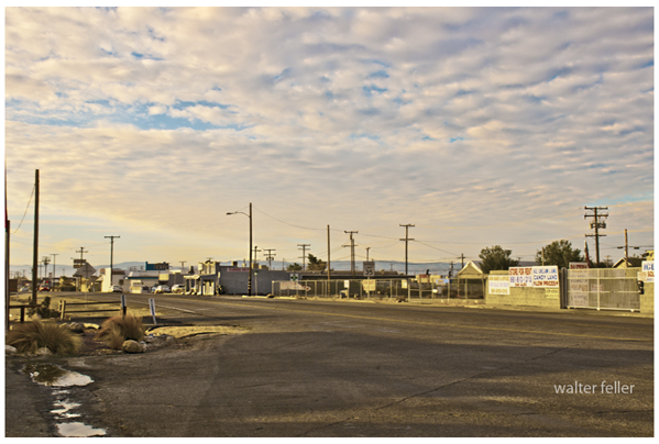
Rosamond, California, is a census-designated community in East Kern County, nestled near the Los Angeles County line. Part of the Greater Los Angeles area, Rosamond is situated just north of Lancaster and Palmdale, two prominent cities in the Antelope Valley. Known as a suburban "bedroom community," many of its residents commute to work at Edwards Air Force Base or travel to Los Angeles, Lancaster, and Palmdale. This essay explores Rosamond's historical roots, geographical significance, transportation networks, and development over time, painting a comprehensive picture of this unique community.Early History and Establishment
Rosamond's history is deeply intertwined with the expansion of the American West, particularly during the late 19th century. The town was established in 1877 as a townsite owned by the Southern Pacific Railroad. The name "Rosamond" was given in honor of the daughter of one of the railroad officials, reflecting the influence of the railroad in the town's foundation and growth.Initially, Rosamond's local industries were mining and cattle ranching, typical of many frontier towns during that era. The discovery of gold in the 1890s brought significant changes to the area. Miners and prospectors flocked to Rosamond, hoping to strike it rich. This period saw the town's rapid population growth and economic development. However, the gold mining industry experienced fluctuations, with the initial boom waning over the years. Despite this, a smaller resurgence occurred during the 1930s, contributing to the town's economic stability.
Willow Springs: A Historical Landmark
Before the advent of the railroad, travelers heading north through the Antelope Valley would pass through Willow Springs, a small settlement about eight miles west of Rosamond. Willow Springs served as a vital water source in the western Mojave Desert, surrounded by willow bushes that gave the springs their name. For centuries, these springs provided water for Native American tribes and later became a crucial stop for travelers and miners.In 1862, Nelson Ward and his 14-year-old wife, Adelia, settled at Willow Springs. They built an adobe structure that served as a boardinghouse, offering hospitality to travelers. The station, known as the "Hotel de Rush," became a popular but cramped stop for miners and mule teams. The discovery of silver at Cerro Gordo in the late 1860s brought even more traffic to Willow Springs, as Los Angeles became the main supply point for the Cerro Gordo mines.
Willow Springs played a significant role in the region's transportation network. It became a stop for the mule-drawn freight wagons of the Cerro Gordo Freighting Company, operated by Remi Nadeau in partnership with mine owners Victor Beaudry and Mortimer Belshaw. These teams hauled silver bullion from Owens Lake to the port at San Pedro, making Willow Springs an essential part of the journey.
Transition and Challenges
The death of Nelson Ward in 1873 left Adelia with five children and the responsibility of running Willow Springs station. However, the station lost its significance when Nadeau shifted his mule-team route to follow the new railroad line over the Tehachapi Mountains. Adelia then moved to Greenwich and later Tehachapi, continuing her role as a hotelier until her death in 1881.The Willow Springs station was subsequently taken over by a couple named Riley, who faced challenges such as a robbery by members of Tiburcio Vasquez's gang in 1875. The arrival of the railroad in Mojave in 1876 made long-distance stagecoach travel obsolete, leading to the decline of Willow Springs. By the mid-1880s, the adobe building was in ruins.
In 1900, Ezra Hamilton, who had found gold on a nearby butte and opened the Tropico mine, bought Willow Springs and the surrounding 160 acres. He built new stone buildings and transformed the property into a resort, adding a swimming pool and dance hall. While the original adobe stage station is gone, the stone buildings Hamilton constructed still stand, marking Willow Springs as a historical landmark.
Geographical Significance
Rosamond is located at the northern end of the Antelope Valley, the westernmost valley of the Mojave Desert. The area, referred to as the "high desert," sits at an elevation ranging from 2,000 to 3,000 feet above sea level. This geographical positioning provides Rosamond with a unique climate and landscape characteristic of the Mojave Desert region.The high desert climate is marked by hot summers and cool winters, with significant temperature variations between day and night. The area's arid conditions and unique flora and fauna make it a distinctive part of Southern California's natural environment. Rosamond's location also makes it a strategic point for transportation and commuting, connecting it to various significant routes and highways.
Transportation Networks
Rosamond's connectivity to major transportation routes has played a vital role in its development and accessibility. Several significant highways pass through or near Rosamond, facilitating travel to neighboring communities and major urban centers. These highways include:Sierra Highway:
An important north-south route that parallels State Route 14, providing local access to communities in the Antelope Valley.Angeles Forest Highway:
Connecting the Antelope Valley to the San Gabriel Mountains and the greater Los Angeles area, this highway offers scenic views and access to recreational areas.Angeles Crest Highway:
A scenic byway that traverses the San Gabriel Mountains, connecting the Antelope Valley to the Los Angeles Basin.Antelope Valley Freeway (State Route 14): A major north-south route that provides direct access to Los Angeles to the south and Mojave to the north. This freeway is crucial for commuters traveling to work in the greater Los Angeles area.
Bus service in Rosamond is provided by Kern Transit, which has a stop at the Lancaster Metrolink Station on Sierra Highway. This connection allows commuters to take a train to Union Station in Los Angeles, further enhancing Rosamond's accessibility to major employment centers.
Development and Modern Community
Today, Rosamond is a thriving suburban community within the Greater Los Angeles area. Its proximity to Edwards Air Force Base continues to influence its economic and demographic profile. Established in 1933 as Muroc Army Air Field, Edwards Air Force Base was later renamed in honor of test pilot Glenn Edwards. The base has played a crucial role in aviation history and continues to be a significant employer for Rosamond residents.The community's development has also been shaped by its transportation links and suburban growth. Many residents commute to work in nearby cities such as Lancaster, Palmdale, and Los Angeles, making Rosamond a desirable location for those seeking a balance between suburban living and access to urban amenities.
Rosamond's local economy has diversified beyond its early reliance on mining and cattle ranching. The presence of Edwards Air Force Base has attracted a variety of businesses and services catering to the needs of military personnel and their families. Additionally, the community's residential areas have expanded, with new housing developments accommodating the growing population.
Willow Springs Raceway
A notable modern attraction near Rosamond is Willow Springs Raceway, located west of the community. Although many of the natural springs at Willow Springs have dried up, the raceway has become a popular venue for motor racing events. Established in 1953, Willow Springs Raceway hosts various events, attracting participants and spectators from Southern California and across the country. The raceway features multiple tracks, including a road course, an oval track, and a karting track, making it a versatile venue for different types of racing.Conclusion
Rosamond, California, is a community with a rich history and a dynamic present. From its establishment as a railroad town in the late 19th century to its role as a suburban "bedroom community" within the Greater Los Angeles area, Rosamond has evolved significantly over time. The town's early industries of mining and cattle ranching laid the foundation for its growth, while the discovery of gold and the establishment of Edwards Air Force Base brought new opportunities and challenges.Willow Springs, with its historical significance as a watering hole for travelers and its modern role as a motor racing venue, adds to the area's unique character. Rosamond's strategic location in the high desert, along with its robust transportation networks, continues to make it a desirable place to live and work.
Today, Rosamond is a vibrant community that balances its historical roots with modern amenities and development. Its proximity to major highways and transportation routes ensures that it remains connected to the broader Southern California region, while its local attractions and community spirit make it a distinctive and welcoming place to call home.
Historical Willow Springs
Tropical Hill
Willow Springs Raceway
History
Rosamond was originally established in 1877 as a townsite which was owned by the Southern Pacific Railroad and was named 'Rosamond' after the daughter of one of the railroad officials.[2] The first local industries were mining and cattle. During the 1890s, gold was discovered and Miners quickly traveled to the area and populated it in order to strike it rich; however, the industry waned for many years, yet later had some success with a small boom during the 1930s. In 1933 Muroc Army Air Field was established, which has since been renamed Edwards Air Force Base in honor of fallen test pilot Glenn Edwards.The Rosamond post office opened in 1885, closed in 1887, and re-opened in 1888.[2]
Sierra Highway
Garces Rock
Southern Pacific
State Route 14
Rosamond, California Historical Timeline
c. 9,00011,000 years agoThe Antelope Valley, where Rosamond is located, was inhabited by Native peoples and used as a trade route.
1776
Father Francisco Garces traveled through the area, making the first recorded European contact.
Mid-1800s
Cattle ranching and mining began. Stagecoach and telegraph lines arrived in the region.
18761877
The Southern Pacific Railroad built a line through the area. Rosamond was established in 1877 as a railroad town, named after a railroad officials daughter.
18851888
The Rosamond post office opened in 1885, briefly closed in 1887, then reopened in 1888.
1890s
Gold was discovered, bringing miners and growth.
18961900
Ezra Hamilton discovered gold near Rosamond in 1896 and sold his mine for about $100,000 by 1900.
Early 1900s
The Tropico Mining Company took over Hamiltons operations and expanded local mining.
1920s
Rosamond became known for bootleg whiskey production during Prohibition, with many hidden desert wells.
1930s
Mining revived during the Depression, employing many.
19331950s
Muroc Army Air Field (later Edwards Air Force Base) was established nearby in 1933, shifting the local economy from mining to aerospace and military work.
1940s
The Wayside Chapel was built with funding from George Hummel, who had developed Rosamonds water services in the 1930s.
1951
George Hummel sold the Rosamond Water Company, which had just 125 customers. Water services are now provided by the Rosamond Community Services District.
1953
Willow Springs Raceway opened, adding motorsport to the local character.
1988
Radio station KVVS (105.5 FM) began broadcasting in Rosamond.