In warm weather —and it is hardly ever cold in their tropic valley —the men wear only a breech-clout, and the women a single garment generally made of flaming bandannas bought in the piece. They dress their long hair in curious ropes, and plaster the scalp with mud, tattoo the chin in wild patterns, and have no ornaments save fichus, which they make with great skill from tiny glass beads.
They have been practicing cremation from time immemorial, and were just having a funeral near East Bridge. The corpse, dressed in its best, was stretched on top of a huge pile of dry old ties from the railroad, and the chief mourner touched a torch to the heap of dry brush at the bottom. As the flames sprang aloft and hissed and roared, the mourners stood in a gloomy ring, chanting a wild refrain ; and as the savage fire and savage song went on, they threw upon the pyre from time to time all the earthly possessions of the deceased, and one by one their own garments and ornaments.
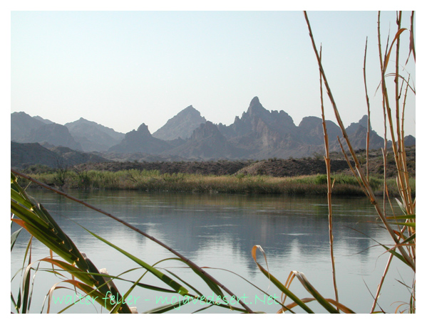
Passing the strange, jagged spires of peaks, which are called the Needles because two of them have natural eyelets, —though these are visible only from the canon, and not from the railroad, —I crossed the 1300-foot drawbridge, now abandoned for a fine new cantilever, a dozen miles below, and stood upon the there forbidding soil of California. A night at the rather pretty little railroad town of Needles, and I started off again into the grim Mojave Desert. It was the beginning of two hundred miles whose sufferings far outweighed all that had gone before . . .
DESERT RAT TEN COMMENDENTS [sic] BY THE EDITOR (from Harry Oliver’s Desert Rat Scrapbook)
I
Thou shalt love the DESERT, but not lose patience with those who say it’s bleak and ornery (even when the wind is blowing).
Even when the wind is blowing ..
II
Thou shalt speak of the DESERT with great reverence, and lie about it with great showmanship, adding zest to Tall Tales and Legends.
Adding zest …
III
Thou shalt not admit other DESERTS have more color than the one on which you have staked your claim.
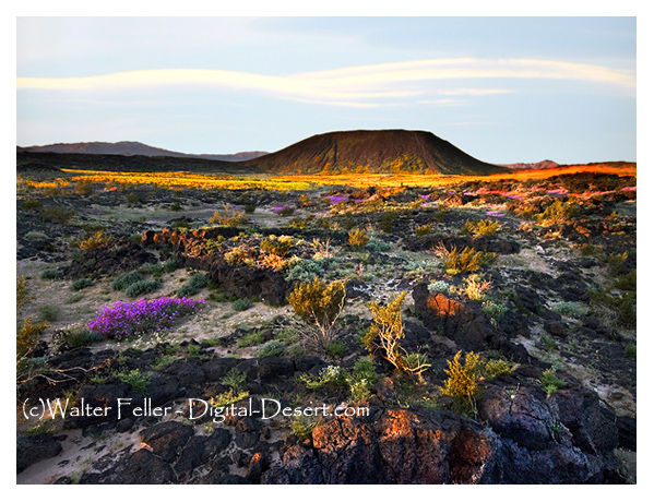
Amboy Crater
IV
Thou shalt on the Sabbath look to the Mountain Peaks so’s to know better your whereabouts, so’s you can help others to know the DESERT, dotting on the map the places where you have camped.
… on the Sabbath look to the Mountain Peaks …
V
Honor the Pioneers, Explorers and the Desert Rats who found and marked the water holes . . . they tell you about the next water hole and try to help you.
VI
Thou shalt not shoot the Antelope-Chipmunk, Kangaroo Rat or other harmless Desert friends. (Keep your shot for a snake.)
Don’t shoot these.
VII
Thou shalt not adulterate the water holes nor leave the campsite messed up. Be sure to take 10 gallons of water with you. Don’t have to ask the other fellow on the road for a quart, but be able to help the tenderfoot by giving him some water.
10 gallons of water ought to do it.
VIII
Thou shalt not steal (from the prospector’s shack), nor forget to fill the wood box and water pail.
Don’t be an asshole and mess up or steal stuff from some guy’s cabin.
IX
Thou shalt not bear false witness against thy neighbor; you know the mining laws; you know the whereabouts of his monuments.
Sign of the times.
X
Thou shalt not covet thy neighbor’s sleeping bag, his gun, nor the contents of his canteen.
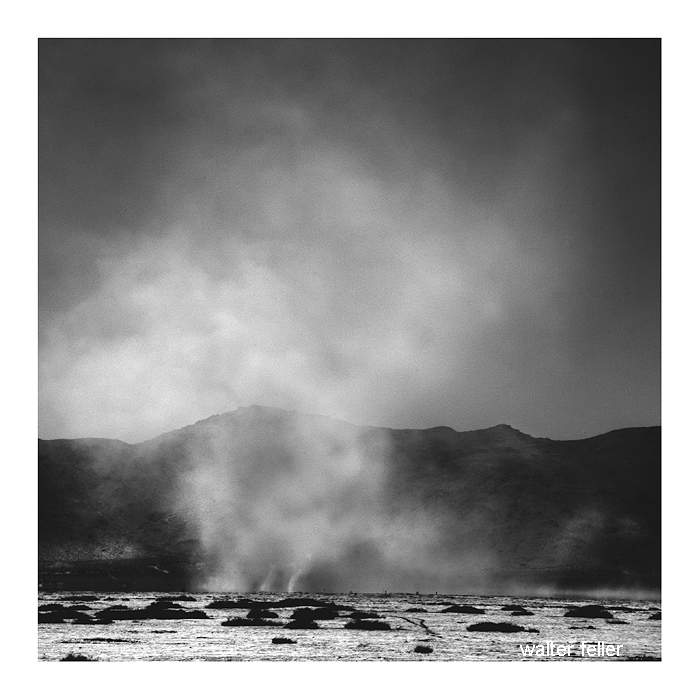
Death Valley was having one of its periodic wind storms when the tourists drove up in front of Inferno store to have their gas tank filled.
Hard Rock Shorty was seated on the bench under the lean-to porch with his hat pulled down to his ears to keep it from blowing away.
Desert wind storm
“Have many of these wind storms?” one of the dudes asked.
“Shucks, man, this ain’t no wind storm. Jest a little breeze like we have nearly every day. You have to go up in Windy Pass in the Panamints to find out what a real wind is like.
“Three-four years ago I wuz up there doin’ some prospectin’. Got together a little pile o’ wood an’ finally got the coffee to boilin’. Then I set it on a rock to cool while I fried the eggs.
“About that time one of them blasts o’ wind come along and blowed the fire right out from under the fryin’ pan. Blowed ‘er away all in one heap so I kept after it tryin’ to keep that fryin’ pan over the fire to git my supper cooked.
“I usually like my eggs over easy, but by the time 1 got one side done I wuz all tired out so I let ‘er go at that. Had to walk four miles back to the coffee pot.”
Once I asked Shorty Harris how he obtained his grubstakes. “Grubstakes,” he answered, “like gold, are where you find them. Once I was broke in Pioche, Nev., and couldn’t find a grubstake anywhere. Somebody told me that a woman on a ranch a few miles out wanted a man for a few days’ work. I hoofed it out under a broiling sun, but when I got there, the lady said she had no job. I reckon she saw my disappointment and when her cat came up and began to mew, she told me the cat had an even dozen kittens and she would give me a dollar if I would take ’em down the road and kill ’em.
“‘It’s a deal,’ I said. She got ’em in a sack and I started back to town. I intended to lug ’em a few miles away and turn ’em loose because I haven’t got the heart to kill anything.
“A dozen kittens makes quite a load and I had to sit down pretty often to rest. A fellow in a two-horse wagon came along and offered me a ride. I picked up the sack and climbed in.
“‘Cats, eh?’ the fellow said. ‘They ought to bring a good price. I was in Colorado once. Rats and mice were taking the town. I had a cat. She would have a litter every three months. I had no trouble selling them cats for ten dollars apiece. Beat a gold mine.’
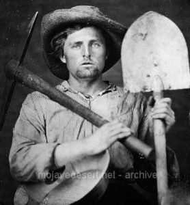
Prospector with grubstake essentials
“There were plenty rats in Pioche and that sack of kittens went like hotcakes. One fellow didn’t have any money and offered me a goat. I knew a fellow who wanted a goat. He lived on the same lot as I did. His name was Pete Swain.
“Pete was all lit up when I offered him the goat for fifty dollars. He peeled the money off his roll and took the goat into his shack. A few days later Pete came to his door and called me over and shoved a fifty-dollar note into my hands. ‘I just wanted you to see what that goat’s doing,’ he said.
“I looked inside. The goat was pulling the cork out of a bottle of liquor with his teeth.
“‘That goat’s drunk as a boiled owl,’ Pete said. ‘If I ever needed any proof that there’s something in this idea of the transmigration of souls, that goat gives it. He’s Jimmy, my old sidekick, who, I figgered, was dead and buried.’
“‘Now listen,’ I said. ‘Do you mean to tell me you actually believe that goat is your old pal, whom you drank with and played with and saw buried with your own eyes, right up there on the hill?’
“‘Exactly,’ Pete shouted, and he peeled off another fifty and gave it to me. So, you see, a grubstake, like gold, is where you find it.”
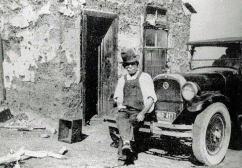
from: Loafing Along Death Valley Trails A Personal Narrative of People and Places Author: William Caruthers
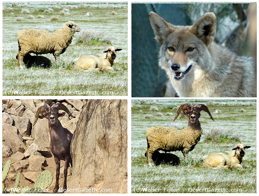
Bill Frakes was a gentleman from Argentina who brought sheep out to his claim at the old Camp Cady along the Mojave River. As soon as he got there, it seemed he had sheep problems. They kept dying. They kept dying because the sheep had coyote problems. The coyotes had issues because they always seemed hungry, and the sheep were so tasty.
Bill Frakes noticed the coyotes rarely messed with the local bighorn sheep. The bighorn would kick the hell out of the coyotes and cause them more coyote problems than the meal was worth–like broken bones, punctured lungs, and death and stuff…
Bill Frakes had an idea on how to solve everyone’s problems–to interbreed the bighorn with the domestic sheep. He would make coyote killers, and Bill Frakes would be on Easy Street raising flocks and flocks of bad-ass sheep.
The details of what happened next are left in the gray fog of best-forgotten history, but there were rumors that several unfortunate and disturbing creatures were tied to a shed, and at night strange animal-like crying and sobbing could be heard.
Bill Frakes’ plan failed miserably with a possible exception; up there in the hills, a hybrid ram is said to have escaped; too ugly to die, too ugly to let itself be seen, the King Mutant Ram’s wailing and moaning can be heard to these very modern times in the mysterious night winds of the Afton Canyon highlands . . .
The End
Fiction inspired by a true event as described in “Daggett, Life in a Mojave Frontier Town,” by Dix Van Dyke – Edited by Peter Wild.
A few miles east of Shoshone is Chicago Valley, which began in a startling swindle and ended in fame and fortune for one defrauded victim.
A convincing crook from the Windy City found government land open to entry and called it Chicago Valley. It was a desolate area; the only living thing to be seen was an occasional coyote skulking across or a vulture flying over. The promoter needed no capital other than a good front, glib tongue, and the ability to lie without the flicker of a lash.
A few weeks later, Chicago widows with meager endowments, scrub women with savings, and some who coughed too much from long hours in sweatshops began to receive beautifully illustrated pamphlets that described a tropical Eden with lush fields, cooling lakes, and more to the point, riches almost overnight. For $100, anyone concerned would be located.
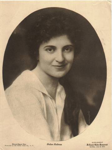
Soon people began to swing off The Goose, as the dinky train serving Shoshone was called, and head for Chicago Valley. Among the victims was a widow named Holmes with a family of attractive, intelligent children. One of these was a vivacious, beautiful teenager named Helen.
The Holmes were handicapped because of tuberculosis in the family. This, in fact, had induced the widow to invest her savings.
Herman Jones used to ride by the Holmes’ place en route to the Pahrump Ranch on hunting trips and owning several burros; he thought the Holmes’ children would like to have one. Taking the donkey over, he told Helen, “You can use him to work the ranch too. Better and faster than a hoe….” He brought a harness and a cultivator, and showed her how to use the implement.
It was inevitable that investors in Chicago Valley would lose their time, labor, and money.
Thus when Helen Holmes returned the burro to Herman one day, Herman was not surprised when she told him she was on her way to Los Angeles to look for a job.
“But what can you do?”
“I wish I knew. I can get a job washing dishes or waiting on tables.”
Shortly afterward, he heard from her—just a little note saying she was a hello girl on a switchboard. “Knew she’d land on her feet,” Herman grinned, and having a bottle handy, he gurgled a toast to Helen. He had to tell the news, of course, and with each telling, he produced the bottle.
So he was in a pleasant mood when somebody suggested a spot of poker. To mention poker in Shoshone is to have a game, and in a little while, Dad Fairbanks, Dan Modine, deputy sheriff Herman, and two or three others were shuffling chips over in the Mesquite Club.
Herman had the luck and quit with $700. “Fellows,” he said as he folded his money, “take a last look at this roll. You won’t see it again.”
“Oh, you’ll be back,” Fairbanks said.
But Herman didn’t come back. Instead, he went to Los Angeles, and found Helen at the switchboard. She confided excitedly that she had a chance to get into the movies as soon as she could get some nice clothes.
“Fine,” Herman said. “When can I see you?” He made a date for dinner, had a few more drinks and when he met her he had a comfortable binge and a grand idea. “… Listen, Helen. You wouldn’t get mad at a fool like me if I meant well, would you?”
“Why Herman—you know I wouldn’t,” she laughed.
“I’m a little likkered and it’s kinda personal….”
“But you’re a gentleman, Herman—drunk or sober….”
“I’ve been thinking of this picture business. I nicked Dad Fairbanks in a poker game. You know how I am. Lose it all one way or another. You take it and buy what you need, and it’ll do us both some good.”
The refusal was quick. “It’s sweet of you, Herman, but not that. I just couldn’t.”
“You can borrow it, can’t you … so I won’t drink it up?”
The argument won, and soon theatergoers all over the world were clutching their palms as they watched the hair-raising escapes from death that pictured “The Perils of Pauline”—the serial that made Helen Holmes one of the immortals of the silent films. She died at 58 on July 8, 1950.
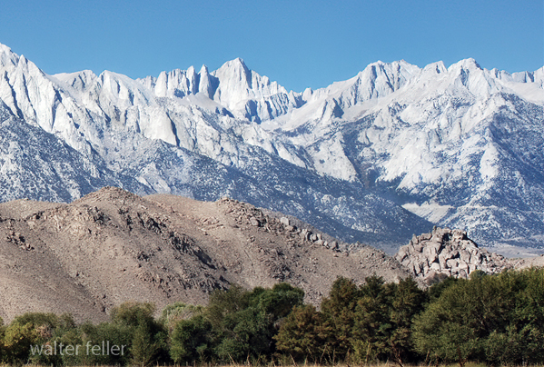
The Eastern Sierra Nevada boasts a rich geological history that spans millions of years. This region offers a captivating glimpse into Earth’s past, from towering granite peaks to ancient volcanic formations. The fascinating geology of the Eastern Sierra Nevada and its unique features make it a geologist’s paradise.
Formation of the Sierra Nevada Range:
The Sierra Nevada Range, including the Eastern Sierra Nevada, began forming around 100 million years ago during the Mesozoic Era. It was the result of tectonic plate movements, specifically the subduction of the Pacific Plate beneath the North American Plate. This process resulted in the uplifting and folding of the Earth’s crust, giving rise to the majestic mountain range we see today.
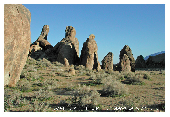
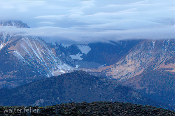
Granite and Glaciers:
One of the defining features of the Eastern Sierra Nevada is its abundance of granite. The region is home to the largest exposed granite batholith in the world, aptly named the Sierra Nevada Batholith. This enormous body of intrusive igneous rock formed deep beneath the Earth’s surface and was gradually exposed through erosion over millions of years.
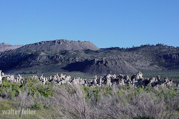
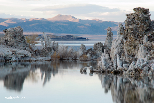
During the last Ice Age, glaciers sculpted the Eastern Sierra Nevada, leaving behind stunning landscapes. Glacial activity carved out U-shaped valleys, polished granite surfaces and created glacial lakes such as Mono Lake and Convict Lake. These remnants of the Ice Age are a testament to the dynamic forces that shaped the region.
Volcanic Activity:
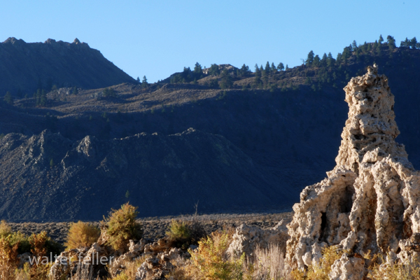
Eastern Sierra Nevada is also home to a number of volcanic features. The Long Valley Caldera, located just east of the Sierra Nevada Range, is a prime example of volcanic activity in the region. This massive volcanic depression formed around 760,000 years ago during a cataclysmic eruption that released an estimated 600 cubic kilometers of magma.
Within the caldera lies the famous Mono-Inyo Craters, a chain of volcanic domes and craters. These volcanic formations offer a glimpse into the region’s volcanic history and provide evidence of past eruptions that have shaped the landscape.
Mineral Deposits:
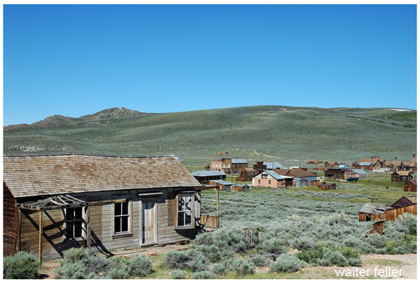
The Eastern Sierra Nevada is known for its rich mineral deposits. Gold, silver, and copper have been mined in the region since the mid-1800s, attracting prospectors during the California Gold Rush. The Bodie State Historic Park, a well-preserved ghost town, stands as a reminder of the mining boom that once thrived in the area.
Conclusion:
Exploring the geology of Eastern Sierra Nevada is a journey through time, where the forces of nature have sculpted a remarkable landscape. This region offers a glimpse into the Earth’s fascinating geological history, from the towering granite peaks to the remnants of ancient volcanoes. Whether you are a geology enthusiast or simply appreciate the beauty of nature, Eastern Sierra Nevada is a destination that will leave you in awe of the Earth’s geological wonders.
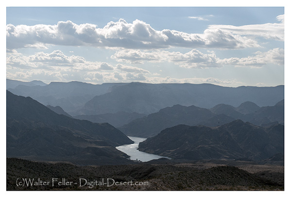
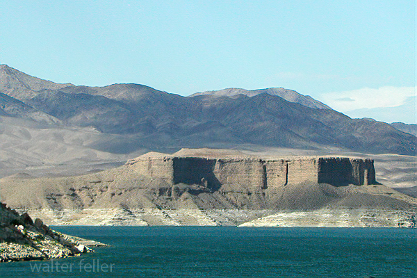
The Lower Colorado River is a mesmerizing natural wonder that winds through the Southwestern United States, attracting millions of visitors annually. Beyond its scenic beauty and recreational opportunities, the geology of the Lower Colorado River offers a fascinating glimpse into the Earth’s history.
Formation of the Lower Colorado River:
The formation of the Lower Colorado River can be traced back millions of years. It all began with the uplift of the Colorado Plateau, a vast region spanning parts of Arizona, Utah, Colorado, and New Mexico. Over time, the relentless forces of erosion, primarily by the Colorado River, carved through sedimentary rock layers, exposing unique geological formations.
Canyons and Gorges:
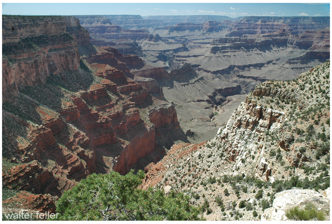
One of the most striking features along the Lower Colorado River is the presence of deep canyons and gorges. The river has carved its way through layers of sedimentary rocks, primarily sandstones, and shales, creating stunning landscapes such as the Grand Canyon and the Black Canyon of the Colorado. These canyons offer a glimpse into the Earth’s history, with each layer representing a different period of deposition.
Rock Formations:
The Lower Colorado River area is renowned for its diverse rock formations. The region showcases various sedimentary rocks, including sandstone, limestone, and shale. These rocks provide clues about ancient environments and the processes that shaped them. Fossilized remains of plants and animals can also be found within these rock formations, offering insights into past ecosystems.
Geological Time Scale:
To truly appreciate the geology of the Lower Colorado River, it is essential to understand the concept of geological time. The river has been actively shaping the landscape for millions of years, leaving behind a rich tapestry of rocks and formations. By studying the various layers, geologists can piece together the history of the region, including ancient climates, sea levels, and tectonic events.
Conclusion:
The geology of the Lower Colorado River is a captivating subject that offers a glimpse into the Earth’s past. From towering canyons to diverse rock formations, this region tells a story of millions of years of geological processes. Exploring the Lower Colorado River is a visual delight and an opportunity to unravel the mysteries of our planet’s ancient history. So, the next time you find yourself near the Lower Colorado River, take a moment to appreciate the remarkable geology that surrounds you.
Death Valley National Park is known for its extreme temperatures, vast desert landscapes, and unique geological features. Located in Eastern California, this national park is a treasure trove for geology enthusiasts.
Formation and Tectonic Activity:
Death Valley’s geological history dates back millions of years. The valley is part of the larger Basin and Range Province, characterized by its numerous mountain ranges and elongated valleys. The formation of Death Valley can be attributed to the complex interplay of tectonic forces.
Faults and Uplift:
One of the key geological features of Death Valley is the presence of faults. Numerous faults, including the prominent Death Valley Fault Zone, crisscross the region. These faults have played a significant role in shaping the landscape, creating dramatic uplifts and sinkholes.
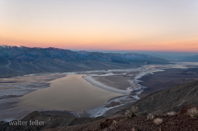
Playa and Salt Flats:
Death Valley is home to several unique geological features, including expansive salt flats and playa. The salt flats, such as the mesmerizing Badwater Basin, are formed when water dissolves minerals from the mountains and then evaporates, leaving behind a thick crust of salt. These salt flats provide a surreal and otherworldly experience for visitors.
Mesquite Flat Sand Dunes:
The Mesquite Flat Sand Dunes offer a striking contrast to the arid landscape of Death Valley. These dunes are formed by the accumulation of wind-blown sand over thousands of years. The shifting dunes create stunning desert scenery and are a popular destination for photographers and nature enthusiasts.
Geological Time and Fossils:
Death Valley is a geological time capsule, preserving a rich fossil record that spans millions of years. Fossils of ancient marine life, plants, and animals have been discovered, providing invaluable insights into the region’s past. These fossils tell the story of a time when Death Valley was submerged under a vast inland sea.
Volcanic Features:
Volcanic activity has also left its mark on Death Valley’s geology. The park is home to several cinder cones, lava flows, and volcanic craters. Ubehebe Crater, a massive volcanic crater, is a testament to the violent eruptions that occurred in the region thousands of years ago.
Conclusion:
Death Valley National Park is a geologist’s paradise, offering a glimpse into the dynamic forces that have shaped our planet. From the towering mountain ranges to the vast salt flats and mesmerizing sand dunes, the geology of Death Valley is a testament to nature’s immense power and beauty. Exploring this unique landscape is a humbling experience that allows us to appreciate the Earth’s geological history and its ongoing processes of change and transformation.
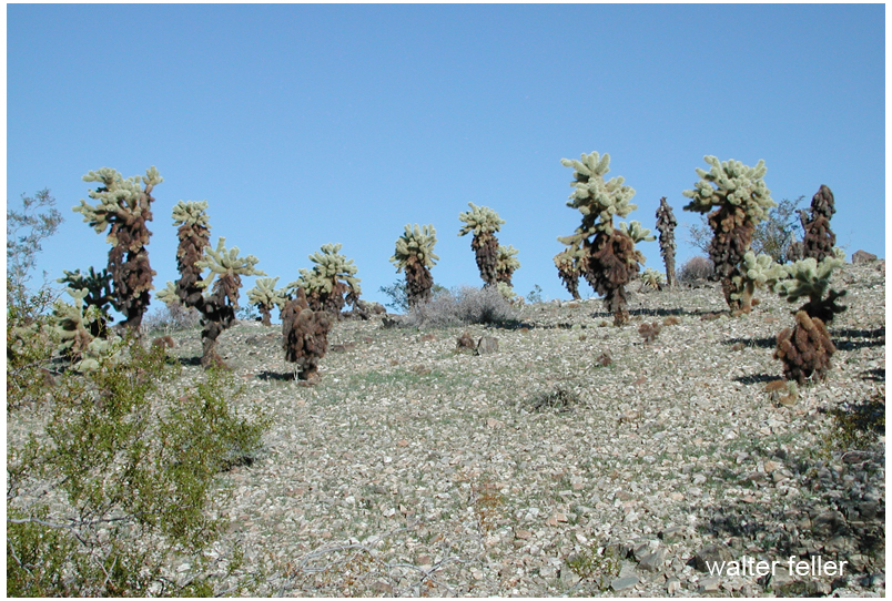
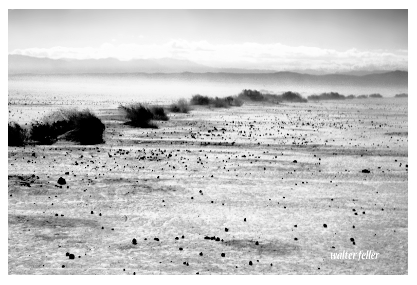
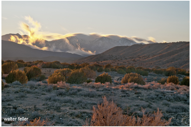
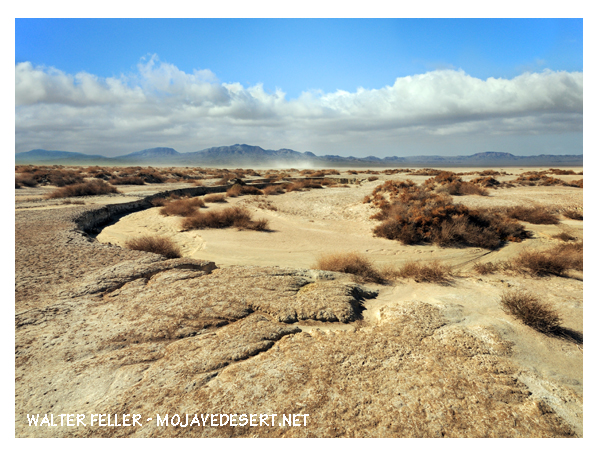
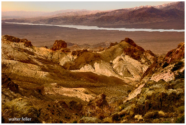
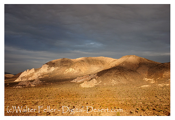
The Mojave Desert, located in the southwestern United States, is known for its vast arid landscape and unique geological formations. Let us now look at Mojave Desert geology. We will explore its history, distinctive landforms, and the forces that have shaped this remarkable desert ecosystem.
Ancient History:
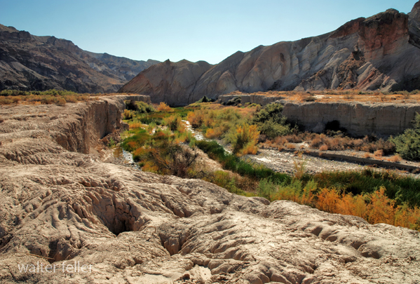
Afton Canyon, Mojave River
The geological history of the Mojave Desert dates back millions of years. It was formed through a complex interplay of tectonic forces, erosion, and climatic changes. The Mojave Desert is part of the Basin and Range Province, characterized by alternating mountain ranges and valleys. Over time, these forces have sculpted the desert’s diverse topography, creating a mesmerizing tapestry of geological wonders.
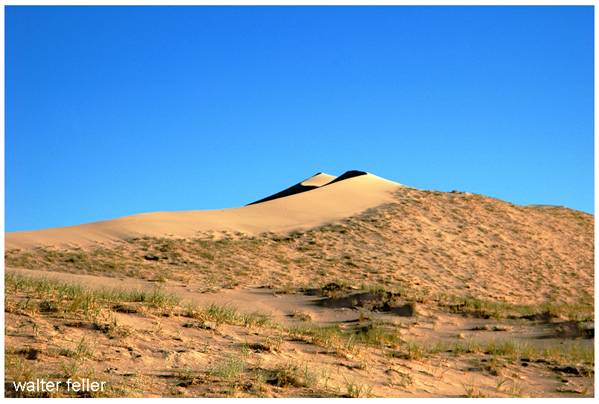
Distinctive Landforms:
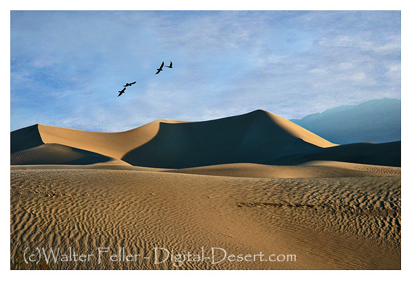
Kelso Dunes, Mojave National Preserve
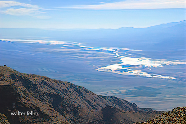
The Mojave Desert is home to many distinctive landforms that capture geologists’ and nature enthusiasts’ imaginations. One such feature is the Mojave River, which runs through the heart of the desert, shaping its landscape and supporting its own ecosystem. Another notable landform is the Kelso Dunes, towering sand dunes that shift and change with the wind, creating an ever-changing desert scene.
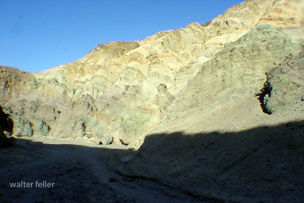
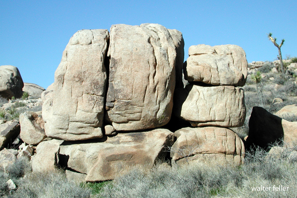
Geology Tour Road stop #6, Joshua Tree National Park
Joshua Tree National Park, located within the Mojave Desert, is renowned for its iconic Joshua trees, which dot the barren landscape. These trees are adapted to the harsh desert environment and symbolize resilience in the face of adversity. The park also boasts mesmerizing rock formations, such as Hidden Valley and Jumbo Rocks, which showcase the desert’s ancient geological past.
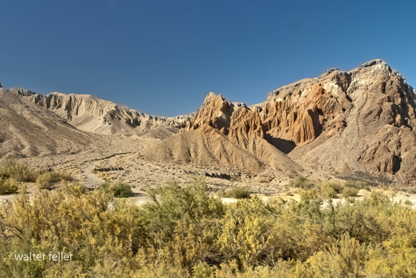
Forces of Shaping:
Rainbow Basin, Barstow, Ca.
Several key forces have shaped the Mojave Desert’s geological landscape. The San Andreas Fault, a major tectonic boundary, runs through the region, causing periodic earthquakes and contributing to the uplift of mountain ranges. Erosion, primarily driven by wind and water, has significantly sculpted the desert’s landforms, creating deep canyons, rugged cliffs, and intricate rock formations.
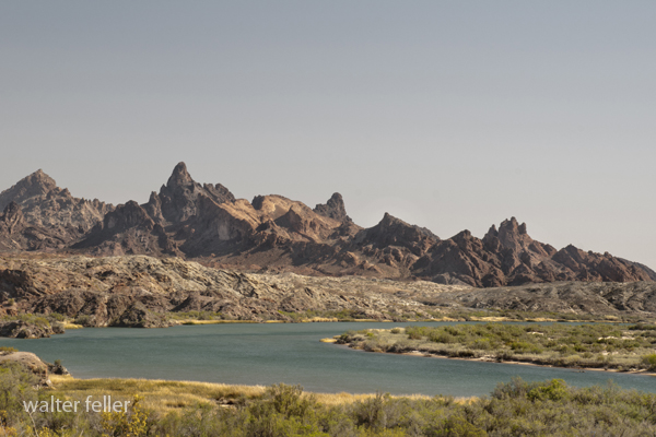
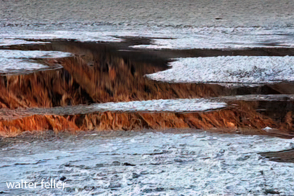
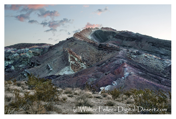
Amargosa River
The climate also shapes the Mojave Desert’s geology. The region experiences extreme temperature fluctuations, with scorching hot summers and chilly winters. These temperature extremes and sporadic rainfall contribute to rock weathering and erosion and the formation of unique geological features.
Conclusion:
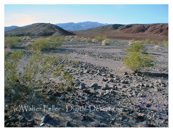
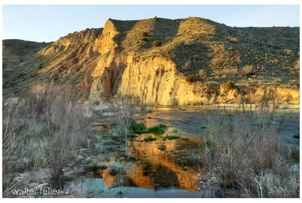
West Fork, Mojave River
The Mojave Desert stands as a testament to the immense power of geological forces and the intricate beauty they can create. From its ancient history to its distinctive landforms, the desert offers a glimpse into the Earth’s ever-evolving landscape. As we explore the Mojave Desert’s geology, we gain a deeper appreciation for the natural wonders that surround us and the forces that have shaped them over millions of years.