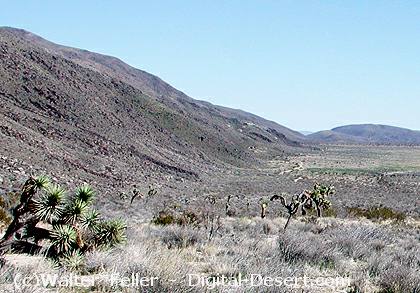
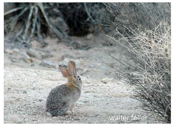
The Mojave Desert is home to many small rodents, including squirrels, rats, and mice. At first glance, they may seem alike, but each group has its own habits and place in the desert.
Antelope Squirrel
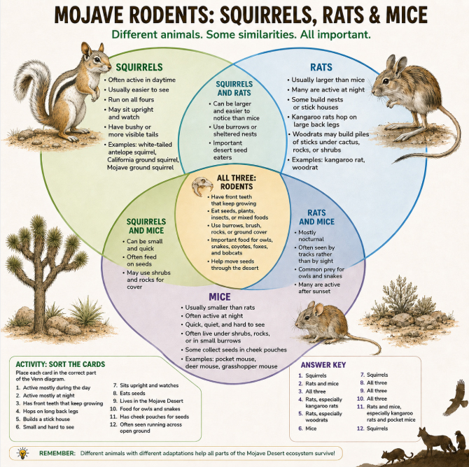
Squirrels are often the easiest to see because many are active during the day. White-tailed antelope squirrels, California ground squirrels, and Mojave ground squirrels may be seen running across open ground, sitting upright, or watching from near a burrow. Their alert behavior helps them survive in a land of hawks, snakes, coyotes, and foxes.
Packrat – Roger Barbour photo – USFWS
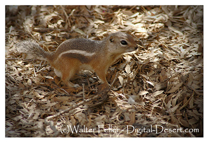
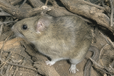
Rats and mice are more often active at night. Kangaroo rats are well-adapted to desert life, with long hind legs for hopping and cheek pouches for carrying seeds. Woodrats may build large stick nests under cactus, shrubs, or rocks. Mice are usually smaller, quicker, and harder to notice. Pocket mice, deer mice, and grasshopper mice often stay hidden in burrows, brush, or rocky cover.
Pocket mouse
All of these animals are rodents. They have front teeth that keep growing, and many feed on seeds, plants, insects, or a mix of foods. Though small, they are an important part of the Mojave ecosystem. They move seeds, loosen soil, and provide food for owls, snakes, bobcats, kit foxes, and other desert predators.
Squirrels are the daytime watchers. Kangaroo rats are the night jumpers. Mice are the hidden seed gatherers. Together, they help keep the desert alive.
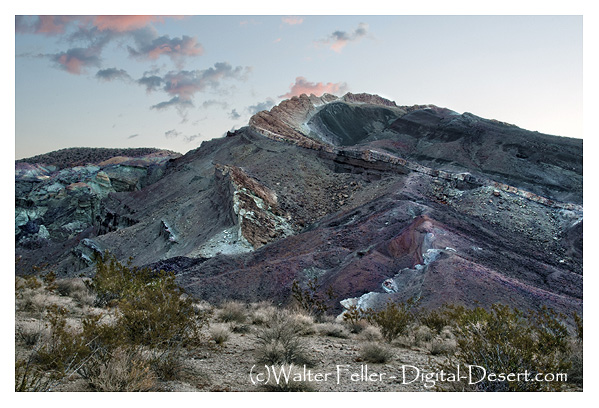
I like geology because it transforms how I see the desert. Geology explains why the land looks the way it does, why water follows certain paths, why mountains rise, or basins sink, and why springs appear. It shows how natural forces shape human choices: trails, roads, mines, railroads, and settlements emerge from the land’s history. Geology turns the desert from empty space into a record that can be read.
To many people, the desert looks still and silent. They see rocks, dry washes, cliffs, playas, distant mountains, and open ground. However, geology reveals that the desert is not still at all. It is the result of movement, pressure, heat, erosion, faulting, volcanism, uplift, and time. Every ridge, canyon, lava flow, terrace, wash, spring, and fault scarp has a reason for being there. While the land may not speak plainly, it leaves evidence.
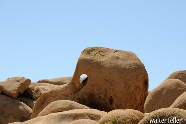
Jumbo Rock – Joshua Tree National Park
That is one reason geology appeals to me. It is based on visible proof. A geologist can look at a cliff face, a broken hillside, a tilted layer of rock, a dry lakebed, or a mine dump and begin to understand what happened. The evidence may be old, weathered, scattered, or partly hidden, but it is still there. Geology rewards careful observation. It asks a person to slow down, look closely, compare patterns, and respect what the land is showing.
For about nine years, I wandered and explored the desert simply by going out there. I moved from one point of interest to another, mostly staying to myself. Instead of following a formal course or guided route, I learned by looking, walking, comparing places, and remembering what I had seen. A canyon led to a spring. A spring led to a wash. A wash led to a road. A road led to a mine, a pass, a dry lake, or a faulted hillside. Over time, the separate places began to connect, further deepening my understanding.
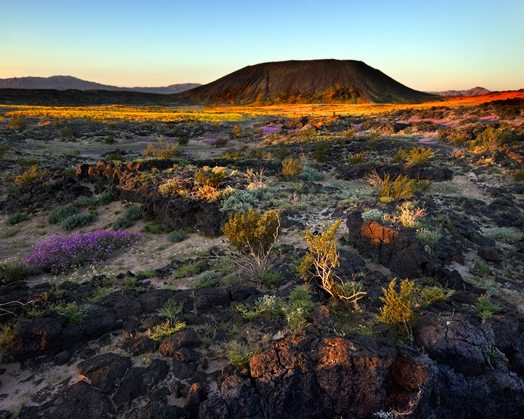
Amboy Crater
That kind of wandering gave the desert time to teach me. I was not trying to master it all at once. Some places made sense right away. Others stayed confusing until I saw another place that explained them. Over time, the desert became less like a collection of isolated sites and more like one connected landscape.
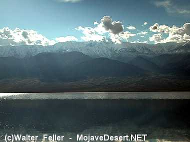
Lake Manly – Death Valley
In making these connections, I began to see that geology and history both seek to explain the past, but in different ways. History asks who came through a place, what they did, what they called it, and what they left behind. Geology, in contrast, asks deeper questions: Why is this pass here? Why did the river cut through at this place? Why did the lake disappear? Why was ore found in this mountain and not another? Why did a spring appear along one route and not another? Ultimately, human history depends on the shape and structure of the earth beneath it.
Blue Cut Fault – Joshua Tree National Park
This is especially true in the Mojave Desert. The Mojave is a land of corridors, barriers, basins, mountains, playas, springs, faults, and washes. People did not move across a blank map. They followed water, passes, dry lake margins, river channels, and openings between ranges. Trails, wagon roads, railroads, highways, mining camps, and towns were all influenced by geology. To understand the Mojave well, a person has to understand the ground.
Geology also explains why the desert can feel so old. Human history may reach back a few hundred or a few thousand years, but geology reaches into deep time. It deals with ancient seas, vanished lakes, old volcanoes, buried rivers, moving faults, and mountains worn down and raised again. It reminds us that the land existed long before us and will remain long after us. That perspective gives the desert dignity.
I admire geologists because they know how to read the earth without needing it to speak plainly. They can stand before a canyon wall, a fault zone, a lava field, or a dry lake and see more than scenery. They see time, force, sequence, and evidence. They understand that the land is not random. It has structure. It has a history. It has a record, even when that record is difficult to read.
I also admire the dedication and discipline geology requires. It is not casual work. It takes field study, maps, measurements, samples, notes, old reports, and comparison. A geologist must be willing to walk rough ground, endure heat and distance, and keep looking when the answer is not obvious. The earth does not reveal its story all at once. Understanding comes one observation at a time.
That kind of work requires humility. A good geologist cannot force the land to fit an easy explanation. The evidence has to lead. If the rocks say one thing and the theory says another, the theory must change. That respect for facts is one of the strongest parts of geology. It is disciplined curiosity. It combines imagination with restraint.
The Desert Studies Center at Zzyzx belongs in this story because it represents desert study put into practice. With this focus shifting from theory to place, it is a center where students, teachers, and researchers can go into the Mojave itself and learn directly from the land. Set near Soda Dry Lake, at the end of the Mojave River system, it stands in one of the best natural classrooms in the desert.
That setting matters. Around Zzyzx are dry lake beds, springs, salt flats, rocky slopes, volcanic features, desert plants, old shorelines, and evidence of water, heat, faulting, erosion, and long-term change. A person studying there is not learning geology only as an abstract subject. He is standing inside the evidence.
The Desert Studies Center also shows why geology requires discipline. Field science is not guessing from a distance. It means walking the ground, taking notes, checking maps, and comparing what is seen with what has been written. That is the kind of work I admire. It takes order and respect for facts.
In that sense, Zzyzx is more than a place on the map. It serves as a bridge between curiosity and discipline, and as a living example of how the Mojave Desert continues to be studied and interpreted. The Desert Studies Center turns admiration for geology into practical learning. Connecting students and researchers directly with the land shows that the desert itself remains the best teacher.
Geologists also help preserve meaning in places that might otherwise be overlooked. A dry wash is not just a wash. A playa is not just a flat place. A fault is not just a crack. A mine is not just a hole in the ground. Building on this, each one belongs to a larger story. Geology connects small details to big forces. It turns scattered features into a pattern.
That is why geology makes the desert understandable. Instead of seeing emptiness, geology reveals the bones and memory of the landscape. The Mojave is not barren, but layered with evidence of violence, patience, age, movement, and history. Geology’s explanation brings order and beauty to the surface, grounded in the evidence it preserves.
I like geology because it deepens every desert visit. Once you begin to see the land geologically, ordinary places become more interesting. A roadcut becomes a lesson. A wash becomes a process. A spring becomes a clue. A mountain front becomes evidence of movement. A dry lake becomes the trace of a vanished world.
Most of all, I like geology because it sharpens attention and deepens understanding. Geology rewards patience, discipline, and respect for the past. It reminds us that the earth has a story older than our own, and the Mojave Desert, far from being empty, vividly displays that story. With geology, the desert becomes readable and meaningful.
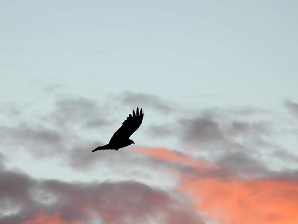
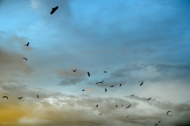
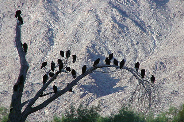
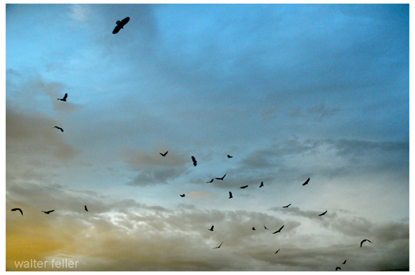
Once dusk approaches, vulture activity shifts noticeably. During the day, vultures ride thermals, travel, and search for carrion. While the sun drops lower, the warm rising air begins to weaken. The birds often stop traveling far and begin moving toward a regular night roost.
Just before sunset, vultures may circle near the roost in loose groups. This circling can look like they are gathering over something dead, but that is not always the case. In the evening, they often use the last lift of the day, sorting themselves into the roost and waiting for a safe place to settle. One bird may arrive, then several more. They may circle, drift, perch, shift position, and lift off again before finally settling.
A roost may be in tall trees, cliffs, utility towers, old buildings, or other high open places. Vultures prefer places where they can see around them. In the morning, they launch easily. Roosting together provides some protection against danger. It may also help them keep track of where other vultures go to feed.
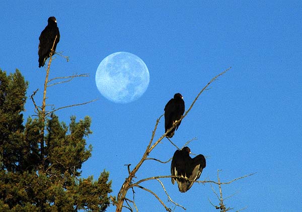
After dark, vultures are mostly quiet and inactive. They do not hunt at night. Their eyesight is good, but they need sunlight and warm air to soar. Without thermals, they conserve energy by perching. They may shift, preen, or shuffle along a branch, but mostly they rest at night.
Animals die at night. Their carcasses, if not swallowed whole, may be hastily shredded, abandoned, and left to rot as a meal for the buzzards or other scavengers.
Near sunrise, the roost stirs. Vultures stretch, preen, and spread their wings. Sunning in the morning is among their most noticeable behaviors. A vulture standing with open wings is usually warming after the cool nighttime, drying dew, and preparing for flight.
They usually wait for the sun to warm the ground and create rising air. When thermals form, vultures leave, circling upward and spreading out. The roost empties, and the search begins again.
The Scavengers
Fifty-seven buzzards, one on each of fifty-seven fence posts at the rancho El Tejon, on a mirage-breeding September morning, sat solemnly while the white tilted travelers’ vans lumbered down the Canada de los Uvas. After three hours they had only clapped their wings, or exchanged posts. The season’s end in the vast dim valley of the San Joaquin is palpitatingly hot, and the air breathes like cotton wool. Through it all the buzzards sit on the fences and low hummocks, with wings spread fanwise for air. There is no end to them, and they smell to heaven. Their heads droop, and all their communication is a rare, horrid croak.
You could think of the Mojave Desert as a grand Broadway production—ancient, dramatic, and full of subtle choreography that has played out for millions of years.
The stage is the geology: immense backdrops of folded mountains, tilted strata, and fault lines painted by time. Volcanic cones serve as spotlight towers, alluvial fans sweep like curtains drawn across the basin floor, and the Mojave River cuts a wandering path like a traveling stagehand moving props between acts.
The set is built from plants, rocks, and the occasional weathered structure. Joshua trees rise like eccentric stage pieces, each with its own pose under the lights. Creosote bushes fill in the ensemble—reliable, understated performers who know every cue. Abandoned mining cabins, ghost towns, and derelict rail ties serve as the props and scenery from earlier acts, remnants left between scenes of prosperity and decline.
The lighting crew is the sun, directing each scene with precision—blinding spotlights at noon, warm amber tones at dusk, and moonlit silver rehearsals after dark. The wind adds the soundtrack, whispering through canyons or howling like a restless audience.
The actors? Coyotes, bighorn sheep, and lizards—all improvising within a script written by climate and time. Even the rain, when it shows up, steals the scene with a brief but powerful soliloquy, transforming everything for one fleeting act before bowing out again for months, sometimes years.
Every performance is different, but the play never closes. The Mojave’s production runs continuously, with geology always holding center stage and life finding its cues wherever it can.
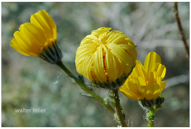
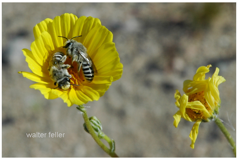
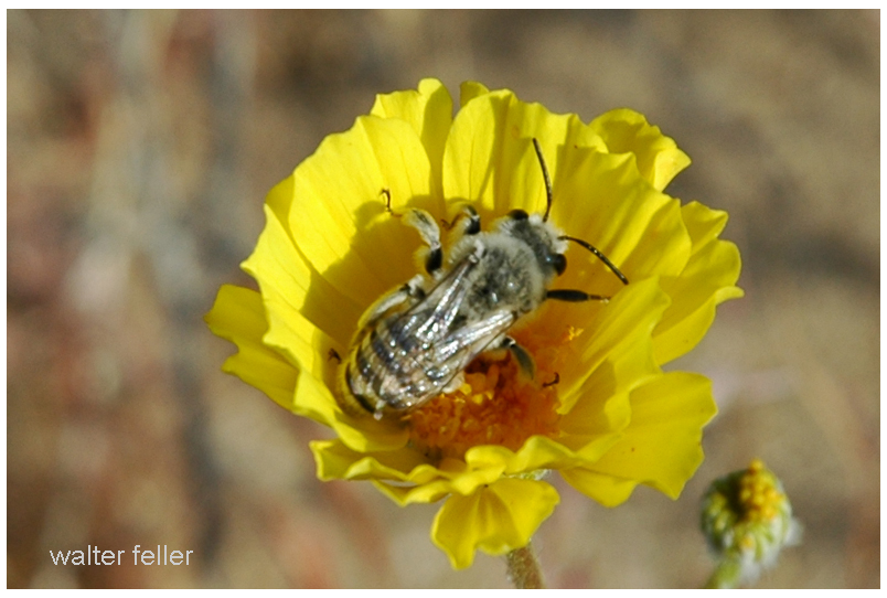
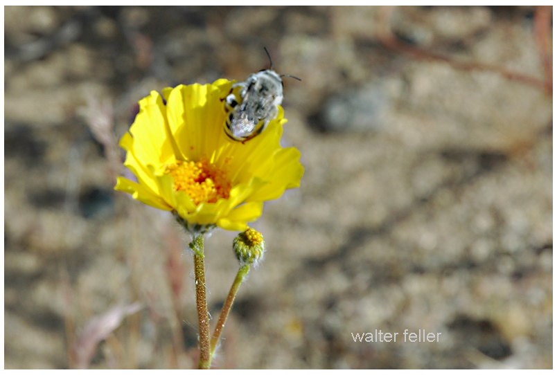
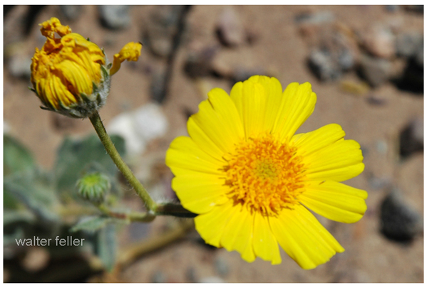
In the Mojave Desert, the bright yellow desert gold flowers open wide in the sunshine. They look like little suns shining across the sand. Bees love to visit, buzzing from one bloom to the next, sipping sweet nectar and rolling in golden pollen.
As the sun sinks low, the flowers start to close their petals. It’s bedtime for desert gold. But sometimes, a bee is still inside. When the petals fold shut, the bee is tucked in—safe and snug in a soft bed of pollen. The flower becomes a tiny motel room just for bees.
On windy nights, the motel isn’t always calm. The flower sways and shakes, tossing the bee about like a boat on stormy water. That’s what makes it “wild” life. But even if it gets bumpy, the bee is better off inside than out in the cold desert night.
Bees are hard workers with a wonderful work ethic. They don’t even leave the job when it’s time to rest. They sleep right at work, in golden beds of pollen. And when the morning sun warms the desert and the flowers open again, the bees are already up and ready—buzzing off to do their important work all over again.
The digital-desert.com and mojavedesert.net sites share the same subject matter and similar structure, dealing with the Mojave Desert and surrounding regions. Both of them provide learning materials, exploration tools, and information on history.
Here are the main parts that make up both sites:
1. Natural History Geology: Rock formations, fissures in the earth (such as the San Andreas Fault), volcanic activity, and desert patterns. Lake systems (e.g., former Lake Manix and dry lakes such as Soda Lake).
Ecology: Plants and animals that live in desert environments include Joshua trees, creosote bushes, desert tortoises, and bighorn sheep. Habitats include sand dunes, salt flats, canyons, and oases. Climate: Desert weather patterns include very hot temperatures, seasonal rain, and wind events.
2. Human History Native American Culture: Tribes such as the Mojave, Chemehuevi, Serrano and Paiute. Rock art, traditions, and trade routes such as the Old Mojave Trail. Explorers and Pioneers: Tales of explorers like Jedediah Smith, Kit Carson, and Father Garces. Principal routes: Mojave Road, Spanish Trail, and Butterfield Overland Mail. Mining History: Gold, silver, and borax mining expand rapidly. Specific mining towns and operations are Calico, Rhyolite, and Boron. Historic Places and Ghost Towns: Places like Kelso Depot, Ballarat, and Pioneer Town. Old abandoned buildings, stage stops, and rail history.
3. Geography and Exploration Areas and Landmarks: Joshua Tree National Park Death Valley Mojave National Preserve and Rainbow Basin. Special shapes such as the Devil’s Punchbowl, Afton Canyon, and sand hills. Streets and Roads: Route 66, Old Mojave Road, and gorgeous roads. Hiking and driving routes with maps and information. Interactive Maps: Topographic and historical maps depicting routes of exploration and other localities.
4. Cultural Characteristics Towns and Communities: Tales of desert towns such as Barstow, Victorville, Littlerock, and Needles. Key Players: The area called Death Valley housed early settlers and miners, even famous dudes like Roy Rogers. Art and Folklore: Desert-themed art installations, legends (e.g., ghost stories, lost mines) and folklore.
5. Learning and Information Photos and Pictures: Large photo galleries of desert landscapes, animals and abandoned places. Field Guides: Resources for identifying plants and animals. History Timelines: A summary of geological, prehistoric, and modern historical events. Resource Links: References to books, museums and archives for further research.
6. Fun Guides Camping and Hiking: Lists of campgrounds, remote places, and summaries of hiking trails. Driving Tours: Ideas for a nice road trip with important places to see. Safety and Preparation: Tips for desert exploration, including hydration, navigation, and safety around wildlife.
While digital-desert.com focuses on exploration and natural beauty through detailed guides and maps, mojavedesert.net often has a more structured historical narrative and cultural focus. Both sites are resources for desert enthusiasts, historians, and educators.
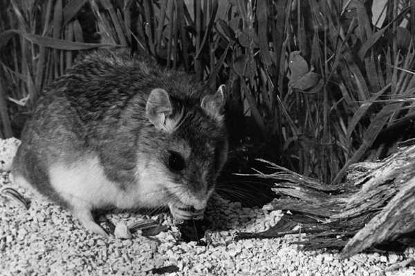
The grasshopper mouse, belonging to the genus Onychomys, is a fascinating creature known for its unique behaviors and adaptations. Here’s a detailed overview of its natural history:
Physical Description
Size: Small rodents, typically around 4 to 5 inches in body length, with an additional 1 to 2 inches of tail.
Appearance: They have a robust body, short tails, and large ears. Their fur is generally grayish-brown on the back and white on the belly.
Habitat
Geographic Range: Found in North America, particularly in the arid and semi-arid regions of the western United States and Mexico.
Preferred Environment: Grasshopper mice inhabit deserts, scrublands, and prairies. They are well-adapted to dry environments and can be found in areas with sparse vegetation.
Behavior
Nocturnal Lifestyle: These mice are primarily nocturnal, coming out to hunt and forage at night.
Territoriality: Grasshopper mice are highly territorial and aggressive. They establish and defend territories vigorously.
Diet
Carnivorous Diet: Unlike many other rodents, grasshopper mice are primarily carnivorous. They feed on insects, other small invertebrates, and even small vertebrates.
Specialization: They are named for their tendency to prey on grasshoppers, but their diet can also include beetles, scorpions, spiders, and even other mice.
Hunting: Known for their hunting prowess, they are sometimes called “scorpion mice” due to their ability to hunt and consume scorpions, showing resistance to the venom.
Vocalizations
Unique Calls: Grasshopper mice are known for their high-pitched, wolf-like howls, which they use to communicate with each other, especially to mark territory.
Reproduction
Breeding Season: Typically breed from spring through late summer.
Litter Size: Females give birth to 2 to 6 young after a gestation period of about 30 days.
Parental Care: The young are weaned after a few weeks and reach maturity at around 2 to 3 months.
Adaptations
Water Conservation: Adapted to arid environments, grasshopper mice obtain most of their water from the food they eat and have efficient kidneys to conserve water.
Venom Resistance: They have developed a resistance to the venom of scorpions, allowing them to prey on these arachnids without harm.
Ecological Role
Predator Control: By preying on insects and other small animals, grasshopper mice help control the populations of these species in their habitats.
Indicator Species: Their presence and health can be indicators of the ecological balance in their environment.
The grasshopper mouse’s unique dietary habits, vocalizations, and behaviors make it a remarkable example of adaptation to harsh environments, playing a crucial role in the ecosystems they inhabit.
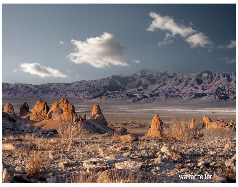
The Trona Pinnacles, located in the California Desert National Conservation Area near the town of Trona, offer a striking landscape of unusual tufa formations rising dramatically from the desert floor. Here’s an expanded look at what makes the Trona Pinnacles a popular destination:
Geological Significance
Formation: The Trona Pinnacles are composed of tufa, a type of limestone that forms in alkaline lake waters. These formations were created 10,000 and 100,000 years ago when the area was submerged under the prehistoric Searles Lake.
Structure: The site features over 500 pinnacles, ranging from small spires to large towers that reach up to 140 feet. These formations vary in shape and size, creating a surreal and otherworldly landscape.
Attractions and Activities
Exploring the Pinnacles:
Self-Guided Tours: Visitors can explore the pinnacles at their own pace, walking among the formations and marveling at their unique shapes and textures. The area is open for hiking and offers numerous trails and pathways.
Interpretive Signs: Informational signs throughout the site provide insights into the geological history of the pinnacles, explaining how they were formed and their significance.
Photography:
Landscape Photography: The Trona Pinnacles are a favorite subject for photographers due to their striking appearance and the dramatic contrasts between the tufa towers and the surrounding desert. The light at sunrise and sunset casts a magical glow on the formations, enhancing their visual appeal.
Astrophotography: The remote location and dark skies make the Trona Pinnacles an excellent spot for stargazing and astrophotography. The formations provide unique foregrounds for night sky photography, including stunning views of the Milky Way.
Off-Roading and Vehicle Access:
Off-Road Trails: The area around the Trona Pinnacles is accessible by dirt roads suitable for high-clearance and four-wheel-drive vehicles. Off-road enthusiasts can enjoy exploring the rugged terrain and discovering hidden viewpoints.
Scenic Drives: For those who prefer a more leisurely visit, scenic drives through the area offer beautiful views of the pinnacles and the surrounding desert landscape.
Camping:
Primitive Camping: The Bureau of Land Management (BLM) allows primitive camping near the Trona Pinnacles. Campers can set up their tents or park their RVs in designated areas, providing a unique opportunity to experience the pinnacles up close, especially during sunrise and sunset.
Stargazing: Camping overnight offers a chance to enjoy the clear desert skies, which are perfect for stargazing and experiencing the tranquility of the desert.
Filming and Events:
Film Location: The Trona Pinnacles have been used as a backdrop for numerous movies, TV shows, and commercials due to their otherworldly appearance. Productions like “Star Trek V: The Final Frontier” and “Planet of the Apes” have featured scenes shot at the pinnacles.
Special Events: Occasionally, the area hosts special events such as photography workshops, stargazing parties, and off-road vehicle rallies, providing unique opportunities for visitors to engage with the site.
Visitor Information
Location and Access: The Trona Pinnacles are about 20 miles east of Ridgecrest, California. The access road to the pinnacles is a graded dirt road off Highway 178, which can be rough in places but is generally passable for most vehicles.
Facilities: The Trona Pinnacles do not have developed facilities. Visitors should come prepared with their water, food, and supplies. Portable toilets are sometimes available, but it’s best to be self-sufficient.
Best Times to Visit
Spring and Fall: These seasons offer mild temperatures, making it the best time for outdoor activities such as hiking and camping. Springtime may also bring wildflower blooms, adding color to the landscape.
Winter: Winter can be a good time to visit if you prefer cooler weather, but be prepared for cold nights. The clear winter skies are excellent for stargazing.
Conservation and Preservation
Protected Area: The Trona Pinnacles are managed by the Bureau of Land Management as part of the California Desert National Conservation Area. Efforts are made to preserve the site’s unique geological features and natural beauty.
Responsible Tourism: Visitors are encouraged to practice Leave No Trace principles, respecting the delicate desert environment and minimizing their impact on the land and formations.
Nearby Attractions
Searles Valley Minerals: The nearby town of Trona is known for its mineral processing facilities. The Searles Valley Minerals plant conducts an annual Gem-O-Rama event, where visitors can collect various minerals and crystals from the Searles Lake deposits.
Death Valley National Park: Located to the east, Death Valley National Park offers additional opportunities for exploring diverse desert landscapes, unique geological features, and historic sites.
Educational and Interpretive Programs
Guided Tours and Talks: Occasionally, the BLM or local organizations may offer guided tours and interpretive talks about the geology and natural history of the Trona Pinnacles, providing deeper insights into the site’s formation and significance.
The Trona Pinnacles offer a unique and memorable experience for visitors interested in geology, photography, outdoor adventure, and the natural beauty of the Mojave Desert. Whether exploring the pinnacles on foot, capturing their striking forms with a camera, or simply soaking in the serene desert atmosphere, the Trona Pinnacles provide an extraordinary destination for all who visit.
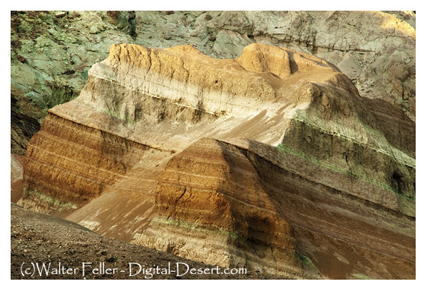
Rainbow Basin is a geological formation in the Mojave Desert of California. It is known for its unique and colorful rock formations, which provide valuable insights into the region’s geological history. Here are some key aspects of the geology of Rainbow Basin:
Sedimentary Rocks: Rainbow Basin primarily comprises sedimentary rocks accumulated over millions of years. These rocks include sandstones, shales, and mudstones. The different layers of sedimentary rocks represent different periods of geological history.
Fossilized Marine Life: Within the sedimentary rocks of Rainbow Basin, fossils of marine life from the Miocene epoch (approximately 15-20 million years ago) have been found. These fossils include shells, bones, and other remnants of ancient sea creatures. This suggests that a shallow sea once covered the area.
Faulting and Uplift: The geology of Rainbow Basin has been influenced by tectonic forces. The region is situated near the intersection of several fault lines, including the Garlock Fault. These fault movements have caused the uplift of the rocks, exposing them to erosion and creating the unique landscape seen today.
Erosion and Weathering: Over time, erosion and weathering have shaped the colorful rock formations in Rainbow Basin. These processes have created intricate patterns and exposed layers of colored sediments, giving the area its name.
Geological Time Scale: The rocks at Rainbow Basin span a significant portion of the geological time scale, providing geologists with valuable information about the changing environments and life forms that existed in the area millions of years ago.
Geological Tours: Rainbow Basin is a popular destination for geological enthusiasts and tourists interested in its unique geology. There are guided tours and interpretive exhibits that provide insights into the geological history of the area.
Rainbow Basin, Barstow, Ca.
In summary, Rainbow Basin is a geological wonder in the Mojave Desert, characterized by its sedimentary rocks, fossils, faulting, erosion, and vibrant colors. It offers a glimpse into the geological history of California and the forces that have shaped its landscape over millions of years.