Curtis Howe Springer and the Complicated Story of Zzyzx

Curtis Howe Springer and the Complicated Story of Zzyzx

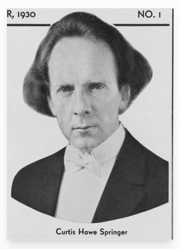
Curtis Howe Springer was a radio preacher, health-product salesman, resort promoter, and one of the Mojave Desert’s most unusual characters. He was neither simply a generous desert visionary nor merely a confidence man. He built a functioning community, provided work and shelter, attracted visitors, and helped Baker’s economy. He also used credentials he had not earned, advertised products with unsupported medical claims, and operated a large resort on federal land he did not own.

Springer arrived at Soda Springs in 1944 with Helen Springer. He filed mining claims covering about 12,800 acres and renamed the place Zzyzx, which he promoted as “the last word in health.” From a collection of tents and old ruins, the Springers developed a resort with guest rooms, a dining hall, a chapel, mineral baths, a swimming pool, radio facilities, workshops, gardens, animal pens, and an airstrip.

Much of this was real. Zzyzx wasn’t simply a name on a brochure. People lived, worked, ate, worshiped, and vacationed there for nearly 30 years. The federal court later described four guest buildings containing 59 units, a dining room and kitchen, an administration building, a chapel, mineral baths, electrical equipment, and numerous other structures.

Work and Economic Benefits

Springer’s operation created work at Zzyzx and generated business in nearby Baker. Workers mixed and packaged health foods, printed literature, prepared radio recordings, filled orders, handled correspondence, maintained buildings, cooked meals, cared for animals, and mailed products.

Some workers were recruited from Los Angeles’ Skid Row. They were offered food, shelter, a small wage, and a place away from alcohol in exchange for construction and maintenance work. This labor helped Springer build the resort at relatively low cost, but it also provided men with few alternatives, a temporary home, and useful work.

Zzyzx also affected Baker. Visitors sometimes stayed in Baker motels while waiting to enter the resort. Springer’s enormous volume of packages, promotional literature, donations, and correspondence helped raise the Baker post office to first-class status. The federal court record specifically confirms that foods, printed materials, and radio recordings were packaged and prepared for mailing at Zzyzx.

However, Springer did not cause Baker’s first post office to be established. Postal records show that the office began under the name Silver Lake on March 27, 1907. It was renamed Baker in February 1933, eleven years before Springer arrived. His business greatly increased its workload, but it did not create the first post office.

Was Springer Rich?

Springer appears to have become wealthy during Zzyzx’s most successful years. The National Park Service describes him as a millionaire. His radio broadcasts reached hundreds of stations, while listeners sent donations and ordered teas, food supplements, books, and other products. The National Park Service states that he shipped more than four million packages during his years at Zzyzx.

One witness later recalled that Springer paid a $2,500 court fine immediately, treating it like a minor expense. This suggests that he had considerable available money.

His exact personal wealth is still unknown. No dependable financial statement or estate accounting has been found. Some of his apparent wealth was represented by buildings and improvements at Zzyzx. Those improvements stood on federal land, and Springer never obtained legal title to the property. He could control the operation while he occupied it, but he did not own a desert estate that he could legally sell.

The Ownership Problem

Springer held unpatented mining claims. Such claims allowed legitimate mineral exploration and mining, along with activities reasonably connected to mining. They did not automatically transfer ownership of the land.

The United States remained the legal owner. Springer’s hotel, health resort, food-packaging operation, radio studio, pools, airstrip, residential buildings, and religious activities went far beyond ordinary mining.

Springer made several attempts to obtain a stronger legal right to the property. He filed desert-land applications in 1951, public-recreation applications in 1957 and 1958, and another non-mineral application in 1966. These applications were rejected, dismissed, or denied. Despite those decisions, he continued operating Zzyzx.

In 1970, a federal district court restricted the property to mining-related uses. A 1971 injunction prohibited Springer from operating the resort, renting rooms, packaging food, preparing mail, recording broadcasts, maintaining pools, or inviting people to live there for purposes unrelated to mining. The Ninth Circuit Court of Appeals upheld that injunction.

The legal record, therefore, leaves little doubt about ownership: Springer and his organizations built and operated Zzyzx, but the United States owned the land.

Was Springer Selling Land?

There is evidence that Springer marked off residential lots and allowed major donors to build homes on them. Some historical accounts describe this as offering or selling parcels to supporters.

The wording requires care. Springer could promise someone a place to live or accept a donation in exchange for the use of a lot, but he could not convey valid ownership because he did not own the land. No deed from Springer could transfer federal property.

It is therefore safest to say that Springer allocated or offered homesites to donors as if he controlled the property. Whether every arrangement was described as a direct sale is less certain. What is certain is that donors could not receive a valid title from him.

Would Nonprofit Status Have Helped?

Nonprofit status would not have solved Springer’s central problems. In fact, organizations connected with Zzyzx already included the Dr. Curtis Howe Springer Foundation and the Zzyzx Community Church. Both were named in the federal land case.

A properly managed nonprofit could have accepted donations, operated a retreat, and possibly applied for an authorized lease or public-purpose agreement. It still would have needed federal approval to occupy the land. It would also have been required to follow food, drug, advertising, tax, and charitable organization laws.

Calling the resort a church, foundation, charity, or nonprofit could not transform a mining claim into ownership. It also could not legalize false medical advertising or the unauthorized distribution of public land.

A nonprofit might have helped only if Springer had reorganized the operation, stopped making unsupported health claims, kept proper financial records, and obtained a valid federal lease. The government had already rejected several of his applications, so nonprofit status alone would not have guaranteed that result.

Why Springer Went to Prison

Springer was not imprisoned merely for being eccentric, practicing natural health, or building a resort in the desert. The strongest court evidence concerns false advertising and misbranded foods.

The Ninth Circuit record states that he had been convicted on 18 counts of false advertising involving supposed remedies for hemorrhoids, heart disease, nervous conditions, thyroid problems, and goiter. It also records violations of California food-misbranding laws.

Springer was fined and sentenced to 60 days in jail. After appeals, he reportedly served 49 days. His imprisonment should be distinguished from the land dispute. The land case was primarily a federal civil action for an injunction, damages, ejectment, and eviction. His false advertising and food law convictions provided the criminal penalties.

Thus, two legal problems came together:

  1. Springer used federal mining-claim land for a resort, residence, manufacturing, and mail-order business.
  2. He advertised health products with claims that authorities and courts found false or misleading.

The first problem cost him Zzyzx. The second resulted in penalties and imprisonment.

Did the Rehabilitation Program Work?

Some men probably benefited from their time at Zzyzx, although their progress was never formally documented. Springer offered homeless and struggling men food, shelter, work, routine, and an alcohol-free environment. The National Park Service has concluded that these conditions certainly helped some visitors.

Springer later claimed that Zzyzx had helped rehabilitate 4,000 destitute men. That figure came from Springer himself. No known records follow these men after they left, nor do they show how many remained sober, found permanent employment, reunited with families, or established stable homes.

Zzyzx was not a licensed rehabilitation center with trained counselors, medical supervision, case records, or long-term follow-up. Nevertheless, temporary shelter and meaningful work can still help people. The fair conclusion is that Springer probably helped some individuals, but his claim of 4,000 successful rehabilitations cannot be verified.

Eviction and Final Years

After years of court proceedings, federal authorities removed Springer and his followers from Zzyzx in 1974. The government did not recognize his ownership claims, and Springer could not take the property with him or sell it as his estate.

In 1976, the Bureau of Land Management permitted the California State University system to use the site. Zzyzx became the Desert Studies Center, where students and researchers continue to study Mojave Desert biology, geology, hydrology, and history.

Springer and Helen moved to Las Vegas after the eviction and his short imprisonment. He remained there for the rest of his life. Curtis Howe Springer died in Las Vegas on August 19, 1985, at age 88. Available sources do not identify the particular residence or hospital where he died.

A Balanced Judgment

Springer’s story resists a simple conclusion. He was a persuasive promoter who made unsupported medical claims and used public land far beyond the limits of his mining claims. He accepted money and donations while presenting himself as a doctor and minister, even though he lacked recognized qualifications. His legal troubles were based on substantial evidence, not simply disagreement with unconventional medicine.

At the same time, he built a real desert community. Zzyzx provided jobs, meals, shelter, inexpensive vacations, religious fellowship, and temporary stability. His mail-order business supported packaging and mailing work and brought measurable business to Baker. Some people remembered him with sincere thanks.

His good works did not give him ownership of federal land, and nonprofit status would not have erased the legal violations. Likewise, his unlawful conduct does not mean that nobody benefited from Zzyzx. Both parts belong in history.

Sources

United States v. Springer, Ninth Circuit Court of Appeals

Mojave National Preserve Administrative History

National Park Service: Zzyzx

Los Angeles Times: Zzyzx and Curtis Howe Springer

California Post Office Records

SFGATE: The History of Zzyzx Road

Zzyzx

Lucerne Valley History

Range One East and Raising the Dust

The early history of Lucerne Valley has been preserved in large part through two closely related books: Range One East and Raising the Dust. Together, these works provide an important record of desert homesteading, agriculture, and daily life during the early settlement period of the Victor Valley region.

Lucerne Valley occupies a high desert basin north of the Mojave River and at the foot of the San Bernardino Mountains. During the late nineteenth and early twentieth centuries, the area was still largely an undeveloped desert, visited mainly by ranchers, prospectors, and travelers moving along routes between the Mojave Desert and the mountain communities. Permanent settlement increased during the homestead era, when families began attempting agriculture in the basin despite its arid conditions.

A central figure in this early history was F. J. Gobar, who settled in the Rabbit Springs area. In 1912, he gave the valley its modern name, “Lucerne Valley,” inspired by lucerne—another name for alfalfa—which he believed could be cultivated successfully there. (Swarthout History – CA, n.d.) The Gobar family experimented with crops and water development, helping demonstrate that farming could be attempted in the valley if irrigation wells were developed. (California – Cult Resources Mojave Western, 1978)

Much of this early period is described in Range One East, written by Virginia C. Hemphill-Gobar and published in 1972. (Hemphill-Gobar, 1972) The book documents the lives of settlers who attempted to build farms and ranches in Lucerne Valley during the early twentieth century. Drawing on family records, oral histories, and local recollections, Hemphill-Gobar describes the challenges of desert homesteading—scarce water, isolation, and the difficulty of establishing a reliable agricultural base in an arid landscape.

The title of the book refers to the Public Land Survey System designation “Range One East,” a six-mile-wide column of survey townships east of the San Bernardino Meridian. (Public Land Survey System, 2024) Much of the land in Lucerne Valley was described using the township-and-range system, and Hemphill-Gobar used that framework to organize the valley’s geography and the locations of early homesteads.

While Range One East presents a broader settlement history, the companion work Raising the Dust provides a more personal perspective. The book records the recollections of Julian Smith Gobar, who grew up in the region during the early years of settlement. His stories describe daily life in the Mojave Desert—working cattle, farming experiments, desert travel, and the colorful characters who populated the small communities scattered across the high desert.

Together, the two books complement each other. Range One East documents the development of the community and settlers’ efforts to establish farms and ranches in Lucerne Valley. Raising the Dust, by contrast, captures the personal experiences of those who lived through that period, preserving memories of the hardships, humor, and independence that characterized desert life.

Although neither work was written as an academic study, both have become valuable historical sources. They preserve details about early settlement, agriculture, and everyday life that are often absent from official records. Cultural resource studies, local historians, and researchers examining the development of Lucerne Valley frequently cite these books because they document firsthand accounts of the region’s formative years.

Through the combined efforts of Virginia C. Hemphill-Gobar and Julian Smith Gobar, the early history of Lucerne Valley—its homesteads, ranches, and pioneering families—was preserved for later generations. Their books remain an important window into the era when settlers first attempted to transform a remote Mojave Desert basin into a farming community.

The early history of Lucerne Valley has been preserved in large part through two closely related books: Range One East and Raising the Dust. Together, these works provide an important record of desert homesteading, agriculture, and daily life during the early settlement period of the Victor Valley region.

Lucerne Valley occupies a high desert basin north of the Mojave River and at the foot of the San Bernardino Mountains. During the late nineteenth and early twentieth centuries, the area was still largely an undeveloped desert, visited mainly by ranchers, prospectors, and travelers moving along routes between the Mojave Desert and the mountain communities. Permanent settlement increased during the homestead era, when families began attempting agriculture in the basin despite its arid conditions.

A central figure in this early history was F. J. Gobar, who settled in the Rabbit Springs area. In 1912, he gave the valley its modern name, “Lucerne Valley,” inspired by lucerne—another name for alfalfa—which he believed could be cultivated successfully there. The Gobar family experimented with crops and water development, helping demonstrate that farming could be attempted in the valley if irrigation wells were developed.

Much of this early period is described in Range One East, written by Virginia C. Hemphill-Gobar and published in 1972. The book documents the lives of settlers who attempted to build farms and ranches in Lucerne Valley during the early twentieth century. Drawing on family records, oral histories, and local recollections, Hemphill-Gobar describes the challenges of desert homesteading—scarce water, isolation, and the difficulty of establishing reliable agriculture in an arid landscape.

The title of the book refers to the Public Land Survey System designation “Range One East,” a six-mile-wide column of survey townships east of the San Bernardino Meridian. Much of the land in Lucerne Valley was described using the township-and-range system, and Hemphill-Gobar used that framework to organize the valley’s geography and the locations of early homesteads.

While Range One East presents a broader settlement history, the companion work Raising the Dust provides a more personal perspective. The book records the recollections of Julian Smith Gobar, who grew up in the region during the early years of settlement. His stories describe daily life in the Mojave Desert—working cattle, farming experiments, desert travel, and the colorful characters who populated the small communities scattered across the high desert.

Together, the two books complement each other. Range One East documents the development of the community and settlers’ efforts to establish farms and ranches in Lucerne Valley. Raising the Dust, by contrast, captures the personal experiences of those who lived through that period, preserving memories of the hardships, humor, and independence that characterized desert life.

Although neither work was written as an academic study, both have become valuable historical sources. They preserve details about early settlement, agriculture, and everyday life that are often absent from official records. Cultural-resource studies, local historians, and researchers examining the development of Lucerne Valley frequently cite these books because they record firsthand knowledge of the region’s formative years.

Through the combined efforts of Virginia C. Hemphill-Gobar and Julian Smith Gobar, the early history of Lucerne Valley—its homesteads, ranches, and pioneering families—was preserved for later generations. Their books remain an important window into the era when settlers first attempted to transform a remote Mojave Desert basin into a farming community

A Barstow Narrative

Barstow, California, from the 1870s through the present, with all key details preserved and arranged chronologically:


Barstow stands today at the center of the Mojave Desert’s long story of ranching, mining, railroads, and highways. Its history reflects the layered development of the Mojave River corridor, where water, transportation, and enterprise have drawn people across the desert for more than a century and a half.

Mojave River

In the years following the Civil War, the upper Mojave River region supported a few scattered cattle ranches and wagon stations. Before Barstow existed, the country between Oro Grande and Daggett was known for its open range and desert pastures. Herds were grazed along the Mojave River, using its shallow pools, seeps, and hand-dug wells. During the 1870s and 1880s, ranchers moved stock between the high country of the San Bernardino Mountains and the desert valleys, following trails that paralleled the river. Stations at places such as Lane’s Crossing and Fish Ponds served as watering points for stock and travelers. As the Santa Fe Railroad advanced across the desert, freight access to distant markets encouraged limited agriculture along the riverbanks. By the early 1900s, alfalfa, grain, and small orchards appeared in Victor Valley, and a few experimental plots extended downstream toward Barstow. The Arrowhead Reservoir and Power Company began purchasing riparian tracts between Victorville and Barstow to secure water rights, recognizing that the Mojave River would control the future of settlement. Though the arid climate limited cultivation, these early ranches and farms laid the foundation for the region’s first lasting economy before industry and highway travel arrived.

Fish Ponds

Barstow’s founding dates to the early 1880s, when the Atlantic & Pacific Railroad, later part of the Atchison, Topeka & Santa Fe system, pushed its line westward from Needles toward Mojave. In 1883, the mainline was completed across the desert, and a division point was established to centralize maintenance, crew changes, and fueling. This camp, called initially Waterman Junction, became the nucleus of Barstow. The town was renamed in 1884 for William Barstow Strong, president of the Santa Fe, and quickly became the railroad’s desert headquarters. Roundhouses, repair shops, and supply depots were built to serve the trains moving freight and passengers across the Mojave.

Santa Fe

While Barstow developed as a railroad town, the nearby community of Daggett became the milling and shipping center for the Calico silver mines. The Calico district boomed in the early 1880s, with more than a hundred mines producing ore that was hauled to Daggett for reduction and shipment east. In 1898, a short branch line was built from Daggett to Calico to carry ore directly to the Santa Fe main line. This small spur improved mining transport but did not found Barstow; the town was already well established as a division headquarters long before. Barstow’s location on the main transcontinental line—roughly midway between San Bernardino and Needles—gave it strategic importance that would outlast the mining booms around it.

Daggett, CA

As the 1890s ended and silver prices dropped, mining declined, but the railroad presence ensured Barstow’s survival. The town expanded with railroad housing, stores, and services for workers and travelers. The Mojave River valley became a modest agricultural district, producing hay, fruit, and dairy products for local use. By 1910, Barstow had schools, churches, and small businesses serving both rail employees and the surrounding ranch country.

Casa del Desierto, Harvey House

In 1911, the Fred Harvey Company constructed the Casa del Desierto, a grand Mission Revival depot and Harvey House that brought elegance and permanence to the desert town. The building served as a hotel, restaurant, and railroad office, offering travelers comfort along the route between Los Angeles and the Colorado River. It quickly became Barstow’s social center and symbol of progress. The Santa Fe expanded its shops, roundhouse, and yards, reinforcing the town’s position as a key maintenance and operating base.

El Garces, Harvey House

At the same time, the automobile age arrived. The National Old Trails Highway followed the corridor of the railroad, and by the 1920s, U.S. Route 66 brought a steady stream of motorists through town. Gas stations, garages, and cafes appeared along the main street, which paralleled the railroad tracks. Barstow became a vital service stop for travelers crossing the Mojave Desert, bridging two eras of transportation—steam and motor—and transforming from a company town into a crossroads community.

Route 66

The Great Depression slowed new growth, but Barstow endured. The flow of automobiles along Route 66 kept the economy alive, while the railroad continued to carry freight and passengers across the desert. By the late 1930s, the town’s main street was lined with motor courts, diners, and filling stations.

Yermo, CA

World War II brought another surge of activity. Barstow’s location on both the Santa Fe main line and Route 66 made it ideal for military supply and logistics. The Marine Corps established the Nebo Depot just west of town, handling ordnance and supplies for the Pacific war effort. Additional facilities at Daggett and Yermo supported troop movements and desert training exercises. Troop trains, fuel convoys, and war freight filled the region, and the population grew rapidly as railroad workers, servicemen, and civilian contractors arrived.

Calico Ghost Town

By the late 1940s, Barstow had become the true hub of the Mojave. Mining had faded, but rail, highway, and military operations kept the town busy. Route 66 was in its prime, bringing travelers east and west through a landscape alive with neon lights and the constant hum of engines. Barstow’s economy rested on three pillars: the Santa Fe Railroad, the Marine base, and the steady flow of cross-country traffic.

After the war, the new interstate system reshaped the desert. The Marine Corps Logistics Base at Nebo expanded during the 1950s, and the Yermo Annex was developed for vehicle storage and repair. Together, they became major employers for the region. Barstow’s population grew as families settled near the base, supported by trucking companies, service stations, and small industries. Route 66 reached its height during this period, and Barstow’s main street glittered with motels, diners, and bright neon signs welcoming motorists.

Interstate 15 Freeway

By the late 1960s, however, the new Interstate 15 and Interstate 40 began to bypass the older downtown route. Travel patterns shifted, and many classic roadside businesses declined. Still, the same geography that had favored Barstow from the start—its place at the meeting of routes—kept it alive. The Santa Fe Railroad remained one of the town’s largest employers, operating extensive classification yards. The Marine bases continued their vital supply missions, and long-haul trucking replaced some of the lost highway trade.

Harvey Girls

Through the 1970s, Barstow adapted to the new interstate era. Truck stops and logistics centers replaced many of the old motor courts. Route 66, though decommissioned later, remained a nostalgic symbol of the town’s mid-century heyday. The Casa del Desierto depot closed in 1973 when passenger rail service declined, but the building survived. Preservation efforts during the 1980s and 1990s restored it as a civic landmark housing the Western America Railroad Museum and the Route 66 Museum offices. The restored depot reopened to the public, honoring the legacy of the Harvey Girls and the long railroad heritage that gave the town its start.

Forks in the Road

Today, Barstow continues to serve as the crossroads of the Mojave Desert. It stands at the junction of Interstates 15 and 40, serving travelers, truckers, and freight moving between Southern California and the interior West. The BNSF Railway, successor to the Santa Fe, operates one of its largest freight classification yards in town, handling thousands of cars daily. The Marine Corps Logistics Base remains a major employer, linking Barstow to the modern defense and transportation economy.

Though much has changed, the pattern remains the same. The Mojave River still winds below the town, the rails still hum with freight, and the highways still carry travelers across the vast desert plain. Barstow’s story—from cattle ranching and mining to railroads and freeways—reflects the larger history of the Mojave itself: a land shaped by endurance, movement, and the constant meeting of past and present at the desert’s enduring crossroads.

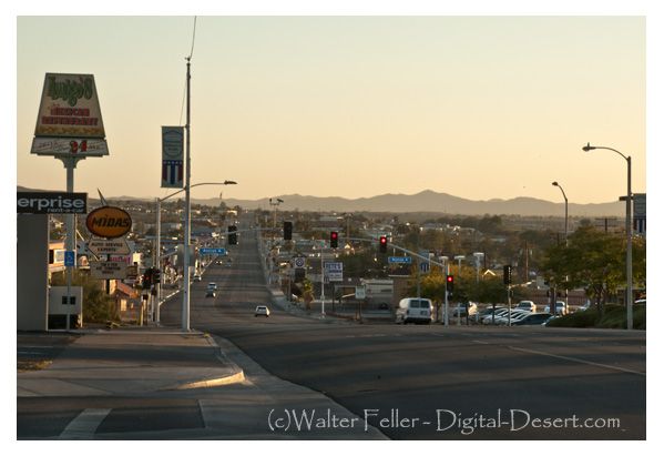
Barstow, CA.


References and Supporting Sources

  1. Brown, John. History of San Bernardino and Riverside Counties. Los Angeles: Western Historical Association, 1922.
    • Primary descriptions of Mojave River water rights, Daggett and Calico mining activity, and railroad development through Barstow.
  2. Myrick, David F. Railroads of Arizona, Volume I: The Southern Roads. Howell-North Books, 1975.
    • Detailed coverage of the Atlantic & Pacific (Santa Fe) construction, Waterman Junction establishment, and early Barstow operations.
  3. Worman, C. Frank. Santa Fe’s Desert Division. Santa Fe Railway Historical Society Bulletin, 1949.
    • Background on Barstow’s role as a division point, maintenance hub, and Harvey House center.
  4. Thompson, David. Route 66: Across the Mojave Desert. Mojave River Valley Museum Press, 1987.
    • Documentation of the highway’s alignment through Barstow, roadside commerce, and mid-century travel culture.
  5. Mojave River Valley Museum Archives. Barstow Historical Collection.
    • Local materials on ranching, early settlement, and photographs of the Casa del Desierto and Route 66 period.
  6. Marine Corps Logistics Base, Barstow. Historical Overview and Command Chronology. U.S. Marine Corps Archives.
    • Details on Nebo Depot and Yermo Annex development during and after World War II.
  7. U.S. Department of Transportation, Federal Highway Administration. Interstate System in California: Desert Corridors Report, 1974.
    • Analysis of Interstate 15 and 40 construction and their impact on Barstow’s highway economy.
  8. Mojave Desert Archives, Digital Desert Project. Barstow: Rail, River, and Road Chronology.
    • Synthesized regional materials integrating historical, geographical, and transportation data for Barstow and the surrounding Mojave River corridor.

Eastwood Dams

When people think of Big Bear Lake or Littlerock Reservoir, they usually picture pine-covered hills or quiet desert canyons. But beneath those scenic views lie stories of bold ideas, early 20th-century innovation, and one man who didn’t mind going against the grain: John S. Eastwood.

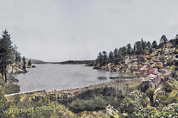
Original Big Bear Dam – 1885 (colorized)

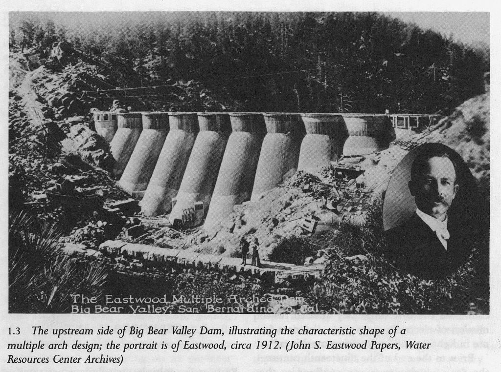
Eastwood wasn’t interested in building dams the way everyone else did. While most engineers were busy stacking massive concrete walls straight across rivers, he had something different in mind: a system of thin, curved arches that transferred pressure into solid rock abutments. It was lighter, cheaper, and—in his view—smarter.

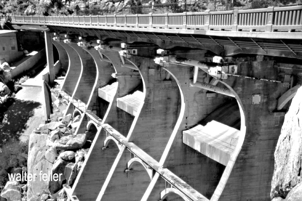
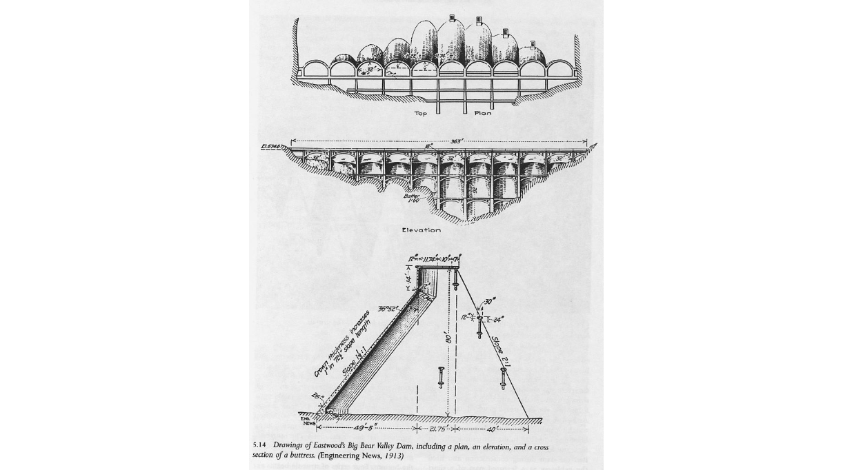
In Big Bear, the original dam dated back to 1884. It was built by Frank Elwood Brown, a man with a vision to turn the dry, chaparral-covered inland valleys into citrus groves. His dam was modest and practical for its time, but growing demand soon outpaced its capacity. By 1910, the Bear Valley Mutual Water Company called on Eastwood to design something new. What he gave them in 1912 was a graceful structure of eleven concrete arches—his signature multiple-arch style. It raised the lake level and helped feed the thirst of the San Bernardino Valley below. A bridge was added in 1924, making the dam a true link between the north and south shores and turning it into a local landmark.

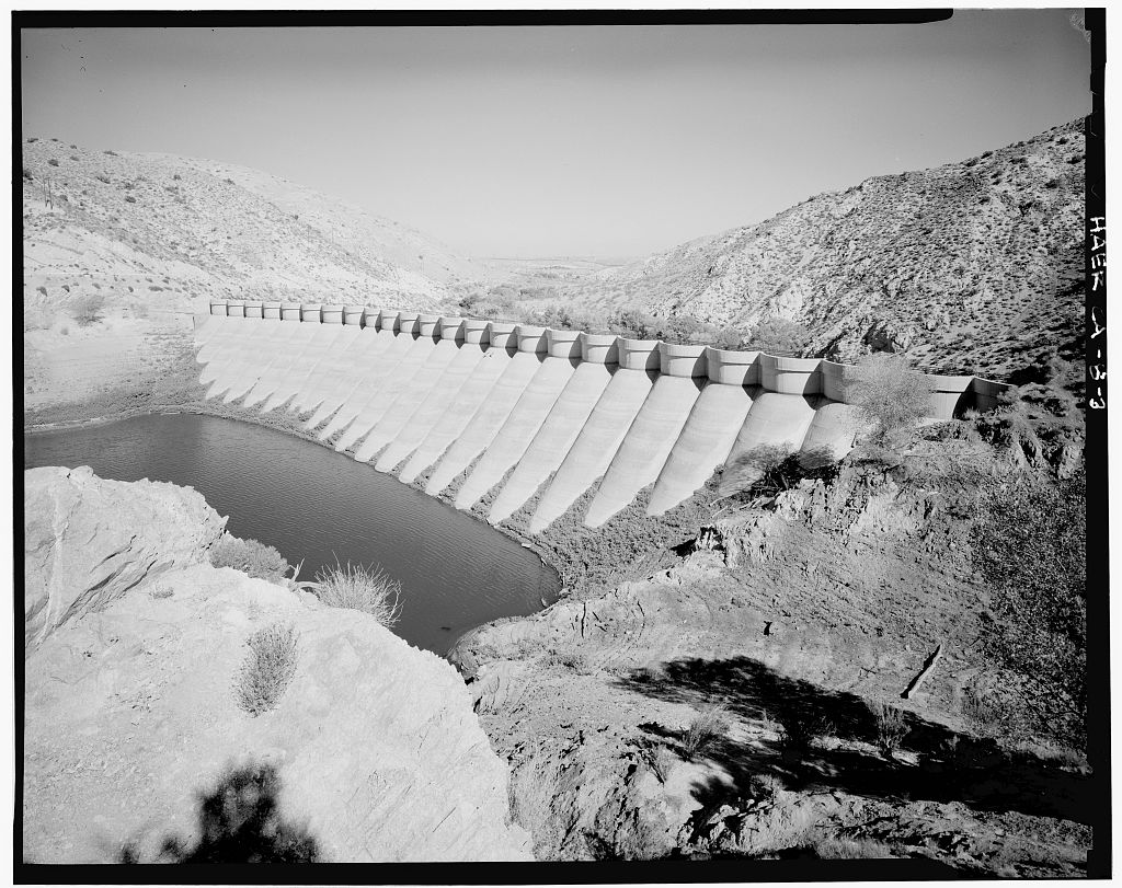
Meanwhile, about 60 miles west as the crow flies, the Littlerock Dam rose in a very different landscape—dry, wide-open desert edged by the San Gabriel Mountains. Built between 1922 and 1924, the dam had a job to do: tame seasonal flooding and store water for nearby farms and growing communities in the Antelope Valley. Again, Eastwood’s multiple-arch design was chosen. At the time of its completion, Littlerock Dam was the tallest structure of its kind in the world. It stood not just as a practical solution but also as a quiet sign of faith in human ingenuity—a way to harness nature without bulldozing over it.

Over the years, both dams have been modified to meet modern standards. Littlerock was reinforced in the 1990s, its delicate arches now hidden beneath a face of roller-compacted concrete. Some of Eastwood’s original elegance was lost, but the structure still holds firm. Big Bear’s dam remains more visibly true to his vision, standing quietly beside the lake like a relic from a time when ambition was poured in concrete.

Littlerock Reservoir

John S. Eastwood may not be a household name, but his work left a lasting mark on California’s landscape. His dams in Big Bear and Littlerock weren’t just about holding back water—they were about pushing engineering forward. More than a century later, their presence still shapes the way people live, work, and play in the Mojave and San Bernardino Mountains.

Eastwood wasn’t interested in building dams the way everyone else did. While most engineers were busy stacking massive walls of concrete straight across rivers, he had something different in mind: a system of thin, curved concrete arches that would transfer pressure into solid rock abutments. It was lighter, cheaper, and—in his view—smarter.

Dutch Charley Koehn

In the lonely reaches of the El Paso Mountains, where the desert stretches wide and the wind whispers through the canyons, Dutch Charley—better known as Charles Koehn—built a life that was equal parts rugged and legendary. A German immigrant turned desert rat, Koehn made his mark not with gold, but with grit, ingenuity, and a bit of old-fashioned stubbornness.

Koehn’s story begins in the 1890s, when he staked a claim at Kane Springs, a much-needed watering hole along the route between Tehachapi and the Panamint Range. While many men chased dreams of striking it rich in the goldfields, Dutch Charley had a different plan—he set up shop right in the heart of the action, offering supplies, water, and even a mail service to the miners and drifters passing through. For 25 cents a letter, a prospector could send word back home, and for a few more coins, he could rest his bones and share a drink at Koehn’s outpost. It wasn’t just a business; it was a lifeline in an unforgiving land.

Despite his knack for trade, Koehn had a prospector’s heart. He spent years scouring the desert for something valuable, and while he never found the gold mother lode, he did uncover something else—gypsum. In 1909, he staked claims on a massive gypsite deposit near his homestead, and by 1910, he had a small operation producing wall plaster. It wasn’t the romantic vision of striking it rich, but it was a steady business. His holdings expanded over the years, and soon, larger companies were leasing his land to extract the valuable mineral.

But life in the Mojave wasn’t just about hard work—it was also about holding your ground. In 1912, a group of claim jumpers, backed by hired guns, tried to push Koehn off his land. The desert was a lawless place, and disputes like these were often settled with more than just words. Koehn, known for being tough as nails, didn’t back down. A gunfight erupted on the dry lakebed, and when the dust settled, Dutch Charley was still standing. The courts later ruled in his favor, affirming his rights to the land. It was the kind of incident that turned a man into a legend.

For decades, Koehn’s outpost—known as Dutch Charley’s Cabin—served as a beacon for desert wanderers. Whether it was a weary prospector looking for water, a film crew from Hollywood needing a mule team, or just a lost traveler in need of a friendly face, Koehn’s place was a welcome sight in the vast emptiness. His generosity was well known, and many recalled his habit of offering water to anyone who needed it, free of charge. It wasn’t just about business—it was about survival, about knowing that out here, in the middle of nowhere, a little kindness went a long way.

But time and fortune have a way of shifting like the desert sands. In the 1920s, Koehn found himself in a series of legal battles over his gypsum claims, and in 1923, he was arrested for allegedly attempting to bomb the home of a judge involved in one of his disputes. Whether he was guilty or the victim of a setup is still debated, but the outcome was clear—he was convicted and sent to San Quentin State Prison. It was a tragic end for a man who had spent his life fighting to carve out a piece of the desert for himself. He died behind bars in 1938, just days before he was scheduled to be released.

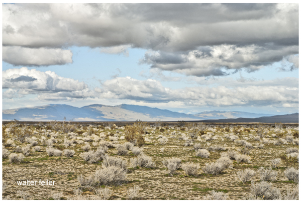
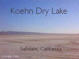
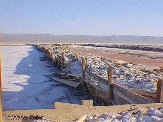
Though Koehn himself is long gone, his legacy remains. Koehn Dry Lake still bears his name, a reminder of the claim fights and salt works that once played out on its barren surface. The remains of Dutch Charley’s Cabin stand as a ghostly relic of a bygone era, a time when men built lives in the harshest of places with nothing but their hands, their wits, and an unbreakable will. His story, filled with hardship, adventure, and the occasional brush with the law, is woven into the fabric of Mojave history.

Dutch Charley was more than just a miner or a businessman. He was a character, a survivor, and above all, a man who belonged to the desert. He may not have left behind great wealth, but he left something just as enduring—the kind of story that echoes through the canyons long after the last prospector has gone.

Dublin Gulch

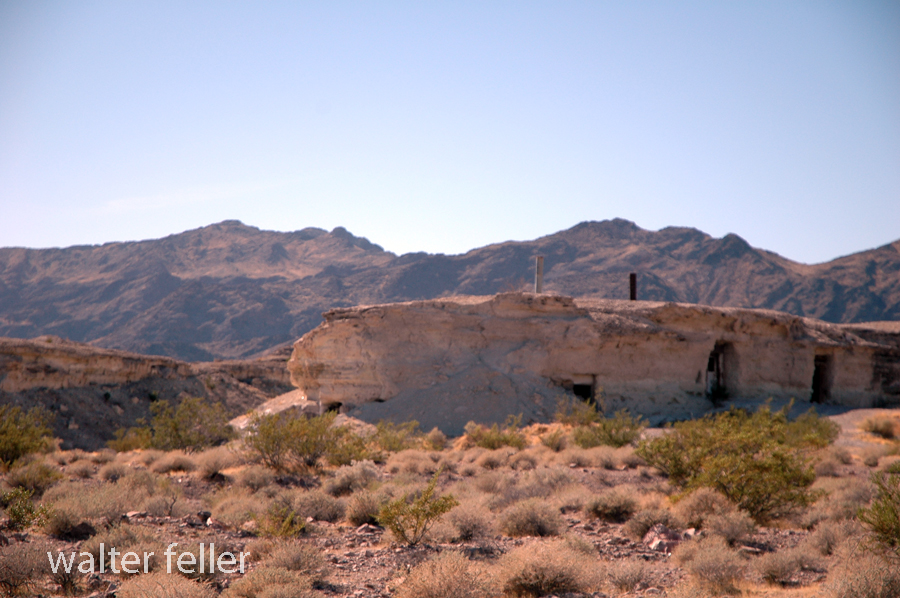
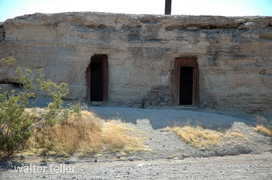
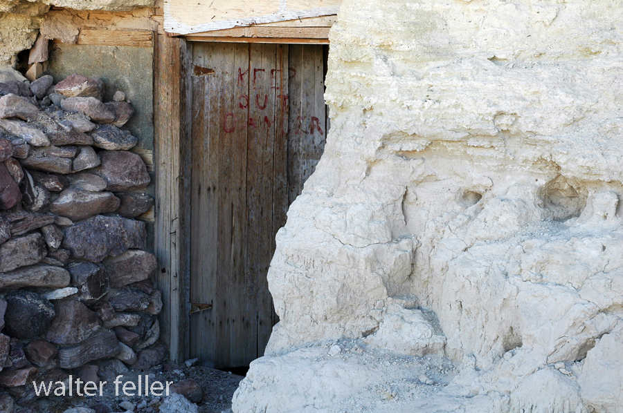
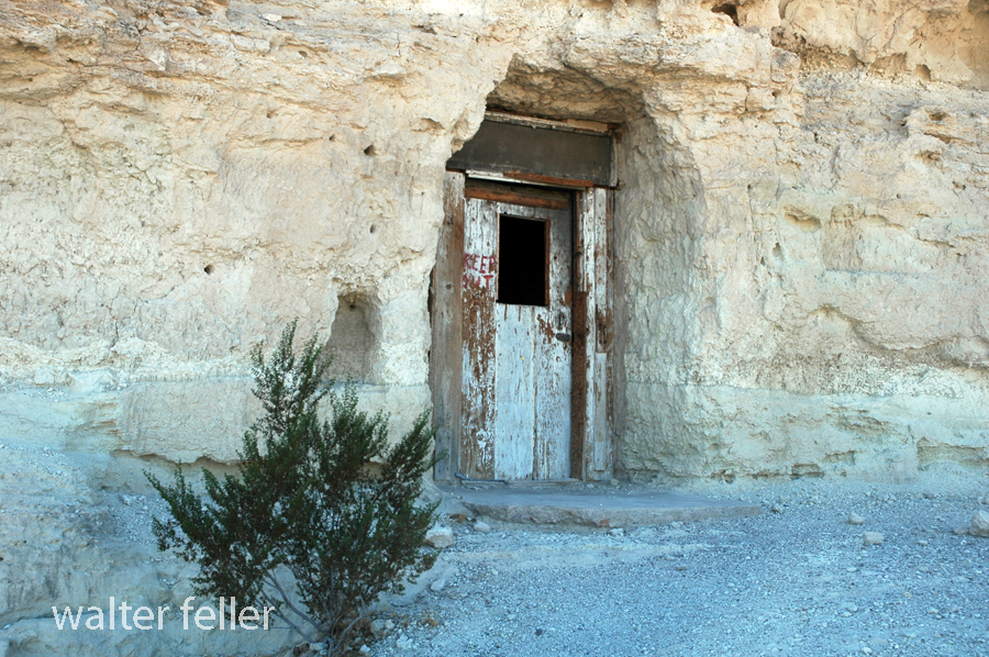
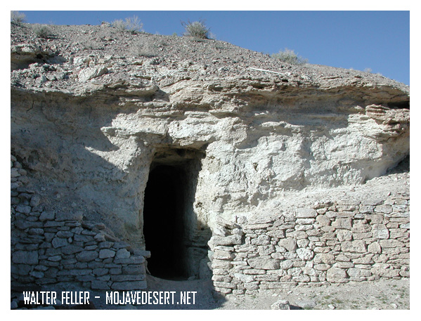
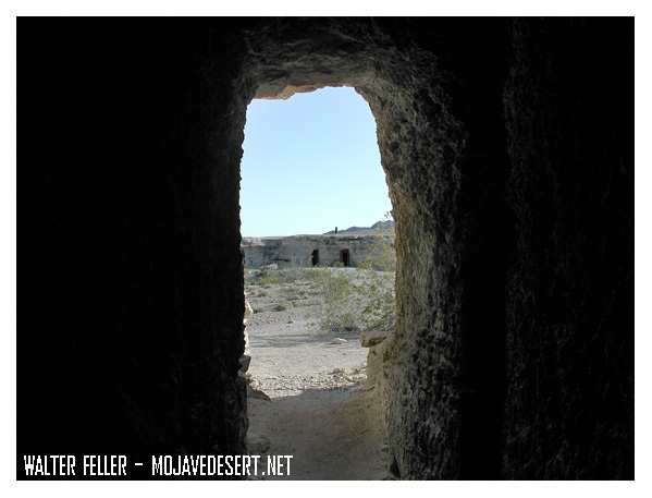
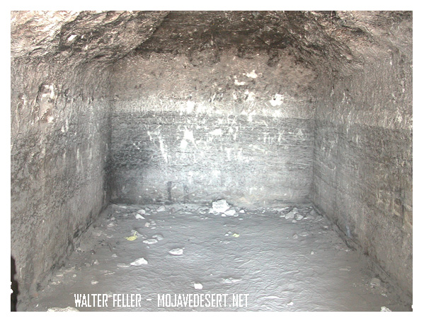
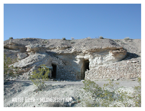
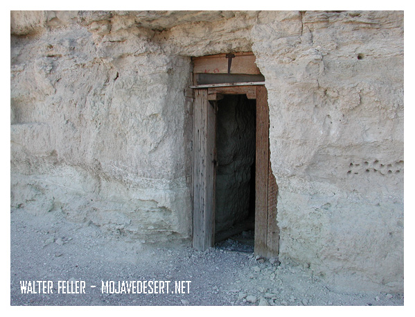
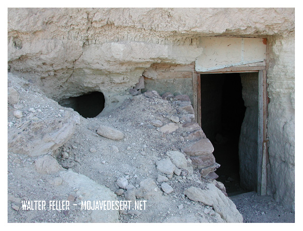
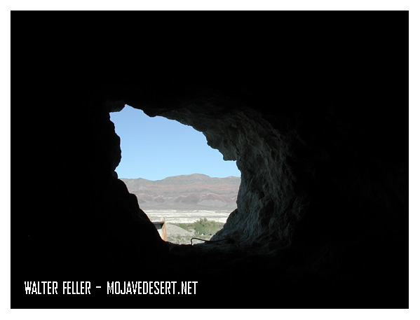
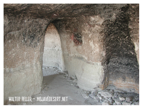
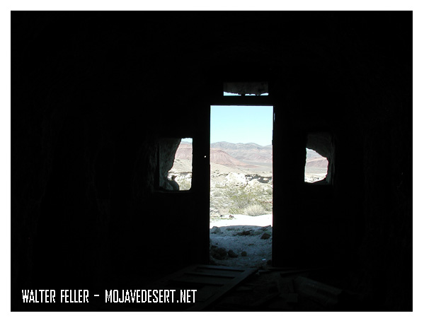
Dublin Gulch in Shoshone, California, is a rich historical site filled with the remains of unique cave dwellings. In the early 1900s, miners and other early settlers dug the caves into soft volcanic ash cliffs. The makeshift shelters protected them against harsh desert weather conditions and extreme temperatures.

These caves were the dwelling place for miners in nearby mines during the early 20th century. Over a certain period, it did take on a kind of community presence. Some of the dwellings even had windows, doors, and chimneys added to them, making them rather homely. Today, Dublin Gulch is a quirky historic site where, among other things, one can see the cave homes and feel what life in the desert must have been like over a century ago.

Dublin Gulch is situated near the small town of Shoshone, one of the important points that both travelers and miners had to pass through in the early 1900s. It lies close to Death Valley and several mining areas. A small piece of history, it offers a glimpse into the rugged, resourceful lives that were lived early on.

Dublin Gulch, Shoshone, Ca. – 2015

Dublin Gulch, Shoshone, Ca. – 2003