Panamint Valley
The Panamint Valley is a north-south, 65 mile long and 10 mile wide basin formed between the Argus and Slate ranges along the west, and the Panamint Range on the eastern side.
Darwin
The town took its name from Dr. Darwin French who explored the area in 1860 ...Darwin Falls
The year-round falls provide a water source for plants and wildlife.Ballarat Ghost Town
From 1897 to 1917 Ballarat served as a supply and recreation center for ...Ballarat Cemetery
The grave of 'Seldom Seen Slim' is the most prominent with several ...Post Office Spring
From early on, bandits, outlaws and rustlers came to the Panamint Mountains to hideout from ...Panamint Dunes
Padre Crowley Point
This scenic point provides panoramic views of the northern end of the Panamint valley in Death Valley ...Death Valley National Park
Attractions and points of interest in the Death Valley portion of the valleyHighway 190
Points of interest along the Death Valley Scenic Byway from Olancha to Death Valley JunctionDarwin Falls
Named after Dr. Darwin French who explored the area in search of the Lost Gunsight Mine. Although named ...Coso Range
From high points within the wilderness, most notably Joshua Flat, one can obtain outstanding views of ...Panamint City
A history of mining in Panamint CityLost Gunsight
The Lost Gunsight Mine became a legend at a very early stage and its location probably would have been cruelly disappointing ...Lookout Mountain
Two years after the discovery of Panamint, on April 22, 1875, rich silver-lead deposits were discovered on ...Darwin
... in late October or November, 1874, supposedly by a wandering prospector trying to find a lost mule. ...Ballarat
Charles Anthony and John Lampier located the Panamint Valley Mine on July 27, 1893. This mine, also known as the ...Mojave Desert
Panamint Valley
This subsection is the alluvial plain of Panamint Valley, between the Argus and Panamint Ranges. ...Searles Valley - Owlshead Mountains
... southern ends of the Argus and Panamint Ranges, Searles Valley, Long Valley, and the southern end of Panamint Valley. ...Southeastern Great Basin
Coso - Argus Ranges
This subsection is between the Owens Valley and Panamint Valley. It includes ...Panamint Range
This subsection comprises the Panamint Mountains, which are between Panamint Valley and Death Valley. It has ...Saline Valley - Cottonwood Mountains
This subsection is between the Inyo Mountains and Death Valley. It includes the Last Chance Range, Saline Range, Cottonwood ...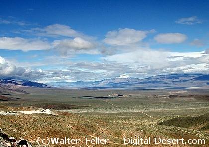
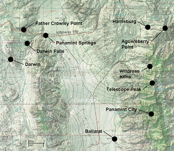
Looking north into Panamint Valley
Panamint dry lake in extremely wet conditions
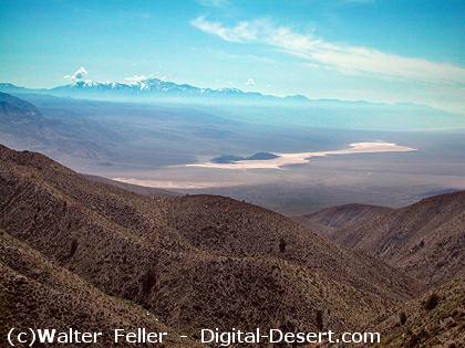
Looking south into Panamint Valley