Subsection 341Fc
Saline Valley - Cottonwood Mountains
South Pass
This region sits between the Inyo Mountains and Death Valley. It includes several ranges and valleys like the Last Chance Range, Saline Range, Cottonwood Mountains, Nelson Range, Saline Valley, Eureka Valley, and a handful of smaller valleys. The climate ranges from hot to temperate and dry (classified under MLRA 29f).
Geology
The bedrock is mostly made up of ancient granite (Mesozoic), marine sedimentary rocks from the Paleozoic Era, and volcanic rocks from the Tertiary period. The full range of Paleozoic layersfrom Cambrian to Carboniferousis present. More recent volcanic rock, especially basalt from the Pliocene, is also common, along with some silica-rich Tertiary volcanic rocks. The valleys contain alluvial (water-transported) and lakebed (lacustrine) deposits. Wind-blown sands (eolian deposits) are widespread in Saline and Eureka Valleys.Landforms
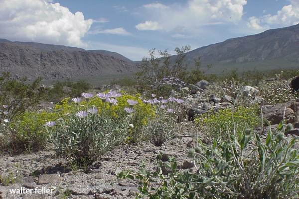
The area is shaped by steep mountains, rolling hills, sloping alluvial fans (deposits from mountain runoff), and flat valley floors. Most mountain ranges here run north-south, except for the Nelson Range, which leans northwest. High plateaus on Hunter Mountain and in the Nelson Range look like they used to be large erosion surfaces (pediments). Elevations range from around 1,100 feet to almost 9,000 feet at the top of Tin Mountain in the Cottonwoods. The landscape is shaped mainly by erosion, landslides, water flow, wind, and freeze-thaw cycles.Soils
Soils vary based on the terrain. Mountains and hills have thin, rocky soils with names like Lithic Torriorthents and Aridic Argixerolls. Volcanic slopes have Lithic Haplargids. Valley fans and floors have a mix of better-developed soils like Typic Torriorthents, Xeric Torriorthents, and others. Around old lakebeds, salty soils like Typic Salorthids appear. Most soils drain well, except for some lakebed soils. Soil temperature ranges from warm (thermic) to cool (mesic), with colder zones (frigid) at higher elevations. Most soils are very dry (aridic), though some lake areas are wetter (aquic).Vegetation
Plant life changes with elevation. In the lowest areas, you'll find desert scrub and various saltbushes. Moving up, there's creosote bush, blackbrush, big sagebrush, and pinyon pine woodlands. Around salty, low-lying lake areas, pickleweed, saltgrass, and greasewood dominate.Typical plant communities include
Grasslands: Alkali sacaton, Indian ricegrass, pickleweed, saltgrass.Shrublands: Blackbrush, catclaw acacia, creosote bush, fourwing saltbush, greasewood, hop-sage, iodine bush, shadscale, mulefat.
Woodlands: Curlleaf mountain mahogany, singleleaf pinyon pine, pinyon-juniper mixes, and Utah juniper.
Climate
Annual rainfall is lowbetween 5 and 12 inches. Higher areas get snow in winter. Temperatures average 40 to 70 degrees Fahrenheit. The number of frost-free days ranges from 125 to 275 each year.Surface Water
Water runs quickly off the fans but moves slowly across valley floors. Most streams dry up for much of the year. Some of the water flows toward Death Valley, but much of it ends up in closed desert basins.< previous - Southern Great Basin - next >