Muddy River
Notes:
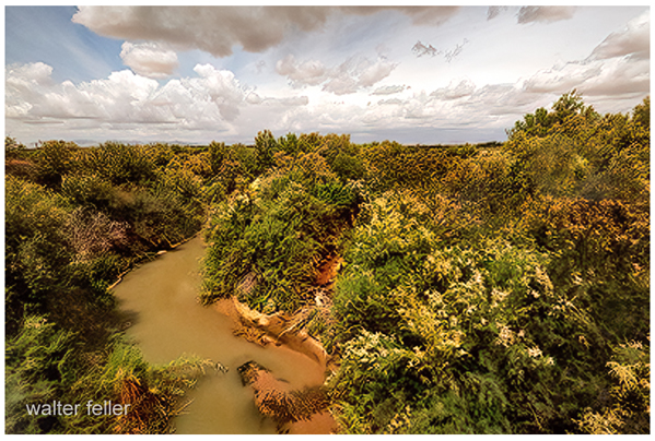
This is one of the relatively few perennial streams/rivers in the Mojave Desert. Only 32 miles long, fed
from warm spring waters it finds its way along the Mormon Mesa and empties into the Overton Arm of Lake Mead.
From about 1855 when Mormon pioneers came into and settled the area, they called it the Muddy River. Officially it
was known as the Moapa, which Moa, meaning "muddy", and pah, meaning "water", would be better translated as
"muddy water" instead of river. The locals never took to calling it the Indian name and persisted in calling it
the Muddy River. In 1960, tired of seeing maps they felt were incorrectly labeled, the government gave in and
officially renamed it the "Muddy River."
This map dated 1886 does not appear to suffer the name problem described above.
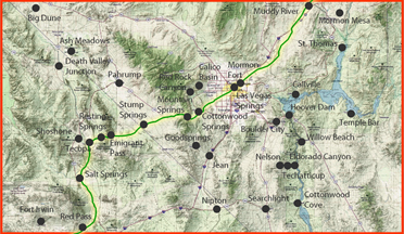
The Muddy River Springs area and the
Muddy River are bounded by the Meadow Valley Mountains
to the north, the Morman Mountains to the northeast, the
Muddy Mountains to the south, and Arrow Canyon Range to
the west.
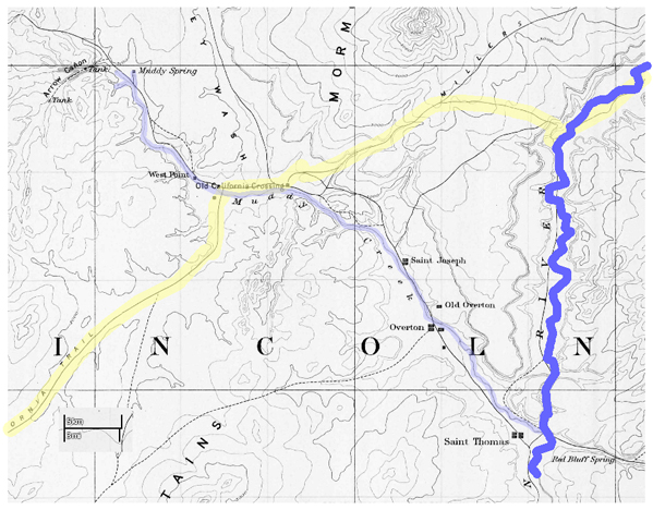
The Muddy River originates from a system of spring
tributaries, which are clustered
along the northeast slope of Arrow Canyon Range.
These tributaries generally consist of warm-water springs and
seeps that emanate from alluvial deposits, occuring near surface
exposures of carbonate rocks. These springs and
seeps discharge into the mainstem of the Muddy River
through three spring tributaries that include South Fork
Muddy River, Muddy Springs Tributary, and Refuge Stream.
Streams in the Muddy River Springs area typically are
meandering, shallow channels consisting mainly of mud and
organic debris. Most banks are thickly overgrown by Saltcedar
(Tamarix ramosissima), cattails (Typha latifolia), and reeds
(Phragmites communis).
Many irrigation diversions and ditches previously
existed in the Muddy River Springs area. Most of the ditches
have been abandoned with the exception of channels near
Cardy Lamb Springs and Unnamed Springs near LDS East
Well.
The Muddy River flows through four farming communities
(Moapa, Glendale, Logandale, and Overton) and through
the northeast corner of the Moapa River Indian Reservation
draining about 6,940 mi² into the Overton Arm of
Lake Mead, west of the mouth of the
Virgin River. Diversions
from the Muddy River primarily are used to irrigate nearby farm land and to
supply water for the Reid Gardner Power Generating Station
and Moapa Valley Dairy. The Muddy River is incised
moderately (about 20 ft deep), with the channel consisting of
mud, sand, gravel, and organic debris. Most banks of the river
are overgrown thickly with Saltcedar and other vegetation.
California Wash and Meadow Valley Wash systems
contribute surface water to the Muddy River during periods of
heavy rainfall. These two systems enter the Muddy River near
the towns of Moapa and Glendale, respectively.
source: USGS