|
Mojave Desert Rivers:
Virgin River
Old Spanish Trail
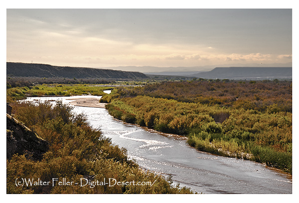
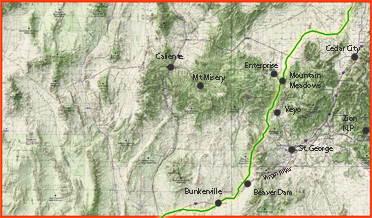
The Virgin River functioned as a natural corridor rather than a destination during the Old Spanish Trail era. For pack trains moving between Santa Fe and Los Angeles, the rivers value lay in dependable water, forage, and passage through broken terrain at the boundary between the Great Basin and the Mojave Desert. Camps clustered where banks widened and grass was available, allowing animals to recover before long dry reaches. The trail followed older Indigenous movement logic, using the river valley as a guide through country where deviation meant risk. Travel was seasonal, cautious, and dictated by flow conditions rather than mileage.
Hydrology
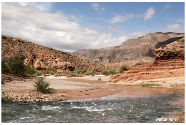
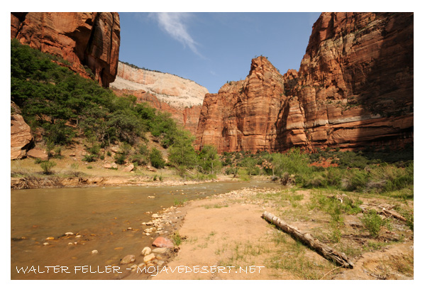
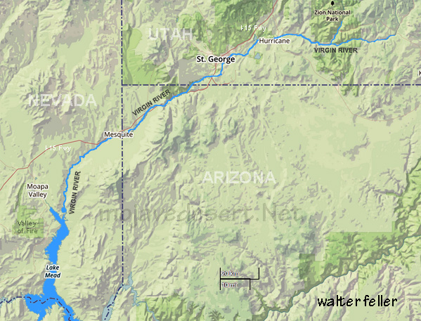
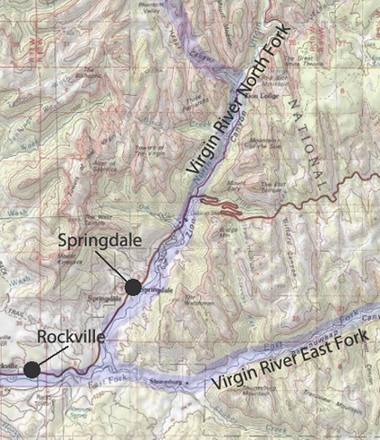
The Virgin River drains high-elevation plateaus of southwestern Utah via two primary headwaters: the North Fork (karst-fed springs near Navajo Lake) and the East Fork (upper Long Valley). Flow regimes are snowmelt-dominated in spring with monsoonal spikes in late summer; baseflows are sustained locally by spring discharge. The river incises steep sandstone terrain through Zion National Park, then transitions to broader desert reaches downstream. Sediment transport is episodic and flood-driven. The river ultimately enters Lake Mead, contributing to the Colorado River system.
|
Jedediah Smith 1826 & 1827
Armijo Route - Old Spanish Trail
Paiute Indians
|