Old Spanish Trail Historical Overview
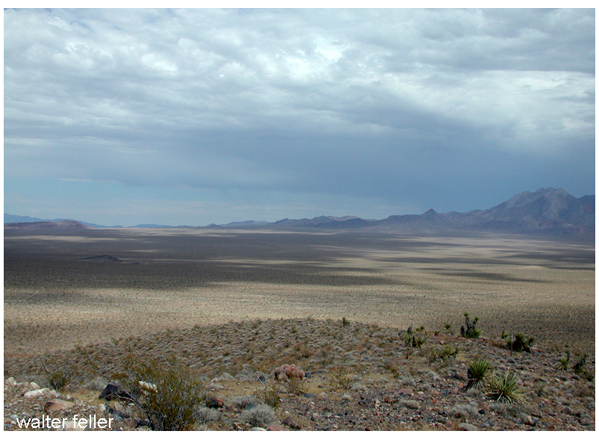
Chicago Valley - Emigrant Pass
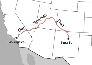
The Old Spanish Trail was not a single road but a working corridorstitched together from older Indigenous pathways, river crossings, springs, and hard-earned local knowledge. Formalized in the late 1820s, it linked Santa Fe with Los Angeles, crossing some of the most demanding country in North America: the Colorado Plateau, the Great Basin, and the Mojave Desert.
The trails practical opening is usually credited to Antonio Armijo, who in 18291830 led a successful pack-mule caravan westward. His route proved that regular commerce was possible where only scattered exploration had gone before. Woolen blankets and woven goods moved west; horses and mules moved east. Travel was slow, seasonal, and unforgiving. Water dictated everything. Camps clustered at springs like Resting Springs, Bitter Springs, and the Virgin River crossings, places already known and used for generations.
Unlike later wagon roads, the Old Spanish Trail was never engineered for speed or comfort. It accepted delay as normal and danger as routine. Its importance lies not in monuments or pavement, but in continuityan enduring proof that movement across the desert depended on patience, memory, and respect for the lands limits.
American Indian groups
Spanish colonial interest
In late summer of 1826
A major variation of the Old Spanish Trail
The major reason for travel
There was considerable legal trade
Some of the vast fur trade
Hispanic New Mexican families
Americans and other foreigners
With the American takeover of California
Over the years a number of military groups
Overall, use of the Old Spanish Trail