In Late Summer of 1826
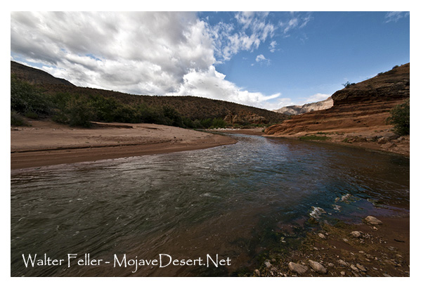
Virgin River in Arizona
In late summer of 1826 Jedediah S. Smith led a small party of trappers westward from the rendezvous at Cache Valley, Utah, utilizing portions of what would become the Old Spanish Trail as he headed southwest toward California. After wintering among the californios, Smith and some of his party made their way to the 1827 rendezvous at Bear Lake near the Utah-Idaho boundary. Leaving that rendezvous in July, Smith again headed for California, generally retracing his steps of a year before, but this time several of his men died in a bloody clash with Mojave Indians when they attempted to cross the Colorado River at a Mojave village.
Beginning in the 1820s, several groups of fur trappers made their way from New Mexico to California via various routes through Arizona. Collectively, these routes are sometimes called the Gila Route because most travelers trapped along the Gila River en route. In 1827, Richard Campbell led 35 men to San Diego. While it is sometimes assumed that he went south along the Gila, he later remembered taking a more northerly route using the Crossing of the Fathers and then going north of the Grand Canyon. In 1827, Sylvester Pattie led a group along the Gila to Baja California, where they were imprisoned by Mexican officials and taken to San Diego. Two members of this party, Isaac Slover and William Pope, escaped and returned to New Mexico. They later followed the Old Spanish Trail to live in California. Ewing Young led a group that included Kit Carsonvia Zuni and the Salt River and then trapped along the Virgin River in Utah before heading to California in 1830. Some members of these groups, as well as members of other groups traveling via southern routes, stayed in California. In 1829, Mexican trader Antonio Armijo departed from Abiqui in command of a commercial caravan of 60 men. Armijo successfully established a route to Los Angeles, where he traded serapes and other New Mexican goods for horses and mules. Following known American Indian and Spanish paths, Armijo traveled west through Navajo and Paiute territory, and forded the Colorado River at the Crossing of the Fathersan indigenous crossing used by Domnguez and Escalante in 1776. Thence, Armijo generally followed the present state boundary between Arizona and Utah until he reached the Virgin River. From the Virgin River, based on the advice from his guide, he passed south of present-day Las Vegas on his way to the Amargosa River.
William Wolfskill and George C. Yount first established the Northern Route of the Old Spanish Trail as they passed through central Utah in 1831. With a party of approximately 20 men, Wolfskill and Yount departed Abiqui in the winter of 1830, and went to California by a route that Wolfskill would later describe as being farther north than that adopted by the Spaniards in traveling between California and New Mexico. The Wolfskill-Yount route headed northwest to a crossing of the Colorado River, then west and southwest through Utah. They returned to the Colorado River and followed it to the Mojave villages, where they rested and fed their animals and traded with the Mojave. The party then proceeded west to Los Angeles.
Previous - Next
About the Old Spanish Trail
American Indian groups
Spanish colonial interest
In late summer of 1826
A major variation of the Old Spanish Trail
The major reason for travel
There was considerable legal trade
Some of the vast fur trade
Hispanic New Mexican families
Americans and other foreigners
With the American takeover of California
Over the years a number of military groups
Overall, use of the Old Spanish Trail
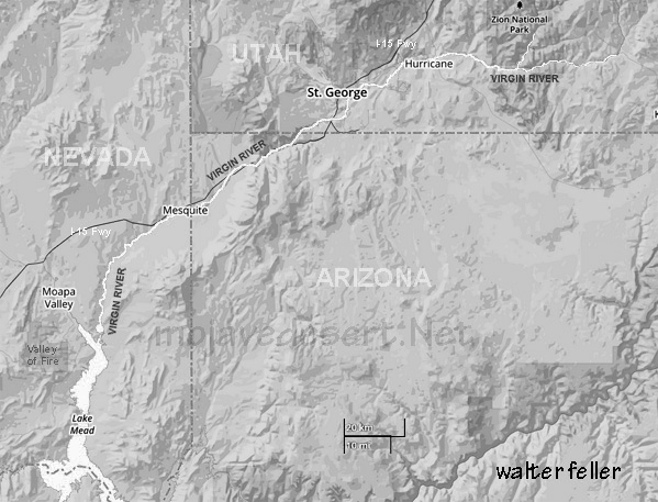
Map of Virgin River