Bishop, California
Bishop is the only incorporated city in Inyo County with a land area of 1.75 square miles. Samuel Bishop came to the area on a cattle drive in 1861 and stayed to build two small cabins and start San Francis Ranch near the site of the present town. Ranching remained an important economic interest in the area for many years, providing beef to nearby mining towns (Bateman 1995). Adjacent to the city are several developed unincorporated areas. The Bishop Paiute Indian Reservation is 8.74 square miles in size and is 2.6 km (1.6 miles) west of the city of Bishop.
4.5.1.4.4.2 Bishop
Ivanpah-Control Project Page 4-157
Proponents Environmental Assessment April
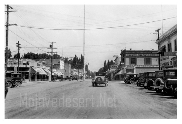
Bishop, Ca. - 1926
Bishop, California, is a small town located in the eastern Sierra Nevada region of California. With a population of around 3,800 people, Bishop is known for its stunning natural beauty and outdoor recreational opportunities.
One of the main attractions in Bishop is the nearby Sierra Nevada mountain range. The towering peaks and rugged terrain provide ample hiking, rock climbing, and mountaineering opportunities. In fact, Bishop is often referred to as the "Gateway to the Sierra" because of its proximity to these majestic mountains.
Another popular outdoor activity in Bishop is fishing. The town is near several lakes and rivers, including the Owens River and Lake Sabrina. Anglers flock to Bishop to try their luck at catching trout, bass, and other fish species.
For those who prefer a more leisurely experience, Bishop offers a charming downtown area with locally-owned shops, restaurants, and art galleries. Visitors can wander the streets and explore the unique offerings of this quaint town.
Bishop is also home to several annual events and festivals. One of the most popular is the Eastern Sierra Tri-County Fair, which occurs every Labor Day weekend. This event features carnival rides, livestock exhibits, live entertainment, and various food vendors.
In addition to its natural beauty and recreational opportunities, Bishop is also known for its rich history. The Paiute Native American tribe settled in the town, and it later became a major supply center for the mining industry. Today, visitors can learn about Bishop's past at the Laws Railroad Museum, which showcases the town's history through exhibits and artifacts.
Bishop, California, offers an unparalleled blend of outdoor adventure, small-town charm, and rich history. Whether you're seeking adrenaline-pumping activities or a peaceful nature retreat, Bishop has something to suit you. So pack your bags, grab your hiking boots, and explore all Bishop has to offer.
-
Bishop Weather
Ancient Bristlecone Pine Forest
Owens Valley Paiute
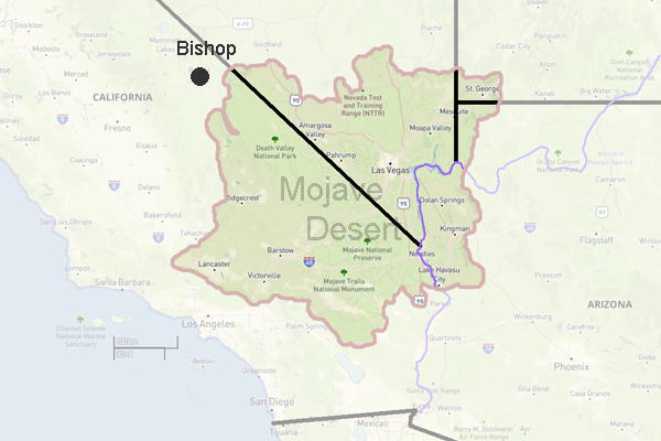
Inyo County
Bishop is a city located in Inyo County, California, USA. As of the 2000 census, the city had a total population of 3,575. The town was named after Bishop Creek, flowing out of the Sierra Nevada: the creek was named after Samuel Addison Bishop, a settler in the Owens Valley.
Bishop is also dubbed the "Mule Capitol of the World" and a week long-festival called Mule Days has been held since 1969 on the week of Memorial Day, celebrating the contributions of Pack-Mules to the area.
Bishop was the home of photographer Galen Rowell, and his wife Barbara, before their untimely death at the Bishop Airport.
Geography
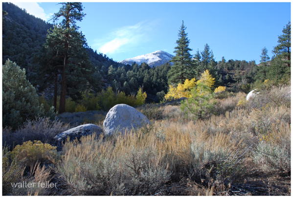
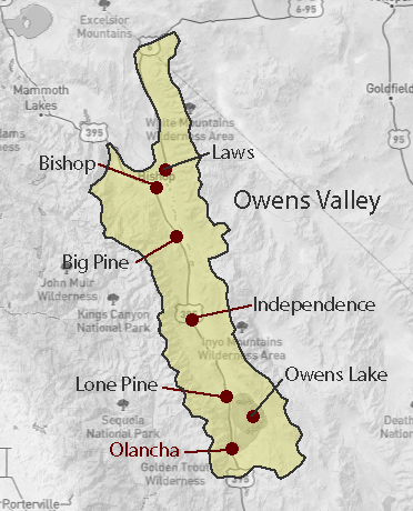
Bishop lies at the northern end of the Owens Valley. U.S. Highway 395 runs through the town. Bishop is also the western terminus of U.S. Highway 6. The Paiute tribe controls land just north of the town.
Bishop is immediately to the east of the Sierra Nevada. Numerous peaks are within a short distance of Bishop, including Mount Humphreys, the tallest peak in the region.
Route Guides