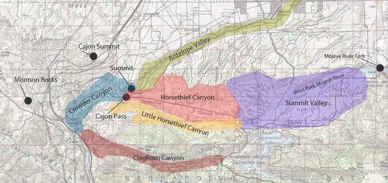
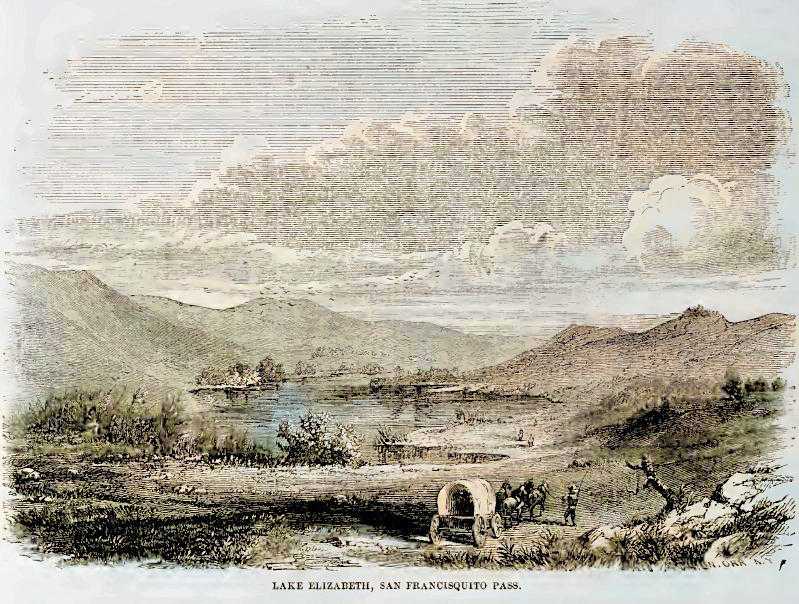
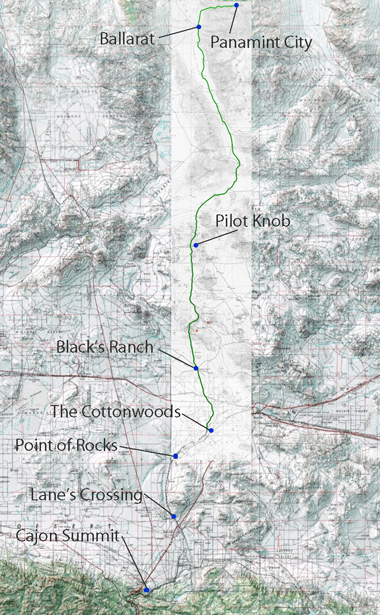
Summit Valley is a region rich in history and natural beauty in Southern California. Nestled between the Mojave Desert and the Southern California Mountains, it lies east of the Cajon Pass. Hesperia borders it to the north and the San Bernardino National Forest to the south. This valley, traversed by the West Fork of the Mojave River, holds significant historical and ecological importance.
Key Historical Figures and Events
1776: Fr. Francisco Garcés
Francisco Garcés, a Spanish Franciscan missionary and explorer, traveled through Summit Valley in 1776 as part of his extensive travels across the American Southwest. Garcés played a crucial role in establishing early routes and missions in the region, and his detailed diaries provide valuable insights into the landscape and indigenous peoples.
1826: Jedediah Smith
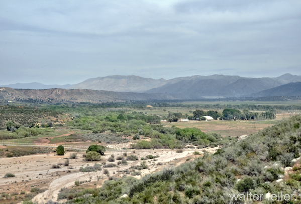
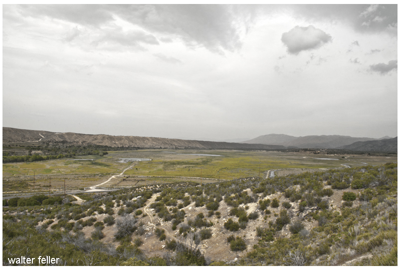
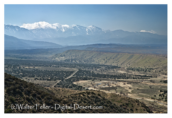
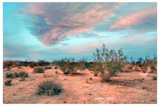
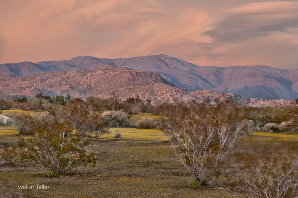
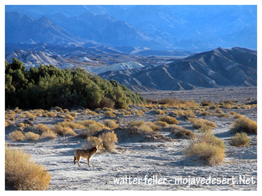
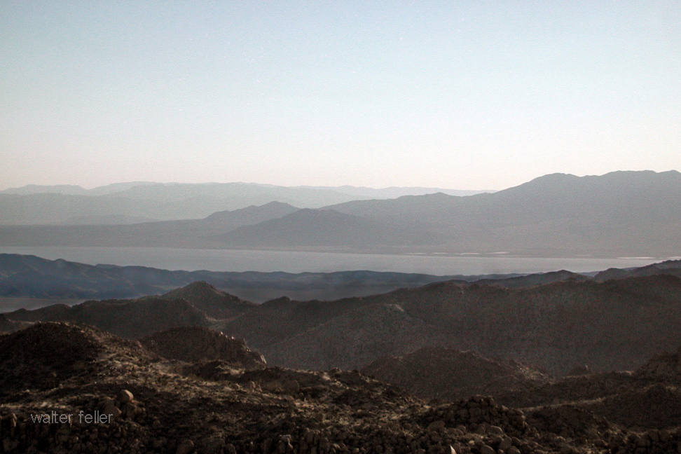
Looking west across the valley
Jedediah Smith, a renowned American frontiersman, trapper, and explorer, led an expedition through Summit Valley in 1826. This marked one of the earliest American explorations of the region, significantly contributing to the mapping and understanding of the Western United States.
1840: Chaguanoso Raid
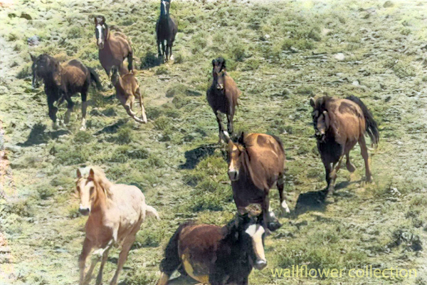
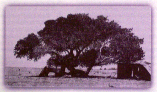
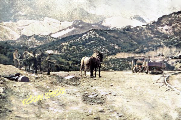
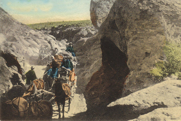
Raiders would run the horses to death if they had to–the stakes were high. (BLM photo colorized)
The Chaguanoso raid was the largest stock theft in California’s history. On May 14, 1840, Juan Perez, the administrator of Mission San Gabriel, reported the theft of mares by Chaguanoso raiders. Tiburcio Tapia, a prominent Californian businessman and alcalde of Los Angeles, directed the pursuit of the robbers who crossed the Mojave Desert. Despite the efforts of men like Ygnacio Palomares and José Antonio Carrillo, the raiders largely escaped.
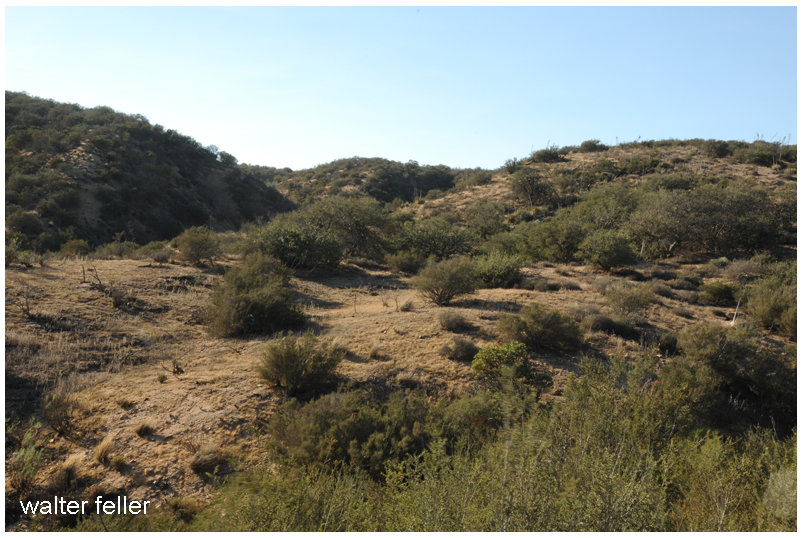
A possible site of Campo de la Puente (Camp on the bridge)
Early 1840s: Michael White (Miguel Blanco)
In the early 1840s, Michael White (Miguel Blanco) confronted horse thieves led by Chief Coyote in Crowder Canyon. White’s successful defense of his cattle, culminating in the killing of Chief Coyote, marked a significant moment in the region’s history and highlighted the persistent threat of banditry.
Settlement and Development
1866: Summit Valley Massacre
Massacre site
On March 25, 1866, Edwin Parrish, Nephi Bemis, and Pratt Whiteside, young cowboys employed at Las Flores Ranch, were ambushed and killed by Piute Indians near Las Flores Ranch. This violent episode highlighted the ongoing tensions between settlers and native populations.
Late 1800s: Las Flores Ranch
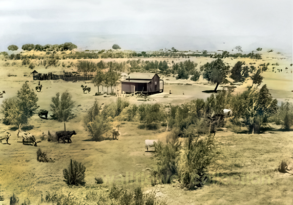
In the late 1800s, cattle driven from Arizona were pastured on Summit Valley’s green grass and running water and fattened before being sent to market in San Bernardino. Despite the challenges from wildlife and hostile natives, the ranch became central to the regional economy.
1884-1885: Railroad Construction
The construction of the Southern California Railroad in 1884-1885, following the old Spanish Trail route, was a significant development. Summit, located about six miles west of the Bircham Ranch, became a crucial station for shipping supplies. Despite unsuccessful oil explorations, the area continued to develop.
Early 1900s: Agricultural Growth
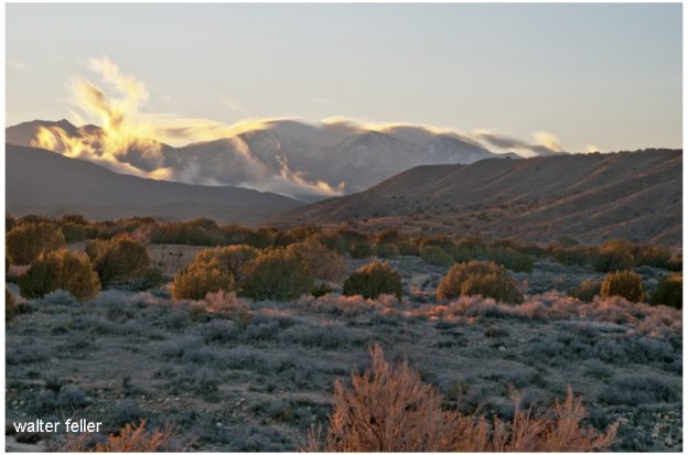
Looking northeast from the mouth of Cedar Springs Canyon
Summit Valley’s fertile lands and plentiful water made it an attractive location for cattle ranching. Early settlers capitalized on these resources, establishing large ranches that became central to the valley’s economy. Over time, the introduction of railroads and improved transportation infrastructure facilitated the growth of agriculture and livestock trade, further cementing the valley’s role as a key agricultural hub.
1924: Modern Infrastructure
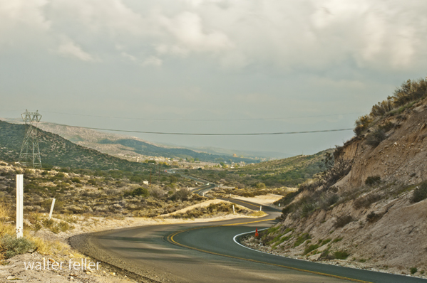
Looking east into Horsethief Canyon on SR 138 – November 2015
By the early 20th century, the region had developed a network of roads and railroads, with State Route 138 emerging as a critical transportation corridor. This infrastructure supported the valley’s continued growth and integration into the broader Southern California economy while preserving its historical legacy and natural beauty.
Ecological and Recreational Importance
Biodiversity and Conservation
Summit Valley has diverse habitats, from montane forests and riparian zones to grasslands and desert ecosystems. These habitats support a variety of wildlife, including many species of birds, mammals, and plants. Conservation efforts in the valley focus on protecting these natural resources, managing invasive species, and ensuring the region’s ecological health.
Silverwood Lake and Recreational Activities
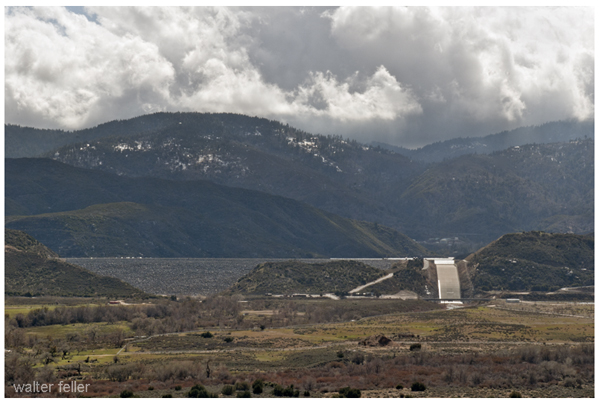
Cedar Springs Dam
The creation of Silverwood Lake as part of the California State Water Project has significantly enhanced the recreational opportunities in Summit Valley. The lake offers boating, fishing, hiking, and camping activities, attracting regional visitors. The Pacific Crest Trail, which passes through the valley, provides additional opportunities for outdoor enthusiasts to explore the area’s natural beauty.
Cedar Springs, CA
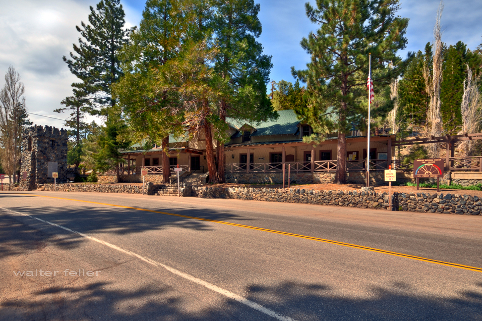
Downtown Cedar Springs, CA.
Cedar Springs was a small community in the San Bernardino Mountains, submerged by the creation of Silverwood Lake in 1971. Before the lake’s construction, Cedar Springs was known for its natural beauty, with lush cedar forests and clear springs that attracted visitors and residents alike. While the community was lost, the lake’s creation transformed the area into a major recreational destination.
Conclusion
Summit Valley’s rich history, from early exploration by figures like Francisco Garcés and Jedediah Smith to significant events like the Chaguanoso raid and Summit Valley massacre, paints a vivid picture of a region that has played a crucial role in Southern California’s story. From the challenges faced by early settlers to its modern-day significance as a recreational and ecological haven, Summit Valley remains a testament to the dynamic interplay between human activity and the natural world.
In the mid-19th century, the American West was a land of vast open spaces, sparse settlements, and a constant struggle for survival. Among the various challenges faced by settlers, Native Americans, and other inhabitants of the region, horse stealing emerged as a significant and often dangerous activity. This essay explores the multifaceted nature of horse stealing, its impact on different communities, and the notable figures involved in these activities, focusing on the Mojave Desert and surrounding areas.
Historical Context and Importance of Horses
Horses were introduced to North America by Spanish explorers in the 16th century and quickly became integral to the way of life for many Native American tribes. By the 19th century, horses were indispensable for transportation, labor, hunting, and warfare. For settlers and ranchers, horses were crucial assets, representing significant economic value and practical utility.
The California Gold Rush of the late 1840s brought settlers to the region, intensifying resource competition and escalating conflicts between different groups. Horses’ value made them prime targets for theft, and horse stealing became a widespread problem, contributing to the lawlessness and violence that characterized much of the frontier.
Techniques and Tactics of Horse Stealing
Horse stealing requires a combination of skill, knowledge, and audacity. Thieves often operated in bands, using well-planned tactics to carry out their raids. These tactics included:
Night Raids: Most horse thefts occurred at night when thieves took advantage of the darkness to avoid detection and increase their chances of a successful escape.
Remote Trails: Thieves used remote trails and difficult terrain to evade pursuers. Their knowledge of the landscape was a significant advantage, allowing them to move swiftly and remain hidden.
Speed and Surprise: The element of surprise was crucial. Thieves would strike quickly, gather as many horses as possible, and leave before the victims could organize a response.
Dispersal and Fencing: Stolen horses were often dispersed among various locations or quickly sold to fences, making it difficult for the rightful owners to recover them.
Notable Figures in Horse Stealing
Several prominent figures became infamous for their involvement in horse stealing. Their stories highlight the complexities and contradictions of frontier life.
Walkara: The Ute Leader
Walkara, also known as Chief Walker, was a Ute leader born around 1808. He became one of the most feared and respected figures in the Great Basin and Mojave Desert regions due to his prowess in horse stealing. Leading numerous raids from Utah into California, Walkara amassed thousands of horses. His knowledge of the terrain and guerrilla tactics made him a formidable opponent. Despite his reputation as a horse thief, Walkara was also a shrewd leader and negotiator, embodying the dual roles of protector and predator standard among Native American leaders of the time.
Jim Beckwourth: The Adventurous Frontiersman
James P. Beckwourth, a mixed-race mountain man, fur trader, and explorer, was born into slavery in 1798 and gained his freedom to become one of the most colorful figures of the American frontier. While primarily known for his role as a trader and guide, Beckwourth’s interactions with various Native American tribes, including the Crow, often placed him amid horse raiding activities. His involvement in horse stealing adds another layer to his multifaceted legacy, reflecting the blurred lines between legitimate trade and outlaw activities on the frontier.
Peg-leg Smith: The Notorious Thief
Thomas L. “Peg-leg” Smith, born in 1801, was notorious for horse-stealing raids across the Southwest. Known for his wooden leg, Smith conducted large-scale raids on Mexican ranchos, stealing hundreds of horses and driving them north to American markets. His daring exploits and cunning escapes made him a legendary figure in Western folklore, contributing to the mythos of the Wild West. Smith’s activities disrupted the economies of the regions he targeted and highlighted the challenges of maintaining law and order in the frontier.
The Case of Indian Joaquin
Indian Joaquin, also known as Joaquin Valenzuela, was another significant figure in horse stealing. His band of outlaws, including the Mojave Desert, was active in California and was known for their bold raids. In 1845, Governor Pio Pico sent Benjamin Davis Wilson to lead an expedition against these horse thieves. Wilson’s mission culminated in a confrontation where he shot and killed Indian Joaquin. This event marked a significant moment in the struggle between settlers and Native American bands, illustrating the harsh measures taken to protect property and assert dominance in the region.
Responses to Horse Stealing
The persistent threat of horse stealing led to various responses from both military and civilian authorities:
Military Patrols: Increased military presence and patrols aimed to protect settlements and ranchos from raids. Forts and outposts were established strategically to serve as bases for these operations.
Vigilance Committees: Settlers often formed vigilance committees to protect their property and pursue horse thieves. These groups operated outside formal legal structures, using extrajudicial methods to capture and punish suspected thieves.
Negotiations and Treaties: In some cases, attempts were made to negotiate with raiding groups to establish peace and trade agreements. However, these efforts were often temporary and depended on the shifting dynamics of power and resources.
Impact and Legacy
The impact of horse stealing in the American West was profound, influencing economic stability, social dynamics, and cultural interactions. The legacy of horse stealing includes:
Economic Disruption: The theft of horses had significant economic implications, disrupting transportation, labor, and trade. For many settlers, losing horses meant a critical setback in establishing livelihoods in the harsh frontier environment.
Cultural Tensions: Horse stealing exacerbated tensions between different cultural groups, including Native Americans, Mexican landowners, and American settlers. These tensions often led to violent confrontations and shaped the broader patterns of conflict in the region.
Folklore and Mythology: The exploits of horse thieves and the responses to their activities became part of the folklore of the American West. Stories of daring raids, cunning escapes, and brutal reprisals contributed to the mythos of the Wild West, reflecting the complexities of frontier life.
Law and Order: The persistent threat of horse stealing highlighted the challenges of maintaining law and order in the rapidly expanding frontier. Responses to this threat, including military actions and vigilance committees, underscored the often violent efforts to establish security and protect property.
Conclusion
Horse stealing in the American West, particularly in the Mojave Desert and surrounding regions, was a complex phenomenon that significantly shaped the frontier’s history and culture. The activities of Walkara, Jim Beckwourth, Peg-leg Smith, and Indian Joaquin illustrate the multifaceted nature of horse stealing, reflecting broader themes of survival, resistance, and adaptation in a rapidly changing landscape.
The responses to horse stealing, from military patrols to vigilance committees, highlight the ongoing struggle to establish order and protect property in a region marked by turmoil and conflict. The legacy of horse stealing, with its economic, social, and cultural impacts, continues to be a fascinating and integral part of the history of the American West. Through the stories of these notorious figures and the broader patterns of conflict and adaptation, we gain valuable insights into the dynamic and often chaotic nature of 19th-century frontier life.
Historic Fort Mojave, located along the Colorado River in Arizona, is a landmark of significant historical and cultural importance. Established in 1859 by the United States Army, the fort served multiple roles, from protecting settlers and travelers to acting as a military stronghold during the turbulent times of the Indian Wars and the American Civil War. The fort’s history reflects the broader narrative of westward expansion, conflict, and cultural change in 19th-century America.
Establishment and Strategic Importance
Fort Mojave was strategically situated on the east bank of the Colorado River, near present-day Fort Mojave in Mohave County, Arizona. Its creation was primarily driven by the need to safeguard settlers and travelers navigating the perilous Mojave Road, a crucial route connecting the east and west coasts. The fort’s location was pivotal, offering a military advantage in a region where control over territory was contested by various Native American tribes, particularly the Mojave tribe.
The fort’s initial garrison faced daunting challenges, including harsh desert conditions, extreme temperatures, and limited water resources. Despite these adversities, Fort Mojave emerged as a critical outpost in the United States’ efforts to secure its expanding frontiers. During the Indian Wars, the fort played a key role in military operations aimed at pacifying and relocating Native American tribes, a mission fraught with conflict and complexity.
Role During the Civil War
During the American Civil War, Fort Mojave’s strategic value increased. It served as a vital supply depot and base for Union forces operating in the Southwest. The fort’s presence ensured Union control over a vast and remote region, deterring Confederate incursions and maintaining supply lines crucial for the war effort. This period marked the fort’s peak in military significance, as it became a hub of logistical and operational activity in a largely unsettled frontier.
Garrison Life and Economic Impact
Life at Fort Mojave for soldiers and their families was a mix of military routine and adaptation to the harsh desert environment. Daily activities included drills, patrols, and maintaining the fort’s infrastructure. The soldiers’ resilience in extreme conditions is a testament to their determination and discipline. The fort also acted as a catalyst for local economic development. The influx of soldiers and associated personnel brought economic activity to the area, fostering the growth of nearby settlements and creating a foundation for future community development.
Decline and Post-Military Use
As the Indian Wars subsided and the American frontier became more settled, Fort Mojave’s military importance waned. By 1890, the fort was officially abandoned by the military. However, its legacy continued as the site found new life in various civilian roles. Notably, it was repurposed as a reservation school for Native American children, symbolizing a shift from conflict to education and cultural integration.
Establishing the Fort Mojave Indian Reservation further ensured the preservation of the site’s historical and cultural significance. The reservation, which spans Arizona, Nevada, and California, has become a vibrant community engaged in agriculture, gaming, and tourism. Efforts to preserve and interpret the history of Fort Mojave include historical markers and exhibits, which provide educational opportunities for visitors and honor the fort’s complex past.
Cultural and Historical Significance
Fort Mojave is a significant cultural heritage site for the Mojave tribe and other Native American communities. It embodies a period of dramatic transition, reflecting the broader themes of westward expansion, military strategy, and cultural interaction in American history. The fort’s preservation efforts underscore the importance of remembering and understanding this chapter of the American frontier.
Conclusion
Historic Fort Mojave is more than a relic of military history; it is a symbol of the enduring legacy of the American West. From its establishment as a frontier defense outpost to its role in the lives of Native American communities, Fort Mojave offers a window into the complex and often contentious history of the 19th-century American frontier. Its story is a testament to resilience, adaptation, and the enduring significance of cultural heritage in shaping our understanding of the past.
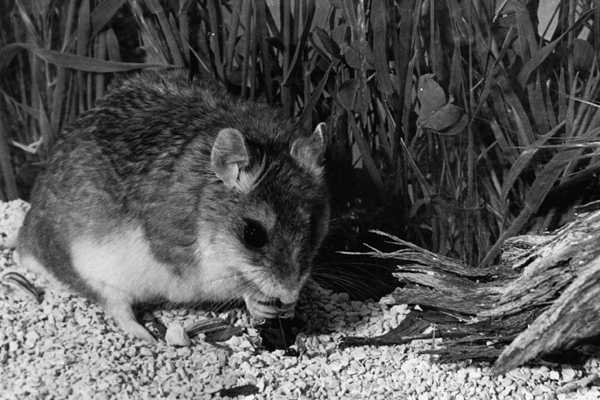
The grasshopper mouse, belonging to the genus Onychomys, is a fascinating creature known for its unique behaviors and adaptations. Here’s a detailed overview of its natural history:
Physical Description
Size: Small rodents, typically around 4 to 5 inches in body length, with an additional 1 to 2 inches of tail.
Appearance: They have a robust body, short tails, and large ears. Their fur is generally grayish-brown on the back and white on the belly.
Habitat
Geographic Range: Found in North America, particularly in the arid and semi-arid regions of the western United States and Mexico.
Preferred Environment: Grasshopper mice inhabit deserts, scrublands, and prairies. They are well-adapted to dry environments and can be found in areas with sparse vegetation.
Behavior
Nocturnal Lifestyle: These mice are primarily nocturnal, coming out to hunt and forage at night.
Territoriality: Grasshopper mice are highly territorial and aggressive. They establish and defend territories vigorously.
Diet
Carnivorous Diet: Unlike many other rodents, grasshopper mice are primarily carnivorous. They feed on insects, other small invertebrates, and even small vertebrates.
Specialization: They are named for their tendency to prey on grasshoppers, but their diet can also include beetles, scorpions, spiders, and even other mice.
Hunting: Known for their hunting prowess, they are sometimes called “scorpion mice” due to their ability to hunt and consume scorpions, showing resistance to the venom.
Vocalizations
Unique Calls: Grasshopper mice are known for their high-pitched, wolf-like howls, which they use to communicate with each other, especially to mark territory.
Reproduction
Breeding Season: Typically breed from spring through late summer.
Litter Size: Females give birth to 2 to 6 young after a gestation period of about 30 days.
Parental Care: The young are weaned after a few weeks and reach maturity at around 2 to 3 months.
Adaptations
Water Conservation: Adapted to arid environments, grasshopper mice obtain most of their water from the food they eat and have efficient kidneys to conserve water.
Venom Resistance: They have developed a resistance to the venom of scorpions, allowing them to prey on these arachnids without harm.
Ecological Role
Predator Control: By preying on insects and other small animals, grasshopper mice help control the populations of these species in their habitats.
Indicator Species: Their presence and health can be indicators of the ecological balance in their environment.
The grasshopper mouse’s unique dietary habits, vocalizations, and behaviors make it a remarkable example of adaptation to harsh environments, playing a crucial role in the ecosystems they inhabit.
Here’s a comparison between the geomorphology of the Funeral Mountains – Greenwater Valley subsection and the second geomorphological description:
Geomorphology Funeral Mountains and Greenwater Valley
Landforms: Steep to very steep mountains and valleys, with very gently to moderately sloping alluvial fans, nearly level basin floors, and dry lake beds.
Orientation: Mountains align north-south or north-northwest.
Elevation Range: About 1,000 feet to 6,703 feet on Pyramid Peak, with many peaks over 5,000 feet.
Geomorphic Processes: Mass wasting, fluvial erosion and deposition, and eolian deflation and deposition.
Geomorphology
Geomorphology is the scientific study of landforms and the processes that shape them, including their origin, evolution, and spatial distribution.
Geomorphology Lucerne and Johnson Valleys
Landforms: Steep mountains, moderately steep hills, gently to moderately sloping pediments and alluvial fans, nearly level basin floors, and dry lake beds. Presence of “badlands” on eroded Miocene nonmarine sedimentary rocks.
Orientation: The hills’ general orientation is less straightforward than the major faults, which trend northwest.
Elevation Range: About 1,600 feet up to 4,873 feet in the Granite Mountains, 5,525 feet in the West Ord Mountains, 6,309 feet in the East Ord Mountains, and 5,878 feet in the Rodman Mountains.
Dry Lake Beds: Includes Lucerne, Soggy, Melville, Galway, Emerson, and Deadman Lake.
Geomorphic Processes: Mass wasting, fluvial erosion and deposition, and eolian deflation and deposition.
Greenwater Valley, Death Valley National Park
Comparison
Landforms: Both regions feature steep mountains and valleys, alluvial fans, basin floors, and dry lake beds. However, the second description includes pediments and mentions “badlands,” which are not noted in the Funeral Mountains – Greenwater Valley description.
Orientation: The Funeral Mountains – Greenwater Valley mountains align north-south or north-northwest, while the hills in the second description have a less clear orientation than the major northwest-trending faults.
Elevation Range: The Funeral Mountains – Greenwater Valley has a broader elevation range, reaching higher peaks (up to 6,703 feet), whereas the second area reaches 6,309 feet in the East Ord Mountains.
Dry Lake Beds: The second description specifies several large dry lake beds by name, which are not mentioned in the Funeral Mountains – Greenwater Valley description.
Geomorphic Processes: Both regions experience similar geomorphic processes, including mass wasting, fluvial erosion and deposition, and eolian deflation and deposition.
In summary, while both regions share common geomorphic features and processes, they differ in specific landform characteristics, elevation ranges, and the presence of features such as “badlands” and named dry lake beds.
When someone mentions they are a geologist, it’s easy to assume that all geologists do the same thing. However, geology is a diverse and multifaceted field, encompassing a wide range of specialties. Each geologist may focus on different aspects of the Earth’s structure, materials, processes, and history. Here’s a more detailed look at the various types of geology and the distinct roles that geologists might have:
Types of Geology
Structural Geology: Geologists in this field study the architecture and processes responsible for the deformation of the Earth’s crust. They analyze faults, folds, and rock formations to understand tectonic movements and stress patterns.
Petrology: Petrologists examine the origin, composition, and structure of rocks. They specialize in:
Igneous Petrology: Focuses on rocks formed from magma or lava.
Sedimentary Petrology: Studies rocks formed by the accumulation of sediments.
Metamorphic Petrology: Investigates rocks transformed by heat and pressure.
Mineralogy: Mineralogists study minerals, including their structure, properties, classification, and distribution. They identify and analyze mineral compositions in various geological contexts.
Geochemistry: Geochemists explore the chemical composition of Earth materials and the chemical processes occurring within and on the Earth’s surface. They study element cycles and mineral interactions.
Geomorphology: Geomorphologists study landforms and the processes that shape them. They analyze erosion, weathering, and sediment deposition to understand landscape evolution.
Sedimentology: Sedimentologists focus on sediments and sedimentary rocks, including their formation, transport, and deposition. They study sedimentary environments like rivers, lakes, and oceans.
Paleontology: Paleontologists study fossils and ancient life forms to understand the history of life on Earth. They analyze fossil records to reconstruct past ecosystems and evolutionary trends.
Volcanology: Volcanologists study volcanoes, volcanic processes, and volcanic rocks. They monitor volcanic activity and assess eruption risks.
Seismology: Seismologists study earthquakes and the propagation of seismic waves through the Earth. They analyze seismic data to understand earthquake mechanics and predict future events.
Geophysics: Geophysicists use physical methods to study the Earth’s interior and its physical properties. They specialize in:
Seismic Geophysics: Uses seismic waves to map the Earth’s interior.
Magnetic Geophysics: Studies the Earth’s magnetic field and anomalies.
Gravitational Geophysics: Examines variations in the Earth’s gravitational field.
Hydrogeology: Hydrogeologists study groundwater, its distribution, movement, and quality. They analyze aquifers and manage water resources.
Engineering Geology: Engineering geologists apply geological knowledge to construction and environmental management engineering practices. They assess ground stability and risks for infrastructure projects.
Environmental Geology: Environmental geologists focus on human interaction and the geological environment. They address natural hazards and resource management to mitigate environmental impacts.
Economic Geology: Economic geologists study materials for financial and industrial purposes, such as minerals, oil, and gas. They explore and develop natural resources.
Planetary Geology: Planetary geologists study the geology of other celestial bodies, such as moons, planets, and asteroids. They analyze surface features and geological processes beyond Earth.
Each type of geologist brings unique expertise to their field, contributing to a comprehensive understanding of the Earth’s dynamic systems. Understanding these distinctions helps us appreciate geologists’ specialized skills and knowledge of various challenges and projects.
Summary
Geology is a diverse field with various specialties. Structural geologists study Earth’s crust deformation, while petrologists focus on rock origins and types. Mineralogists analyze minerals, and geochemists explore Earth’s chemical processes. Geomorphologists study landforms, sedimentologists examine sediments, and paleontologists investigate fossils. Volcanologists monitor volcanic activity, seismologists study earthquakes, and geophysicists use physical methods to probe Earth’s interior. Hydrogeologists focus on groundwater, engineering geologists apply geology to construction, and environmental geologists manage natural hazards. Economic geologists explore resources like minerals and oil, and planetary geologists study celestial bodies. Each specialty offers unique insights into Earth’s processes and history.
The parietal eye, also known as the third eye, is a part of the pineal gland and is found in some species of reptiles and amphibians. It is a photosensitive organ located on the top of the head and is capable of detecting light and dark. Here are some key points about the parietal eye:
Location and Structure: The parietal eye is situated in the parietal area of the brain, on the top of the head, and it is visible as a small, light-sensitive spot in some reptiles and amphibians.
Function: The parietal eye’s primary function is to detect changes in light intensity, helping the animal regulate its circadian rhythms and hormone production. It can also influence basking, thermoregulation, and seasonal reproduction.
Presence in Species: The parietal eye is found in various species of reptiles, such as some lizards (like iguanas) and tuataras, as well as some species of amphibians and fish. It is not present in birds or mammals.
Evolutionary Aspect: The parietal eye is considered an ancient feature in vertebrate evolution, reflecting an early adaptation to environmental light changes.
Comparison with Pineal Gland: While the parietal eye is light-sensitive, the pineal gland in other vertebrates (including humans) receives light information indirectly through the eyes and the brain. Both structures are involved in regulating circadian rhythms and reproductive cycles.
In summary, the parietal eye is an intriguing evolutionary feature that aids certain reptiles and amphibians in detecting environmental light and regulating physiological functions.
The Parietal Eye: Nature’s Light Sensor
The parietal eye, often called the third eye, is a fascinating feature found in some reptiles and amphibians. This photosensitive organ, located on the top of the head, plays a crucial role in detecting light and dark and aids in regulating various physiological processes.
Structure and Location
The parietal eye is situated in the parietal area of the brain and is visible as a small, light-sensitive spot. Unlike the primary eyes, which detect images, it acts as a direct light sensor. This organ is found in certain lizards (including iguanas), tuataras, and some amphibians and fish. Birds and mammals, however, do not possess this feature.
Function and Role
The primary function of the parietal eye is to detect changes in light intensity, helping the animal maintain its circadian rhythms and regulate hormone production. This detection influences behaviors such as basking, thermoregulation, and seasonal reproduction. By sensing light, the parietal eye helps these animals adapt to their environment, optimizing their physiological and behavioral responses.
Evolutionary Significance
The presence of the parietal eye is an ancient adaptation, reflecting early vertebrate evolution. It showcases how animals have developed specialized organs to respond to environmental changes. While the parietal eye is a direct light sensor, other vertebrates, including humans, rely on the pineal gland for similar functions. The pineal gland receives light information indirectly through the eyes and brain, playing a key role in regulating circadian rhythms and reproductive cycles.
Conclusion
The parietal eye is a remarkable evolutionary feature that underscores the diversity of adaptations in the animal kingdom. By detecting light and dark, it enables reptiles and amphibians to finely tune their behaviors and physiological processes to their environments, ensuring their survival and reproductive success.
Summary
The parietal eye, or third eye, is a light-sensitive organ found in some reptiles and amphibians, situated on the top of the head. It detects changes in light intensity, aiding in regulating circadian rhythms, hormone production, and behaviors like basking and thermoregulation. Present in species such as lizards, tuataras, and some amphibians, this ancient adaptation highlights early vertebrate evolution. Unlike the parietal eye, the pineal gland in other vertebrates receives light information indirectly through the eyes and brain. This unique feature helps these animals optimize their responses to environmental changes, ensuring survival and reproductive success.
Dune saltation is a key process in the formation and movement of dunes. It involves the hopping or bouncing movement of sand grains across the surface, driven by wind. Here’s a detailed explanation:
Dune Saltation Process
Initiation: Wind speeds reach a threshold where they can lift sand grains from the ground. This threshold varies depending on the size and weight of the grains, as well as the wind speed and direction.
Lift-off: Sand grains are lifted into the air by the wind. The initial lift is usually caused by the impact of other grains, which creates a chain reaction.
Transport: Once airborne, the grains are carried by the wind. They travel a short distance before falling back to the ground due to gravity.
Impact: When the grains land, they can dislodge other grains, causing them to lift off and continue the saltation process. This impact also leads to the erosion and smoothening of the surface.
Repetition: The cycle of lift-off, transport, and impact continues, causing the sand grains to move in a series of short hops or bounces.
Factors Influencing Saltation
Wind Speed: Higher wind speeds increase the distance and height of saltation.
Grain Size: Smaller grains are more easily lifted and carried by the wind, while larger grains require stronger winds.
Surface Conditions: Smooth surfaces allow for easier saltation, while rough surfaces can trap grains and reduce movement.
Moisture: Moisture in the sand can cause grains to stick together, inhibiting saltation.
Impact on Dune Formation
Dune Shape: Saltation contributes to the growth and movement of dunes. The continuous movement of sand grains causes dunes to migrate toward the prevailing wind.
Sorting of Grains: Saltation can lead to sorting grains by size, transporting finer grains further than coarser ones.
Erosion and Deposition: Saltation causes erosion and deposition, shaping the landscape and forming various dune structures, such as crescent-shaped barchan and linear dunes.
Understanding dune saltation is crucial for studying desert geomorphology and predicting changes in dune landscapes.
Dune saltation is the wind-driven process where sand grains are lifted, transported, and deposited in a series of hops. Wind lifts grains into the air, which then travel short distances before falling back, dislodging other grains upon impact. This cycle causes sand to move and shapes dunes. Wind speed, grain size, surface conditions, and moisture influence saltation. Higher wind speeds and smaller grains increase movement, while moisture and rough surfaces reduce it. Saltation contributes to dune formation, migration, and sorting of grains by size, playing a crucial role in desert geomorphology.
In the summer of 1845, Benjamin D. Wilson, who owned part of the interest in the Jurupa Rancho, the site of the present city of Riverside, led a troop of Calvary in search of cattle rustlers.
Setting out from San Bernardino Valley, he divided his command. Most of the men he sent through Cajon Pass, keeping only 22 Mexican troopers with him to follow a trail across the mountains. Two days later, Wilson and his men reached the lake, where they sighted scores of grizzly bears.
Big Bear Lake
Most of the soldiers had been vaqueros. They formed in pairs and drew reatas, each pair attacking a bear. One looped a rope around the bear’s neck; his companion roped the same bear by a hind foot. Then, the men drew apart to stretch the rope taut and hold the bear a prisoner. They bagged and skinned eleven bears, stretched their hides, and continued across the mountains to join the rest of the command on the desert at Rancho Las Flores, on the Mojave River.
Here, the reunited party engaged Indians in a fight, after which Wilson and his 22 vaquero-troopers returned home by the lake. They again found the place overrun with bears, and the same 22 soldiers brought in eleven more bears—enough to give them a bear rug apiece as a trophy. It was then that Wilson gave the little body of water the name Bear Lake.
Years later, the name was changed to Baldwin Lake. The name survives, however, in Big Bear Lake, which was created at the site of the Talmadge Ranch in 1884, when a dam was built to provide a constant water supply for the Redlands District.
– Adapted from ~ Pioneer Tales of San Bernardino County – WPA – 1940.
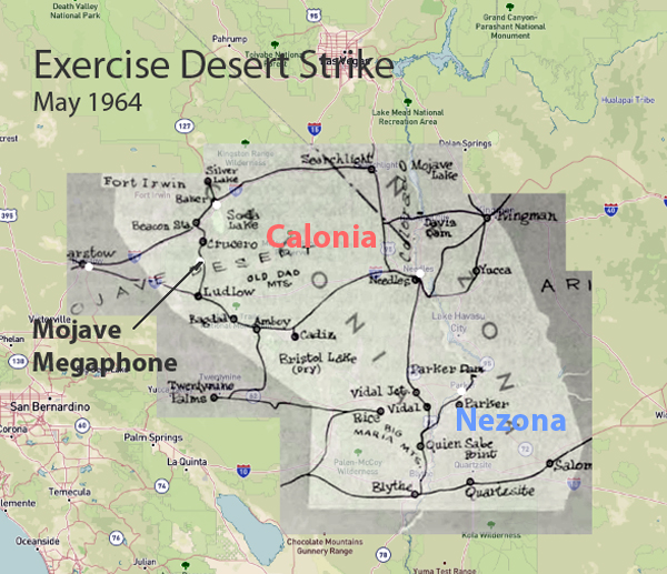
In May 1964, the United States conducted Exercise Desert Strike, one of the most extensive military exercises during the Cold War. It involved over 100,000 military personnel. The primary objectives were to evaluate operational readiness, test conventional and nuclear forces integration, and improve command and control capabilities. The exercise was carried out in multiple phases, beginning with conventional warfare tactics and escalating to simulated nuclear warfare. This tested the troops’ adaptability and response to high-stress scenarios.
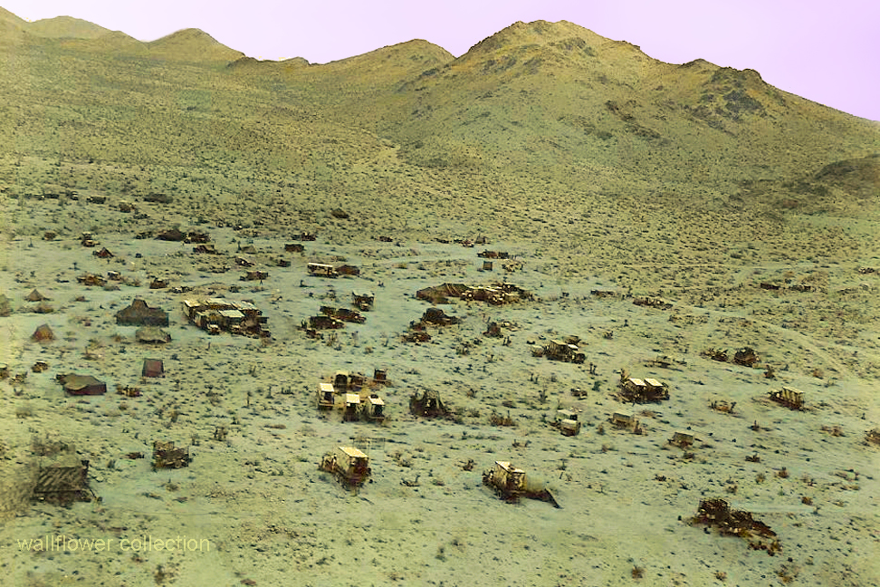
Remote Calzona Camp – Colorized
Despite meticulous planning and rigorous training, the exercise was marred by the tragic loss of 24 men. This underscores the inherent dangers and high stakes of large-scale military operations.
Map showing war zone
Key outcomes of Exercise Desert Strike included a comprehensive assessment of the U.S. military’s strengths and weaknesses. In addition, it validated cutting-edge technologies and significantly improved communication and nuclear warfare strategies. The exercise profoundly impacted subsequent military strategies, contributing to Cold War-era defense policies and nuclear deterrence.
Exercise Desert Strike remains a crucial event in armed forces history, highlighting the importance of preparedness and realistic training in maintaining national security. This exercise’s legacy continues to influence military planning and operations, proving the critical role military exercises have in safeguarding the nation. The fatalities during the exercise are a poignant reminder of the sacrifices made to pursue military excellence and national security.
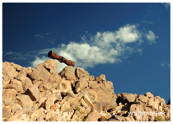
A lasting relic of this period is a megaphone mounted on a rocky hill, symbolizing Exercise Desert Strike’s monumental legacy. This relic is a powerful reminder of the sacrifices necessary to defend our beautiful country. It represents the enduring commitment to national defense and the high price of freedom. It embodies the spirit of vigilance and dedication that inspires and guides military preparedness and strategic planning today.
The Pacific Crest Trail (PCT), stretching over 2,650 miles from Mexico to Canada, offers hikers an unparalleled experience of diverse landscapes and challenging terrains. One of the captivating sections of this trail is the journey from Cajon Pass to Wrightwood in Southern California. This 27-mile segment within the San Gabriel Mountains presents an invigorating mix of natural beauty, physical challenge, and serene solitude.
Setting Out from Cajon Pass
Cajon Pass, located at an elevation of approximately 3,000 feet, marks the starting point for many hikers embarking on this segment of the PCT. The pass, intersected by major highways and railroads, is a bustling gateway to the wilderness beyond. As hikers leave behind the urban cacophony, they are greeted by the rugged charm of the San Bernardino National Forest.
The initial ascent from Cajon Pass is gradual, allowing hikers to acclimate to the elevation change while enjoying sweeping views of the surrounding valleys. This portion of the trail is characterized by its diverse flora, ranging from chaparral shrubs to the majestic Jeffrey pines. Wildlife sightings, including mule deer and various bird species, are common, offering a glimpse into the region’s rich biodiversity.
Climbing into the San Gabriels
As the trail progresses, the terrain becomes increasingly challenging, with steeper inclines and rocky paths. Hikers often find themselves navigating narrow switchbacks that test their endurance and resolve. However, the reward for this effort is the breathtaking vistas that unfold at higher elevations. The panoramic views of the Mojave Desert to the north and the Los Angeles Basin to the south are nothing short of spectacular.
One of the notable landmarks along this stretch is Silverwood Lake, a man-made reservoir that provides a refreshing respite for weary travelers. The lake’s shimmering waters, set against the backdrop of rolling hills, create a picturesque scene that beckons hikers to pause and rejuvenate. This area is also a popular spot for camping, offering a chance to experience the tranquility of the wilderness under a starlit sky.
Approaching Wrightwood
The final leg of the journey to Wrightwood is marked by a gradual descent into the quaint mountain town. Wrightwood, situated at about 6,000 feet, is a welcoming destination for PCT hikers. The town’s rustic charm, friendly residents, and well-stocked amenities provide a much-needed break from the rigors of the trail.
Wrightwood’s proximity to the Angeles National Forest means that hikers can continue to explore the area’s natural beauty even after completing this segment of the PCT. Popular activities include visiting the nearby Grassy Hollow Visitor Center, learning more about the local flora and fauna, and tackling the challenging ascent to Mount Baden-Powell, one of the highest peaks in the San Gabriel range.
Reflection on the Journey
The trek from Cajon Pass to Wrightwood is more than just a physical journey; it is a transformative experience that tests and strengthens the hiker’s spirit. The changing landscapes, from arid desert vistas to lush forested slopes, mirror the inner journey of growth and discovery. Each step taken on this trail is a step towards understanding nature’s profound beauty and resilience.
In conclusion, the Pacific Crest Trail segment from Cajon Pass to Wrightwood offers a unique blend of natural splendor, physical challenge, and serene solitude. It is a journey that leaves an indelible mark on those who undertake it, reminding them of the wilderness’s enduring allure and strength of the human spirit.
The Pacific Crest Trail (PCT) is a remarkable journey that stretches over 2,650 miles from Mexico to Canada. One of the trail’s most captivating segments runs from Big Bear Lake to Cajon Pass, offering hikers a unique blend of natural beauty, challenging terrains, and a rich tapestry of ecosystems. This section, approximately 56 miles long, embodies the essence of the PCT, making it a memorable adventure for those who traverse its paths.
The Journey Begins: Big Bear Lake
Starting at Big Bear Lake, hikers are greeted by the serene, high-altitude environment of the San Bernardino Mountains. Big Bear Lake is a popular recreational area known for its picturesque scenery and vibrant community. As the trailhead, it serves as a gateway to the wilderness that lies ahead. The trail initially winds through lush pine and fir forests, providing a cool and refreshing ambiance, especially welcome during the warmer months.
This part of the trail is relatively gentle, allowing hikers to acclimate to the altitude and prepare for the more strenuous sections. The sounds of rustling leaves and the occasional sighting of local wildlife, such as deer or various bird species, enhance the tranquil experience.
Into the Wild: Rugged Terrains and Scenic Vistas
As the trail progresses, the terrain begins to change, reflecting the region’s diverse topography. Hikers encounter steeper climbs and rocky paths, demanding more physical exertion. The effort, however, is rewarded with breathtaking views. One notable spot is the Deep Creek Hot Springs, a natural oasis that offers a perfect respite for weary hikers. The hot springs, with their soothing waters, are a testament to the geothermal activity beneath the Earth’s surface and starkly contrast the surrounding arid landscape.
Continuing further, the trail ascends to the high ridges, offering panoramic views of the Mojave Desert to the north and the lush forests to the south. These vistas are particularly stunning at sunrise and sunset when the sky is painted with orange, pink, and purple hues. The stark beauty of the landscape reminds hikers of the PCT’s ability to transport them to places of profound natural splendor.
The Descent: Approaching Cajon Pass
The descent towards Cajon Pass marks the final leg of this segment. This part of the trail is characterized by its rugged and often exposed paths with little shade. The flora also changes to hardy shrubs and desert plants that withstand harsher conditions. The trail meanders through narrow canyons and along ridges, presenting challenges and opportunities for reflection.
One of the most fascinating aspects of this segment is the historic significance of Cajon Pass. This natural corridor has been a critical passageway for centuries, used by Native American tribes, Spanish explorers, and pioneers. Today, it is a major transportation route, with the PCT offering a unique perspective of this historically rich area.
Conclusion: A Journey Worth Taking
Hiking the Pacific Crest Trail from Big Bear to Cajon Pass is more than just a physical endeavor; it explores nature’s diverse landscapes and a journey through history. The changing environments, from the cool forests of Big Bear to the arid expanses near Cajon Pass, showcase the incredible variety the PCT offers. For those seeking adventure, solitude, and a deeper connection with the natural world, this trail segment is an unforgettable experience.
Whether you are a seasoned hiker or a novice explorer, the PCT from Big Bear to Cajon Pass promises a journey that challenges the body, inspires the spirit, and captivates the soul.
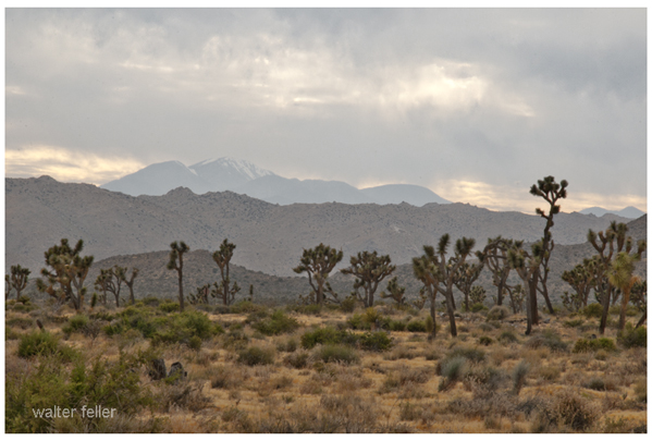
Unique Flora and Fauna: The park is renowned for its namesake Joshua Trees (Yucca brevifolia), which give the landscape an otherworldly feel. It also has various desert plants and animals, including cacti, wildflowers, bighorn sheep, and desert tortoises.
Stunning Landscapes: The park’s diverse landscapes include rugged mountains, stark desert plains, and unique rock formations. These features provide breathtaking views and excellent opportunities for photography.
Recreational Activities: Joshua Tree NP is a haven for outdoor enthusiasts. Popular activities include hiking, rock climbing, camping, and stargazing. The park’s clear skies and lack of light pollution make it an excellent spot for astronomy.
Rock Climbing: The park is a world-class destination for rock climbers, offering thousands of climbing routes of varying difficulty. The unique granite rock formations attract climbers from all over the globe.
Cultural and Historical Significance: The park has a rich cultural history, with evidence of human habitation dating back over 5,000 years. Visitors can explore historical sites, including remnants of old mines, homesteads, and Native American petroglyphs.
Accessibility: Its proximity to major urban centers like Los Angeles, San Diego, and Las Vegas makes it an accessible destination for both day-trippers and longer visits.
Varied Ecosystems: Joshua Tree NP spans the convergence of two distinct desert ecosystems—the Mojave and the Colorado Deserts. This unique positioning offers a variety of environments within the park, each with its own distinct flora and fauna.
These factors, combined with the park’s natural beauty and recreational opportunities, make Joshua Tree National Park a popular destination for nature lovers, adventurers, and tourists alike.
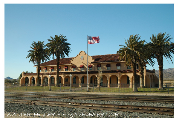
Kelso Depot, also known as the Kelso Depot Visitor Center, is a historic railroad station in the Mojave Desert within the Mojave National Preserve in California. It serves as a significant historical landmark, offering insights into the region’s railroad history and the broader story of the American West.
History and Significance
Construction and Early Years
The Los Angeles and Salt Lake Railroad, later absorbed by the Union Pacific Railroad, constructed Kelso Depot in 1923. The depot was strategically located at Kelso, a small community that sprang up primarily to serve the railroad and the nearby mining operations. The location was chosen because it provided a crucial water stop for steam locomotives and a place to house “helper” engines needed to assist trains over the steep grades of Cima Hill.
Architectural Style
The depot was built in the Spanish Mission Revival style, popular in the southwestern United States during the early 20th century. The building features stucco walls, a red tile roof, and a distinctive colonnade, reflecting the architectural trends of the time. The depot included passenger waiting rooms, a telegraph office, and a restaurant known as the “Beanery,” which served meals to passengers and railroad employees.
Role During the Boom Years
Kelso Depot played a vital role during the peak years of rail traffic. It was a bustling hub for both freight and passenger services. The surrounding area saw significant economic activity due to nearby borax and iron ore mining operations. The depot was an essential stop on the Los Angeles to Salt Lake City route, facilitating the transport of goods and passengers across the desert.
Decline and Abandonment
The need for water stops and helper engines diminished with the advent of diesel locomotives in the mid-20th century. As a result, the importance of Kelso Depot declined. Passenger service was discontinued in 1964, and the depot eventually closed in 1985. The building fell into disrepair and was at risk of demolition.
Preservation and Restoration
Inclusion in Mojave National Preserve
In 1994, the Mojave National Preserve was established, and efforts began to preserve the historical and cultural resources within the area. Recognizing the historical significance of Kelso Depot, the National Park Service (NPS) took on the task of restoring the building.
Restoration Efforts
The restoration of Kelso Depot was a major undertaking by the NPS. The project aimed to return the building to its former glory and adapt it as a visitor center and museum. The restoration preserved many of the depot’s original architectural features while making necessary updates to meet modern safety and accessibility standards.
Kelso Depot Visitor Center
Exhibits and Interpretation
Today, Kelso Depot serves as the primary visitor center for the Mojave National Preserve. It houses a variety of exhibits that explore the natural and cultural history of the Mojave Desert. Displays cover topics such as the geology, flora, and fauna of the region, as well as the history of mining, railroads, and early settlers.
Visitor Amenities
The visitor center offers a range of amenities for park visitors. These include an information desk, interpretive displays, a small bookstore, and public restrooms. The restored “Beanery” provides a glimpse into the dining experiences of early 20th-century railroad travelers.
Educational Programs and Events
Kelso Depot also hosts educational programs and special events throughout the year. Ranger-led tours, interpretive talks, and community events help to engage visitors and deepen their understanding of the Mojave National Preserve’s rich history and natural beauty.
Conclusion
Kelso Depot is a testament to the railroad’s transformative impact on the American West. Its preservation and restoration provide a valuable link to the past, allowing visitors to step back and appreciate the challenges and triumphs of those who lived and worked in the Mojave Desert. Through its exhibits, programs, and architectural beauty, Kelso Depot continues to educate and inspire new generations about the unique history of this remarkable region.
The Mojave National Preserve, encompassing over 1.6 million acres, offers diverse landscapes, wildlife, and recreational activities. Located in southeastern California, the preserve is a haven for outdoor enthusiasts and nature lovers. Here’s an expanded look at what makes the Mojave National Preserve a popular destination:
Key Features and Attractions
Kelso Dunes:
Dune Field: Covering over 45 square miles, the Kelso Dunes are some of the tallest dunes in North America, with the highest peak rising about 650 feet.
Hiking and Exploration: Visitors can hike to the top of the dunes for panoramic views and experience the phenomenon of “singing sands,” a booming sound produced by the movement of the sand.
Sunset Views: The dunes are stunning at sunset when the shifting light creates dramatic shadows and colors.
Hole-in-the-Wall:
Geological Features: This area is named for its unique rock formations created by volcanic activity and erosion. The walls are filled with holes and cavities, giving the area its distinctive appearance.
Rings Loop Trail: A popular 1.5-mile loop trail that features metal rings bolted into the rock to help hikers navigate steep sections of the trail. The trail offers a close-up view of the fascinating rock formations.
Visitor Center: The Hole-in-the-Wall Information Center provides exhibits on the area’s geology, wildlife, and cultural history.
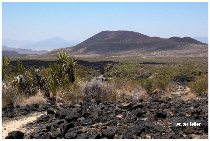
Cinder Cone Lava Beds:
Volcanic Landscape: This area features ancient volcanic cones, lava flows, and craters, offering a rugged and dramatic landscape.
Hiking Trails: Trails wind through the lava beds, providing opportunities to explore the unique terrain and view the surrounding desert.
Mitchell Caverns:
Limestone Caves: Located in the Providence Mountains State Recreation Area, these caverns are filled with stalactites, stalagmites, and other fascinating formations.
Guided Tours: The only way to explore the caverns is through guided tours offered by California State Parks, which provide insights into the caves’ geological history and natural features.
Mojave Road:
Historic Route: The Mojave Road is a historic 140-mile off-road trail that follows a route used by Native Americans, early explorers, and settlers. It provides a challenging and adventurous way to experience the preserve.
Landmarks: Along the route, travelers can see historic sites, old military forts, and natural landmarks. The route requires a high-clearance 4WD vehicle and careful planning.
Wildlife and Plant Life
Desert Flora: The preserve has various desert plants, including Joshua trees, creosote bushes, cacti, and wildflowers. Springtime can bring vibrant blooms, adding color to the landscape.
Wildlife: The preserve’s diverse habitats support a wide range of wildlife, including bighorn sheep, coyotes, desert tortoises, and numerous bird species. The varying elevations and environments within the preserve create unique ecosystems.
Recreational Activities
Hiking:
Diverse Trails: The preserve offers a range of hiking trails, from short nature walks to strenuous backcountry routes. Trails provide opportunities to explore the varied landscapes and observe the native flora and fauna.
Backpacking: For those seeking a more immersive experience, the preserve offers backcountry camping and backpacking opportunities. Permits are required for overnight stays.
Camping:
Developed Campgrounds: The preserve has several developed campgrounds, including Hole-in-the-Wall and Mid Hills, which offer amenities such as picnic tables, fire rings, and restrooms.
Dispersed Camping: For a more primitive experience, visitors can camp in designated areas throughout the preserve. Dispersed camping allows for solitude and a closer connection with nature.
Stargazing:
Dark Skies: The remote location of the preserve provides excellent conditions for stargazing. The lack of light pollution allows for clear views of the night sky, making it a perfect spot for observing stars, planets, and meteor showers.
Bird Watching:
Diverse Bird Species: The varied habitats within the preserve attract a wide range of bird species, making it a popular destination for bird watchers. Seasonal migrations and diverse environments provide opportunities to see both resident and migratory birds.
Off-Roading:
Designated Routes: The preserve has numerous designated off-road vehicle routes, offering adventurous ways to explore the rugged terrain. It’s important to stay on designated routes to protect the environment and adhere to regulations.
Historical and Cultural Sites
Kelso Depot: A restored 1924 Union Pacific train depot now serving as the preserve’s visitor center. The depot features exhibits on the history of the railroad, mining, and desert communities.
Rock Springs Land and Cattle Company: Historical ranch buildings and corrals that provide a glimpse into the ranching history of the area.
Conservation and Preservation
Protected Area: The Mojave National Preserve is managed by the National Park Service, protecting its unique landscapes, wildlife, and cultural resources.
Leave No Trace: Visitors are encouraged to practice Leave No Trace principles, minimizing their impact on the environment and helping to preserve the preserve’s natural beauty and integrity.
Visitor Information
Accessibility: The preserve is accessible via Interstate 15 and Interstate 40, with several entry points and visitor centers providing information and resources.
Seasonal Considerations: The best times to visit are spring and fall when temperatures are moderate. Summer temperatures can be extreme, and winter can bring cold nights and occasional snow at higher elevations.
The Mojave National Preserve offers a diverse and captivating landscape with countless opportunities for exploration and adventure. Whether hiking through rugged canyons, climbing towering dunes, or simply soaking in the vast desert vistas, the preserve provides a memorable and enriching experience for all who visit.
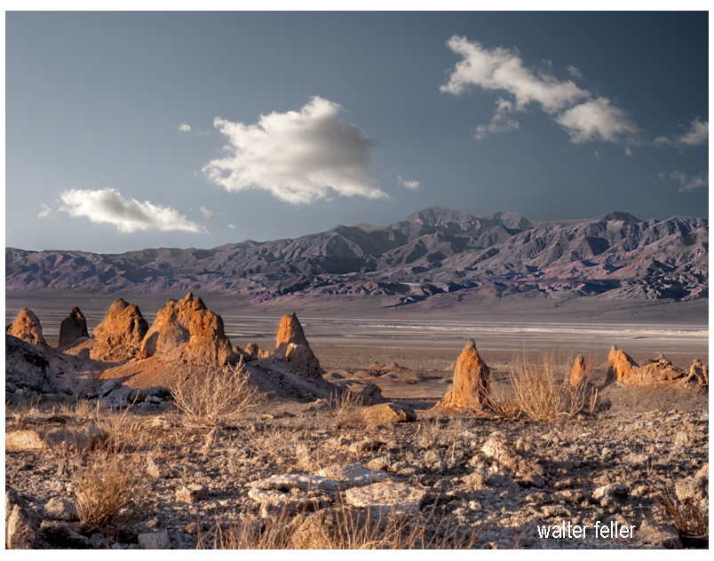
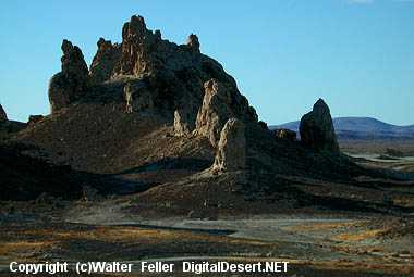
The Trona Pinnacles, located in the California Desert National Conservation Area near the town of Trona, offer a striking landscape of unusual tufa formations rising dramatically from the desert floor. Here’s an expanded look at what makes the Trona Pinnacles a popular destination:
Geological Significance
Formation: The Trona Pinnacles are composed of tufa, a type of limestone that forms in alkaline lake waters. These formations were created 10,000 and 100,000 years ago when the area was submerged under the prehistoric Searles Lake.
Structure: The site features over 500 pinnacles, ranging from small spires to large towers that reach up to 140 feet. These formations vary in shape and size, creating a surreal and otherworldly landscape.
Attractions and Activities
Exploring the Pinnacles:
Self-Guided Tours: Visitors can explore the pinnacles at their own pace, walking among the formations and marveling at their unique shapes and textures. The area is open for hiking and offers numerous trails and pathways.
Interpretive Signs: Informational signs throughout the site provide insights into the geological history of the pinnacles, explaining how they were formed and their significance.
Photography:
Landscape Photography: The Trona Pinnacles are a favorite subject for photographers due to their striking appearance and the dramatic contrasts between the tufa towers and the surrounding desert. The light at sunrise and sunset casts a magical glow on the formations, enhancing their visual appeal.
Astrophotography: The remote location and dark skies make the Trona Pinnacles an excellent spot for stargazing and astrophotography. The formations provide unique foregrounds for night sky photography, including stunning views of the Milky Way.
Off-Roading and Vehicle Access:
Off-Road Trails: The area around the Trona Pinnacles is accessible by dirt roads suitable for high-clearance and four-wheel-drive vehicles. Off-road enthusiasts can enjoy exploring the rugged terrain and discovering hidden viewpoints.
Scenic Drives: For those who prefer a more leisurely visit, scenic drives through the area offer beautiful views of the pinnacles and the surrounding desert landscape.
Camping:
Primitive Camping: The Bureau of Land Management (BLM) allows primitive camping near the Trona Pinnacles. Campers can set up their tents or park their RVs in designated areas, providing a unique opportunity to experience the pinnacles up close, especially during sunrise and sunset.
Stargazing: Camping overnight offers a chance to enjoy the clear desert skies, which are perfect for stargazing and experiencing the tranquility of the desert.
Filming and Events:
Film Location: The Trona Pinnacles have been used as a backdrop for numerous movies, TV shows, and commercials due to their otherworldly appearance. Productions like “Star Trek V: The Final Frontier” and “Planet of the Apes” have featured scenes shot at the pinnacles.
Special Events: Occasionally, the area hosts special events such as photography workshops, stargazing parties, and off-road vehicle rallies, providing unique opportunities for visitors to engage with the site.
Visitor Information
Location and Access: The Trona Pinnacles are about 20 miles east of Ridgecrest, California. The access road to the pinnacles is a graded dirt road off Highway 178, which can be rough in places but is generally passable for most vehicles.
Facilities: The Trona Pinnacles do not have developed facilities. Visitors should come prepared with their water, food, and supplies. Portable toilets are sometimes available, but it’s best to be self-sufficient.
Best Times to Visit
Spring and Fall: These seasons offer mild temperatures, making it the best time for outdoor activities such as hiking and camping. Springtime may also bring wildflower blooms, adding color to the landscape.
Winter: Winter can be a good time to visit if you prefer cooler weather, but be prepared for cold nights. The clear winter skies are excellent for stargazing.
Conservation and Preservation
Protected Area: The Trona Pinnacles are managed by the Bureau of Land Management as part of the California Desert National Conservation Area. Efforts are made to preserve the site’s unique geological features and natural beauty.
Responsible Tourism: Visitors are encouraged to practice Leave No Trace principles, respecting the delicate desert environment and minimizing their impact on the land and formations.
Nearby Attractions
Searles Valley Minerals: The nearby town of Trona is known for its mineral processing facilities. The Searles Valley Minerals plant conducts an annual Gem-O-Rama event, where visitors can collect various minerals and crystals from the Searles Lake deposits.
Death Valley National Park: Located to the east, Death Valley National Park offers additional opportunities for exploring diverse desert landscapes, unique geological features, and historic sites.
Educational and Interpretive Programs
Guided Tours and Talks: Occasionally, the BLM or local organizations may offer guided tours and interpretive talks about the geology and natural history of the Trona Pinnacles, providing deeper insights into the site’s formation and significance.
The Trona Pinnacles offer a unique and memorable experience for visitors interested in geology, photography, outdoor adventure, and the natural beauty of the Mojave Desert. Whether exploring the pinnacles on foot, capturing their striking forms with a camera, or simply soaking in the serene desert atmosphere, the Trona Pinnacles provide an extraordinary destination for all who visit.
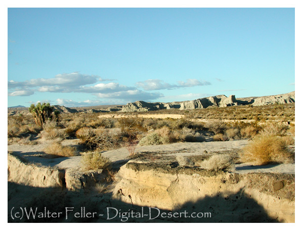
Red Rock Canyon State Park, located in the southern Mojave Desert, is renowned for its stunning rock formations, vibrant colors, and rich history. Here’s an in-depth look at what makes Red Rock Canyon State Park a popular destination:
Geological and Natural Features
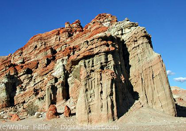
Spectacular Rock Formations: The park is famous for its dramatic cliffs, buttes, and vividly colored rock layers that span millions of years of geological history. These formations primarily comprise sandstone, volcanic rock, and sedimentary deposits.
Unique Colors: The park’s namesake red cliffs and outcroppings are complemented by layers of white, pink, and brown, creating a visually striking landscape that changes with the angle of the sunlight.
Attractions and Activities
Hiking Trails:
Hagen Canyon Nature Trail: A popular 1-mile loop trail that offers close-up views of the park’s iconic rock formations and opportunities to spot wildlife. It is an easy hike suitable for all ages.
Red Cliffs Trail: A moderate trail that leads hikers through some of the park’s most scenic areas, including red cliffs and narrow canyons. This trail provides excellent photo opportunities.
Nightmare Gulch Loop: A longer, more challenging trail offering a rugged adventure through narrow canyons and dramatic rock formations. It is typically open from July through January due to nesting raptors in the area.
Wildlife Viewing:
Bird Watching: The park’s diverse habitats attract numerous bird species, making it a great spot for enthusiasts.
Camping:
Ricardo Campground: The park’s main campground is located amidst scenic cliffs and rock formations. It offers 50 campsites with picnic tables, fire rings, and restrooms.
Primitive Camping: For a more rustic experience, visitors can opt for primitive camping in designated areas, allowing them to connect more closely with nature.
Photography:
Landscape Photography: The park’s vibrant rock formations and desert vistas provide endless opportunities for landscape photography. Sunrise and sunset are particularly magical times for capturing the beauty of the park.
Night Sky Photography: The park’s remote location and minimal light pollution make it an excellent spot for stargazing and astrophotography. The clear desert skies offer stunning views of the Milky Way and other celestial phenomena.
Off-Roading and Driving:
Scenic Drives: Visitors can enjoy scenic drives through the park, with several dirt roads and trails accessible to high-clearance vehicles. These drives offer a chance to explore more remote areas and enjoy panoramic views.
Off-Road Vehicle Areas: Designated areas within the park allow for off-road vehicle use, providing an adventurous way to explore the rugged terrain.
Cultural and Historical Sites:
Petroglyphs and Historical Artifacts: The park is rich in cultural history, with petroglyphs and artifacts from Native American tribes who once inhabited the area. Interpretive signs provide insights into the historical significance of these sites.
Film and Television Location: Red Rock Canyon has served as a filming location for numerous movies, television shows, and commercials, adding to its cultural appeal.
Visitor Information
Visitor Center: The park’s visitor center offers educational exhibits on the geology, wildlife, and cultural history of the area. It also provides information on hiking trails, camping, and other recreational activities.
Accessibility: The park is easily accessible from major highways, with well-maintained roads leading to the main attractions and facilities.
Best Times to Visit
Spring and Fall: These seasons offer the most comfortable weather for outdoor activities, with mild temperatures and blooming wildflowers in spring.
Winter: The park can be visited year-round, but winter provides cooler temperatures, making it an ideal time for hiking and exploring without the intense heat of summer.
Conservation and Preservation
Protected Area: As a state park, Red Rock Canyon is protected to preserve its natural beauty, wildlife habitats, and cultural resources for future generations.
Leave No Trace Principles: Visitors are encouraged to practice Leave No Trace principles to minimize their impact on the environment and help maintain the park’s pristine condition.
Nearby Attractions
Jawbone Canyon: Located to the north of the park, Jawbone Canyon offers additional opportunities for off-roading, hiking, and exploring unique desert landscapes.
California City: A nearby city that provides additional amenities such as lodging, dining, and shopping for park visitors.
Red Rock Canyon State Park offers a blend of natural beauty, outdoor adventure, and rich history, making it a must-visit destination for anyone exploring the Mojave Desert. Whether you’re hiking, camping, photographing, or simply enjoying the stunning scenery, the park provides an unforgettable experience.
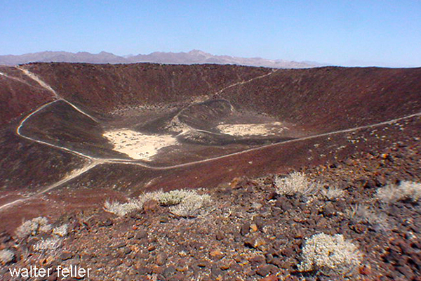
Amboy Crater is a remarkable natural feature in the Mojave Desert, offering visitors a unique opportunity to explore a dormant volcanic cinder cone and its surrounding landscape. Here’s an expanded look at what makes Amboy Crater a popular attraction:
Geological Significance
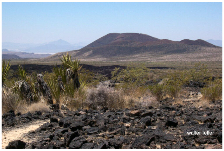
Formation: Amboy Crater is a cinder cone volcano that formed during an eruption approximately 79,000 years ago. The eruption produced the cone and extensive lava fields that stretch across the desert floor.
Volcanic Structure: The crater stands about 250 feet above the surrounding landscape and has a diameter of about 1,500 feet—the crater’s interior features a flat floor and a breached rim, indicative of past volcanic activity.
Attractions and Activities
Hiking to the Crater:
Trail Information: The hike to the summit of Amboy Crater is a moderately challenging trek of about 3 miles round trip. The trailhead is equipped with interpretive signs that provide information about the volcanic history and the local ecology.
Trail Experience: The trail leads through lava fields and desert terrain, offering a chance to see various volcanic features up close. The ascent to the crater rim provides stunning views of the surrounding desert.
Exploring the Crater:
Crater Interior: Once at the top, hikers can descend into the crater’s interior, which features a flat floor covered with volcanic ash and small rocks. It’s a unique landscape that feels almost otherworldly.
Scenic Views: The crater’s rim offers panoramic views of the Mojave Desert, including the vast lava fields and distant mountain ranges. The view is particularly striking at sunrise and sunset.
Wildlife and Flora:
Desert Plants: The area around Amboy Crater is home to various desert plants, including creosote bushes, cacti, and wildflowers. During spring, the landscape can be dotted with colorful blooms.
Wildlife: Visitors might spot desert wildlife like lizards, snakes, and birds. Despite the harsh conditions, the area’s natural habitat supports a diverse ecosystem.
Photography Opportunities:
Landscape Photography: The stark contrast between the black lava fields and the sandy desert creates dramatic photo opportunities. The crater’s unique geological features make it a favorite subject for photographers.
Astrophotography: Amboy Crater’s remote location and lack of light pollution make It an excellent spot for stargazing and astrophotography. The clear desert skies provide breathtaking views of the night sky.
Visitor Information
Location and Access: Amboy Crater is located off historic Route 66, near the town of Amboy. The site is accessible via a well-maintained dirt road and a parking area at the trailhead.
Facilities: The trailhead features shaded picnic tables, informational kiosks, and restroom facilities. There is also a viewing platform for those who prefer not to hike but still want to enjoy the scenery.
Historical and Cultural Context
Route 66: Amboy Crater is situated along the iconic Route 66, adding a layer of historical significance. The nearby town of Amboy and the famous Roy’s Motel and Café provide a nostalgic glimpse into the heyday of America’s Mother Road.
Cultural Significance: The crater and its surroundings have been a significant landmark for indigenous peoples, early travelers, and modern explorers. It has been a navigation point and a source of fascination for centuries.
Safety and Preparation
Hiking Precautions: Due to the harsh desert environment, hikers should come prepared with plenty of water, sun protection, and appropriate footwear. The trail can be challenging, especially in hot weather.
Weather Considerations: The best times to visit are during the cooler months of fall, winter, and early spring. Summer temperatures can be extreme, making hiking hazardous.
Conservation Efforts
Protected Area: Amboy Crater is designated a National Natural Landmark, recognizing its geological significance and ensuring its protection for future generations.
Responsible Tourism: Visitors are encouraged to practice Leave No Trace principles, respecting the delicate desert environment and preserving the area’s natural beauty.
Amboy Crater offers a unique blend of geological wonder, natural beauty, and historical intrigue. Whether you’re an avid hiker, a photography enthusiast, or simply curious about the natural world, Amboy Crater provides a memorable and enriching experience in the heart of the Mojave Desert.
The Mojave Desert offers a variety of unique and exciting activities. Here are ten of the most popular places:
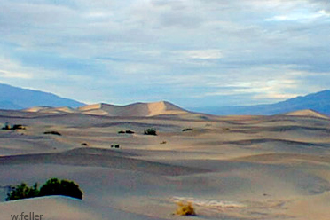
Death Valley National Park: Known for its extreme temperatures and stunning landscapes, it features attractions like Badwater Basin, the lowest point in North America, and the Mesquite Flat Sand Dunes.
Joshua Tree National Park: Famous for its unique Joshua trees, it offers rock climbing, hiking, and stargazing opportunities amidst a surreal desert landscape. .
Mojave Road: This historic off-road trail takes you through the heart of the Mojave Desert, offering a challenging adventure with historical landmarks and diverse desert scenery.
Kelso Depot Visitor Center: Located in the Mojave National Preserve, this historic train depot provides insight into the region’s rail history and is a gateway to exploring the preserve.
Mojave National Preserve: With over 1.6 million acres, the preserve offers numerous trails, including the Kelso Dunes and the Hole-in-the-Wall Rings Trail. .
Trona Pinnacles: These unique tufa formations, formed underwater over 10,000 years ago, are popular for photography and off-road exploration. .
Red Rock Canyon State Park: Known for its vibrant rock formations and scenic desert cliffs, this park offers hiking, camping, and wildlife viewing opportunities. .
Amboy Crater: A dormant volcanic cinder cone, Amboy Crater provides a moderately challenging hike with rewarding views from the top. .
Mojave Air and Space Port: This hub for aerospace innovation offers public tours showcasing historic aircraft and cutting-edge aerospace technology. .
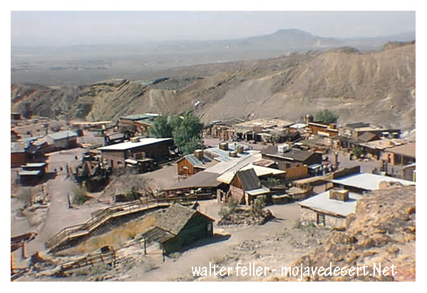
Visit Calico: A restored mining town from the Silver Rush era, Calico offers a glimpse into the past with its preserved buildings, mine tours, and reenactments. .
These activities highlight the diverse attractions and experiences the Mojave Desert offers, from natural wonders to historical sites.
The Mojave Air and Space Port, located in Mojave, California, is a unique and significant facility that plays a crucial role in the aerospace industry. Here’s an expanded look at what makes it a popular attraction and an important center for aerospace activities:
History and Significance
Establishment: Originally established in 1935 as a small rural airfield, the Mojave Air and Space Port has become a major center for aerospace research and development.
Spaceport License: In 2004, it became the first facility in the United States to be licensed as a spaceport, allowing it to conduct spaceflight activities.
Key Features and Attractions
Virgin Galactic’s second SpaceShipTwo vehicle, VSS Unity, soars on its first-ever glide flight on Dec. 3, 2016. (Image credit: Virgin Galactic)
Aerospace Innovation and Companies:
Scaled Composites: the first privately funded spacecraft to reach space, is known for developing innovative aircraft, including SpaceShipOne.
Virgin Galactic: Developing commercial spaceflight services with its SpaceShipTwo spacecraft, aiming to offer suborbital space tourism.
Masten Space Systems: Working on vertical takeoff, landing rockets, and lunar lander technology.
Public Tours and Educational Opportunities:
Guided Tours: The Mojave Air and Space Port offers guided tours that provide insights into the operations of various aerospace companies, the facility’s history, and ongoing projects.
Visitor Center: This center features exhibits on the history of aviation and space exploration, including models and displays of historic and modern aircraft and spacecraft.
Aircraft Storage and Boneyard:
Aircraft Boneyard: The air and spaceport is home to a large aircraft boneyard where retired commercial and military aircraft are stored, maintained, or dismantled for parts. This is a fascinating area for aviation enthusiasts to see a variety of aircraft up close.
Flight Testing and Demonstrations:
Test Flights: The air and spaceport is a premier location for flight testing, with companies conducting regular test flights of new aircraft and spacecraft. Visitors can often witness these test flights, adding to the excitement of the visit.
Air Shows and Events: Periodic air and aerospace events showcase cutting-edge technology and historic aircraft, allowing the public to engage with the aerospace community.
Space Launches and Rocket Testing:
Rocket Engines: Various companies conduct rocket engine testing at the facility, and on occasion, space launches are performed, offering a rare chance to see rocket technology in action.
Experimental Spacecraft: The development and testing of experimental spacecraft, such as those by Virgin Galactic, offer a glimpse into the future of space travel.
Mojave Transportation Museum Foundation:
Historical Exhibits: Dedicated to preserving the rich history of transportation in the Mojave Desert, the museum features exhibits on aviation, railroads, and automotive history in the region.
Educational Programs: The foundation offers educational programs and events to inspire the next generation of engineers, pilots, and aerospace professionals.
Unique Aspects
Climate and Location: The Mojave Desert’s desert climate and wide-open spaces are ideal for aerospace testing and development.
Innovation Hub: The air and space port fosters a culture of innovation, attracting various aerospace companies and startups pushing the boundaries of technology.
Visitor Information
Accessibility: Located just off the main highways, the Mojave Air and Space Port is easily accessible for visitors traveling by car.
Amenities: The facility offers amenities such as a visitor center, dining options, and ample parking.
Future Developments
Expansion Plans: Ongoing expansion and development projects aim to enhance the air and space port’s capabilities, including new hangars, testing facilities, and infrastructure to support increased spaceflight activities.
Commercial Space Travel: As companies like Virgin Galactic move closer to offering commercial space travel, the Mojave Air and Space Port will continue to play a pivotal role in making space tourism a reality.
The Mojave Air and Space Port is not only a hub of aerospace innovation but also a fascinating destination for anyone interested in aviation, space exploration, and cutting-edge technology. Its combination of historical significance, active testing and development, and public accessibility make it a unique and exciting place to visit.
Calico Ghost Town is a fascinating destination that offers a glimpse into the past, specifically the boom-and-bust era of the American West. Here’s a detailed look at what makes Calico Ghost Town a popular attraction:
History of Calico Ghost Town
Founding and Boom Era: Calico was founded in 1881 during the California silver rush. At its peak, the town boasted over 500 mines and produced millions of dollars worth of silver ore.
Decline: By the mid-1890s, silver prices had plummeted, leading to the decline of mining activities. Calico was largely abandoned by the early 20th century, becoming a true ghost town.
Attractions and Activities
Mine Tours:
Maggie Mine: This is one of the few mines in Calico that is safe for tourists to enter. Visitors can take a self-guided tour to learn about the mining techniques and see the remnants of the silver extraction process.
Calico Odessa Railroad: A narrow-gauge train ride that offers a scenic tour of the town and the surrounding mining areas, providing insights into the town’s mining history.
Historical Buildings:
Lane’s General Store: Restored to its 1880s appearance, this general store offers a variety of souvenirs and historical artifacts.
Schoolhouse: A replica of the original schoolhouse where children of miners once studied. It now serves as a museum displaying educational artifacts from the era.
Lil’s Saloon: A typical Old West saloon where visitors can enjoy refreshments and imagine the lively atmosphere of Calico during its heyday.
Living History and Reenactments:
Gunfight Shows: Regularly scheduled reenactments of gunfights and skirmishes typical of the Wild West, performed by actors in period costumes.
Ghost Tours: Evening tours that delve into the spookier side of Calico’s history, sharing ghost stories and legends associated with the town.
Shops and Craft Demonstrations:
Blacksmith Shop: Demonstrations of traditional blacksmithing techniques, with the opportunity to purchase handmade metal items.
Pottery and Leather Shops: Artisans demonstrate their crafts, offering unique, handmade goods for sale.
Special Events:
Calico Days: An annual festival celebrating the town’s history with parades, live music, and old-fashioned games.
Ghost Haunt: A Halloween-themed event featuring haunted attractions and spooky activities for all ages.
Natural Surroundings
Hiking Trails: Various trails around Calico offer hiking opportunities with views of the desert landscape and remnants of old mining operations.
Desert Flora and Fauna: The area is home to unique desert plants and wildlife, complementing the historical attractions.
Visitor Information
Accessibility: Calico Ghost Town is easily accessible from major highways and offers ample parking for visitors.
Facilities: The site includes picnic areas, restrooms, and camping facilities for those wishing to extend their visit.
Significance
Educational Value: Calico Ghost Town serves as an important educational resource, teaching visitors about the history of mining, the lifestyle of early settlers, and the economic forces that shaped the American West.
Preservation: The town has been designated a California Historical Landmark and is maintained by the San Bernardino County Regional Parks system, ensuring its preservation for future generations.
Calico Ghost Town offers a unique blend of history, entertainment, and education, making it a must-visit destination for anyone interested in the rich heritage of the Mojave Desert and the American West.
Mercury is a naturally occurring element that is found in the Earth’s crust, and it is extracted from cinnabar ore. The process of obtaining mercury from cinnabar involves several steps:
By H. Zell – Own work, CC BY-SA 3.0, Cinnabar. (2024, April 11). In Wikipedia. https://en.wikipedia.org/wiki/Cinnabar
Mining: Mercury is primarily obtained from cinnabar ore, which contains mercury sulfide (HgS). The cinnabar ore is mined from deposits found in the Earth.
Crushing and Grinding: The mined cinnabar ore is crushed and ground to liberate the mercury sulfide from the surrounding rock.
Roasting: The crushed ore is then heated in a furnace to a temperature of about 500 to 600 degrees Celsius (932 to 1112 degrees Fahrenheit) in the presence of oxygen. This process, called roasting, causes the mercury sulfide to decompose into mercury vapor and sulfur dioxide gas: HgS+O2→Hg+SO2
Condensation: The mercury vapor is then cooled and condensed into liquid mercury. This is typically done by passing the vapor through a series of condensers where it cools and changes back into a liquid state.
Purification: The liquid mercury is collected and further purified to remove impurities. This can be done through distillation, where the mercury is heated to vaporize it again and then condensed to obtain pure mercury.
The resulting liquid mercury is then stored in flasks or containers and used for various industrial and scientific applications.
By Bionerd – Own work, CC BY 3.0, Mercury (element). (2024, May 16). In Wikipedia. https://en.wikipedia.org/wiki/Mercury_(element)
Cinnabar (mercury sulfide, HgS) is toxic. The primary concern with cinnabar is its mercury content. Here are some key points about its toxicity:
Mercury Content: Cinnabar contains mercury, which is a highly toxic element. Mercury can exist in several forms, each with different levels of toxicity and ways of causing harm. The toxicity primarily depends on the form and the route of exposure.
Inhalation Hazards: When cinnabar is heated or processed, it can release mercury vapor. Mercury vapor inhalation is particularly dangerous as it can cause severe neurological and systemic health problems.
Skin Contact and Ingestion: While elemental mercury is less easily absorbed through the skin, compounds like mercury sulfide in cinnabar can be harmful if ingested or if particles are inhaled. Chronic exposure can lead to mercury poisoning, which can affect the kidneys, nervous system, and other organs.
Chronic Exposure: Long-term exposure to mercury, even in small amounts, can lead to mercury poisoning, with symptoms including tremors, memory problems, mood swings, and cognitive impairment.
Environmental Impact: Mercury from cinnabar mining and processing can also contaminate the environment, leading to bioaccumulation in the food chain and affecting wildlife and human health.
Due to these risks, handling cinnabar and processing mercury require strict safety protocols to protect workers and the environment. Proper ventilation, protective equipment, and environmental controls are essential to minimize exposure and prevent mercury poisoning.
Elizabeth Lake, located in the Sierra Pelona Mountains of Los Angeles County, California, is enveloped in folklore and legend, making it one of the most intriguing spots in the Mojave Desert region. The most prominent legend associated with Elizabeth Lake involves mysterious and terrifying creatures.
The Myth of the Monster
According to local lore, Elizabeth Lake is home to a monster described as a massive, dragon-like creature. This legend dates back to the early Spanish settlers and the indigenous people before them. The beast, often called the “Elizabeth Lake Monster,” has wings, a long tail, and a fearsome appearance. Accounts of sightings have persisted through the centuries, often varying in detail but maintaining the core elements of a menacing beast.
Historical Accounts
In the mid-19th century, stories of the monster were popular among ranchers and settlers. Some tales suggest that the creature could fly, and its wingspan was so large that it cast a shadow over the entire lake. These stories contributed to the lake’s reputation as a place to be feared.
Explanations and Speculation
Several theories attempt to explain the legend of Elizabeth Lake. Some suggest that the stories originated from large birds or other wildlife sightings. Others believe that the lake’s mysterious aura and the eerie atmosphere could have fueled imaginations, leading to the creation of the monster legend.
Modern Interest
Today, Elizabeth Lake remains a site of curiosity for locals and visitors. While no concrete evidence of the monster’s existence has ever been found, the legend remains part of the area’s cultural heritage. The picturesque lake attracts nature enthusiasts and those intrigued by its storied past.
Conclusion
The Legend of Elizabeth Lake is a captivating part of Mojave Desert folklore. Whether rooted in real events or purely a product of imagination, the stories of the Elizabeth Lake Monster add a layer of mystique to this serene and beautiful spot in California.
Swarthout Lodge, located in the Big Pines Recreation Area of the Angeles National Forest, has a rich history tied to developing recreational facilities in Southern California. Here’s a detailed overview of its history:
Early Beginnings
1924: The Los Angeles County Board of Supervisors established the Big Pines Recreation Area as a mountain resort to promote public recreation. This was part of a broader effort to make the natural beauty of the San Gabriel Mountains accessible to the public.
Initial Development: The area quickly became popular for winter sports and summer activities. Facilities such as lodges, cabins, and a ski jump were constructed to accommodate visitors.
Swarthout Lodge
Construction: Swarthout Lodge was one of the central buildings in the Big Pines Recreation Area. Named after H. L. Swarthout, the lodge served as a visitor hub.
Architecture: The lodge was designed in a rustic style typical of mountain resorts of the era. Its focus was on blending into the natural surroundings while providing essential amenities for guests.
Role in Recreation
Winter Sports: The lodge played a significant role in promoting winter sports, particularly skiing. Big Pines became a premier destination for Southern Californians seeking snow sports, and Swarthout Lodge was at the heart of this activity.
Summer Activities: During the summer, the lodge served as a base for hiking, fishing, and other outdoor activities. Its location in the Angeles National Forest provided easy access to numerous trails and scenic spots.
Decline and Changes
Mid-20th Century: As recreational trends changed and other mountain resorts developed, the popularity of Big Pines and Swarthout Lodge began to decline. Additionally, natural disasters like fires and floods affected the area, leading to periods of reconstruction and change.
Transition: Over the years, the lodge’s management and use evolved. Parts of the original facilities were repurposed or fell into disrepair, reflecting broader changes in public recreation and forest management policies.
Legacy and Current Status
Preservation Efforts: In recent years, efforts have been made to preserve and restore historic structures within the Big Pines Recreation Area, including Swarthout Lodge. These efforts aim to maintain the historical significance and promote the area’s rich heritage.
Modern Use: Today, the Big Pines Recreation Area offers recreational opportunities, although the focus has shifted to more sustainable and environmentally conscious practices. Swarthout Lodge’s history remains a testament to the early efforts to make natural landscapes accessible for public enjoyment.
With its historical significance and role in the development of outdoor recreation in Southern California, Swarthout Lodge remains an important part of the heritage and history of the Angeles National Forest.
Photograph of ice skate jumping at Big Pines Recreation Camp, 1929. Five barrels labeled “Big Pines Skating Club” are stacked on their sides on the ice at the center. A skater in dark clothing and a lightly-colored hat is mid-jump over the barrels. Tall evergreen trees stand in the background.;
“In 1923, Los Angeles County established a major recreational facility at Big Pines, an all-year resort that included winter and summer sports. Big Pines Recreation Camp (elevation 6,862 feet) had cabins, a dining room, a fountain, and a store. Many buildings still stand (notably one of the two stone towers that once supported a pedestrian overpass across Highway 2, west of Wrightwood). Now administered by the U.S. Forest Service, Big Pines is a popular recreation area encompassing three ski resorts, several campgrounds, and Jackson Lake.”
Title: Ice skate jumping at Big Pines Recreation Camp, 1929 Date: 1929 Collection: California Historical Society Collection, 1860-1960 Owning Institution: California Historical Society Source: Calisphere Date of access: May 19 2024 16:16 Permalink: https://calisphere.org/item/82e13683baac344604588a7655825d43/
The Whipple 35th Parallel Railroad Survey, led by Lieutenant Amiel Weeks Whipple in 1853, was a pivotal expedition to explore a potential transcontinental railroad route along the 35th parallel from Fort Smith, Arkansas, to Los Angeles, California. Commissioned by Secretary of War Jefferson Davis, the survey aimed to assess the feasibility of the railroad, gather scientific data, and document interactions with Native American tribes, significantly contributing to the understanding and development of the American West.
Excerpt from – Harper’s New Monthly Magazine The Tribes of the Thirty-Fifth Parallel September 1858 VOL. XVII.–No. 100
Mohaves
Leaving the beautiful valley of the Chemehuevis, we presently find our friends among the shrewd, sprightly, and hospitable Mojaves. On the 25th of February, they were honored by a visit of ceremony from a pompous old chief of the Mojaves, who presented credentials from Major Heintzelman.–The Major wrote that the bearer, Captain Francisco, had visited Fort Yuma, with a party of warriors, while on an expedition against the Cocopas, and that he had professed friendship; but Americans were advised not to trust him.
The parade and ceremony with which the visit was set off were not, in this instance, altogether vain and idle, for without them that august personage, Captain Francisco, might easily have been mistaken for the veriest[sic] beggar of his tribe. He was old, shriveled, ugly, and naked-but for a strip of dirty cloth suspended by a cord from his loins and an old black hat, band-less and torn, drawn down to his eyes. But his credentials were satisfactory, and he was received with all the honors and installed in a stately manner on a blanket. The object of the expedition was explained to him, and he cordially promised aid and comfort. A few trinkets, some tobacco, and red blankets cut into narrow strips were then presented for distribution among the warriors. The chief would accept nothing for himself, so the council was dissolved. The Mojave chiefs look upon foreign gifts in a national light and accept them only in the name of the people.
Savedra counted six hundred Indians in camp, of whom probably half had brought bags of meal or baskets of corn for sale. The market was opened, and all were crowding, eager to be the first at the stand, amidst shouts, laughter, and a confusion of tongues-English, Spanish, and Indian.
When the trading was concluded, the Mojave people sauntered about the camp in picturesque and merry groups, making the air ring with peals of laughter. Some of the young men selected a level spot, forty paces in length, for a play-ground, and amused themselves with their favorite game of hoop-and-poles. The hoop is six inches in diameter, and made of elastic cord; the poles are straight, and about fifteen feet in length. Rolling the hoop from one end of the course toward the other, two of the players chase it half-way, and at the same time throw their poles. He who succeeds in piercing the hoop wins the game.
Target-firing and archery were then practiced–the exploring party using rifles and Colt’s pistols, and the Indians shooting arrows.
The fire-arms were triumphant; and at last an old Mojave, mortified at the discomfiture of his people, ran in a pet and tore down the target. Notwithstanding the unity of language, the family resemblance, and amity between the Cuchans and Mojaves, a jealousy, similar to that observed among Pimas and Maricopas, continually disturbs their friendship. A squaw detected her little son in the act of concealing a trinket that he fancied. She snatched the bauble from him with a blow and a taunt, saying, “Oh, you Cuchan!” Some one inquired if he belonged to that tribe. “Oh no,” she replied ” he is a Mojave, but behaves like a Cuchan, whose trade is stealing !” Nevertheless, the Cuchans are welcomed by the Mojaves wherever they go.
These Indians are probably in as wild a state of nature as any tribe on American territory.
They have not had sufficient intercourse with any civilized people to acquire a knowledge of their language or their vices. It was said that no white party had ever before passed through their country without encountering hostility.
Nevertheless they appear intelligent, and to have naturally amiable dispositions. The men are tall, erect, and well-proportioned; their features inclined to European regularity; their eyes large, shaded by long lashes, and surrounded by circles of blue pigment, that add to their apparent size. The apron, or breech-cloth, for men, and a short petticoat, made of strips of the inner bark of cotton-wood, for women, are the only articles of dress deemed indispensable; but many of the females have long robes, or cloaks, of fur. The young girls wear heads.
When married, their chins are tattooed with vertical blue lines, and they wear a necklace with a single sea-shell in front, curiously wrought.
Those shells are very ancient, and esteemed of great value.
From time to time they rode into the camp, mounted on spirited horses; their bodies and limbs painted and oiled, so as to present the appearance of highly-polished mahogany. The dandies paint their faces perfectly black. Warriors add a streak of red across the forehead nose, and chin. Their ornaments consist of leathern bracelets, adorned with bright buttons, and worn on the left arm; a kind of tunic, made of buckskin fringe, hanging from the shoulders; beautiful eagles’ feathers, called “sormeh”–sometimes white, sometimes of a crimson tint-tied to a lock of hair, and floating from the top of the head; and, finally, strings of wampum, made of circular pieces of shell, with holes in the centre, by which they are strung, often to the length of several yards, and worn in coils about the neck.
These shell beads, which they call “pook,” are their substitute for money, and the wealth of an individual is estimated by the “pook” cash he possesses. Among the Cuchans, in 1852, a foot of “pook” was equal in value to a horse; and divisions to that amount are made by the insertion of blue stones, such as by Coronado and Alargon were called “turkoises,” [turquoise] and are now found among ancient Indian ruins.
The Mojave rancherias are surrounded by granaries filled with corn, mesquite beans, and tortillas. The houses are constructed with an eye to durability and warmth. They are built upon sandy soil, and are thirty or forty feet square; the sides, about two feet thick, of wicker-work and straw; the roofs matched, covered with earth, and supported by a dozen cottonwood posts. Along the interior walls are ranged large earthen pots, filled with stores of corn, beans, and flour, for daily use. In front is a wide shed, a sort of piazza, nearly as large as the house itself. Here they find shelter from rain and sun. Within, around a small fire in the centre, they sleep. But their favorite resort seems to be the roof, where could usually be counted from twenty to thirty persons, all apparently at home. Near the houses were a great number of cylindrical structures, with conical roofs, quite skillfully made of osiers; these were the granaries, alluded to above, for their surplus stores of corn and mesquite.
As the explorers passed these rancherias, the women and children watched them from the house-tops; and the young men, for the moment, suspended their sport with hoop and poles. At first only a few of the villagers seemed inclined to follow them, but at length their little train swelled to an army a mile in length.
On the 27th of February, being favored with a clear and calm morning, they hastened to take advantage of it to cross the river; but the rapid current and the long ropes upset their ” gondola” in mid-stream. The Mojaves, who are capital swimmers, plunged in and helped them save their property. Many had brought rafts to the spot, anticipating the disaster. These were of simple construction, being merely bundles of rushes placed side by side, and securely bound together with osiers.
But they were light and manageable, and their crews plied them with considerable dexterity.
It was night when finally the great work was accomplished-the Colorado crossed, and the camp pitched on the right bank.
Our friends had now quite exhausted their stock in trade in gifts, although large quantities of grain were yet in camp for sale. When told that their white brothers were too poor to buy, the Indians expressed no disappointment, but strolled from fire to fire, laughing, joking, curious but not meddlesome, trying, with a notable faculty of imitation, to learn the white man’s language, and to teach their own.
As long as our explorers were among them, these Mojaves were gay and happy, talking vicariously, singing, laughing. Confiding in the good intentions and kindness of the strangers, they laid aside for the time their race’s studious reserve. Tawny forms glided from one camp-fire to another, or reclined around the blaze, their bright eyes and pearly teeth glistening with animation and delight. They displayed a new phase of Indian character, bestowing an insight into the domestic amusements which are probably popular at their own firesides: mingling among the soldiers and Mexicans, they engaged them in games and puzzles with strings, and some of their inventions in this line were quite curious.
No doubt these simple people were really pleased with the first dawning light of civilization.
They feel the want of comfortable clothing, and appreciate some of the advantages of trade. There is no doubt that, before many years pass away, a great change will have taken place in their country. The advancing tide of emigration will sweep over it, and, unless the strong arm of Government protects them, the Mojaves will be driven to the mountains or exterminated.
When the exploring party wore about to leave, the chiefs came with an interpreter, to say that a national council had been held, in which they had approved of the plan for opening a great road through the Mojave country. They knew that on the trail usually followed by the Pai’ Utes toward California the springs were scanty, and insufficient for the train; that thus the mules might perish on the road, and the expedition fail. Therefore they had selected a good man, who knew the country well, and would send him to guide their white brothers by another route, where an abundance of water and grass would be found. They wished their white brothers to report favorably of their conduct to the Great Chief at Washington, in order that he might send many more of his people to pass that way, and bring clothing and utensils to exchange for the produce of their fields.
Desiring to learn something of their notions regarding the Deity, death, and a future existence, Lieutenant Whipple led an intelligent Mojave to speak upon these subjects. One stooped and drew in the sand a circle, which he said was to represent the former casa, or dwelling-place of Mat-e-vil, Creator of Earth (which was a woman) and Heaven. After speaking for some time with impressive, and yet almost unintelligible, earnestness regarding the traditions of that bright era of their race which all Indians delight in calling to remembrance, he referred again to the circle, and suiting the action to the word, added:
“This grand habitation was destroyed, the nations were dispersed, and Mat-e-vil took his departure, going eastward over the great waters. 110 promised, however, to return to his people and dwell with them forever; and the time of his coming they believe to be near at hand.”
The narrator then became enthusiastic in the anticipation of that event, which is expected to realize the Indian’s hopes of a paradise on earth. Much that he said was incomprehensible. The principal idea suggested was the identity of their Deliverer, coming from the east, with the Montezuma of the Pueblo Indians, or perhaps the Messiah of Israel; and yet the name of Montezuma seemed utterly unknown to this Indian guide. His ideas of a future existence appeared somewhat vague and undefined. The Mojaves, he said, were accustomed to burn the bodies of the dead; but they believe that an undying soul arises from the ashes of the deceased, and takes its flight, over the mountains and waters, eastward to the happy spirit-land.
Loroux says, that he has been told by a priest of California that the Colorado Indians were Aztecs, driven from Mexico at the time of the conquest of Cortez. He thinks the circle represents their ancient city, and the water spoken of refers to the surrounding lakes. This idea derives some plausibility from the fact, mentioned by Alargon, that, in his memorable expedition up the Colorado River in 1540, he met with tribes that spoke the same language as his Indian interpreters, who accompanied him from the City of Mexico, or Culiacan.
Historical events and figures from the 19th-century American West inspire this fictional account. While specific characters and incidents are invented, they reflect the real dangers and drama experienced by travelers during this period.
Introduction
The vast and arid expanse of the Mojave Desert, with its rugged terrain and searing heat, served as both a backdrop and a stage for countless stories of adventure, survival, and crime during the 19th century. Among these tales, the ambush and robbery of stagecoaches stand out, epitomizing the lawlessness and danger that travelers faced in this harsh landscape. This narrative delves into the intricacies of one such dramatic incident, highlighting the perilous journey, the cunning of the outlaws, and the subsequent impact on the victims and the broader society.
Setting the Scene: The Mojave Desert
The Mojave Desert, spanning southeastern California, southern Nevada, southwestern Utah, and northwestern Arizona, is characterized by its extreme temperatures, sparse vegetation, and formidable terrain. During the 19th century, this region was a critical corridor for stagecoach routes, vital for communication and transportation. These routes connected burgeoning towns and mining camps, crucial in the United States’ westward expansion. Travelers on these stagecoaches included prospectors, merchants, settlers, and even lawmen, all braving the unforgiving environment in pursuit of fortune, opportunity, or duty.
The Stagecoach and Its Journey
In the summer of 1874, a Wells Fargo stagecoach embarked on a routine yet perilous journey from Los Angeles to Las Vegas. Laden with passengers and valuable cargo, including gold bullion destined for the banks of San Francisco, the stagecoach was a prime target for bandits. The stagecoach driver, an experienced and stoic man named Samuel Hawkins, was well aware of the risks. Accompanying him were two armed guards tasked with protecting the passengers and the precious cargo.
The passengers on this fateful trip included a diverse group: a wealthy miner named John Everhart, a young schoolteacher named Mary Collins, a traveling salesman named Thomas Reid, and an elderly couple, the Whitmans, heading to visit their grandchildren. Each passenger carried their hopes and fears, adding to the tense atmosphere within the coach.
The Ambush
As the stagecoach neared the isolated stretch known as Dead Man’s Pass, a notorious ambush point, Hawkins and his guards heightened their vigilance. Unbeknownst to them, a gang of outlaws led by the infamous bandit known as Black Jack Ketchum had been tracking the coach for days. Ketchum, a former cowboy turned outlaw, was infamous for his ruthless and cunning tactics. He had orchestrated numerous robberies across the Southwest, and his reputation instilled fear in both travelers and lawmen.
The ambush was swift and brutal. As the stagecoach entered a narrow canyon, gunshots rang out, shattering the stillness of the desert. The horses reared in panic as bullets struck the ground around them. Hawkins struggled to maintain control, but the outlaws quickly overpowered the guards. In the ensuing chaos, the stagecoach came to a halt, surrounded by Ketchum and his men.
The Robbery
With practiced efficiency, the outlaws forced the passengers out of the coach onto the hot, dusty ground. Ketchum, a tall and imposing figure with a black bandana covering his face, demanded the gold and any valuables. The passengers, terrified and disoriented, complied, handing over their money, jewelry, and personal belongings. After recognizing resistance’s futility, John Everhart offered up the gold bullion, hoping to avoid further violence.
Despite the tension, Ketchum maintained a perverse sense of decorum, assuring the passengers that no harm would come to them if they cooperated. This promise, however, was tenuous at best, as any hint of resistance would have likely resulted in bloodshed. After securing the loot, the outlaws bound the passengers and stagecoach crew, leaving them stranded in the sweltering desert heat.
Aftermath and Impact
The aftermath of the ambush left the passengers and crew in a dire situation. Bound and dehydrated, they faced the very real threat of succumbing to the elements before help could arrive. Fortunately, a passing group of miners stumbled upon the scene later that day and freed the captives. The miners provided water and escorted the shaken travelers to the nearest town, where they could report the crime and seek medical attention.
News of the ambush spread rapidly, stirring outrage and fear among the local communities. The robbery highlighted the vulnerabilities of stagecoach travel and the need for greater security measures. In response, Wells Fargo increased the number of armed guards on its coaches and began offering substantial rewards for information leading to the capture of outlaws like Ketchum.
The Pursuit of Justice
Law enforcement agencies, spurred by public demand and the lucrative rewards, intensified their efforts to apprehend the culprits. Black Jack Ketchum and his gang became the targets of a relentless manhunt. Over the next few months, several members of the gang were captured or killed in skirmishes with lawmen. Ketchum was eventually apprehended in a dramatic showdown, ending his reign of terror.
The trial of Black Jack Ketchum was sensational, drawing large crowds and extensive media coverage. Convicted of multiple crimes, including the stagecoach robbery, Ketchum was sentenced to hang. His execution marked a significant victory for law enforcement and served as a stark warning to other would-be outlaws.
Legacy of the Ambush
The ambush and robbery of the stagecoach in the Mojave Desert left an indelible mark on the region’s history. It underscored the constant dangers faced by travelers during the westward expansion and the harsh realities of life in the frontier. The incident also led to lasting changes in how stagecoach companies operated, with increased security measures becoming standard practice.
For the passengers and crew involved, the experience was a harrowing reminder of their vulnerability. Many of them carried the psychological scars of that day for the rest of their lives, while others found a renewed sense of resilience and determination. The ambush also entered local folklore, becoming a story told and retold around campfires and in saloons, a testament to the lawlessness and adventure that characterized the American West.
Conclusion
The 19th-century stagecoach ambush in the Mojave Desert vividly illustrates the perils and unpredictability of frontier life. It is a story of survival against the odds, the brutality of outlaws, and the relentless pursuit of justice. As a piece of Western history, it reminds us of the challenges faced by those who ventured into the unknown and the enduring spirit of those who sought to bring order to the lawless expanses of the American frontier.
The desert creosote bush (Larrea tridentata) is a remarkable plant native to the arid regions of North America and is known for its resilience and adaptability. One of the most intriguing aspects of this plant is its allelopathic properties. Allelopathy refers to the biochemical interactions between plants, where one plant releases chemicals that can inhibit neighboring plants’ growth, survival, and reproduction. This essay explores the allelopathic properties of the creosote bush, examining its chemical mechanisms, ecological impacts, and potential applications.
Overview of the Creosote Bush
The creosote bush dominates in the southwestern United States and northern Mexico deserts. It thrives in extreme conditions characterized by high temperatures, low rainfall, and poor soil quality. The plant is well-adapted to these harsh environments, with small, waxy leaves to minimize water loss and an extensive root system to maximize water uptake. Beyond its physical adaptations, the creosote bush employs chemical strategies to maintain its dominance in the desert ecosystem.
Chemical Mechanisms of Allelopathy
The allelopathic properties of the creosote bush are primarily attributed to the secondary metabolites it produces. These compounds include phenolic acids, flavonoids, and lignins, which are released into the soil and air through various plant parts such as leaves, roots, and stems. Among these, phenolic compounds like nordihydroguaiaretic acid (NDGA) play a crucial role.
NDGA is a potent antioxidant and a significant allelopathic agent. It inhibits competing plants’ seed germination and root growth by disrupting cellular respiration and photosynthesis. Studies have shown that soils beneath creosote bushes have higher concentrations of NDGA, leading to reduced germination rates and stunted growth of other plant species. This chemical warfare allows the creosote bush to secure essential resources such as water and nutrients by minimizing competition.
Ecological Impacts
The allelopathic properties of the creosote bush have significant ecological implications. By suppressing the growth of other plants, the creosote bush creates a unique microhabitat that influences plant diversity and distribution in desert ecosystems. This phenomenon leads to a mosaic of vegetation patterns, where patches dominated by creosote bushes are interspersed with bare soil or sparse vegetation.
The reduced plant diversity around creosote bushes can impact other trophic levels, including herbivores and predators. For instance, herbivorous insects and small mammals that rely on various plant species for food may find fewer resources in areas dominated by creosote bushes. Consequently, the allelopathic effects of the creosote bush can influence the distribution and abundance of these animals.
Additionally, the altered plant community structure can affect soil properties. The reduced litter input from other plant species may lead to lower organic matter content and changes in soil microbial communities. These changes can further reinforce the creosote bush’s dominance, creating a feedback loop that maintains its competitive edge.
Potential Applications
Understanding the allelopathic properties of the creosote bush has practical applications in agriculture and weed management. The compounds responsible for allelopathy, such as NDGA, could be explored as natural herbicides. These bioherbicides offer an environmentally friendly alternative to synthetic chemicals, potentially reducing the ecological footprint of agricultural practices.
Furthermore, studying allelopathy in the creosote bush can inform sustainable land management strategies in arid regions. By recognizing the impacts of allelopathic plants on ecosystem dynamics, land managers can make informed decisions to promote biodiversity and maintain ecological balance. For example, controlling the spread of creosote bushes in areas where they threaten native plant communities could help preserve biodiversity.
Challenges and Future Research
While the creosote bush’s allelopathic properties offer exciting possibilities, there are challenges to consider. The complexity of natural ecosystems means that the effects of allelopathy are not always straightforward. Factors such as soil type, climate, and interactions with other organisms can influence the outcome of allelopathic interactions. Therefore, comprehensive field studies are essential to fully understanding the ecological impacts of allelopathy in diverse settings.
Hesperia
Future research should also explore allelopathy’s genetic and molecular basis in the creosote bush. Identifying the genes and regulatory pathways involved in the production of allelopathic compounds could provide insights into the evolutionary origins of this trait and its potential for manipulation. Additionally, investigating the interactions between allelopathic compounds and soil microorganisms could reveal new aspects of plant-microbe interactions and their role in shaping plant communities.
Conclusion
Apple Valley
The allelopathic properties of the desert creosote bush highlight the intricate and dynamic nature of plant interactions in arid ecosystems. The creosote bush significantly influences plant community structure, soil properties, and overall ecosystem dynamics by producing secondary metabolites. While challenges remain in fully understanding and harnessing these properties, the potential applications in agriculture and land management are promising. Continued research into the allelopathic mechanisms of the creosote bush will advance our ecological knowledge and contribute to the development of sustainable practices in managing natural and agricultural systems.
Governor Robert Waterman played a significant role in the history of mining in the Mojave Desert. His influence extended beyond his political career, deeply impacting the development of the region’s mining industry.
Early Life and Career
Waterman Ranch
Robert Whitney Waterman was born in Fairfield, New York, on December 15, 1826. He moved to California during the Gold Rush in 1850 and engaged in various business ventures. Eventually, he settled in San Bernardino County and became involved in mining, real estate, and ranching.
Mining Ventures
Waterman Mine
Waterman’s most notable contribution to the Mojave Desert’s mining history was the discovery and development of the Waterman Mine. Here are some key points:
Waterman Mine: Robert Waterman discovered the Waterman Mine in 1881, located in the Calico Mountains. The mine became one of the richest silver mines in California, producing substantial amounts of silver ore.
Calico Ghost Town: Calico grew rapidly around the mining operations, with Waterman playing a pivotal role in its development. At its peak, Calico had over 500 mines and was one of the most productive silver-mining districts in the state.
Political Career
Waterman’s success in mining bolstered his political career. He served as the 17th Governor of California from September 12, 1887, to January 8, 1891. During his tenure, he continued to support mining interests and infrastructure development in the state.
Contributions to Mining Legislation
As governor, Waterman worked on several initiatives to support the mining industry:
Infrastructure Development: Waterman advocated for expanding railroads and transportation networks, which were crucial for transporting ore from remote mining sites in the Mojave Desert to processing facilities and markets.
Mining Laws: He supported legislation that protected miners’ rights and promoted fair practices in the industry, ensuring that mining operations could thrive in California.
Legacy
Governor Robert Waterman’s legacy in the Mojave Desert is still evident today. The Calico Ghost Town, now a historical landmark and tourist attraction, is a testament to his contributions to the mining industry. His efforts helped shape the economic landscape of the Mojave Desert, leaving a lasting impact on the region’s development.
Conclusion
Governor Robert Waterman’s involvement in mining, particularly in the Mojave Desert, was instrumental in the industry’s growth. His discovery of the Waterman Mine and subsequent political support for mining operations contributed significantly to the area’s economic prosperity. His legacy continues to be remembered through historical sites like the Calico Ghost Town.
The Pendergast Hotel in Ludlow, California, has a rich history tied to the development of the Mojave Desert and the railroad’s bustling activity.
Early History and Construction: The Pendergast Hotel was established during the late 19th century, likely around the time the Southern Pacific Railroad extended its lines through the Mojave Desert. Ludlow became an important stop along the route, leading to the development of various amenities, including hotels to serve travelers and workers.
Ownership and Operation: The hotel was named after its owner, Edward Pendergast, a prominent figure in the local community. Pendergast was involved in various business ventures and contributed to the growth and development of Ludlow.
Role in the Community: The Pendergast Hotel served as a central hub for the community, providing lodging, meals, and a place for social gatherings. It catered to railroad workers, miners, and travelers passing through the region.
Decline and Historical Significance: As the railroad’s importance diminished and transportation shifted towards automobiles, Ludlow and the Pendergast Hotel experienced a decline. However, the hotel remains a significant part of Ludlow’s history, representing the era of railroad expansion and the development of the Mojave Desert.
Preservation and Legacy: While the hotel no longer operates, it stands as a historical landmark, offering a glimpse into the past and Ludlow’s role in the broader context of the Mojave Desert’s development.
If you are interested in more detailed historical accounts, local archives, and historical societies in the area may provide further insights into the Pendergast Hotel and its impact on the region.
The Mojave Desert, encompassing vast stretches across southeastern California, southern Nevada, and minor portions of Utah and Arizona, is a region of stark beauty and extremity. This desert is not just a barren wasteland but a vibrant biome with a unique blend of ecological, geological, and climatic elements. Each facet of the Mojave contributes to its distinctive landscape and the diversity of life that has adapted to thrive under some of the most challenging conditions on Earth. This essay will explore the intricate geology, dynamic climate, and resilient ecology of the Mojave Desert, revealing the complex interplay between these aspects that sustains life in this extraordinary desert biome.
The Mojave Desert’s dramatic landscape is sculpted from a geological past marked by intense tectonic activity and volcanic eruptions. The region predominantly features igneous and metamorphic rocks, interspersed with extensive sandy plains that have formed from the erosion of granite. These geological materials not only dictate the rugged aesthetics of the desert but also influence its ecological patterns.
Historical Development
The formation of the Mojave is primarily associated with the interactions between the North American and Pacific Plate. These tectonic plates’ movements have spurred a variety of geological phenomena, from the creation of fault lines to significant volcanic activity. The desert lies within the Basin and Range Province, characterized by its striking topography of narrow mountain ranges separated by broad valleys, directly resulting from crustal stretching.
Landscape Features
Notable geographical features of the Mojave include Death Valley, the lowest and one of the hottest places in North America, and the Joshua Tree National Park, famous for its rugged rock formations and iconic Joshua trees. These landmarks define the desert’s appearance and contribute to its geological diversity, which supports a range of ecosystems and influences the distribution of flora and fauna.
Section 2: Climate of the Mojave Desert
Characteristic Climate Conditions
The climate of the Mojave Desert is defined by extremity and variability, with scorching summers and chilly winters. This desert experiences some of the most extreme temperature fluctuations on the planet, with summer daytime temperatures often exceeding 100°F, while winter nights can plummet below freezing.
Seasonal Weather Patterns
Rainfall in the Mojave is minimal and unpredictable, typically less than two inches annually, making it one of the driest regions in the United States. Water scarcity profoundly affects the desert’s geological and ecological aspects, shaping its landscape and the life forms it supports.
Impact on Desert Landscape
The harsh climatic conditions have significantly influenced the desert’s soil composition and erosion patterns and determined water availability. These factors force plants and animals in the Mojave to evolve specialized adaptations to manage the limited resources efficiently.
Section 3: Ecology of the Mojave Desert
Flora and Adaptations
The vegetation of the Mojave is as resilient as it is varied, with species like the Joshua tree, creosote bush, and numerous cacti having developed remarkable adaptations to conserve water and minimize sun exposure. These plants are crucial for stabilizing the desert soil and providing essential resources for other organisms.
Fauna and Ecological Niches
Coyote
The desert is home to various animals uniquely adapted to its extreme environment. Species such as the desert tortoise, known for its longevity, the cunning coyote, and the elusive bighorn sheep thrive here by optimizing their physiological and behavioral traits to conserve water and regulate body temperature.
Ecological Interactions
Loggerhead Shrike
Ecological interactions in the Mojave are intricate, with each species playing a vital role in maintaining the balance of the ecosystem. Predatory birds and mammals help control the populations of smaller animals and insects, ensuring a dynamic but stable ecosystem despite challenging conditions.
Conclusion
The Mojave Desert is a biome of exceptional resilience and beauty, epitomizing the remarkable adaptability of life. Understanding its geology, climate, and ecology offers profound insights into how diverse life forms survive and thrive in one of the planet’s most inhospitable landscapes. The Mojave is a vivid example of ecological balance and adaptation, providing valuable lessons on resilience and sustainability.
This essay provides a comprehensive overview of the Mojave Desert’s natural aspects, designed to educate and engage general readers interested in one of North America’s most fascinating biomes.
Nestled within the rugged landscapes of Eastern California, the Panamint Valley is home to a historical artery that has played a pivotal role in developing the American West—the road to Panamint. Originally trodden by Native Americans and later transformed by the ambitions of silver miners, this route not only facilitated economic booms but also bore witness to the ebbs and flows of fortune. The road to Panamint is a testament to the region’s mining era, epitomizing the broader transportation infrastructure development crucial for westward expansion.
Historical Background
The Panamint Valley, framed by the arid peaks of the Panamint Range, was first utilized by the Shoshone Native Americans, who traversed these harsh landscapes following seasonal migration patterns and trade routes. The discovery of silver in 1872 marked a turning point for the valley. News of silver attracted droves of prospectors, catalyzing the establishment of mining camps and the nascent stages of the road. This road would soon become the lifeline for a burgeoning settlement, later known as Panamint City.
Development of the Road
The transformation from a series of Native trails to a fully functional road was propelled by the mining industry’s explosive growth. As prospectors and entrepreneurs flooded the area, the demand for a reliable transportation route skyrocketed. The road to Panamint was quickly carved out of the valley’s rugged terrain, facilitating the movement of people and ore. During the mid-1870s, Panamint City blossomed into a boomtown, with the road being crucial for transporting silver ore to markets beyond the valley. However, as the mines depleted and profits dwindled, the road witnessed the departure of those who had come seeking fortune, leaving behind ghost towns and tales of a fleeting era.
Significance in Regional History
Beyond its economic contributions, the road to Panamint played a significant role in shaping the regional history of Eastern California. It facilitated the integration of remote areas into the state’s broader economic and cultural fabric. Moreover, it was a stage for several historical events, including conflicts between Native Americans and settlers and among competing mining companies. The road connected Panamint with the outside world and helped establish transportation routes that would later support the growth of other regional industries and settlements.
Preservation and Legacy
Today, the road to Panamint is a shadow of its former self, yet it remains an integral part of the cultural heritage of the American West. Efforts have been undertaken to preserve its historical significance, recognizing the road as a physical pathway and a historical document inscribed upon the landscape. It is featured in historical tours, providing insights into the challenges and triumphs of those who once traveled its length in pursuit of silver and survival. The preservation of this road allows contemporary visitors and historians alike to traverse the same paths miners once did, offering a tangible connection to the past.
Conclusion
The road to Panamint encapsulates the spirit of an era driven by the quest for precious metals and the relentless push toward the West. Its historical importance remains a key narrative in understanding how transportation helped shape the economic and cultural landscapes of the American West. As we reflect on its legacy, the road to Panamint continues to offer valuable lessons on resilience and the transient nature of human endeavors.
The Pinto Basin and Mountains, located in Joshua Tree National Park in southern California, are notable for their rugged terrain, diverse geology, and rich history. Here’s an overview of the key aspects of this region:
Geography and Geology
Pinto Basin
Location: The Pinto Basin is in the southeastern part of Joshua Tree National Park.
Terrain: The basin is characterized by broad, sandy expanses interspersed with rocky outcrops and occasional washes.
Geology: The basin’s geology is diverse, with ancient Precambrian rocks, including gneiss and schist, and recent sedimentary deposits. The basin’s alluvial fans are made of materials eroded from the surrounding mountains.
Pinto Mountains
Location: The Pinto Mountains lie to the south of the Pinto Basin.
Elevation: The mountains vary in elevation, with some peaks rising over 3,000 feet above sea level.
Geology: The mountain range comprises various rock types, including granitic and metamorphic rocks, indicative of a complex geological history involving volcanic activity and tectonic movements.
History
Prehistoric and Native American Presence
Pinto Culture: The region is named after the Pinto Culture, an early Native American group that inhabited the area around 8,000 to 10,000 years ago. Artifacts such as stone tools and points have been found, suggesting a hunter-gatherer lifestyle.
Native American Tribes: Various tribes, including the Chemehuevi and Cahuilla, lived in the region, relying on its resources for sustenance.
Historic Era
Mining: In the late 19th and early 20th centuries, the Pinto Basin and Mountains saw sporadic mining activity, primarily for gold and other minerals. Remnants of old mines and mining equipment can still be found in the area.
Homesteading: In the early 20th century, homesteaders attempted to settle in the region, though the harsh desert environment made it challenging.
Flora and Fauna
Flora: The Pinto Basin is home to various desert plant species, including creosote bush, Joshua trees, and ocotillo. The area’s unique ecosystem supports common and rare plant species adapted to the arid conditions.
Fauna: The Pinto Basin’s wildlife includes desert bighorn sheep, coyotes, jackrabbits, and numerous bird species. Reptiles such as lizards and snakes inhabit the area.
Recreation and Attractions
Hiking: The Pinto Basin offers several hiking opportunities, with trails ranging from easy walks to challenging backcountry routes. Popular trails include the Lost Palms Oasis and the Arch Rock Nature Trail.
Scenic Drives: The Pinto Basin Road provides a scenic drive through the basin, offering stunning landscape views and access to various trailheads and viewpoints.
Stargazing: The remote location and minimal light pollution make the Pinto Basin an excellent spot for stargazing and astrophotography.
The Pinto Basin and Mountains are a fascinating area within Joshua Tree National Park, offering visitors a glimpse into the natural and cultural history of the Mojave Desert.
The Mohave Tui Chub (Siphateles bicolor mohavensis) is a fascinating species of fish native to the Mojave Desert region of California, specifically the Mojave River basin. This fish is notable for its unique adaptations to a harsh desert environment and as a symbol of conservation challenges and efforts in arid ecosystems. The Mohave Tui Chub is currently listed as an endangered species, making its survival a priority for environmentalists and scientists. This essay explores the biology, habitat, conservation status, and ongoing efforts to preserve this distinctive species.
Biology and Habitat
The Mohave Tui Chub is a small, stout fish, typically dark olive in color, that thrives in the freshwater marshes and isolated springs of its native habitat. As a member of the Cyprinidae family, it is adapted to survive in the variable conditions of desert water systems, which can range from clear to turbid. This species is predominantly a bottom-dweller, feeding on various invertebrates and organic debris, demonstrating a versatile diet that aids in its survival in limited environments.
Historically, the Mohave Tui Chub inhabited many interconnected water systems in the Mojave Desert. However, its habitat has drastically reduced due to water diversion, groundwater pumping, and the introduction of non-native species that compete for resources and introduce diseases.
Conservation Status and Efforts
The Mohave Tui Chub’s status as an endangered species results from extensive habitat loss and ecological changes. The redirection of water sources for agricultural and urban development has fragmented its living spaces, leaving the species vulnerable and isolated. Furthermore, introducing predatory fish species has led to a significant decline in their numbers.
Conservation efforts for the Mohave Tui Chub are multifaceted. They include habitat restoration, legal protection of water resources, and breeding programs aimed at increasing population numbers. Programs like the Artificial Propagation and Reintroduction Plan have established secure populations in protected areas. Moreover, environmental education programs are raising awareness about preserving this unique species and its ecosystem.
Conclusion
The Mohave Tui Chub is more than just a species; it represents the broader challenges of conserving biodiversity in desert ecosystems. The efforts to save the Mohave Tui Chub from extinction indicate a larger environmental stewardship goal to maintain the ecological balance and health of the Mojave Desert. Protecting this fish entails preserving a fragile ecosystem that supports diverse life. Through continued conservation initiatives and public support, there is hope that the Mohave Tui Chub will thrive again as proof of nature’s resilience and the effectiveness of concerted human conservation efforts.
The Salton Sea, located in the Colorado Desert of Southern California, is a fascinating and complex body of water with a rich history shaped by both natural and human influences. Here’s an overview of its history:
Prehistoric and Early History
Ancient Lake Cahuilla:
The Salton Sea’s basin has intermittently held water for thousands of years. The area was once part of Lake Cahuilla, a massive freshwater lake that existed during prehistoric times and was periodically filled by the Colorado River.
Native American tribes, such as the Cahuilla and Kumeyaay, lived around the lake and utilized its resources.
Formation of the Modern Salton Sea
1905-1907: Creation:
The modern Salton Sea was created by accident in 1905 when engineers working on irrigation canals for the Imperial Valley inadvertently diverted the entire flow of the Colorado River into the Salton Sink.
For nearly two years, the river flowed unchecked into the basin, filling it and creating the Salton Sea.
20th Century Development
Agricultural Hub:
The region around the Salton Sea became a vital agricultural area due to the fertile soil and irrigation from the Colorado River.
Runoff from these agricultural activities has been a major source of water for the Sea.
Mid-20th Century: Recreation Boom:
In the 1950s and 1960s, the Salton Sea became a popular recreational destination, often referred to as a “miracle in the desert.”
Resorts, marinas, and yacht clubs flourished, attracting celebrities and tourists for boating, fishing, and other water activities.
Environmental Challenges
Rising Salinity and Pollution:
Over time, the Salton Sea’s salinity increased due to evaporation and lack of freshwater inflow: agricultural runoff containing fertilizers and pesticides further degraded water quality.
The increasing salinity began to harm fish populations, leading to mass die-offs and the collapse of the once-thriving fishing industry.
Health and Environmental Concerns:
The drying of the Salton Sea has exposed toxic dust from the lakebed, posing health risks to surrounding communities.
The ecosystem has been severely impacted, with significant losses of fish and bird populations that once thrived in the area.
Modern Efforts and Challenges
Restoration Efforts:
Numerous efforts have been proposed and some initiated to address the Salton Sea’s environmental issues. These include water management projects, habitat restoration, and dust suppression measures.
California state agencies and environmental groups continue to work on strategies to mitigate the ecological and health impacts.
Ongoing Challenges:
Despite these efforts, the Salton Sea remains a critical environmental challenge. Balancing agricultural needs, wildlife conservation, and public health concerns continues to be a complex and contentious issue.
The history of the Salton Sea is a testament to the intricate interplay between human activities and natural processes. It serves as a poignant reminder of the consequences of environmental mismanagement and the ongoing need for sustainable solutions.
Barstow, California, has a significant historical connection to the National Old Trails Road, which was key in developing the American road transportation system. The National Old Trails Road, also known as the Ocean-to-Ocean Highway, was established in the early 20th century and stretched from Baltimore, Maryland, to California, ending in Los Angeles. This road was one of the earliest transcontinental highways and was instrumental in promoting automotive travel and the development of roadside infrastructure across the United States.
Barstow emerged as an essential stop along the National Old Trails Road due to its strategic location at the junction of several key routes. It lies at the crossroads of the Mojave River Valley, where the Salt Lake Trail, the Mojave Road, the Old Spanish Trail, and later, the railroad routes converge. This made Barstow a crucial hub for transportation and logistics, connecting the eastern parts of the country with the West Coast.
With the rise of the automobile, Barstow became a popular stopover for travelers traveling across the country. The town provided essential services such as lodging, fuel, and vehicle repairs, which helped support its local economy. The presence of the National Old Trails Road also encouraged the development of other infrastructure, including the famed Route 66, which was aligned with parts of the Old Trails Road.
In 1926, with the establishment of the U.S. Highway System, much of the National Old Trails Road was incorporated into U.S. Route 66. Barstow continued to thrive as a key stop along Route 66, attracting tourists and travelers with its diners, motels, and other attractions tailored to the road-tripping public.
Today, Barstow celebrates its rich transportation history through museums and cultural sites that highlight its role in the era of cross-country travel. The town serves as a gateway to regional attractions and continues to honor the legacy of the National Old Trails Road and Route 66.
Jefferson Hunt was a significant figure in the history of the American West, particularly in the Mojave Desert. Born in 1803, Hunt was a captain in the Mormon Battalion during the Mexican-American War and later played a crucial role as a pioneer and explorer.
Key Contributions:
Mormon Battalion: As a captain in the Mormon Battalion, Hunt led his men on one of the longest infantry marches in U.S. history, from Council Bluffs, Iowa, to San Diego, California. This journey helped to open up the Southern Route, which passed through the Mojave Desert.
Guide and Explorer: Hunt became a prominent guide and explorer in the Southwest after his military service. He was instrumental in establishing and improving overland trails. His deep knowledge of the terrain and survival skills made him a valuable leader for settlers moving west.
California Legislature: Hunt served as a representative in the first California Legislature from 1850 to 1851. During his term, he advocated for the interests of settlers and worked on development policies that affected the Mojave Desert region.
Settlements and Communities: Jefferson Hunt founded several communities, notably contributing to the Mormon colonization of San Bernardino in California. His efforts helped establish vital supply routes and settlements that facilitated further migration and trade.
Jefferson Hunt’s contributions to the development and exploration of the Mojave Desert are a testament to his leadership and pioneering spirit. His work helped to shape the patterns of settlement and economic growth in the region during a crucial period in American history.
Dec 22, 2021 … Death Valley’s Lost ’49ers. Jefferson Hunt’s Mojave San Joaquin Company, a wagon train made up of anxious gold seekers and settlers frustrated …
On the 11th of June, 1847, accompanied by Captain Jefferson Hunt‘s Mormon Battalion, the Mormons trek for Salt Lake started. They left Council Bluffs, Iowa; …
Captain Jefferson Hunt. Captain in the Mormon Battalion – Led the Mojave/San Joaquin Company (Mojave Sand-walking Company) to Southern California, a portion of …
History: Profiles in Mojave Desert History. William Lewis Manly. The Bennett-Arcane party had split off from Jefferson Hunt’s “Mojave Sand-Walking …
Jefferson Hunt’s Mojave San Joaquin Company, a wagon train made up of … Jefferson Hunt to guide them to Los Angeles over the Old Spanish Trail. At the …
Jefferson Hunt’s Mojave San Joaquin Company, a wagon train made up of anxious gold seekers and settlers frustrated by a late start across the desert in late …
Steamboats on the Colorado River played a significant role in the development of the American West during the 19th and early 20th centuries. They were primarily used for transporting goods and people up and down the river, a critical artery for accessing the remote regions of the Mojave Desert, Arizona, and southern California.
The Era of Steamboats:
Beginnings: Steamboat navigation on the Colorado River began in earnest in the 1850s. The first successful steamboat to navigate the river was the “Uncle Sam” in 1852, which marked the start of steamboat commerce until the early 1900s.
Key Ports: Important ports along the river included Yuma (Arizona Territory), which served as a central distribution point for supplies to military posts in the region, settlements, and mining operations in areas like the Gila River the Mojave Desert and upriver to places like Callville and Rioville in Nevada.
Navigation Challenges: Navigating the Colorado River was notoriously difficult due to its unpredictable water flow, shifting sandbars, and snags. Boats with shallow drafts and powerful engines were necessary to handle these obstacles.
Impact and Decline:
Economic Impact: Steamboats on the Colorado River were crucial for the economy, particularly in supporting mining operations. They transported silver, gold ore, other minerals, and goods and supplies to isolated settlements.
Decline: The arrival of railroads in the late 19th century gradually led to the decline of steamboat traffic on the river. Railroads provided a more reliable and quicker means of transportation and could operate year-round without being affected by the river’s water levels.
The Explorer (colorized)
Legacy:
The steamboats of the Colorado River are an essential part of the history of transportation and commerce in the American Southwest. They contributed to the region’s economic development and helped shape the settlements along the river. Today, they are remembered through historical markers, museum exhibits, and river tours that explore their history.
Steamboats represent a fascinating chapter in the history of the American West, highlighting the adaptability and ingenuity required to tame such a challenging and vital waterway.
There are 101,272 acres of mixed-use land in Juniper Flats, both public and private. Juniper Flats, located between the Mojave Desert and the forests of the San Bernardino Mountains, is home to a unique mixture of plants from both environments. Many species of wildlife are attracted to its streams and wetlands. Beautiful views and a diverse landscape make Juniper Flats a favorite recreation destination all year long.
Juniper Flats is a fascinating area between the Mojave Desert and the San Bernardino National Forest in Southern California. It’s a unique ecosystem where the arid desert landscape meets the more temperate and forested environment of the mountains.
The Mojave Desert is known for its iconic Joshua trees, vast expanses of sand, and unique flora and fauna adapted to harsh desert conditions. On the other hand, the San Bernardino National Forest offers a stark contrast with its dense pine forests, mountainous terrain, and cooler climate.
Juniper Flats serves as a transition zone between these two distinct environments. Here, you might find juniper trees, sagebrush, yuccas, and other plants that thrive in desert and semi-arid conditions. Wildlife in this area includes desert species like jackrabbits, desert tortoises, and various reptiles, as well as mountain creatures like deer, mountain lions, and black bears.
The recreational opportunities in Juniper Flats are diverse, ranging from hiking and camping to off-roading and wildlife watching. It’s a place where you can experience the beauty and contrasts of Southern California’s natural landscapes in one location.