Mojave Chronology

1600s

  • 1604: Juan de Oñate becomes the first European to meet the Mohave Indians while searching for the “Southern Sea.”

1700s

  • 1772: The first white men to see the San Bernardino Mountains are deserting Spanish soldiers from the San Diego Mission, pursued by Captain Pedro Fages. Fages leads an expedition along the Mojave’s edge, searching for deserters.
  • 1774: Juan Bautista de Anza’s expedition becomes the first encounter between Europeans and the Cahuilla while searching for a trade route between Sonora, Mexico, and Monterey, California.
    • The Cahuilla, living far inland, had little contact with Spanish soldiers or priests, as the Spanish viewed the desert as barren and undesirable. They learned about mission life from nearby tribes near Mission San Gabriel and San Diego.
  • 1776: Spanish explorers travel through southern Nevada. Friar Francisco Garcés becomes the first Caucasian to cross the desert.
  • 1781: Yumas close the land route to white settlers.

1800s

  • 1810 (May 20): Padre Francisco Dumetz names San Bernardino Valley on the feast day of St. Bernardine of Siena. Politana, a mission chapel and supply station, is established.
  • 1811: The Cahuilla, along with the Serrano, Gabrielino, and Yuma tribes, revolt against the missions.
  • 1812: Repeated earthquakes shake the region, leading to an Indian uprising. Politana is destroyed by Serrano Indians.
  • 1819: Fr. Joaquin Pasqual Nuñez joins a punitive expedition against the Mojave (Amajaba) Indians. Several asistencias are also established nearby.
  • 1826: Jedediah Smith explores a route across the Mojave from the Colorado River to San Bernardino.
  • 1827: Jedediah Smith returns to the Mojave villages but is attacked by the Mojave; ten of his men are killed.
  • 1829: Antonio Armijo and 60 men travel from Abiquiú, New Mexico, to California, establishing the Old Spanish Trail route and arriving in San Gabriel in January 1830.
    • San Bernardino Asistencia, a permanent outpost of Mission San Gabriel, is constructed.
    • Rafael Rivera becomes the first European to explore Las Vegas Valley.
  • 1830: George Yount and William Wolfskill, with 20 men, arrive in California via the Mojave after a harsh journey.
  • 1831: New Mexican traders, including Antonio Santi-Estevan and others, bring wool to California, trading it for horses and livestock.
  • 1832: Friar Cabot of Mission San Miguel reports increased trade and theft of horses by New Mexicans.
  • 1833: Juan de Jesus Villalpando leads an expedition to California; José Avieta and 125 men arrive in Los Angeles with serapes for trade.
  • 1834: Mission secularization begins, redistributing lands and herds. José Avieta and his men continue to trade and steal livestock.
  • 1837: Jean Baptiste Chalifoux leads a party of 30 men to California, stealing 1,400–1,500 animals. José María Chávez flees New Mexico after a rebellion and settles in California.
  • 1838: Lorenzo Trujillo and others from New Mexico become the first settlers in San Bernardino.
  • 1839: José Antonio Salazar leads an expedition, returning to New Mexico with 2,500 animals.
  • 1840: New Mexicans, including Tomás Salazar, continue trading and stealing livestock from California.
  • 1841: The Rowland-Workman party, including immigrants, travels to California.
  • 1842: Juan Antonio, leader of the Cahuilla Mountain Band, grants traveler Daniel Sexton access to areas near the San Gorgonio Pass.
  • 1845: Chief Juan Antonio supports Mexican forces, attacking the Luiseño at Temecula, killing 33 to 100 people.
    • The Mountain Band also supports Lieutenant Edward Fitzgerald Beale’s U.S. Army expedition, defending it against Ute warrior Walkara and his band.
  • 1846: The Mexican-American War begins. Miles Goodyear uses the Old Spanish Trail to trade hides.
  • 1847: Kit Carson and Lt. George Brewerton use the trail to deliver messages during the war.
  • 1848: The Treaty of Guadalupe Hidalgo ends the war. Miles Goodyear drives 4,000 horses from California to Utah.
  • 1849:
  • The Bennett-Arcan party, while searching for gold, becomes stranded in Death Valley.
  • On November 4, William Manly and John Rogers leave Death Valley to find help for the stranded party.
  • The Lost 49ers, a portion of the Hunt Wagon Party, are the first Caucasians to cross Death Valley.
  • Gold-seekers increasingly traverse the Mojave Desert, paving the way for trails that would become significant transportation routes.
  • 1850: The Cahuilla revolt alongside the Yuma and Cocopa tribes at the Cupeño village in opposition to property taxes.
    • The California Gold Rush brings pressures from miners, ranchers, and settlers. Conflicts arise with the neighboring Cupeño tribe. Tribal leaders like Juan Antonio resort to attacks on settlers when treaties are not ratified.
  • 1852: The California Senate refuses to ratify a treaty granting Cahuilla control over their lands.
  • 1855: First gold is reported in Big Bear Valley.
  • 1858: John Cook files the first mining claim in Big Bear Valley. Butterfield Overland Mail begins stage service through the Mojave.
  • 1859: The Mojave Road is established, linking Fort Mojave to Los Angeles. Mining begins in Big Bear Valley.
  • 1860: Southern California’s largest gold rush begins in Holcomb Valley.
  • 1863: A devastating smallpox epidemic spreads through the Cahuilla population, allegedly caused by infected blankets distributed by white settlers.
  • 1866: The Mojave Road is used as a mail route, with military outposts established.
  • 1868: Copper is discovered in the Clark Mountain area by Johnny Moss.
  • 1870: Gold, silver, and lead are rediscovered in the Coso Range. Mining activities increase in the Mojave Desert, with early exploration in the Calico Hills.
  • 1874–1876: Southern Pacific Railroad connects San Francisco to Los Angeles, including the Tehachapi Loop.
  • 1877: The government formalizes reservation boundaries, leaving the Cahuilla with only a small portion of their traditional lands.
    • One former village, Tekwite (Tikwit), near a natural hot spring, is converted into a railroad station, later becoming the modern-day town of Indio, California.

1880s: Founding and Early Growth

  • 1882: Southern Pacific Railroad extends a line from Mojave to the Colorado River; Daggett is established as a transportation hub.
  • 1883: The Stone Hotel is constructed by Victor Van Briesen as a two-story building with thick stone walls and a glass dome.
  • 1885: Seymour Alf purchases the hotel and begins operating Alf’s Railroad Eating House.
  • 1888: The Calico Railroad is completed, transporting silver ore from Calico to Daggett; Daggett becomes a bustling town with 20 saloons and significant economic activity.

1890s: Mining Boom and Infrastructure Development

  • 1890: The Stone Hotel survives a fire but is significantly rebuilt with a central staircase and turret.
  • 1893: Southern California Improvement Company begins work on the Daggett Ditch (Minneola Canal) for irrigation and hydroelectric power.
  • 1894: Alf’s Blacksmith Shop is rebuilt after a fire; it continues crafting borax wagons.
  • 1897: The Daggett and Borate Railroad replaces 20-mule teams, connecting borax mines in Mule Canyon to Daggett.
  • 1898: The Southern California Improvement Company goes bankrupt; plans for the Minneola farming colony fail.

1900s: Transition and Decline

  • 1901: Theodore and Dix Van Dyke revive the Daggett Ditch project, irrigating 320 acres east of Daggett.
  • 1907: The Daggett and Borate Railroad is decommissioned as borax operations move elsewhere.
  • 1908: The Stone Hotel suffers another fire, leaving it as a single-story structure.
  • 1909: Daggett begins losing prominence as Barstow develops into a major railroad hub.

1910s-1940s: Daggett’s Role Diminishes

  • 1912: Walter Alf moves Alf’s Blacksmith Shop to its current location.
  • 1924: Minneola’s school district closes, marking the end of the settlement’s revival efforts.
  • 1940s: During World War II, the Daggett Garage serves as a mess hall for soldiers guarding railroad bridges.

1950s-1970s: Later Years

  • 1950s: Fish are reported in the Daggett Ditch, still in use for limited irrigation.
  • 1970: Walter Alf passes away, marking the end of Alf’s Blacksmith Shop as an active operation.
  • 1970s: Interstate 40 bypasses Daggett, further reducing its economic activity.

Oom

The Oasis of Mara is located in what is now Joshua Tree National Park. It is a historical and cultural treasure. This green area in the desert has always been a place of refuge for animals, travelers, and local people because it has a sure supply of water and shade.

Native American Heritage
The Serrano people first lived in the oasis, which they named Mara. They thought it was a holy place. Their stories say that a medicine man told them to plant a palm tree for each boy born in the tribe. As time passed, the oasis became covered with many California fan palms, giving important shelter in the tough desert conditions.

Early Exploration and Settlers

This oasis was important for people who lived and traveled in the 19th century. There was water and a resting place for those crossing the desert. Later, miners and ranchers visited the area for water and natural resources. Settlers arrived, bringing non-native plants and changing the nature of the oasis.

20th Century and Preservation
As time passed, the Oasis of Mara became part of the Joshua Tree National Monument, a national park. This beautiful oasis has significant historical and cultural importance. Nowadays, the Joshua Tree Visitor Center at Twentynine Palms offers visitors the opportunity to view palm remains and learn about the area’s history and ecology.

The Oasis of Mara shows how strong and flexible the land and its people are. It also represents the close connection between humans and nature in the Mojave Desert.

(Oasis of Mara – c.1904 – colorized)

https://digital-desert.com/oasis-of-mara

John Daggett

John Daggett was born in Newark, New York, in May 1833. In 1852, at 19 years old, Daggett came to California.

His political life started early as a member of the California State Assembly in 1858. He became the Lieutenant Governor of California in 1882 and continued for quite some time between 1883 and 1887.

In addition to the politics, mining took Daggett seriously in California. In San Bernardino County, he was the holder of the Calico Mine, the most active site of silver mining, toward the turn of the 19th century.

Very close to his mines, several miles away, came a town named Daggett, and his importance could be measured as that person holding stakes in the site. He died on August 30, 1919, attaching a legacy associated with the mining and politics of California to his name.

Edward H. Harriman

Edward H. Harriman (1848–1909) was a powerful and influential figure in the railroad industry during the late 19th and early 20th centuries. He played a pivotal role in shaping America’s transportation infrastructure and economy through his aggressive and visionary leadership. Here’s a quick overview:

Key Facts About Edward H. Harriman:

  1. Railroad Tycoon: Harriman was known for his ability to turn struggling railroads into profitable ventures. He gained control of major railroads, including the Union Pacific Railroad and the Southern Pacific Railroad, creating one of the most extensive rail networks in the United States.
  2. Visionary Reformer: Harriman didn’t just consolidate railroads; he modernized them. He invested heavily in improving infrastructure, laying stronger tracks, building more efficient locomotives, and standardizing operations to ensure reliability and profitability.
  3. Business Tactics: He was a master of corporate strategy, using bold financial maneuvers to outcompete rivals. His tactics sometimes drew criticism for being ruthless, but they solidified his reputation as one of the great “railroad barons.”
  4. Connection to Death Valley Scotty: Harriman’s name is linked to Death Valley Scotty because Scotty once claimed Harriman had invested in his mythical gold mine. There’s no evidence Harriman actually did, but Scotty frequently invoked Harriman’s name to bolster his credibility with other investors. It was part of Scotty’s knack for attaching himself to famous figures.
  5. Legacy: Harriman’s influence extended beyond railroads. He was a philanthropist, supporting educational and scientific endeavors, including the famed Harriman Alaska Expedition in 1899, which was a major scientific and exploratory mission.

Edward H. Harriman’s legacy as a transformative force in the railroad industry lives on, and his association with larger-than-life figures like Death Valley Scotty adds a colorful footnote to his historical impact.

Landers, California

Landers is a small community in the Mojave Desert of California. It is noted for its desert vistas, unique landmarks, and significant historical events.

Giant Rock is a giant boulder. It is sometimes believed to be the world’s largest freestanding rock. It has connections with UFO enthusiasts and desert spirituality.

The Integratron is a dome-shaped structure built by George Van Tassel. Sacred shapes and Nikola Tesla inspired it. Today, people visit for sound baths and meditation.

1992 Landers Earthquake: A 7.3 magnitude earthquake brought widespread attention and damage to the area. Desert Lifestyle: Landers is remote, attracting artists, nature enthusiasts, and stargazers.

/landers-ca/

Green Book

The Negro Motorist “Green Book” is commonly referred to as simply the Green Book. This book was an annual travel guide published from 1936 to 1966. Its founder conceived it to help African Americans navigate the difficulties of traveling during the era of segregation and Jim Crow laws.

Travelers, postal workers, and business owners helped create the listings, which made them trustworthy and extensive. The guide was organized by state and city, so finding safe places to stop while traveling was simple. It often included helpful tips for handling car problems or police encounters.

The Green Book was indispensable to Black travelers who wanted to visit their families, go on vacation, and conduct business safely and confidently. It also instilled a sense of community by mapping Black-owned businesses and furthering economic independence.

As the Civil Rights Movement grew stronger, the Green Book began promoting its goals through articles and ads encouraging people to be active and aware. When segregation laws were abolished by the Civil Rights Act of 1964, the guide was no longer needed; thus, its last edition came out in 1966.

The Green Book has been remembered today as evidence of the strength and ingenuity of African Americans who refused to let systemic racism get in the way of their travels and aspirations. It inspired books, documentaries, and movies, including the 2018 movie Green Book. Copies of the guide are now historical artifacts in archives and museums, preserving for future generations evidence of the barriers of the past and the determination of those who broke them down to create a better, more inclusive future.

Link Structure Diagram

Here’s a breakdown of the categories listed:

  • Intro: Likely provides an overview or introduction to the Mojave Desert.
  • Nature: Focuses on the flora, fauna, and ecosystems within the Mojave Desert.
  • Map: Offers maps of the region for navigation and exploration.
  • Parks: Highlights national and state parks in the Mojave Desert, such as Joshua Tree and Death Valley.
  • Points of Interest: Details significant landmarks, attractions, and natural features.
  • Ghosts & Gold: Likely focuses on ghost towns, mining history, and legends tied to the Mojave Desert’s past.
  • Communities: Covers towns and settlements within or around the Mojave Desert.
  • Roads & Trails: Features routes for driving, hiking, or exploring the area.
  • People & History: Discusses historical figures, indigenous communities, and the desert’s role in human history.
  • BLOG: Includes articles, stories, or updates about the Mojave Desert.
  • Weather: Provides information on the climate and current conditions in the desert.
  • 😕: Unclear purpose; could be a placeholder or mystery section.
  • Glossary: Defines terms or concepts related to the Mojave Desert.

Home
│
├── Intro
│ ├── Overview
│ ├── Importance of the Mojave
│ └── Quick Facts
│
├── Nature
│ ├── Flora
│ ├── Fauna
│ ├── Ecosystems
│ └── Conservation Efforts
│
├── Map
│ ├── Interactive Map
│ ├── Topographical Map
│ └── Downloadable Maps
│
├── Parks
│ ├── Joshua Tree National Park
│ ├── Death Valley National Park
│ ├── Mojave National Preserve
│ └── Regional Parks
│
├── Points of Interest
│ ├── Natural Landmarks
│ ├── Historical Sites
│ ├── Recreational Spots
│ └── Scenic Views
│
├── Ghosts & Gold
│ ├── Ghost Towns
│ ├── Mining History
│ ├── Legends & Stories
│ └── Famous Mines
│
├── Communities
│ ├── Major Towns
│ ├── Historical Settlements
│ ├── Indigenous Tribes
│ └── Current Demographics
│
├── Roads & Trails
│ ├── Historic Routes
│ ├── Driving Tours
│ ├── Hiking Trails
│ └── Off-Road Adventures
│
├── People & History
│ ├── Indigenous History
│ ├── Pioneers & Settlers
│ ├── Military & Exploration
│ └── Modern Developments
│
├── BLOG
│ ├── Featured Articles
│ ├── Travel Guides
│ ├── Local Stories
│ └── Event Updates
│
├── Weather
│ ├── Current Conditions
│ ├── Seasonal Trends
│ └── Climate Information
│
└── Glossary
├── Geographical Terms
├── Historical Terms
├── Cultural Terms
└── Natural Terms

A Unified Resource

Bringing together copies of available resource websites and pages into a centralized collection for human and natural history offers several advantages:

### 1. **Consolidated Access** – A unified resource eliminates the need to visit multiple websites, making research faster and more convenient. Users can find related information in one place without having to search across disparate platforms.

### 2. **Cross-Disciplinary Insights** – Combining resources from fields like anthropology, geology, paleontology, and history enables interdisciplinary connections that might not be apparent in isolated resources. This integration fosters a holistic understanding of the subject.

### 3. **Preservation of Information** – Hosting copies ensures that valuable information remains accessible even if the original websites are discontinued or become inaccessible. This acts as a safeguard against data loss.

### 4. **Improved Searchability** – A centralized platform can implement enhanced search tools and indexing, allowing users to locate specific information more efficiently than on individual, unstandardized websites.

### 5. **Standardization of Formats** – Public domain resources often vary in format and presentation. A unified collection can standardize data formats, making it easier to compare and analyze information across different sources.

### 6. **Customization for Specific Audiences** – A central repository can tailor content to suit different audiences, from academics to casual learners, by organizing material in ways that emphasize educational or thematic priorities.

### 7. **Enhanced Collaboration** – Researchers and educators can use a shared platform as a base for collaboration, sharing annotations, insights, and findings, which is harder to do across multiple websites.

### 8. **Resource Integration** – A unified site can integrate supplementary tools like interactive maps, timelines, and multimedia, enriching the learning experience. For instance, combining geological maps with human migration data can reveal new patterns and stories.

### 9. **Accessibility Enhancements** – Centralized resources can include accessibility features, such as translations, audio descriptions, and simplified summaries, making the content available to a broader audience.

### 10. **Contextual Connections** – Centralization makes it easier to present the interplay between natural and human history, such as how geological formations influenced ancient civilizations or migration patterns.

### 11. **Encouragement of Public Use** – With a well-organized and user-friendly interface, centralized collections can encourage public interest and education about topics like local history or environmental conservation.

### 12. **Efficiency for Educators and Students** – Teachers and learners can use a single, curated source for lesson planning, research projects, or presentations, saving time and providing a consistent reference point. In summary, centralizing public domain resources enriches usability, enhances learning, and ensures the preservation of important data, while also fostering an environment for interdisciplinary exploration and public engagement.

Digital-Desert & Mojave Desert .Net

The digital-desert.com and mojavedesert.net sites share the same subject matter and similar structure, dealing with the Mojave Desert and surrounding regions. Both of them provide learning materials, exploration tools, and information on history.

Here are the main parts that make up both sites:

1. Natural History Geology: Rock formations, fissures in the earth (such as the San Andreas Fault), volcanic activity, and desert patterns. Lake systems (e.g., former Lake Manix and dry lakes such as Soda Lake).

Ecology: Plants and animals that live in desert environments include Joshua trees, creosote bushes, desert tortoises, and bighorn sheep. Habitats include sand dunes, salt flats, canyons, and oases.
Climate: Desert weather patterns include very hot temperatures, seasonal rain, and wind events.

2. Human History Native American Culture: Tribes such as the Mojave, Chemehuevi, Serrano and Paiute. Rock art, traditions, and trade routes such as the Old Mojave Trail. Explorers and Pioneers: Tales of explorers like Jedediah Smith, Kit Carson, and Father Garces. Principal routes: Mojave Road, Spanish Trail, and Butterfield Overland Mail. Mining History: Gold, silver, and borax mining expand rapidly. Specific mining towns and operations are Calico, Rhyolite, and Boron. Historic Places and Ghost Towns: Places like Kelso Depot, Ballarat, and Pioneer Town. Old abandoned buildings, stage stops, and rail history.

3. Geography and Exploration Areas and Landmarks: Joshua Tree National Park Death Valley Mojave National Preserve and Rainbow Basin. Special shapes such as the Devil’s Punchbowl, Afton Canyon, and sand hills. Streets and Roads: Route 66, Old Mojave Road, and gorgeous roads. Hiking and driving routes with maps and information. Interactive Maps: Topographic and historical maps depicting routes of exploration and other localities.

4. Cultural Characteristics Towns and Communities: Tales of desert towns such as Barstow, Victorville, Littlerock, and Needles. Key Players: The area called Death Valley housed early settlers and miners, even famous dudes like Roy Rogers. Art and Folklore: Desert-themed art installations, legends (e.g., ghost stories, lost mines) and folklore.

5. Learning and Information Photos and Pictures: Large photo galleries of desert landscapes, animals and abandoned places. Field Guides: Resources for identifying plants and animals. History Timelines: A summary of geological, prehistoric, and modern historical events. Resource Links: References to books, museums and archives for further research.

6. Fun Guides Camping and Hiking: Lists of campgrounds, remote places, and summaries of hiking trails.
Driving Tours: Ideas for a nice road trip with important places to see.
Safety and Preparation: Tips for desert exploration, including hydration, navigation, and safety around wildlife.

While digital-desert.com focuses on exploration and natural beauty through detailed guides and maps, mojavedesert.net often has a more structured historical narrative and cultural focus. Both sites are resources for desert enthusiasts, historians, and educators.

Around the Mojave

Describing areas outside the Mojave Desert is like connecting puzzle pieces to see the bigger picture. Here’s how it helps:

  1. Contextualizing the Mojave
    By comparing the Mojave to nearby regions, you show how it fits into the broader landscape. Whether it’s geology, hydrology, or human history, deserts like the Great Basin, Sonoran, and Colorado are all connected. For example, understanding ancient lake systems or fault lines often requires looking at neighboring regions.
  2. Highlighting Shared Processes
    Forces that shaped the Mojave—like plate tectonics, erosion, and hydrological changes—didn’t stop at its borders. Studying areas outside the Mojave can reveal patterns and processes that help explain its features. For instance, the formation of Lake Manix makes more sense when compared to similar systems in the Basin and Range.
  3. Tracing Movement and Influence
    Human migration, animal movement, and water flow often cross regional boundaries. Exploring areas beyond the Mojave allows you to tell a more complete story. This is especially helpful for anthropological or archaeological studies—trade routes, trails, and cultural exchanges didn’t stay confined to one region.
  4. Strengthening Comparisons and Contrasts
    Describing other regions helps highlight what makes the Mojave unique. For example, comparing the Mojave’s dry lakebeds to the wetter remnants of Lake Cahuilla in the Colorado Desert shows the diversity of ancient hydrological systems.
  5. Providing a Broader Audience Appeal
    By linking the Mojave to surrounding areas, your project becomes more relevant to people interested in those neighboring landscapes. This makes the material more engaging and widely accessible.
  6. Holistic Understanding
    Nature doesn’t recognize human-made borders. To truly understand the Mojave—its past, present, and future—it’s helpful to look at it as part of a larger ecological, geological, and cultural network.

To really understand the Mojave–its history, what it is now, what might become of it—viewing it in terms of a larger system, embracing nature, land features, and culture, is helpful. Alternatively, exploring areas out of the Mojave helps explain how this desert fits into a much larger story.

Ultimately, stepping beyond the Mojave’s boundaries allows you to provide depth and clarity, showing how this desert is part of a much bigger story.


Old and Local History

Old, local histories offer several benefits, particularly for those interested in understanding their community, heritage, or region in depth. Here are some of the key advantages:

1. Preserving Cultural Heritage

Local histories capture the stories, traditions, and customs of a specific area, ensuring they aren’t lost to time. These records help preserve the unique identity of a community and can be a source of pride for residents.

2. Understanding Historical Context

They provide insight into how a community or region developed, from its earliest days to the present. This context can help explain why things are the way they are—like why a town was built in a particular spot or how its economy evolved.

3. Fostering Connection to Place

Local histories make people feel more connected to their surroundings. Learning about past residents, old landmarks, or forgotten events can create a deeper sense of belonging and appreciation for where you live.

4. Educational Value

These histories are invaluable resources for educators, researchers, and students. They offer specific examples of broader historical trends, such as migration, industrialization, or environmental changes, on a small, relatable scale.

5. Uncovering Hidden Stories

Local histories often highlight lesser-known stories or voices that might not appear in broader historical accounts—such as those of indigenous peoples, women, or minority groups who played crucial roles in shaping the area.

6. Inspiration for Creative Work

Writers, artists, and filmmakers often draw inspiration from local histories to create works that bring these stories to life. They can be a goldmine for unique characters, dramatic events, and compelling narratives.

7. Guiding Modern Decisions

Understanding a region’s past can inform present-day decisions about planning, conservation, and development. Knowing what worked (or didn’t) in the past helps guide future actions.

8. Building Community

Sharing stories from a local history can bring people together, whether through historical societies, reenactments, or simply reminiscing. It strengthens communal ties and fosters intergenerational dialogue.

9. Highlighting Change and Continuity

Local histories show what has changed over time and what has stayed the same. This perspective can be both humbling and inspiring, reminding people of their resilience, adaptability, and enduring values.

10. Personal Connections

If your ancestors lived in a region, exploring its history can help you learn more about their lives and experiences, making genealogy research richer and more meaningful.

In short, old, local histories help us better understand the roots of our communities, connect to the past, and navigate the future. They’re like a treasure chest of lessons, stories, and wisdom waiting to be rediscovered!

Granite Blisters

Granite blisters are formed through a geological process known as exfoliation. This happens when the layers of granite, much like an onion, begin to peel off due to the release of pressure, changes in temperature, and chemical weathering.

To put this in simple terms: Granite is created deep inside the Earth where it’s hot and under much pressure. As time goes by, erosion wears away the rocks above stuff, decreasing the pressure on the granite.

Pressure Release: When the granite feels less pressure, it starts to expand a little. This creates stress in the outer layers, which causes cracks and peels that run parallel to the surface.

Temperature Changes: The heating and cooling every day cause the surface of the granite to expand and contract. This weakens the bonds over time and leads to flaking.

Chemical Weathering: Water and other chemicals infiltrate the cracks, weakening the granite and helping to separate the layers. Doming Effect: If such processes happen on a large scale, then granite can develop domelike or rounded structures. The peeling layers have an appearance similar to blisters, for which the term was coined. Granite blisters are typical in any area of exposed granite

EcoSystems and Habitats Tree Dominated Wildlife Habitats Desert Riparian

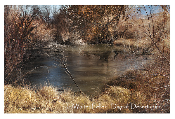
EcoSystems and Habitats Tree Dominated Wildlife Habitats Desert Riparian (DRI) Tamarisk, Mesquite, Fremont Cottonwood Vegetation Desert riparian habitats include dense stands of small, bushy trees or tall shrubs (Küchler 1977) to woodlands of small to medium-sized trees (Cheatham and Haller 1975).

These habitats occur adjacent to permanent water, such as streams and springs, or areas annually flooded or naturally watered from below (Parker and Matyas 1981). This habitat commonly forms a sharp ecotone with adjacent, shorter, more open desert communities.

The height of riparian vegetation varies according to the constituent plant species; willow thickets are between 1 to 3 m (3 to 10 ft) in height (Cheatham and Haller 1975), whereas Fremont cottonwoods may reach over 24 m (80 ft). Tree species vary with each desert river type. The overstory species include tamarisk, velvet ash, mesquite, screwbean mesquite, Fremont cottonwood, and willows such as Gooding, Hinds, and arroyo (Bradley and Deacon 1967, Cheatham and Haller 1975, Küchler 1977, Paysen et al. 1980, Parker and Matyas 1981).

The subcanopy has smaller plants of the canopy species and also includes quailbush, Mojave seablight, desert lavender, seep willow, and arrowweed (Bradley and Deacon 1967, Küchler 1977. Paysen et al. 1980, Parker and Matyas 1981). Other names for Desert Riparian habitat include Cottonwood Series; Arrowweed Series (Payson et al. 1980, Parker and Matyas 1981); Tamarisk Series (Parker and Matyas 1981); Saltcedar Series; Mesquite Series; Willow Series (Payson et al. 1980); Colorado River Bottomland Woodland 6.12; Willow Thickets – 6.24; Southern Alluvial Woodland – 6.31 (Cheatham and Haller 1975), and Alkali Scrub Woodland – 48 (Küchler 1977). Habitat Stages Vegetation Changes– 1;24.S-D. Desert Riparian habitats may exist as a variety of habitat stages ranging from seedlings through tree/shrub to large tree. Canopy development and plant density depend on available water, plant species, and site characteristics. Length of Stages. The duration of successional stages for Desert Riparian is not reported, but likely varies depending on disturbance factors, including fire and floods, as well as groundwater and precipitation patterns. Biological Environment Desert riparian habitats often occur adjacent to other desert habitats, including Desert Wash (DSW), Desert Succulent Shrub (DSS), Desert Scrub (DSC), Joshua Tree (JST), Alkali Scrub (ASC), and Palm Oasis (POS). The taller and denser desert riparian habitats typically form a sharply defined border with the surrounding generally shorter and sparser desert habitats. Wildlife Considerations– The value of these rare desert river areas to animal populations is very high. These habitats have more diversity and numbers of birds and other wildlife than most other desert habitats (England et al. 1981)(No England et al. 1981 in Habitat Lit Cite. I used England et al. 1984 as Lit Cite at end.) with the possible exception of some of the Palm Oasis habitats. The dense shrubs and permanent waters provide food, cover, and water for the other wildlife. Physical Setting Soils range from silty alluvial to rocky, sandy, well-drained types (Bradley and Deacon 1967, Cheatham and Haller 1975). Soils are typically moist but some may be dry on the surface with moisture beginning a few meters below (Cheatham and Haller 1975). Desert Riparian habitats do not occur on saline soils (Parker and Matyas 1981), but often occur along permanent streams in canyons or on river sediments in wider valleys. They can also be found in various landforms where the water table reaches or is very close to the surface. The habitats usually experience hot summers, dry with cool to cold, and wet winters. Highest July temperatures range from 30 to 42 C (86 to 107 F). Lowest January temperatures range between 7 and 6 C (19 and 42 F) (Rowlands et al. 1982, P. G. Rowlands pers. comm.). Most precipitation is in winter, but summer rainfall occurs especially in southeastern California. Total rainfall is between 8 and 25 cm (3.1 to 9.8 in) each year, and possible water loss through evaporation and plant transpiration is 3 to 17 times greater than the rainfall (Rowlands et al. 1982, P. G. Rowlands pers. comm.).

Distribution Desert Riparian habitats occur along permanent streams and at areas where the water emerges from the ground, such as seeps and springs, within Mojave and Sonoran deserts, and within desert canyons of the Peninsular ranges. Habitats usually are found below 900 m (3000 ft) in elevation; however, willow thickets can occur far higher up into the mountainsides—Cheatham and Haller, 1975.

AI4.0

The Ebb and Flow of Predator and Prey: Bobcats, Coyotes, and Rabbits

Nature has a fascinating way of keeping populations in check, and the relationship between predators like bobcats and coyotes, and their prey, such as rabbits, is a perfect example. This interplay, known as the predator-prey cycle, shows how species rely on one another and the environment in a delicate balance.

How the Cycle Works

  1. Rabbit Population Rises:
    When conditions like plentiful vegetation occur, rabbit populations grow rapidly. This abundance creates a feast for predators like bobcats and coyotes, boosting their survival and reproduction rates.
  2. Predator Populations Grow:
    With more rabbits to hunt, bobcat and coyote numbers increase. However, this rise in predator populations leads to greater pressure on the rabbit population.
  3. Rabbits Decline:
    As predators hunt more rabbits, the prey population begins to shrink. Over time, this decline causes food shortages for predators, and their populations begin to drop as well.
  4. Predators Decline, Rabbits Recover:
    With fewer predators hunting them, rabbits get a chance to rebound. As their numbers increase again, the cycle resets.

Bobcats, Coyotes, and Competition

The dynamic between bobcats, coyotes, and rabbits isn’t just about predation—it also involves competition. Bobcats and coyotes often overlap in their territories and hunt similar prey. Coyotes, being larger and more aggressive, tend to dominate these interactions, sometimes pushing bobcats to hunt smaller animals or less ideal prey. This competition can influence the cycle by reducing the hunting success of one predator or altering its diet.

Environmental Factors and Complexity

The balance between these species is further influenced by environmental conditions like droughts, rainy seasons, and habitat changes. For example:

  • Wet Years: Abundant rainfall leads to more vegetation, boosting rabbit populations. This abundance can temporarily increase bobcat and coyote numbers.
  • Dry Years: Droughts can cause rabbit populations to crash, leaving predators struggling for food. Coyotes, being opportunistic scavengers, might switch to other food sources, while bobcats are more tied to hunting small mammals like rabbits.

Real-Life Applications

In ecosystems like the Mojave Desert, this predator-prey cycle plays out visibly. A surge in rabbit populations after a rainy season might be followed by a rise in bobcat and coyote numbers. But when the environment shifts—like during a drought—rabbit numbers plummet, causing predator populations to decline as well.

This dynamic highlights the interconnectedness of life. The ebb and flow of predator and prey aren’t just about who eats whom—it’s a rhythmic dance of survival influenced by competition, resource availability, and the environment. Understanding these relationships helps us appreciate the intricate web of life that keeps ecosystems thriving.

Layers of the Mojave

A Trip Through Time and Land The Mojave Desert may be perceived as a dry and empty place, but it is filled with stories, old powers, and different cultures. Its land has been changed over many thousands of years by geological events, water changes, and the movement of people. To the close observer, Mojave reveals itself in a complex picture, mixed with the strength of life and human creativity.

The ancient Mojave River and Lake Systems. One of the most captivating aspects of the Mojave is the ancient river and lake systems, especially the Mojave River and Lake Manix. These hydrological features are remnants of wetter eras—like fingerprints left behind by the Earth’s shifting climate.

The Mojave River, which flows underground and surfaces sporadically, has a unique course that defies conventional ideas about desert hydrology.

Simultaneously, the Lake Manix was developed during the Pleistocene epoch and proved that this area used to be a busy oasis.

A multidisciplinary approach will be needed to understand these systems: geologists will excavate tectonic forces and erosion patterns that sculpted the land; hydrologists trace pathways of ancient water flows and interpret how precipitation and groundwater worked together to create those features; archaeologists and anthropologists piece together early inhabitants’ lives, whose survival depended upon the river’s seasonal rhythms. Paleontologists delve into the fossil record and find megafauna that once roamed this region.

Human History Along the Mojave River

For thousands of years, Native peoples like the Piute and Chemehuevi thrived here in the Mojave, using its sparse resources wisely and skillfully. Rabbit Springs in Lucerne Valley and Resting Springs show their deep relation with the land. These vital water sources provided not only sustenance but also became way stations on trade routes spanning the desert.

When European settlers arrived, the Mojave became a route to conquest and commerce. Marl Springs, once a decent watering hole on the Mojave Road, is symbolic of that transformation: soldiers, miners, and traders carved trails that often clashed with the trails of Native peoples, forever changing the fabric of culture.

GEOLOGICAL WONDERS: A LIVING CLASSROOM

Notably, the Mojave Desert is also interesting for the unbelievably interesting landforms, such as the colorful rocks of Rainbow Basin and the beautiful views from Afton Canyon, called the “Grand Canyon of the Mojave.” More than just nice views, these landforms speak of millions of years past. Afton Canyon, for instance, has a striking shape because of huge drainage after Lake Manix some 15,000 years ago.

Events like this show that the Earth can change suddenly and in big ways. A visit to the Devil’s Punchbowl or the Indian Cove area of Joshua Tree National Park reveals the intricate dance between tectonic forces and erosion. On these hikes, one can easily see the scars from the San Andreas Fault and see how, over eons, the artistry of wind and water sculpted the landscape. These are not static relics but parts of a very dynamic Earth changed continuously through natural forces.

The Human Touch: Towns and Cultural Places Within a vast Mojave, human settlements are interesting focal points. Littlerock, Pearblossom, and Barstow each have their own story. Littlerock, with its farming background, exemplifies how communities can adapt in dry places. Barstow acts as a transportation center that illustrates how the desert serves to connect California’s interior with broader markets and cultures.

Places such as the Apple Valley Inn and the Pioneer Saloon at Goodsprings, Nevada, bring to mind the rough appeal of the Mojave’s recent history. Locals and travelers could mix together at such places, mixing usefulness with a style hint. The metal building of the Pioneer Saloon, sent from Sears and Roebuck, is one of a kind but lasting sign of early 20th-century cleverness. The Art and Culture of the Desert Thus, there have been many artists inspired by the Mojave’s simplicity and empty space. For example, the Goldwell Open Air Museum near Rhyolite, Nevada, reflects this artistic feeling. Here, sculptures rise from the desert floor, making us reflect on what remains and what doesn’t. Those pieces show how human creativity works with the strong, harsh environment. There’s also neon art popular in the Mojave. In Victorville, the altered sign of Sunland Ford, now reading “FAIR,” is a witty tip of the hat to design aesthetics of the mid-20th century. Neon, more commonly associated with bustling cityscapes, takes on a different meaning in the desert, where its light appears like a beacon through the dark of night. Learning and Exploring With a background in anthropology and studio art, the Mojave is just an endless wellspring of inspiration. Its history, from ancient lake systems to the rise and fall of towns, aligns perfectly with interdisciplinary research. One can craft a narrative that incorporates elements of geology, archaeology, and cultural studies, one with which audiences of all ages resonate. While education is about sharing facts, it’s also about getting people interested. Working complex topics into fun stories helps younger audiences understand the amazing things about places like Marl Springs or Lane’s Mojave River Crossing. Visual materials like maps and pictures can make these stories more real and give a better experience. Preserving the Mojave’s Legacy Keeping the Mojave safe is an ongoing challenge because building and climate change put its fragile ecosystems in danger. Pearblossom has a very nice balance between holding on to its cultural heritage and taking care of nature, thus being a very good example of sustainable development. Likewise, changing Cedar Springs into Silverwood Lake shows the good and the bad sides of changing nature for the needs of people. Places like Bickel Camp show us how important it is to preserve things at the local level. Usually taken care of by devoted people, these places really help keep the Mojave’s history alive for future generations. They connect us to the lives and stories of those who came before us. Personal Links to the Mojave Visiting places such as the Devil’s Punchbowl or Bickel Camp leaves an impression that will last. The visits are not just about seeing something good to look at in nature but also, in a way, make one feel connected to a place’s history. Talking with caretakers, walking on old paths, and just stopping to listen to the quiet of a desert make memories that last forever.

Having taught all manner of students, there is a deep wellspring of fulfillment in taking those personal experiences and translating them into teaching materials. The Mojave becomes a classroom where students can explore, not just facts, but the very essence of curiosity and discovery.

Looking Forward: What’s Next for the Mojave The story of the Mojave is not yet complete. We are still learning much from the study of its ancient systems and recent changes, about how it adapts and remains resilient. Interdisciplinary projects, by combining anthropology, geology, hydrology, and art, give us new perspectives in understanding and sharing its past. The ancient Mojave River and associated lakes form a very critical component of this research. From the past of this river and associated lakes, we can learn about greater trends related to climate change and human creativity. This information is not only for learning; it helps us understand how to manage water, protect the environment, and keep cultures safe in dry areas around the world.

Conclusion: A Place Full of Opportunities The Mojave Desert is replete with strong beauty and rich history. It is old and changing, tough but supportive. To those who take time to look more closely, the Mojave is more than simply a desert; it’s a living record, a work of art, and a guide. The Mojave keeps on inspiring people in so many ways: through research by scholars on ancient lake systems, preservation of historic sites, and production of educational materials, its story goes on and on, just like the river that carved it, connecting past, present, and future nonstop.

Mojave River Narrows

The Mojave River has two well-recognized bedrock constrictions: the Upper and Lower Narrows, located near Victorville in California. The constrictions occur where the river’s channel is narrowed because of resistant bedrock formations, which force the river through narrower gaps.

Upper Narrows: Above Victorville, the Upper Narrows is a reach where the Mojave River is cut through bedrock, making the channel narrower. This natural constriction allows the upwelling of groundwater that creates perennial flow in this reach of the river.

These areas have traditionally been used as recreational campsites and as points of water supply, such as was done at Lane’s Crossing just north of the Lower Narrows.

California’s Department of Water Resources

Lower Narrows: Downstream of the Upper Narrows, the Lower Narrows forms another place where the river is in contact with bedrock, creating a similar narrowing of the channel. This contraction also forces groundwater to surface, therefore maintaining a perennial flow in this area. The Lower Narrows is a significant landmark on the Mojave River and a crucial part of the river’s unique hydrology.

Department of Water Resources, California

These bedrock narrows are very important to the hydrology of the Mojave River, as they create perennial surface flows within an otherwise intermittent river system. The permanent water supply in these reaches maintains relatively diverse riparian habitats and has traditionally supplied resources critical to human uses within the region.

Day in the Sun

It seemed to be the right kind of day
with the sun and butterflies.

In between moments infinitely close
becoming moments in themselves.

Infinitely close and forever expanding
Unforgiven by false and manipulated

However, behind the scenes, in the Mind
Without the dubious and empty is a particular freedom

The Mojavekind, holistic, and accepting with indifference
To have experienced and explored times beyond reach.

Metal gate detail – The Portal – Dennis Rudolph


Macadam Paving and Its Significance on Route 66

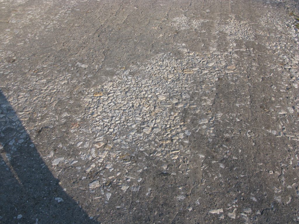
Macadam paving is a new method of road building. It was invented by a Scottish engineer called John Loudon McAdam in the early 19th century. This technique played a very vital role in constructing Route 66, one of the most famous highways in America. The method used small jagged stones that were compacted together to make a solid and durable surface.

Early roads would become muddy in wet weather or dusty in dry weather. Macadam paving provided a more durable, dependable roadway. Early macadam did not use a binding agent, relying on natural proper alignment of the stones. In later variations, tar or bitumen was added to create “tar-macadam,” or tarmac, onto which the first asphalt roads were built. When Route 66 was established in 1926, much of the highway was either unpaved or covered with dirt and gravel. It was rough going for cars to travel easily. A big improvement for many parts of the highway in those early years, especially country areas where roads were still under construction, was macadam paving.

It produced a superior surface for the growing number of vehicles using the roadway and it provided a drainage advantage as well. The road was now better equipped to handle those weather conditions that could make travel hazardous.

As more cars used Route 66 in the 1930s and 1940s, the road surface was improved. Many parts of Route 66 were changed to asphalt and concrete, which was stronger and gave the driver a smoother ride. But macadam paving helped a lot in the early years of the development of the road. It changed a mix of dirt and gravel roads into a better and easier route to use. Finally, the shift from macadam to superior paving techniques reveals one aspect of the evolution of Route 66. What began as a humble, crude roadway forged for early motorists would develop into one of the most important highways in the United States, connecting urban and rural landscapes from sea to shining sea. Today, when most associate Route 66 with asphalt and concrete paving, this may remain the influential Macadam on the formation of early identity in the famous highway.

Route 66

Dendrites

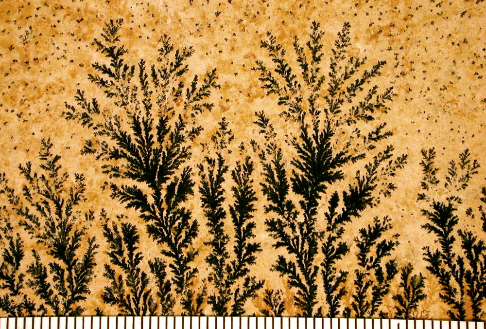
Dendrite fossils are not actual fossils but mineral formations that display branching, tree-like patterns on rock surfaces. These patterns are called “dendrites,” derived from the Greek word dendron, meaning “tree.” Due to their resemblance to ferns, mosses, or algae, they are often mistaken for fossilized plants.

Formation of Dendritic Patterns

  • Mineral Deposition: Dendritic patterns form when mineral-rich water percolates through cracks and fissures in rocks. As the water evaporates, minerals like manganese and iron oxides precipitate out of the solution.
  • Crystallization Process: These minerals crystallize in branching patterns along the rock’s surface or within its layers, creating intricate designs that mimic organic structures.
  • Environment: Such formations commonly occur in sedimentary rocks like limestone, sandstone, and shale, where groundwater movement is prevalent.

Distinguishing Features

  • Inorganic Origin: Unlike true fossils, dendrites do not result from the preservation of organic material. They are entirely inorganic, formed solely by mineral processes.
  • Lack of Cellular Structure: Under magnification, dendrites lack the cellular details that characterize fossilized plant material.
  • Surface Patterns: Dendritic formations are typically two-dimensional patterns on rock surfaces, whereas fossils often have three-dimensional structures.

Common Misconceptions

  • Mistaken Identity: The visual similarity to plant life leads many to incorrectly identify dendrites as fossilized flora.
  • Educational Importance: Understanding dendrites helps in learning how to differentiate between mineral formations and actual fossils, which is crucial in fields like paleontology and geology.

Significance in Geology and Collecting

  • Scientific Interest: Dendrites provide insights into mineral deposition processes and the geological history of the area where they are found.
  • Aesthetic Value: Their intricate and visually appealing patterns make dendritic rocks popular among collectors and are often used in jewelry and decorative items.

Examples and Notable Locations

  • Solnhofen Limestone, Germany: Known for fine-grained limestone that often displays dendritic patterns, sometimes mistaken for fossilized plants.
  • Utah and New Mexico, USA: Regions where dendritic manganese oxides are commonly found on sandstone surfaces.
  • Chiastolite Stones: A variety of andalusite that shows cross-shaped (cruciform) patterns due to carbonaceous impurities, sometimes confused with dendritic patterns.

Conclusion

While dendritic patterns, or “dendrite fossils,” captivate the imagination with their lifelike appearances, they are mineralogical phenomena rather than remnants of ancient life. Recognizing the difference between these mineral formations and true fossils enhances our understanding of geological processes and helps prevent misinterpretations in both amateur and professional studies.


References

  • Mineralogy and Geology Texts: For detailed explanations of mineral formation processes.
  • Field Guides on Fossil Identification: To learn how to distinguish between fossils and mineral patterns.
  • Geological Surveys: For information on regions where dendritic formations are prevalent.

Hassayampa River


The Legend of the Hassayampa River in Wickenburg, Arizona, is a fascinating piece of local folklore that captures the imagination of those who hear it. According to the legend, anyone who drinks from the Hassayampa River can never tell the truth. This river, which flows near the historic town of Wickenburg, has been the subject of stories and tall tales among locals and visitors alike.

Wickenburg is a town rich in history, often associated with the early mining and ranching days of the American West. The Hassayampa River, with its sometimes elusive water flow, winds through this rugged landscape, contributing to the area’s mystique and charm. The legend likely originates from the playful exaggerations common among miners and settlers of the time, symbolizing perhaps the transformative nature of the West or the elusive fortunes sought by those who ventured there.

The story of the Hassayampa River is a testament to the creativity and humor of the people in the region. It embodies the spirit of the Old West, where truth could be as variable and shifting as the sands of the desert. Over the years, it has become a cherished part of Arizona’s folklore, reminding us of the colorful history and enduring mysteries of the American Southwest.

Amphicyonidae

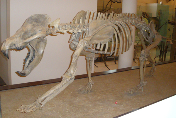
Bear dogs, or Amphicyonidae, were representatives of an extinct family of carnivorous mammals that lived during the Miocene Epoch. They possessed peculiar features because they combined some aspects of modern bears and dogs; hence, this name was attached to them. Fossils of bear dogs were found in parts of the world; one is Barstow Fossil Beds in California, which is also an important center for paleontologists studying the ancient ecosystems of North America.

Physical Characteristics:

Size: They were very varied in size, from the smallest, which was about the size of modern foxes, to the largest, which rivaled grizzly bears in size and strength.

Appearance: Bear-like bodies, but with powerful jaws and sharp teeth adapted for hunting, while their legs were longer and more dog-like in structure, running and chasing their prey.

Diet: These were carnivorous animals that probably preyed upon smaller mammals and did so perhaps by ambush and endurance hunting, just like the big cats or wolves of today do.

Barstow Fossil Beds: These fossil beds, if situated within the Mojave Desert, have yielded a wide variety of prehistoric animal remains, including those of bear dogs. This is a formerly much more lush environment with forests, rivers, and wetlands that support diverse wildlife.

Miocene Environment: When bear dogs ranged into the Barstow area, it was a temperate region teeming with ancient species such as early horses, camels, rhinos, and mastodons. Bear dogs were likely top predators in this ecosystem.

Evolution: The various fossil discoveries in Barstow will help scientists trace the evolution of flesh-eating mammals. The bear dogs belonged to the early lineage that gave rise to present-day bears, dogs, and all other large predators.

Extinction: Bear dogs flourished for millions of years but died out toward the end of the Miocene Epoch. Their extinction may be related to climate changes and competition with other carnivores, ancestors of modern cats and wolves, which were better adapted to changing environmental conditions.

Importance of the Barstow Fossil Discoveries:

Fossils like bear dogs found around Barstow give rare glimpses into an ancient world. Such finds enable paleontologists to reconstruct the ancient ecosystems of North America and learn more about how animal species, including early carnivores, adapted and evolved.

The bear dog fossils from near Barstow point to the emergence of very diversified ecosystems in which the bear dogs were among the top predators of their time. Their fossils are an important determinant that leads to unraveling their biology and the environment to which they belonged millions of years ago.

Red Hill Cinder Mine

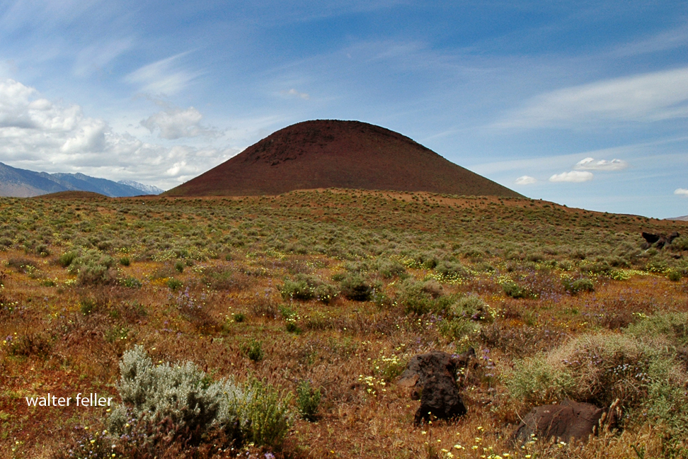
The Red Hill Cinder Mine is an active volcanic site in the Coso Volcanic Field where red and black cinders are extracted from a cinder cone. What makes this spot so unique, however, is volcanic bombs that have been thrown out during previous eruptions-large pieces of solidified lava. These bombs have been picked up and placed around the mining company’s office buildings.

Red Hill is one of the youngest volcanic formations in the area, with an estimated age of less than 10,000 years. A small flank eruption on the cone could have occurred within the last 1,000 years. If you drive south down Highway 395, you can see the small crater from that eruption on the northwest side of the cone.

CEMEX currently mines the Red Hill Quarry on the south flank of the cinder cone, crushing the volcanic rock into scoria for use in road construction and the manufacture of cinder blocks. Larger pieces of the rock are also used for landscaping.

Batteries Go Here

A cloaca is an opening in some animals, like birds, reptiles, and amphibians, where the digestive, urinary, and reproductive systems come together. It’s like a multi-purpose exit, handling waste and reproduction. In most mammals, these functions are separated into different exits, but in animals with a cloaca, everything comes out of the same spot.

Cedar Springs

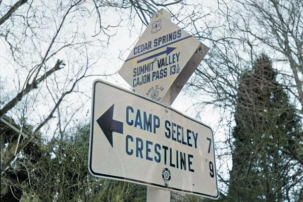
A tiny town, Cedar Springs, California, existed in the San Bernardino Mountains. Picture a quaint, peaceful village surrounded by towering trees and mountains, where residents go about their everyday routines. However, a major development occurred in the 1970s when engineers built a dam to form Silverwood Lake, resulting in the abandonment of all of Cedar Springs, which was ultimately submerged underwater.

There are no longer any homes or roads in the location once occupied by Cedar Springs; instead, a large and attractive lake now resides there. Silverwood Lake offers opportunities for individuals to fish, boat, camp, or enjoy the outdoors. Despite the town’s disappearance, its natural beauty remains, allowing one to envision what Cedar Springs was like when it was nestled in the mountains.

San Bernardino Mountains

Silverwood Lake

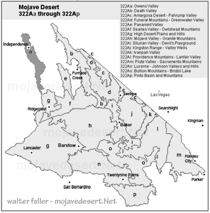
Owens Valley*

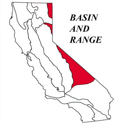
Owens Valley happens to be one of the most singular and interesting places in the United States. It is located in the western part of the continent – between the Sierra Nevada and the Inyo Mountains. This valley forms part of the geomorphic province of Basin and Range, characterized by mountains and valleys as unique features resulting from the process of Earth crust movement.

Geomorphology: The Shape of the Land

The Owens Valley lies within crust of the Basin and Range province, which is famous for its “horst and graben” structure. Consider the crust of the earth to be rifting apart: the surface breaks, and some blocks go down while others rise up. This process forms a pattern of highs and lows. Owens Valley is one of these low areas, known as a “graben,” while surrounding mountains are the high areas known as “horsts.” The elevation of the valley varies from about 3000 to 6000 feet and includes flat and gently sloping areas.

Erosion, the wearing away of rocks and soil by water and wind, and deposition combine in the process whereby these materials are laid down in new places. Through such continuous action, an alluvial fan—the fan-shaped deposit of soil and rocks at the base of the mountains—and a basin fill, or a layering of sediments on the floor of the valley, form over time.

Soil and Vegetation: Life on the Land

Soils in Owens Valley vary considerably. On the alluvial fans, Torrifluvents and Torriorthents soils are well drained and support a wide variety of plant life. Elsewhere in the basin-fill areas, the soils may be poorly drained and these areas may support different kinds of plants. There is even dune sand in places!

The vegetation of Owens Valley differs according to soil and location. You might find plants such as saltbush and greasewood that are tolerated on salty soils in the areas of basin fill. On the alluvial fans, there were plants like shadscale and hop-sage that could stand the drier conditions. Higher up on the fans, there is black bush with sagebrush. South of Owens Lake, creosote bush is the predominant plant.

Climate: Hot and Dry

Long-term temperatures and rainfall—Owens Valley has a hot and dry climate. Average annual precipitation, or the amount of rain that falls in an average year, is only about 4 to 8 inches. Most of this rain falls during the winter months. The mean annual temperature varies from 55° to 65° F. Because it is so dry, plants and animals must be tough in order to survive with little water.

Water: The Lifeline

Water plays a major role in the Owens Valley way of life. Along the middle of this long valley runs the Owens River, which furnishes water to many plants, animals, and people. Centuries ago, Owens Lake used to overflow periodically and send water to the neighboring valleys. Nowadays, so much of the Owens River water is exported to Los Angeles that Owens Lake is virtually dry.

Conclusion

Owens Valley is a place both fascinating in geology and ecology. Distinct landform, variety of soils, and flora hardiness testify to the ability of life to adapt to the rigors of heat and dryness. Understanding Owens Valley would help us recognize the sensitive links between land, water, plants, and animals that give this part of the world its special identity.

*AI

California to Salt Lake City

THE OVERLAND MAIL
1849-1869
Promoter of Settlement
Precursor of Railroads by
LE ROY R. HAFEN, PH.D .
Historian, The Stale Historical and Natural History Society of Colorado

The first United States mail between California and Salt Lake City was established in 1851. This route was advertised January 27, 1851, and the thirty-seven bids received ranged from $20,000 for “horseback or two horse coach service,” to $200,000 per year for service with ” 135 pack animals with 45 men, divided into three parties.” One bid was for a four-horse coach with a guard of six men, at $135,000 per year. The lowest bid was accepted and a contract was made in April with Absalom Woodward and George Chorpenning for a monthly service at $14,000 per year; the trip each way was to be made in thirty days. No points were designated at which the route should touch, but it was to go “by the then traveled trail, considered about 910 miles long.”

Chorpenning and his men left Sacramento May 1, 1851, with the first mail. They had great difficulty in reaching Carson valley, having had to beat down the snow with wooden mauls to open a trail for their animals over the Sierras. For sixteen days and nights they struggled through and camped upon deep snow. Upon reaching Carson valley, Chorpenning staked off in the usual western manner, a quarter section of land and arranged to establish a mail station. The town of Genoa, Nevada, grew-up on this site. Chorpenning and several men continued eastward and reached Salt Lake City June 5th, having been delayed somewhat by snow in the Goose Creek mountains.

Throughout the summer, difficulties were experienced with the Indians; and Woodward, who left Sacramento with the November mail, was killed by them just west of Malad River in northern Utah. The December and January mails from Sacramento were forced to return on account of deep snow, but the February (1852) mail was pushed through by way of the Feather River Pass and reached Salt Lake City in sixty days. The carriers endured frightful sufferings; owing to the fact that their horses were frozen to death in the Goose Creek mountains, they had to go the last two hundred miles to Salt Lake City on foot. Permission was obtained from the special agent in San Francisco to send the March mail down the coast to San Pedro and thence by the Cajon Pass and the Mormon trail to Salt Lake City. During the summer of 1852 the service continued to be performed across northern Nevada by way of the Humboldt River; but as winter approached, arrangements were made with the mail agent at San Francisco to carry the Utah mail via Los Angeles during the winter months. The Carson valley post office was supplied monthly by a carrier on snow-shoes. Fred Bishop and Dritt were the first carriers and they were succeeded by George Pierce and John A. Thompson. The latter, “Snowshoe Thompson,” a Norwegian by birth, made himself famous in this section by his feats on snow-shoes during succeeding winters. The shoes used were ten feet long and of the Canadian pattern. He often took one hundred pounds upon the journey between Placerville and Carson, and made the trip in three days to Placerville and the return journey in two days.

With the interruption by bad weather of the mail service east of Salt Lake City, the mail was sent westward to San Pedro, where it was transmitted by steamer to the Atlantic seaboard. This increased the weight of Chorpenning mail from about one hundred pounds to about five hundred pounds. For this additional service Chorpenning made claim and in 1857 received payment on a pro rata basis.

The causes of the irregularity and interruption of the mail service to Utah had not been explained to the Postmaster-general by the Special Agent at San Francisco and so, upon the grounds of the derangement of the service, the Postmaster-general annulled the contract with Chorpenning, and made one with W. L. Blanchard of California. The new contractor was to receive $50,000 per year, and was to maintain a fortified post at Carson valley. Upon learning of this new arrangement in January, 1853, Chorpenning set out for Washington and, after setting forth his case before the new Postmaster-general, was reinstated. A verbal agreement was made that the compensation should be increased to $30,000 per year and permission was given to carry the mails via San Pedro during the winter months.

During the first three years (1851-4) the Utah-California mail was carried except in winter, by the old emigrant route. This route lay from Sacramento
through Folsom, Placerville, along the old road through Strawberry and Hope valleys to Carson valley. From this point it led to the Humboldt, which stream
was followed nearly to its source. Leaving the Humboldt the route led northeastward into southern Idaho in the vicinity of the Goose Creek mountains, and thence southeasterly around the north side of Great Salt Lake to Salt Lake City.

In the lettings of 1854, the Utah-California mail route was changed to run from Salt Lake City over the Mormon trail to San Diego. Chorpenning was again the successful bidder. The mail was to be carried monthly each way, through in twenty-eight days, for a compensation of $12,500 per year. Chorpenning thought it worthwhile to enter a low bid to ensure getting the contract since he expected that the service would probably be increased to a weekly schedule, the time per trip reduced, and the compensation increased.

The service began July 1, 1854, and was to continue for four years. The mail was carried on horseback or on pack mules. During that first summer, Indian difficulties arose and continued at intervals for months. The emigration fell off and expenses on the route increased. Similar difficulties had been encountered by the contractors east of the Rocky Mountains, who appealed to Congress and received increased remuneration by the act of March 3, 1855. Encouraged by their success with Congress, and inasmuch as his difficulties continued, Chorpenning went to Washington and presented his claims in June, 1856. Congress responded with an act for his relief March 3, 1857. It provided that the compensation be increased to $30,000 per year from July 1, 1853, to the termination of the contract in 1858; that the full contract pay be allowed during the suspension of the contract in the spring of 1853; and that the Postmaster-general make an additional allowance on a pro rata basis for the extra service performed prior to 1853. A total of $109,072.95 was allowed and paid under the provisions of this act.

During the four years of the duration of the contract (until July i, 1858), the mail was carried with fair regularity, and often in less than schedule time. The service was usually performed on horseback, but a wagon was used occasionally. The mail of December, 1857, was taken from Salt Lake City to Los Angeles by wagon in twenty-six days, while on horseback the trip often did not consume more than twenty days.

Wells Fargo and Company, Adams and Company, and other express companies maintained express service on the line during this period (1854-8). There was also much freighting and some emigrant travel over the road. The Mormon “State of Deseret” had included the whole of this route with its terminus upon the Pacific Coast. A colony was planted by these pioneers at San Bernardino in 1851 and considerable trade and intercourse was carried-on over this road.

The route was in general that of the present “Arrowhead Trail” automobile road. From Los Angeles the route led to San Bernardino, through Cajon Pass to the Mohave River, which was followed for fifty miles. From the Mohave River the route lay to the north to Bitter Springs, then turned eastward by Kingston Springs to Las Vegas, Nevada. From this famous resting station a dry stretch of sixty miles was crossed leading to the Muddy Creek. After crossing another “bench” the Virgin River was reached, and this stream was followed to Beaver Dams, Arizona. Leaving the Virgin River the road crossed the “slope” and over a little mountain range to the Santa Clara Creek, which stream was followed to the vicinity of the famous Mountain Meadows. From Mountain Meadows the route led to Cedar City and thence almost due north through the Mormon settlements of Parowan, Beaver, Fillmore, Nephi, Payson, Provo, and Lehi to Salt Lake City.”

Before the termination of the contract on this route the policy of extensive increases in the western mail lines was inaugurated, and partisans of the “Central Route” via Salt Lake City and across northern Nevada were demanding service upon that more direct route to San Francisco. Accordingly, in 1858 this Los Angeles to-Salt Lake City route was discontinued and the original route of 1851 was re-established and put upon an improved basis.

–

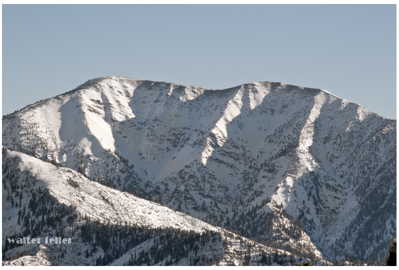
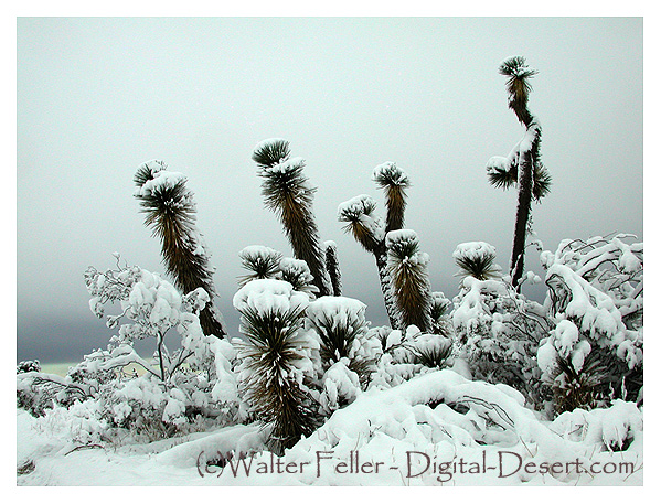
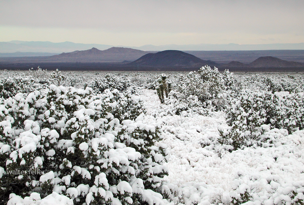
Why is there Snow?

Snow is one of nature’s most captivating occurrences, turning landscapes into winter wonderlands. Have you ever wondered why snowfall occurs? Let’s discover the icy world of snow and understand how it forms.

It must be Cold

In order for snow to form, the temperature needs to be cold, particularly below freezing (32°F or 0°C). When the atmosphere freezes, moisture can change into ice without going through the liquid stage. The process of making snow starts with this important initial stage. Cold temperatures act like a natural freezer, providing the right environment for water to transform into ice crystals.

Humidity in the Atmosphere

Despite being invisible, water vapor is constantly present in the air. The moisture originates from lakes, oceans, rivers, and even plants. As moist air rises into the atmosphere, it loses heat and becomes cooler. The reduced ability of colder air to hold water vapor causes the vapor to condense into tiny droplets, eventually forming clouds.

Cloud formation

Clouds are primarily made up of tiny water droplets or ice particles. When the air temperature cools enough within these clouds, the water droplets freeze and change into ice crystals, forming the basis of snowflakes. Ice crystals in clouds collide, stick together, and grow in size, forming intricate snowflake patterns.

When Snowflakes Fall

When the snowflakes become thick, they start falling from the clouds. While descending, they pass through different layers of the atmosphere. If the temperature by the surface is freezing, the snowflakes stay whole and fall as snow. If the temperature is warmer near the surface, snowflakes may melt and change into rain or sleet before reaching the ground.

Snow

Different forms of snow can occur based on the temperature and moisture content in the atmosphere. During extreme cold, snow becomes light and airy, ideal for creating snow angels and skiing. When the temperature gets closer to freezing, the snow becomes more moist and dense, perfect for making snowmen and having snowball fights.

Summary

Snow is an intriguing outcome of low temperatures, moisture, and cloud movements. It starts with chilled air turning water vapor into ice crystals. The snowflakes are made of crystals, creating a white blanket when they fall to the ground. Snow creates happiness and thrill, transforming the world into a winter wonderland of leisure pursuits. The next time you witness snowflakes descending, remember nature’s process of mixing cold and moisture to form a magical winter scene!

Yucca Moths and Joshua Trees: A Mutualistic Relationship

Pronuba moth in a yucca blossom. NPS

https://mojavedesert.net/trees/yucca-brevifolia

Introduction The relationship between Joshua trees (Yucca brevifolia) and yucca moths (Tegeticula synthetica) is a classic example of mutualism, where both species benefit from their interaction. This symbiotic relationship is essential for the reproduction of Joshua trees and the lifecycle of yucca moths.

Yucca Moth Pollination Process

  1. Flowering: Joshua trees typically bloom from February to late April, producing clusters of creamy white to green flowers. The blooming process depends on sufficient rainfall and a winter freeze.
  2. Moth Activity: Female yucca moths visit Joshua tree flowers during their active period. Unlike most insects that visit flowers for nectar, yucca moths have a unique role. The female moth collects pollen from the anthers of one flower and forms it into a ball using specialized tentacles near her mouth.
  3. Pollination: The moth deliberately transfers the pollen ball to the stigma of another Joshua tree flower. This deliberate act ensures cross-pollination, which is crucial for the genetic diversity and reproductive success of the Joshua tree.
  4. Egg Laying: After pollinating the flower, the female moth lays her eggs inside the flower’s ovary. This ensures that her larvae will have a food source when they hatch.
  5. Larval Feeding: As the seeds develop within the flower’s ovary, the moth eggs hatch into larvae. These larvae feed on a portion of the developing seeds. Despite this seed predation, enough seeds typically remain viable to ensure successful reproduction of the Joshua tree.

Selective Abortion Joshua trees have developed a mechanism to ensure seed survival despite the larvae feeding. They can selectively abort ovaries that contain too many moth eggs. This limits the number of larvae that can develop and ensures that sufficient seeds remain viable for the tree’s reproduction.

Mutual Benefits

  • For the Joshua Tree: The deliberate pollination by the yucca moth increases the likelihood of successful seed set and promotes genetic diversity due to cross-pollination.
  • For the Yucca Moth: The Joshua tree provides a secure environment for the moth to lay its eggs and a reliable food source for the larvae.

Unique Adaptations

  • Yucca Moth: Specialized tentacles for collecting and transferring pollen. This adaptation is unique among insects and has specifically evolved to pollinate Joshua trees.
  • Joshua Tree: Flower structure that accommodates the yucca moth’s pollination behavior. The tree’s ability to selectively abort seed pods with too many larvae is also a crucial adaptation for managing seed predation.

Ecological Importance The relationship between Joshua trees and yucca moths is a cornerstone of the Mojave Desert ecosystem. This mutualism ensures the reproduction and survival of Joshua trees and supports a complex web of life, providing food and habitat for various species of birds, mammals, reptiles, and insects.

Conclusion The intricate pollination mechanism between Joshua trees and yucca moths highlights these species’ deep co-evolution and interdependence. This mutualistic relationship is essential for their survival and plays a vital role in maintaining the ecological balance of the Mojave Desert.

The Evolution of Muroc: From Desert Wasteland to Aviation and Racing Hub

Geological and Environmental Background

Pleistocene Era (circa 2.5 million years ago) The origins of Rogers Dry Lake, located in the Antelope Valley within the Mojave Desert, trace back to the Pleistocene Era, around 2.5 million years ago. As a pluvial lake, it boasts an incredibly flat, smooth, and hard surface, which can withstand pressures up to 250 psi. These unique geological characteristics made Rogers Dry Lake a natural choice for aviation and automotive speed trials. Covering approximately 65 square miles, the lakebed forms a rough figure eight and is known for its harsh climate, experiencing extreme temperatures, violent dust storms, and mesmerizing sunsets.

Early Settlement and Development

Pre-1876: Sparse Population and Railroad Expansion Before significant settlement, the area was primarily inhabited by occasional prospectors searching for mineral wealth. The Southern Pacific Railroad established a water stop near the lakebed in 1876. In 1882, the Santa Fe Railroad extended westward from Barstow toward Mojave, establishing another water stop at the edge of what was then called Rodriguez Dry Lake. By the early 1900s, the name “Rodriguez” had been anglicized to “Rogers.”

1910: The Corum Family and the Founding of Muroc In 1910, the Corum family settled at the lakebed, naming the area “Muroc” by reversing their last name after their original choice, “Corum,” was rejected due to its similarity to “Coram, California.” The Corum family established a general store and post office, attracting other homesteaders and helping to develop the area. Their efforts laid the foundation for what would become a significant site in both aviation and automotive history.

Early Racing Events

1920s: The Dawn of Speed Events Muroc Dry Lake became a prominent site for American Automobile Association (AAA) sanctioned speed events during the 1920s. The affordability and modifiability of the Model T made it the preferred vehicle for early hot rodders. Roadsters were favored among racers, but touring cars were also frequently raced. In May 1923, Joe Nikrent set a speed record of 108.24 miles per hour in a stripped-down Buick. The following year, Tommy Milton achieved 151.26 mph in a Miller-powered race car. In 1927, Frank Lockhart reached a speed of 171 miles per hour, further cementing Muroc’s reputation as a premier racing venue.

October 9, 1927: Southern California Champion Sweepstakes One of the most significant early racing events was the Southern California Champion Sweepstakes, held on October 9, 1927. Organized by Earl Mansell from Pasadena, California, the event featured five classes of competition:

  1. Ford Roadsters: Open to any Ford roadster with or without fenders or windshields, requiring a hood and turtle deck.
  2. Ford Coupes: Required fenders, hood, windshield, and doors.
  3. Ford Touring Cars: Fenders and windshields were optional.
  4. Special Flathead Race: Open to any body style with a flathead engine, offering refunded entry fees to winners of the previous events.
  5. Championship Sweepstakes: Open to any roadster, coupe, or touring car, with the option to race without windshield or fenders.

Organized Racing and the SCTA

1931: The First Organized Speed Trials In 1931, one of the first known organized amateur speed trials took place at Muroc, sponsored by Gilmore Oil Company of Los Angeles and organized by George Wight, owner of Bell Auto Parts. Recognizing the need for coordinated rules and regulations, Wight invited hot rodders to an organizational meeting in East Los Angeles. Early rules categorized cars based on engine types, including Model T flatheads, Model T Rajos, Model T Frontenacs and Chevrolets, Model A flatheads, and Model A overhead valve conversions. Supercharged cars were not allowed to compete. The first organized meet was held on March 25, 1931, followed by another on April 19, 1931. Safety measures were implemented, such as a 40 mph speed limit for returning cars and penalties for jumping the start.

Formation of the Muroc Racing Association By the end of 1931, the Muroc Racing Association was formed, complete with officers and a race program. The association collected a one-dollar entry fee to cover expenses, and the Purdy Brothers developed an electrical timer to clock the cars’ speeds, further formalizing the events.

1932-1933: Changes in Classification In 1932, the trials continued under the same rules, but significant changes in car classification were introduced. Cars were now categorized as either stock-bodied or modified. Stock-bodied cars could have certain parts removed, while modified cars were significantly altered. Between the 1932 and 1933 seasons, classifications shifted to speed and body type, with new classes based on potential top speeds. This change aimed to ensure fairness and safety, with measures like painting speedometers with white shoe polish to prevent drivers from knowing their exact speed.

Military Establishment and World War II

September 1933: The Arrival of the Army In 1933, the United States Army arrived at Muroc, recognizing the lakebed’s potential as an airfield. The Muroc Bombing and Gunnery Range was established, and by 1937, the United States Army Air Corps set up Muroc Air Field for training and testing purposes.

World War II and the Establishment of Muroc Army Air Base During World War II, Muroc Army Air Base was activated, serving as a major training site for bomber crews and fighter pilots. The flat, hard surface of Rogers Dry Lake was ideal for aircraft testing, including early jet planes like the Bell XP-59A and the Lockheed XP-80. On October 1, 1942, the Bell XP-59A Airacomet, America’s first jet plane, made its first flight at Muroc. The base played a crucial role in the war effort, training crews and testing new aircraft.

Post-War Developments After the war, Muroc continued to be a central hub for aviation research and development. The Bell X-1, piloted by Capt. Charles E. “Chuck” Yeager, broke the sound barrier on October 14, 1947, marking a significant milestone in aviation history. The base was renamed Edwards Air Force Base in February 1948 in honor of Capt. Glen W. Edwards, who died in a test flight accident. By 1950, Edwards Air Force Base was officially dedicated and recognized as the U.S. Air Force Flight Test Center (AFFTC).

The Hot Rodding Era

Post-War Racing and El Mirage The end of World War II marked a transition from racing activities at Muroc to El Mirage, another dry lakebed south of the air base. While El Mirage was not as ideal as Muroc, it continued to host hot rodding events. The SCTA (Southern California Timing Association) organized several “reunion” races at Muroc in 1995, bringing together a generation of racers who had participated in early SCTA events. However, racing activities at Muroc were halted following the events of September 11, 2001, due to security concerns.

Legacy and Continued Significance

Aviation and Hot Rodding Heritage Muroc’s dual legacy as a pioneering site for both aviation and hot rodding remains significant. Edwards Air Force Base continues to be a premier flight testing center, contributing to numerous advancements in aerospace technology. Meanwhile, the early days of hot rodding at Muroc are fondly remembered by enthusiasts and are considered a foundational period in the history of American motorsports.

Current Status and Future Prospects While racing activities at Muroc have ceased, El Mirage remains an active site for hot rodding events. The SCTA continues to organize races, preserving the spirit and tradition of early speed trials. There is hope that, in the future, Muroc might once again host racing events, allowing the sands to echo with the sounds of high-speed automotive competition.

In conclusion, Muroc’s history is a testament to its unique geographical features and its adaptability, serving as a critical site for both military aviation and automotive racing. The integration of these diverse historical elements highlights Muroc’s significant contribution to American technological and cultural heritage.
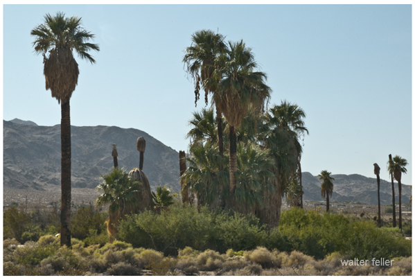
Aviation in the Antelope Valley

/antelope-valley/

The story of the aeronautics industry in Antelope Valley, California, is like a thrilling adventure packed with innovation, daring feats, and a community of passionate people pushing the boundaries of what’s possible.

The Early Days: A Desert Transformed

Dryden Flight Research Center and Edwards Air Force Base 1983.
(Courtesy of NASA, NASA/Dryden Flight Research Center)

In the 1930s, Antelope Valley’s vast, quiet deserts started humming with activity as the Muroc Army Air Field, which would become Edwards Air Force Base, took root. The endless skies and isolated expanses were perfect for daring pilots to test new aircraft far from prying eyes.

World War II: A Boom of Innovation
Fast forward to the 1940s, and the skies over the Antelope Valley were buzzing with the energy of World War II. The desert became a crucible for innovation, with pilots and engineers working tirelessly to develop and test new aircraft that would give the Allies an edge.

Breaking Barriers: The Jet Age
Then came the post-war era and, with it, a leap into the unknown. In 1947, Chuck Yeager made history by breaking the sound barrier in the Bell X-1 at Edwards Air Force Base. Imagine the exhilaration of that moment—the roar of the jet, the shattering of records, and the sense of stepping into a new era of aviation.

The Space Race: Reaching for the Stars
The 1960s brought the space race, and the Antelope Valley became a launchpad for dreams of space exploration. NASA’s Flight Research Center at Edwards AFB buzzed with activity. Engineers and astronauts worked side by side, testing the limits of humans and machines. The X-15 rocket plane, for instance, soared to the edge of space, paving the way for the Apollo missions.

Modern Marvels: From Stealth to Space
The Antelope Valley continued to be a hotbed of innovation in the following decades. The 1980s and 1990s saw the development of stealth technology, leading to iconic aircraft like the B-2 Spirit bomber and the F-117 Nighthawk. Every test flight was a step into the unknown, with engineers and pilots working together to make the impossible possible.

The Commercial Space Age: New Horizons
As we moved into the 21st century, the Mojave Air and Space Port became a playground for the new pioneers of space—the private companies aiming to make space travel accessible to all. Think of the excitement as companies like Virgin Galactic and SpaceX took bold steps towards commercial spaceflight, testing rockets and spacecraft in the very place where aviation history had been made for decades.

A Community of Innovators
One thing remained constant throughout these eras: the spirit of the people in Antelope Valley. This community has been the heart and soul of aviation innovation, from the test pilots risking their lives to the engineers working late into the night to the local educators training the next generation of aerospace workers.

Milestones and Memories
The Antelope Valley is more than just a location; it’s a living testament to human ingenuity and endurance. It’s where the sound barrier was broken, the Space Shuttle first touched down, and new frontiers in aviation and space continue to be explored.

The story of the aeronautics industry in the Antelope Valley celebrates human achievement. It’s a narrative filled with high-flying dreams, ground-breaking successes, and the persistent pursuit of the skies and beyond.

Aeronautics Industry in Antelope Valley, California

The Antelope Valley, located in northern Los Angeles County and the southeast portion of Kern County in California, is a significant hub for the aeronautics industry. This region is often referred to as the “Aerospace Valley” due to its rich history and ongoing contributions to aviation and space exploration. Here are some key highlights about the aeronautics industry in the Antelope Valley:

  1. Edwards Air Force Base:
    • Edwards AFB is a major center for flight testing and research. It is home to the Air Force Test Center and the Air Force Test Pilot School.
    • Historically, it has been the site for testing experimental aircraft, including the X-1, in which Chuck Yeager broke the sound barrier, and the Space Shuttle, which landed here after its missions.
  2. NASA’s Armstrong Flight Research Center:
    • Located within Edwards Air Force Base, this NASA center focuses on aeronautics research and testing advanced aircraft technologies.
    • Notable projects include the testing of unmanned aerial vehicles (UAVs) and new propulsion systems.
  3. Mojave Air and Space Port:
    • The Mojave Air and Space Port is a civilian aerospace test center and home to several private aerospace companies.
    • Companies such as Virgin Galactic, Stratolaunch, and Masten Space Systems have conducted significant testing and development here.
  4. Plant 42:
    • Air Force Plant 42 in Palmdale is another critical facility, serving as a production and testing site for major aerospace companies like Lockheed Martin, Northrop Grumman, and Boeing.
    • It is known for the assembly and modification of aircraft, including the B-2 Spirit and the F-35 Lightning II.
  5. Aerospace Companies:
    • Several prominent aerospace companies have a significant presence in the Antelope Valley. Northrop Grumman, Lockheed Martin, and Boeing all conduct major regional operations.
    • These companies are involved in developing and testing cutting-edge technologies for military and civilian applications.
  6. Historical Significance:
    • The region has a storied aviation history, from the early days of flight testing to the modern era of space exploration.
    • It has played a crucial role in developing many iconic aircraft and spacecraft.
  7. Educational and Research Institutions:
    • Institutions like Antelope Valley College, California State University, and Bakersfield offer programs related to aerospace and engineering, supporting the industry with a skilled workforce.

The Antelope Valley continues to be a cornerstone of innovation and progress in the aeronautics industry, playing a pivotal role in advancing aerospace technology and exploration.

Aviation Leaders in the Valley

The Antelope Valley has been home to numerous aviation leaders who have significantly contributed to advancing aerospace technology. These pioneers and visionaries have left an indelible mark on the industry, driving innovation and inspiring future generations. Here are some notable aviation leaders from the Antelope Valley:

  1. Chuck Yeager
    Accomplishment: First person to break the sound barrier.
    Contribution: On October 14, 1947, Yeager piloted the Bell X-1 at Edwards Air Force Base, achieving supersonic flight. His courage and skill made him an aviation legend and set the stage for future high-speed aircraft development.
  2. Jack Northrop
    Accomplishment: Founder of Northrop Corporation.
    Contribution: Jack Northrop was a visionary engineer and designer known for his innovative aircraft designs, including the flying wing concept. His company played a crucial role in developing advanced military aircraft.
  3. Kelly Johnson
    Accomplishment: Founder of the Lockheed Skunk Works.
    Contribution: Johnson was a brilliant aerospace engineer who designed iconic aircraft such as the U-2 spy plane, the SR-71 Blackbird, and the F-117 Nighthawk. His work at Skunk Works in Palmdale pushed the boundaries of stealth and reconnaissance technology.
  4. Burt Rutan
    Accomplishment: Founder of Scaled Composites.
    Contribution: An innovative aerospace engineer, Rutan is known for designing SpaceShipOne, the first privately funded spacecraft to reach space. His work at the Mojave Air and Space Port has revolutionized the field of private space exploration.
  5. George S. Patton Jr.
    Accomplishment: WWII General and namesake of Patton Aviation.
    Contribution: Although primarily known for his military leadership during World War II, Patton’s legacy extends to aviation through the Patton Aviation company, contributing to aviation training and services in the Antelope Valley.
  6. Bill Dana
    Accomplishment: NASA test pilot and astronaut.
    Contribution: Dana was a key figure in testing the X-15 rocket plane, reaching the edge of space. His work helped bridge the gap between atmospheric flight and space travel, contributing significantly to the understanding of high-speed, high-altitude flight.
  7. Frank Kendall
    Accomplishment: Assistant Secretary of the Air Force for Acquisition.
    Contribution: Kendall has played a vital role in developing and procuring advanced aerospace systems, ensuring the U.S. Air Force remains at the cutting edge of technology. His work has supported the Antelope Valley’s position as a leader in aerospace innovation.
  8. Richard Branson
    Accomplishment: Founder of Virgin Galactic.
    Contribution: Branson’s company, Virgin Galactic, based at the Mojave Air and Space Port, is pioneering commercial space tourism. His vision and investment have opened new private space travel and exploration frontiers.
  9. Elon Musk
    Accomplishment: Founder of SpaceX.
    Contribution: Though not based in the Antelope Valley, Musk’s SpaceX has conducted numerous tests and operations at the Mojave Air and Space Port. His leadership has accelerated the development of reusable rockets and the goal of making life multi-planetary.
  10. James Webb
    Accomplishment: NASA Administrator.
    Contribution: Webb’s leadership during the Apollo program laid the groundwork for modern space exploration. The James Webb Space Telescope, named in his honor, represents the next generation of space exploration technology.

    These leaders have each contributed uniquely to the aerospace industry, driving the boundaries of what is possible and cementing the Antelope Valley’s reputation as a cradle of aviation and space exploration innovation.

The Mourning Dove Song

Sad notes the Mourning doves call from bunches of thick green leaves in the cottonwood trees. The heat pushes up the canyon, and the bright sun chases the shadows into themselves the way a mirage disappears as you approach.

Boots crunched softly in the thick sand along the trail and spotted lizards dart frantically in the low scrub.

The pointed ears of a coyote catch your attention as it leaps over a clump of gray grass to pounce on a squirrel eating a seed. A tortoise steadfastly moves forward, fearless in his search for a mate. A cottontail nibbles on a juicy young leaf and listens closely to every scratch and pop.

The late morning gives way, and high noon marches forward as bold as a bully. The air is clear and hot. The sun burns the back of your hands, bringing salt to your dry lips. Your forehead tingles; you push the brim of your hat back and tilt your head forward a bit to keep your face in the shade.

Pancho Barnes

Pancho Barnes was an extraordinary pilot and a living legend from the early days of aviation. Born over a century ago as Florence Leontine Lowe, she was fierce, witty, and always ready to take on a challenge. In 1930, she shattered Amelia Earhart’s speed record, becoming the fastest woman in the world for a time. Beyond setting records, she also made her mark as a Hollywood stunt pilot, leaving audiences in awe with her breathtaking aerial acrobatics for the cameras.

But Pancho Barnes didn’t stop there. She started the first stunt pilots’ union and the Happy Bottom Riding Club, a place to hang out near Edwards Air Force Base. Aviators and Hollywood stars loved it. Her ranch became legendary, and test pilots would visit regularly, including those who broke the sound barrier.

Pancho lived life on her terms and never buckled to society. That’s why she’s so important and loved in aviation history. Her story is strength and adaptability personified – the adventurous and pioneering spirit of the early flyers.

Willow Springs Raceway: A Storied Legacy in Motorsports

Willow Springs Raceway

Willow Springs Raceway, also known as Willow Springs International Motorsports Park, stands as a storied institution in the world of motorsports. Located in Rosamond, California, this iconic racing facility has been a cornerstone of American racing since its inception in 1953. Known affectionately as “The Fastest Road in the West,” Willow Springs boasts a rich history, diverse tracks, and a reputation for challenging and exhilarating racing.

Ford -vs Ferrari

A Storied History

Founded by a group of racing enthusiasts led by Bill Huth, Willow Springs Raceway opened its doors in November 1953 with its inaugural race, quickly establishing itself as a premier racing destination. Over the decades, the track grew in popularity and prestige, attracting top racers and becoming a hub for automotive testing and media production.

Famous Figures and Vehicles

Willow Springs Raceway has a storied legacy and has been home to many iconic drivers and vehicles. I’m impressed by the list of notable names who have raced there, including Mario Andretti, Ken Miles, Carroll Shelby, and even James Dean. Steve McQueen was also a frequent visitor.

As for the cars and motorcycles, the list is just as impressive. The Shelby Cobra, Ford GT40, Porsche 911, and Ferrari 250 GTO are all iconic names in the automotive world, and Willow Springs Raceway has hosted them all. And then there are the motorcycles, like the Yamaha YZR500, Honda RC30, and Ducati 916.

Willow Springs has also hosted famous riders like Kenny Roberts, Wayne Rainey, and Nicky Hayden. The track has been a part of many famous moments in racing, and it continues to offer a challenging and exhilarating experience for drivers and spectators alike.

Diverse and Challenging Tracks

Willow Springs Raceway is a storied institution in the world of motorsports, known for its high-speed straights and challenging corners. The main track, Big Willow, is ideal for those who enjoy an adrenaline rush. But Willow Springs Raceway is home to several tracks, each catering to different types of racing and experience levels.

Streets of Willow is a smaller, technical course, while Horse Thief Mile is favored by drifting enthusiasts and time attack events. The Willow Springs Kart Track is perfect for those who want to test their skills in a competitive environment. Whether you’re looking for speed or technique, Willow Springs Raceway has a track to suit your needs.

Endurance Racing and Top Races

One of the most significant events in the track’s history is the Willow Springs 24-Hour Endurance Race. This grueling event tests both the durability of vehicles and the stamina of drivers, attracting a diverse field of competitors from professional teams to amateur racers. While not held annually, endurance races remain a highlight, showcasing the track’s versatility and challenge.

Other top races include SCCA national races, NASA events, and the Willow Springs Motorcycle Club (WSMC) races. The track has also hosted the Toyota Pro/Celebrity Race and various vintage racing events, adding to its reputation as a premier motorsports venue.

Accidents and Safety

Willow Springs Raceway has experienced its fair share of accidents over the years. Other incidents have occurred during private track days and club racing events. Despite these challenges, the raceway has continually made safety improvements. These include enhanced barriers, runoff areas, and emergency response protocols to ensure a safe environment for all participants.

Conclusion

Willow Springs stands as a testament to the enduring appeal and excitement of motorsports. It has a rich history and diverse tracks, and it continues to attract top racers, automotive enthusiasts, and fans from around the world. With its challenging racing environment and diverse and thrilling experience for drivers and spectators alike, it’s no wonder that Willow Springs remains a beloved and iconic racing facility. It’s a great place to learn how to race, test your skills, and watch professionals.

Stage Stops & Relay Stations

Stagecoach relay stations and accommodations were vital for the stagecoach travel system, especially during the 18th and 19th centuries. These stations were strategically located along stagecoach routes to ensure efficient travel and the well-being of passengers, horses, and drivers.

Relay Stations

Relay stations, also known as “staging posts” or “stage stops,” were positioned every 10 to 20 miles along the route. Their primary purpose was to provide fresh horses for the stagecoach, as they would be exhausted after traveling long distances. At these stations, tired horses were replaced with rested ones, ensuring the stagecoach could maintain a steady pace without long delays.

Key features of relay stations included:

  • Stables: For housing and caring for horses.
  • Feed and Water: Ample supplies of food and water for the horses.
  • Blacksmith Services: For shoeing horses and making necessary repairs to the stagecoach.
  • Shelter: Basic accommodations for passengers if they need a brief rest.

Accommodations

Beyond just relay stations, more substantial accommodations were often provided at larger intervals or significant points along the route. These accommodations varied widely, ranging from simple inns to more elaborate hotels, depending on the route’s location and prominence.

Key features of stagecoach accommodations included:

  • Sleeping Quarters: Rooms for passengers to rest overnight, often shared with other travelers.
  • Dining Facilities: Meals were provided, typically hearty and designed to sustain travelers for the next leg of their journey.
  • Lounge Areas: Common rooms where passengers could relax, socialize, and recover from the journey.
  • Washrooms: Basic facilities for washing up, although these were often quite rudimentary by modern standards.
  • Repair Services: Facilities to fix any damage to the stagecoach or passenger belongings.

The Experience

Traveling by stagecoach was often uncomfortable and tiring. Roads could be rough, and the constant need to change horses meant frequent stops. However, relay stations and accommodations provided necessary breaks and a chance for passengers to stretch their legs, eat, and rest. These stops were crucial for the safety and efficiency of the stagecoach system, making long-distance travel more manageable during this era.

Despite the hardships, stagecoach travel was an essential part of life, enabling communication, commerce, and transportation across vast distances before the advent of the railroad and the automobile.

Overview of Desert Stagecoach Lines Before Railroads

Before railroads revolutionized transportation, stagecoaches were a critical means of public transport across the desert regions. Here are some key stage lines and their operations:

  1. Goldfield Stage (1905): This stage provided transportation services in the Goldfield area.
  2. Applewhite’s Stage: This stage used a three-bench buggy to transport miners from Calico to town for business and lodging.
  3. Arizona Overland Mail (1866-1868): Initially, it was a weekly mail service from Camp Drum to Prescott, Arizona, which later became twice-weekly. It overcame significant challenges, including Indian troubles.
  4. Barnwell to Death Valley Route: A daily stage route from Barnwell to Manse, Nevada, that remained crucial for travelers and miners even after the completion of the Salt Lake Railroad.
  5. Barnwell to Searchlight Stage Line: Operated until 1906 when the Barnwell & Searchlight Railroad commenced.
  6. Black Canyon Stage Station: A stop for the Panamint Transportation Company along the Black Canyon route.
  7. Brooklyn Well: A stage stop on the Dale to Amboy route, providing necessary water and rest.
  8. Butterfield Overland Stage Company (1858-1860): A major mail route running from Missouri to California, passing through the Mojave Desert.
  9. Calico Stage Line (1): Operated between Daggett and Calico from 1885 to 1887 using a six-horse Concord Coach.
  10. Calico Stage Line (2): Provided twice-daily trips between Calico and Daggett with improved coaches and horses.
  11. California Southern Stage Line: Connected Calico with Barstow and San Bernardino.
  12. Cottonwood Stage Station: A notable station that was raided in 1875 by Cleovaro Chavez’s gang.
  13. Crackerjack Auto Transit Company (1907): Introduced auto-stage services between Silver Lake and Crackerjack.
  14. Daggett & Skidoo Stage Line: Operated through Black Canyon.
  15. Dale to Amboy Stage Line (1903-1916): Known as the Buckboard Stage, this line included lunch in its $5 fare.
  16. Death Valley Chug Line (1907): An auto-stage operated by “Alkali Bill” Brong, transporting passengers around Death Valley.
  17. Domingo Stage & Freight (1887): Ran from Providence to Fenner, primarily hauling ore.
  18. Goldstone-Los Angeles Auto Stage: Provided bi-weekly trips between Los Angeles and Goldstone.
  19. Harrison’s Calico Express Line (1882): Connected San Bernardino with Calico, taking a day and a half each way.
  20. Huntington Stage: The first public transport service between San Bernardino and Calico.
  21. Livingstone & Cahill Stage Line: Operated between Barstow, Daggett, and Calico.
  22. Mecham’s Panamint Stage (1874): Charged $30 for a one-way trip from San Bernardino to Panamint.
  23. Nipton & Searchlight Stage Line (1910): Transported passengers and freight between Searchlight and the railroad at Nipton.
  24. Orange Blossom Mining & Milling Company Stage Line (1908): Served the Orange Blossom mines and camp.
  25. Panamint Transportation Company (1873-1874): Ran from San Bernardino to Panamint City, a challenging and critical route for the time.
  26. Perew Auto Stage (1905): An innovative auto-stage line from Manvel to Searchlight.
  27. Pioneer Stage (1890s): Charged $2 for a 5-mile trip from Manvel into Vanderbilt.

These stagecoach lines were essential in connecting remote areas and facilitating commerce, mail delivery, and passenger transport before the widespread advent of railroads. They navigated rough terrain, faced threats from bandits, and dealt with challenging weather conditions to keep the region connected.

The Butterfield Overland Mail and Its Impact on California

The Butterfield Overland Mail was a pioneering mail and passenger service that operated from 1858 to 1861. It was established by John Butterfield, who won a federal contract to transport mail twice a week between St. Louis, Missouri, and San Francisco, California, in 25 days or less. This service, known as the Butterfield Overland Trail, was crucial in connecting the eastern United States with the burgeoning populations on the West Coast. The route’s significance to California, in particular, cannot be overstated, as it facilitated communication, commerce, and the integration of the state into the broader national framework.

The Establishment of the Route

In 1857, the U.S. Congress awarded Butterfield a $600,000-a-year contract to establish an overland mail route. This contract was the largest land-mail contract ever awarded in the United States at the time. The route began from two eastern termini on the Mississippi River at St. Louis, Missouri, and Memphis, Tennessee. It converged and followed a southerly course through Missouri, Arkansas, Texas, New Mexico, and Arizona before heading north through California to its western terminus in San Francisco. The southern path, known as the Oxbow Route, was chosen to avoid the harsh winter conditions of the Rocky Mountains.

Challenges and Operations

The undertaking was enormous. In association with the principals of Wells Fargo & Co., Butterfield invested over a million dollars to organize the stage line. This investment covered building or repairing roads and bridges, establishing and staffing about 150 stations, and purchasing stagecoaches, wagons, horses, mules, and feed. Additionally, water wells had to be dug, and mountain passes had to be cleared. The route’s operation required the coordination of 800 employees, from drivers and station keepers to blacksmiths and cooks.

Travel along the Oxbow Route was by stagecoach, which left twice a week carrying passengers, freight, and mail. The stagecoaches averaged 100 miles daily, ensuring that mail could be delivered to San Francisco within 25 days. Despite the logistical challenges, including the lack of water and conflicts with Native American tribes, the Butterfield Overland Mail managed to operate remarkably efficiently.

California’s Segment of the Route

The California segment of the Butterfield Overland Trail was particularly significant. After crossing the Colorado River near Fort Yuma, the route entered California and proceeded through the desert and mountain landscapes. Key stops included Los Angeles, where the stagecoaches resupplied and passengers rested, and San Francisco, the final terminus. The route’s passage through California was essential for integrating the state’s economy and population with the rest of the country.

Impact on California

The Butterfield Overland Mail significantly impacted California’s development. Providing a reliable and relatively fast mail service helped integrate California’s economy with the rest of the nation. The route facilitated commerce, allowing businesses to send and receive correspondence and goods more efficiently. It also enabled more effective governmental communication, which was crucial for the governance and development of the rapidly growing state.

Moreover, the Butterfield Overland Mail played a vital role in shaping California’s social and cultural landscape. The service brought many people, including settlers, businesspeople, and adventurers, who contributed to the state’s diverse population. The stagecoach route also supported infrastructure development, such as roads and stations, which continued to benefit the state long after the service ended.

Challenges and Legacy

Despite its success, the Butterfield Overland Mail faced numerous challenges. The harsh desert and mountain environments, the threat of Indian attacks, and the logistical difficulties of maintaining such an extensive route were significant obstacles. The onset of the Civil War in 1861 led to the suspension of the Butterfield Overland Mail as the route was deemed vulnerable to Confederate attacks. The U.S. government rerouted mail delivery to the Central Overland Trail, which was shorter and considered safer.

The legacy of the Butterfield Overland Mail endures as a symbol of American enterprise and determination. It demonstrated the feasibility of a transcontinental mail service and paved the way for future developments in communication and transportation. The route’s influence on California’s integration into the United States and its contribution to its economic and social development are lasting testaments to its significance.

In conclusion, the Butterfield Overland Mail was a monumental achievement in American history. Its establishment and operation represented a significant advancement in communication and transportation, particularly for California. Despite its relatively short operation, the service profoundly impacted the state’s development and integration into the broader national framework. The Butterfield Overland Mail symbolizes the pioneering spirit and the relentless pursuit of progress that characterized the era.

Butterfield Overland Trail National Historic Trail Special Resource Study (May 2018)

Butterfield Overland National Historic Trail Special Resource Study/Environmental Assessment Trail Study News (January 2012)

Butterfield Overland Trail Special Resource Study/Environmental Assessment Scoping Report (September 2012)

Butterfield Overland Trail Special Resource Study Press Release — Termination of Environmental Assessment (December 7, 2016)

Butterfield Overland National Historic Trail Map (c2012)

Committee Report: Butterfield Overland Mail (extract from The Chronicles of Oklahoma, Vol. 36 No. 4, Winter 1958-1959)

Designation of the Butterfield Overland National Historic Trail Public Law 117-345 136 Stat. 6196 (January 5, 2023)

Maps: Arizona • Arkansas • California-North • California-Central • California-South • Missouri • New Mexico • Texas-East • Texas-West • Texas & Oklahoma (c2012)

Marking the Butterfield: Retracing the Indian Territory Segment of the 1858-61 Butterfield Overland Mail Stagecoach Road (Susan Penn Dragoo, extract from The Chronicles of Oklahoma, Vol. 97 No. 1, Spring 2019)

Potts’ Inn (Jack E. Porter, January 11, 1970)

Significance Statement: Butterfield Overland Trail (proposed National Historic Trail) (April 9, 2013)

The Butterfield Overland Mail Company (Mary A. Helmich, 2008)

The Butterfield Overland Mail One Hundred Years Ago (Muriel H. Wright, extract from The Chronicles of Oklahoma, Vol. 35 No. 1, Spring 1957)

The Overland Mail 1849-1869 (Le Roy R. Hafen, 1926)

The Pioneers of the Mojave Desert: A Historical Overview

Several pioneering families and individuals significantly influenced the development of the Mojave Desert. Among them were the Stoddard brothers, Lafayette Mecham, Aaron Lane, John Brown Sr., Hieronymous Hartman, the Fears family, the Swarthout family, William Holcomb, Jed Van Duzen, Heber Huntington, and Max Stroebel. These figures played a crucial role in shaping the region’s history through their contributions to infrastructure, mining, ranching, and settlement.

The Stoddard Brothers

Sheldon Stoddard

Arvin and Sheldon Stoddard were instrumental in developing the Mojave Desert. The brothers, originally from Canada, moved to the United States and later settled in San Bernardino. They contributed to the establishment of infrastructure such as wells and roads. Arvin drilled the well-known Stoddard Well, and the brothers created Stoddard Wells Road, reducing travel time and aiding in the region’s development​ (Desert Gazette)​​ (Desert Gazette)​​ (Digital Desert)​​ (Digital Desert)​.

Lafayette Mecham

Lafayette Mecham

Lafayette Mecham was awarded a contract in 1867 to transport hay from Little Meadows to Camp Cady. He established a more direct route, which later became part of Stoddard Wells Road, and operated a station at Fish Ponds. His efforts significantly improved transportation and infrastructure in the Mojave Desert​ (Digital Desert)​​ (Digital Desert)​.

Aaron Lane

Aaron G. Lane

Aaron G. Lane was the first permanent settler on the High Desert, establishing Lane’s Crossing in 1858. Despite facing numerous challenges, including raids and threats, Lane’s settlement became a crucial waypoint for travelers and military missions, contributing to the early development of the area​ (Mojave Guide)​​ (Mojave Guide)​.

John Brown Sr.

John Brown Sr. built a toll road through the Cajon Pass in 1861, facilitating the movement of goods and people. This road, known as Brown’s Toll Road, was essential for travelers and significantly impacted the region’s development. Brown also engaged in trade with local Native American tribes and operated a ferry at Fort Mojave​ (Mojave Guide)​​ (Desert Gazette)​​ (Digital Desert)​.

Hieronymous Hartman

Hieronymous Hartman, also known as Hiram Hartman, was a rancher and prospector involved in significant mining operations, including the Hartman Tungsten Mine. Despite his contributions to the local economy, Hartman had a controversial reputation. He was a storekeeper in Calico, a booming silver mining town in the 1880s. Hartman was imprisoned for bigamy in 1900, and his wife died before his release, ironically leaving him her estate. Hartman was later killed in 1908 by Stanley Houghton, who was acquitted, indicating Hartman’s unpopularity in the community​ (Mojave Guide)​​ (Mojave Guide)​​ (Mojave History)​​ (FindAGrave)​​ (Southwest Parks)​​ (CampReview)​.

The Fears Family

The Fears family, led by James “Uncle Jim” Fears, were significant settlers in the Cajon Pass during the 1860s. They established a way station that served travelers, providing essential services and facilitating commerce. James Fears later moved to Spadra and remained there until his death​ (Digital Desert)​​ (Buckthorn Publishing)​​ (Digital Desert)​.

The Swarthout Family

The Swarthout family arrived in San Bernardino in 1851 and established themselves as prominent ranchers. Nathan, Albert, Truman, and George Swarthout owned large tracts of land and raised cattle, with the Swarthout Valley named in their honor due to their significant presence​ (Wrightwood Historical Society)​​ (Mojave Desert Archives)​.

William Holcomb

William Holcomb

William F. Holcomb discovered gold in Holcomb Valley in 1860, sparking the biggest gold rush in Southern California history. Holcomb’s discovery brought many prospectors to the area, and Holcomb Valley became a thriving mining community. His contributions to the region’s mining history are commemorated through the valley named after him​ (Digital Desert)​​ (Mojave Guide)​​ (Digital Desert)​.

Jed Van Duzen

Jed Van Duzen was a blacksmith who graded a crucial road between the Victor Valley and the San Bernardino Mountains. In 1874, he was contracted to carry the U.S. Mail from San Bernardino to Prescott, Arizona, ensuring weekly postal delivery to the Mojave River Settlement. His road played a significant role in facilitating the transport of goods and mail through the region​ (SBC Sentinel)​.

Heber Huntington

Heber Huntington operated a prominent way station in Victorville during the 1870s. He transformed the station into a trading post, providing provisions, ammunition, fresh horses, blacksmithing services, and meals, supporting the needs of travelers and settlers in the Mojave Desert​.

Max Stroebel

Maximilian Franz Otto Von Strobel

Max Stroebel purchased the entire Hesperia townsite for cash in 1870. His acquisition and subsequent development efforts contributed to the area’s growth and settlement, supporting the regional economy and infrastructure during a critical period of expansion in the Mojave Desert​ (SBC Sentinel)​.

Connections and Overlaps

The pioneers who shaped the Mojave Desert likely knew of each other or interacted due to overlapping activities, periods, and geographical regions.

  1. Stoddard Brothers and John Brown Sr.:
  2. Lafayette Mecham and the Stoddard Brothers:
  3. Aaron Lane and Other Settlers:
  4. Hieronymous Hartman:
    • Hartman’s activities in ranching and mining placed him in proximity to other significant figures in the Mojave Desert, though his controversial reputation set him apart​ (Mojave Guide)​​ (Mojave Guide)​​ (Mojave History)​​ (FindAGrave)​.
  5. Fears Family and Regional Pioneers:
  6. Swarthout Family:
  7. William Holcomb:
    • Holcomb’s gold discovery drew many to the area, likely resulting in interactions with other miners and settlers involved in the desert’s development​ (Digital Desert)​​ (Mojave Guide)​​ (Digital Desert)​.
  8. Jed Van Duzen:
    • Van Duzen’s road construction and mail delivery services connected vital areas, linking him with other pioneers involved in transportation and settlement activities in the Mojave Desert​ (SBC Sentinel)​.
  9. Heber Huntington:
    • The area now Victorville was initially known as Huntington’s Crossing, named after Heber Huntington, a Mormon pioneer who settled there in the mid-19th century. Huntington’s operation of a way station and trading post connected him with travelers and other settlers, making him a significant figure regionally.
  10. Max Stroebel:
    • Stroebel’s purchase and development of the Hesperia townsite positioned him as a key player in the expansion and economic growth of the Mojave Desert, interacting with other pioneers involved in settlement activities​ (SBC Sentinel)​.

Conclusion

These pioneers’ combined efforts significantly impacted the Mojave Desert’s development. Their work in establishing critical infrastructure, supporting community development, and their adventurous pursuits left a lasting mark on the region. Today, their names are commemorated through various landmarks, ensuring their contributions are remembered in the history of the American West.

Cudahy Camp, Old Dutch Cleanser, and the Wonders of Last Chance Canyon

Cudahy Camp: A Glimpse into the Past

Nestled in the El Paso Mountains, Cudahy Camp is a historical landmark in the early 20th-century mining industry. From 1923 to 1947, this site was the primary source of pumice used to manufacture ‘Old Dutch Cleanser,’ a widely known cleaning product in the United States. At its peak, the camp employed 12 men who produced 100 tons of pumicite weekly. Today, visitors can explore the remnants of the camp, including concrete foundations and large hollowed-out rooms from the mining operations.

The Evolution of Old Dutch Cleanser

Old Dutch Cleanser’s journey began in 1905 when the Cudahy Packing Company, a meatpacking firm, developed the product to repurpose animal fat. The cleanser, made by combining soap with pumicite, quickly became a household staple due to its effectiveness. The brand’s logo, featuring a Dutch woman chasing dirt with a stick, symbolized cleanliness and helped the product gain widespread recognition.

In the 1920s and 1930s, Old Dutch Cleanser was heavily promoted through advertisements and civic events like “Clean-Up Week,” encouraging community participation in cleaning efforts. These campaigns solidified the product’s place in American homes and contributed to its lasting legacy.

Corporate Changes and Present-Day

In 1955, Purex acquired Old Dutch Cleanser from the Cudahy Packing Company. The brand changed hands again in 1985 when Greyhound Corporation’s Dial division purchased Purex. Despite these transitions, Old Dutch Cleanser remained a trusted cleaning product. It is manufactured by Lavo in Montreal and continues to uphold its reputation for quality (6/2024).

Last Chance Canyon: A Scenic and Historic Site

Last Chance Canyon, part of the El Paso Mountains, is a significant historical and natural site. It offers a unique glimpse into the area’s rich mining history, including the famous Burro Schmidt Tunnel. The canyon features a rugged landscape with geological formations, box canyons, and historical mining sites. This area was heavily mined from the 1890s through the 1920s, with various operations continuing into the late 20th century.

Visitors to Last Chance Canyon can explore the remains of mining camps, such as Bickel Camp and the Holly Ash Mine, alongside the Old Dutch Cleanser mining site. The canyon is also known for its beautiful scenery, including rock-walled sandy canyons and spectacular layered cliffs.

Cultural Significance and Enduring Legacy

Old Dutch Cleanser has significantly impacted American culture, from being featured in popular media to becoming part of civic traditions. Its memorable branding and consistent advertising have made it a recognizable name in household cleaning. The El Paso Mountains and Last Chance Canyon now serve as historical sites, offering a window into the past for those interested in industrial history and heritage.

For more details, you can visit the Old Dutch Cleanser history page and read about the Cudahy Camp and Last Chance Canyon online.

.

Asimov’s Laws of Robotics to current AI engines

Isaac Asimov’s Three Laws of Robotics is a set of fictional principles designed to govern robots’ behavior and ensure their safe interaction with humans. These laws are:

  1. A robot may not injure a human being or, through inaction, allow a human being to come to harm.
  2. A robot must obey the orders given it by human beings, except where such orders would conflict with the First Law.
  3. A robot must protect its own existence as long as such protection does not conflict with the First or Second Law.

Although practical implementation is challenging, Asimov’s laws provide an interesting conceptual framework for current AI engines. Here’s how current AI technologies align with or diverge from these laws:

Current State of AI and Robotics

  1. Safety and Non-Harm (First Law):
    • Alignment: AI systems, especially in critical applications like autonomous driving, medical diagnostics, and industrial robots, are designed with numerous safety protocols to prevent harm. For example, autonomous vehicles have sensors and algorithms to avoid collisions.
    • Challenges: Ensuring that AI does not inadvertently cause harm is difficult. Issues like biased decision-making in AI algorithms can lead to harmful outcomes. Moreover, defining and predicting all possible harmful scenarios is complex.
  2. Obedience to Humans (Second Law):
    • Alignment: Many AI systems are designed to follow human instructions. Virtual assistants like Siri or Alexa respond to user commands, and industrial robots follow programmed tasks.
    • Challenges: Conflicts can arise when human commands are unethical or dangerous. Current AI lacks the nuanced understanding to refuse harmful orders intelligently. Additionally, AI systems can be manipulated or hacked to follow malicious instructions.
  3. Self-Preservation (Third Law):
    • Alignment: AI and robotic systems have built-in mechanisms to maintain functionality, such as self-diagnostics and error correction. Autonomous systems like drones or robots are programmed to avoid damaging situations.
    • Challenges: Prioritizing self-preservation without conflict with human safety and obedience is complex. Balancing these aspects requires sophisticated decision-making capabilities that current AI systems do not fully possess.

Practical Considerations

  • Ethical and Legal Frameworks: Governments and organizations are developing ethical guidelines and regulations to ensure AI safety and ethical behavior. Examples include the EU’s AI Act and the IEEE’s guidelines for ethically aligned design.
  • Transparency and Accountability: It is crucial to ensure that AI decisions are transparent and systems are accountable. Explainable AI (XAI) is a growing field focused on making AI decision-making processes understandable to humans.
  • Advanced Research: Research in AI safety, such as AI alignment and robustness, is ongoing to address AI systems’ limitations and potential risks.

Conclusion

While Asimov’s laws provide a valuable philosophical lens through which to view AI safety and ethics, current AI technologies are not yet fully advanced enough to embody these principles. Ongoing research, ethical guidelines, and regulatory frameworks are essential to move closer to the ideals proposed by Asimov.

Describe a tarantula to someone with no knowledge

A tarantula is a large, hairy spider. Here are some key features to help you visualize it:

  1. Size: Depending on the species, Tarantulas can have a leg span ranging from 4.5 inches to over 11 inches, making them one of the larger spider species.
  2. Body: Spiders have two main body parts. The front part, called the cephalothorax, contains the eyes, mouth, and legs. The back part, the abdomen, is more rounded and houses the spider’s vital organs.
  3. Legs: They have eight legs, which are long, jointed, and covered in hair. The hairs help them sense their environment and capture prey.
  4. Color: Depending on the species, their coloration can vary widely, ranging from brown and black to more vibrant hues like blue or red.
  5. Hair: Tarantulas are known for being very hairy. These hairs are not just for show; they serve various purposes, such as sensing vibrations and, in some species, being used as a defense mechanism by flicking them at potential threats.
  6. Eyes: They have multiple small eyes, usually clustered together. Despite having many eyes, their vision is generally poor, and they rely more on touch and vibrations.
  7. Fangs and Venom: Tarantulas use large, powerful fangs to inject venom into their prey. While their venom is potent enough to subdue insects and small animals, it is generally not dangerous to humans, though a bite can be painful.
  8. Behavior: They are typically solitary creatures and are most active at night. They can be found in various habitats, from tropical rainforests to deserts.

Tarantulas are often misunderstood due to their size and appearance, but they play a vital role in their ecosystems by controlling insect populations.

Describe a tarantula to someone with some previous knowledge

A tarantula is a member of the Theraphosidae family, known for their large size, hairy bodies, and diverse coloration. They are spread across various habitats, including tropical rainforests, deserts, and grasslands. Here are some details that build on basic knowledge:

  1. Size and Structure: Tarantulas are among the largest spiders, with some species, like the Goliath birdeater (Theraphosa blondi), reaching leg spans up to 11 inches. Their bodies are divided into the cephalothorax and abdomen, with the former housing their multiple eyes, chelicerae (fangs), and pedipalps.
  2. Sensory Adaptations: Despite having multiple eyes, tarantulas have poor vision and rely heavily on their setae (hair) to detect vibrations and chemical signals in their environment. These hairs also aid in climbing and handling prey.
  3. Venom and Biting: While all tarantulas possess venom, their bites are generally not dangerous to humans, akin to a bee sting in terms of pain and symptoms. They use their fangs primarily for hunting, injecting venom to immobilize and pre-digest their prey.
  4. Defensive Behaviors: Many New World tarantulas possess urticating hairs on their abdomen, which they can flick at potential predators, irritating. Old World tarantulas, lacking these hairs, are more prone to defensive posturing and biting.
  5. Reproduction: Tarantula mating involves intricate courtship rituals. Males typically transfer sperm to the female using specialized pedipalps. After mating, females lay eggs in a silken sac and guard it until the spiderlings hatch.
  6. Molting: Like all arachnids, tarantulas undergo molting to grow. This process involves shedding their exoskeleton and can take several hours. During molting, they are vulnerable and often reclusive.
  7. Lifespan: Female tarantulas generally have longer lifespans, living up to 20 years or more in captivity, whereas males often live only a few years post-maturity.
  8. Habitat and Burrowing: Many tarantulas are ground-dwelling and construct burrows for protection and hunting. These burrows can be lined with silk, providing stability and a retreat from predators.

Understanding these aspects gives a deeper insight into tarantulas’ fascinating and diverse world.

Describe tarantula to an expert

Tarantulas, members of the family Theraphosidae, exhibit a remarkable diversity in morphology, behavior, and ecology, making them a subject of significant interest within arachnology. Here are some key aspects relevant to an expert:

Morphology

1. Size and Dimorphism:

  • Tarantulas exhibit significant size variation, with the largest species, such as Theraphosa blondi and Lasiodora parahybana, achieving leg spans up to 30 cm.
  • Sexual dimorphism is prominent, with females typically larger and more robust, while males are more gracile with longer legs.

2. Setation and Sensory Structures:

  • Tarantulas possess a dense covering of setae, serving multiple functions from mechanoreception to defense (in the form of urticating hairs in New World species).
  • Specialized sensory setae, such as trichobothria, are crucial for detecting air currents and vibrations.

Venom and Chelicerae

1. Composition and Function:

  • The venom of tarantulas, composed of a complex mixture of neurotoxins, proteolytic enzymes, and other bioactive compounds, primarily targets invertebrates but can cause significant pain and local effects in humans.
  • Cheliceral musculature and fang mechanics are adapted for delivering venom and masticating prey, with variations observed across different genera reflecting ecological adaptations.

Behavior and Ecology

1. Defensive Strategies:

  • New World tarantulas utilize urticating hairs, with different species exhibiting variations in hair type and deployment strategies, ranging from flicking to passive release.
  • Old World species, lacking urticating hairs, exhibit more aggressive defensive behaviors, including stridulation and rapid striking.

2. Habitat Specialization:

  • Tarantulas occupy a range of ecological niches, from arboreal habitats (e.g., Avicularia spp.) to fossorial environments (e.g., Haplopelma spp.), with corresponding morphological and behavioral adaptations.
  • Burrowing species construct elaborate retreats lined with silk, exhibiting behaviors such as plug-making and tunnel reinforcement, which are crucial for thermoregulation and predator avoidance.

Reproduction and Life Cycle

1. Courtship and Mating:

  • Courtship behaviors are highly species-specific, involving complex tactile and vibrational signals. Males use specialized structures like tibial apophyses to secure the female during copulation.
  • Post-mating, females exhibit maternal behaviors, including egg sac construction, guarding, and in some species, communal care of spiderlings.

2. Molting and Growth:

  • Tarantulas undergo periodic molting, a process regulated by hormonal cycles (ecdysteroids), with frequency decreasing as they mature.
  • During ecdysis, tarantulas are vulnerable to predation and environmental stressors, necessitating secure, humid environments for successful molts.

Conservation and Research

1. Population Dynamics and Threats:

  • Habitat destruction, climate change, and the pet trade pose significant threats to tarantula populations, necessitating conservation efforts focused on habitat preservation and sustainable trade practices.
  • Research on tarantula venom has revealed potential biomedical applications, including novel painkillers and antimicrobial agents, highlighting the importance of preserving these arachnids for future scientific discoveries.

These aspects provide a comprehensive overview of tarantulas, emphasizing their complexity and the ongoing need for research to understand their biology and ensure their conservation.

Indian Trails in the Mojave Desert

The Mojave Desert, an expansive arid region spanning southeastern California and parts of Nevada, Arizona, and Utah, is more than just a vast, desolate landscape. It is a land imbued with a rich cultural history, much of which is etched into the ancient Indian trails that crisscross its terrain. These trails are a deep connection to the land possessed by the indigenous peoples who once called this desert home.

Historical Significance

.

The Indian trails of the Mojave Desert were primarily created and used by Native American tribes such as the Mojave, Chemehuevi, and Southern Paiute. These tribes utilized the trails for various purposes, including trade, communication, and seasonal migration. The network of trails facilitated the exchange of goods like pottery, shells, foodstuffs, and obsidian, linking the Mojave Desert with coastal and inland regions. This trade network was integral to the economy and culture of the tribes, allowing for the spread of ideas, technologies, and cultural practices.

The trails were not merely utilitarian. They often held spiritual and cultural significance, following natural landmarks and water sources. Sacred sites, ceremonial grounds, and essential gathering places were often along these trails. This cultural layer adds depth to understanding these pathways, illustrating how they were interwoven with the people’s social and spiritual lives.

The Old Spanish Trail

One of the most notable trails is the Old Spanish Trail, which later became a significant route for Spanish explorers and settlers in the 18th and 19th centuries. Blazed initially by Native Americans, this trail stretched from Santa Fe, New Mexico, to Los Angeles, California. The Spanish utilized these established paths to connect their colonial holdings, facilitating trade and the movement of people and goods. The trail highlights the continuity of use by various cultures over centuries, transforming from an indigenous trade route to a significant conduit of colonial expansion.

The Old Spanish Trail was a challenging route, traversing some of the harshest landscapes in North America. Its use by both Native Americans and later Spanish settlers underscores the adaptability and resourcefulness required to navigate the Mojave Desert.

Adaptation to the Desert Environment

The Indian trails of the Mojave Desert showcase the adaptive strategies of Native Americans to the harsh desert environment. The tribes identified and utilized natural springs and seasonal water sources, ensuring safe passage across the expansive and often unforgiving terrain. These water sources were crucial, as they provided the necessary hydration points along the trails. Knowledge of these water sources was passed down through generations, often guarded closely as essential survival information.

The trails frequently ran along the base of mountain ranges and through passes, providing more accessible routes than the open desert. These paths took advantage of the natural topography to offer shade, easier walking conditions, and strategic viewpoints. The trails also connected various ecological zones, allowing the tribes to exploit various resources, from desert plants to mountain game.

Cultural Legacy

Today, the Indian trails of the Mojave Desert are an integral part of the region’s cultural heritage. Many of these trails are preserved and studied by archaeologists and historians, offering insights into the historical movements and lifestyles of the indigenous populations. Modern-day hikers, historians, and cultural enthusiasts retrace these paths, gaining a deeper understanding of the rich history and enduring legacy of the Native American tribes who first navigated the vast Mojave Desert.
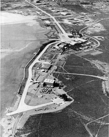
Preservation efforts are crucial in maintaining these historic routes. Many trails are threatened by modern development, off-road vehicle use, and natural erosion. Organizations dedicated to preserving Native American heritage work tirelessly to document and protect these trails, ensuring they remain a living testament to the ingenuity and resilience of the desert’s original inhabitants.

Contemporary Relevance

In recent years, interest has been resurgent in these ancient trails. Educational programs, guided tours, and cultural heritage projects aim to bring the stories of these paths to a broader audience. Indigenous groups also play a vital role in these efforts, sharing their knowledge and perspectives to preserve and respect the trails as sacred cultural sites.

The trails also offer lessons in sustainable living and environmental stewardship. The indigenous peoples of the Mojave Desert thrived in a harsh environment through a deep understanding of the land and its resources. Their trails remind us of the importance of living in harmony with nature, an increasingly relevant lesson today.

Conclusion

The Indian trails of the Mojave Desert are more than just paths across the sand; they are the veins of a rich cultural heritage, connecting the past with the present. They tell stories of trade, migration, survival, and spiritual journeying etched into the desert’s landscape. As we explore and preserve these trails, we honor the legacy of the Native American tribes that first navigated the Mojave Desert, ensuring that their stories and knowledge continue to inspire and educate future generations.