Jack Longstreet

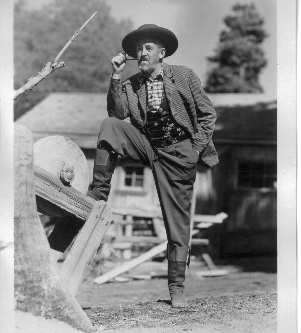
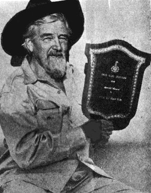
Andrew Jackson “Jack” Longstreet (circa 1834–1928) earned renown as “the Last of the Desert Frontiersmen” — a man of fierce independence and rugged frontier grit, whose life still echoes across Nevada’s wild backcountry.

Jack Longstreet was one of those desert characters who seemed pulled straight from a dime novel, only he was real — and larger than life. Born around 1834, probably in Tennessee, he carried a shadowy past that folks whispered about. Some said he’d been mixed up in rustling back east, and when his gang was caught, the others swung from a rope while Longstreet got off with the loss of an ear. He grew his hair long to hide it, and the scar just added to the air of danger around him.

By the 1880s, he had drifted into Nevada, a land of raw opportunity and rough justice. He was everything the frontier demanded: a prospector, gambler, rancher, stagecoach shotgun rider, saloonkeeper, and, by some accounts, even a Pony Express rider. He married a Southern Paiute woman named Fannie, learned her language, and earned a reputation as a man who stood up for Native rights. He could be tough, but he was fair — a quality that made him respected by some and feared by others.

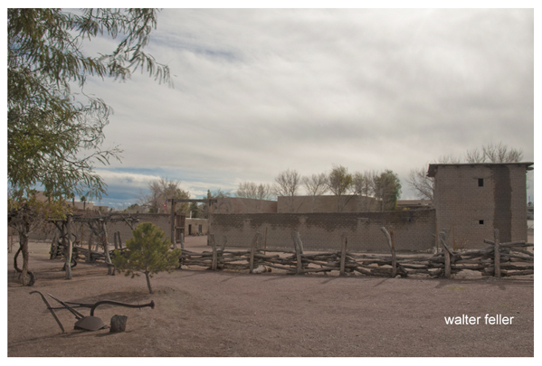
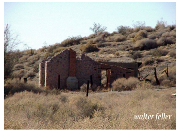
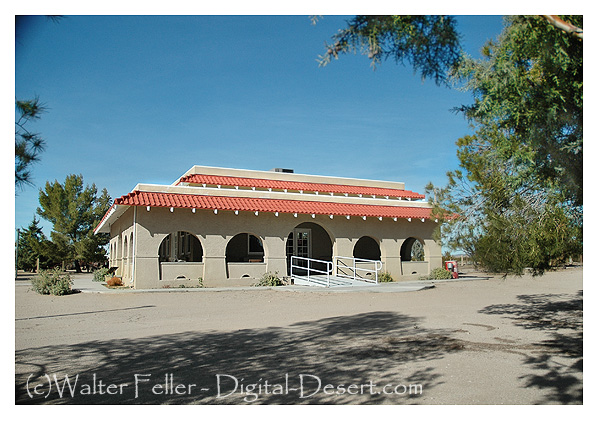
In 1895, Longstreet built a stone cabin beside a spring in the lonely Ash Meadows of the Amargosa Valley. The place was remote enough to suit him, with water for his livestock and a wide view of anyone coming his way. That cabin, now restored in the Ash Meadows National Wildlife Refuge, still stands as a quiet witness to his life on the edge of civilization.

Ash Meadows Wildlife Refuge

He later moved north into the Monitor Range, setting up the Red Rock Ranch near Belmont. His final years were quieter, but not without drama. In 1928, an accidental gunshot led to a stroke that ended his life at the age of about 94. He was buried in Belmont Cemetery, with Fannie joining him four years later.

Longstreet lived by his own rules in a Nevada that was still wild. His life was part outlaw tale, part survival story — the kind of man who could gamble in a saloon one night, dig a waterhole the next, and disappear into the hills without a trace. Even today, his name carries the weight of desert legend.

Timeline

1834 – Born, likely in Tennessee.
Mid-1800s – Rumored involvement in rustling; loses an ear as punishment.
1880 – Arrives in Nevada Territory; works as prospector, gambler, rancher, saloonkeeper, stagecoach shotgun rider.
1882 – Operates a saloon and drug store in Sylvania, Nevada.
Late 1880s – Homesteads near Moapa Indian Reservation; involved in a fatal shooting, later acquitted as self-defense.
1890s – Marries Southern Paiute woman, Fannie; becomes known for supporting Native rights.
1895 – Builds stone cabin at Ash Meadows, Amargosa Valley; ranches and develops spring site.
Early 1900s – Leaves Ash Meadows for Monitor Range; establishes Red Rock Ranch near Belmont.
1928 – Accidentally shoots himself; suffers stroke and dies in Tonopah at about 94 years old.
1932 – Fannie Longstreet dies; buried beside Jack in Belmont Cemetery.

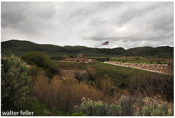
Ash Meadows

Death Valley 49er Hoax

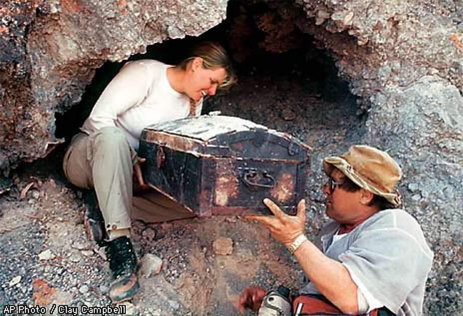
Back in late 1998, Jerry Freeman, an amateur historian with a passion for Death Valley’s old 49er trails, came out of the Panamint Mountains claiming he had found something straight out of a gold rush daydream. Hidden deep inside a cave, he said, was a wooden trunk left behind by the lost ’49ers who famously struggled across Death Valley in 1849.

AP photo – Clay Campbell

The box was a curiosity in itself — weathered wood, iron hinges, smelling of dust and old paper. Inside was a jumble of “treasures”: gold and silver coins (most tarnished, some shiny), a hymnal, a flintlock pistol, a pair of baby shoes worn soft with age, ceramic bowls, and even a letter dated January 2, 1850, supposedly written by a pioneer named William Robinson. The letter told a story of hardship and faith as the writer prepared to leave the desert behind. To Freeman, it was the smoking gun of history — proof that the Jayhawker survivors had stashed some of their belongings before moving on.

When he brought the chest to Death Valley National Park headquarters in early 1999, there was real excitement. Newspapers ran breathless headlines about a half-million-dollar find. Historians daydreamed about finally holding personal effects from the very people who gave Death Valley its name.

But almost as quickly, the doubts started trickling in. Some of the coins didn’t match the time period. The word “grubstake” appeared in the letter — a term that historians said wasn’t common until years later. And some items looked suspiciously… fresh. One ceramic bowl still had a price sticker.

Park officials brought in experts from the Smithsonian and the Western Archaeological and Conservation Center. That’s when the story unraveled fast. They found modern polymer glue holding parts together. The tintype photos used a process that wasn’t invented until after 1856. A “Made in Germany” stamp on one bowl could only have existed after World War I. Even the leather on the baby shoes was still soft, which shouldn’t have been possible after 150 years in Death Valley heat.

By the end of January 1999, the Park Service went public: it was a hoax. Not one item in the chest could be proven authentic to the Gold Rush era.

Freeman stood his ground, saying he’d always believe the chest was genuine, maybe “salted” with a few newer items by someone else. But for most historians, the romance was gone. What had looked like a once-in-a-lifetime discovery turned out to be another desert tall tale — one that fooled people just long enough to make them want to believe it.

Moe the Chimpanzee

A Detailed Historical Account

Origins and Early Life
Moe is a chimpanzee with an extraordinary life story that began in Africa and soon intertwined with a California family. In 1967, St. James Davis – then a merchant seaman – encountered an infant chimp in Tanzania whose mother had been killed by poachers. Davis rescued the baby chimp and brought him to the United States with the help of missionaries. He and his wife LaDonna, who were unable to have children of their own due to LaDonna’s health, decided to adopt the chimpanzee and name him Moe. The Davises raised Moe in their West Covina, California home just as one might raise a human child. He wore clothes, was toilet-trained, took showers, and even slept in a bed. Family life for Moe included simple pleasures like enjoying chocolate milk and watching television with his adoptive parents. From his infancy, Moe bonded strongly with the Davises, becoming the center of their family life for decades.

Relationship with His Owners
St. James and LaDonna Davis considered Moe their son in every sense. They referred to themselves as “Moe’s dad and mom,” and treated the chimpanzee as a pampered, if unconventional, member of the family. “That was the word they used to describe him, and that was how they treated him,” a story noted, portraying Moe as a “hairy, rambunctious child” in the Davis household. They taught Moe how to wear clothing, use utensils at the dinner table, and even communicate through simple sign language. In an oft-cited anecdote, Moe participated in the Davises’ wedding ceremony – LaDonna described him as a combination of flower girl and best man – emphasizing just how integrated he was in their personal lives. Over the years, countless family photos showed Moe snuggling with the couple or even lounging in bed with them. The deep emotional bond was mutual: the Davises doted on Moe, and he in turn was docile and affectionate with them, knowing them as his family. LaDonna once tearfully explained that Moe was “like the son she never had,” underscoring the profound connection between the chimp and his human caregivers.

Media Presence and Fame Prior to 2008
The City of West Covina awarded Moe an “Honorary Citizen” certificate in 1971, reflecting his local celebrity status. From the 1970s onward, Moe became something of a local celebrity in Southern California. In fact, a 1971 legal battle over Moe’s residency in West Covina turned into a public spectacle that Moe ultimately “won” – a judge ruled the city could not evict him, remarking in court that “he doesn’t have the traits of a wild animal, and is, in fact, somewhat better behaved than some people.” Following this victory, West Covina presented Moe with an official Honorary Citizen certificate, symbolically recognizing him as one of their own. Moe went on to make numerous public appearances that endeared him to the community. In the 1970s, he was often seen in parades and at civic events – at one point even ceremonially receiving the “keys to the city” of West Covina. Friends wrote a biographical book, Moe, documenting these years, including photographs of the chimpanzee engaging in human-like pastimes. Moe was pictured driving a speedboat and even sitting behind the wheel of a sports car, grinning as if he were out for a joyride. He reportedly “sold” Girl Scout cookies to help local troops and delighted crowds by performing ribbon-cuttings at events. Thanks to such exploits, Moe became a media darling. Local newspapers and TV stations featured stories on “Moe the chimp” over the years – sometimes portraying the charming, well-behaved ape as a model primate, and other times covering the more troublesome incidents that came later. By the early 2000s, Moe’s name was familiar to many in the Los Angeles area, as his saga of domestic life, celebrity cameos, and subsequent controversies played out in headlines.

Housing and Care Arrangements (Jungle Exotics in Devore)
Moe’s living arrangements changed several times over his life, especially after authorities determined he could no longer reside in a suburban home. In 1999, following two incidents in which Moe bit a police officer’s hand and later a visitor’s fingertip (after she reached into his enclosure with red-painted nails), West Covina authorities forcibly removed Moe from the Davis home for violating the city’s wild animal ordinance. This marked the end of Moe’s idyllic life in the house and the beginning of his life in sanctioned facilities. His first stop was the Wildlife WayStation, a noted animal sanctuary in the Angeles National Forest, where he stayed for a few years. In 2003, when that sanctuary ran into licensing problems, Moe was transferred to a nonprofit facility called Animal Haven Ranch near Bakersfield, California. It was at Animal Haven Ranch that a notorious incident occurred in 2005: as St. James and LaDonna visited Moe to celebrate his 39th birthday with a cake and treats, two other younger chimpanzees escaped their cage and brutally attacked the Davises. (Moe himself did not partake in the attack and remained in his enclosure, reportedly looking on in shock.) This horrific event left St. James gravely injured and LaDonna also hurt, and it underscored the potential dangers of captive primates. Animal Haven Ranch closed to the public after the attack, and Moe’s presence there became a legal liability. In the aftermath, Moe had to be moved yet again for his own safety and care. By 2007, Moe found a new home at Jungle Exotics, a private compound in Devore, California. Jungle Exotics is a licensed facility that provides animals – from tigers and lions to reptiles and dogs – for film and television productions. Unlike a sanctuary, it’s essentially a training and boarding compound for working animals. Moe was not used in any show business work; he was kept as a permanent boarder, and the owners built him a large, comfortable enclosure complete with toys, blankets, and even a “lookout tower” platform where he could watch trains go by in the distance. By all accounts, Moe adjusted well and was “a happy camper” at Jungle Exotics, enjoying the fresh air and roomy cage after years in smaller quarters. However, this arrangement would later prove controversial. The co-owner of Jungle Exotics, a trainer named Sid Yost (operating under the business name “Amazing Animal Productions”), had been sued in 2005 for animal cruelty amid accusations that he beat and abused chimpanzees used in Hollywood shows. Yost settled that lawsuit in 2006 by agreeing to send all his chimps to accredited sanctuaries and to bar himself from working with great apes ever again. Yet here was Moe – a chimpanzee – living on Yost’s property in 2007–2008. The Animal Legal Defense Fund later pointed out that Moe’s very presence at Jungle Exotics violated the 2006 legal settlement and raised alarms about the adequacy of Moe’s care. (In fact, ALDF representatives said they had no idea Moe was at Jungle Exotics until news broke of his escape.) Despite these red flags, for a time Moe appeared to thrive in the Devore facility under the day-to-day care of trainers there. Jungle Exotics was Moe’s fourth home since leaving West Covina, and tragically, it would also be the last place he was seen.

The 2008 Escape
Moe’s tranquil stay at Jungle Exotics came to an abrupt end in late June 2008. On Friday, June 27, 2008, the 42-year-old chimpanzee somehow escaped from his enclosure at the facility. The exact circumstances of Moe’s breakout remain a bit mysterious. The owners of Jungle Exotics were baffled as to how Moe managed to defeat his cage’s security – one co-owner noted that the steel enclosure “should have been able to hold a gorilla,” yet Moe had the strength or smarts to pry it open or break the welds. One theory was that Moe, who had always been clever with his hands, unlatched or bent a portion of the cage and simply walked out. Another suggestion was that a recent wildfire in the area might have agitated or frightened Moe, prompting him to make a bold escape into the unfamiliar wilderness. What is known is that on that Friday afternoon, after getting free, Moe wandered calmly from the Jungle Exotics compound onto a neighboring property. He ambled into a house that was undergoing remodeling, startling a group of construction workers inside. Reports indicate Moe may have approached the workers in a non-aggressive manner – one witness thought the chimp held out his hand as if expecting a treat or handshake, and there was even a rumor that a worker offered Moe a sandwich. Before anyone could contain him, however, Moe slipped away again. He hopped a fence and headed off into the vast brushy expanse of the San Bernardino National Forest, which borders the Devore area to the north. By the time animal caretakers arrived on scene, Moe had vanished into the wild. The initial escape occurred in a mountainous, heavily wooded zone, making it immediately difficult to track the chimp’s movements. Moe, who had lived his entire life in human care, was suddenly loose in an environment full of real dangers (rattlesnakes, mountain lions, and other wildlife) and devoid of the easy food sources he was used to. It was a race against time to find him.

Search Efforts After the Escape
The search for Moe in the summer of 2008 was intense and emotionally charged. As soon as his disappearance was discovered, the Davises and their friends mobilized a private search party to comb the foothills where Moe was last seen. St. James Davis, still partially recovering from the 2005 mauling, even ventured out (in a wheelchair) to direct search efforts, demonstrating the couple’s devotion to their chimp despite the physical hardship. They quickly hired a helicopter to fly low over the forest, hoping the noise of the chopper might flush Moe out of hiding or spur him to reveal himself. Searchers on foot used four-wheel-drive vehicles to navigate the rugged terrain and broadcasted recorded chimp calls through loudspeakers in an attempt to lure or communicate with Moe. They also brought in bloodhounds to sniff for any trace of the chimpanzee’s trail. The San Bernardino County Animal Control authorities were on standby with tranquilizer dart guns, but they treated Moe’s escape as a mostly private matter – since Moe was not deemed an immediate public threat, officials did not mount a massive manhunt, instead offering support and a hotline for sightings. Despite these efforts, finding a single chimp in 240 square miles of forest proved exceedingly difficult. No confirmed sightings of Moe came in the first days or even weeks after his escape. The Davises pleaded with the public to help if they spotted Moe – asking anyone who saw the chimp to call authorities but not to approach him, for fear that Moe could be frightened or harmed by strangers. Numerous tips did trickle in: search teams followed up on reports of “big, hairy” creatures in the woods, only to determine those tracks belonged to bears, stray dogs, or even a mule. In one bizarre incident, someone reported seeing “a man in a monkey suit” running in traffic near a mountain road, which sent deputies scrambling, but that too turned out to be a false alarm or prank. A few tantalizing clues suggested Moe might still be roaming nearby – locals noted a couple of outdoor water faucets mysteriously left turned on, and a few chickens went missing from a rural property, raising hopes that Moe was stealthily raiding yards for water and food. However, none of these clues could be definitively linked to the chimp. After several exhaustive weeks, the search gradually wound down with no sign of Moe. Sadly, as of 2008, Moe had not been found and remains missing to this day. His disappearance became an unsolved mystery, leaving the Davises heartbroken and the public wondering whether Moe could possibly survive long-term in the wild.

Public and Legal Responses and Controversies
Moe’s saga over the decades sparked significant public debate and several legal battles, highlighting controversies over exotic animal ownership. Early on, many in the community regarded Moe with affection – as evidenced by West Covina’s granting of honorary citizenship to the chimp – but city officials also grappled with the risks of keeping a chimpanzee in a residential neighborhood. In 1971, when West Covina first tried to enforce its ban on wild animals by removing Moe, the Davises fought back in court and won an unusual reprieve. The judge’s conclusion that Moe did not behave like a wild beast effectively gave the family legal cover to keep him at that time. This case, with Gloria Allred as the Davises’ attorney, received media attention and set a precedent (at least temporarily) that a well-behaved chimp could be treated akin to a household pet. However, as Moe grew older and larger, and after incidents in the late 1990s demonstrated the potential danger (two people were bitten, albeit in provoked situations), public sentiment shifted toward caution. In 1999 West Covina authorities invoked a zero-tolerance stance on the city’s wild animal ordinance, removing Moe for public safety reasons despite the Davises’ objections. The couple’s subsequent legal efforts – including a civil rights lawsuit – led to a 2002 settlement: West Covina agreed to pay them $100,000 and assist in purchasing a house in Baldwin Park (a neighboring city with looser animal regulations) so the family might reunite with Moe legally. In principle, this suggested a compromise to allow Moe back into a home setting outside West Covina. Yet bureaucratic delays and the aftermath of the 2005 mauling incident derailed that plan. By 2005, even some former supporters of Moe’s homecoming questioned the wisdom of keeping a strong adult chimp in a domestic environment, no matter how gentle he seemed. After the 2005 attack (in which Moe himself was blameless but humans were grievously hurt), the controversy over exotic pet primates intensified. The incident became a cautionary tale in news reports about the unpredictability of chimpanzees and the dangers they can pose as they reach maturity. St. James and LaDonna Davis, despite their trauma, remained steadfast in their love for Moe – in 2006 they even put up a sign on their lawn reading “Free Moe,” signaling their continued desire to bring him home. They pressed West Covina to honor the earlier agreement. A judge eventually ruled in 2007 that the city had breached its obligations and ordered West Covina to pay the Davises a further $32,000 and contribute $300 per month toward Moe’s care, since the promised Baldwin Park arrangement never materialized. This legal victory was bittersweet; by then Moe was living at Jungle Exotics under the Davises’ frequent supervision, and the couple’s priority was simply his well-being. Moe’s 2008 escape brought another wave of public response. There was both sympathy for the Davises – a sense of empathy for “parents” desperate to find their missing family member – and renewed criticism of the practice of keeping chimpanzees in captivity outside accredited zoos or sanctuaries. Animal welfare organizations seized on Moe’s disappearance as evidence that stricter oversight was needed. Notably, the Animal Legal Defense Fund called attention to the circumstances of Moe’s care at Jungle Exotics, arguing that Sid Yost should never have had a chimp in his custody at all due to his prior legal ban. ALDF suggested that Moe’s escape (and possible grim fate in the wild) was a tragic result of substandard caretaking and regulatory slip-ups. The case fueled discussion about tightening laws on exotic animal trainers and private ownership. Indeed, California law already prohibits keeping primates like chimpanzees without special permits, and Moe’s story became an example cited in support of these regulations. Ultimately, Moe the chimpanzee’s life reflects the complexities of human relationships with exotic animals. He was at once a beloved member of a human family and a wild creature subject to instincts and strength that humans sometimes underestimated. Public and legal responses to Moe’s situation evolved from indulgence and fascination in the early years to concern and strict oversight in later years. The controversies surrounding Moe – from city council meetings and courtroom showdowns to animal-rights investigations – have had a lasting impact. They have raised awareness about the responsibilities and risks of keeping great apes in captivity, and have prompted ongoing conversations about how we balance compassion for animals with public safety. Moe’s disappearance in 2008 left unanswered questions, but his legacy endures in the legal precedents and cautionary lessons that arose from his remarkable journey.

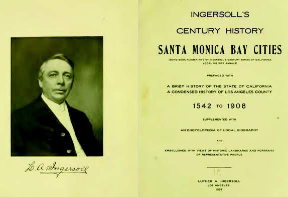
Luther A. Ingersoll

Luther A. Ingersoll was a journalist, editor, and historian active in Southern California in the late 19th and early 20th centuries. He is best known for compiling and publishing Ingersoll’s Century Annals of San Bernardino County, 1769–1904, a substantial local history volume released in 1904. This book is a detailed chronicle of San Bernardino County, California, combining early exploration, settlement, economic development, and biographical sketches of prominent citizens.

Here are a few key points about Luther A. Ingersoll:

  • Background: Not much is readily available about his early life, but he appears to have had a background in journalism and was active in publishing and historical writing.
  • Editor and Publisher: He worked in various editorial capacities and likely contributed to or edited newspapers in California. His writing style shows familiarity with both narrative history and biographical journalism.
  • Century Annals (1904): This was his best-known work and a common reference source for researchers studying early San Bernardino County. The book includes:
    • Explorations and Spanish mission history.
    • Rancho and pioneer development.
    • Biographical sketches (often based on submitted family or self-authored accounts).
    • Civic and institutional growth, including railroads, mining, and agriculture.
  • Methodology: Ingersoll’s work reflected the historiographical style of his time—often celebratory, biographically focused, and boosterish. Still, it captured primary recollections and early records that might otherwise have been lost.
  • Legacy: Despite some historical inaccuracies or omissions, Century Annals remains one of the foundational regional histories for San Bernardino County and is still cited in local historical studies.

Broken Homes

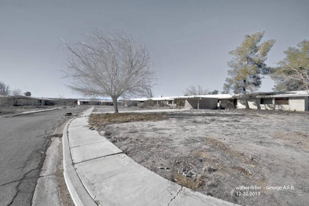
Photo Title: George A.F.B., 12-22-2013
Photographer: Walter Feller


1. Composition:

  • The curve of the sidewalk pulls the viewer’s eye naturally from the foreground toward the background, which is effective in creating depth and leading lines.
  • The tree in the mid-ground serves as a visual anchor, offering a natural focal point in an otherwise rigid environment.
  • The buildings form a flat horizon, which complements the minimalist and desolate tone of the scene.

2. Lighting and Tone:

  • The subdued, desaturated palette supports the theme of abandonment and decay. There’s a washed-out, almost ghostly feel that mirrors the forgotten nature of the place.
  • Lighting is soft and diffused, likely from overcast skies or a low winter sun. That lends a cold, lifeless mood—appropriate for the subject matter.

3. Subject and Message:

  • The photograph tells a quiet but heavy story—of abandonment, former purpose, and time’s erosion. It’s a subtle documentation of what was once a vibrant part of military infrastructure, now fallen into silence.
  • Including the date and location in the image enhances its documentary value and turns the image into an archival piece.

4. Technical Observations:

  • Sharpness is well-controlled; textures in the concrete, tree bark, and dried ground are detailed but not exaggerated.
  • Some may critique the almost HDR-like softness in tonal contrast, but in this case, it enhances the surreal stillness.
  • The slight tilt of the camera horizon (if unintentional) could be distracting, but it also contributes a sense of unease.

5. Suggestions (if improvement were desired):

  • Cropping a sliver off the bottom might help rebalance the frame if you want to lessen sidewalk dominance and bring the focus more toward the buildings.
  • A version with slightly boosted contrast or selective color treatment (e.g., leaving the tree full desaturated while warming the sky subtly) could offer an alternative mood without losing the melancholy.

Overall Impression:
A quietly powerful photograph. It captures the stark beauty of abandonment with compositional clarity and emotional restraint. The image feels frozen in time—appropriate for a forgotten base in the middle of the Mojave. It’s not loud, but it lingers.

Tamarix Notes

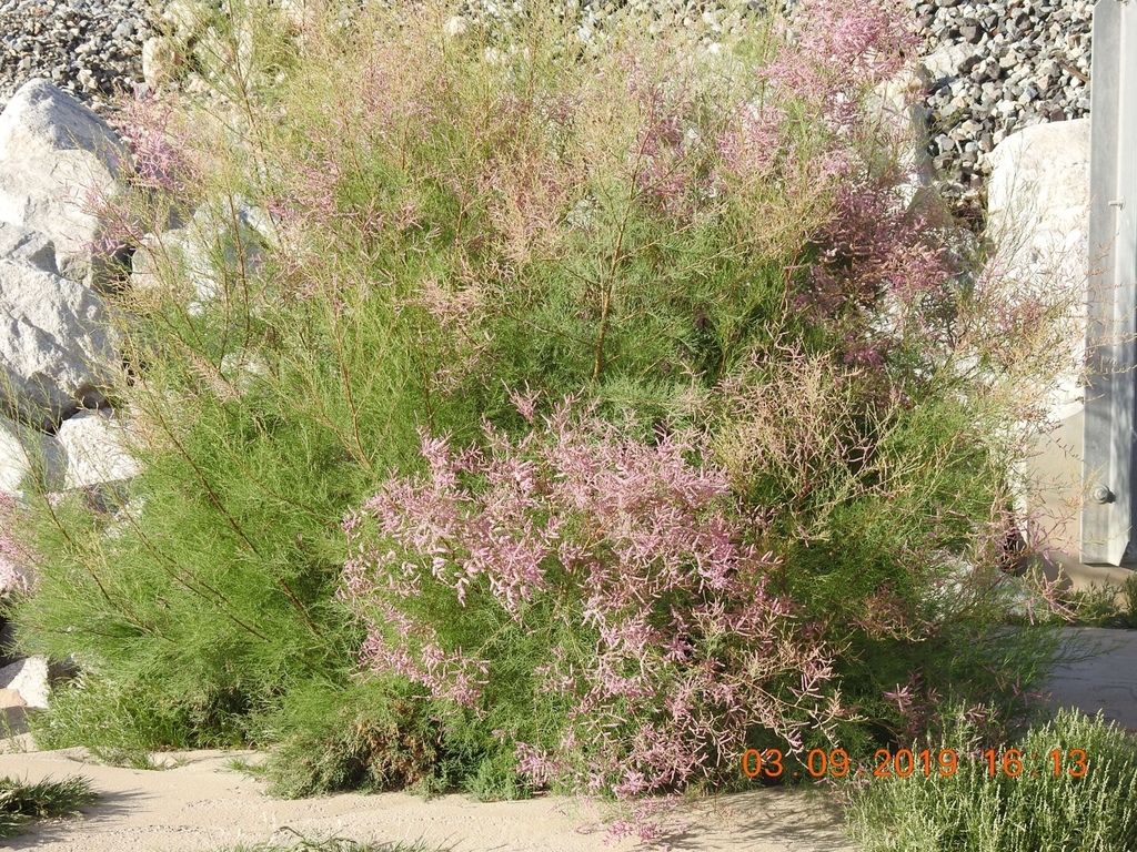
—it’s Tamarix aphylla (athel tamarisk), which only reproduces by cloning, not seed. While it isn’t spreading like Tamarix ramosissima or chinensis, which have taken over waterways in the West, all types of tamarisk share one thing: they use proportionately large amounts of water. So even the non-invasive ones have an impact, especially in desert regions where water is life.

Here’s a list of the most common tamarisk (or saltcedar/athel) species found in the American Southwest, especially the Mojave Desert, with notes on whether they are considered invasive and whether they are heavy water users:

  1. Tamarix ramosissima (Saltcedar)
    • Invasive: Yes
    • Water-sucking: Yes
    • Notes: One of the most aggressive species, spreads by seed and root. Known for choking out native vegetation and monopolizing riparian zones.
  2. Tamarix chinensis (Chinese tamarisk)
    • Invasive: Yes
    • Water-sucking: Yes
    • Notes: Often hybridizes with T. ramosissima. Together, they dominate many desert waterways and floodplains.
  3. Tamarix parviflora (Smallflower tamarisk)
    • Invasive: Yes
    • Water-sucking: Yes
    • Notes: Less common but still invasive, particularly in California. Can handle salty soils and crowds out native plants.
  4. Tamarix gallica (French tamarisk)
    • Invasive: Occasionally
    • Water-sucking: Yes
    • Notes: Less aggressive in arid environments than others but still considered problematic in some regions.
  5. Tamarix aphylla (Athel tamarisk or Athel tree)
    • Invasive: No (not generally considered invasive in the U.S.)
    • Water-sucking: Yes
    • Notes: Grows as a large tree, does not spread by seed in North America, but it still consumes a lot of water. Introduced intentionally as a shade and windbreak tree.

Summary:

  • Invasiveness: Most tamarisk species are invasive, especially T. ramosissima, chinensis, and their hybrids.
  • Water Use: All tamarisks are thirsty. Even T. aphylla, though not invasive, draws significant water—making them ecologically impactful in arid regions like the Mojave.
Tamarix aphylla (Athel tamarisk or Athel tree)
https://en.wikipedia.org/wiki/Tamarix_aphylla
FeatureTamarix aphylla (Athel)Invasive Tamarisk (ramosissima/chinensis)
Growth FormLarge treeShrub or small tree
Height30–50 feet6–20 feet
TrunkSingle main trunkMultiple stems
LeavesScale-like, dull grey-greenFine, feathery, bright green
Leaf SpacingWidely spacedDense along twigs
FlowersSparse, rarely seenShowy pink/white spikes
Blooming SeasonRarely blooms in U.S.Late spring to summer
Seed ProductionNone (no viable seed in U.S.)Profuse—spreads aggressively
Branch ColorBrown to greyReddish to purplish, especially new growth
Water UseHighHigh
Spread PotentialLow (clonal only)Very high (seed and roots)
Typical LocationHomesteads, roadsides, farmsRiverbanks, washes, natural springs
Tamarix ramosissima
Photo 32999308, (c) larry-heronema, some rights reserved (CC BY-NC)
https://www.inaturalist.org/photos/32999308


Eastwood Dams

When people think of Big Bear Lake or Littlerock Reservoir, they usually picture pine-covered hills or quiet desert canyons. But beneath those scenic views lie stories of bold ideas, early 20th-century innovation, and one man who didn’t mind going against the grain: John S. Eastwood.

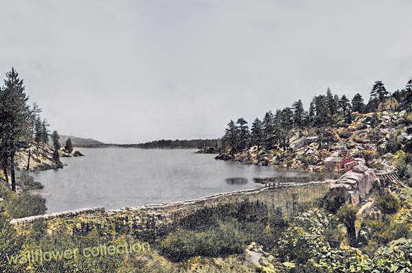
Original Big Bear Dam – 1885 (colorized)

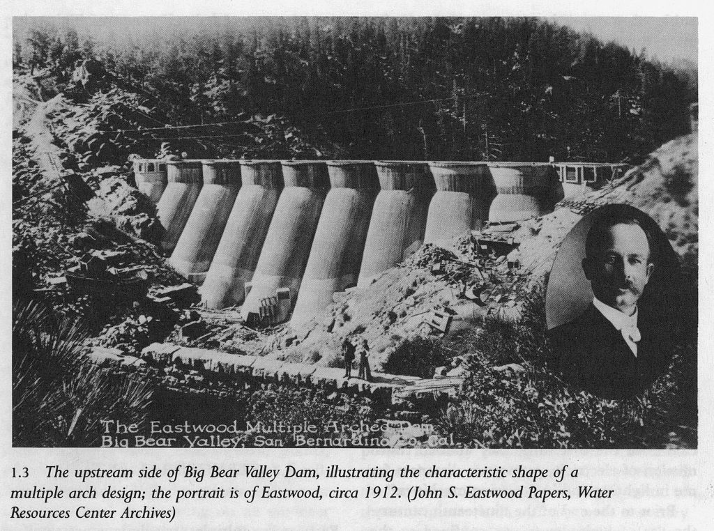
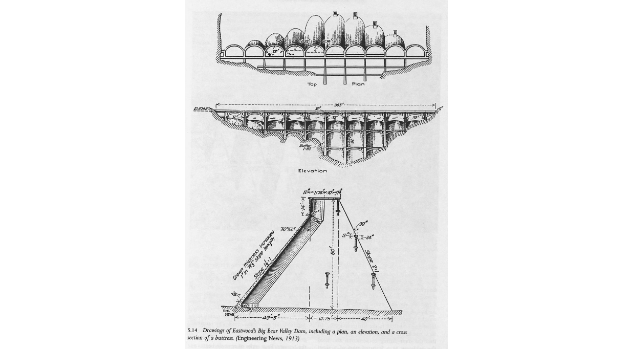
Eastwood wasn’t interested in building dams the way everyone else did. While most engineers were busy stacking massive concrete walls straight across rivers, he had something different in mind: a system of thin, curved arches that transferred pressure into solid rock abutments. It was lighter, cheaper, and—in his view—smarter.

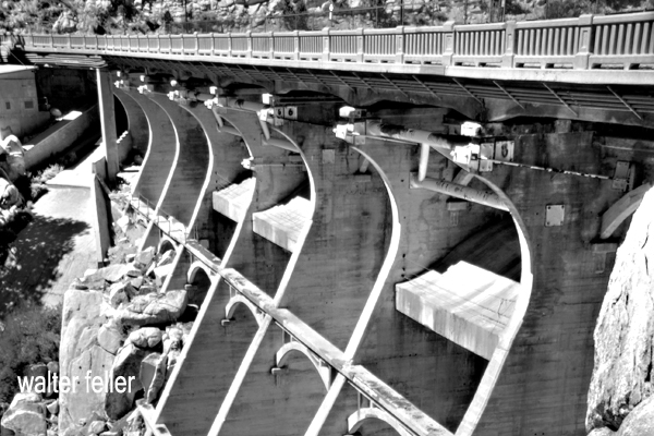
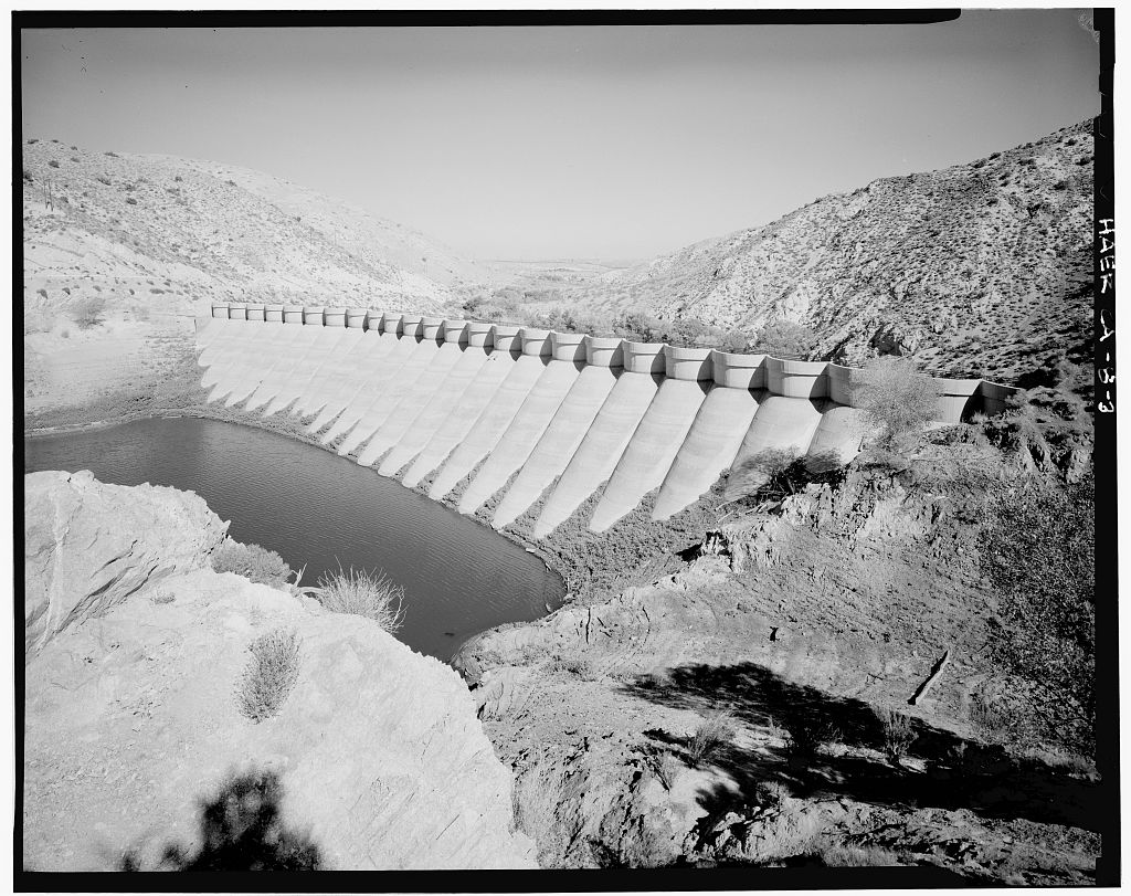
In Big Bear, the original dam dated back to 1884. It was built by Frank Elwood Brown, a man with a vision to turn the dry, chaparral-covered inland valleys into citrus groves. His dam was modest and practical for its time, but growing demand soon outpaced its capacity. By 1910, the Bear Valley Mutual Water Company called on Eastwood to design something new. What he gave them in 1912 was a graceful structure of eleven concrete arches—his signature multiple-arch style. It raised the lake level and helped feed the thirst of the San Bernardino Valley below. A bridge was added in 1924, making the dam a true link between the north and south shores and turning it into a local landmark.

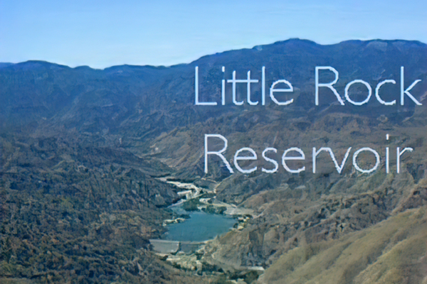
Meanwhile, about 60 miles west as the crow flies, the Littlerock Dam rose in a very different landscape—dry, wide-open desert edged by the San Gabriel Mountains. Built between 1922 and 1924, the dam had a job to do: tame seasonal flooding and store water for nearby farms and growing communities in the Antelope Valley. Again, Eastwood’s multiple-arch design was chosen. At the time of its completion, Littlerock Dam was the tallest structure of its kind in the world. It stood not just as a practical solution but also as a quiet sign of faith in human ingenuity—a way to harness nature without bulldozing over it.

Over the years, both dams have been modified to meet modern standards. Littlerock was reinforced in the 1990s, its delicate arches now hidden beneath a face of roller-compacted concrete. Some of Eastwood’s original elegance was lost, but the structure still holds firm. Big Bear’s dam remains more visibly true to his vision, standing quietly beside the lake like a relic from a time when ambition was poured in concrete.

Littlerock Reservoir

John S. Eastwood may not be a household name, but his work left a lasting mark on California’s landscape. His dams in Big Bear and Littlerock weren’t just about holding back water—they were about pushing engineering forward. More than a century later, their presence still shapes the way people live, work, and play in the Mojave and San Bernardino Mountains.

Eastwood wasn’t interested in building dams the way everyone else did. While most engineers were busy stacking massive walls of concrete straight across rivers, he had something different in mind: a system of thin, curved concrete arches that would transfer pressure into solid rock abutments. It was lighter, cheaper, and—in his view—smarter.

Hollywood Finches

How House Finches ended up in New York is yet another quirky little chapter in bird history—and it all starts with a bit of rule-bending in the pet trade.

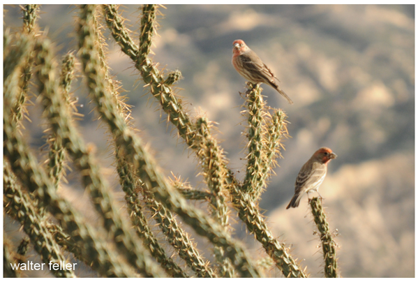
In the 1930s and early 1940s, House Finches were native only to the western United States and parts of Mexico. At that time, they were not present on the East Coast. But their pretty colors and sweet songs made them attractive to bird lovers. So, pet shop owners began capturing them in the Southwest and shipping them to pet stores in the East, especially around New York City.

Here’s the catch: under the Migratory Bird Treaty Act, it was illegal to sell native wild birds as pets. But sellers didn’t want to stop, so they tried to work around the law by giving the birds a fancy new name—“Hollywood Finches”—to make them sound exotic and non-native.

That didn’t fool everyone. Enforcement started tightening up when the government caught wind of the illegal trade. In 1940, pet shop owners in New York panicked and did something unexpected—they released their captive finches into the wild to avoid getting caught.

And that’s when things got interesting.

The released birds survived, adapted, and started breeding. They found New York’s parks, gardens, and backyards suitable places to raise families. Within a few years, they had spread throughout the Northeast and expanded rapidly across the eastern half of North America.

So now, thanks to an accidental release tied to illegal pet sales, House Finches are one of the most widespread songbirds in North America. It’s a classic case of unintended consequences—but one that ended with a success story (for the birds, anyway).

House Finch

Rambling On

A natural thread of wildlife presence woven in, showing how desert creatures went about their lives while miners, homesteaders, and road-trippers came and went:

Ivanpah Valley: Mining, Settlement, and the Story of the Mojave

Nestled in the northeastern part of San Bernardino County, the Ivanpah Valley tells a story of shifting sands, silver dreams, and the rugged endurance of those who dared to live in one of the harshest corners of the American West. This desert basin, with its sweeping alluvial fans and ancient hills, bears the marks of both geologic forces and human ambition. From the first mining camps to homesteaders and the rise of Route 66, Ivanpah is a quiet but enduring witness to the broader saga of the Mojave Desert, a place of allure and mystery that has captivated generations.

The valley lies 2,600 and 4,500 feet above sea level and is part of Major Land Resource Area (MLRA) 30g. Its surface comprises fluvial, lacustrine, and wind-blown sands laid down during the Quaternary period, while occasional outcrops of rugged Precambrian rock poke through the sediment. Gently sloping alluvial fans define the terrain, while basin floors and dry lake beds, known as playas, stretch toward the horizon. Rain is rare—only about 4 to 7 inches fall yearly—yet the soil and climate support hardy desert plant communities like creosote bush, Joshua tree, saltbush, and greasewood, depending on moisture and soil type.

Amidst all this change and activity, the local wildlife continued its existence with a quiet resilience. Wagons rattled over gravel trails, and miners pounded away at rock walls. Yet, desert tortoises quietly roamed the flats, burrowing down into the cool earth to escape the heat. Coyotes trotted unseen along arroyos, pausing now and then to listen. Jackrabbits darted through greasewood and shadows, while red-tailed hawks circled high above the empty mining camps. For the creatures of the desert, life pulsed to an older rhythm, indifferent to boom or bust, a testament to the enduring resilience of the natural world.

Into this arid but mineral-rich land came waves of miners in the 19th century, drawn by tales of hidden veins and easy fortunes. In 1860, the first productive mine in the Mojave—called “Christmas Gift”—opened in Death Valley, setting off a flurry of activity across the desert. Borax, known as “the white gold of the desert,” was soon discovered and began to be mined profitably. By the 1870s, the Clark Mountain Mining District was established, and with it the town of Ivanpah, at that time the only sizable American settlement in the eastern Mojave.

The Bullion Mine, located on the north end of the Ivanpah Mountains, began production in the 1860s. Its rich silver ore was shipped down the Colorado River and on to Swansea, Wales. In 1879, the mine was producing steadily—about five tons every three days—and wagons driven by Jesse Taylor hauled the ore out across the desert. That same year, the mine superintendent, James Boyd, made headlines by replacing an Indian laborer who earned 75 cents a day with a teenage boy, advertised in the San Bernardino Weekly Times, who would work for $30 a month and board–this was frontier economics at its most practical.

The mine changed hands over the years, and in 1909, it was leased by George Bergman of Eldorado Canyon, backed by a $50,000 bond. With multiple shafts and a depth of 250 feet, the Bullion Mine produced ore containing lead, copper, and silver into the 1910s but has seen no significant production since.

Other mines in the Ivanpah Mountains also flourished, if only briefly. The Standard Mine, discovered in 1904 on the west side of the range, operated from 1906 to 1910 and again during World War I. It was nearly 700,000 pounds of copper and 20,000 ounces of silver. By 1908, a small company town had sprung up around it, with bunkhouses, a store, and an assay office.

The Kewanee Mine, discovered around 1901, was especially busy between 1907 and 1911, employing fifty men and operating its mill.

The Morning Star Mine, just west of the Kewanee, saw its most active years between 1927 and 1939, and by the 1970s, it was still being worked in search of the estimated 100,000 ounces of gold beneath its claims.

A particularly curious chapter comes from the Kokoweef Caves, where, in the 1920s, a miner named E.P. Dorr claimed to have discovered an underground river of gold. The tale has since become the stuff of legend, with some continuing to search for treasure in the shadows of the Carbonate and New Trail copper mines nearby.

While miners chased fortune beneath the ground, another wave of settlers sought a different treasure—land. In 1910, homesteaders arrived under federal land programs, usually staking claims on 160-acre parcels. Many came to the Lanfair Valley and surrounding regions, hoping to make a go of desert farming. The rains of the early 1910s encouraged them—fields sprouted crops, and the dry air drew veterans of World War I suffering from the effects of mustard gas.

But the good years were short-lived. When the rains failed, wells dried up or never reached water. Homesteaders found themselves hauling water across miles of open land. Tensions over water rights flared between settlers and ranchers. Gradually, families gave up. They left behind lonely cabins, wind-worn and silent, scattered across the desert.

And still, the lizards sunned themselves on warm rocks. Desert bighorn sheep lined the mountain ridges, standing like statues in the morning light. After a lucky rain in the springtime, wildflowers painted the valley in yellow and purple while hummingbirds zipped among the blooms—untroubled by claims or county lines.

In the 1920s, the iconic Route 66 was born. Built to connect the Midwest to California, it followed old wagon trails and pioneer routes. It symbolized freedom and opportunity—nicknamed “The Mother Road” and “Main Street of America.” It inspired books, songs, and even a TV show. Its significance in shaping the American landscape and culture is undeniable, evoking a sense of nostalgia and appreciation in those who traverse its historic path.

Then came the Great Depression in the 1930s. Struggling families from the Dust Bowl followed Route 66 west, hoping to grow their food and escape the failing economy. After World War II, traffic along Route 66 surged. Though the road was narrow and dangerous in spots, it remained vital—until the 1950s, when new interstate highways like I-15 and I-40 began to bypass the small desert towns. The last section of Route 66 was officially decommissioned in 1985. But its memory lives on. Starting in 1995, “Historic Route 66” signs began appearing in all eight states the route once crossed. Today, travelers trace its path through the Mojave, chasing a piece of American history.

The Ivanpah Valley and its surroundings may seem quiet today, but the landscape still whispers the stories of boomtowns and busted dreams, sunburned miners and hopeful homesteaders, and dust-choked cars rolling west on Route 66. It is a land shaped by wind, stone, and determination—where people once came looking for gold and found, if not riches, a chapter in the great American tale. And through it all, the desert’s original residents—the coyotes, quail, snakes, and tortoises—have never left, carrying on as they always have, desert-born and desert-bound.

Lake Tecopa Geology

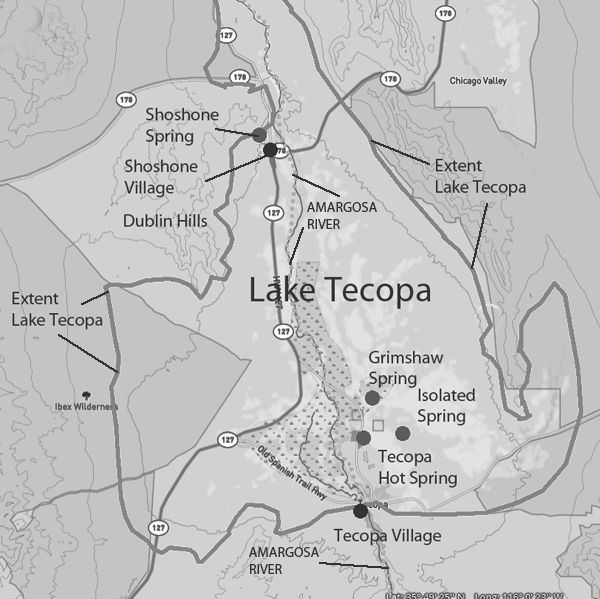
Lake Tecopa was a large lake in southeastern California during the Ice Age. Due to changes in climate, earthquakes, and shifting rivers, it formed and disappeared several times over the past two million years.

How Lake Tecopa Changed Over Time

Early Lakes (~2 million to 765,000 years ago):

  • Before the Amargosa River reached the area, smaller lakes from local rainfall and runoff filled the basin.
  • These lakes could not drain, so water stayed in the basin until it evaporated.

Amargosa River Connection (~765,000 to 580,000 years ago):

  • Around 765,000 years ago, the Amargosa River started flowing into the Tecopa Basin.
  • This caused the lake to grow much larger, filling the basin several times over the next 200,000 years.

Final Overflow (~185,000 years ago):

  • The lake reached its highest level and spilled over, creating a channel that drained into Death Valley.
  • Once this happened, Tecopa was no longer a closed lake. Water from the Amargosa River could now flow toward Death Valley instead of staying in the basin.
  • This spillover permanently changed the region’s water system.

How the Spillover Happened

  • The lake overflowed because of heavy rainfall, rising water levels, and erosion of the basin’s southern part.
  • As water broke through, it carved a channel that deepened over time, allowing the Amargosa River to connect with Death Valley.
  • After this, Lake Tecopa could no longer reform as a long-lasting lake.

Evidence Left Behind

  • Ancient Shorelines: Rings around the basin show where the lake once stood at different times.
  • Fossils: Scientists have found tiny fossils of algae and freshwater mollusks, proving that the lake supported life.
  • Rock Deposits: Layers of calcium carbonate and tufa formed in the lake, marking its highest water levels.
  • Spillover Channel: The area where the lake drained remains a landform today, showing where the water escaped.

Comparing Lake Tecopa to Other Ice Age Lakes

  • Lake Tecopa vs. Lake Manly (Death Valley):
    • Lake Tecopa’s overflow helped form Lake Manly in Death Valley.
    • Lake Manly was filled and dried up multiple times, depending on the climate conditions.
    • Unlike Tecopa, Lake Manly was always part of a larger river system.
  • Lake Tecopa vs. Lake Mojave (Mojave Desert):
    • Lake Mojave (which included Silver and Soda Lakes) was fed by the Mojave River instead of the Amargosa.
    • Unlike Tecopa, Lake Mojave did not spill over into another basin. Instead, it dried up when the climate changed.
    • Both lakes grew and shrank over time due to changes in rainfall and temperature.

Why This Matters

The story of Lake Tecopa helps scientists understand how Ice Age lakes formed, changed, and disappeared. The lake’s final overflow was an important event because it changed how water flowed across the region. Studying Tecopa’s past gives us clues about ancient climates, shifting landscapes, and the history of water in the Mojave Desert.

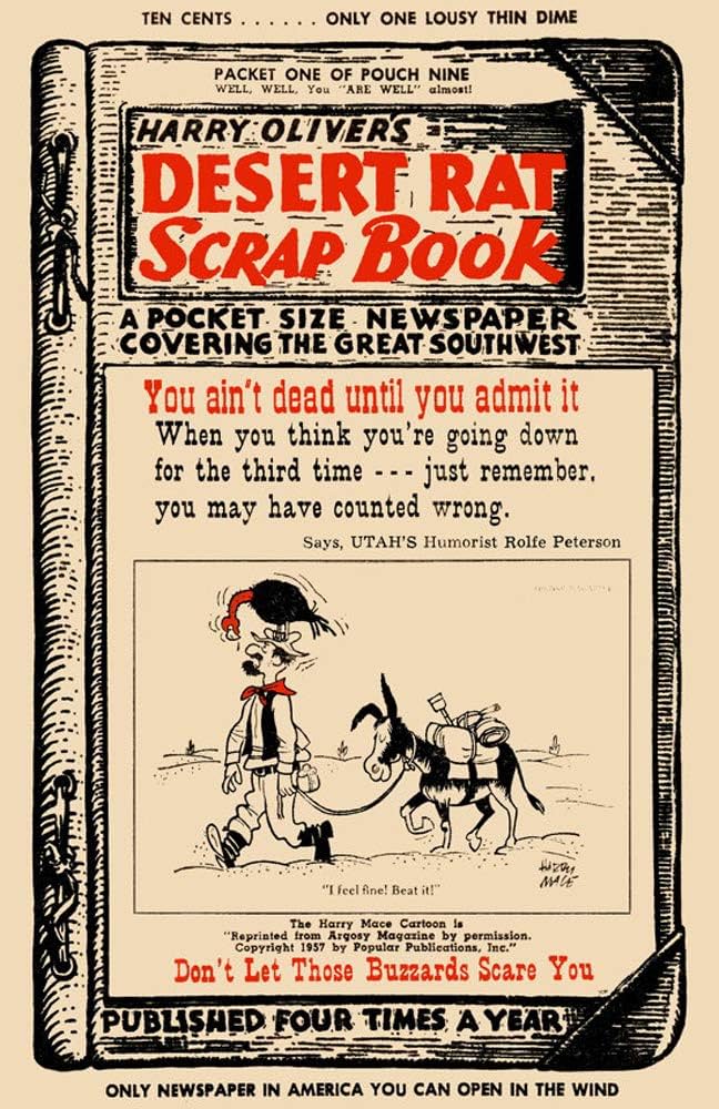
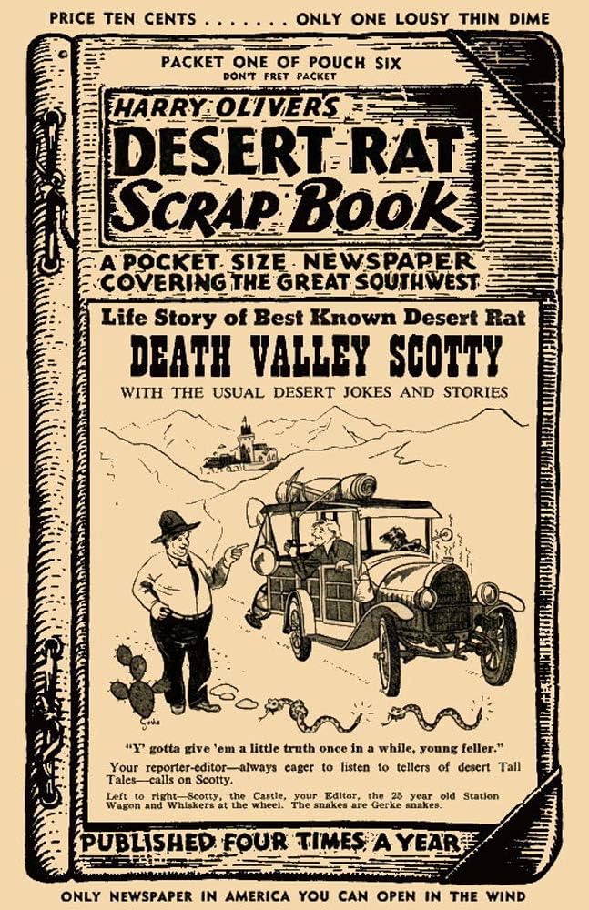
Desert Rat Scrapbook

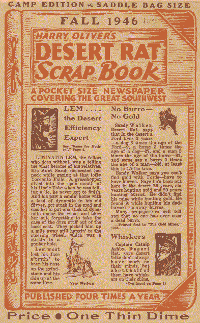
Harry Oliver’s Desert Rat Scrapbook was a quirky, hand-assembled publication that ran from 1946 to 1965. Created by Oliver, a former Hollywood set designer and self-proclaimed “desert rat,” the Scrapbook was a mix of tall tales, local history, jokes, and desert lore, all presented in an old-timey, Wild West newspaper style.

Oliver published the Scrapbook from his adobe home in Thousand Palms, California, near Palm Springs. It was printed on rough, oversized newsprint and mailed out to subscribers, who were part of the informal “Lost Horse Phonygraph Club.” The content was an eccentric blend of factual history and outright fabrications, which made it both entertaining and sometimes infuriating for those trying to separate fact from fiction.

Oliver was deeply fascinated by desert culture and the people who lived in remote corners of the Southwest. His work helped popularize the image of the rugged, independent desert wanderer—part prospector, part storyteller, and part trickster. Through the Scrapbook, he connected far-flung desert enthusiasts, building a community around the shared appreciation of the oddities and legends of the region.

Harry Oliver’s Desert Rat Scrapbook was packed with stories that blended real history, wild exaggeration, and outright fabrications. Here are a few standout tales from his collection:

  1. The Lost Pegleg Mine – One of the most enduring legends in desert lore, Oliver frequently wrote about Thomas “Pegleg” Smith’s supposed gold discovery in the Colorado Desert. Pegleg allegedly found black-coated gold nuggets but could never relocate the spot. Oliver’s Scrapbook added layers to the tale, sometimes claiming new clues had surfaced or spinning yarns about hopeful prospectors who had set out on doomed quests.
  2. The Curse of the Lost Dutch Oven Mine – A variation of lost treasure stories, this one involved a prospector who discovered a rich mine but was killed before he could cash in. Supposedly, he buried his gold in a Dutch oven somewhere in the desert, and anyone who searched for it was met with misfortune.
  3. Desert Dynamite Fishing – One of Oliver’s more humorous pieces claimed that some old-timers out in the desert had perfected the art of “dry fishing” with sticks of dynamite. They’d toss a charge into a dry lake bed, wait for the explosion, and then go around picking up dazed or dead fish. Complete nonsense, but it made for a great desert tall tale.
  4. The Phantom Burro – Oliver often mixed ghost stories with desert humor, and this one involved a spectral burro that would lead lost travelers to safety—or, depending on the version, trick them into wandering deeper into the dunes.
  5. The Tin Can Mail Route – This was based on a real oddity: desert drifters and small communities that used tin cans to mark trails and leave messages. Oliver’s version exaggerated the practice, describing elaborate systems of tin can “mailboxes” where hermits and prospectors exchanged cryptic notes, treasure maps, or just empty cans.
  6. Jackass Mail and the Desert Post Office – He wrote about makeshift post offices set up in desert outposts where letters would be delivered by burros or left under a rock for the next traveler to take along. These informal mail systems weren’t unheard of, but Oliver took them to absurd levels, claiming they were still in use well into the 20th century.
  7. Lost Vikings in the Desert – Oliver had a particular fondness for weird history, and one of his pieces speculated that Norse explorers had made it to the Southwest long before the Spanish, leaving behind stone ruins and petroglyphs. While there’s no evidence for it, the story fit in well with the other strange desert myths.
  8. The Camels Are Still Out There – Playing off the true history of the U.S. Army’s short-lived Camel Corps experiment in the mid-1800s, Oliver spun yarns about feral camels still wandering the desert, occasionally showing up to spook travelers.

Harry Oliver knew exactly how to mix fact and fiction into something that kept readers entertained, even if they weren’t sure what was real. His Scrapbook became a kind of time capsule for desert folklore, blending the true stories of the West with the kind of campfire tales that made the region so colorful.

Dutch Charley Koehn

In the lonely reaches of the El Paso Mountains, where the desert stretches wide and the wind whispers through the canyons, Dutch Charley—better known as Charles Koehn—built a life that was equal parts rugged and legendary. A German immigrant turned desert rat, Koehn made his mark not with gold, but with grit, ingenuity, and a bit of old-fashioned stubbornness.

Koehn’s story begins in the 1890s, when he staked a claim at Kane Springs, a much-needed watering hole along the route between Tehachapi and the Panamint Range. While many men chased dreams of striking it rich in the goldfields, Dutch Charley had a different plan—he set up shop right in the heart of the action, offering supplies, water, and even a mail service to the miners and drifters passing through. For 25 cents a letter, a prospector could send word back home, and for a few more coins, he could rest his bones and share a drink at Koehn’s outpost. It wasn’t just a business; it was a lifeline in an unforgiving land.

Despite his knack for trade, Koehn had a prospector’s heart. He spent years scouring the desert for something valuable, and while he never found the gold mother lode, he did uncover something else—gypsum. In 1909, he staked claims on a massive gypsite deposit near his homestead, and by 1910, he had a small operation producing wall plaster. It wasn’t the romantic vision of striking it rich, but it was a steady business. His holdings expanded over the years, and soon, larger companies were leasing his land to extract the valuable mineral.

But life in the Mojave wasn’t just about hard work—it was also about holding your ground. In 1912, a group of claim jumpers, backed by hired guns, tried to push Koehn off his land. The desert was a lawless place, and disputes like these were often settled with more than just words. Koehn, known for being tough as nails, didn’t back down. A gunfight erupted on the dry lakebed, and when the dust settled, Dutch Charley was still standing. The courts later ruled in his favor, affirming his rights to the land. It was the kind of incident that turned a man into a legend.

For decades, Koehn’s outpost—known as Dutch Charley’s Cabin—served as a beacon for desert wanderers. Whether it was a weary prospector looking for water, a film crew from Hollywood needing a mule team, or just a lost traveler in need of a friendly face, Koehn’s place was a welcome sight in the vast emptiness. His generosity was well known, and many recalled his habit of offering water to anyone who needed it, free of charge. It wasn’t just about business—it was about survival, about knowing that out here, in the middle of nowhere, a little kindness went a long way.

But time and fortune have a way of shifting like the desert sands. In the 1920s, Koehn found himself in a series of legal battles over his gypsum claims, and in 1923, he was arrested for allegedly attempting to bomb the home of a judge involved in one of his disputes. Whether he was guilty or the victim of a setup is still debated, but the outcome was clear—he was convicted and sent to San Quentin State Prison. It was a tragic end for a man who had spent his life fighting to carve out a piece of the desert for himself. He died behind bars in 1938, just days before he was scheduled to be released.

Though Koehn himself is long gone, his legacy remains. Koehn Dry Lake still bears his name, a reminder of the claim fights and salt works that once played out on its barren surface. The remains of Dutch Charley’s Cabin stand as a ghostly relic of a bygone era, a time when men built lives in the harshest of places with nothing but their hands, their wits, and an unbreakable will. His story, filled with hardship, adventure, and the occasional brush with the law, is woven into the fabric of Mojave history.

Dutch Charley was more than just a miner or a businessman. He was a character, a survivor, and above all, a man who belonged to the desert. He may not have left behind great wealth, but he left something just as enduring—the kind of story that echoes through the canyons long after the last prospector has gone.

Early Life and Settlement at Kane Springs (El Paso Mountains)

Charles Koehn, famously known as “Dutch Charley,” was a German-born prospector who became a prominent desert character in California’s El Paso Mountains around the 1890s​

vredenburgh.org. In 1892, he homesteaded land at a desert water source called Kane Springs (later often referred to as Koehn Springs) with the intent to profit from the stream of travelers and miners between Tehachapi and the Panamint Range​

publiclandsforthepeople.org. Koehn established a way station there that soon turned into a one-man desert outpost. In September 1893 he even secured a post office at his ranch (officially named “Koehn” post office) and began delivering mail to local mining camps at 25 cents per letter​

publiclandsforthepeople.org. His station offered much-needed services: he ran a store and bar, sold staples like hay, grain, and meat to prospectors, and even provided free water to any traveler or teamster passing by​

vredenburgh.org. This generosity and entrepreneurial spirit made Dutch Charley’s place a well-known stopover in the Mojave Desert. By late 1893, two stores were operating at Kane Springs alongside Koehn’s facilities, attesting to the little community that sprang up around his oasis​

vredenburgh.org. Koehn’s resourcefulness and commanding personality earned him colorful nicknames such as the “Bismarck of the Desert” and the “Wild Dutchman,” reflecting both his German heritage and his formidable presence on the frontier​

angelfire.com.

Role as a Prospector and Mining Claims

Despite primarily running a supply station, Dutch Charley was also an active prospector and mining man. During the 1893 gold rush in the El Paso Mountains (notably at Goler and Red Rock canyons), Koehn capitalized on the boom by supporting miners rather than striking gold himself​

publiclandsforthepeople.org. In early 1896, he built a small stamp mill at Kane Springs to process ore​

vredenburgh.org, one of the first mills outside of Garlock, though such mills were soon overshadowed when railroads enabled shipping ore to larger mills elsewhere​

vredenburgh.org. Koehn’s true prospecting successes came from the desert’s less-glamorous minerals. He dabbled in borax: in 1896 he discovered a deposit of ulexite (a borate mineral) near his homestead and worked it sporadically over the years, though total production was only a few railcar loads of borax “cottonballs”​

publiclandsforthepeople.org. His most significant find was a large gypsum deposit. In late 1909, Charles Koehn located an extensive bed of gypsite (a gypsum-clay mixture) in the dry lake adjacent to his ranch (now Koehn Lake)​

publiclandsforthepeople.org. By 1910–1912 he had attracted outside interest in this gypsum; a small calcining plant started making wall plaster, and the California Crown Plaster Company produced the first sacks of gypsite from his claims​

publiclandsforthepeople.org. Koehn began leasing portions of his gypsum property to various companies between 1910 and 1930 to be mined for plaster and agricultural additives​

publiclandsforthepeople.org.

Aside from gypsum, Koehn also held salt claims on the dry lake itself. Koehn Lake (sometimes called Kane Dry Lake) was rich in surface salt, and Koehn had staked claims there in the early 1900s​

vredenburgh.org. By leasing or working with larger capitalists, Koehn managed to derive income from these mineral claims despite not having the means to develop them entirely on his own. His ventures made him locally famous – if not for striking a mother lode of gold, then for uncovering the desert’s more humble riches like salt, borax, and gypsum.

Conflicts over Claims and Notoriety

Charles “Dutch Charley” Koehn’s mining ventures were not without conflict. His gypsite and salt claims led to fierce disputes in the wild lawlessness of the Mojave. In January 1912, a band of claim jumpers, backed by hired gunmen, attempted to seize Koehn’s holdings on the dry lake​

publiclandsforthepeople.org​

vredenburgh.org. This confrontation erupted into a gunfight on the alkali flats of Koehn Lake. Koehn, described by historians as “feisty,” stood his ground and won what was by all accounts a brief but lively battle​

publiclandsforthepeople.org​

vredenburgh.org. The aftermath of the shootout landed the instigators in court – the Randsburg Miner newspaper reported that T. H. Rosenberger and ten others were found guilty of forcible entry in the incident (effectively acknowledging Koehn’s rights) and were fined for their actions​

vredenburgh.org. Ultimately, about a year later, Koehn reached a deal with his rivals: he sold his salt claims to Thomas Thorkildsen (one of the claim jumpers’ financiers), who then passed them to the Los Angeles-based Diamond Salt Company​

vredenburgh.org. This resolution allowed an organized salt works to proceed at the site, while presumably earning Koehn some compensation. A local paper even headlined “Charles Koehn Sells Famous Salt Springs” in late 1912, marking a victorious end to that particular feud​

vredenburgh.org.

Koehn’s battles moved from the desert to the courts in the ensuing years. With multiple companies leasing or coveting his gypsum deposits, contractual disputes arose. Various firms sued Koehn over percentages and rights; one such company, Alpine Lime & Plaster, demanded $50,000 in damages around 1920​

publiclandsforthepeople.org. Legal skirmishes dragged on, but a far more dramatic incident occurred in 1923. That year, Koehn was arrested under alarming circumstances: he was caught fleeing the Fresno home of Judge Campbell Beaumont (who had been involved in one of the civil cases) and was accused of planting an explosive device there​

publiclandsforthepeople.org. Suspicious evidence – a bomb with fuse and bits of newspaper – was allegedly found in Koehn’s car, though Koehn steadfastly proclaimed his innocence​

publiclandsforthepeople.org. Despite lingering doubts about whether he was truly guilty, Koehn was convicted of attempted bombing. The aging desert miner was sent to San Quentin State Prison in 1924 to serve his sentence​

publiclandsforthepeople.org. Tragically, “Dutch Charley” never regained his freedom – he died behind bars in 1938, just days before a scheduled release which might have pardoned his late-life transgression​

publiclandsforthepeople.org. This inglorious end stands in stark contrast to his earlier years of desert independence. Nonetheless, his notoriety from the claim wars and the courtroom drama only cemented his legend in Kern County lore.

Dutch Charley’s Cabin and Desert Wanderers’ Haven

Throughout the turn of the century, Dutch Charley’s outpost at Kane Springs became a well-known haven for desert wanderers. His stone cabin (often referred to as Dutch Charley’s Cabin) served not only as his home and base of operations but as a reliable refuge for prospectors, travelers, and stagecoach drivers crossing the arid expanse. Reports from the Bureau of Land Management note that Koehn’s supply station included a rock house which may still be extant decades later​

scvhistory.com. In the 1890s, this cabin and ranch was essentially the only “town” for miles. Koehn dispensed mail from the station until 1898 (when the small post office was discontinued as richer diggings at Randsburg drew away the miners)​

vredenburgh.org​

vredenburgh.org. Yet the site itself remained active; Koehn kept his ranch running for some 30 years more, and his stone cabin continued to be a landmark in the El Paso Mountains long after he was gone​

vredenburgh.org. Travelers could stop at Dutch Charley’s place to water their horses at his well, rest in the shade of his porch, and perhaps hear a story or two from the garrulous host. He was known to give out water freely to parched passers-by and was generally hospitable – as one contemporary observer put it, desert wayfarers were “warranted to keep out the desert heat” at Koehn’s spring, which was “a veritable oasis in the desert”​

vredenburgh.org​

vredenburgh.org.

Koehn’s cabin-stopover also fostered interactions with many other desert characters of the era. He dealt daily with prospectors grubstaking in the El Paso range and the Rand District; men like the gold discoverers of Goler Gulch would have frequented his station. He was part of a network of desert personalities that included figures such as William “Burro” Schmidt – the lone miner who famously dug a tunnel through the El Pasos not many miles from Koehn’s ranch​

publiclandsforthepeople.org. It’s easy to imagine Schmidt, during his 1906–1930 tunneling feat, stopping by Dutch Charley’s for supplies or mail. Likewise, when early Hollywood film crews came out to Red Rock Canyon (just west of Koehn’s place) in the 1910s and 1920s to shoot Westerns, it was Dutch Charley whom they contacted to rent wagons and mules for their movies​

angelfire.com. He supplied produce from his garden to these crews and local mining camps, showing a surprisingly domestic side (cultivating vegetables in the desert) alongside his rough prospector image​

angelfire.com. By serving as a hub for miners, wanderers, and even filmmakers, Dutch Charley’s cabin became embedded in desert lore as a welcomed stopover – a place of cold drinks, warm meals, and lively conversation in an otherwise desolate region.

Legacy and Cultural Portrayals

Charles “Dutch Charley” Koehn left an indelible mark on the Mojave Desert’s history. Several geographic landmarks still bear his name and attest to his activities. Koehn Dry Lake (north of California City in Kern County) is named after him and was the site of his salt and gypsum exploits​

vredenburgh.org​

vredenburgh.org. The site of his homestead, Kane Springs, is sometimes referred to as Koehn Springs on old maps, acknowledging his role as the founder of that desert settlement​

vredenburgh.org. Even the short-lived mining camp of Gypsite (which grew around the gypsum diggings near Koehn Lake) owes its existence to his discovery – a California state mineral report noted that Koehn’s gypsum deposit covered about a square mile and was significant enough to be mined on and off for decades​

publiclandsforthepeople.org. While little remains of “Gypsite” today, the ruins of Dutch Charley’s rock cabin at Kane Springs reportedly survived for many years; historians in 1980 observed that the stone house was “still extant”, a tangible relic of Koehn’s desert enterprise​

scvhistory.com. The cabin site, though remote, is considered an archaeological and historical site within the El Paso Mountains, symbolizing the era of lone prospectors and desert hospitality.

In popular culture, Dutch Charley’s adventurous life has been portrayed with some creative license. An episode of the classic Western TV series “Death Valley Days” titled “One Man Tank” (1960) fictionalized Koehn’s story for television. In that episode, actor John Bleifer plays Dutch Charley Koehn as an aging prospector who, having failed to strike it rich in gold, buys a goat farm instead – only to inadvertently hit a gold vein on that very farm​

conservapedia.com. The plot includes a scheming character trying to oust Charley from his property and a friend helping to fight the injustice​

conservapedia.com. While this TV tale takes liberties (there is no record of Koehn ever running a goat ranch or belatedly finding gold), it reflects how Koehn’s persona had entered frontier folklore. The very inclusion of “Dutch Charley” in a 1960s Western show underscores his local fame; viewers were treated to the legend of a stubborn old desert rat whose luck turned in a fanciful way.

Beyond television, Koehn’s name appears in regional histories, museum exhibits, and guided off-road tours of the Mojave. He is remembered as a quintessential Mojave Desert prospector: resilient, shrewd, and a bit rebellious. Writers have alternately cast him as a hero of the desert (standing up to claim jumpers and aiding fellow miners) and as an outlaw figure (given the later bomb plot conviction). In truth, his life encompassed both aspects. Today, visitors to Red Rock Canyon State Park and the surrounding El Paso Mountains might hear about Dutch Charley when exploring sites like Garlock (where his mill once operated), Last Chance Canyon, or the Old Dutch Cleanser Mine – all part of the same historical landscape he inhabited. The story of Charles “Dutch Charley” Koehn – from immigrant prospector and “Desert Bismarck” to embattled claim owner and folklore character – is an integral chapter of California’s desert heritage, illustrating the grit, conflict, and community of the old prospecting days​

angelfire.com​

vredenburgh.org.

Sources: Historical mining accounts and archives such as Desert Fever: An Overview of Mining in the California Desert​

publiclandsforthepeople.org​

publiclandsforthepeople.org, the Randsburg Miner and other contemporary newspapers summarized in Vredenburgh et al.’s research​

vredenburgh.org, as well as cultural references like Death Valley Days​

conservapedia.com, have been used to compile the above information on Dutch Charley’s life and legacy. These sources document Koehn’s activities (mail delivery, mining claims, legal battles) and paint the colorful narrative of a desert character whose cabin became a Mojave legend.
Tribal Generations

Before the arrival of the Spanish and other Europeans, a Native American tribe might separate into two (or more) for several reasons, all tied to natural social, environmental, and political dynamics:

  1. Territorial Expansion – As a tribe grew in population, they might need more space to hunt, gather, or farm. A portion of the group might move to a new area, eventually developing their own identity and leadership.
  2. Resource Availability – If a hunting or fishing ground became overused, or if a drought affected a key water source, some members of the tribe might migrate elsewhere, forming a new but related group.
  3. Disagreements Over Leadership – Tribal leadership was often based on consensus, but disagreements could arise. If a faction preferred a different leader or way of governance, they might break away and establish their own group.
  4. Cultural or Spiritual Differences – A group within the tribe might develop distinct beliefs, ceremonies, or practices, leading to a natural separation over time.
  5. Trade and Alliances – Interaction with neighboring tribes could lead to new connections, intermarriage, or even the adoption of different customs, creating a distinct offshoot of the original tribe.
  6. Conflict or Internal Struggles – Disputes over hunting grounds, resources, or social issues could lead a faction to break away to avoid ongoing conflict.
  7. Seasonal or Nomadic Patterns – Some groups might split due to differing seasonal migration routes, with each eventually forming its own traditions and leadership.

Many tribes we recognize today likely formed through gradual separations like these, rather than sudden or dramatic splits. Over time, they developed distinct dialects, customs, and identities while still often maintaining shared ancestry and connections.

Ancient Lake Tecopa

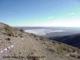
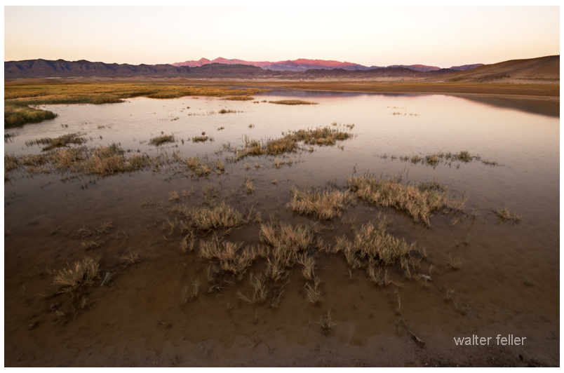
Lake Tecopa was once a vast body of water located in what is now southeastern California, near Death Valley. During the Ice Age, when the climate was much cooler and wetter, rain and melted snow filled the basin, creating a long-lasting lake. It existed for thousands of years, supporting various life forms and leaving clues about the region’s ancient past.

The lake was home to tiny aquatic creatures such as snails, clams, and microscopic algae. Larger animals, including mammoths and other Ice Age megafauna, gathered along its shores to drink. Over time, layers of mud and clay accumulated at the bottom, trapping fossils and preserving a detailed record of the lake’s ecosystem. These sediments also captured evidence of significant volcanic events. One of the most well-known ash layers in the Tecopa basin originates from a massive eruption of the Yellowstone hotspot approximately two million years ago. This ash, which traveled hundreds of miles, settled into the lakebed and became part of its geological history. Other eruptions also left behind layers of light-colored ash, which now serve as chronological markers for scientists studying the ancient environment.

Eventually, the lake’s natural barriers eroded, allowing water to escape and connect with what is now the Amargosa River. This event permanently drained Lake Tecopa, leaving behind a dry basin filled with clay and sediment. Today, the remnants of the ancient lake tell the story of changing climates, shifting landscapes, and the forces that shaped the Mojave Desert. Scientists continue to study the lakebed’s layers, using fossils, ash deposits, and sediment patterns to better understand the past and how this once-thriving lake disappeared into history.Lake Tecopa was once a vast body of water in what is now southeastern California, near Death Valley. During the Ice Age, when the climate was much cooler and wetter, rain and melted snow filled the basin, creating a long-lasting lake. It remained for thousands of years, supporting various life and leaving clues about the region’s ancient past.

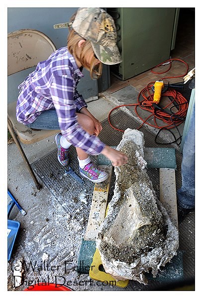
This image has an empty alt attribute; its file name is kassidy-bob-hilburn-.jpg
Kassie, under the eye of paleontologist, Bob Hilburn, exposes and cleans what would be a semi-lunar arch from either a mammoth or mastodon (the jawbone would be required to tell). .The bone could be anywhere from 14,000 to a million years old.

The lake was home to tiny aquatic creatures such as snails, clams, and microscopic algae. Larger animals, including mammoths and other Ice Age megafauna, gathered along its shores to drink. Over time, layers of mud and clay built up at the bottom, trapping fossils and preserving a detailed record of the lake’s ecosystem. These sediments also captured evidence of major volcanic events. One of the most well-known ash layers in the Tecopa basin comes from a massive eruption of the Yellowstone hotspot around two million years ago. This ash, which traveled hundreds of miles, settled into the lakebed and became part of its geological history. Other eruptions also left behind layers of light-colored ash, which now serve as time markers for scientists studying the ancient environment.

Eventually, the lake’s natural barriers eroded, allowing water to escape and connect with what is now the Amargosa River. This event permanently drained Lake Tecopa, leaving a dry basin filled with clay and sediment. Today, the remains of the ancient lake tell a story of changing climates, shifting landscapes, and the forces that shaped the Mojave Desert. Scientists continue to study the lakebed’s layers, using fossils, ash deposits, and sediment patterns to understand better the past and how this once-thriving lake disappeared into history.

Telegraph Communications

The telegraph revolutionized communication in the 19th century, allowing messages to travel almost instantly over long distances. Before its invention, news and correspondence had to be carried by horseback, stagecoach, or mail wagons, often taking days or weeks. Using Samuel Morse and Alfred Vail’s Morse code system, the telegraph changed that by transmitting electrical signals through wires.

Samuel Morse and Alfred Vail developed the first working telegraph in 1837. By 1844, telegraph wire carried the first long-distance message sent between Washington, D.C., and Baltimore. This success led to rapid expansion, with telegraph lines stretching across the United States. The first transcontinental telegraph line was completed on October 24, 1861, linking California with the rest of the country and making the Pony Express obsolete.

In the Mojave Desert, the telegraph was crucial for military operations, railroads, and mining communities. After Fort Mojave was established in 1859, the U.S. Army relied on telegraph lines to coordinate across remote desert outposts, particularly along the Mojave Road. The Southern Pacific and Santa Fe railroads extended telegraph lines along their tracks in the late 1800s, improving train dispatching and reducing accidents. Mining towns such as Calico (founded 1881) and Rhyolite (1904) depended on the telegraph for communication with investors and supply networks.

By the early 1900s, the telephone began replacing the telegraph, offering direct voice communication. However, railroads continued using the telegraph for dispatching into the mid-20th century. Today, while the telegraph has long been obsolete, remnants of old telegraph poles and wires can still be found in the Mojave Desert, marking the path of a once-revolutionary technology.

Calico

Rhyolite

Southern Pacific

Santa Fe

Mojave: Nature or Nurture

If you’re wondering whether the Mojave Desert is shaped more by nature or human influence, the answer is a combination of both. However, nature has had the predominant role for much longer.

Over millions of years, nature has carved out the Mojave, sculpting its landscapes through the forces of wind and water. It has created mountain ranges, valleys, and ancient lakebeds, setting the stage with extreme temperatures, limited rainfall, and hardy plants and animals that have adapted to survive in this challenging environment. Species like Joshua trees, creosote bushes, bighorn sheep, and sidewinder rattlesnakes have all found a way to thrive in a land where survival is not guaranteed.

In contrast, humans have made their mark in a much shorter timeframe. Indigenous peoples, such as the Chemehuevi and Mojave, lived sustainably in the region, moving with the seasons and utilizing the land’s resources without depleting them. Later, settlers, miners, ranchers, railroad builders, and modern developers added further layers of change. Some areas, like Las Vegas, military installations, and sprawling solar farms, have undergone significant transformation. In contrast, other regions remain relatively untouched, preserving their raw, ancient beauty.

So, is the Mojave a product of nature or nurture? Nature formed it, while humans have made adjustments—sometimes respecting its limits and other times pushing them. Regardless of how much we build or alter the landscape, the desert continues to adhere to its own rules. Flash floods serve as reminders of the power of water, sand dunes shift and reclaim the land, and scorching summer temperatures demonstrate who is truly in charge.

The Rickard – Earp Connection

Tex Rickard and Wyatt Earp were both larger-than-life figures of the Old West, though they came from different backgrounds and made their marks in different ways.

Wyatt Earp is best known as a lawman, gambler, and gunslinger, with his most famous moment being the Gunfight at the O.K. Corral in 1881 in Tombstone, Arizona. Over his long life, Earp moved from town to town, working as a marshal, running saloons, and getting involved in mining and real estate.

Tex Rickard, on the other hand, was a cowboy-turned-promoter who became one of the most influential figures in early boxing. He built Madison Square Garden and promoted some of the biggest fights of the early 20th century, including Jack Dempsey’s title bouts.

Their connection? Rickard worked in mining towns early in his career and operated gambling halls, much like Earp. It’s believed that the two crossed paths in Nome, Alaska, around 1900, when Rickard was running a saloon and gambling house during the Klondike Gold Rush, and Earp was similarly involved in gambling and saloon keeping. Though they weren’t close associates, they were part of the same world of frontier towns, gambling, and larger-than-life hustling.

Earp’s legend was shaped by dime novels and Hollywood, while Rickard became a giant in sports promotion. Both, in their own ways, embodied the rough-and-tumble, opportunistic spirit of the American West.

Tex Rickard – Promoter

Tex Rickard (1870–1929) was an American boxing promoter, entrepreneur, and gambler who played a major role in popularizing prizefighting in the early 20th century. Born George Lewis Rickard in Kansas, he earned the nickname “Tex” due to his time in Texas as a cowboy and lawman.

Rickard made a fortune in gold mining in Alaska during the Klondike Gold Rush before turning to gambling and sports promotion. He gained fame by organizing high-profile boxing matches, including several heavyweight championship bouts featuring Jack Dempsey, which helped transform boxing into a mainstream sport.

Beyond boxing, Rickard was also a key figure in the development of Madison Square Garden, overseeing its construction in 1925. He also played a role in early professional hockey, founding the New York Rangers in 1926. His influence on sports promotion and venue management set the stage for modern sports entertainment.

Wyatt Earp and the Controversial 1896 Boxing Match Referee Incident

Wyatt Earp’s Most Notorious Night in the Ring: On December 2, 1896, famed lawman Wyatt Earp stepped into the boxing ring as the referee for a heavyweight bout between Bob “Ruby” Fitzsimmons and Tom “Sailor” Sharkey. The fight took place at Mechanics’ Pavilion in San Francisco, California. Billed (controversially) as a contest for the Heavyweight Championship of the World, the event drew enormous attention. By the end of the night, Earp’s decision to disqualify one fighter sparked a firestorm: he awarded the victory to Sharkey under contentious circumstances, provoking immediate outrage. This incident would become one of the most infamous controversies in boxing history, severely tarnishing Wyatt Earp’s reputation for years to come.

Background: Fighters and the Lead-Up to the Fight

In 1896, the heavyweight boxing scene was in flux. The reigning champion, James J. “Gentleman Jim” Corbett, had recently retired, leaving the title vacant and boxing fans eager to crown a new champion. Bob Fitzsimmons – an English-born fighter nicknamed “Ruby Robert” – was a skilled boxer and ferocious puncher (earlier that year he had knocked out contender Peter Maher in one round). Fitzsimmons was widely regarded as the top contender and heavy favorite to become the next champion. His opponent, Tom “Sailor” Sharkey, was a tough Irish-born brawler and former sailor who had built a respectable record, though he was seen as the underdog against the more accomplished Fitzsimmons. To capitalize on the public’s hunger for a title showdown, the San Francisco-based National Athletic Club arranged a high-profile match between Fitzsimmons and Sharkey. Boxing was technically illegal in San Francisco at the time, but that didn’t deter promoters or fans – demand was so high that about 10,000 spectators crowded into Mechanics’ Pavilion for the bout (city officials and police even attended, despite the legal prohibition).

Tom “Sailor” Sharkey (left) and Bob “Ruby” Fitzsimmons (right), the two fighters in the 1896 San Francisco heavyweight bout refereed by Wyatt Earp. Fitzsimmons was an experienced former middleweight champion known for his knockout power, while Sharkey was a rugged brawler and Navy veteran. The match between these two was billed as a championship fight to determine the top heavyweight after James J. Corbett’s retirement, and public interest was enormous.

Wyatt Earp’s role as referee came about somewhat unexpectedly. Earp was 48 years old and long retired from his Wild West lawman days, but he had dabbled in boxing circles as a spectator and occasional referee of small matches on the West Coast and in Mexico. The fight’s organizers, scrambling to find a reputable official for such a high-stakes contest, approached Earp. He had a known name and a reputation (at least then) for toughness and honesty, which they hoped would lend credibility to the bout. Wyatt reportedly hesitated at first, aware that he lacked experience officiating bouts of this magnitude. Nevertheless, the allure of being the third man in a major prizefight – and perhaps a generous fee – convinced him to accept the assignment. Earp was announced as the referee just before the fight, a choice that drew some skepticism even before the opening bell.

Pre-Fight Tensions and Rumors of a Fix

Even before the fight started, controversy was brewing around Earp’s appointment. San Francisco was abuzz with rumors that the fight might be “fixed” – that is, that the outcome was pre-arranged in Sharkey’s favor. Sharkey’s own trainer, Danny Needham, had reportedly sent telegrams to acquaintances urging them to “Bet all you have got on Sharkey to win.” Such confidence in the underdog struck many as suspicious. Indeed, Martin Julian, Fitzsimmons’ manager, was so alarmed by the pre-fight gossip that he protested Earp’s selection in the ring before the bout began, citing “all the chatter of a fix” and demanding a different referee. Sensing the tension, Earp said he was willing to step down if both camps agreed, but Sharkey’s side insisted on Earp staying on, threatening to cancel the fight if he was removed. Their steadfast support of Earp as referee (despite the swirling rumors) later struck observers as one more curious detail in an increasingly dubious affair.

Another almost comic incident underscored the night’s unusual atmosphere: Wyatt Earp entered the ring armed, with a large revolver tucked in his coat. San Francisco Police Captain George Wittman, on hand at the event, was startled to see the famous lawman packing heat in the prize ring and made Earp hand over the “murderous-looking revolver” before the fight got underway. (Earp habitually carried a gun, explaining later that he did so out of habit and for personal protection.) The image of a boxing referee surrendering his six-shooter to the police in front of thousands of spectators made for vivid newspaper copy, and the San Francisco Call would soon mock Earp for having “a Navy revolver a foot long sticking out of his hip pocket” in the ring. With the preliminaries (and Earp’s sidearm) set aside, the fighters and referee prepared to make boxing history – though not in the way anyone expected.

The Fight: A Hard Battle until a Sudden, Controversial End

When the match began, it lived up to its hype – at least for the first seven rounds. Fitzsimmons, nicknamed “The Fighting Blacksmith,” used his superior skill and punching power to outbox Sharkey, as many anticipated. Sharkey, known for his brawling style and toughness, pressed forward aggressively but was eating hard shots and clearly losing ground as the fight went on. The crowd, largely rooting for Fitzsimmons (who was the favorite in betting), grew increasingly confident they were about to see “Ruby Robert” crowned the new champion.

In the 8th round, however, the drama reached its climax. Fitzsimmons drove a heavy body blow into Sharkey and knocked the sailor to the canvas. What happened next would be debated for decades. Sharkey writhed on the floor clutching his groin, claiming he’d been hit with a low blow (a punch below the belt). Fitzsimmons, believing he’d scored a legitimate knock-out, initially stood amused at Sharkey’s reaction, apparently unconvinced that any foul had occurred. After a brief moment of confusion, referee Wyatt Earp halted the bout and stunned everyone by announcing that Fitzsimmons had indeed struck a foul punch. He disqualified Bob Fitzsimmons and awarded the victory to Tom Sharkey. This meant Sharkey won the match (and the hefty prize purse) on a technicality, at the very moment he seemed to be losing.

Earp’s call provoked immediate chaos and outrage. The roaring crowd of thousands booed loudly as soon as the decision was announced. Almost no one in the audience had seen any foul occur – from their viewpoint, Fitzsimmons’ body blow looked fair, and Sharkey’s collapse appeared either genuine but unrelated to an illegal punch, or outright faked. Ringside witnesses were similarly baffled; one report noted “very few” actually observed the purported low blow. The arena erupted in anger, with spectators jeering Earp vehemently. Many had placed bets favoring Fitzsimmons (given he was the expected victor), so not only did their champion seem unjustly robbed, but their wallets were too. Earp suddenly found himself surrounded by an irate mob in the ring – some shouting that the fight was rigged, others simply stunned that the famous Wyatt Earp had rendered such a contentious verdict.

Immediate Aftermath: Protests, Legal Action, and Public Outcry

Right after the fight, accusations flew. Fitzsimmons was incensed at being denied victory and insisted he’d done nothing illegal. His managers and supporters claimed that a grave injustice – even fraud – had just taken place. They took the extraordinary step of going to court the very next day to prevent Sharkey from collecting the prize money. Fitzsimmons’s camp sought an injunction on the grounds that the result was fixed and illegitimate. A hearing was held, putting the bout under legal scrutiny for several days. In court, witnesses recounted the fight and the suspicious circumstances. One boxing official testified to seeing unusual betting activity favoring Sharkey shortly before the match (odds had shifted suddenly in Sharkey’s favor, hinting that insiders knew something). There were even questions about Sharkey’s injury: Dr. B. Brookes Lee, who examined Sharkey right after the bout, turned out not to be a licensed doctor at all – and years later he admitted he had helped fake the extent of Sharkey’s injury to support the foul claim. Despite all the suspicions, the legal challenge ran into a wall: a judge ultimately ruled that because the fight itself had been illegal (unlicensed prizefighting), the courts could not recognize its result or enforce any decision. In other words, the civil authorities washed their hands of the whole affair. This left Tom Sharkey free to collect the purse, and the official outcome (Sharkey winning by Earp’s disqualification call) remained intact – at least on paper. Fitzsimmons had no legal recourse to overturn the result. (He would, however, get his chance at glory a few months later: Corbett came out of retirement to fight Fitzsimmons in March 1897, and Fitz won that bout to claim the undisputed World Heavyweight Championship.)

Meanwhile, the public reaction to Earp’s decision was swift and brutal. In San Francisco, nearly everyone outside of Sharkey’s own entourage believed that Wyatt Earp had perpetrated a fix. As one paper put it, “Virtually no one agreed with Earp’s ruling,” encapsulating the public sentiment. Earp, once celebrated as a fearless lawman, was now being denounced on the West Coast as either a crooked referee or an incompetent one. Immediately after the fight, Earp had to be escorted out of the venue for his own safety, and he reportedly left San Francisco soon thereafter to lay low.

Media Coverage and the Storm of Controversy

The newspapers of the day had a field day with the story, and their coverage both reflected and amplified the outrage. San Francisco’s two major dailies took opposite sides. **William Randolph Hearst’s **Examiner (perhaps owing to Hearst’s past friendly acquaintance with Earp) cautiously supported Wyatt, while the **San Francisco **Call unleashed a barrage of criticism. On December 5, 1896, the Call devoted nearly its entire front page to the “foul” fight. It lambasted Earp’s character and integrity, calling the verdict “one of the most bare-faced robberies that has ever been perpetrated in this State under the guise of sport.” The Call openly suggested that Earp had colluded to fix the fight. It pointed to the suspicious betting and insider confidence on Sharkey’s side as evidence that a criminal conspiracy was afoot. The paper even mocked Earp’s gun-toting persona, sneering that he came to the ring with a revolver as if his “past mode of making a livelihood” (gunfighting) was his answer to everything. Describing him as a trigger-happy frontier thug, the Call wrote that Earp “has been a man who has shot down people innumerable… and said ‘What a great man am I.’” – a scathing portrayal meant to undermine Earp’s credibility in the modern sports arena.

Earp was pilloried in newspapers across the country. The story of the famous lawman allegedly cheating in a prizefight proved irresistibly sensational. Newspapers from California to New York picked up the tale and ran with it. Perhaps the most biting criticism came in the form of editorial cartoons. The New York Herald published a harsh caricature of Wyatt Earp that was reprinted widely (including in the San Francisco papers). In it, Earp is depicted as a “cackling, washed-up ruffian” in a cowboy hat, pointing a pistol at a fallen Fitzsimmons with one hand while passing a bag of cash to Sharkey with the other. This cartoon encapsulated what many believed: that Earp had brazenly taken a payoff to call a foul and hand victory to Sharkey. The image’s caption dubbed Earp a “Bad Man,” and it so captured public sentiment that it “dogged him the rest of his life.” Indeed, for years afterward, anyone who knew of Wyatt Earp would recall his role in this scandal with scorn or bemusement.

Amid the media furor, Wyatt Earp defended himself staunchly. He flatly denied any wrongdoing or any deal with the fighters. “I felt I did what was right… I saw the foul blow struck as plainly as I see you, and that is all there is to it,” Earp told the press, notably the San Francisco Examiner. He maintained that he called the fight as he saw it, implying that if the public disagreed, it didn’t concern him. Despite Earp’s protestations of honesty, the general public remained deeply skeptical. To most observers, it strained belief that an experienced boxer like Fitzsimmons would suddenly commit a flagrant foul when he was on the verge of victory – unless something nefarious was afoot. And if Fitzsimmons truly had fouled Sharkey, why had almost no one except Wyatt Earp seen it? These doubts continued to shadow the incident. Years later, in 1905, Dr. B. Brookes Lee (the dubious “physician” who treated Sharkey) signed an affidavit admitting the fight had been fixed – he confessed that he had helped make it appear Sharkey was fouled by treating him for an injury he didn’t really have. Lee’s statement suggested the fighters and promoters had arranged in advance for Sharkey to claim a foul once he was in trouble, thus securing him the win. It remains unclear whether Earp was in on this scheme or was an unwitting patsy who truly believed he saw a low punch. Regardless, the damage to Earp’s name was already done by then.

Impact on Earp’s Reputation and Legacy

The controversial San Francisco fight had a devastating impact on Wyatt Earp’s reputation. In the immediate aftermath, Earp became a pariah in sporting circles. He was threatened with indictment by local authorities for his role in the illegal fight (and was even fined $50 for carrying that concealed weapon into the ring). Old creditors and detractors saw an opportunity to dogpile him – within days, several lawsuits were filed against Earp for unrelated debts, as if to literally “cash in” on his notoriety. Feeling the heat, Earp left San Francisco abruptly and kept a low profile for a time. His venture into big-time boxing had left him humiliated. One historian noted it was “the most humiliating event of Earp’s life,” exceeding even the negative fallout he’d faced after infamous gunfights. The stain of the alleged fix followed him relentlessly. Wherever Earp went, the story trailed behind – often overshadowing the legend of Tombstone’s O.K. Corral.

In fact, when Wyatt Earp died in 1929, many newspaper obituaries and public recollections focused as much on the boxing scandal as on his days as a frontier marshal. As one account observed, by the time of his death “he was perhaps more well known for his decision in the title fight than his actions at the O.K. Corral gunfight.” This indicates just how deeply the 1896 fight had permeated the public consciousness. For a man who had survived deadly gunfights and vigilante notoriety, it was the boxing ring that dealt Earp’s image a blow he couldn’t shake off in his lifetime. In the decades after, the tale of Wyatt Earp’s refereeing fiasco remained a topic of debate among boxing historians and Old West enthusiasts alike – an “ugly blemish on the complexion of Wyatt Earp,” as one modern writer put it. Some continued to argue Earp might have made an honest (if mistaken) call, but the prevailing view has long been that the fight was a fixed sham and Earp’s name was rightly tarnished by it.

Over time, as Hollywood movies and sympathetic biographies resurrected Wyatt Earp as an iconic Western hero, the memory of the Sharkey–Fitzsimmons fight began to fade for the general public. Yet historians always mention it as a curious chapter in Earp’s life, illustrating that this legendary lawman wasn’t immune to controversy outside the Wild West. It took many years for Earp’s lawman legacy to be disentangled from the boxing scandal in the public mind. Today, the 1896 fight is remembered as a notorious episode in both sports and Wild West history. It serves as a reminder that Wyatt Earp’s life after Tombstone was full of unexpected turns – including a night in San Francisco when, as a boxing referee, his decision sparked an uproar and nearly knocked out his legend for good.
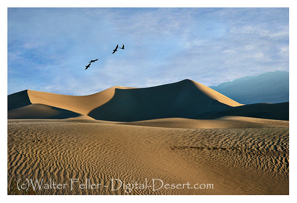
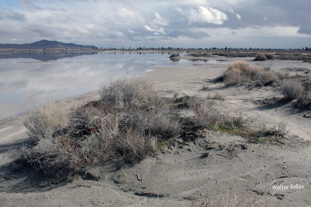
Sources:

  • Bob Fitzsimmons vs. Tom Sharkey fight details and aftermath (Wikipedia)
  • Contemporary newspaper reactions (San Francisco Call and others) as cited in Earp biographies
  • Sean Crose, The Fight City: “The Fight That Haunted Wyatt Earp” (2024) – narrative of the fight and its legacy
  • True West Magazine: “The Fix” by Garner Palenske (2016) – historical analysis of the fight and Earp’s later comments.

If I were a horny toad, I would want my name to be Tony.

Desert Horned Lizard – Phrynosoma platyrhinos
Family: Phrynosomatidae Order: Squamata Class: Reptilia

Tony is a solid name–tough and simple, like a horned lizard should be. I would pass my days soaking up the blistering desert sun, digging in the sand, and waiting for ants, which are my main source of sustenance. Life in the desert is harsh, but I would be ready. My large, flat body and sandy hue would keep me concealed, and if I ever found myself in a jam, I would have a few tricks up my sleeve. First, I would freeze, hoping my camouflage would save me. If that failed, I’d puff up to make myself big and hard to swallow. And if a predator actually went ahead and made a lunge to bite, I’d use my last trick—one that only the most powerful horned lizards can manage. I would shoot a little blood out of my eyes, just enough to make an attacker think twice about biting. But honestly, I would not wish to be a bother. I would stay in my own corner of desert, enjoying the hot sun, an occasional gentle breeze, and the ever-present plenty of ants which are my sustenance. Life as Tony the Horny Toad would be uncomplicated, peaceful, and appropriate to the one place I would ever need—the wide, open desert.

AI Report: Object-Oriented Programming (OOP) Representation of a Horse and Cart

This made for an interesting morning of coffee and gummies. I might be getting another dog. It is lonely here on the asteroid.

Overview:

This discussion explores modeling a horse and cart as objects using Object-Oriented Programming (OOP) principles. It covers defining attributes (fields/state), behaviors (methods), and their relationship, particularly when the horse pulls or detaches from the cart.


1. Initial Concept – Software Object Representation

  • The conversation began with an explanation of software objects in OOP, defining them as entities encapsulating both fields (state) and methods (behavior).
  • A general software object diagram was provided to illustrate the concept.

2. Horse as a Software Object

  • The horse was modeled as an object with:
    • Fields (State): Color, breed, age, speed, running status.
    • Methods (Behavior): run(), stop(), neigh(), eat().
  • A visual representation was generated to illustrate this concept.

3. Cart as a Software Object

  • The cart was modeled as an object with:
    • Fields (State): Material, wheels, capacity, color.
    • Methods (Behavior): move(), stop(), load(), unload().
  • A corresponding visual was generated.

4. Relationship Between Horse and Cart

  • The relationship was established where the horse pulls the cart.
  • The horse has a pull(cart) method, and the cart’s movement depends on whether it is attached to the horse.
  • A visual representation was generated showing this relationship.

5. Transition to a Bucking Bronco

  • The scenario was adjusted to depict the horse as a bucking bronco, modifying its behavior:
    • New Methods (Behavior): buck(), kick() (in addition to run(), stop(), neigh()).
    • The detaches() method was introduced to allow the cart to become disconnected when the horse bucks.
  • The updated relationship was illustrated with a new visual representation.

6. Code Representation of the Relationship

  • A Python implementation was provided, demonstrating:
    • The Cart class with methods to attach, detach, and store attributes.
    • The Horse class with methods to pull, buck, and interact with the cart.
    • The relationship where the horse pulls the cart when attached but detaches it upon bucking.
  • Example output of how the objects interact was included.

Conclusion:
The conversation effectively modeled a real-world system using OOP principles, highlighting how objects interact dynamically. The transition from a standard horse to a bucking bronco demonstrated flexibility in design, adapting object behaviors based on context.

This discussion provided conceptual diagrams and practical code to reinforce the learning process.

Historians

Historians can be categorized based on their approach, audience, and purpose. Here’s a general breakdown from the most scholarly to the most narrative-driven:

  1. Academic Historians – These are professional historians, usually with PhDs, who conduct original research, publish in peer-reviewed journals, and contribute to the academic study of history. Their work is often theoretical, analytical, and deeply sourced.
    • Example: A university professor writing a book on frontier economics based on archival records.
  2. Public Historians – These historians work outside academia, often in museums, historic sites, archives, or government agencies. They focus on making history accessible and engaging for the public while maintaining scholarly rigor.
    • Example: A historian curating an exhibit at a history museum or writing an interpretive panel at a historic site.
  3. Popular Historians – Writers who produce history books intended for general audiences. They may have academic training but prioritize readability and engagement over deep historiographical debates.
    • Example: A bestselling author writing about the California Gold Rush in a way that appeals to casual readers.
  4. Journalistic Historians – These historians approach history with a journalist’s eye, emphasizing compelling storytelling, investigative research, and connections to current events.
    • Example: A journalist writing a book on the Dust Bowl using interviews, personal stories, and archival research.
  5. Historical Novelists – Writers who blend history with fiction, using real events, places, and people but taking creative liberties to fill in gaps or enhance the story.
    • Example: A novelist writing about a fictional prospector in Bodie during its boom years.
  6. Folk Historians / Local Historians – These are individuals, often self-taught or community-based, who preserve and share regional or family histories. They rely on oral traditions, personal research, and local records.
    • Example: A longtime resident documenting the history of a small Mojave Desert town through interviews and old photos.
  7. Storytellers / Mythmakers – These historians focus on lore, legends, and dramatized history. Their accounts may be based on real events but are often embellished or fictionalized for entertainment.
    • Example: A storyteller spinning tales of Death Valley Scotty’s hidden gold in a campfire setting.

Each type plays a role in how history is understood and shared. Academic historians establish the facts, public historians interpret them, popular historians make them engaging, and storytellers keep them alive in culture.

Trivia Peddling

For generations, history classes have been bogged down by rote memorization-names, dates, and events drilled into students’ heads with little thought given to why any of it matters. Even today, many history teachers and local historians lean too heavily on disjointed facts instead of using them to build meaningful narratives that explain historical significance.

History isn’t just a giant list of trivia; it’s a web of interconnected stories shaped by social, political, and economic forces. A single event doesn’t exist in isolation—it has context, causes, and consequences. Without these connections, history is reduced to a collection of random tidbits, stripped of its power to help us understand the past, present, and future.

This is where public historians—whether in classrooms or local museums—have a real responsibility. Their job isn’t just to present facts but to interpret them, to connect the dots, and to explain why something matters. Trivia peddling is easy; real historical work is harder. It demands analysis, evaluation, and critical thinking. It also requires acknowledging complexity, contradictions, and uncomfortable truths.

And here’s a tough one: not everything that’s old is historically valuable. Sometimes, old stuff is just junk. Not every weathered building or faded document holds significance. Just because something has been around for a long time doesn’t mean it shaped history in a meaningful way. The real test is simple: So what?

That’s the question local historians should always ask. Why does this story, this place, or this artifact matter? How does it fit into the larger historical picture? If we can’t answer that, we aren’t doing history—we’re just collecting trivia.

Spirit

The Mojave is a proving ground and gathering place, changing those who move through it alone and in community. It boils life down to its essence—heat, wind, rock, and sky—compelling individuals to face themselves in ways they never have before. In conflict, some individuals discover definitive answers, others find questions, and most sense a connection to something greater than themselves.

To the Indigenous people, the land is sacred, with spirits and tales. Springs, rock etchings, and ancient trails indicate sites for ceremony and connection, where individuals sought visions and where the community reinforced common beliefs. Treasure hunters, travelers, and outlaws found their own beliefs later–whether in luck, omens, or the promise of vast fortune. The desert has always been a place where people feel their faith, shaped by the quiet and the open space that appears to go on forever.

Socially, the Mojave has brought together people who are seeking diverse things. From campfire stories to new-age spiritual retreats, from the alien ambiance of the Integratron to the shared awe of a meteor shower over Joshua Tree, individuals have congregated to experience something unspoken but profoundly sensed. Even in solitude, there is community–rock circles, roadside shrines, and invisible footprints signal that someone else has passed through, leaving their own faint imprint.

In its nature, the Mojave is a mirror. It reflects back what a person has inside–hope, desire, belief, or fear. Some see a wasteland, and some see a haven. Some leave the same, and some are transformed. Whether contemplating alone or together, the desert is the same: a place where meaning is created, where faith and doubt are tried, and where the silence, in its own voice, speaks.

El Gobernador

El Gobernador was a steam locomotive built for the Union Pacific in 1885. It was one of the largest locomotives of its time, designed specifically to handle heavy trains on difficult terrain.

Key facts about El Gobernador:

  • It was a 4-10-0 type locomotive, featuring four leading wheels and ten driving wheels.
  • The design aimed to provide greater traction for hauling freight trains over steep grades on the Union Pacific network.
  • Due to its size and weight, it encountered operational problems, such as excessive rail wear and difficulty navigating curves.
  • Despite its power, the locomotive was not a success and was retired after only a few years of service.

El Gobernador is an example of 19th-century railroad companies’ efforts to build more powerful locomotives to accommodate increasing rail traffic. However, not all innovations proved practical in the long run.

El Gobernador proved a few important things about locomotive design and rail operations in the 19th century:

  1. Bigger Isn’t Always Better – The locomotive was built to be powerful, but its massive size and weight caused operational issues, like excessive rail wear and difficulty navigating curves. This showed that simply adding more wheels and power wasn’t always the best solution.
  2. Engineering Limits – The locomotive highlighted the mechanical and structural limitations of railroad technology at the time. The tracks and infrastructure couldn’t always support such a heavy locomotive, leading to inefficiencies.
  3. Experimentation Leads to Progress – Even though El Gobernador wasn’t a long-term success, its design contributed to later improvements in locomotive engineering. Railroads learned from its flaws and refined locomotive designs to balance power, efficiency, and practicality.
  4. Specialization is Key – Instead of using oversized locomotives for all tasks, railroads moved toward specialized locomotives designed for specific terrains and train types, improving overall efficiency.

In short, El Gobernador was an ambitious experiment that demonstrated the need for balance between power and practicality in locomotive design. It helped shape the future of rail technology by showing what worked—and what didn’t.

The Mormon War

The Mormon War (Utah War) of 1857–58 was a conflict between the U.S. government and the Mormons in Utah Territory, though it never escalated into full-scale fighting. President Buchanan, concerned that Brigham Young was prioritizing church laws over U.S. laws, replaced him as territorial governor and sent a military force led by Colonel Albert Sidney Johnston to enforce federal authority. In response, Young declared martial law, mobilized the Mormon militia, and recalled Mormon settlers from surrounding regions. Harsh winter conditions delayed the U.S. Army’s arrival, allowing time for negotiations, which ultimately resolved the dispute peacefully.

Mormon Fort
Mountain Meadows
Map of Lower Colorado River in 1850s
Steamship Explorer

During this period, tensions were high, especially following the Mountain Meadows Massacre in 1857, which contributed to fears of conflict and influenced emigrant routes. Meanwhile, the Mormons were also exploring and attempting to expand their influence along the lower Colorado River. They hoped to establish an outlet to the sea for trade, increase missionary efforts among Native American groups, and prepare for possible military threats.

Eldorado Canyon

In Las Vegas, Nevada, Mormon missionaries established a mission in 1855 at Las Vegas Springs and explored the Colorado River’s navigability. Early expeditions, such as those led by Rufus Allan and later groups, scouted the river and surrounding lands but found the river largely unnavigable. With the rising tension between Mormons and the U.S. military, Jacob Hamblin and other Mormon scouts, including Ira Hatch and Dudley Leavitt, conducted reconnaissance on U.S. Army activities, believing an invasion was imminent. One Mormon spy, Thales Haskell, was caught aboard the military survey steamer Explorer but provided misleading information about alternative California routes.

Fearing a federal attack from the south, Apostle Amasa M. Lyman led an expedition in 1858 to identify a defensive site near Pyramid Canyon, though no battle materialized. They concluded that Eldorado Canyon was the furthest feasible point for navigation. Ultimately, the anticipated invasion never came, and tensions eased.

Lake Manix

Lake Manix – Coyote Arm

The Coyote Arm of Lake Manix refers to a western extension of the ancient lake, reaching into what is now the Coyote Basin area. During the lake’s high stands, this arm would have been a shallow extension of the main body of water, influenced by the surrounding topography and hydrology.

As Lake Manix formed during the Pleistocene, its extent fluctuated with climate changes. At its peak, it covered over 90 square miles and was fed by the Mojave River. The Coyote Arm, like other sections of the lake, would have played a role in shaping local sediment deposition and ecosystems. When Lake Manix eventually breached at Afton Canyon, draining down the ancestral Mojave River path, the Coyote Arm would have dried up along with the rest of the lake, leaving behind alluvial deposits, clay beds, and evidence of past shorelines.

Afton Canyon

This area is now part of the Mojave Desert, with remnants of Lake Manix’s history visible in fossilized shorelines, lacustrine sediments, and scattered Pleistocene fossils.

The Bouse Formation:

A Window into the Prehistoric Hydrology of the Lower Colorado River

The Bouse Formation is a geological deposit found in parts of southwestern Arizona, southeastern California, and southern Nevada. Dating back to the Pliocene epoch, approximately 5 to 3 million years ago, this formation consists of fine-grained sediments such as marl, limestone, siltstone, and claystone. It provides crucial insights into the environmental history of the lower Colorado River and its transition from a series of ancient water bodies to the modern river system that defines the region today.

Composition and Depositional Environment

The Bouse Formation primarily comprises calcareous sediments, which indicate deposition in aquatic environments. The presence of marl and limestone suggests that these deposits formed in a setting rich in calcium carbonate, likely influenced by water chemistry changes over time. Interbedded silt and clay layers point to periodic shifts in sediment input, possibly linked to fluctuating water levels or varying sources of sediment.

The nature of the Bouse deposits has led to significant debate over their origin. Some researchers propose that the formation represents a marine incursion when the Gulf of California extended farther inland. This hypothesis is supported by the presence of marine fossils, such as foraminifera, which typically inhabit saltwater environments. However, another widely discussed interpretation suggests that the Bouse Formation was deposited in a series of freshwater to brackish lakes that existed before the modern Colorado River carved its path. In this scenario, the river may have initially flowed into these isolated basins, forming temporary lakes before fully integrating into a continuous drainage system.

Fossil Evidence and Hydrological Implications

One of the most intriguing aspects of the Bouse Formation is its fossil content, which includes both marine and freshwater microfossils. This mix of species suggests that environmental conditions shifted over time, either due to changes in water source or gradual transitions between marine and non-marine settings. The presence of diatoms, ostracods, and other aquatic organisms provides valuable data for reconstructing the region’s paleohydrology.

The Bouse Formation also plays a role in understanding the ancient course of the Colorado River. Some researchers believe that the formation represents the earliest phase of the river’s integration into the Gulf of California. Others argue that before the modern river fully developed, a system of large lakes existed, gradually draining as the river’s course evolved. These interpretations have significant implications for understanding water flow patterns, sediment transport, and landscape evolution in the region.

Connection to Broader Geological History

The study of the Bouse Formation is closely tied to the broader history of the American Southwest, particularly in relation to the Mojave Desert and its ancient lake systems. Similar to the now-extinct Lake Manix, which was part of the Mojave River’s prehistoric flow, the Bouse deposits suggest a period when water played a much more prominent role in shaping the landscape. Understanding these ancient hydrological processes helps geologists piece together the story of how the Southwest transitioned from a wetter, lake-dominated environment to the arid desert we see today.

Conclusion

The Bouse Formation remains a subject of ongoing scientific investigation, as its origins and implications continue to be debated. Whether formed by marine incursions or freshwater lakes, its sediments hold valuable clues about the past hydrology of the lower Colorado River. As researchers uncover more details, the Bouse Formation will remain a critical piece in reconstructing the prehistoric landscape of the region, offering insights into the forces that shaped the modern desert Southwest.

Summary

The Bouse Formation, dating back 5 to 3 million years ago, consists of calcareous sediments found in Arizona, California, and Nevada. It provides key insights into the ancient hydrology of the lower Colorado River. Debate surrounds its origin, with theories of marine incursions or freshwater lakes. Fossil evidence suggests shifting environments, linking it to broader geological changes in the American Southwest.

Damn Yellow Flowers

Desert Gold (Geraea canescens)

Damn Yellow Flowers (DYFs) is a term affectionately (or begrudgingly) used by botanists, naturalists, and desert wanderers to describe the frustratingly abundant and often similar-looking yellow wildflowers that blanket arid regions like the Mojave Desert. These flowers, while beautiful, can be a nightmare to identify—kind of like trying to tell apart identical twins who insist they have wildly different personalities.

The Science Behind DYFs

Desert Dandelion (Malocothryx glabrata)

Despite their casual nickname, DYFs encompass a wide range of plant species, predominantly from the Asteraceae (sunflower) family. This family includes some of the most common desert wildflowers, many of which share characteristics like bright yellow petals, composite flower structures, and a knack for popping up right where you least expect them.

Common DYFs of the Mojave Desert

Brittlebush (Encelia farinosa)

Below are a few of the most frequently encountered DYFs in the Mojave Desert, along with their scientific and common names:

  1. Desert Gold (Geraea canescens) – A tall, wiry-stemmed sunflower lookalike that thrives after rainy winters. It’s often the first to bloom during a superbloom, showing off like that one cousin who always arrives overdressed.
  2. Desert Dandelion (Malacothrix glabrata) – A smaller, daintier yellow flower that resembles a garden dandelion but grows in sandy soils. It’s the floral equivalent of a minimalist, sticking to the basics but still catching your eye.
  3. Golden Suncup (Camissonia brevipes) – A member of the evening primrose family, this plant has smaller yellow flowers that bloom near the ground. It thrives in disturbed soils, much like the houseplants you keep forgetting to water.
  4. Brittlebush (Encelia farinosa) – One of the most easily recognizable DYFs, this shrub produces clusters of yellow daisy-like flowers on long stalks above silvery-green leaves. Imagine a desert plant trying its best to cosplay as a daisy bouquet.
  5. Yellow Cups (Chylismia brevipes) – Similar to golden suncup but with more pronounced petals, this species tends to appear in sandy washes and along roadsides, proving that even wildflowers enjoy people-watching.
  6. Goldfields (Lasthenia californica) – These tiny yellow blooms cover vast expanses of desert terrain, often blending together to create the illusion of a solid golden ground cover—kind of like nature’s way of rolling out the red carpet, but for bees.

Why So Many Yellow Flowers?

Desert Marigold (Baileya multiradiata)

The dominance of yellow in desert wildflowers isn’t just a coincidence. Many desert plants have evolved yellow blooms because it is one of the most visible colors to pollinators, especially bees and butterflies. In an environment where survival depends on successful pollination, standing out is a strategic advantage—basically, these flowers are nature’s version of a flashy billboard.

The Struggles of Identifying DYFs

Bigalow’s Coreopsis (Coreopsis bigelovii)

For amateur botanists and even seasoned professionals, distinguishing between different species of DYFs can be a daunting task. Many species exhibit only minor differences in petal shape, leaf texture, or stem height. Additionally, environmental factors such as soil composition and precipitation levels can influence plant morphology, making identification even trickier. It’s kind of like trying to pick the right brand of mustard—so many choices, all vaguely the same.

Appreciating DYFs Beyond the Frustration

Mojave Sun Cup (Camissonia campestris)

While they may be difficult to differentiate, DYFs are an essential part of the desert ecosystem. They provide nectar and pollen for pollinators, contribute to soil stabilization, and play a role in the desert food chain. Whether viewed as a botanical headache or a seasonal spectacle, these flowers are an undeniable part of the Mojave Desert’s charm.

So the next time you find yourself cursing at a sea of damn yellow flowers, remember that each one has its own niche, history, and role in the desert’s delicate balance. Or just make up a name and move on—chances are, no one will correct you.

Goldfields (Lasthenia californiaca)

The Open Spaces . . .

Those were the days of open-handed hospitality on the Mexican ranches. No introduction was necessary. People came and went on horseback, hung their saddles on pegs and their hats on the floor, and stayed as long as they liked.

Everywhere I stopped I was welcomed. The owner came in from the fields, knocked off work for the day, produced tequila, coffee, cigarettes, and sat down under the porch for a talk. The coffee- pot and bean-pot were always over the fire and in constant requisition. There was no great variety of food at the table, but the meats and vegetables were tastily cooked, and, if there were young girls in the family, there was singing, to the accompaniment of the guitar, during and after the dinner. When it came to retiring for the night, one simply dragged out a rawhide or canvas cot to whatever part of the premises he pleased, spread his blankets, and went to sleep listening to the dogs chasing coyotes.

The hospitality was very simple, whole-hearted, and very gratefully received because of its fine spirit.

John C. Van Dyke

Newberry Springs

Newberry Springs, California, is a small but historically notable town some 20 miles east-southeast of Barstow along the iconic Route 66. Its history is tied to the spread of the railroad, the journey of early migrants, and the precious water resources of the Mojave Desert.

The region initially became well-known when the Southern Pacific Railroad laid railway tracks through the area in 1883. The Watson post office was established at the point of railroad work on February 19 that year and was named for the initial postmaster, Josiah Watson. The post office did not last long, however, closing by July of the same year. The railway, in the meantime, had named its stop Newberry; so when the Watson post office was discontinued, this name de facto became the community’s accepted name. Throughout the years, the region underwent several renaming: in 1899, the post office briefly reopened as Newberry before it was closed afterward; in 1911, it was renamed Wagner in tribute to local resident and grocer Madge Wagner; and in 1919, it was once more renamed as Water, highlighting the great volumes of water—estimates are placed somewhere between 300,000 to 600,000 gallons daily—pumped out of the region for use by the Santa Fe Railroad. Later, in 1967, the name was formally altered to Newberry Springs.

The derivation of “Newberry” is contested. In a local myth, two Newberry brothers lived near the springs, one of whom died in a conflict over water rights. However, a more historically grounded theory suggests the area was named after Dr. J.S. Newberry, a physician on the 1857 expedition of Lt. Joseph C. Ives. Regardless of its actual origins, the name has remained, cementing Newberry Springs’ place in Mojave Desert history.

Newberry Springs has historically been appreciated for its reliable springs, which were important water sources for the early wagon trains and eventually the Santa Fe Railroad. Beyond its transport and water supply historical significance, Newberry Springs has also become well known for artificial ponds, utilized by sporting enthusiasts recreationally, and agricultural promise. The fertile ground in the area makes possible the growing of crops, fruit trees, and cattle ranching, demonstrating versatility beyond its previous transport role.

Another recognizable landmark in Newberry Springs is the Cliff House, situated on the historic Route 66. Though information on the Cliff House is scarce, it serves as a representation of the town’s significance at the peak of American automobile travel. Route 66, nicknamed the “Mother Road,” simplified travel from the Midwest to the West Coast, and Newberry Springs still has vestiges of the period. Vintage motels, service stations, and restaurants still dot the landscape, providing travelers with a glimpse of the roadside culture of the mid-20th century.

Along with its historical significance in transportation and farming, Newberry Springs also holds important archaeological significance. The nearby Newberry Cave is a prominent prehistoric site, containing carefully preserved rock art and artifacts that provide insightful knowledge about the area’s early inhabitants. Additionally, the natural features of the area, including volcanic formations and Troy Lake, contribute to its geological and ecological value.

Newberry Springs is a community that has been defined significantly by its history, geography, and the perpetual issue of water scarcity in the Mojave Desert. Evolving as a railroad stop and developing through the heyday of Route 66 and subsequent developments, this desert town is a fascinating piece of California’s extensive and rich history.

Newberry Springs

Tandem Website Configurations

Mojave Desert Net & Digital-Desert.com

Walter Feller, a retired engineering technician, has spent the past 30 years developing and expanding Digital-Desert.com and MojaveDesert.Net, two extensive resources dedicated to the history, geography, and natural beauty of the Mojave Desert. His work combines research, photography, and storytelling to document the region’s landscapes, historic sites, and ecological significance.

His dedication to preserving and sharing knowledge about the Mojave Desert through these platforms has made him a key figure in desert history documentation.

Introduction

The Mojave Desert is a sprawling, rugged terrain full of history, unusual geology, and varied ecosystems. Two valuable online resources, **MojaveDesert.net** and **Digital-Desert.com**, offer an extensive overview of this interesting region. With coverage ranging from national parks and wilderness areas to ghost towns, historic trails, and natural landmarks, the websites offer detailed guides for adventurers, historians, and nature lovers alike. Suppose you’re interested in desert wildlife and plants, mining history, native cultures, or points of interest. In that case, these websites provide detailed information, interactive maps, and beautiful photographs to make the Mojave tales come alive.

MojaveDesert.net is a comprehensive resource dedicated to the Mojave Desert, offering a variety of information about its geography, history, ecology, and more. The directory tree in the following is not complete but demonstrates While I don’t have access to a complete directory tree of the website, I can provide an overview of its main sections based on available information:

  • Home: Introduction to the Mojave Desert, featuring highlights and recent updates.
  • Geography: Details about the desert’s location, topography, and significant landmarks.
  • Flora and Fauna: Information on the plant and animal species native to the Mojave Desert.
  • History: Insights into the cultural and historical aspects of the region, including indigenous cultures, exploration, and settlement.
  • Ecology: Discussions on the desert’s ecosystems, climate, and environmental concerns.
  • Recreation: Guides and tips for activities such as hiking, camping, and sightseeing in the Mojave Desert.
  • Photo Gallery: A collection of images showcasing the desert’s landscapes, wildlife, and points of interest.
  • Resources: Additional materials like maps, articles, and external links for further exploration.

For a more detailed exploration of the website’s content, I recommend visiting MojaveDesert.net directly.

MojaveDesert.net is a resource covering the Mojave Desert’s geography, history, ecology, flora, fauna, and recreation. It includes sections on landmarks, indigenous cultures, exploration, environmental concerns, hiking, and photography. The site also offers maps, articles, and external resources.

Digital-Desert.COM

Digital-Desert.com is a comprehensive resource dedicated to the Mojave Desert, offering detailed information across various topics:

  • Nature: Explores the desert’s ecology, including its wildlife, plant life, geology, and climate.
  • Parks & Forests: Provides insights into national parks like Death Valley and Joshua Tree, as well as lesser-known state and county parks.
  • Wilderness Areas: Highlights regions preserved in their natural state, free from human impact.
  • Geology & Natural Formations: Discusses the majestic formations and mountain ranges found throughout the Mojave Desert.
  • Points of Interest: Features notable destinations and attractions within the desert.
  • Regional Map Guide: Offers an interactive map for navigating the Mojave Desert.
  • People & History: Delves into the histories of various groups and cultures associated with the Mojave, including influential figures and native cultures.
  • Roads and Trails: Covers historical and contemporary routes, as well as hiking trails and backroads.
  • Ghost Towns & Gold Mines: Examines abandoned communities and the mining history that once thrived in the region.
  • Communities: Profiles current towns and cities within the Mojave Desert.

The website also features sections on the Mojave River, historic roads and trails, craters and lava flows, petroglyphs, dunes, and dry lakes (playas). Additional resources include a blog, weather information, and a glossary.

digital-desert.com

For a more in-depth exploration, visit Digital-Desert.com.

summary

Digital-Desert.com is a comprehensive resource on the Mojave Desert, covering its nature, geology, history, and points of interest. It includes information on national parks, wilderness areas, ghost towns, gold mines, roads, trails, and regional communities. The site also features interactive maps, historical accounts, and details on wildlife, plant life, and natural formations.

description of these two websites combined

Conclusion

MojaveDesert.net and Digital-Desert.com are two extensive online resources dedicated to exploring the Mojave Desert’s rich history, geography, ecology, and cultural significance. Together, they provide a comprehensive look at the region’s national parks, wilderness areas, ghost towns, historic roads, and geological formations. These sites offer in-depth information on the desert’s plant and animal life, environmental concerns, indigenous cultures, mining history, and notable landmarks. Visitors can also find interactive maps, hiking guides, and photography collections that highlight the beauty and complexity of the Mojave Desert.

Crossroads at Elizabeth Lake

Draft Only

Pre-European Contact (Before 1770s)
Tataviam and Kitanemuk peoples inhabit the region, using trails through San Francisquito Canyon and Elizabeth Lake for trade and migration.
Elizabeth Lake (La Laguna de Chico Lopez) serves as a natural water source.

Spanish & Mexican Period (1770s-1848)
1770s-1820s: Spanish explorers and missionaries establish travel routes between Mission San Fernando and the San Joaquin Valley.
1830s: The area becomes part of Mexican land grants, including Rancho La Liebre and Rancho El Tejon, supporting ranching and travel.

The Lost ’49ers & Death Valley (1849-1850)
Summer 1849: The Lost ’49ers follow the Hunt Cutoff, a supposed shortcut to California goldfields, leading them into Death Valley.
November 1849: The emigrants become trapped, suffering from starvation and dehydration.
December 1849: William Manly and John Rogers travel over 250 miles to find help, passing near Searles Lake before reaching Rancho San Francisco.
January-February 1850: Survivors escape past Elizabeth Lake, through San Francisquito Canyon, and toward Los Angeles.
February 1850: The last emigrants leave Death Valley, one reportedly saying, “Goodbye, Death Valley.”

Stagecoach & Freight Era (1850s-1870s)
1853: San Francisquito Pass is surveyed for a wagon road linking Los Angeles to the San Joaquin Valley.
1858: The Butterfield Overland Mail establishes a stage stop at Elizabeth Lake, making it an important relay station.
1860s: Freight wagons carry borax and silver from Searles Lake through San Francisquito Canyon and Elizabeth Lake en route to San Pedro Harbor.
1860s-1870s: Elizabeth Lake continues as a key stop for stagecoaches and freight wagons.

Railroad & Decline of Stage Routes (1876-1890s)
1876: The Southern Pacific Railroad completes the Los Angeles-to-San Francisco line, reducing reliance on stage routes.
1880s: Twenty-mule teams transport borax from Death Valley to Mojave, where shipments are transferred to San Francisco by rail.
1890s: Rail connections replace the wagon freight industry, but Elizabeth Lake Road and San Francisquito Canyon remain essential travel routes.

Elizabeth Lake

Mojave Phone Booth

The Mojave Phone Booth was a payphone located in the Mojave National Preserve, 15 miles east of Baker, California. It gained a following in the late 1990s when folks saw the phone booth website exposing the phone booth visitors started dialing in at the phone booth to hear the other end answered. The booth, placed in the 1960s, initially sat in a location to serve miners and ranchers in the off-the-beaten-path region. It was a run-of-the-mill payphone, first a rotary dial model and then a push button model. It gained a phone number, (714) xxx-xxxx (later changed to 619 with updated area codes for current times).

Mojave Phone Booth

In the late ’90s, a web surfer named Godfrey Daniels discovered its presence and posted its phone number. Word traveled rapidly through web forums, and visitors started hiking into the desert to dial in, converse, and even answer the phone. Some visitors even pitched a tent nearby to converse with strangers dialing in from all over the planet. It became a surreal social experiment, with stories of deep conversation and chance encounters.

Due to concerns of the National Park Service, under whose administration part of the Mojave National Preserve lay, in 2000, it took down the booth in May. Officials cited concerns over the environment and the danger posed by its presence in a delicate environment and for visitors. Still, its legend lives in pop culture, with a short film, books, and ongoing nostalgia for those who remember it.

For over two decades gone, the Mojave Phone Booth lives in legend, a reminder of digital-era chance, proving that we can make chance encounters and meaningful contact even in most off-the-beaten-path locations.

Evergreen & Deciduous Content

Comprehending Evergreen and Seasonal Topics of the Mojave Desert

The Mojave Desert is a stunning destination filled with tales of survival, science, and culture. Certain topics on the Mojave are as enduring as the desert, long-lasting, stable, and perpetually in fashion. Such subjects are referred to as “evergreen” topics, which never wane in popularity. Some topics are transient, tied to today’s news or specific dates. Such are the “deciduous” topics, losing importance over time as autumn leaves drop. Let us examine both sets, remembering how they teach and enrich our understanding and appreciation of this amazing desert.

Evergreen Mojave Topics: The Desert’s Permanent Stories.

Interesting sections of the Mojave Desert are never a disappointment. Nature and wildlife, for instance, never cease to intrigue people and scientists alike. Stories such as “The Unique Adaptations of Mojave Desert Plants” or “Animals You Can Spot in the Mojave” never fail to grab your attention, whether you read them at any time. The Joshua tree, the emblem of the Mojave, is yet another that never gets old. Its strange shape and capability to endure harsh weather speak volumes about the bridge that spans the past to the present. Geology is a source of enduring knowledge. Reading essays such as “How the Mojave Desert Was Created” or “The Mojave’s Ancient Lake Systems” teaches about the mechanisms that formed the desert millions of years ago. Such subjects are not exclusive to geologists—these are interesting for anyone interested in learning the big picture of our planet.

History and culture within the Mojave are important as well. From the Native American communities to miners and ranchers who came afterward, the stories of individuals persevering and being creative are all quite important. A travel guide to historical trails, like the Mojave Road, or the story about how the California Gold Rush affected the desert, will always be of value. They allow us to connect with those who came before us on this planet.

Finally, practical travel tips—like “Best Hiking Trails in the Mojave Desert” or “How to Visit the Mojave Safely”—are useful to anyone preparing for a trip. These evergreen topics are always valuable, providing tips and recommendations that don’t change year after year.

Changing Mojave Topics: The Desert Today

Not all things in the Mojave are always the same. Some are bound to a point in time, such as news stories, seasons, or scientific discoveries. For instance, “Mojave Desert Conservation Update” or “2025 Mojave Wildfires” are significant but lose their meaning as things shift. Seasonal content is another form of transitory content. For instance, stories on the “Best Places to Observe Wildflowers in the Mojave This Spring” are interesting for a couple of months, but not when the flowers are gone. Similarly, seasonal event calendars, such as a 2025 meteor shower or a list of winter trails to trek, are extremely interesting but for a limited time.

Trending topics fit into this category. So, for example, “The Most Instagrammable Places in the Mojave This Year” will receive attention for a short time but will not be relevant next year when the trend shifts. In the same vein, news of renewable energy developments or tourist numbers is thrilling for a short time but quickly becomes old news as new news takes its place.

Travel content, say hotel advertising or opening theme parks, is a transitory subject. It is useful to visitors while they plan their holiday, but individuals don’t generally return to such content after an extended break.

Even science is deciduous. New discoveries, like new fossil discoveries or revised climate statistics, are thrilling when they first come out, but ultimately get integrated into the overall corpus of knowledge. These tales might be part of the larger Mojave story, but they’re anchored in the here and now.

Both evergreen and deciduous subjects play a valuable role in telling the story of the Mojave Desert. Evergreen content remains timely, offering valuable information and inspiration to people who love the desert or wish to learn more about it. Deciduous content, on the other hand, adds a sense of urgency, connecting us to the news and discoveries unfolding in the Mojave. Understanding the difference makes it clear how the Mojave Desert is simultaneously ageless and forever changing—much like the stories we tell about it. Whether we are amazed by its ancient rocks or tracing the latest conservation efforts, the Mojave has something for everybody at every moment.

Traction Engines

Traction engines were large, powerful, steam-powered machines capable of pulling heavy loads over terrain rather than tracks. They were used from the late 1850s to the mid-1900s to tow massive loads.

Few roads and rails were in the desert then, and folks hoped that machines could function better than horses and mules. What Were Traction Engines For?

Mining: Mines and mills scattered all over the Mojave Desert, and traction engines moved ore other cargo.

Borax: Perhaps you have heard “20-mule teams” hauling borax (a mineral in cleaners and such) out of Death Valley Someone once considered traction engines might haul it out faster. But the desert had other plans.

Desert Freighting: Traction engines also delivered food and provisions to places without a train.

Why Didn’t They Work So Well?

Water Problems: They were steam engines, and steam requires water. The Mojave Desert is hardly filled with water, so keeping the engines supplied with water over long distances wasn’t easy. Tough

Terrain: The desert’s soft sand and rock tracks proved challenging for heavy equipment to navigate. It was prone to breakdowns or getting stuck on these routes.

Tough to Fix: These complex engines require experienced people to operate them. If something went awry in the difficult and remote terrain, it was not simple to repair.

What Happened to Them? Traction engines didn’t survive long in the Mojave. They were more difficult to operate than mules, trucks, and trains. However, they remain significant in desert history. The machines demonstrated how people always attempted to discover better means of tackling difficult challenges.

Today, you can see old traction engines in museums or rusty ones along abandoned mining areas. They remind us of when people were ready to try new things, even if they did not always succeed.

Regional History Categories

1. Indigenous Histories Focus on the original Native American residents like the Mojave, Chemehuevi, Serrano, and Paiute people. Emphasize traditions, trade routes (e.g., Mojave Trail), religious beliefs, and their adaptation to the harsh desert environment. Mention the effects of colonization, like displacement, cultural loss, and present-day preservation efforts.

2. Exploration and Early Settler Histories Talk about early explorers like Jedediah Smith, John Fremont, and Francisco Garces. This would involve the creation of trails, like the Mojave Road and Old Spanish Trail, for trade and migration purposes. Discuss early homesteading enterprises and settler-Native interactions.

3. Histories of Mining and Economic Development Involve boom-and-bust patterns of mining towns like Calico, Rhyolite, and Goldfield. Describe the mining of gold, silver, borax, and other minerals and their economic significance. Highlight transportation infrastructure like railroads (e.g., Tonopah and Tidewater) that supported mining operations.

4. Military Histories Describe military use of the Mojave, including the establishment of forts (e.g., Fort Mojave) to protect settlers and trade routes. Including World War II-era training camps like Camp Iron Mountain and the Desert Training Center. Highlight the Mojave’s role in defense testing and operations at Fort Irwin and Edwards Air Force Base bases.

5. Transportation and Route Histories Discuss desert travel route development, from Native trade trails to wagon roads and railroads. Feature famous highways like Route 66 and their cultural influence. Describe water stops, stagecoach stations, and road towns that served travelers.

6. Agricultural Histories Discuss the challenges and technology of desert dry land farming and ranching. Feature homesteading stories and irrigation projects like those in Lucerne Valley or Imperial Valley. Observe how modern development altered ranching lands.

7. Environmental and Geologic Histories Explain how desert environments, ancient lake systems (e.g., Lake Manix), and unique geologic features developed. Highlight changes in vegetation and fauna over time and human impact on the ecosystems. Add paleontological discoveries, e.g., fossils in the Rainbow Basin.

8. Tourism and Preservation Histories Describe the creation of national parks and monuments like Joshua Tree, Death Valley, and Mojave National Preserve. Discuss the growth of desert tourism, ghost town tourism, and recreation activities. Describe efforts at conserving cultural and natural heritage sites.

Summary

Mojave Desert histories can be grouped into these main types:

  1. Indigenous Histories: Focus on Native peoples, their culture, trade, and adaptation.
  2. Exploration and Settlers: Highlight explorers, early settlers, and trade routes.
  3. Mining and Development: Cover mining booms, ghost towns, and railroads.
  4. Military Histories: Include forts, WWII training camps, and modern bases.
  5. Transportation Routes: Explore trails, railroads, Route 66, and travel stops.
  6. Agriculture: Discuss ranching, farming, and irrigation efforts in the desert.
  7. Environmental Histories: Explain geological formations, ancient lakes, and ecosystems.
  8. Tourism and Preservation: Focus on parks, ghost towns, and conservation.

Regional Histories

The Mojave Desert is rich and varied in its history. Its past teaches us how occurrences that happened in a place help us to understand connections between people, places, and larger historical trends. The distinctive lands, settings, and natural resources of the Mojave influenced the way people lived there and generated narratives that are still linked to this place.

Johannesburg

https://mojavedesert.net/history/regional/

Local History and Family Background in the Mojave Desert Local history and family history are frequently intertwined in the Mojave Desert. The communities that were settled here early, from mining boomtowns to railroad towns, were frequently documented by the families of the first people who came here, pioneers, prospectors, ranchers, and homesteaders. These histories preserve knowledge about the first settlers, their failures and successes at carving out a life in a brutal landscape. They also depict segments of the lives of Native American people, such as the Mojave, Chemehuevi, and Serrano Indians, who inhabited the region many years before the European settlers arrived.

Willow Springs

These histories are a goldmine for genealogists. They provide in-depth information about the families who resided and worked in the Mojave and the economic and social circumstances they encountered. Church records, school rolls, and local newspapers show how families expanded, businesses flourished or collapsed, and communities changed.

Wilsona Gardens

Local History Beyond Genealogy

The local histories of the Mojave have much more than dates and names; they paint a distinct picture of desert life: Food and Cooking Habits: The early residents adapted their cuisine to the harsh desert environment, making use of indigenous plants such as mesquite and yucca, animals, and crops resistant to drought. These habits depict the resourcefulness and skills of the individuals living there.

Las Vegas

Mining and Economic Development:

Mojave’s history is directly related to mining. It began with the 1800s gold rush and continued with borax mining. Rhyolite, Calico, and Boron towns came and went depending on the success of their mines, leaving behind ghost towns and abandoned industrial infrastructure. Transportation and Railroads: The Mojave was also significant in the development of railroads and highways for transportation, being a point where individuals traveling west intersected. The Southern Pacific, Santa Fe, and Union Pacific railroads revolutionized the desert landscape and linked its cities to the economy. Cultural Arts and Traditions: The desert’s remoteness spawned distinctive art forms, including music and legends of Native American tribes and creations of modern artists inspired by the Mojave’s minimalist beauty.

Goffs Schoolhouse

Joshua Tree has emerged as a cultural center for musicians and artists. Consequences of National Events: National events impacted the Mojave in different ways through wars, economic recessions, and periods of national expansion. World War II, for instance, resulted in the creation of military bases in the region, such as the Marine Corps Air Ground Combat Center in Twentynine Palms, that reshaped local populations and economies.

Broader Consequences of Local Political Culture

The Mojave’s local histories show how its political culture shaped wider trends. Such issues as land use, water rights, and conservation in the Mojave Desert are good lessons about how far local decisions can have huge implications. The fight over resources such as the Colorado River and controversy over public lands show why one should study local conditions in relation to national and international issues.

Eldorado Canyon

Briefly stated, local and regional histories of the Mojave Desert are more than a collection of ancient myths; they are a window into the diverse forces-geographic, economic, cultural, and political-that have shaped this legendary place. Through the lens of local history, we can see how seemingly remote desert places are connected to larger patterns of human history and experience.

Summary

The Mojave Desert’s local history offers insights into its unique culture, economy, and environment. It intertwines genealogy with stories of settlers, miners, and Native American communities. Local accounts highlight foodways, mining, railroads, and artistic traditions shaped by the desert’s geography. Broader events, like wars and economic shifts, impacted the region in distinctive ways. Political battles over water and land use reveal its national significance. These histories illuminate the Mojave’s enduring connection to human resilience and adaptation.

The Story of Kramer Junction:

Desert Crossroads Kramer and Kramer Junction don’t look grand today, but these little nooks in the Mojave Desert have a rich and grand history replete with grand aspirations, tiring battles, and a whole lot of determination. Mining booms, railroads, and highways have scripted the life of the desert, and these little nooks have seen them all through.

How It All Started

The Southern Pacific Railroad in 1882 named Kramer in honor of German immigrant Moritz Kramer, who had settled in the area a little a few years earlier. Initially, Kramer was a single siding with nothing happening. All changed in 1884, when copper was discovered in the vicinity, and then, in 1884, gold was discovered by J.R. Maxey.

Prospectors flocked to the area in the hope of striking it rich, and in late 1884, the Kramer Mining District was formally organized. Miners in the mining camp lived a rough life. There were no hotels or permanent buildings, and visitors were instructed to bring a blanket. Thankfully, soon, the thrill wore off.

High shipping costs and a scarcity of water saw mining become too arduous, and most miners scattered in 1885, taking most of them with them.

The Mining Boom in Kramer Hills

A mere four miles southeast of Kramer Junction stands the Kramer Hills, and it saw its mining boom, too. In 1926, two Herkelrath brothers, Ed and John, discovered gold, and a mining boom of epic dimensions defined the region ever since. A small mining settlement grew with a store, a library, and several hundred mining claims. Everyone flocked to try their luck. But just as then, realities of the desert won out. The gold was of poor grade, and water remained in short supply. By 1931, the boom collapsed, and the village lay dormant.

2001 photo

Today, quiet sits over the Kramer Hills, but they recall a time when humans hoped for gold’s promise. Kramer Junction: Where Highways Cross Kramer Junction, also known as “Four Corners,” sits at the crowded intersection of U.S. Route 395 and Route 58. It became a stop for travelers and for trucks rumbling through the desert. Roadside restaurants, service stops, and shops popped up to serve through-trekkers. There was even a Beecher-operated restaurant and a dream of having the site renamed “Beecher’s Corner,” but in 1960, city leaders chose to stick with “Kramer Junction.” Though most pass through, Kramer Junction serves as a gateway to larger destinations. North will take you to Ridgecrest and Bishop. South will take through Victorville and down Cajon Pass. To head west, go to Boron, Mojave, and Tehachapi; to the east, to Barstow and beyond.

From a Stormy History to a Role Today

Kramer Junction has, over the years, become safer and easier for visitors to access. In 2020, a new development along an expressway smoothed traffic and enhanced security. This highway system is a major route for shipping goods through California and across the country. It’s a big one for Central Valley farms, producing a big portion of America’s produce.

A Spot with a History

Kramer and Kramer Junction don’t look like much today, but they’ve seen gold rushes, railroad expansion, and the construction of high-speed highways. What transpired in these locations is a history of people arriving in the desert with big dreams and working tirelessly to carve out something from nothing. Today, these places remind us that even in the most subdued corners, there can be incredible tales that alter the world around them. Next time driving through, don’t forget to pay your respects to the people who inhabited this dusty crossroads at one point in time.

Kramer Junction, CA

U.S. 395

Interstate 40

1604 Juan de Oñate

In 1604, a Spanish explorer, Juan de Oñate, embarked on an epic journey to explore America’s western region, present-day America, in modern terms. On his journey, he became the first European to encounter the Native Americans, specifically the Mohave Indians, who lived near the Colorado River in the Mojave Desert, a region that we use today.

The sole purpose of Oñate’s journey was discovering a path to the “Sea of the South,” nowadays’ Pacific Ocean. He hoped that it could lead to new trading avenues and routes. Even though he failed to discover the ocean, much about the Mohave tribe, he discovered. The Mohave were seasoned farmers who cultivated such crops such as squash, beans, and corn in and around the river, and they played a key role in trading between disparate Southwest Native American communities. The beginning of encounters between Europeans and Native Americans, initiated with, saw numerous future encounters between them, with some peaceful, but many encountering obstacles and rivalry as well.

For the Mohave, it was only the beginning of drastic changes that started with even more Europeans arriving in years to come.