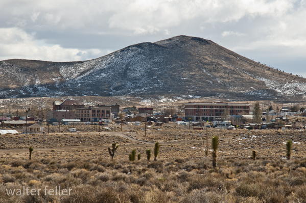
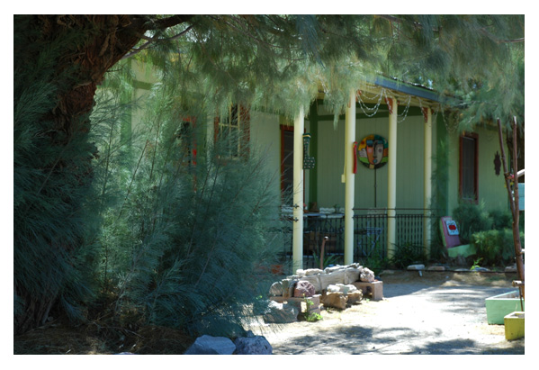
A day in Bodie Ghost Town provides visitors with a unique and immersive experience that offers a glimpse into the past and showcases the history, culture, and daily life of a late 19th-century mining town.
Here’s what a day in Bodie can show you:
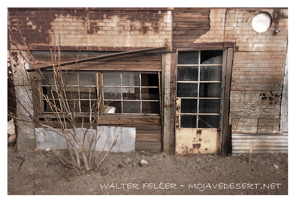
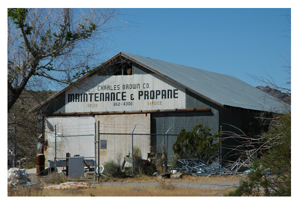
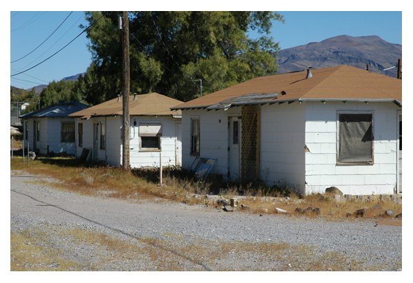
Well-Preserved Buildings: Bodie is known for its remarkably well-preserved buildings. A walk through the town reveals a variety of structures, including homes, saloons, general stores, a church, a schoolhouse, and more. These buildings are frozen in time, filled with period-appropriate furnishings, tools, and artifacts, allowing visitors to see how people lived and worked in the late 1800s.
Historic Artifacts: Inside the buildings and throughout the town, you’ll find a wide range of historical artifacts, from old mining equipment to personal belongings of the town’s former residents. These items provide insight into the daily lives and occupations of Bodie’s inhabitants.
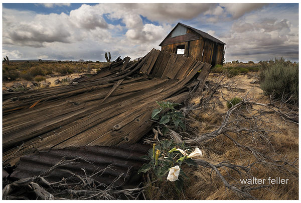
Authentic Atmosphere: Bodie Ghost Town has a unique atmosphere that transports visitors back in time. The unpaved streets, weathered wooden buildings, and the absence of modern amenities contribute to an authentic Old West ambiance.
Interpretive Displays: The Bodie State Historic Park often features interpretive displays and signs that provide historical context and information about the town’s history, its prominent figures, and its residents’ challenges.
Photography Opportunities: Bodie is a popular destination for photographers due to its picturesque buildings, dramatic landscapes, and the way natural elements have reclaimed some areas. The interplay of light and shadow on the historic structures creates stunning photo opportunities.
Ghost Town Lore: Visitors can learn about the legends and stories associated with Bodie, including its reputation for being a rough and lawless place during its heyday. The town’s history contains tales of mining accidents, shootouts, and colorful characters.
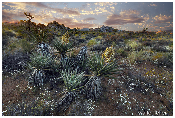
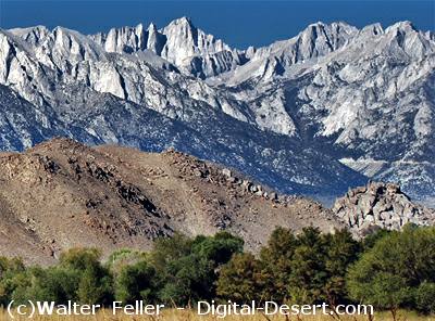
Spectacular Scenery: Bodie is surrounded by beautiful natural landscapes, with views of the Sierra Nevada Mountains in the background. Visitors can enjoy the region’s scenic beauty, including meadows and desert flora.
Visitor Center: Bodie has a visitor center where you can gather information about the town’s history, obtain maps, and watch introductory videos that provide background on the site. It’s a good starting point for your visit.
Guided Tours (seasonal): Bodie may offer guided tours led by knowledgeable park rangers or docents, depending on the time of year. These tours provide additional insights and stories about the town’s history.
Peaceful Serenity: Bodie is often described as a peaceful and serene place. The remote location, lack of crowds (compared to more famous tourist destinations), and the sense of isolation contribute to a tranquil and reflective experience.
Overall, a day in Bodie Ghost Town offers a fascinating journey into the past, providing a tangible connection to the lives of those who once called this historic mining town home. It’s a place where history comes alive, and visitors can appreciate the challenges and triumphs of the people who lived there during the late 1800s.
Sorrow deepens in the evening then glides on tilted wings Between the twisted trees Above the trail through a woodland malice .
. And shadow after shadow drops from the moonlight pouring through the forest. The white moon and the burnt black shadows. Shoved into sadness . These terrible shadows, one after another Long wings slowly, gracefully beating Silent, save the wind. Silent and sad. .
Arrowhead Pinnacles is a popular rock climbing area in Southern California’s San Bernardino Mountains. It is known for its unique and challenging rock formations, making it a favorite destination for rock climbers and outdoor enthusiasts.
Here are some key details about Arrowhead Pinnacles:
Location: Arrowhead Pinnacles is situated within the San Bernardino National Forest, near the city of San Bernardino in San Bernardino County, California. It is approximately 80 miles east of Los Angeles.
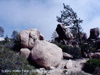
Rock Formations: The area is characterized by a series of granite rock spires and pinnacles, which provide a wide range of climbing opportunities. The granite formations offer a variety of cracks, slabs, and faces for climbers of different skill levels.
Rock Climbing: Arrowhead Pinnacles is primarily known for its rock climbing opportunities. Climbers can find routes that vary in difficulty, from beginner-friendly routes to more advanced and challenging climbs. The granite rocks and scenic surroundings make it a popular destination for traditional and sports climbing.
Access: Access to Arrowhead Pinnacles typically requires a National Forest Adventure Pass for parking. The area is accessible via a short hike from the parking area to the climbing routes. Climbers should check for specific regulations and access updates from the San Bernardino National Forest or local climbing organizations.
Scenic Beauty: Besides rock climbing, Arrowhead Pinnacles offers stunning views of the surrounding San Bernardino Mountains and Lake Arrowhead. The area’s natural beauty attracts climbers, hikers, and nature enthusiasts.
Safety: Climbing at Arrowhead Pinnacles requires proper gear, including ropes, harnesses, helmets, and climbing shoes. Climbers should also be aware of the weather conditions and potential hazards associated with outdoor rock climbing.
As with any outdoor activity, it’s essential for climbers to prioritize safety and adhere to Leave No Trace principles to protect the natural environment. Before visiting Arrowhead Pinnacles, you should check with local climbing organizations or the San Bernardino National Forest for up-to-date information on access, routes, and any seasonal closures or restrictions.
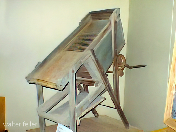
A drywasher for gold is a piece of equipment used in gold prospecting and mining. It is a device that uses air to separate gold particles from other materials, such as sand and gravel, without water. Here’s how it typically works:
Dry Material Feed: A drywasher is loaded with dry material from a gold-bearing area, such as soil or gravel, that may contain gold flakes or nuggets.
Vibrations: The dry washer has a vibrating mechanism that shakes the material, allowing the gold particles to settle downward due to their higher density.
Air Blower: An air blower blows air through the material. The airflow helps to separate the lighter materials (like sand and gravel) from the heavier gold particles. Gold is denser than most other materials in the mixture, so it settles at the bottom.
Collection Tray: At the bottom of the drywasher is a tray or riffles where the separated gold collects. Miners can then carefully remove the gold from this tray.
Repeat Process: The process is repeated until no more gold is collected, indicating that the gold-bearing material has been processed.
Drywashers are particularly useful in arid regions where water is scarce or where regulations restrict water use for mining activities. They are portable and relatively easy for small-scale prospecting and mining operations.
It’s important to note that using a drywasher for gold requires understanding gold prospecting techniques and knowing where to find gold-bearing material. Additionally, following local laws and regulations related to gold prospecting and mining activities is essential.
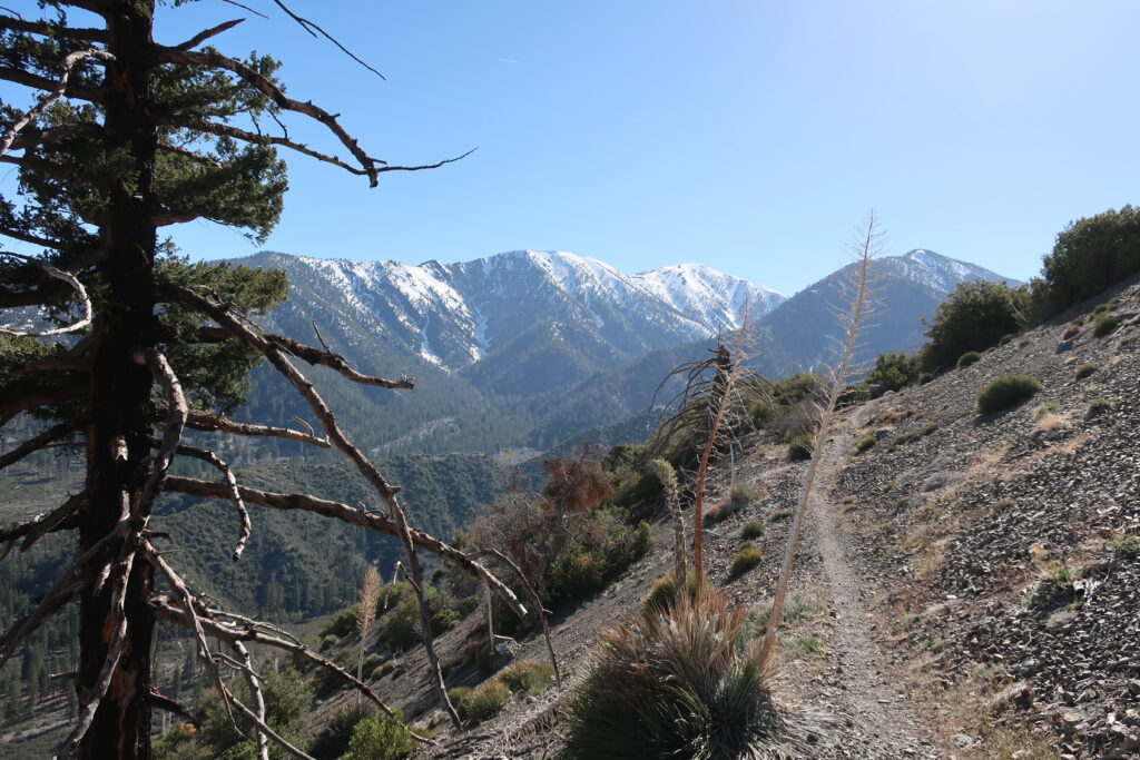
The Acorn Canyon Trail is a popular hiking trail in Wrightwood, California. It is part of the San Gabriel Mountains and offers a beautiful natural setting for outdoor enthusiasts. The trail is known for its scenic views.
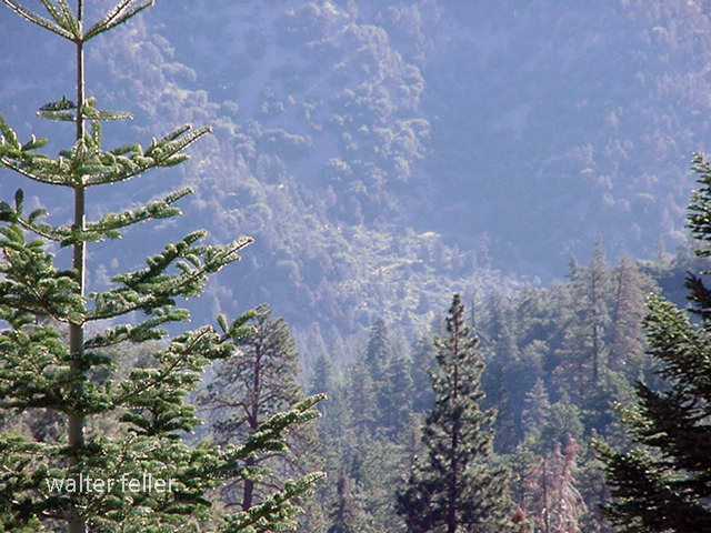
View from the Acorn Trail
Trail conditions, accessibility, and regulations may change over time, so it’s a good idea to check with local authorities or websites dedicated to hiking in the area for the most up-to-date information before planning your visit. Additionally, be prepared with appropriate hiking gear and follow Leave No Trace principles to protect the environment while enjoying the trail.
Acorn Canyon is indeed a part of the Angeles National Forest in California. It’s a beautiful area for hiking and enjoying the outdoors. As with any outdoor activity, it’s important to be prepared and follow safety guidelines when exploring this area.
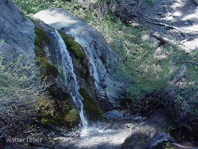
Acorn Falls
Here are some general tips:
Trail Information: Ensure you have up-to-date information about the Acorn Canyon Trail, including its length, difficulty level, and recent trail conditions or closures. This information is often found on the Angeles National Forest website or from local ranger stations.
Hiking Gear: Wear appropriate clothing and footwear for hiking. Don’t forget essentials like a hat, sunscreen, sunglasses, and plenty of water. Depending on the season, you may also want to carry insect repellent.
Trail Etiquette: Practice Leave No Trace principles by staying on designated trails, disposing of trash properly, and respecting wildlife. It’s also a good idea to yield the trail to others and be courteous to fellow hikers.
Safety: Let someone know your plans, including your expected return time. Carry a map and a fully charged cell phone, but be aware that cell phone reception may be limited in some parts of the forest.
Wildlife: Be aware of the potential for encounters with wildlife, including snakes. Stay on the lookout and keep a safe distance.
Weather: Check the weather forecast for the area before heading out. Weather conditions can change rapidly in mountainous areas, so be prepared for sudden temperature drops or rain.
Permits and Regulations: Depending on the specific trail and activities you plan to do, you may need permits or have to follow certain regulations. Check with the forest service or relevant authorities for necessary permits or rules.
Emergency Contacts: Have the contact information for local emergency services or the nearest ranger station in emergencies.
Safety should be a priority when enjoying the outdoors, especially in wilderness areas like the Angeles National Forest. Enjoy your hike in Acorn Canyon and take in the area’s natural beauty while staying safe and respecting the environment.
Goldfield, Nevada, is a small town in Esmeralda County, in the southwestern part of the state. It has a rich history, primarily centered around its boom and subsequent decline during the early 20th century.
Here’s a brief overview of the history of Goldfield:
Discovery of Gold: Goldfield’s history began in 1902 when prospector Tom Fisherman and his partner Harry Stimler discovered gold in the area. This discovery led to a rush of prospectors and miners to the region, hoping to strike it rich.
Boomtown: The town of Goldfield quickly grew as miners and entrepreneurs flocked to the area. By 1903, it had become a booming mining town with a rapidly growing population. Goldfield was known for its numerous mines, including the famous Combination Mine.
Infrastructure Development: During its peak, Goldfield saw significant development. The town had hotels, saloons, theaters, banks, and even an opera house. The Goldfield Hotel, constructed in 1907, was one of the most luxurious hotels in the state at the time.
Mining Industry: The mining industry was the lifeblood of Goldfield. The town produced significant gold, silver, copper, and other minerals. It became one of the largest gold-producing towns in Nevada.
Labor Strikes: Goldfield experienced labor strikes and tensions in the early 1900s as miners demanded better working conditions and wages. The labor disputes occasionally turned violent.
Decline: Despite its initial success, Goldfield’s fortunes began to decline in the late 1910s. The ore veins started to run out, and the town’s population dwindled. The decline accelerated during the Great Depression.
Modern Era: Today, Goldfield is a small, historic town with a much smaller population than its heyday. It is known for its preserved historic buildings, including the Goldfield Hotel, which is rumored to be haunted.
Tourism: In recent years, Goldfield has seen a revival of interest in its history and has attracted tourists interested in the town’s gold rush past.
Goldfield’s history is a classic example of the rise and fall of a mining boomtown in the American West. While it may not have the same prosperity it once enjoyed, its history and architecture continue to captivate those interested in the Old West and the mining industry.
Gold and silver ore milling and processing in the Mojave Desert refers to the historical practice of extracting and refining precious metals from ore deposits found in the Mojave Desert region of the southwestern United States, primarily during the late 19th and early 20th centuries.
Keeler smelter
This process involved several steps:
Mining: The first step was to locate and extract gold and silver ore from underground mines or open-pit operations in the desert. Miners would use various techniques to break up the rock and access the valuable minerals.
Crushing and Grinding: Once the ore was extracted, it was typically in large rocks or chunks. Miners would use crushers and mills to crush and grind the ore into smaller particles, making it easier to extract the precious metals.
Chemical Processing: After crushing and grinding, the ore was treated with chemicals, typically cyanide for gold and other reagents for silver, to separate the precious metals from the rest of the ore.
Smelting: In some cases, the ore was further processed through smelting. Smelting involves heating the ore to high temperatures to separate the metal from impurities. This step was often used for silver processing.
Refining: The final step was refining the extracted gold and silver to increase their purity. Various techniques were used to achieve this, including electrolysis and chemical processes.
Tailings: The waste material left after extracting and processing gold and silver ore, known as tailings, was often deposited in tailings piles or ponds near the processing facilities. These tailings could contain residual metals and chemicals, posing environmental concerns.
Historically, many towns and mining camps in the Mojave Desert were established to support these mining and processing operations. Some of these ghost towns remain reminders of the region’s mining history.
It’s important to note that the methods and environmental regulations for mining and ore processing have evolved significantly since the heyday of mining in the Mojave Desert. Modern mining and processing operations are subject to strict environmental regulations to mitigate the impact on the desert ecosystem and surrounding communities.
The Mojave Desert is known for its rich history of mining and the presence of ghost towns and abandoned mines. Here are some notable ghost towns, sites, and gold and silver mines in the Mojave Desert:
Calico Ghost Town: Located near Barstow, California, Calico is one of the most famous ghost towns in the Mojave Desert. It was a thriving silver mining town in the late 1800s but became abandoned when the silver market declined. Today, it’s a well-preserved tourist attraction.
Rhyolite, Nevada: Rhyolite was once a booming gold mining town in the early 1900s. It had over 5,000 people but was quickly abandoned when the mines played out. You can visit the remains of the town and see the famous “Bottle House” made of glass bottles.
Goldfield, Nevada: Goldfield was another prosperous gold mining town in Nevada. It had a peak population of around 20,000 people in the early 1900s. The Goldfield Hotel and several historic buildings still stand today.
Panamint City, California: This remote ghost town in Death Valley National Park was a silver mining town in the late 1800s. It’s accessible via a challenging hike and offers stunning views of the surrounding desert.
Cerro Gordo, California: Cerro Gordo is an old silver mining town still privately owned. It’s located in the Inyo Mountains and has a well-preserved ghost town, including a general store, bunkhouse, and other structures.
Mines in the Mojave Desert: The Mojave Desert is home to numerous gold and silver mines, many of which are abandoned. These mines contributed to the region’s mining history. Some notable mines include the Tonopah-Belmont Mine, the Desert Queen Mine, and the Goldstone Mine.
Remember that exploring abandoned mines can be dangerous due to unstable structures and the presence of toxic gases. It’s essential to exercise caution and, if needed, seek permission or guidance from local authorities or landowners when visiting these sites. Additionally, some ghost towns and mines may be on private property, so be respectful of any access restrictions.
The Old Spanish Trail had become increasingly used as a pack mule trail between New Mexico and California, and with this traffic came the opportunity for those to take advantage of the distance and desperate nature of the land.
Hundreds and sometimes even thousands of stolen horses from the ranchos would burst through Coyote Canyon beginning their ‘journey of death’ across the Mojave.
California horses were beautiful creatures, and the mules were taller and stronger than those in New Mexico and they were easy to steal. The rolling hills and plains presented clear paths to the Cajon where numerous hidden canyons and washes were available to slip into and prepare for the furious run across the desert. Horses would be stolen in herds from many different ranchos at once. Hundreds of horses, even thousands could be commandeered and driven by just a few experienced thieves.
Narrows, Crowder Cyn., Cajon Pass
Chief Walkara, ‘Hawk of the Mountains’ and the greatest horse thief in all of history along with his band of renegade Chaguanosos , and notables such as Jim Beckwourth and Pegleg Smith would work together in this illegal trade. During one raid they were said to have coordinated the theft of 3,000-5,000 horses, driving them to Fort Bridger to trade for more horses to run to New Mexico to trade again. Horses would fall from exhaustion every mile and the local bands of Paiute would feast on the remains.
The rich ranchos of southern California.
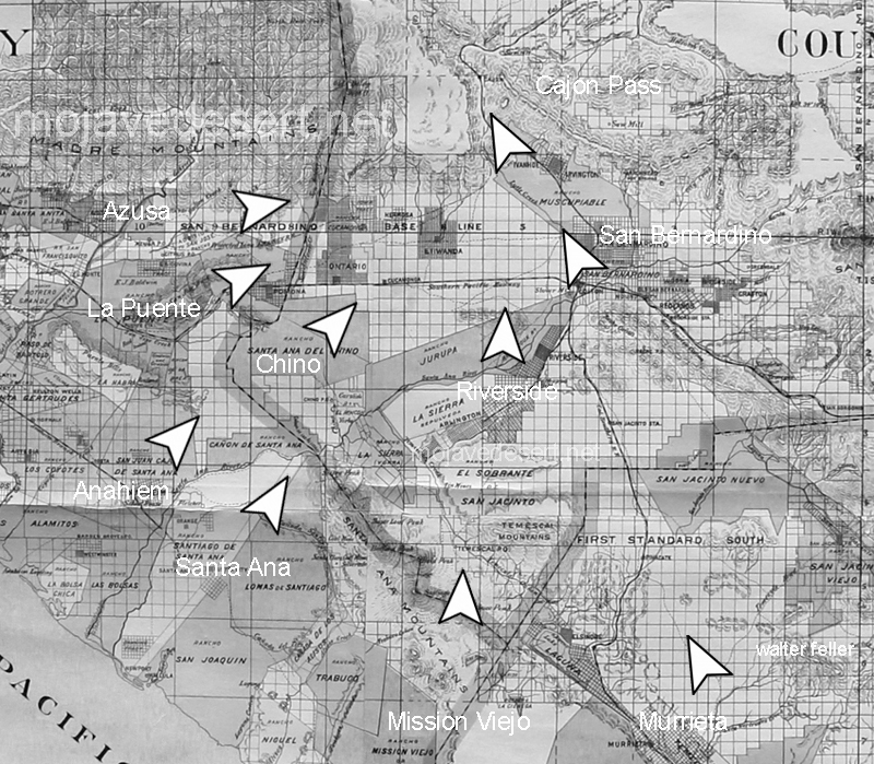
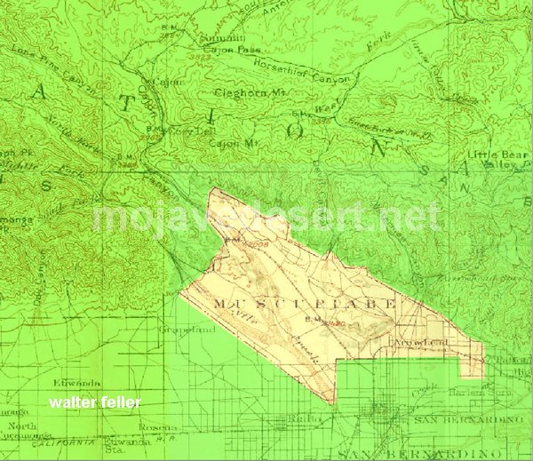
In 1843 Michael White was granted one league of land at the mouth of the Cajon Pass called Rancho Muscupiabe. At a point overlooking the trails leading into and away from the canyon he was expected to thwart the raiders and horse thieves that were plaguing the Southern California ranchos. In theory it was a good plan but in practice it did not work so well.
From the piedmont between Devil and Cable canyons, Miguel Blanco could keep an eye out for the horse thieves entering the Cajon.
He built his home of logs and earth and constructed corrals for his stock. However, the location between Cable and Devil Canyon only served as a closer and more convenient target for the Indian thieves. His family was with him, but after six weeks until it became too dangerous. He left after nine months without any livestock and in debt.
The Old Spanish Trail went down this slope to behind Miguel Blanco’s rough-hewn homestead. Indians would watch from this forest for Miguel to leave and they would slip down and steal everything that could be stolen.
Miguel sold his property, however, Miguel had misread the grant, letting the rancho go for much less than it was worth. The land described on the grant was roughly 5 times larger than Miguel thought. Blanco brought a suit but lost.
Muscupiabe Rancho
As the late 1840s and 1850s rolled by wagon roads were being developed in the canyon minimizing the effectiveness of the maze of box canyons being used to cover the escape of desperadoes on horseback. With California becoming a state frontiersmen such as Beckwourth and Peg Leg Smith would not steal from fellow Americans. Horse-thieving under U.S. law had become a crime where before it was just stealing horses from Mexicans. That was only serious if caught in the act. Americans would never extradite them. For the most part, that was the end of the horse stealing raids.
Mount Baldy as seen from the Baldy Bowl Trail. It’s a steep climb to the “Bowl”, let alone the summit. However, the alpine scenery and bright blue skies make it entirely worth it.
Hike Mount Baldy to Wrightwood via the North Backbone Trail. This trip takes you from south to north, traversing the San Gabriel mountains eastern high country. The terrain is high and dry, passing amongst wind bent pines, colorful outcroppings of rock, and views in all directions while taking you through stunning alpine scenery.
Total Distance = Approx. 12 miles one way
Initial Elevation Gain = 3,900′ the first 4 miles to Mt Baldy. Once on the North Backbone trail, which’ll take off northward at the 10,064′ summit, there is an initial 1,300′ of steep descent down to the first saddle. Next there’s 900′ of climb to Dawson Peak followed by 400′ of drop to the next saddle. Finally there’s a brief climb of 450′ to the gentle summit of Pine Mountain. Now and finally, there’s a good 1,400′ drop down to the last little saddle before climbing up a couple hundred yards to the end of the North Backbone trail. In another 1 1/2 miles of level trail walking you’ll reach the upper end of the Acorn Trail where there will be 1,600′ of drop into Wrightwood. Over the length of this hike your total Gain will be 5,250′ and the total DROP will be 4,700′.
Map to take: Tom Harrison’s “ANGELES High Country” map, 2018. Nothing against map apps, I just happen to really like having a physical map as well as bringing an orienteering compass, too.
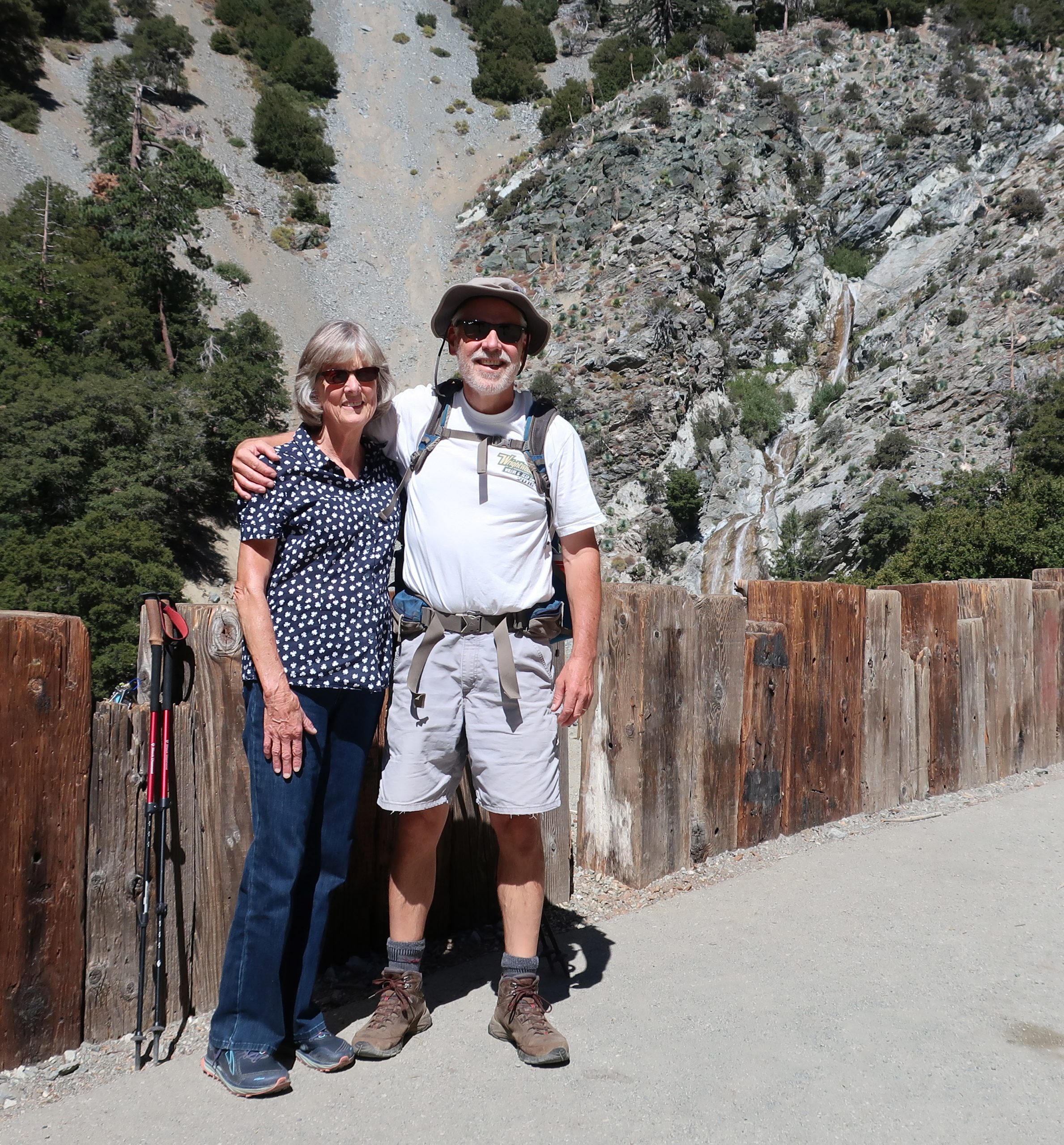
Joanie and Chris just a short distance up San Antonio Canyon from Manker Flat Campground. That’s San Antonio Falls just off to the right of my shoulder.
This last Monday, my wife and I drove around to San Antonio Canyon above Upland, from our home in Wrightwood. I’d been thinking about hiking up Mt. Baldy from the U.S. Forest Service Manker Flat campground and had been kicking this idea around for about a week. As some days went by, got to thinking that it’d be really nice to just keep on hiking from Baldy’s summit to Wrightwood via the North Backbone trail. Easy, speasy.
All of this area, including the North Backbone trail, I had hiked years earlier, meaning in some cases, some decades ago… It all seemed so easy in my head and being that it was only going to be a day hike, there wouldn’t be a heavy pack to lug up and down the ridge tops. That’s it, a cinch! I’m now pushing 59 years and still hiking, yet there’s no denying that the hikes take a wee bit longer and the recovery the day after is longer . Yeah. Well, as things turned out, we got started a bit later than planned, meaning like almost 11:00 a.m. Nonetheless, it ended up being a great day to hike! My wife was going to drop me off at the Manker Flat trailhead and we’d meet up later in Wrightwood.
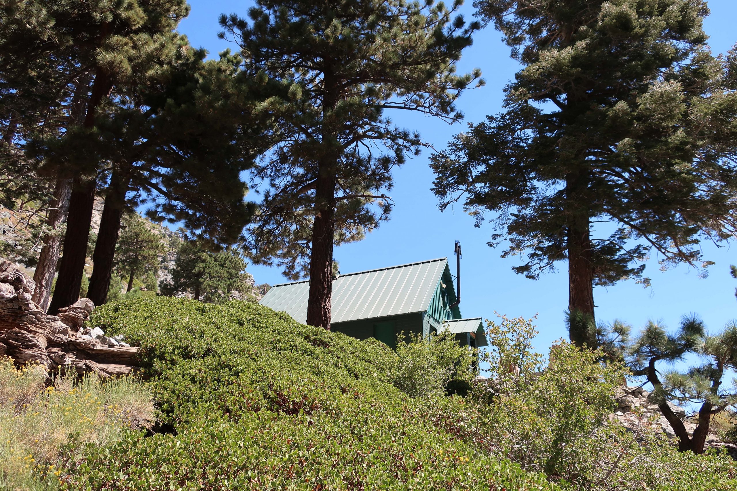
The Sierra Club’s “Ski Hut” was built back in the 1930’s. After a couple of really steep miles, the Baldy Bowl Trail passes just beneath this beautifully maintained cabin.
I’d wanted to show Joanie San Antonio Falls, which she’d never seen before, and peer down at some of the little cabins hidden along the little creek. This meant walking the gated fire road, which is unfortunately paved, up to its’ first switchback at the base of the falls. It can be sort of hot and exposed, like it was the day we went. Still it was worth seeing the Falls. We said our goodbyes out under the bright blue sky and off I climbed up the fire road which had now become dirt. It’d be some ten hours before we’d meet up, again, on the other side of the range in Wrightwood.
View looking toward Baldy Notch from Mt. Baldy Bowl. This photo was taken just minutes after passing by the Sierra Club Ski Hut.
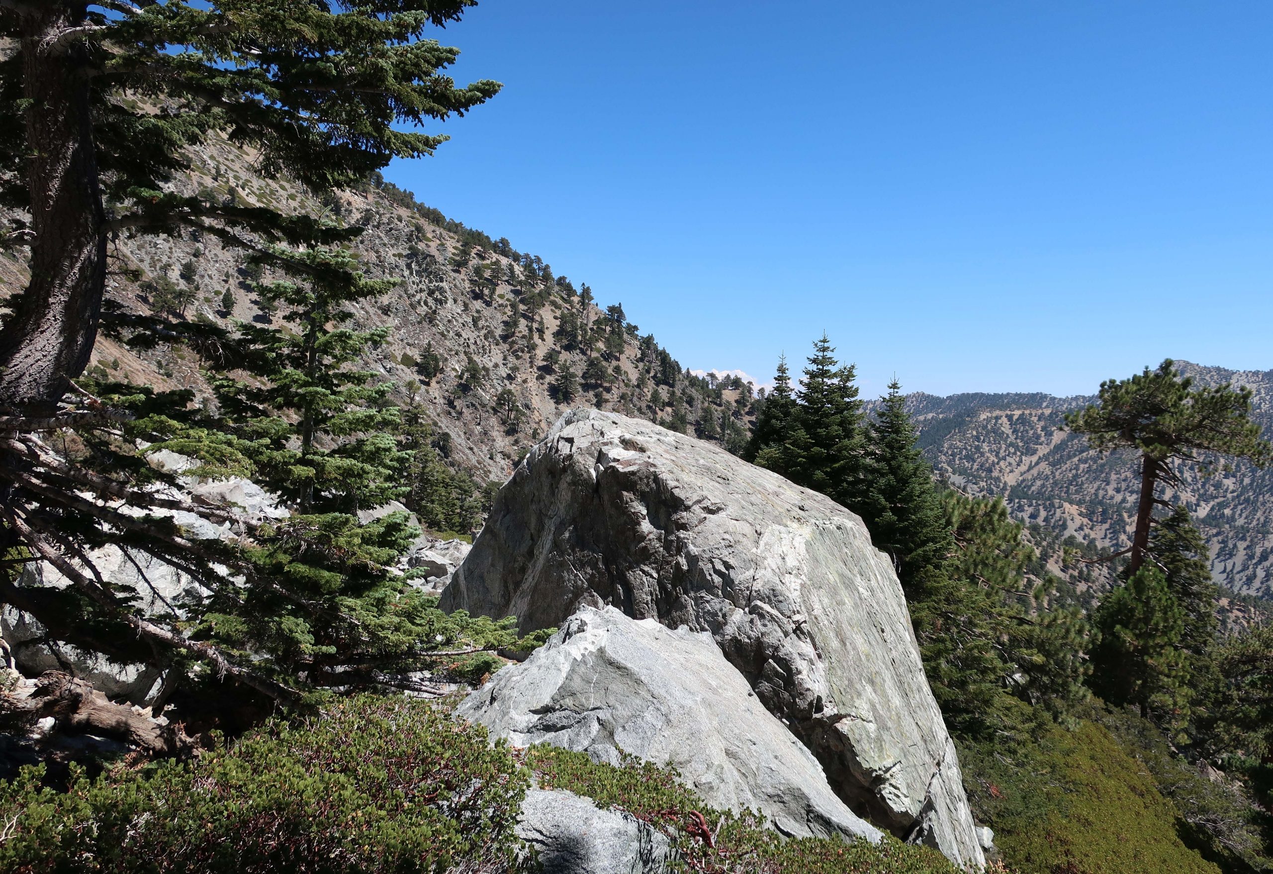
The turn off for the Baldy Bowl trail came up quickly on my left. That’s where the work began. Two things that came to mind and became readily apparent in no time at all was: 1. How much steeper the trail was than I had remembered it and 2. Just how big Mt. Baldy really is, no matter which way you go up it. It’s really a tall, broad mountain, especially by Southern California standards. Throughout the climb, despite the frequent standing up rests to slow the heart down and catch my breath, it was absolutely beautiful looking out over rugged San Antonio canyon. The trail climbs quickly up through oaks, mountain mahogany, manzanita and of course, shading pines and white fir. Just before reaching the Baldy Bowl, named by early x-country skiers in the early 20th century, you pass under the Sierra Club’s ski hut. Available to overnight stays by reservation only, this place is meticulously maintained and obviously loved by the membership. No one was there that day and I just kept hiking along, grateful for the icy cold stream that lay just moments ahead. There are strips of meadow flowers hugging the stream banks both below and above the trail. Flowers and willows crowded together along the tumbling, silver thread of water. The section where the trail crosses through the bowl is a complex of boulders, many the size of small cabins. It’s slow going and requires taking your time to read the trail, watching for clues as to where to meander next. Constantly, there was this sense that I was in the Sierras, and yet, somehow this San Gabriel mountains scenery felt, looked and even had that scent of Sierra rock and pine. All too soon, the trail leaves the Bowl and begins to switchback up through Jeffrey and Ponderosa pines. Soon the lodgepole pines began to make their presence and so did someone else.
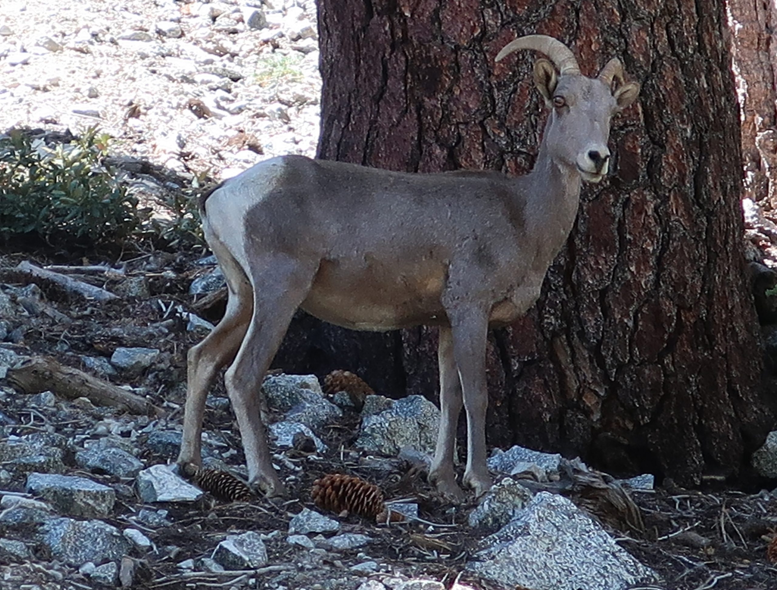
A solitary Big Horn sheep on the west side of the Baldy Bowl. This is a female or commonly known as a ewe. Often elusive, these creatures are able to easily scale the steepest and loosest of high country slopes.
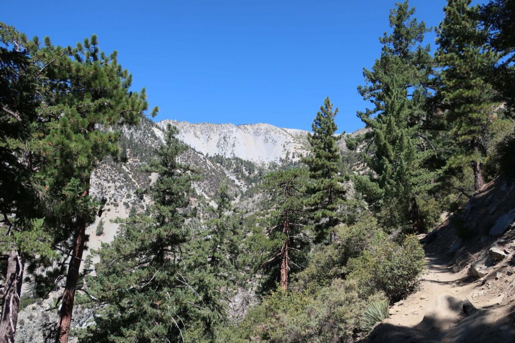
It had been years since seeing a bighorn sheep. Like always, it was never my eyes that would detect these elusive creatures. The sound of a few pebbles breaking loose from the hillside caught my attention and there she was! A few minutes later, another ewe peered at me from behind a fallen tree. She and her lamb were grazing on about a 45 degree slope on the edge of the Bowl. A double gift for sure. Occasionally I’d stop at the end of a switchback and take in the changing view of the ridge line (Devil’s Backbone) coming in from Baldy Notch. By now I’d reached the broad ridge top defining the west side of Baldy Bowl, the immense scale of the smooth talus slope dropping steeply off the south side of the summit had become apparent. The trees, pretty much all lodgepole, were twisted and sculpted by the centuries of storms blowing in off the Pacific.
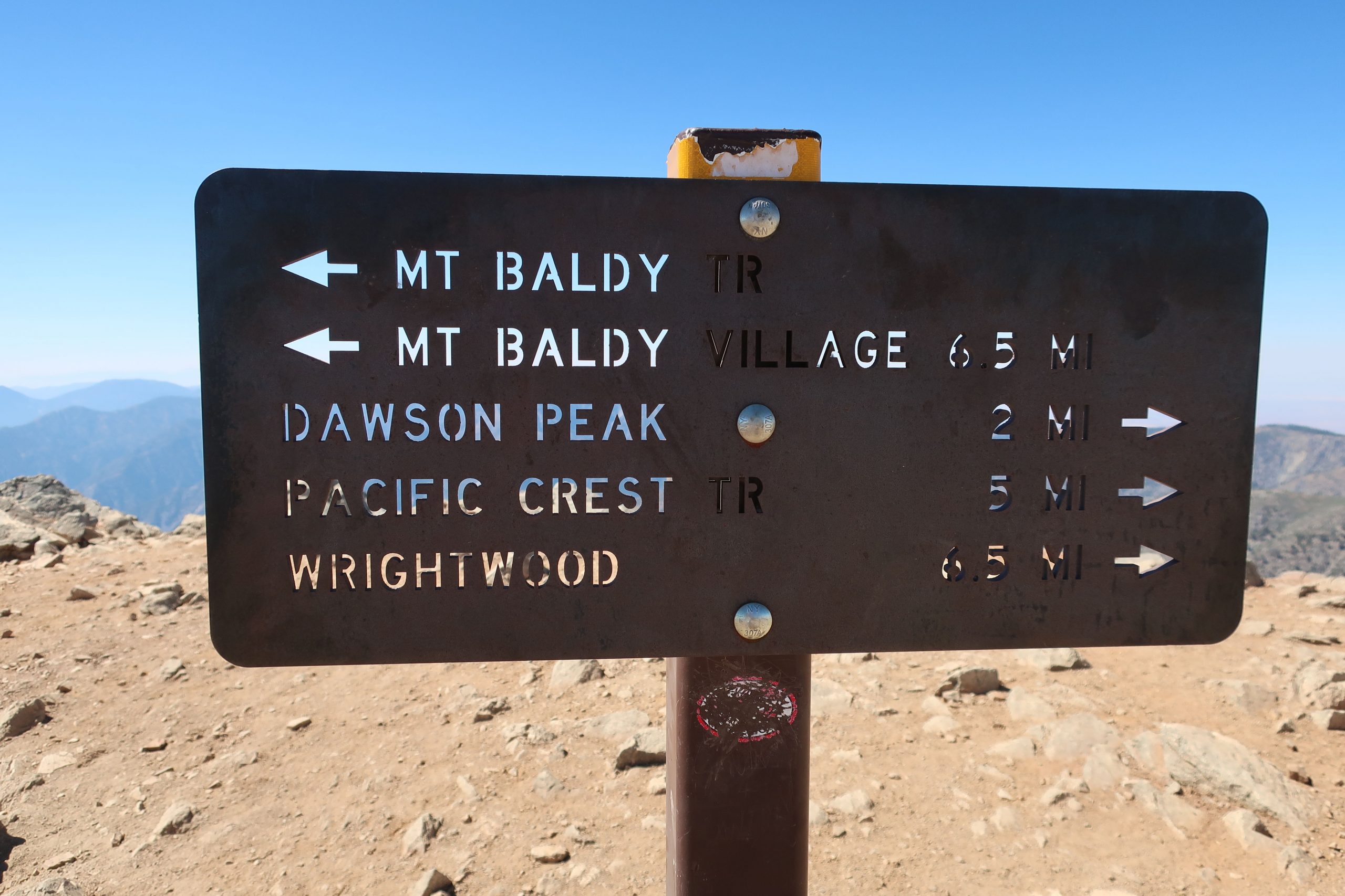
One of the trail signs at the summit of Mt. Baldy. There’s no lack of directional signage here, a good thing.
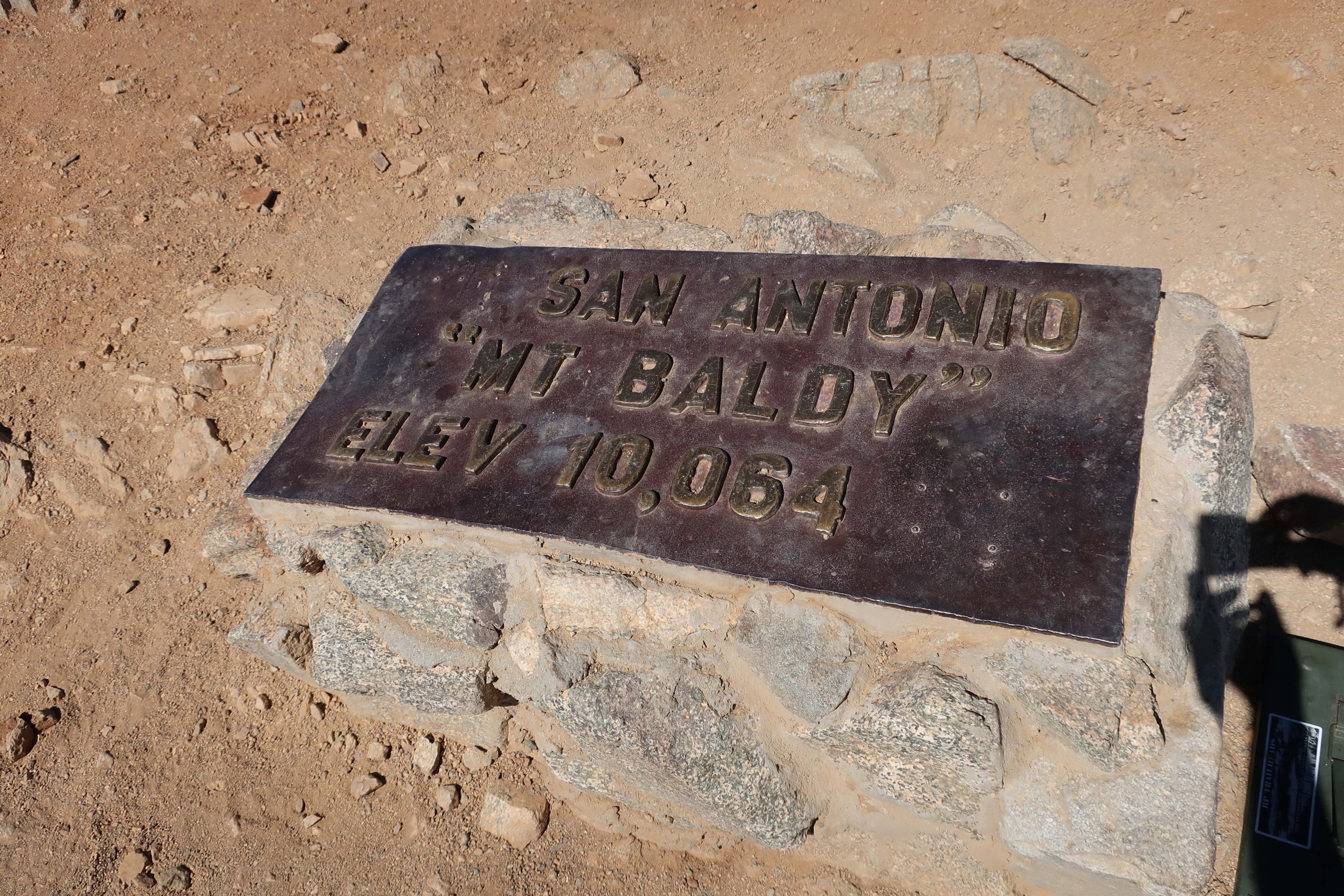
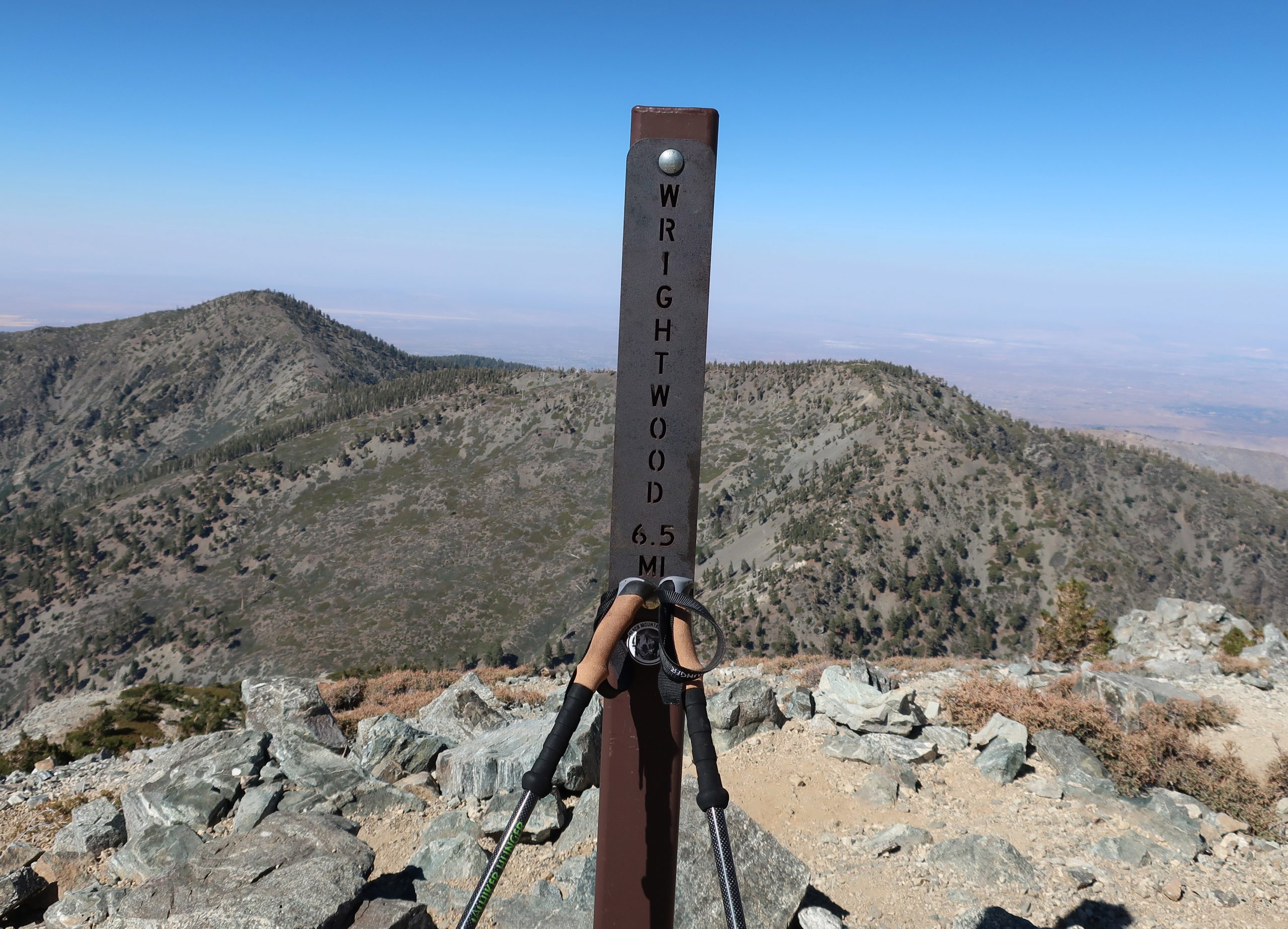
One thing that really caught my eye along the whole route were the really well made and maintained trail signs. Not only are there good directional signs along the way, there are even square steel posts with reflective tape on them, often giving you a good sense of where the trail would be should it be dark or there be a mantle of snow on the ground. This trail has really been well thought out. Another detail that became subtly apparent after some time was the lack of litter. My route was especially pristine and free of trash. There’s definitely a sense of stewardship going on up here. I hadn’t brought a watch, so never did determine just when I summited. That was purposeful and there was this wonderful relief at not having to know. Probably at least several hours had elapsed before making it to the top. There were probably no more than a dozen people sharing the trail up to the top that day. Really peaceful. Found a spot near the summit marker (elev. 10,064′) to sit down on my tired haunches, looking out to the north and down into the Fish Fork.
Here’s the monument marking the summit of one of the most popular peaks in Southern California.
While taking in the view, a fit 30 something man with a solid build and neatly cropped red beard approached, asking if he wasn’t spoiling my solitude. Of course not! Pull up a boulder and sit down. Pretty soon I learned where he’d been, as his IPA cracked open and quickly vanished. Sam had started out at the Heaton Flat trailhead way down in the East Fork before heading up to Iron Mountain, one of the most isolated and difficult peaks to reach. From there, he worked his way across West San Antonio Ridge to the summit of West Mt. Baldy. From here, he’d drop down to Manker Flat and find his hidden mountain bike and take that back to his car by pedaling over the Glendora Mountain Ridge Road! That’s the caliber of company you can sometimes run into on higher peaks… Soon I was off and heading down the North Backbone Trail toward Blue Ridge and Wrightwood beyond. Gotta tell you, taking trekking poles was one of my best moves of the day. The descent was extremely steep down to the first saddle north of Mt. Baldy. Spots where I definitely would have slipped just from fatigue, were pretty easily walked down with the aid of the poles. This is a trip where you’d be glad to have a set of them.
Here’s the view looking toward the North Backbone trail from Mt. Baldy’s summit. That’s Dawson Peak straight ahead, just off to the right of the steel sign. Pine Mountain is further out, on the left of photo. Hiking this ridge is the key to traversing the San Gabriels to Wrightwood.
The climb up to Dawson Peak went well. There’s lots of rabbitbrush along the way. The trail weaved in and out of the thick yellow blossoms, giving the late afternoon light a feeling of autumn. Mountain mahogany and twisted rock outcroppings kept things interesting as well. There was a great view down toward the Cajon Pass with commuters making their sluggish drive back toward the desert. A freight train could be seen climbing the serpentine railroad tracks as well, tiny in comparison to the arid landscape. All this activity was silent, visible, yes, yet no sound whatsoever. To my left, grand scenes of the Fish Fork and Mount Baden Powell, continued to dominate my senses. A refreshing and constant breeze out of the west kept me cooled down. Once on top of Dawson (elev. 9,575′), I signed the summit register and continued on down a gentle descent through sun – polished plates of schist. Talus, I suppose. Beautiful stuff that sounded like ceramic dinner plates clunking together under my boots at times. There were even these beautiful, hidden, forested and shaded flats just below the trail at times, spots that would make for a perfect campsite. Untouched. Just before reaching the saddle between Dawson and Pine Mountain, I saw the old and seemingly untrammeled Fish Fork Trail coming in from my left.
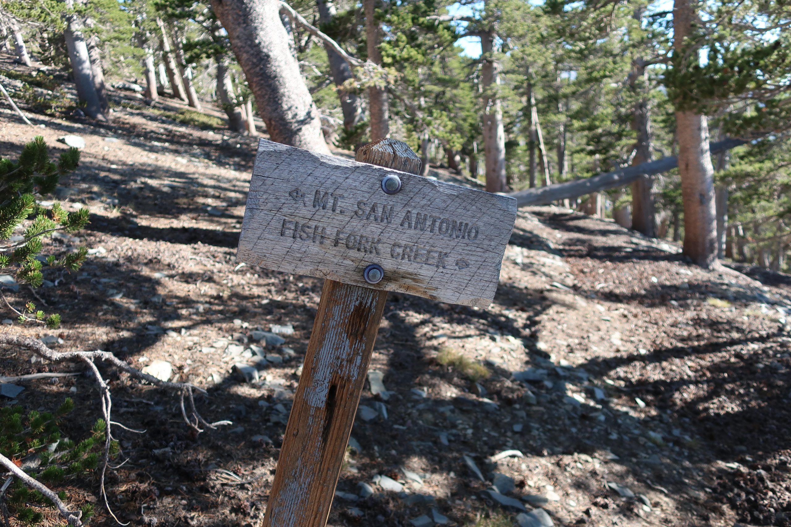
Trail junction for the seldom trod Dawson Peak Trail in the upper Fish Fork. This is the upper end of what appears on Tom Harrison’s Angeles High Country map as being the 4 1/2 mile route down to Fish Fork Campsite, probably one of the most remote places in the San Gabriels. The elevation at this spot is 9,200′.
There’s even an old graying wooden sign indicating the way down. I’ve always wanted to follow this trail which drops down to Fish Fork trail camp, probably one of the most isolated haunts in our range. That old feeling came back somewhat suddenly, mixed with wonder at how good things still are in the backcountry here. Pristine. And since it’s hard to get to, at least for me, nothing’s trashed. A constant truth throughout the ages. Thank God. Amen.
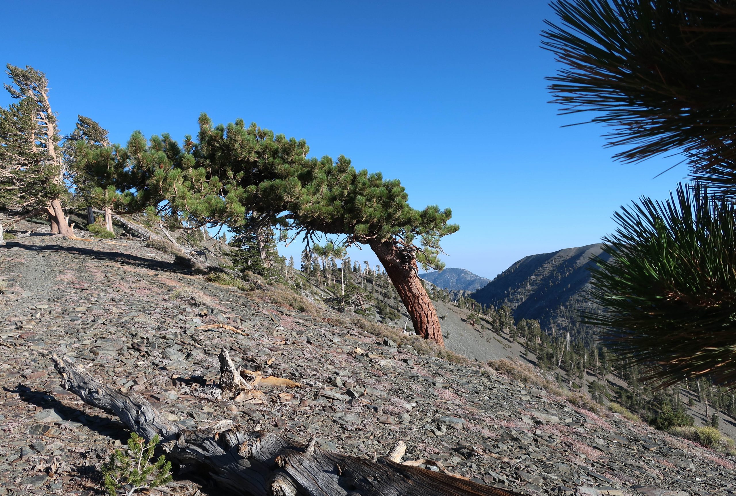
A section of the North Backbone trail, looking back toward Dawson Peak. The ridge line on the horizon, seen off to the right is part of the Mount Harwood / Mt. Baldy massif. This picturesque “flag” tree in the foreground is one of many found along these high country slopes and ridge tops, sculpted over the centuries from the high winds blowing in from Pacific winter storms.
Soon I was climbing yet, again. This time it was up to Pine Mountain (9,648′). Weaving amongst more pines and mountain mahogany, the sun continued to drop further and further down across the mountains, casting longer and longer shadows in the gentle wind. Up on top, the summit register of nested red cans was easily found in a cairn of rocks. The desire to linger here awhile longer was resisted by the nagging feeling to at least get to Blue Ridge and the Pacific Crest Trail (PCT) before it got dark. So, reluctantly, off I dragged my now tired self down a gentle slope amongst a thick forest of lodgepole pine. The deepening pools of shade penetrated the forest in a way that reminded me of being a little boy, maybe six or seven, running through the giant sequoias where our family used to camp every summer in a tent cabin. I missed people that I hadn’t thought about in awhile. They all came back for a bit and I reveled in this.
As the sun sunk lower and lower in the west, I made my way along the top of the ridge to the north of Pine Mountain, dropping toward Blue Ridge which is visible to the right.
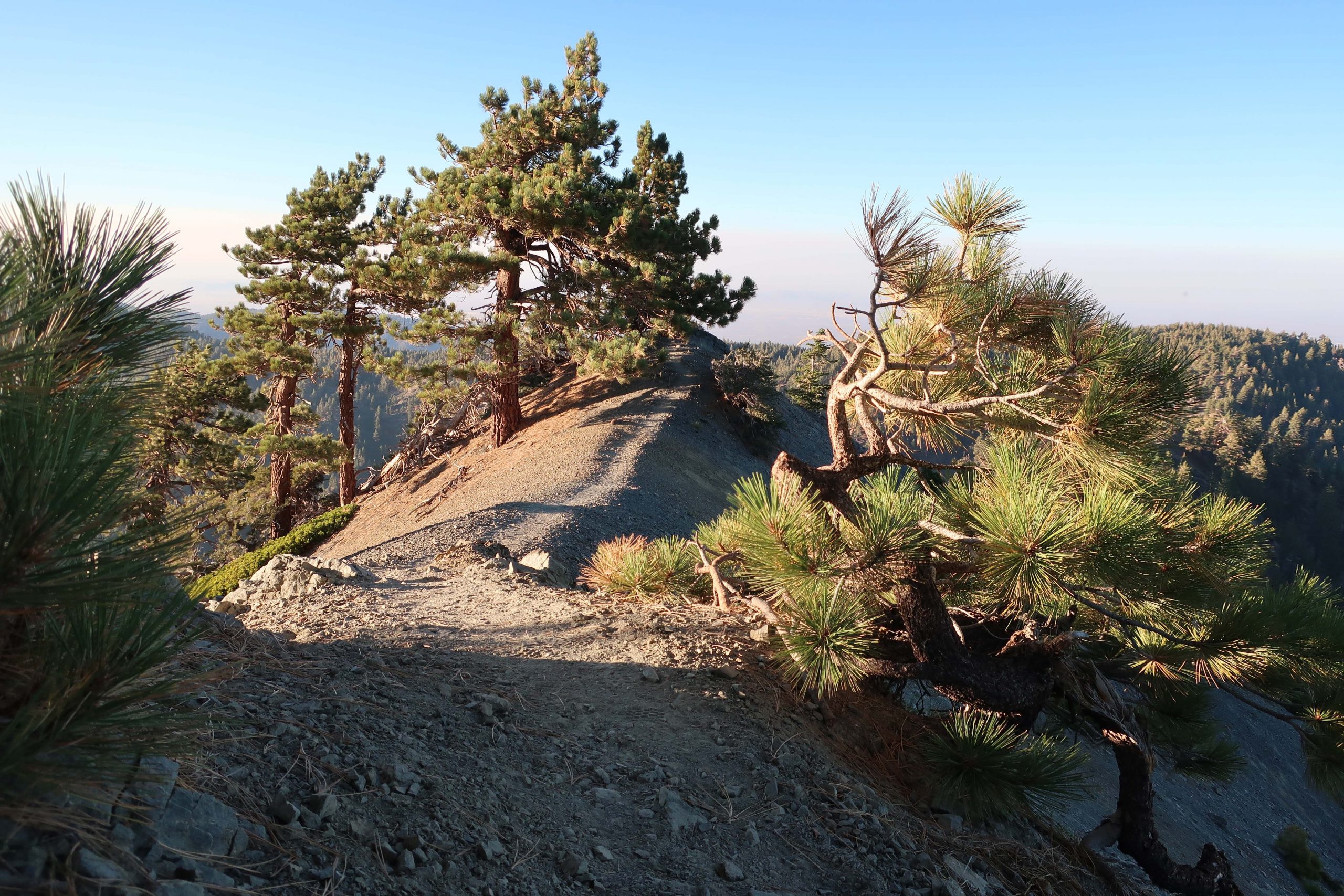
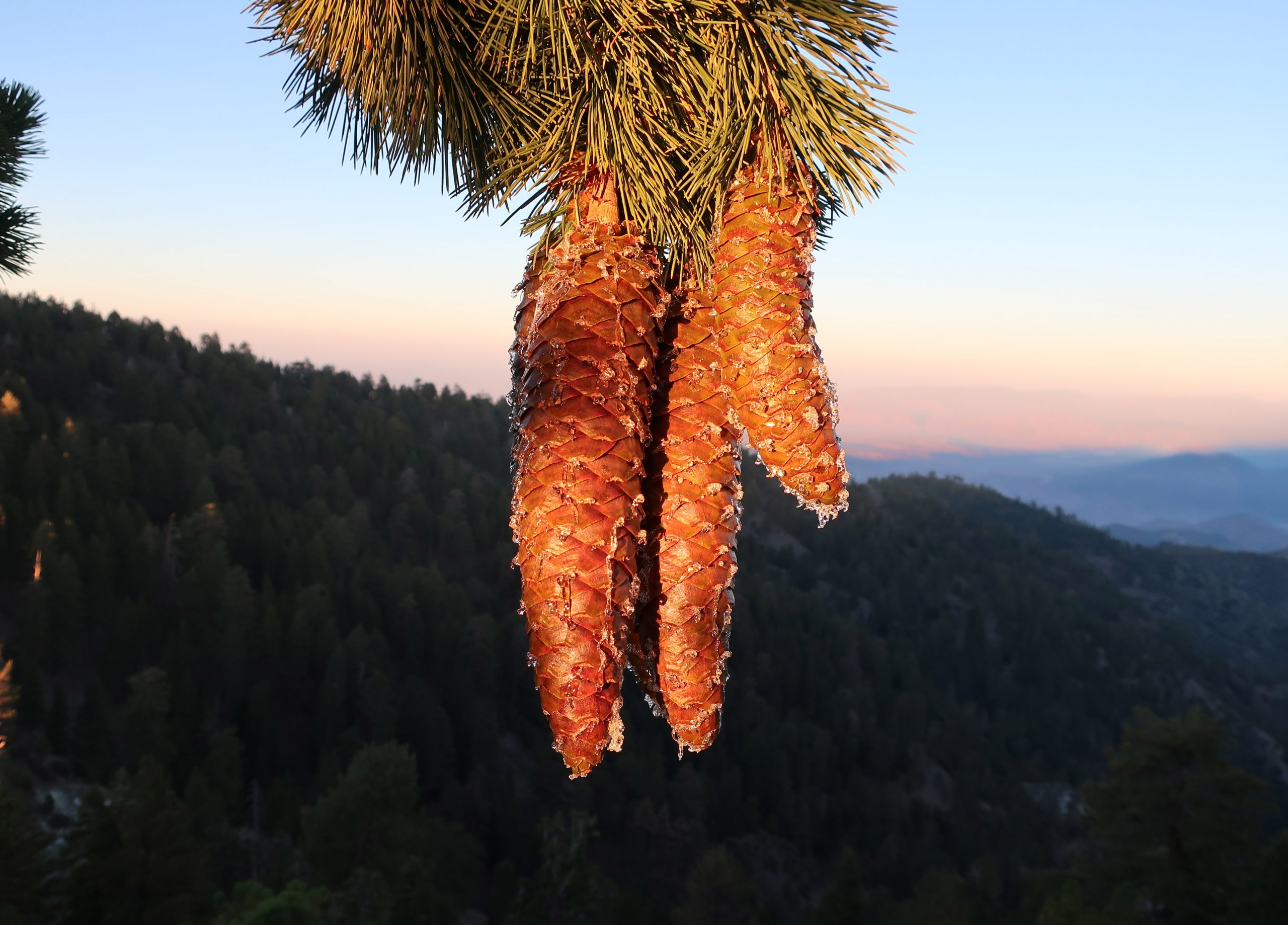
After a short while, the ridge top timber all but left, becoming a sharp edged knife of rock, bathed in orange golden sunlight. Take your time here, Chris, something kept gently telling me. I was tired and starting to get sloppy, not quite so nimble as hours earlier. Eventually the ridge got easier and right before sun had set below the horizon, a beam of that gold light struck some dangling cones hanging from an ancient sugar pine. This hike kept getting more and more gorgeous, nostalgic in a way. In the graying light, I made a last little climb up to the dirt road (East Blue Ridge recreation road) to the northern terminus of the North Backbone Trail.
The gold light of early evening illuminates several sugar pine cones along the North Backbone trail. That’s the Mojave Desert in the background, while distant ranges still bask in the sunset.
I scurried up the slope behind the road, following a scratch trail that led to the PCT. Turning left (west) and continuing at a pretty fast clip, I arrived at a spot just to the west of the large slide above Wrightwood. The lights of homes were now twinkling in the early evening darkness. Time to get the flashlight out. I continued on in the dark, amongst and under the tall white fir and pines. Still no one around. Perfect. Here and there you could make out the silhouette of Pine Mountain to the south. A short time later was the turn-off for the Acorn Trail, which would descend about 1,600′ feet down into upper Wrightwood. Up here, it was possible to reach Joanie by radio, and yes, you guessed it…. Without a bit of shame, I took the ride back to our home in the little red Honda while Joanie told me about her day. Why the hell not? Who wants to walk on pavement I say to myself. That ride was heaven on earth. And so there you have it, it’s possible to walk across the highest point in the San Gabriels in a day! The next day my thighs felt entirely spent while walking on the little stone paths around our yard. And yet, looking back on it all, such as all good hikes, it was definitely worth it.
Mid-winter through spring is a good time to hike up to Mt. Wilson. Even as Chantry Flat in the Big Santa Anita Canyon continues to heal from the Bobcat Fire of 2020, don’t feel like there’s no good way up to Mt. Wilson. If you’ve never done it, hiking up the Old Mount Wilson Trail from the scenic Sierra Madre is not a bad way. The canyon you’ll travel through on your way up toward Manzanita Ridge is known as the Little Santa Anita Canyon. This is the original way up to “Wilson’s Peak,” named after Don Benito Wilson. The trail dates back to the 1860s.
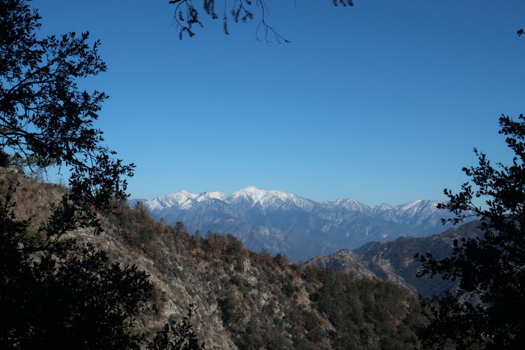
A view of Mt. Baldy from Manzanita Ridge.
Manzanita Ridge, sections of it quite true to its’ name, makes up the watershed divide between Winter Creek (to the north) and Little Santa Anita Canyon on the south. Following the ridge line up toward the Old Mount Wilson Toll Road views out into the High Country of the San Gabriels abound. Once up on the Toll Road, you’ll continue to walk along refrigerator-sized boulders that have dropped off the near vertical slopes of Mt. Harvard.
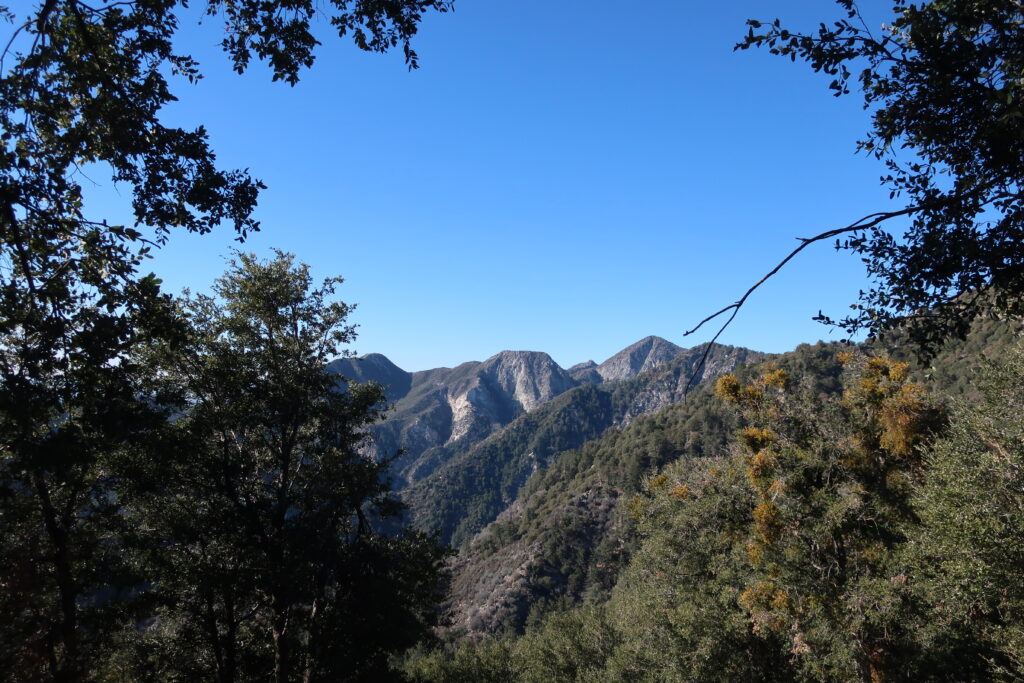
Once you reach Martin’s Saddle, the site of a once popular trail resort of the late 19th Century, views out toward the west are to be had. You’re now contouring the slopes of Upper Eaton Canyon, a beautifully rugged wilderness in its own right. Looking out across the steep and deep tributary canyons, there is, from left to right, Mt. Lowe, Mt. Markham (flat-topped), and San Gabriel Peak. When the air is clear, this scene is spectacular.
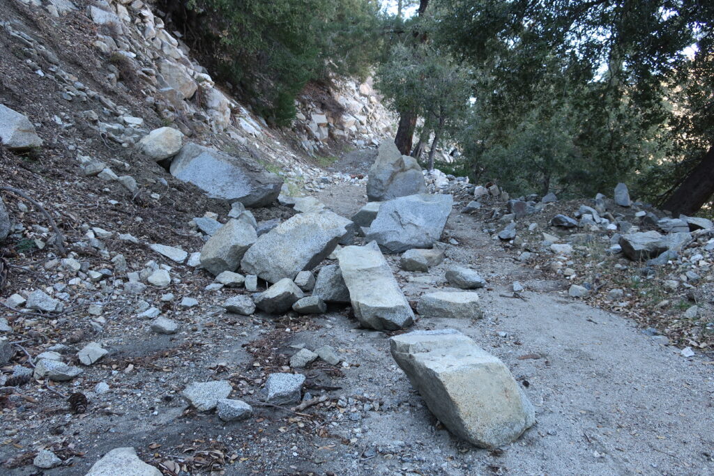
Boulders accumulate on the Mt. Wilson Toll Road after winter storms.A view across Upper Eaton Canyon
Once up at the top, I found a picnic bench in the open-air pavilion and soaked in the sunlight for some time before heading back down. The Pacific reflected back at me like an amber platter just to the north of the Palos Verdes peninsula. What a beautiful place to be hiking. What a beautiful place to be alive.
Mt. Baldy and Dawson Peak are seen from the PCT. This view looks across upper Lytle Creek and some miles below East Blue Ridge.
Vincent Gap trailhead is once again open to vehicles coming in through Wrightwood. Highway 2 continues to be gated to any driving west of the trailhead. If you’re looking to hike up to Mt. Baden Powell or drop down into the East Fork, all this is possible now and through the summer and autumn months.
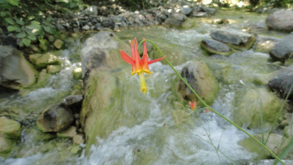
Looking out across the East Fork of the San Gabriel River to Pine Mountain, Dawson Peak, and Mt. Baldy. This view is from a spur ridge just below the summit of Mt. Baden-Powell. A native Columbine graces the East Fork just downstream from Mine Gulch Campsite.
In the summer of 1845, Benjamin D Wilson, who owned part of the interest in the Jurupa Rancho, the site of the present city of Riverside, led a troop of Calvary in search of cattle rustlers.
Setting out from San Bernardino Valley, he divided his command. Most of the men he sent throughCajon Pass, keeping only 22 Mexican troopers with him to follow a trail across the mountains. Two days later, Wilson and his men reached the lake, where they sighted scores of grizzly bears.
Most of the soldiers had been vaqueros. They formed in pairs and drew reatas, each pair attacking a bear. One looped a rope around the bear’s neck; his companion roped the same bear by a hind foot. Then, the men drew apart to stretch the rope taut and hold the bear a prisoner. They bagged and skinned eleven bears, stretched their hides, and continued across the mountains to join the rest of the command in the desert at Rancho Las Flores on the Mojave River.
Here, the reunited party engaged Indians in a fight, after which Wilson and his 22 vaquero-troopers returned home by the way of the lake. They again found the place overrun with bears, and the same 22 soldiers brought in eleven more bears– enough to give them a bear rug apiece as a trophy. Then, Wilson named Bear Lake to the little body of water.
Years later, the name was changed to Baldwin Lake. The name survives, however, in Big Bear Lake, which was created at the site of the Talmadge Ranch in 1884 when a dam was built to provide a constant water supply for the Redlands District.
– adapted from ~ Pioneer Tales of San Bernardino County – WPA – 1940.
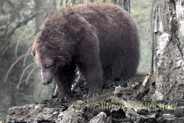
The California grizzly bear (Ursus arctos californicus) is a subspecies of the brown bear that once inhabited various regions of California. Historically, grizzly bears were found throughout the state, from the coast to the mountains and valleys. They were an important part of California’s wildlife and played a role in the culture and folklore of indigenous peoples.
California grizzly bear (Ursus arctos californicus)
Unfortunately, due to habitat loss, hunting, and human conflicts, the California grizzly bear population declined significantly throughout the 19th century. The last known California grizzly bear in the wild was killed in 1922 in Tulare County. The species was declared extinct in 1924.
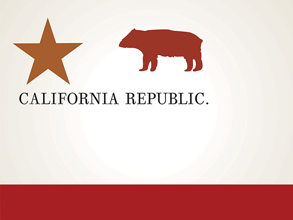
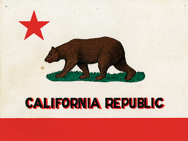
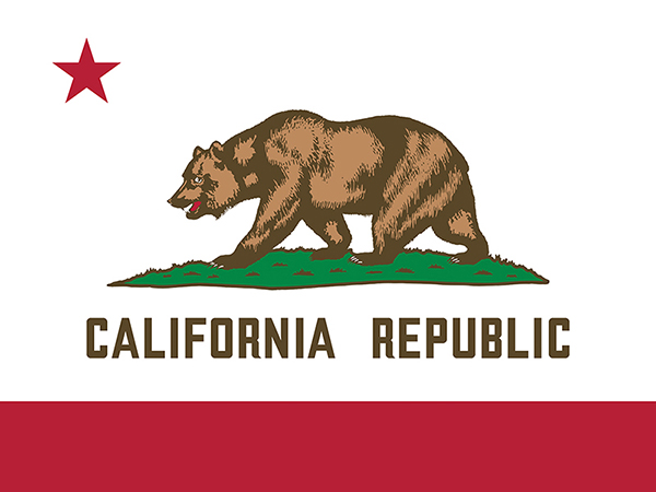
Efforts have been made to preserve the memory of the California grizzly bear, and it is often symbolically represented in the state’s flag and seal. The California grizzly bear is also the state animal, even though it no longer exists in the wild.
1846 – 1910
1911 – 1952
Today
There have been occasional discussions and proposals for reintroducing grizzly bears to certain parts of California, but these efforts are complex and face challenges related to habitat, human-wildlife conflicts, and public opinion. As of my last knowledge update in January 2022, there were no active reintroduction programs in place. Still, it’s advisable to check for the latest information, as conservation efforts and plans may evolve.
Benjamin Wilson leads a posse of 22 men into the San Bernardino Mountains to search for Indians who had been raiding ranches in . He discovers Big Bear Valley and gives it the name it has today. Up until 1845, Bear Valley was known to the local Serrano Indians as Yahaviat, which means “Pine Place”. – bb
Gentrification is a complex and multifaceted process that typically involves the transformation of a neighborhood or community due to an influx of wealthier residents and increased property development. While gentrification is commonly associated with urban areas, how it might manifest in desert regions is worth considering.
In the context of desert areas like the Mojave Desert, some factors may contribute to changes in local communities:
Tourism Development: Deserts are often attractive to tourists seeking unique landscapes and experiences. Developing tourist infrastructure, such as upscale resorts, could change the local economy and demographics.
Environmental Conservation and Luxury Living: Some desert areas may become appealing to those seeking a more secluded or environmentally conscious lifestyle. This could lead to the development of upscale residences, potentially displacing existing communities.
Renewable Energy Projects: The Mojave Desert, particularly, has seen increased interest in renewable energy projects like solar farms. This can bring economic development but may also change the local population dynamics.
Artistic and Cultural Appeal: Artists and individuals attracted to the tranquility and unique landscapes of the desert may contribute to gentrification by establishing art communities or cultural hubs.
It’s crucial to note that the impact of gentrification can vary based on the specific characteristics of each desert region and the policies in place to address community concerns. Local governments and community organizations play a crucial role in shaping development patterns and mitigating the potential negative effects of gentrification, such as displacement of long-term residents and cultural erosion.
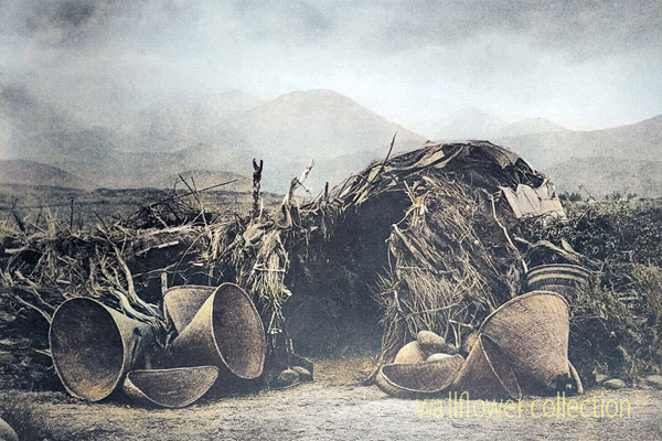
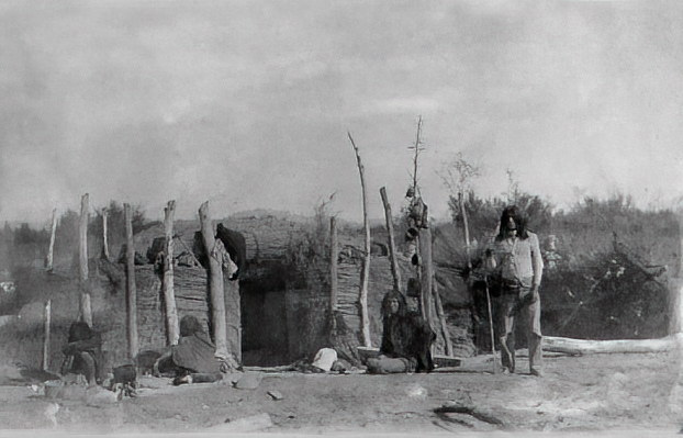
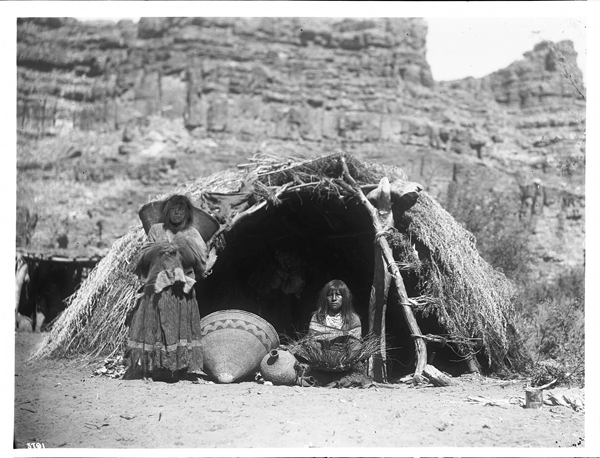
Mono Paiute wickiup – Edward Curtis 1900 (colorized)
A “wikiup” in the context of Native American culture typically refers to a traditional type of shelter or dwelling. It is a simple, dome-shaped structure constructed using a framework of branches or saplings. The frame is often covered with various materials, such as brush, reeds, grass, or sometimes animal hides. Various indigenous peoples in North America commonly used these shelters.
The design of wikiups varied among different tribes, reflecting the local environment and available resources. They were relatively easy to construct and could be adapted to different climates. Nomadic or semi-nomadic groups often used Wikiups as temporary or seasonal shelters.
It’s important to note that the term “wikiup” might be spelled or pronounced differently in various indigenous languages, and the specific features of these shelters could vary based on cultural and regional differences.
The most famous lost mine in the Death Valley area is the Lost Breyfogle. There are many versions of the legend, but all agree that somewhere in the bowels of those rugged mountains is a colossal mass of gold, which Jacob Breyfogle found and lost.
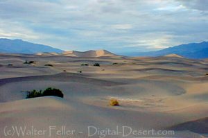
Mesquite Flats Sand Dunes – Death Valley
Jacob Breyfogle was a prospector who roamed the country around Pioche and Austin, Nevada, with infrequent excursions into theDeath Valleyarea. He traveled alone.
Indian George, Hungry Bill, and Panamint Tom saw Breyfogle several times in the country around Stovepipe Wells, but they could never trace him to his claim. When followed, George said, Breyfogle would step off the trail and completely disappear. Once George told me about trailing him into the Funeral Range. He pointed to the bare mountain. “Him there, me see. Pretty quick—” He paused, puckered his lips. “Whoop—no see.”
Breyfogle left a crude map of his course. All lost mines must have a map. Conspicuous on this map are the Death Valley Buttes which are landmarks. Because he was seen so much here, it was assumed that his operations were in the low foothills. I have seen a rough copy of this map made from the original in possession of “Wildrose” Frank Kennedy’s squaw, Lizzie.
Breyfogle presumably coming from his mine, was accosted near Stovepipe Wells by Panamint Tom, Hungry Bill, and a young buck related to them, known as Johnny. Hungry Bill, from habit, begged for food. Breyfogle refused, explaining that he had but a morsel and several hard days’ journey before him. On his burro he had a small sack of ore. When Breyfogle left, Hungry Bill said, “Him no good.”
Incited by Hungry Bill and possible loot, the Indians followed Breyfogle for three or four days across the range. Hungry Bill stopped en route, sent the younger Indians ahead. At Stump Springs east ofShoshone, Breyfogle was eating his dinner when the Indians sneaked out of the brush and scalped him, took what they wished of his possessions and left him for dead.
Ash Meadows Charlie, a chief of the Indians in that area confided to Herman Jones that he had witnessed this assault. This happened on the Yundt Ranch, or as it is better known, the Manse Ranch. Yundt and Aaron Winters accidentally came upon Breyfogle unconscious on the ground. The scalp wound was fly-blown. They had a mule team and light wagon and hurried to San Bernardinowith the wounded man. The ore, a chocolate quartz, was thrown into the wagon.
Resting Springs
“I saw some of it at Phi Lee’s home, theResting Spring Ranch,” Shorty Harris said. “It was the richest ore I ever saw. Fifty pounds yielded nearly $6000.”
Breyfogle recovered, but thereafter was regarded as slightly “off.” He returned to Austin, Nevada, and the story followed.
Wildrose (Frank) Kennedy, an experienced mining man obtained a copy of Breyfogle’s map and combed the country around the buttes in an effort to locate the mine. Kennedy had the aid of the Indians and was able to obtain, through his squaw Lizzie, such information as Indians had about the going and coming of the elusive Breyfogle.
“Some believe the ore came from around Daylight Springs,” Shorty said, “but old Lizzie’s map had no mark to indicate Daylight Springs. But it does show the buttes and the only buttes in Death Valley are those above Stovepipe Wells.
“Kennedy interested Henry E. Findley, an old time Colorado sheriff and Clarence Nyman, for years a prospector for Coleman andSmith(thePacific Borax Company). They induced Mat Cullen, a rich Salt Lake mining man, to leave his business and come out. They made three trips into the valley, looking for that gold. It’s there somewhere.”
Francis Marion “Borax” Smith
At Austin, Breyfogle was outfitted several times to relocate the property, but when he reached the lower elevation of the valley, he seemed to suffer some aberration which would end the trip. His last grubstaker was not so considerate. He told Breyfogle that if he didn’t find the mine promptly he’d make a sieve of him and was about to do it when a companion named Atchison intervened and saved his life. Shortly afterward, Breyfogle died from the old wound.
Indian George, repeating a story told him by Panamint Tom, once told me that Tom had traced Breyfogle to the mine and after Breyfogle’s death went back and secured some of the ore. Tom guarded his secret. He covered the opening with stone and leaving, walked backwards, obliterating his tracks with a greasewood brush. Later when Tom returned prepared to get the gold he found that a cloudburst had filled the canyon with boulders, gravel and silt, removing every landmark and Breyfogle’s mine was lost again.
“Some day maybe,” George said, “big rain come and wash um out.”
Among the freighters of the early days was John Delameter who believed the Breyfogle was in the lower Panamint. Delameter operated a 20 mule team freighting service between Daggett and points in both Death Valley and Panamint Valley. He told me that he found Breyfogle down in the road about twenty-eight miles south of Ballarat with a wound in his leg. Breyfogle had come into the Panamint from Pioche, Nevada, and said he had been attacked by Indians, his horses stolen, while working on his claim, which he located merely with a gesture toward the mountains.
Subsequently, Delameter made several vain efforts to locate the property, but like most lost mines, it continues to be lost. But it was good bait for a grubstake for years and served both the convincing liar and the honest prospector.
Nearly all old timers had a version of the Lost Breyfogle differing in details, but all agreed on the chocolate quartz and its richness.
That Breyfogle really lost a valuable mine, there can be little doubt, but since he is authentically traced from the northern end of Death Valley to the southern, and since the chocolate quartz is found in many places of that area, one who cares to look for it must cover a large territory.
“Gold Stone is the name of a new camp, thirty-five miles north of Barstow, where some phenomenal ore has been found. Quite a stampede followed the discovery.
The area is the site of the only commercial opal mine in the California Desert. Waterman. Five years before the famous silver discoveries at Calico, George G.
4 days ago … Post Views: 12. Goldstone, Barstow California, Mojave Desert. digital-desert.com › goldstone-ghost-town. Goldstone Ghost Town. More of a site …
Goldstone – Mojave Desert. Several people were involved in mining during this same time, including John Harper and Goodrich. 289. One of the most active …
Persistent rumors have it that gold … 1859: Bodie, California … by prospector Wakeman S. Bodey, who the town was named after. Bodey died in November making …
States: Primarily in California and Nevada, with smaller portions in Arizona and Utah. Extent: The Mojave Desert is part of the larger North American Desert and …
Some of the dry lake beds are Bicycle, Coyote, East Cronese, West Cronese, Goldstone, Langford Wells, Leach, Manix, Nelson, Pilot Knob Valley, Red Pass, and …
And now, with the operations of the Goldstone tracking station ushering the “space age” into the desert, the future holds promise far beyond the wildest dreams …
A long interaction history between people and the challenging desert environment marks the human (historical) geography of the Mojave Desert. Here are key aspects of the human history and settlement patterns in the Mojave Desert:
The construction of railroads, such as the Southern Pacific Railroad, was crucial in connecting the Mojave Desert to the broader transportation network.
Railroad towns, including Barstow, developed as important transportation hubs.
The historic Route 66, a major U.S. highway, passed through the Mojave Desert during the mid-20th century, bringing increased traffic, commerce, and tourism to the region.
Establishing national parks and preserves, such as Joshua Tree National Park and the Mojave National Preserve, reflects efforts to conserve the desert’s unique ecosystems and landscapes.
Modern Urbanization and Recreation:
Urban areas on the periphery of the Mojave Desert, such as Las Vegas, have experienced rapid growth.
The desert attracts tourists and outdoor enthusiasts interested in hiking, rock climbing, and stargazing.
Understanding the human history of the Mojave Desert involves recognizing the diverse ways different groups have interacted with the desert environment over time, from indigenous peoples adapting to the harsh conditions to the various waves of exploration, settlement, and economic activities that have shaped the region.
The Mojave Desert, situated in the southwestern United States, has a distinctive physical geography shaped by its unique combination of topography, climate, and ecosystems.
Here is an overview of the physical (regional) geography of the Mojave Desert:
Location:
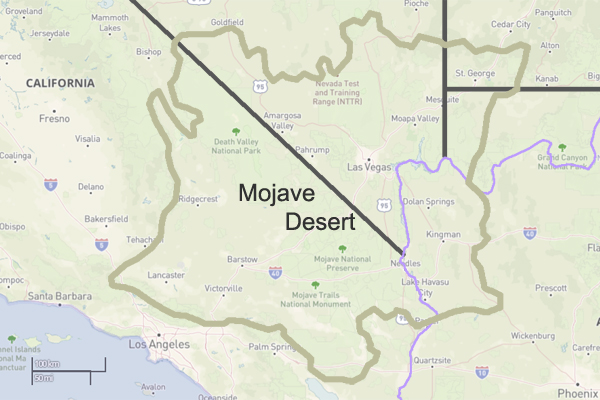
The Mojave Desert spans southeastern California, southern Nevada, southwestern Utah, and northwestern Arizona. It is one of the four major deserts in North America.
Size:
The Mojave Desert covers approximately 47,877 square miles (124,000 square kilometers).
Topography:
The Mojave Desert features a diverse topography with mountain ranges, valleys, and extensive desert plains.
Prominent mountain ranges include the Mojave, Providence, New York, and Clark Mountains.
The Mojave Desert has a cold climate characterized by hot summers and mild winters.
Summer temperatures often exceed 100°F (38°C), while winter temperatures can drop below freezing, especially at higher elevations.
Rainfall is generally low, with most precipitation occurring during the winter months. The desert experiences occasional flash floods during intense rainstorms.
Natural water sources are limited, and the Mojave River is one of the few perennial rivers in the region.
Springs and oasis areas, such as Ash Meadows in Nevada, provide critical water sources for both wildlife and human activities.
Human Impact:
Human activities in the Mojave Desert include mining, military training areas, and recreational activities.
Cities such as Las Vegas, Nevada, and Lancaster, California, are located on the periphery of the Mojave Desert.
Protected Areas:
The Mojave National Preserve, Joshua Tree National Park, and portions of Death Valley National Park are examples of protected areas within the Mojave Desert, preserving its unique ecosystems and landscapes.
Understanding the physical geography of the Mojave Desert involves recognizing its diverse landforms, climate extremes, and the adaptations of both flora and fauna to the arid conditions. Additionally, human activities and efforts to preserve the desert’s unique features contribute to the overall regional geography of the Mojave.
The Mojave Desert is a vast desert in the southwestern United States, primarily in southeastern California, southern Nevada, and parts of Arizona and Utah.
Here are some key geographical features and characteristics of the Mojave Desert:
Location:
States: Primarily in California and Nevada, with smaller portions in Arizona and Utah.
Extent: The Mojave Desert is part of the larger North American Desert and is the smallest of the four major deserts in the United States.
Size:
The Mojave Desert covers approximately 47,877 square miles (124,000 square kilometers).
Topography:
The desert’s topography is varied, featuring flat basins, rugged mountains, and expansive valleys.
Some prominent mountain ranges include the Providence, New York, and Clark Mountains.
Landforms:
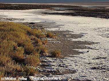
Playas: Dry lake beds or playas are scattered throughout the desert.
Mesas and Buttes: Flat-topped plateaus and isolated hills dot the landscape.
Dunes: The Kelso Dunes and Eureka Dunes are extensive dune fields in the Mojave.
Climate:
The Mojave Desert has a typical cold desert climate with hot summers and mild winters.
Summer temperatures can exceed 100°F (38°C), while winter temperatures can drop below freezing, especially at higher elevations.
Rainfall is generally low, and the desert experiences occasional flash floods during intense rainstorms.
Vegetation:
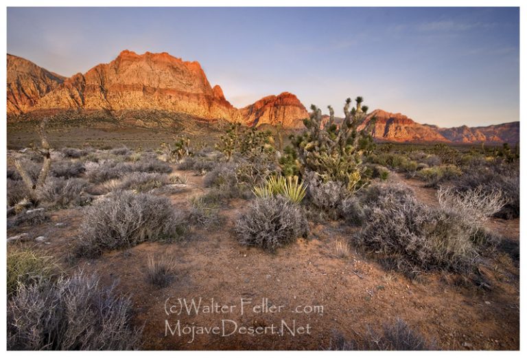
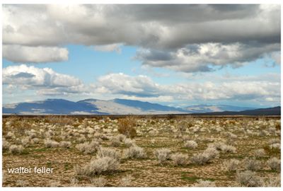
The desert is home to various plant species adapted to arid conditions, including Joshua trees, creosote bushes, yuccas, and cacti.
Higher elevations may support juniper and pinyon pine forests.
Understanding the geography of the Mojave Desert involves recognizing its diverse terrain, climate, and the various plant and animal species that have adapted to this challenging environment.
The Mojave Desert, located in the southwestern United States, is a unique and ecologically diverse ecosystem known for its extreme temperatures, arid conditions, and distinct plant and animal life. Various factors, including topography, climate, and human activities, influence the transitions within the Mojave Desert ecosystem.
Here are some key ecological transitions within the Mojave Desert:
Elevation Gradients:
The Mojave Desert exhibits significant elevation gradients, ranging from below sea level in Death Valley to higher elevations in mountainous regions such as the Spring Mountains and the Mojave National Preserve. These elevation changes lead to variations in temperature, precipitation, and vegetation types.
Flora and Fauna Shifts:
Plant and animal species are adapted to specific elevation ranges within the Mojave Desert. As you move from lower to higher elevations, you may encounter shifts in vegetation types, with desert shrubs giving way to pinyon-juniper woodlands and eventually to coniferous forests.
Water Availability:
Water availability is a critical factor influencing ecological transitions in the Mojave Desert. Oasis ecosystems, supported by underground aquifers or natural springs, provide unique habitats in contrast to the surrounding arid landscapes. These oases can support a higher diversity of plant and animal life.
Playa Ecosystems:
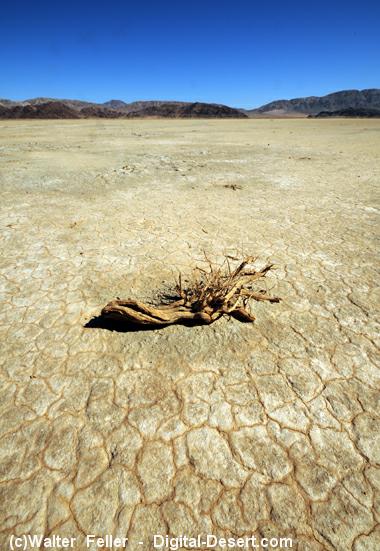
Playas, or dry lake beds, are common features in the Mojave Desert. During rainfall, playas can fill with water, creating temporary wetland habitats that support a burst of life, including migratory birds and amphibians. However, these ecosystems are highly dependent on unpredictable precipitation patterns.
Human Impact:
Human activities, such as urban development, agriculture, and infrastructure projects, have significantly altered the Mojave Desert landscape. Urban areas like Las Vegas and Los Angeles have expanded into the desert, leading to habitat fragmentation and loss. Human activities can disrupt natural ecological processes and contribute to invasive species encroachment.
Climate Change Effects:
The Mojave Desert is not immune to the impacts of climate change. Changes in temperature and precipitation patterns can affect the distribution of plant and animal species, alter vegetation composition, and influence the timing of biological events, such as flowering and migration.
Fire Ecology:
Fire is a natural ecological process in many ecosystems, including the Mojave Desert. Some plant species in the desert have adapted to fire, and periodic wildfires can shape vegetation patterns. However, altered fire regimes due to human activities or climate change can have complex effects on the ecosystem.
Spring MountainsDesert FrontIbex SpringEmerson Dry LakeHuman Impact – Victorville
Understanding these ecological transitions is crucial for effective conservation and management of the Mojave Desert. Conservation efforts need to consider the interconnectedness of various factors and address the challenges posed by human activities and climate change to maintain the health and biodiversity of this unique desert ecosystem.
Ecotones are transitional zones between different ecosystems, characterized by a mix of species from adjacent ecosystems and often exhibiting unique ecological dynamics. In the case of the Mojave Desert, there are several ecotones where the desert transitions into other ecosystems. Here are some notable ecotones in the Mojave Desert:
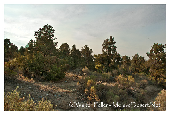
At higher elevations in the Mojave Desert, the vegetation transitions from typical desert scrub, dominated by creosote bush (Larrea tridentata), Joshua trees (Yucca brevifolia), and other drought-tolerant plants, to pinyon-juniper woodlands. Pinyon pine (Pinus monophylla) and juniper (Juniperus spp.) become more prevalent in these transitional areas.
In the mountainous regions surrounding the Mojave Desert, pinyon-juniper woodlands transition further into coniferous forests. Species such as ponderosa pine (Pinus ponderosa) and white fir (Abies concolor) become more dominant. This transition is often associated with increasing elevation and cooler temperatures.
Desert Washes and Riparian Zones:
Where desert washes, or arroyos, intersect with the Mojave Desert, there are ecotones characterized by riparian vegetation. These transitional zones may include cottonwood (Populus fremontii) and willow (Salix spp.) trees, providing habitat for different plant and animal species compared to the surrounding arid landscape.
Desert to Playa Ecosystems:
The transition from the desert to playa ecosystems, such as dry lake beds, represents another ecotone. Playas can support unique vegetation adapted to periodic flooding and provide a habitat for migratory birds during wet periods.
Urban-Wildland Interface:
There is an ecotone known as the urban-wildland interface, where urban areas encroach upon the Mojave Desert. The interaction between human-dominated landscapes and the natural desert environment characterizes this transition zone. Human activities in these areas can have significant impacts on the desert ecosystem.
Mojave Desert to Great Basin Transition:
In the northern reaches of the Mojave Desert, there is a transition zone where the desert ecosystem merges with the Great Basin. This transition is marked by changes in vegetation and species composition influenced by elevation and precipitation.
Understanding and protecting these ecotones is crucial for preserving biodiversity and maintaining ecosystem resilience in the Mojave Desert. These transitional zones often support unique assemblages of plants and animals that are adapted to the specific conditions found at the boundaries between different ecosystems. Human activities, including urban development and climate change, can impact these ecotones, emphasizing the importance of conservation and sustainable management practices in the region.
Ecozones, also known as ecological zones or ecoregions, are geographic areas with distinct ecological characteristics, including climate, vegetation, and animal life. In the case of the Mojave Desert, several ecozones can be identified, each with its unique set of features. These ecozones help to categorize and understand the diverse environments within the broader Mojave Desert region.
Here are some key Mojave Desert ecozones:
Lower Colorado River Valley:
This ecozone includes the area along the lower course of the Colorado River, extending into southeastern California. Riparian habitats, including marshes and wetlands, along the riverbanks characterize it. The presence of water allows for a higher diversity of plant and animal life compared to the more arid parts of the Mojave Desert.
Mojave Desert Basin and Range:
The Mojave Desert Basin and Range ecozone cover the central and southern parts of the Mojave Desert. It includes vast expanses of arid lands with characteristic desert scrub vegetation, dominated by creosote bush, Joshua trees, and various cacti. Basins and mountain ranges mark the terrain.
Mojave High Desert:
This ecozone encompasses higher elevations within the Mojave Desert, including areas with pinyon-juniper woodlands and coniferous forests. It is found in mountainous regions such as the Spring Mountains and the Mojave National Preserve. The Mojave High Desert exhibits cooler temperatures and a different plant and animal community compared to lower elevations.
Sonoran Desert Transition:
Along the Mojave Desert’s southern boundary is a transition zone into the Sonoran Desert. This ecozone exhibits characteristics of both deserts and supports a mix of plant species from both regions. A warmer and subtropical climate influences the Sonoran Desert Transition ecozone compared to the central Mojave.
Mojave Desert Playas:
Playas, or dry lake beds, are characteristic features of the Mojave Desert landscape. These flat, unvegetated areas are part of the Mojave Desert Playas ecozone. They are important for unique plant and animal communities adapted to the periodic flooding during rain events.
Mojave-Upland Desert Scrub:
This ecozone includes upland areas within the Mojave Desert, characterized by desert scrub vegetation. It represents the transitional zone between lower elevations and the Mojave High Desert, showcasing variations in plant composition and adaptations to different environmental conditions.
Understanding these ecozones is essential for the Mojave Desert’s conservation efforts and management strategies. Each ecozone has its ecological processes, biodiversity, and environmental challenges. Conservation initiatives should consider each ecozone’s specific characteristics to ensure the long-term health and sustainability of the Mojave Desert ecosystem.
The Mojave Desert, located in the southwestern United States, is a vast and enchanting landscape that has inspired various stories and myths. While it may not be traditionally associated with romantic tales, “Romance of the Mojave Desert” could be interpreted differently.
One aspect might refer to the rugged beauty and allure of the desert itself. The Mojave Desert is known for its unique and diverse ecosystems, featuring vast expanses of arid land, rocky canyons, and iconic Joshua trees. Many people find beauty in the solitude and harshness of the desert environment, and there’s a certain romance in appreciating the stark landscapes and breathtaking sunsets.
Another interpretation could be linked to the historical and cultural stories embedded in the Mojave Desert. Native American communities have inhabited the region for thousands of years, and their stories and traditions add a layer of richness to the area. Explorers, pioneers, and settlers have also left their mark on the Mojave, contributing to its fascinating history.
“Romance of the Mojave Desert” may be a book, poem, or piece of art that captures the spirit and essence of the desert romantically or imaginatively.
The Mojave Desert continues to captivate and inspire those drawn to its unique charm and mystique. Whether it’s the silence of the vast landscapes, the resilience of the flora and fauna, or the rich history that echoes through the canyons, the Mojave Desert holds a special place in the collective imagination.
A desert microhabitat refers to a small-scale environment within a desert with unique characteristics and supporting specific life forms. Deserts are harsh ecosystems characterized by low precipitation levels and extreme temperatures. Despite these challenging conditions, various microhabitats exist within deserts, providing specialized plants and animals with niches to thrive. Here are some examples of desert microhabitats:
Shade of Rocks or Sand Dunes:
Some plants and animals find refuge in the shade provided by rocks or dunes, where temperatures are slightly lower.
Rock Crevices:
Gaps and crevices in rocks can offer protection from the sun and wind. Certain plant species may establish themselves in these microenvironments.
Dry Riverbeds (Washes):
Though dry for much of the year, riverbeds in deserts (washes) may have occasional water flow during rain events, attracting a variety of life adapted to sporadic water availability.
Salt Flats:
In some desert regions, there are vast salt flats where specific salt-tolerant plants and microorganisms can survive.
Oases:
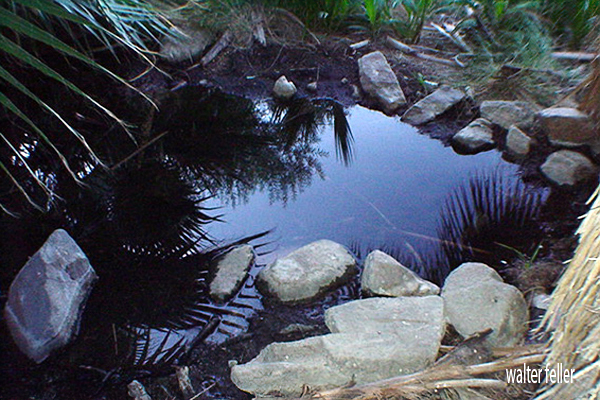
Oases are areas with water sources, often surrounded by vegetation. They provide a vital microhabitat for a diversity of plant and animal species in an otherwise arid landscape.
Burrows and Nests:
Some desert animals create burrows or nests to escape extreme temperatures and predators. Examples include burrowing rodents, reptiles, and certain bird species.
Cryptobiosis in Microorganisms:
Certain microorganisms in deserts can enter a state of cryptobiosis, a dormant condition that allows them to survive extreme dryness until conditions become more favorable.
Surface Crusts:
Microbial crusts on the desert surface, composed of algae, fungi, and bacteria, play a crucial role in stabilizing soil and preventing erosion. They also contribute to nutrient cycling.
Camouflage Adaptations:
Both plants and animals in deserts often have adaptations for camouflage, helping them blend in with the surroundings and avoid predators.
Understanding and preserving these microhabitats is essential for the conservation of desert ecosystems. Even small-scale disturbances can significantly impact the delicate balance of life in these environments.
Desert Wash – Desert Habitats. Roadside water runoff can also create a microhabitat of its own. The sacred datura, also called jimson weed or thorn apple, …
Microhabitat · Indian Culture Ceremonialism · Wildflower Photo Guide · Joshua Tree National Park · List of Mojave Desert Shrubs * · Plants at Hoover Dam · Zion …
Unlike the sparse vegetation in most of the Mojave, plantlife in washes is lush and deep-rooted. Plants range from shrubs such as the catclaw acacia, cheesebush …
Oasis Visitor Center, Twentynine Palms. Skull Rock – .25 mile loop, Microhabitat – Cap Rock · A relict population – Hidden Valley · Disappearing soil – Arch …
mojavedesert.net › trees › pinus-monophylla › 2.00.html
The seed characteristics and the microhabitats in which seeds are placed are important in determining their fate after dispersal. … Singleleaf pinyon seedlings …
The ecotones between singleleaf pinyon woodlands and adjacent shrublands and grasslands provide favorable microhabitats for singleleaf pinyon seedling …
The Mojave Desert rain shadow is a meteorological phenomenon that occurs in the southwestern United States. A rain shadow is an area on the leeward side of a mountain or mountain range that receives significantly less precipitation than the windward side. In the case of the Mojave Desert, this rain shadow effect is primarily influenced by the Sierra Nevada mountain range.
The prevailing westerly winds carry moist air from the Pacific Ocean. As this air rises over the western slopes of the Sierra Nevada, it cools and condenses, leading to precipitation. By the time the air descends on the eastern side of the mountains, it has lost much of its moisture, creating a rain shadow effect.
The Mojave Desert, located east of the Sierra Nevada in California, experiences this rain shadow effect. The descending air on the eastern side of the mountains warms up, leading to a drier and warmer climate in the Mojave Desert compared to the western side of the Sierra Nevada.
As a result, the Mojave Desert is characterized by arid and semi-arid conditions, with lower annual precipitation than the Sierra Nevada’s western slopes. This rain shadow effect plays a significant role in shaping the climate and ecosystem of the region. The Mojave Desert is known for its unique flora and fauna adapted to the arid conditions influenced by the rain shadow effect.
Overview. View from shadow mountains near El Mirage The Mojave Desert exists in a rain shadow created by the Transverse Ranges and the Sierra Nevada Mountain …
For example, the California portion of the desert often receives as little as 3 cm of rain. The Mojave is considered a rain shadow desert because the …
The rain shadow effect is produced by the high mountains on the west, which block the movement of wet winter storms. Artesian Wells · Flash Floods · Intro:: …
… rain shadow” effect produced by the high mountains on the west, and 2) the … The Joshua trees serve as a rain gauge in those areas of the desert where no …
The rain shadow from the San Gabriel Mountains affects vegetation types and water availability in the Mojave Front Country Place. It is a transition zone …
The Transverse Ranges are a group of mountain ranges in Southern California, USA. They run east-west and are characterized by their unique orientation, perpendicular to the typical north-south alignment of most other mountain ranges in North America. The Transverse Ranges play a significant role in the geography and climate of Southern California.
San Gabriel Range
San Bernardino Range
The main Transverse Ranges include:
San Gabriel Mountains: Located northeast of Los Angeles, the San Gabriel Mountains are a prominent part of the Transverse Ranges. They contain several peaks over 10,000 feet, including Mount San Antonio (Mt. Baldy), the highest peak in the range.
San Bernardino Mountains: To the east of the San Gabriel Mountains, the San Bernardino Mountains are another subrange within the Transverse Ranges. They include prominent peaks such as San Gorgonio Mountain, the highest peak in Southern California.
Additional Transverse Ranges (not in project)
Santa Ynez Mountains: Situated to the northwest of Los Angeles, the Santa Ynez Mountains are part of the Transverse Ranges and run parallel to the coast. They contribute to the scenic backdrop of the Santa Barbara area.
Santa Susana Mountains: Located northwest of Los Angeles, the Santa Susana Mountains are a smaller subrange within the Transverse Ranges.
Topatopa Mountains: Situated north of Ventura, the Topatopa Mountains are part of the Transverse Ranges and are known for their distinctive east-west orientation.
The Transverse Ranges have a significant impact on the climate of Southern California. They act as a barrier to moist air coming from the Pacific Ocean, causing a rain shadow effect. This results in a drier climate on the leeward (eastern) side of the ranges, contributing to the arid conditions of the inland areas.
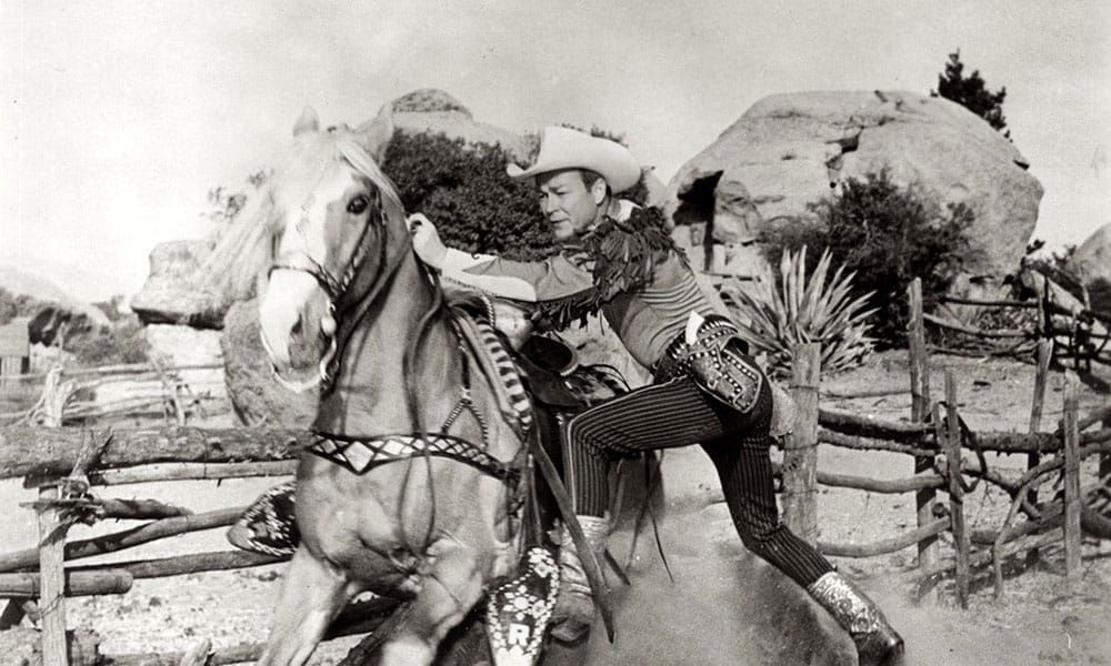
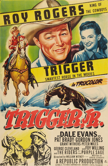
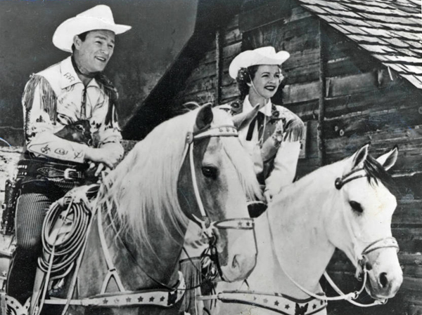
Trigger was the famous horse ridden by Roy Rogers, the iconic American cowboy actor and singer. Trigger was a golden palomino known for his intelligence, versatility, and striking appearance. He became one of the most well-known and beloved horses in the history of Hollywood.
Trigger was a Palomino horse that became famous as the faithful companion of Roy Rogers, a popular American cowboy actor and singer. Trigger was born in 1932 and originally named Golden Cloud. Roy Rogers first encountered the horse in the 1938 movie “The Adventures of Robin Hood,” where Olivia de Havilland rode him.
Impressed by the horse’s beauty and abilities, Rogers eventually acquired him. The horse was then renamed Trigger, and he became one of the most famous horses in Hollywood history. Trigger appeared in many of Roy Rogers’ films and television shows, showcasing his remarkable intelligence and performing various tricks on command.
Trigger appeared in many of Roy Rogers’ films and television shows, becoming a true partner to Rogers in his on-screen adventures. The horse was trained to perform a variety of tricks and stunts, showcasing both Trigger’s abilities and the strong bond between him and Rogers.
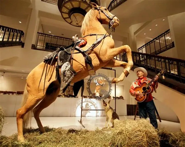
Trigger became a beloved icon, often called “The Smartest Horse in the Movies.” After Trigger died in 1965, Rogers arranged for the horse to be taxidermied. The preserved Trigger was displayed at the Roy Rogers and Dale Evans Museum in California. Later, the museum closed, and in 2010, Trigger was sold at auction for nearly $266,000. The buyer, a cable television network, intended to use the preserved horse in a planned Roy Rogers exhibit.
Trigger’s legacy lives on in fans’ memories and the numerous films and television shows where he played a prominent role alongside Roy Rogers.
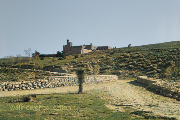
“Shea Desert Castle Sold,” Los Angeles Times, 25 Mar 1935 (colorized)
Richard Peter Shea built Shea’s Castle in 1924, also known as Sky Castle or Castle Ranch.
1929’s stock market crash bankrupted Shea. Shea’s wife died, the bank took over the castle, and Shea committed suicide.
Over the years, the property has changed hands and been used as a filming location.
Trigger, Roy Rogers’ horse, was trained on the property.
It is now a private residence.
The massive granite structure, built by R. P. Shea, was sold to three Beverly Hills women in 1935. The “castle” boasts many unique design elements that remain untouched after the purchase. This photograph appears with the article, “Shea Desert Castle Sold,” Los Angeles Times, 25 Mar 1935: 19.CAPTIONText from negative sleeve: Shae’s [sic] Castle nitrates
Handwritten on negative: Shae’s [sic] Castle 3-16-35 Text from newspaper caption: “Dream Home” in Mojave Desert Passes Into New Hands; A massive granite structure in the Mojave Desert, built ten years ago as a “dream home” of R. P. Shea, yesterday, passed into the hands of new owners. So incongruous is its setting that many believe they are beholding a mirage when they see the $175,000 castle.
Skidoo came to life because of fog. When Harry Ramsey and a man called One-eye Thompson lost their way on a road leading to the new boom camp of Harrisburg, they stopped to rest near a log lying against an outcropping of rock. When the fog lifted, the rock turned out to be gold. This was back in 1905. In deciding upon a name for the town that sprung up, a numerologist associated a popular expression of the day, 23-Skidoo, with the fact that a Rhyolite man named Bob Montgomery had successfully piped water from Telescope Peak 23 miles away and suggested the name Skidoo. So it became.
Downtown Skidoo. Death Valley National Park
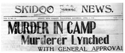
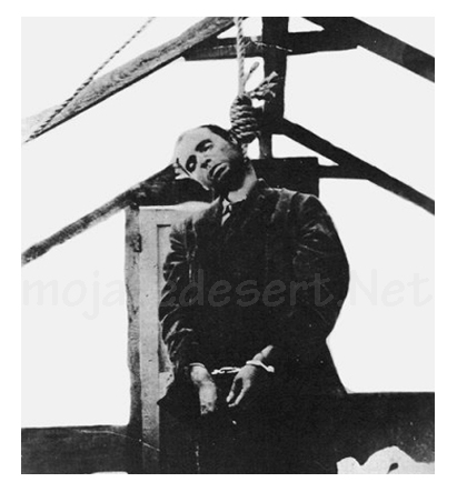
Old-timers say the camp produced over a million dollars worth of gold ore between its discovery and its demise some 20 years later. Skidoo’s chief claim to fame, however, was not its riches. Rather, it was an infamous lynching of a scoundrel named Joe Simpson in 1908.
On a tour to the ghost town of Skidoo in 1962, we were privileged to be accompanied by an 87-year-old gentleman named George Cook. The interesting thing about Mr. Cook was that it was he who pulled on the rope at the lynching. His participation had only recently been divulged to a few intimate friends—after all others involved had passed on to their rewards, or whatever.
Joe “Hooch” Simpson
“Joe Simpson,” Mr. Cook told us, ‘was a would-be villain who had killed a man at Keeler after shooting-up Jack Gun’s Saloon in Independence the preceding year. He’d somehow gotten off and drifted to Skidoo where he became a partner with Fred Oakes in the Gold Seal Saloon. Across the street was Jim Arnold’s Skidoo Trading Company.
“Arnold was a friendly, well-liked man and had always been on good terms with Simpson, but Simpson became drunk and abusive one April morning and decided to hold up a bank situated in part of Arnold’s Skidoo Trading Company. Apprehended, his gun was taken away and hidden by the deputy sheriff, but a little later Simpson found his weapon and returned to the store to shoot Jim Arnold. He then turned on two other men who had come to the rescue, but his aim was poor and both escaped. Eventually, Simpson was overpowered and placed under guard in the deputy sheriff’s cabin. Unfortunately,” Mr. Cook lamented, “the popular Jim Arnold died that night.”
Skidoo went wild with indignation. After Arnold’s funeral, which the entire camp attended, a group went to the improvised jail, led the prisoner out at the end of a rope, and hanged him to the nearest telephone pole. When Sheriff Nailor from Independence arrived, after a hazardous trip over rough roads via Tonopah and Rhyolite, he made the now famous statement, “It’s the best thing that ever happened to Inyo County; it saved us $25,000!”
But this wasn’t the end. Several spectators had forgotten their cameras and wanted pictures of the hanging. So, Joe Simpson’s body was obligingly strung up again, this time from the ridgepole of the tent where he was “laid out.” News of this gruesome encore spread and the lynching won everlasting fame. In his private narrative of the event, George Cook added a factor never before related: “Joe was dead before we got the rope around his neck; he died of a heart attack (from fright) and was already gone when dragged to the telephone pole scaffold.”
It was also he, George Cook confessed, who assisted Dr. MacDonald in removing the head from Simpson’s corpse. The doctor, it seems, had once performed an operation on Simpson s nose and wanted to make a further medical study of the case. Going at night, they performed the severance at the lonely prospect hole where Simpson’s body had been tossed. (No one in Skidoo would give him a decent burial, so great was the indignation at his senseless crime). The skull was exhibited for a period in a showcase at Wildrose, but later disappeared.
The remainder of the skeleton resisted oblivion, however. Years later when George Cook returned to Skidoo to work in the mill, an agitated prospector appeared one day to report a headless skeleton of a man who’d evidently been murdered. Because Cook was the only old-timer around at the time, he was consulted. Indeed a crime had been committed sometime, he agreed, but of the details, he had conveniently forgotten.
Last year George Cook passed away. Small in stature, religious, mild-tempered, and given to writing sentimental verse, he was the antithesis of our Western idea of a vigilante. The role forced upon him by his acute anger over the murder of a friend bothered this good man to the end of his days. His belief that Simpson did not expire at his hand appeared to be a real comfort. And, perhaps he was right. We cannot disagree, for George Cook was there.
Much interesting history is connected with the now-defunct Skidoo. Following its early boom, the town was deserted for a period, then, under new management, the mine and mill reopened during the 1930s and a period of production occurred. The old wild days never returned, however, and its fame as a mining camp still rests upon the lynching incident —to which we add, “Joe Simpson did not die because of a rope and a telephone pole. He died of a heart attack!”
by Myrtle Nyles – November 1964 – Desert Magazine
Editor’s Note: This is but one version of this story, and it is worth saying that it has generated many other versions and stories through its telling.
In January 1906 two wandering prospectors, John Ramsey and John (One-Eye) Thompson were headed towards the new gold strike at Harrisburg. Along the way a blinding fog came in and the two camped near Emigrant Spring for fear of getting lost. …More …
The Chumash are a Native American people who historically inhabited the coastal and inland regions of California, particularly the Central and Southern California coastal areas. Their traditional territory includes areas from the Santa Barbara Channel to Malibu. The Chumash are considered part of the Hokan language family.
The Chumash people are known for their complex social organization, advanced maritime technology, and well-developed basketry and rock art. They were skilled fishermen, hunters, and gatherers, relying on the rich marine resources of the Pacific Ocean as well as the diverse plant and animal life in their environment.
The Chumash were organized into chiefdoms, each with its leader, and they lived in villages with plank-built houses. Their society had a sophisticated economic and political structure and traded with neighboring tribes.
With the arrival of Spanish explorers in the 18th century, the Chumash were profoundly affected by European colonization. Spanish missions were established in Chumash territory, leading to changes in their way of life, the introduction of new diseases, and the disruption of their social structures.
Today, Chumash people continue to maintain and revitalize their cultural traditions. Ongoing efforts are to preserve Chumash languages, arts, and traditional knowledge. Some Chumash individuals and communities are also involved in cultural and educational initiatives, including managing tribal museums and interpretive centers that showcase Chumash history and heritage.
The Chumash are recognized as a sovereign tribal nation, and contemporary issues include discussions about tribal governance, land rights, and the broader acknowledgment of indigenous rights in the United States.
The Halchidhoma (also spelled Halchidoma or Haltchidhoma) was a Native American tribe historically inhabiting the southwestern United States. They were part of the Yuman language-speaking people and lived in the lower Colorado River region, particularly in what is now Arizona and California. The Halchidhoma were closely related to other Yuman-speaking groups, such as the Mojave, Quechan, and Cocopah.
The Halchidhoma people were known for adapting to the desert environment and were skilled at fishing, hunting, and gathering resources in the arid landscape. They utilized the Colorado River for sustenance, catching fish, and utilizing plants for food, medicine, and other purposes.
However, the Halchidhoma tribe faced significant challenges with the arrival of European colonizers and the subsequent westward expansion of the United States. The disruption caused by the influx of settlers, diseases, and conflicts with other Native American groups and European colonists contributed to the decline of the Halchidhoma population.
Over time, the Halchidhoma people faced displacement, and their distinct tribal identity gradually faded. Today, the Halchidhoma are considered one of the many Native American groups whose historical presence has diminished, and their cultural heritage is often studied through archaeological and historical records.
It’s important to note that the history of Native American tribes is complex, and various factors, including interactions with European settlers, government policies, and environmental changes, have shaped their experiences.
The Mojave are Native American people who traditionally inhabited the Mojave Desert, which spans parts of California, Arizona, Nevada, and Utah in the United States. The Mojave people are part of the larger Yuman language family.
The Mojave are known for their adaptation to the harsh desert environment and their traditional lifestyle as hunter-gatherers. They relied on the diverse resources of the desert, including native plants, seeds, and the hunting of small game. The Colorado River, which flows through their territory, played a significant role in their lives.
Historically, the Mojave people lived in small family groups and had a strong sense of community. They built dome-shaped houses known as “kish,” their social organization included tribal leaders and spiritual figures.
With European settlers’ arrival and the United States’s expansion in the 19th century, the Mojave, like many other Native American groups, faced significant challenges. European diseases, conflicts over land, and changes in their traditional way of life profoundly affected their population and culture.
Today, the Mojave people continue to maintain their cultural traditions and have a presence on the Fort Mojave Indian Reservation, which spans parts of California, Arizona, and Nevada. Efforts are underway to preserve the Mojave language, arts, and traditional knowledge. Additionally, like other Native American groups, the Mojave is engaged in discussions about tribal sovereignty, land rights, and broader issues related to recognizing indigenous rights.
The Hualapai, also spelled Walapai, are a Native American people who traditionally lived in the western part of the United States, primarily in the Hualapai Indian Reservation in northwestern Arizona. They are part of the larger Yuman language family.
The Hualapai people are known for their strong connection to the Grand Canyon, as a significant portion of their reservation includes parts of the Grand Canyon and the Colorado River. The term “Hualapai” translates to “People of the Tall Pines” in their language, reflecting the importance of the pine forests in their traditional territory.
Historically, the Hualapai were hunter-gatherers, relying on the resources of their diverse environment, including the Grand Canyon, plateaus, and mountainous regions. They hunted game, gathered plants, and engaged in cultural practices that reflected their close relationship with the land.
With the arrival of European settlers and the expansion of the United States, the Hualapai faced challenges such as the loss of traditional lands, conflicts over resources, and changes in their way of life. In the late 19th century, the Hualapai Reservation was established, providing a designated area for the tribe.
Today, the Hualapai people continue to preserve their cultural heritage. The Hualapai Reservation is a popular destination for tourists interested in experiencing the Grand Canyon from the perspective of the Hualapai people. The Hualapai Tribe is also known for managing the Grand Canyon Skywalk, a glass bridge that extends over the Grand Canyon.
Efforts are ongoing to maintain and revitalize the Hualapai language, arts, and traditional knowledge. Like many other Native American groups, the Hualapai are actively engaged in issues related to tribal sovereignty, land rights, and the broader recognition of indigenous rights.
The Havasupai, or Havasu ‘Baaja, are a Native American people who have traditionally lived in the Grand Canyon region of Arizona, particularly in Havasu Canyon. “Havasupai” means “people of the blue-green water,” which reflects the turquoise color of the Havasu Creek that flows through their ancestral lands.
Havasupai’s history and culture include their deep connection to the Grand Canyon, reliance on the area’s natural resources, and their traditional practices as hunter-gatherers. Havasupai people historically hunted game, gathered plants, and engaged in trade with neighboring tribes.
In 1882, the U.S. government established the Havasupai Indian Reservation, which encompasses about 188,077 acres and includes the Havasu Canyon. The reservation is situated within the larger Grand Canyon National Park.
Some notable features of Havasupai land are the Havasu Falls, Mooney Falls, and other waterfalls along Havasu Creek. These natural wonders, known for their striking blue-green waters, attract visitors worldwide.
The Havasupai people maintain cultural traditions, including traditional ceremonies, crafts, and storytelling. The Havasupai language is also preserved within the community.
Tourism plays a significant role in the Havasupai economy, as visitors are allowed to experience the beauty of Havasu Canyon, including its waterfalls and hiking trails. However, the community also faces challenges in maintaining the delicate balance between tourism and preserving cultural and natural resources.
Like other Native American groups, the Havasupai are actively engaged in issues related to tribal sovereignty, land rights, and the broader recognition of indigenous rights.
The Cocopah, or Cocopah Tribe, are a Native American people who traditionally lived along the lower Colorado River in the southwestern United States and northern Mexico. Their homeland includes areas in Arizona and California, as well as the Baja California region of Mexico. The Cocopah are part of the larger Yuman language family.
Historically, the key aspects of Cocopah culture included fishing, hunting, and gathering in the desert and riverine environments. They were skilled in constructing traditional houses called “káak” or “mat káak” made from arrowweed and brush. The Cocopah people have a rich cultural heritage, including traditional songs, dances, and ceremonies.
With the arrival of European settlers, the Cocopah, like many other Native American groups, faced challenges such as changes in their way of life, conflicts, and the loss of traditional lands. The Cocopah Reservation, established in the United States, is located near Somerton in southwestern Arizona.
Today, the Cocopah Tribe is engaged in cultural preservation efforts, including revitalizing the Cocopah language, traditional arts, and ceremonies. The tribe is also involved in economic development initiatives, education, and healthcare programs to benefit its community members.
The Cocopah people maintain a connection to their ancestral lands and the Colorado River, an important aspect of their cultural identity. Issues related to tribal sovereignty, water rights, and the broader recognition of indigenous rights are significant considerations for the Cocopah Tribe.
The Quechan also spelled Kwtsaan or Kwtsan, are a Native American people who traditionally inhabited the lower Colorado River Valley, including parts of present-day Arizona and California. The Quechan are part of the larger Yuman language family.
The Quechan people have a rich cultural heritage, including traditional ceremonies, dances, and crafts. They historically relied on the resources of the region, such as fish from the Colorado River, wild plants, and small game.
One of the well-known groups within the Quechan people is the Fort Yuma Quechan Tribe, which is based on the Fort Yuma Indian Reservation. The Fort Yuma Indian Reservation is near the present-day city of Yuma, Arizona, along the Colorado River. The Quechan people have a long history in the region, and their reservation is an important center for preserving and promoting their cultural traditions.
With the arrival of European settlers and the establishment of the United States, the Quechan, like many Native American groups, faced challenges such as the loss of traditional lands, conflicts, and changes in their way of life. However, they have persisted in maintaining their cultural identity and practices.
Today, the Quechan Tribe is actively involved in issues related to tribal sovereignty, land rights, and the broader recognition of indigenous rights. The Fort Yuma Quechan Tribe engages in various cultural and educational initiatives to preserve and revitalize their language, arts, and traditions, ensuring their heritage is passed on to future generations.
The 1952 Kern County earthquake occurred on July 21, 1952, in southern California. This earthquake had an estimated magnitude of 7.3, making it one of the most powerful earthquakes in California’s history. The epicenter was near the White Wolf Fault in the southern Sierra Nevada mountain range.
Key points about the 1952 Kern County earthquake:
Magnitude and Intensity: The earthquake was 7.3 and is considered a major event. It caused strong shaking in the affected areas.
Location: The epicenter was near Arvin in Kern County, California.
Damage: The earthquake caused significant damage in several communities, including Bakersfield, Tehachapi, and Arvin. Many buildings were damaged, and some were destroyed. Infrastructure, such as roads and bridges, also suffered.
Casualties: The earthquake resulted in 12 fatalities and numerous injuries. The loss of life and property damage were considerable.
Aftershocks: Like many major earthquakes, the 1952 Kern County earthquake was followed by a series of aftershocks, some of which were strong enough to cause additional damage.
Effects on Oil Fields: The earthquake had notable effects on oil fields in the region. The shaking caused ground rupture and surface faulting, impacting oil extraction operations.
Response and Study: The earthquake prompted increased interest and research in engineering and seismology. Lessons learned from the event contributed to advancements in earthquake-resistant building design and seismic hazard assessment.
The 1952 Kern County earthquake was a significant event in the history of seismic activity in California, and it played a role in shaping earthquake preparedness and research efforts in the region.
Shoshone is a small unincorporated community located in the southeastern part of Inyo County, California, USA. The history of Shoshone is closely tied to the development of the surrounding region, characterized by its desert landscape and proximity to Death Valley.
Native American Presence: Before European settlers arrived, the area around Shoshone was inhabited by various Native American groups, including the Shoshone people, from whom the town takes its name. The Shoshone were a group of indigenous people who traditionally lived in the Great Basin and surrounding areas.
Exploration and Settlement: In the late 19th century, the California desert attracted prospectors and settlers seeking opportunities. In 1880, George Lane discovered a spring in the area, which led to the establishment of Shoshone as a water stop for the Tonopah and Tidewater Railroad in the early 1900s. This made Shoshone an essential point for transportation and commerce.
Mining and Agriculture: The nearby Dublin Gulch and Funeral Mountains attracted miners seeking gold and other minerals. Mining activities contributed to the growth of Shoshone. Additionally, agriculture, particularly the farming of date palms, became important in the region due to the presence of water from natural springs.
Amargosa Opera House: Marta Becket, a dancer and artist, arrived in Shoshone in the 1960s. She renovated and reopened the Amargosa Opera House in nearby Death Valley Junction, which became a cultural hub for the area. The opera house is known for its unique murals and performances.
Tourism and Recreation: Over the years, Shoshone has become a gateway for tourists exploring Death Valley National Park and the surrounding desert landscapes. The town offers services and amenities for visitors, including accommodations, restaurants, and the Shoshone Museum, which showcases the area’s history.
Environmental and Conservation Issues: The region faces water scarcity and environmental conservation challenges. The delicate desert ecosystem requires careful management, and organizations work to balance development with the preservation of natural resources.
Today, Shoshone remains a small community focusing on tourism and outdoor recreation. Its history reflects the broader patterns of development and economic activities that have shaped the desert regions of California. Visitors to Shoshone can explore its historical sites, enjoy the unique desert landscape, and learn about the area’s rich cultural and natural heritage.