The Sidewinder Rattlesnake: A Master of Adaptation

Introduction:

The Sidewinder rattlesnake, scientifically known as Crotalus cerastes, is a fascinating rattlesnake species that calls North America home. Renowned for its unique sidewinding locomotion and distinctive rattling tail, this snake has captivated researchers and nature enthusiasts alike. Let us explore the fascinating world of the Sidewinder rattlesnake. We will examine its physical characteristics, habitat, behavior, and remarkable ability to adapt to the harsh desert environment.

Physical Characteristics:

The Sidewinder rattlesnake is a medium-sized venomous snake, typically measuring 2 to 3 feet long. One of its most notable features is the presence of horn-like scales above its eyes, known as supraocular scales, which provide protection and aid in camouflage. Its coloration varies, blending perfectly with the sandy desert surroundings, ranging from light tan to reddish-brown. The Sidewinder also possesses a triangular-shaped head, heat-sensing pits on each side of the face, and a segmented rattle at the end of its tail, which it uses as a warning signal.

Habitat and Range:

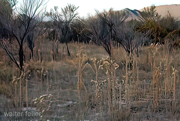
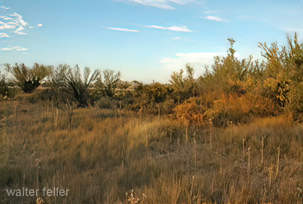
This species of rattlesnake is predominantly found in the arid regions of the southwestern United States and northern Mexico. It thrives in sandy deserts, dunes, and scrublands, where it has evolved to withstand extremely high temperatures and scarce water sources. The Sidewinder has also been known to inhabit rocky outcrops and areas with sparse vegetation, displaying its remarkable adaptability to a range of desert environments.

Behavior and Hunting:

The Sidewinder rattlesnake is primarily nocturnal, preferring to venture out under the cover of darkness when temperatures are cooler. By utilizing its unique sidewinding locomotion, the snake is able to traverse the shifting sand with ease, leaving distinctive J-shaped tracks behind. This sidewinding behavior minimizes the snake’s contact with the hot desert surface, reducing the risk of overheating.

Regarding hunting, the Sidewinder relies on its exceptional camouflage and heat-sensing pits to locate its prey, primarily consisting of small rodents, lizards, and birds. Once a potential meal is detected, the Sidewinder strikes with precision, injecting venom into its prey to immobilize it before swallowing it whole.

Adaptations to the Desert Environment:

Surviving in the harsh desert environment requires remarkable adaptations, and the Sidewinder rattlesnake has evolved several strategies to cope with the challenges it faces. One such adaptation is its ability to burrow into the sand, seeking refuge from extreme temperatures and predators. By burying itself, the Sidewinder can regulate its body temperature and remain hidden from potential threats.

Furthermore, the scales of the Sidewinder are specialized to enhance its ability to move on loose sand. The keeled scales on its belly provide additional traction, allowing the snake to sidewind efficiently. This unique mode of locomotion also reduces the surface area in contact with the hot sand, preventing excess heat absorption.

Conclusion:

The Sidewinder rattlesnake is a fascinating creature that has mastered the art of survival in the desert. Its extraordinary adaptations, including sidewinding locomotion, remarkable camouflage, and ability to burrow, make it a true desert icon. While maintaining a respectful distance from this venomous snake is crucial, appreciating its remarkable abilities and the role it plays in the delicate desert ecosystem is equally important. The Sidewinder serves as a reminder of the incredible diversity and resilience of life in even the harshest environments.

w.feller – 2023

Battle at Chimney Rock

History of San Bernardino and Riverside counties
Brown, John & Boyd, James – 1922

 Typical of the troubles of the times is the following article from a local newspaper of February 1867: “For several years past, our citizens have been greatly annoyed by roving bands of Indians who come into the valley and steal all the horses and cattle they find unguarded. Nor do they hesitate to attack stockmen and travelers if an opportunity offers. Already Messrs. Parish, Bemus and Whiteside, and a dozen others have fallen victim to their bloodthirstiness within the past four years. Growing bolder by impunity, on the 29th of January, they attacked the sawmill of Mr. James upon the mountain, a few miles east of this place, having previously robbed the house of Mr. Cain, carrying off five horses and burned down the house. The party at the mill, consisting of Messrs. Armstrong, Richardson, Cain, and Talmadge, sallied out to meet them. A brisk fight followed when the party, finding that most of the Indians had guns and fearful of being overpowered, retreated to the mill. The next morning the party, having been reinforced, went out and was attacked again, the fight lasting for more than an hour. Two of the white men were wounded, two Indians were killed, and three wounded. A party was made up to pursue these Indians, and after following them, found the Indians encamped in the desert at Rabbit Springs. The company made an attack, the men having to climb up the steep mountains and over the rocks on all fours, and the skirmishing lasted until dark. The skirmishing lasted for two days longer when the whites were compelled to withdraw because supplies were exhausted. Four Indians were killed and two of the white party wounded.” The Mojave region came under the protection of Camp Cady, which was established as a regular military post in 1868 on the road between Wilmington and Northern Arizona territory, and about 100 troops under Colonel Ayers remained here until about 1870.

Battle of Chimney Rock John Brown

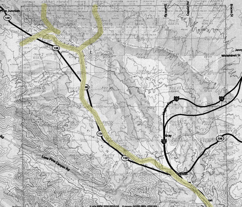
Lucerne Valley Road Network – 1901

Tonopah, Nevada

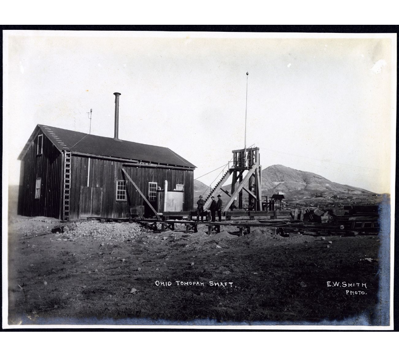
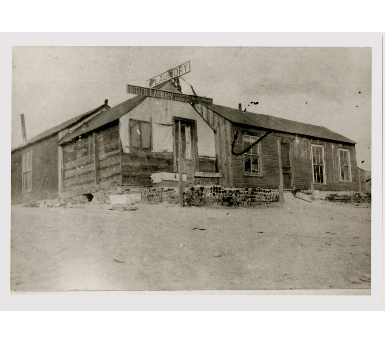
Tonopah was one of Southern Nevada’s most prosperous mining communities, drawing hundreds of prospectors from its founding in 1900.  Silver was first discovered on May 19, 1900, by prospector Jim Butler who was traveling through the area.  On an overnight stop, Butler discovered silver outcroppings near Tonopah Springs.  When Butler’s friend Tasker Oddie  (later Nevada Senator and Governor) had Butler’s sample assayed, it was found to be worth $50-$600 per ton.  That August, Butler and his wife staked eight claims in Tonopah.  Mrs. Butler christened the first three claims Desert Queen, Burro, and Mizpah.  The Mizpah became Tonopah’s largest producer over the next forty years.  Later that year, Butler leased his claims for one year, collecting 25% of the royalties from the gold and silver ore that was mined. 

In 1901 several companies opened, including the West End Consolidated Mining Company and the Tonopah Extension Mining Company.  In January, the mining camp had a population of 40, including three women.  By springtime, the population rose to 250, and Tonopah’s first stage, the Concord, arrived from Sodaville.  In May 1901, Tonopah’s first post office and the largest building in the city, The Mizpah Bar & Grill, opened.   That summer, Tonopah’s population reached 650.  W.W. Booth advertised the district through his newspaper, the Tonopah Bonanza.  As word spread, more prospectors entered the area, and three large mining corporations were formed in early 1902: The Tonopah Belmont Mining Company, the Montana Tonopah Mining Company, and the Tonopah Mining Company. 

The camp was still relatively primitive in 1902.  Prices, crude sanitary conditions, and Tonopah’s isolation made it difficult to obtain supplies. This changed in early 1903 when construction began on a 60-mile-long narrow gauge railroad connecting Tonopah with the Carson and Colorado Branches of the Southern Pacific Railroad at the Sodaville Junction. 

By the end of 1903, Tonopah’s population surged to 3,000.  With several profitable silver and gold strikes, production boomed, and mining stocks listed on the San Francisco stock exchange since April soared.  A building boom followed the mining boom. There were thirty-two saloons, six faro games, two dancehalls, two weekly newspapers, several mercantile stores, and two churches built before 1904.  On July 25, 1904, the town celebrated the completion of the narrow gauge railroad with speeches, sporting events, horse races down Main Street, and several dances. 

The population continued to grow as transportation to the district became easier, and by May 1905, the Nye County seat was moved from Belmont to Tonopah, the post office changed its name to Tonopah, and construction began on a new $55,000 Nye County courthouse.  On July 7, 1905, Tonopah’s first city government was incorporated.  In the fall, the two railroads in Tonopah merged into the Tonopah and Goldfield Railroad Company, its track gauge standardized and extended to Goldfield. 

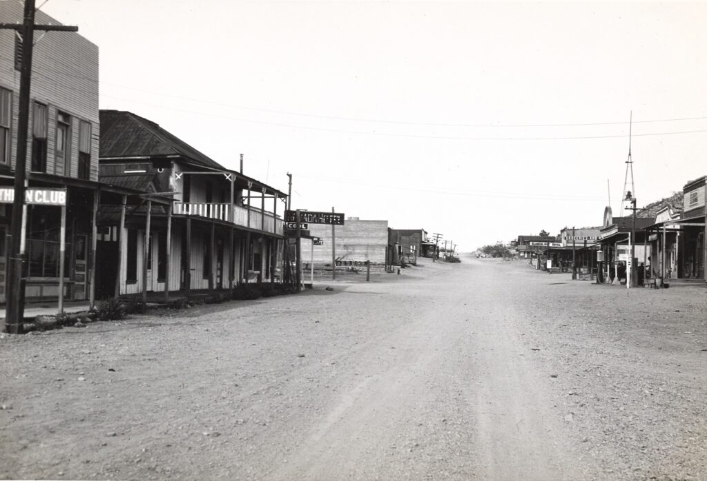
Tonopah survived the financial panic of 1907.  The city had five banks, modern hotels, cafes, an opera house, a school, electric and water companies, numerous gambling halls, and several four to five-story buildings downtown.  In 1908 and 1909, Tonopah was devastated by a series of fires.  In May 1908, a fire destroyed an entire block of the commercial district.  A year later, the roundhouse and the machine shops at the Tonopah and Goldfield Railroad burned to the ground.  The infamous Belmont fire occurred on February 23, 1911, when the 1,200-foot mine shaft of the Belmont Mine caught fire.  Seventeen men perished from the toxic fumes of the blaze. 

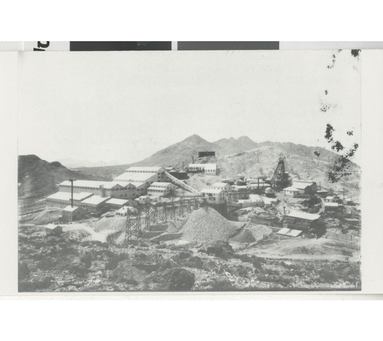
Mining activity expanded in 1912 when the Belmont mine and mill began operating in July.  The daily wage for a machine operator averaged $4.50-$5.50 per shift. The following year was Tonopah’s most profitable: Annual production in gold, silver, copper, and lead was valued at $10 million.  Several mills were constructed to process 1,830 tons of ore daily, including the Tonopah Belmont Development Company’s massive 500-ton mill on the east side of Mount Oddie. 

Tonopah reached its peak production between 1910 and 1914.  Between the end of  World War I and the Great Depression, four companies remained active: the Tonopah Mining Company, Tonopah Belmont, Tonopah Extension, and West End Consolidated Mines.  In 1921, four of the twenty-five principal silver mines in the nation were still in Tonopah, and Tonopah was the nation’s second-largest producer of gold. But on October 31, 1939, a fire destroyed the Belmont Mine, and another fire in 1942 closed the Tonopah Extension Mill.  World War II brought an Army Air Force Base to the area, but it was shut down upon the close of the war.  When the Tonopah and Goldfield Railroad ceased operations in 1947, Tonopah’s remaining mines closed, and the population dwindled. 

The total production of Tonopah’s mines over its forty years of production is estimated at over $150 million, and during that time, Tonopah produced many millionaires and statesmen, including Tasker Oddie, Jim Butler, Frank Golden, Zeb Kendall, and Key Pittman.  In the words of Nevada historian Stanley Paher, “Virginia City had put Nevada on the map; Tonopah kept it there.”

Tonopah, Nevada

https://special.library.unlv.edu/boomtown/counties/nye.php#tonopah

Searchlight — circa 1929-33

UNLV describes the history of Searchlight in the following;

“Gold ore was first discovered in Searchlight by Paiute Indians in 1870, 55 miles south of Las Vegas, but it was not until 1897, when G.F. Colton, a notable prospector, discovered a rich gold vein and word spread, that Searchlight boomed. The following year, the mining district was fully organized. The Quartette Mill opened in 1898 and soon became one of the city’s finest producers. In 1902 the first newspaper, Searchlight, began publishing, and the Duplex Mining Company constructed a twenty-stamp mill. In 1903 a miners’ strike brought the town’s production to a standstill until the mining companies brought in non-union miners to work the mines. The boom peaked during the spring of 1907 when the first train of the Barnwell & Searchlight Railroad arrived at Searchlight’s station to a warm greeting of a fifty-piece cowboy band. In 1907 Searchlight contained over forty-four working mines and a population of 5,000. However, Searchlight was hard hit by the financial panic of 1907.

The city recovered after a number of years and, by 1910, was noted for its fashionable and modern amenities and its commuter train. The community boasted a luxurious hotel, several saloons, a barbershop, a lumberyard, shops, cafes, union halls, boarding houses, schools, several stables, the newspaper, and its own hospital. The biggest mines were the Quartette, Cyrus Noble, Little Brown Jug, Old Bottle, and Duplex, whose gold production totaled $7 million. In 1934 a flotation mill was built, and a 30-ton custom mill ran briefly in 1935. However, by the late 1940s, little was left of the once modern boomtown of Searchlight.”

Image courtesy of the Franklin M. Murphy Photograph Collection, approximately 1929-1933. PH-00232. Special Collections and Archives, University Libraries, University of Nevada, Las Vegas. Las Vegas, Nevada. 

https://www.facebook.com/nevadaghosttowns

Johnny-Behind-the-Gun

from Chapter XXV – Ballarat. Ghost Town — Loafing Along Death Valley Trails by William Carruthers

A familiar figure throughout Death Valley country was Johnny-Behind-the-Gun—small and wiry and as much a part of the land as the lizard. His moniker was acquired from his habit of settling disputes without cluttering up the courts. Johnny, whose name was Cyte, accounted for three or four sizable fortunes. Having sold a claim for $35,000 he once bought a saloon and gambling hall in Rhyolite, forswearing prospecting forever.

Johnny advertised his whiskey by drinking it and the squareness of his game, by sitting in it. One night the gentleman opposite was overwhelmed with luck and his pockets bulged with $30,000 of Johnny’s money. Having lost his last chip, Johnny said, “I’ll put up dis place. Ve play vun hand and quit.”

Johnny lost. He got up, reached for his hat. “Vell, my lucky friend, I’ll take a last drink mit you.” He tossed the liquor, lighted a cigar. “Goodnight, chentlemen,” he said. “I go find me anudder mine.”

Johnny had several claims near the Keane Wonder in the Funeral Mountains, held by a sufferance not uncommon among old timers, who respected a notice regardless of legal formalities.

Senator William M. Stewart, Nevada mining magnate, had employed Kyle Smith, a young mining engineer to go into the locality and see what he could find. Smith, a capable and likable chap, in working over the districts, located several claims open for filing by reason of Johnny’s failure to do his assessment work.

It is not altogether clear what happened between Johnny and Smith, but Smith’s body was found after it had lain in the desert sun all day. There being no witnesses the only fact produced by sheriff and coroner was that Smith was dead. Johnny went free. Other escapades with Johnny-Behind-the-Gun occurred with such frequency that he was finally removed from the desert for awhile as the guest of the state.

In a deal with Tom Kelly, Johnny was hesitant about signing some papers according to an understanding. His trigger quickness was explained to Kelly who was not impressed. He went to Johnny and asked him to sign up. Johnny refused. Kelly said calmly, “Johnny, do you see that telephone pole?”

“Yes, I see. Vot about?”

“If you don’t sign, you’re going to climb it.” Johnny signed. He put his gun away when he acquired a lodging house at Beatty, where he died in 1944.

The Hog Drive to Daggett

TRUE STORIES – TOLD INCORRECTLY – A DESERT TRADITION

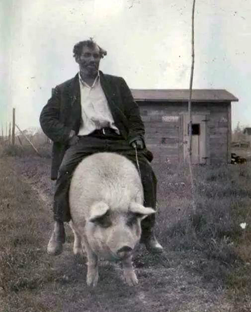
A totally unrelated photo of Leslie Kirchner riding his pig reminds me of the legend of the Daggett Pig Drive.

There were too many pigs, and it would have been too expensive to have them hauled to market, yet the little girl’s family needed the money to live in a hotel in Long Beach or someplace like that. The decision was made to drive the hogs to the railroad depot in Daggett as an old-fashioned cattle drive to Abilene. Betty was excited.

There were hogs and pigs as far as the eye could see, being guided by drovers experienced not with driving pigs but with small cattle. One-eyed Ben, the old man, said, “Driving pigs is just like driving tiny cows, except they don’t have horns, which is good because pigs are angry.” The hogs snorted, grunted, and squealed as they hurried down the dusty road. The trick, however, was to keep them from running and losing all their weight.

Little Betty cried when her father told her pigs were classified into ‘lard’ or ‘bacon.’ That meant the dreams of her two favorite pigs, Willis and Tina, wouldn’t be getting a pig wedding and then having a pig family together. Their future looked dark. “Lard or bacon?” thought Betty.

“Cheer up, Betty,” her father told her. “Have a stick of gum.”

And she did, and she stopped crying and went to live in a hotel in or near Long Beach.

The End

Fiction inspired by a true event as described in “Daggett, Life in a Mojave Frontier Town,” by Dix Van Dyke – Edited by Peter Wild.

About Water

Two stories about water, its availability, and value


Not long ago a respectable citizen of a little California town had to cross the desert at a point where water-holes were few and far apart. He depended upon obtaining water at a certain ranch, established at one of the oases on his route, and when he arrived there he and his guide and burros were in sad condition, having been several hours without water. He gave his guide a five-dollar gold piece and told him to see the rancher and purchase the water necessary to carry them to the next watering place. It happened that the rancher’s well was in danger of going dry, and he declined the money, refusing to part with any water. Pleadings were unavailing, and the guide returned to his employer and reported his inability to make a deal. Then the staid citizen arose in his wrath and, with a ten-dollar gold piece in one hand and a revolver in the other, he sought the rancher.

“There is ten dollars for the water, if you will sell it,” he said; “and if not, I will send you to Hades and take it, anyway! Now which will it be?”

There was but one reply to an argument of that kind ; the rancher sulkily accepted the money, the brackish water was drawn from the well, and the journey was soon resumed. As a result of this transaction, however, the rancher was obliged to take a forty-mile journey over the desert and back, to replenish his water-supply from another well.

John F. McPherson, of Los Angeles, manager of the Nevada Land Office, left Los
Angeles, in August, 1900, to traverse the Great Mojave Desert, on his way to look over the lands in the Parumph Valley, in Nevada. His experience, which was by no means uncommon, is best related by himself.

“I left Los Angeles by team,” he says, “to retrace the Government surveys and make field notes. I had with me two companions, one Samuel Baker and a young man from the East. We proceeded over the foothills to Cajon Pass, thence to Victor, out on the desert. It was in the burning days of a fierce, dry summer. The earth was fervid, and the air quivered with the sun’s intense heat, which poured its burning rays from a cloudless sky. Bad luck accompanied us from the very start. At Pomona, thirty miles from Los Angeles, we lost a horse and had to purchase another. At Daggett, out in the desert, which place we reached on the second day of our desert travel, we found the thermometer registering 128 degrees in the shade. We passed through Daggett and made camp ten miles
farther on, at dark.

“Eighteen miles beyond Daggett is Coyote Holes, where we expected to find water to replenish the supply with which we left Daggett at seven o’clock in the morning. We found the well dry when we reached there, and the place red with alkali. Near the well, two pieces of two by four scantling marked the grave of some traveler who had preceded us and who had run short of water before reaching the Holes. He had arrived too far gone to go farther, and his companions had remained with him till the end and had given him a burial in the sand and set the scantlings to mark the spot. Those scantlings proved our salvation a little later.


“By noon we had consumed all but about three gallons of our water -and we determined to save this till the last extremity, for we had yet eighteen miles to go to the next watering-place, Garlic Springs. Our horses were already in bad shape and nearly crazed for want of water. In their eagerness to reach it they plunged forward at a pace that threatened soon to exhaust them. Our efforts to restrain them by means of the reins were unavailing, and we were obliged to take off our coats and throw them over the heads of the animals and then lead them by the bits in this blinded condition.

“Just beyond Coyote Holes, on the road to Garlic Springs, is a fearful sink known as Dry Lake. Here the ground is shifty and treacherous and the wheels of the wagon sank deep into the sand. Just as we had reached the farther side of the lake the forward axle of the wagon broke, letting the front part of the wagon fall to the ground. This frightened the horses so that they became almost unmanageable. They seemed to realize that this delay meant possible death, and their cries were almost human-like and were indeed pitiable to hear.

“By this time the condition of my companions and myself was dire, and we realized that time was of the greatest importance. The thermometer registered 130 in the shade and no available shade. To add to our misery and increase our danger a terrible sand storm arose, blinding, stinging, and almost smothering us.

“It was like standing before a blast furnace, opening the door, and catching at the blast. There were 1600 pounds of provisions in the wagon at the time, and
if we abandoned that, we would perish of starvation. It could not be thought of. “We unhitched the horses and tied them to the wagon’s rear and stretched the heavy canvas which had covered the wagon over them to protect them from the sand storm. Our salvation lay with the horses. If they became exhausted or broke loose, we knew our bones would be left to bleach upon the desert sands, as have the bones of so many desert travelers.

“The young Easterner lost his courage and cried like a baby. The three gallons of water were divided among man and beast, and then Baker started back to Coyote Holes to get the two pieces of scantling to mend our broken wagon. While he was gone, the young Easterner and I threw the freight from the wagon to make ready for trussing up the rig when Baker returned with the scantlings.

” The storm continued to increase and soon became as dark as midnight. When it came time for Baker’s return, the storm was so high that we feared he would have perished in it or had lost his way. Hour after hour passed, but he still did not return, and we lost hope. At about 9 o’clock in the evening, however, he came into camp with the scantlings. His mouth was bleeding from thirst, and he was nearly blinded by the sand, but he had the material to repair the wagon, and hope returned to all our hearts.

” With stout wires and the timbers, we soon had our wagon in shape, and the freight was speedily loaded upon it, and we prepared to resume our journey. Our
ill luck, however, was not at an end, for when we attempted to attach the tongue of the wagon, the kingbolt was not to be found. It was midnight when we had our wagon repaired and loaded, and it was two o’clock before we succeeded in pawing the kingbolt out of the sand where it had fallen. Then we had twelve weary miles to travel before reaching the water. We were all in a terrible state when we started, and the wagon sank so deeply in the sand that our progress was fearfully slow.

“Twenty-four hours without water in the desert is a terrible thing. Baker went mad before we had covered half the distance to Garlic Springs. He was for abandoning the party, which meant certain death to one in his condition. There was only one thing I could think of to prevent him, and I did. I pulled out my revolver and told him I would shoot him if he attempted to leave the party. He had enough sense or sanity to heed the admonition and stayed with us. I had to carry my revolver in my hand, however, and constantly keep an eye on him. We reached the springs at ten o’clock and were all on the verge of delirium. It was several hours before our swollen and parched throats would admit more than a few drops of water at a time. We bathed in the water, soaked towels in it and sucked at the ends, and by degrees, fought away the demon of thirst. Baker spent five weeks in a hospital after reaching civilization, and we all were unfitted for hard work for a long time.”

It is easy to gather tales of this sort from the towns bordering upon the deserts. There are still more disastrous tales that remain untold because none survive to relate them.

From:
The Mystic Mid-Region
The Deserts of the Southwest
By Arthur J. Burdick – 1904

Argali

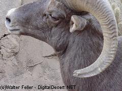
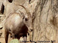
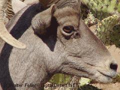
The way our language changes, develops, and reaches back fascinates me. Those animals had to be called something before proper names were defined and decided upon. So probably before Ovis canadensis was made legitimate, at least three common people commonly agreed to call what was then called an Argali, a bighorn sheep, an Argali is what it may have commonly been called.

From; A Pictorial History of California – Frost 1851

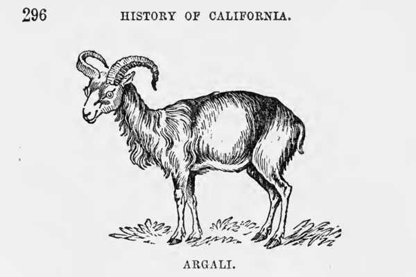
The Argali Ovis Moritanoe is found in California, sometimes called the Rocky Mountain Sheep.

By some, the goat of the Rocky Mountains has been confounded with this animal; and it has also been called an antelope, though it is neither the one nor the other, but truly and properly a goat. The characters of this species, or probably variety (for it really seems that, notwithstanding all the diversities of the genus (his, whether in the wild or the cultivated state, there is no well-made out distinction broader than that of variety,) are very apparent and at once prevent any possibility of confounding it either with the antelopes or the goats, though of course, as all sheep do, it approximates more closely to the latter of these than to the former. The body is remarkable for its thickness and roundness in proportion to its length; the legs are very long; the outline of the forehead, seen in profile, is nearly straight; and the muzzle is almost exactly that of the common sheep.

The male’s horns are thick and large; they advance in front of the eyes and form nearly an entire spiral turn. They are flattened laterally like the domestic ram and have similar transverse furrows and ridges. These furrows and ridges are very conspicuous on the basal half of the length of the horn, but much less so on the terminal half, and of the three lateral faces, the front one is the largest.

The horns of the female are much more slender than those of the male; they are compressed, nearly straight, and without furrows; there are, in some instances, plates or folds of skin under the throat, especially in the male; the tail is very short in both sexes; the color in summer is generally grayish fawn, with a reddish or yellowish line down the back, and a large patch of the same color -on the buttocks; and the under part, and the insides of the legs are either russet, yellowish, or of a white sand color; in winter, the color of the upper part is more reddish, and the throat and breast are more inclining to white; but the patch on the buttocks remains much the same at all seasons.

These animals are found in little flocks, of about twenty or thirty in each, on the Rocky Mountains and extending southward as far as California. Several naturalists have expressed their conviction that the mouflon of the south of Europe, the Argali of Asia, and the wild sheep of America, are only climatal varieties of one great species, to which they have given the name of “mountain sheep;” but whether this is or is not positively the fact, we have no means of ascertain ing. Probability is in favor of it, however, and the more so that, among the domesticated sheep, which we have every reason to believe are all originally of the same stock, whatever that stock may have been, there are differences of external appearance fully greater than any which are to be met with among the wild ones; and we believe that, in the whole genus, there are no differences but external ones. Some further confusion and uncertainty are produced among these wild sheep by the conduct of the keepers of museums, who have filled these with horns and other scraps, not having any history, and which have, in consequence, been referred to places where they are not to be found. However, the great puzzle in the history of this genus is the proneness which has to break into varieties, not only in different countries but in the same country and even in the same flock. However, the other two species or varieties are worthy of notice, even though they do not settle, or tend to settle, the question of common origin.

Other Keenbrook Settlers

by Alice Hall

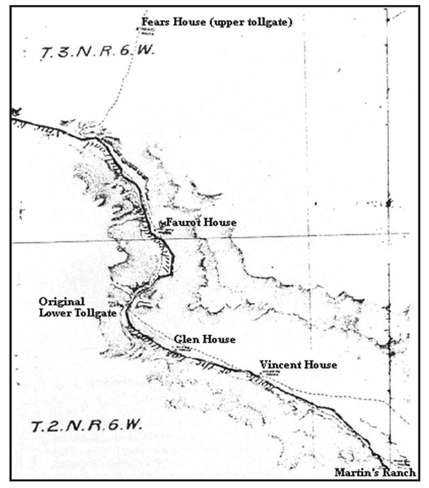
This portion of an 1875 Los Angeles and Independence Railway map shows John Brown’s Toll Road from Martin’s Ranch (Glen Helen) to Fears House, the upper tollgate. The lower toll gate (Blue Cut) was eventually moved to Faurot House, later called Bear Flat Ranch and Cozy Dell. The site of the Vincent house is now the San Bernardino Water Company property and the Glen House is Keenbrook. Rebecca Fears, daughter of the upper tollgate keeper, married Jerry Vincent.

Let’s see if I can itemize some of the other Keenbrook settlers besides the Glenns and the Keens.

William Gould Bailey, a printer by trade, raised bees in Bailey Canyon high above Verdemont around 1866. When fire destroyed his enterprise, he moved to Keenbrook and started a poultry farm. He was one of the co-purchasers with the Keens. Shortly after his marriage to Cinderella, he was called back to San Francisco to claim his son from a previous alliance, Hervey, whose mother had just died. William had been working in San Francisco with Waterman.

May Schultz and her sister Kate were housekeepers for the railroad, and Hervey Bailey married May.

Hervey Bailey homesteaded the Keenbrook place, and when his natural son, Ray, died, he deeded his property to the boy he’d raised, May’s son, Frank Schultz. Future generations of Baileys didn’t appreciate that Hervey Bailey had been overlooked. Frank married Hilda Wharton, who lived on what is now known as Ruddell Hill (Joe Camp’s place) with her mother and two sisters before they moved across Cajon Creek to the Obst place that became known as Freedom Acres when Anna Mills owned it. Hervey’s son was Raymond Gould.

Hilda Wharton Schultz became our trusted caretaker who managed our livestock when we had to be away from home.

Most of the photos I’ve been posting came from Ray Bailey, the grandson of Londa Bailey, whose husband was the Keenbrook station master between 1911 and 1918. Londa’s sister, Stella Ehwegen, was married to the Cajon station master, who previously served at the Summit Valley station. The two couples visited each other frequently, and both women were avid photographers. Ray Bailey inherited their photographs and graciously shared copies with me when he lived in Muscoy. Ray wanted the photos to have more public exposure, so here it is. More are available in the Cajon Pass book from Arcadia Publishing—from ArcadiaPublishing.com or most large bookstores.

Ben and Kathleen Verbryck also owned land in the Keenbrook area, and they donated land to the USFS to construct the first fire lookout platform in the Pass and the SB National Forest. Steam locomotives often started fires.

Gilbert Stuveling was another prominent landowner north of Keenbrook in the Clear Springs District when the land was assessed at $10 an acre. J.M. Herndon owned over 900 acres in the area.

Land boundaries in the pass have been fairly fluid through the years. Devore used to extend to Glen Helen and even beyond. Keenbrook used to include land on the east side of the creek like Mathews place and Freedom Acres.

Hilda’s Story

by Alice Hall

The other day I ran a photo of Hilda Wharton Schultz, and I thought a few memories of the area directly from Hilda would be appreciated. The photo, taken from the Blue Cut rock retaining wall, is of the Carlo home she mentioned.

HILDA’S STORY

By Hilda Wharton Schultz

Stories of Devore? Anyone who’s lived there could come up with pages of stories. My memories contain lots of stories of the Devore area.

My mother, Cora Wharton, was widowed young in West Virginia, and raising three daughters alone was difficult. We moved from a relative’s home in Arkansas to Fontana and from Fontana to Lenhardt’s 80 acres (now shown on Forestry maps as Ruddell Hill). We stayed there and took care of his many goats. After the 1938 flood, which trapped us on the hill for three weeks, we moved to Holcomb’s place in Verdemont. When we left in 1941, we lived for three years at the Obst place to watch their son Artie and care for the many goats. That place later became known as Anna Mill’s Freedom Acres across the canyon from Lenhardt’s, set back from Highway 66. Mr. Obst was the manager of Harris’s Department Store. (And Dr. Lenhardt, a veterinarian, had married Norma, the daughter of a Devore poultry farmer.

During the war (WWII), my sister Joanna and I used to go up to Clyde Ranch on Lone Pine Canyon Road. There was a tower there, and we used to spot airplanes for civil defense. I remember a little schoolhouse below Carlo’s big house that was washed out in the flood of 1938.

I remember election polls at Blue Cut. I remember that Kaylen’s place, the green house at Keenbrook, used to have a post office in it (that house has been replaced by a modular), and I remember the little post office on Cajon Blvd. later on. I remember hiking through the hills near Blue Cut (behind Gem Ranch up near the Heby place) and having my hackles rise when I realized something was following me. I never saw it, but I’m pretty sure it was a cougar.

I remember when Minnie Bradley, who bought my Keenbrook place, got her car stuck on the railroad tracks when it ran off the road a little. I could flag down the engineer, and he stopped in time and helped us move the car.

I remember the wide spot where the helper train engines could turn around to go back to town after making the grade. The turn-around was way past Cozy Dell, but on the other side of the wash. It was a big flat place where lots of tracks intertwined.

I remember when there were holding pens for cattle at the Summit and Ed Barnes’ unusual way of killing rattlesnakes- Fire probably is not the best tool for that job.

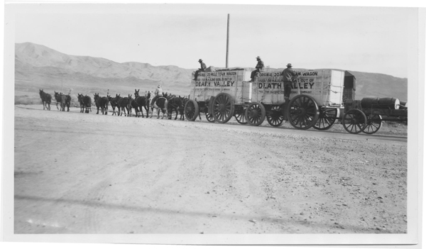
Hervey Bailey used to tell me some pretty interesting stories about living at Keenbrook. He used to ride the stagecoach from Keenbrook up to Victorville to eat at the Harvey House. He also enjoyed riding the 20-mule-team Borax wagons. He’s the one who homesteaded the Keenbrook area that included the place where I lived for a time.

I remember, after leaving Keenbrook for Verdemont (I lived at the Houghton place at the top of Palm), coming back to Devore almost every day to clean houses for people or care for their livestock while they were away. I worked for Kendall and Mary Rose Stone and Roger and Alice Hall. That’s where I learned never to trust a ram. I also worked for Superior Court Judge Edward P. and Jane Fogg in north San Bernardino.

Editors note: I met Hilda at my dad’s feed store in 1961. She started working for us during holidays and judging junkets in 1962. She was completely reliable and trustworthy and knew her livestock unbelievably well. We visited her both at her little bungalow tucked between the railroad tracks at Keenbrook and the Houghton place in Verdemont. I’ve always said that everyone needs a Hilda, and I miss having that kind of help since she retired.

Cajon Creek

by Alice Hall

This photo taken by either the Baileys (station masters at Cajon Station) or the Ehwegens, pronounced Ay-vay-gen (station masters at the Keenbrook Station) from Applewhite Road between 1911 and 1918, shows Cajon Creek.

The buildings along the railroad and near the lower right corner are Keenbrook.
I’m guessing that the large clear area against the San Bernardino hills nearing the upper left corner would be Freedom Acres when Anna Mills owned it in the 1970s, formerly owned by Obst.

Another guess is that the white line down the hill points to the Mathews and Hall Ranches. Those places were homesteaded in the 1920s by Francisco and Esperanza Luna and Mr. and Mrs. Francisco Nunez. Monte Mathews and his stepfather, Dr. Henderson Pittman, bought the Luna place. The Nunez place passed through several owners, including Edward and Edna Soehanel, before Harry and Ione Hall bought it in 1952.

Other early homesteaders by the creek were the Fears family, Jerry and Rebecca (Fears), Vincent, and Henry Clock.

Keenbrook

by Alice Hall

A locomotive stops at Keenbrook Station for water and fuel. Keenbrook was named for G.H. and Sarah Keene, who, along with two other parties, bought the property from James and Ruth Ellen Applewhite in 1883. Ruth Ellen was the daughter of the previous owner of the land, Silas and Mourning Dove Glenn, who established the successful resort in Lytle Creek. A stagecoach drove adventurous vacationers from the railroad station in Keenbrook to Glenn Ranch in Lytle Creek–not a trip I would have wanted to take.

Other Early Settlers of Devore

by Alice Hall

Before John A. Devore, many settlers claimed land in and around the hills where Devore now nestles. Those settlers were why the U.S. Government did not push their dispute against Henry Hancock over the conflict of interests shown when he surveyed the Muscupiabe Rancho. The government didn’t want to disrupt those many lives.

Besides Cole, other settlers in the area at the time were: Moses Sweat, a gold miner who owned his home; Narcisso Baroni, an irrigator, and his family; Refugio Chavia of the Cahuilla Tribe, who owned his own home where he housed his family; Peter Pahl, a German doctor, and his wife Harriet; Frank Coa, a servant and a teamster; Amanda Gavits, a Canadian nurse; Leon Lason or Lacon, a prospector from Virginia. People with their own farms were: McNew, Meyer, Long, Clark, Davidson, Riedel, Bledsoe, Bemis, Martin, and Leach. Other settlers in the area were Taylor, Van Horn, and Huey. Douglas was near Cole.

THE AKERS

The Akers were important settlers in the 1800s. Larkin B. Akers sold for $500 to John Akers in 1883, all his land, easements, and water rights in and around Akers Canyon in Section 21 of Township 2N, Range 5W, San Bernardino Meridian. Akers Canyon was described as being due north of the Old Martin Station (Glen Helen). That would make it Kimbark and put it in the vicinity of the alfalfa field the Coles later sold to Devore and Marble. The Coles may have had ownership as early as 1891.

In 1884, John M. Akers sold for $500 all his land in and around Akers and Alder canyons (the two Kimbarks?) to Henry De Garmo, John Hauser, and M.D. Katz.

In 1886, John M. Akers sold for $1000 to T.B. Lyon 80 acres of the John M. Akers place in Section 28 at the mouth of Cajon Pass. Neighbors mentioned as having previously bought land in Section 28 from John M. Akers were Bart Smithson to the east and M. Phelps to the west.

In 1886, L.B. Akers sold back to John Hancock, the owner of Rancho Muscupiabe and brother of land manager and surveyor Henry Hancock, land and water rights to Akers Creek he had purchased from Hancock three years before. The resale price was $1350 in gold coin.

L.B. Akers was also the father of Julia, who married Henry Hopper at the age of 16 in 1873. They settled in Section 22 of Devore, raised several children, and bought additional land from Devore early in his short tenure.

The Hopper place was on the top side of Foothill just west of Deercrest. Hopper Canyon still bears that name, and one of the Hopper sons has returned to see his birthplace through the years. During two of those visits, he spoke with Nancy Sneed, as the Sneed home is at Hopper Canyon.

THE DEVORES—1901

THE DEVORES

John A. Devore was born in Pennsylvania in 1859 to parents who had also both been born in PA according to the 1880 US Census in Cook County, IL.

At the time he was 22, he lived with Daniel and Martha Evans, his in-laws, his wife Anna, age 21, herbrother Walter age 20, a 23-year-old book keeper named James Seaton from England and a 19-year-old Swedish maid named Ida Olson. Daniel and Walter Evans were both listed as bakers. Martha and Anna were named as homemakers, but no job was mentioned for John A. Devore.

In 1890, John and Anna Devore and Walter Evans, all who lived at 3235 Rhodes Ave., were listed in the Chicago Blue Book of Selected Names.

Somewhere along the line Devore acquired a high-ranking position in Kenwood Corporation, a clothing manufacturer specializing in railroad uniforms. Apparently that business sent him to California at the age of 42, where his dealings with the railroads and his willingness to help the corporation develop the land they had acquired gave him a modicum of fame.

John Devore’s vision for the land that now bears his name was evidently for a place of grace and beauty, and authors of his time lauded him for the lovely homes, rock walls, and gardens he had incorporated into the design of the community.

Perhaps Kenwood, the upscale section of Chicago where Anna’s family lived, influenced his plans.

According to friends mentioned in his obituary, he had many more plans for Devore that never materialized, one of which may have been a golf course. By the time he was 45 he was in poor health and looked forward to days of better vitality so he could accomplish those plans. Unfortunately, he had a paralyzing stroke at the age of 48 and died shortly thereafter. Whatever dreams he had for the village named after him remain unknown.

Anna remarried, mortgaged the property John had quitclaimed to her, and lost all of it within three years.

When John Devore died, his widow had to dispose of 14 horses, a Jersey cow, eight carriages/buggies, 11 plows, four mowers, two rakes and various other tools, a six-ton Fairbanks scale, 12 picking boxes, 18,000 trays, 700 sweat boxes, and all kinds of furniture and other equipment, including a gas manufacturing plant for illumination.

THE DEVORE HOUSE

The Optimist Boys’ Ranch was home to needy boys for decades, and it was a great place for some local young people to find good work, too.

It originally opened in 1951, but was closed for over a decade after the Devore House burned down. It reopened in 1980 when the new house was constructed, but it did not reopen without opposition from the Committee for Devore.

The Optimists said they would be taking boys who were truants, incorrigibles, runaways, petty thieves, and those whose families had given up.

Not welcome in the home would be boys who were arsonists, rapists, assaulters, and serious druggies.

Optimists said they wanted to teach the boys to respect their community, and they appreciated the fact that in Devore 4-H clubs still flourished and children were taught to love the land. The property was sold to a developer in 2006.

Picture 1—The Devore House was built in 1900 by John Devore on his 1800 acre ranch that became the community that bears his name. From a Sun photo, 1950s.

It served as a stage station.

Devore died in 1907, and in 1912 his widow sold the house to R.B. Peters, who lived in it until 1928.

It became Paige Military Academy, Devore Sunday School, and Optimist Boys Ranch.

It stood at the corner of Muriel and Kimbark.

(Sun Photo and caption from the ’50s found in The California Room at the Feldheym Library).

Picture 2—The Devore house in 1908 after John A. Devore’s death, and Anna Devore lived in the house. According to some sources, Mrs. R.K. Walker lived in the house at the time it was sold to Peters.

Photo from the Sun Souvenir Number of 1908, thanks to The California Room at the Feldheym Library.

The porch pillars and rails certainly changed.

Glen Helen

by Alice Hall

When our family moved to Devore in 1948, Glen Helen was home to Doc and Belle Davis, but in 1952 it became a County working farm growing all kinds of crops, from potatoes to asparagus. Hereford and Angus cattle ranged on many acres of pasture, and 50 acres were planted to alfalfa. Horses were used to round up and rope cattle.

Prisoners that did the farm work were trucked in from the Chino Men’s Prison, and the farm overseer was Tony Gianinni. Two of his three children, Carl and Paula, became our playmates.

According to Carl (Gianinni) Durling, Glen Helen Farm consisted of about 1,300 sprinkler-irrigated acres out of 2000, some 800 acres dry farmed, and leased grazing land brought the total to 4,000 acres of useable land.

BEFORE MY DAY

Early records call the place Glen Hellen. One of the “l”s was dropped from Hellen between 1888 and 1900. Many rumors exist about the origin of the name, but there is no official reason for the name Glen Helen.

George and Sarah Martin were listed in the 1870 census as owning 2,700 acres of land at the lower end of Cajon Pass worth about $10,000. They had purchased it in 1864 when it was on the delinquent tax list. Mrs. Foote and Jesse Martin were also associated with Glen Helen.

They shared their abode with military men, private citizens, and newspaper reporters, among others who traveled through. During the Civil War, a Union Post under the command of Col. William Hoffman, called Camp Cajon, was located at Martin’s Ranch.

Reportedly, up to 2,360 acres of the Muscupiabe Rancho went directly to the Martins. Names of Hancock and Wilson and Muscoy Water Company have also been associated with the property. And John and Nettie Cole co-owned part of it with Wilson in the late 1800s for a Jersey breeding farm.

When George Martin died in 1874, his oldest son, Archibald, started selling the Martin property. However, the name Martin’s Ranch clung to the property through several other owners. One of those owners apparently threw some lavish parties that were attended by people from town, as well as county residents.

Another son of George and Sarah, Samuel Martin, built his home at the foot of the Mojave Trail near Cable Canyon in 1873. A third son, George, is also listed in the 1887 County Directory as living in the “Martin’s District,” which covered lower Cajon Pass, the Devore area, and the Verdemont area. In 1882, Samuel Martin sold 300 acres to Julius Meyer, who developed much of Verdemont.

In the early 1900s, the Terribilini brothers ran a dairy on Glen Helen, and then the property passed into the hands of the Muscoy Water Company. John Terribilini married Lily Bubier, whose family also lived in that area, and moved up the dirt road, now paved and called Glen Helen Road.

In 1926 the Muscoy Water Co. sold its Glen Helen holdings to Jonas and Roof, who formed the Muscoy Syndicate. By 1930 the Syndicate owned 5640 acres of irrigable land with only 3000 irrigated. G.S. Towne bought back the Muscoy Water Company in 1936, and in 1948 the Muscoy Water Co. sold 2,079 acres of Glen Helen to San Bernardino County. Its extensive water ditch had not been used in years, the whole plan having been destroyed by the flood of 1938.

During this time, Doc and Belle Davis lived at Glen Helen until the county decided to start its farm. Also, Gene and Liz Grogan and their children Susan and Nick lived there in 1969-70 because Billy and Thelma Beardsley had moved their horse training stables to Glen Helen, and Liz worked for them. Thelma was also the music director for County Schools. After Glen Helen became a park, the Grogans moved onto Cajon Blvd., where Liz, a vocal county government watchdog, could keep her horses.

Look for more on Glen Helen!

Photo 1—A view of Martin’s Ranch circa 1870, later Glen Helen. Photo found in the San Bernardino County Archives.

Photo 2—Tony Gianinni and his children check the Glen Helen reservoir in the early 1950s. Photo sent via e-mail by Carl Gianinni Durling.

Photo 3—The Glen Helen barn housed the cattle and horses in 1952. Photo via e-mail from Carl (Gianinni) Durling.

Blue Cut

by Alice Hall

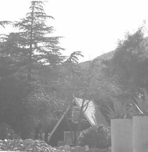
I had a request for information on Casa Maria, so here is a photo from 2007 along with what little I know. This cute little A-frame building was a popular café, The A-Frame Eatery, at Blue Cut when Highway 66 was in its prime. The A-Frame had other owners and was often used as a rental after it became Gem Pines, owned by Gerry and Glenda Bayless of Gem Ranch across the 66. Now it is an adorable worship center called Casa Maria.

Nearby was the Blue Cut Garage and a restaurant owned by the Hickmans since 1929. They moved their business to the 395 cutoff in 1950 when they heard about the freeway plans. Tom Shepherd purchased it, but Bob and Julie Gauthier converted the restaurant into a residence and have lived there for over 40 years.

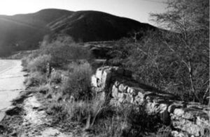
The second photo is of the rock retaining walls along Rt. 66 at Blue Cut, which gets its name from the Pelona Schist in the hills that shows color when cut during construction. The walls were designed by B.A. Switzer and built by Olie Dahl to keep motorists from going off Rt. 66.

Indian Mouse

Nevada History: XXVII
SOME NEVADA TRAGEDIES
From James G. Scrugham, Nevada: The Narrative of the Conquest of a Frontier Land (1935), vol. I

The Story of Mouse

One of the wildest frontier lands left in the United States is embraced in the southern tip of the State of Nevada, between the confluence of the Virgin and Colorado rivers and the site of the great Boulder dam project construction.

Bonelli Landing – Lake Mead

Some thirty-five years ago (123 years in 2023), this area was the scene of one of the most remarkable man hunts ever taking place within the state’s confines. This thrilling drama’s chief actors were eight: three Pahute Indians and five white men.

The leading character was an Indian named “Mouse” by his fellow tribesmen, of his habit of hiding out in the brush and his sly and silent movements. Although of a retiring and surly disposition, he was a good worker and possessed a crafty and intelligent mind.

The next character in importance and interest was one “Red Eye,” the most skilled Indian tracker of his tribe. He derived his name from bloodshot flecks which were always visible in the whites of his eyes, and was well-liked by the white men on account of his loyalty and industry as a ranch hand.

The third Indian character was a fierce old Indian woman who proved to be the Nemesis of the story, stirred to heroic action by the theft of a large and much-prized cabbage from her garden.

Daniel Bonelli – Huntington Library

Of the white actors, the most important was Daniel Bonelli, a famous pioneer settler of the early days. He conducted a hay and vegetable ranch near the junction of the Virgin and Colorado Rivers. Also, he operated a ferry over the latter stream connecting with the main trail south through Arizona. He employed a large number of white men and Indians to assist in his livestock, farming, and ferrying enterprises, among whom was a strong, fearless cowpuncher named George Sherwood, who later appears prominently in the story.

Other white men who figured notably in the tragedy were two young prospectors, Davis and Stearns, who were searching for placer gold on the bars of the Colorado River. These men were accompanied by an elderly prospector k, Majorreenowalt, whose chief function was to serve as camp tender.

The story begins at Bonelli’s ranch on the Colorado River. The place was then on the main line of travel between Oregon, Idaho, Utah, and the rich mining camps of Pioche and Delamar on the north to points in Arizona, Mexico, and elsewhere in the south. A continual stream of travelers passed, many of whom were fugitives from justice-seeking oblivion in distant, isolated places.

Bonelli’s Ferry

Others were nomads seeking the warmth of southern climes in winter and the coolness of the highlands of the north in the summer. In addition to revenues derived from his voyage over the Colorado and sale of hay and supplies to passersby, Bonelli also made extensive trade in meat and produce with the flourishing mining camps at El Dorado Canyon, Chloride, Gold Basin, and a score of other places.

In the operation of his ranch, Bonelli employed several Indian hands, including Mouse and Red Eye.

The Bonelli Home in Rioville (Bonelli Landing)

On a spring evening in 1896, when the story begins, the Indian Mouse somehow secured a quantity of whisky that he drank. Under the alcoholic stimulant, his naturally vicious disposition had no restraint, and Mouse started a promiscuous shooting at the other Indians in the camp. They fled to the main ranch and informed Bonelli that Mouse was on a killing rampage, and their lives had only been saved by the bad aim of the drunken aggressor.

Bonelli and some of his ranch hands then went to the Indian camp and disarmed the crazed Mouse, locking him in an adobe outhouse for the night. The next morning the Indian had become sober and appeared entirely docile. However, Bonelli, knowing the disposition of Mouse, gave him his discharge and ferried him over to the Arizona side; after returning to the man, his gun and ammunition were taken away the previous evening.

From Bonelli’s Ferry, the Indian went to a mining camp called White Hills and worked a few days cutting Joshua trees for fuel. Becoming tired of the labor, he stole a horse and set out for one of his old haunts at Indian Springs, some eighty miles away at the foot of the Charleston Mountains.

Mouse attempted to cross the Colorado River back to Nevada at a point opposite the old trail up the Las Vegas Wash, evidently intending to obtain food supplies at the Las Vegas ranch en route to his destination.

Just before he reached the Nevada shore, his horse became so deeply mired in the quicksands that he could not be extricated. Mouse was compelled to leave the struggling animal, and he made his way up the river toward a prospector’s camp, which he sighted on the Arizona shore. This camp was occupied at the time by the three men mentioned above, Davis, Stearns, and Major Greenowalt, who were prospecting for placer gold in the river bars. They had a small boat which they used for the purpose and accommodatingly crossed the river to meet the Indian when he signaled to them.

After being fed by the prospectors, who were obviously tenderfeet in the country, the crafty Mouse aroused their interest by relating the story of a fictitious ledge of gold-bearing quartz, which he claimed to have discovered in an almost inaccessible canyon, some ten miles back from the camp.

Early the following day, accompanied by Davis and Stearns, the Indian started for the scene of the alleged find, Greenowalt remaining at the river location. Davis and Stearns were never again seen alive.

The next morning the scene of the story shifts back to the Bonelli ranch, some twenty miles further up the river from the prospectors’ camp.

Among the horses on the place were two handsome gray geldings, half-brothers five and six years old, which Bonelli had bought from a band of well-bred horses being driven from northern Nevada to the Arizona market. These animals were the best in the place, but one was a much better saddle horse than the other, owing to a more tractable disposition.

During the time Mouse worked on the ranch, he was familiar with the horses and their characteristics. On the morning in question, when the ranch hands went into the fields to harness the stock, the best gray horse was found to be missing. This caused no particular excitement until it was found that his bridle was also gone.

Speedily circling the fields in search of tracks, the buckaroos discovered where the lost horse had been led out toward the Virgin River by a man wearing leather boots, who mounted at the bank before plunging into the stream. A hasty inspection of the shorelines revealed no place where the rider could have come out from the river. A general alarm was sounded, and all hands set out to find the trail of the thief. After a couple of hours’ delay, the outcoming tracks were finally located on the opposite side, more than a half mile above where the stolen animal had entered the water. The extraordinary effort made to throw pursuers off the track indicated that the horse stealer was a person of some skill and experience who had gained a probable ten or twelve-hour start on possible pursuers. However, Bonelli acted promptly. He armed two of his best riders with Winchester rifles and instructed them to stay with the trail until they recovered the horse or killed the thief.

The pursuing posse followed the tracks up the sandy shores of the Rio Virgin until they reached the Bitter Springs Wash, the drainage channel for a great range of territory to the west of the Virgin.

At the head of this wash are springs of bitter waters that will support life, although hardly palatable enough for human consumption. Here the crafty Mouse, for he was the thief, left the bottom of the wash where trailing was easy and took to the dolomitic limestone banks where vegetation and the soft ground were scanty, and no imprints were made. However, the very hardness of the ground defeated the purpose of the Indian thief. The rough limestone caused the horse’s hoofs to bleed, leaving a plain track for the pursuers to follow.

All through the long afternoon and in the moonlit evening, the Bonelli buckaroos followed the trail. About ten o’clock at night, while going over a steep declivity covered with loose lime shale, one of the horses missed his footing and started both riders and their steeds to slide into the precipitous gulch below. When the descent was stopped, both horsemen were so exhausted from the efforts of the day that they dismounted and unsaddled their animals, leaving their bridles on.

Both men wrapped themselves in their saddle blankets and took turns sleeping through the remainder of the night. On the following morning, they were up at the first peep of dawn, ready to resume the trail. However, it was found that the horse who had missed his footing was so badly bruised and cut that he could hardly walk, and the trailers decided to go back to the Bonelli ranch for reinforcements.

On arriving home early in the afternoon and reporting their adventures, the master of the ranch immediately detailed George Sherwood, his ranch foreman, and Red Eye, the skilled Indian tracker, to follow the thief to the end. From the information available, Sherwood and Red Eye decided that the horse thief was heading for the Las Vegas ranch, seventy-five miles away, as that was the nearest food and water available.

Pushing their horses to the utmost, the trailers arrived at their destination the second evening after leaving the Bonelli ranch. Then it was found that the Indian Mouse had arrived the night before on foot, wearing leather boots, with a story of having killed his crippled horse in the Muddy range at a point near where the first pair of pursuers had lost the bloody trail the day before.

It then became obvious that Mouse was the thief and that the lost horse was dead; otherwise, he would have been brought in for water. As further evidence of the guilt of the Indian, he had silently slipped away in the night soon after the ranchmen fed him, and his tracks indicated that he had made directly for the rugged fastnesses of the Charleston Mountains, some thirty miles away.

A successful pursuit was impossible, so after two days’ rest, Sherwood and Red Eye started on their return to the Bonelli place to inform their employer of the identity of the criminal. Arriving at the foot of the Las Vegas Wash, where Mouse had lost his first stolen horse in the quicksands of the Colorado River a few days before, Sherwood and his companion saw a flock of buzzards circling around and eating the remains of the animal, which projected from the quicksand.

As night was approaching, they rode up the river to a point opposite the prospectors’ camp.

Here Major Greenowalt rowed over and informed them that his partners had left five days before with an Indian named Mouse, who was to show them the location of a rich gold ledge. The Major was greatly disturbed by the protracted absence of his companions, as they had only carried food and water for a one-day trip.

On hearing the Major’s story, both Sherwood and Red Eye became apprehensive that the surly Mouse, with whom they were well acquainted, had added murder to his crime of horse theft.

The next morning they rode back to the home ranch and reported their information and suspicions to Mr. Bonelli.

The aroused ranch owner immediately organized a posse that went down the river to seek the missing men. Again the indomitable Red Eye took up the trail over rough and hard ground.

After two days of tedious tracking, Red Eye finally led the posse to the foot of a steep declivity where the mutilated bodies of Davis and Stearns were discovered. The boots had been removed from the feet of Stearns, accounting for the boot tracks made by Mouse when he had stolen the gray gelding at the Bonelli ranch.

Reconstructing the tragedy, Mouse appeared to have taken the lead until he enticed the two prospectors to the lonely place where the bodies were found. There he suddenly turned and vented his blood lust against the white race by shooting both Davis and Stearns.

The bodies of the unfortunate gold seekers were carried down to the river, then transported 100 miles in skiffs to Needles, California, from whence the remains were shipped back to relatives in the East.

With his dastardly acts fully revealed, Mouse became a hunted outcast, to be killed on sight. Even his tribal compatriots were in terror of him and sought his extermination as a crazed killer.

Mouse Tank – Valley of Fire

For two years, the murderer remained at large, living on seeds, nuts, and rodents and making an occasional raid on a prospectors camp for flour, bacon, and beans. There was found evidence of where Mouse had killed a wild mustang at a water hole and made jerky of the meat.

Finally, there came an end to this bold and much-feared outlaw. In the course of his wanderings, he came to a mountain overlooking a narrow valley where some of his fellow tribesmen had a little truck garden by a water hole. He descended in the night and stole some corn and cabbage to assuage his hunger.

This act led to his undoing. The cabbage belonged to an astute old squaw, who picked up the trail and followed it enough to identify it as belonging to Mouse from certain peculiarities of gait with which she was familiar.

Returning to the camp, the old squaw set up a hue and cry, which brought about the speedy organization of a well-armed posse to endeavor to capture the murderer. Red Eye, the tracker, led the hot pursuit. Day and night continued the chase through the flaming red sandstones of the Valley of Fire, then up the Meadow Valley Wash to Cave Springs and back again toward the Muddy River.

Bonelli had relays of men to provide food and water for the pursuers, as he was determined that the miscreant should not again escape.

The track was lost and found, then lost and found again. Mouse used every concealment art, but the tireless Red Eye never gave up the trail.

After nearly two weeks of hide and seek, the posse cornered Mouse early one morning at a lonely water hole on a gypsum flat near the Muddy River. Here the outlaw made his last stand.

Cursing and screaming, Mouse exchanged shot for shot with his pursuers. However, his pistols were no match for the high-powered rifles of the posse. The savage murderer finally fell, with his body literally riddled with bullets. Thus was avenged the deaths of Davis and Stearns, and the whole countryside felt relief from the sinister shadow of the Indian Mouse.

END

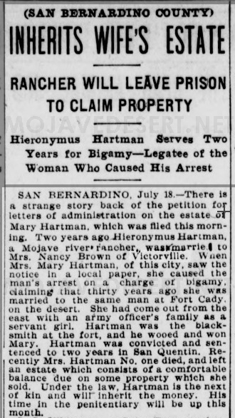
Bigamist Wins Big

(SAN BERNARDINO COUNTY)
INHERITS WIFE’S ESTATE
RANCHER WILL LEAVE PRISON
TO CLAIM PROPERTY

Hieronymus Hartman Serves Two Years for Bigamy-Legatee of the Woman Who Caused His Arrest

SAN BERNARDINO, July 18 1902.-There is a strange story back of the petition for letters of administration on the estate of Mary Hartman, which was filled this morning. Two years ago, Hieronymus Hartman, a Mojave river rancher, married Mrs. Nancy Brown of Victorville. When Mrs. Mary Hartman of this city saw the notice in a local paper, she caused the man’s arrest on a charge of bigamy. claiming that thirty years ago, she was married to the same man at Fort Cady. on the desert. She had come out from the east with an army officer’s family as a servant girl. Hartman was the blacksmith at the fort and wooed and won Mary. Hartman was convicted and sentenced to two years in San Quentin. Recently Mrs. Hartman #1 died and left an estate with a comfortable balance due on some property she sold. Under the law, Hartman is the next of kin and will inherit the money. His time in the penitentiary will be up this month.

Coyote (Crowder) Canyon

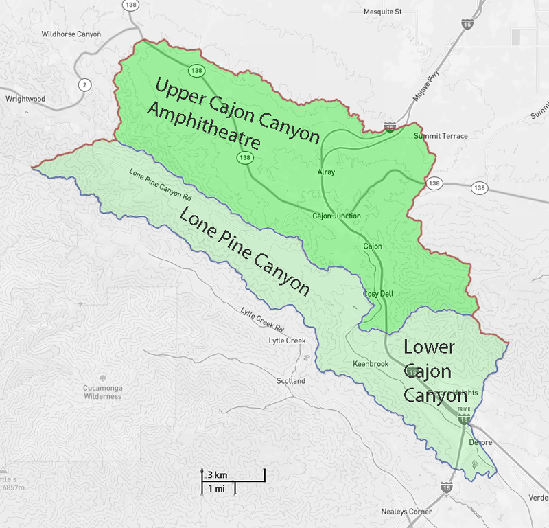
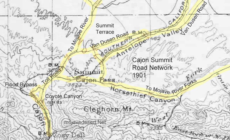
There are numerous names of features within the story of the Cajon Canyon complex; Mormon Rocks, Lost Lake, Lone Pine Canyon, and more. There is one canyon, however, the most popular variation of the Old Spanish Trail as it entered southern California was known as Coyote Canyon.

In the early 1840s, Englishman Michael White and William Workman were partners in a store in New Mexico. White sold his part of the business and came west to live on one hundred acres his wife purchased from the Catholic Church. On this property near Mission San Gabriel, Michael White established a home. Indian raids were discouraging, but Mr. White worked on and ultimately succeeded in raising cattle. His herd grew and he looked for range land. Mr. White and two other men made an agreement to help each other raise cattle in the valley northwest of San Bernardino.

The Story of Coyote Canyon

It was near the mouth of the Cajon Canyon where he built his camp. However, the ‘partners’ failed to show up leaving Miguel to his own defense if there were an attack.

Miguel Blanco

One morning Mr. White woke up to find his cattle missing–the culprits most likely were ‘Chaguanosos.’ The Chaguanosos were a band of Indians exiled and cast away from all, the worst of the worst, cast from their own tribes, notorious and deadly in their own right. These men would steal anything and everything and kill anyone that attempted to stop them. These renegades committed many of the raids on the animals of the ranchos. There was Chief Coyote who was known in the area to be cunning, and violent and leading a band of these heartless men.

During the dark of night, the Chief and his thieves drove away over 400 head of Mr. White’s herd. Michael White was alone save for a seventeen-year-old Indian boy. Together, they rode off to attempt to halt the theft. They needed to keep the band of thieves from leaving the Cajon Canyon and entering the Mojave Desert–they had to head them off at the pass.

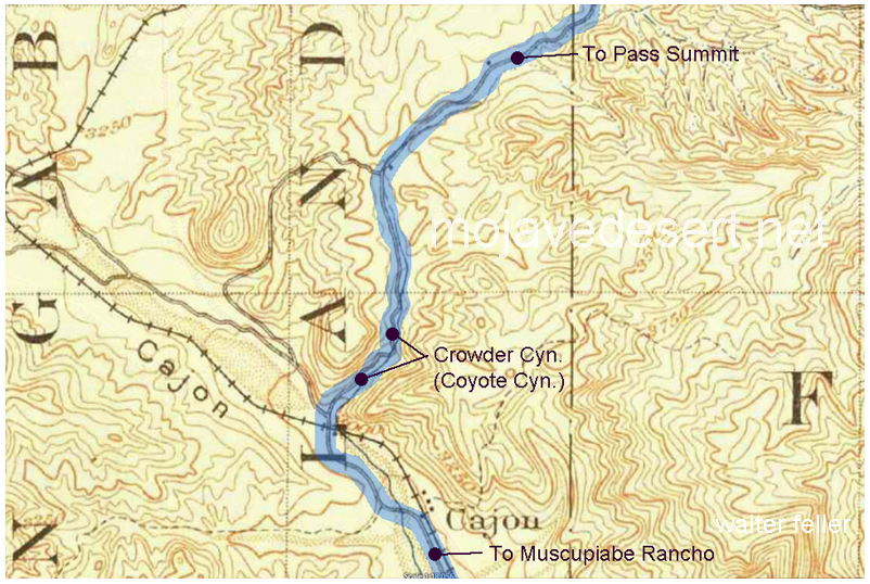
Crowder (Coyote) Canyon – Initially named ‘Coyote’ canyon, for the horse thief, Chief Coyote who was killed within the narrow canyon walls by protector of the Cajon Pass, Miguel Blanco,

Mr. White and the Indian boy rode up the canyon, circled around, and came in between the outlaws and the top of the pass. The thieves were unaware as they were greedily feasting on a horse they had killed.

Mr. White thought to stampede the herd back down through the narrows trapping the Chaguanosos from escape.

Michael drew the attention of Chief Coyote. The renegade charged him. Michael aimed and fired. The shot knocked the Chief off of his horse. He fell into the brush. Dead. The gunshot startled the cattle and they stampeded over the camp and back down the canyon surprising those in the camp. There was a gunfight. White would fire his gun and one by one the Chaguanosos fell dead in the canyon. The boy reloaded the extra gun and kept Michael White fighting. Several of the renegades escaped in the dust and confusion.

A possible site of Campo de la Puente (Camp on the bridge)

The stolen animals were rounded up and returned to the glen at the mouth of the Cajon canyon.

Calling the canyon ‘Coyote Canyon’ wasn’t in honor of a great chief. It was simply a ravine where a bad guy was killed. That is how the canyon became known as Coyote Canyon.

However, the story doesn’t end there- The Governor of California heard of this heroic episode and found that Mr. White had no land but desired to. So, Michael White became naturalized as Miguel Blanco, a citizen of Mexico, and received a grant for 32,000 acres (50 square miles) of land northwest of the Lugo Rancho San Bernardino. With this land situated on a high point of the bajada that runs the southwestern base of the San Bernardino mountains, he was to guard and defend the southern California ranchos from further raids from horsethieves.

Of course, the story doesn’t really end there, either- This is the beginning of the story of Miguel Blanco and the Rancho Muscupiabe.

-end-

(c)W.Feller – 2022

Just California

Augustin S. Macdonald, comp.
A Collection of Verse by California Poets. 1914.

Camp Cajon
Camp Cajon Dedication

By John S. McGroarty

’TWIXT the seas and the deserts,
’Twixt the wastes and the waves,
Between the sands of buried lands
And the ocean’s coral caves,
It lies not East nor West,
But like a scroll unfurled,
Where the hand of God hath hung it,
Down the middle of the world.

It lies where God hath spread it,
In the gladness of his eyes,
Like a flame of jeweled tapestry
Beneath His shining skies,
With the green of woven meadows,
And the hills in golden chains,
The light of leaping rivers,
And the flash of poppied plains.

Days rise that gleam in glory,
Days die with sunset’s breeze,
While from Cathay that was of old
Sail countless argosies;
Morns break again in splendor
O’er the giant, new-born West,
But of all the lands God fashioned,
’Tis this land is the best.

Sun and dews that kiss it,
Balmy winds that blow,
The stars in clustered diadems
Upon its peaks of snow;
The mighty mountains o’er it,
Below, the white seas swirled—
Just California stretching down
The middle of the world.

Camp Cajon
Camp Cajon Dedication

Ancestral Mojave River

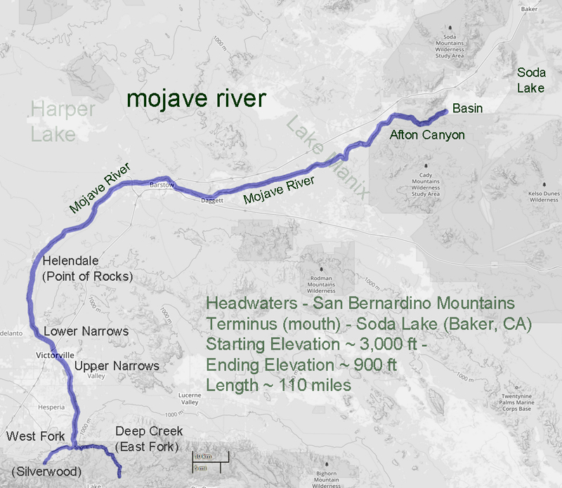
Dry lakes along the Mojave River were formed as the river itself evolved and the land took shape. Only 500,000 years ago the Mojave sloped toward the ocean and as the Transverse Ranges pushed the desert up the slope reversed and the river began to form lakes from the water flowing inland instead of toward the sea. The river would fill a swamp and then a lake, and the lake would flood and stretch the river a bit further and further to one lake and then another until the ultimate inland termination, Death Valley and its Lake Manly.

Original presentation by Dr. Norman Meek, Advisor Bob Reynolds, Images Walter Feller

click the map to read the presentation;

Stealing Horses & Ranchero Life

Seventy-five years in California; a history of events and life in California

CHAPTER XV Indian Insurrections and Treachery

OCCASIONALLY the Indians who had been at the Missions, and had become well informed in regard to the surrounding neighborhood and the different ranches in the vicinity, would desert the Missions, retreat to their old haunts and join the uncivilized Indians. At times they would come back with some of the wild Indians to the farms, for the purpose of raiding upon them, and capturing the domesticated horses. They would come quietly in the night, and carry off one or two caponeras of horses, sometimes as many as five or six, and drive them back to the Indian country for their own use.

In the morning a ranchero would discover that he was without horses for the use of the ranch. He would then borrow some horses from his neighbor, and ten or twelve men would collect together and go in pursuit of the raiders. They were nearly always successful in overtaking the thieves and recovering their horses, though oftentimes not without a fierce fight with the Indians, who were armed with bows and arrows, and the Californians with horse carbines. At these combats the Indians frequently lost some of their number, and often as many as eight or ten were killed. The Californians were sometimes wounded and occasionally killed. Once in a while, but very seldom, the Indians were successful in eluding pursuit, and got safely away with the horses, beyond recovery.

In the early part of ’39, nearly all the saddle horses belonging to Captain Ygnacio Martinez, at the rancho Pinole, were thus carried off by the Indians, and his son Don José Martinez, (whose niece I afterward married), with eight or ten of his neighbors, went in pursuit of them, and though they succeeded in recovering the animals, they lost one of their number, Felipe Briones, who was killed by an arrow. The fight on that occasion was exceedingly severe, and the Indians became so incensed, and their numbers increased so much, that the little party deemed it too hazardous to continue the fight, and retreated, taking with them the recovered horses, but were compelled to leave the body of Briones on the field. Two days afterward the party went back and recovered it, but found it terribly mutilated. Some eight or ten of the Indians were killed by the Californians in that fight.

Juan Prado Mesa was the comandante of the San Francisco Presidio, and frequently left his post to go in campaigns against the Indians with part of his command. He was always considered a successful Indian fighter. He was a brave and good man. On one occasion he was wounded with an arrow, which ultimately carried him to his grave. He was blessed with a large family. I became very well acquainted with him, and he frequently furnished me with fine saddle horses and a vaquero to make my business circuit around the bay. He was under the immediate command of General Vallejo, with whom he was intimate, and sometimes he confided to me secret movements of the government. The Californians were early risers. The ranchero would frequently receive a cup of coffee or chocolate in bed, from the hands of a servant, and on getting up immediately order one of the vaqueros to bring him a certain horse which he indicated, every horse in a caponera having a name, which was generally bestowed on account of some peculiarity of the animal. He then mounted and rode off about the rancho, attended by a vaquero, coming back to breakfast between eight and nine o’clock.

This breakfast was a solid meal, consisting of carne asada (meat broiled on a spit), beefsteak with rich gravy or with onions, eggs, beans, tortillas, sometimes bread and coffee, the latter often made of peas. After breakfast, the ranchero would call for his horse again, usually selecting a different one, not because the first was fatigued, but as a matter of fancy or pride, and ride off again around the farm or to visit the neighbors. He was gone till twelve or one o’clock, when he returned for dinner, which was similar to breakfast, after which he again departed, returning about dusk in the evening for supper, this being mainly a repetition of the two former meals. Although there was so little variety in their food from one day to another, everything was cooked so well and so neatly and made so inviting, the matron of the house giving her personal attention to everything, that the meals were always relished.

When the rancheros thus rode about, during the leisure season, which was between the marking time and the matanza or killing time, and from the end of the matanza to the spring time again, the more wealthy of them were generally dressed in a good deal of style, with short breeches extending to the knee, ornamented with gold or silver lace at the bottom, with botas (leggings) below, made of fine soft deerskin, well tanned and finished, richly colored, and stamped with beautiful devices (these articles having been imported from Mexico, where they were manufactured), and tied at the knee with a silk cord, two or three times wound around the leg, with heavy gold or silver tassels hanging below the knee. They wore long vests, with filagree buttons of gold or silver, while those of more ordinary means had them of brass. They wore no long coats, but a kind of jacket of good length, most generally of dark blue cloth, also adorned with filagree buttons. Over that was the long serape or poncho, made in Mexico and imported from there, costing from $20 to $100, according to the quality of the cloth and the richness of the ornamentation. The serape and the poncho were made in the same way as to size and cut of the garments, but the former was of a coarser texture than the latter, and of a variety of colors and patterns, while the poncho was of dark blue or black cloth, of finer quality, generally broadcloth. The serape was always plain, while the poncho was heavily trimmed with gold or silver fringe around the edges, and a little below the collars around the shoulders.

They wore hats imported from Mexico and Peru, generally stiff; the finer quality of softer material — vicuña, a kind of beaver skin obtained in those countries. Their saddles were silver-mounted, embroidered with silver or gold, the bridle heavily mounted with silver, and the reins made of the most select hair of the horse’s mane, and at a distance of every foot or so there was a link of silver connecting the different parts together. The tree of the saddle was similar to that now in use by the Spaniards and covered with the mochila, which was of leather. It extended beyond the saddle to the shoulder of the horse in front and back to the flank, and downwards on either side, halfway between the rider’s knee and foot. This was plainly made, sometimes stamped with ornamental figures on the side and sometimes without stamping. Over this was the coraza, a leather covering of finer texture, a little larger and extending beyond the mochila all around, so as to cover it completely. It was elaborately stamped with handsome ornamental devices.

Behind the saddle, and attached thereto, was the anqueta, of leather, of half-moon shape, covering the top of the hindquarters of the horse, but not reaching to the tail; which was also elaborately stamped with figures and lined with sheep skin, the wool side next to the horse. This was an ornament, and also a convenience in case the rider chose to take a person behind him on the horse.

Frequently some gallant young man would take a lady on the horse with him, putting her in the saddle in front and himself riding on the anqueta behind.

The stirrups were cut out of a solid block of wood, about two and a half inches in thickness. They were very large and heavy. The strap was passed through a little hole near the top. The tapadera was made of two circular pieces of very stout leather, about twelve to fifteen inches in diameter, the outer one a little smaller than the inner one, fastened together with strips of deer skin called gamuza, the saddle strap passing through two holes near the top to attach it to the stirrup; so that when the foot was placed in the stirrup the tapadera was in front, concealed it, and protected the foot of the rider from the brush and brambles in going through the woods.

This was the saddle for everyday use of the rancheros and vaqueros, that of the former being somewhat nicer and better finished. The reins for everyday use were made of deer or calfskin or other soft leather, cut in thin strips and nicely braided and twisted together, and at the end of the reins was attached an extra piece of the same with a ring, which was used as a whip. Their spurs were inlaid with gold and silver, and the straps of the spurs worked with silver and gold thread.

When thus mounted and fully equipped, these men presented a magnificent appearance, especially on the feast days of the Saints, which were celebrated at the Missions. Then they were arrayed in their finest and most costly habiliments, and their horses in their gayest and most expensive trappings. They were usually large, well-developed men, and presented an imposing aspect. The outfit of a ranchero and his horse, thus equipped, I have known to cost several thousand dollars. The gentleman who carried a lady in this way, before him on a horse, was considered as occupying a post of honor, and it was customary when a bride was to be married in a church, which was usual in those days, for a relative to take her before him in this fashion on his horse to the church where the ceremony was to be performed. This service, which involved the greatest responsibility and trust on the part of the gentleman, was discharged by him in the most gallant and polite manner possible.

On the occasion of my marriage, in 1847, the bride was taken in this way to the church by her uncle, Don José Martinez. On these occasions the horse was adorned in the most sumptuous manner, the anqueta and coraza being beautifully worked with ornamental devices in gold and silver thread. The bride rode on her own saddle, sometimes by herself, which was made like the gentleman’s but a little smaller, and without stirrups, in place of which a piece of silk—red, blue, or green—perhaps a yard wide and two or three yards long, joined at the two ends, was gracefully hung over the saddle, puffed like a bunch of flowers at the fastening, and hung down at one side of the horse in a loop, in which the lady lightly rested her foot.

The ladies were domestic and exceedingly industrious, although the wealthier class had plenty of Indian servants. They were skillful with their needles, making garments for their families, which were generally numerous. The women were proficient in sewing. They also did a good deal of nicer needlework of fancy kinds—embroidery, etc.—in which they excelled, all for family use. Their domestic occupations took up most of their time.

Both men and women preserved their hair in all its fullness and color, and it was rare to see a gray-headed person. A man fifty years of age, even, had not a single gray hair in his head or beard, and I don’t remember ever seeing, either among the vaqueros or the rancheros or among the women, a single bald-headed person. I frequently asked them what was the cause of this remarkably good preservation of their hair, and they would shrug their shoulders, and say they supposed it was on account of their quiet way of living and freedom from worry and anxiety.

The native Californians were about the happiest and most contented people I ever saw, as also were the early foreigners who settled among them and intermarried with them, adopted their habits and customs, and became, as it were, a part of themselves. Among the Californians, there was more or
less caste, and the wealthier families were somewhat aristocratic and did not associate freely with the humbler classes; in towns, the wealthy families were decidedly proud and select, the wives and daughters especially. These people were naturally, whether rich or poor, of a proud nature, and though always exceedingly polite, courteous, and friendly, they were possessed of a native dignity, an inborn aristocracy, which was apparent in their bearing, walk, and general demeanor. They were descended from the best families of Spain and never seemed to forget their origin, even if their outward surroundings did not correspond to their inward feeling. Of course, among the wealthier classes, this pride was more manifest than among the poorer.

In my long intercourse with these people, extending over many years, I never knew of an instance of incivility of any kind. They were always ready to reply to a question, and answered in the politest manner, even the humblest of them; and in passing along the road, the poorest vaquero would salute you politely. If you wanted any little favor of him, like delivering a message to another rancho, or anything of that sort, he was ready to oblige and did it with an air of courtesy and grace and freedom of manner that were very pleasing. They showed everywhere and always this spirit of accommodation, both men and women. The latter, though reserved and dignified, always answered politely and sweetly, and generally bestowed upon you a smile, which, coming from a handsome face, was charming in the extreme. This kindness of manner was no affectation, but genuine goodness, and commanded one’s admiration and respect.

I was astonished at the endurance of the California women in holding out, night after night, in dancing, of which they never seemed to weary, but kept on with an appearance of freshness and elasticity that was as charming as surprising. Their actions, movements, and bearing were as full of life and animation after several nights of dancing as at the beginning, while the men, on the other hand, became wearied, showing that their powers of endurance were not equal to those of the ladies. I have frequently heard the latter ridiculing the gentlemen for not holding out unfatigued to the end of a festival of this kind.

The rancheros and their household generally retired early, about eight o’clock, unless a valecito casaro (little home party) was on hand when this lasted till twelve or one. They were fond of these gatherings, and almost every family had some musician of its own, music and dancing were indulged in, and a very pleasant time was enjoyed. I have attended many of them and always was agreeably entertained. These parties were usually impromptu, without formality, and were often held for the entertainment of a guest who might be stopping at the house. The balls or larger parties were of more importance and usually occurred in the towns. On the occasion of the marriage of a son or daughter of a ranchero they took place on the rancho, the marriage being celebrated amid great festivities, lasting several days.

Fandango was a term for a dance or entertainment among the lower classes, where neighbors and others were invited in, and engaged themselves without any great degree of formality. The entertainments of the wealthy and aristocratic class were more exclusive in character; invitations were more carefully given, more formality observed, and of course, more elegance and refinement prevailed. An entertainment of this character was known as a baile.

In November 1838, I was a guest at the wedding party given at the marriage of Don José Martinez to the daughter of Don Ygnacio Peralta, which lasted about a week, dancing being kept up all night with a company of at least one hundred men and women from the adjoining ranchos, about three hours after daylight being given to sleep, after which picnics in the woods were held during the forenoon, and the afternoon was devoted to bullfighting. This program was continued for a week when l myself had become so exhausted for want of regular sleep that I was glad to escape.

The bride and bridegroom were not given any seclusion until the third night.

On this occasion Doña Rafaela Martinez, wife of Dr. Tennent, and sister of the bridegroom, a young woman full of life and vivacity, very attractive and graceful in manner, seized upon me and led me on to the floor with the waltzers. I was ignorant of waltzing up to that moment. She began moving around the room with me in the waltz, and in some unaccountable manner, perhaps owing to her magnetism, I soon found myself going through the figure with ease. After that, I had no difficulty in keeping my place with the other waltzers and was reckoned as one of them. I waltzed with my fascinating partner for a good portion of the night.

During this festivity, Don José Martinez, who was a wonderful horseman, performed some feats which astonished me. For instance, while riding at the greatest speed, he leaned over his saddle to one side, as he swept along, and picked up from the ground a small coin, which had been put there to try his skill, and then went on without slackening his speed.

Some years after that I was visiting him, and while we were out taking a ride over his rancho, we came to an exceedingly steep hill, almost perpendicular; at the top was a bull quietly feeding. He looked up and said, “Do you see that bull?” “Yes,” said I. “Now,” said he, “we will have some fun. I am going up there to drive him down and lasso him on the way.” It seemed impossible owing to the steepness of the declivity. Nevertheless, he did it, rode up to the top, started the bull down at full speed, and actually lassoed the animal on the way, threw him down, and the bull at once commenced rolling down the steep side of the hill, over and over, until he reached the bottom, José following on his horse and slackening up the riata as he went along. He was a graceful rider.

After many years of happiness with his excellent wife, during which they were blessed with six or eight children, Don José Martinez became a widower. A few years after this he married an English lady, a sister of Dr. Samuel J. Tennent, who was then living at Pinole ranch, and who married a sister of Don José Martinez. Dr. Tennent lived on a portion of the ranch inherited by his wife. The marriage of Don José to a lady outside of his own countrywoman was rather an unusual occurrence among the Californians. The marriage proved a happy one, and half a dozen children resulted therefrom. This lady is now living in San Francisco (1889).

Don José Martinez had the largest kind of heart, and if anyone called at his house who was in need of a horse, he was never refused, and the people of the surrounding country were constantly in receipt of favors at his hands. If one wanted a bullock and had no means to pay for it, he would send out a vaquero to lasso one and bring it in and tie it to a cabestro (a steer broken for that purpose), so that the man could take it home, and told him he might pay for it when convenient, or if not convenient, it was no matter. So with a horse which he might furnish, it didn’t matter whether the animal was returned or not. This generosity was continual 70 and seemed to have no limit. At his death, which occurred in 1864, his funeral was attended by a vast concourse of people from all the surrounding country, who came in wagons, buggies, and carriages to the number of several hundred vehicles, such was the high appreciation in which he was held by the community.

I never saw such respect paid to the memory of any other person. If true generosity and genuine philanthropy entitle a man to a place in the kingdom of Heaven, I am sure that Don José Martinez is received there as one of the chief guests.

Seventy-five years in California; a history of events and life in California http://www.loc.gov/resource/calbk.025
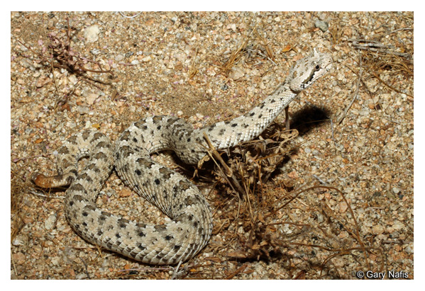
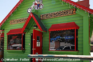
The Wife of Don Antonio Maria Lugo

Don Antonio Maria Lugo, of Los Angeles, was genial and witty, about eighty years of age, yet active and elastic, sitting on his horse as straight as an arrow, with his reata on the saddle, and as skillful in its use as any of his vaqueros. He was an eccentric old gentleman. He had a wife aged twenty or twenty-two—his third or fourth. In 1846 I visited him. After cordially welcoming me, he introduced me to his wife, and in the same breath, and as I shook hands with her, said, in a joking way, with a cunning smile, “ No se enamore de mi joven esposa.” (Don’t fall in love with my young wife.) He had numbers of children, grandchildren, and great-grandchildren. Los Angeles was largely populated from his family. Referring to this circumstance, he said to me, quietly, “ Don Guillermo, yo he cumplido mi deber a mi pais.” (Don Guillermo, I have fulfilled my duty to my country)

William Heath Davis – “Seventy-five Years in California”

Don Antonio Maria Lugo

‘Gravel Gertie’

Part I

Juanita “Gravel Gertie” Inman lived in a shack off of the old Route 66 in the Cajon Pass at the southern edge of the Mojave Desert north of San Bernardino, California. “Gertie’s” shack wasn’t really a shack, it was a chicken coop, albeit a very nice chicken coop. There were plenty of windows to let in light and coverings and tarpaulins to cozy the place up in the wind and storms, and there was a stovepipe sticking out of the roof, indicating there was warmth available for the birds to keep them laying their eggs during the worst of times.

Plush quarters for the hens indeed. This shack, for looks and legal purposes, was a chicken coop–a hen house for pampered poultry.

During WWII, building materials were in short supply and available only for subsistence projects, such as watering troughs for hogs, horses, and milk cows. Structures for chickens, turkeys, and other such creatures were permitted.

So Gertie built her home under the auspices of creating a hen house. It was very nice inside with several rooms and a fireplace. The county would check on projects like these, but from a reasonable distance, it looked like chickens lived there. They didn’t, though. The chickens were kept outside in a wire coop.
—

Wrong-Way River

by walter feller

Mojave River

In 1852 a survey was made of the southwestern edge of the Mojave Desert. The Old Spanish Trail # had become a wagon road bringing thousands of pioneers to the west and developed as a supply route between Los Angeles and Salt Lake City. The survey was as accurate as any at that time and followed the trail from near the top of the Cajon Pass to a point where the trail leaves the Mojave River near Fishponds. The trail to Salt Lake continues north as we know it, but the river flowing east on this map bears southeast and empties into the Colorado River. At the time it was thought the Mojave (spelled Mohahve on the map) River followed this course. It did not. There was no Mojave Road in 1852 and not many Americans had traversed that portion of the desert. As we now know the Mojave River cuts through Afton Canyon and then disappears into the sink of the Mojave before it reaches Soda Lake.

The Williamson survey the next year in 1853 begins to correct the true ancient course of the river as it would have found its way to converge with the Amargosa River and empty into Death Valley’s Lake Manly via Soda Lake, Silver Lake, Silurian Lake, and Salt Springs.

-End –

Indian Queho.

Standing second from the left is Frank Waite, chief of police in Las Vegas for many years. Waite was a member of the posse that initially searched for Queho.

Subject: – – Mummified remains of an Indian renegade known as Queho. Many years previous to when this photo was taken in the early 1940s, Queho is said to have killed and robbed a number of individuals in the Searchlight, Nevada area. Unsuccessful efforts were made to apprehend Queho.

In the early 1940s, the men pictured here on the left and right were exploring an area along the Colorado River when they saw a cave in the cliffs above the river. they climbed up to the cave and Queho’s remains were found. Research had established that the remains were Queho’s because several of the artifacts he had stolen from people in Searchlight accompanied the remains.

Queho’s remains were turned over to the Palm Mortuary in Las Vegas when a question arose as to who would pay for the expenses of keeping Queho there and his burial. Roland Wiley, district attorney for Clark County, Nevada, at the time, suggested that the remains be turned over to the Elks Lodge, where for a number of years they were exhibited on the Heldorado grounds during Heldorado days in a glass display case with some of the stolen artifacts.

Queho’s remains were stolen from the Elks on 2 occasions, and each time they were recovered. Jim Cashman, head of the Las Vegas Elks at the time, grew tired of worrying about the theft of Queho’s remains so they were moved to a building belonging to Dobie Doc Caudil near the Tropicana Hotel.

Subject: A view of the suspension bridge and the statue of Christ at Cathedral Canyon, Pahrump Valley, Nevada, in the late 1980s. The statue, carved of rock, is a small replica of the Christ of the Andes installed in the Andes Mountains on the border between Argentina and Chile in the early part of the 20th century. The replica was made by an artist from Ajijic, a small town south of Guadalajara, Mexico. Wiley constructed the suspension bridge about 1973. In 1989, approximately 1,000 people a month visited Cathedral Canyon. Roland Wiley is seated in the picture; the man standing in the white shirt is unidentified.

Roland Wiley purchased Queho’s remains from Dobie Doc for $100 and buried them near Cathedral Canyon, located on Wiley’s ranch in Pahrump Valley overlooking his Hidden Hills airstrip, in concrete and steel so they could not be easily stolen again. Wiley believed the Indian deserved a decent burial and buried popcorn with the remains to accompany Queho on his journey.

The Renegade

On February 21, 1940, the banner headline in the Las Vegas Review-Journal— BODY OF INDIAN FOUND— recalled for many in the town memories of the first murder the dead Indian had committed, thirty years earlier at Timber Mountain, just a few miles from Searchlight in the McCullough Range. . . .

Death Valley Brochures

Featuring Amargosa Hotel, Death Valley Junction & Furnace Creek Inn, Death Valley – 1931

Borate Gallery

Borax mining in the United States started with the production of borax from Borax lake in Tehama County in 1864. The discovery of cotton ball ulexite in the playa of Teel’s Marsh by Frances Marion (Borax) Smith in 1872 ushered in the first major production of Borax in the United States. The center of cotton ball production then moved to Death Valley in 1880. The most famous operation was the Harmony borax works run by William Tell Coleman. This is the operation that becomes associated with the twenty-mule team wagons. With the discovery of colemanite, the Playa period started to decline.

The mines at Borate ushered in the Colemanite period of borax production. W. T. Coleman initiated the mining operations at Borate in 1884, but actual production did not commence until 1890. Several factors contributed to this delay. The first was the obvious need to provide transportation to the area and develop the mines. The second was the bankruptcy of the “House of Coleman.” In 1890 Borax Smith acquired the property from Coleman’s creditors. He then formed the Pacific Coast Borax Company and commenced shipping ore to the recently updated refinery in Alameda, California.

The two major problems plaguing production at Borate were the transportation and concentration of the ore. Initially, the ore was hand sorted at the mine and hauled to Daggett using the 20 mule teams and wagons once used in Death Valley. Smith was unhappy with this method, so in 1894 he experimented with a steam tractor locally called “Old Dinah.” Unfortunately, this experiment was a failure due to the nature of the road from the mines to Daggett. A narrow gauge railroad was then constructed in 1898 allowing the unprocessed ore to be shipped to a Calcining plant located at Marion, just North of Daggett. The ore was heated until the colemanite decrepitated and could be separated from the gangue. This allowed a better grade of ore to be shipped to Alameda and solved both problems.

By 1907 it was obvious to Smith that the days of Borate were numbered and the main operations were shifted to the Lila C mine at old Ryan, near Death Valley. All of the equipment, including the buildings, were removed and sent to the Lila C, leaving Borate completely bare. The Lila C lasted for only seven years and colemanite mining shifted to various mines in the Death Valley region. In 1927 the mines at Boron opened ushering in the Kernite period. Lessees and small miners continued operations at Borate until the opening of the mines at Boron.

text: http://wikimapia.org/1783734/Borate-CA-site

Archive Albums

Pete Harmon

Keep on Steppin’ — The man who walked 481 miles to see a sick friend

. . . At our home he [Shorty Harris] lay on his back for weeks, fed with a spoon. Always talking of putting another town on the map. Always losing a million dollars a day. He was miraculously but slowly recovering when an Associated Press dispatch bearing a Lone Pine date made front page headlines with an announcement of his death.

Though the report was quickly corrected, his presence at our house brought reporters, photographers, old friends, and the merely curious. At the time the Pacific Coast Borax Company’s N.B.C. program was featuring stories based on his experiences over a nation-wide hook-up. Among the callers also were moguls of mining and tycoons of industry who had stopped at the Ballarat cabin to fall under the spell of his ever ready yarns.

Pete Harmon

Among these guests, one stands out.

It was a hot summer day when I saw on the lawn what appeared to be a big bear, because the squat, bulky figure was enclosed in fur. Answering the door bell I looked into twinkling eyes and an ingratiating smile. “They told me in Ballarat that Shorty Harris was here.” I invited him in.

“I’ll just shed this coat,” he said, stripping off the bearskin garment. “… sorta heavy for a man going on 80.” He laid it aside. “It’s double lined. Fur inside and out. You see, I sleep in it. Crossed three mountain ranges in that coat before I got here. May as well take this other one off too.” He removed another heavy overcoat, revealing a cord around his waist. “Keep this one tied close. Less bulky….”

Under a shorter coat was a heavy woolen shirt and his overalls concealed two pairs of pants. He went on: “I was with Shorty at Leadville. My name’s Pete Harmon. We ought to be rich—both of us. Why, I sold a hole for $2500 in 1878. Thought I was smart. They’ve got over $100,000,000 outa that hole. I was at Bridgeport when I heard Shorty was sick, so I says, ‘I’ll just step down to Ballarat and see him.’ (The ‘step’ was 298 miles.) When I got there Bob Warnack tells me he’s in Los Angeles. When I get there they tell me he’s with you. So I just stepped out here.”

He had “stepped” 481 miles to see his friend.

Shorty Harris

I ushered him in and left them alone. After an hour I noticed Pete outside, smoking. I went out and urged him to return and smoke inside, but he refused. “It’s not manners,” he insisted.

Later I happened to look out the window and saw him empty the contents of a small canvas sack into his hand. There were a few dimes and nickels and two bills. He unfolded the currency. One was a twenty. The other, a one. He put the coins in the sack and came inside. A few moments later, from an adjacent room I heard his soft, lowered voice: “Shorty, I’m eatin’ reg’lar now and got a little besides. I reckon you’re kinda shy. You take this.”

“No—no, Pete. I’m getting along fine….”

I fancy there was a scurry among the angels to make that credit for Pete Harmon.

Late in the afternoon, Pete donned his coats. “I’d better be going. I’ve got a lotta things on hand. A claim in the Argus. When the money comes in, well—I always said I was going to build a scenic railroad right on the crest of Panamint Range. Best view of Death Valley. It’ll pay. How far is it to San Diego?”

“A hundred and forty miles….”

“Well, since I’m this far along I’ll just step down and see my old partner. Take care of Shorty….” And down the road, he went.

With humility I watched his passage, hoping that the good God would go with him and somehow I felt that of all those with fame and wealth or of high degree who had gone from that house, none had left so much in my heart as Pete.

Adapted from;
Chapter XVII
Shorty Frank Harris
Title: Loafing Along Death Valley Trails
       A Personal Narrative of People and Places

Author: William Caruthers

Protecting the Mojave in 1974

Los Angeles Herald Examiner Photo Collection
Howell, E. Bruce – 1974

Photograph caption dated April 3, 1974 reads, “Shy desert tortoise curls up inside his shell on top of a groove left in desert sand by motorcycle on the Stoddard Valley off-road vehicle racing area of Barstow. Already legally protected as an endangered species, environmentalists and scientists say the threat is heightened along with other desert life by off-road vehicle activities.”

Photograph caption dated April 3, 1974 reads, “Environmentalist group that recently toured the Mojave Desert to show evidence of damage done by indiscriminate use of off-road vehicle say they believe holes on this live desert tortoise shell were caused by bullets.”

Photograph caption dated April 3, 1974 reads, “Tiny marker planted in Mojave Desert at Stoddard Valley, marks U.S. Bureau of Land Management boundary separating approved off-road vehicle race course from a restricted area. Heavy tire tracks on both sides of marker indicate that such markers are virtually ignored, except by desert visitors with guns, who have riddled them with bullets.”

Photograph caption dated April 3, 1974 reads, “Stoddard Valley on Mojave Desert near Barstow, despite its vast openness is a continuous maze of off-road vehicle tire tracks. Federal plan for managing off-road vehicle use on desert has left it open for off-road vehicle races and closed other areas. But environmentalists and scientists say regulations for restricted areas are too vague and open to this kind of damage.”

Photograph caption dated April 3, 1974 reads, “These people seek to defend the vast Mojave Desert from a federal program that regulates off-road vehicles. They claim regulations are vague, unenforceable, and could open the desert to extensive off-road vehicle damage. From left are UC Riverside professors Bill Mayhew, zoology; Sylvia Broadbent, anthropology; and Richard E. Gutting, Jr., attorney for Environmental Defense Fund.”

Photograph caption dated April 3, 1974 reads, “Judith Winder, staffer for Environmental Defense Fund, sketches petroglyph of longhorn sheep from rock in Inscription Canyon.”

Photograph caption dated April 3, 1974 reads, “Hand of UC Riverside anthropology professor, Sylvia Broadbent, points out recent chisel mark at bottom of a chipped out section of volcanic rock which had an ancient Indian carving on it. Such damage to antiquities, which is widespread in the Mojave Desert is illegal. This damage was in Inscription Canyon near Barstow.”

Photograph caption dated April 3, 1974 reads, “Richard E. Gutting, Jr., kneeling, attorney for Environmental Defense Fund, and UC Riverside anthropology professor Sylvia Broadbent, examine off-road vehicle dislocation of ‘desert pavement,’ a dark, rocky covering on desert floor which takes thousands of years to form but is important to the natural balance of desert life. Light swath was made by off-road vehicle race.”

Photograph caption dated April 3, 1974 reads, “Off-road vehicle race course touring party gathers at scene of ancient Indian sleeping circle (foreground), a circular formation of larger rocks in midst of small ones, which anthropologists say were foundations for shelters built by prehistoric Indians. All such sites, they assert, should be protected.”

Photograph caption dated April 3, 1974 reads, “Not just ordinary boulders, these, according to Dr. Sylvia Broadbent, UC Riverside anthropology professor, who said there is no question that the slightly concave rock in the upper half of photo was worn that way by ancient Indians grinding grain and marks on the surface of the rock in the lower photo were also made by the same Indians.”

Photograph caption dated April 3, 1974 reads, “Petroglyphs, ancient Indian rock art, abound on the walls of Inscription Canyon near Barstow. Archaeologists look upon them as valuable keys to unlocking the secrets of prehistoric peoples who inhabited the vast Mojave Desert, but complain they are being destroyed by desert visitors at an alarming rate.”

Photograph caption dated April 3, 1974 reads, “He calls the Mojave Desert ‘home.’ Desert lizard suns itself on dark, porous volcanic rock in Inscription Canyon. Same rocks are covered with ancient Indian petroglyphs, and rock art carvings, indicating the canyon may have been where Indians trapped and captured longhorn sheep and other desert game. The entire canyon is falling victim to vandals and souvenir hunters.”


High Desert Small Atlas

Cajon Pass/Victor Valley Roads

Working copy – not all roads included

1 – Old Spanish Trail/Indian trail (1827)
2 – Cajon Pass (Lower) – Indian trail
3 – Lone Pine Canyon – Indian trail
4 – Sheep Creek – Indian trail
5 – Sanford Pass (c.1854-57)
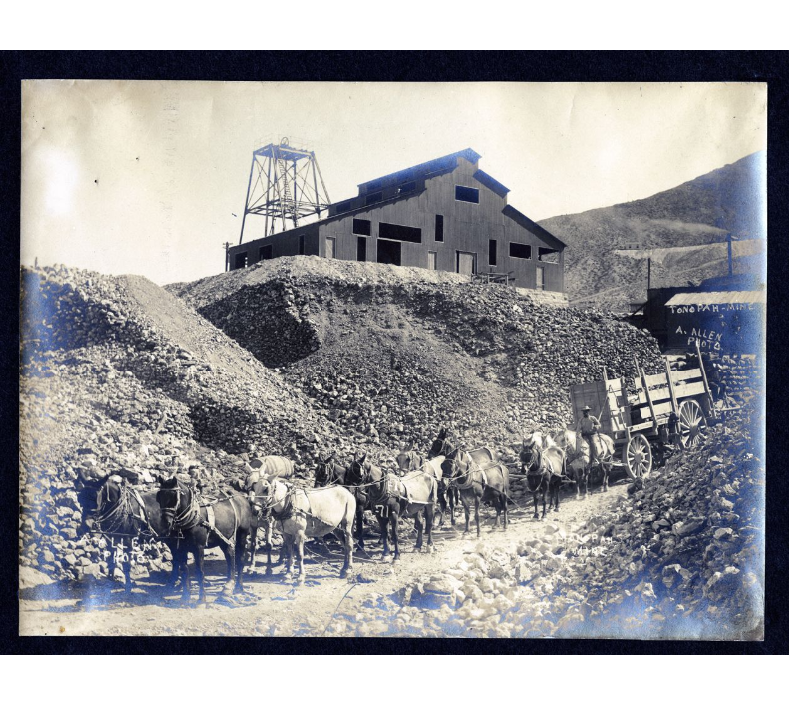
6 – Fort Tejon – Indian trail
7 – to Mojave River – Indian trail
8 – to Daggett (c.1855)
9 – Lucerne/Cushenbury Lumber road
10 – Van Dusen/Holcomb Valley Road – (1862)
11 – Mojave Indian trail (c.1776, 1826)

Cajon Pass without the Railroad

1901 Cajon Pass Transportation Network
Man-made features removed to predate map
Paleo road network

Cajon 1901 base map not showing California Southern Railroad (A.T.&S.F.) constructed in 1885.

Effectively shows the canyon as far back as 1857 when the Sanford Pass was carved into the mountain.

Sanford Pass
https://digital-desert.com/sanford-pass/

The Legend of ‘Three-fingered’ Bob

A Mystery of the Mojave – Men on the Mesa:

‘Three-fingered’ Bob lay dying on the saloon floor in the mud and the blood and the beer. He was an old man for his time–34 years old to be exact. Quite old for a varmint and bank robber like him up here on the mesa.

They called him ‘Three-fingered’ Bob because, of course, his name was Bob. He liked that. He was playing cards one night and lost a bet. He lost his finger to a dull knife for a marker on his debt. Six days later he paid his debt and his finger was returned to him, but it was too late to reattach. Bob didn’t learn his lesson.

The next week he lost a finger on the other hand–another bet he couldn’t cover. He paid his gambling debt sooner this time, after only one day–but it was too late to sew the finger back on.

Within days it happened once more. Bob was now down to two fingers remaining on one hand and three on the other. Three fingers, on the one hand, wasn’t why they called him ‘Three-fingered’ Bob. He was called ‘Three-fingered’ Bob because he kept his three dried-up fingers in a little bag tied to his belt.

I never did find out what happened to ‘Three-fingered’ Bob, why he was dying, and why the mud and the blood and the beer were all over the floor. Because by the time I finished telling you his story he died and the coroner came and took his corpse away.

“What did kill ‘Three-fingered Bob?” you may ask. This, no one knows that I know of. In fact, we may never know as this is, . . . A Mystery of the Mojave ~