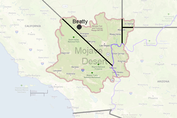
Beatty, Nevada
click for photo gallery
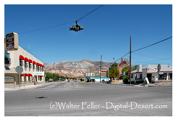
Population, 1,154. Elevation 3,304. A few miles southeast of nowhere, so its easy to find. Nowdays, a gateway to Death Valley, Beatty started out as a supply station for the Bullfrog Mining District.
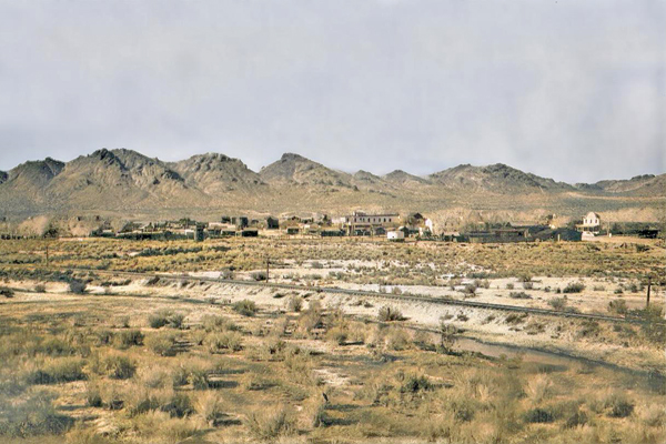
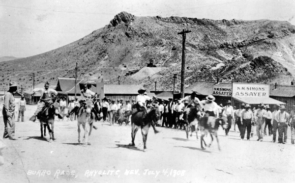
c. 1926 - UCLA Digital Library
Beatty, Nevada, is a small town located in Nye County in the U.S. state of Nevada. It is situated in the Amargosa Valley, near Death Valley National Park. With a population of around 1,000, Beatty is known for its tranquil atmosphere and scenic beauty.
The town of Beatty offers a variety of attractions and activities for visitors to enjoy. One popular destination is the Rhyolite Ghost Town, located just outside Beatty. This former mining town was once a booming community in the early 1900s but is now an interesting historical site. Visitors can explore the old buildings and remnants of the town's past, giving them a glimpse into the area's mining history.
For outdoor enthusiasts, there are plenty of hiking, camping, and wildlife viewing opportunities in Beatty and its surrounding areas. The nearby Death Valley National Park offers breathtaking landscapes, including sand dunes, canyons, and salt flats. Visitors can also enjoy activities such as biking, off-roading, and stargazing.
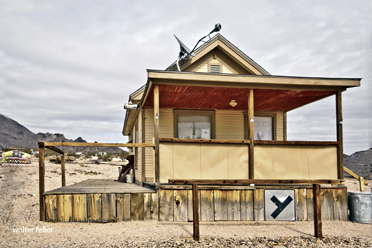
In addition to its natural beauty, Beatty has a few local attractions worth mentioning. The Beatty Museum and Historical Society provides insights into the town's history and showcases artifacts from the area's mining days. The town also hosts various events throughout the year, such as the Beatty Days Festival, which celebrates the town's heritage and features live music, food vendors, and a parade.
Regarding dining options, Beatty offers a few restaurants and cafes where visitors can grab a bite. Whether you're in the mood for American cuisine, Mexican dishes, or a quick coffee, you'll find something to satisfy your cravings in this charming town.
Accommodations in Beatty range from cozy motels to RV parks, providing options for both overnight stays and longer visits. The town's friendly atmosphere and convenient location make it a great base for exploring the surrounding area and experiencing the unique desert landscape.
In conclusion, Beatty, Nevada, is a small town with a rich history and natural beauty. Whether you're interested in history, outdoor activities, or simply enjoying the tranquility of a small desert town, Beatty has something to offer. So, if you're looking for a peaceful getaway or an adventure in the desert, consider visiting Beatty, Nevada.
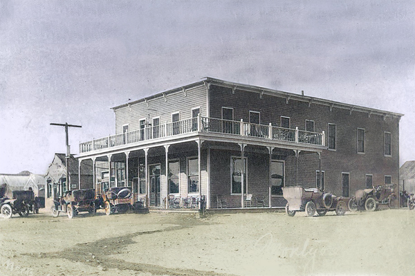
The Montgomery Hotel in 1905. It was owned by Bob Montgomery, namesake of the Montgomery-Shoshone Mine in nearby Rhyolite.
Railroads
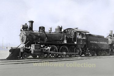
Beatty, Nevada, was historically served by several railroads that played crucial roles in the development and economic life of the town, particularly during its mining boom era. Heres a look at the key railroads that served Beatty:Las Vegas and Tonopah Railroad (LV&T):
This was the primary railroad serving Beatty, established in 1905 to connect Las Vegas to Tonopah. The arrival of the LV&T in Beatty in 1906 was instrumental in its development, facilitating the influx of miners and the transportation of ore and supplies between mining towns in the Bullfrog Mining District. The railroad provided a direct link from Beatty to other significant Nevada towns, enhancing its role as a commercial hub.Tonopah and Tidewater Railroad (T&T):
Although the T&T did not pass directly through Beatty, it had significant indirect effects on the town. Completed in 1907, the T&T ran from Ludlow, California, to Goldfield, Nevada, passing through nearby areas. It helped in transporting borax and other minerals and played a strategic role during the peak of mining operations in the region. Its route provided logistical support to the mining communities, including those close to Beatty.Bullfrog Goldfield Railroad:
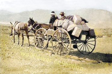
This railroad was another key player in the region, established in 1907 primarily to serve the mines in the Bullfrog District and Goldfield area. It connected with the LV&T at Beatty, making Beatty a crucial junction for miners and goods traveling throughout the region. These railroads were vital in sustaining the mining operations by providing necessary infrastructure for the transport of ores to mills and markets. They also brought in goods and travelers, contributing significantly to the area's economic and social life. As mining declined, these railroads eventually faded out of operation, but they left a lasting impact on the history and development of Beatty and the surrounding areas.Beatty, Nevada, has a colorful history characterized by its early mining activities and its key location near other significant historical sites. Here are the main points in the history of Beatty:
Early Inhabitants:
Before European settlers arrived, the area around Beatty was inhabited by Native American tribes, notably the Paiute and the Shoshone. These groups utilized the region's resources for centuries.Mining Boom:
The town of Beatty was established in 1905, named after Montillus "Old Man" Beatty, who was a Civil War veteran and a local rancher. He provided services to travelers and miners, playing a central role in the early community. Beattys development was closely linked to the Bullfrog Mining District, where gold was discovered in 1904. This discovery prompted a mining boom, attracting prospectors and leading to the establishment of several small towns in the area, including Rhyolite, which is now a ghost town just a few miles away.Railroads:
The Las Vegas and Tonopah Railroad reached the town in 1906, improving access and further boosting Beattys role as a regional mining hub. The railroad facilitated the transport of ore to processing mills and brought goods and passengers to the area.Transition to Tourism and Energy:
As mining activities dwindled, Beatty transitioned towards tourism and service industries. Its proximity to Death Valley National Park made it a convenient stop for tourists. In recent decades, Beatty has also been involved in energy production, particularly geothermal energy, leveraging the region's natural resources.Cultural Heritage:
Beatty maintains its historical heritage through local attractions such as museums and historical sites, including those in the nearby ghost town of Rhyolite. The annual Beatty Days festival celebrates the town's mining heritage and its community spirit.Beattys evolution from a mining town to a tourist and energy hub reflects its ability to adapt to changing economic conditions while preserving its rich historical legacy.
Rhyolite Ghost Town
At that time there was only one other person in the whole area: Old Man Beatty who lived in a ranch with his family five miles away. ...
Railroad History in the Mojave Preserve
The line never did reach the coast or Tonopah, stopping just short of Beatty, Nevada, but served as the "neighborhood railroad" for much of the desert, ...
Skidoo - Death Valley National Park
Plans had already been made for an auto line from Beatty, a stage line seemed definite, application had been made for a post office and with its high ...
Amargosa River
The Amargosa River originates in the mountains surrounding Beatty, Nevada, flows through the Amargosa Desert region, and terminates at Badwater in Death ...
Vanderbilt Mine
Eventually, he interested M. M. Beatty, who had an Indian wife, a member of the same family group as Bob Black, and after whom Beatty, Nevada is named. ...
Western Shoshoni Myths
Beatty, Nev.; Tom Stewart, Shoshoni, age about 70. Ash Meadows, Nev., where Shoshoni and Southern Paiute were somewhat mixed, but myths claimed to be ...
Greenwater
On September 7, 1907, the Beatty Bullfrog Miner reported that the Green water Miner had stopped publication and that a hundred people were still at ...
Jimville: A Bret Harte Town - Land of Little Rain - Mary Austin
Says Three Finger, relating the history of the Mariposa, "I took it off'n Tom Beatty, cheap, after his brother Bill was shot." ...
Leadfield Ghost Town
The road winds up through the mountain passes for over fifteen miles from Leadfield to the Beatty highway, and climbs from an elevation of 3400 feet at the ...
Western Shoshoni Myths
Desert & Mountain Fine Art Photo Prints, Shoshone Indians · Western Shoshoni Myths: Beatty, Nevada. The Origin of People. Every day Coyote met a girl. ...
Beatty Weather
Beatty Historic Photos
Amargosa River
Rhyolite
Elizalde
Beatty Weather
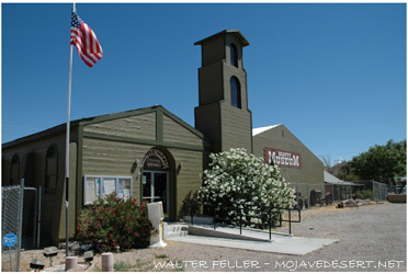
Beatty Museum
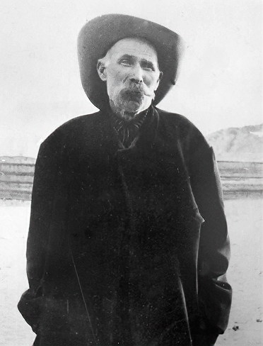
Montillus "Monty" Beatty
The Outfit
Tonopah & Tidewater Railroad