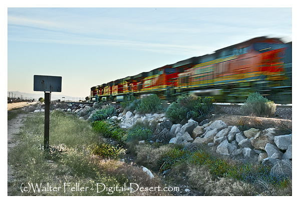
The Mojave Desert System Index serves as the master reference page for the entire project. Its purpose is to let a reader see, on one page, how the Mojave landscape, corridors, nodes, and site-cores fit together. It acts as a structural guide rather than a narrative article.
The index begins with the regional framework.
The Mojave Desert occupies a broad interior region of the southwestern United States bounded by the Sierra Nevada to the west, the Transverse Ranges to the south, the Colorado River to the east, and the Great Basin to the north. Within this landscape, mountain uplifts, basin systems, river corridors, and transportation routes have shaped both the physical environment and the patterns of human settlement.
The following index organizes the Mojave Desert into its major structural components.
Primary Geographic Framework
These features define the physical structure of the Mojave Desert landscape.
Mountain systems San Bernardino Mountains San Gabriel Mountains Tehachapi Mountains Providence Mountains Granite Mountains Piute Range Clark Mountain
Major basin systems Victor Valley Lake Manix basin Soda Lake basin Silver Lake basin Cronese basin Ivanpah Valley Death Valley basin
These landforms control drainage, sediment movement, and ecological patterns across the region.
Major River and Drainage Systems
Water is the dominant organizing force in Mojave geography.
Mojave River Amargosa River Owens River (northern margin influence) Colorado River
The Mojave River forms the largest internal drainage system of the desert, flowing from the San Bernardino Mountains toward the Soda Lake basin.
Transportation Corridors
Travel routes through the Mojave follow the natural pathways created by mountains, valleys, and water sources.
These corridors guided Indigenous travel, wagon roads, railroads, Route 66, and modern highways.
Primary Nodes (Level 1)
These locations organize the major systems of the Mojave.
Cajon Pass Barstow Needles Mojave Tehachapi Pass Mojave River Afton Canyon Soda Lake Ivanpah Valley Kelso Dunes Providence Mountains Granite Mountains
These nodes appear on the Mojave system map and anchor the regional structure.
Regional Zones
To simplify exploration, the Mojave can be divided into six geographic zones.
Cajon Gateway and Upper Mojave Zone Mojave River Corridor Zone Barstow Transportation Hub Zone Kelso Basin and Providence Mountains Zone Eastern Mojave Springs and Mojave Road Zone Colorado River Gateway Zone
Each zone contains its own cluster of site-cores and landscape features.
Top Site-Core Locations
These locations represent the most important interpretive anchors across the Mojave Desert.
Cajon Summit Mormon Rocks Barstow Yard Casa del Desierto Daggett Depot area Camp Cady Lane’s Mojave River Crossing Afton Canyon Narrows Soda Lake shore Zzyzx Kelso Depot Kelso Dunes Hole-in-the-Wall Mitchell Caverns Cima Dome Teutonia Peak Piute Springs Fort Piute Ludlow townsite Needles depot (El Garces)
Each of these sites illustrates an important component of Mojave geography, geology, or transportation history.
System Navigation Structure
The Mojave Desert system can be explored using the following hierarchy.
Regional Zones → Corridor Systems → Primary Nodes → Site-Core Locations
This layered structure reflects how geography, hydrology, transportation, and settlement patterns developed across the Mojave Desert.
Significance
The Mojave Desert System Index provides a unified framework for understanding the region. By organizing landscapes, corridors, and historic sites within a single structure, the index allows readers to navigate the Mojave as an interconnected system rather than a collection of isolated places.
Benefit: 10/10. This page becomes the master orientation guide for the entire Mojave project.
Hindrance: 2/10. As the project grows, the index may need occasional updates to include additional nodes or site-cores, but its core structure should remain stable.
The early history of Lucerne Valley has been preserved in large part through two closely related books: Range One East and Raising the Dust. Together, these works provide an important record of desert homesteading, agriculture, and daily life during the early settlement period of the Victor Valley region.
Lucerne Valley occupies a high desert basin north of the Mojave River and at the foot of the San Bernardino Mountains. During the late nineteenth and early twentieth centuries, the area was still largely an undeveloped desert, visited mainly by ranchers, prospectors, and travelers moving along routes between the Mojave Desert and the mountain communities. Permanent settlement increased during the homestead era, when families began attempting agriculture in the basin despite its arid conditions.
A central figure in this early history was F. J. Gobar, who settled in the Rabbit Springs area. In 1912, he gave the valley its modern name, “Lucerne Valley,” inspired by lucerne—another name for alfalfa—which he believed could be cultivated successfully there. (Swarthout History – CA, n.d.) The Gobar family experimented with crops and water development, helping demonstrate that farming could be attempted in the valley if irrigation wells were developed. (California – Cult Resources Mojave Western, 1978)
Much of this early period is described in Range One East, written by Virginia C. Hemphill-Gobar and published in 1972. (Hemphill-Gobar, 1972) The book documents the lives of settlers who attempted to build farms and ranches in Lucerne Valley during the early twentieth century. Drawing on family records, oral histories, and local recollections, Hemphill-Gobar describes the challenges of desert homesteading—scarce water, isolation, and the difficulty of establishing a reliable agricultural base in an arid landscape.
The title of the book refers to the Public Land Survey System designation “Range One East,” a six-mile-wide column of survey townships east of the San Bernardino Meridian. (Public Land Survey System, 2024) Much of the land in Lucerne Valley was described using the township-and-range system, and Hemphill-Gobar used that framework to organize the valley’s geography and the locations of early homesteads.
While Range One East presents a broader settlement history, the companion work Raising the Dust provides a more personal perspective. The book records the recollections of Julian Smith Gobar, who grew up in the region during the early years of settlement. His stories describe daily life in the Mojave Desert—working cattle, farming experiments, desert travel, and the colorful characters who populated the small communities scattered across the high desert.
Together, the two books complement each other. Range One East documents the development of the community and settlers’ efforts to establish farms and ranches in Lucerne Valley. Raising the Dust, by contrast, captures the personal experiences of those who lived through that period, preserving memories of the hardships, humor, and independence that characterized desert life.
Although neither work was written as an academic study, both have become valuable historical sources. They preserve details about early settlement, agriculture, and everyday life that are often absent from official records. Cultural resource studies, local historians, and researchers examining the development of Lucerne Valley frequently cite these books because they document firsthand accounts of the region’s formative years.
Through the combined efforts of Virginia C. Hemphill-Gobar and Julian Smith Gobar, the early history of Lucerne Valley—its homesteads, ranches, and pioneering families—was preserved for later generations. Their books remain an important window into the era when settlers first attempted to transform a remote Mojave Desert basin into a farming community.
The early history of Lucerne Valley has been preserved in large part through two closely related books: Range One East and Raising the Dust. Together, these works provide an important record of desert homesteading, agriculture, and daily life during the early settlement period of the Victor Valley region.
Lucerne Valley occupies a high desert basin north of the Mojave River and at the foot of the San Bernardino Mountains. During the late nineteenth and early twentieth centuries, the area was still largely an undeveloped desert, visited mainly by ranchers, prospectors, and travelers moving along routes between the Mojave Desert and the mountain communities. Permanent settlement increased during the homestead era, when families began attempting agriculture in the basin despite its arid conditions.
A central figure in this early history was F. J. Gobar, who settled in the Rabbit Springs area. In 1912, he gave the valley its modern name, “Lucerne Valley,” inspired by lucerne—another name for alfalfa—which he believed could be cultivated successfully there. The Gobar family experimented with crops and water development, helping demonstrate that farming could be attempted in the valley if irrigation wells were developed.
Much of this early period is described in Range One East, written by Virginia C. Hemphill-Gobar and published in 1972. The book documents the lives of settlers who attempted to build farms and ranches in Lucerne Valley during the early twentieth century. Drawing on family records, oral histories, and local recollections, Hemphill-Gobar describes the challenges of desert homesteading—scarce water, isolation, and the difficulty of establishing reliable agriculture in an arid landscape.
The title of the book refers to the Public Land Survey System designation “Range One East,” a six-mile-wide column of survey townships east of the San Bernardino Meridian. Much of the land in Lucerne Valley was described using the township-and-range system, and Hemphill-Gobar used that framework to organize the valley’s geography and the locations of early homesteads.
While Range One East presents a broader settlement history, the companion work Raising the Dust provides a more personal perspective. The book records the recollections of Julian Smith Gobar, who grew up in the region during the early years of settlement. His stories describe daily life in the Mojave Desert—working cattle, farming experiments, desert travel, and the colorful characters who populated the small communities scattered across the high desert.
Together, the two books complement each other. Range One East documents the development of the community and settlers’ efforts to establish farms and ranches in Lucerne Valley. Raising the Dust, by contrast, captures the personal experiences of those who lived through that period, preserving memories of the hardships, humor, and independence that characterized desert life.
Although neither work was written as an academic study, both have become valuable historical sources. They preserve details about early settlement, agriculture, and everyday life that are often absent from official records. Cultural-resource studies, local historians, and researchers examining the development of Lucerne Valley frequently cite these books because they record firsthand knowledge of the region’s formative years.
Through the combined efforts of Virginia C. Hemphill-Gobar and Julian Smith Gobar, the early history of Lucerne Valley—its homesteads, ranches, and pioneering families—was preserved for later generations. Their books remain an important window into the era when settlers first attempted to transform a remote Mojave Desert basin into a farming community
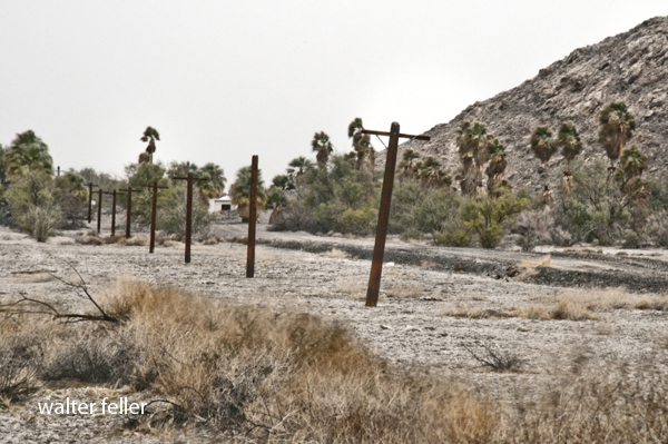
Telegraph poles along the side of the T&T RR roadbed.
Across the Mojave Desert, distance has always been the central challenge, fundamentally shaping the region’s social and economic development. Before the introduction of the telegraph and other forms of rapid communication, travelers, soldiers, and traders moved slowly between scattered springs, river crossings, and mountain passes. Messages traveled only as fast as the horses or wagons carrying them. In this landscape, information lagged behind events, leaving settlements, mining camps, and transportation routes isolated for days. This persistent isolation highlights the importance of the telegraph’s arrival. In this essay, I will examine how the emergence and spread of the telegraph transformed communication in the Mojave, tracing its gradual development, its integration into the transportation and mining infrastructure, and its broader role in connecting the region to the economic and administrative systems of the American West.
The telegraph’s arrival in the nineteenth century transformed communication in the Mojave. As wires were laid alongside railroads and travel routes, the region’s first network emerged—turning settlements and stations into nodes that instantly transported news, business, and personal messages across vast distances. In this way, the once-remote Mojave became part of a coordinated economic and transportation landscape.
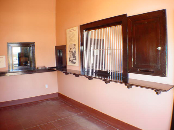
Telegraph room, Kelso Depot
The telegraph lines were more than a technological milestone—they turned the desert’s corridors into channels for movement and information, connecting towns from Needles to Barstow and Mojave as part of a regional network. To understand this transformation, note that the telegraph’s spread across the Mojave was not a single event but a gradual process spanning several decades. Initially, communication lines traced existing corridors: first, military roads in the mid-nineteenth century; then stage routes; and finally, most decisively, railroads beginning in the 1870s. With each advance, as the wire reached new parts of the Mojave, the effective distance shrank. Consequently, remote stations, mining camps, depots, and river crossings could now report conditions, request supplies, transmit orders, and relay market news in near real time.
Before the telegraph—throughout the early to mid-1800s—communication across the Mojave depended entirely on physical travel. Messages were moved by rider, wagon, stage, or military courier over routes such as the Mojave Road and the Salt Lake Road. Later in the century, they traveled along the wagon corridors tied to San Bernardino, Fort Mojave, and the Colorado River crossings. As a result, delay, uncertainty, and isolation were the norm. For example, a storm, a washout, a hostile encounter, or a shortage of animals could disrupt message delivery for days. In a region where water, distance, and timing mattered, that limitation was severe.
In 1861, the construction of the first transcontinental telegraph line marked a major turning point in American communications, but this initial line bypassed the Mojave. Only after the Civil War, as settlement, military use, mining, and rail transport expanded in the region during the late 1860s and 1870s, did the Mojave begin to develop its own telegraph lines. (Editors, 2009) In the desert Southwest, telegraph lines thrived where regular travel and economic support made maintenance feasible.
Against this backdrop, by the 1870s and 1880s, railroads became the main builders of telegraph infrastructure in the Mojave. As tracks crossed the desert, telegraph poles inevitably followed, since the railroad needed wire as much as rails. To dispatch trains efficiently over long single-track stretches, rapid communication between stations, sidings, yards, and division points became vital. In this way, telegraph offices at depots and section stations became the desert railroad’s nervous system, turning what was once open distance into a managed corridor.
This approach was exemplified by the Southern Pacific’s advance into the greater Mojave in the 1870s. Rail stations were not just stops for passengers and freight; they were communication nodes. A station agent might also serve as a telegraph operator, sending orders, reporting shipments, relaying delays, and linking local businesses to regional markets. Settlements with rail stops often gained telegraphic relevance as well.
The Mojave corridor’s transformation accelerated in 1883, when the Atlantic & Pacific Railroad—later controlled by Santa Fe—completed its line from Needles to Mojave. This milestone marked a decisive moment in regional communication (Atlantic and Pacific Railroad records, 1889-1893, n.d.). With the railroad came a continuous telegraph, linking Colorado River gateways, desert sidings, supply hubs, and western connections. As a result, towns such as Needles, Fenner, Cadiz, Ludlow, Barstow, and Mojave gained new significance—they became points in an interconnected network, not just locations on a map.
As a result of these shifts, Barstow’s later importance rested partly on this logic. As lines converged and railroad functions intensified, so did telegraph traffic. Train movements, freight, maintenance orders, livestock, mining output, and commercial messages all depended on the wire. Telegraphy made Barstow a control point, not just a stopover. The same applied, more modestly, to smaller stations, whose importance stemmed from siding capacity, water supply, or As the route developed into a major rail corridor after 1901, its telegraph infrastructure expanded, and places such as Daggett and the line toward Las Vegas became part of a communications spine linking Southern California with the Great Basin and the interior West (Guide to the San Pedro, Los Angeles & Salt Lake Railroad Company Records, 2024). In turn, the wire made the entire corridor legible to managers, dispatchers, and officials.
As rail and telegraph lines expanded, mining districts also benefited, though typically only indirectly at first. Mines needed access to a telegraph office, whether at their own camp, a nearby rail station, or a supply town—not a full regional grid. In the Mojave, camps often rose and fell too quickly for elaborate infrastructure, but more durable districts spread communication from the railheads. As one mining superintendent observed in an 1882 report, “With the wire to hand, news of strikes or shipments is sent in minutes, not weeks.” Telegraphy enabled ore buyers, investors, freighters, smelters, and operators to coordinate activities far faster than before. The telegraph was an economic multiplier; however, it did not create mineral wealth, but accelerated extraction and speculation.
Beyond its economic impact, the telegraph fundamentally reshaped the exercise of governance in the desert by enabling authorities to coordinate and intervene over long distances far more effectively than before. Sheriffs, military officers, railroad managers, and commercial entities gained the ability to transmit orders, directives, and requests for aid almost instantaneously, enabling more proactive, coordinated responses to emergencies and routine matters alike. The telegraph enabled the rapid management of crises such as accidents, conflicts, floods, labor disputes, supply shortages, and equipment failures. In a region where low population density and vast expanses had previously hindered centralized oversight and delayed administrative actions, the telegraph facilitated more timely decision-making and remote supervision. In effect, telegraphy became not just a technical advance but a core administrative instrument that altered patterns of authority and governance in the Mojave Desert. (Schwoch, n.d.)
Socially, the telegraph drew isolated desert communities into a broader world, fostering new cultural connections and a sense of participation in national affairs. Telegraph offices not only provided access to newspapers, commodity prices, railroad schedules, political news, and personal messages, but also exposed residents to broader currents of information and social change. The resulting increase in awareness allowed Mojave inhabitants to engage more actively with markets, politics, and news beyond their immediate environment. However, it is important to recognize that these benefits were not experienced equally by all residents. Some individuals and communities, particularly those unable to afford telegraph services or lacking easy access to the wire, may have found themselves left further behind as information and economic opportunities flowed to more connected settlements. Although expensive and specialized compared to mail, the telegraph’s symbolic value was enormous, representing technological progress and integration with modern society. (Schwoch, 2019) Nevertheless, while a desert station with a telegraph key was no longer truly remote, those without such infrastructure could remain marginalized—demonstrating that technological advancement could both connect and divide communities within the Mojave. In this sense, the telegraph’s integration sometimes reinforced social and economic disparities, complicating the narrative of universal connectedness and belonging to the broader American experience.
By the early twentieth century, telegraph service across the Mojave had become routine but remained crucial. It laid the groundwork for later advances like telephones and radio, proving that main corridors were channels of information as significant as the rails.
The development of the telegraph across the Mojave can be divided into three clearly defined stages. The first stage, prior to the 1860s, was characterized by a pre-wire desert that relied entirely on courier communication, with messages delivered by riders or wagons. The second stage, spanning the mid to late nineteenth century, marked a transition, as growing military, commercial, and transportation demands increased the need for more rapid communication, prompting the initial spread of telegraph lines along established routes. The third stage began in the 1870s and extended into the early 1900s, when the expansion of railroads led to the widespread installation of telegraph lines along the main transportation corridors of the desert, making telegraphic communication a standard feature of the Mojave (Axotl, 2025). While the telegraph did not conquer the Mojave by itself, its expansion demonstrated a new order: the desert was transformed from a space merely traversed into one constantly monitored, coordinated, and integrated.
By the early twentieth century, telegraph offices at railroad depots relayed train orders and freight movements, connecting desert settlements with distant cities and enabling coordination with markets and administrative centers beyond the desert.
Although later technologies—such as the telephone, radio, and digital communication—replaced the telegraph’s practical role, it is important to remember that the system it created marked a turning point in the region’s history. The telegraph bound the Mojave Desert into the economic and administrative framework of the American West and enabled information to travel as quickly as railroads carried people and goods.
Seen in this light, the telegraph poles that once lined the desert rail corridors represented far more than mere infrastructure. They signaled a profound transformation in the region’s social and economic fabric, marking the Mojave’s entry into the networks that shaped the modern American West.
Alongside the development of railroads and roads, the telegraph fundamentally redefined the meaning of distance and isolation in the desert. By enabling near-instantaneous communication, it not only connected settlements but also facilitated new forms of economic coordination, administrative oversight, and social engagement. Ultimately, the arrival of the telegraph was not simply a technological change: it reimagined the Mojave as part of a broader, interconnected world, demonstrating how technological innovations can reshape both the lived experience and future possibilities of even the most remote regions.
For decades, San Bernardino County lived in anticipation. Everyone knew that a transcontinental railroad would eventually stitch the lower Mississippi to the Pacific. The only question was where it would cross Southern California—and who would benefit.
San Diego boosters were convinced their harbor would be the terminus, calling it the only true port south of San Francisco. San Bernardino residents, by contrast, placed their confidence in geography. The county possessed two natural gateways—San Gorgonio Pass and Cajon Pass—and it seemed self-evident that any rational engineer would choose one of them. In that assumption lay both hope and frustration.
In 1867, the Memphis & El Paso Railroad, with John C. Frémont as president, was incorporated to push westward to the Pacific. Construction began in the East, but the enterprise collapsed before reaching California. Other schemes followed the same pattern: surveys completed, concessions granted, speeches delivered—then silence. A San Diego–to–Gila River line advanced no further than paper. The so-called International line, proposed to run eastward across part of Mexican territory, dissolved after preliminary activity.
The Texas & Pacific Railway, organized in 1869 by financier Tom Scott, appeared for a moment to be the solution. San Diego offered generous land and harbor-front grants. Ceremonies were held. Ten miles of roadbed were even graded. Then came the Panic of 1873, and the project stalled. Capital evaporated, and Southern California remained unconnected.
Locally, enthusiasm far exceeded results. In August 1868, San Bernardino citizens formally resolved to support a railway from Anaheim Landing to their town, pledging to secure county bonds of $5,000 per mile. The resolution bore the signatures of leading citizens. Yet no rails followed.
That same year, the Pacific & San Bernardino Railroad Company was incorporated with $2 million in capital stock. Contemporary newspapers declared it a “fixed fact.” Investors subscribed. Expectations soared. The rhetoric was grand: San Bernardino would stand “as it were on the sea shore,” drawing Arizona and Southern Utah trade into its lap. But beyond incorporation and optimistic editorials, nothing materialized. The company vanished as quietly as it appeared.
These early failures were not anomalies; they were characteristic of western railroad promotion in the 1860s and early 1870s. Speculation outran financing. Surveys substituted for construction. Communities competed aggressively, offering bonds and land grants in the belief that a rail connection meant economic survival.
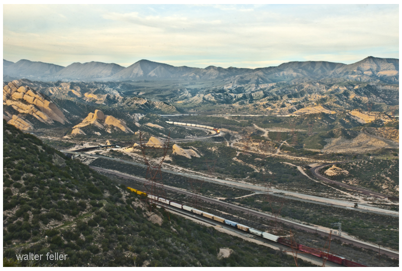
Structurally, Cajon Pass remained the logical corridor. It was the natural breach between the San Gabriel and San Bernardino ranges—a passage already used by Indigenous peoples, traders, and emigrants. The absence of rails was not a matter of geography but of capital and timing.
What this period demonstrates is less a story of defeat than of persistence. The county’s repeated efforts indicate its strategic awareness. San Bernardino understood that rail access would redirect freight from the Gulf of California routes and overland teamsters, anchoring the region to national markets.
The rails did come—eventually. But the first chapter of railroad history in the Cajon was written in surveys, stock certificates, and public resolutions rather than iron and timber.
The Mojave Desert can appear vast and open, yet movement across it has never been random. For thousands of years, travelers—whether on foot, horseback, wagon, train, or automobile—have followed a few geographic pathways. These pathways exist because the desert landscape constrains movement. Mountains must be crossed through passes, rivers must be crossed where bridges or fords are possible, and long desert basins must be traversed along routes where grades are manageable and water is available. The result is a transportation system organized around a limited number of natural gateways.
In the Mojave region, these gateways serve as control points for travel. Cajon Pass provides the principal crossing between the Los Angeles Basin and the Mojave Desert. Tehachapi Pass links the desert with California’s Central Valley. The Colorado River crossing near Needles and Topock serves as the primary gateway between California and Arizona. Junctions such as Mojave and Barstow exist where multiple corridors meet, while places like Daggett serve as hinge points connecting Southern California with Southern Nevada.
Other gateways reflect local geographic realities. The Mojave River corridor offers a rare linear water route through the desert, influencing both early travel and later settlement. The eastern Mojave basin corridor—stretching through Cadiz and Fenner—provides a broad, relatively level path across the desert interior. In the north, Owens Valley forms a long north–south corridor along the eastern flank of the Sierra Nevada. Mining districts around Death Valley created additional gateways where mineral railroads connected isolated basins to the main transportation network.
Across time, different transportation technologies reused these same pathways. Indigenous trails first established practical routes between water sources and passes. Wagon roads and stage routes later formalized these corridors. Railroads engineered permanent alignments through the same gateways, concentrating activity at junction towns such as Mojave, Barstow, and Needles. In the twentieth century, highways often paralleled these earlier routes, following the same geographic logic through the desert.
Understanding these gateways helps explain why towns, rail yards, and highways appear where they do. They are not accidental settlements but the result of long-standing corridors shaped by geography. Once these gateways are recognized, the transportation history of the Mojave Desert becomes easier to interpret: most routes are simply different eras of travel passing through the same landscape constraints.
Wilsona Gardens is a small unincorporated community in northeastern Los Angeles County within the Antelope Valley on the western edge of the Mojave Desert. Best-available public gazetteer-style coordinates cluster tightly around 34.6678° N, 117.8256° W, with elevation reported around 2,560–2,570 ft (≈780–783 m), but these values should be treated as an approximate centroid rather than a surveyed boundary point.
The regional climate is strongly arid to semi-arid “high desert,” with cool winters, hot summers, and precipitation concentrated in the cool season. Using 1991–2020 climate normals for nearby Lancaster (William J. Fox Airfield) as a defensible proxy for Wilsona Gardens, mean monthly temperatures range from ~45°F in January to ~82°F in July; annual precipitation normals total ~6.81 inches (173 mm), with ~83% of the annual total falling from November–March.
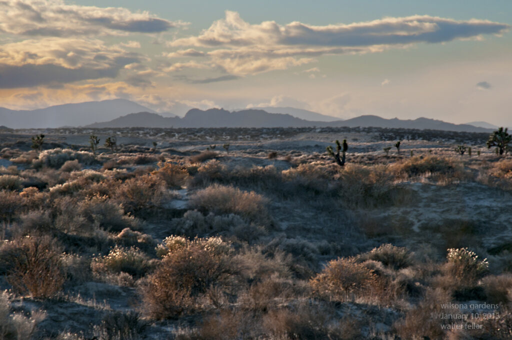
Vegetation in and around Wilsona Gardens sits at the ecotone between Joshua tree woodland and creosote bush scrub, with additional patch types tied to soil/landform variation: sandy to loamy alluvial fans and washes (supporting creosote and episodic annual wildflowers), granitic pediments/hills (shrub-dominated with sparse cover), and small disturbed parcels/roads that disproportionately favor invasive annual grasses. Nearby Saddleback Butte State Park was established specifically to preserve a Joshua tree woodland in this landscape context, underscoring the local ecological importance and sensitivity of that community.
Key ecological drivers are (i) limited and highly variable water supply (winter storms plus occasional convective summer precipitation), (ii) substrate/soil controls on rooting depth and water holding capacity, (iii) disturbance regimes—especially the modern invasive-grass/fine-fuel pathway that enables uncharacteristic fire in desert shrublands/woodlands, and (iv) expanding land use pressures (parcel development, roads, off-highway vehicle activity, and utility/renewable-energy corridors at a regional scale).
Conservation-relevant species in the broader western Mojave context include the federally threatened Mojave population of the desert tortoise and the state-threatened Mohave ground squirrel; both are sensitive to habitat fragmentation, road mortality, and disturbance. State policy attention is also high for western Joshua tree via the Western Joshua Tree Conservation Act (WJTCA, enacted July 2023), which governs take and permitting.
Geographic setting and administrative boundaries
Assumed place target. This report follows your instruction to treat “Wilsona Gardens” as the community in the Lancaster/High Vista portion of ZIP 93535, rather than similarly named entities elsewhere.
Best-available coordinates and elevation (centroid-style). Multiple independent gazetteer-like sources converge on essentially the same point location:
Coordinate estimate: 34.6678° N, −117.8256° W (decimal degrees)
Elevation estimate: ~2,560–2,570 ft (≈780–783 m)
Because these sources behave as “place point” representations (not surveyed boundary vertices), they should be interpreted as an approximate community center suitable for landscape-scale ecological context, not a legal boundary for entitlement, permitting, or parcel decisions.
County and unincorporated status. Los Angeles County contains extensive unincorporated territory governed by the County Board of Supervisors (functionally acting as municipal government for unincorporated areas). A compiled list of unincorporated areas places Wilsona Gardens in Supervisorial District 5 in at least one published local-government reference document.
Relationship to nearby named places and map frameworks. Wilsona Gardens is mapped in the vicinity of Hi Vista and is referenced as appearing on the “Hi Vista” USGS topo quadrangle in at least one place-profile source. These cartographic associations reinforce the appropriateness of analyzing Wilsona Gardens as part of the western Mojave high-desert mosaic rather than the urban Lancaster basin proper.
5 km buffer polygon (for ecological analysis when administrative boundaries are uncertain). Because an authoritative polygon boundary for “Wilsona Gardens” was not retrieved from a primary boundary dataset within the constraints of the sources accessed here, the remainder of this report treats a 5 km radius buffer around the coordinate above as the analysis area of interest (AOI). This is an ecological—not administrative—boundary selection.
(Construction method: geodesic forward calculation on a spherical Earth approximation with evenly spaced bearings; intended for communication and reproducibility, not cadastral work.)
Regional physical environment
Physiographic context. Wilsona Gardens lies on the western margin of the Mojave Desert where broad alluvial plains are punctuated by granite buttes and pediments; a nearby reference point is Saddleback Butte, described as a granite mountaintop rising ~1,000 ft above surrounding alluvial plains and reaching 3,651 ft elevation. This terrain creates strong local gradients in exposure, soil depth, and runoff concentration, which drive patchy vegetation patterns despite the region’s overall aridity.
Climate normals (1991–2020) and proxy selection. Station-based 30-year climate normals are the official U.S. reference for “typical” climate conditions and are produced by NOAA National Centers for Environmental Information. For Wilsona Gardens, a practical and transparent approach is to use the nearest long-record station normals that represent the same high-desert air mass and elevation band; LA County compilations report 1991–2020 normals for Lancaster (William J. Fox Airfield) and show close agreement with other regional references.
Temperature regime (1991–2020 normals). Monthly mean temperatures for Lancaster (Fox Field) are ~45°F (Jan), 48°F (Feb), 54°F (Mar), 59°F (Apr), 68°F (May), 76°F (Jun), 82°F (Jul), 81°F (Aug), 74°F (Sep), 63°F (Oct), 51°F (Nov), and 44°F (Dec), with annual mean ~62°F. Average monthly maximums peak near ~98°F in July–August, while average monthly minimums fall to ~30°F in December–January, consistent with strong radiational cooling in dry air and open terrain.
Precipitation seasonality (1991–2020 normals). Normal annual precipitation for the Lancaster (Fox Field) station is 6.81 inches (July–June “rainfall season” framing), with monthly normals strongly weighted to winter: Dec–Feb alone sum to ~4.33 inches (≈64% of annual), and Nov–Mar sum to ~5.66 inches (≈83%). Summer precipitation is typically minimal (e.g., Aug normal ~0.01 in). This seasonality structures the timing and intensity of primary productivity pulses (germination, herbaceous growth, flowering) and constrains perennial recruitment opportunities.
Landforms and soils
Dominant landforms in the 5 km AOI. The key landform template in this sector of the western Mojave is a set of alluvial plains and fans shed from granitic uplands and buttes, plus local washes that convey episodic runoff. Saddleback Butte is explicitly described as a granite feature towering above broad alluvial plains, implying extensive fan and bajada development around nearby uplands. A representative drainage element of this landscape is the region’s washes (ephemeral channels); “Big Rock Wash” is mapped nearby as a GNIS-class feature, illustrating the local importance of episodic flowpaths and shallow alluvial deposition in an otherwise dry matrix.
Why soil series matter ecologically. In arid ecosystems, soil depth to restrictive layers (bedrock, petrocalcic horizons), texture (sand vs loam vs clay), and carbonate content strongly govern (i) infiltration versus runoff, (ii) soil-moisture residence time after storms, (iii) rooting depth for shrubs/trees, and (iv) germination windows for annual wildflowers. NRCS Official Soil Series Descriptions (OSDs) provide standardized, primary descriptions of these properties and the landscape positions where each series occurs.
Likely soil/landform assemblage near Wilsona Gardens (series-level). A fully authoritative soil-map-unit attribution typically requires an AOI query in NRCS Web Soil Survey; the sources accessed here do not include an AOI-specific map output for the Wilsona Gardens centroid. Nevertheless, several OSD soil series are explicitly defined for Mojave Desert settings matching the local landforms and elevations, and they plausibly bracket the range of soil conditions expected within a 5 km AOI:
Hi Vista series: moderately deep to rock; formed in granitic residuum on hills and rock pediments; mean annual precipitation ~5 inches; vegetation described as native desert shrubs.
Rosamond series: deep, well-drained, fine-loamy soils on lower margins of alluvial fans between sloping fans and playas; mean annual precipitation ~5 inches.
Hesperia series: very deep, well-drained soils on alluvial fans, valley plains, and stream terraces; formed in granitic alluvium; native vegetation includes creosote bush in the high desert.
Lucerne series: arid alluvial fans/terraces in the Mojave Desert; vegetation includes Utah juniper, scattered Joshua tree, annual grasses/forbs, and perennial grasses, indicating a slightly higher-elevation or cooler/moister microclimate subset within the desert fan system.
Popson series: broad alluvial fans/flood plains in the arid Mojave; mean annual precipitation ~4–5 inches; associated with other fan soils including Hesperia and Rosamond, and explicitly described at elevations ~2,300–2,550 ft—very close to the Wilsona Gardens elevation estimates.
Soils and landforms comparison table
Soil series (NRCS OSD)
Typical landform position
Key physical traits (ecologically relevant)
Likely vegetation signal in OSD
Relevance to Wilsona Gardens AOI
Hi Vista
Hills and granitic rock pediments
Moderately deep to bedrock; residuum from granitic rock; slopes 2–50%
Native desert shrubs
Represents shallow-soil/upland edges and pediment patches likely present near local buttes
Rosamond
Lower margins of alluvial fans near playas
Deep, fine-loamy, calcareous; low slopes (0–2%)
Desert range (typical pedon context)
Represents fan-to-basin transition soils that can support creosote scrub and annual forbs on flats
Hesperia
Alluvial fans, valley plains, stream terraces
Very deep; coarse-loamy; moderately rapid permeability; semiarid to arid setting
Creosote bush and sparse annuals in high desert settings
Strong candidate for the dominant “developable” fan surfaces around a community centroid
Lucerne
Alluvial fans, fan terraces, terraces
Arid; moderately rapid permeability; elevations 2,900–4,800 ft (series range)
Brackets cooler/moister micro-sites and higher nearby fan/terrace positions; useful for understanding woodland/grassland patches
Popson
Broad alluvial fans and flood plains
Arid; mean annual precip 4–5 in; elevations 2,300–2,550 ft (series range)
Fan soils, associated with Hesperia/Rosamond and Mojave settings
Elevation match suggests Popson-like fan soils may occur near the AOI core
Vegetation and plant communities
Regional vegetation frame. The nearby Saddleback Butte State Park description explicitly frames the local ecosystem as “high-desert Joshua tree woodland” with a “Joshua Tree/Creosote habitat,” and notes that springtime wildflower displays vary strongly by year—an ecological signature of precipitation-driven annual pulses on desert soils. NRCS OSDs for adjacent Mojave soil series independently point to creosote dominance on many fan soils and to Joshua tree presence on certain fan/terrace or woodland-inclined soils (e.g., Lucerne).
Interpreting “percent cover” at two scales. Because a site-specific vegetation survey for Wilsona Gardens (plots/transects) is not included in the accessed primary sources, the report distinguishes between: (1) Landscape composition (percent of AOI area in broad community types), estimated analytically from landform/soil drivers and verified qualitatively by the documented presence of Joshua tree woodland and creosote habitats in the immediate regional matrix; and (2) Within-community vegetative cover (e.g., shrub canopy cover), which is not directly estimated here beyond relative structure descriptors due to lack of plot-based measurements in primary sources.
Dominant plant communities expected in the 5 km AOI (with explicit uncertainty). The following landscape composition is presented as a best-estimate range consistent with (i) the explicit Joshua tree woodland/creosote habitat descriptions for the nearest preserved area, (ii) soil-series vegetation hints in NRCS OSDs, and (iii) the strong alluvial-fan template of the western Mojave edge:
Creosote bush scrub (Larrea tridentata-dominated): ~45–70% of AOI area (highest on broad, low-slope fan surfaces with deep alluvium such as Hesperia/Popson-like settings).
Joshua tree woodland / Joshua tree–creosote ecotone: ~15–35% (concentrated on slightly higher, cooler terrace/fan positions and near granitic uplands; reinforced by the park established to preserve Joshua tree woodland and by OSDs acknowledging Joshua presence in Mojave fan/terrace soils).
Mojave desert grassland elements (native perennial bunchgrasses and forbs in shrub interspaces, plus increased annual cover in wet years): ~5–15% as discrete patches or functional components within shrubs/woodland, particularly where soil texture and disturbance history permit grass persistence.
Annual wildflower fields / ephemeral herbaceous flats: ~2–10% as event-driven, precipitation-dependent expression on favorable soils (notably fan flats and disturbed or sandy microsites), with strong interannual variability.
Disturbed/developed parcels, roads, and altered ground: ~3–15%, depending on how intensively the 5 km AOI intersects parcel grids and graded surfaces; these areas are ecologically important because they can amplify invasive annual grass establishment and fuel continuity.
Plant community comparison table
Community type
Diagnostic setting in AOI
Dominant/indicator plants (representative, not exhaustive)
Estimated AOI area share
Primary ecological controls and uncertainties
Joshua tree woodland / Joshua tree–creosote ecotone
Higher or cooler fan/terrace positions; near granitic uplands and protected woodland remnants
Joshua tree with creosote in ecotone; woodland emphasis locally documented
15–35% (range)
Controlled by elevation/microclimate, soil depth/texture, and fire history; quantification is uncertain without mapped vegetation polygons or field plots
Creosote bush scrub
Broad alluvial fans/valley plains; deep granitic alluvium soils
Creosote bush indicated as native vegetation on high desert fan soils
45–70% (range)
Water limitation and soil moisture storage dominate; disturbance can shift understory toward invasives
Mojave desert grassland functional component
Interspaces on suitable fan/terrace soils; some higher terrace positions
Perennial grasses and forbs noted in Mojave terrace soils; can form important interspace fuels if invaded by annual bromes
5–15% (range)
Sensitive to grazing/disturbance and invasive annual grasses; hard to map as discrete “patches” without field data
Often dominated by nonnative annual grasses (e.g., bromes) and ruderal forbs
3–15% (range)
Disproportionate ecological leverage via invasive grass establishment and fuel continuity; actual extent is boundary/AOI dependent
Fauna and ecological indicators
Evidence base and approach. Site-specific species inventories for Wilsona Gardens were not present in the accessed primary sources, so this section prioritizes (i) wildlife explicitly reported for the nearest formally managed reference area (Saddleback Butte State Park), and (ii) conservation-status species whose documented ranges include the western Mojave and Los Angeles County portions of that region.
Representative fauna with conservation and indicator value.
Desert tortoise (Mojave population): Listed as threatened under the U.S. Endangered Species Act (final rule dated April 2, 1990), with threats centered on habitat degradation, fragmentation, disease, and human-caused mortality (including roads and off-highway vehicle impacts). Federal and USGS sources describe the tortoise as an indicator or umbrella species for the ecosystems it occupies, making its habitat needs a useful proxy for overall desert ecosystem integrity.
Kit fox: Reported as part of the wildlife assemblage at Saddleback Butte State Park; functionally, kit fox presence signals relatively intact desert food webs and prey bases, but local occupancy is sensitive to road density and development pressures.
Mountain bluebird: Reported at Saddleback Butte State Park; as an open-country insectivore, it reflects seasonal insect availability and habitat openness typical of desert woodland/scrub edges.
Mohave ground squirrel: Listed as threatened under the California Endangered Species Act and described by state sources as endemic to the western Mojave Desert; the species is explicitly associated with desert scrub communities and Joshua tree woodlands, and CDFW emphasizes renewable energy development pressures as a risk factor. Federal review history documents substantial attention to development-related threats even when federal listing was found not warranted at that time.
Invertebrates (functional role rather than site list). In this ecosystem, the spring annual wildflower pulse implies episodic but high ecological importance for native pollinators and other invertebrates, because short-lived flowering events are synchronized with winter precipitation availability and temperature windows. The strong precipitation seasonality and variable spring wildflower displays described for the local reference area provide the core support for this inference, even though a Wilsona Gardens-specific insect inventory is not sourced here.
Ecological drivers, threats, and conservation context
Water limitation and pulse dynamics. The defining driver is water: annual precipitation is low and concentrated in winter months, producing discrete germination and productivity pulses rather than continuous growth. In the Lancaster-area normals used here, >75% of annual precipitation falls Dec–Mar and ~94% falls Oct–Apr, which tightly constrains recruitment opportunities for long-lived perennials and governs when annual wildflower “events” can occur.
Fire regime transformation via invasive annual grasses. Desert shrublands and Joshua tree woodlands are not structured for frequent fire, yet multiple authoritative sources document how invasive annual grasses increase fine-fuel continuity and drive a grass–fire feedback:
USGS describes cheatgrass-driven expansion and the positive feedback loop where earlier curing fuels fires and promotes post-fire invasive spread.
BLM similarly emphasizes that invasive annual grasses create continuous fine fuels, enabling uncharacteristic fire behavior at large scales and leaving native communities more vulnerable to reinvasion.
USFS fire-effects syntheses report that in the Mojave Desert, red brome codominance (often with Schismus spp.) can allow extensive and rapid fire spread; the western Mojave is explicitly included in the experimental-fire data summarized.
For Wilsona Gardens, the ecological implication is that disturbed surfaces (roadsides, graded pads, firebreak edges) can act as invasion “seedbeds,” converting originally discontinuous desert fuels into a connected matrix capable of carrying fire through shrub and woodland patches.
Land use pressure and fragmentation. Regional conservation analyses for focal species identify a consistent suite of pressure pathways—urban/rural development, renewable energy buildout, road networks, and off-highway vehicle activity—each of which elevates direct mortality risk and fragments habitat. These exact stressors are cited in desert tortoise conservation analyses and in both state and federal discussions of Mohave ground squirrel risk context.
Species- and habitat-specific conservation frameworks. Three governance signals are especially relevant for Wilsona Gardens’ ecological management context:
Western Joshua Tree Conservation Act (WJTCA): Enacted July 2023, governs take and permitting of western Joshua trees in California and allows permit pathways and potential local delegation under defined conditions.
Desert tortoise (Mojave population) ESA status: Federally threatened listing (final rule April 2, 1990) with critical habitat and recovery planning history, making habitat disturbance and fragmentation a high-stakes consideration in the broader region.
Mohave ground squirrel CESA status: State-threatened status and a dedicated conservation strategy framework, with explicit attention to renewable energy development pressures in the western Mojave.
Light pollution and dark-sky policy tools (evidence-limited for AOI membership). Los Angeles County planning open-data services include a “Rural Outdoor Lighting District (Dark Skies)” layer, evidencing that the County uses zoning/planning instruments to manage outdoor lighting in at least some unincorporated areas. Whether Wilsona Gardens falls inside that district boundary was not determined from the sources accessed here, so this is treated as an available management lever rather than a confirmed local condition.
Shifts suitability and recruitment windows; amplifies drought stress
Joshua tree protection is explicitly framed as climate-relevant state policy
Long-term, high consequence; interacts with fire and development
Reduced recruitment, increased mortality during drought; altered phenology of annual pulses
Stewardship and management recommendations
Management goal framing (site-scale, AOI-scale). The most defensible objective for Wilsona Gardens is to maintain (or restore where degraded) the structural mosaic of Joshua tree–creosote ecotone, creosote scrub, and wash/fan microhabitats while preventing the disturbance-to-invasive-to-fire pathway from converting that mosaic into an annual-grass fuel bed. This goal is consistent with (i) the protected-area rationale for securing Joshua tree woodland nearby, (ii) the invasive annual grass/fire feedback described by federal land-management and science agencies, and (iii) the conservation requirements implied by sensitive species frameworks in the western Mojave.
Invasive grass prevention as the top near-term intervention. Prioritize prevention, early detection, and rapid response for invasive annual grasses along disturbance vectors (roadsides, graded pads, utility easements). The rationale is that invasive annual grasses can cure early and create continuous fine fuels that carry fire across landscapes otherwise too discontinuous to burn extensively. Practical, site-scale tactics include: limiting new soil disturbance, requiring weed-free fill/materials, staging equipment on already disturbed ground, and suppressing invasive seed set in targeted strips before peak curing.
Fire risk reduction tailored to desert ecology. Because desert shrublands/woodlands can be highly vulnerable to fire once invasive fuels connect patches, prioritize fuel continuity interruption rather than broad brush removal. Use narrow, strategically placed breaks on already disturbed alignments (roads, parcel edges) and manage fine fuels (annual grasses) rather than removing native shrubs that stabilize soils and provide habitat. This is consistent with the Mojave-specific observation that annual grass codominance can enable rapid fire spread in desert systems.
Joshua tree governance compliance and conservation design. Any action involving western Joshua trees should be planned under WJTCA permitting logic (including incidental take pathways and mitigation/fee options where applicable). A conservative stewardship posture is to treat Joshua trees on-site as protected biological assets and to design development footprints and access routes to avoid impacts, consistent with the statute’s take prohibitions unless authorized.
Habitat-friendly parcel and roadway practices. Where development is occurring or planned, prioritize clustered footprints, minimized new road cuts, and dark-sky compatible lighting where feasible, using the County’s demonstrated availability of outdoor lighting district tools as a policy model even if AOI inclusion is uncertain. Fragmentation pathways are repeatedly identified as core threats to sensitive desert fauna, particularly for the desert tortoise and for regionally endemic species like Mohave ground squirrel.
Wildlife-sensitive operations and education. In areas likely to support high-value species habitat (especially broadly suitable desert scrub and Joshua woodland), reduce night driving on unpaved roads, limit free-roaming pets, and prioritize signage/education around sensitive species and invasive-seed hygiene. These measures align with the human-mortality and habitat-degradation pathways documented for desert tortoise and emphasized in western Mojave conservation initiatives.
Seasonal ecological pulse model (Mermaid)
The following conceptual pulse timeline links the observed climate seasonality (winter-dominant precipitation, hot dry summers) to predictable ecological responses in Mojave scrub/woodland systems.
flowchart TB
A[Oct–Apr: Storm season dominates annual precipitation] –> B[Soil moisture recharge on fans, washes, shallow soils] B –> C[Nov–Feb: Germination window opens for annuals in wet years] C –> D[Feb–Apr: Peak flowering pulse (wildflowers vary strongly by year)] D –> E[Mar–May: Seed set and seedbank replenishment] E –> F[May–Jun: Rapid drying; annual senescence] F –> G[Jun–Sep: Hot/dry summer; drought stress; low primary productivity] G –> H[Late summer: occasional convective storms (usually minor totals)] H –> I[Patchy late-season germination possible; generally limited] I –> A F –> J[If invasive annual grasses present: continuous fine fuels] J –> K[Higher probability of uncharacteristic wildfire spread] K –> L[Post-fire: invasive grass dominance risk increases] L –> J
“Corridor archaeology” is an approach to archaeology that treats a route—and the landscape people moved through along it—as the primary unit of study, rather than focusing solely on a single site (a village, a mine, a camp, a ruin).
Instead of asking “What happened at this one place?”, it asks questions like: How did movement happen here over time? Where were the dependable resources (water, forage, stone, shelter) that structured travel? What were the choke points, forks, and bottlenecks? How did different eras reuse, overwrite, or abandon earlier paths?
Core idea. A corridor is a strip or network through the landscape (a river valley, pass, canyon, shoreline, ridge, or desert trail system) that concentrates movement. Corridor archaeology examines the material traces of that movement—both the “hard” evidence (artifacts, features, datable deposits) and the “soft” patterning (spacing, visibility, access, risk, seasonality).
What it typically studies (common evidence types).
Route traces and wayfinding: trail braids, wagon ruts, cairns, cutbanks, switchbacks, “shortcuts” that grow into new alignments.
Water and provisioning nodes: springs, seeps, tinajas, wells, river crossings, camps near dependable water, and the scatter patterns that form around them.
Task- and stop-related features: hearths, rock alignments, windbreaks, temporary corrals, caches, packet scatters, repair debris.
Artifact distributions: lithic scatters, ceramics, metal, glass, can dumps, horseshoe nails—often more informative as spatial patterns than as isolated finds.
Overlapping time layers: Indigenous travel corridors, later trade routes, wagon roads, rail grades, highways—each leaving different signatures but often occupying the same logic of terrain.
How it differs from “site archaeology.” Traditional site work tends to privilege bounded places and discrete occupations. Corridor archaeology is comfortable with “low-density” archaeology: long, thin, messy distributions that don’t look like a classic site boundary, but still carry strong information when mapped and analyzed as a system.
Typical methods (the toolkit).
Transect survey and systematic recording along a corridor width (not just a line).
Why it matters. Corridors are where daily life happens at scale: travel, trade, seasonal rounds, herding, migration, mail routes, military movement, tourism. If you only study the famous “dots on the map,” you miss the connective tissue that explains why those dots exist where they do.
Desert photography starts out as a simple urge: “That looks good—take a picture.” If it stays there, it can go stale, because the camera becomes a souvenir machine and nothing more. But if you pull the pieces together—purpose, learning, editing, and display—it becomes something older and steadier: a craft that turns attention into knowledge, and knowledge into a record you can live with, share, and pass along.
The first part is purpose, because it keeps the work from turning into an endless string of casual snaps. In the desert, purpose can be as plain as an assignment. “Follow the wash and photograph what changes.” “Track an old route and record the artifacts.” “Show a plant community, not a single plant.” “Make a sequence that explains a place, not just a postcard.” When you have an assignment, you stop hunting for random pretty scenes and start asking the kind of questions that lead to better photographs: What is the subject? What is it doing here? What does the light reveal? What is the story the landscape is telling?
That’s what purpose does: it forces you to look longer. And in the desert, looking longer is the whole game. The desert isn’t loud the way a city is loud; it’s legible. A dry fan tells you where water used to run. A wash shows you how recent storms rearranged the ground. Desert varnish and pavement show the passage of time. A line of cottonwoods or reeds tells you where water persists even when everything else says “no.” Old grades, culverts, pole lines, and broken pavement show how people tried to solve the desert’s problems—water, distance, and heat—using the tools of their era. When your photography has purpose, you start photographing these clues on purpose. That’s the moment the camera stops being a mirror and starts being a notebook.
The second part is learning, because desert photographs can be more than attractive; they can be evidence. If you want your images to teach you something later—and teach other people something too—you need a simple discipline: shoot identifiers, not just beauty. For plants, that means the flower (if present), the leaves, the overall form, and the habitat context. For geology, it means a close-up texture shot, a mid shot showing where the rock sits, and a wide establishing shot showing the landform. For historic sites, this means details of construction, a sign or marker (if one exists), and the relationship to the landscape (because the landscape explains why the site is there). Add one shot that gives scale. It can be as simple as your boot near a track, a coin next to a fossil fragment (where legal and ethical), or a hand near a tool mark—anything that anchors size.
That method sounds almost dull, but it’s the opposite. It’s how you build a personal archive that gets more valuable with time. Later, when you want to confirm an ID, write an article, or compare changes across seasons, you have what you need. You’re not guessing. You’re working from proof.
The third part is technique, and in desert work, technique is mostly about light, distance, and protection. Desert light is brutally honest. Midday sun flattens color, blows highlights, and makes the scene look harsher than it felt. Early and late light—side-light especially—reveals texture and makes the land readable. Overcast, though rarer in the desert, is excellent for plants and details because it reduces contrast and preserves color. After rain is its own gift: clearer air, richer tones, and sometimes standing water or damp sand that photographs like velvet. Distance is the next factor: heat shimmer can ruin long telephoto shots across a flat basin in the middle of the day, and wind can turn a gentle tripod setup into a vibrating mess. Protection is the constant: dust, grit, and sun don’t care what brand of camera you brought. The desert is hard on gear and harder on complacency.
But technique isn’t only about settings. It’s about how you choose to see. A phone can make fine desert photographs if you treat it like a camera and not a distraction. A “serious” camera gives you more control and consistency, but it doesn’t give you purpose. Purpose is earned.
The fourth part is editing, because editing is where your photographs become cohesive. Editing isn’t just “making it prettier.” It’s where you declare what you’re loyal to. Are you loyal to realism—making it look like it felt? Are you loyal to form—graphic lines and hard light? Are you loyal to color—subtle separation of tans, blues, and varnish-black? Are you loyal to the story—an image that serves a sequence more than it serves itself? Once you know your loyalty, the sliders stop being a casino and start being tools.
A good way to think about editing is in terms of “mode and style.” Mode is the job. Style is the repeated set of choices. Documentary realism is a solid mode for desert work because it respects the place. You protect highlights, keep color believable, lift shadows without flattening, and use sharpening with restraint so rocks look like rock rather than crunchy digital grit. Classic landscape is another: slightly deeper contrast, careful dodging and burning, and a “printed” look that suits wide scenes. Graphic high-contrast can be powerful too—especially on dunes, volcanic rock, road cuts, and old concrete—where shape and shadow are the story. Film-like or vintage styles can work, but only if you keep them consistent; otherwise, it becomes a costume you put on photos at random.
The most important editing decision is not what you add—it’s what you refuse. Decide your line in the sand. Many desert photographers do better the moment they reject heavy HDR halos, neon saturation, and fake skies. The desert has plenty of drama; you don’t need to manufacture it. Restraint reads as confidence.
The fifth part is display, because display is where the whole thing becomes real. A photograph that lives only on a hard drive is unfinished. Display is also where people get confused, because every output has different needs. A print for the wall is not the same as an image for a phone screen, and neither is the same as an image for publication.
For home display, you’re making something you’ll live with. That calls for calm editing, predictable sizes, and consistency. A single strong piece can anchor a room, but series work—washes, roads, dunes, textures—can turn a wall into a story. A traditional approach helps: standard sizes, consistent frame style, consistent mat color. The goal is for the work to read as a body rather than a pile.
For a gallery, cohesion is everything. A gallery show is not a “best of.” It’s a statement. Limiting sizes, limiting styles, and arranging images as sequences make viewers slow down and follow the logic. Captions matter more than people like to admit in landscape work. One sentence can turn a pretty scene into a scene with meaning: what it is, where it is, and why it matters. Desert photography especially benefits from this because the land is full of clues that most viewers don’t yet know how to read.
For gifts, you’re choosing ease and friendliness. Smaller sizes, a bit more brightness than you’d keep for yourself, and subjects that communicate immediately. A clean Joshua tree silhouette, a classic road fragment, a dramatic ridge line—these are images people can place in their own homes without needing the backstory. You can still include the backstory, but the gift should stand on its own.
For publications, you’re in a world of specifications, accuracy, and reproducibility. You keep color conservative, avoid heavy sharpening, and give editors room for crop and caption. A publication image is as much about clarity as it is about mood. In this setting, your photographs become a form of documentation—proof again—especially when they support a narrative about history, ecology, or place.
When you combine these parts, you can finally answer what it means and what it does.
What it means is that desert photography becomes a form of attention practiced over time. It’s a way of noticing that isn’t casual. You go out with a purpose, you learn what you’re seeing, you refine how you translate it into an image, and you finish it in a form that can be shared. In other words, it becomes a craft rather than a pastime. The desert rewards craft because it’s a place where small differences matter: a slight change in slope tells a water story; a slight change in soil tells a plant story; a slight change in light turns a flat scene into a readable one.
What it does is equally concrete. It builds a personal archive that grows in value over time. It trains your eye to recognize patterns. It gives you a record of places that change—sometimes slowly, sometimes abruptly. It creates material for sharing: a wall series, a booklet, a website page, a classroom talk, a gift that carries a place into someone else’s home. It also has a quiet civic function: photographs can support memory, and memory can support stewardship. When you have images that show how a site looked, where a route ran, what a wash did after a storm, or what a grove of cottonwoods looked like before a dry year, you have evidence. You can argue from something more solid than nostalgia.
There’s also a personal effect that’s easy to underestimate: purpose-driven photography makes desert time feel fuller. A day out stops being “a drive with a few stops” and becomes “a study of a place.” Even if you come home with only a handful of images worth keeping, you still have knowledge.
Intro: Selective memory is how a community turns a messy past into a usable public story. It can steady a place—shared symbols, shared pride, shared reference points—but it also sets a price: some details are pushed offstage so the official picture stays clean. The quiet usually falls on the people whose experiences complicate the preferred narrative, especially around land, access, labor, class, and power.
Example (Hilltop House Hill / Bass Hill, Apple Valley): The hilltop landmark became an easy civic emblem—an elevated “lookout” that photographed well and carried founder-era prestige. In that symbolic role, the story tends to emphasize aspiration, identity, and nostalgia. The harder parts—who controls the site, whether access is treated as a public commons or a managed property, how liability and cost are used in public justification, and how competing community visions are labeled as “trouble” versus “heritage”—often get minimized or treated as side issues. The result is unity around the image of the hill, paired with social pressure to mute arguments that would turn the emblem into a debate about rights, stewardship, and whose version of Apple Valley gets to be public.
Why this matters:
It matters because public memory isn’t just a story people tell; it becomes a steering mechanism. Once a place agrees on a “clean” narrative, that narrative starts deciding what gets funded, preserved, demolished, named, fenced, and whose complaints are treated as legitimate versus “noise.” In other words, memory becomes governance.
It also matters because selective memory sets the moral boundaries of belonging. When a community’s identity is built around a few symbols, disagreement about those symbols stops being an ordinary policy argument and turns into a loyalty test. People learn—often quietly—what can be said without social penalty and what must be softened, delayed, or dropped. That is how cohesion is maintained, but it is also how resentment accumulates.
Finally, it matters because the “quiet” never stays quiet forever. Stories that are excluded don’t disappear; they surface later as conflict—at council meetings, in public-comment letters, in lawsuits, in vandalism, in social media feuds, in bitter arguments over access and interpretation. A town that makes room for honest complexity early tends to have steadier institutions and fewer blowups later. A town that relies on silence gets a simpler story in the short run and a higher repair bill in the long run.
History often functions less as a neutral record than as a contested resource. Control over public memory can legitimize the present by presenting current arrangements as noble, inevitable, or simply “how things have always worked.” When a ruling order is framed as the natural endpoint of a long story of sacrifice and necessity, opposition can be cast as unreasonable or even illegitimate.
Collective identity is built the same way. By elevating certain founders, victories, and defining traumas—and sidelining others—institutions help produce a shared sense of “who we are.” That identity work also draws boundaries: who counts as fully belonging, whose experiences matter, and who gets to speak for the group.
Selective history can also dampen dissent. If past injustices, past resistance, or credible alternative systems are minimized or forgotten, the range of imaginable change narrows. This does not require overt censorship; omission, euphemism, ridicule, and sheer imbalance of attention can be enough to tilt public understanding.
Such shaping can unify or divide. Mythologized narratives may cultivate patriotism and cohesion, but they can also alienate communities whose lived experience contradicts the official story. The more a shared myth depends on silence, the more fragile the unity becomes.
Finally, history supplies moral framing. The choice of heroes and villains, the emphasis on certain virtues, and even the vocabulary used (“riot” versus “uprising,” “pacification” versus “massacre”) teach a society what to admire, what to fear, and what to accept as normal.
In short, history is not only about what happened; it is about what becomes remembered, repeated, and institutionalized—and who benefits from that settlement of memory.
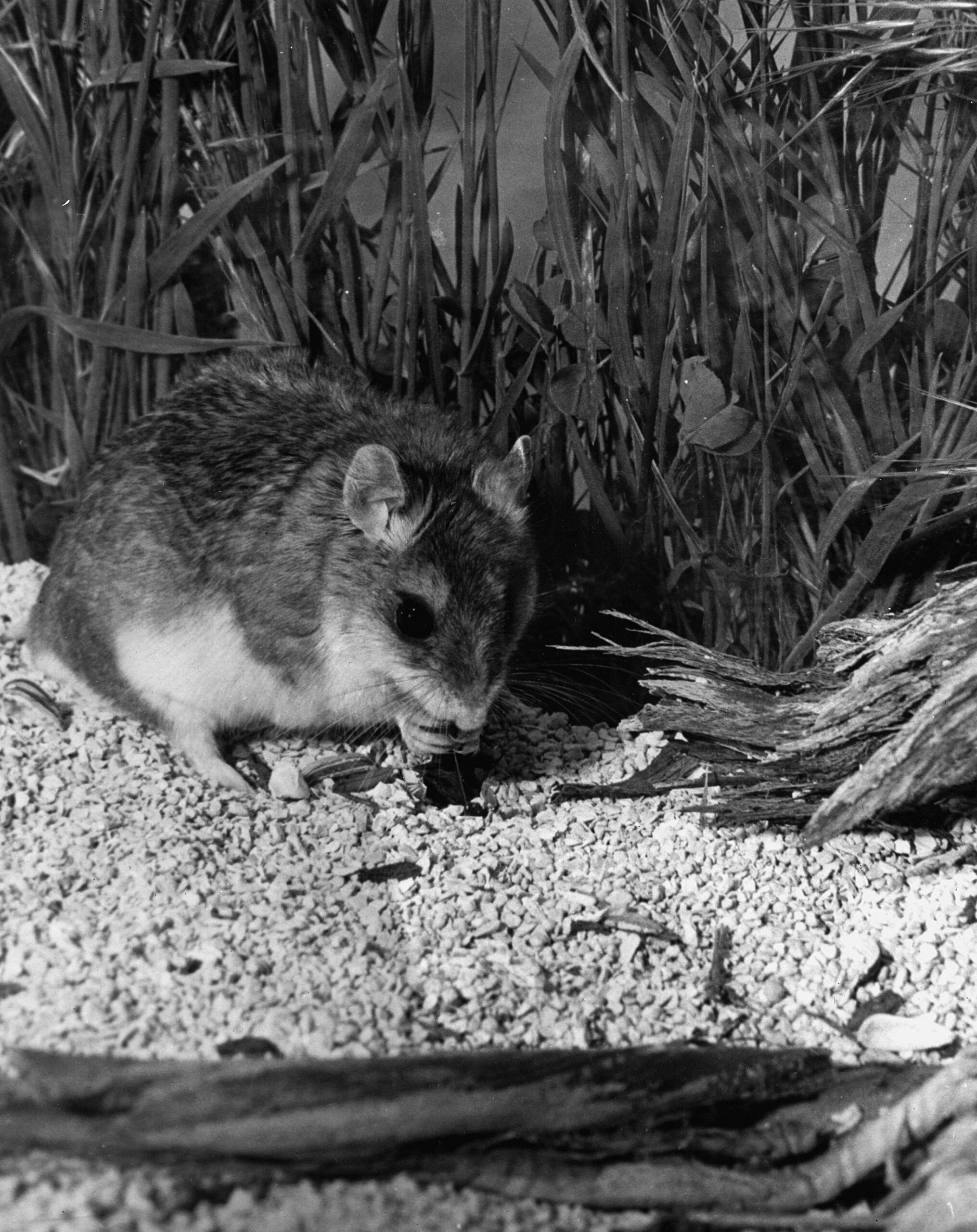
It starts with a sound that doesn’t belong in the night—a sharp, saw-edged scream that makes the desert go still for half a heartbeat. Not a bird, not a rabbit, nor even a grasshopper, not anything you’d expect from something so small. Then it comes skittering out of the shadows: the grasshopper mouse. Cute at a glance, sure—big eyes, soft fur, that tidy little face. But that’s the mask. Under it is a creature that’s too hungry, too carnivorous, and far too pleased with itself.
Grasshopper mouse – wikipedia
–
It moves like it owns the ground. Quick, confident, nose testing the smell like a bloodhound in miniature. Its hunger isn’t the mild, tidy kind. It’s the kind that looks for heat and motion. The type that makes it pause, head cocked, listening for a cricket’s scrape or a scorpion’s faint drag through sand. And when it hears it—when it knows—its whole body tightens like a spring.
Then it strikes. No dithering, no hesitation. It doesn’t “sample” prey; it takes it. A pounce, a bite, and those little jaws go to work with disturbing purpose. In the dark, it’s all business: pin, tear, chew. The desert is full of things that live on seeds and prudence, but this one lives on meat and nerve.
And that scream—lord, that scream. The grasshopper mouse tips its head back like it’s calling the night to order, and it lets loose again, a thin, triumphant howl scaled down to rodent size but carrying the attitude of something ten times larger. It doesn’t sound afraid. It sounds like a declaration. Like it’s telling every crawling thing in the sand: I’m here, and I’m hunting.
Too hungry. Too carnivorous. Too bold. It’s a pocket-sized outlaw of the desert, wearing a baby face and making a living the old-fashioned way—by taking what it wants and daring the world to argue about it.
It moves like it owns the ground. Quick, confident, nose testing the air like a bloodhound in miniature. Its hunger isn’t the mild, tidy kind. It’s the kind that looks for heat and motion. The kind that makes it pause, head cocked, listening for a cricket’s scrape or a scorpion’s faint drag through sand. And when it hears it—when it knows—its whole body tightens like a spring.
Then it strikes. No dithering, no hesitation. It doesn’t “sample” prey; it takes it. A pounce, a bite, and those little jaws go to work with unsettling purpose. In the dark, it’s all business: pin, tear, chew. The desert is full of things that live on seeds and caution, but this one lives on meat and nerve.
And that scream—lord, that scream. The grasshopper mouse tips its head back like it’s calling the night to order, and it lets loose again, a thin, triumphant howl scaled down to rodent size but carrying the attitude of something ten times larger. It doesn’t sound afraid. It sounds like a declaration. Like it’s telling every crawling thing in the sand: I’m here, and I’m hunting.
Too hungry. Too carnivorous. Too bold. It’s a pocket-sized outlaw of the desert, wearing a baby face and making a living the old-fashioned way—by taking what it wants and daring the world to argue about it.
A) The Mojave River spine (Colorado River → eastern Mojave springs → Mojave River corridor → Cajon Pass → San Bernardino/LA)
Mojave Indian Trail; Mojave River Trail; Mojave Road; Old Spanish Trail (where it drops into/uses Mojave River and related desert crossings); Beale’s Wagon Road (in its CA desert segment); Brown’s Toll Road (as the Cajon gateway upgrade); plus the generic “Wagon Roads” label when you’re talking about the 19th-century wagonable evolution of the same line.
The idea is simple: reliable water spacing and a workable pass dictated the alignment. The Mohave Trail conceptually underlies the later Mojave Road, and the NPS explicitly treats the Mojave Road through Mojave National Preserve as a branch of the Old Spanish National Historic Trail. Beale’s route description also ties his Mojave Desert segment to the Mojave Trail/Old Spanish Trail network, then notes the junction with the Mormon Road at the Mojave River. Brown’s Toll Road is best understood as “the Cajon Pass switch” that made the desert–coast connection more serviceable (toll/improvement era), not a whole new long-distance corridor by itself.
B) The LA ↔ Salt Lake “southern route” family (good-roads era branding laid over older travel)
Salt Lake Road; Old Spanish Trail (northern route pieces); Arrowhead Trails Highway; and again “Wagon Roads” as the pre-auto baseline.
This is the family that turns into the famous LA–Las Vegas–Salt Lake motor corridor in the auto-trails era. The BLM’s Arrowhead Trails Highway page is blunt about the lineage: the proposed/marketed auto route followed the late-19th-century “Old Mormon Road” and the earlier Old Spanish Trail. The Arrowhead Trail’s “association/branding layer” starts in 1916 (organized/incorporated that year) and is essentially a named-trail wrapper on that corridor.
C) “Good Roads” transcontinental overlays (names that often ride on top of existing roads, then feed into numbered highways)
National Old Trails; Midland Trail; Route 66 (as the numbered successor in the Southwest); and sometimes Arrowhead Trails Highway where it shares pavement with the NOTR in Southern California.
The key point: these aren’t necessarily new alignments end-to-end; they’re promotional/organizational systems that sign and improve what counties and states already had. FHWA and other summaries describe the National Old Trails Road Association as one of the early major named-trail movements (founded 1912). In the West, big stretches of the NOTR were later folded into US 66, which was established/commissioned in 1926 (signing followed). The Midland Trail is another early signed transcontinental auto trail (signed by 1913) that overlaps conceptually with the named-trails era rather than replacing everything on the ground.
D) The Sierra/Eastern Sierra north–south family (LA ↔ Mojave ↔ Owens Valley and beyond)
Sierra Highway / El Camino Sierra.
This one is its own long corridor family, and it intersects the desert east–west systems at junction towns rather than duplicating them. It’s commonly framed as an early 20th-century promoted route (established/advertised early, with later highway rebuilds) connecting Los Angeles into the Eastern Sierra.
E) The Tejon/Tehachapi gateway family (LA Basin ↔ San Joaquin Valley crossings)
Fort Tejon Road; Ridge Route.
Think “northbound exit from the LA Basin” rather than “Mojave crossing.” The Los Angeles–Fort Tejon Road is described as a successful wagon road solution over/near the Tehachapi barrier, completed in 1855. The Ridge Route is the early engineered state highway-era answer (opened 1915) that finally made that link paved and direct in the automobile age.
F) San Bernardino/San Gabriel mountain connectors (coast ↔ mountain communities, not trans-desert corridors)
Rim of the World Drive; Angeles Crest Scenic Drive (Angeles Crest Highway); Van Dusen Road.
These are “mountain access projects” more than “interregional desert crossings.” Rim of the World Drive is documented as opening in 1915 to connect San Bernardino with Big Bear through the range. Angeles Crest Highway construction begins in 1929 and the completed through-route opens much later (mid-20th century). Van Dusen Road sits here as an earlier wagon-road era Big Bear/Holcomb access line tied to the 1860–61 gold rush logistics (often described as a wagon road built in 1861).
West Side Road (Death Valley); Road to Panamint; Eichbaum’s Toll Road (same as “Eichbaum Toll Road”).
This family is its own ecosystem: borax-era freight roads, mining camp supply lines, then purpose-built access to resorts/tourism. NPS frames the borax era as transport over “primitive roads” (1883–1889). The Eichbaum Toll Road is well-documented as a 1925–26 build from near Darwin to Stovepipe Wells (i.e., a deliberate west-side entry improvement). “Road to Panamint” is best treated as the umbrella for the Panamint Valley/Skidoo/Rhyolite road-pushing phase in the 1906–1907 window and its successors; NPS history material and HAER/other documentation talk explicitly about wagon-road development and the Rhyolite–Skidoo road beginning in 1906 and being in use by 1907. West Side Road is the park backroad line on the valley floor’s west side (modern status aside), squarely in the “Death Valley internal access” bucket.
Heritage branding and administrative designations (late name layers) In the late 20th and 21st centuries, “historic” names often return as interpretive overlays: scenic byways, trail designations, monuments, and NRHP listings. These don’t always match the exact historic alignment, but they do become the public-facing name people repeat. (That’s not “wrong,” it’s just a different layer—commemoration rather than navigation.)
If you want a practical system for understanding Mojave pages, the old-fashioned way works best: treat names like strata. For any road/trail/place page, keep a short “Naming” paragraph that explicitly separates
(1) earliest known/traditional name, (2) Spanish/Mexican-era name if applicable, (3) wagon-era name, (4) auto-trail/highway-era name, (5) modern heritage/administrative name.
Then, when a reader asks, “Which is correct?” : “all of them—just not in the same decade, and not for the same user group.”
Look out the window: Mojave naming changes usually aren’t random—they’re the paper trail of who was moving (and why) at a given moment. When feet become wagons, wagons become cars, and cars become heritage tourism, the corridor stays put, but the name on the map keeps changing with the times.
The future of online history and AI will look a lot like what happened to printing presses, photo reproduction, and the web itself: a big drop in cost, a big jump in volume, and a new premium on credibility.
First, production becomes cheap and continuous. AI will make it normal for a historical “page” to behave less like a finished essay and more like a living dossier: timelines that auto-update when new primary sources appear, maps that can be re-layered (roads, water, settlement, ecology) on demand, and multiple reading modes (200 words for a roadside stop, 2,000 for the serious reader, full citations for the librarian). The winning sites will feel more like well-kept archives than blogs: structured entries, consistent metadata, and stable identifiers so that other people can link to the same “thing” rather than a shifting paragraph.
Second, the center of gravity shifts from writing to curation. When everyone can generate a plausible narrative, what matters is the chain of custody: “Where did this claim come from?” Expect online history to split into two tiers:
fast, synthetic summaries (useful, but assumed to be fallible), and
citation-forward, source-first history where the argument is less important than the evidence trail. In that second tier, the “product” isn’t just a story; it’s a neatly organized set of primary sources, transcriptions, georeferenced photos, and a transparent note about what’s uncertain.
Third, provenance and authenticity become non-negotiable. Deepfakes and fabricated “documents” will force better verification habits. You’ll see more of: hash-logged scans, photographed source context (cover pages, archive boxes, catalog records), and “claim cards” that separate (a) direct quotes, (b) paraphrase, (c) inference, and (d) tradition/hearsay. In practice, that’s how a good museum label already works—AI will just make the discipline necessary everywhere.
Fourth, local history gets a renaissance, but with new rules. Small communities will finally have the tools to build serious public-facing archives—oral histories, newspaper runs, cemetery records, land patents, route alignments—without needing a grant-sized budget. But the tradeoff is that communities will also be flooded with polished nonsense. The local historian’s role becomes more like an editor-at-large: verifying, annotating, and refusing to let the record become “whatever got shared most.”
Fifth, interfaces will get spatial and query-driven. The old “article page” won’t disappear, but it’ll be surrounded by tools: “show me every mention of this spring between 1844 and 1871,” “overlay these three route hypotheses,” “list all claims on this page with evidence strength: high/med/low,” “open the scans that support paragraph 4.” In other words: history as a navigable system, not a linear read.
Sixth, authorship changes, but it doesn’t vanish. The best work will still have a human voice and judgment—what to include, what to omit, what to call uncertain, what’s a plausible inference versus a reach. AI will draft and cross-link; humans will set standards, choose framing, and keep the tone honest. The premium will be on people who can do three things: (1) source criticism, (2) clear structure, (3) restraint.
Finally, expect new “trust signals.” Just as we learned to look for citations in Wikipedia or peer-reviewed journals, online history will develop its own visible credibility markers: version histories, audit trails, “last verified” dates for specific claims, and known-source badges (archive scans, government documents, reputable newspapers). Sites that adopt these early will age well; sites that don’t will feel like the early web—charming, but unreliable.
If you want a practical takeaway: the future belongs to online histories that treat AI like a typesetter and research assistant, not like an oracle. The winners will be the ones who make it easy for a reader to check the work.
Mono Lake, located near Lee Vining, is a unique and fascinating natural wonder in California. This saline soda lake is known for its mesmerizing tufa towers and limestone formations that rise from its surface. These towers, created over thousands of years by interacting freshwater springs and alkaline lake water, create a surreal and otherworldly landscape.
The lake itself covers an area of about 70 square miles and is an important habitat for a variety of plant and animal species. It is particularly famous for its abundant birdlife, including migratory birds such as Wilson’s phalarope and California gull. The lake’s brine shrimp and alkali flies attract many migratory birds, making it a birdwatcher’s paradise.
Visitors to Mono Lake can explore its beauty and learn about its unique ecosystem through various activities. One of the most popular activities is a scenic drive along the Mono Lake Scenic Area, which offers breathtaking views of the lake and its surroundings. Visitors can stop at several viewpoints and interpretive signs to learn about the lake’s geology, wildlife, and cultural history.
Guided tours are available for those looking to get a closer look at the Tufa Towers. These tours provide an opportunity to walk among the tufa formations and learn about their formation and significance. It is important to note that climbing on the tufa is strictly prohibited to preserve their delicate nature.
In addition to the lake itself, the town of Lee Vining offers a range of amenities for visitors. There are several lodging options, restaurants, and shops where visitors can relax and refuel after a day of exploring Mono Lake. The town also serves as a gateway to nearby attractions, such as Yosemite National Park and the Eastern Sierra Nevada mountains.
Overall, visiting Mono Lake and Lee Vining is necessary for nature lovers and those seeking a unique and awe-inspiring experience. Whether you are interested in the lake’s geological wonders, its diverse birdlife, or simply enjoying the tranquility of the surroundings, Mono Lake offers something for everyone. So, you can plan your visit and immerse yourself in the natural beauty of this extraordinary destination.
Rainbow Basin is a unique geological formation in the Mojave Desert in California, United States. Spanning over 1,800 acres, this breathtaking landscape is known for its vibrant colors and fascinating rock formations.
The basin gets its name from the colorful layers of sedimentary rock that are exposed on the surface, creating a stunning visual display. These layers were formed over millions of years due to various geological processes, including the deposition of sediments, erosion, and the uplifting of the Earth’s crust.
One of the main attractions of Rainbow Basin is its diverse range of colors. The rocks here display shades of red, orange, yellow, green, and purple, creating a natural rainbow-like effect. This vibrant palette results from the minerals in the rocks, such as iron oxides, manganese, and copper.
The unique rock formations in Rainbow Basin are also breathtaking. Their intricate shapes and patterns provide a fascinating glimpse into geological history.
Aside from its geological wonders, Rainbow Basin is also home to various plant and animal species. Desert vegetation thrives in this arid environment, with cacti, shrubs, and wildflowers dotting the landscape. Wildlife enthusiasts can spot animals like the desert tortoise, jackrabbits, and various bird species.
Exploring Rainbow Basin is a treat for outdoor enthusiasts and nature lovers. The area offers several hiking trails that allow visitors to immerse themselves in the desert’s beauty.
Visitors to Rainbow Basin should come prepared with water, sunscreen, and sturdy footwear, as the desert environment can be harsh. It is also important to respect the fragile ecosystem and follow any posted regulations to preserve this unique natural wonder.
In conclusion, Rainbow Basin is a mesmerizing destination showcasing nature’s wonders. With its vibrant colors, stunning rock formations, and diverse wildlife, it offers a truly unforgettable experience for those who venture into the Mojave Desert. Whether you are a geology enthusiast, a nature lover, or simply seeking a unique outdoor adventure, Rainbow Basin is a must-visit destination.
Willow Beach is a picturesque destination located on the shores of Lake Mojave. Situated in the Mojave Desert, this serene location offers visitors a tranquil escape from the hustle and bustle of everyday life.
One of the main attractions of Willow Beach is its stunning natural beauty. The crystal-clear waters of Lake Mojave provide the perfect backdrop for a variety of outdoor activities. Whether you’re interested in fishing, boating, or simply relaxing on the beach, you’ll find plenty to do in this idyllic setting.
Fishing enthusiasts will be delighted that Willow Beach is known for its excellent trout fishing. The lake’s stocked rainbow trout provide a thrilling challenge for anglers of all skill levels. With the picturesque surroundings and the thrill of the catch, fishing at Willow Beach is an experience like no other.
For those who prefer to explore the lake by boat, Willow Beach offers boat rentals and a marina. Whether you’re interested in cruising along the shoreline or venturing further into the lake, you’ll have the opportunity to take in the breathtaking views and maybe even spot some wildlife.
If you’re looking for a more leisurely experience, you can relax on the sandy shores of Willow Beach. The beach offers picnic tables and shaded areas, making it the perfect spot for a family outing or a romantic picnic by the lake.
In addition to its natural beauty, Willow Beach also offers amenities for visitors. There is a visitor center where you can learn more about the area and its history. Additionally, there are restroom facilities and a store where you can purchase fishing supplies, snacks, and souvenirs.
Willow Beach on Lake Mohave is a captivating destination offering visitors various activities and amenities. Whether you’re an avid angler, a boating enthusiast, or simply seeking a peaceful nature retreat, Willow Beach will surely leave you with lasting memories of its serene beauty.
From the revised Journals of Jedediah Smith edited by Walter Feller
About 18 miles from the first mentioned creek, we crossed another 80 yards wide in appearance like the first, and three miles further came to a farm. In this distance, we had passed many herds of cattle belonging to the residents of the Angel village and some thousands of wild horses. The wild horses sometimes become so abundant to eat the grass relatively clean.
My guide informed me that the village’s inhabitants and vicinity collect whenever they consider the country overstocked. They build a large and sturdy pen with a small entrance, and two wings extending from the access to the right and left. Then mounting their swiftest horses, they scour the country and surrounding large bands; they drive them into the enclosure by hundreds.
The California Method – Edward Vischer, 1874
They may lasso a few of the most handsome and take them out of the pack. A horse selected in this manner is immediately thrown down and altered, blindfolded, saddled, and haltered (for the Californians always commence with the halter). The horse can then get up, and a man is mounted. When he is firmly in his seat and the halter in his hand, an assistant takes off the blind the several men on horseback with handkerchiefs to frighten and some with whips to whip-raise the yell, and away they go. The poor horse, so severely punished and spooked, does not think of flouncing but dashes off at no slow rate for a trial of his speed. After running until he is exhausted and finds he cannot eliminate his enemies, he gives up.
He is tied for 2 or 3 days, saddled, and ridden occasionally. If he proves docile, he is bound by the neck to a tame horse until he becomes attached to the company, then let loose. But if a horse proves immediately refractory, they do not trouble themselves with him long but release him from his bondage by thrusting a knife to his heart.
Cruel as this fate may seem, it is a mercy compared to the hundreds left in the pack, for they die a most lingering and horrible death within a narrow space without the possibility of escape. Without a morsel to eat, they gradually lose their strength and sink to the ground making vain efforts to regain their feet, when at last, all-powerful hunger has left them, the strength to raise their heads from the dust, their eyes becoming dim with the approach of death, may catch a glimpse of green and widespread pastures and winding streams while they are perishing from want.
They die one by one, and at length, the last and strongest sinks down among his companions to the plain. No man of feeling can imagine such a scene without surprise, indignation, and pity. Indignation and wonder that men are so heartless and unfeeling. Pity for the noblest of animals dying from want amid fertile fields. A disgraceful fact to the Californians not credited to a single narrator but has been since corroborated.
The cultivation of alfalfa has become an important industry in this state and throughout the West. As San Bernardino County can claim the first successful culture of this plant in the United States, a brief outline of its history may not be out of place.
Lucerne Valley, Ca.
Alfalfa is the oldest grass known, having been introduced into Greece from Media, 500 years before Christ. The Romans, finding its qualities good, cultivated it extensively and carried it into France when Caesar reduced Gaul. It has always been extensively cultivated in Europe under the name of lucerne, supposed to be derived from the province of Lucerne in Switzerland. The name alfalfa was given to the plant in Chili, where it grows spontaneously in the Andes as well as on the pampas of that country and of the Argentine Republic.
Oro Grande, Ca.
It was introduced into the United States as early as 1835—and probably earlier—and attempts at cultivation in New York and other Eastern states were unsuccessful.
In the United States Agricultural Report for 1872, Mr. N. Wyckoff, of Yolo, Napa County, Cal, reports: “In the winter of 1854. I sowed four acres with alfalfa, or lucerne, as it was then called, seed brought from Chili. As far as I know, it was a part of the first parcel of seed brought into this country. My sowing proved so foul with weeds that I plowed it up and did not re-sow until 1864.” The United States Agricultural Report of 1878, a considerable production of alfalfa is reported from some of the northern counties of the state.
In the winter of 1852-3, a party of Mormons arrived in San Bernardino from Australia. At least one of the party, Mr. John Metcalf, brought with him some alfalfa seed. This was sown on his place, now the Metcalf place on Mount Vernon Avenue, near First street. It was irrigated from Lytle Creek and did well, and the plant was soon cultivated by others. The seed was at first sold for $1.00 per pound and was distributed from San Bernardino to other points in Southern California. The early supply of seeds for Los Angeles was obtained from San Bernardino and the seed was taken from here to Salt Lake thus the alfalfa industry, one of the most important in Utah, was started. The alfalfa crop is now one of the most important of the county and San Bernardino County had, in 1900, more than six thousand acres seeded to this plant.
INGERSOLL’S CENTURY ANNALS OF San Bernardino County 1769 to 1904 (201)
Over the sagebrush desert gray, Through alkali patches pale, It stretches away and away and away – The weary overland trail.
Where they who followed have smoothed the path For the track of the iron horse Between the rocks and around the hills It threads its sinuous course.
And ever the wagon tracks diverge, Like strands of a parted skein; And anon the old trail straightens out And gathers them again.
Eagle Butte
When bison fleeing the red man’s chase Stampeded the toiling train. And dust clouds rose as thundering herds Swept over the rolling plain.
These deep-worn ruts that divide the bank At this dry arroyo’s brink Still tell of the awful, maddening thirst Of the beasts that rushed to drink.
Wagon
Rushed down to drink, too oft, alas, To find but a bed of dust, Or, here and there, a sunken pool White with alkali crust.
And many a rock was an ambuscade That sheltered a skulking foe; And wild shrieks echoed the Indian yell, While men and women and children fell And arrows flew like snow.
Unnamed graves
And smoking heaps in the dawn-light gray Unfolded the tragic tale Of the wagon camp that was sacked and burned On the winding, windswept trail.
And many a ghastly heap of bones, Bleached white by the sun and wind, Is the final record of man or beast That faltered and fell behind.
Who runs may read, as he speeds along, Its record of blood and tears; May see dim specters wan and worn, The ghosts of the vanished years.
My heartbeats quicken, the trail grows dim, My eyes are blind with tears As | think with pity and pain and pride Of those daring pioneers.
And in fancy I see, as my palace winged Flies over the iron rail The long, slow-creeping, wagon train That traveled the overland trail.
Out where the handclasp’s a little stronger, Out where the smile dwells a little longer, That’s where the West begins; Out where the sun is a little brighter, Where the snows that fall are a trifle whiter, Where the bonds of home are a wee bit tighter, That’s where the West begins.
Out where the skies are a trifle bluer, Out where the friendship’s a little truer, That’s where the West begins; Out where a fresher breeze is blowing, Where there’s laughter in every streamlet flowing, Where there’s more of reaping and less of sowing, That’s where the West begins.
Out where the world is in the making, Where fewer hearts in despair are aching, That’s where the West begins. Where there’s more of singing and less of sighing, Where there’s more of giving and less of buying, And a man makes a friend without half trying— That’s where the West begins.
(Read by Judge Rex B. Goodcell at the dedication of Camp Cajon July 4, 1919, and by William M. Bristol at the dedication of Live Oak Park by the Chamber of Commerce of northern San Diego County, July 17, 1920.)
The Flag by Charles L. Frazer
Hats off, ye men! Now lift the flag on high: Break out its folds and let them proudly fly As from its staff on this our natal day There floats the banner none may take away.
Its streaming lines, its starry field of blue Are caught by winds that long have known them true: And rising, falling, with exquisite grace, They kiss each other in a fond embrace.
Flag of our own, we give thee to the breeze: Thrice hail on land, thrice hail on bounding seas: On armored deck, o’er valley, peak and crag. Wave on, and on, our own beloved flag!
Thrice-hallowed flag, one moment thou shalt be Half-masted for those Sons of Liberty Who, over seas or on the swelling flood Have re-baptized thee with a nation’s blood.
Our hero dead! No matter how they fell. In camp, at sea> on crimson fields of hell; They gave their all our pledged faith to keep, Tis ours to pay them homage as they sleep.
Courtesy Austin Daily Herald
Peace to their ashes; let us write each name In fadeless glory on the roll of fame: And unborn freemen shall their valor tell Soldier, and sailor, fare, O fare thee well! * * * *
Flag of the free, beloved on land and main. May treason never thy escutcheon stain; Defeat—the battle lost—were better far Than that dishonor dim one single star.
Aye, better that thy stars forever set; And God, and men» and angles thee forget. Than that thy name should ever used be To bind one shackle on humanity.
But thou, O flag, shalt not thine honor yield! Not by one thread, or star upon thy shield I Through calm and storm undaunted shalt thou ride. And all thy deathless principles abide.
Courtesy Santa Fe New Mexican
O, Thou Who boldest in Thy guilding hand ‘ The veiled future of this mighty land. Keep Thou our flag, and may it ever be Triumphant in the cause of liberty!
Then fly, proud flag, from thine exalted place; Shine on. ye stars, by God’s eternal grace! With faith undimmed we dedicate anew Ourselves to thee—the Red, the White, the Blue.
The following text has been adapted from a history of San Bernardino County by John Brown Jr. first published in 1922 describing the celebration of the opening of Camp Cajon.
The content has not been changed other than scan errors corrected and minor grammar changes to improve readability by modern standards.
On the north and east of San Bernardino Valley are the San Bernardino Mountains and beyond them the vast Mojave Desert. Through this high mountain range is a natural gap—a parting of the heights—a winding, tortuous passage, dividing the mountains and uniting the white sands on the north with the green lands of the south.
Looking south from the desert rim toward San Bernardino
This is Cajon Pass. Cajon—pronounced cah-hone with the second syllable strongly accented—is the Spanish word for “box.” Because a portion of the defile is walled by high cliffs, the early Spaniards christened a portion of it “Paso del Cajon”—Box Pass. Through this pass comes the National Old Trails Highway, now paved from San Bernardino to Summit, a distance of 26 miles. It parallels the long abandoned and almost obliterated Santa Fe Trail over which, in 1849, and in the early ’50s, the Pioneers came to lay the foundations for a Southland empire.
Bennett’s Long Camp – Death Valley National Park
At the point in the Pass where the old trail from Salt Lake joined the one from Santa Fe there stands a tall monument, erected in honor of those hardy adventurers. It was built in 1917 by the survivors of the Forty-Niners and their descendants and was dedicated on December 23 of the same year.
Santa Fe & Salt Lake Trail plaque
A short distance northward from the monument, and just 20 miles from San Bernardino is Camp Cajon, a welcome station for the incoming motor traveler, which an eastern writer has termed “California’s Granite Gate.” It, too, is a monument dedicated to the present and the future as the pioneers’ monument is to the past. Camp Cajon is the conception of William M. Bristol, orange grower, poet, and dreamer of Highland, 25 miles southeastward. Mr. Bristol first dreamed of his dream of Camp Cajon at the dedication of the Pioneers’ Monument.
Welcome to Camp Cajon
Thirty years before, Mrs. J. C. Davis, a Wisconsin woman, had spent a winter in California and returned home, wrote, and published a poem entitled “The Overland Trail,” a graphic pen picture of the old trail as seen from the windows of a modern Pullman car. Mr. Bristol was present at the dedication of the monument for the purpose of reading this poem as a part of the formal program. It is an interesting fact that Mrs. Davis had returned to California and was residing at Devore, at the southern portal of the Pass, Without knowing that she was to contribute in any way to the ceremonies of the day, she was taken into the Bristol family car and was present to hear her poem unexpectedly read nearly a third of a century after it was written.
At the close of the ceremonies, the throng adjourned to the willow grove, where Camp Cajon now stands, and, sitting on the sandy ground, at a picnic dinner, It was then and there that the need for permanent conveniences for such an occasion occurred to Mr. Bristol, and on that day he began the formulation of the plans for making his dream come true. In May 1919, he pitched his tent in the willow grove, then a jungle, intending to take a two months’ vacation from his orange grove, and build a dozen concrete dining tables, each with benches of the same massive and indestructible type. That was the extent of his original dream. But so enthusiastically was his innovation received by the world at large, and especially by Southern California, that his vacation was stretched to two years; and when he finally resigned as director and returned to his home, there were fifty-five tables instead of the dozen, besides numerous other structures not contemplated in the original plans. He was not only an architect but an artisan, much of the actual work of construction being done by himself, personally, the ornamental mosaics of dark and white stone and the hundred or more metal tablets on the tables and buildings being his own handiwork. A wealth of beautiful blue granite boulders near at hand inspired and aided in the building of various structures which promise to stand for all time.
Perhaps the most elaborate structure at the camp is the Elks’ outpost clubhouse, erected by all the Elks’ lodges of Southern California at a cost of several thousand dollars and dedicated to loyal Elks of the world. It affords conveniences for serving a meal to half a hundred people, and, standing and facing upon California’s most popular transcontinental highway, it also proclaims that the order stands ready to meet and greet all comers to the Southland. Across its face, in a beautiful mosaic of dark and white stone are the initials, “B. P. O. E.,” and above this in the same artistic stonework, is the Elks’ clock, with its hands pointing to the mystic hour of eleven. Below is a metal tablet carrying the entire text of -Arthur Chapman’s poem, “Out Where the West Begins.” Elsewhere is a double tablet carrying John S. McGroarty’s favorite poem, “Just California.” And on the camp, flag column is four stanzas of Charles L. Frazer’s poem. “The Flag.” Each table and stove, each broiler and barbecue pit carry a tablet with an inscription and the name of the donor.
Perhaps the spirit of Camp Cajon is best and most briefly expressed in two tablets that read. “To the desert-weary traveler,” and “To the stranger within our gates.”
The following is the list of tables, stoves, and so on, with donors and the main part of inscriptions:
Twenty miles to San Bernardino, the Gate City, and home of the National Orange Show.
Thirty miles to Redlands and famous Smily Heights.
Twenty-three miles to Colton, the Hub City, where industry reigns.
Twenty-five miles to East Highlands, the Buckle of the Citrus Belt.
Twenty-three miles to Highland, gateway to City Creek, and Rim of the World.
Thirty-five miles to Mirage Valley, where things grow without irrigation.
Twelve miles to Sheepcreek, a watered and fertile valley.
Ten miles to Baldy Mesa, where things grow without irrigation.
Forty-five miles to Chino, where everything grows.
Twenty-three miles north to Adelanto, the transformed desert.
Twenty miles to Apple Valley, where apples keep the doctor away.
Twenty-three miles to Lucerne Valley, a land of abundant shallow water.
Sixty-one miles to Barstow, the metropolis of Mojave Valley.
Seventy miles to Santa Ana, the county seat of Orange County.
At the south portal of Caion Pass, Devore, the home of the muscat grape.
Twenty miles to Del Rosa, beneath the Arrowhead.
Twenty miles to Arrowhead Hot Springs, the hottest springs known.
Twenty miles to Rialto’s orange grove.
Twenty-three miles to Fontana, the largest orange grove in the world.
Twenty-five miles to Bloomington, orange, and lemon empire.
Thirty-five miles to beautiful Etiwanda, home of the grape and the lemon.
Thirty-five miles to Cucamonga with its peaches, grapes, and “welcomes.”
Forty miles to Ontario, the model city. offers opportunity.
Thirty-five miles oceanward to Upland, and Euclid Avenue.
To all nature lovers, by the employees of the State Hospital at Patten.
Dedicated to checker players by the family of John Andreson, Sr., a pioneer of 1850. To the “Stranger within our gates,” by the family of David H. Wixom.
The “West to the East ever calls,” Hiram Clark and family.
Dedicated to the people of Needles by George E. Butler.
Dedicated to the people of Cloverdale, Michigan, by Mrs. Chas. H. Schaffer of Marquette, Mich.
To commemorate the visit of the Brooklyn Daily Eagle, dedication tour, April 28, 1920.
In honor of Fred T. Perris, who, in 1884, led the iron horse through Cajon Pass.
To the Pioneers of San Bernardino Valley, by Native Sons who have gone afield. (Judge B. F. Bledsoe, Paul Shoup, and others).
To our Pioneers, by Arrowhead Parlor, Native Sons.
To the Trailmakers, by officers and men of Santa Fe.
To Highway Builders, by officers and men of Santa Fe. Redlands Rotary Club, with Rotary emblem.
Riverside Rotary Club, with Rotary emblem.
San Bernardino Rotary Club, with double table, and international Rotary emblem.
“The groves were God’s first temples,” by W. M. Parker.
“Now good digestion wait on appetite, and health on both,” by A. C. Denman. Jr.
“To the desert-weary traveler,” by W. J. Hanford.
A bake-oven, dedicated to the baking public, by W. j. Hanford.
A family broiler, dedicated to the broiling public, by C. G. Lundholm.
A pump, dedicated to the “drinking public,” by W. D. Anderson. A community broiler, “Max Aron bids you broil your steak.”
A big range. Orange County.
One barbecue pit. dedicated to the “barbecuing public.” by W. J. Curtis, J. W. Curtis, Henry Goodcell, Rex B. Goodcell, Herman Harris, John Andreson, Jr. Joseph E. Rich, W. E. Leonard, E. E. Katz and Mrs. F. I. Towne.
Flag column, erected by the Native Sons of Illinois, as a tribute to the State of their adoption.
“I love you, California.” Column, its mosaics, and tablets, the handiwork of F. M. Bristol, contributed by him.
Flag pole, gift of J. B. Gill, formerly Lieutenant-governor of Illinois.
Large tablet carrying four stanzas, Chas. L. Frazer’s poem, “The Flag.”
Elevation 3,002 feet.
HISTORY OF SAN BERNARDINO AND RIVERSIDE COUNTIES by JOHN BROWN, Jr. Editor for San Bernardino County THE WESTERN HISTORICAL ASSOCIATION — 1922
Max Stroebel, who was to become known as the Father of Orange County, acting as agent for a syndicate bought 50,000 acres of land encompassing much of what makes Hesperia today. Purchasing the land was in anticipation of a railroad which was not to be for nearly 15 years, far too long for the investors. The land was sold at a loss and became the property of a German Temperance Colony.