Footpaths to Mule Trails

The transition from footpaths to mule trails marks an important phase in the evolution of human transportation networks, reflecting changes in societal needs, technological advancements, and the domestication of animals for labor and transport. This transition is characterized by the adaptation and enhancement of existing paths to accommodate animal pack trains, primarily mules, which could carry heavier loads than humans and travel longer distances more efficiently. Here’s an overview of this transformation:

Footpaths

  • Initial Use: Footpaths were primarily pedestrian pathways that connected early human settlements, water sources, hunting grounds, and other essential locations. They were narrow, following the natural contours of the landscape, and were often the result of many years of foot traffic compacting the soil.
  • Characteristics: These paths were generally suitable only for walking or for pack animals that could navigate narrow, uneven terrains, such as goats or small horses. The paths were maintained minimally by the communities they served, cleared of obstacles but not significantly modified or paved.

Transition to Mule Trails

  • Domestication and Use of Mules: The domestication of mules (a hybrid of a male donkey and a female horse) played a pivotal role in this transition. Mules combine the strength, endurance, and surefootedness of their parents, making them particularly suited for carrying loads over difficult terrains. Their ability to carry significant weight and traverse challenging paths made them invaluable for expanding trade and transportation.
  • Modification of Footpaths: To accommodate mules and their loads, footpaths had to be widened and sometimes reinforced. This meant clearing more vegetation, smoothing out steep or irregular sections, and sometimes reinforcing the path with stones or wood to make it more durable and less prone to erosion.
  • Infrastructure Development: Along these mule trails, infrastructure such as rest stops, water points, and in some cases, stabling facilities began to appear. These developments were especially common on routes that became major trade or pilgrimage paths, reflecting the increased traffic and the need for services catering to both the animals and their handlers.

Impact of the Transition

  • Economic and Social Expansion: The transformation of footpaths into mule trails facilitated trade and communication between distant regions. Mule trains could carry goods such as minerals, agricultural products, and manufactured items across mountains, deserts, and other challenging terrains, linking remote areas with major trade centers.
  • Cultural Exchange: As mule trails increased access to previously isolated regions, they also became conduits for cultural exchange, spreading ideas, religions, languages, and technologies.
  • Environmental and Landscape Changes: The expansion of mule trails had environmental impacts, including changes in landscape to accommodate these paths and the associated infrastructure. In some regions, this led to deforestation, soil erosion, and habitat disruption.

Conclusion

The transition from footpaths to mule trails illustrates a significant development in human mobility and economic activity, enabled by the domestication of animals and improvements in transportation infrastructure. This evolution from simple pedestrian paths to more complex transportation networks facilitated not only the exchange of goods but also ideas and cultures, playing a crucial role in the development of human societies. The legacy of these mule trails can still be seen today in some of the ancient trade routes and paths that have been preserved or adapted for modern use.
Game Trails to Footpaths

The transition from game trails to footpaths represents a fundamental shift in human mobility and landscape interaction, reflecting broader evolutionary changes in human societies. This transition is deeply intertwined with the development of human cultures, technologies, and the increasing impact of humans on the natural environment. Here’s an exploration of this transition:

Game Trails

  • Natural Origins: Game trails are created by the repeated movements of animals across the landscape. These paths are formed naturally as animals travel in search of food, water, shelter, or during migration. They typically follow the contours of the land, taking the path of least resistance to conserve energy.
  • Human Utilization: Early humans and their predecessors would have initially used these natural pathways for similar reasons as the animals did: to find food, water, and navigate through the landscape more efficiently. Following game trails would have also been a strategy for hunting, as these paths often led to areas frequented by game animals.

Transition to Footpaths

  • Early Human Modification: As humans began to establish more permanent settlements and engage in agricultural practices, the need for more defined and reliable pathways became evident. People started to modify and extend existing game trails to suit their specific needs, such as connecting settlements, fields, water sources, and areas of religious or social significance.
  • Development of Footpaths: These modifications involved clearing vegetation, removing obstacles, and marking paths more clearly. Over time, what began as simple trails widened and became more established through repeated use, evolving into footpaths that were intentionally maintained by human communities.
  • Cultural and Social Significance: Footpaths also began to hold cultural and social significance, connecting not just physical locations but also linking people, communities, and cultural sites. They became conduits for trade, communication, and cultural exchange, reflecting the social organization and technological capabilities of a society.

Factors Influencing the Transition

  • Technological Advances: The development of tools for clearing paths and constructing more durable walking surfaces (e.g., wooden walkways, stone pavements) facilitated this transition. Such technologies made travel easier and more accessible, encouraging the further development of footpaths.
  • Societal Changes: The shift from nomadic to sedentary lifestyles, the development of agriculture, and the rise of cities and trade networks all contributed to the transformation of game trails into more sophisticated footpaths and, eventually, into roads and highways.
  • Environmental Impact: This transition also reflects the growing impact of humans on the environment. As societies grew, so did their influence on the landscape, transforming natural paths into human-made infrastructure that catered to their evolving needs.

Conclusion

The transition from game trails to footpaths is emblematic of human ingenuity and adaptability, marking the beginning of a long history of environmental modification for transportation. This process was not uniform across all human societies but evolved in diverse ways depending on local environmental conditions, technological advancements, and societal needs. The development of footpaths from game trails is a key milestone in the history of human mobility, laying the groundwork for the complex network of roads and pathways that facilitate movement today.

Providence Mountains

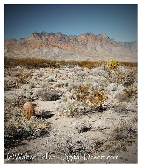
The Providence Mountains are a mountain range located in the eastern Mojave Desert of San Bernardino County, California, within the Mojave National Preserve. This range is known for its striking geological features, rich biodiversity, and historical significance. One of the highlights of the Providence Mountains is the Mitchell Caverns, part of the Providence Mountains State Recreation Area, which showcases fascinating limestone caves with various natural formations such as stalactites, stalagmites, and other speleothems.

Eastern face of Providence Mountains

Geologically, the Providence Mountains are part of the greater Basin and Range Province, characterized by their rugged, linear ranges and intervening valleys. They offer diverse habitats, from desert scrub at lower elevations to pinyon-juniper woodlands at higher altitudes, supporting a wide array of wildlife and plant species.

The area has a rich history, from Native American use to European exploration and mining in the 19th and 20th centuries. Indigenous peoples traversed the mountains and surrounding areas for thousands of years, and more recently, they were mined for silver, iron, and other minerals during the boom periods of the American West.

The Mojave National Preserve, where the Providence Mountains are located, provides opportunities for outdoor activities such as hiking, camping, wildlife viewing, and exploring the scenic beauty of the desert landscape. The preserve’s conservation and restoration efforts help protect this unique area’s natural and cultural resources for future generations.

Providence Mountains

Providence Mountains (Gold-Iron) The gold mines in the Providence Mountains that were first worked lay south of Foshay Pass, and were discovered as early as …

Gold and Iron in the Providence Mountains

California Ghost Town – Providence

Providence ghost town in the Mojave Preserve, California Mojave Desert.

Providence Mines

In the Trojan mining district of the Providence Mountains are located the properties of the Bonanza King Development Company of Los Angeles. This property …

Providence Mountains – Lanfair Valley: Mojave Desert Ecological …

Providence Mountains – Lanfair Valley · Lithology and Stratigraphy. The uplands in this subsection are mainly Mesozoic granitic, Tertiary volcanic, Paleozoic …

Providence Mountains Miners Run Off by Indians

For the period of the 1850s the records of mining activities on the Mojave Desert are very scant, as the prospectors were few and the work was on a minor scale.

Providence Mountains – Notes

Providence, East Mojave Desert Historical Sites

Along the steep slopes of the Providence Mountains, south of the Clark Mining District, parties of prospects from Ivanpah found extremely rich silver ore …

Providence Mountains Mining History

Stream Terraces and Older Surfaces – Mojave Preserve – California …

Note how little relief exists on this alluvial fan surface on the eastern flank of the Providence Mountains. Close-up view of a desert pavement. A close-up …

Crystal Spring, Desert Springs, California Mojave Desert

Mojave National Preserve

Located in southern California, the desert area is a land of mountain ranges, sand dunes, great mesas and extinct volcanoes. Mojave contains several diverse …

Mitchell Caverns

Located in the heart of the Providence Mountains State Recreation Area at an elevation of 4,300 feet are the Mitchell Caverns. … Mojave Geomorphic Province

California Ghost Town – Providence

Chemehuevi Indians of the Mojave Desert

The Chemehuevi territory lay off the lower Colorado River north and west toward Death Valley and west to about the Providence Mountains. A less populated …

Mitchell Caverns

by Robert M. Norris. Like most limestone caves in other parts of the world, the Providence Mountains caves seem to have had a two-stage history.

Life at Mitchell Caverns

Rock cabin. Living at the caverns was to be Jack and Ida’s second honeymoon. “Two Lovers Shipwrecked on a Deserted Island.” They would live in the desert …

Physiography – Mojave Preserve – California Mojave Desert

The Mojave Desert comprises the southwestern quadrant of the Basin and Range physiographic province, a vast region dominated by rugged mountain ranges and …

Piute Mountains Wilderness

Piute Mountains, Mojave Desert Wilderness. … Providence Mountains – Lanfair Valley, Piute Valley – Sacramento Mountains

Temple Bar

/lake-mead/ /temple-bar/


Temple Bar, located on the Arizona side of Lake Mead, has a rich history intertwined with the development and management of the Colorado River and the creation of Lake Mead itself. Lake Mead is a man-made reservoir formed by the Colorado River damming with the completion of the Hoover Dam in 1936. This dam was a monumental engineering project of its time, aimed at controlling floods, providing irrigation water, and generating hydroelectric power for the southwestern United States.

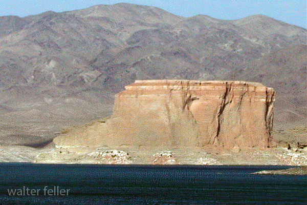
The Temple

The name “Temple Bar” predates Lake Mead and is believed to have been named after a rock formation in the area resembling a temple. As Lake Mead filled, Temple Bar became an important recreational area. It is one of the many sites around Lake Mead that offers access to the water for boating, fishing, and other water sports, along with facilities for camping and lodging.

Before Lake Mead flooded the area, the region was home to indigenous peoples who left behind petroglyphs and other archaeological sites for thousands of years. With the arrival of European settlers, the area saw various uses, including as part of trade routes, mining operations, and later, as recreational sites once the dam was completed.

The creation of Lake Mead and facilities like Temple Bar marked a significant change in how the American Southwest dealt with water, turning the arid region into a place where large-scale agriculture and urban centers could develop, thanks to the availability of controlled water resources. Over the decades, Lake Mead has become not just a utilitarian body of water but also a major recreational destination, drawing visitors worldwide.

Environmental changes and challenges have also affected Lake Mead and Temple Bar. Water levels in the lake have fluctuated significantly in recent years due to ongoing drought conditions, impacting the area’s ecology and the human activities that depend on the lake. These changes have spurred efforts to manage water resources more sustainably and to balance the needs of urban development, agriculture, and the natural environment in the Colorado River Basin.

The history of Temple Bar, like much of the region around Lake Mead, is a testament to human ingenuity and adaptation in the face of harsh environmental conditions. It reflects broader themes in American and environmental history, including the impact of human activities on natural landscapes and the ongoing challenges of managing water resources in the West.

Fremont’s Lost Cannon

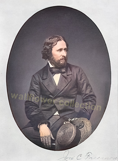
So, this story takes place north of the Mojave. However, it is still relevant to John C Fremont’s 1843-44 survey expedition of the Mojave Desert and how he lost a cannon.

“Fremont’s Lost Cannon” refers to a historical incident involving John C. Frémont, an American explorer, military officer, and politician. During one of his expeditions in the 19th century, specifically the third expedition (1845-1846) aimed at mapping and exploring the Western United States, John C. Frémont brought along a cannon for defense purposes. This expedition was crucial in the context of the U.S. expansion westward, including the period of the Mexican-American War.

The story goes that while traversing challenging terrains, including the Rocky Mountains and the Sierra Nevada, Frémont’s party faced significant difficulties. The terrain and conditions were so harsh that the expedition had to abandon the cannon in the snow to save themselves and their other supplies. This occurred as they attempted to cross the Sierra Nevada during the winter, which was an extraordinarily difficult and risky endeavor then.

The exact location where the cannon was abandoned has been a subject of speculation and interest among historians and treasure hunters. Some attempts have been made to find the lost cannon, but as far as public records indicate, it remains lost to history. The story of Fremont’s lost cannon is often cited as an example of the challenges faced by early explorers of the American West and the lengths to which they went in their efforts to map the continent and secure it for future American settlement.

–

John C. Frémont, known for his exploration and mapping of the American West, did not explicitly have permission from the U.S. government to take a cannon on his expeditions. His expeditions, particularly the one in 1845-1846 leading into the beginning of the Mexican-American War, were officially for the purpose of mapping and exploration. However, the political and military context of the time suggests that his actions were not entirely outside the interests of the U.S. government.

Frémont was a lieutenant in the U.S. Army, and his expeditions were funded and supported by the government, specifically by the Corps of Topographical Engineers. The third expedition, which is often associated with the story of the lost cannon, was aimed at mapping the Oregon Trail and further exploring the Great Basin and California, which were not yet part of the United States but were of significant interest due to the manifest destiny ideology and tensions with Mexico.

Although there might not have been explicit permission for using a cannon, the military nature of his role and the implicit support of expansionist elements within the U.S. government suggests that his actions, including arming his expedition, aligned with broader U.S. interests in the region. Using a cannon could be considered a precautionary measure for defense against potential threats, considering the hostile territories they were exploring and the uncertain political situation with Mexico at the time.

Frémont’s expeditions, especially the third one, played a significant role in the U.S. expansion westward, contributing to the outbreak of the Mexican-American War and the eventual annexation of California and other territories to the United States. The ambiguity around permission for the cannon reflects the complex mix of exploration, military reconnaissance, and political maneuvering characteristic of U.S. westward expansion during that period.

–

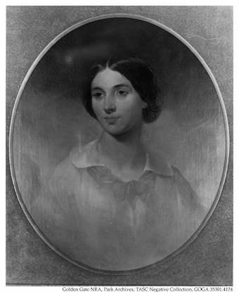
Jessie Benton Frémont, the wife of John C. Frémont, played a significant role in her husband’s expeditions, including the suggestion to take a cannon on his third expedition. Jessie was supportive of her husband’s ventures and actively involved in planning and advocating for his work. She was the daughter of Senator Thomas Hart Benton of Missouri, a prominent advocate of westward expansion, which likely influenced her interest and involvement in her husband’s exploratory missions.

Jessie Benton Frémont was known to be a strong and intelligent woman who understood the political and military implications of her husband’s expeditions. Her suggestion to take a cannon along on the expedition can be seen as a strategic move, understanding the potential for conflict and the need for protection in the uncharted territories they were to explore. The cannon symbolized both a means of defense and a statement of American power and intent in the face of foreign claims to the territories of the West, especially with tensions rising between the United States and Mexico over territories such as California.

Her involvement went beyond mere suggestions; Jessie was instrumental in editing and preparing Frémont’s reports and writings for publication, helping to shape the narrative of his expeditions and the image of the American West in the minds of the U.S. public and policymakers. These reports played a significant role in drumming up support for westward expansion and contributed to the mythology of the American frontier.

Jessie Benton Frémont’s suggestion to take a cannon underscores her understanding of the complexities of the expedition, not only in terms of exploration but also in the context of national ambition and security.

Loggerhead Shrike

/wildlife-birds/loggerhead-shrike.html

The Loggerhead Shrike, scientifically known as Lanius ludovicianus, is a fascinating and unique bird species, notable for its predatory habits despite its small size. It belongs to the shrike family, which is known for its members’ unusual behavior of impaling their prey on thorns, twigs, or barbed wire. This distinctive behavior has earned them the nickname “butcher birds.”

loggerhead shrike

Characteristics

  • Size and Appearance: The Loggerhead Shrike is a medium-sized bird measuring about 8 to 9 inches long. It has a distinctive black mask that extends across its eyes and forehead, a grey back, and a white underbelly. Its wings are black with white patches, and it has a relatively large head compared to its body size, which is where its name “loggerhead” comes from.
  • Diet: This bird is carnivorous, feeding on various prey, including insects, small mammals, birds, and reptiles. It lacks the strong talons of raptors, so it uses its hooked beak to kill and manipulate its prey.
  • Habitat: Loggerhead Shrikes are found across North America, particularly in open habitats such as grasslands, farmlands, and desert edges. They require environments with suitable perches for hunting and dense vegetation or other structures for impaling their prey.
  • Reproduction: They are monogamous birds that nest in trees or shrubs. The female typically lays 4 to 8 eggs, which both parents help to incubate. After hatching, the young are fed by both parents until they are ready to fledge.

Conservation Status

The Loggerhead Shrike is considered a species of conservation concern in many parts of its range due to habitat loss, pesticide use, and collisions with vehicles. Efforts are being made to monitor populations and conserve their habitats to help stabilize and increase their numbers.

Despite their fierce hunting habits, these birds play an important role in their ecosystems by controlling insect and small vertebrate populations. Understanding and conserving the Loggerhead Shrike and its habitat is vital for maintaining the balance of ecosystems where these unique birds live.

OpenAI. (2024). ChatGPT (4) [Large language model]. https://chat.openai.com

Integetron

/landers-ca/

This image has an empty alt attribute; its file name is 599-811-integetron-DSC_9567.jpg

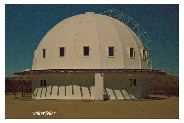
The Integratron is a unique and historic structure located in Landers, California, near Joshua Tree National Park. Designed by George Van Tassel, who was an aeronautical engineer, ufologist, and contactee, the Integratron is a 38-foot high, 55-foot diameter, all-wooden dome that was constructed without the use of nails to ensure a perfect acoustical environment. Van Tassel claimed that the Integratron was capable of rejuvenation, anti-gravity, and time travel and that its design was inspired by Moses’ Tabernacle and the work of Nikola Tesla. The building sits on a powerful geomagnetic vortex in the Mojave Desert, adding to its mystical appeal. Today, the Integratron is known for its “Sound Bath” experiences, offering visitors deep relaxation, rejuvenation, and introspection through the use of sound waves generated within the structure’s acoustically perfect dome​

Indian Cove

/joshua-tree/indian-cove/


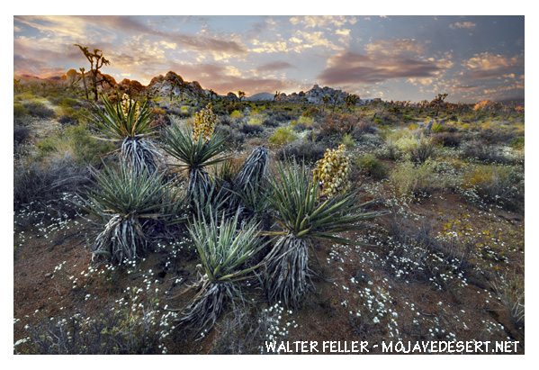
Indian Cove is a popular area within Joshua Tree National Park, known for its stunning rock formations, unique desert landscapes, and accessibility for camping and rock climbing. Located in the Mojave Desert of California, this area offers a different experience than the park’s main parts due to its unique geology and vegetation. Indian Cove is characterized by its towering rock walls, which make it a favorite spot for climbers of various skill levels.

The campground at Indian Cove is nestled among the massive boulders, providing a scenic backdrop for campers. It’s one of the few campgrounds in Joshua Tree National Park that can be reserved in advance, making it a convenient option for visitors planning their trip. The area also features several hiking trails, ranging from easy walks to more challenging hikes, allowing visitors to explore the desert landscape and wildlife.

Indian Cove is accessed from a road different from the main park entrances, located off Highway 62, which makes it somewhat separate from the rest of Joshua Tree National Park. This separation adds to its secluded and exclusive feel, although it is still part of the park and subject to the same rules and regulations.

Visitors to Indian Cove can enjoy the natural beauty and outdoor activities and the opportunity to experience the quiet and solitude of the desert. Nighttime brings clear, starry skies, making it an excellent location for stargazing.

To visit Indian Cove, it’s important to check the latest information on Joshua Tree National Park’s official website or contact the park directly for current conditions, campground availability, and any specific requirements or restrictions that may be in place.

Silver Queen – Mojave, CA

/mojave-ca/

Call NumberX-61476
CreditDenver Public Library Special Collections, [call number]
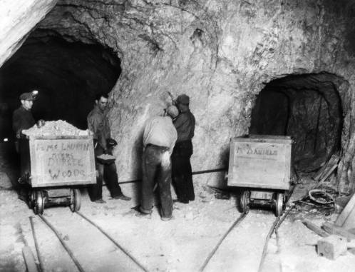
TitleSilver Queen Mine Mojave Calif.
Date1934 December 4
SummaryMiners, including Andrew Holmes, inspect a piece of ore in a tunnel of the Silver Queen Mine (a gold mine) near Mojave, California. Two mine cars that read: “R. L. McLaurin Myers Durkee Woods” and “M. Daniels” are nearby.
Format of Original Material1 photoprint ; 17 x 22 cm (7 x 8 1/2 in.)
Digital Version Created FromMax 1980.
Type of MaterialPhotographic prints; Black & white photographs
SubjectDump cars–Arizona–Mojave; Silver Queen Mine (Calif.); Gold mining–Arizona–Mojave; Interiors–Arizona–Mojave; Miners–Arizona–Mojave; Mining–Arizona–Mojave
Format-MediumPhotograph
Contact InformationSubmit questions about research and access to this material here: https://history.denverlibrary.org/contact-us. For questions about reproduction and use of this material visit: https://history.denverlibrary.org/image-pricing-and-sizes.
Digital Reproduction Available for Purchase?Yes
Related MaterialImage File: ZZR710061476
NotesTitle hand-written on back of print. Type-written label attached to back of print reads: “Associated Press Photo” and contains historical information. R7100614761
Corrections and SuggestionsIf you have a question or a correction regarding this resource, please contact us at history@denverlibrary.org

Erosion

Like in many desert environments, natural erosion in the Mojave Desert is a process influenced by a combination of factors, including wind, water, temperature fluctuations, and biological activity. These forces work together to shape the landscape over time, contributing to the unique features characteristic of the desert. Here’s an overview of how these factors contribute to natural erosion in the Mojave Desert:

  1. Wind Erosion: Wind is a significant agent of erosion in the Mojave Desert. Strong winds can pick up and transport sand and smaller particles in a process known as deflation, leaving behind larger rocks and creating features such as sand dunes and yardangs (streamlined rock formations carved by wind-blown sand). Wind erosion can also polish and shape rocks and landforms through a sand-blasting effect.
  2. Water Erosion: Although the Mojave Desert is known for its arid climate, it does experience occasional heavy rains and flash floods, especially during thunderstorms. These sudden downpours can rapidly erode the landscape, carving out gullies and washes and shaping canyons and valleys. Water erosion is particularly effective because the dry, compacted soil and sparse vegetation offer little resistance to the force of running water.
  3. Temperature Fluctuations: The Mojave Desert experiences extreme temperature variations between day and night, contributing to mechanical weathering, which breaks down rocks without chemical change. This occurs as minerals in the rocks expand and contract at different rates due to the temperature changes, leading to the formation of cracks and ultimately causing the rocks to break apart. Over time, this process further breaks down rock materials that can be more easily eroded by wind and water.
  4. Biological Activity: The activity of organisms, including plants, animals, and microorganisms, can also contribute to erosion in the Mojave Desert. For example, the roots of plants can grow into cracks in rocks, eventually prying them apart. Burrowing animals can move soil and rock, exposing new surfaces to erosion. Microbial and fungal activity can also chemically weather rock surfaces, making them more susceptible to erosion.
  5. Chemical Erosion: Although less visible, chemical weathering plays a role in shaping the Mojave Desert landscape. This involves the breakdown of rocks through chemical reactions, such as the dissolution of minerals by water. This process can be particularly evident in areas with saline soils and water sources, forming unique mineral deposits and features.

These natural erosion processes are slow and occur over long periods, gradually sculpting the desert’s landscape into its current form. The interaction of these factors creates a dynamic environment where landforms are continuously shaped and reshaped, contributing to the diverse and striking landscapes found in the Mojave Desert.

Casa Del Desierto

/casa-del-desierto/

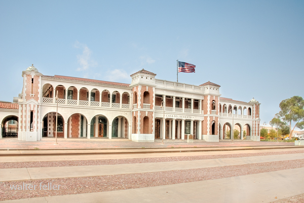
History of Casa del Desierto, Harvey House, Barstow, California

Casa del Desierto

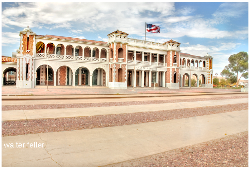
The Casa del Desierto in Barstow, California, is a significant landmark with a rich history, symbolizing the Harvey Houses’ bygone era. In partnership with the Santa Fe Railway, Fred Harvey established a chain of Harvey Houses along the railroad in the late 19th and early 20th centuries. These establishments provided high-quality food and lodging to travelers, revolutionizing railway dining and accommodation in the United States.

The Casa del Desierto, meaning “House of the Desert,” was built in 1911 and is one of the finest examples of the Harvey House establishments. Designed in the Spanish Colonial Revival style, it reflects the architectural elegance and grandeur intended to attract and serve passengers of the Santa Fe Railway. This particular Harvey House played a crucial role in the development of the American Southwest by providing a luxurious stopover for travelers traversing the vast and arid Mojave Desert.

Throughout its operational years, the Casa del Desierto served as a restaurant and hotel and housed the Barstow railroad depot, a Harvey Company retail store, and a telegraph office. It was a vital part of the community and a hub of activity, embodying the spirit of hospitality and the cultural exchange between the East and West.

However, with the decline of railway travel and the rise of automobile transportation, the demand for Harvey House services diminished. The Casa del Desierto closed its doors in the late 20th century and fell into disrepair. Recognizing its historical and architectural significance, efforts were made to preserve and restore the building.

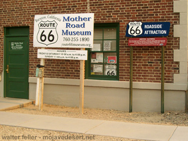
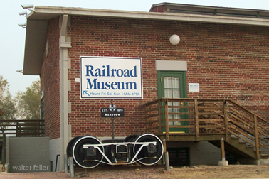
Today, the Casa del Desierto has been repurposed and houses the Barstow Area Chamber of Commerce, the Western America Railroad Museum, and the Route 66 “Mother Road” Museum. It stands as a testament to the vision of Fred Harvey and the importance of the Harvey Houses in American history. It is listed on the National Register of Historic Places, ensuring its preservation for future generations to appreciate the legacy of the Harvey Houses and their impact on travel and culture in the American Southwest.

Naming Phelan

/phelan-ca/

Phelan, California

A high desert community NW of San Bernardino. The area was known as Sheep Creek in the early 1900s ) and when the AFPO was filed on 2 May 1916, the name “Renfroe” was requested, allegedly to the surprise of natives who crossed it off the application and substituted Phelan. Phelan was for former San Francisco mayor James Phelan, and again, the locals claimed the name was “foisted” off on them against their wishes by the P.O.D. At any rate, the name was given the P.O. and remains the community name. Before the P.O. was established, mail was delivered from Victorville 3 times a week for five years by Isaac McAllister, who had homesteaded in 1915.

Postmaster Ruth McDaniel states the office had four different locations in and around the small town since 1916 and is presently located in a mall at 4184 Phelan Rd. It has over-flowed its building and has a permanent trailer for retail sales in front of the facility. The office has ten employees making 4,000 deliveries to an estimated patronage of 10,000.

From Postal History of San Bernardino County
by Lewis Garrett

Twentynine Palms

/twentynine-palms-ca/

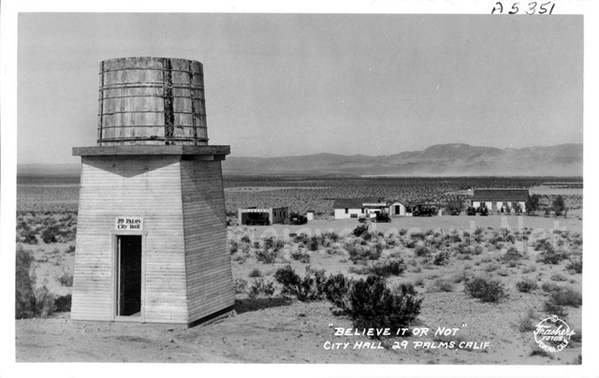
The name “Twentynine Palms,” referring to the city in California, indeed lacks a hyphen, which might seem unusual given the norm in English to hyphenate compound numbers from twenty-one through ninety-nine. The reason for this absence of a hyphen in “Twentynine Palms” is more historical and conventional than grammatical.

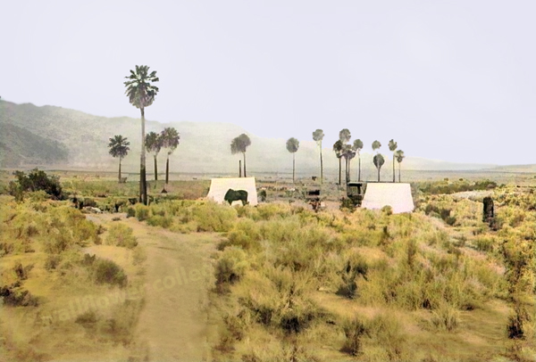
Oasis of Mara (colorized vintage photo)

The city’s name comes from the original designation of the area by the Oasis of Mara, where it was noted by early settlers or possibly by surveyors that there were twenty-nine palm trees at the site. This naming convention stuck, and the specific styling of “Twentynine” without a hyphen became the city’s official name. Over time, this styling was retained in official documents, signage, and local usage, making it the standard spelling.

In-place names, especially hyphens, can vary widely and are often dictated by tradition or local preference rather than strict grammatical rules. Once a name is established and recognized in official records, it tends to remain unchanged to preserve historical consistency and identity. This is why “Twentynine Palms” remains without a hyphen, reflecting its unique history and how it was originally named.

Building Randsburg

/randsburg-ca/

Randsburg, often called a “living ghost town,” is a unique and fascinating study in architectural resilience, adapting to both the harsh desert environment and the boom-and-bust cycles characteristic of mining towns. In the high desert of California, Randsburg’s architectural style reflects its history as a late 19th-century gold mining town that has managed to retain a small population even as its mining operations have largely ceased.

The architectural significance of Randsburg lies not just in the individual structures but in the town’s overall ability to maintain its historical character while adapting to modern needs. It serves as a case study in preserving historical architecture in challenging environments and economic conditions.

Randsburg’s architecture tells the story of its past, from the optimism of the gold rush era to the perseverance required to survive once the initial boom faded. The town’s ability to attract tourists and maintain a sense of community amidst its historic buildings is a testament to the enduring appeal of architectural heritage.

Randsburg’s architecture offers valuable insights into the life and times of a mining town that has weathered the ups and downs of fortune. Its buildings, both preserved and decaying, provide a tangible connection to the past. At the same time, the town’s ongoing adaptation speaks to the resilience of its community and the enduring relevance of its architectural legacy. Randsburg stands as a living ghost town where architecture plays a crucial role in keeping its history alive.

Route 66 – Bottle Tree Ranch

/route-66/bottle-ranch/

Elmer Long’s Bottle Tree Ranch is a unique outdoor art gallery on the historic Route 66 in Helendale, California. This folk art installation is a fascinating example of American roadside culture and creativity. Elmer Long began creating his Bottle Tree Ranch in the early 2000s, using bottles collected from his childhood adventures in the desert with his father. The ranch features hundreds of metal trees adorned with thousands of glass bottles and various found objects and antiques, creating a colorful and whimsical landscape.

Visitors to the Bottle Tree Ranch can wander through the forest of bottle trees, each clinking and clattering in the wind, creating a serene yet eerie musical symphony. The installation is not just a display of recycled art; it’s a personal history and homage to the spirit of exploration and beauty in discarded items. Each tree and item on the ranch tells a story, making it a poignant stop on the journey along Route 66.

Elmer Long’s Bottle Tree Ranch is a testament to the artist’s creativity and dedication to transforming everyday objects into something magical. It’s a must-see for travelers interested in folk art, Americana, and the history of Route 66. The ranch provides a unique photo opportunity and a chance to experience one of the most iconic and imaginative roadside attractions in the United States.

Boy in a Box

The “Boy in the Box” incident occurred in 1969 at Solar Ranch near Vidal, California. This case involved a six-year-old boy named Anthony Saul Gibbons, who was found sitting inside a six-foot by six-foot box with a chain padlocked to his left leg and attached to a heavy metal plate. This incident was connected to the Solar Lodge of the Ordo Templi Orientis, a magical organization established in 1965 in California. The lodge owned several businesses in Vidal, including a gas station with a cafe, motel, bar, house, and grocery store​​​​​​.

The case became infamous when it was revealed that the boy was mistreated by members of the lodge, leading to charges of child endangerment. It was alleged that the boy had been chained inside the box for 56 days; however, it was later clarified that he was only in the box for 10 hours. To avoid prosecution, several officers of the lodge fled California​.

/vidal-ca/

Sierra Highway

/road-trail/

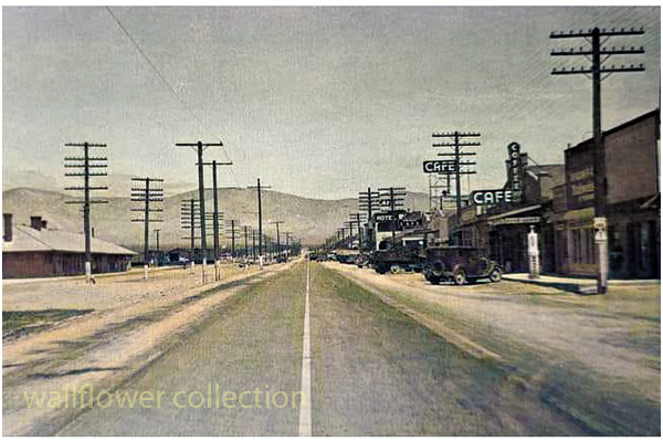
Looking north on the Sierra Highway from Mojave, Ca.

The Sierra Highway is a road in Southern California, United States, with a rich history. Here’s an overview:

  1. Early Beginnings: The history of the Sierra Highway can be traced back to the early 20th century. It was initially part of the state highway system established in 1910 under the State Route 4 designation. This route was part of the Midland Trail, a transcontinental route established in the early days of automobile travel.
  2. Ridge Route Connection: In the 1910s, the Sierra Highway was connected to the Ridge Route, a significant engineering achievement that connected Los Angeles to the San Joaquin Valley. This connection made the Sierra Highway a vital link in Southern California’s road network.
  3. U.S. Route 6: In 1937, the Sierra Highway became part of U.S. Route 6, a transcontinental highway that at one point stretched from Provincetown, Massachusetts, to Long Beach, California. This made it one of the longest highways in the United States.
  4. Changes and Decline in Importance: Completing the Interstate Highway System, particularly Interstate 5, led to a decline in the importance of the Sierra Highway as a major through route. Much of its role was supplanted by these newer, faster roadways.
  5. Modern Era: The Sierra Highway still exists today, but it functions more as a local road than a major thoroughfare. It passes through or near towns such as Santa Clarita, Palmdale, and Mojave, and it offers a scenic alternative to the faster interstate highways.
  6. Cultural Significance: Beyond its practical use, the Sierra Highway holds a place in California’s cultural and historical landscape. It represents an era of early automotive travel, the state’s infrastructure development, and Southern California’s growth.

The Sierra Highway, like many historic roads, tells a story of technological progress, changing transportation needs, and the development of communities along its path.

/historic-roads/

/historic-roads/el-camino-sierra/

/road-trail/highway-14.html

Braided Trails

Braided wagon trails become braided due to a variety of factors, primarily stemming from the behavior of the travelers and the physical environment they traverse. Here’s an overview of how this process occurs:
  1. Multiple Path Creation: Initially, a wagon trail starts as a single path. As more wagons follow the same route, the trail becomes more pronounced. However, when a part of the trail becomes difficult to traverse due to obstacles, mud, steep inclines, or other challenges, travelers may start to create alternate paths to bypass these difficult sections.
  2. Environmental Conditions: Factors like weather conditions (heavy rains creating mud, snow, etc.), natural obstacles (fallen trees, rockslides), or changes in the landscape (river course changes, growth of vegetation) can render parts of the original trail less passable. Wagon drivers then seek easier or safer routes, leading to the creation of parallel tracks.
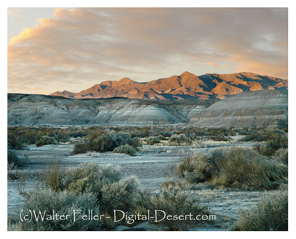
  3. Heavy Use and Erosion: With heavy use, the main trail can become deeply rutted and eroded, making it increasingly difficult for wagons to pass. This encourages travelers to forge new paths alongside the original one. Over time, with many wagons choosing different routes to avoid these ruts, a braided pattern of multiple trails emerges.
  4. Avoidance of Conflict or Danger: Sometimes, the creation of braided trails is also influenced by the travelers’ desire to avoid conflict with other groups or dangerous wildlife. This could lead to detours that contribute to the braiding.
  5. Search for Resources: In some cases, particularly during long journeys, wagons might veer off the main path in search of resources like water, grazing land for livestock, or better camping spots, which further contributes to the braiding of trails.
  6. Lack of Central Coordination: In many historical contexts, there was no central authority planning or maintaining these trails, so they evolved organically based on the immediate needs and decisions of the travelers.

This phenomenon was particularly notable in the era of westward expansion in the United States, where many trails, like portions of the Oregon Trail or the Santa Fe Trail, exhibited this braiding due to the heavy traffic of wagons over decades, all facing various environmental and practical challenges.

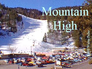
Mountain High North

Wrightwood Ski Resorts

Mountain High North, previously known as Ski Sunrise, is part of the Mountain High Resort in Wrightwood, California. This area of the resort has its own unique characteristics and offerings. Here’s an overview:

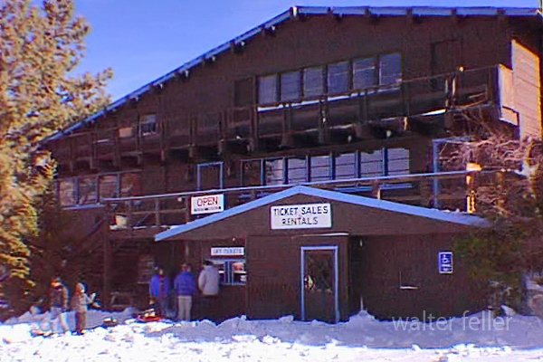
Ski Sunrise – 1996

Mountain High North, previously known as Ski Sunrise, is part of the Mountain High Resort in Wrightwood, California. This area of the resort has its own unique characteristics and offerings. Here’s an overview:

  1. Location and Terrain: Mountain High North is located in the San Gabriel Mountains near Wrightwood. The terrain at Mountain High North is generally known for being more beginner and family-friendly compared to the other areas of Mountain High. It’s an excellent place for those new to skiing or snowboarding.
  2. Integration and Development: Mountain High North was integrated into Mountain High Resort following the acquisition of the Ski Sunrise area. This integration expanded the overall capacity and variety of terrain offered by Mountain High, making it one of the largest ski resorts in Southern California.
  3. Facilities and Services: Mountain High North typically offers various services, including ski and snowboard lessons, equipment rentals, and food and beverage options. The facilities are designed to cater to families and beginners, focusing on creating a welcoming and accessible environment.
  4. Snow Play and Tubing: One of the unique features of Mountain High North is its emphasis on snow play and tubing. This makes it a popular destination for skiers and snowboarders, and those looking to enjoy the snow in other ways.
  5. Operating Schedule: Mountain High North sometimes has a different operating schedule than the West and East resorts, often opening later in the season and closing earlier. This is due to its specific focus and the varying snow conditions across the different areas of Mountain High.
  6. Events and Activities: Mountain High North hosts various events and activities throughout the season aimed at families and beginners. These can include special holiday events, beginner workshops, and family-friendly competitions.
  7. Contribution to Mountain High: The addition of the North resort has allowed Mountain High to offer a more diverse range of experiences to visitors. It complements the more advanced and diverse terrain in the West and East resorts, making the combined Mountain High Resort appealing to a wider range of winter sports enthusiasts.

Mountain High North, with its focus on beginner-friendly slopes, snow play, and tubing, plays a crucial role in the overall appeal of Mountain High Resort. It caters to a segment of visitors looking for a more relaxed, family-oriented snow experience in the proximity of Los Angeles.

Mountain High West

Wrightwood Ski Resorts

Blue Ridge (Mountain High West)

The Blue Ridge Ski Resort in Wrightwood, California, is a historical part of the region’s skiing heritage. However, it’s important to clarify that Blue Ridge Ski Resort is the former name of what is now known as the West Resort of Mountain High.

  1. Early Beginnings: Blue Ridge Ski Resort was among the earliest ski areas developed in the San Gabriel Mountains. Its origins trace back to the 1930s and 1940s when the potential for winter sports in the Wrightwood area was first realized.
  2. Development and Growth: The resort grew in popularity through the mid-20th century. The development of ski lifts and other infrastructure helped establish Blue Ridge as a notable destination for Southern California skiers.
  3. Transition to Mountain High: Blue Ridge Ski Resort evolved and expanded over time. It eventually became part of what is known today as Mountain High. This transition involved a change in name and significant upgrades in facilities and services. The West Resort of Mountain High, the direct successor of the original Blue Ridge Ski Resort, retains much of the historical charm and ski culture from its early days.
  4. Terrain and Features: The area that was once Blue Ridge and is now Mountain High West Resort is known for its varied terrain, catering to skiers and snowboarders of different skill levels. It features a mix of beginner, intermediate, and advanced runs.
  5. Modernization and Improvements: After becoming part of Mountain High, the former Blue Ridge Ski Resort saw substantial improvements, including the installation of more modern and efficient lifts, enhanced snowmaking capabilities, and the development of terrain parks.
  6. Cultural Impact: The history of Blue Ridge Ski Resort is deeply intertwined with the development of skiing culture in Southern California. It was crucial in introducing and popularizing winter sports to a region more commonly associated with beaches and sunshine.
  7. Legacy: Today, while the name Blue Ridge Ski Resort has faded into history, its legacy continues through the West Resort of Mountain High. It remains a testament to the early days of skiing in Southern California and the region’s growth in the sport.

This brief history highlights the transformation of Blue Ridge Ski Resort from its early days to its modern incarnation as part of Mountain High, underscoring its significance in the development of skiing in Southern California.

Mountain High East

Wrightwood Ski Resorts

Holiday Hill Ski Resort, located in the San Gabriel Mountains near Wrightwood, California, has a significant place in Southern California’s skiing history. While less known today, Holiday Hill played an important role in the region’s winter sports scene. Here’s a brief overview of its history:

  1. Early Beginnings: Holiday Hill Ski Resort started in the mid-20th century. It was part of the burgeoning ski industry in Southern California, which capitalized on the region’s mountainous terrain and winter snowfall.
  2. Location and Accessibility: Situated near the town of Wrightwood, Holiday Hill was easily accessible to the growing population of Southern California, especially those in the Los Angeles area. This accessibility contributed to its popularity as a ski destination.
  3. Facilities and Attractions: The resort offered skiing and snowboarding opportunities, with various slopes catering to different skill levels. It was known for its family-friendly atmosphere and was a popular choice for beginners and intermediate skiers.
  4. Transition and Development: Over the years, Holiday Hill underwent several changes, including ownership transitions and developments in its infrastructure. These changes were part of the broader evolution of the ski industry in Southern California.
  5. Integration into Mountain High: Eventually, Holiday Hill became part of the larger Mountain High resort. This integration was a significant step in consolidating the ski areas in the Wrightwood region. The once Holiday Hill area is now part of the expanded Mountain High complex, specifically the East Resort.
  6. Legacy and Modern Era: Today, the legacy of Holiday Hill lives on as part of Mountain High. The East Resort of Mountain High, which encompasses the former Holiday Hill area, continues to offer skiing and snowboarding, emphasizing varied terrain and scenic views.
  7. Cultural Impact: Holiday Hill contributed to the growth of the skiing culture in Southern California. It played a role in introducing many Southern Californians to winter sports and helped establish the region as a destination for skiing and snowboarding.

In summary, Holiday Hill Ski Resort was a key player in developing the skiing industry in Southern California. Its integration into Mountain High Resort has allowed its legacy to continue, contributing to the region’s rich history of winter sports.

Lake Cahuilla

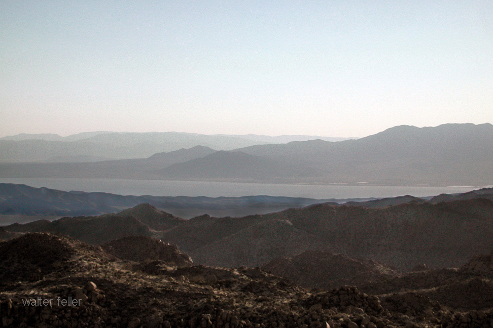
Ancient Lake Cahuilla, or Lake LeConte, was a prehistoric lake in California and northern Mexico. This lake was significantly larger than the current Salton Sea in the same region. It existed in the Salton Basin, a low-lying area of the Colorado Desert.

Salton Sea

The formation of Lake Cahuilla was due to the Colorado River changing its course at various times in history. The river flowed into the Salton Basin, creating a large freshwater lake. The size and existence of the lake fluctuated over centuries, depending on the river’s course and the climate.

Lake Cahuilla was significant in several ways:

  1. Ecological Impact: As a large freshwater lake, it supported a diverse ecosystem and was an important habitat for various species.
  2. Human History: The lake significantly influenced the indigenous peoples of the region. Tribes such as the Cahuilla, Quechan, Mohave, and others lived around its shores and relied on its resources for survival. The lake’s presence and subsequent disappearance influenced their cultural narratives and settlement patterns.
  3. Geological Interest: The rise and fall of Lake Cahuilla have been of interest to geologists and other scientists in understanding the region’s geological history and the behavior of the Colorado River.
  4. Archaeological Significance: The areas that were once under the lake have been rich in archaeological findings, providing insights into the life of the indigenous peoples who lived there.
  5. Influence on Modern Issues: The history of Lake Cahuilla has been studied in the context of understanding modern issues related to the Salton Sea, such as environmental and water management challenges.

The remnants of Lake Cahuilla, like beach ridges and other geological features, are still visible in the landscape, providing a glimpse into this prehistoric body of water’s vastness and significance.

Timeline for Lake Cahuilla

The timeline of Lake Cahuilla’s existence spans several thousand years, with filling and drying periods corresponding to changes in the course of the Colorado River and regional climate conditions. Here’s a general overview of its timeline:

  1. Early Formation (Prehistoric Times): The formation of Lake Cahuilla dates back to prehistoric times. It is believed to have formed and disappeared multiple times over several thousand years. The exact dates of these cycles are subject to ongoing research and interpretation.
  2. Evidence of Multiple Cycles (Several Thousand Years Ago): Geological and archaeological evidence suggests that Lake Cahuilla filled and dried up multiple times. These cycles were driven by the Colorado River’s changing course, alternating between flowing into the Gulf of California and the Salton Basin.
  3. Last High Stand (About 1300-1600 AD): One of Lake Cahuilla’s most recent and well-documented high stands occurred between 1300 and 1600 AD. This period is particularly interesting to archaeologists and historians as it coincides with the flourishing of indigenous cultures in the region.
  4. Final Drying (Around 1600 AD): The lake is believed to have dried up completely around 1600 AD, following the Colorado River reverting its course away from the Salton Basin and back towards the Gulf of California. The desert environment of the Salton Sea area as we know it today began to take shape after this event.
  5. Modern Times (20th Century Onwards): The current Salton Sea was created in the early 20th century due to accidental flooding from the Colorado River in part of ancient Lake Cahuilla’s basin. This event is unrelated to the natural cycles that created and dried up Lake Cahuilla but occurs in the same geographic region.

The timeline of Lake Cahuilla is a subject of ongoing scientific study, with new research continually refining our understanding of its history and the factors that influenced its formation and disappearance.

Mines in Joshua Tree National Park

Joshua Tree National Park

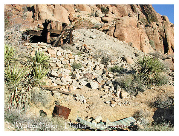
Eagle Cliff Mine

Mines in Joshua Tree National Park are remnants of the region’s rich mining history. During the late 19th and early 20th centuries, the area now Joshua Tree National Park saw a mining boom. Prospectors were drawn to this part of the California desert by the promise of gold, silver, copper, and other valuable minerals.

  1. History of Mining in the Area: The mining era in the region began in the 1800s and continued into the early 1900s. Miners established several small mines throughout the area, extracting various minerals. The most sought-after were gold and silver, but there were also operations for copper and other minerals.
  2. Impact on the Landscape: The mining activities left a significant mark on the landscape. You can find old mine shafts, ruins of miner’s cabins, and remnants of mining equipment scattered throughout the park. These historical artifacts provide a glimpse into the harsh conditions miners faced.
  3. Preservation and Safety: Many of these mines are now part of the cultural heritage protected within Joshua Tree National Park. However, they can be dangerous, with unstable shafts and toxic substances. Visitors are generally advised to admire them safely and not enter mine shafts or tunnels.
  4. Popular Mines to Visit: Some of the more well-known mines in the park include the Lost Horse Mine, one of the area’s most productive gold mines, and the Desert Queen Mine. These mines and others are accessible via hiking trails and are popular spots for visitors interested in the area’s history.
  5. Educational and Recreational Opportunities: The park offers educational programs about the area’s mining history, and many visitors enjoy hiking to these historical sites to learn about the past.
  6. Conservation Efforts: The National Park Service works to preserve these historical sites while ensuring visitors’ safety and the natural environment’s protection.

Thus, Joshua Tree National Park is a natural reserve and a historical archive of the American West’s mining era.

Overview of Mining

.

The Mastodon Mine

/mastodon-mine/

The Mastodon Mine in Joshua Tree National Park has history dates back to the early 20th century. In southeastern California, Joshua Tree National Park is renowned for its stunning desert landscapes, unique vegetation, and geological features.

Mastodon Mine

The Mastodon Mine was primarily a gold mine, reflecting the broader gold mining activity of the California Gold Rush era. However, it occurred later than the initial rush of 1849. Mining in this region was fueled by the discovery of gold and the potential for profitable mining operations.

The mine was established in the early 1900s. The Mastodon Mine was not one of the region’s largest or most productive mines during its operational years. Still, it was significant enough to draw workers and contribute to the local mining history. The miners would have used traditional hard-rock mining techniques to extract gold from the quartz veins in the area.

Over the years, the mine changed hands and eventually ceased operations. Like many abandoned mines, it was left with remnants of its mining past, including shafts, tunnels, and debris. These remnants are historical artifacts, providing insight into the mining techniques and life during that period.

In 1994, the area encompassing the Mastodon Mine became part of Joshua Tree National Park, established to protect the region’s unique desert ecosystem and cultural heritage. The National Park Service manages the site, balancing preserving historical resources with protecting the natural environment.

Today, the Mastodon Mine is a point of interest for Joshua Tree National Park visitors. It offers a glimpse into the area’s mining history, with trails leading to the mine site and interpretive signs providing information about its history and impact on the region.

As with many historical sites, the information about the Mastodon Mine is based on historical records, archaeological evidence, and ongoing research. The National Park Service and historians continue to study such sites to understand the region’s past better.

Joshua Tree National Park

Mines & Mills

Saltdale – Koehn Dry Lake

/a/trona/sd01.html

Koehn Lake and the nearby ghost town of Saltdale have a rich history intertwined with the salt industry in California. Koehn Lake, situated in the Fremont Valley of the Mojave Desert in eastern Kern County, California, is a dry and seasonally endorheic lake, occasionally becoming a closed basin without outflow. The lake is approximately 5 miles long and 3 miles wide at its widest point.

Saltdale, founded in 1915, owes its origins to the salt harvesting operations from Koehn Dry Lake. The town had a post office operating from 1916 to 1950. The history of salt production in the area began in earnest in 1914 with the operations of the Consolidated Salt Company. This was further expanded with the involvement of the Fremont Salt Company from 1919 to 1927, which also utilized solar evaporation of surface brine for salt production.

The salt industry in this region has undergone several changes in ownership and production methods over the years. In the early 20th century, salt production fluctuated considerably, largely dependent on rainfall and storm runoff to supply water for brine formation. Modern techniques involve pumping brine from wells and channeling it to ponds for evaporation, a process that takes about four months to form approximately 6 inches of salt.

Saltdale, during its peak, had a diverse community, including managers, skilled workers, and their families, as well as common laborers, often Latino Catholics. The town had facilities like a company store, a post office, a school, and a service station. Saltdale’s school, under the guidance of notable teachers, played a significant role in community life, including efforts towards “Americanization” by encouraging English language use and cultural integration.

However, Saltdale faced challenges due to its remote location and the fluctuations in the salt industry. The town experienced isolation, difficulties in accessing law enforcement and medical care, and was impacted by the economic conditions of the time, including the Great Depression.

The decline of Saltdale was marked by the eventual abandonment of the town by the 1970s. The salt operations also evolved, with less need for manpower due to modernization. Today, Saltdale stands as a ghost town, with the remnants of its past slowly eroding away in the salty landscape.

Koehn Lake, apart from its salt mining history, has also been used for various other purposes. At its northern end, there are evaporation ponds from the salt mining operation, and the rail siding at the former townsite of Saltdale has been used for offloading explosives. The area around the lake has also been used for testing by the Reaction Research Society and for a desert test track by Honda Motors. In 2014, it was notably the area where Virgin Galactic’s experimental spaceship disintegrated.

The history of Koehn Lake and Saltdale provides a unique glimpse into the industrial and community life of early 20th-century California, highlighting the challenges and adaptations of a community built around a natural resource.


Ashford Mill

/a/death-valley/ashfordmill/

Ashford Mill in Death Valley, located in California, has a fascinating history that dates back to the early 20th century. It was named after the Ashford brothers, who were prospectors in the area.

Ashford Mill – Death Valley National Park
  1. Discovery of Gold: The story of Ashford Mill begins with the discovery of gold in the Black Mountains of Death Valley. In 1907, two brothers, Harold and Erwin Ashford, staked claims in a canyon known as Golden Canyon.
  2. Operation of the Mill: The Ashford brothers lacked the experience and resources to develop the mine, so they leased it to a businessman, B.W. McCausland. McCausland recognized the need for a mill to process ore and built the Ashford Mill in 1914. The mill was constructed to process gold ore from the Golden Treasure Mine, located about five miles away in the Black Mountains.
  3. Technological Features: The mill was a typical representation of the ore-processing technology of its time. It included structures for crushing, mixing with chemicals, and separating gold from the ore.
  4. Short-Lived Success: Despite the investment in the mill and the initial enthusiasm, the operation was short-lived. The ore from the Golden Treasure Mine was of lower quality than expected, making the operation unprofitable.
  5. Abandonment: By 1915, just a year after its construction, the mill was abandoned as the dreams of profitable gold mining faded. The harsh conditions of Death Valley and the lack of substantial gold findings made it impractical to continue.
  6. Today: The ruins of Ashford Mill stand as a reminder of the brief gold rush in Death Valley. The site is preserved within Death Valley National Park. Visitors can see the remnants of the mill’s foundation and some of the walls, offering a glimpse into the early mining history of the region.

The history of Ashford Mill is a typical example of the boom-and-bust cycle that characterized many mining ventures in the American West during the late 19th and early 20th centuries. It reflects the optimism, hardships, and eventual disappointment those seeking fortune face in this harsh and unforgiving landscape.

/gold-mining/

/death-valley/

Ghost Stories & Legends

With its vast and rugged landscape, the Mojave Desert is steeped in legends and ghost stories passed down through generations. Here are some of the most famous ones:

  1. The Lost Ship of the Desert: One of the most enduring legends is that of a Spanish galleon laden with pearls and gold, which is said to have been stranded in the desert centuries ago. Over the years, many have searched for this lost ship, but it remains a tantalizing mystery, possibly just a mirage or a tale spun from the heat and isolation of the desert.
  2. The Ghosts of Calico: Once a thriving silver mining town, Calico is now a ghost town and tourist attraction. Visitors and employees have reported numerous ghost sightings, including that of a playful little girl, miners still panning for silver, and mysterious floating orbs.
  3. The Yucca Man: Similar to Bigfoot, the Yucca Man is a legendary creature said to roam the Mojave. Described as very tall and covered in hair, campers and hikers have reported this elusive being, though evidence of its existence is purely anecdotal.
  4. The Haunted Joshua Tree: The Joshua Tree National Park, part of the Mojave Desert, is home to many myths. One such story involves a specific Joshua tree said to be haunted by the spirit of a man who was hanged from its branches. Some claim to have seen his ghost wandering near the tree at night.
  5. The Cursed Gold of Pegleg Smith: This legend revolves around Thomas “Pegleg” Smith, a mountain man who allegedly discovered a huge black-coated gold nugget in the Mojave. He never found it again, and many treasure hunters have tried and failed to locate Pegleg’s lost gold, leading to speculations of a curse.
  6. The Char Man of San Bernardino: A lesser-known but chilling tale is that of the Char Man, a ghostly figure said to have been a fire victim. He is reputed to haunt the outskirts of San Bernardino, frightening unwary travelers with his burned and disfigured appearance.

These stories, whether based on fact or fiction, add a rich layer of mystery and intrigue to the Mojave Desert. They reflect the human fascination with the unknown and the allure of a beautiful and forbidding landscape.

Ghost Stories,Legends,Mojave Desert Myths,Haunted Places,Desert Ghosts,Paranormal Activity,Folklore,Desert Legends,Supernatural Tales,Haunted Sites,Mojave Mysteries,Historical Legends,Ghost Towns,Desert Spirits,Spooky Stories,Desert Lore

Covered Wagon (prairie schooner)

/wagons/

Covered wagons significantly impacted the United States’ westward expansion during the 18th and 19th centuries. These wagons, often called “prairie schooners,” were designed to transport goods and settlers across the North American continent.

Family & covered wagon (prairie schooner)

Key features and uses of covered wagons included:

  1. Design: Covered wagons typically had a wooden frame with a canvas cover. This cover protected the contents from weather elements like rain and sun. The wagon bed was usually made of wood and was about four feet wide by ten feet long.
  2. Cover: The cover was made of canvas or similar durable cloth, stretched over hooped frames, providing shelter and goods for the occupants.
  3. Wheels: The wheels were often large and designed to handle rough terrain. The front wheels were usually smaller than the rear wheels, allowing easier turning.
  4. Draft Animals: Oxen, mules, or horses were commonly used to pull these wagons. Oxen were preferred for their strength and endurance, especially over long distances.
  5. Role in Expansion: Covered wagons were essential for westward migration in the U.S. They carried settlers’ belongings, including tools, food, and sometimes even passengers. These wagons were a vital part of the movement to settle the American West and were commonly seen on trails like the Oregon Trail, the Santa Fe Trail, and the California Trail.
  6. Living Quarters: The covered wagon was a temporary home for many settlers traveling west. Families would cook, eat, sleep, and spend much of their time in or around the wagon during their journey.
  7. Historical Significance: The image of a covered wagon crossing the plains has become an iconic symbol of American frontier life, representing the pioneer spirit, exploration, and the challenges of frontier life.

The use of covered wagons declined with the advent of railroads, which offered a faster and more efficient means of transporting goods and people across the country. However, their legacy remains an integral part of American history and folklore.

Odometer

Are we there yet?

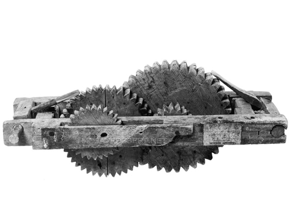
An odometer was an instrument used by American pioneers, particularly during the westward expansion in the 19th century, to measure the distance traveled. These devices were vital for journeys along routes like the Old Spanish Trail, as they helped travelers gauge their progress, estimate their arrival times, and manage their resources more effectively.

Wagon odometer – Courtesy LDS Church

The basic principle of the odometer dates back to ancient times, with variations used by the Romans and Chinese. However, the version used on covered wagons was adapted to the needs of the pioneers. It typically involved a mechanism that counted the revolutions of a wagon wheel. Since the wheel’s circumference was known, each revolution corresponded to a specific distance traveled. This count was then converted into miles or another distance unit and displayed.

This simple but effective device was crucial for pioneers who had to navigate vast, often unmarked territories. Knowing how far they had traveled, they could make informed decisions about when to rest, resupply, or seek shelter, especially as they faced the weather, terrain, and other uncertainties of frontier travel.

Borax Wagons

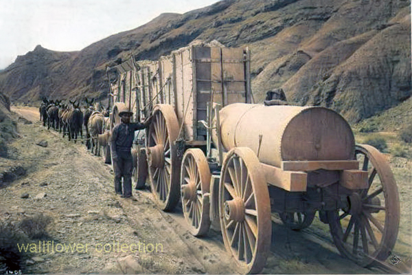
The 20-mule team borax ore wagons used in the late 1800s to transport borax from the mines in Death Valley, California, were quite large and had specific dimensions.

Here are the approximate dimensions for a typical 20-mule team borax ore wagon:

  1. Length: Approximately 30 feet (9 meters)
  2. Width: About 8 feet (2.4 meters)
  3. Height: Around 7 feet (2.1 meters)
  4. Weight: These wagons weighed approximately 7 tons when fully loaded with borax ore.

These massive wagons required a team of 18 mules and two horses to pull them across the harsh desert terrain. They were an iconic part of the borax mining industry in the late 19th century and were crucial in transporting borax to the nearest railroad for distribution.

  1. Two large ore wagons were used to transport the borax ore from the mines in Death Valley to the nearest railroad for shipment. They were massive and could carry a significant amount of borax.
  2. One water tank wagon: There was a specialized tank wagon in addition to the two ore wagons. This wagon carried water for the mules and horses that pulled the wagons. The desert environment of Death Valley was harsh, and providing water for the animals was crucial to their survival during the long and arduous journey.

So, the 20-mule team borax wagons actually consisted of 18 mules and 2 horses pulling two ore wagons and one water tank wagon. These wagons became an iconic symbol of the borax mining industry in the late 19th century.

Borax

20-Mule Teams

Harmony

The Mojave People

The Mojave Indians are a Native American tribe indigenous to the southwestern United States, primarily in the Mojave Desert region, which spans parts of California, Nevada, Arizona, and Utah. They have a rich ethnography and ethnohistory characterized by their unique cultural practices, social organization, and historical interactions with European settlers.

Here are some key aspects of the Mojave Indians’ ethnography and ethnohistory:

  1. Language and Culture: The Mojave people traditionally spoke the Mojave language, part of the Yuman language family. Their culture was closely tied to the natural environment of the Mojave Desert, and they had a deep knowledge of desert plants and animals. They practiced farming along the Colorado River and engaged in hunting and gathering.
  2. Social Organization: The Mojave society was organized into clans, and their social structure was matrilineal, meaning descent and inheritance were traced through the mother’s line. Clan membership played a significant role in their social and kinship systems.
  3. Religion and Spirituality: Mojave religious beliefs were centered around a complex system of spirits and deities associated with the natural world. The Colorado River played a significant role in their spiritual beliefs, and ceremonies often revolved around it. The Mojave Creation Story is an important part of their religious narrative.
  4. Contact with European Settlers: Like many Native American tribes, the Mojave people experienced significant changes with the arrival of European settlers. In the 19th century, they encountered Spanish explorers, Mexican settlers, and American pioneers. These encounters led to conflicts and changes in their way of life.
  5. Fort Mojave Reservation: In the 19th century, the Mojave people were relocated to the Fort Mojave Indian Reservation, which is located near Needles, California. The reservation is still home to many Mojave tribal members today.
  6. Contemporary Mojave: Today, the Mojave people continue to preserve and celebrate their cultural heritage. They have cultural centers and organizations that work to maintain their traditions, languages, and arts. The tribe also engages in economic development and land management on their reservation.

The ethnography and ethnohistory of the Mojave Indians provide valuable insights into the history and culture of this indigenous group in the American Southwest. Researchers and historians continue to study and document their traditions to preserve their cultural heritage for future generations.

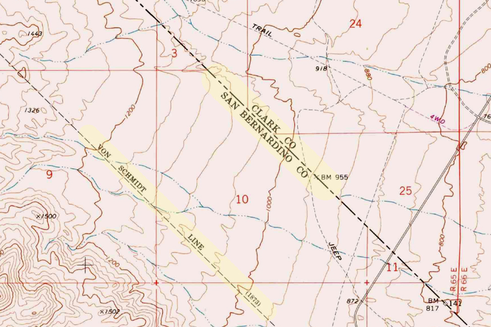
The Von Schmidt Boundary

(1873)

The Von Schmidt boundary, or the Schmidt Line, refers to a historical boundary line in California. It was surveyed and established by Alexey von Schmidt, a Russian engineer, in the 1860s. The purpose of the Von Schmidt boundary was to delineate the border between California and Nevada during a time when there was confusion and disputes over the exact location of the state boundary.

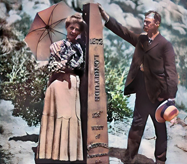
Von Schmidt’s survey helped clarify the boundary and resolve conflicts between California and Nevada. His efforts included placing markers and monuments along the boundary line to make it clear and permanent. The boundary he established still exists today and is the official border between the two states.

The Von Schmidt boundary is of historical significance and has been preserved as a reminder of the surveying and boundary disputes of the past. It is located in the eastern part of California near the Nevada border.

Why was the initial boundary incorrect?

The initial boundary between California and Nevada was incorrect and subject to disputes for several reasons:

  1. Lack of Accurate Surveys: In the early years of California’s statehood and during the Gold Rush era in the mid-19th century, limited resources and technology were available for accurate land surveys. As a result, the initial surveys and boundary markers were not precise.
  2. Rush for Mineral Resources: The discovery of gold and other valuable minerals in the region led to a rapid influx of settlers and miners. This rush created a need for clear land boundaries and property rights. However, the focus was often on extracting resources rather than conducting precise surveys.
  3. Overlapping Claims: Different parties, including miners, settlers, and land speculators, had conflicting claims to land in the region. These overlapping claims added to the confusion regarding the exact location of the state boundary.
  4. Political Disputes: California became a state in 1850, and shortly thereafter, disputes arose over its eastern boundary. Nevada was not established as a separate territory until 1861. Political disagreements and conflicting interpretations of earlier treaties and agreements existed during this period.
  5. Multiple Surveys: Various individuals and surveyors attempted to establish the boundary, but their surveys often differed. This further complicated matters.

Given these factors, there was much uncertainty and disagreement regarding the California-Nevada boundary in the early years. It was only through the efforts of surveyors like Alexey von Schmidt and subsequent legal and political resolutions that the boundary was eventually clarified and accepted. Von Schmidt’s survey work played a crucial role in resolving these disputes and establishing a more accurate boundary line.

Aurora

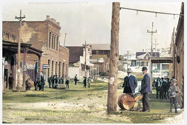
Aurora, Nevada 1910

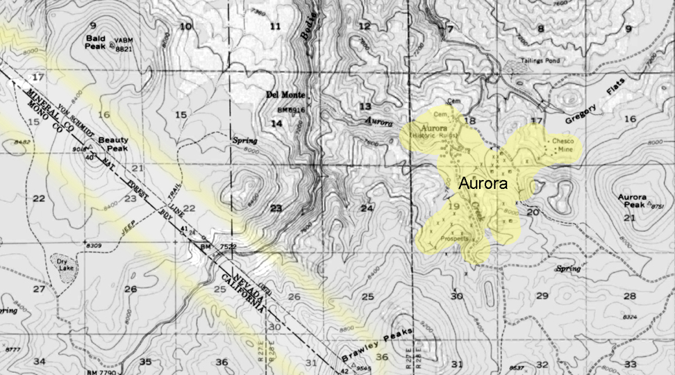
The town of Aurora, Nevada, experienced a move due in part to the boundary disputes between California and Nevada. Aurora was originally founded in the 1860s during the Nevada Silver Rush. At its founding, the exact location of the California-Nevada border was still uncertain and subject to disputes.

As a result of the boundary disputes and the fact that Aurora’s initial location was close to the border, there were concerns about which state’s jurisdiction the town fell under. Aurora’s residents and businesses moved the town slightly to the east, further into Nevada’s territory, to avoid potential legal and tax issues. This move ensured that Aurora would be firmly within the boundaries of Nevada when the border dispute was eventually resolved.

The relocation of Aurora was a strategic decision made to secure the town’s status as part of Nevada rather than California, given the uncertainties and conflicts related to the state boundary at the time. This move allowed Aurora to thrive as a mining town in Nevada without the legal complications associated with straddling the border.

Is everybody happy?

It’s difficult to determine whether “everybody” is happy, as people’s feelings and satisfaction with their circumstances can vary widely. Happiness is subjective and depends on individual experiences, perspectives, and circumstances.

In the context of the town of Aurora’s relocation due to boundary disputes, it’s possible that the decision to move was made to address specific legal and jurisdictional concerns at the time. The move may have been necessary for the town’s continued growth and prosperity. However, whether every resident or stakeholder was happy with the decision would depend on their perspectives and interests.

In any community or population, there will be a range of opinions and emotions regarding significant decisions like a town’s relocation. Some may have been happy with the move because it resolved legal uncertainties, while others may have been less pleased due to the disruption and changes associated with relocation.

To determine the current happiness or satisfaction of people in a specific context, it would be necessary to conduct surveys or interviews to gather their perspectives and opinions.

Shoshone/Tecopa

/shoshone-tecopa/

The history of the Tecopa and Shoshone area in California is closely tied to the region’s Native American heritage and the later development spurred by mining and tourism. Here’s a brief overview of the history of this area:

  1. Native American Presence: Before European and American settlement, the Tecopa and Shoshone region was inhabited by Native American tribes, including the Southern Paiute people. They had a rich cultural history and lived harmoniously with the desert environment.
  2. Mining Era: In the late 19th century, mining activities brought settlers to the area. Tecopa was named after a Paiute leader and became a mining town. Various minerals, including borax, were mined in the region. Mining operations attracted people looking for economic opportunities.
  3. Shoshone’s Beginnings: Shoshone, known as Metberry Springs, developed as a railroad station and water stop along the Tonopah and Tidewater Railroad in the early 20th century. The name was later changed to Shoshone.
  4. Water Resources: The presence of natural springs in the Shoshone area, including the famous Shoshone Springs, played a crucial role in attracting settlers and supporting mining and agricultural activities in the arid desert environment.
  5. Borax and Tourism: Borax mining was a significant industry in the area, and the famous Twenty Mule Team wagons transported borax from the region to the market. The Harmony Borax Works, located nearby, was a key mining operation. Additionally, the unique desert landscapes and proximity to Death Valley National Park began to draw tourists.
  6. Modern-Day Shoshone and Tecopa: Today, Shoshone and Tecopa are small communities that rely on tourism, agriculture, and the natural springs for their economy. They serve as gateways to Death Valley National Park, attracting visitors interested in exploring the desert’s unique beauty, geology, and history.
  7. Cultural and Historical Preservation: Efforts have been made to preserve the historical and cultural heritage of the Tecopa and Shoshone area. The Shoshone Museum, for example, provides insights into the region’s history.

Overall, the history of Tecopa and Shoshone, CA, reflects the area’s development from its Native American roots through mining and the growth of tourism, all while showcasing the rugged beauty of the Mojave Desert and its natural resources.

Rainbow Basin Geology

/rainbow-basin/

Rainbow Basin

Rainbow Basin is a geological formation in the Mojave Desert of California. It is known for its unique and colorful rock formations, which provide valuable insights into the region’s geological history. Here are some key aspects of the geology of Rainbow Basin:

  1. Sedimentary Rocks: Rainbow Basin primarily comprises sedimentary rocks accumulated over millions of years. These rocks include sandstones, shales, and mudstones. The different layers of sedimentary rocks represent different periods of geological history.
  2. Fossilized Marine Life: Within the sedimentary rocks of Rainbow Basin, fossils of marine life from the Miocene epoch (approximately 15-20 million years ago) have been found. These fossils include shells, bones, and other remnants of ancient sea creatures. This suggests that a shallow sea once covered the area.
  3. Faulting and Uplift: The geology of Rainbow Basin has been influenced by tectonic forces. The region is situated near the intersection of several fault lines, including the Garlock Fault. These fault movements have caused the uplift of the rocks, exposing them to erosion and creating the unique landscape seen today.
  4. Erosion and Weathering: Over time, erosion and weathering have shaped the colorful rock formations in Rainbow Basin. These processes have created intricate patterns and exposed layers of colored sediments, giving the area its name.
  5. Geological Time Scale: The rocks at Rainbow Basin span a significant portion of the geological time scale, providing geologists with valuable information about the changing environments and life forms that existed in the area millions of years ago.
  6. Geological Tours: Rainbow Basin is a popular destination for geological enthusiasts and tourists interested in its unique geology. There are guided tours and interpretive exhibits that provide insights into the geological history of the area.
Rainbow Basin photo
Rainbow Basin, Barstow, Ca.

In summary, Rainbow Basin is a geological wonder in the Mojave Desert, characterized by its sedimentary rocks, fossils, faulting, erosion, and vibrant colors. It offers a glimpse into the geological history of California and the forces that have shaped its landscape over millions of years.

/blog/mojave-desert-geology/

Barstow Railroad History

Barstow, California, has a rich history related to railroads. Here is an overview of the railroad history in Barstow:

Harvey House – Casa Del Desierto
  1. Early Railroad Development: Barstow’s history as a railroad town dates back to the late 19th century when the Atchison, Topeka, and Santa Fe Railway (AT&SF) and the Southern Pacific Railroad (SP) played significant roles in its development. The AT&SF arrived in Barstow in 1883, and the SP followed shortly after.
  2. Railroad Facilities: Barstow became a strategic location for both railroads due to its position as a junction point. It was a division point on the AT&SF line, meaning it had extensive locomotive maintenance and repair facilities. Additionally, it served as a crew change and refueling station.
  3. Harvey House: The historic Casa del Desierto, also known as the Harvey House, was a prominent feature of the Barstow railroad history. It was a luxurious hotel and restaurant built by the Fred Harvey Company in 1911 to serve passengers traveling on the AT&SF railway. The Harvey House has been beautifully restored and now houses a museum.
  4. Railroad Growth: Barstow continued growing as a railroad town over the years. It had a large rail yard, roundhouse, and various support facilities to handle the extensive railroad traffic passing through the area.
  5. Importance as a Railroad Junction: Barstow’s strategic location made it a crucial junction for freight and passenger trains. It was a hub for transferring goods and passengers between different rail lines, making it a bustling activity center.
  6. Modern Times: While the significance of railroads has declined in recent years, Barstow still maintains its historical ties to the railroad industry. The Barstow Rail Museum and the Harvey House Museum are popular attractions for visitors interested in learning about the town’s railroad history.

Barstow’s history as a railroad town is an integral part of its identity, and the legacy of the railroads can still be seen and appreciated in the town today.

Barstow Area Mining

The history of mining in the Barstow area is closely tied to the extraction of various minerals and resources that played a significant role in the development of Southern California. Here’s a more detailed look at the history of mining in the Barstow area:

  1. Borax Mining: Borax mining was one of the earliest mining activities in the Barstow region. In the late 19th century, borax deposits, a valuable industrial mineral used in various applications, were discovered in the nearby Calico Mountains. The Pacific Coast Borax Company, owned by Francis Marion “Borax” Smith, was instrumental in developing borax mines in the area. This marked the beginning of significant mining operations in the region, with borax being a primary focus.
  2. Calico Mining District: The Calico Mining District, which includes the town of Calico, was a major center of mining activity in the Barstow area. Silver and silver-lead ores were the primary resources mined in this district. At its peak in the late 1800s, Calico had a population of over 3,000 people and was a bustling mining town.
  3. Calico Ghost Town: Calico, often referred to as Calico Ghost Town today, was once a thriving mining town. It featured numerous mines, including the Bismarck, Silver King, and Oriental Mines. Visitors to Calico can explore the well-preserved historic buildings, mines, and artifacts, gaining insight into the region’s mining history.
  4. Railroad Transportation: The expansion of railroads played a crucial role in facilitating the transportation of mined materials from the Barstow area to other parts of California and beyond. The Atchison, Topeka, and Santa Fe Railway was a key transportation link for the mining industry, enabling the efficient movement of ores and minerals.
  5. Variety of Minerals: While borax, silver, and silver-lead ores were among the most significant resources mined in the Barstow area, various other minerals were also extracted. These included gypsum, limestone, and barite. These minerals had industrial applications and were important for construction and manufacturing.
  6. Decline of Mining: As the easily accessible mineral deposits were depleted, mining activities in the Barstow area began to decline. Many mines were abandoned, and mining communities saw a decrease in population. The shift in economic focus led to the decline of mining as a major industry in the region.

Today, the mining history of the Barstow area is preserved through places like Calico Ghost Town, museums, and historical sites. These serve as reminders of the pioneering spirit of early miners and the role mining played in shaping the history of Barstow and the surrounding region.

Barstow Mining,Mojave Desert Mining,Mining History,Barstow Area Mines,Mojave Desert Geology,Mining Towns,Historic Mining Sites,California Mining History,Barstow Geology,Old Mines in Barstow,Desert Mining Operations,Gold Mining,Silver Mining,Mining Artifacts,Barstow Natural History,Mining Camps,Mineral Exploration,Abandoned Mines,Mining Technology,Mojave Desert Resources

The Curse of Bodie

/bodie-ghost-town/

The Curse of Bodie is a legend that suggests the town of Bodie, particularly its well-preserved buildings and artifacts, is cursed. This legend is not uncommon in ghost towns and adds to the town’s mystique. Here are the key elements of the Curse of Bodie legend:

  1. Taking Artifacts: According to the legend, the curse affects those who take artifacts, items, or souvenirs from Bodie Ghost Town without proper permission. This includes visitors who remove historical objects from the town as keepsakes.
  2. Misfortune and Bad Luck: Those who are believed to have taken items from Bodie may experience a series of misfortunes and bad luck in their lives. The curse brings financial troubles, health problems, or other unfortunate circumstances to those who have taken something from the town.
  3. Returning Stolen Items: Some versions of the legend suggest that the curse can be lifted or mitigated by returning the stolen item to Bodie. Restoring the item to its rightful place is believed to break the curse and avoid further misfortune.
  4. Mail-Back Items: Over the years, there have been reports of people mailing stolen artifacts or items back to Bodie, accompanied by letters expressing remorse for taking them and hoping to undo the curse. These returned items are often referred to as “Ghost Town Mail.”
  5. Warnings and Signs: Bodie’s visitor center and park rangers often display warnings and signs advising visitors not to take anything from the town, emphasizing the belief in the curse and the importance of preserving the site’s historical integrity.
  6. Cultural Preservation: The legend of the curse serves as a reminder of the importance of preserving historical and cultural heritage. It encourages responsible tourism and respect for the historical significance of Bodie Ghost Town.

It’s important to note that the Curse of Bodie is part of the folklore and mystique surrounding the town, and there is no scientific evidence to confirm the existence of such a curse. Nevertheless, the legend has become a cultural phenomenon associated with Bodie, and many visitors are aware of it. As a result, most people who visit Bodie today respect its historical artifacts and refrain from taking items as souvenirs, contributing to the ongoing preservation of the site.

/bodie-ghost-town/