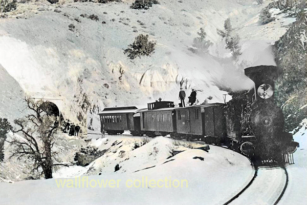
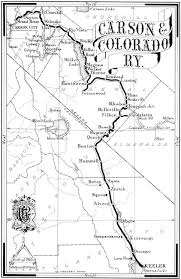
The Carson and Colorado Railway, initially incorporated on May 10, 1880, was a critical artery in the economic development of Nevada and Eastern California. Running approximately 300 miles from Mound House, Nevada, to Keeler, California, this narrow-gauge railway navigated some of the region’s most challenging terrains, including the formidable 7,100-foot-high Montgomery Pass.
Carson & Colorado at Mt. Montgomery Pass – 1882
Early Days and Expansion
Construction of the railway began swiftly after its incorporation, aiming to connect the isolated mining and agricultural communities along its route. Operations commenced on August 1, 1883, with the railway serving as a vital transport link for ore, goods, and passengers. The line initially facilitated the economic boom in mining areas, particularly with the discovery of silver and gold in Tonopah and Goldfield, Nevada.
Technical Specifications
The railway was built as a narrow gauge (3 feet or 914 mm), which was more economical and could handle the sharp curves and steep grades of the mountainous regions better than standard gauges. It used a variety of steam locomotives suitable for the narrow gauge and the challenging conditions of the route. These trains were crucial for transporting diverse freight, including timber, livestock, and minerals, and also provided passenger services essential for local populations’ mobility.
Strategic Reorganizations
In 1892, the railway was reorganized as the Carson and Colorado Railway. In 1900, it was sold to the Southern Pacific Company, marking a significant transition in its operations. This acquisition integrated the Carson and Colorado into a larger railway network, enhancing its operational capacity through better resources and management. The northern section from Mound House to Mina was converted to standard gauge in 1905, facilitating direct interchange with other lines and improving logistical efficiency.
Decline and Legacy
Despite its importance, the railway’s relevance waned with the rise of automobiles and improved road networks. The railway began phasing out operations, with parts of the line abandoned in the 1930s and 1940s. The last train ran on April 29, 1960, and the tracks were removed in January 1961.
Today, the legacy of the Carson and Colorado Railway is preserved in museums and historical sites along the former route. These sites celebrate its role in the development of the American West, particularly in how it supported remote communities and contributed to the region’s economic dynamism.
Community Impact
The presence of the railway significantly shaped communities like Mound House, Hawthorne, Bishop, and Laws. The railway not only supported local economies but also fostered their growth by connecting them to larger markets and other parts of the country. The connection at Mound House with the Virginia and Truckee Railroad was particularly crucial, enhancing the flow of goods and ores from Nevada’s mining districts to broader markets.
The Carson and Colorado Railway remains a topic of interest for historians and railway enthusiasts. It symbolizes the challenges and triumphs of maintaining railway service in one of America’s most rugged landscapes.
This article provides a comprehensive look at the historical and technical aspects of the Carson and Colorado Railway, illustrating its importance in the development and eventual decline of regional rail transport in the American West.
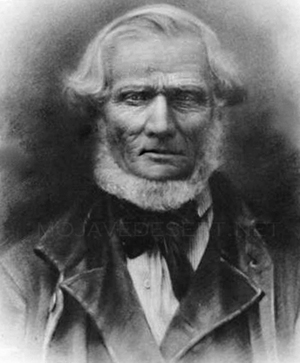
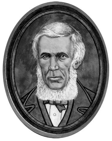
Jefferson Hunt was a significant figure in the history of the American West, particularly in the Mojave Desert. Born in 1803, Hunt was a captain in the Mormon Battalion during the Mexican-American War and later played a crucial role as a pioneer and explorer.
Key Contributions:
Mormon Battalion: As a captain in the Mormon Battalion, Hunt led his men on one of the longest infantry marches in U.S. history, from Council Bluffs, Iowa, to San Diego, California. This journey helped to open up the Southern Route, which passed through the Mojave Desert.
Guide and Explorer: Hunt became a prominent guide and explorer in the Southwest after his military service. He was instrumental in establishing and improving overland trails. His deep knowledge of the terrain and survival skills made him a valuable leader for settlers moving west.
California Legislature: Hunt served as a representative in the first California Legislature from 1850 to 1851. During his term, he advocated for the interests of settlers and worked on development policies that affected the Mojave Desert region.
Settlements and Communities: Jefferson Hunt founded several communities, notably contributing to the Mormon colonization of San Bernardino in California. His efforts helped establish vital supply routes and settlements that facilitated further migration and trade.
Jefferson Hunt’s contributions to the development and exploration of the Mojave Desert are a testament to his leadership and pioneering spirit. His work helped to shape the patterns of settlement and economic growth in the region during a crucial period in American history.
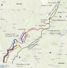
Dec 22, 2021 … Death Valley’s Lost ’49ers. Jefferson Hunt’s Mojave San Joaquin Company, a wagon train made up of anxious gold seekers and settlers frustrated …
On the 11th of June, 1847, accompanied by Captain Jefferson Hunt‘s Mormon Battalion, the Mormons trek for Salt Lake started. They left Council Bluffs, Iowa; …
Captain Jefferson Hunt. Captain in the Mormon Battalion – Led the Mojave/San Joaquin Company (Mojave Sand-walking Company) to Southern California, a portion of …
History: Profiles in Mojave Desert History. William Lewis Manly. The Bennett-Arcane party had split off from Jefferson Hunt’s “Mojave Sand-Walking …
Jefferson Hunt’s Mojave San Joaquin Company, a wagon train made up of … Jefferson Hunt to guide them to Los Angeles over the Old Spanish Trail. At the …
Jefferson Hunt’s Mojave San Joaquin Company, a wagon train made up of anxious gold seekers and settlers frustrated by a late start across the desert in late …
Steamboats on the Colorado River played a significant role in the development of the American West during the 19th and early 20th centuries. They were primarily used for transporting goods and people up and down the river, a critical artery for accessing the remote regions of the Mojave Desert, Arizona, and southern California.
The Era of Steamboats:
Beginnings: Steamboat navigation on the Colorado River began in earnest in the 1850s. The first successful steamboat to navigate the river was the “Uncle Sam” in 1852, which marked the start of steamboat commerce until the early 1900s.
Key Ports: Important ports along the river included Yuma (Arizona Territory), which served as a central distribution point for supplies to military posts in the region, settlements, and mining operations in areas like the Gila River the Mojave Desert and upriver to places like Callville and Rioville in Nevada.
Navigation Challenges: Navigating the Colorado River was notoriously difficult due to its unpredictable water flow, shifting sandbars, and snags. Boats with shallow drafts and powerful engines were necessary to handle these obstacles.
Impact and Decline:
Economic Impact: Steamboats on the Colorado River were crucial for the economy, particularly in supporting mining operations. They transported silver, gold ore, other minerals, and goods and supplies to isolated settlements.
Decline: The arrival of railroads in the late 19th century gradually led to the decline of steamboat traffic on the river. Railroads provided a more reliable and quicker means of transportation and could operate year-round without being affected by the river’s water levels.
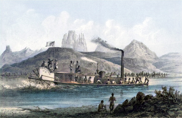
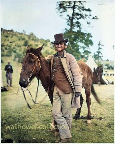
The Explorer (colorized)
Legacy:
The steamboats of the Colorado River are an essential part of the history of transportation and commerce in the American Southwest. They contributed to the region’s economic development and helped shape the settlements along the river. Today, they are remembered through historical markers, museum exhibits, and river tours that explore their history.
Steamboats represent a fascinating chapter in the history of the American West, highlighting the adaptability and ingenuity required to tame such a challenging and vital waterway.
Wonderland Ranch, also known as the Wall Street Mill area, is a historic site within Joshua Tree National Park. This area offers a glimpse into the region’s mining history and transformation into a national park. Here are some key points about its history:
Early History: Before becoming part of Joshua Tree National Park, the area was used by Native American tribes such as the Serrano, the Chemehuevi, and the Cahuilla. The region’s resources were utilized for their livelihoods.
Mining Era: The Wonderland Ranch area became significant during the California gold rush era. Bill Keys, a prominent local figure, owned and operated the Wall Street Mill, one of the area’s best-preserved mills. The mill was primarily used for crushing gold ore, which was essential in gold extraction processes.
Bill Keys: A notable historical figure in the Joshua Tree area, Bill Keys played a pivotal role in local mining and community life. He was known for his resourcefulness and for being a central figure in the community’s development. Keys also had disputes with his neighbor, Worth Bagley, which led to a fatal shootout, adding a notorious chapter to the area’s history.
Conservation and National Park: Joshua Tree’s ecological and geological significance led to its designation as a national monument in 1936 under President Franklin D. Roosevelt. Later, it was elevated to national park status in 1994. This change helped preserve the natural and historical resources, including the remnants of the Wonderland Ranch.
Today, visitors to Joshua Tree National Park can explore the historic sites around Wonderland Ranch, including the remains of the Wall Street Mill, old mining equipment, and the rustic landscapes that tell the stories of a bygone era of ambitious miners and rugged desert life.
There are 101,272 acres of mixed-use land in Juniper Flats, both public and private. Juniper Flats, located between the Mojave Desert and the forests of the San Bernardino Mountains, is home to a unique mixture of plants from both environments. Many species of wildlife are attracted to its streams and wetlands. Beautiful views and a diverse landscape make Juniper Flats a favorite recreation destination all year long.
Juniper Flats is a fascinating area between the Mojave Desert and the San Bernardino National Forest in Southern California. It’s a unique ecosystem where the arid desert landscape meets the more temperate and forested environment of the mountains.
The Mojave Desert is known for its iconic Joshua trees, vast expanses of sand, and unique flora and fauna adapted to harsh desert conditions. On the other hand, the San Bernardino National Forest offers a stark contrast with its dense pine forests, mountainous terrain, and cooler climate.
Juniper Flats serves as a transition zone between these two distinct environments. Here, you might find juniper trees, sagebrush, yuccas, and other plants that thrive in desert and semi-arid conditions. Wildlife in this area includes desert species like jackrabbits, desert tortoises, and various reptiles, as well as mountain creatures like deer, mountain lions, and black bears.
The recreational opportunities in Juniper Flats are diverse, ranging from hiking and camping to off-roading and wildlife watching. It’s a place where you can experience the beauty and contrasts of Southern California’s natural landscapes in one location.
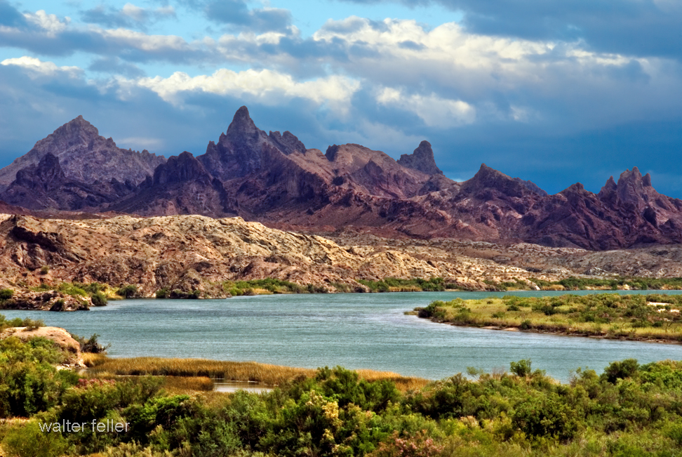
The Needles in the Mohave Mountains of Arizona present a unique geological character.
Here’s an overview of the geology of this area:
Location and Formation
The Chemehuevi Mountains are located in southeastern California and extend into the Mohave Mountains in Arizona. This range is part of the Basin and Range Province and is characterized by its dramatic elongated mountain ranges separated by flat valleys or basins.
Erosional Features
The Needles within the Mohave Mountains are likely a result of extensive erosional processes that have sculpted the landscape over millions of years. Weathering and erosion, driven by temperature fluctuations, water action, and wind, have exposed the harder, more resistant rock formations. These processes create the sharp, needle-like spires and rugged terrain typical of the area.
Ecological and Environmental Significance
The Mohave Mountains’ geological diversity supports various habitats and is significant for biodiversity. The area’s unique geology affects soil composition, water availability, and vegetation types, all of which contribute to the ecological complexity of the region.
These geological and erosional processes have given the Mohave Mountains their distinctive rugged appearance, making them a notable example of the dynamic Earth processes at work in the desert environments of the American Southwest.
A “hanging dune” is a specific type of sand dune that forms on the leeward side of a hill or mountain, typically above the general level of the surrounding terrain. These dunes are essentially perched above other landforms, often appearing as though they are hanging on the slopes.
Here’s how they develop and some characteristics:
Formation
Hanging dunes primarily form in areas with significant wind activity where the topography causes the wind to deposit sand on steep slopes rather than just along flat surfaces. This process involves:
Wind Patterns: Strong, consistent winds carry sand from lower areas.
Obstacle Impact: When these winds encounter steep slopes or cliffs, their upward deflection causes a reduction in wind speed, dropping the sand and forming a dune.
Accumulation: Over time, more sand accumulates, stabilizing despite the steep slopes due to vegetation or moisture, further building the dune.
Characteristics
Location: They are typically found on the sides of hills, cliffs, or within mountain ranges where wind patterns are disrupted by the topography.
Stability: These dunes can be quite stable if vegetation anchors the sand, or they can be transient and shift with changes in wind patterns.
Ecological Impact: Hanging dunes can create unique microenvironments that support specialized plants and animals adapted to these specific conditions.
Geologic and Ecological Significance
Indicator of Wind History: The presence and orientation of hanging dunes can provide clues about historical wind directions and strengths.
Biodiversity: These dunes can host unique species that have adapted to the niche environments created by the unusual moisture and temperature conditions on the slopes.
Conservation: Due to their unique nature and the specialized ecosystems they support, hanging dunes can be important areas for ecological studies and conservation efforts.
Hanging dunes are less common than other dune types and require a unique set of environmental conditions to form and persist, making them particularly interesting for geologists and ecologists studying aeolian (wind-driven) processes and desert ecosystems.
The Mojave River Fan, located in the Mojave Desert of California, is an extensive alluvial fan formed by the deposition of sediments from the Mojave River. This geological formation is significant due to its role in shaping the landscape and hydrology of the region. Here are some key aspects of its geology:
Formation and Composition:
The fan comprises sediments such as sand, gravel, and finer materials from the surrounding mountains carried down by the Mojave River and its tributaries. These sediments are deposited primarily during periods of high water flow, typically associated with rainfall events.
The materials are sorted by size, with coarser materials settling closer to the mountains and finer materials spreading further onto the fan.
Geological Features:
The Mojave River Fan is characterized by its radial pattern, spreading from where the river emerges from the mountains onto the flatter desert plain. This spreading creates a broad, gently sloping surface.
The fan is divided into different lobes or segments, each representing periods of active deposition under varying climatic and hydrologic conditions.
Hydrology and Erosion:
The fan plays a critical role in the desert’s hydrology, influencing groundwater recharge and the distribution of aquifers. Water percolates through the porous sediments, replenishing groundwater reserves.
Erosional processes also shape the fan, as water channels carve out new paths during floods, redistributing the sediments.
Environmental and Climatic Influences:
The formation and evolution of the fan are closely linked to climatic changes over geological time scales. Periods of wetter climate have led to increased sediment load and fan expansion, while drier periods have seen reduced activity.
Human Impact and Studies:
The area has been the subject of various geological and environmental studies, especially concerning water resource management and hazard assessment due to its proximity to populated areas and infrastructure.
Understanding the geology of the Mojave River Fan is crucial for managing natural resources and mitigating natural hazards in this part of the Mojave Desert.
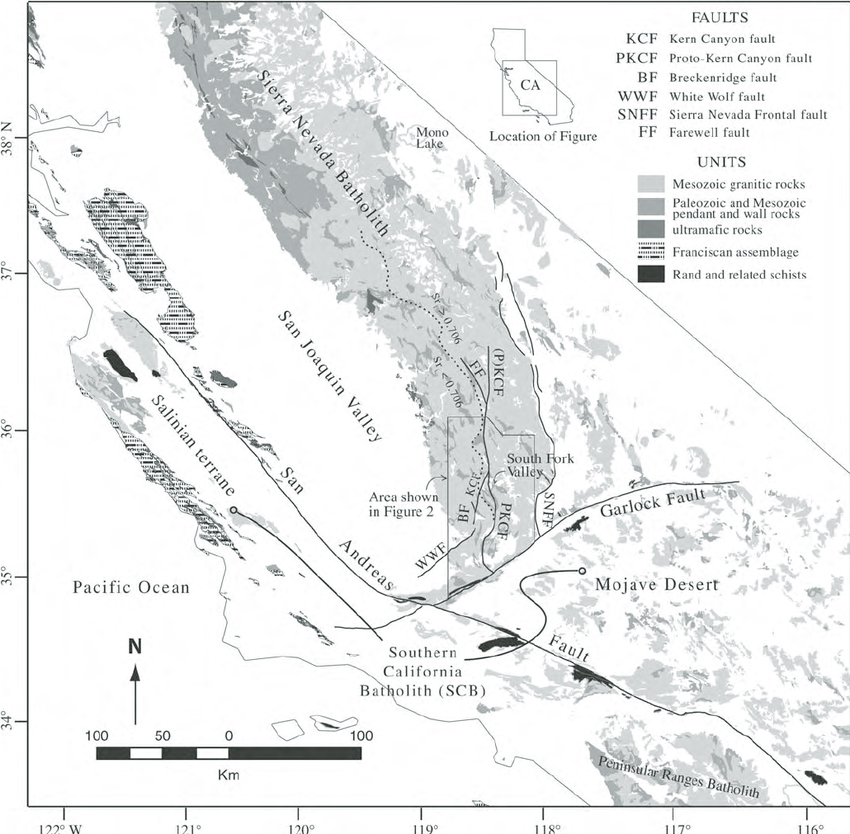
The Sierra Nevada Batholith is a large, composite body of igneous rock in the Sierra Nevada range of California. This batholith, mainly composed of granitic rock, was formed during the Mesozoic era, particularly from the Late Jurassic to the Late Cretaceous period. It extends over a vast area and is exposed over approximately 400 miles along the western slopes of the Sierra Nevada.
The formation of the Sierra Nevada Batholith is tied to the subduction of the oceanic Farallon Plate beneath the North American Plate. As the plate subducted, it generated magmas that rose and solidified to form the granite that characterizes this batholith. The emplacement and cooling of these granitic magmas over millions of years have significantly influenced the region’s geology and topography.
Geologically significant and visually striking, the Sierra Nevada Batholith is a major feature underlying the rugged landscapes of Yosemite Valley and other parts of the Sierra Nevada. It is important not only for shaping the physical landscape but also for contributing to understanding the geological processes of mountain building and magmatic intrusions.
The information about the Sierra Nevada Batholith is based on well-established geological knowledge and does not come from a specific source.
For in-depth information about the Sierra Nevada Batholith, the following sources are highly recommended:
“Geology of the Sierra Nevada” by Mary Hill – This book provides a comprehensive overview of the geological history of the Sierra Nevada, including detailed discussions on the formation of the Sierra Nevada Batholith.
“Roadside Geology of Northern and Central California” by David Alt and Donald W. Hyndman – This guidebook includes accessible explanations and descriptions of geological features along various routes, including those that expose parts of the Sierra Nevada Batholith.
“The Geologic Story of Yosemite National Park” by N. King Huber—While focused on Yosemite, this publication offers valuable insights into the granitic formations making up the Sierra Nevada Batholith and their significance in the park’s natural history.
Scholarly articles such as the Journal of Geophysical Research or Geological Society of America Bulletin often publish research on the Sierra Nevada Batholith, discussing its formation, composition, and role in regional geology.
These sources will provide a detailed and accurate understanding of the Sierra Nevada Batholith, suitable for educational and research purposes.
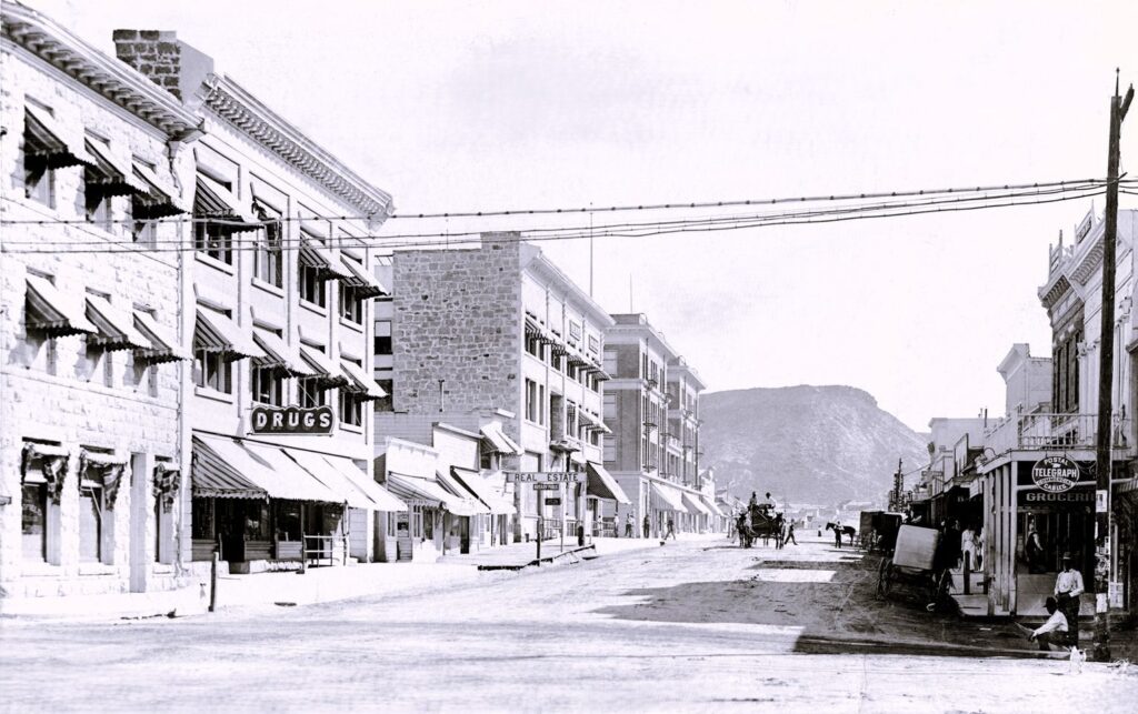
1910 Columbia Street in Goldfield, Nevada. Amidst the dust of mining fortunes, this town thrived as a hub of gold mining activity.
Goldfield, Nevada, was founded in 1902 after gold was discovered in the area. The town quickly grew into one of the largest in Nevada, with a population peaking at around 20,000 during its heyday. Goldfield was established to support the booming mining industry in the region, particularly the gold mines.
The town boasted numerous businesses, including saloons, hotels, banks, and brothels, catering to the needs of miners and prospectors. It became known as the “Queen of the Tonopah Mining District” due to its wealth and prominence in the area.
However, like many mining towns, Goldfield’s fortunes declined after the initial boom. By the 1920s, the population had dwindled, and the town fell into decline. Today, Goldfield is a ghost of it’s former self, with remnants of its past glory still visible today, including historic buildings, mines, and artifacts.
Image courtesy of the University of Nevada, Reno, Special Collections. Nevada Ghost Towns and Historic Sites is in Goldfield, NV.
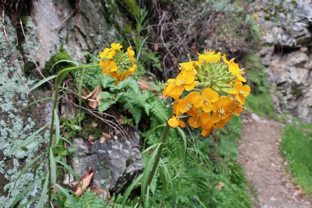
Here’s a Douglas Wallflower alongside the Upper Falls Trail, as seen this last Monday while hiking up the Big Santa Anita Canyon under cloudy skies. Our series of much-needed rain storms have brought back thick green grasses and the start to what’ll most likely be a colorful Spring of other wildflowers. Joanie and I hiked the two-mile Falling Sign Loop from Fern Lodge.
These Douglas Wallflowers (Erysimum capitatum) popped out at us just downstream from the double slot pools on the Upper Falls Trail. There’s also a nice grouping of wallflowers near the second bench up the road from Roberts’ Camp in San Olene Canyon.
Sturtevant Falls was tumbling down nicely. The scent of white sage peppered the cool air and the background surf-like sound of the stream followed us the whole way. We brought along an old shovel, cleaning off small slides here and there. Wild lilacs (buck brush) are still sending their mild lavender scent into the canyon breezes while the bright red orange of Indian paintbrush pokes up from the damp earth near Hoegee’s Drop-Off. And overarching along most of the route, the Laurel bay blossoms still cling to the dark green canopies. Look for the tender dark reddish purple leaves of the canyon big-leaf maples as their foliage begins to fill back in for a new season. Even the white alders are pushing out a myriad of their bright green leaflets, replacing that smokey look of dormancy with new life.
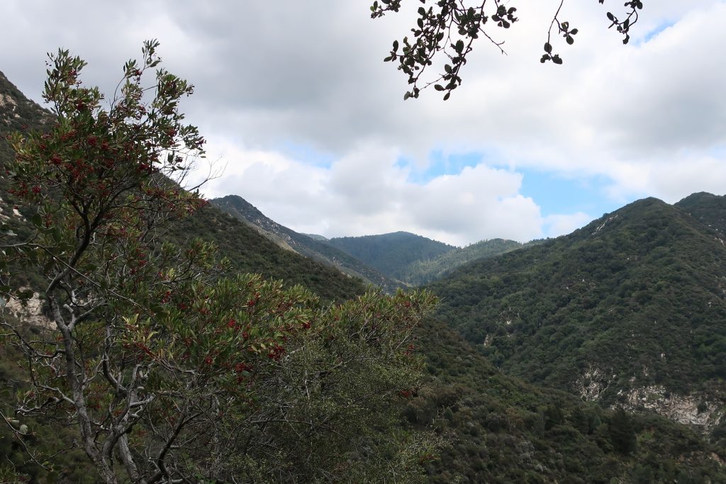
View looking east up into the East Fork of Big Santa Anita Canyon from Gabrielino Trail. Note the Toyon in the foreground, still hanging onto some of its’ red berries. That’s Rankin and Monrovia peaks in the most distant background. Clamshell Peak is barely captured on the right hand side of photo.
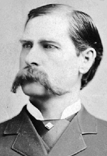
The recent death of Wyatt Earp (Wyatt died January 13, 1929) recalls to mind the part he played in the claim jumping expedition to Searles Lake in October 1910. At the time I was Acting Receiver for the California Trona Company and was in charge of a group of placer mining claims covering some 40,000 acres. The party had been organized at Los Angeles by Henry E. Lee, an Oakland attorney and probably was the best equipped gang of claim jumpers ever assembled in the west. It consisted of three complete crews of surveyors, the necessary helpers and laborers and about 20 armed guards or gunmen under the command of Wyatt Berry Stapp.
The party of 44 in number, arrived at Searles Lake in seven touring cars and established a camp at the abandoned town of “Slate Range City” about eight miles southeast of the company’s headquarters. On the morning following their arrival we saw some of the surveyors across the lake and our foreman road over and ordered them off the property but they paid no attention to his protest an proceeded to do a very thorough job or surveying and staking.
Searles Lake
As I considered it necessary to make some show of force in protecting our claims, I visited the enemy’s camp at sunrise the next day with our whole force of five men who were armed with all the weapons they could collect. It was a very critical moment when we jumped from our wagon and walked up in front of the mess house where the raiders were assembled for breakfast. I stood in the center with my boys on either side of me. There was a shout and men came running from all directions and fearing there might be trouble.
I started right off to explain to the surveyors present that I had only come over to give notice that I was officially and legally in possession of the claims and that they were trespassers.
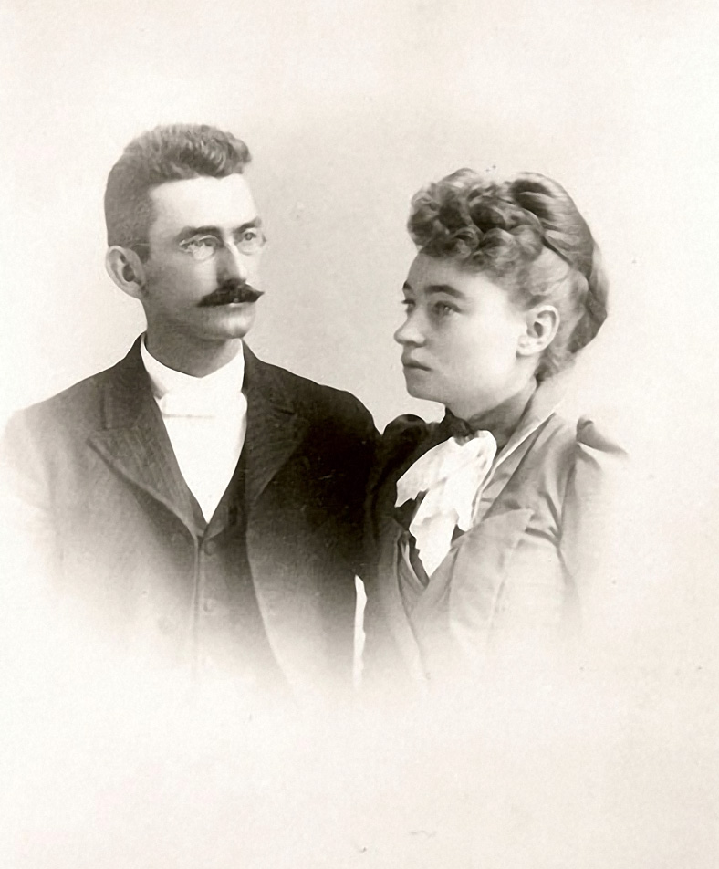
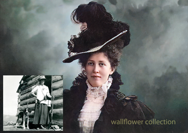
S. Wallace Austin & Mary Hunter Austin – 1891
Before I got very far a tall man with iron grey hair and a mustache pushed his way to the front and in a loud voice demanded why I had come into their camp with armed men. At the same time he grabbed hold of my shotgun held by the boy on my left and attempted to take it away from him. At this attack upon us I drew an automatic and ordered him to let go. He did so and then ran to a building nearby saying “I’ll fix you.” Before he could secure a rifle, however, the cooler headed members of the party surrounded him and calmed him down. Also, you may be sure every effort was made to prevent a fight, as, in spite of our bold being, we were pretty badly scared.
Just as things seemed to have quieted down, one of the excited jumpers accidentally discharged a gun. No one was hurt but, it was a very tense moment for all of us. Having failed to dislodge the enemy the following day I called for a US Marshall and when he arrive the claim jumpers were all arrested and sent home including “Wyatt Berry Stapp”, none other than the famous Marshall Wyatt Stapp Earp.
San Francisco Call, Volume 108, Number 151, 29 October 1910
SODA CLAIMS SEIZED BY BAND 0F ARMED MEN
United States Marshal, Elliott received a telegram yesterday from Deputy Marshal Fred Burling, in Los Angeles, stating that 24 armed-men had seized the properties of the California Trona Company near Johannesberg. A receiver has been placed in charge of the 40,000 acres of soda claims pending the decision of a suit by the Foreign Mines development company against the Trona Company for $200,000.
Deputy Marshal Burling was sent out to serve papers on certain persons alleged to be interfering with the receiver.
Los Angeles Herald, Volume 33, Number 28, 29 October 1910
GUNMEN PROTECT BORAX LAKE PROPERTY
Methods Used in Oil Fields Are Applied to Country Held by Borax Outfit
SEARLES, Cal., Oct. 28. — Borax Lake, located in the northwest corner of San Bernardino County, is again the scene of a claim jumping struggle. A party of armed men, thirty-five in number, with automobiles, led by a man named Splat, of Los Angeles, have entered the property of California Trona company and are surveying and locating over the locations of the Trona company which has just finished assessment work costing $25000.
This is the same property on which Charles Davidson of Oakland perished last June while leading a claim jumping expedition for the same property. The property is now in charge of a receiver of the United States court who notified the jumpers to desist. They replied by show of arms and refused. The United States marshal is now on his way to the scene of trouble.
The automobiles are in charge of Chauffeur M, C. Vorney and are numbered 24145, 32783, 36991, 37404 and 29487.
Names of locators are: H. C. Fursman, W. Hull, R. Wagmire, P. Perkins, H. A. Baker, E. Thompson, D. Smith, T. W. Pack. Witness, E. A. Rasor.
The Foreign Mines and Development company has a mortgage of $250,000 on this property. A sale is pending in |the east, said to be on a $1,000,000 basis.
The Mojave Desert, located in the southwestern United States, is a vast, arid region known for its unique and resilient ecosystems. Its natural history can be divided into several key aspects:
Geology and Geography: The Mojave Desert has varied topography, including valleys, dunes, and mountains. It is home to the famous Death Valley, the lowest and one of the hottest places in North America. The Mojave’s geological history includes volcanic activity, the formation of mountain ranges, and the erosion that created its present landscapes.
Climate: This desert is known for its extreme temperatures and aridity. Its high temperatures vary day and night due to the lack of humidity and sparse cloud cover. Rainfall is scarce and unpredictable, often leading to drought conditions.
Flora and Fauna: The Mojave Desert supports a range of life adapted to its harsh conditions. Notable plants include the Joshua tree (Yucca brevifolia), symbolic of the Mojave, and various cacti and shrubs adapted to survive with minimal water. Animal life includes reptiles like the desert tortoise, mammals such as the bighorn sheep, and numerous bird species that navigate the challenging environment.
Ecological Dynamics: The ecosystems of the Mojave are shaped by limited water resources and extreme temperatures, leading to unique interactions among species. Plants and animals have evolved various adaptations for survival, including water conservation mechanisms and nocturnal activity patterns.
Human Impact and Conservation: Human activity has significantly impacted the Mojave Desert. Issues include water resource extraction, urban expansion, and the development of renewable energy installations. Conservation efforts are ongoing to protect its biodiversity and landscape, with areas like the Mojave National Preserve established to safeguard habitats and natural features.
Cultural History: The desert has been inhabited by Native American tribes for thousands of years, each with rich cultural histories and connections to the land. More recently, it has played a role in American history through mining, military use, and as a site for artistic and literary inspiration.
The Mojave Desert’s natural history is a complex tapestry of geological, climatic, biological, and human factors, making it a fascinating subject for study and exploration.
The Berkeley Library, specifically the University of California, Berkeley Library, has extensive resources and collections that provide a comprehensive view of California’s history. Here are key aspects related to the history of California as reflected in the Berkeley Library’s collections:
Early History and Colonization: The library holds materials on the early exploration and colonization of California, including the impact of Spanish missions, the lives of Native Californian tribes, and the region’s integration into the Spanish empire and later Mexico.
Gold Rush and Statehood: There is a wealth of information on the California Gold Rush of 1849, which was a pivotal event in American history, drawing thousands to the state and leading to California’s rapid admission to the Union in 1850.
Economic and Social Development: The library’s collections cover the development of California’s economy, including the rise of the agricultural, entertainment, and technology sectors. It also houses materials on social movements, immigration, and the diverse cultures that have shaped California.
Environmental History: Given California’s diverse ecosystems, the Berkeley Library has significant resources on the environmental history of the state, including water use and management, conservation efforts, and the impact of human activities on the landscape.
Political History: The collections include materials on California’s political history, from its early days as a part of Mexico, through its statehood, and into its role as a trendsetter in American politics, including the Progressive Era, civil rights movements, and contemporary political issues.
University of California History: As part of the UC system, the Berkeley Library also has materials on the history of the University of California and its role in the educational and cultural development of the state.
These collections are used by researchers, students, and the public to study and understand the complex history of California. The Berkeley Library serves as a vital resource for those looking to explore the many facets of California’s past and its impact on the present and future.
The region’s earlier history includes the town of Carrara, established to support marble quarrying, which began in 1904. Despite initial optimism, the marble’s quality and economic factors led to the quarry and the town’s decline.
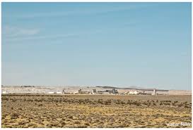
The “Elizalde Cement Plant” in Nevada has historical significance. It was established in the early 20th century to supply cement for Hoover Dam construction. The Elizalde Company built the plant and operated when the American Southwest underwent significant industrial and infrastructure development.
After the completion of the Hoover Dam, the demand for cement decreased, leading to the plant’s closure. The remnants of the Elizalde Cement Plant now stand as a testament to the region’s industrial history, attracting historians and enthusiasts interested in the area’s development and the broader story of American industrialization.
The Elizalde Cement Plant, located in Nevada, has a history tied to industrial ambitions and unforeseen setbacks. Incorporated in November 1940 as the Carrara Portland Cement Company, it aimed to produce standard gray and special white cement, utilizing crushed marble from the nearby Carrara quarry.
Incorporated in November 1940 as the Carrara Portland Cement Company, it aimed to produce standard gray and special white cement, utilizing crushed marble from the nearby Carrara quarry. By April 1941, construction was in full swing, with an estimated daily output planned for 80 tons of cement. However, a devastating fire in July 1941 destroyed significant parts of the plant, halting progress. Despite efforts to rebuild and expand, World War II’s fuel rationing ultimately doomed the plant, which never became operational.
By April 1941, construction was in full swing, with an estimated daily output planned for 80 tons of cement. However, a devastating fire in July 1941 destroyed significant parts of the plant, halting progress. Despite efforts to rebuild and expand, World War II’s fuel rationing ultimately doomed the plant, which never became operational.
The Elizalde Cement Plant was supposed to mark a new industrial phase, but it became a relic of unfulfilled industrial aspirations, now an intriguing ruin in the desert landscape.
OpenAI. (2024). ChatGPT (4) [Large language model]. https://chat.openai.comhttps://www.nvexpeditions.com/nye/elizalde.php https://nvtami.com/2023/05/09/ghost-towns-of-beatty/
The 1785 Land Ordinance provided that all federal land would be surveyed into townships six miles square. Townships are subdivided into 36 one-mile-square sections. Sections can be further subdivided into quarter sections, quarter-quarter sections, or irregular government lots. Each township is identified with a township and range designation. Township designations indicate the location north or south of the baseline, and range designations indicate east or west of the Principal Meridian. A meridian is an imaginary line running north to south.
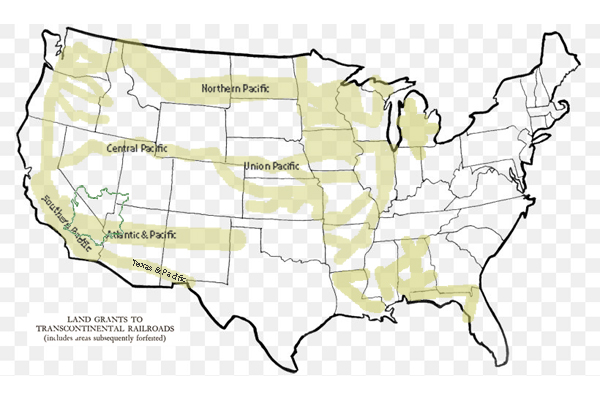
1861 Central Pacific Railroad is incorporated.
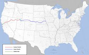
1862 President Abraham Lincoln signed the Pacific Railway Act, a law that authorizes the federal government to give land grants and loans to aid construction of the Central Pacific Railroad as the Western part of the Transcontinental Railroad and the Union Pacific as the Eastern part.
1863 Central Pacific begins construction at Sacramento.
1864 The United States Congress passes the Pacific Railway Act of 1864, which doubles the land grant to 20 alternate sections per mile, with a 20 mile checkerboard corridor on each side of the right-of-way.
1865 Central Pacific Railroad establishes a Land Department in Sacramento. Benjamin B. Redding, former mayor of Sacramento, was chosen to lead to design and manage the new organization.
1866 The Pacific Railway Act is amended to allow a railroad to select lands outside of the land grant area in exchange for unavailable land grant land.
1866 The federal government gives Southern Pacific Railroad a land grant to complete the western section of the Atlantic & Pacific line through California via Mojave to Needles.
1867 First land patent is issued to the Central Pacific Railroad by the federal government.
1868 September 25: The Central Pacific Railway owners acquire control of the Southern Pacific Railroad.
1869 The California & Oregon Railroad receives a federal land grant to build a line northward from Davis to connect to the Oregon & California Railroad at the California and Oregon border.
1869 The Central Pacific Railroad begins operating the California & Oregon Railroad.
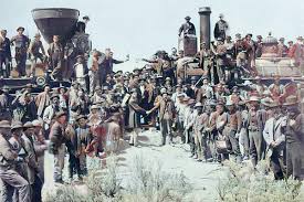
1869 The Golden Spike ceremony held at Promontory, Utah, marks the completion of the transcontinental railroad between Sacramento, California and Omaha, Nebraska.
1870 California & Oregon Railroad is consolidated with the Central Pacific Railroad, and becomes a branch line of the Central Pacific Railroad.
1871 The federal government gives the Southern Pacific Railroad land grants and loans, allowing it to build to meet the Texas & Pacific at Yuma, California and build from Los Angeles to Colton, California.
1875 The Southern Pacific Railroad opens a land agency in San Francisco. 1876 Jerome Madden, Benjamin Redding’s assistant, became the land agent for Southern Pacific.
1886 Southern Pacific Company assumes control of the Oregon & California Railroad.
1899 The Central Pacific Railroad is reorganized as the Central Pacific Railway in order to pay off its federal debt.
1912 The Southern Pacific Company transfers some of its remaining land assets to Southern Pacific Land Company.
1916 Oregon & California grant lands are returned to the Federal Government.
1927 Southern Pacific purchases the Oregon & California Railroad.
1984 The Southern Pacific Company merges with Santa Fe Industries, parent company of the Atchison, Topeka & Santa Fe Railway, to form Santa Fe Southern Pacific Corporation (SPSF).
1985 The Interstate Commerce Commission (ICC) denies permission for the railroad operations to merge.
1986 Appeal of the ICC ruling fails.
1986 The renamed holding company, the Santa Fe Pacific Corporation, retains all of the non-rail interests of both companies except one. All of the Southern Pacific Railroad California real estate holdings are transferred to a new holding company, Catellus Development Corporation.
1996 The Southern Pacific Railroad is acquired by Union Pacific Railroad and its operations cease.
2005 Catellus Development Corporation is merged into ProLogis, another land development company based in San Francisco. ProLogis remains one of the largest real estate holders in California.
California State Railroad Museum Library and Archives https://oac.cdlib.org/institutions/California+State+Railroad+Museum+Library+and+Archives
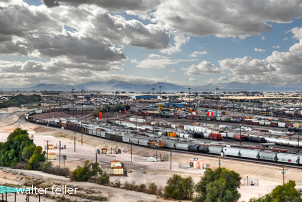
Barstow, California. Intermodal freight transport involves the transportation of cargo in an intermodal container or vehicle, using multiple modes of transportation (e.g., rail, ship, and truck) without any handling of the freight itself when changing modes. This system reduces cargo handling, improves security, reduces damage and loss, and allows freight to be transported faster.
Barstow is a significant hub in the intermodal network due to its strategic location along major freight rail lines and highways. It facilitates the transfer of goods between different transportation modes, playing a critical role in the logistics and distribution chain, especially between major ports and inland destinations across the United States.
The history of the Barstow Intermodal facility is closely tied to the development of transportation infrastructure in the Barstow area, which has long been a key junction point for major rail and road routes.
Railway History: Barstow’s role as a transportation hub began with the railroad. The area became a key railway center in the late 19th and early 20th centuries with the arrival of the Atchison, Topeka, and Santa Fe Railway (now part of the BNSF Railway). This established Barstow as a critical point in the transcontinental rail network, facilitating the movement of goods across the country.
Intermodal Development: The concept of intermodal transport—moving goods in the same container or vehicle by multiple forms of transportation—gained popularity in the mid-20th century. Barstow’s strategic location made it a natural choice for developing intermodal facilities. The Barstow Intermodal facility allows for efficient transfer of containers between trains and trucks, optimizing the transport of goods to and from the ports of Los Angeles and Long Beach and across the wider United States.
Economic Impact: Over the years, the intermodal facility has played a significant role in the economic development of Barstow and the surrounding region. It has created jobs, spurred the growth of logistics and support industries, and contributed to the local economy by facilitating efficient and cost-effective transportation of goods.
Expansion and Modernization: The facility has continuously expanded to accommodate the growing demand for intermodal transport. Technology, infrastructure, and equipment investments have enhanced its capacity and efficiency, allowing it to handle larger freight volumes and adapt to changing transportation needs.
The history of Barstow Intermodal reflects the broader trends in transportation and logistics, showcasing the evolution from rail-centric freight movement to integrated, multimodal transport systems that support the dynamic flow of goods in a globalized economy.
Penn Phillips was a real estate developer known for his work in various parts of the United States, including Hesperia, California. Born M. Penn Phillips, he was a prominent figure in the mid-20th century, recognized for developing planned communities. In Hesperia, he was instrumental in transforming the area from a rural community into a more developed suburban area. Phillips was known for his aggressive marketing strategies and development projects that often included building infrastructure and amenities to attract residents and investors to the areas he developed. His impact on Hesperia and other towns he developed is still evident today in the layout and infrastructure of these communities.
What other towns was Penn Phillips involved with developing?
Penn Phillips developed several towns across the United States, particularly in the 1950s and 1960s. Some of the notable towns and communities he developed include:
California City, California: Perhaps his most ambitious project, California City, was intended to be one of the largest cities in California, with Phillips investing heavily in infrastructure and marketing to attract residents and businesses.
Coos Bay, Oregon: Phillips was known for his development work in the Coos Bay area, significantly impacting the local economy and landscape.
Boron, California: Similar to his work in other towns, Phillips aimed to transform Boron into a thriving community through extensive development projects.
Salton City, California: On the shore of the Salton Sea, Phillips attempted to develop Salton City as a resort community, capitalizing on its unique location and potential for tourism.
Phillips’ approach to development often involved buying large tracts of land, creating basic infrastructure, and then promoting the areas aggressively to attract residents and businesses. His legacy is mixed, with some of his projects turning into successful communities, while others, like California City and Salton City, did not fully realize the grand visions he had planned.
Was Phillips and Mendelsohn together in California City?
Yes, Penn Phillips and Nathan Mendelsohn were indeed associated with the development of California City, California. While Penn Phillips was a prominent real estate developer known for his work in various communities, Nathan Mendelsohn, a sociology professor turned developer, was the main force behind California City’s development.
Mendelsohn purchased the land and envisioned a new city that would become a significant community in the Mojave Desert. He planned and developed the infrastructure, plotting streets and laying out residential, commercial, and industrial areas to attract residents and businesses. Penn Phillips, known for his development projects in other areas, was also involved in the real estate development aspect of California City. However, Mendelsohn was the primary developer and driving force behind the city’s creation and initial development.
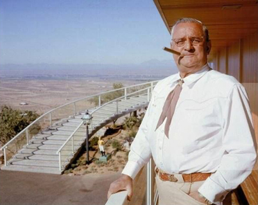
Nat Mendelsohn
Their collaboration in the development of California City was part of the larger trend of ambitious planned communities in post-war America, where developers sought to create new cities and communities from scratch in undeveloped areas.
Was Phillips a con man?
Penn Phillips had a reputation that some considered controversial, and some accounts label him as a con man, particularly in his real estate dealings. He was known for his aggressive and sometimes deceptive marketing strategies. Phillips would often sell land in undeveloped areas, promising potential buyers that these would become thriving communities with various amenities and infrastructure. However, in some cases, the promised development and amenities were not fully realized, leaving buyers with worthless plots of land.
For example, in his development projects, Phillips was known to sell plots of land through high-pressure sales tactics, often exaggerating the potential for growth and development. Buyers sometimes found themselves owning land in remote areas with little to no development, far from the bustling communities they were led to expect.
While Phillips was undoubtedly a successful developer in some respects, creating legitimate and thriving communities, his methods and the outcomes of some of his projects led to a mixed legacy. The perception of him as a con man stems from these practices, where the reality did not always meet the expectations he set for his investors and buyers.
Did Newton Bass in Apple Valley ever work with Penn Phillips?
Newton Bass and Penn Phillips were prominent real estate developers in California’s high desert region. Still, they are generally associated with different communities, and no well-documented collaboration exists between them. Newton Bass was one of the key figures in the development of Apple Valley, California, while Penn Phillips was known for his work in places like Hesperia and California City.
Newt Bass at Hilltop House
Both men were active during the mid-20th century and were instrumental in the development of the Mojave Desert area, but they operated largely independently of each other. Bass, alongside his partner Bud Westlund, developed Apple Valley into a thriving community, promoting it as an ideal place to live with a focus on quality of life and community amenities.
While both Bass and Phillips had similar careers in developing new communities in California’s desert regions, there is no significant historical record of them working together on a development project. Their approaches to development and the communities they built were distinct, reflecting their individual visions for high desert living.
–
Were there any other city developers in the Mojave Desert at the time?
Besides Penn Phillips and Newton Bass, other developers were active in the Mojave Desert area during the mid-20th century. These developers also played significant roles in shaping the region’s landscape and communities:
Bud Westlund: Partnered with Newton Bass in developing Apple Valley; Westlund was instrumental in promoting and building the community alongside Bass. They worked together to create a desirable living environment that attracted residents and businesses to the area.
Ray Ryan: Involved in developing Indio, California, and other areas in the Coachella Valley, Ryan was a notable figure in the real estate and oil industries. His contributions to the region’s development were significant, although controversy and connections to organized crime also marked his career.
Mervyn Dymally: While more known for his political career, Dymally was involved in various development projects in the Mojave Desert region, particularly in the Antelope Valley area. His work in real estate and politics intersected as he contributed to the growth and development of the area.
George Alexander and H.L. Waliser: They were involved in developing Victorville and the surrounding areas. Their efforts helped shape the growth and structure of these communities in the high desert.
These developers, among others, contributed to transforming the Mojave Desert from a sparsely populated area into a region with growing towns and communities. Each brought their unique approach to development, impacting the economic and social landscape of the desert region.
In the Lancaster and Palmdale areas of the Mojave Desert, several developers played significant roles in shaping the growth and development of these communities. Some of the notable figures include:
M. Leroy Gilleland: Gilleland was an early developer in Palmdale, playing a crucial role in its development during the mid-20th century. He was instrumental in promoting the area and attracting residents and businesses.
Tom Carrell: Along with his partner, Carrell was a significant figure in the development of Lancaster. They were responsible for much of the residential and commercial development in the area, contributing to Lancaster’s growth and structure.
Jack Kyser: Kyser was a key player in the economic development of the Antelope Valley, including Lancaster and Palmdale. His efforts in regional planning and economic development helped shape the future of these cities.
Fritz Huntsinger: Involved in industrial and commercial development in Palmdale, Huntsinger played a vital role in the city’s economic growth, contributing to its status as an important industrial and aerospace hub.
These developers, among others, were pivotal in transforming Lancaster and Palmdale into the significant urban centers they are today in the Antelope Valley region. Their contributions included residential, commercial, industrial, and aerospace developments, reflecting the diverse economic base of the area.
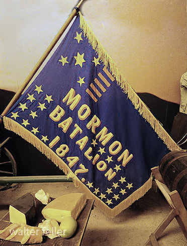
The Mormon Battalion was a unique military unit in American history, formed during the Mexican-American War in 1846. It consisted of about 500 Latter-day Saints (Mormons) volunteers. This battalion was the only religiously based unit in United States military history and was recruited to help the U.S. secure new territories in the American West.
The battalion was mustered in at Council Bluffs, Iowa, and marched nearly 2,000 miles to San Diego, California, one of the longest military marches in history. The journey helped to open new wagon routes in the West and was instrumental in the settlement and development of the region. The battalion never engaged in battle but faced hardships like disease, lack of provisions, and challenging terrain.
The Mormon Battalion is significant for its military contribution and impact on the westward expansion and settlement of the United States, particularly in Utah and California. Its members helped to establish communities and build infrastructure in the West after their military service ended.
After their discharge in 1847, members of the Mormon Battalion played a significant role in the history of the Mojave Desert and the broader American West. Their journey and subsequent activities helped to establish and improve trails across the desert, facilitating the movement of people and goods.
Some of the discharged members of the Mormon Battalion, along with other Mormons, were instrumental in developing the Southern Route, also known as the Mormon Road, through the Mojave Desert. This route later became critical for settlers moving to California, especially during the Gold Rush. They improved the trail, making it more passable for wagons, and established supply stations along the way, vital for the survival of travelers crossing the harsh desert environment.
Additionally, these battalion members engaged in early exploratory and settlement activities. They were among the first U.S. citizens to extensively travel through and document the Mojave Desert region. Their efforts contributed to the mapping of the area and provided valuable information about resources and potential settlement sites.
Their work in the Mojave Desert facilitated westward expansion and laid the groundwork for future economic development in the region, including mining, agriculture, and transportation. Through their endeavors, the discharged members of the Mormon Battalion left a lasting legacy in the development of the American Southwest.
THE JOURNAL OF THE American Medical Association VOLUME 105, No. 11, CHICAGO, ILL. SEPTEMBER 14, 1935
Curtis Howe Springer first came to the attention of the Bureau of Investigation through a display advertisement published in the Davenport (Iowa) Times on Oct. 2, 1929. This carried a picture of Springer, who was described as “Dean of Greer College.” The advertisement read in part as follows:
Photographic reproduction (greatly reduced) of the cover of an alleged magazine put out by Springer as an advertising asset. At that time Springer affected long hair; since then he has had it cut. In this “magazine” Springer had an “explanation” of why he had to cease broadcasting over WBRE.
“Money For You. Develop Your Powers. Be Healthy, Happy, Successful. A series of Free Lectures Is offered to the public under the auspices of the Extension Department of Greer College.
“Thousands have paid to hear these lectures, but you can hear them free, through the courtesy of the Davenport Psychology Class.
“President Hoover said the complete abolition of poverty is now a possibility for us. ;
“Analyze Yourself. Know Your Hidden Powers.
In August 1930, the Scranton (Pa.) Better Business Bureau wrote that Springer had been giving a course of “lectures” at the local Y. M. C. A., which he is said to have claimed were presented through the courtesy of the “Extension Department of the National Academy.” What this Academy is or was, if, which seems doubtful, it ever has been, we have been unable to learn. Neither have we been able to learn anything about the “Springer School of Humanism” that was also mentioned. The Better Business Bureau reported further that Springer’s “lectures” were entitled “How to Banish Disease and Know the Joy of Living.” Springer was said not to have charged any admission but to have taken up a collection and also to have sold so-called private courses in psychoanalysis at $25 a course.
Bureau stated further that a local woman who had contracted and paid for a “course” charged Springer with obtaining money under pretenses. When the case came up for a trial, the woman is said to have testified that for the money paid, Springer had agreed to give her twelve “readings” or “sittings,” two a week for six weeks, but that at the end of two weeks, Springer left the city and she received no further notice from him. The Scranton Better Business Bureau reported that prosecution was dropped when Springer refunded the woman’s money.
In December 1930 Springer put out what purported to be the first issue of a magazine entitled “Symposium Creative Psychologic,” a name that is as meaningless as some of the titles that Springer has annexed. This sheet was devoted mainly to advertising Springer and his activities, especially his “Doc. Springer Temple of Health.” In it Springer published an “explanation” of why he had had to cease broadcasting over WBRE.
At this point it may be interpolated that investigation seems to show that: Springer came originally from Birmingham, Ala., where his record, not being of a medical or quasi-medical character, need not be gone into at this time; he left there to come to Chicago; he organized the “Temple of Health” in Wilkes-Barre, Pa.; he sold “Springer’s Health Bread” at Johnstown, Pa.; he exploited a similar scheme in Cumberland, Md.; he made payments on some land at Mount Davis, near Salisbury, Pa. with the idea of starting a “health resort”; he incorporated Basic Foods, Inc., with an authorized capital of fifty shares, of which Springer and another man were said to held one share each and Springer’s wife to hold the other fortyeight shares; he published in not-too-particular papers alleged health columns with his picture accompanying the reading matter.
During the past few years Curtis Howe Springer, in advertising himself, has placed after his name the letters “M.D., N.D., D.O., Ph.D.,” sometimes with the statement beneath the “degrees” that they were “Honorarily conferred.” A most thorough search fails to show that Springer was ever graduated by any reputable college or university, medical or otherwise. In May 1933 a physician in Cumberland, Md., wrote to the Bureau of Investigation, stating that when Springer had appeared in his locality the local state’s attorney demanded that Springer produce a certificate showing that he had the right to use the title M.D. This, of course, Springer was unable to do. Then, according to our correspondent, Springer was charged with practicing medicine without a license, but, being at liberty without bail, he left Cumberland and could not be apprehended for trial. Later it was reported that he was broadcasting at Philadelphia and still later at Pittsburgh,
SPRINGER COMES TO CHICAGO In the latter part of December 1933 the broadcasting station WGN, operated by the Chicago Tribune, called up the Bureay of Investigation of the American Medical Association and asked for, and received, such information as was then available on Curtis Howe Springer. It appeared that Springer wanted to buy time on the air over WGN, but the contract he offered was rejected. A few days later (Jan. 4, 1934) Springer himself, with the effrontery of his kind, came to the headquarters of the American Medical Association and asked to see the Director of the Bureau of Investigation. He told the Director that he had called to correct what he described as certain misconceptions that the Bureau of Investigation was said to have regarding him.
Springer was asked where he had obtained and by what right he used the degree M.D. He stated that the degree had been bestowed by one Frederick W. Collins, a chiropractor of New Jersey, who runs the egregious “First National University of Naturopathy” and apparently several other high-sounding institutions of dubious educational character. Needless to say, the Collins outfit is not a recognized medical college. It has no scientific standing and, of course, has no legal authority whatever to grant the degree of Doctor of Medicine. Springer further admitted during the interview that his alleged degrees were granted without attendance and upon the payment of either $200 or $300 (he said he could not remember which) and the answering of certain questions !
Springer was told that interviews were unsatisfactory, as they left the problems discussed a matter of recollection on the part of two individuals. For that reason he was requested to send the Bureau of Investigation a letter setting forth the various facts regarding himself and correcting any alleged inaccuracies of which the Bureau of Investigation had been accused. At the time, Springer stated that he would go right hack to his hotel (one of the most expensive in Chicago) and write such a letter.
Within five minutes of the termination of the interview the Director of the Bureau of Investigation wrote a letter to Springer at his address in the hotel in Chicago, setting forth exactly the claims that he had just made. He was asked to confirm by letter his verbal claim that he had paid $200 or $300 for his M.D. “degree” granted by chiropractor Collins, who had no right to grant such a degree; he was asked from what institutions and on what dates he had received his “degrees” of N.D., D.O. and Ph.D.; he was asked whether the Greer College, of which he had been advertised as Dean, was the same concern that had been the subject of a cease and desist order from the Federal Trade Commission; he was asked, also, to furnish, as he had promised verbally, written evidence to indicate that he had some knowledge of nutrition and dietetics, and he was also asked to send any information he cared to regarding “Doc. Springer’s Temple of Health” at Wilkes-Barre, Pa. Needless to say, Springer was much too shrewd to fulfil his verbal promise to write a letter or to put in black and white answers to any of the questions that were put to him.
Although unsuccessful in buying time on the air over WGN, it was not long before Springer was broadcasting twice daily over WCFL, another radio station operating in the Chicago area. In this connection, we cannot do better than quote from the Chicago Better Business Bureau’s report on Springer’s Chicago radio activities :
“These talks were along sensational lines, tending to vilify those who disagreed with the New Deal and President Roosevelt’s program. Appeals for money for his activities were made and, according to information received, many sent him funds. In the early summer of 1934 Springer brought out a newspaper called the New Deal, which was labeled ‘Official Organ of Legion of Honor.’ The style ‘Legion of Honor’ was another creation of Springer’s, the stated purpose of which was to federate honest, patriotic and loyal merchants into an organization known as ‘Federation of New Dealers’ that will afford the opportunity to enlighten the working man, the forgotten man, and others seeking truth. Springer likewise carried on attacks against business establishments in Chicago, charging them with exploiting the public. Soon complaints started to come to the Better Business Bureau and a number of warrants were taken out for Springer in Chicago, charging him with slander, etc.”
About the middle of July 1934 Springer is said to have come to the office of the Chicago Better Business Bureau for the purpose of giving information regarding certain complaints which existed against him. While he was there, he was asked some questions by the officials of the Better Business Bureau Quoting again from that Bureau’s report:
“When asked about his qualifications as a medical doctor, Springer said that he took his degree of M.D. from the American College of Doctors and Surgeons in Washington, D. C. [There is no such institution—Ed.] He took his degree of osteopathy at Meyersdale, Pa. where he maintained a residence. [There never has been an osteopathic college there—Ed.] He states that he attended the Westlake West Virginia College for one year. [There is no such college and never has been.—Ed.], and -further, that he took his degree of Ph.D. from a New Jersey school of osteopathy. When it was called to his attention that a school of osteopathy did not confer such a degree as Ph.D., Springer did not answer the question.
Re-Hib, an anti-acid product, and the so-called Basic Food. Springer met the various complaints against him with counter-charges designed to discredit the complaints. About the middle of July he ceased broadcasting on radio station WCEL, following which complaints were received from business establishments alleging unsatisfied obligations left by Springer.”
One incidental point, as showing Springer’s character, is worth bringing out. While Springer was broadcasting in Chicago over radio station WCFL, he was defaming certain Chicago stores which were picketed because of strikes. At the same time Springer was staying at one of the most expensive hotels in Chicago which was also, both at that time and later, the subject of picketing!
CURTIS HOWE SPRINGER M. D., N. D., D. O., Ph. D. Honorarily Conferred
Formerly Dean of Greer College; Founder of the Springer Schools of Humanism; Honorary President of the National Academy
Photographic reproduction of the title page of a Springer booklet advertising his “patent medicine,”’ Antediluvian Tea, a mixture of chopped-up herbs. .
Since Springer wore out his welcome in Chicago, he has apparently been lying comparatively low—at least, the number of inquiries that have come in regarding him has been few. One did come in in April 1935 from the Philadelphia County Medical Society, which telegraphed the Bureau of Investigation of the American Medical Association, stating that a Philadelphia radio station was requesting advice on Springer’s Re-Hib and Antediluvian Tea. The Philadelphia County Medical Society was told that Springer was not a physician and that the Bureau of Investigation considered him a blatant faker, that his Re-Hib was apparently mainly baking soda, while the Antediluvian Tea was evidently nothing more than a crude mixture of laxative herbs. The Bureau was later advised by the Philadelphia County Medical Society that the radio station had refused Springer’s contract for broadcasting.
Summed up, it may be said that Springer is but one more example of what to the thoughtful citizen must appear as one of the most dangerous social phenomena of American city life: The person with an ignorance of the human body and its processes that is wide and deep, who by virtue of an unblushing effrontery combined with a flair for garrulity dupes an ignorant public. Loquacious fakers, faddists and quacks have for some years past made an easy living by their wits through the facility with which they could hire halls and announce so-called free lectures on subjects on which the ignorance of the audience was only exceeded by that of the speaker. The advent of the radio has multiplied the opportunities for dispensing misinformation at the public’s expense.
THE JOURNAL OF THE American Medical Association VOLUME 105, No. 11 535 North Dearborn Street, CHICAGO, ILL. SEPTEMBER 14, 1935
The conflict between Dr. Curtis Howe Springer and the American Medical Association (AMA) underscores a significant moment in the history of medical regulation and public awareness regarding health fraud. Springer, who was not a medically trained doctor, operated under the guise of one, promoting various health remedies, treatments, and establishments that had little to no scientific backing. His operations, most notably the Zzyzx Mineral Springs and Health Resort in the Mojave Desert, attracted attention for their bold claims about the curative powers of natural remedies and treatments offered. The AMA’s denouncement of Springer as the “King of Quacks” in 1969 was a part of its broader mission to protect public health from fraudulent medical practices.
An experience of Michael White (Miguel Blanco) on the Old Spanish Trail to San Bernardino, California.
We stopped a day or two on a lake called the San José (now known as the Beggars’), and I told my partner to take care of the horses, as I wanted to ride around and take a look at the country. Riding round I heard firing a little ahead of me. Hurrying on, I discovered that our New Mexicans had surrounded a rancheria of Piutes. I saw one little Indian boy, about 12 years old, with his arm nearly shot off, just hanging by the skin a little below the shoulder. I began to scold the New Mexicans and called them a pack of damned brutes and cowards, and they were so.
There was one old Indian, standing with his bow and arrow. They wanted to take and kill him, but were afraid to approach near enough to come within reach of his arrow. I went up to the Indian and asked him for his bow and arrows—they had solemnly promised me not to hurt him if I succeeded in disarming him. The Indian handed them to me and I shall never forgive myself for having taken the word of those villains, for villains they were, of the blackest kind. As soon as they saw the Indian without arms they came near and riddled him with bullets.
I parted with them and went by myself. This was a considerable distance from our camp. I found another rancheria in a thicket of willows. An Indian came out and by sign asked me if I had come to fight. I said no; then he asked me if I was hungry, and answering in the affirmative, he invited me to alight, and partake of what he had, which was atole [a drink], made of the seed of hogweed, and barbecued trout of the most delicious—as you may suppose, considering I had had nothing to eat in nearly 24 hours. Whilst I was eating up came the confounded New Mexicans, and the Indians ran to conceal themselves in the brush. All but two succeeded in escaping—those two unfortunate Piutes were taken by the Mexicans, tied, and shot in cold blood. I begged, entreated, threatened, and did all I could to have their lives spared but all my efforts were unavailing. When they were about to shoot the Indians, I was so indignant that I raised my gun, aimed at one of the gang, and pulled the trigger, and it wouldn’t fall, though I pulled it with all my force. 10 or 12 guns were pointed at me, but they didn’t fire, as my gun had not gone off—they said this was what saved me. The rascal’s name was Tomás Salazar. I assured them that I would never again travel with such a set of brutes. They answered, “ Que! no es pecado matar esos indios gentiles.” [Oh, well. It’s no sin to kill those pagan Indians.]
My partner in the camp wanted me to keep quiet, because the New Mexicans were exasperated against me and would put me to death if I said more. From that time I had no rest at night. I was apprehensive of being murdered.
California all the way back to 1828. By Michael C. White. Written by Thomas Savage for the Bancroft Library, 1877
What would it have been like to live on the edge of the desert wilderness between 1850 and 1970?
Life in the Barstow, Daggett, and Calico area between 1850 and 1870 would have been characterized by the challenges and opportunities of frontier living and the influence of the California Gold Rush.
During this period, the area was an important outpost along the Mojave Road, a major trade route connecting southern California with the rest of the Southwest. Barstow, Daggett, and Calico towns would have seen a steady stream of pioneers, settlers, and traders passing through, seeking respite, supplies, and companionship on their journeys.
Life in the area would have been challenging, as settlers and travelers had to contend with harsh desert conditions, extreme temperatures, and limited resources. The towns would have offered essential services—food, water, lodging, and blacksmithing —providing a lifeline for those passing through the unforgiving landscape.
The California Gold Rush of the late 1840s and 1850s also affected the area, as prospectors and miners flocked to California in search of their fortunes. The discovery of gold and other minerals in the region attracted settlers and entrepreneurs, leading to mining camps and boomtowns.
Life in the mining camps and towns would have been marked by hard work, uncertainty, and camaraderie as people came together to build communities and seek their fortunes in the California desert. The mining industry played a central role in shaping the area’s economy and society, with miners facing dangerous working conditions and fluctuations in the market for minerals.
Overall, life in the Barstow, Daggett, and Calico area between 1850 and 1870 would have been characterized by the challenges and opportunities of frontier living. The towns served as vital outposts, providing essential services and support to pioneers and settlers seeking a better life in the American West.
1871 – 1900
The introduction of the railroad to the Barstow, Daggett, and Calico area between 1871 and 1900 would have significantly impacted the region’s life and economy.
The railroad would have facilitated the transportation of goods, materials, and people to and from the mining towns, making it easier to access the area and transport resources in and out. This would have boosted the local economy and helped the mining industry thrive by providing a more efficient means of transportation for the minerals extracted from the mines.
The railroad also brought an influx of new settlers and businesses to the area, further contributing to the growth and development of the towns. The increased connectivity provided by the railroad would have helped the communities in the area become more integrated with the rest of the region and the broader economy.
Life in the mining towns between 1871 and 1900, with the presence of the railroad, would have been marked by increased economic activity, improved infrastructure, and enhanced opportunities for trade and commerce. The towns would have become more connected to the outside world, allowing for exchanging goods, services, and ideas.
The railroad would have also influenced social life in the towns, bringing new cultural influences and experiences to the area. The increased mobility provided by the railroad would have allowed for more interaction between the residents of the mining towns and the wider world, enhancing the diversity and vibrancy of the communities.
Overall, the introduction of the railroad to the Barstow, Daggett, and Calico area between 1871 and 1900 would have been a transformative event, shaping the region’s economy, society, and culture and contributing to the growth and prosperity of the mining towns during this period.
1901 – 1926
Life in the Barstow, Daggett, and Calico areas between 1901 and 1926 would have been influenced by the region’s continued growth and development, as well as by significant historical events and social changes during that time.
Railroad Expansion: The early 20th century saw further expansion of the railroad network in the area, with the Atchison, Topeka, and Santa Fe Railway playing a prominent role. The railroads continued to be a driving force in the local economy, facilitating the transportation of goods, people, and resources to and from the towns.
Mining Industry: The mining industry remained a significant part of the economy during this period, with Calico continuing to produce silver, borax, and other minerals. The town experienced periods of boom and bust as the demand for minerals fluctuated, shaping the livelihoods of the residents in the area.
Cultural and Social Changes: The early 20th century brought about changes in cultural and social norms, with new technologies, entertainment, and modes of transportation becoming more prevalent in the region. The towns would have been influenced by trends in popular culture and the influx of new residents and visitors to the area.
World War I: The impact of World War I would have been felt in the Barstow, Daggett, and Calico areas, with residents likely affected by the war effort, rationing, and economic changes resulting from the conflict. The mining industry may have seen shifts in production and demand during this time.
Prohibition and the Roaring Twenties: The period also saw the implementation of Prohibition in the United States, which may have had varying effects on the towns depending on their adherence to the ban on alcohol. The Roaring Twenties brought about changes in social customs, fashion, and entertainment that would have been reflected in the area’s communities.
Overall, life in the Barstow, Daggett, and Calico areas between 1901 and 1926 would have been a dynamic mix of economic, social, and cultural changes shaped by the continued growth of the region, historical events, and the evolving lifestyles of the people living in the American Southwest during this time.
1927 – 1940
Significant changes in transportation, economic conditions, and social dynamics shaped life in the Barstow, Daggett, and Calico areas between 1926 and 1940. The introduction of the National Old Trails Highway and later Route 66, followed by the onset of the Great Depression, would have had a profound impact on the communities in the region.
Route 66 and Transportation: Establishing Route 66 as a major east-west highway in 1926 would have brought increased traffic, travelers, and commerce through the towns of Barstow, Daggett, and Calico. The highway served as a vital link between the Midwest and the West Coast, providing economic opportunities for businesses along its route.
Impact of the Great Depression: The onset of the Great Depression in 1929 would have brought economic hardship to the area’s residents. The collapse of the economy, widespread unemployment, and financial instability would have affected the towns’ businesses, workers, and families, leading to struggles to make ends meet and maintain their livelihoods.
Mining Industry and Agriculture: The mining industry in Calico and surrounding areas may have been impacted by the economic downturn, with fluctuations in demand for minerals and challenges in maintaining profitability. Agriculture in the region may have also faced challenges due to the Depression, affecting local farmers and growers.
Migration and Transient Population: The economic conditions of the Great Depression may have led to an influx of migrants, transient populations, and “Okies” traveling along Route 66 in search of work and opportunities. The towns along the highway would have seen more transient populations passing through, seeking respite and resources.
Community Support and Resilience: Despite the era’s challenges, the communities in Barstow, Daggett, and Calico would have likely come together to support one another, with local organizations, churches, and charities assisting those in need. Resilience, resourcefulness, and a sense of community would have been key in navigating the difficulties of the Great Depression.
Overall, life in the Barstow, Daggett, and Calico area between 1926 and 1940 would have been characterized by the transformative impact of Route 66, the challenges of the Great Depression, and the resilience of the communities in the face of economic hardship and uncertainty. The towns would have been part of a shifting landscape shaped by changes in transportation, economy, and society during this time period.
1941 – 1970
Life in the Barstow area between 1941 and 1970 would have been marked by significant historical events, economic changes, and social transformations that influenced the development and character of the region during this period. Here are some key aspects of life in the Barstow area between 1941 and 1970:
World War II and Military Presence: The outbreak of World War II in 1941 would have profoundly impacted the Barstow area, as the town’s strategic location and proximity to military installations made it a hub for military activity. The nearby Marine Corps Logistics Base Barstow and the National Training Center at Fort Irwin would have brought a significant military presence to the region, influencing the local economy and community.
Industrial Development: The post-war period saw the growth of industrial development in the region, driven in part by the construction of highways, such as Interstate 15 and Interstate 40, that passed through the Barstow area. The expansion of transportation infrastructure, including railroads and highways, facilitated the movement of goods and people through the region, contributing to economic growth.
Population Growth and Urbanization: The period between 1941 and 1970 would have witnessed population growth and urbanization in the Barstow area as more people moved to the region searching for employment opportunities, particularly in the military, transportation, and logistics sectors. The town of Barstow would have experienced changes in its demographics and urban landscape during this time.
Cultural and Social Changes: The post-war period brought about cultural and social changes in the Barstow area, influenced by trends in popular culture, music, and entertainment. The town would have been impacted by shifts in societal norms, technological advancements, and changing attitudes toward race and gender.
Civil Rights Movement and Social Activism: The Civil Rights Movement of the 1960s would have resonated in the Barstow area as communities grappled with racial inequality, discrimination, and social justice issues. Residents may have participated in civil rights activism, protests, and movements for equality and justice during this period.
Environmental Concerns: The growth of industrial activity and infrastructure in the Barstow area would have raised ecological concerns related to pollution, resource depletion, and land use. In response to these challenges, residents may have become more aware of the need for environmental conservation and sustainability.
Overall, life in the Barstow area between 1941 and 1970 would have been shaped by wartime mobilization, industrial development, population growth, cultural changes, social activism, and environmental considerations. The region would have been part of a dynamic landscape undergoing transformation and evolution in response to historical events and societal shifts during this time.
1971 – 2000
Living in the Barstow area from 1971 to 2000 would have been characterized by continued growth, industry changes, demographic shifts, and evolving social dynamics. Here are some critical aspects of life in the Barstow area during this period:
Military Influence: The presence of military bases, such as the Marine Corps Logistics Base Barstow and the National Training Center at Fort Irwin, would have continued to shape the economy and community of the Barstow area. Military personnel and their families would have been a significant part of the population, contributing to the local economy and culture.
Transportation Hub: Barstow’s strategic location at the intersection of major highways, including Interstate 15 and Interstate 40, would have solidified its role as a transportation hub. The town would have continued to serve as a stop for travelers, truckers, and tourists passing through the area on their way to Southern California destinations.
Industrial and Economic Development: From 1971 to 2000, the Barstow area would have seen further industrial and economic development. The expansion of logistics, transportation, and distribution industries would have created job opportunities and attracted businesses to the region, contributing to local economic growth.
Tourism and Hospitality: Barstow would have become a popular stopping point for tourists visiting attractions such as the Calico Ghost Town, the Mother Road Museum, and Route 66 landmarks. The hospitality industry, including hotels, restaurants, and retail shops, would have flourished to cater to visitors passing through the area.
Environmental Awareness and Conservation: The Barstow area may have experienced increasing awareness of environmental issues and a growing emphasis on conservation and sustainability during the 1971 to 2000 period. Efforts to protect natural resources, preserve desert ecosystems, and promote responsible land use would have become more prominent in the community.
Cultural Diversity and Community Life: The demographic makeup of the Barstow area would have continued to diversify, reflecting immigration, migration, and changes in population trends. Residents would have celebrated cultural diversity through community events, festivals, and activities that showcase different traditions and heritage.
Technological Advancements: Advances in technology, communication, and digital infrastructure would have influenced daily life in the Barstow area. Residents may have experienced improved connectivity, access to information, and changes in how they interact with technology in their personal and professional lives.
Living in the Barstow area from 1971 to 2000 would have been characterized by a mix of military influence, transportation prominence, economic development, tourism opportunities, environmental awareness, cultural diversity, and technological advancements. The town would have continued to evolve and adapt to changing conditions while maintaining its role as a significant community in the high desert region of Southern California.
2001 – 2021
Life in the Barstow area from 2001 to today would have been characterized by further economic development, changes in industry, continued military presence, technological advancements, and ongoing efforts to address social and environmental issues. Here are some critical aspects of life in the Barstow area during this period:
Economic Diversification: The Barstow area would have continued to diversify its economy beyond traditional industries such as transportation and military-related sectors. Efforts to attract new businesses, promote tourism, and support local entrepreneurship would have contributed to the region’s economic growth and job creation.
Renewable Energy Initiatives: The Barstow area may have seen increased focus on renewable energy initiatives, such as solar and wind power projects, as part of efforts to transition towards sustainable energy sources and reduce reliance on fossil fuels. These developments would have created opportunities for green jobs and investment in clean technology.
Infrastructure Improvements: Infrastructure projects, including upgrades to transportation networks, utilities, and public facilities, would have been implemented to support the growing population and economic activities in the Barstow area. Investments in infrastructure would have aimed to enhance connectivity, efficiency, and quality of life for residents.
Military Training and Operations: The Marine Corps Logistics Base Barstow and the National Training Center at Fort Irwin would have continued to play a significant role in the community, providing training and support for military personnel and contributing to the local economy. Military exercises and operations conducted in the region would have influenced daily life for residents.
Education and Healthcare Services: Access to education and healthcare services in the Barstow area would have been a focus of community development efforts. Schools, colleges, and medical facilities would have expanded to meet the needs of a growing population and ensure that residents have access to quality services.
Community Engagement and Social Initiatives: Community organizations, non-profit groups, and local government agencies would have worked together to address social issues, promote inclusivity, and support community well-being. Initiatives related to youth programs, affordable housing, healthcare access, and cultural events would have enriched the social fabric of the Barstow area.
Digital Connectivity and Innovation: Technological advancements in communication, digital infrastructure, and e-commerce would have influenced how residents in the Barstow area connect, access services, and engage with the broader world. Efforts to expand broadband access and promote digital literacy would increase connectivity and provide opportunities for residents.
Overall, life in the Barstow area from 2001 to today would have been shaped by ongoing economic development, infrastructure improvements, renewable energy initiatives, military activities, community engagement, technological advancements, and efforts to address social and environmental challenges. The region would have continued to evolve and adapt to changing conditions while maintaining its unique character and sense of community in the high desert of Southern California.
Hallie Morse Daggett, the daughter of John Daggett. John Daggett was a notable figure in his own right, having served as the Lieutenant Governor of California from 1883 to 1887 and later as the Superintendent of the San Francisco Mint.
Hallie’s connection to her father and upbringing influenced her independent spirit and determination.
Growing up in a family with such a public-service-oriented background may have instilled in her the confidence and resilience to pursue a career in the traditionally male-dominated forestry and fire lookout work. Her pioneering role as the first woman fire lookout in the United States Forest Service, where she dedicated 14 years of her life to protecting the forests of Northern California.
“Fred W. Loring, in his campaign costume, with his mule `Evil Merodach.’ Taken about 48 hours before he was brutally murdered by Apache–Mohaves while en route from Prescott, Arizona Territory to San Bernardino, Ca., by stage. Loring had been with the Wheeler expedition as general assistant and correspondent and was returning to the East with a mind stored with rare adventure and scenic wonders.”
By Timothy H. O’Sullivan, 1871.
FRED W. LORING AND HIS MULE “EVIL MERODACH” PRESCOTT, ARIZONA
In the Spring of 1925, William M. Dowsing and J. L. Hannan discovered a huge deposit 120 feet (37 m) thick just 1 1/2 miles west of Suckow’s shaft, which they …
3) Go west on State Route 58 through Boron, Mojave, or California City and up to Tehachapi and over the Southern Sierra. 4) Go east to Barstow. There is …
The Copper World Mine, discovered in 1869, was systematically mined in 1898. Ore was smelted west of the mine at Valley Wells. After reduction at the …
This valley is one of nine in California with the same name. This valley sweeps across the western Mojave high desert and includes the communities of Lancaster, …
Sep 27, 2023 … Chemical Composition: Borax is an inorganic compound comprising sodium, boron, oxygen, and water molecules. Its chemical formula is Na2B4O7· …
The population was 3,836 at the 2000 census. The town is located at the northwestern corner of the Mojave Desert, below the Oak Creek Pass. Mojave, Ca …
Boron California. [19][20] The first post office at Boron opened in 1938. History of Borax Mining in … The Twenty Mule Teams hauled more than 20 million …
Desert Fever – Kern County: Kramer District. This district, located some 30 miles east of Mojave, contains the most important source of borax and borate …
State Highway 58 (SR 58) in California, which traverses the Mojave Desert, passes through a range of interesting and diverse points of interest. Here’s a look …
The mule skinner was a skilled tradesman who specialized in working with mules. Their job was to maintain and care for the animals, as well as harness them for tasks such as pulling carts or carrying loads. Mule skinners had a unique set of skills that were essential for the successful operation of various agricultural and transportation industries.
Responsibilities
1. Caring for the Animals: Mule skinners were responsible for the daily care and maintenance of mules. This included grooming, feeding, and watering them, as well as providing any necessary medical attention. They also ensured that the mules were properly shod and fit for work.
2. Harnessing and Driving: One of the key duties of a mule skinner was to harness the animals for the task at hand. They needed to know the correct placement of harness and straps to ensure the safety and comfort of the mules. Mule skinners also drove the mules using a variety of methods, such as using a whip or voice commands.
3. Teamster: Mule skinners were often employed as teamsters, leading teams of mules in tasks such as pulling carts or carrying loads. They needed to know how to manage a team of mules, keeping them coordinated and working together efficiently.
4. Maintenance and Repair: Mule skinners were responsible for maintaining the mules’ equipment and keeping everything in good working order. This included repairing harnesses, mending cart wheels, and other tasks to ensure the mules’ safety and productivity.
5. Safety and Security: Mule skinners had to ensure the mules’ safety and security at all times. They needed to be aware of the potential dangers on the road and take precautions to prevent accidents or injury to the animals.
Skills and Qualifications
To become a mule skinner, individuals typically had to possess certain skills and qualifications. These may include:
– Technical Knowledge: Mule skinners needed to know the anatomy and behavior of mules, as well as the best methods for harnessing and driving them. They also needed to possess knowledge of mule breeding and veterinary care.
– Leadership and Communication: Mule skinners had to be good leaders, able to effectively communicate with a team of mules and other drivers. They needed to be able to calm animals when agitated and guide them safely through challenging situations.
– Physical Strength and Endurance: Mule skinners needed to possess physical strength and endurance to work long hours in physically demanding conditions. They needed to be able to handle the mules and harness them, as well as assist in loading and unloading carts or wagons.
– Problem-Solving Skills: Mule skinners often encountered unexpected situations and had to think on their feet. They needed problem-solving skills to quickly assess situations and make sound decisions to ensure the safety and well-being of the mules.
Conclusion
The mule skinner was a skilled tradesman who played a significant role in various industries that rely on mules. Their job was to care for and maintain the animals, harness them for work, and drive them effectively. Mule skinners had a unique set of skills that allowed them to successfully handle mules and contribute to the success of various agricultural and transportation operations.
The Southern Pacific. The Southern Pacific began construction at Mojave in February 1882 of a new line to Needles, on the Colorado River. The destination was …
Historic RR Chronology … That railroad was never built, but the Southern Pacific constructed a line through the desert in 1882-83 from Mojave to Needles, …
In taking over this Southern Pacific line, especially the part between Needles and Barstow, the Santa Fe System achieved ownership of a transcontinental …
Lancaster, California. The Beginning. The Southern Pacific Railroad built a line from San Francisco to Los Angeles which was completed in 1876. Along the line …
The First Railroads. The Southern Pacific. The first western railroad project was put forth in 1835, when a line starting from Lake Michigan and extending …
The indigenous peoples of the Mojave Desert, such as the Mojave, Chemehuevi, Serrano, and others, developed the first trails through the desert based on a deep understanding of the natural environment, honed over generations of living in this challenging landscape. These trails were not found by accident but were carefully established routes facilitating travel, trade, and access to resources within the desert and between different ecological zones. Here are some key methods and considerations that these indigenous peoples likely used to establish the trails:
Water Sources: Finding and remembering the locations of reliable water sources was crucial for survival in the desert. Trails often connected springs, rivers, and waterholes that could sustain travelers through the arid landscape.
Landmarks: Natural landmarks such as mountains, rock formations, and distinctive vegetation would have served as navigation aids, helping to guide the way and mark progress along the trails.
Seasonal Variations: Understanding the seasonal changes in the desert, including variations in water availability and the movement of game animals, would have influenced the timing and direction of travel on these trails.
Trade and Social Networks: Trails facilitated trade and communication between indigenous groups. They were designed to connect communities and trading posts, enabling the exchange of goods, ideas, and cultural practices.
Observation and Oral Tradition: Knowledge of the landscape and its best routes would have been passed down through generations, with each generation refining and adding to this knowledge base. This oral tradition ensured that valuable information about navigating the desert was retained and shared within communities.
Adaptation to the Environment: Trails would have been adjusted and modified over time in response to environmental changes, such as the shifting of water sources or the growth of new obstacles. This adaptive approach ensured that the trails remained viable over long periods.
These trails, established through intimate knowledge of the desert environment, would later be used by European explorers, settlers, and others as they moved through the Mojave Desert. The legacy of these indigenous trail-making practices is a testament to the ingenuity and resilience of the desert’s original inhabitants.
OpenAI. (2024). ChatGPT (4) [Large language model]. https://chat.openai.com
Lake Manix is an ancient lake in what is now the Mojave Desert of California, USA. It was part of the ancient Mojave River system, which flowed through the area during periods of the Pleistocene epoch when the climate was wetter than it is today. The presence of this lake is a testament to the dramatically different environmental conditions that prevailed in the region thousands of years ago.
Lake Manix
In its ancient course, the Mojave River fed into Lake Manix, creating a significant water body supporting diverse flora and fauna. This ancient river system was vital for migrating and sustaining animals and possibly early human populations. Over time, Lake Manix eventually dried as the climate became warmer, and the Mojave River’s flow diminished significantly. The remnants of this ancient river system can still be traced in the modern landscape of the Mojave Desert, with the Mojave River now flowing intermittently and largely underground.
Archaeological and geological evidence from the Lake Manix area provides valuable insights into the climatic changes that have occurred over millennia in the Mojave Desert. Studies of sediment deposits, fossil records, and other geological features around the former lake site help scientists reconstruct the paleoenvironmental conditions, offering clues about water availability, vegetation types, and the animals that once inhabited the region.
The transition from a wetter, lake-dominant landscape to the arid desert environment of today highlights the dynamic nature of Earth’s climate and ecosystems. Understanding the history of Lake Manix and the ancient Mojave River system contributes to our knowledge of past climatic shifts. It helps inform current and future conservation efforts in desert ecosystems.
Coyote Arm of Lake Manix
The Coyote arm of Lake Manix refers to a specific portion or segment of ancient Lake Manix, which existed during the Pleistocene epoch in what is now the Mojave Desert of California. This area is particularly interesting to geologists and archaeologists because it provides evidence of the extent of the lake and the environmental conditions that prevailed in the region.
Lake Manix covered a large area and had multiple “arms” or extensions, with the Coyote arm being one of them. These arms were parts of the lake that extended into different valleys or low-lying areas, filled by the ancient Mojave River and its tributaries. The existence of these arms indicates that the lake’s water levels and boundaries changed over time, influenced by climatic fluctuations, precipitation patterns, and river flow dynamics.
Studying the Coyote arm and other parts of Lake Manix helps scientists reconstruct the paleohydrology of the region. By examining sediment layers, fossil remains, and other geological features, researchers can infer past water levels, the timing of lake expansion and contraction, and the habitats around the lake. This information is crucial for understanding how ancient ecosystems responded to climate change and how they supported early human populations and other species.
Evidence from the Coyote arm and similar areas around the former Lake Manix also contributes to our understanding of the broader paleoclimatic patterns in North America. Such studies are part of a larger effort to piece together the history of Earth’s climate and how it has shaped the development of landscapes and ecosystems over geological time scales.
Troy Lake arm of Lake Manix
The Troy Lake arm of Lake Manix represents another significant segment of the ancient Lake Manix, which was a part of the extensive Pleistocene-age lake system in the Mojave Desert, California. Like the Coyote arm, the Troy Lake arm was one of the various extensions or branches of Lake Manix, fed by the ancient Mojave River and its tributaries during a time when the climate was considerably wetter than it is today.
The presence of the Troy Lake arm and other arms like the Coyote arm indicate the region’s complex hydrology and varied topography during the Pleistocene. These arms were essentially the lake’s extensions into surrounding valleys, creating diverse habitats for various plant and animal life. These lake arms’ fluctuating boundaries and water levels, driven by climatic variations, offer valuable insights into past environmental conditions.
Researchers study the Troy Lake arm and focus on sediment deposits, fossilized remains, and other geological indicators to understand the lake’s hydrology, such as water depth, extent, and changes over time. These studies contribute to a broader understanding of how ancient lake systems like Lake Manix responded to glacial and interglacial cycles, influencing precipitation patterns, temperature, and, ultimately, the region’s hydrography.
The research on the Troy Lake arm, alongside other parts of Lake Manix, is crucial for reconstructing past climates and ecosystems. It helps in understanding the challenges faced by early human settlers and the strategies they employed for survival. Moreover, it provides context for current environmental changes and aids in predicting future climatic shifts, especially in desert regions like the Mojave, which are sensitive indicators of broader environmental transformations.
Afton Canyon
/afton-canyon/
Afton Canyon, often called the “Grand Canyon of the Mojave,” is a striking geological feature in California’s Mojave Desert. It is renowned for its dramatic landscape, including steep canyon walls, rare desert waterways, and various wildlife. The formation of Afton Canyon is closely tied to the history of Lake Manix and the ancient Mojave River system.
During the Pleistocene epoch, when Lake Manix existed, it was a significant water body fed by the Mojave River, which carried meltwater from glaciers in the mountains to the north. Over time, the climate became drier, and the lake levels fluctuated. Eventually, Lake Manix breached its natural dam, leading to a catastrophic water outflow. This event was a pivotal moment in the formation of Afton Canyon.
The breach of Lake Manix’s dam caused a massive release of water that carved through the landscape, creating Afton Canyon. Rapid erosion cut deeply into the sediment and rock, forming the canyon’s distinctive steep walls. The force of the water was so powerful that it removed vast amounts of material, shaping the canyon into its present form.
Today, Afton Canyon remains one of the few places in the Mojave Desert where the Mojave River flows above ground, offering a rare glimpse into the water’s erosive power that shaped the landscape. The canyon’s formation is a testament to the dynamic geological processes that have occurred over millennia, driven by climatic shifts and water movement.
The role of Lake Manix in forming Afton Canyon highlights the interconnectedness of geological features within the Mojave Desert. It illustrates how ancient lakes, rivers, and climatic conditions have sculpted the region’s unique landscapes. Afton Canyon’s creation is a prime example of how water, even in arid environments, can be a powerful change agent, carving through the earth to create spectacular natural features.
Addressing littering, illegal dumping, vandalism, and theft in natural areas like the Mojave Desert requires a multifaceted approach, considering prevention and remediation. Here are some strategies that can be employed:
Education and Awareness
Public Education Campaigns: Educating the public about the ecological, cultural, and historical significance of the Mojave Desert can foster a sense of stewardship. Campaigns can highlight the negative impacts of littering, dumping, vandalism, and theft.
School Programs: Integrating environmental education into school curriculums can instill values of conservation and respect for nature in young people.
Enforcement and Regulation
Increased Surveillance: Deploying more rangers or utilizing surveillance technology in high-risk areas can deter potential offenders.
Stricter Penalties: Implementing harsher penalties for violations can serve as a deterrent. This could include higher fines, community service in environmental cleanup, and legal action for more serious offenses.
Quick Response to Incidents: Rapid response to reports of dumping, vandalism, or theft can help catch perpetrators and serve as a deterrent to others.
Community Engagement and Participation
Volunteer Cleanup Events: Organizing community cleanups can address existing litter and dumping and foster a sense of community ownership and responsibility.
Adopt-a-Spot Programs: Encouraging individuals, families, or groups to “adopt” areas of the desert for regular monitoring and maintenance can help maintain cleanliness and report issues quickly.
Infrastructure and Accessibility
Better Waste Management Facilities: Providing accessible and convenient disposal options near the Mojave area can reduce the likelihood of illegal dumping.
Improved Signage: Clear, informative signage about rules, regulations, and the importance of preservation can serve as both an educational tool and a deterrent.
Technology and Innovation
Mobile Apps: Developing and promoting mobile apps that allow visitors to report litter, dumping, vandalism, or theft in real-time can aid in quick responses and create a database of problem areas.
Social Media: Utilizing social media platforms to share information, organize cleanup events, and foster a digital community of stewards can enhance engagement and awareness.
Partnerships
Collaboration with Local Businesses: Engaging local businesses in sponsorship opportunities for cleanup events or educational programs can enhance resources and community involvement.
Partnerships with Environmental Organizations: Working with NGOs and environmental groups can bring expertise, volunteers, and additional resources for conservation efforts.
Solving these issues in the Mojave Desert requires persistent efforts across multiple fronts. It’s about creating and nurturing a culture of respect and care for the environment, backed by effective enforcement and community involvement.
“The Story of Inyo” by W.A. Chalfant is a comprehensive history of Inyo County, California, first published in 1922. W.A. Chalfant (1865-1943) was a newspaperman and historian who spent much of his life in the Eastern Sierra region of California. His work is considered one of the seminal histories of this part of California, detailing the early exploration, settlement, and development of Inyo County.
The book covers a wide range of topics, including the area’s indigenous peoples, the impact of European settlement, mining, and economic development, and the natural history and geography of the region. Chalfant’s writing is noted for its detailed research, engaging narrative style, and commitment to telling the stories of the Native American inhabitants and the settlers who came to the area.
Inyo County is a region of great diversity and contrast, home to some of the highest and lowest points in the contiguous United States, including Mount Whitney and Death Valley. This geographic and environmental diversity is reflected in the stories Chalfant tells, from tales of survival and adaptation in harsh landscapes to the boom and bust of mining towns and the ongoing challenges and conflicts over land and water use.
Mono Lake
Petroglyphs
“The Story of Inyo” remains an essential resource for historians, geographers, and anyone interested in the American West, offering insights into the complex history of human and environmental interaction in this unique part of California.
The Baker Grade is a renowned and challenging stretch of the Interstate 15 (I-15) freeway in the Mojave Desert near Baker, California. This freeway segment is characterized by its steep incline and decline over a long distance, presenting a significant test for vehicles, especially during the extreme temperatures in this desert region. The I-15 is a critical highway connecting Southern California, Los Angeles, and San Diego, as well as Las Vegas, Nevada. Further, it extends towards Salt Lake City, Utah, making the Baker Grade a crucial passage for travelers and freight transport.
Baker, the small town near this stretch of the I-15, is often cited as the “Gateway to Death Valley,” serving as a critical rest and supply stop for those en route to Death Valley National Park and other destinations in the Mojave Desert. The town is famous for the World’s Tallest Thermometer, a 134-foot tall structure designed to commemorate the highest temperature recorded in Death Valley (134°F in 1913) and symbolize the region’s extreme heat.
The Baker Grade’s significance goes beyond its physical challenge; it is a testament to the engineering and planning required to maintain such a vital artery through one of the most inhospitable terrains in the United States. Travelers navigating this section are advised to ensure their vehicle’s cooling system is in optimal condition, to carry plenty of water, and to be prepared for the possibility of extreme weather conditions, which can range from scorching heat to sudden cold in the winter months.
State Highway 127 to Death Valley
Moreover, the Mojave Desert’s stark, austere beauty offers a unique backdrop for this portion of the I-15. It makes the journey through the Baker Grade memorable for its scenic vistas and physical demands. Despite the challenges it presents, the Baker Grade is an essential component of the southwestern U.S. transportation network, facilitating commerce and travel between California and Nevada.
Deep Creek Hot Springs, located near Apple Valley in the Mojave Desert of Southern California, is a popular natural attraction within the San Bernardino National Forest. These hot springs are renowned for their scenic beauty and the therapeutic benefits of the mineral-rich waters. The area around Deep Creek Hot Springs offers a variety of outdoor activities, including hiking, swimming, and wildlife viewing.
Access to Deep Creek Hot Springs is primarily through hiking trails, the most common being the Bradford Ridge Path from the high desert side and the Pacific Crest Trail from the Lake Arrowhead side. The hike to the hot springs is known for its rugged terrain, offering a moderate to challenging trek depending on the path chosen and the hiker’s experience level.
The hot springs themselves are situated along Deep Creek, a tributary of the Mojave River. The area features several pools with varying temperatures, allowing visitors to choose their preferred level of warmth. The surrounding environment is a mix of desert and riparian zones, home to various plant and animal species.
It’s important to note that visiting Deep Creek Hot Springs requires adherence to local regulations and respect for the natural environment. The area is managed by the U.S. Forest Service, which may impose restrictions to protect the habitat and ensure the safety and enjoyment of all visitors. Additionally, due to its remote location and the necessity of hiking to reach the hot springs, visitors should be well-prepared with adequate water, food, and safety gear.
Cartago Landing holds a significant place in the history of the Owens Valley and Eastern Sierra region of California, particularly during the era when Owens Lake was a fully watered body. Cartago Landing served as a crucial point for transporting and shipping goods before the lake’s desiccation due to water diversion to Los Angeles via the Los Angeles Aqueduct in the early 20th century.
Pre-Aqueduct Era:
Economic Hub: Cartago Landing, situated on the shores of Owens Lake, was an important economic hub in the late 19th and early 20th centuries. The lake provided a natural route for transporting goods, making Cartago a vital location for loading and unloading cargo to be distributed throughout the Owens Valley and beyond.
Steamship Operations: The use of steamships on Owens Lake facilitated the movement of silver ore from mines in the area, particularly from Cerro Gordo, to Cartago Landing. From there, the ore was transported to processing facilities or railheads for further distribution. This mode of transportation was critical for the mining industry, which was a significant economic driver in the region during that period.
Environmental and Economic Impact: The construction of the Los Angeles Aqueduct, which began in 1908 and was completed in 1913, profoundly impacted Owens Lake and Cartago Landing. The diversion of water to Los Angeles led to the drying up of Owens Lake, rendering the lakebed a source of dust pollution and significantly altering the ecological and economic landscape of the region.
Loss of Waterway: Cartago Landing and its role as a transportation and economic hub ceased with the lake’s desiccation. The area transformed from a vibrant community centered around the lake’s resources to one grappling with the environmental and health impacts of dust storms from the dry lakebed.
Modern Efforts and Legacy:
Environmental Restoration: In recent decades, efforts have been made to mitigate the dust pollution from the dried lakebed, including partial rewatering projects and establishing ground cover to stabilize the soil. These efforts are part of broader environmental restoration initiatives in the Owens Valley.
Historical Recognition: The history of Cartago Landing, along with the broader story of Owens Lake and the impact of water diversion, remains an important chapter in California’s environmental history. It serves as a reminder of the complex interplay between natural resource management, urban development, and environmental stewardship.
The transition of Cartago Landing from a bustling port to a reminder of ecological change underscores the profound impact human actions can have on the environment. It highlights the ongoing challenges of balancing water needs, environmental health, and community well-being in the arid West.
The transition from horse-drawn vehicles to automobiles in the Mojave Desert, much like in other parts of the United States and the world, marked a significant shift in transportation, lifestyle, and economic activities. This changeover happened primarily in the early 20th century, driven by the broader adoption of the automobile as a more efficient and reliable means of transportation. Here are several key aspects of this transition:
1. Impact on Transportation
Speed and Efficiency: Automobiles offered much faster and more reliable transportation than horse-drawn vehicles. This efficiency was crucial in the vast and challenging terrain of the Mojave Desert, where distances between towns and water sources can be significant.
Infrastructure Development: The rise of automobiles necessitated the development of roads suitable for vehicle traffic. In the Mojave Desert, this meant creating and improving roads that could withstand the harsh desert conditions.
2. Economic Changes
Decline of Traditional Industries: The demand for services related to horse-drawn transportation, such as blacksmiths and farriers, saw a decline as automobiles became more prevalent.
New Opportunities: At the same time, new economic opportunities arose, including those related to automobile maintenance, fuel stations, and roadside accommodations for travelers.
3. Social and Cultural Impact
Accessibility: Automobiles made the Mojave Desert more accessible for residents and tourists. This accessibility profoundly impacted the social fabric and cultural exchanges within the region.
Lifestyle Changes: The ease of travel allowed for greater mobility, changing where people lived, worked, and how they spent their leisure time.
4. Environmental Considerations
Impact on the Landscape: Road construction and increased vehicle traffic had environmental impacts on the desert landscape, affecting native plant and animal species.
Resource Consumption: Automobiles also changed resource consumption, including increased demand for petroleum and water for cooling engines, which must be considered in the desert’s scarce water supply context.
5. Historical Context
Early Adoption and Challenges: The adoption of automobiles in remote areas like the Mojave Desert came with challenges, including limited access to fuel and mechanical services. Early automobiles were not as reliable as they are today, and breakdowns in the desert could be life-threatening.
Route 66 and Other Roads: The construction of Route 66, which passes through the Mojave Desert, was a significant factor in the desert’s automotive history. It facilitated increased travel and commerce, symbolizing the American West’s automotive transition.
This transition was part of the broader technological and societal shifts occurring in the early 20th century, reflecting the changing American landscape and the Mojave Desert’s unique challenges and opportunities.
The transition from early road and highway networks to the modern Interstate Highway System represents a monumental shift in transportation infrastructure, significantly impacting economic development, urban planning, and daily life across the United States. This evolution can be traced from the early 20th century to the mid-1950s when the Interstate Highway System began to take shape under President Dwight D. Eisenhower’s administration.
Early Road and Highway Networks
Prior to the Interstate Highway System, the United States relied on a patchwork of roadways that included everything from unpaved rural roads to paved urban streets and early state highways. The early 1900s saw the rise of the automobile, quickly outpaced existing roads’ capacity and condition, leading to calls for a national road network. Initiatives like the Lincoln Highway (established in 1913 as one of the first transcontinental highways) and the U.S. Numbered Highway System (established in 1926) marked significant early efforts to create a more organized and navigable network of national roads. However, these roads varied greatly in quality and were often insufficient for the rapidly increasing number of motor vehicles.
The Push for a National System
The idea of an interstate highway system gained momentum in the 1930s and 1940s, driven by the need for national defense, improved road safety, and economic development. The Federal-Aid Highway Act of 1944 first proposed the creation of a “National System of Interstate Highways,” but it did not provide funding to build the highways.
The Interstate Highway System
The modern Interstate Highway System officially began with the Federal-Aid Highway Act of 1956, which was championed by President Dwight D. Eisenhower. Eisenhower had been influenced by his experiences in World War II and his appreciation of the German autobahn network. He saw the strategic value of a national highway system for defense purposes and the potential benefits for economic growth and efficiency.
The 1956 act authorized the construction of a 41,000-mile (later expanded) network of interstate highways across the nation. It introduced a new funding mechanism through a Highway Trust Fund, which collected revenue from a federal fuel tax and allocated funds to the states to cover 90 percent of the construction costs, with states responsible for the remaining 10 percent.
Impact and Expansion
The Interstate Highway System revolutionized travel, commerce, and urban development in the United States:
Economic Growth: It facilitated the efficient movement of goods and services, contributing to economic growth and the expansion of the national economy.
Suburban Expansion: The system enabled greater suburban growth, as people could easily commute longer distances by car.
National Connectivity: It connected major cities and regions with reliable, high-speed roadways, making long-distance travel and shipping faster and more predictable.
Urban Development: The construction of interstate highways through urban centers had mixed effects, including facilitating urban sprawl and, in some cases, contributing to the decline of inner cities.
Ongoing Challenges and Evolution
While the Interstate Highway System has been a cornerstone of American infrastructure, its development has not been without challenges, including environmental concerns, the displacement of communities, and the maintenance of an aging network. Today, there is ongoing discussion about how to modernize the system, address its environmental impact, and ensure its sustainability for future generations.
The transition from early road networks to the modern Interstate Highway System reflects a significant evolution in how people and goods move across the United States, with lasting impacts on the country’s social, economic, and physical landscape.
The transition from wagon roads to toll roads and early paved highways represents a significant evolution in transportation infrastructure, reflecting changes in technology, economics, and societal needs. This transition occurred over several centuries, with notable developments taking place from the 18th century onwards.
Wagon Roads
Wagon roads were the primary means of overland transportation for centuries. These roads were often simple, dirt paths that followed the natural landscape. They were suitable for wagons, horses, and foot traffic but were prone to becoming impassable in poor weather conditions. Wagon roads connected rural areas with towns and cities, facilitating trade, migration, and communication. However, their maintenance was minimal, and they did not allow for efficient or speedy travel over long distances.
Toll Roads
The concept of toll roads, or turnpikes, emerged as a response to the need for better-maintained and more reliable roads. Private investors or companies typically built toll roads. In return, they were granted the right to charge travelers a fee, or toll, to use the road. This revenue was used to fund construction, maintenance, and improvement of the road. The toll road system began in the late 17th and early 18th centuries, first in Europe and later in North America.
Toll roads represented an early form of public-private partnership in infrastructure development. They facilitated more reliable and efficient transportation of goods and people, contributing to economic growth. The roads were constructed more thoughtfully, with attention to gradients, drainage, and surfacing to make them passable in all weathers.
Early Paved Highways
The advent of the automobile in the late 19th and early 20th centuries necessitated a new wave of road development. Early paved highways were designed to accommodate motor vehicles, offering smoother, more durable surfaces than the earlier dirt and gravel roads.
The transition to paved highways involved significant technological and engineering advances. Materials like concrete and asphalt became the standard for road construction, providing durability and facilitating higher speeds. The early 20th century saw the development of national highway systems, with governments taking a more active role in funding and overseeing road construction and maintenance.
The Federal Aid Road Act of 1916 in the United States marked a pivotal moment in this transition, signaling the federal government’s commitment to improving road infrastructure. This act was followed by further legislation and investment, leading to the construction of extensive highway networks across the country and around the world.
Impact
The transition from wagon roads to toll roads and early paved highways had a profound impact on society. It facilitated economic growth by improving the efficiency of transportation and trade. It also changed the way people lived and worked, enabling faster travel over longer distances and contributing to the growth of suburbs and the mobility of the population.
This evolution of road infrastructure reflects broader trends in technological innovation, economic development, and societal change. It laid the groundwork for the modern transportation systems that are essential to contemporary life.
OpenAI. (2024). ChatGPT (4) [Large language model]. https://chat.openai.com
The transition from wagon roads to steamboats and railroads marks a pivotal era in transportation history, characterized by dramatic improvements in speed, capacity, and reliability. This period, primarily occurring during the 18th and 19th centuries, was driven by technological innovation and the industrial revolution, leading to significant social, economic, and geographical changes.
Wagon Roads
Characteristics: Wagon roads were an improvement over footpaths and wagon trails, often constructed with more durable materials and designed to support the heavy loads of freight wagons and stagecoaches. Despite these improvements, travel over land was still slow, expensive, and limited by weather and the physical condition of the roads.
Limitations: The major limitations of wagon roads included their vulnerability to weather conditions, limited capacity for freight and passengers, and the physical toll on animals and vehicles. These limitations underscored the need for more efficient means of transportation over longer distances.
Steamboats
Advent of Steam Power: The introduction of steam power in the late 18th and early 19th centuries revolutionized water transportation. Steamboats could travel upstream and against the wind, making river travel more reliable and opening up inland waterways that were previously difficult to navigate.
Impact: Steamboats significantly reduced transportation costs and time, especially in the United States, where the extensive river systems became highways for the movement of goods and people. They facilitated the agricultural and industrial expansion into the interior regions, connecting these areas with domestic and international markets.
Railroads
Technological Innovation: The development of the steam locomotive in the early 19th century introduced a new era in land transportation. Railroads could carry larger loads over longer distances at faster speeds than wagons, regardless of weather conditions.
Expansion: The rapid expansion of the railroad network in the mid to late 19th century transformed economies and societies. Railroads made it feasible to connect distant cities and ports, greatly enhancing the movement of goods and people. They played a crucial role in the industrialization process, enabling the efficient distribution of raw materials and manufactured goods.
Social and Economic Impact: Railroads had a profound impact on almost every aspect of society. They facilitated westward expansion in the United States, contributed to the growth of new cities, and were instrumental in the development of national markets. Railroads also accelerated the pace of industrialization, requiring and enabling the mass production of steel and other materials.
Conclusion
The transition from wagon roads to steamboats and railroads was a transformative period in transportation history. It was characterized by significant advancements in technology and infrastructure, leading to unprecedented changes in how goods and people moved across landscapes and waterways. This era laid the foundation for the modern transportation systems we rely on today, significantly shrinking the perceived size of the world and increasing the connectivity between different regions and cultures.
The transition from mule caravan trade routes to wagon roads in the Mojave Desert exemplifies a key phase in developing transportation infrastructure in arid regions of the American West. A combination of technological advancements, economic demands, and the adaptation of transportation methods to the challenging desert environment drove this evolution. Here’s an overview of this transformation:
Mule Caravan Trade Routes
Initial Use: Mule caravans were a primary mode of trade transportation in the Mojave Desert, especially before the mid-19th century. These caravans were essential for moving goods, people, and information across vast and difficult terrains where water and resources were scarce.
Advantages: Mules are highly resilient and adapted to arid conditions, making them ideal for navigating the harsh desert landscape. They could carry significant loads long distances, relying on minimal water and forage.
Transition to Wagon Roads
Economic and Social Drivers
Mining and Settlement: The discovery of gold, silver, and other valuable minerals in and around the Mojave Desert during the 19th century led to an influx of settlers and miners. This mining boom created a demand for more efficient transportation methods to move larger quantities of goods and equipment.
Agricultural Development: As agricultural activities in the region expanded, there was a need to transport produce to markets, further necessitating improved transportation infrastructure.
Technological Improvements
Wagon Technology: Advances in wagon design and construction allowed for larger loads and more durable vehicles that could withstand the rigors of desert travel. The development of the “prairie schooner” and other wagon types made it possible to carry supplies and equipment needed for mining and settlement.
Road Construction: The construction of wagon roads involved clearing paths, improving natural surfaces, and occasionally creating more permanent infrastructures such as bridges over washes and gullies. These roads followed existing trails where possible but were often widened and modified to accommodate wagon traffic.
Impact of the Transition
Trade and Communication: Wagon roads improved trade and communication within the Mojave Desert and surrounding regions. They enabled the more efficient movement of goods, contributing to the area’s economic development.
Settlement Patterns: The establishment of wagon roads facilitated the growth of settlements and the expansion of mining operations, as they provided a lifeline for communities in the desert.
Environmental Changes: The construction and use of wagon roads also had environmental impacts, including changes to the landscape and local ecosystems. Over time, these roads would pave the way for further developments, including railroads and highways.
Conclusion
The transition from mule caravan trade routes to wagon roads in the Mojave Desert was a critical development in the region’s history, reflecting broader trends in the American West. This transformation was driven by economic opportunities, such as mining and agriculture, and was enabled by technological advancements in transportation. The development of wagon roads marked a significant step in the integration of the Mojave Desert into the regional and national economy, setting the stage for future transportation innovations and the continued development of the American Southwest.
OpenAI. (2024). ChatGPT (4) [Large language model]. https://chat.openai.com