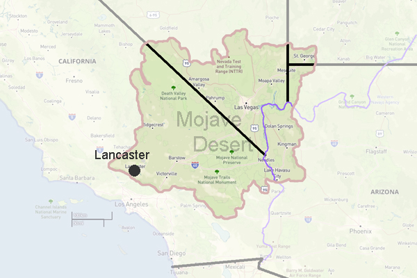
Lancaster, California
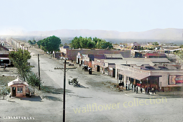
Sierra Highway, Lancaster, Ca. 1918
Lancaster got its start back in 1876 when the Southern Pacific Railroad finished building a line between San Francisco and Los Angeles. One of the stops along the way was at a remote desert spot that later became Lancaster. At first, it was just a place where trains could stop for water. The railroad built homes for workers who kept the tracks running, and soon a small town began to grow nearby.
Not far from the stop, the Lancaster Hotel went up, and out on Lancaster Boulevard, another hotel changed names over the yearsfrom the Antelope Valley Hotel to the Gilwyn, and finally the Western Hotel.
Where Did the Name "Lancaster" Come From?
Theres some mystery around how the town got its name. Most people say it came from Moses Langley Wicks, a real estate developer from Lancaster, Pennsylvania, who bought over 38,000 acres in 1884 and named the area after his hometown. But some older records show the name "Lancaster" was used even before Wicks showed uppossibly named after a railroad worker named J.W. Lancaster. So, it's likely the Southern Pacific Railroad had something to do with naming it in the first place.
Building a Town
In 1884, M.L. Wicks bought land from the railroad for about $2.50 an acre. He laid out streets and started selling 160-acre pieces of land for $6 an acre. Lancaster got its first newspaper in 1885, and by 1890 it was a booming farm town. Good rainfall helped farmers grow tons of wheat and barley.
Hard Times and a Comeback
Then came a terrible drought in 1894 that lasted nearly ten years. Farms dried up, businesses shut down, and cattle were moved elsewhere. Things started looking up again around 1898 when gold and borax were discovered nearby. Borax turned out to be a big dealit was used in all sorts of products from soap to glass.
Things really took off again in 1908, when workers came to the area to help build the Los Angeles Aqueduct. The aqueduct was a massive project that brought water from the Owens Valley to Los Angeles, and Lancaster became a busy place while the work was going on.
Education and Famous Faces
In 1912, the Antelope Valley High School District was created. A big new high school was finished in 1915, and it even had dorms so kids from outlying areas could attend without leaving the region. One of Lancasters most famous former residents was Judy Garland. Before she became a movie star, she lived in Lancaster for seven years starting in 1926, performing locally as a child under her birth name, Frances Baby Gumm.
Growth and Change
In the 1930s, Lancaster began to grow steadily again, helped by the construction of Muroc Air Force Base (later Edwards Air Force Base). The base became known for flight tests and eventually for space shuttle landings. Even though the town had grown a lot over the years, it stayed under Los Angeles Countys control until 1977, when Lancaster officially became its own city.

Lancaster, California Timeline
Over 11,000 years ago - Indigenous peoples inhabit the Antelope Valley, using it as a trading hub.1850s - The area is part of the StocktonLos Angeles Road and the Butterfield Overland Mail route.
1876 - Southern Pacific Railroad builds tracks, establishing a station and facilities that become the nucleus of Lancaster.
1882 - A Scottish community settles in the area.
1884 - Real estate developer M.L. Wicks names the settlement Lancaster after his hometown in Pennsylvania.
18941908 - Prolonged drought brings hardship, but mining discoveries nearby help recovery.
19081913 - Construction of the Los Angeles Aqueduct brings workers and growth.
1977 (November 22) - Lancaster is formally incorporated as a city.
1990s2000s - Film companies use vacant housing for scenes; cultural identity shifts continue.
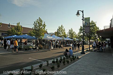
2010 - Lancaster unveils The BLVD, a revitalized cultural corridor.
2012 - The Lancaster Museum of Art and History opens downtown in The BLVD district.
20132014 - Lancaster becomes the first U.S. city to require solar panels on all new homes.
2018 - Downtown Lancaster is designated The BLVD Cultural District, hosting murals, arts, and the Aerospace Walk of Honor.
Lancaster Weather
 Elevation: 2355 feet
County: Los Angeles
Land area: 94.0 square miles
Western Hotel Museum
Ripley Desert Woodland
Poppy Reserve
Tropico Gold Mine
Saddleback State Park
Antelope Valley
West Mojave Desert
Mojave Desert Wildflower Guide
Palmdale CA
Rosamond, CA - Digital-Desert
Mojave CA
Southern Pacific Railroad
California Highway 14
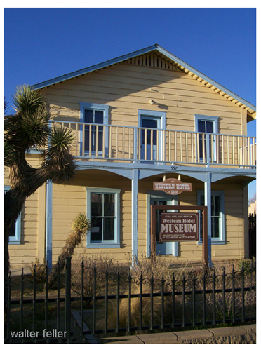
Western Hotel Museum