|
Digital-Desert :
Mojave Desert
|
| Intro:: Nature:: Map:: Parks:: Points of Interest:: Ghosts & Gold:: Communities:: Roads & Trails:: People & History:: BLOG:: Weather:: :?:: glossary |
|
|
Wilderness - MAP 
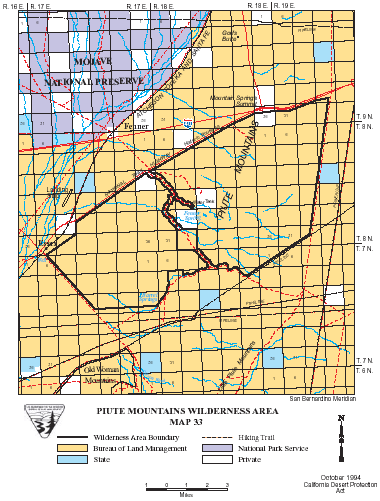
Piute Mountains >> Map #33 Piute Mountains Wilderness
SIZE: 36,840 acres LOCATION: San Bernardino County; 18 miles west of Needles, California 
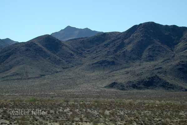
NATURAL RESOURCES: This wilderness encompasses the Piute Mountains. This small range of mountains is bisected by an extensive system of connecting washes. The Mojave Indians refer to these mountains as "Kwikantsoka" and consider them sacred.
ACCESS: To access this wilderness, exit Interstate 40 at Mountain Springs Road (17 miles west of Needles) and travel south on Route 66. The wilderness boundary coincides with the southern edge of the highway's right-of-way. Geomorphic Province : Mojave Desert Ecosection : Mojave Desert Ecosubsection : Providence Mountains - Lanfair Valley, Piute Valley - Sacramento Mountains Native Culture : Mohave, Chemehuevi |
|
| Intro:: Nature:: Map:: Parks:: Points of Interest:: Ghosts & Gold:: Communities:: Roads & Trails:: People & History:: BLOG:: Weather:: :?:: glossary |
|
Digital-Desert :
Mojave Desert
|
|
Country Life Realty Wrightwood, Ca. |
Mountain Hardware Wrightwood, Ca. |
Canyon Cartography |
G.A. Mercantile |
Grizzly Cafe Family Dining |
|
Abraxas Engineering privacy |
Disclaimer: Some portions of this project were developed with assistance from AI tools to help reconstruct historical contexts and fill informational gaps. All materials have been reviewed and fact-checked to ensure accuracy and reliability, though complete precision cannot be guaranteed. The aim is to provide dependable starting points and distinctive perspectives for further study, exploration, and research. These materials are historical in nature and intended for educational use only; they are not designed as travel guides or planning resources. Copyright - Walter Feller. 1995-2025. All rights reserved. |