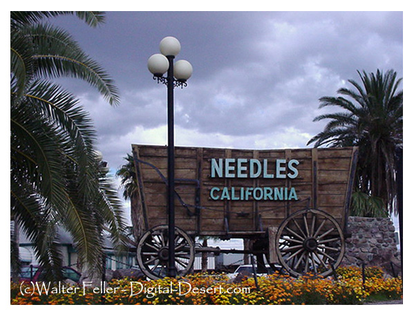
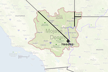
Needles, Ca
Needles, beautiful desert surroundings, the scenic Colorado River, winters full of sunshine ideal for all types of activities, bright blue skies, potential for growth and a friendly community atmosphere.
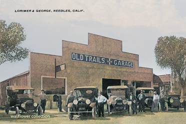
Needles, California, founded in 1883 with the coming of the railroad, and incorporated October 30, 1913 as a California Charter City. Needles is a city with a rich and colorful history.
The Mojave people had been living in the area for hundreds, if not thousands, of years prior to the European exploration of the area. In 1859, Fort Mojave was built to protect immigrants to California and other travelers from the Mojave.
Historic U.S. Route 66 passes through the city, lined with motels and other shops from that era. Located on the Colorado River, Needles is a tourism and recreation center, a tradition going back for decades.
Needles, like Death Valley, is known for extreme heat during the summers. Temperatures in Needles routinely reach 120 °F (49 °C) in late July and early August. The Needles weather station is frequently reported by the United State government's National Oceanic and Atmospheric Administration (NOAA) as the site of the highest daily temperature recorded in the U.S. During the hot desert summers, Needles occasionally sets national or world daily high temperature records.
Southern Pacific & Santa Fe
The Colorado River Gateway: Southern Pacific, Atlantic & Pacific, and Santa FeThe story at the Colorado River is not just a tale of tracks meeting at Needles. It is a story of strategy, monopoly, and timing. In the early 1880s Southern Pacific was determined to keep a rival transcontinental line from gaining a clean entrance into California. The rival was the Santa Fe system, advancing westward through the Atlantic & Pacific Railroad. By then Santa Fe had acquired a major interest in the St. Louis and San Francisco, which in turn gave it control over the Atlantic & Pacific, so although the corporate names at the river were Southern Pacific and Atlantic & Pacific, the real contest was Southern Pacific versus Santa Fe. The fight mattered because control of the California gateway meant control of traffic, rates, and influence across the Southwest.
Congress had chartered the Atlantic & Pacific to build westward along the 35th parallel to the Colorado River, where it was expected to connect with a western line. But Southern Pacific moved aggressively to make sure that this connection would happen on terms favorable to itself. According to the classic Pacific Historical Review account, William B. Strong, president of the Santa Fe, accepted a temporary compromise late in 1882: the Atlantic & Pacific would be allowed to reach the Colorado River, but Southern Pacific would build the California-side line from Mojave to Needles. Strong agreed because the alternative was worse. If Santa Fe could at least plant itself at the river, it would gain what one historian called a "foothold on the very border of the enemy's country." It was not victory, but it was a position from which the fight could continue.
That compromise produced one of the most important railroad scenes in Mojave history. In 1883 the Atlantic & Pacific pushed west to the Colorado and crossed the river on its first bridge in early August. Needles itself was founded as an Atlantic & Pacific crew-change point during this same moment of construction. Yet when the A&P arrived from the east in August 1883, Southern Pacific had already finished its branch eastward from Mojave to the river a short time earlier. The two lines met, but the meeting did not create an equal partnership. Santa Fe had reached California's edge, but Southern Pacific still controlled the outlet across the desert west of Needles. The connection was real, but it was hemmed in from the start.
This is what makes Needles such an important but often misunderstood node. Needles was the breakthrough point, but not yet the place of independence. Santa Fe had come to the river through the Atlantic & Pacific, but Southern Pacific still held the practical advantage because it owned the line from Needles west to Mojave and could shape traffic arrangements to its own benefit. Contemporary accounts describe those arrangements as unsatisfactory, and the broader record shows why. Southern Pacific was already using its power against Santa Fe interests elsewhere, including refusing proper interchange with the California Southern at Colton and diverting freight in ways that weakened its rival. Reaching the river, then, was only the first stage. The larger battle was over whether the foothold at Needles could be turned into a true California entrance.
William B. Strong understood that point clearly. Faced with the situation in 1884, he saw that Santa Fe could not remain permanently dependent on Southern Pacific's goodwill. The Pacific Historical Review article lays out the logic plainly: there seemed to be only one workable solution, namely to buy the Southern Pacific division from Mojave to Needles and thus secure for the Atlantic & Pacific a practically independent right of way. That agreement was signed on August 20, 1884. Even then, however, the story was not complete. Santa Fe still needed a direct Southern California approach of its own. That came when the California Southern, Santa Fe's subsidiary from San Diego, pushed north through Cajon Pass and connected with the desert line at Barstow in November 1885. With that link completed, Santa Fe at last had an independent rail entrance into Southern California. Needles had been the foothold; Barstow made the foothold usable.
So the Colorado River connection should be understood as a three-part story. First came Southern Pacific's defensive move: build east from Mojave and block a rival from entering California freely. Second came Santa Fe's partial success: use the Atlantic & Pacific to reach the Colorado River and establish a presence at Needles. Third came the real turning point: convert that precarious presence into an independent route by acquiring the Mojave-Needles line and then tying it to the California Southern at Barstow. In that sense, the drama at the river was not the final triumph but the opening breach in Southern Pacific's wall. Needles marks the moment Santa Fe got its hand on the gate. The full opening of the gate came only afterward. That closing interpretation is an inference from the chronology and strategic descriptions in the historical sources.
For your project, the cleanest takeaway is this: at the Colorado River the formal railroad meeting was Southern Pacific and Atlantic & Pacific, but the historical meaning of the event is Southern Pacific versus Santa Fe. Needles is the border foothold node. Barstow is the independent California breakthrough node.
Also see:
Garces Harvey House
Early in the 1900s, when trains were the principal means of personal transportation, depots gave travelers a ...
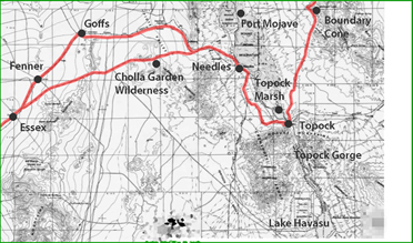
Bigelow Cholla Garden Wilderness
The densest concentration of Bigelow cholla cactus in the California Desert is found within this wilderness.
Mystic Maze
Not a true maze, this site is a series of windrows placed in an extensive geometric ...
Colorado River
The Colorado River runs approximately 1,450 mi (2,330 km) from the western slopes of the Rocky Mountains across the ...
Topock Gorge
The colorful Colorado River zig-zags its way through the jagged formations, past ...
Topock Marsh - Havasu Wildlife Refuge
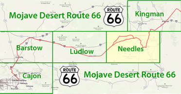
Route 66
Interstate 40
Needles Weather
Needles History
Early Days of Needles
Historic Photos
Route 66
National Old Trails
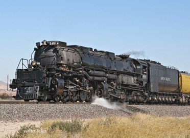
Santa Fe Railroad
Garces Harvey House
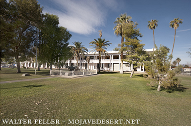
El Garces Harvey House
First Trans-Mojave Railroad