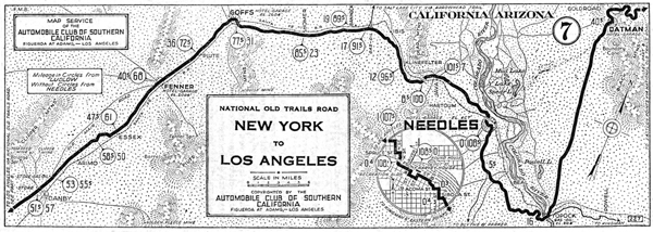
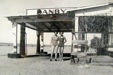
Needles - Danby - 1923

Danby is the next objective point, and the motorist travels westward a distance of fifty-seven miles over a section that is typically desert. The Santa Fe Railway is traversed between these points and is crossed at several places. The roadway proper is of a natural gravel surface with a few miles of oiled mac-adam east of Goffs and between Essex Station and Danby. During the midsummer months, the heat over the desert is quite oppressive, but this discomfort can be avoided if the motorist will drive thru during the cooler hours of the night.
In leaving Needles the route bears almost directly west to Goffs, then south the remainder of the distance to Danby. Piute Mountain rises southeast of Essex, and the Clipper Mountains are located to the north of Danby. In the early pioneer days, there were a number of famous mines in this section of the desert. The Tom Reed and the Clipper mines are situated north of Danby, and the Golden Fleece mine is to the west and south of the same town. Once there were crowds of miners and prospectors in the country, but later years thinned and dispersed their ranks, and the desert came gradually back to its own.
Danby - Ludlow < > Kingman - Needles
Essex
Goffs
Needles
