Route 66 - Mojave Desert
There is nothing like Route 66 in America. Main Street of America has been immortalized in song, literature, and television. Early on, automobiles followed the railroad with its valuable water resources to the desert. In the early 1900s, the route was called the National Old Trails Road. US Route 66 was paved from Los Angeles to Chicago by 1926. As a result of dustbowl immigrants' heavy travel, Steinbeck called it the Mother Road. After Interstate 40 bypassed Route 66 in 1973, the designation was dropped in 1985. -w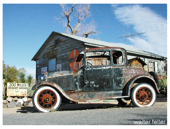
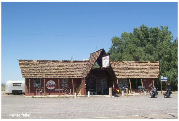
Hackberry, Arizona
In the heart of the California desert, between the towns of Barstow and Needles, stretches a ribbon of history, most of which traverses public lands and serves as a symbol of the pioneering spirit of emigrants coming West and an icon of American freedom and mobility. Dubbed "The Mother Road," in John Steinbeck's "The Grapes of Wrath," Route 66 continues to be an international bucket-list item for many travelers wanting to - as the song goes - get their "kicks on Route 66."
Newberry Springs, California
Route 66 had its beginnings in the West's old wagon roads of the 1800s. Later, the railroads followed much of this same corridor, further establishing routes that would ultimately become part of Route 66. Towns established themselves along the route and became hubs for trading posts, hotels and restaurants. Many roadside services such as gas stations and diners were established as a result of this road. In fact, it has been said that Route 66 led to the invention of the motel. As traffic increased between towns, a need for these main streets to become connected grew. On Nov. 11, 1926, U.S. Highway 66 was offcially established and still serves as one of the most famous highways in America. Also called America's Main Street, the 2,400-mile highway extending from Chicago to Los Angeles quickly became the principal route of travel from the Midwest to the Pacific Coast, carrying thousands of people each year to the booming West, particularly Southern California.
Route 66 had its beginnings in the West's old wagon roads of the 1800s. Later, the railroads followed much of this same corridor, further establishing routes that would ultimately become part of Route 66. Towns established themselves along the route and became hubs for trading posts, hotels and restaurants. Many roadside services such as gas stations and diners were established as a result of this road. In fact, it has been said that Route 66 led to the invention of the motel. As traffic increased between towns, a need for these main streets to become connected grew. On Nov. 11, 1926, U.S. Highway 66 was offcially established and still serves as one of the most famous highways in America. Also called America's Main Street, the 2,400-mile highway extending from Chicago to Los Angeles quickly became the principal route of travel from the Midwest to the Pacific Coast, carrying thousands of people each year to the booming West, particularly Southern California.

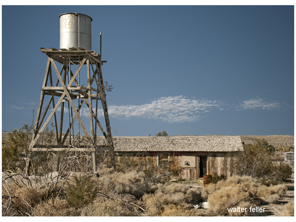
Chambless, California
Because of its connection to the westward expansion, large portions of the historic highway pass through public lands managed by the Bureau of Land Management, making it a distinctive historical and cultural public lands experience.
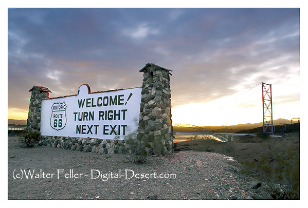 Needles, California
Winter here, with its abundance of wildflowers, is a perfect time to explore Route 66 in Southern California where public lands contain iconic pieces of American history, areas of rich cultural diversity, and exceptional geologic landscapes. The route passes through small towns such as Amboy, a nearly empty ghost town in California's Mojave Desert. Amboy is home to Roy's Motel and Cafe, a Route 66 landmark that has been preserved, making it an ideal backdrop for photographers and filmmakers. Nearby, the 6,000-year-old, 250-foot-high Amboy Crater National Natural Landmark, managed by the BLM, is one of the best examples in the Mojave Desert of a volcanic cinder cone.
 La Delta, Bryman, California
Throughout the years, Route 66 has become the subject of many stories, songs and even a 1960s TV show that celebrated freedom, the open road and the Chevrolet Corvette. Although it was effectively replaced by the interstate highway system in the 1960s, the road's aura of promise and possibility remains for the many visitors to the California Desert.
Steve Razo - BLM California Desert District Office.
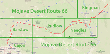
 - Cajon
 - Barstow
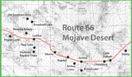 - Ludlow
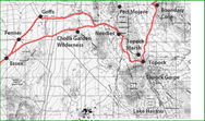 - Needles
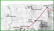 - Kingman
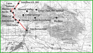
From Trail to Expressway
The Sagebrush Route
the railroadsRoute 66 is an iconic highway that has left a significant mark on American culture, especially through the Mojave Desert. Known as the "Main Street of America," it was established in 1926 and became a crucial route for westward travel, connecting Chicago to Los Angeles. The road is celebrated in various forms of media and is a symbol of freedom and mobility.
Key Locations on Route 66 in the Mojave Desert:
Hackberry, Arizona:
This historic area captures the essence of Route 66's legacy, with sites like the Hackberry General Store offering a glimpse into the past.
Bagdad Cafe (formerly Sidewinder Cafe), Newberry Springs, California:
A famous stop along Route 66, immortalized in the movie "Bagdad Cafe," this spot is a must-visit for its quirky charm and cinematic history.
Chambless, California:
One of the many small towns along Route 66, Chambless is a reminder of the road's role in connecting isolated communities.
Needles, California:
Located near the border of California and Arizona, Needles is known for its extreme desert climate and historical significance on Route 66.
Amboy, California:
Home to Roy's Motel and Cafe, a classic Route 66 landmark. The nearby Amboy Crater, a 250-foot-high volcanic cinder cone, offers unique geological insights and stunning landscapes.
Historical Context:
Origins and Development:
Route 66 evolved from the old wagon roads and railroads of the 1800s, solidifying its path through various towns that sprang up along the way.
It became a primary route during the Dust Bowl migration, famously dubbed the "Mother Road" by John Steinbeck in "The Grapes of Wrath."
Impact on Communities:
The highway spurred the development of roadside services, including gas stations, diners, and motels, essentially giving birth to the motel concept.
Towns along Route 66 thrived as hubs for trade and travel.
Modern Significance:
Despite being bypassed by Interstate 40 and losing its official designation in 1985, Route 66 remains a symbol of Americana. Public lands along the route, managed by the Bureau of Land Management, offer a blend of historical and cultural experiences. The route's legacy continues to attract travelers from around the world, eager to experience the nostalgia and scenic beauty of America's historic highway.
Seasonal Highlights:
Winter Exploration:
Winter is an ideal time to explore Route 66 in Southern California, with mild temperatures and an abundance of wildflowers. The area offers rich cultural diversity and stunning geological features, making it perfect for outdoor enthusiasts and history buffs alike.
Route 66's journey through the Mojave Desert is more than just a drive; it's a trip through history, culture, and the enduring spirit of the American West.