Desert Food Chain

The desert food chain is a complex system involving various organisms interacting for energy and survival. Despite the harsh conditions of deserts, life has adapted to these environments, and a delicate balance exists within the food chain. Here is a simplified overview of the desert food chain:

Seeds → kangaroo rat → rattlesnake → hawk
Wildflowers → grasshopper → lizard → roadrunner
Grasses and wildflowers → desert tortoise → raven (primarily eggs and young tortoises)
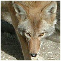
Shrubs → jackrabbit → coyote

  1. Producers:
    • Plants and Cacti: Deserts have specialized plants adapted to conserve water and thrive in arid conditions. Examples include cacti, succulents, and drought-resistant shrubs. These plants are primary producers, converting sunlight into energy through photosynthesis.
  2. Primary Consumers:
    • Herbivores: Insects, rodents, and small mammals feed on desert plants. Examples include grasshoppers, mice, and rabbits. These organisms are primary consumers that obtain their energy by consuming plants.
  3. Secondary Consumers:
    • Carnivores: Predators in the desert feed on herbivores. Examples include snakes, lizards, and birds of prey. Some mammals like foxes and coyotes also fall into this category, preying on smaller animals for sustenance.
  4. Tertiary Consumers:
    • Top Predators: Larger predators at the top of the desert food chain prey on herbivores and smaller carnivores. Examples include large birds of prey like eagles and apex predators like some species of bobcats and mountain lions.
  5. Scavengers:
    • Scavengers: These organisms feed on the remains of dead animals. Scavengers play a crucial role in nutrient recycling in the desert ecosystem. Vultures are an example of scavengers.
  6. Decomposers:
    • Microorganisms: Decomposers decompose organic matter, such as dead plants and animals, into simpler nutrients the soil can absorb. Bacteria and fungi are essential decomposers in the desert ecosystem.

Throughout this food chain, energy is transferred from one trophic level to the next, with each level being dependent on the level below for its energy source. Water is a limiting factor in deserts, and many organisms have adapted various mechanisms to conserve water or extract it efficiently from their food sources. The delicate balance of the desert food chain is essential for the survival of its inhabitants in these harsh environments.

Desert Food Chain

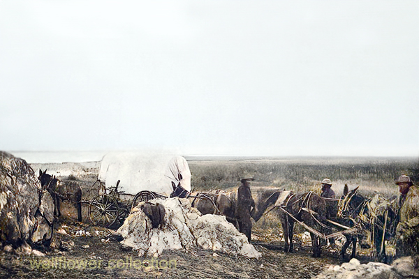
Stagecoaches and Stage Routes in the Mojave Desert

In the 19th century, stagecoaches and stage lines were crucial in transportation across the American West, including the Mojave Desert. The Mojave Desert, located in the southwestern United States, spans parts of California, Nevada, Utah, and Arizona. Stagecoaches were an essential means of transportation for people and goods during this time, connecting remote areas and facilitating the westward expansion.

Key points about stagecoaches and stage lines in the Mojave Desert include:

  1. Butterfield Overland Mail Route:
    • The Butterfield Overland Mail Company operated one of the most famous stagecoach routes in the 1850s. The Butterfield Overland Mail Route ran from St. Louis, Missouri, to San Francisco, California, passing through the Mojave Desert. This route covered vast distances and was critical for mail delivery and passenger transport.
  2. Mojave Road:
    • The Mojave Road was a historic trade route later used by stagecoaches, connecting the Colorado River with the Mojave River. It was a challenging trail across the desert, and stagecoaches faced numerous obstacles, including extreme heat, lack of water, and rough terrain.
  3. Water Stops:
    • One of the significant challenges for stagecoach travel in the Mojave Desert was water scarcity. Stagelines had to plan their routes carefully, stopping at reliable water sources to replenish supplies for passengers and horses.
  4. Freighting and Passenger Service:
    • Stagecoaches served as freighting vehicles for goods and as a mode of passenger transport. Passengers endured long, uncomfortable journeys in the stagecoaches’ often cramped and sweltering conditions.
  5. Overland Trail Companies:
    • Various stagecoach companies operated in the Mojave Desert, providing services to different regions. These companies included the Pioneer Stage Line and the California Stage Company.
  6. Decline of Stagecoaches:
    • The rise of the transcontinental railroad in the late 19th century contributed to the decline of stagecoach travel. Railroads provided a faster and more efficient means of transportation, reducing the reliance on overland stagecoach routes.
  7. Historical Landmarks:
    • Some remnants of the old stagecoach routes and stations can still be found in the Mojave Desert, serving as historical landmarks. These sites provide a glimpse into the challenges early travelers face in the region.

Today, the legacy of stagecoaches and stage lines in the Mojave Desert is preserved in museums, historical sites, and the stories of the Old West. The Mojave Desert symbolizes the challenges and adventures faced by pioneers and travelers in the 19th century.

Ecosections

Ecosections, also known as ecological sections, are geographic subdivisions of a region based on its climate, landforms, and vegetation. In California, the state is divided into several ecosections, each characterized by unique ecological features. These divisions help in understanding and managing the diverse ecosystems within the state. Remember that the specific ecosection classification system may vary depending on the source. One commonly used system is the “California Ecological Units” classification. Here are some examples of ecosections in California:

  1. Sierra Nevada
    • Characterized by high mountain ranges, including the iconic Sierra Nevada.
    • Alpine and subalpine ecosystems, mixed conifer forests, and meadows.
  2. Southern California Mountains and Valleys
    • Encompasses the Transverse and Peninsular Ranges.
    • Chaparral, coastal sage scrub, and oak woodlands are common vegetation types.
  3. Central California Valley
    • Includes the expansive Central Valley, a major agricultural region.
    • Diverse agricultural landscapes, grasslands, and riparian ecosystems.
  4. Great Basin
    • Spans the northeastern part of California.
    • Sagebrush steppe, pinyon-juniper woodlands, and mountain ranges.
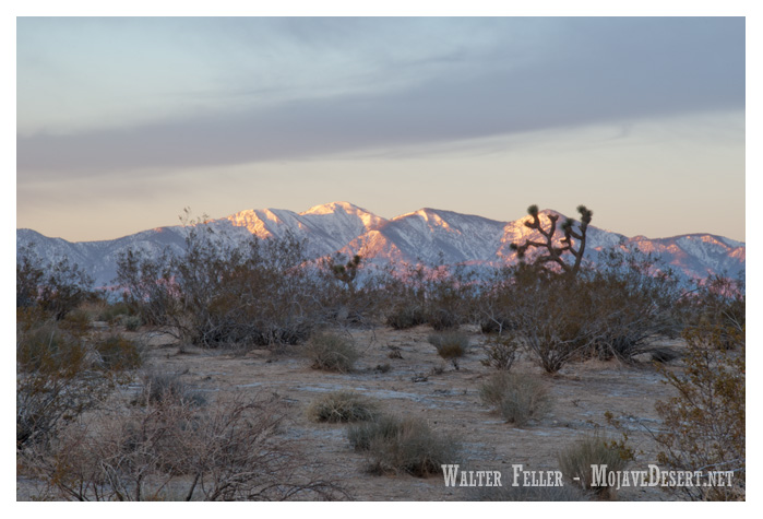
  5. Mojave Desert
    • It is located in the southeastern part of the state.
    • Characterized by desert landscapes with Joshua trees, creosote bush, and other desert plants.

These ecosections provide a framework for understanding the ecological diversity of California, which is crucial for conservation, land management, and environmental planning. It’s important to note that these descriptions are generalizations, and there may be ecosystem variations and overlaps within each ecosection.

Googie Architecture

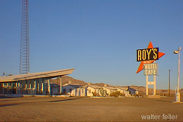
Roy’s Motel & Cafe – Amboy, Ca.

Googie architecture is a distinctive architectural style that emerged in the mid-20th century in the United States. It is often associated with the design of roadside architecture, particularly diners, motels, gas stations, and other commercial buildings. The style is characterized by bold, futuristic, and space-age elements, reflecting the optimism and fascination with technology that prevailed during the post-World War II era.

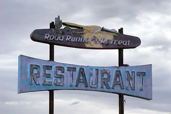
Neon sign – Road Runner’s Retreat, 2001 – Route 66, Mojave Desert

Key features of Googie architecture include:

  1. Upswept Roofs and Dramatic Angles: Buildings often feature bold, upswept roofs, acute angles, and dynamic geometric shapes.
  2. Large Plate Glass Windows: Transparency and visibility were emphasized, with large windows often integrated into the design.
  3. Steel and Concrete Construction: The use of modern materials, such as steel and concrete, was common in Googie architecture.
  4. Atomic and Space Age Motifs: Elements inspired by the Space Age, atomic symbols, and futuristic motifs were frequently incorporated into the design, reflecting the cultural fascination with space exploration and technology.
  5. Neon Signs and Lighting: Bright and colorful neon signs were a hallmark of Googie architecture, contributing to a vibrant and attention-grabbing aesthetic.
  6. Futuristic Materials: The use of materials like Formica, plastic, and fiberglass, which were considered modern and cutting-edge at the time.
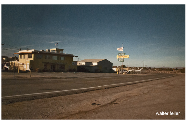
Hesperia Airport

Googie architecture reached its peak popularity in the 1950s and 1960s but declined in the subsequent decades. Nevertheless, it has left a lasting impact on popular culture and is celebrated for its whimsical and nostalgic qualities. Many examples of Googie architecture can still be found across the United States, particularly in areas that experienced significant suburban development during the mid-20th century.

Las Vegas, Nevada – 2005

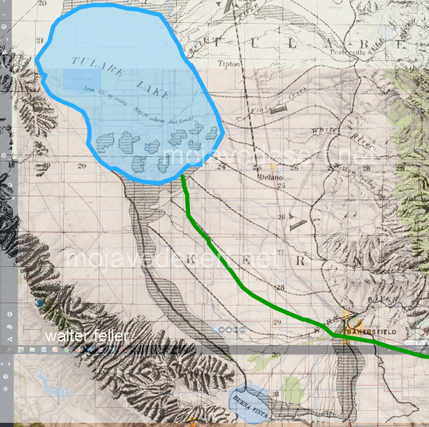
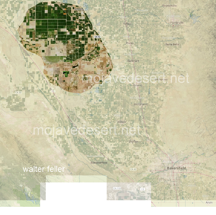
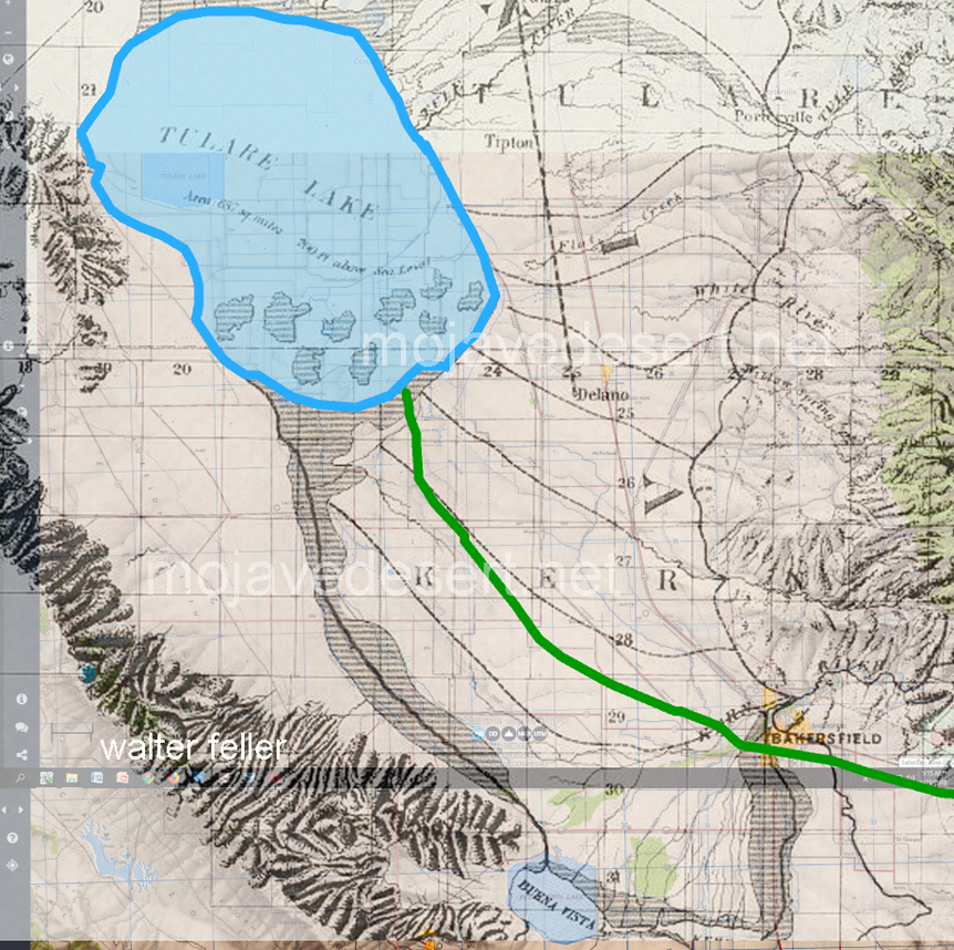
Tulare Lake – Vanished

Many folks interested in Mojave Desert history are aware that in 1776, Francisco Tomás Hermenegildo Garcés was the first non-native American to cross the Mojave from the Mojave Indian villages near Needles at the Colorado River to the Mission San Gabriel near Los Angeles, California.  Trapper and explorer Jedediah Smith also crossed the Mojave in 1826 and in 1827.

Tulare Lake – 1874

Not so well known is that when they left the mission at San Gabriel, both men made their way north to the San Joaquin Valley and the shore of Tulare Lake.   In tracking the paths of both men concerning our modern geography, it is soon discovered that this lake does not seem to exist.

What happened to Tulare Lake?

The answer to this mystery of a disappearing lake is simple yet inelegant and predictable:

At the onset of American settlement in the area in the late 1840s, the lake was the largest body of fresh water west of the Great Lakes. Its destruction by the late 1800s because of diking and water diversion for irrigation was one of the most dramatic signs of a major theme in the state’s history: the rapid transformation of the wild California landscape into one dominated almost completely by human action.

From Report of the Board of Commissioners on the Irrigation of the San Joaquin, Tulare, and Sacramento Valleys of the State of California.

Tulare Lake Satellite Overlay 2018

So, now you know.

California High & Low Deserts

https://mojavedesert.net/ecology/

California is home to high and low deserts, characterized by distinct features, climates, and elevations. The primary differences between California’s high and low deserts include elevation, temperature, and vegetation.

Low Desert
High Desert
  1. Elevation:
    • High Desert: The high desert refers to areas at higher elevations, typically between 2,000 and 4,000 feet above sea level. Examples of high desert regions in California include the Mojave Desert. Cities like Lancaster and Palmdale are located in the high desert region.
    • Low Desert: The low desert, on the other hand, is found at lower elevations, often below 2,000 feet. The Colorado Desert, part of the larger Sonoran Desert, is an example of a low desert in California. Cities like Palm Springs and Indio are located in the low desert region.
  2. Temperature:
    • High Desert: High deserts generally experience greater temperature fluctuations between day and night. Summers can be hot, with daytime temperatures exceeding 100°F (37.8°C), while winters can be cool, with nighttime temperatures dropping significantly.
    • Low Desert: Low deserts tend to have higher average temperatures, especially during the summer. Daytime temperatures in the low desert areas can often surpass 100°F (37.8°C), and the winters are milder compared to the high deserts.
  3. Vegetation:
    • High Desert: Vegetation in the high desert is adapted to the arid conditions and includes hardy shrubs, grasses, and some cold-resistant plants. Joshua trees are a characteristic plant of the Mojave Desert.
    • Low Desert: The low desert is known for its unique plant life, including various species of cacti and succulents. The iconic saguaro cactus is commonly found in the lower elevations of the Sonoran Desert.
  4. Geography:
    • High Desert: The high desert often features rocky terrain and vast expanses of open land and is characterized by a mix of mountains, plateaus, and valleys.
    • Low Desert: The low desert may have more sandy and flat terrain, including areas with salt flats. Rugged mountains may also punctuate the landscape.

It’s important to note that these are generalizations, and there can be variations within each desert region. The specific characteristics can also vary depending on the exact location within California.

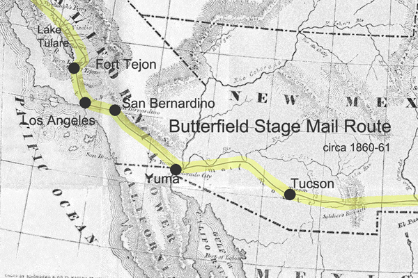
Butterfield Overland Stage Mail Route

The Butterfield Overland Mail Route was a historic transportation route in the mid-19th century that played a crucial role in connecting the eastern and western parts of the United States.

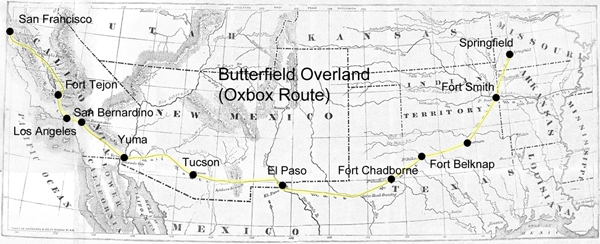
Butterfield Overland Stage Route
(Oxbow Route)

Here are some key points about the Butterfield Overland Mail Route:

  1. Establishment: The Butterfield Overland Mail Company was awarded a government contract in 1857 to establish and operate a stagecoach and mail route between St. Louis, Missouri, and San Francisco, California. The purpose of the route was to improve communication and transportation between the two coasts, especially in light of the California Gold Rush.
  2. Route: The route covered approximately 2,800 miles and passed through eight present-day states: Missouri, Arkansas, Oklahoma, Texas, New Mexico, Arizona, California, and Oregon. It traversed various terrains, including deserts, mountains, and plains.
  3. Frequency and Duration: The Butterfield Overland Mail Company operated its stagecoaches twice a week in each direction, and the journey took about 25 days to complete. This significantly improved travel time compared to other methods available at the time.
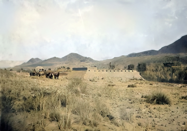
  4. Stations and Stops: The company established a series of stations along the route to facilitate the long and arduous journey, spaced about 20-30 miles apart. These stations provided fresh horses, food, and accommodations for passengers and drivers. Some of these stations eventually became important settlements in their own right.
  5. Challenges: The route faced numerous challenges, including harsh weather conditions, difficult terrain, and the threat of attacks from Native American tribes. The company had to implement security measures to protect passengers and mail.
  6. End of Operations: The Butterfield Overland Mail Route faced financial difficulties exacerbated by the onset of the Civil War. 1861, the service was suspended, and the stagecoaches and stations were abandoned. The route became less relevant as the transcontinental railroad was completed after the Civil War, offering faster and more reliable transportation.
  7. Legacy: While the Butterfield Overland Mail Route was relatively short-lived, its legacy persists. The route contributed to the United States’s westward expansion and shaped the development of communities along its path. Some old stations have been preserved as historic sites, and portions of the route have been designated the “Butterfield Overland Mail Route.”

The Butterfield Overland Mail Route remains an important chapter in the history of westward expansion and transportation in the United States during the mid-19th century.

https://mojavedesert.net/stagecoaches/

https://mojavedesert.net/mojave-desert-indians/

https://digital-desert.com/historic-roads/

  1. Butterfield Overland Mail (or Oxbow Route):
    • The Butterfield Overland Mail was a stagecoach and mail delivery service that operated from 1857 to 1861. It was a vital communication and transportation link between the eastern and western United States.
    • The route covered approximately 2,800 miles, connecting St. Louis, Missouri, and San Francisco, California. It passed through several states, including Missouri, Arkansas, Texas, New Mexico, Arizona, and California.
    • The term “Oxbow” might not be directly associated with the Butterfield Overland Mail but could be a local or regional name for a section of the route or a specific location along the way.
  2. Overland Stage Route:
    • The Overland Stage Route, on the other hand, generally refers to the network of stagecoach routes that existed in the western United States during the 19th century. These routes were crucial for mail delivery, transportation of passengers, and freight.
    • The most famous of these stagecoach lines was the Butterfield Overland Mail, but there were other stage lines as well, such as the Central Overland California and Pikes Peak Express Company (C.O.C. & P.P.), which operated a route known as the “Pony Express.”

19th Century Military

https://mojavedesert.net/military/

Camp Cady – 1863, Rudolph D’Heureuse

The 19th century was a period of significant expansion and change in the United States, and the military played a crucial role in securing and maintaining control over newly acquired territories. The Mojave Desert was part of this expansion in the southwestern United States. Here are some key points about the military in the Mojave Desert during the 19th century:

  1. Mexican-American War (1846-1848): The Treaty of Guadalupe Hidalgo 1848 ended the Mexican-American War and ceded a large portion of territory, including the Mojave Desert, to the United States. The U.S. Army played a central role in the conquest and occupation of these new territories.
  2. California Gold Rush (1848-1855): The discovery of gold in California in 1848 led to a massive influx of settlers and prospectors. This increased population in the region and the military was tasked with maintaining order, protecting settlers from Native American resistance, and resolving conflicts among different groups.
  3. Mormon Pioneer Expeditions: In the mid-19th century, Mormon pioneers, led by Brigham Young, established a series of settlements in what is now Utah and the surrounding areas, including parts of the Mojave Desert. The military presence was important for maintaining peace and resolving disputes between the settlers and other groups.
  4. Butterfield Overland Mail Route: In the late 1850s, the Butterfield Overland Mail Company established a stagecoach route through the Mojave Desert, connecting the eastern and western coasts. The U.S. Army protected the mail coaches and stations along the route.
  5. Civil War (1861-1865): During the Civil War, many military forces were withdrawn from the western frontier to participate in the conflict. This temporarily reduced the military presence in the Mojave Desert. Additionally, the Confederate Army briefly invaded Arizona and New Mexico territories, which included parts of the Mojave Desert.
  6. Indian Wars: The 19th century saw conflicts between the U.S. military and various Native American tribes in the Mojave Desert region. The military was involved in efforts to control and relocate Native American populations.
  7. Fort Mojave: Established in 1859, Fort Mojave played a significant role in the military’s presence in the Mojave Desert. It served as a base for operations against local Native American tribes and protected settlers and travelers.
  8. Railroad Construction: The late 19th century also saw the construction of railroads through the Mojave Desert. The military played a role in ensuring the security of railroad workers and the transportation of goods.

Overall, the military presence in the Mojave Desert during the 19th century was shaped by the expansion of the United States, the Gold Rush, conflicts with Native American tribes, and the development of transportation routes across the region.

Randsburg Railway

https://mojavedesert.net/railroads/randsburg-railway/

Randsburg Railway refers to a historic narrow-gauge railway that once operated in and around the town of Randsburg, California, in the United States. Randsburg is a small mining town located in the Mojave Desert, and the railway played a significant role in the transportation of minerals and people in the late 19th and early 20th centuries.

The Randsburg Railway was primarily built to serve the mining industry, carrying gold, silver, and other valuable minerals from the mines in the area to nearby processing facilities. The railway also provided a means of transportation for the town’s residents and visitors.

The railway was initially constructed in 1896, connecting Randsburg with the Southern Pacific Railroad at Kramer Junction. The tracks covered about 12 miles and used narrow-gauge equipment. The Southern Pacific Railroad acquired the Randsburg Railway in 1897, and it became part of their system. This connection with the Southern Pacific allowed for the efficient transportation of ore and other goods to wider markets.

Over the years, the mining industry in Randsburg declined, and as a result, the railway’s importance diminished. The line was eventually abandoned in the mid-1930s. Today, Randsburg is a small, historic town that attracts tourists interested in its mining heritage and the remnants of the railway, which can still be seen in the area.

The Randsburg Railway is a part of the rich history of mining and transportation in the American West. It serves as a reminder of the challenges and opportunities that existed in the region during the late 19th and early 20th centuries.

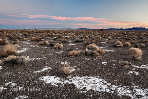
Amargosa Desert

/amargosa/

The Amargosa Desert is a desert in the southwestern United States, primarily in southeastern California and southwestern Nevada. It is part of the larger Mojave Desert region. The term “Amargosa” is Spanish for “bitter,” it may refer to the bitter water found in the area.

One notable feature of the Amargosa Desert is the Amargosa River, which flows through the region. The river is intermittent and often runs underground for significant portions of its course. Sparse vegetation, dunes, and rocky terrain characterize the desert landscape.

The Amargosa Desert is near Death Valley, one of North America’s hottest and driest places. It is a harsh environment with extreme temperatures, especially during summer. Despite its arid nature, the desert supports a variety of plant and animal life adapted to the challenging conditions.

The region is known for its scenic beauty, unique geological formations, and desert landscapes. The Amargosa Opera House and Hotel, located in the town of Death Valley Junction in the Amargosa Desert, is a historic and cultural landmark in the area. Overall, the Amargosa Desert is an interesting and remote part of the desert landscape in the American Southwest.

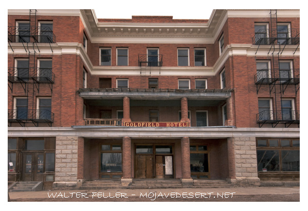
Goldfield Hotel

/goldfield-nv/

The Goldfield Hotel is a historic hotel located in Goldfield, Nevada, USA. Goldfield was a boomtown in the early 20th century, fueled by the discovery of gold in the area in 1902. The Goldfield Hotel was one of the many grand buildings constructed during this time, and it opened its doors in 1908.

The hotel was designed by architect George E. Holesworth and was known for its luxurious accommodations and modern amenities at the time. It boasted features such as an elevator, electric lights, and steam heat. The Goldfield Hotel quickly became a symbol of the prosperity and wealth associated with the gold mining industry.

However, the prosperity of Goldfield was short-lived, as the gold production in the area declined, leading to a population decrease and economic downturn. The hotel closed in 1945, and since then, it has gained a reputation for being haunted. Over the years, various paranormal experiences and stories have been associated with the Goldfield Hotel, contributing to its mystique.

In recent years, efforts have been made to restore and renovate the Goldfield Hotel. The building is a historic landmark and reminds us of the town’s vibrant past. It has also attracted the attention of those interested in paranormal activity and ghost hunting due to its rumored haunted history. The Goldfield Hotel remains an intriguing piece of Nevada’s history and architecture.

Furnace Creek, Death Valley

/furnace-creek-ca/history.html

Furnace Creek is a well-known location in Death Valley National Park in eastern California, USA. It is a popular tourist destination and serves as the primary visitor center for the park. Here are some key points about Furnace Creek:

Location: Furnace Creek is in the heart of Death Valley, one of North America’s hottest and driest places. It’s approximately 190 feet (58 meters) below sea level, making it one of the lowest points in North America.

Visitor Center: The Furnace Creek Visitor Center is a central hub for visitors to the national park. It provides information about the park’s geology, history, and natural features. It’s a starting point for exploring the various attractions within Death Valley.

Climate: Furnace Creek is known for its extreme desert climate, with scorching summer temperatures exceeding 120°F (49°C). Winters are milder but still relatively warm compared to many other regions.

Attractions: Nearby attractions in the Furnace Creek area include Badwater Basin, the lowest point in North America; Zabriskie Point, known for its unique erosional landscape; Artist’s Palette, an area with colorful mineral deposits; and more.

Lodging and Services: Furnace Creek offers lodging options such as the Furnace Creek Inn and Ranch Resort, campgrounds, and restaurants, making it a convenient base for exploring the park.

History: The name “Furnace Creek” reflects the region’s extreme heat. This area has a human settlement and mining history; some historic structures can still be seen nearby.

Furnace Creek is a popular starting point for exploring the natural wonders and unique features of Death Valley National Park. Its striking desert landscapes, geological formations, and harsh conditions make it a remarkable destination for adventurous travelers.

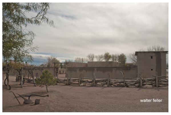
Mormon Fort, Las Vegas, Nevada

https://digital-desert.com/mormon-fort/

The Mormon Fort in Las Vegas, Nevada, is a historic site that holds significance in the region’s history. It is also known as the Old Mormon Fort State Historic Park. The fort represents the birthplace of Las Vegas and is considered the first permanent, non-native settlement in the Las Vegas Valley.

Here are some key points about the Mormon Fort:

  1. Establishment: The fort was established by a group of Mormon missionaries led by William Bringhurst in 1855. They were sent to the area to establish a way station along the Old Spanish Trail.
  2. Purpose: The Mormons built the fort to provide a place for travelers and settlers to rest and replenish supplies as they journeyed through the region. It served as a crucial stop for those traveling between Salt Lake City and Southern California.
  3. Abandonment: Due to conflicts with local Native American tribes and other challenges, the Mormons abandoned the fort in 1857.
  4. Later History: The fort had various uses over the years, including serving as a ranch and a military post. In the early 20th century, efforts were made to preserve and restore the site.
  5. State Historic Park: Today, the Old Mormon Fort is a state historic park managed by the Nevada Division of State Parks. It offers visitors a glimpse into the area’s past, featuring reconstructed adobe buildings and interpretive exhibits.
  6. Location: The Mormon Fort is located in downtown Las Vegas, near the intersection of Las Vegas Boulevard and Washington Avenue.

Visitors to the Mormon Fort can explore the historic structures, learn about the early pioneers who settled in the area, and gain insights into the challenges faced by the original inhabitants. The site provides a contrast to the modern development of Las Vegas and highlights its historical roots.

Old Spanish Trail and Las Vegas

/las-vegas-springs/

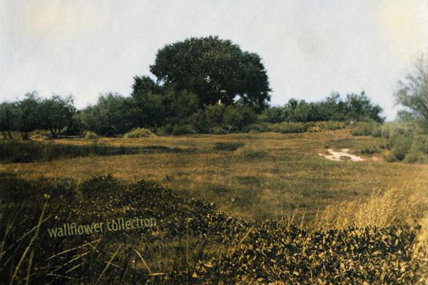
Meadow at Las Vegas Springs


Las Vegas has historical connections to the Old Spanish Trail, which was crucial in developing and expanding trade routes in the American Southwest during the 19th century.

  1. Trade Route Influence: The Old Spanish Trail passed through the general vicinity of what is now Las Vegas. This trail served as a trade route between Santa Fe, New Mexico, and the coastal areas of California. It was used by traders, trappers, and others involved in commerce.
  2. Water Source: Las Vegas, which means “The Meadows” in Spanish, was named after the natural artesian springs in the area. These springs provided a reliable water source for travelers along the Old Spanish Trail, making Las Vegas an important stop for those traversing the harsh desert landscape.
  3. Stopping Point: The springs in the Las Vegas Valley made it a natural stopping point for travelers, providing a place to rest, replenish water supplies, and allow livestock to graze. This contributed to the area’s significance along the Old Spanish Trail.
  4. Connection to Mexican Trade: The Old Spanish Trail was part of the larger system of trade routes that connected Mexico with the western regions of North America. It facilitated the exchange of goods and helped integrate the economies of different regions.
  5. Transition to Modern Era: While the Old Spanish Trail fell out of use with the advent of more direct transportation routes, the presence of reliable water sources continued to make Las Vegas a notable location in the arid landscape of the Southwest.

Today, the historical significance of the Old Spanish Trail is recognized in the region. Efforts have been made to preserve and commemorate parts of the trail, and there is ongoing interest in its history. Having grown from a small oasis in the desert, Las Vegas has transformed into a major metropolitan area. Still, its history as a stopping point along the Old Spanish Trail remains an important part of the region’s heritage.

Travelers and history enthusiasts can explore this connection by visiting historical sites in and around Las Vegas, learning about the Old Spanish Trail’s impact on the area, and appreciating the city’s unique role in the broader context of Western exploration and trade.

Points of Interest in the Mojave

The Mojave Desert, located in the southwestern United States, is known for its unique landscapes and interesting points of interest. Here are some notable places to visit in the Mojave Desert:

  1. Joshua Tree National Park: Famous for its otherworldly Joshua trees, it offers stunning rock formations, hiking trails, and stargazing opportunities. Key attractions include Skull Rock, Hidden Valley, and Keys View.
  2. Death Valley National Park: While part of Death Valley extends into the Mojave Desert, this park is worth mentioning. It’s the hottest and driest national park in the United States. Highlights include Badwater Basin (the lowest point in North America), Dante’s View, and Artist’s Palette.
  3. Red Rock Canyon State Park: Located in the El Paso Mountains, this park features dramatic red rock formations, cliffs, and canyons. It’s a great place for hiking, rock climbing, and photography.
  4. Kelso Dunes: These are large dunes located in the Mojave National Preserve. The dunes can reach heights of up to 650 feet and are known for “singing” or booming when the sand is disturbed.
  5. Mojave National Preserve: This vast area encompasses diverse landscapes, including cinder cone volcanoes, Joshua tree forests, and the Kelso Depot Visitor Center. The preserve offers opportunities for hiking, camping, and exploring old mines.
  6. Calico Ghost Town: A former silver mining town, Calico is now a ghost town restored for tourists. Visitors can explore historic buildings, learn about the town’s history, and experience a taste of the Old West.
  7. Amboy Crater: A volcanic cinder cone in the Mojave Desert, Amboy Crater is a unique geological formation. Visitors can hike to the top for panoramic views of the surrounding desert.
  8. Hole-in-the-Wall: Located in the Mojave National Preserve, Hole-in-the-Wall is known for its unique rock formations, including natural arches and tunnels. There are hiking trails that lead to these formations, providing a chance to explore the area.
  9. Mitchell Caverns: In Providence Mountains State Recreation Area, Mitchell Caverns offers guided tours of limestone caves. The caverns feature stalactites, stalagmites, and other interesting formations.
  10. Lake Mead National Recreation Area: While primarily known for its lakes and water-based activities, it extends into the Mojave Desert. It offers opportunities for boating, fishing, and exploring the desert landscape.

When visiting these places, be sure to check for any updates on accessibility, weather conditions, and park regulations. Additionally, always practice Leave No Trace principles to help preserve the beauty of the desert environment.

Roads West

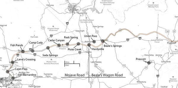
Mojave Road and Beale’s Wagon Road are historic routes in the southwestern United States, particularly in the Mojave Desert region. Here’s some information about each:

  1. Mojave Road:
    • The Mojave Road is a historic trail that traverses California’s Mojave Desert. It was a significant route used by Native Americans, Spanish missionaries, and later by American pioneers and traders.
    • The trail is approximately 138 miles long and extends from the Colorado River near present-day Needles, California, to the Mojave River near present-day Barstow, California.
    • It was primarily used for transportation and trade between the Colorado River and the coastal settlements in California. The trail passes through varied desert landscapes, including sandy stretches, rocky terrain, and mountainous areas.
  2. Beale’s Wagon Road:
    • Beale’s Wagon Road, named after Edward F. Beale, a military officer and explorer, was a trail developed in the 19th century for the U.S. Army to improve communication and transportation across the arid lands of the American Southwest.
    • Edward F. Beale surveyed and established the road in the late 1850s. The road ran from Fort Defiance in Arizona to the Colorado River, passing through present-day Arizona and California.
    • Beale’s Wagon Road was designed to be more reliable and accessible than other trails, facilitating military movement and communication between California and the western territories.

Mojave Road and Beale’s Wagon Road were important in the United States’ westward expansion. Today, these routes attract history enthusiasts, adventurers, and off-road enthusiasts who explore them to experience the challenges faced by those who traveled these paths in the past. Keep in mind that conditions and accessibility of these trails may vary, so it’s important to check for current information and any regulations before embarking on a journey along these historic routes.

Old Spanish Trail

https://digital-desert.com/old-spanish-trail/

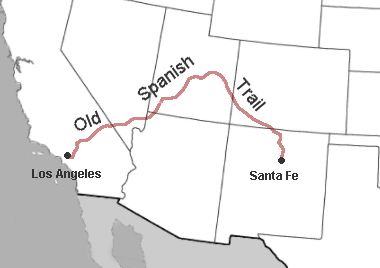
The Old Spanish Trail is a historic trade route that connected Santa Fe, New Mexico, to Los Angeles, California, and passed through what is now the southwestern United States, including parts of Nevada. The trail was established in the early 19th century and was primarily used for transporting goods, primarily luxury items like furs, mules, and horses.

Here are some key points about the Old Spanish Trail:

  1. Origins: The Old Spanish Trail is not Spanish in origin. Mexican and American traders established it in the early 19th century. The trail network was developed to extend the more well-known Santa Fe Trail, connecting Santa Fe with California.
  2. Trade and Commerce: The primary purpose of the trail was to facilitate trade between the Mexican provinces of New Mexico and California. Goods from Santa Fe, such as woolen goods and furs, were traded for California horses and mules.
  3. Route: The trail had several branches, but the most common route passed through present-day Arizona, southern Utah, Nevada, and California. It roughly followed the course of the Virgin River in what is now southwestern Utah and crossed the Mojave Desert before reaching the coastal areas of California.
  4. Difficulty and Challenges: Traveling the Old Spanish Trail was challenging. The journey was perilous because of the harsh desert environment, lack of water, and difficult terrain. Many sections of the trail required careful navigation to ensure the safety of the travelers and their livestock.
  5. Decline: With the opening of the Santa Fe Railroad in the late 19th century, the Old Spanish Trail lost its significance as a major trade route. The development of more accessible transportation options led to its decline.
  6. Legacy: Despite its relatively short period of use, the Old Spanish Trail left a lasting impact on the history and development of the American Southwest. Today, parts of the trail are preserved, and efforts have been made to recognize its historical importance.

The Old Spanish Trail is a testament to the interconnected history of the American Southwest and the role of trade routes in shaping the economic and cultural landscape of the region during the 19th century.

Scotty

“Death Valley” Scotty, whose full name was Walter E. Scott, was a colorful and legendary figure associated with Death Valley, a desert valley located in Eastern California. Scotty gained fame in the early 20th century for his claims of owning a gold mine in Death Valley and for his flamboyant personality.

Scotty’s story is closely tied to his relationship with wealthy Chicago businessman Albert Johnson. In the early 1900s, Scotty convinced Johnson to invest in his supposed gold mine, even though there was little evidence to support the existence of significant gold deposits. Despite the skepticism of others, Johnson continued to finance Scotty’s ventures, and the two became unlikely friends.

With his charismatic and theatrical personality, Scotty became a well-known character, and his antics and stories helped attract attention to Death Valley. He was known for his cowboy attire, tall tales, and his ability to charm people.

Scotty’s gold mine claims were largely exaggerated, and there is little evidence that he ever discovered a significant amount of gold. The financial arrangement between Scotty and Johnson remained a subject of speculation and mystery.

After Johnson died in 1948, it was revealed that much of the financing had come from Johnson himself, and Scotty had not been as successful in the mining business as he claimed. Despite the deceptive aspects of his story, Scotty remained a beloved figure in Death Valley folklore, and his former home, Scotty’s Castle, is a popular tourist attraction in Death Valley National Park.

The legacy of “Death Valley” Scotty is a mix of fact and fiction, blending the mystique of the Old West with a touch of showmanship and exaggeration.

“Seldom Seen Slim”

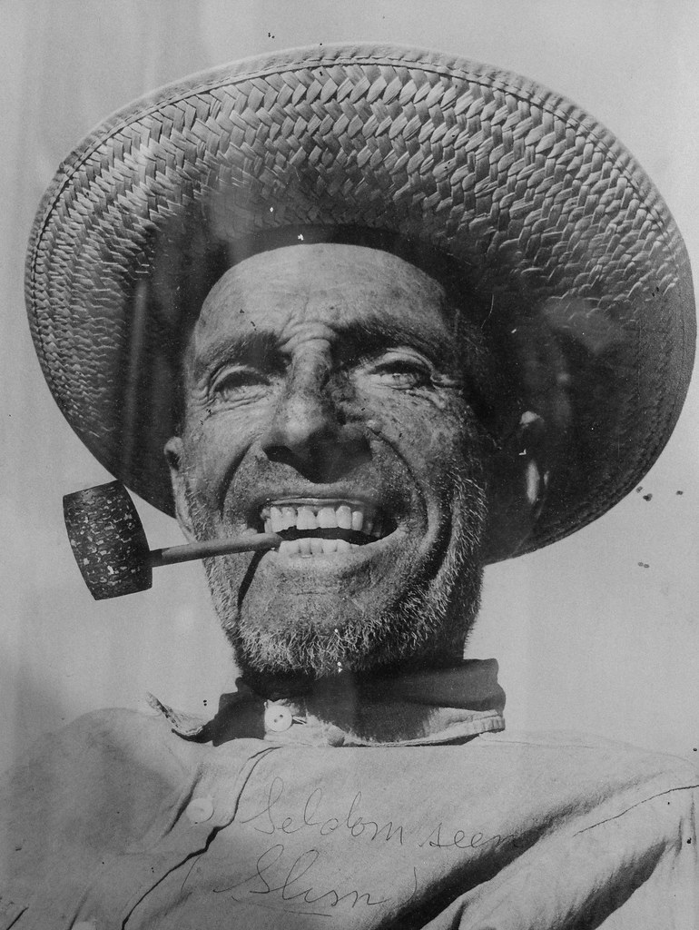
“Seldom Seen Slim” was a nickname for a man named Charles Ferge, who lived in the Panamint Valley of California. He was known for his reclusive lifestyle and infrequent appearances in town, leading to the nickname “Seldom Seen Slim.” He was a prospector and a colorful character in the region’s history. The nickname reflects his tendency to avoid social interactions and to be rarely seen by others.

He claimed he wasn’t lonely because he was half coyote and half burro!

AKA “Seldom Seen Slim”

“Me lonely? Hell no! I’m half coyote and half wild burro.”

Seldom Seen Slim said these words many times, and they are the epitaph on his grave at Ballarat Cemetery in Ballarat, California.

Seldom Seen Slim, named Charles Ferge by his parents, was born in Illinois in 1881, according to wellfare records. Slim always said, “I got no people, I was born in an orphanage.

Slim came to Ballarat sometime between 1913 and 1917, not long after the town was abandoned by the miners who had been seeking their fortunes in the silver mines of the Panamint Mountains. He became the last resident of Ballarat, now a ghost town. Slim had a reputation as a recluse with a cantankerous side. He didn’t believe in showers or baths because “bathing was a waste of water”. Although, he did make into town for his annual haircut and bath whether he felt he needed it or not!

Slim was a visitor to Trona when the time came to stock up on supplies of tobacco for his corn cob pipe and to replenish his bottle of hooch. His reputation was so widespread that Walter Knott had statues of “Seldom Seen Slim” made and placed in his Knotts Berry Farm and Ghost Town in Buena Park, CA.

Slim was found ailing in his rundown trailer in Ballarat’s ruins and was taken 70 miles to Trona, where he survived only five days. His funeral was in Boot Hill in 1968 and was broadcast on television around the country before cable, as he was the last of a breed of prospectors who spent their lives living on the Mojave Desert in and around Death Valley. He was the first to be buried in the Ballarat cemetery in half a decade. After Slim’s death in 1968, at the age of 80, the United State Department of the Interior approved the naming of a peak in the Panamint Mountains in honor of Charles Ferge. The peak is now named “Slim’s Peak”.

Ref = findagrave

https://www.findagrave.com/memorial/12763141/charles-ferge

Oro Grande Train Robbery

FEDERAL GRAND JURY.

They Are Investigating the Oro Grande Train Robbery

The Federal Grand Jury are today examining into the recent train robbery at Oro Grande when the mail car was robbed by men, one of the men is supposed to be Jones who died after he was arrested at the County hospital.

Three of the supposed accomplices of Jones, named Clyde Bennington, A. Caesner and D. T. Chilson, are now in the County Jail and it is the evidence against them that today is being considered by the inquisition jury.

Express Messenger A. C. Mott, who shot the dead robber Jones was on the witness stand most of the morning, giving substantially just the same evidence as heretofore. One of the striking men among the witnesses in attendance was Mr. Jones, the father of the robber who was killed. His sturdy face bore plain traces of the sorrow that he has lately endured.

It is strange that no trace of the twenty-three registered packages that were taken from the mail car can be found. The post office authorities, however, do not consider this as any serious defect in the case against the men as the want is supplied by other testimony, which is considered just as strong.

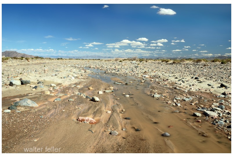
Life in a Desert Wash

https://mojavedesert.net/desert-habitats/desert-wash.html

A desert wash, also known as an arroyo, is a dry riverbed or gulley that occasionally fills with water during periods of heavy rain or flash floods in arid regions. Life in a desert wash is characterized by its adaptability to extreme and unpredictable conditions. Here’s a glimpse into what life in a desert wash might be like:

  1. Flora and Fauna:
    • Plants: Some plants in desert washes are adapted to survive both dry and wet conditions. These may include drought-resistant shrubs, grasses, and small trees. Seeds of various plants may lie dormant until the rare occurrence of rainfall triggers germination.
    • Wildlife: Animals in desert washes are often adapted to both desert and aquatic environments. Insects, reptiles, and small mammals may be common, taking advantage of the occasional water source. Larger mammals might use the wash as a corridor for movement.
  2. Survival Strategies:
    • Dormancy and Adaptation: Many plants and animals in desert washes have developed strategies to survive long periods of drought. They may go into a state of dormancy, conserving energy until water becomes available again.
    • Migration: Some animals may migrate to and from the wash, following the water source. This movement can be triggered by seasonal changes or the availability of food and water.
  3. Flash Floods:
    • Quick Response: Life in a desert wash must be adaptable to sudden changes. Flash floods can transform a dry riverbed into a rushing torrent of water in a matter of minutes. Some animals have evolved behaviors or adaptations to quickly escape or take advantage of these temporary water sources.
  4. Biodiversity Hotspots:
    • Rich Ecosystems: Desert washes can be biodiversity hotspots despite the harsh conditions. The intermittent water flow creates a mosaic of habitats, supporting various life. The contrast between wet and dry periods contributes to the diversity of species that can inhabit these areas.
  5. Challenges:
    • Water Scarcity: Water scarcity is the primary challenge for life in a desert wash. Species must be adapted to survive with limited water resources and quickly respond to the unpredictable nature of rainfall.
    • Temperature Extremes: Desert environments often experience extreme temperatures, ranging from scorching heat during the day to cold nights. Life in a desert wash needs to endure these temperature fluctuations.
  6. Human Interaction:
    • Cultural Significance: In some regions, desert washes hold cultural significance for local communities. People may have traditional practices and stories associated with these areas.
    • Conservation: The fragile ecosystems of desert washes are susceptible to human activities. Conservation efforts are crucial to preserving the unique flora and fauna that depend on these environments.

Life in a desert wash is a testament to the resilience and adaptability of nature in the face of challenging environmental conditions. The flora and fauna that inhabit these areas have evolved unique strategies to cope with the extremes of desert life, making these ecosystems fascinating and diverse.

Boomtown Historical Context and Characteristics

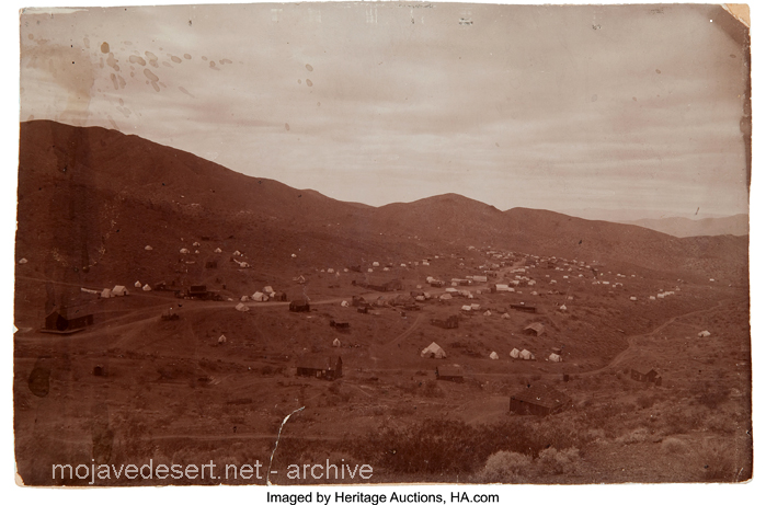
Rush to Claim Wealth: The news of these discoveries led to a rush of people trying to claim their share of the newfound wealth. Prospectors and miners flocked to the region in search of fortunes.

Randsburg c. 1897 – C.W. Tucker – photo

Discovery of Gold and Silver: These booms were triggered by the chance discovery of large deposits of gold and silver in the respective areas. The presence of valuable minerals was the catalyst for the rapid development of these towns.

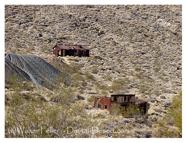
Leadfield (2003)

Explosive Growth of Boomtowns: The growth of these towns was explosive and often chaotic. They quickly developed into rowdy boomtowns characterized by a fast-paced, often disorderly expansion.

Promoters and Flimflam Men: Alongside serious promoters who saw the economic potential of these towns, there were also flashy con artists and tricksters looking to take advantage of the mining boom for their gain.

Arrival of Various Groups: As these towns grew, they attracted a diverse group of people, including merchants, teamsters, camp followers, schoolteachers, wives, and children. The influx of residents and services accompanied the rapid development.

Development of Farms and Ranches: The growth of these mining towns also led to the development of nearby farms and ranches. These agricultural activities provided food and resources to sustain the booming population.

Hope for Quick Riches: Many who flocked to these mining towns were motivated by the hope of striking it rich quickly. The prospect of finding valuable minerals and becoming wealthy was a powerful draw.

Values of the Old West: The people who settled in these towns held traditional values associated with the Old West, including a strong emphasis on personal freedom, independence, hard work, and the ability to endure the harsh conditions and challenges of the natural environment.

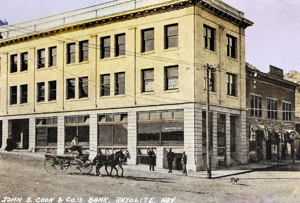
Cook Bank – Rhyolite, Nevada

Like many others in the Old West, these mining booms followed a pattern of rapid growth, economic opportunity, and social change, often accompanied by a degree of lawlessness and volatility. Over time, these towns could thrive or decline depending on the success of mining operations and economic factors, and their histories reflect the larger story of the American frontier and the pursuit of wealth and opportunity.

Mojave Road

/mojave-road/

Soda Springs – 1863

The Mojave Road, also known as the Old Mojave Road or the Mojave Trail, is a historic trade route and wagon road that traverses the Mojave Desert in the southwestern United States. Native American tribes originally used it for trade, and it later became an important transportation route for European settlers and traders during the 19th century.

Here are some key points about the Mojave Road:

Location: The Mojave Road runs through the Mojave Desert, primarily in what is now California and Nevada. It stretches from the Colorado River in the east to the San Bernardino Mountains in the west, covering approximately 140 miles (225 kilometers).

History: The road has a long history, with Native American tribes using it for centuries for trade and travel. In the 19th century, it became an essential route for early explorers, settlers, and traders moving through the desert.

Water Sources: One of the challenges of traveling the Mojave Road was the scarcity of water sources. Travelers had to rely on natural springs and wells, many of which were marked along the route to aid navigation.

Military Use: During the 19th century, the U.S. Army used the Mojave Road as a military supply route and for communication between the southern California coast and the interior of the Southwest. The road played a role in the U.S. government’s efforts to control the region.

Historic Sites: Along the Mojave Road, there are several historic sites and landmarks, including the Mojave National Preserve, the Mojave River, the Kelso Depot, and the Fort Piute ruins.

Recreation: Today, the Mojave Road is a popular route for off-road enthusiasts, hikers, and history buffs. Travelers can explore the historic route and experience the natural beauty of the Mojave Desert.

Preservation: Efforts have been made to preserve and maintain the Mojave Road as a historic and recreational route. The Mojave Road Guide, written by historian Dennis G. Casebier, is a valuable resource for those interested in traveling the road.

Please note that road conditions and accessibility may vary, so if you plan to explore the Mojave Road, it’s essential to do thorough research and be well-prepared for the journey. Always check for current information and obtain any necessary permits if required.

Cajon Pass in Southern California

/cajon-pass/

The Cajon Pass is a significant geographical feature located in Southern California, United States. It is a mountain pass in the San Bernardino Mountains, part of the Transverse Ranges in Southern California. The pass is approximately 60 miles (97 kilometers) east of Los Angeles and is a crucial transportation corridor in the region. Here are some key points about the Cajon Pass:

Geographical Location: The Cajon Pass is in San Bernardino County, California. It is part of Interstate 15, which connects the cities of San Bernardino and Victorville in the south to the High Desert region and beyond to Las Vegas, Nevada, in the north.

Transportation: The pass is a critical route linking the densely populated Los Angeles metropolitan area with the desert and the southwestern United States. It serves as a major route for both passenger and freight transportation. Numerous vehicles and freight trains pass through the Cajon Pass daily.

Elevation: The Cajon Pass rises to an elevation of approximately 3,800 feet (1,160 meters) above sea level. This elevation change is significant, and it makes the pass an important point in the regional geography.

Natural Scenery: The Cajon Pass offers stunning natural scenery with its rugged terrain, including rocky cliffs and slopes. It is a popular spot for hiking and outdoor activities, providing beautiful views of the surrounding landscapes.

Historical Significance: The pass has historical significance as it was used by Native American tribes, Spanish explorers, and early settlers. In the mid-19th century, it became a vital transportation route for wagon trains during the California Gold Rush.

Climate: The climate in the Cajon Pass can vary significantly with the seasons. It can experience hot summers and cold winters, and snowfall is common during winter, impacting transportation through the pass.

Wildlife: The region surrounding the Cajon Pass is home to various wildlife, including desert bighorn sheep, often seen in the area.

Infrastructure: To facilitate transportation through the pass, major highways and rail lines traverse it. These include Interstate 15, California State Route 138, and numerous rail lines used for freight transportation.

Geological Activity: The Cajon Pass is located in an area with geological activity, including the presence of the San Andreas Fault. Earthquakes are a potential natural hazard in this region.

Recreational Opportunities: Besides its transportation importance, the Cajon Pass offers recreational opportunities, including hiking, rock climbing, and wildlife viewing for outdoor enthusiasts.

Overall, the Cajon Pass plays a significant role in the transportation infrastructure of Southern California, linking the metropolitan areas to the High Desert and beyond while also providing a natural setting for outdoor activities and appreciation of the region’s unique geography.

History

The history of the Cajon Pass is rich and significant, with a timeline that spans many centuries. Here is an overview of the historical events and developments related to the Cajon Pass:

Indigenous Peoples: Long before European settlers arrived in the region, the Cajon Pass was inhabited by indigenous peoples, including the Serrano and Tongva tribes. These Native American groups used the pass as a natural corridor for trade and travel.

Spanish Exploration: In the late 18th century, Spanish explorers, including Father Francisco Garces and Juan Bautista de Anza, passed through the Cajon Pass during their expeditions into California. The Spanish established a presence in California, and the pass was an important part of their transportation network.

Early American Settlement: As California transitioned from Spanish to Mexican rule and eventually became part of the United States, pioneers and settlers used the Cajon Pass as they headed westward during the westward expansion period of the 19th century. It was a crucial route for wagon trains and the Butterfield Overland Mail Stagecoach Line, facilitating westward migration.

California Gold Rush: The discovery of gold in California in 1848 led to a rush of people seeking their fortunes. Many gold seekers, known as “forty-niners,” passed through the Cajon Pass on their way to the goldfields in Northern California.

Railroad Development: The construction of the First Transcontinental Railroad in the 1860s further solidified the importance of the Cajon Pass. The Atchison, Topeka, and Santa Fe Railway, in particular, played a significant role in developing rail infrastructure through the pass, greatly facilitating trade and transportation in the region.

Modern Transportation: In the 20th century, the pass evolved as a transportation hub. The development of modern highways, including U.S. Route 66 and later Interstate 15, made the pass a vital link in the national highway system. It also became a major corridor for freight transportation.

Natural Hazards: The Cajon Pass is located in a seismically active region, and it has been affected by earthquakes throughout its history. Notably, the 1812 San Juan Capistrano Earthquake created a landslide in the pass, altering its geography.

Natural Beauty: Beyond its historical significance, the Cajon Pass has always been appreciated for its natural beauty and scenic vistas. Outdoor enthusiasts and hikers have enjoyed the pass’s rugged terrain and unique landscapes.

Cultural Significance: Over the years, the Cajon Pass has been featured in literature, music, and popular culture. It is often mentioned in songs and stories about Route 66 and the American West.

Today, the Cajon Pass remains a vital transportation link in Southern California, serving as a critical route for passenger and freight traffic. Its historical and cultural importance, as well as its stunning natural beauty, continue to make it a noteworthy part of the region’s heritage.

Geology

The geology of the Cajon Pass is a fascinating aspect of its natural history, and it plays a significant role in shaping the landscape and geological features of the region. The pass is located within the San Andreas Fault zone, which is one of the most well-known and active fault systems in California. Here are some key geological aspects of the Cajon Pass:

San Andreas Fault: The Cajon Pass is situated along the San Andreas Fault, which is a transform fault that marks the boundary between the Pacific Plate and the North American Plate. This fault system is responsible for the movement of tectonic plates and is associated with earthquakes in the region.

Fault Activity: The San Andreas Fault is known for its potential to produce significant seismic events. The movement of the Pacific Plate and North American Plate along the fault can result in earthquakes, and the Cajon Pass area is considered seismically active. This fault activity has influenced the landscape in the region over geological time.

Formation of the Pass: The Cajon Pass itself is a result of tectonic activity along the San Andreas Fault. Over millions of years, the fault has caused uplift and displacement, creating a gap or pass in the San Bernardino Mountains. This geological process has allowed for the formation of the pass as a natural transportation corridor.

Rocks and Geology: The geology of the Cajon Pass includes a variety of rock types, including sedimentary, metamorphic, and igneous rocks. The mountains surrounding the pass are composed of various types of bedrock, including schist, gneiss, and granite, which have been uplifted and exposed due to tectonic forces.

Topography: The pass features rugged terrain, steep slopes, and cliffs, which are the result of geological processes such as faulting, erosion, and uplift. These geological features create the distinctive landscape of the pass.

Erosion: Over time, erosion, primarily driven by wind and water, has shaped the topography of the Cajon Pass. It has also exposed rock formations and created canyons and valleys in the area.

Waterways: The pass has been influenced by the flow of water, with several small streams and washes running through it. These waterways have played a role in shaping the pass and the surrounding landscape.

Geological Study: The Cajon Pass is of interest to geologists and seismologists who study the San Andreas Fault and its activity. Understanding the geology of the pass and its fault systems is important for assessing earthquake hazards in the region.

The geological features and the presence of the San Andreas Fault make the Cajon Pass an area of both scientific interest and potential geological hazard. The ongoing study of its geology contributes to our understanding of the complex tectonic processes at work in Southern California and helps with earthquake preparedness and mitigation efforts in the region.

Railroad History

The history of railroads in the Cajon Pass is closely intertwined with the broader history of railroad development in the American West. The construction and operation of railroads through the Cajon Pass played a pivotal role in the economic growth and expansion of Southern California and the United States. Here’s an overview of the railroad history in the Cajon Pass:

Early Railroad Development: The first railroad to traverse the Cajon Pass was the California Southern Railroad, which was a subsidiary of the Atchison, Topeka, and Santa Fe Railway (AT&SF). Construction of this railroad began in the 1880s, with the goal of connecting San Diego with Barstow and the transcontinental rail network. The California Southern Railroad was the first to establish a rail link through the pass.

Competition and Expansion: Other railroads, including the Southern Pacific and Union Pacific, also sought to establish a presence in Southern California. This led to competition and further expansion of rail lines in the region, making the Cajon Pass a vital corridor for the movement of goods and people.

Completion of the Santa Fe Line: The AT&SF completed its line through the Cajon Pass in 1885, providing a direct route from Chicago to the Pacific Coast. This line played a significant role in the development of Southern California and the growth of cities like San Bernardino and Los Angeles.

Rise of San Bernardino: The city of San Bernardino, located at the western end of the Cajon Pass, became a major railroad hub and grew in importance as a transportation center. The city’s rail yards and facilities played a crucial role in the movement of goods and the transfer of passengers.

Engineering Challenges: Constructing and maintaining rail lines through the rugged terrain of the Cajon Pass presented numerous engineering challenges. Building tunnels, bridges, and track beds on steep slopes and rocky terrain required significant effort and ingenuity.

Decline of Passenger Rail: With the rise of automobiles and highways in the mid-20th century, passenger rail service declined. However, freight traffic through the Cajon Pass remained robust and continues to be a critical part of the nation’s transportation network.

Modern Rail Transportation: Today, the Cajon Pass remains a key transportation corridor for freight rail, with multiple rail lines running through it. The BNSF Railway (successor to the AT&SF) and Union Pacific are among the major railroads operating in the pass.

The history of railroads in the Cajon Pass reflects the broader history of American westward expansion and the role of railroads in opening up new territories, fostering economic growth, and shaping the development of cities and regions. The legacy of the railroads in the Cajon Pass continues to be felt in the transportation and economic networks of Southern California and the United States.

Historic Trails and Highways

The Cajon Pass has been historically significant as a transportation corridor. It has been traversed by several historic trails and highways that played crucial roles in the westward expansion of the United States and the development of Southern California. Here are some of the notable historic trails and highways that passed through or near the Cajon Pass:

Old Spanish Trail: The Old Spanish Trail was a historic trade route that connected Santa Fe, New Mexico, to California. It passed through the Cajon Pass, making it an important part of the trail network that facilitated trade between the Spanish colonies of the Southwest and California during the early 19th century.

Mojave Road: The Mojave Road, also known as the Old Government Road, was a 19th-century wagon route that crossed the Mojave Desert. It passed through the Cajon Pass and served as an important east-west transportation route for settlers, traders, and the U.S. military.

Mormon Pioneer National Historic Trail: The Mormon Pioneer Trail followed the path of Mormon pioneers who journeyed from the Midwest to the Salt Lake Valley in Utah during the mid-19th century. This trail intersected with the Mojave Road, which passed through the Cajon Pass, as Mormons traveled to California for trade and other purposes.

Santa Fe Trail: While the primary route of the Santa Fe Trail led to Santa Fe, New Mexico, it had several branches and alternative paths. The route connecting California to the Santa Fe Trail passed through the Cajon Pass and the San Bernardino Valley.

California Trail: The California Trail was a major emigrant trail used during the California Gold Rush in the mid-19th century. Many gold seekers and settlers traveling to California passed through the Cajon Pass on their way to the goldfields in Northern California.

National Old Trails Road: The National Old Trails Road was a transcontinental highway that passed through the Cajon Pass. It was established in the early 20th century and played a role in developing the American highway system.

U.S. Route 66: U.S. Route 66, often referred to as the “Main Street of America,” was a historic highway that connected Chicago to Los Angeles. It passed through the Cajon Pass, and its association with the pass contributed to the highway’s iconic status.

Interstate 15: Modern Interstate 15, which runs through the Cajon Pass, connects Southern California to Las Vegas and points north. It has become a vital part of the national highway system, carrying passenger and freight traffic.

These historic trails and highways were instrumental in opening up the American West, facilitating trade, settlement, and travel, and connecting various regions of the United States. The Cajon Pass’s strategic location as a natural transportation corridor made it a pivotal point on many of these routes, and its historical significance remains evident in the region’s cultural and transportation heritage.

Cajon Pass Geography

The Cajon Pass is a geological and geographical feature located in Southern California, United States. It is a mountain pass in the San Bernardino Mountains, which are part of the Transverse Ranges. The pass is situated approximately 60 miles (97 kilometers) east of Los Angeles and serves as a vital transportation corridor in the region. Here are some key aspects of the geography of the Cajon Pass:

Elevation: The Cajon Pass rises to an elevation of approximately 3,800 feet (1,160 meters) above sea level. This elevation change is significant, and it makes the pass a crucial point in the geography of the region. The pass transitions between the lowland areas to the west and the High Desert region to the east.

Location: The Cajon Pass is located in San Bernardino County, California, and it provides a natural passage through the San Bernardino Mountains, which are part of the larger Transverse Ranges mountain system.

Transportation Corridor: The pass is a critical transportation corridor, facilitating the movement of both passengers and goods. It is part of Interstate 15, which connects the cities of San Bernardino and Victorville in the south to the High Desert region and Las Vegas, Nevada, in the north. Several major highways and rail lines traverse the pass, making it a key component of the region’s transportation infrastructure.

Rugged Terrain: The Cajon Pass is known for its rugged terrain, including steep slopes, rocky cliffs, and canyons. The geology of the pass is influenced by the presence of the San Andreas Fault, which has caused the uplift and displacement of rocks in the area.

Natural Scenery: The pass offers stunning natural scenery, with panoramic views of the surrounding landscape. The rugged topography and diverse plant life in the region make it a popular spot for outdoor enthusiasts, hikers, and nature lovers.

Climate: The climate in the Cajon Pass can vary significantly with the seasons. It experiences hot summers and cold winters, and snowfall is not uncommon during the winter months. The geography of the pass, with its elevation changes, can lead to variations in weather conditions.

Waterways: The pass is intersected by various small streams and watercourses that drain into the Mojave River. These waterways have played a role in shaping the geography of the pass over time.

Wildlife: The region surrounding the Cajon Pass is home to various wildlife, including desert bighorn sheep, often seen in the area.

The Cajon Pass’s unique geography, with its elevation change, rugged terrain, and proximity to the San Andreas Fault, has made it a focal point for transportation and a picturesque destination for those seeking to explore the natural beauty of the San Bernardino Mountains and the surrounding areas in Southern California.

Natural Scenery

The natural scenery around the Cajon Pass is known for its rugged beauty, diverse landscapes, and stunning vistas. This region in Southern California offers a range of natural features and outdoor recreational opportunities. Here are some of the key elements of the natural scenery in and around the Cajon Pass:

Rugged Mountains: The Cajon Pass is surrounded by the San Bernardino Mountains, a rugged and picturesque range of mountains. These mountains consist of various types of bedrock, including schist, gneiss, and granite, which geological forces have shaped over time.

Rocky Cliffs and Slopes: The pass is characterized by rocky cliffs and steep slopes that have been shaped by erosion and tectonic activity. These geological features provide a dramatic backdrop for the pass.

Canyons and Gorges: The region features numerous canyons and gorges, which are often formed by the flow of water. These canyons add to the diversity of the landscape and provide opportunities for exploration and hiking.

Desert Flora: As you move farther east from the pass, you’ll enter the High Desert region of Southern California, characterized by a unique desert ecosystem. Joshua trees, yuccas, creosote bushes, and other desert plants are common in this area.

Mountain Flora: At higher elevations in the San Bernardino Mountains, you’ll find a different array of plant life, including coniferous trees such as pine and fir, as well as a variety of wildflowers that bloom in the spring.

Wildlife: The region is home to diverse wildlife, including desert bighorn sheep, coyotes, bobcats, and numerous bird species. The San Bernardino Mountains and the surrounding High Desert provide habitats for various animal species.

Geological Formations: The presence of the San Andreas Fault and the associated geological activity in the region has led to unique geological formations. These formations include fault lines, exposed rock layers, and uplifted terrain, which interest geologists and nature enthusiasts.

Panoramic Views: The Cajon Pass offers panoramic views of the surrounding landscape. Whether you’re driving along the highways or hiking in the area, you’ll have opportunities to enjoy breathtaking vistas of the San Bernardino Mountains and the High Desert.

Outdoor Activities: The diverse natural scenery in the region provides opportunities for outdoor activities such as hiking, rock climbing, birdwatching, and wildlife photography. The pass is a popular destination for outdoor enthusiasts.

Seasonal Changes: The scenery in the Cajon Pass changes with the seasons. Spring brings wildflower blooms, while the winter months can see snow on the mountains. Each season offers a unique and beautiful perspective on the landscape.

The natural scenery in and around the Cajon Pass is a testament to the diverse and dynamic landscapes found in Southern California. It offers various outdoor experiences for those who appreciate the beauty of the region’s geography and the opportunity to explore its natural wonders.
Tarantula Migration

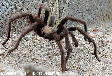
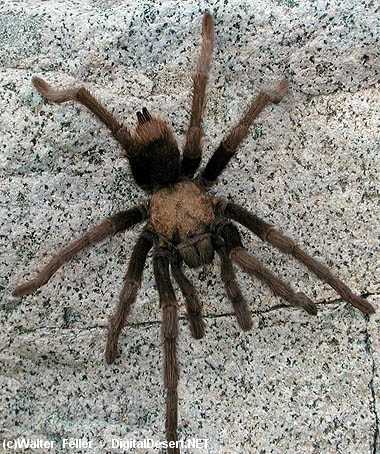
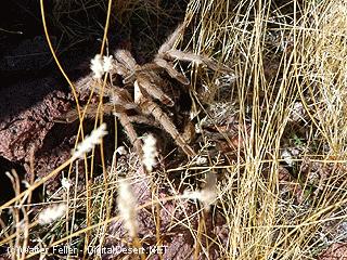
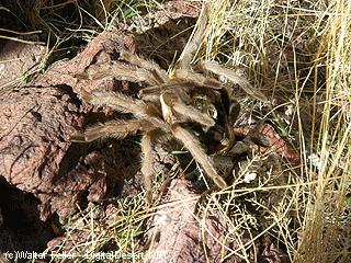
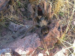
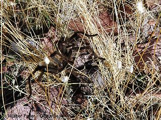
The term “tarantula migration” is often used to describe the phenomenon of large groups of tarantulas moving en masse in search of food, mates, or new habitats. Tarantulas are solitary spiders for most of the year, but during certain seasons, they may engage in these migrations. This behavior is more commonly observed in some species of tarantulas, particularly in the southwestern United States.

Here are some key points about tarantula migrations:

Timing: Tarantula migrations typically occur in the late summer and early fall, often in August and September. This timing is associated with the mating season for many tarantula species.

Purpose: Tarantulas migrate to find mates as males search for females. The females may also move to find suitable locations to lay their eggs or search for prey.

Location: The most famous tarantula migrations in the United States occur in the deserts of the American Southwest, such as Arizona and California. These migrations can involve thousands of tarantulas moving across the desert floor.

Behavior: During a migration, tarantulas can be seen traveling on the ground in search of food and potential mates. They often move during the evening and nighttime to avoid extreme daytime heat.

Species: The most well-known species that participate in these migrations is the Aphonopelma species, commonly called the desert tarantula. However, not all tarantulas engage in migrations, and the behavior can vary among different species.

Conservation: Tarantula migrations are an important part of the ecosystem, as they help control insect populations and serve as a food source for various predators. Conservation efforts are often aimed at protecting their habitats.

During a tarantula migration, it’s not uncommon for people to go out and observe or photograph the spiders. Still, it’s essential to do so responsibly and without disturbing their natural behavior or habitats.
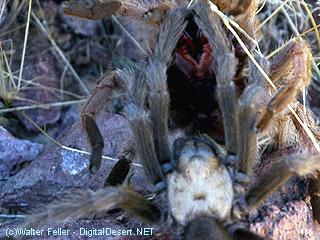
Suppose you’re interested in witnessing a tarantula migration. In that case, it’s best to consult local experts or naturalists who can guide you to appropriate locations and provide you with additional information on when and where to observe this fascinating natural phenomenon.

Tarantulas Mating Process

/wildlife/tarantula.html

The mating process of tarantulas, like many other spiders, is quite fascinating and can vary among different species, but there are some common elements to it. Here’s a general overview of how tarantulas mate:

Courtship: The process typically begins with a male tarantula searching for a receptive female. Male tarantulas are often smaller and have less colorful markings than females. When a male finds a female’s silk-lined burrow or web, he approaches cautiously to initiate courtship. However, approaching a female can be risky because some females may perceive the male as potential prey rather than a potential mate.

Drumming and vibrations: To signal his intentions to the female, the male may engage in courtship rituals, including drumming on the female’s web or tapping on her burrow. These vibrations are thought to be a way for the male to communicate and let the female know he is not a threat.

Presentation of a sperm sac: Once the male has successfully courted the female, he may present her with a sperm sac. This sac contains sperm that he has produced and stored in his pedipalps, which are modified appendages near the front of his body.

Copulation: If the female is receptive to the male’s advances, she will allow him to approach her. They engage in a mating ritual in which the male transfers his sperm into the female’s reproductive organs using specialized structures called pedipalps. This process can be risky for the male, as the female might suddenly become aggressive or attempt to prey on him.

Male retreats: After copulation, the male usually makes a hasty retreat to avoid being attacked by the female. Some male tarantulas may not survive this encounter, especially in species with highly aggressive females.

Female’s egg sac: If the mating is successful, the female will eventually lay eggs and create an egg sac, which she guards closely. The female may carry the egg sac with her and continue to protect it until the spiderlings (baby tarantulas) hatch.

It’s important to note that the mating process in tarantulas can be dangerous for the males, as females of some species are known to be aggressive and may cannibalize the male after mating. To maximize their chances of reproducing, male tarantulas have developed various courtship behaviors and tactics to minimize the risk of being consumed.

Additionally, the mating process can vary between different tarantula species, and some species may have unique courtship rituals and behaviors.

Tarantula Hawk Wasp

/wildlife/tarantula-wasp.html

The tarantula hawk wasp is a large and impressive species of wasp known for its distinctive and painful sting. These wasps are primarily found in the southwestern United States, Mexico, and parts of Central and South America. Here are some key characteristics and facts about the tarantula hawk wasp:

Size: Tarantula hawk wasps are among the largest wasps in the world, with a body length that can reach up to 2 inches (5 cm).

Coloration: They are usually brightly colored, with black bodies and iridescent blue or black wings. The coloration may vary among species.

Venomous sting: Tarantula hawk wasps are solitary predators, and their primary prey is tarantulas. They paralyze the tarantula with their potent venomous sting, then lay an egg on the immobilized spider. The larva that hatches from the egg feeds on the paralyzed tarantula.

Painful sting: The sting of a female tarantula hawk is considered one of the most painful insect stings in the world, and it is rated as a 4 on the Schmidt Sting Pain Index, created by entomologist Justin Schmidt. The pain from the sting can be excruciating and may last for several minutes.

Solitary behavior: Tarantula hawk wasps are solitary insects, meaning they do not form colonies or nests like social wasps such as yellow jackets or paper wasps. Each female hunts for and provisions her own prey.

Males vs. females: Male tarantula hawk wasps are typically smaller than females and do not have a stinger. Their primary purpose is to mate with females.

Habitat: These wasps are often found in arid or desert regions, where tarantulas are more abundant. They are also commonly spotted near flowers, as they feed on nectar and other plant fluids in addition to hunting for tarantulas.

Flight: Tarantula hawk wasps are known for their agile and powerful flight. They can be seen soaring through the air in search of tarantulas or nectar-rich flowers.
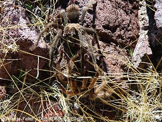
Defensive behavior: Although tarantula hawk wasps are not typically aggressive toward humans, they will defend themselves if they feel threatened. It’s best to observe them from a safe distance to avoid getting stung.

Conservation: These wasps play a role in regulating tarantula populations, and they are considered beneficial in their ecosystems. However, they are vulnerable to habitat loss and pesticides, which can impact their populations.

In summary, the tarantula hawk wasp is a fascinating and somewhat intimidating insect known for its painful sting and unique predatory behavior. While they can deliver a formidable sting, they are generally not aggressive toward humans unless provoked.

Limber Pine Trees

/a/baden-powell/lp1.html

Limber pine (Pinus flexilis) is a species of pine tree that is native to western North America, particularly the Rocky Mountains and surrounding areas. It is known for its adaptability to harsh mountainous environments and its distinctive characteristics. Here’s some information about limber pine trees:

Physical Characteristics:

Limber Pine

Limber pine is a slow-growing, long-lived species that can take several hundred years to reach maturity. Mature trees can live over 1000 years old. Although Limber pine stands tend to be even-aged, populations also occur in uneven-aged stands and on very harsh sites as widely spaced, isolated individuals. Most trees grow irregularly or in a multi-stemmed form and rarely reach more than 50 feet (15 meters). In high elevations, they sometimes develop krummholz (stunted, twisted shrubs due to wind exposure). Trunks can reach a diameter of 6.5 feet (2 meters). This species is cold- and drought-tolerant. The trees are ectomycorrhizal, have deep taproots, and are very wind-resistant. Limber pine has thin bark.

The needles of limber pine trees are arranged in bundles of five, and they are flexible, giving the tree its common name, “limber.”

The tree’s bark is often scaly and furrowed, varying in color from gray to reddish-brown.

Cone and Seed Production:

Limber pine trees produce both male and female cones. Female cones are larger and take about two years to mature.

The seeds of limber pine trees are large and winged, and they serve as a crucial food source for various wildlife, including birds, squirrels, and bears.
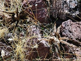
Limber pine trees have a serotinous cone adaptation, meaning their cones remain closed and require the intense heat of a fire to open and release seeds.
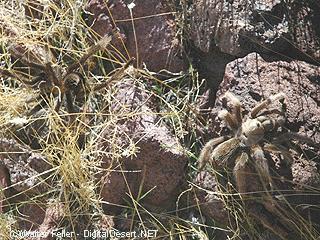
This helps the species regenerate after wildfires.
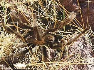
Adaptation:

Limber pine is well-adapted to high-elevation, cold, and windy mountain environments. It can thrive in poor soils and withstand extreme temperature fluctuations.

These trees have a deep root system that helps them access water and nutrients in rocky and challenging soils.

Conservation:

Limber pine trees are vulnerable to various threats, including mountain pine beetle infestations and white pine blister rust, which is a fungal disease.

Conservation efforts are in place to protect and restore limber pine populations. These efforts include monitoring for disease, maintaining genetic diversity, and conducting controlled burns to promote regeneration.

Ecological Significance:

Limber pine trees play a critical role in mountain ecosystems by providing habitat and food for various wildlife species.

The seeds of limber pine are an essential food source for Clark’s nutcrackers, a type of bird. These birds play a role in seed dispersal, helping to regenerate limber pine populations.

Recreational Use:

Limber pine forests are popular among hikers, campers, and outdoor enthusiasts, as they often grow in scenic mountain environments. These forests provide habitat and shade for recreation.

Limber pine trees are an important and iconic component of the mountain ecosystems in western North America. Their adaptability to challenging environments and their role in providing food and habitat for wildlife make them a valuable part of these ecosystems. Conservation efforts are crucial to ensuring the continued health and resilience of limber pine populations in the face of various threats, including disease and climate change.

Bill McHaney

Bill McHaney would have been around 73 years old when this photo was taken, and had lived and prospected in the area for over 50 years. Willis Keys noted that he always wore a red or blue bandana, like the one pictured around his neck in this photograph, and would not come out of his cabin without it.

Born in the Midwest, McHaney came to California with the waves of easterners moving west towards the end of the 1870s. Bill and his brother James first arrived in the area in 1879 as members of what local legend says were cattle rustlers who used the area’s isolation to hide stolen cattle until they could be sold. Old timers remember that the higher valleys of the park were covered in tall grass, providing good winter cattle grazing. The McHaneys established a headquarters that included adobe cookhouse, barn and bunkhouse amongst the foothills of what is now the Desert Queen (Keys) Ranch.

McHaney lived and prospected in the area for nearly 60 years. The cabin in the photograph no longer exists, but it is known that William F. (Bill) Keys took over this neighboring homestead when it was abandoned, and likely asked McHaney to stay there to maintain the claim. When McHaney became too ill to take care of himself, the Keys family brought him to their homestead, where he passed in 1937.

Desert Queen Ranch Collection, Willis Keys photo album
https://www.nps.gov/museum/exhibits/jotr/Desert-Peoples/New-Industries/JOTR-40127.html


In 1933, Bill lived in a wickiup in upper Musick Valley, Gold Park, and claimed he had lived there for 35 years. In 1933, his sight was very bad, and shortly before this interview, he had picked up a 10-button rattler, thinking it was a piece of rope. Bill mostly prospected, although at times, he worked for others. He claimed that he and/or his brother first found several of the best early mines.

Notes of an Interview with William H, McHaney
by W, E. Ketcham and W, Egbert Schenck – March 1933
Transcribed by Schenck March 1952

Historic Linguistics

Historical linguistics, also known as diachronic linguistics, is the subfield of linguistics that focuses on the study of how languages change over time. It involves the examination and reconstruction of the evolutionary development of languages, as well as the relationships between different languages and language families. Here are some key concepts and topics related to historical linguistics:

  1. Language Change: Languages constantly evolve, with changes occurring in pronunciation, vocabulary, grammar, and other linguistic features. Historical linguists analyze these changes and attempt to understand the processes behind them.
  2. Sound Change: One of the most common types of language change is sound change, where the pronunciation of words and sounds in a language gradually shifts over time. For example, the English word “knight” was once pronounced with a “k” sound, but that sound has disappeared in modern English.
  3. Comparative Linguistics: Comparative linguistics involves the comparison of languages to identify common origins and relationships. Linguists use the method of the comparative method to reconstruct the common ancestor of related languages, known as a proto-language.
  4. Proto-Languages: A proto-language is a hypothetical, reconstructed language that is believed to be the common ancestor of a group of related languages. For example, Proto-Indo-European is the reconstructed ancestor of the Indo-European language family.
  5. Language Families: Languages are often classified into families based on their historical relationships. The Indo-European, Afroasiatic, and Sino-Tibetan language families are examples of language families that encompass multiple languages with common origins.
  6. Language Evolution: Historical linguists seek to understand the processes that drive language evolution, such as lexical change (the addition and loss of words), grammatical change (changes in word order or verb conjugations), and semantic change (shifts in word meaning).
  7. Etymology: Etymology is the study of the history and origin of words. Historical linguists trace the development of words and their meanings over time, often by examining the historical records and written texts in which these words appear.
  8. Language Contact: Languages can also change through contact with other languages, leading to the borrowing of words, phrases, and even structural features. This is known as language contact or linguistic borrowing.
  9. Language Isoglosses: An isogloss is a geographic boundary that marks the distribution of a particular linguistic feature. Studying isoglosses can provide insights into the history of language change and dialect development.
  10. Language Classification: Historical linguistics is crucial in classifying and organizing languages into language families and subgroups. These classifications help linguists understand the historical connections between languages.

Historical linguistics is an essential field for understanding the rich tapestry of human languages and how they have evolved. It helps us trace the development of languages, reconstruct ancestral languages, and gain insights into the cultural and historical aspects of different language communities.

Chukar

Chukars (Alectoris chukar) were introduced to the Mojave Desert in the southwestern United States in the mid-20th century. These introductions were part of efforts to establish populations of chukars for hunting and recreational purposes in the arid regions of the United States. Chukars were brought to the Mojave Desert and other arid areas in the western United States as game birds to provide opportunities for hunters.

The specific dates of these introductions can vary by location, but chukars were likely introduced to the Mojave Desert in the 1940s and 1950s. The birds adapted well to the desert environment and have since established populations in parts of the Mojave Desert, making them a popular game bird for hunting in the region. However, it’s worth noting that their introduction has led to both positive and negative ecological impacts, and they are a subject of interest and concern in terms of their effects on native flora and fauna.

The chukar (Alectoris chukar) is a bird species that belongs to the partridge family and is native to the rocky and hilly regions of South Asia and parts of the Middle East. Chukars have been introduced to various other regions for hunting and have established populations in some parts of the world. Here are some key characteristics and information about chukars:

  1. Physical Description: Chukars are medium-sized game birds with a plump body and relatively short legs. They have distinctive markings, including a barred pattern on their flanks and a black line running from their beak, through the eye, and down the side of the neck. Males and females are similar in appearance, but males tend to have slightly brighter and more vibrant colors.
  2. Range: Chukars are native to various habitats across South Asia, including countries like Pakistan, India, Nepal, and parts of the Middle East, including Iran and Turkey. They have also been introduced to other parts of the world, including North America, New Zealand, and some European countries, as game birds.
  3. Habitat: Chukars prefer arid and rocky habitats like desert canyons, hillsides, and semi-arid landscapes. They are well adapted to living in rugged terrain and can be found at various elevations, from low deserts to high mountains.
  4. Behavior: Chukars are social birds and often gather in coveys, which are groups of individuals. They feed on a variety of seeds, plants, and small insects. Their call is distinctive and sounds like “chukar-chukar-chukar,” which is how they got their common name.
  5. Reproduction: Chukars typically nest in rocky crevices or depressions on the ground. The female incubates the eggs, and the chicks are precocial, meaning they can leave the nest shortly after hatching. Chukar chicks can feed themselves and are raised by the female until they are old enough to fly.
  6. Conservation: Chukars are not considered globally threatened, and their populations are stable in their native range. However, in regions where they have been introduced as game birds, they are subject to hunting regulations to ensure sustainable populations.
  7. Game Birds: Chukars are popular game birds, and they are commonly hunted for sport and their meat. They are often released for hunting purposes in many parts of the world.

Chukars are known for their adaptability to arid and rocky environments and are appreciated by hunters for their challenging behavior and flight patterns. They have become established in various regions due to their introduction to recreational hunting.

Gambel’s Quail

https://digital-desert.com/wildlife/gambels-quail.html

Gambel’s quail (Callipepla gambelii) is a species of New World quail that is native to the southwestern United States and parts of Mexico. They are named after William Gambel, a 19th-century naturalist who documented various species of North American birds.

Here are some key characteristics and information about Gambel’s quail:

  1. Physical Description: Gambel’s quail are medium-sized birds with a plump, rounded body. They have a distinctive appearance with a prominent topknot or plume on their head, which consists of a black feather with white edges. Males and females look similar, but males are slightly larger and more colorful.
  2. Range: These quail are primarily found in the arid and semi-arid regions of the southwestern United States, including parts of Arizona, New Mexico, Nevada, Utah, Colorado, and California, as well as northern Mexico.
  3. Habitat: They inhabit various desert and semi-desert environments, including shrublands, scrubby areas, and open woodlands. Gambel’s quail is particularly adapted to arid regions and can often be found in areas with brushy cover.
  4. Behavior: These birds are known for their distinctive “ka-KAA” call, which is often heard in the early morning and late evening. They are generally ground-dwelling birds and spend most of their time foraging for seeds, leaves, and insects on the ground. They are social birds and often gather in family groups or coveys, especially during the non-breeding season.
  5. Reproduction: Gambel’s quail breed during the spring and early summer. Nests are typically placed on the ground and are well-hidden. The female incubates the eggs and cares for the chicks after hatching. The chicks are precocial and can leave the nest shortly after hatching.
  6. Conservation: Gambel’s quail populations are generally stable, and they are not considered to be at risk. They have adapted well to human-altered landscapes in some areas and can even be seen in suburban environments.
  7. Game Birds: Gambel’s quail are often hunted for sport and are considered game birds in the regions where they are found. Hunting seasons and regulations are in place to ensure the sustainability of the population.

Gambel’s quail are iconic birds of the American Southwest, and their distinctive appearance and calls make them a popular sight for birdwatchers and nature enthusiasts in their native habitat.

Barstow, California

https://digital-desert.com/barstow-ca/

.

  1. Early Inhabitants: The Barstow area was originally inhabited by Native American tribes, including the Mojave people, for centuries before European settlers arrived.
  2. Railroad History: Barstow’s modern history began with the arrival of the Atchison, Topeka, and Santa Fe Railroad in the late 19th century. The railroad played a significant role in the city’s development, as it was a vital stop on the transcontinental rail line, connecting the eastern United States to the West Coast.
  3. Water Stop and Rail Depot: Barstow served as an important water stop for steam locomotives, providing a place for trains to refill their water tanks in the desert. The city also became a key rail depot and maintenance facility.
  4. Name Change: Originally known as Waterman Junction, the city’s name was changed to Barstow in 1886 in honor of William Barstow Strong, a president of the Santa Fe Railroad.
  5. Route 66: In the early 20th century, Barstow became an integral part of the iconic Route 66, the “Main Street of America,” connecting Chicago to Los Angeles. The city thrived as a popular stopping point for travelers on this historic route.
  6. Military Presence: During World War II, Barstow’s population grew due to the establishment of the Marine Corps Logistics Base Barstow and the nearby Fort Irwin National Training Center, which continue to play significant roles in the local economy.
  7. Modern Times: Barstow remains a transportation center today, situated at the junction of Interstates 15 and 40. It continues to serve as a rest stop for travelers and a transportation and logistics hub for goods moving across the country.
  8. Historical Landmarks: The city has preserved its historical heritage, with several landmarks and museums, including the Route 66 Mother Road Museum and the Western America Railroad Museum, showcasing its rich transportation history.

Barstow’s history is deeply intertwined with the development of transportation networks, from the railroad to Route 66 and modern interstate highways. Today, it remains an essential point of access and commerce for those traveling through the Mojave Desert in Southern California.

Beavertail Cactus

https://mojavedesert.net/cactus/beavertail.html

The beavertail cactus, scientifically known as Opuntia basilaris, is a species of prickly pear cactus native to the southwestern United States and parts of northern Mexico. It gets its common name from the shape of its pads, which resemble the broad, flattened tail of a beaver. This cactus is known for its distinctive, bluish-gray, oval or paddle-shaped stems, which are typically covered in tiny, hair-like spines and glochids, which are small, hair-like prickles that can irritate the skin upon contact.

Beavertail cacti produce colorful flowers in shades of pink, magenta, or purple. These flowers often appear at the edges of the pads in the spring and early summer. The fruits of this cactus are edible and are usually red or purple when ripe.

Beavertail cacti are adapted to arid and desert environments and are well-suited to the harsh conditions of their natural habitat. They are drought-tolerant and can store water in their stems to survive periods of water scarcity. These cacti play a role in providing food and habitat for wildlife in their native regions.

In landscaping and gardening, beavertail cacti are often cultivated for their ornamental value, as their unique appearance and vibrant flowers make them attractive additions to xeriscape gardens or desert-themed landscapes. However, it’s essential to handle them with care due to their spines and glochids, which can cause skin irritation.

Like other cacti, the beavertail cactus prefers well-draining soil and requires minimal watering once established. It is important to be mindful of local regulations when collecting or cultivating beavertail cacti, as they are protected in some areas due to their ecological importance and vulnerability to overharvesting.

Mojave or Mohave?

IS WORD “MOJAVE”: J OR H?

Much confusion and argument have arisen from the two spellings of the word “Mojave.” A ruling of the Geographical Board in Washington, D.C., however, a few years ago simplified the problem somewhat. If you are in California, the name of the river, the city, and the desert should be spelled with a “j”: Mojave. If, on the other hand, you happen to be in Arizona, then you must spell the name of the county and the Indian tribe with an “h”: Mohave.

Dr. A.L. Kroeber of the University of California, a noted anthropologist, claims that only the “h” spelling should exist since the word is an Indian one, not Spanish, and was only transliterated by the early Spanish, who gave all “h” sounds a spelling of “j.” The very same problem arose with the greatest Indian tribe of Northern Arizona: should it be Navaho or Navajo?

The word Mojave (or Mohave) itself is of Indian origin and is that tribe’s name for “three mountains,” referring to three distinctive landmarks near the present city of Needles, whose name also refers to this geological oddity.

from; Desert Rat Scrapbook
Published by Harry Oliver

Fort Commander, Publisher, Distributor, Lamp Lighter, Editor, Artist, Gardener, Janitor, Owner
A paper that grows on you as you as you turn each page . . . excepting page 5

Pictures are by the author, many of them are woodcuts.

“I Did All but the Spelling.”

Cultural Mojave

The Mojave Desert, located in the southwestern United States, is not only a vast expanse of arid land and rugged beauty but also a region rich in cultural heritage. The Cultural Mojave is a term that encompasses the diverse traditions, art forms, and history of the indigenous peoples and settlers who have called this desert home for centuries.

One of the most prominent aspects of the Cultural Mojave is the Native American heritage. The Mojave people, also known as the Pipa Aha Macav, have inhabited the region for thousands of years and have a deep connection to the land. Their traditional way of life, which includes hunting, gathering, and agriculture, reflects their strong bond with nature. Through their storytelling, music, and art, the Mojave people preserve and pass down their cultural traditions from generation to generation.

Artistic expression plays a significant role in the Cultural Mojave. The desert landscape, with its stark beauty and unique features, has inspired numerous artists over the years. From painters capturing the vibrant colors of the desert sunsets to photographers capturing the vastness of the dunes, the art of the Cultural Mojave reflects the awe-inspiring nature of the region.

Another important aspect of the Cultural Mojave is the history of exploration and settlement. The desert has long been a crossroads for travelers, from Native American trade routes to the westward migration of pioneers during the 19th century. The stories of these intrepid explorers and settlers are woven into the region’s fabric, adding depth and complexity to its cultural identity.

In recent years, the Cultural Mojave has gained attention as a center for alternative and sustainable living. The desert’s remote location and vast open spaces have attracted individuals and communities seeking a simpler and more environmentally conscious way of life. From off-grid living to eco-friendly architecture, the Cultural Mojave is a hub for innovative ideas and practices that promote harmony with the natural world.

It is the spirit of the human spirit that constitutes the Cultural Mojave. It is a place where ancient traditions merge with modern innovations, creating an extraordinary and vibrant cultural tapestry. Whether it’s exploring ancient petroglyphs, attending traditional ceremonies, or simply marveling at the breathtaking landscape, the Cultural Mojave offers a multitude of experiences that celebrate the rich heritage of this extraordinary desert region.

Ecotones Defined

Ecotone is a term used in ecology to describe a transitional zone between two different ecosystems. It is an area where two distinct ecological communities meet and interact, creating a unique and diverse habitat. Ecotones are characterized by a blend of species and environmental conditions from both adjacent ecosystems, resulting in a rich array of biodiversity.

Ecotones can be found in various natural settings, such as where a forest meets a grassland, a river merges with a lake, or a shoreline transitions into a marsh. These transitional zones often display a gradient of species composition, with certain species being more abundant or specialized at specific points along the ecotone.

The dynamics of an ecotone are influenced by the physical and biological processes occurring in both adjacent ecosystems. Factors such as climate, topography, soil type, and water availability can shape the structure and function of the ecotone. As a result, ecotones can exhibit unique microclimates, hydrological patterns, and nutrient cycling dynamics that differ from the surrounding ecosystems.

Ecotones play an essential role in supporting biodiversity and promoting ecological resilience. They serve as corridors or stepping stones for species migration, allowing for gene flow and enhancing genetic diversity. Ecotones also provide habitat for specialized species that are adapted to the unique conditions found within the transitional zone.

Furthermore, ecotones contribute to ecosystem services by providing valuable resources and ecological functions. They can regulate water flow, filter pollutants, and stabilize soil, thus helping to mitigate the impacts of human activities on surrounding ecosystems. Ecotones also offer recreational and educational opportunities, allowing people to appreciate the beauty and ecological significance of these transitional areas.

In conclusion, ecotones are dynamic and complex zones that bridge the gap between two distinct ecosystems. They are characterized by a unique blend of species and environmental conditions, creating a diverse and valuable habitat. Understanding and conserving ecotones is crucial for maintaining biodiversity, promoting ecological resilience, and ensuring the sustainability of our natural environment.

Shoshone, California

https://digital-desert.com/shoshone-ca/

Shoshone, California, is a small unincorporated community in Inyo County, California. Nestled in the southern part of the state, Shoshone is situated in the Mojave Desert near the eastern border of Death Valley National Park. The town was founded in 1910 and has a rich history tied to mining and agriculture.

One of the main attractions in Shoshone is the Shoshone Museum, which showcases the town’s history and the surrounding area. The museum exhibits Native American heritage, mining operations, and early pioneers. Visitors can learn about the Mojave Desert’s wildlife, geology, and plant life.

Outdoor enthusiasts can explore the nearby Death Valley National Park, which is just a short drive away from Shoshone. This vast national park offers a variety of recreational activities like hiking, camping, and birdwatching. With its striking landscapes, including dunes, salt flats, and rugged mountains, Death Valley is a must-visit destination for nature lovers.

Shoshone is a peaceful and quiet community that offers a respite from the hustle and bustle of city life. With its charming small-town atmosphere, visitors can experience a slower pace of life and reconnect with nature. The town has a few accommodations, including a motel and camping facilities, making it an excellent base for exploring the surrounding area.

Whether you’re interested in history, outdoor activities, or simply looking for a peaceful getaway, Shoshone, California, has something to offer. Its unique location near Death Valley National Park and rich history make it a destination worth visiting. So, pack your bags and embark on an adventure to Shoshone, where you can immerse yourself in the desert’s beauty and tranquility.

–