Mojave River
Introduction - The River Beneath the Desert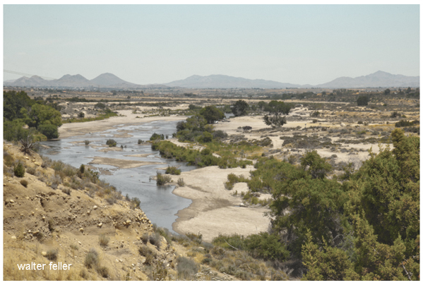
At first glance, the Mojave River hardly seems like a river at all. For miles, its broad channel lies dry beneath the desert sun, a wide expanse of pale sand bordered by mesquite, cottonwoods, and scattered willows. Visitors often stand in the riverbed wondering where the water is, unaware that it may be flowing silently beneath their feet through deep layers of sand and gravel. In the Mojave Desert, the most important river is often the one that cannot be seen.
Yet this hidden river has shaped the western Mojave Desert for hundreds of thousands of years. It carved valleys, filled ancient lakes, nourished wetlands, and sustained life across one of North America's driest landscapes. Long before highways crossed the desert or towns appeared on its floor, the Mojave River provided dependable water for Indigenous peoples, supported rich riparian habitats, and served as a natural corridor connecting mountains, valleys, and distant deserts.
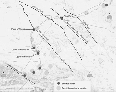
The river begins high in the San Bernardino Mountains, where winter storms and melting snow feed Deep Creek and the West Fork of the Mojave River. These streams join near the Forks of the Mojave before flowing northward onto the desert floor. From there the river travels approximately 110 miles through Victorville, Apple Valley, Helendale, Barstow, Afton Canyon, and finally toward Soda Lake. Only during unusually wet years does surface water complete the entire journey. Most years the river disappears beneath its sandy channel, continuing underground through a vast alluvial aquifer that stores and slowly releases the desert's most valuable resource.
This unusual behavior makes the Mojave River one of the most distinctive river systems in North America. Rather than flowing continuously on the surface, it alternates between visible and hidden reaches as groundwater moves through ancient deposits of sand and gravel. Bedrock constrictions, known as narrows, force water back to the surface in places, creating ribbons of green where cottonwoods, willows, marshes, and wildlife flourish. These riparian corridors stand in striking contrast to the surrounding creosote flats and open desert, revealing the quiet influence of water on an otherwise arid landscape.
For thousands of years the Mojave River was the lifeline of the western desert. Serrano and Vanyume communities lived along its upper and middle reaches, while trade routes connected them with the Mohave along the lower Colorado River, the Chemehuevi to the east, and neighboring peoples throughout Southern California and the Great Basin. Springs, marshes, and reliable pools became places to gather food, hunt game, exchange goods, and pass knowledge from one generation to the next. The river was more than a source of water; it was a route of travel, a provider of food, and part of a cultural landscape shaped by centuries of careful observation and experience.
When Spanish explorers entered the region during the eighteenth century, they followed pathways that had long been established by Native people. American trappers, military expeditions, emigrant wagon trains, miners, ranchers, and railroad surveyors soon followed. The Mojave Road, the Mormon Road, the Santa Fe Railroad, Historic Route 66, and Interstate 15 all crossed or paralleled the river because, in the desert, water determined the practical routes of travel. The river quietly influenced the location of camps, settlements, ranches, rail stops, and eventually modern communities.
The Mojave River also preserves the geological story of the desert. During the Ice Ages it fed vast lakes, including ancient Lake Manix, whose shorelines remain etched across nearby hills. Powerful floods carved Afton Canyon and redirected the river toward Soda Lake, while thousands of years of deposition built the broad floodplain that today stores groundwater beneath its surface. Every bend in the channel, every terrace, every wash, and every spring reflects a long history of changing climate, shifting faults, and the persistent work of flowing water.
Today the Mojave River continues to shape the lives of the people who live within its watershed. Its aquifer supplies water to communities across the Victor Valley and Barstow region. Its riparian forests provide habitat for hundreds of species of plants and animals. Archaeologists study the traces of early inhabitants preserved along its banks, geologists investigate the record of ancient lakes and earthquakes, and visitors come to experience one of the desert's most surprising landscapes.
The Mojave River is often described as a river that flows underground. While true, that description tells only part of its story. The Mojave River is the thread that connects the geology, ecology, archaeology, exploration, transportation, and settlement of the western Mojave Desert. To follow its course is to discover how water has shaped this landscape from the distant past to the present day. More than any other natural feature, the Mojave River explains why the western Mojave Desert looks as it does, why people traveled where they did, and why communities continue to thrive where the river still flows beneath the sand.
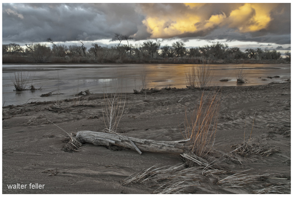
The Mojave River is unique as for most of its length water flows below ground, under the sand and instead of flowing toward the ocean as rivers do, the Mojave flows inland, terminating in the middle of the desert.
The ephemeral waters of the Mojave originate in the watershed of the San Bernardino Mountains. Water gathers from north of the ridgeline and flow down a series of creeks and washes, either underground, or combine in either Deep Creek or Miller Creek, the main above ground sources of the Mojave River before it slips beneath the surface.
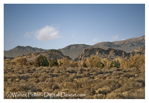
Upper Mojave River Narrows
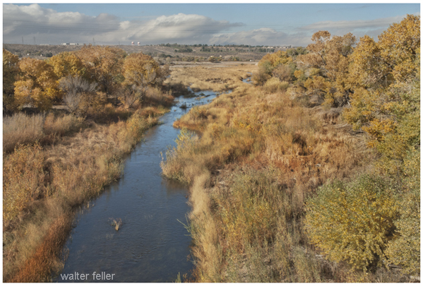
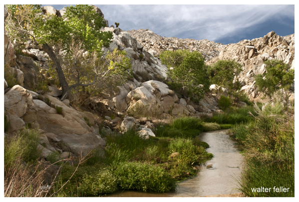
The Mojave waters do come above ground. Usually, the river flow can be seen at the upper narrows between Victorville and Apple Valley, then downstream past Barstow at the lower narrows as the river begins its way through Afton Canyon. The river winds down the canyon and seeps into the sand disappearing before it reaches Soda Lake near Baker.
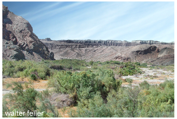
Afton Canyon
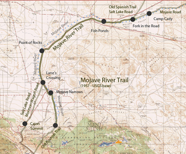
The Mojave Road followed along the river from Soda dry lake to the Cajon Pass. Desert Indians used this as a trade route where water could easily be found on the way to and from the coast. Later, the Old Spanish Trail and Salt Lake Trail (Mormon Road/Trail) joined up with the river near where Daggett is today.
Maps
Points of Interest
Nature
History
Geology
click for larger map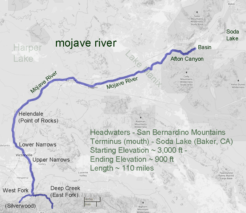
East Fork (Deep Creek)
West Fork
Ancestral Mojave River
How the Mojave River got its Name
The Broken River
Afton Canyon
Mojave River Trail & Wagon Road
Opening the Mojave River Trail